
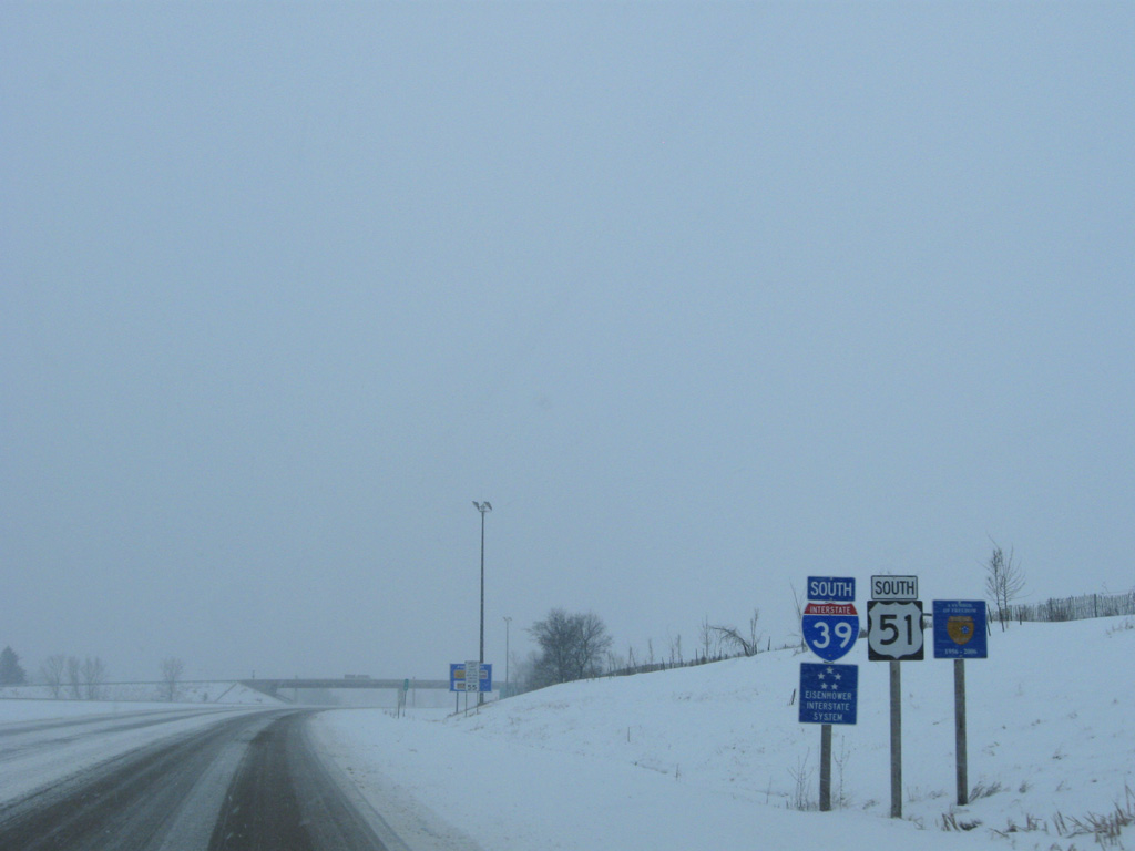
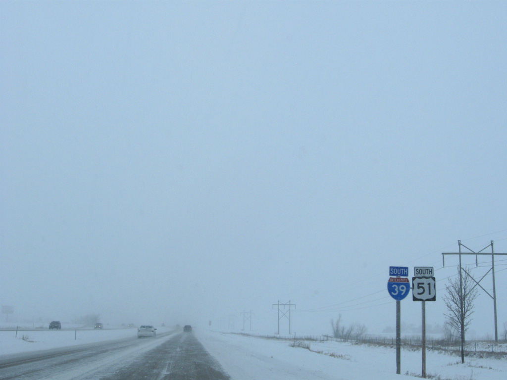
Interstate 39 South - La Salle County
 South
South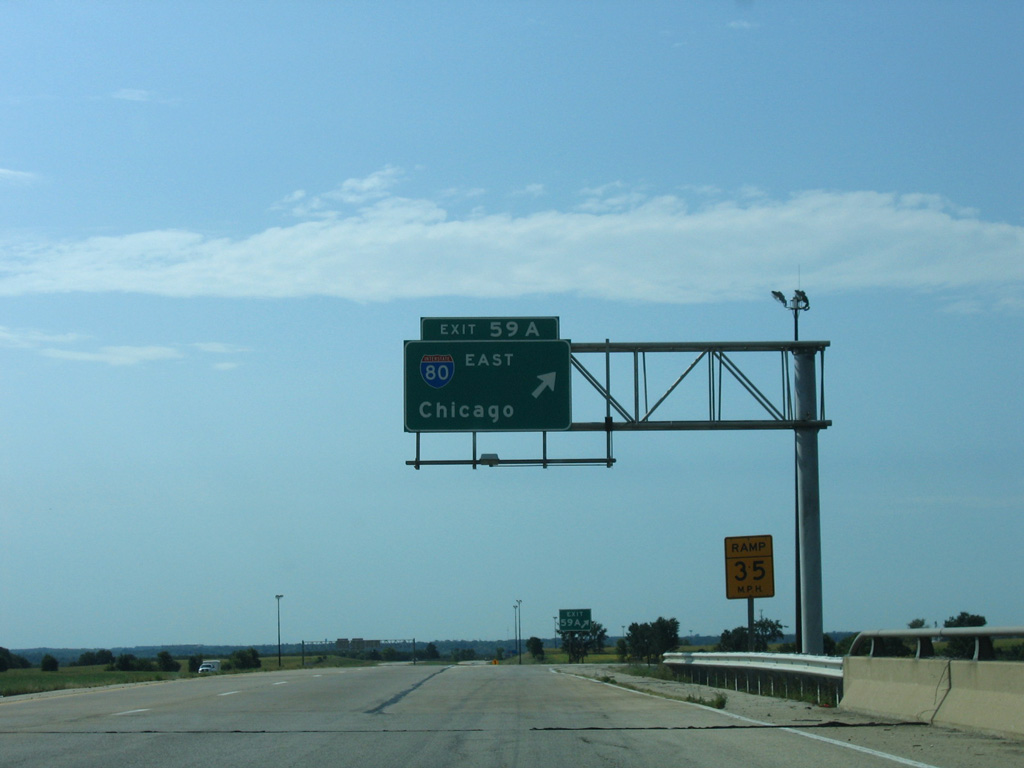
A cloverleaf interchange (Exits 59 B/A) connects I-39/U.S. 51 with Interstate 80 in rural areas of northeast La Salle.
09/04/05
Heading south from Interstate 80 through rural areas of the La Salle city limits on I-39/U.S. 51.
12/27/09
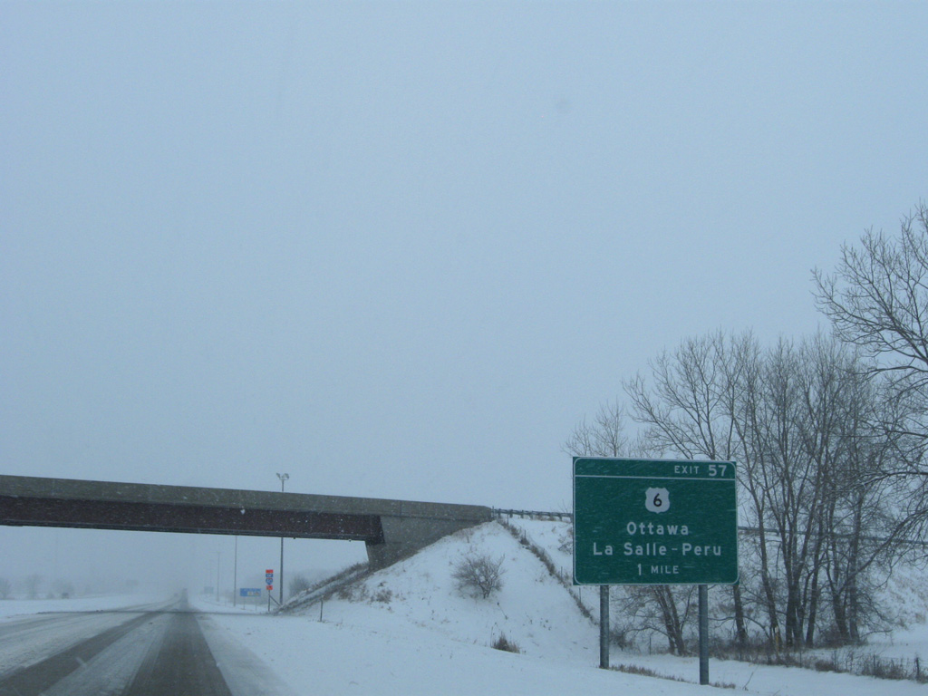
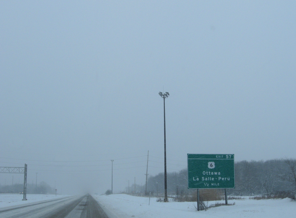
U.S. 6 follows a stair stepped route southwest from the village of North Utica to cross paths with Interstate 39 at Exit 57.
12/27/09
U.S. 6 angles southwest across I-39 to cross the Little Vermillion River into the La Salle street grid. U.S. 6 dog legs south from 5th Street alongside IL 351 (Joliet Street) to 3rd Street west as it connects La Salle with neighboring Peru.
12/27/09
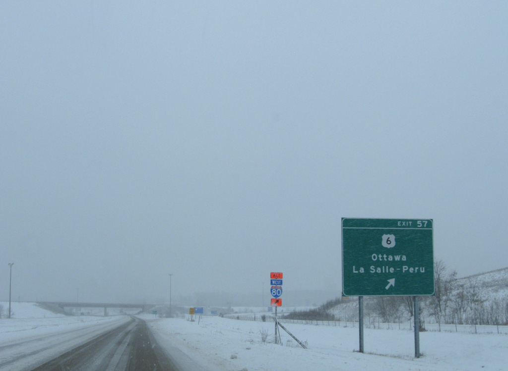
Entering the diamond interchange (Exit 57) with U.S. 6 on I-39/U.S. 51 south.
12/27/09
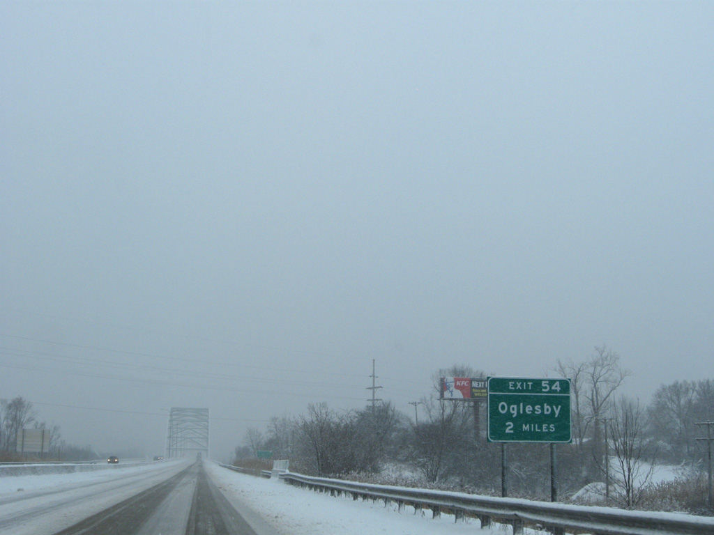
I-39/U.S. 51 advances two miles south to the city of Oglesby.
12/27/09
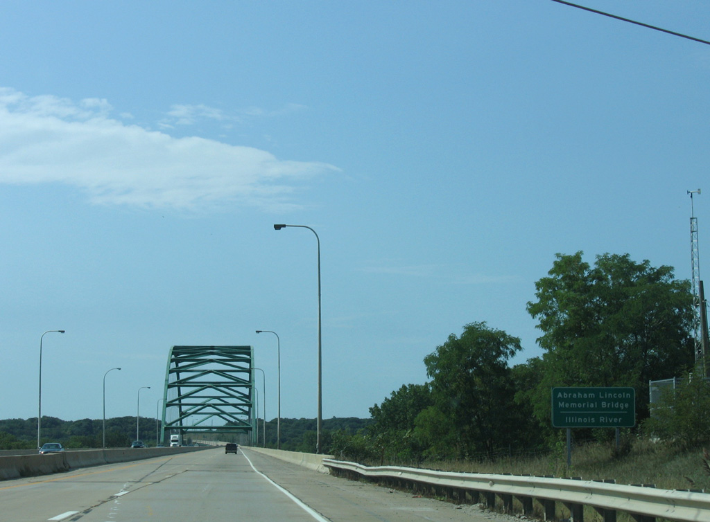
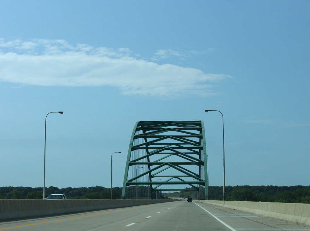
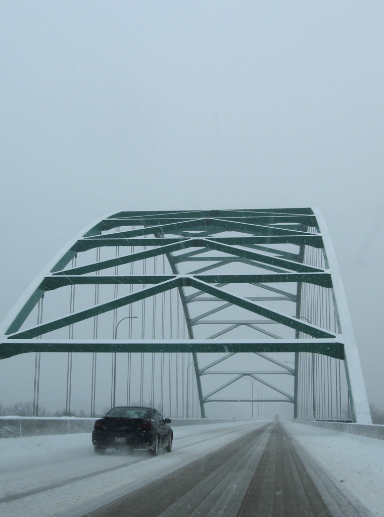
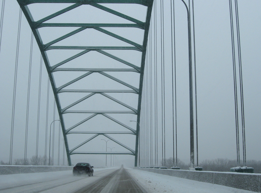
Interstate 39 crosses the Illinois River over the Abraham Lincoln Memorial Bridge. The four lane span was completed in 1987.1
09/04/05
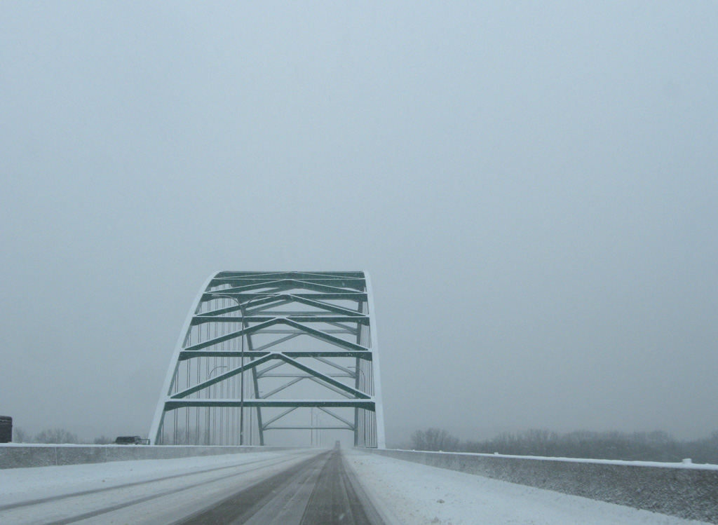
The Abraham Lincoln Memorial Bridge is a tied arch bridge totaling 7,122 feet in length at a height of 66 feet above the Illinois River navigation channel. The bridge deck is 82 feet wide.1
12/27/09
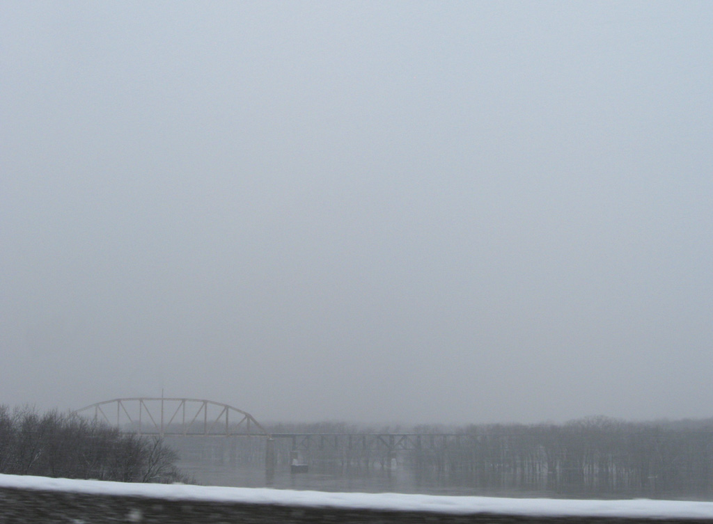
Spanning the Illinois River just west of Interstate 39 is the CN Railroad.
12/27/09
09/04/05
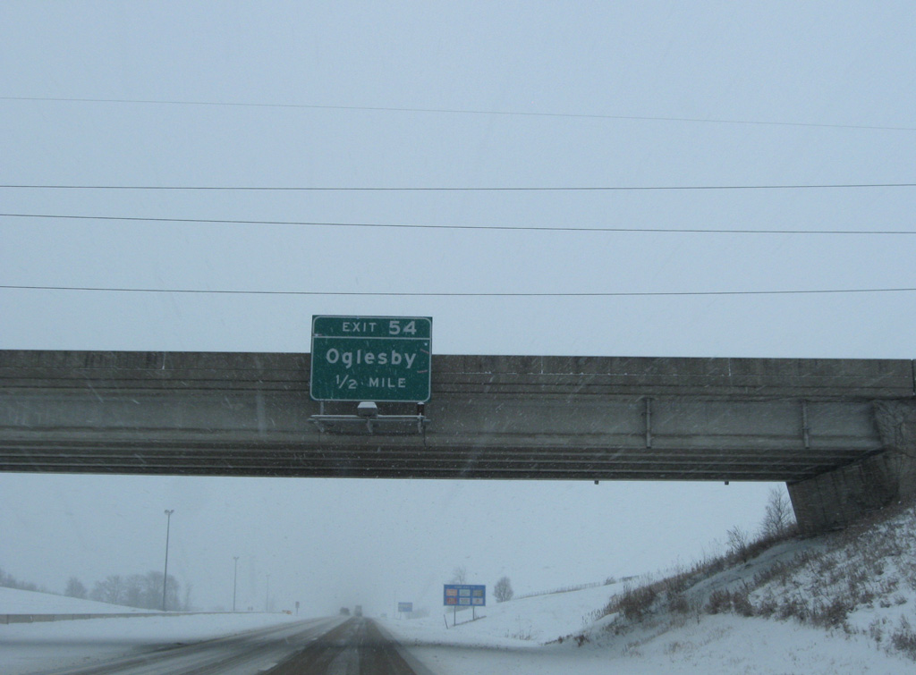
Curving east, IL 351 passes below I-39 at Piety Hill as the freeway continues south to a diamond interchange (Exit 54) with Walnut Street in Oglesby.
12/27/09
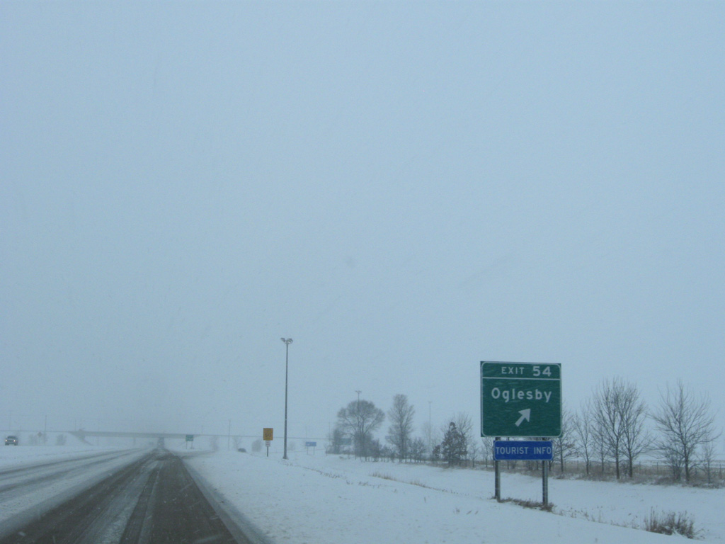
Exit 54 departs I-39/U.S. 51 south for Walnut Street.
12/27/09
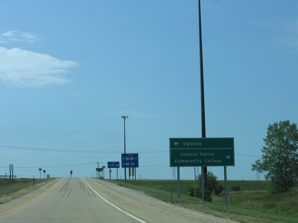
Walnut Street links I-39/U.S. 51 with CR 62 north to Illinois Valley Community College and IL 251 to the west. East from Exit 54, Walnut Street connects with IL 71/351 (Columbia Avenue) ahead of Downtown Oglesby.
09/04/05
I-39/U.S. 51 remain rural and leave the Oglesby city limits.
12/27/09
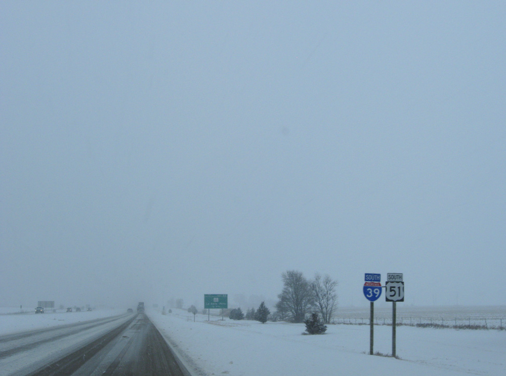
IL 251 bee lines southeast from the Illinois River at Peru to meet I-39/U.S. 51 at Exit 52. This is their first time meeting directly since the state route began at South Beloit.
12/27/09
IL 251, the former alignment of U.S. 51, shifts to the east side of Interstate 39 for the remainder of its course south from Exit 52 to Wenona, Minonk and El Paso.
12/27/09
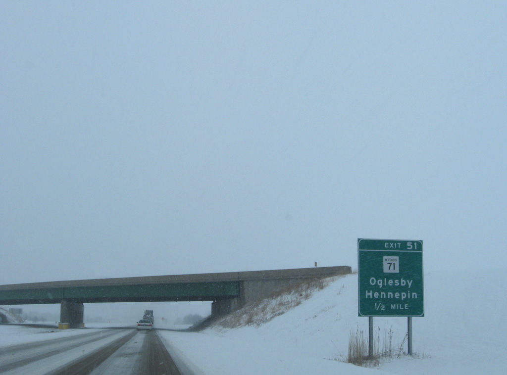
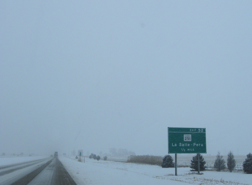
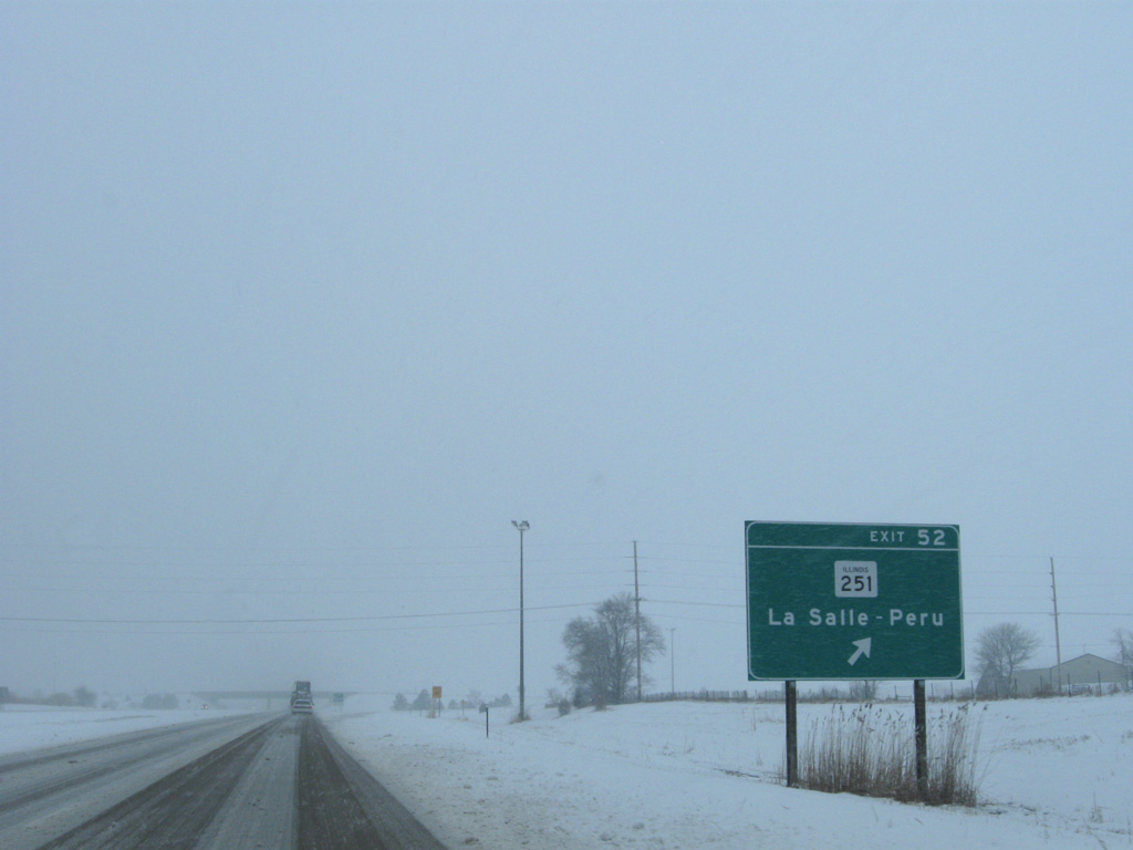
IL 71 combines with IL 351 south from Jonesville through the city of Oglesby along Columbia Avenue. IL 351 ends just east of the upcoming diamond interchange (Exit 51) with I-39 at IL 251.
12/27/09
Confirming markers for I-39/U.S. 51 south posted on the short segment between Exits 52 and 51.
12/27/09
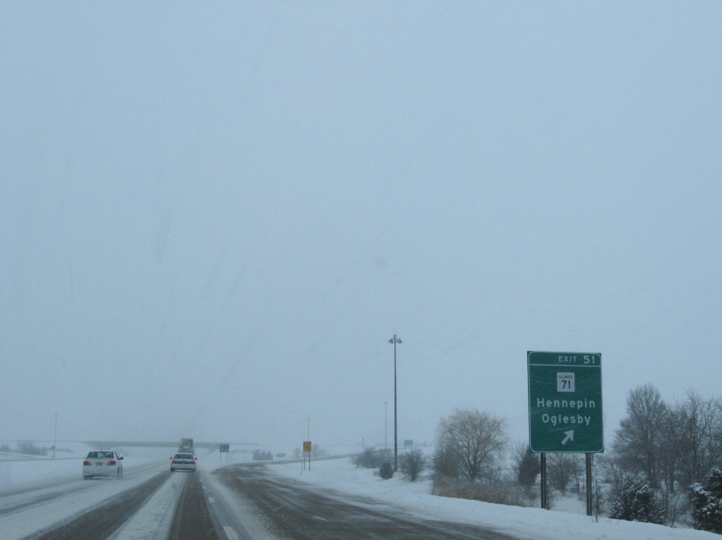
West from Exit 51, IL 71 continues to the village of Cedar Point and Interstate 180 at Hennepin.
12/27/09
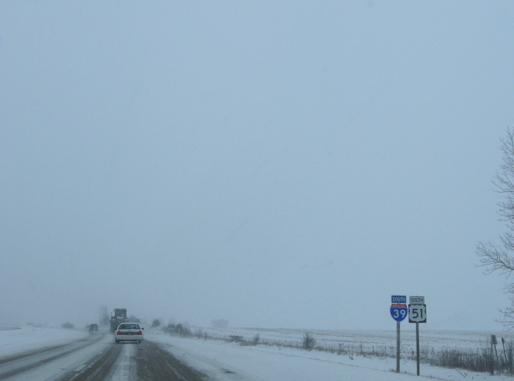
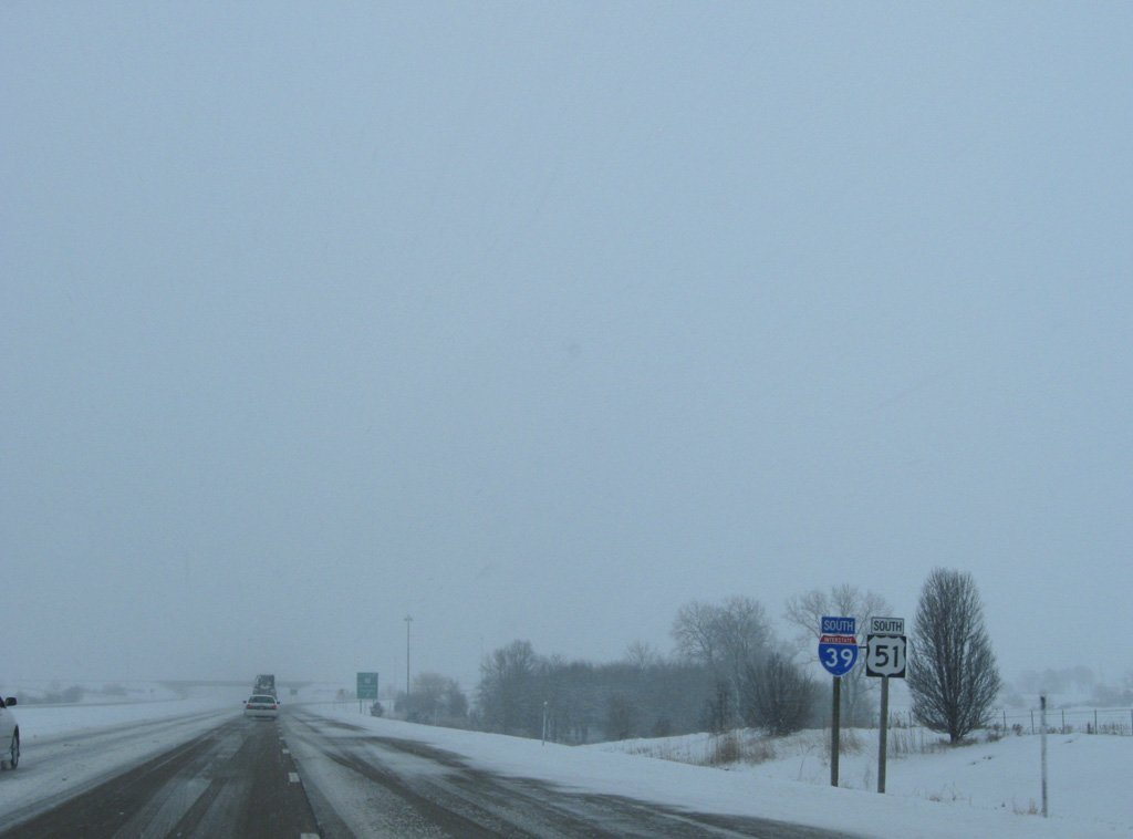
Interstate 39 shifts slightly eastward as it traverses agricultural areas south from Exit 51 toward the village of Tonica.
12/27/09
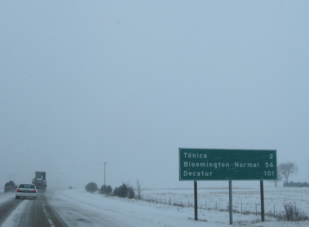
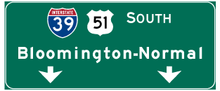
Bloomington-Normal lies another 56 miles to the south, beyond the end of Interstate 39 at I-55. Decatur is 101 miles away via the U.S. 51 expressway south from I-74.
12/27/09
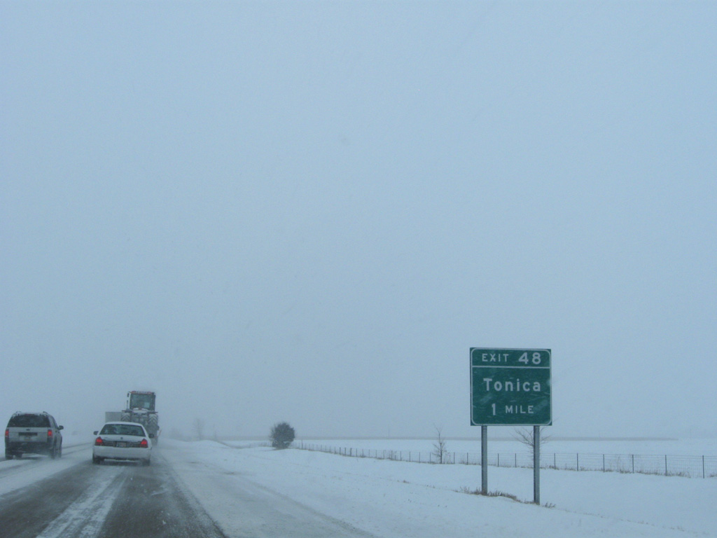
A diamond interchange (Exit 48) joins I-39/U.S. 51 with CR 54 (Ray Richardson Road) at Tonica in one mile.
12/27/09

CR 54 (Ray Richardson Road) links I-39 with parallel IL 251 (1st Street) south into Tonica. CR 14 ties into their intersection from Lowell to the northeast.
12/27/09
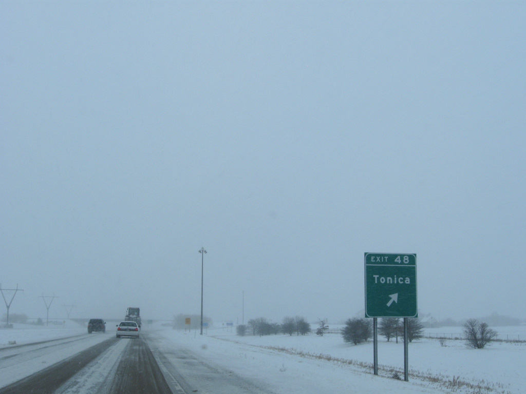
Exit 48 leaves I-39/U.S. 51 south for Tonica. CR 54 forms an L-shaped route west 2.5 miles to E 2nd Road, and north 2.5 miles to Cedar Point.
12/27/09
Crossing a tributary of Bailey Creek along I-39/U.S. 51 south at the village of Tonica.
12/27/09
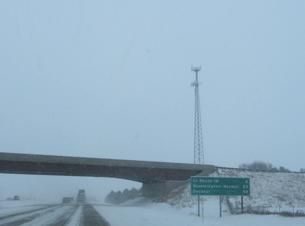
I-39/U.S. 51 reach the final La Salle County exit in six miles. Bloomington-Normal is 53 miles away
12/27/09
One mile ahead of the diamond interchange (Exit 41) with IL 18 on I-39/U.S. 51 south ahead of the N 14th Road overpass.
12/27/09
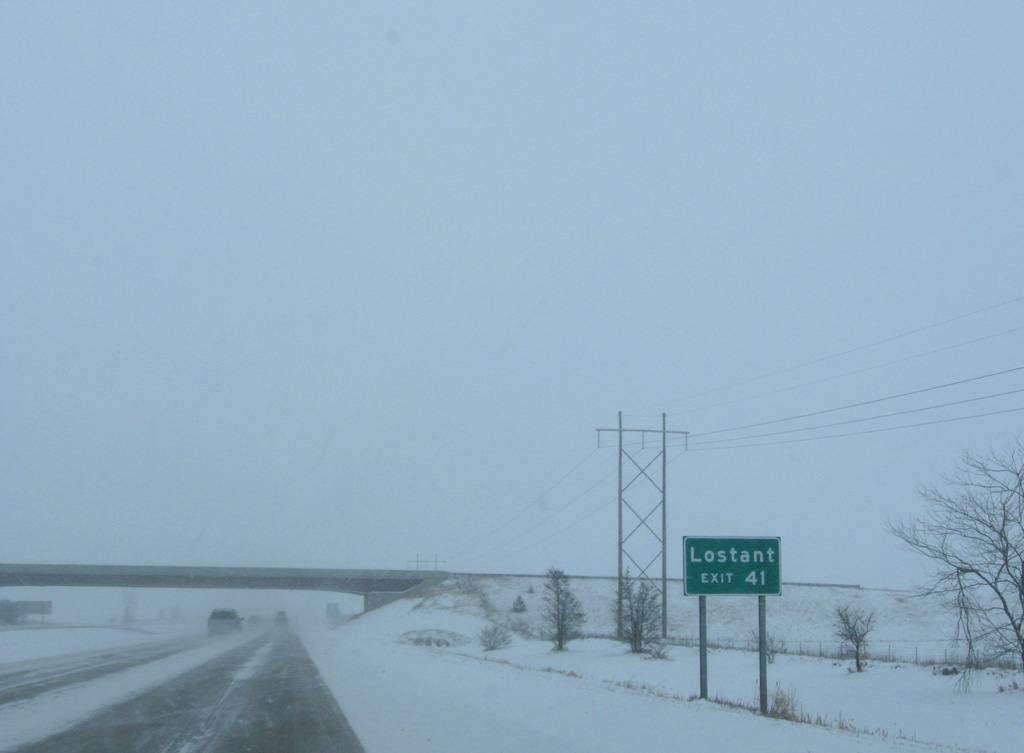
The freeway generally bypasses the adjacent village of Lostant, which centers around parallel IL 251 and the Norfolk Southern Railroad. The village limits extend southward to Exit 41 however.
12/27/09
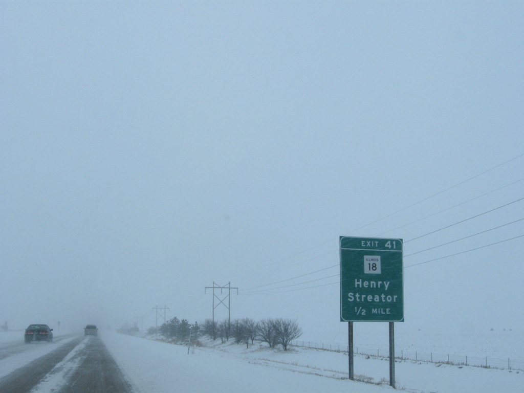
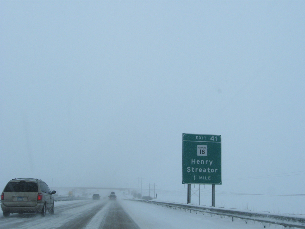
IL 18 is a 38 mile route stretching west to IL 29 at Henry and east to IL 17 at Blackstone.
12/27/09

Exit 41 departs I-39 south for IL 18 west to Magnolia and the Henry Bridge across the Illinois River. The city of Streator lies 11.5 miles to the east along the state route.
12/27/09
Shields for I-39 and U.S. 51 posted south of IL 18 and Exit 41.
12/27/09
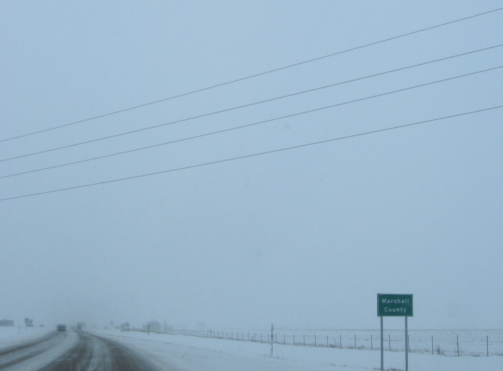
An S-curve shifts I-39/U.S. 51 a half mile east into northern Marshall County. The freeway proceeds south directly alongside IL 251 (old U.S. 51) for a 1.8 mile stint.
12/27/09

References:
- Abraham Lincoln Memorial Bridge - Illinois River Highway Crossing. John A. Weeks III, web site.
Photo Credits:
- AARoads: 09/04/05
- Alex Nitzman: 12/27/09
Connect with:
Page Updated Sunday April 29, 2018.