
Interstate 70 East - St. Charles County


 East
East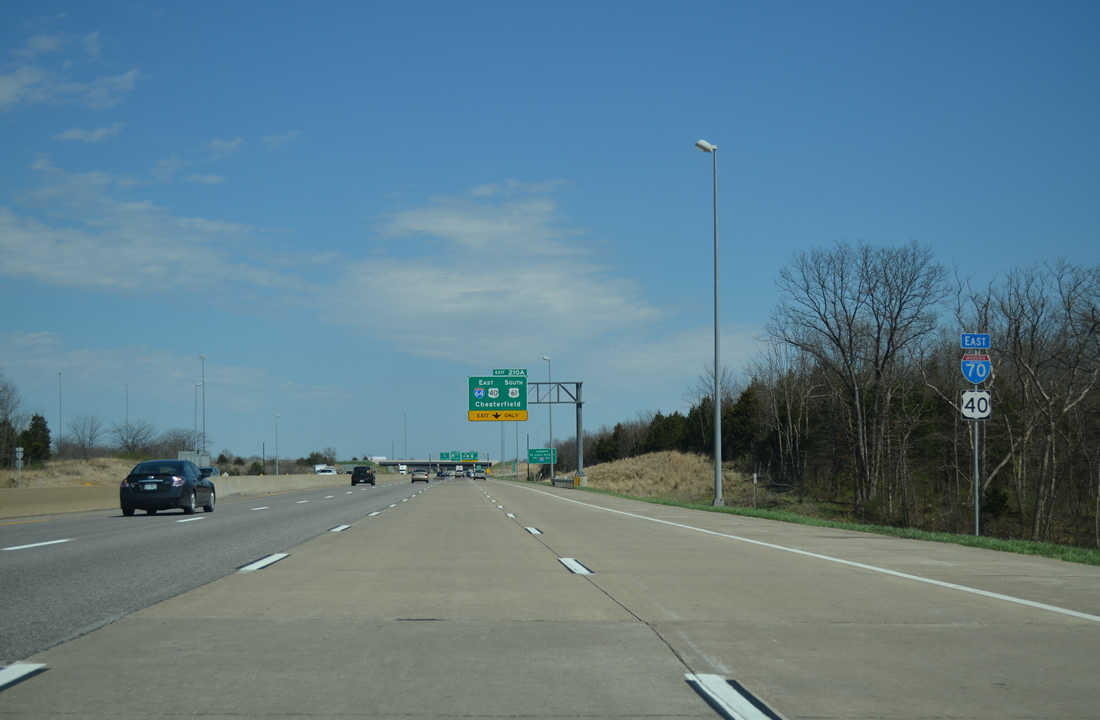
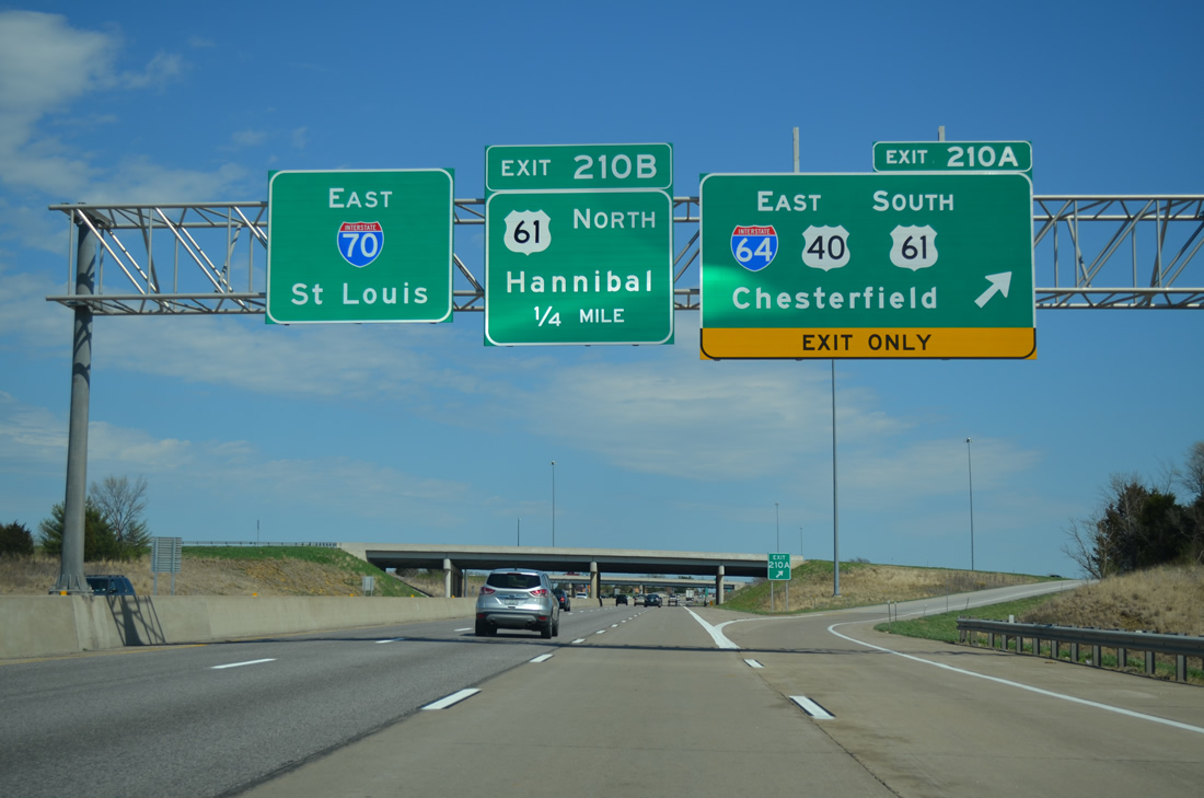
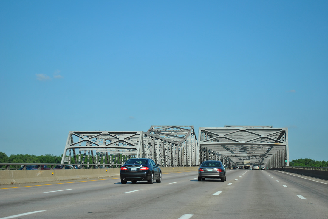
The final shield assembly for the I-70/U.S. 40 overlap in Missouri. The two commingle again in East St. Louis, Illinois.
04/13/13
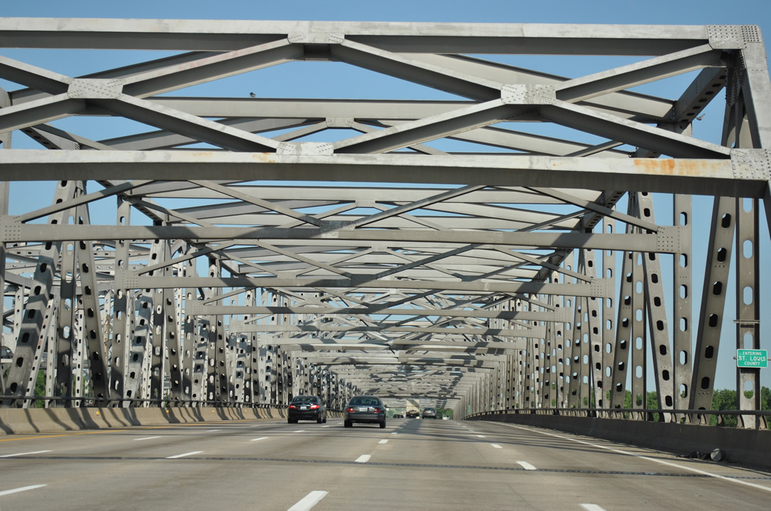
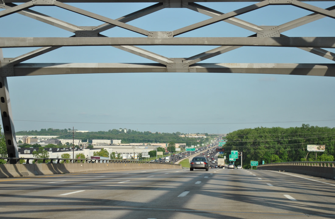
I-70/U.S. 40 east expand to four lanes ahead of the directional cloverleaf interchange (Exits 210A/B) with Interstate 64 east and U.S. 61.
04/13/13
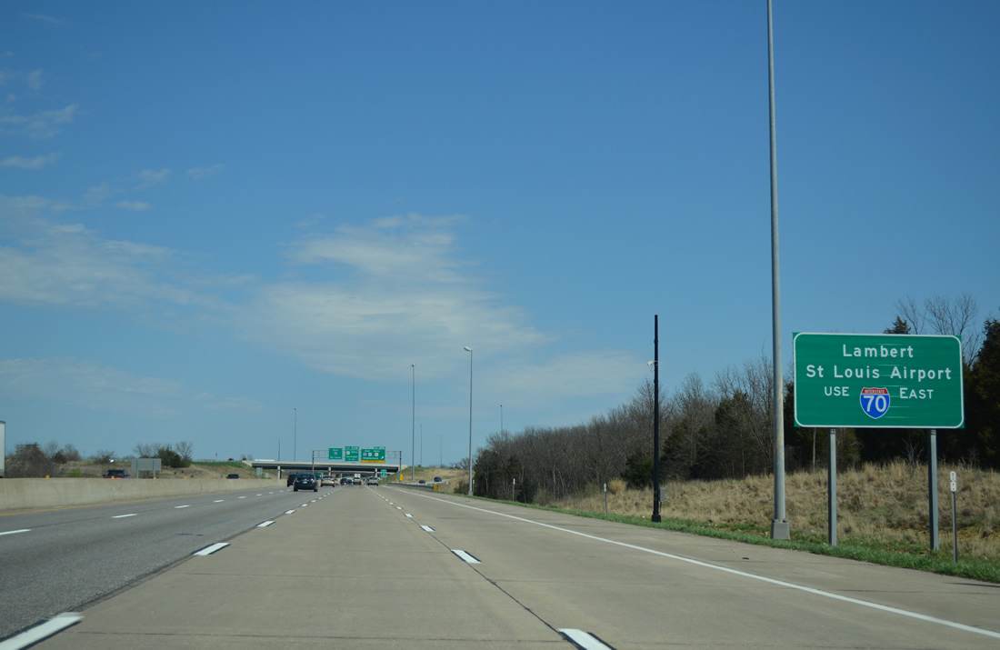
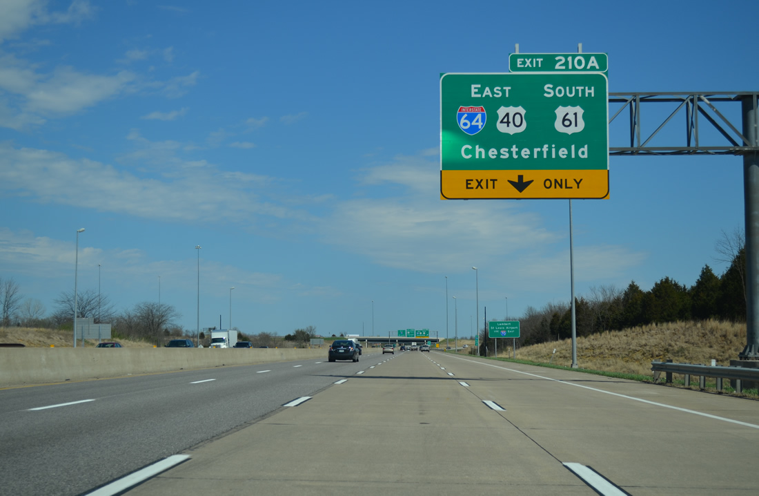
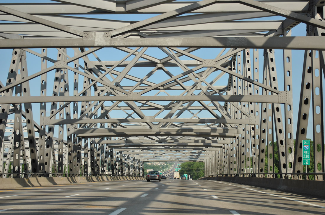
Motorists destined to St. Louis Lambert International Airport (STL) are directed to remain along Interstate 70 east. I-70 travels solo for the remainder of its course across Missouri as U.S. 40 departs for I-64/U.S. 61 east at Exit 210 A.
04/13/13
Interstate 64 was extended west to Wentzville in 2009, overlaying both U.S. 40/61 along their expressway southeast through Lake St. Louis, Weldon Spring and Chesterfield. The Interstate provides an alternate route to the Poplar Street Bridge into Illinois while also doubling as a commuter route from the St. Charles County suburbs to Downtown St. Louis.
04/13/13
east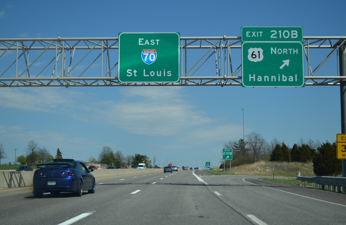
U.S. 61 presses northward from I-64 and U.S. 40 through Wentzville to Troy, Bowling Green and Hannibal. The route doubles as the Avenue of the Saints to the Keokuk, Iowa area.
04/13/13
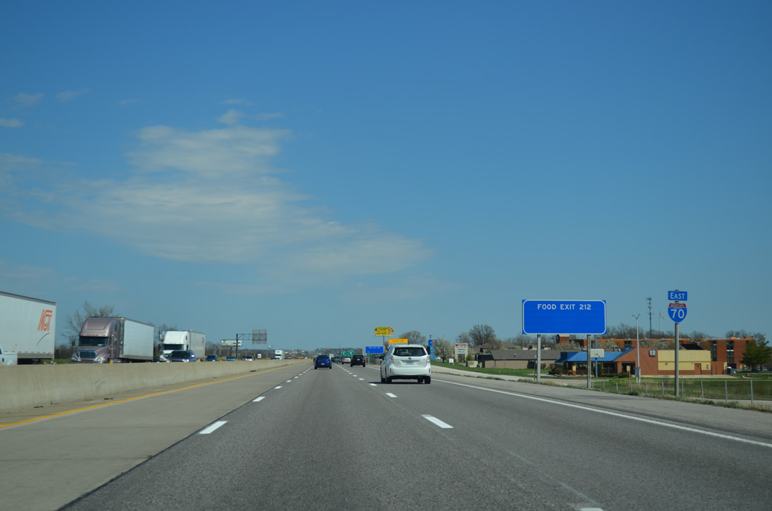
Interstate 70 maintains six overall lanes east from Wentzville.
04/13/13
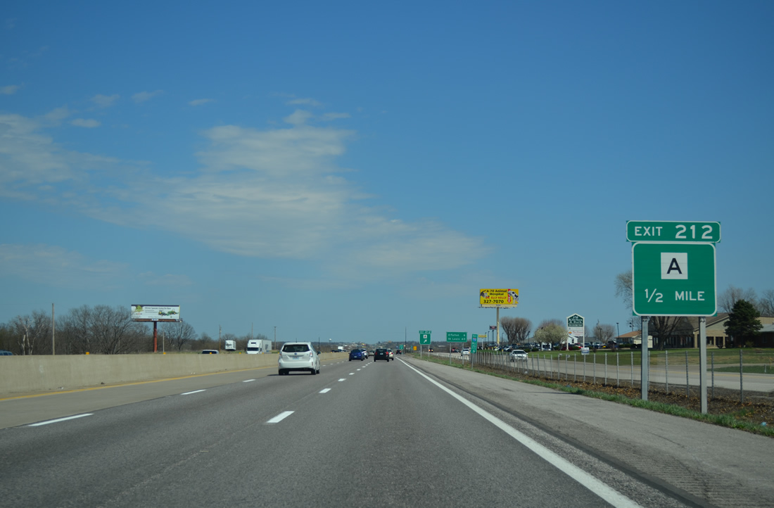
Highway A arcs 3.37 miles east from U.S. 61 in Wentzville to a diamond interchange (Exit 212) with Interstate 70 at Lake St. Louis.
04/13/13
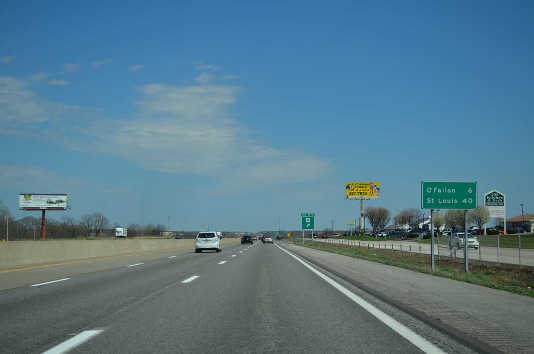
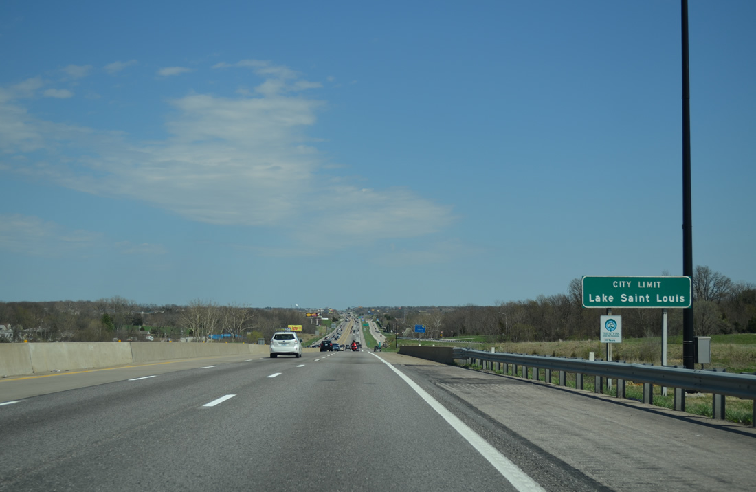
Eastbound travelers next enter the suburb of O'Fallon with Downtown St. Louis still a 40 mile drive.
04/13/13
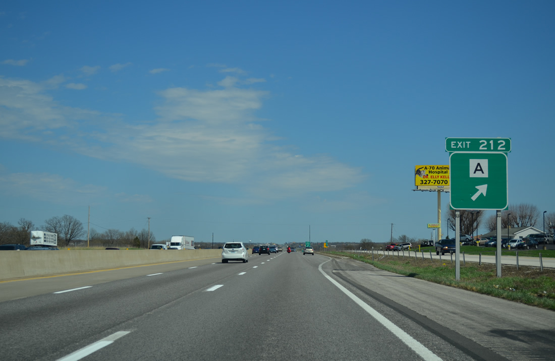
Exit 212 leaves Interstate 70 east for Highway A west to the GM Wentzville Assembly Plant and Freymouth Road south to Founders Park.
04/13/13
Veterans Memorial Parkway, a south side frontage road, ties into the end of Highway A to provide residential access to the Lake Sainte Louis area.
04/13/13
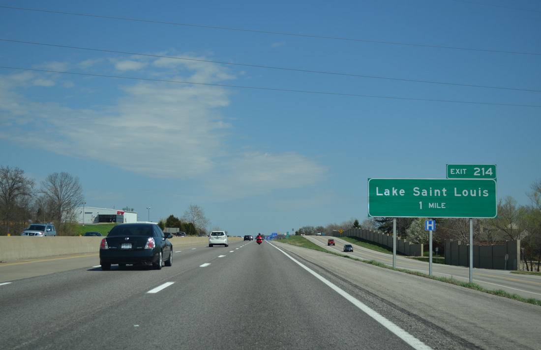
A second diamond interchange joins Interstate 70 with the city of Lake St. Louis in one mile.
04/13/13
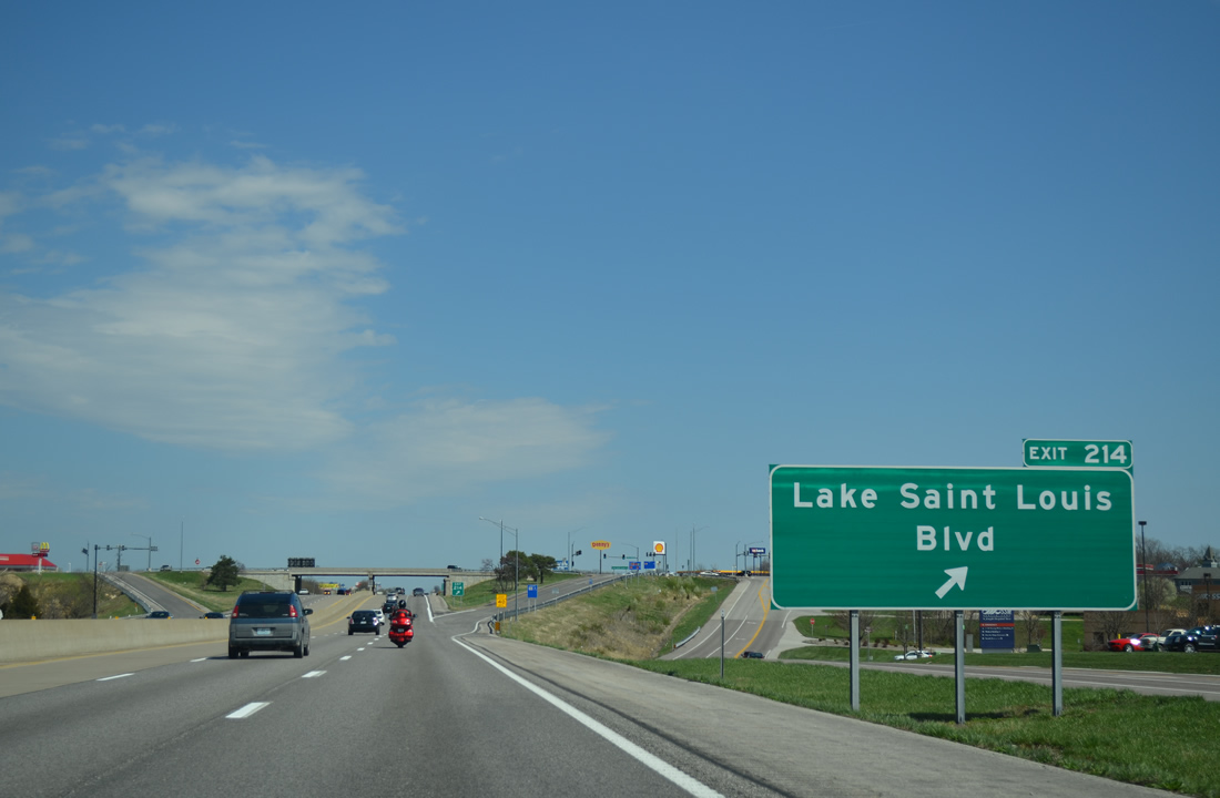
Lake St. Louis Boulevard winds south from Guthrie Road and Exit 214 to encircle Lake Saint Louis south and west to I-64/U.S. 40-61 at Exit 2. Guthrie Road leads north through western reaches of O'Fallon to rural areas near Josephville.
04/13/13
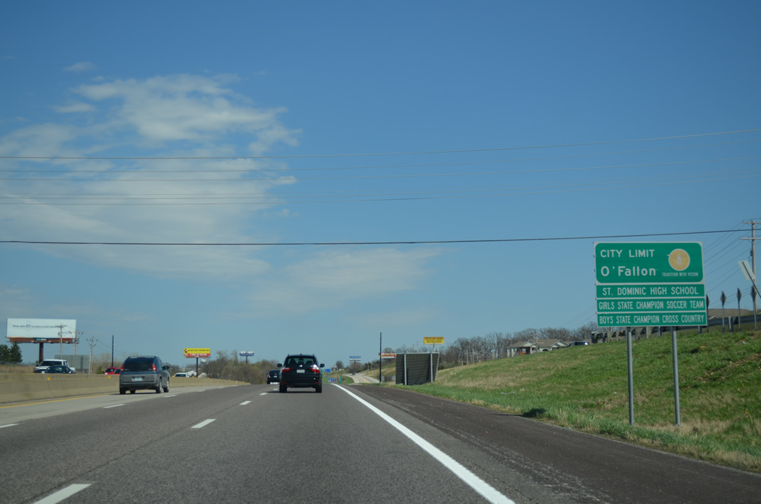
Drivers along I-70 east enter the O'Fallon city limits on the one mile approach to Exit 216 with Bryan Road. The initial guide sign for the diamond interchange was knocked over.
04/13/13
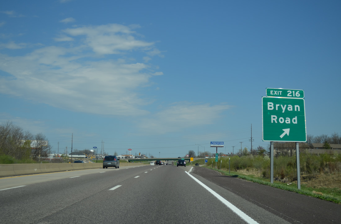
Bryan Road leads south from parallel Terra Lane by a number of subdivisions to become WingHaven Boulevard south at Highway N near Dardenne Prairie.
04/13/13
Veterans Memorial Parkway continues along the south side of Interstate 70 to a commercialized intersection with Highway K.
04/13/13
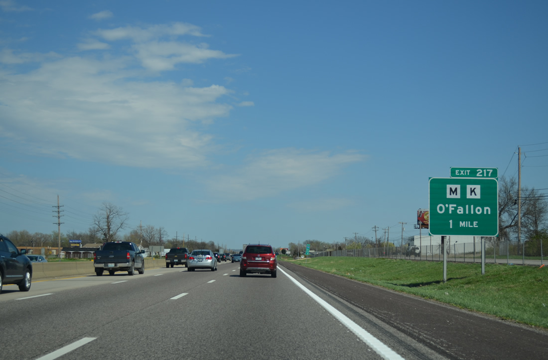
Highway K runs 6.56 miles north from I-64/U.S. 40-61 (Exit 9) through the heart of O'Fallon to end at Exit 217.
04/13/13
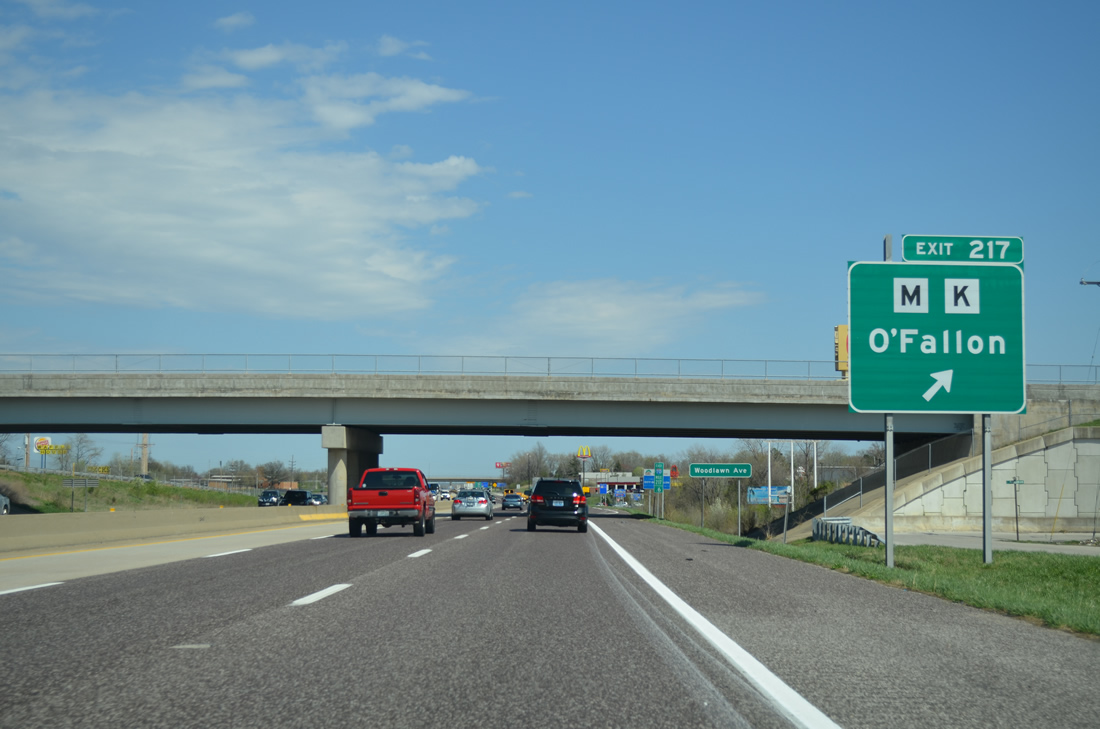
Main Street (former Highway M) extends northward from Exit 217, 1.93 miles to the intersection of Highway P west and the remaining 1.00 miles of Highway M north to Missouri 79.
04/13/13
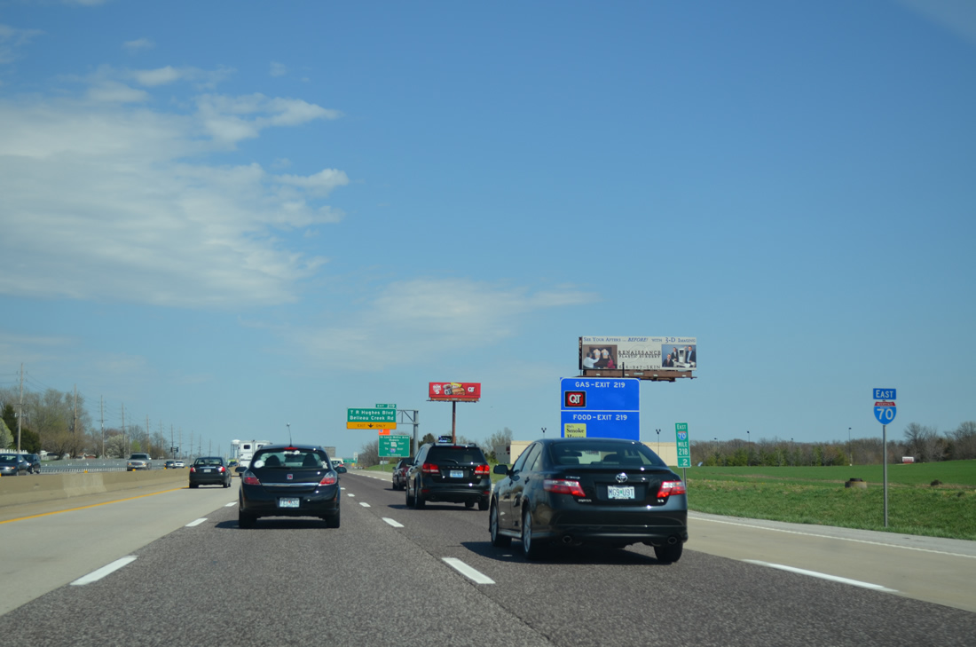
Suburbia lines both sides of Interstate 70 to the Cool Springs Interchange (Exit 219).
04/13/13
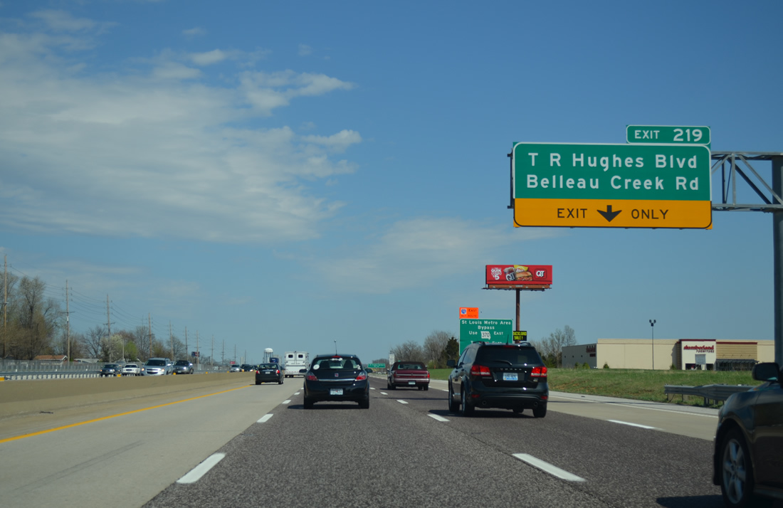
A single point urban interchange (SPUI) joins Interstate 70 with T.R. Hughes Boulevard north and Belleau Creek Road south at forthcoming Exit 219. Work broke ground on July 2, 1998 for the interchange first envisioned in the O'Fallon comprehensive plan in 1986.1,2
The SPUI ties into the October 20, 2004-opened T.R. Hughes Boulevard, a five lane arterial winding north to the Ozzie Smith Sports Complex. That road was built with a combination of funds from the city of O'Fallon, the county Road Board and MoDOT for $6.25 million.3
04/13/13
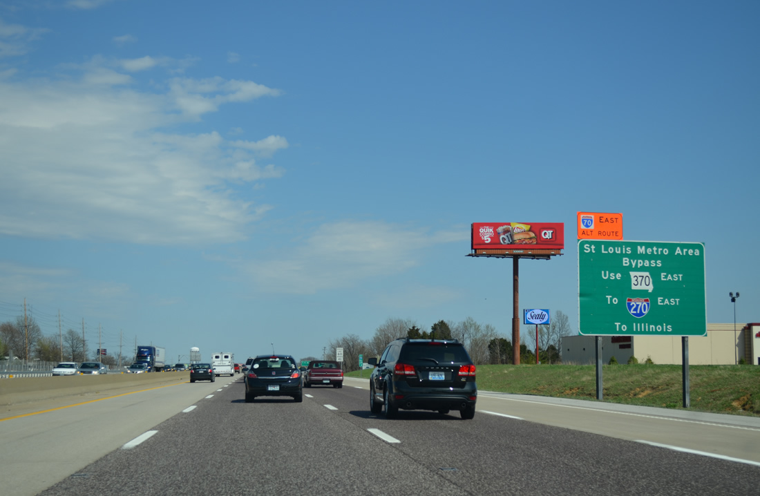
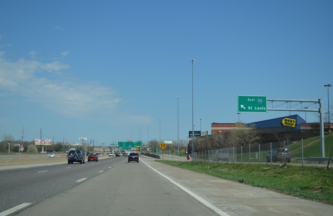
The first in a series of signs advising through traffic to take Missouri 370 east to Interstate 270 to bypass St. Louis resides ahead of Exit 219. Missouri 370 departs five miles ahead to circumvent St. Charles to I-270 at Bridgeton.
04/13/13
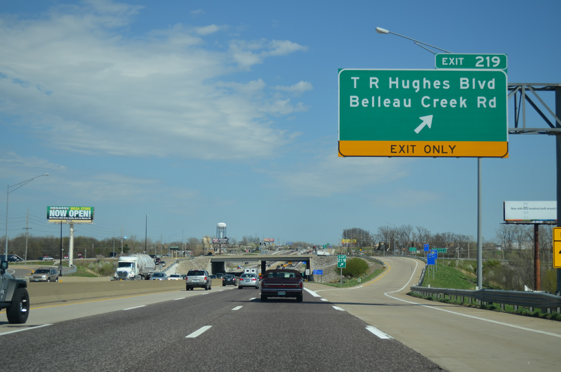
Exit 219 leaves Interstate 70 east for T.R. Hughes Boulevard north to T.R. Hughes Ballpark (home of the River City Rascals minor league baseball team) and Missouri 79. Belleau Creek Road stems south from adjacent Veterans Memorial Parkway as a residential through road to Mexico and Knaust Roads.
04/13/13
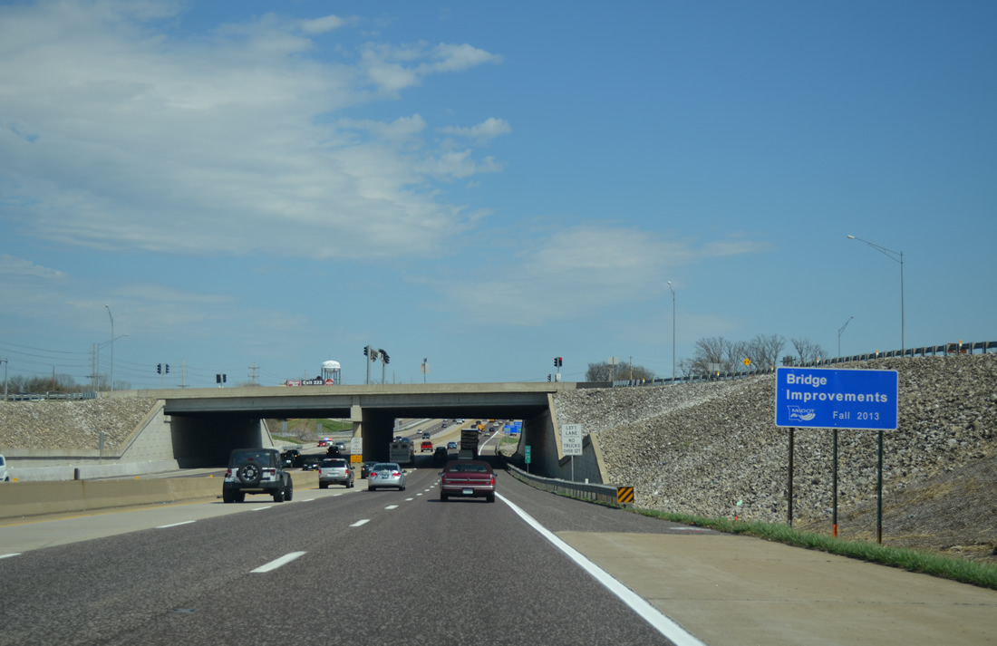
Passing below the Exit 219 SPUI along Interstate 70 east. A ribbon cutting ceremony took place on March 22, 2001 to formally open the $22 million interchange.2
04/13/13
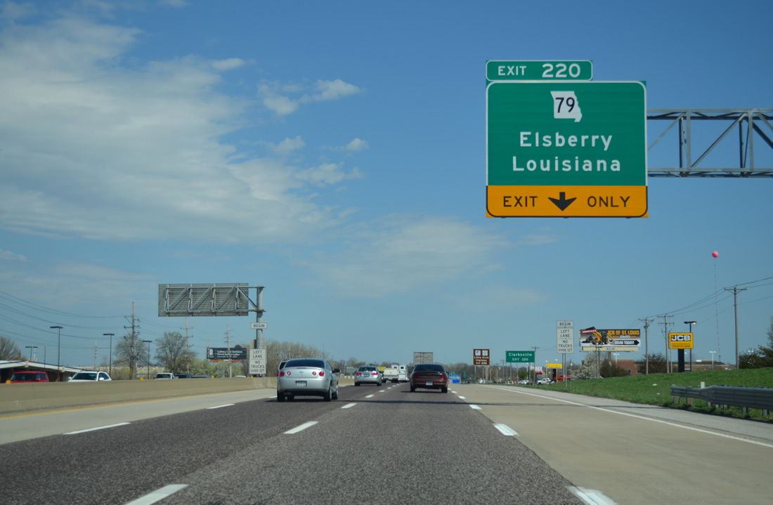
Interstate 70 passes through an industrial area ahead of the parclo interchange (Exit 220) with Missouri 79. The 87.94 mile state highway begins at I-70 and leads north to Hannibal.
04/13/13
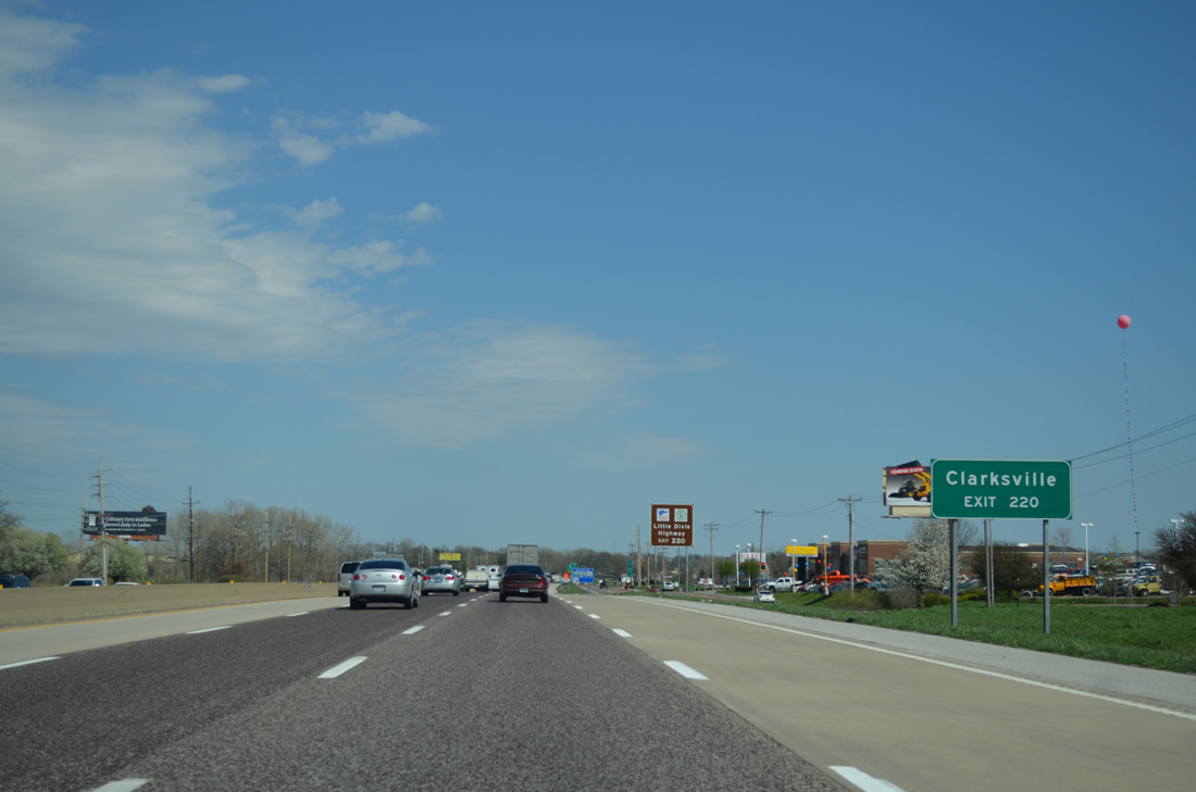
Missouri 79 travels along the Mississippi River from the tourist destination of Clarksville to the Pike County seat of Louisiana and again leading into Hannibal.
04/13/13
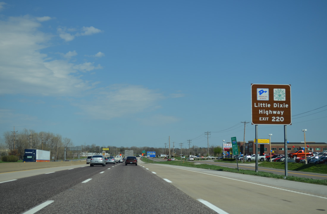
Missouri 79 doubles as the Little Dixie Highway of the Great River Road from Clarksville northward to Hannibal. The scenic drive travels along limestone bluffs above the Mississippi.
04/13/13
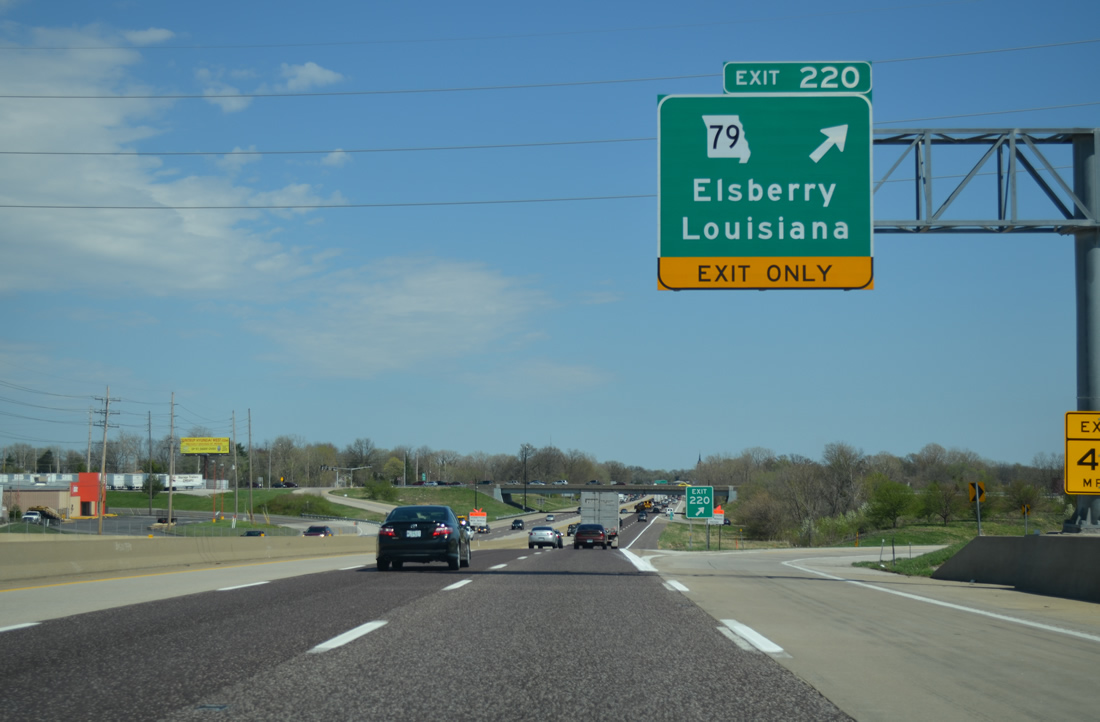
Salt Lick Road ties into the south side of Exit 220 opposite Missouri 79 through west Saint Peters. Missouri 79 upgrades the road into an expressway to Pearl Drive. Elsberry is 28 miles to the north.
04/13/13
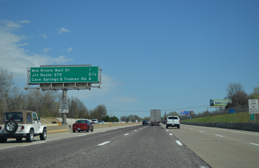
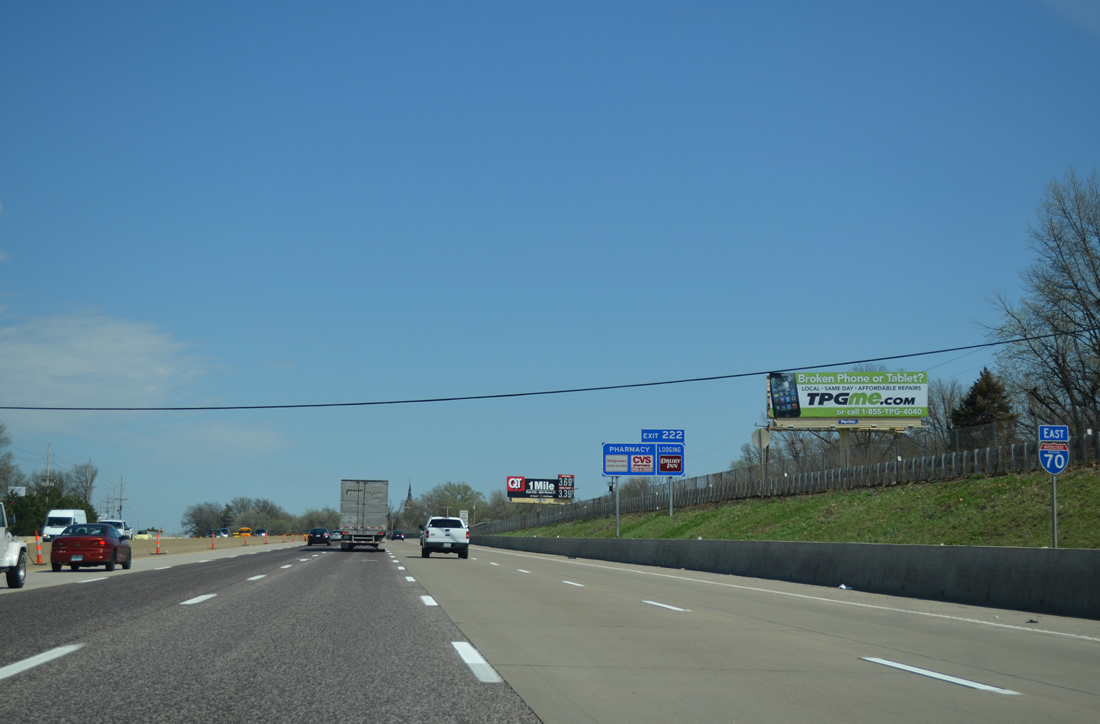
Interstate 70 enters the St. Peters city limits below MO 79. Mid Rivers Mall Drive (Exit 222) lies one mile east of Dardenne Creek as the lone city interchange.
04/13/13
Another stretch of Veterans Memorial Parkway acts as the south side service road to Interstate 70 through St. Peters.
04/13/13
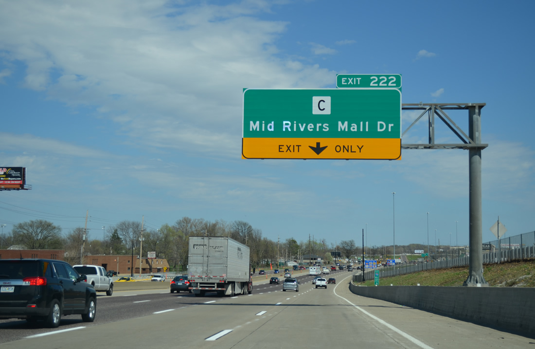
A diverging diamond interchange (DDI) links I-70 east with Mid Rivers Mall Drive. The arterial joins I-70 with the adjacent mall by the same name while en route to Cottleville and Route 94/364 at Pitman Hill Road.
04/13/13
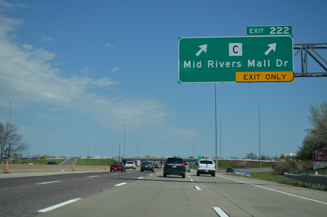
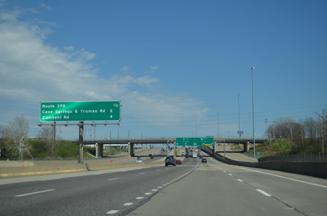
North from Exit 222, Mid Rivers Mall Drive leads to an industrial park and Salt River Road. Highway C was truncated from Mid Rivers Mall Drive and adjacent Main Street west to Salt River Road. The 4.56 mile secondary route remains from Saint Peters to the Mississippi River near Peruque.
04/13/13
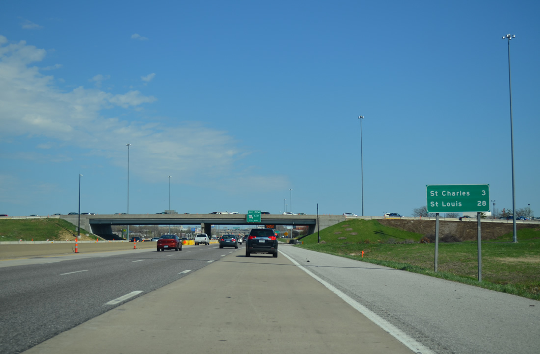
12 miles removed from the last distance sign, St. Louis is now 28 miles away with Interstate 70 next reaching the city of St. Charles.
04/13/13
Missouri 370, a 12.67 mile freeway, provides a bypass of St. Charles for traffic headed to Interstate 270 and the northern suburbs of Hazelwood, Florissant and Bellefontaine Neighbors.
04/13/13
A slip ramp joins Interstate 70 east from Veterans Memorial Parkway at Mid Rivers Mall.
04/13/13
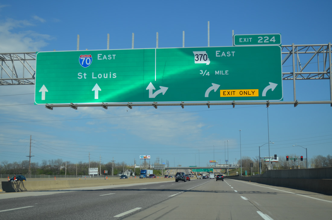
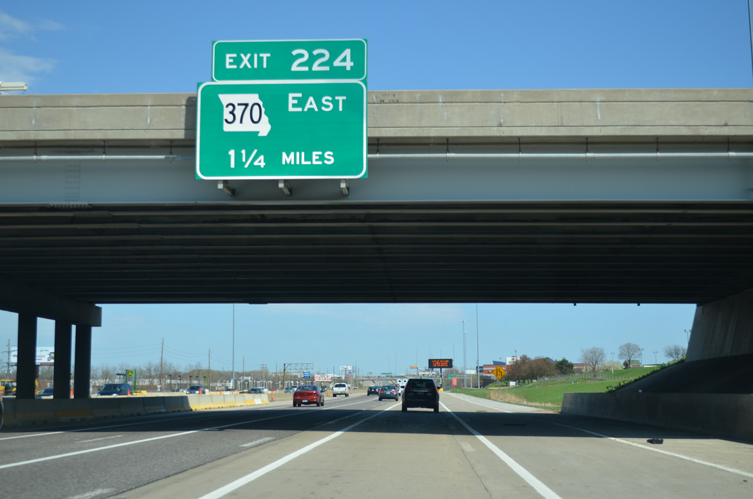
One-Arrow-Per-Lane (OAPL) signs alert motorists to the three-lane splits of the Interstate 70 eastbound mainline and Exit 224 for Missouri 370 east to the Discovery Bridge and Bridgeton.
04/13/13
Beyond the directional T interchange with Missouri 370, Interstate 70 travels two miles to Cave Springs Road (Exit 225) in the city of St. Charles.
04/13/13
The Missouri 370 freeway was completed on November 20, 1996. The six to eight lane freeway replaced Missouri 115 as the second route between St. Charles and St. Louis County.
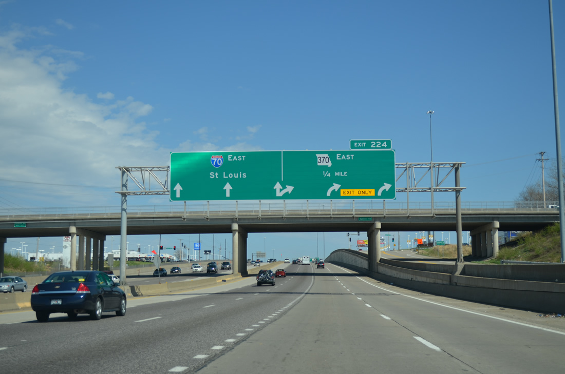
04/13/13
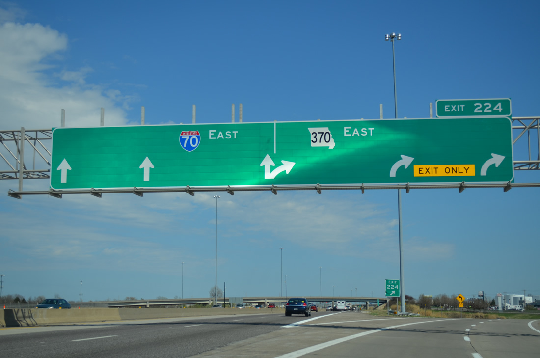
Exit 224 peels away from Interstate 70 east to Missouri 370 east. MO 370 and Interstate 270 east provide a long distance bypass to Interstate 70 east from Troy, Illinois to Indianapolis, Indiana and I-55 north to Chicago.
04/13/13
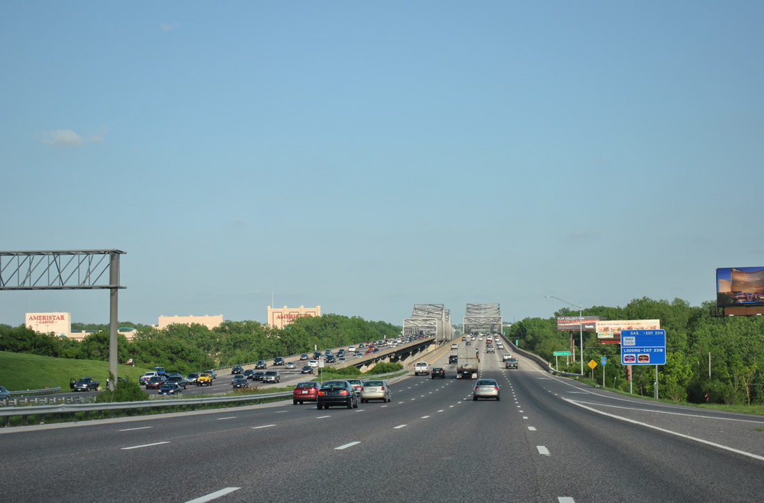
Interstate 70 leaves St. Charles to cross the Missouri River on the Blanchette Bridge. A $64 million project was undertaken between November 2012 and December 2013 to rehabilitate the westbound span of the two bridges. Closure of the 1959-bridge to August 24, 2013 allowed crews to replace the overhead trusses and redeck the span while also converting the three spans near the east end to roadway on embankment.4
05/03/12
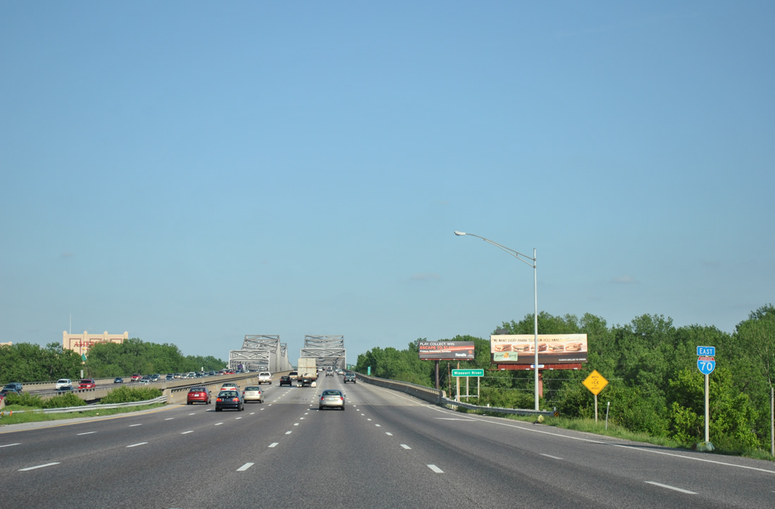
Traffic merges onto Interstate 70 east from South River Road ahead of this reassurance marker preceding the Blanchette Bridge.
05/03/12
The Blanchette Bridge normally carries ten overall lanes of traffic. During the 2012-13 westbound rehabilitation project, the eastbound bridge was converted to two-way traffic with six overall lanes.
05/03/12
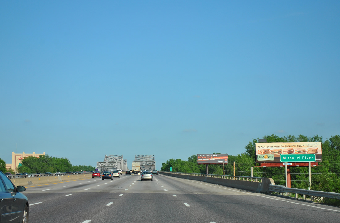
Eastbound Interstate 70 crosses the Missouri River on a cantilever bridge opened in 1978. The eastbound span carries a 68-foot wide deck for a total length of 3,792 feet.5
05/03/12
The Missouri River represents the boundary between St. Charles and St. Louis Counties across Interstate 70.
05/03/12
Continuing east across the Blanchette Memorial Bridge on Interstate 70. The span crests at 66 feet above the Missouri River.5
05/03/12

References:
- "2 MAJOR OVERPASS PROJECTS BEGIN, OTHER IMPROVEMENTS ARE ON SLATE." St. Louis Post-Dispatch, June 4, 1998.
- "(ST. CHARLES COUNTY BRIEFS)." St. Louis Post-Dispatch, March 20, 2001.
- "O'Fallon officials cut ribbon on final stretch of Hughes Boulevard." St. Louis Post-Dispatch, October 21, 2004.
- I-70 Missouri River Bridge (Blanchette Bridge) - Connecting St. Charles and St. Louis Counties,
http://www.modot.org/stlouis/major_projects/BlanchetteBridgerenovations.htmMoDOT web site. - Blanchette Memorial Bridge @ johnweeks.com.
Photo Credits:
- AARoads: 04/13/13
- ABRoads: 05/03/12
Connect with:
Page Updated Tuesday November 19, 2013.