
Interstate 70 West - Effingham to I-55
 West
West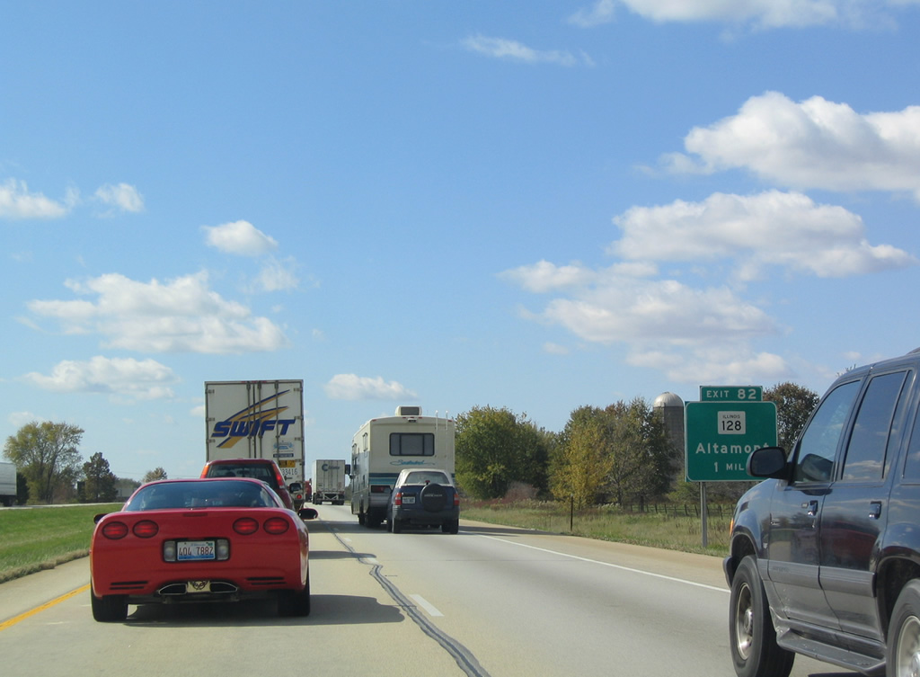
Ten miles west of the separation with Interstate 57 south, I-70 advances to the city of Altamont and IL 128 at Exit 82.
10/16/04
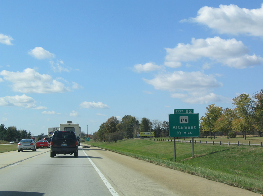
IL 128 concludes from the north at Interstate 70. The state route measures 56 miles from Altamont north toward Shelbyville and IL 121 outside Decatur. Exit 82 onto IL 128 (Main Street) north to U.S. 40 (Cumberland Road) east connects Exit 82 with the Effingham County Fairgrounds.
10/16/04
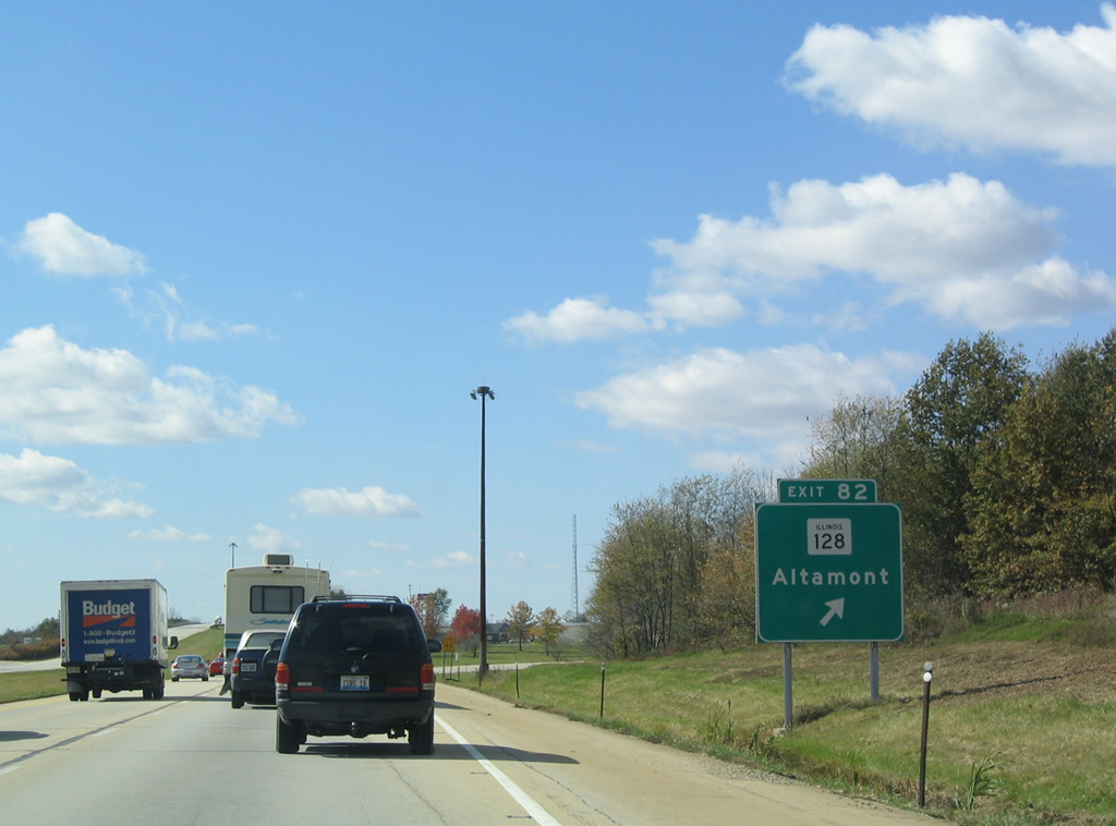
Entering the diamond interchange (Exit 82) with Main Street (IL 128 north, CR 25 south) on I-70 west. County Road 25 extends southward to eastern Fayette County, connecting Altamont with IL 37 near Farina.
10/16/04
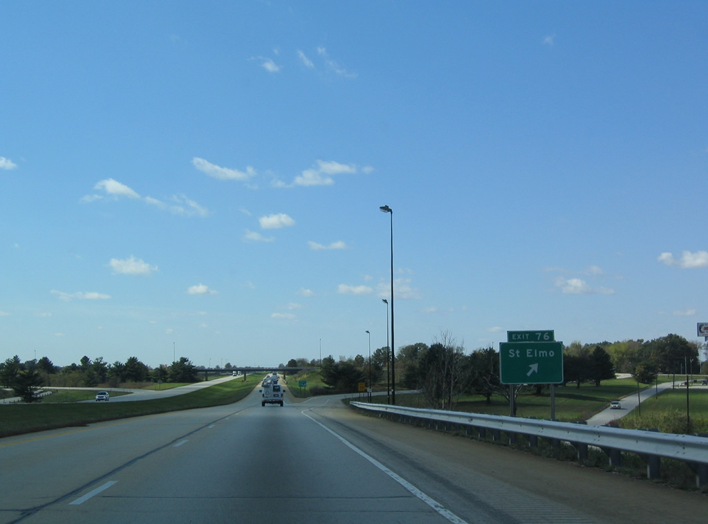
Interstate 70 crosses into Fayette County and next meets CR 7 (County Road 2125 East) outside the city of St. Elmo. U.S. 40 remains parallel to the north town as CR 7 south connects with IL 185 near Loogootee.
10/16/04
U.S. 40 (Historic National Road) continues west from St. Elmo through Brownstown, home of the Fayette County Fairgrounds, to switch sides with Interstate 70 at a diamond interchange (Exit 68).
10/16/04
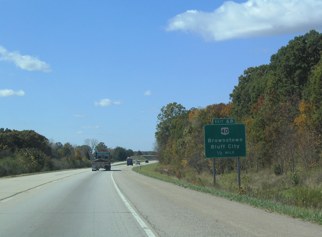
Exit 68 with U.S. 40 lies two miles east of Bluff City and three miles west of Brownstown.
10/16/04
The original construction of I-70 resulted in a short relocation of U.S. 40 from the original Historic National Road southward where it combines with IL 185. IL 185 angles northwest to Hillsboro and southeast to Farina along a 26 mile route.
10/16/04
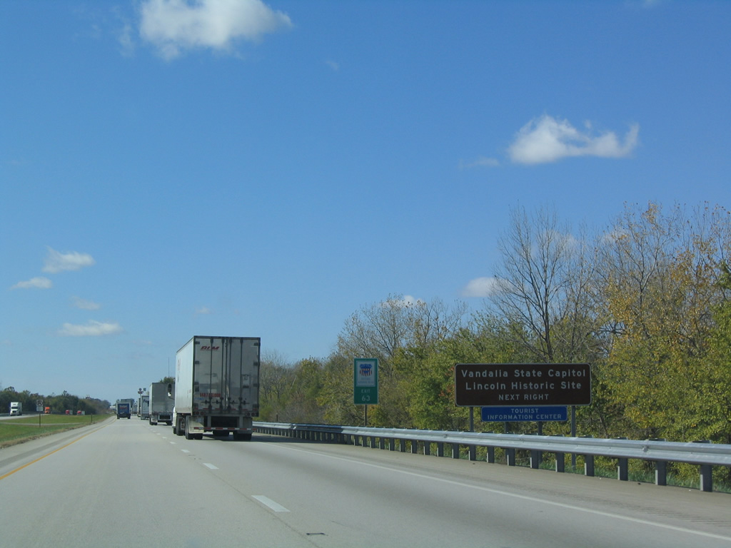
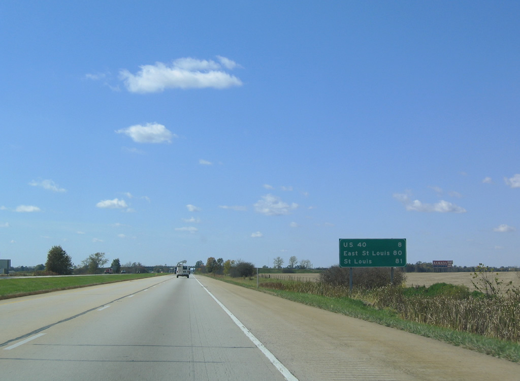
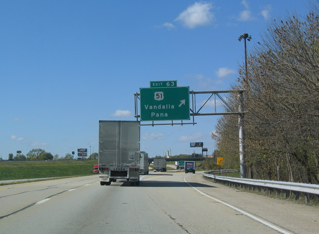
The first of two exits for Vandalia from I-70 is with U.S. 51 (Kennedy Boulevard). Vandalia was the first capitol city of Illinois, serving as the government center between 1819 and 1839. A tourist information center resides off U.S. 51 near Exit 63, a facility that hosts Tribute to Farmers Monument.
10/16/04
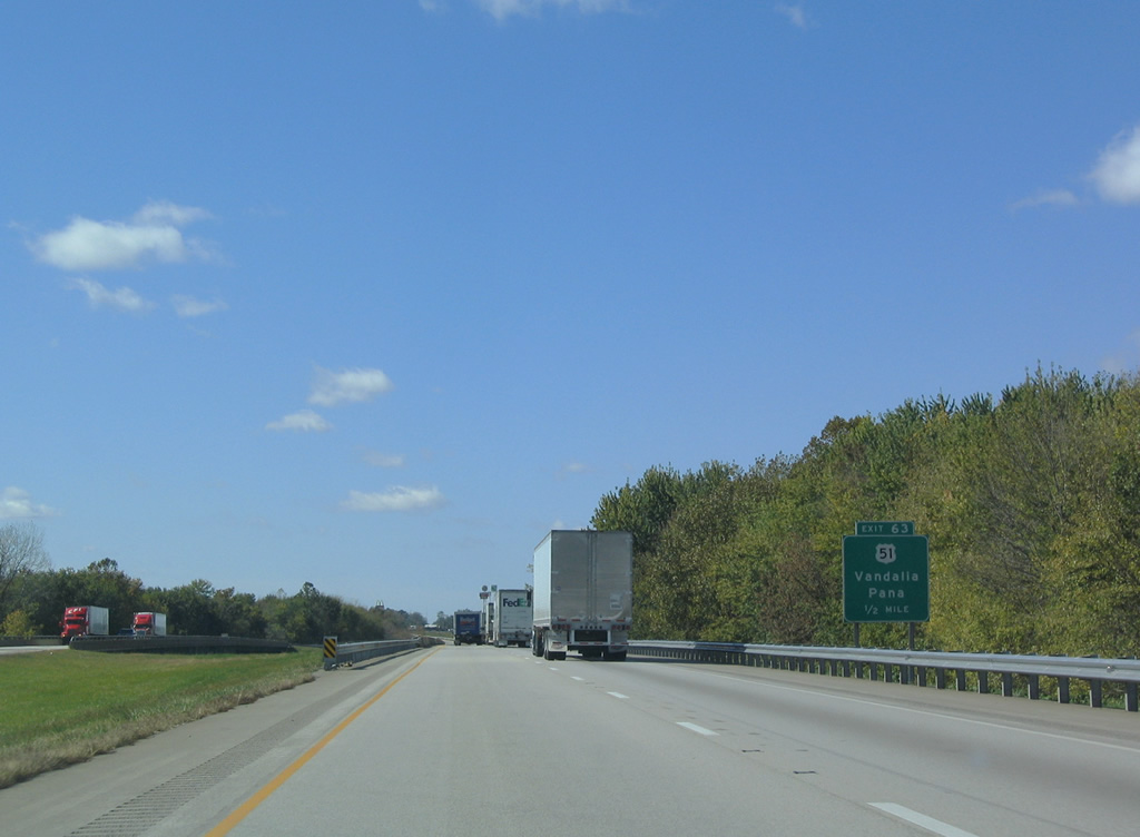
Spanning the Kaskaskia River one half mile east of the diamond interchange (Exit 63) with U.S. 51 (Kennedy Boulevard). U.S. 51 travels the height of Illinois from Cairo north 390 miles to the Wisconsin state line, north of Rockford. Within central Illinois, the US Route joins Vandalia with Pana and Decatur to the north and Centralia and Du Quoin to the south.
10/16/04
U.S. 51 combines with U.S. 40 and IL 185 nearby at Veterans Avenue southward to Gallatin Street. U.S. 40 diverges from the original National Road via Veterans Avenue, a north side industrial bypass, while IL 140 follows the historic route west from downtown Vandalia to Hagarstown.
10/16/04
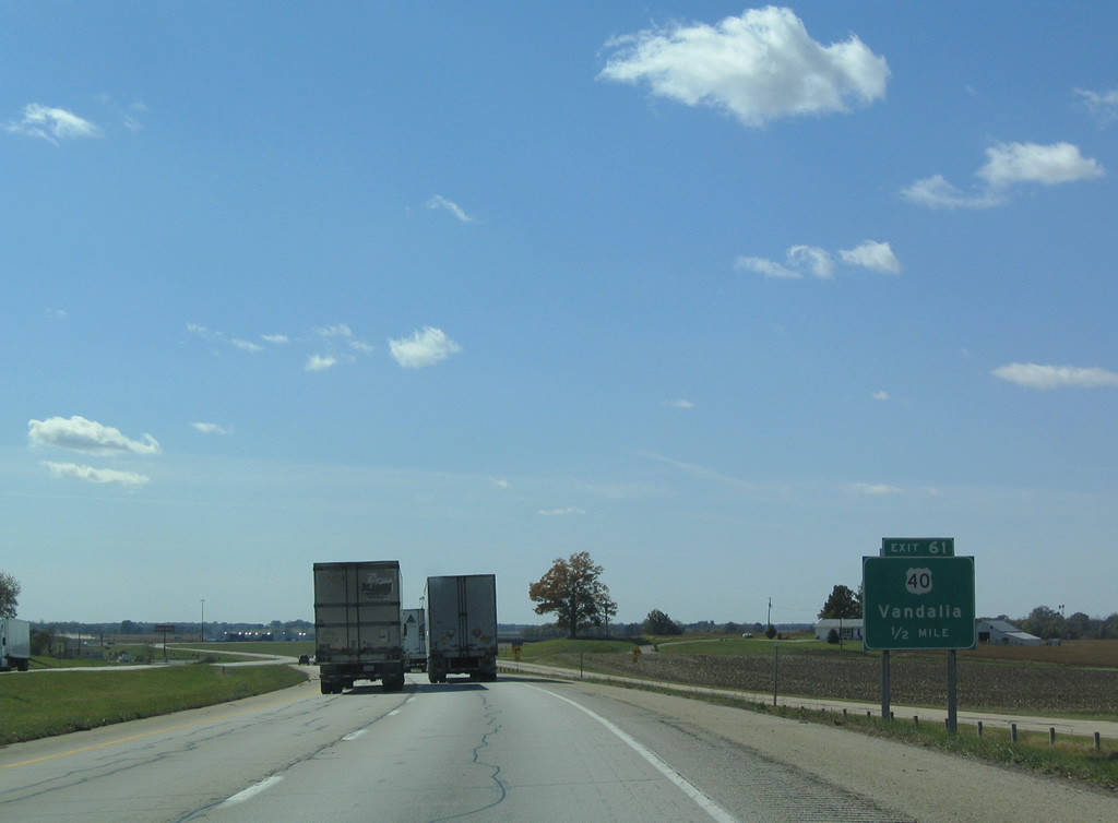
U.S. 40 follows Veterans Avenue west from the split with IL 185 (Hillsboro Road) to Randolph Street and a diamond interchange with Interstate 70 at Exit 61.
10/16/04
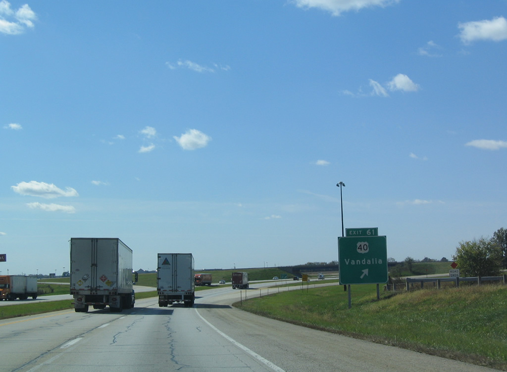
West from Exit 61, U.S. 40 resumes along the north side of Interstate 70 to Greenville. A frontage road visible along the north side of I-70 represents an older alignment of U.S. 40 that ran west from Hillsboro Road (IL 185). This alignment was cut short when Veterans Avenue west from Hillsboro Road and Exit 61 opened for service in 1977.
10/16/04
Reassurance marker posted between Vandalia and the diamond interchange (Exit 52) with Maple Street at Mulberry Grove.
10/16/04
Bridges that span Interstate 70 also cross over adjacent U.S. 40 on the stretch leading west to Bond County.
10/16/04
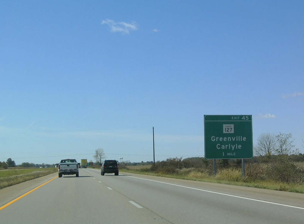
The second of four exits in Bond County joins Interstate 70 west with IL 127 on the southeast periphery of Greenville.
10/16/04
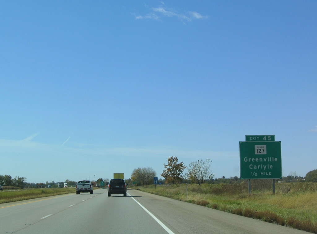
Greenville, the Bond County seat and home to the County Fairgrounds, was incorporated in 1855. U.S. 40 (Historic National Road) bypasses the city of over 7,000 to the south, as IL 127 joins the route with downtown via Harris Avenue and 3rd Street.
10/16/04
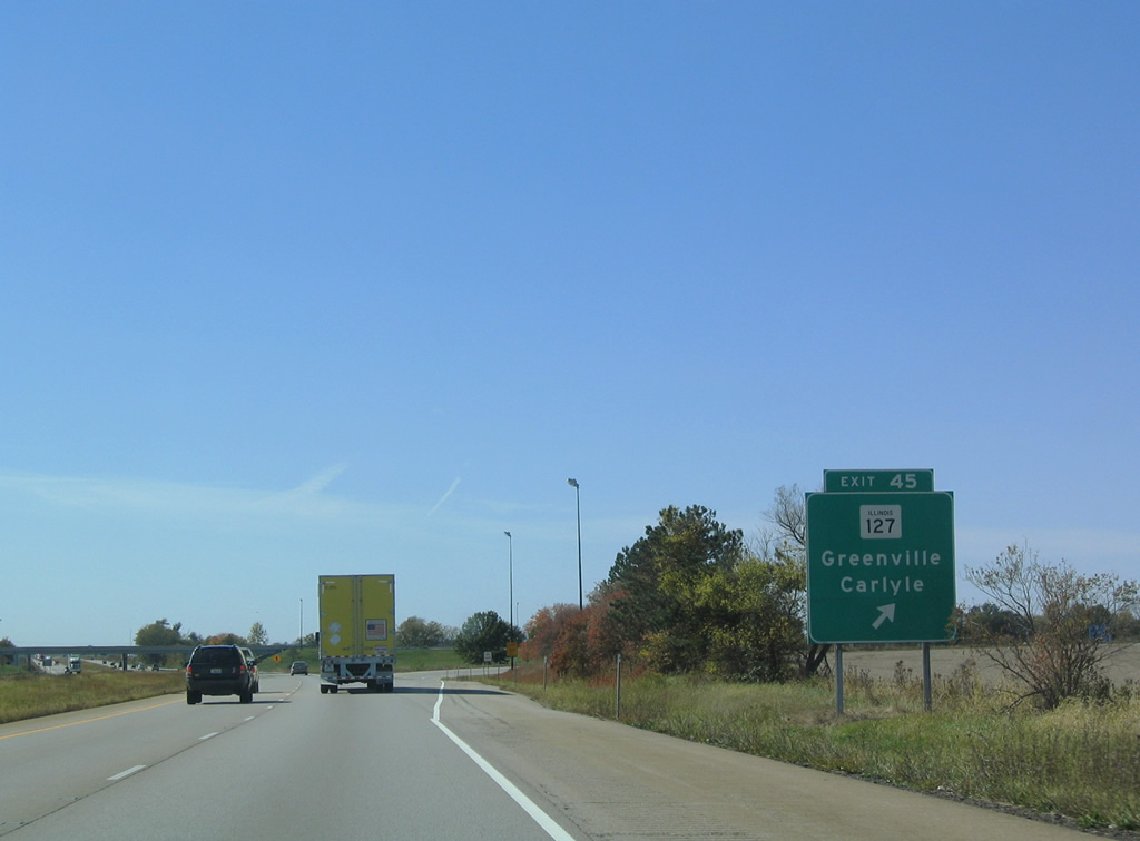
South from the diamond interchange (Exit 45) with I-70, IL 127 continues 19 miles to the Clinton County seat of Carlyle and Carlyle Lake. Overall the state route travels 179 miles from Unity to Interstate 55 at Raymond.
10/16/04
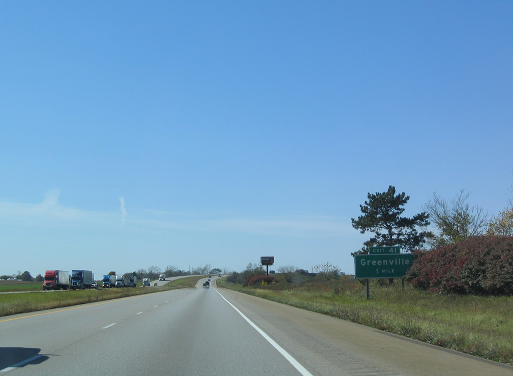
U.S. 40 (Historic National Road) again nears Interstate 70 at a folded diamond interchange (Exit 41) with County Route 17 (Millersburg Road).
10/16/04
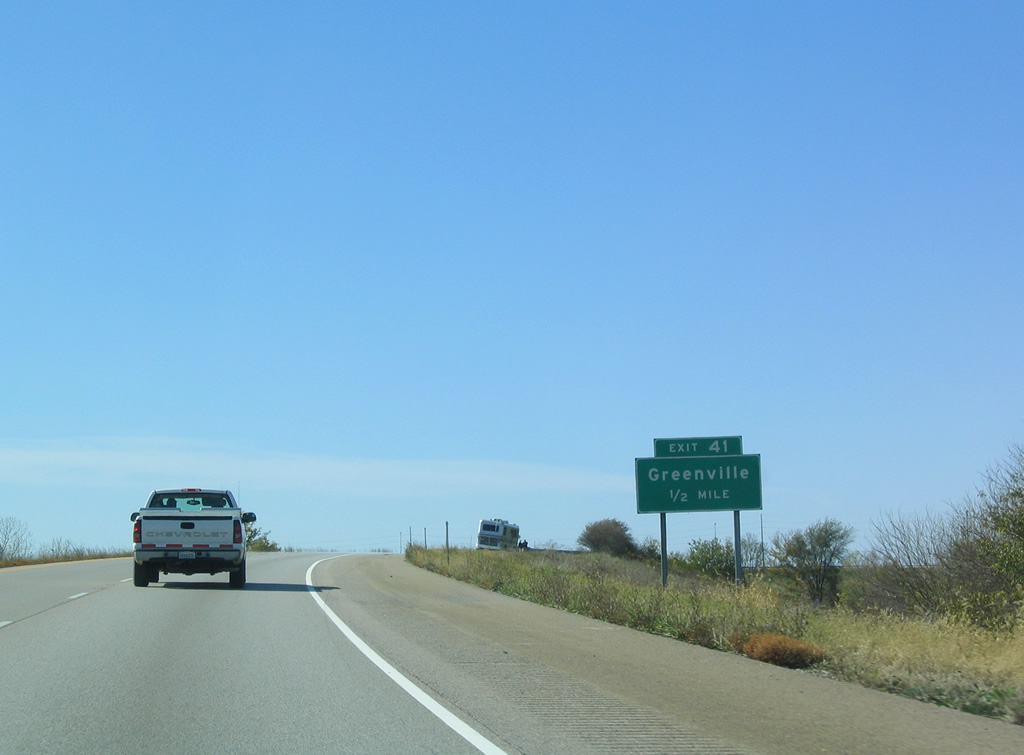
Interstate 70 crosses over a CSX Railroad a half mile ahead of Exit 41 to Greenville.
10/16/04
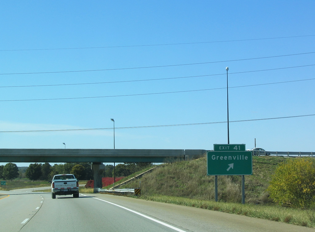
Exit 41 loops onto Millersburg Road south of U.S. 40. U.S. 40 continues adjacent to the westbound lanes to Shoal Creek outside Pocahontas. Millersburg Road run south through agricultural areas to IL 153 and northern Clinton County.
10/16/04
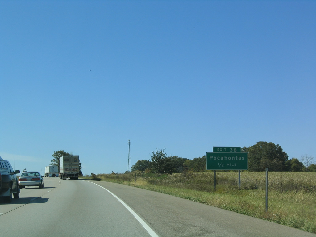
Staying just north of Pocahontas, Interstate 70 meets Pokey Road (CR 21 north) and U.S. 40 at a diamond interchange (Exit 36) in a half mile.
10/16/04

U.S. 40 follows Johnson Street west through Pocahontas to a northward turn at Exit 36. The US highway combines with Interstate 70 west as the former alignment along Freys Meadow Avenue parallels closely to Exit 30.
10/16/04
 West
West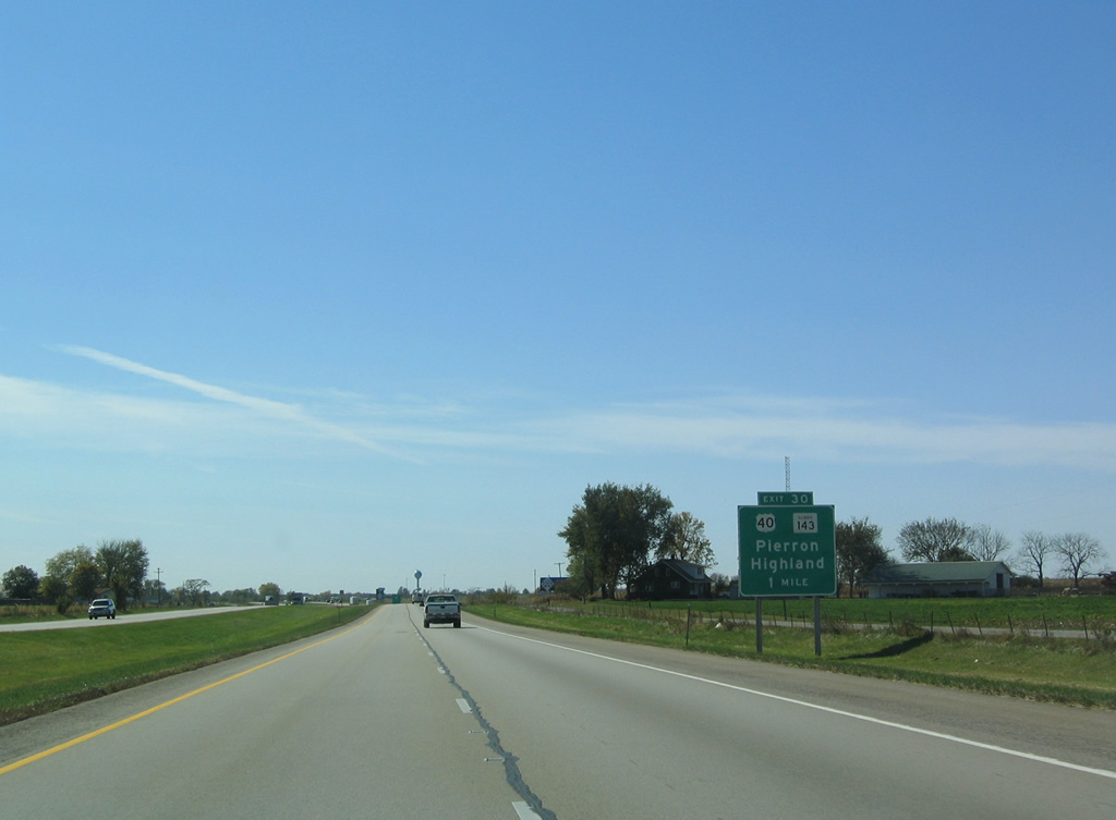
I-70/U.S. 40 west part ways at the diamond interchange (Exit 30) outside Highland. Suburbia begins appearing here at the outskirts of Highland.
10/16/04

IL 143 is a 32 mile route west to Alton and east to Pierron and IL 127. U.S. 40 joins the state route nearby for a 3.6 mile overlap to Highland.
10/16/04

U.S. 40 west parts ways with Interstate 70 at Exit 30. Steiner Road leads north from U.S. 40 (National Road) while U.S. 40 converges with I-70 again along the overlap with I-55 near Troy.
10/16/04
West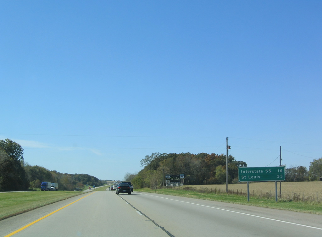
Interstate 55 lies 16 miles ahead as St. Louis is a half hour away.
10/16/04
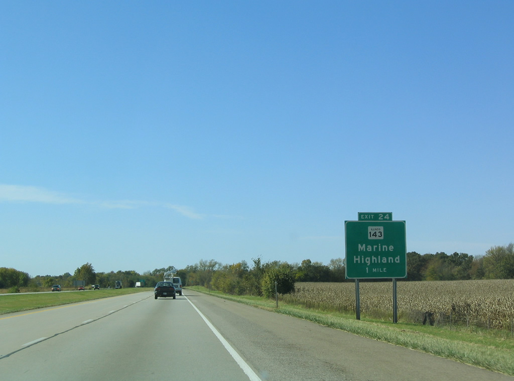
IL 143 branches northwest from U.S. 40 (Historic National Road) in Highland to a diamond interchange (Exit 24) with Interstate 70.
10/16/04
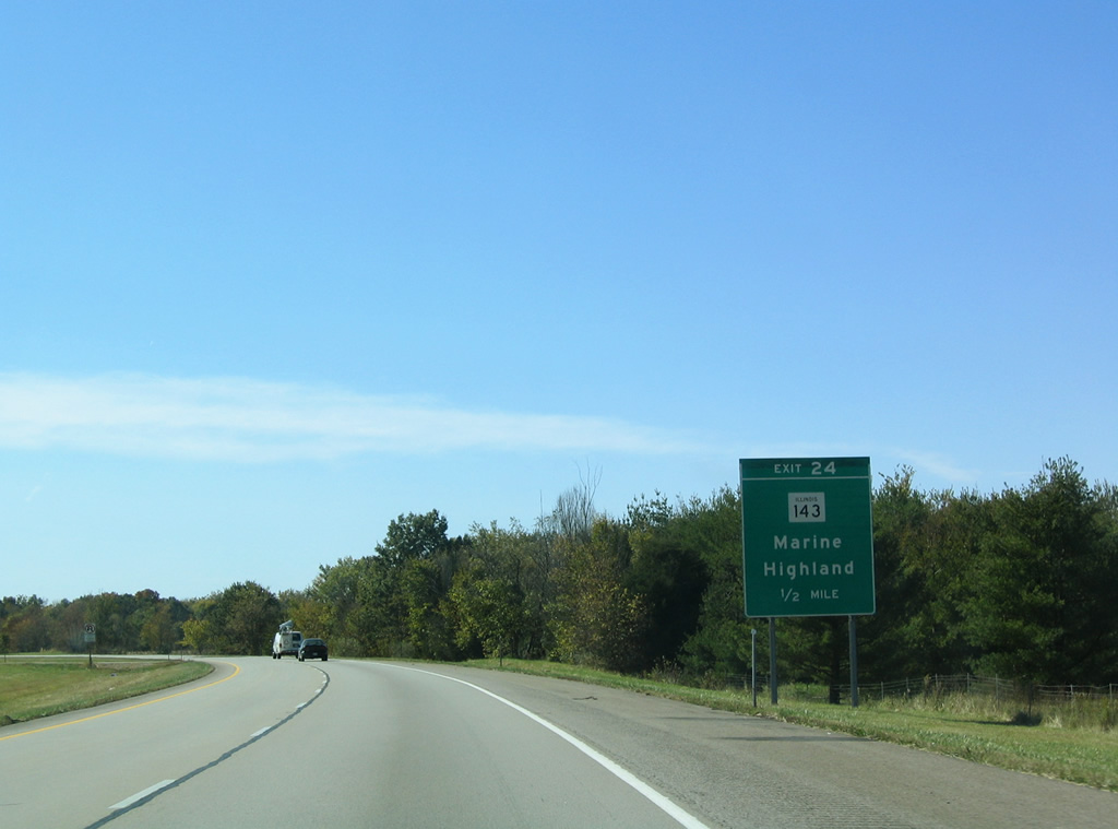
Continuing west from Exit 24, IL 143 travels two miles to Marine along Division Street.
10/16/04
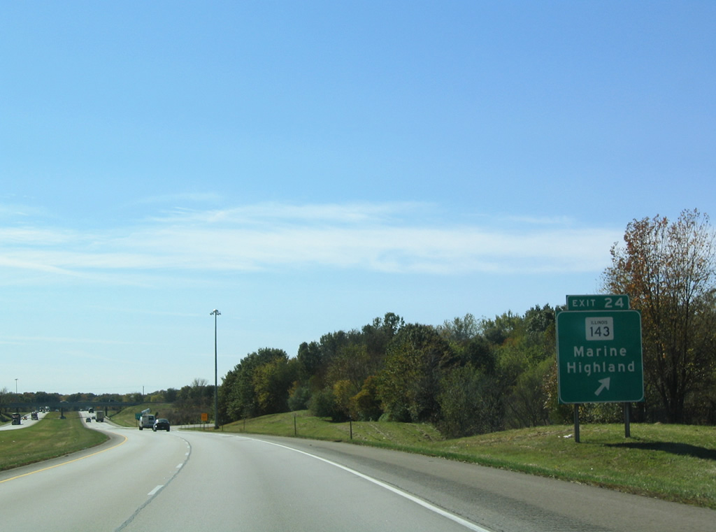
Exit 24 departs Interstate 70 west for IL 143. The state route connects Highland and Marine with Edwardsville and Wood River beyond I-55.
10/16/04

Marine Road passes over Interstate 70 west, one mile out from the diamond interchange (Exit 21) with IL 4.
10/16/04
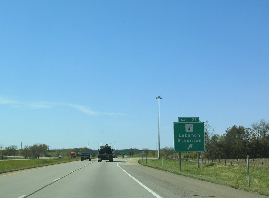
IL 4 travels north 18 miles to Staunton and south 11 miles to Lebanon. Overall the state route runs 160 miles from IL 13 in Jackson County to Springfield.
10/16/04

Interstate 70 west next meets I-55 and I-270 at a directional cloverleaf interchange in four miles.
10/16/04
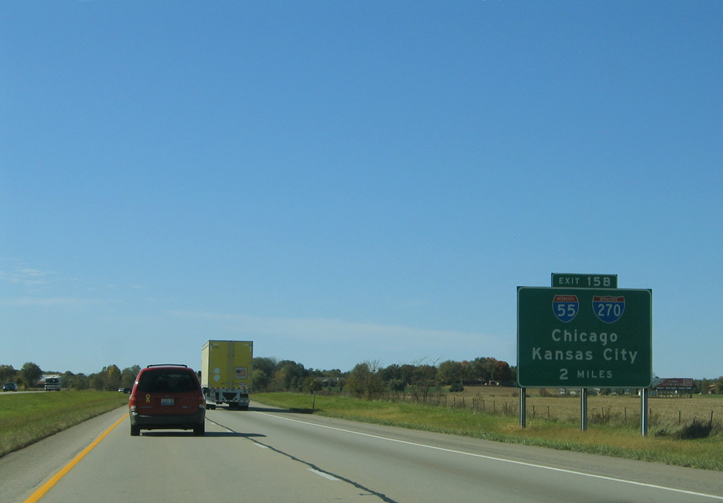
The Exit number for Interstate 55 north to Springfield uses the mileage of I-270 to the Mississippi River. I-70 turns southward just ahead of Exit 15 B to combine with Interstate 55 for 15.5 miles to I-64 at East St. Louis.
10/16/04
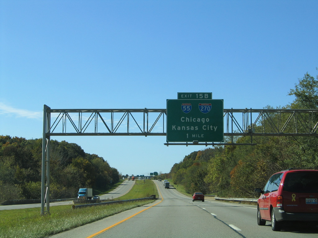
Interstate 70 west traverses a wooded area by Wendell Branch leading to the exchange with I-55/270. Traveling 313 miles in Illinois, I-55 joins Chicago with St. Louis and Memphis, Tennessee to the south.
10/16/04
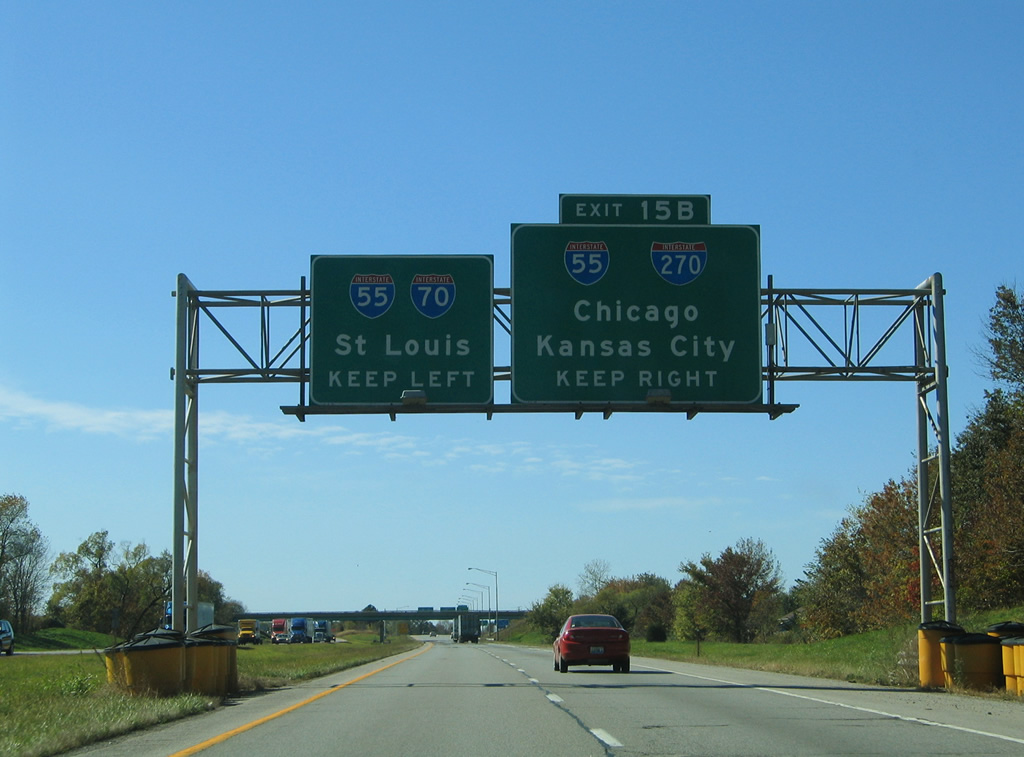
Through traffic bound for Kansas City, Missouri is directed onto Interstate 270 west. I-270 encircles St. Louis to the north and west along a 50.59 mile loop west to Maryland Heights and south to Mehlville, Missouri.
10/16/04
The left lanes default onto I-55/70 west to Collinsville, East St. Louis and St. Louis as Interstate 270 west to St. Charles, Missouri commences.
10/16/04
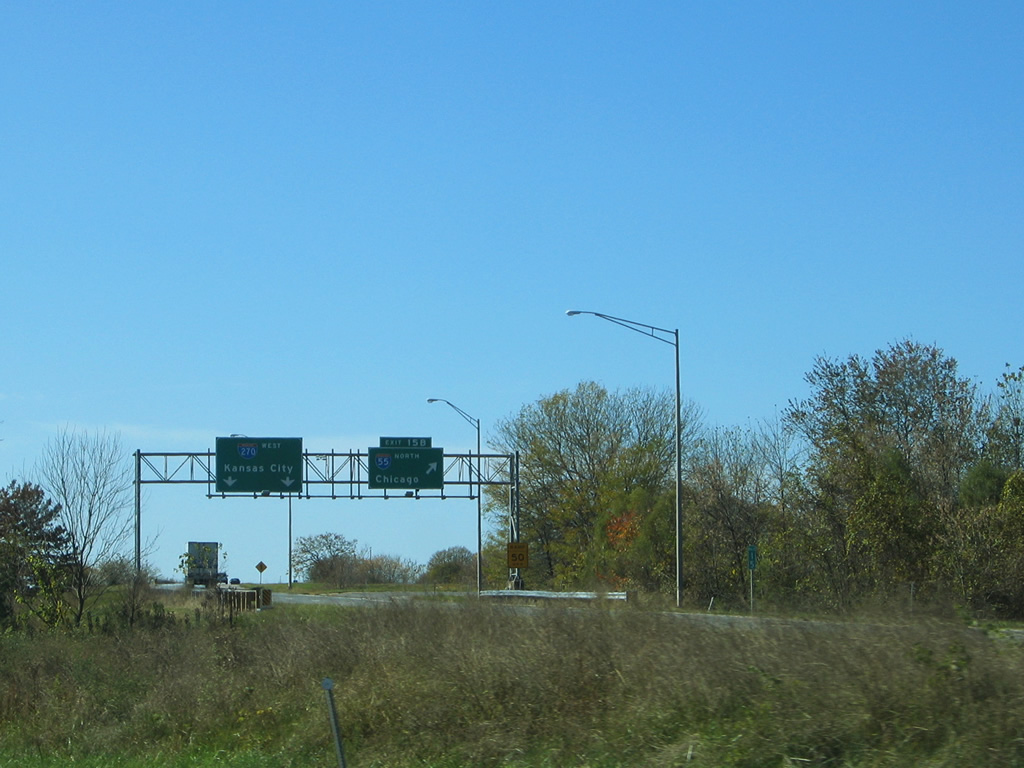
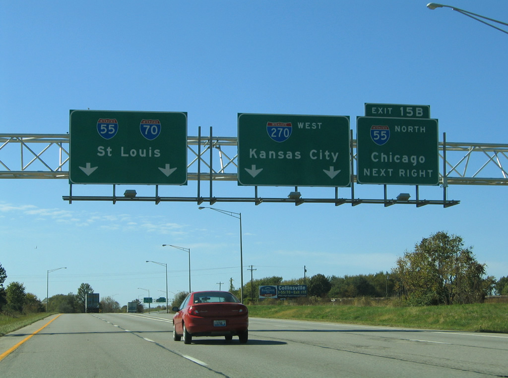
Exit 15 B departs from the westbound beginning of Interstate 270 to I-55 north. I-55 travels 77 miles north to the capital city and 270 miles to Chicago.
10/16/04

Photo Credits:
- AARoads: 10/16/04
Connect with:
Page Updated Monday April 02, 2012.