
Interstate 72 West - Pittsfield to Missouri

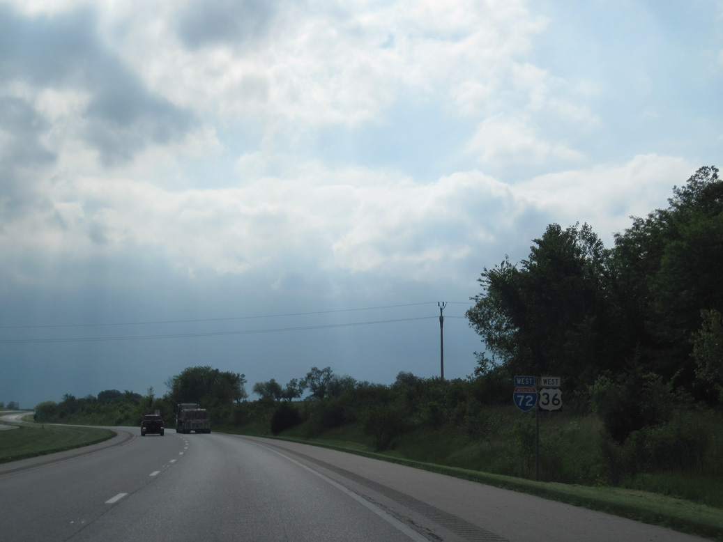
 West
West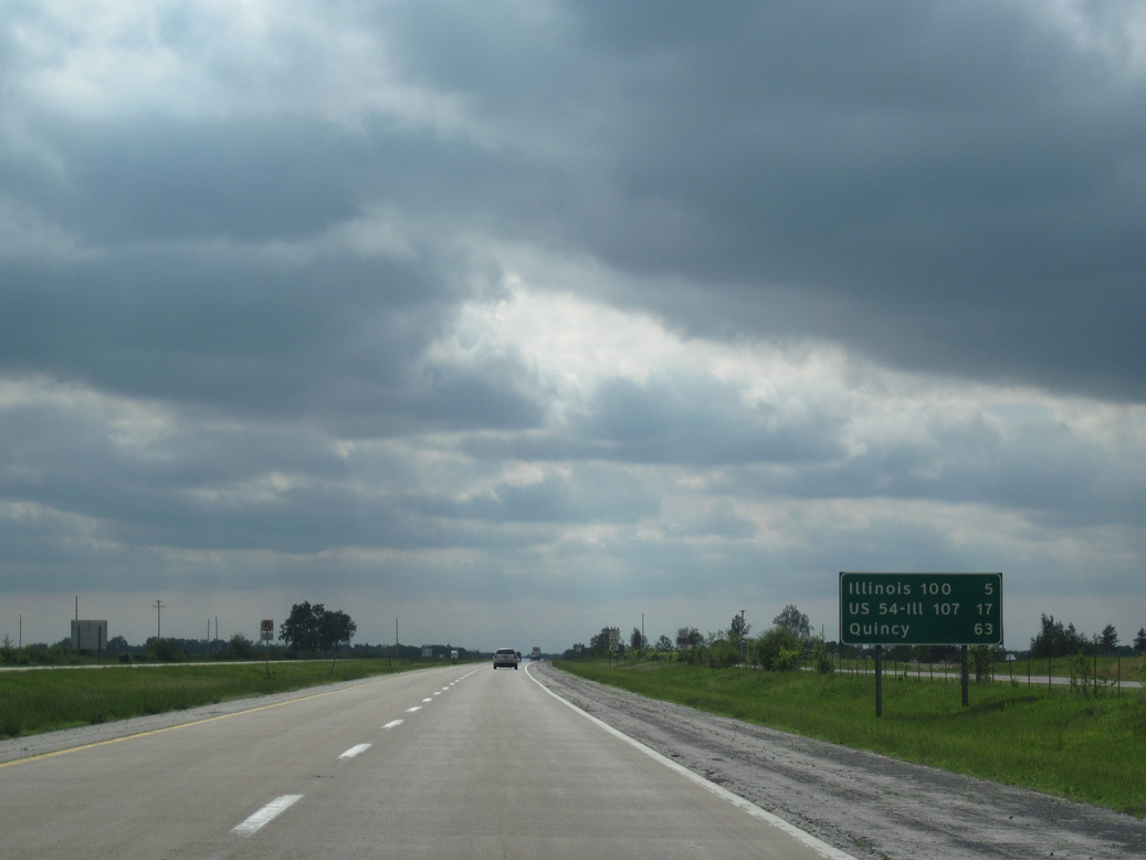
The last exit in Scott County on I-72/U.S. 36 west links with IL 100 in five miles. The subsequent exit lies midway between Griggsville and Pittsfield.
05/07/10
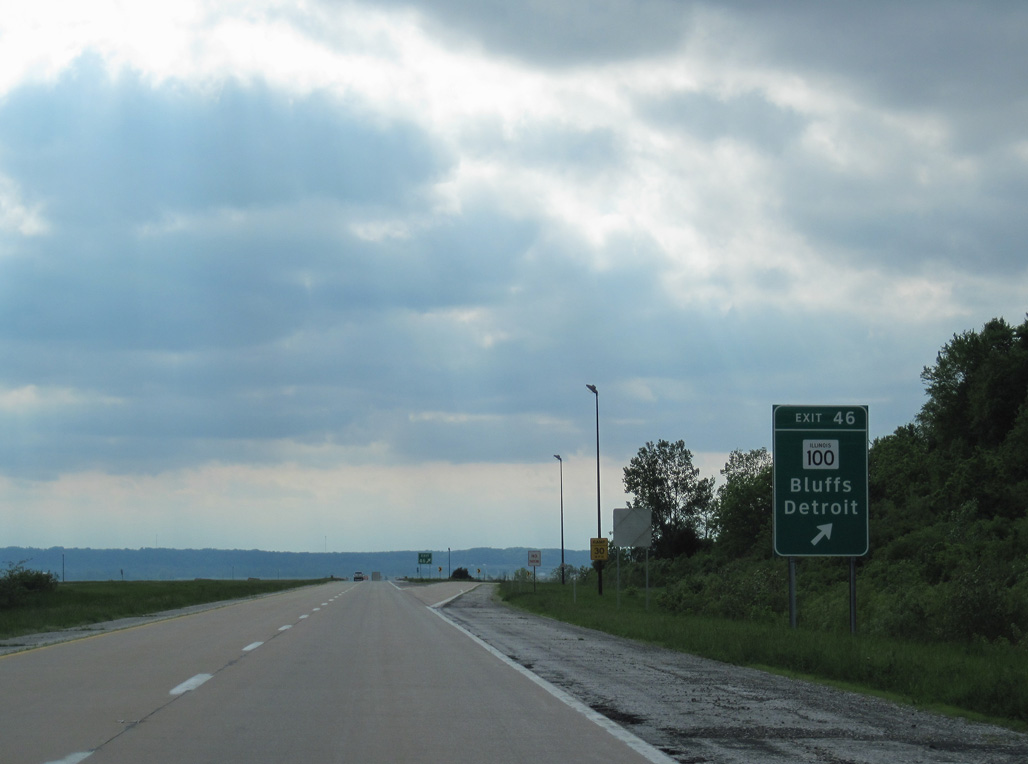
IL 100 branches 3.89 miles north from IL 106 (old U.S. 36) east of Florence to the diamond interchange at Exit 46.
05/07/10
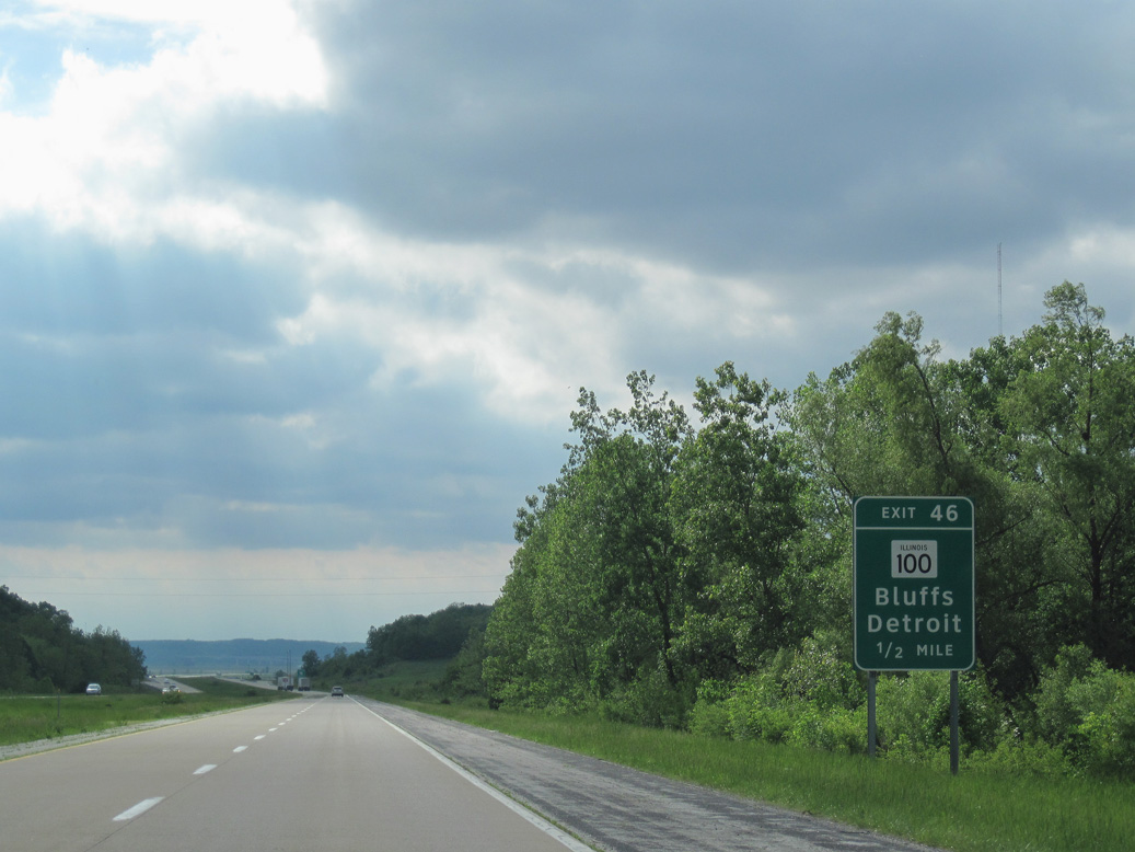
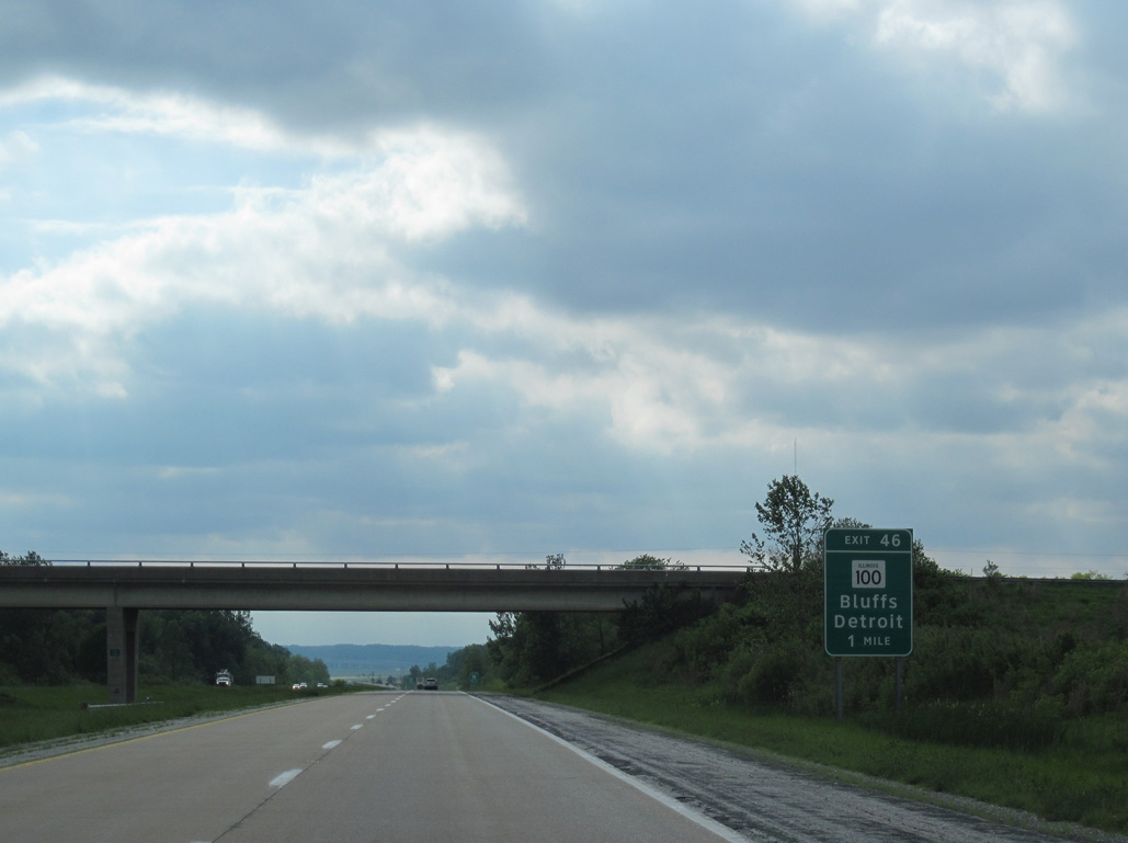
Continuing north from I-72/U.S. 36, IL 100 reaches the Bluffs village limits in 4.56 miles.
05/07/10
IL 100/106 overlap 5.58 miles west to the villages of Florence and Detroit in Pike County.
05/07/10
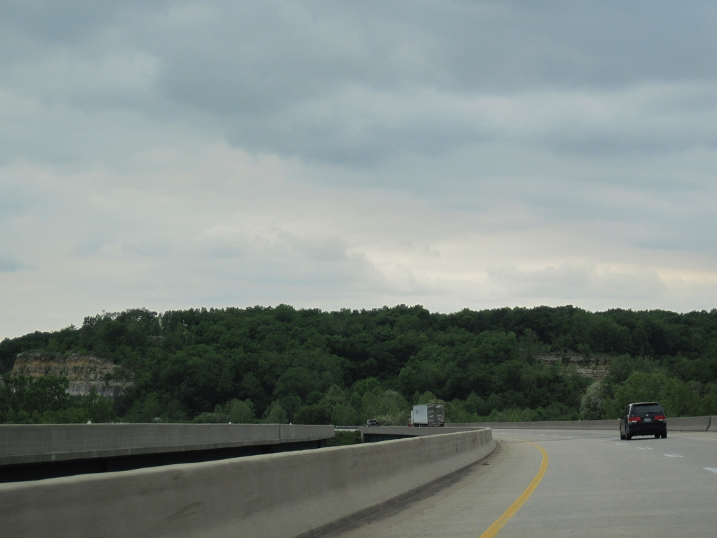
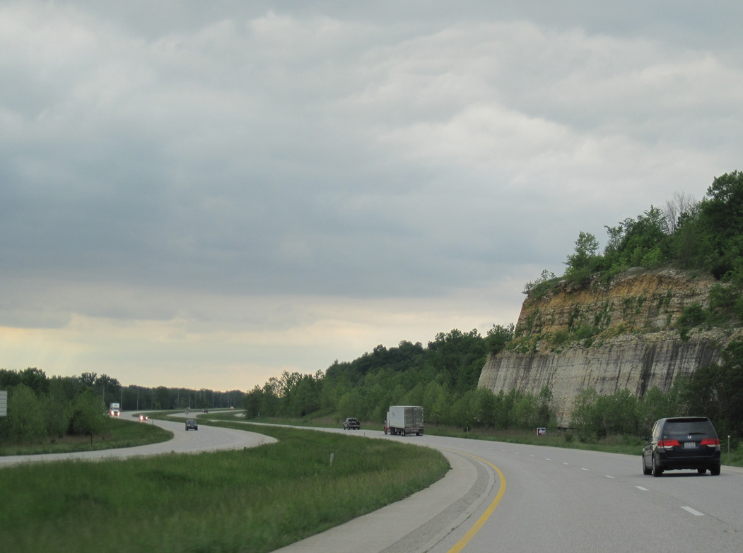
Lining the Illinois River, bluffs rising to over 600 feet above sea level spread along the western horizon.
05/07/10
The succeeding 3.90 miles leading west from IL 100 to the Pike County line ply across flat agricultural areas within the Illinois River flood plain.
05/07/10
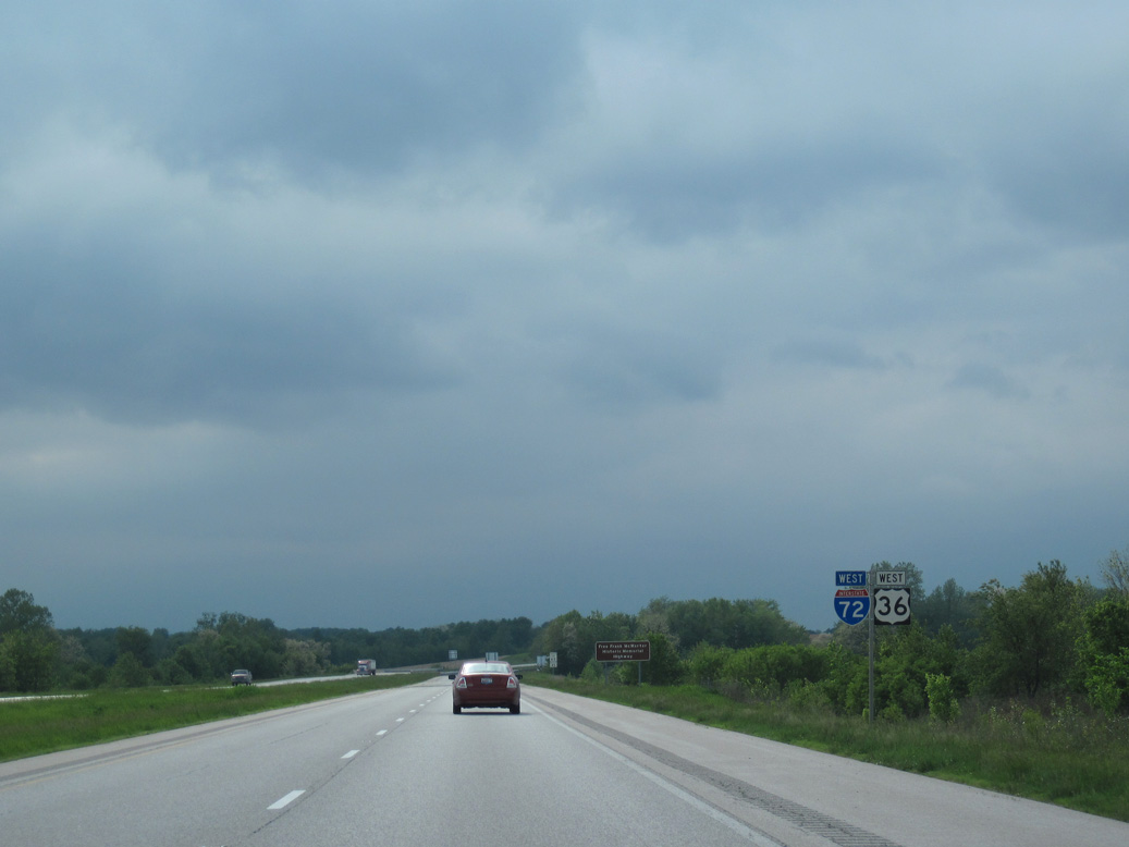
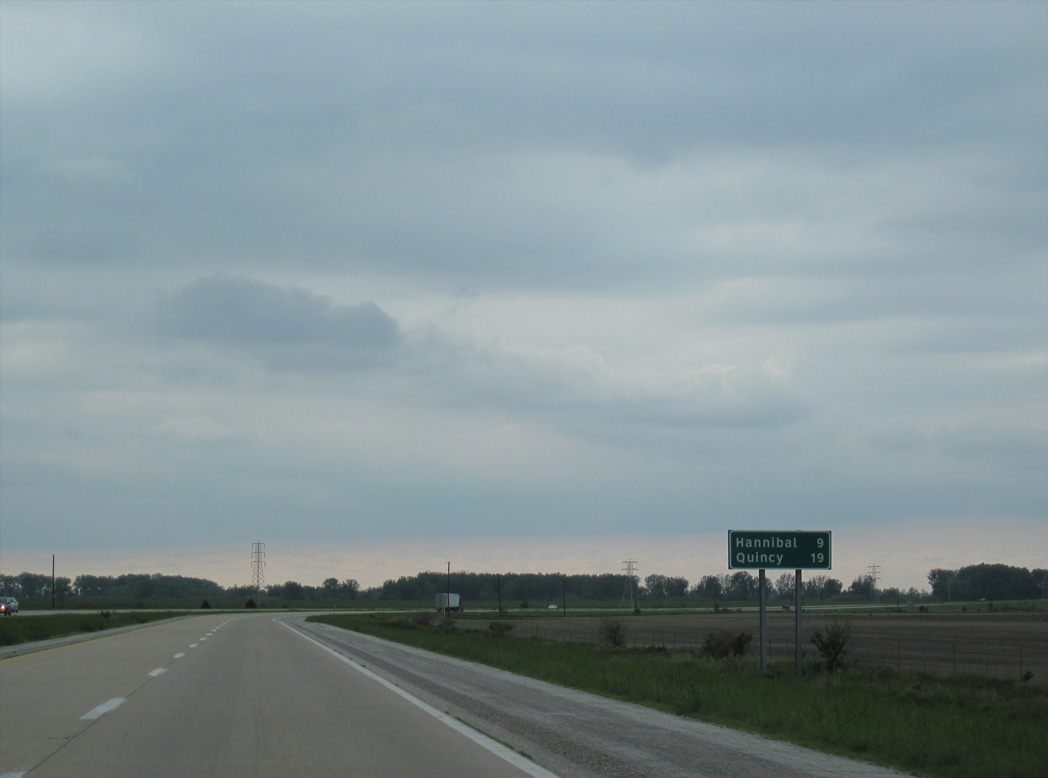
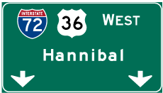
Interstate 72 west reaches Hannibal, Missouri in 46 miles. I-172 spurs north to Quincy from I-72 in 40.5 miles.
05/07/10
A flood relief bridge precedes mile marker 43 and the Phillips Ferry Road underpass.
05/07/10
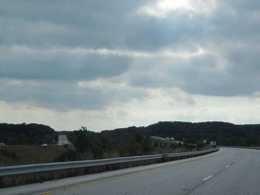
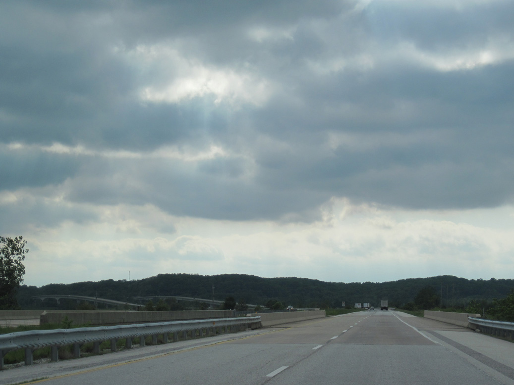
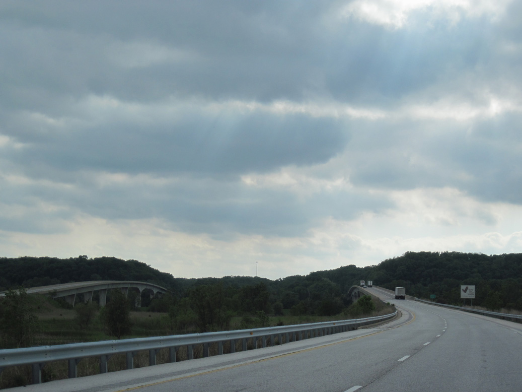
The roadways for Interstate 72 diverge ahead of the Valley City Eagle Bridges spanning the Illinois River.
05/07/10
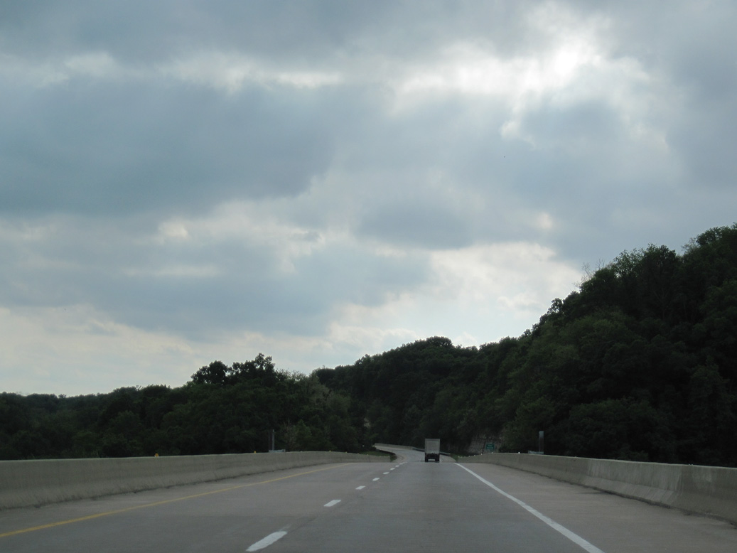
I-72/U.S. 36 gain elevation west from the Illinois River onto a series of bluffs by Napoleon Hollow.
05/07/10
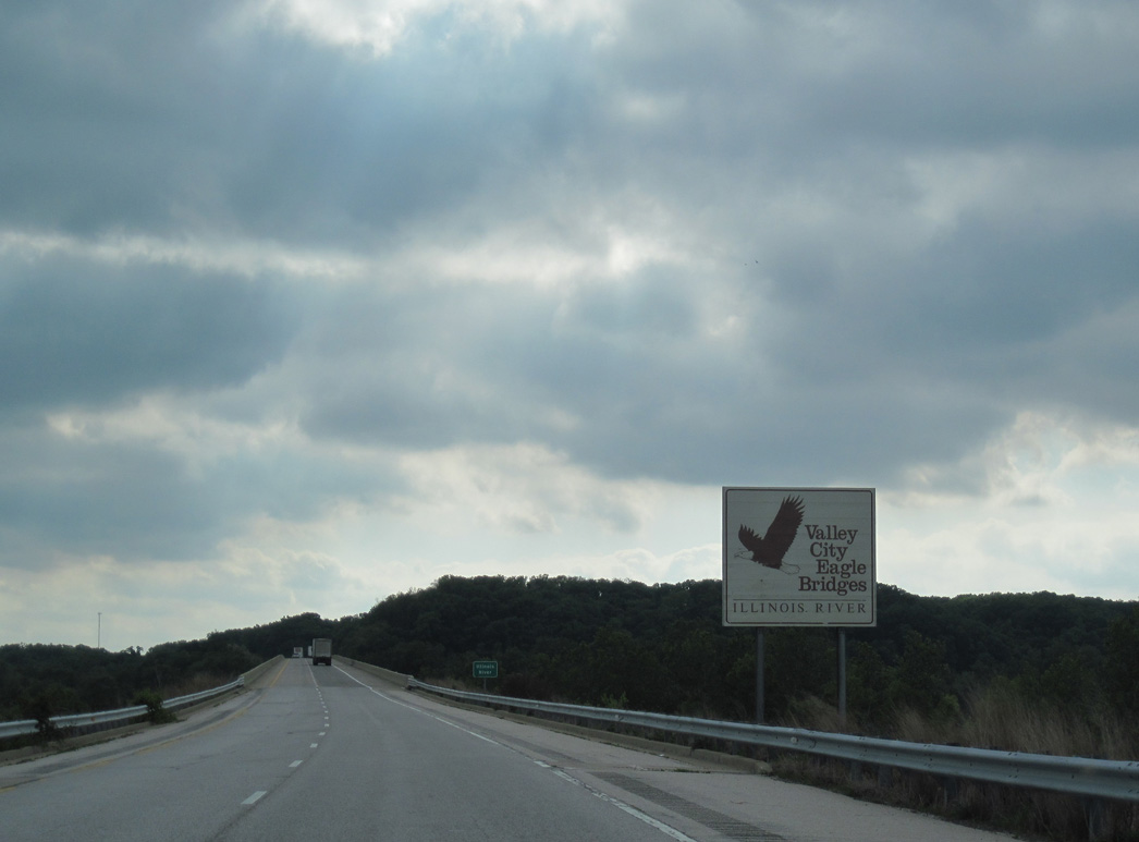
Built in 1988, the Valley City Eagle Bridges are box girder bridges.1
05/07/10
The westbound span taking I-72/U.S. 36 across the Illinois River measures 3,204 feet in length. The eastbound crossing is slightly longer at 3,330 feet in length.2
05/07/10
The Valley City Eagle Bridges crest at 72 feet above the Illinois River.1
05/07/10
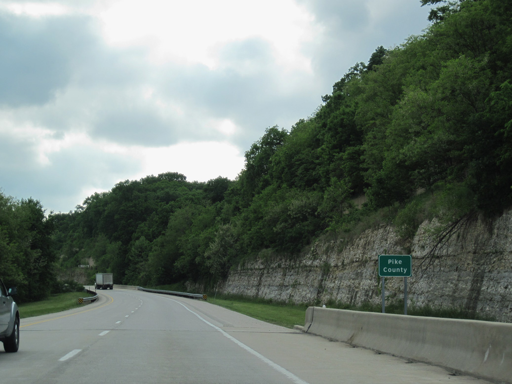
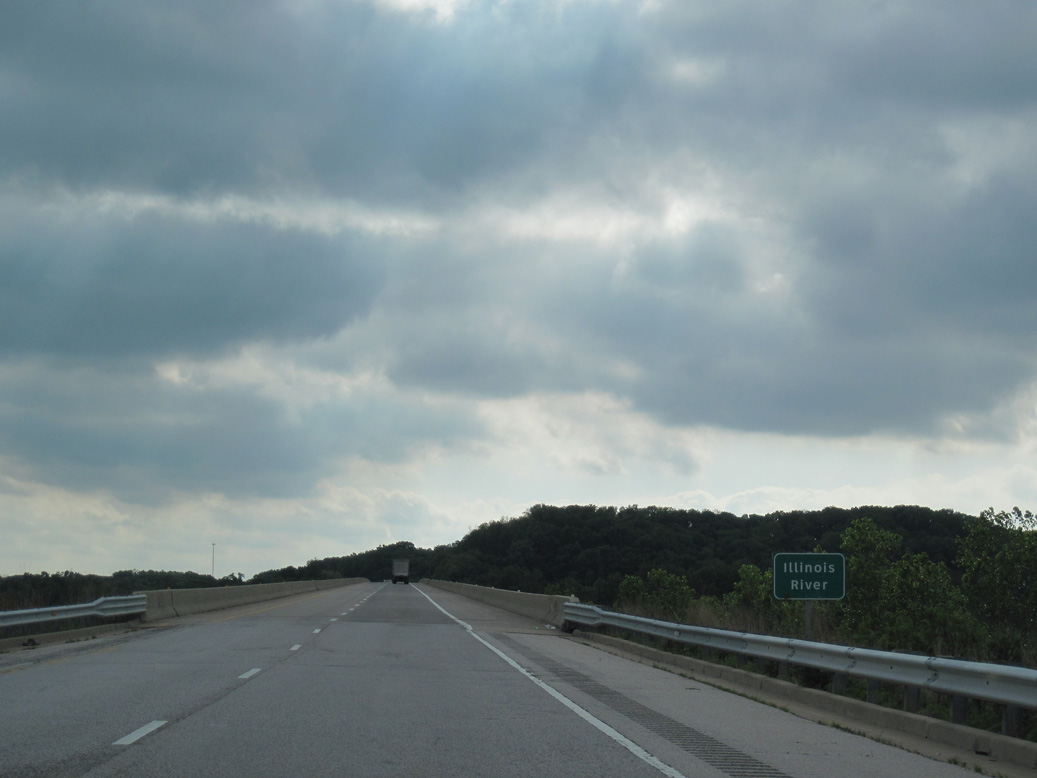
Interstate 72 west enters Pike County at mid span across the Illinois River.
05/07/10
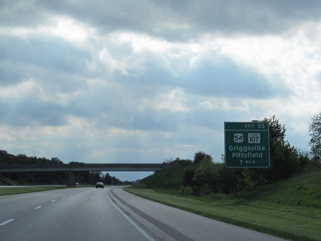
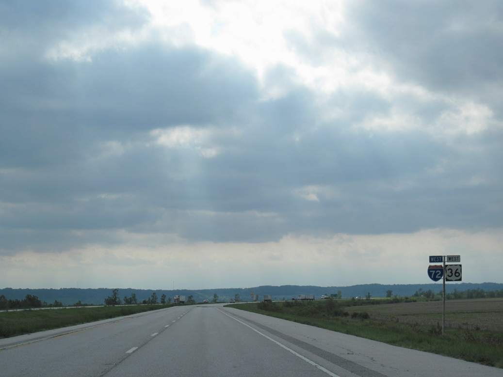
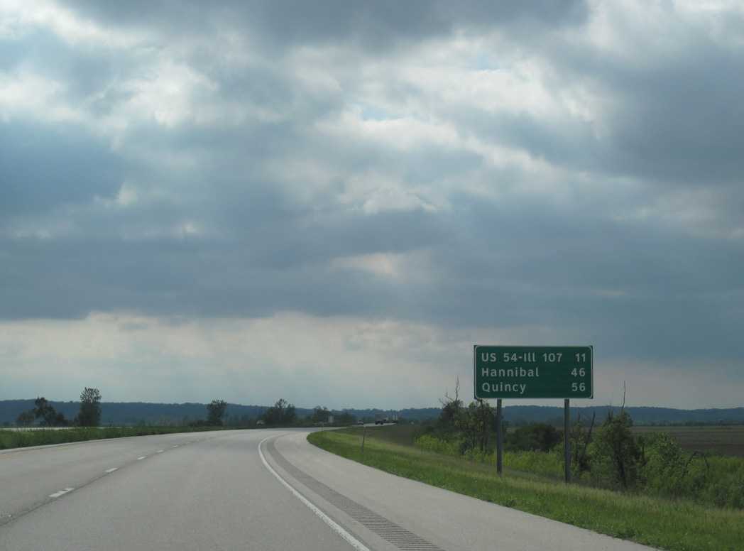
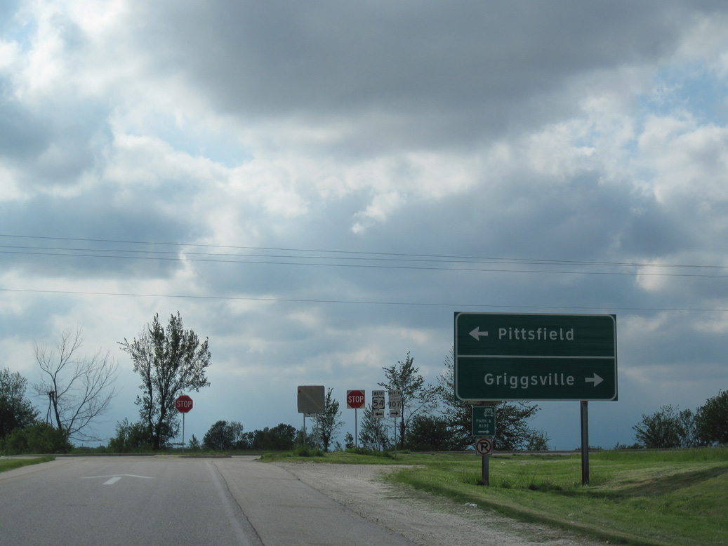
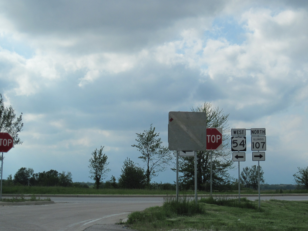
IL 107 south and U.S. 54 east converge at a rural diamond interchange (Exit 35) along Interstate 72 and U.S. 36 in one mile. The Central Illinois Expressway opened west to Exit 35 on October 13, 1990.1
05/07/10
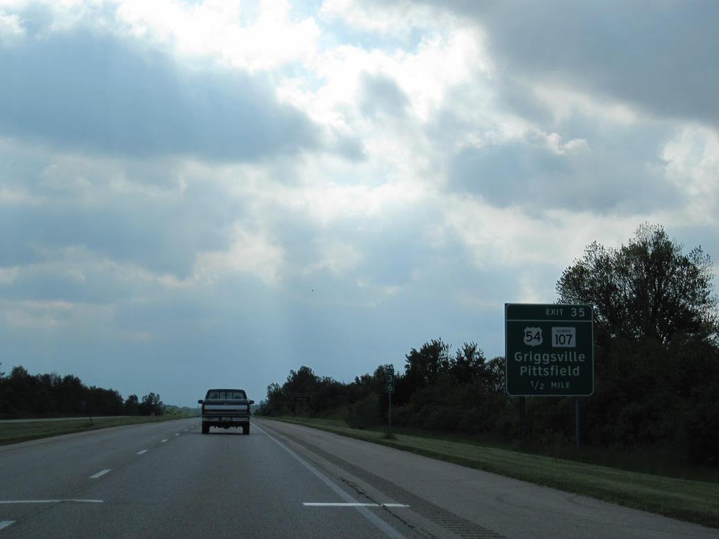
IL 107 angles northeast 2.75 miles onto Wall Street in the city of Griggsville. U.S. 54 runs 4.53 miles south onto Jackson Street in the Pittsfield residential street grid.
05/07/10

U.S. 54 originally traveled northeast from Pittsfield to Chicago. The highway was truncated 278 miles southwest to U.S. 36 in Pittsfield per approval by the American Association of State Highway and Transportation Officials (AASHTO) on June 27, 1971. The route was subsequently extended north over IL 107 from Pittsfield to U.S. 36/I-72 in 1992.
05/07/10
North from Griggsville, IL 107 travels to the village of Perry and IL 99 outside Mount Sterling.
05/07/10
Beginning at I-72/U.S. 36, U.S. 54 runs 23.95 miles southwest to the Mississippi River at Louisiana, Missouri. Nationally the highway crosses the Great Plains en route to El Paso, Texas.
05/07/10
I-72/U.S. 36 navigate through an S-curve west of Blue Creek.
05/07/10
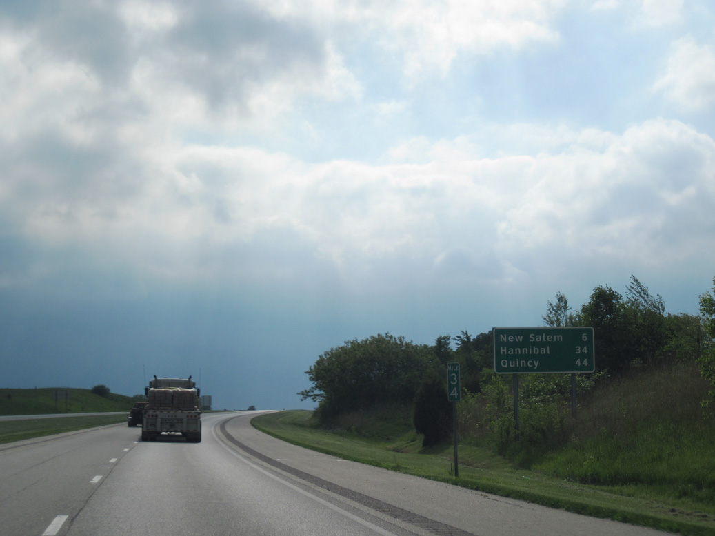
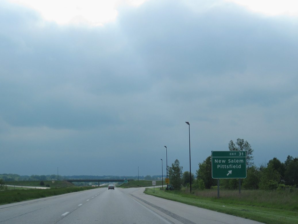
Representing the next exit from I-72/U.S. 36 west, the village of New Salem lies 5.5 miles to the northwest.
05/07/10
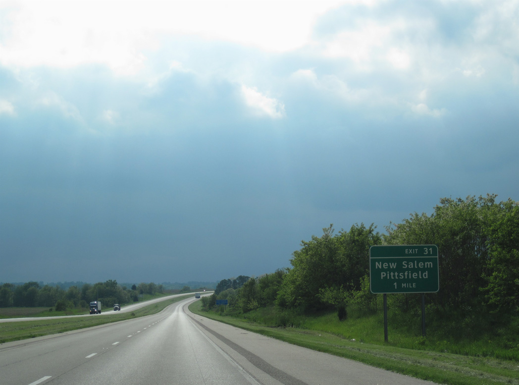
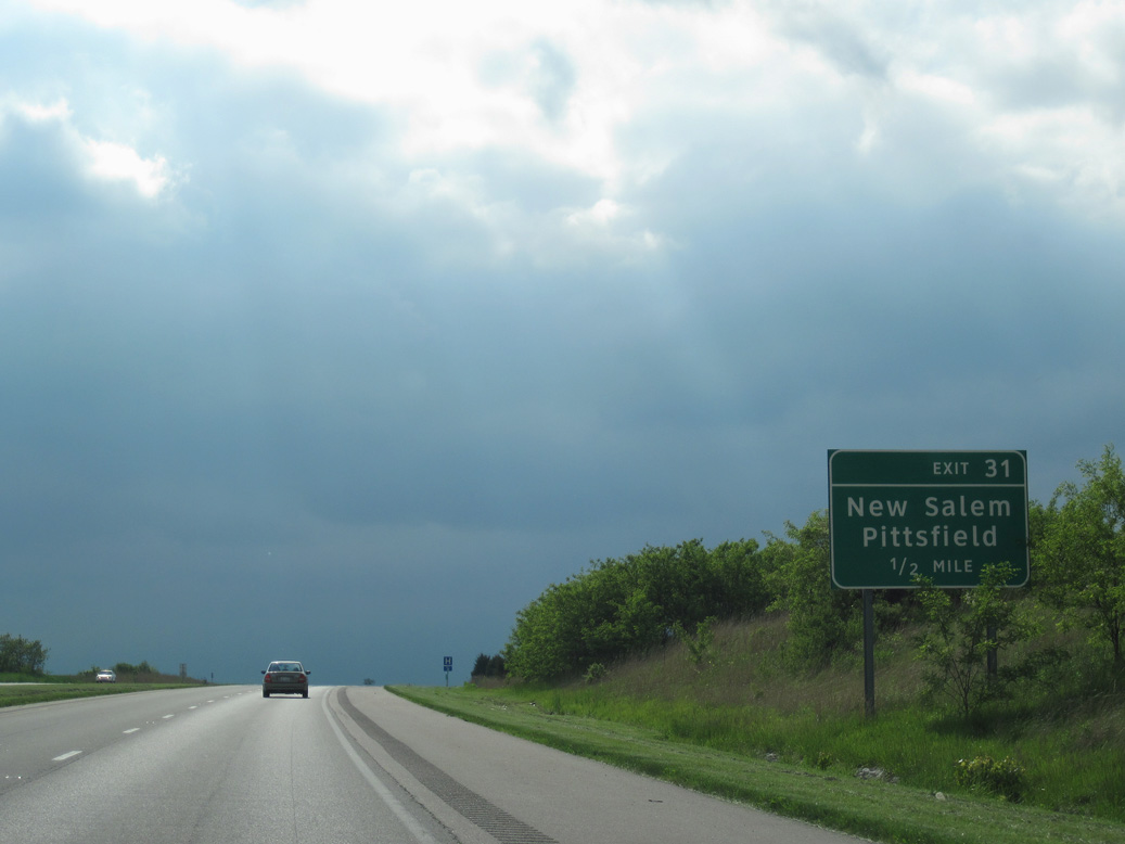
The diamond interchange at Exit 31 connects I-72/U.S. 36 west with County Highway 3.
05/07/10
County Highway 3 follows a stair-stepped course 4.90 miles south from Exit 31 onto Dutton Street in the Pittsfield street grid.
05/07/10
Continuing north, County Highway 3 runs 2.74 miles to Griggsville Road (County Highway 2) within the village of New Salem.
05/07/10
Designated the Free Frank McWorter Historic Memorial Highway, I-72/U.S. 36 trend northward ahead of Bay Creek.
05/07/10

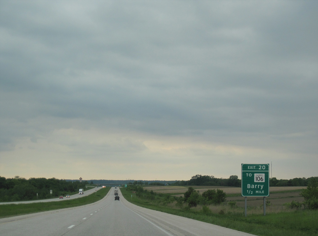
9.8 miles ahead, the succeeding exit from I-72/U.S. 36 west is for the city of Barry.
05/07/10
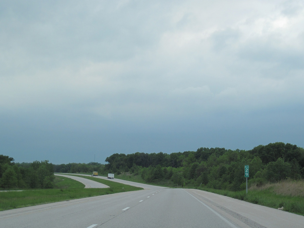
Interstate 72 rises to around 800 feet above sea level near mile marker 29.
05/07/10
Interstate 72 crosses Kiser Creek ahead of New Philadelphia and after milepost 25.
05/07/10
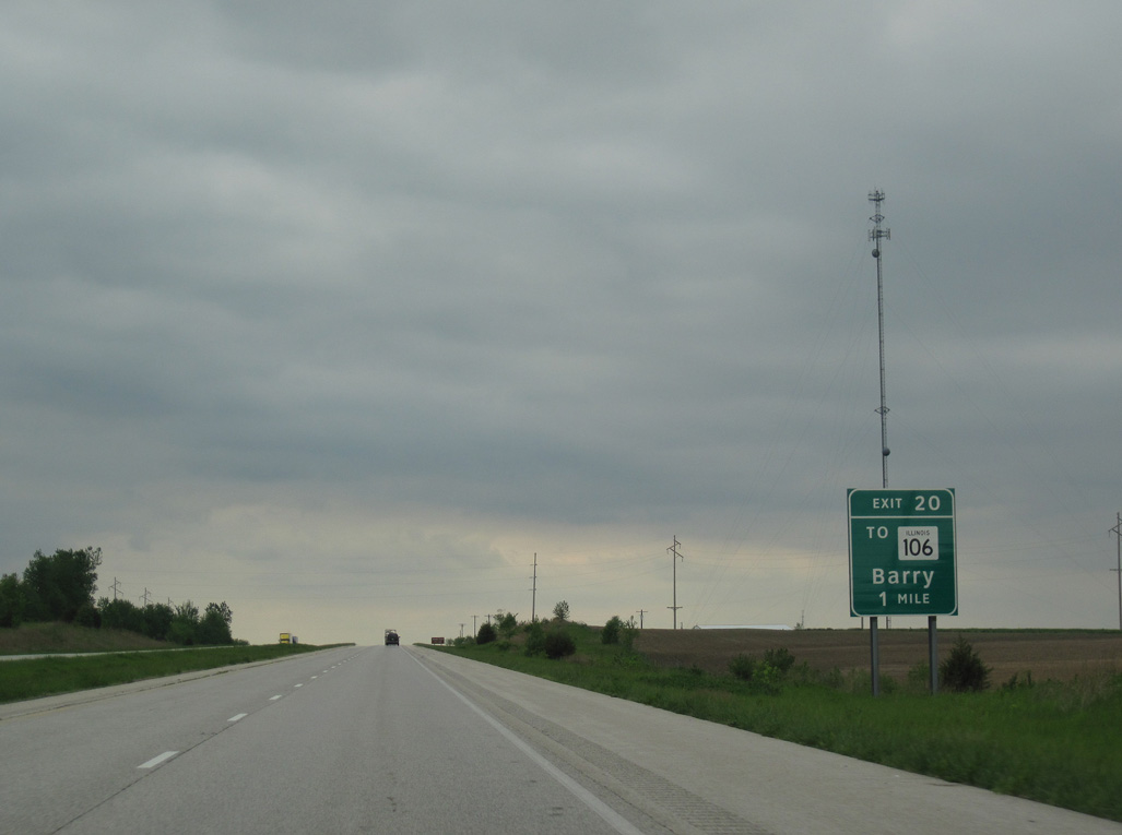
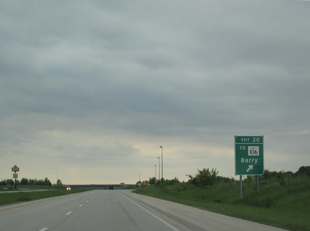
Shifting northward across Barry, I-72/U.S. 36 parallel IL 106 (former U.S. 36) west to a diamond interchange (Exit 20) with County Highway 4.
05/07/10
County Highway 4 links I-72/U.S. 36 with IL 106 at Rodgers Street, 0.32 miles to the south. IL 106 continues west beside the freeway toward Pike-Adams Sportmen's Park.
05/07/10
Rodgers Street extends south from County Highway 4 and IL 106 to Downtown Barry.
05/07/10
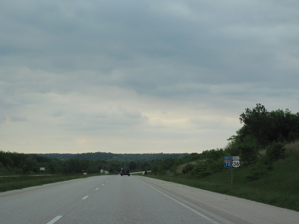
Leaving Barry, I-72/U.S. 36 travel through an S-curve across Hadley Creek and a Norfolk Southern Railroad line.
05/07/10
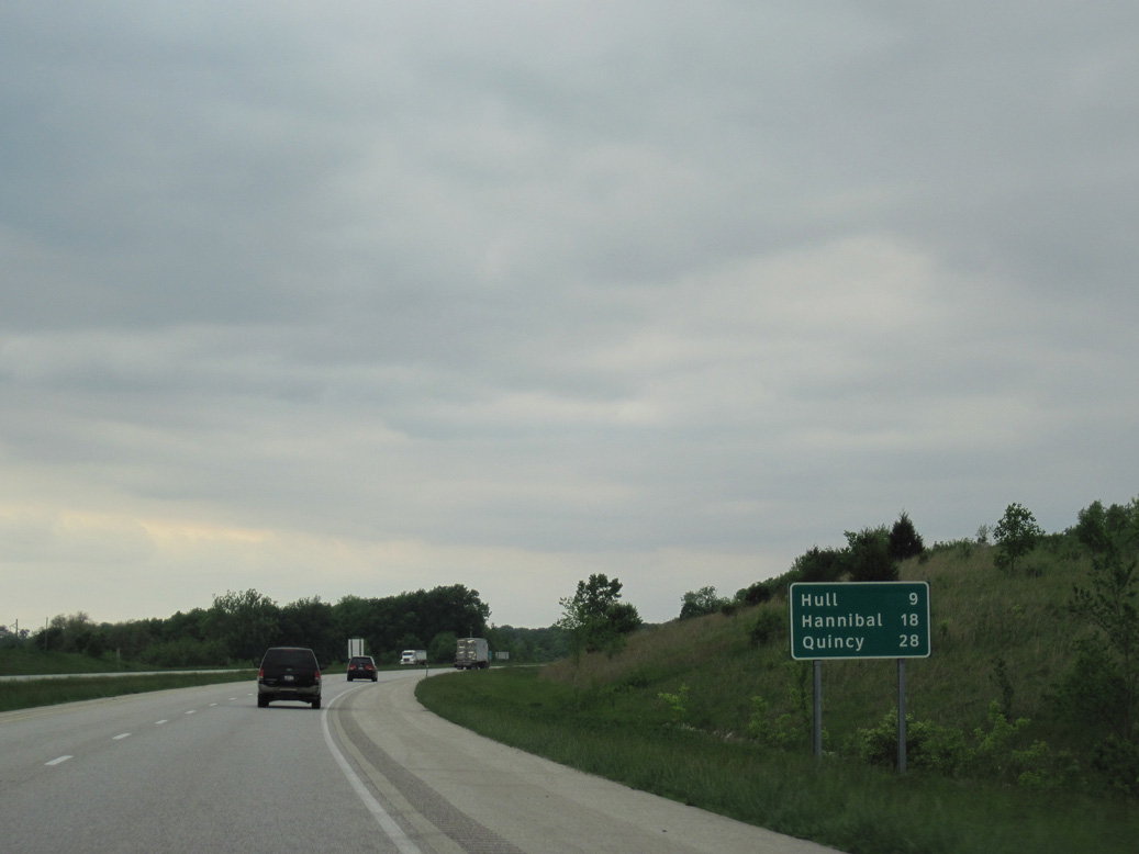
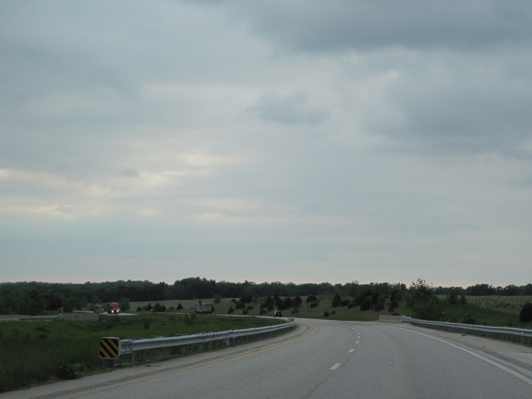
Nine miles away at the succeeding exit, the village of Hull is the last municipality along I-72/U.S. 36 west in Illinois.
05/07/10
Interstate 72 elevates on a viaduct spanning 315th Avenue and 250th Street in addition to the NS Railroad and Hadley Creek.
05/07/10
Adjacent bluffs rise to 680 feet above sea level while I-72/U.S. 36 parallel IL 106 and 312th Avenue around 550 feet in elevation.
05/07/10
Passing well away from the village of Kinderhook along IL 106 (old U.S. 36), I-72/U.S. 36 arc northward 1.8 miles.
05/07/10
I-72/U.S. 36 cross 213th Street as the freeway turns southwest toward Hull.
05/07/10
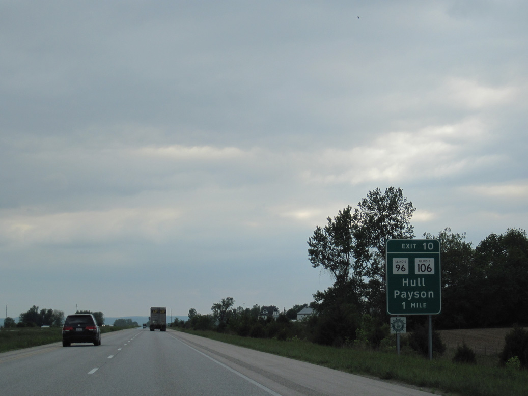
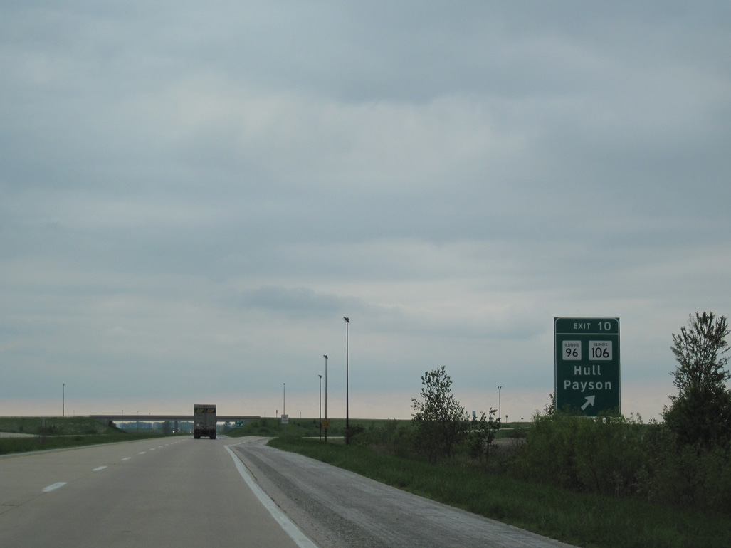
IL 96 stems 0.41 miles north from IL 106 (old U.S. 36) in Hull to the diamond interchange at Exit 10.
05/07/10

IL 96 travels north from Hull to Plainville and northwest from there to the village of Payson.
05/07/10
IL 57 formerly overlapped with IL 96 north 0.97 miles from IL 106 to County Highway 57. IL 57 was truncated 7.4 miles northwest to I-172 at Exit 2 near Fall Creek.
05/07/10
Confirming markers posted ahead of the 175th Street over crossing north of Hull.
05/07/10
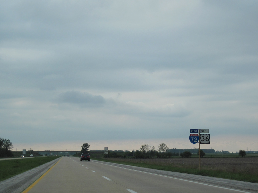
I-72/U.S. 36 traverse agricultural areas northwest to I-172 before turning southwest to Hannibal, Missouri.
05/07/10
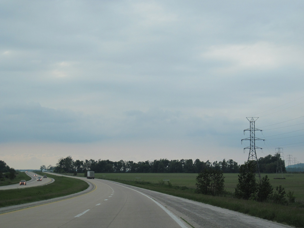
Leading north to Quincy, transmission lines span I-72/U.S. 36 near Pigeon Creek.
05/07/10
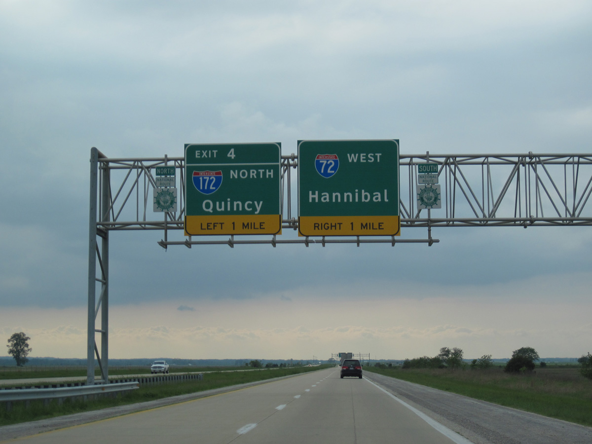
I-72 makes a second TOTSO (turn off to stay on) movement overall westbound at the trumpet interchange (Exit 4) with Interstate 172.
05/07/10
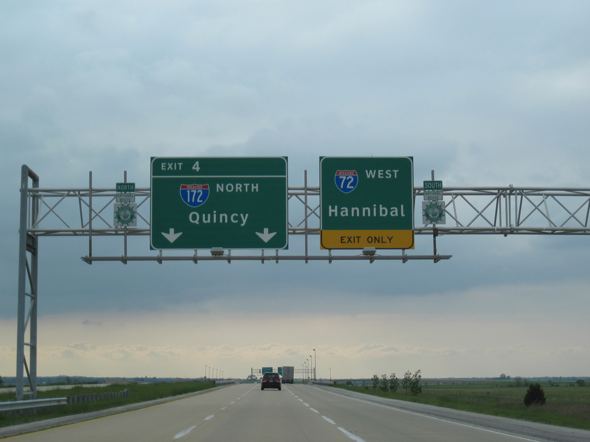
I-172/IL 110 (Chicago Kansas City Expressway) extend north to the Adams County seat of Quincy. IL 110 is an overlapped multi state highway traveling north to Macomb, Galesburg and the Quad Cities and east to Chicago.
05/07/10
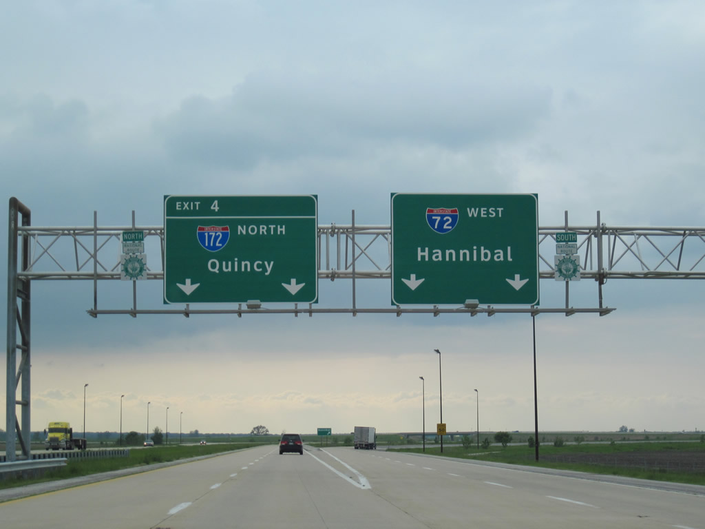
Interstate 172 runs north from I-72/U.S. 36 to U.S. 24 northeast of Quincy. IL 110 (CKC) accompanies I-72/U.S. 36 west into Hannibal, Missouri.
05/07/10
 West
West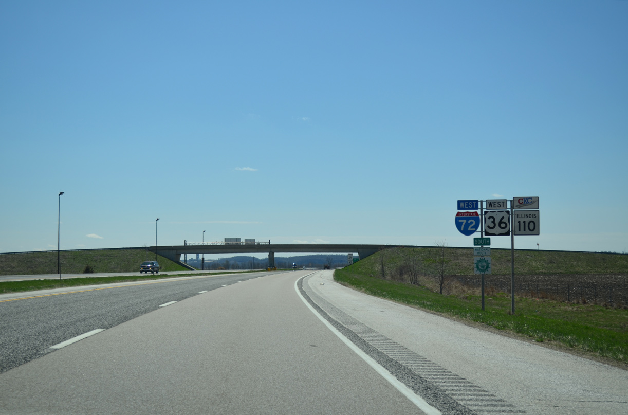
I-72/U.S. 36-IL 110 (CKC) curve southward from I-172 across farm land ahead of The Sly.
04/13/13
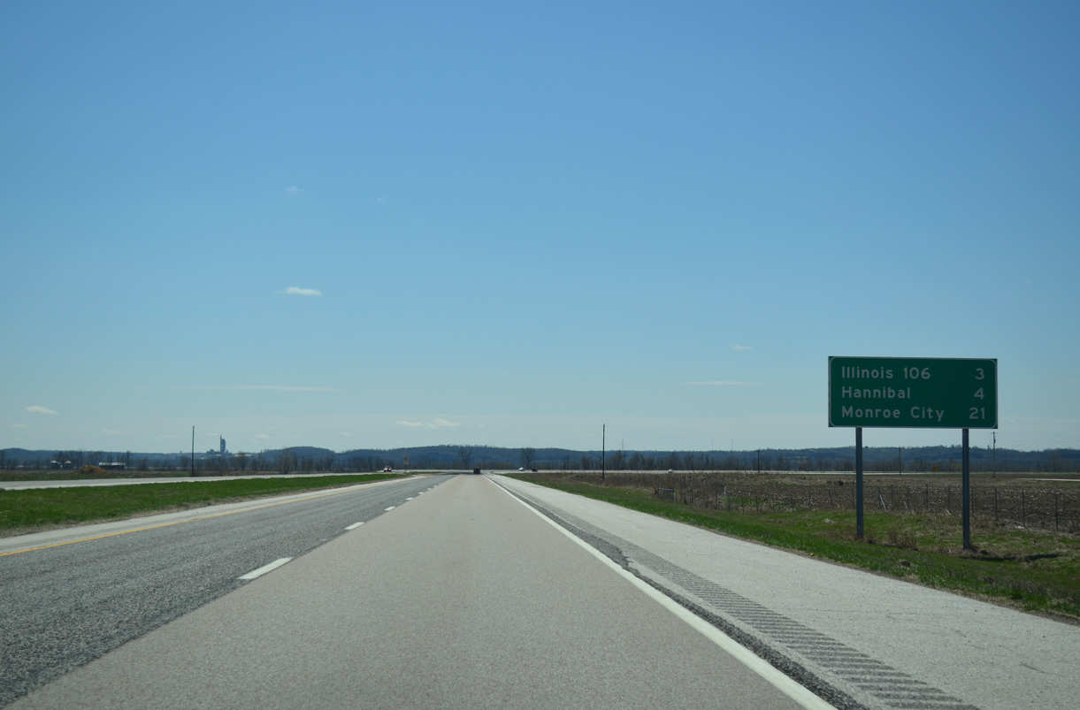
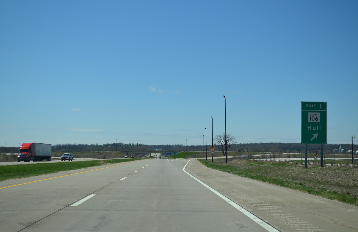
IL 106 concludes at I-72/U.S. 36-IL 110 (CKC) in three miles. U.S. 36/MSR 110 west reaches Monroe City, Missouri in 24 miles.
04/13/13
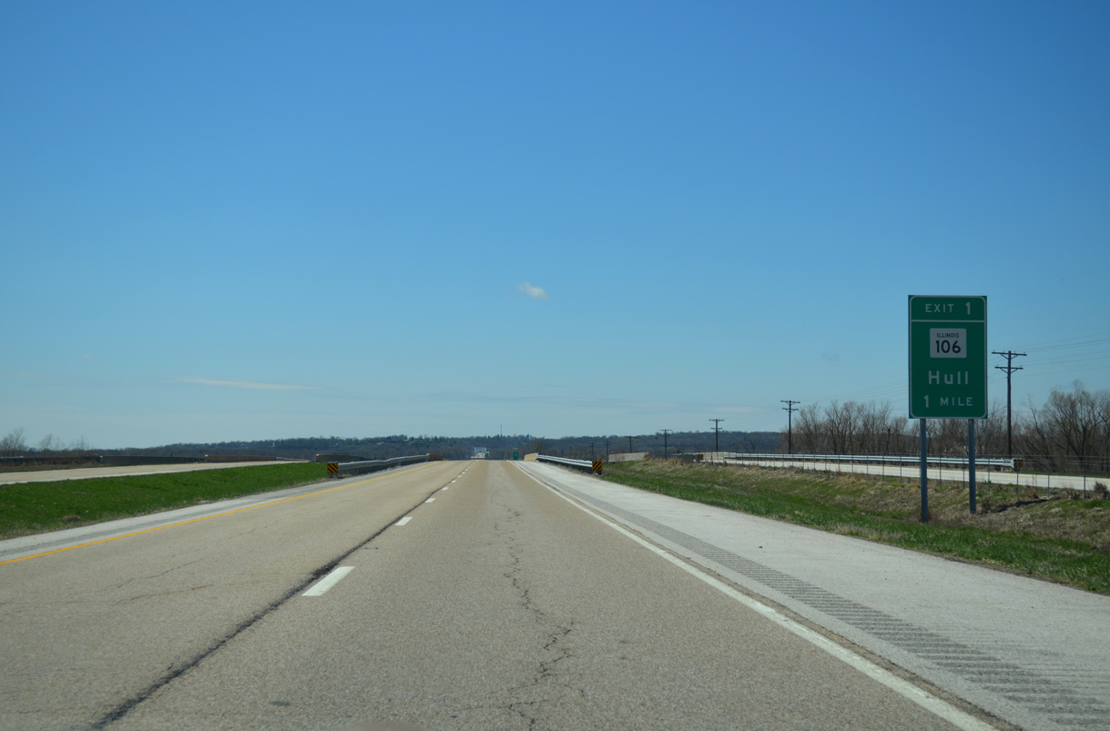
IL 106 diverges from the parallel Norfolk Southern Railroad and the original alignment of U.S. 36 to meet I-72/U.S. 36-IL 110 (CKC) at a diamond interchange (Exit 1).
04/13/13
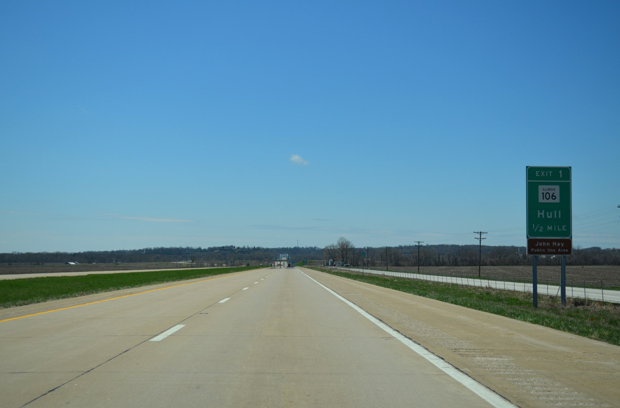
John Hay Public Use Area lies at the end of old U.S. 36 where the previous Mark Twain Memorial Bridge spanned the Mississippi River to Hannibal.
04/13/13
322nd Avenue ties into the west end of IL 106 from the nearby unincorporated community of East Hannibal.
04/13/13
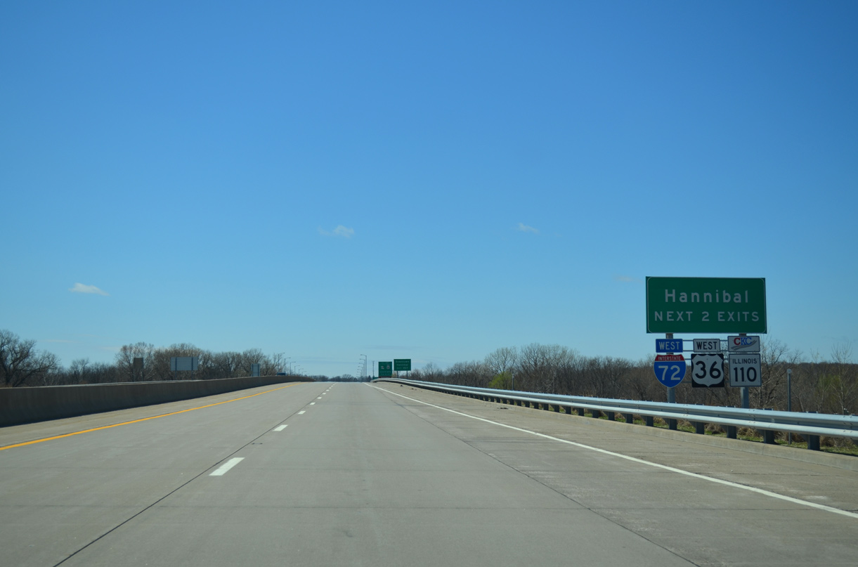
The last two exits from Interstate 72 west fall within the city of Hannibal. U.S. 36/IL 110 (CKC) extend the limited access highway another 7.3 miles from the Interstate end.
04/13/13
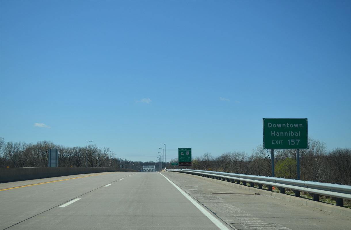
Located along the Mississippi River to the south, Missouri Route 79 (Mark Twain Avenue) joins I-72/U.S. 36-IL 110 (CKC) at Exit 157 with Downtown Hannibal. This sign was one of four installed by MoDOT in March 2001 addressing sign confusion in reaching Downtown from I-72.3
04/13/13
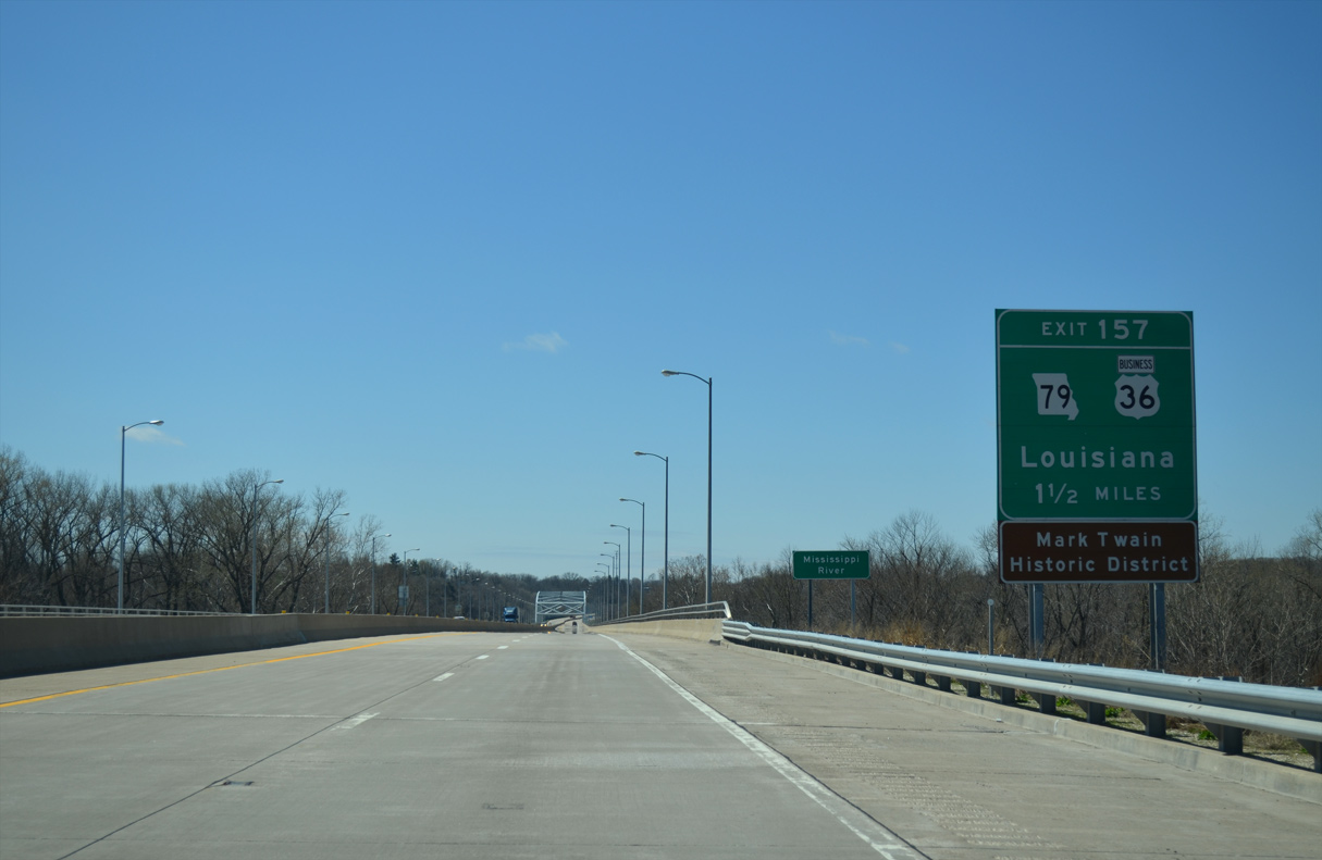
Missouri Route 79 commences a 87.95 mile long course from Exit 157 southeast along the Missouri River to Saint Peters.
04/13/13
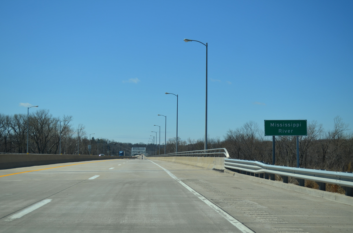
Interstate 72 crosses the Mississippi River over the Mark Twain Memorial Bridge.
04/13/13
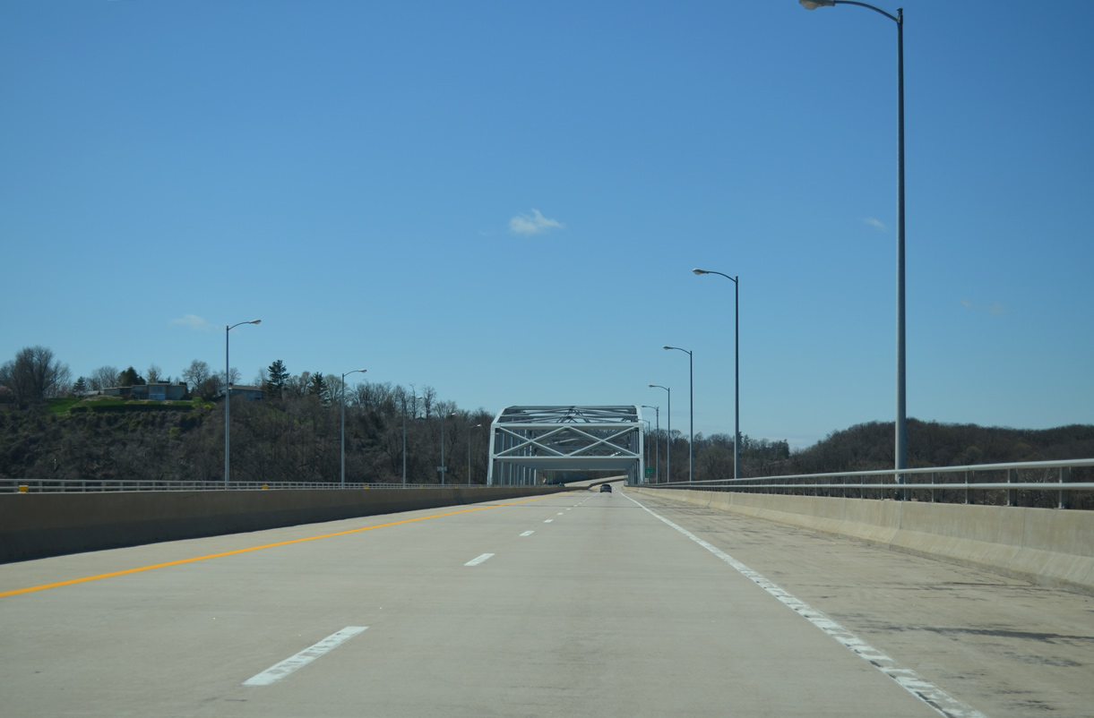
Opened on September 16, 2000,4 the Mark Twain Memorial Bridge is a steel truss through deck span5 measuring 4,490 feet in length.6
04/13/13
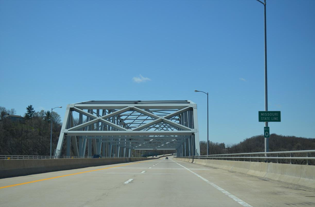
The Missouri state line lies at mid-span across the Mississippi River. The four lane bridge provides 74 feet of navigation clearance along the river.6
04/13/13

References:
- Valley City Eagle Bridges - Illinois River Highway Crossing. John A. Weeks III.
- "Bridging the Gap in Pike County - Opening of Expressway Brings Mixed Reactions from Residents." State Journal-Register, The (Springfield, IL), October 14, 1990.
- "Don't miss 'Downtown Hannibal' - MoDOT installs new exit signs." Hannibal Courier-Post (MO), March 7, 2001.
- "Both Twain bridges carried traffic for a time - New, old structures were open concurrently for 20 minutes." Hannibal Courier-Post (MO), September 18, 2000.
- Mark Twain Memorial Bridge - I-72 Mississippi River Crossing At Hannibal. John A. Weeks III.
- "A few lights, some paint here and there - New Mark Twain Memorial Bridge is nearly complete." Hannibal Courier-Post (MO), April 24, 2000.
Photo Credits:
- ABRoads: 05/07/10
- AARoads: 04/13/13
Connect with:
Page Updated Wednesday November 08, 2023.