
I-73-74/U.S. 220 North - Rockingham to Star


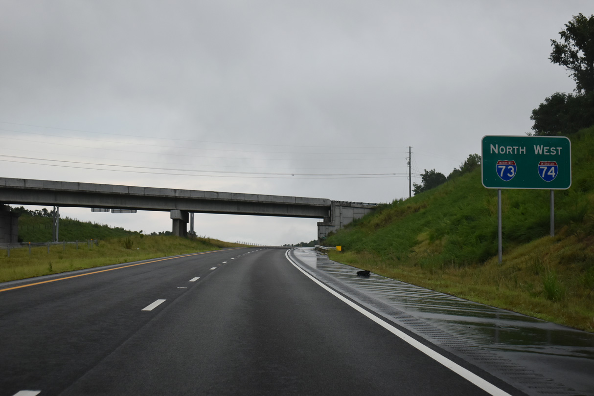
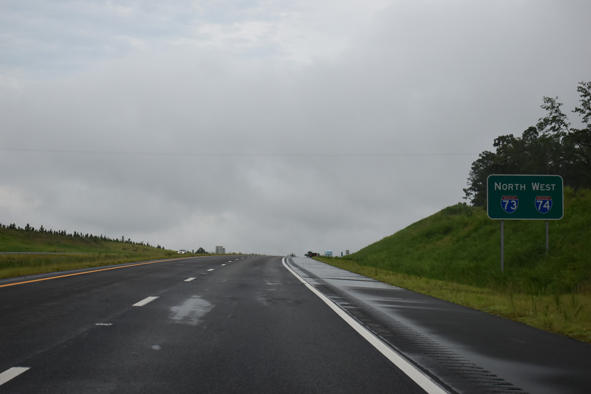
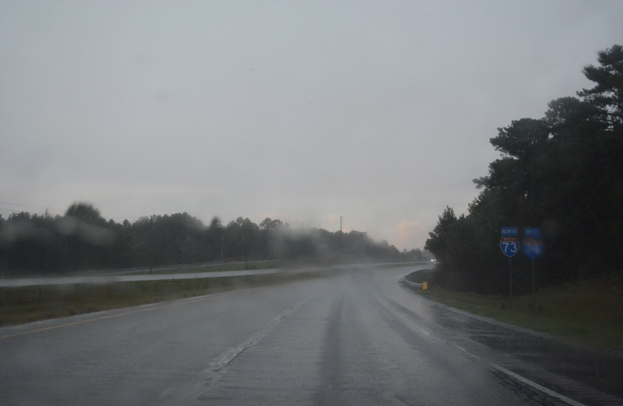
Interstate 73 begins along the Rockingham Bypass north from U.S. 74. The first reassurance sign for I-73 precedes the Old Charlotte Highway (SR 1140) overpass.
07/29/25
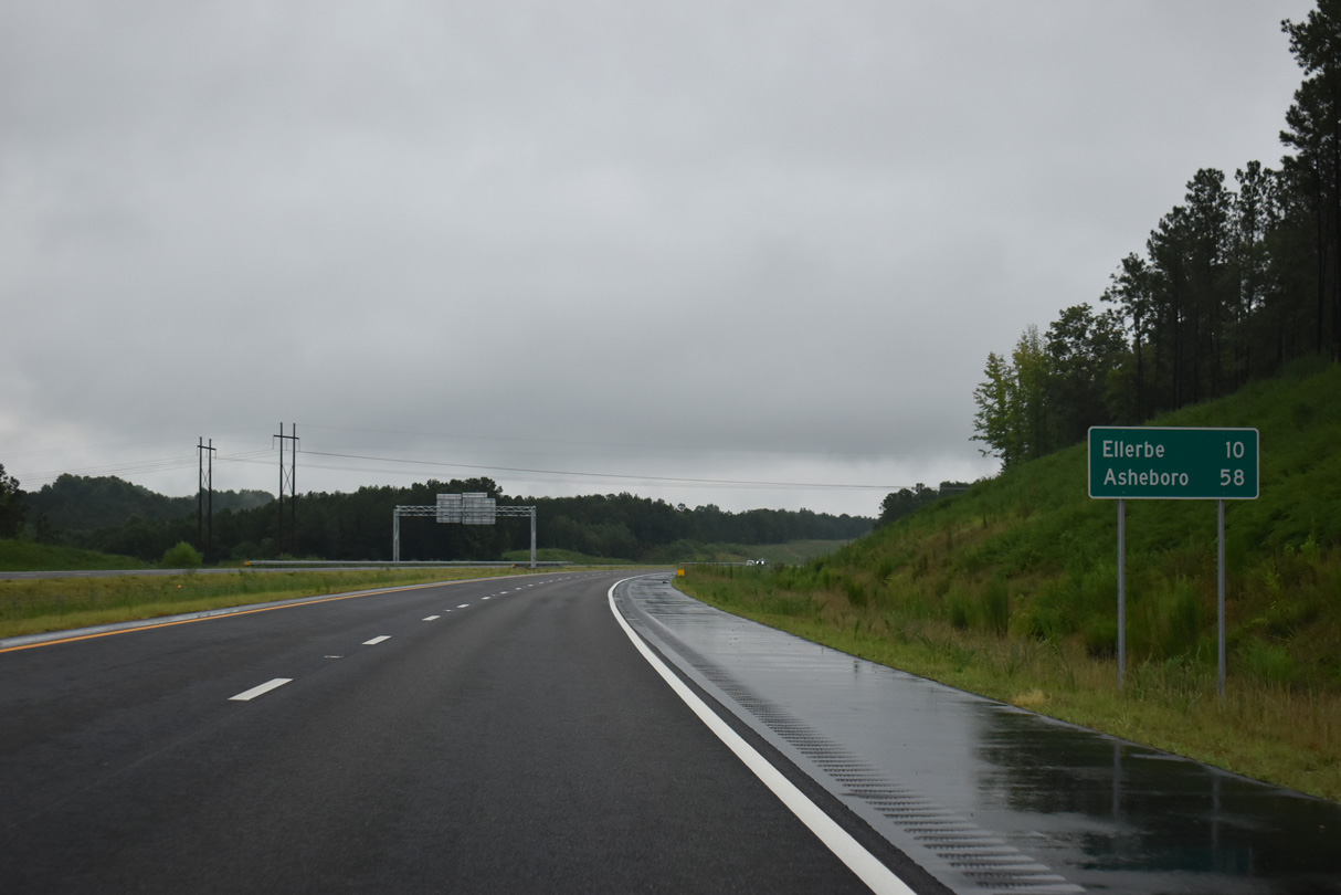
The town of Ellerbe is ten miles to the north via I-73/74 and U.S. 220.
07/29/25
The Rockingham Bypass traverses hilly terrain northwest of Rockingham and south of Coggins Hill.
07/29/25
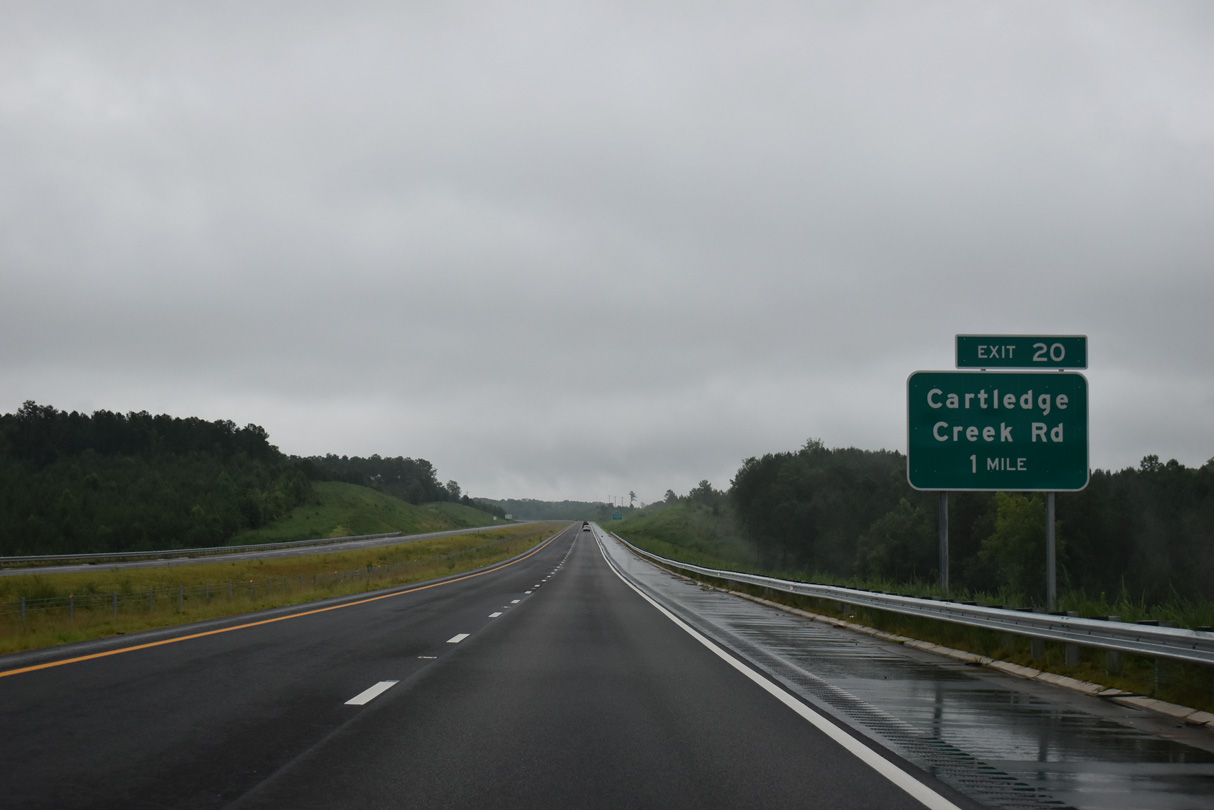
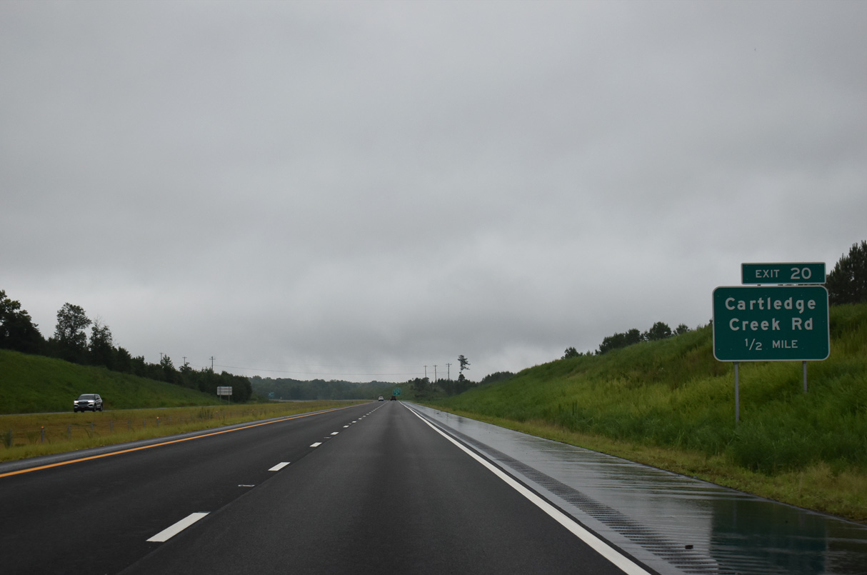
Cartledge Creek Road (SR 1005) heads 2.3 miles north from U.S. 74 Business to I-73/74 at Exit 20.
07/29/25
Cartledge Creek Road continues 11.7 miles north from I-73/74 to NC 73 near Covington.
07/29/25
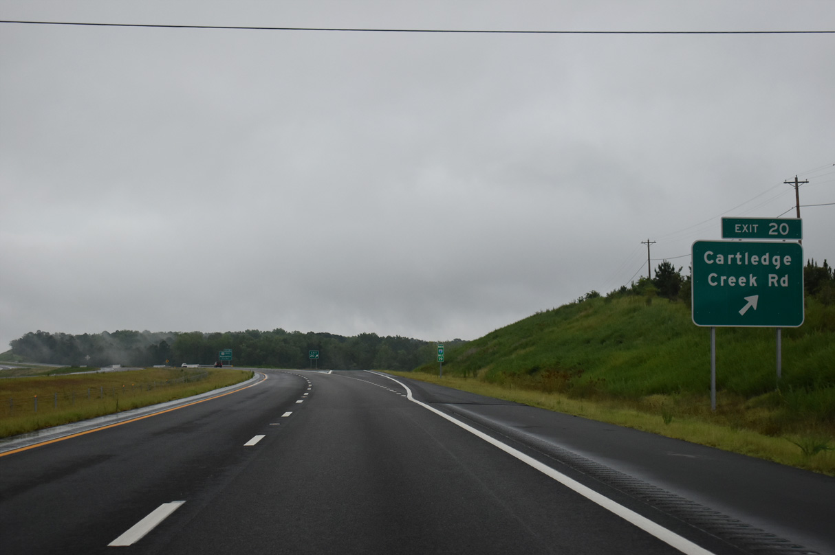
Entering the diamond interchange (Exit 20) with Cartledge Creek Road on I-73/74 northbound.
07/29/25
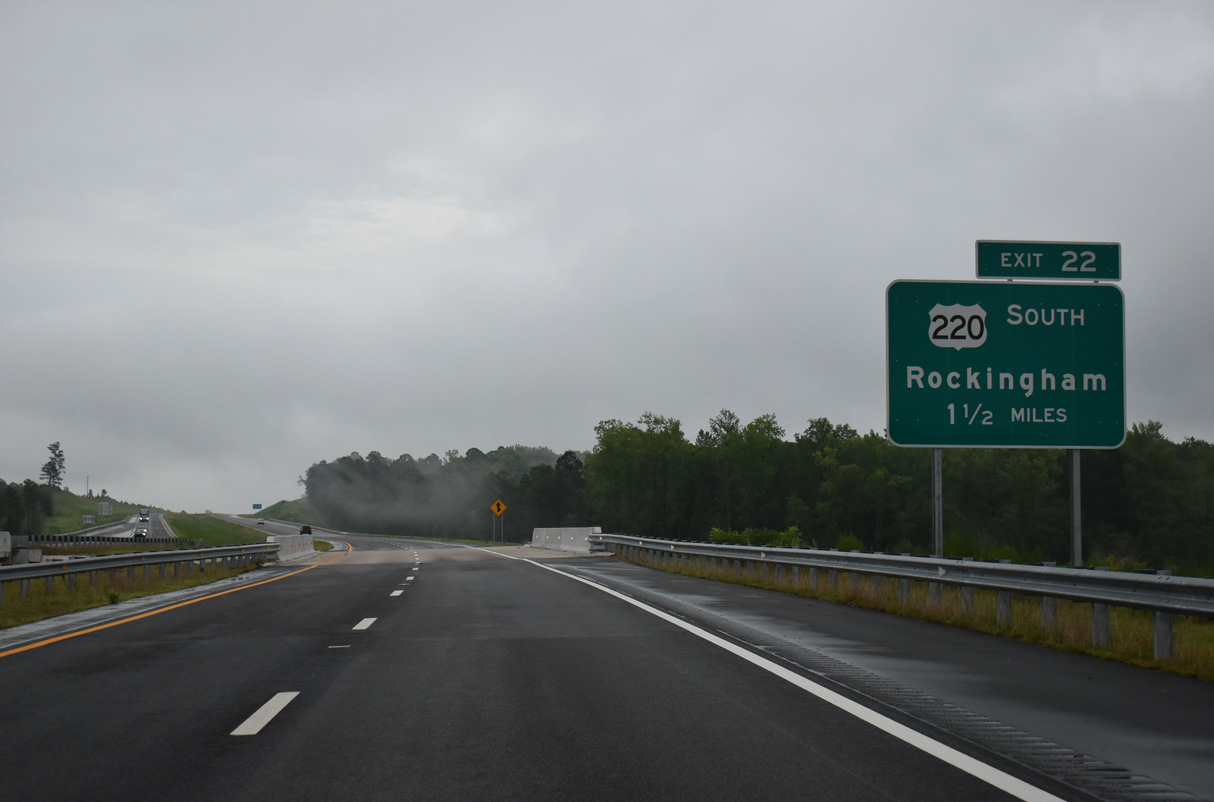
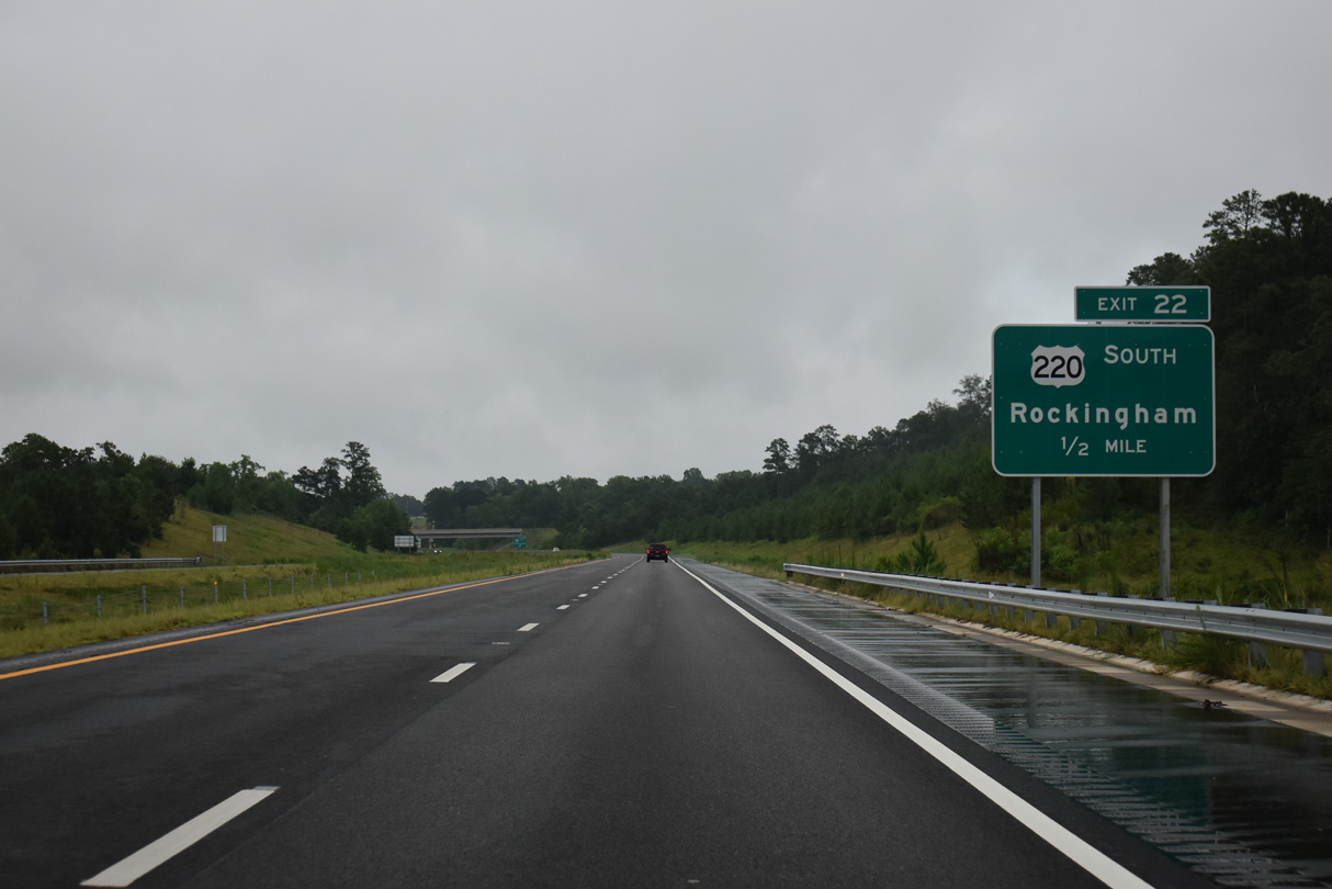
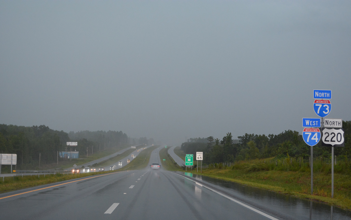
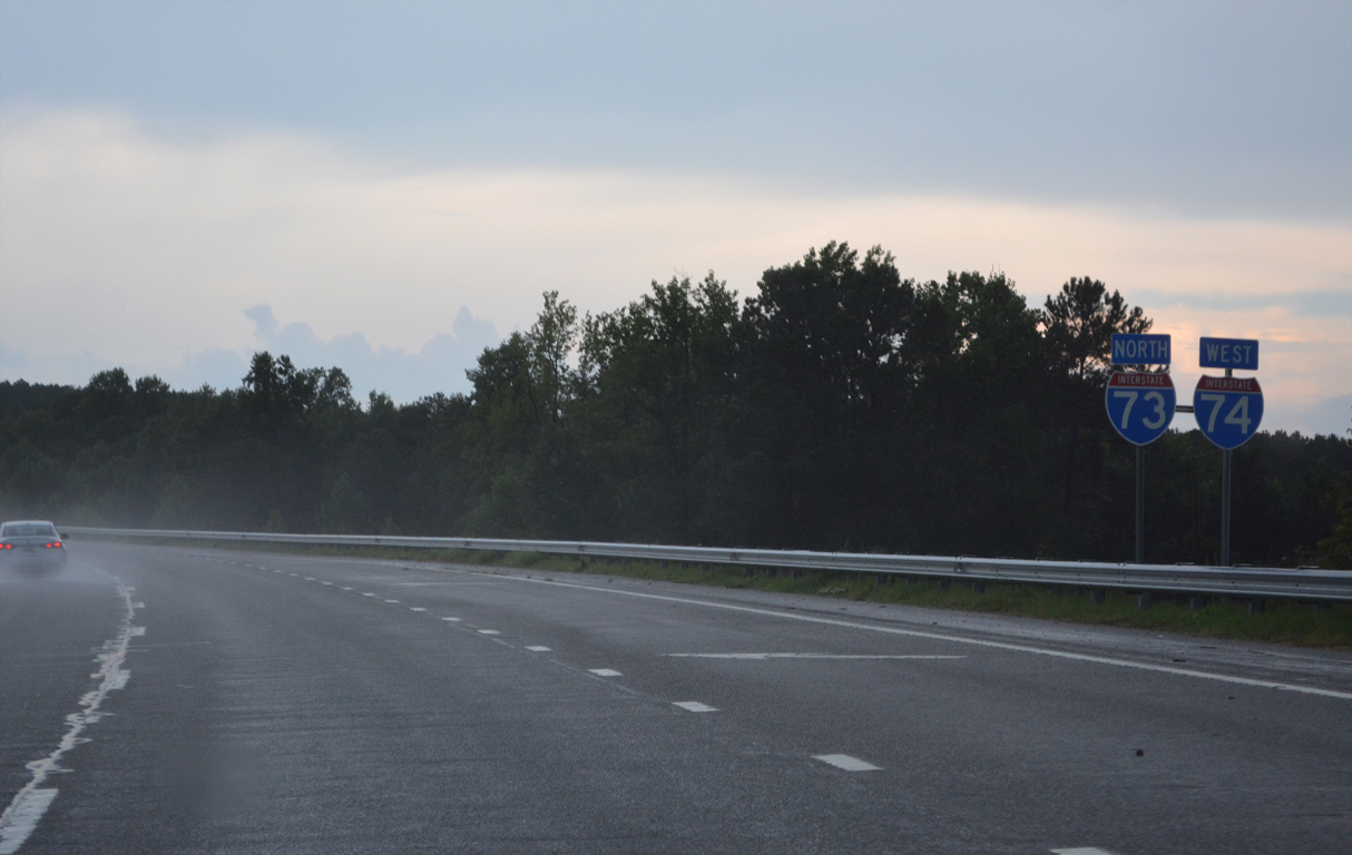
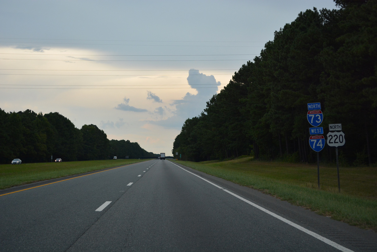
Exit 22 links I-73/74 north with U.S. 220 south back to Rockingham in 1.5 miles.
07/29/25
Confirming sign for I-73/74 north posted by the disconnected sections of Dave Kings Road (SR 1303).
07/29/25
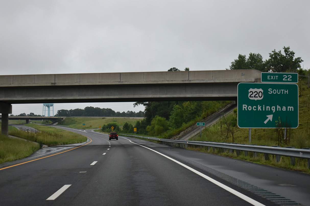
A trumpet interchange joins I-73/74 with U.S. 220 at Exit 22.
07/29/25
U.S. 220 concludes five miles to the south at U.S. 1 in Rockingham. The north end is at I-86/NY 17 in Waverly, New York.
07/29/25
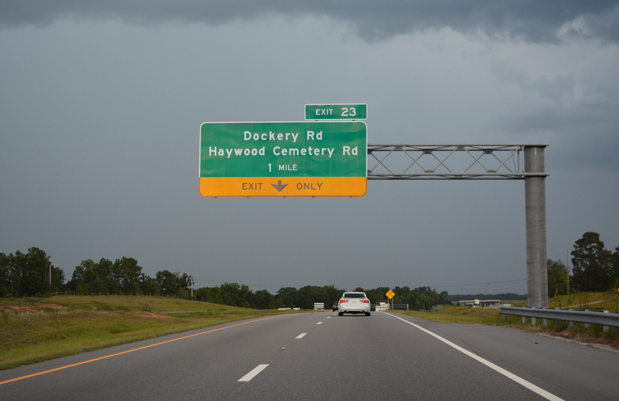
U.S. 220 transitions onto I-73/74 northbound ahead of the folded diamond interchange (Exit 23) with Dockery Road (SR 1306) west and Haywood Cemetery Road (SR 1446) north.
07/29/25
08/14/21
Guardian Way (SR 1581) runs along the east side of I-73/74 on the former alignment of U.S. 220.
07/29/25
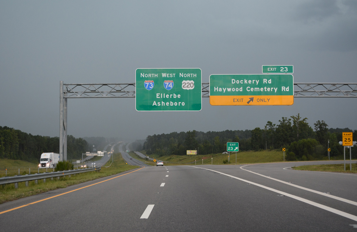
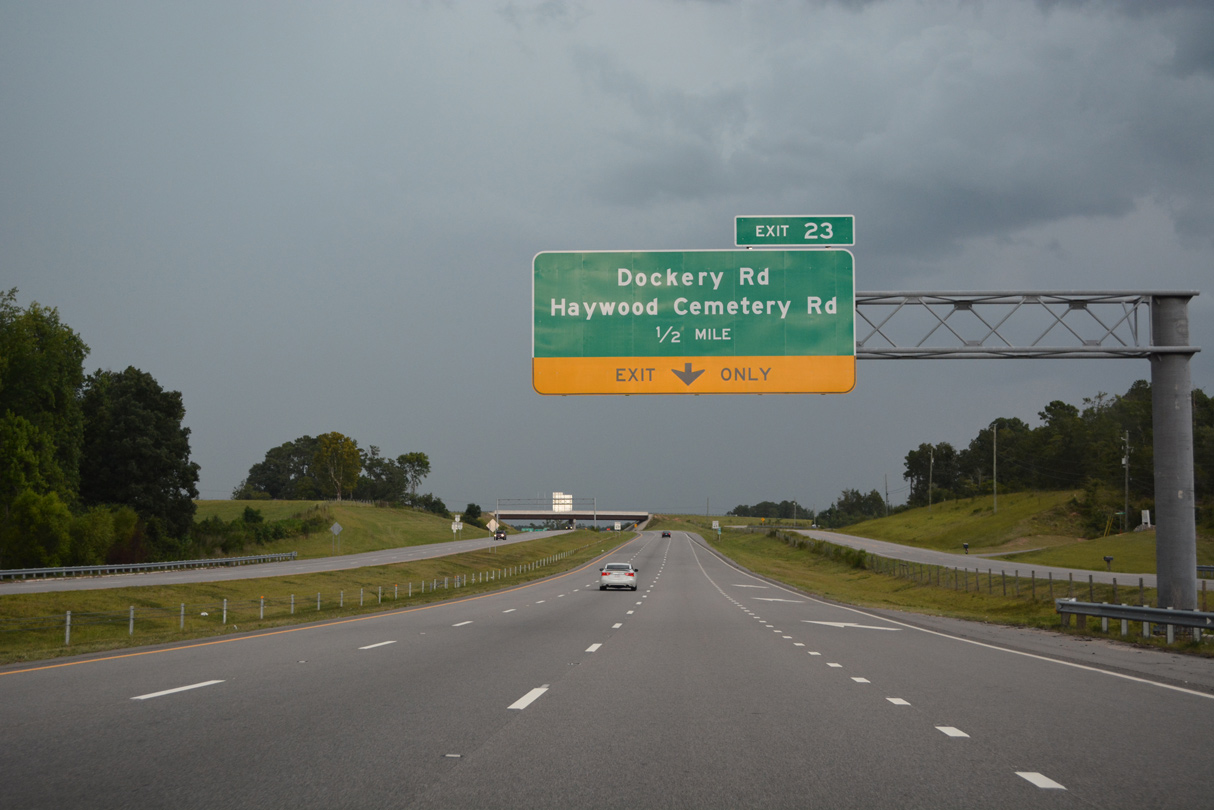
The auxiliary lane added from U.S. 220 north drops at Exit 23.
07/29/25
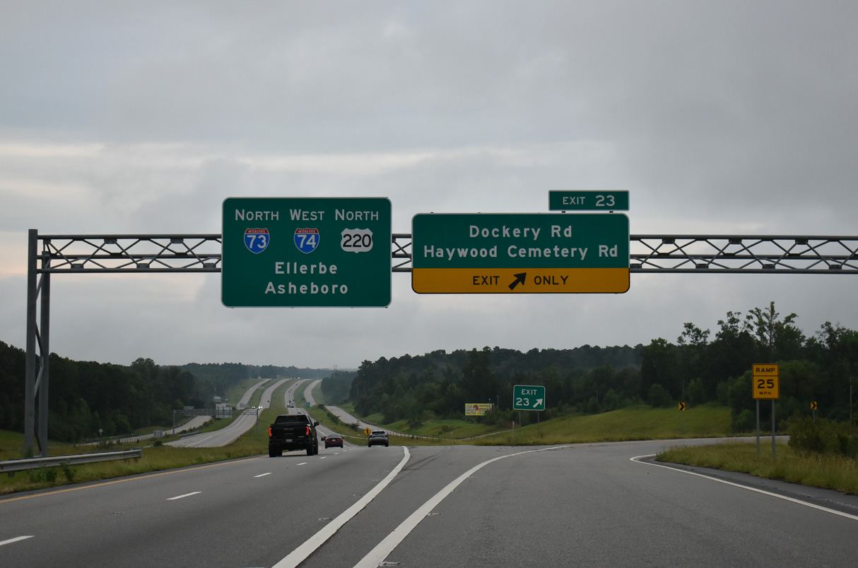
Haywood Cemetery Road (SR 1446) loops east from I-73/74, 2.61 miles from Exit 23 to Exit 25. Dockery Road runs 2.95 miles west to Cartledge Creek Road (SR 1005).
07/29/25
I-73/74-U.S. 220 advance north from Sandy Ridge across the South Prong of Cartledge Creek.
08/14/21
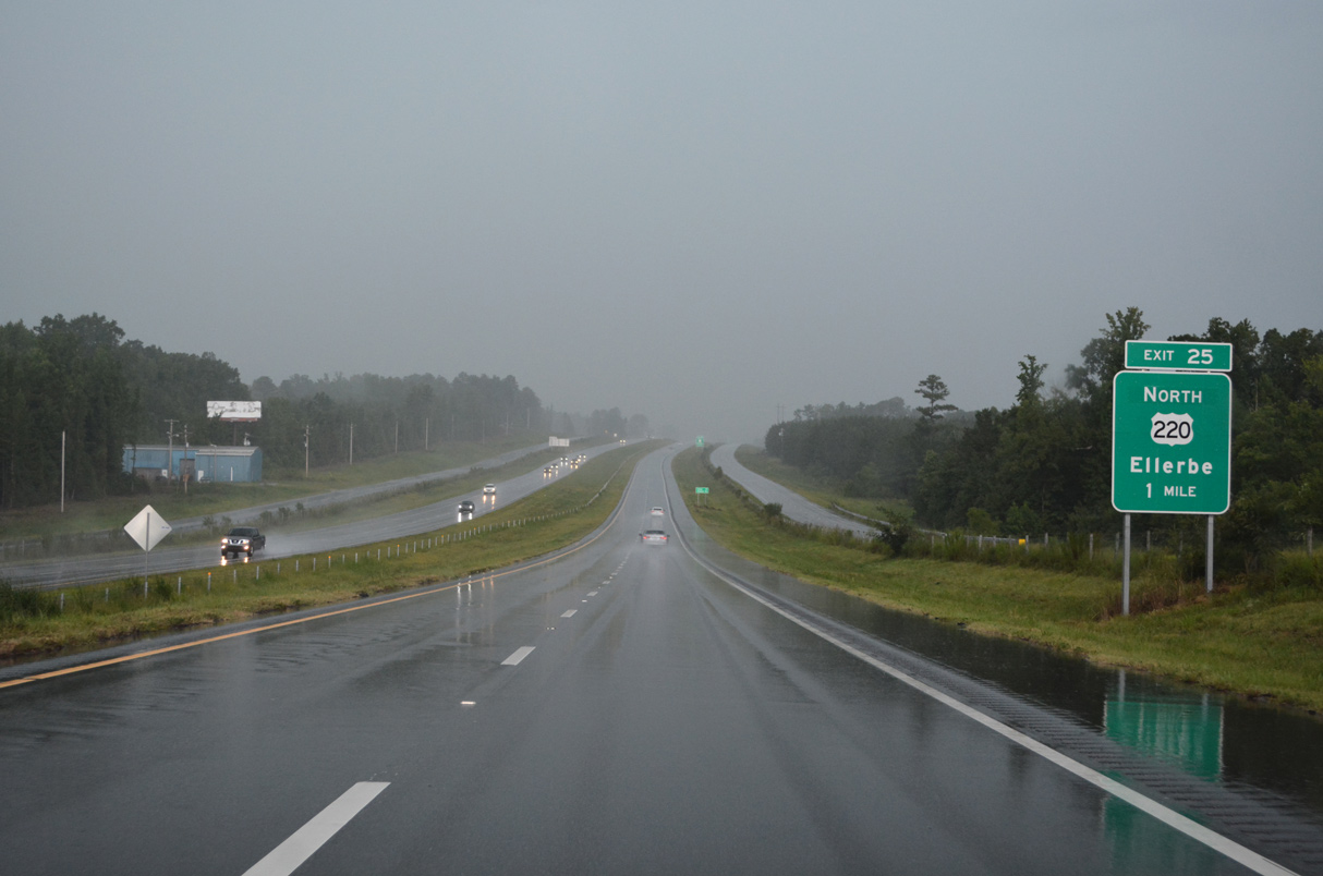
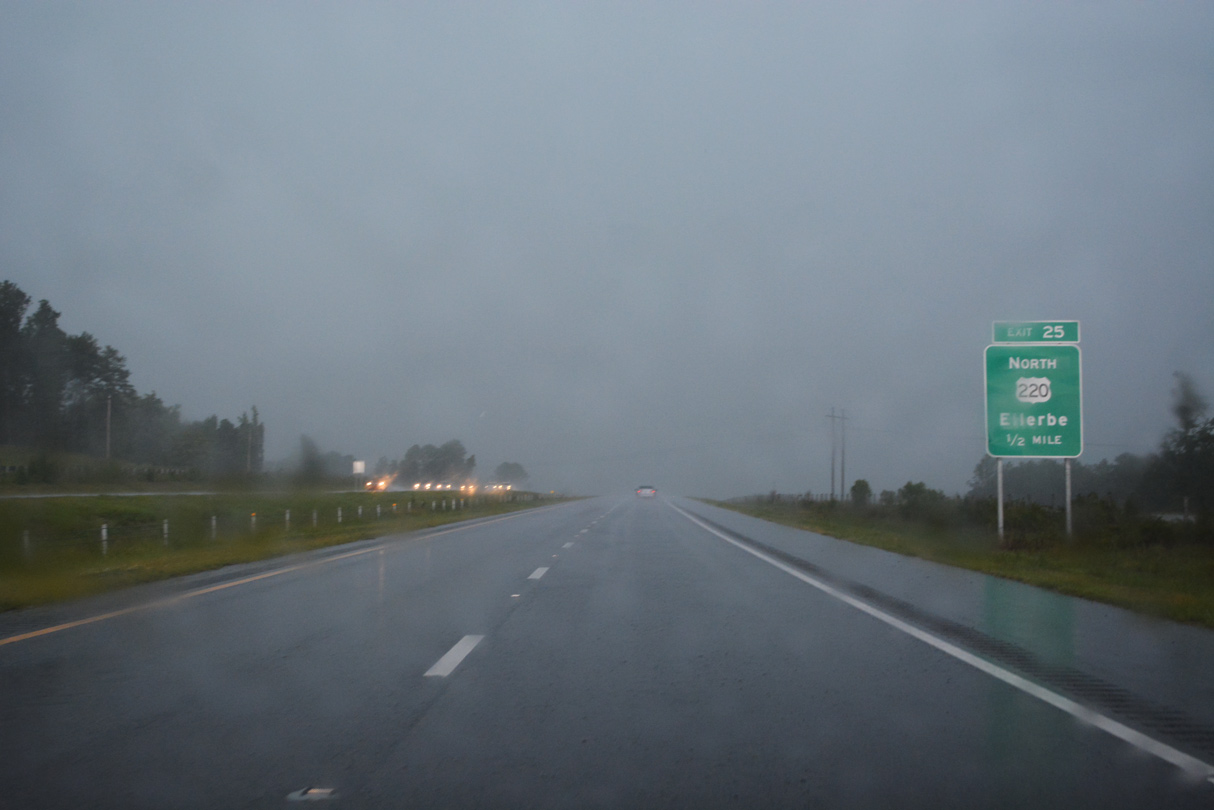
The diamond interchange (Exit 25) joining I-73/74 with U.S. 220 north into Ellerbe was originally Exit 8.
08/14/21
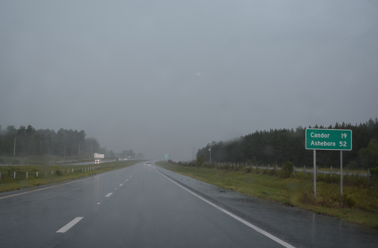
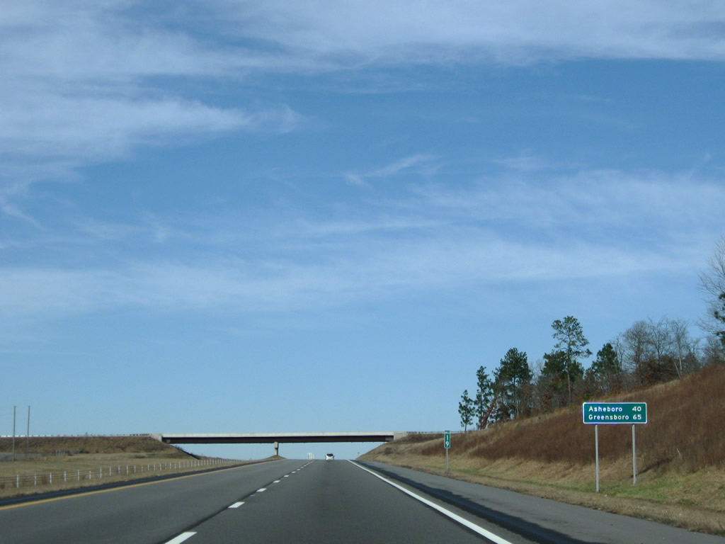
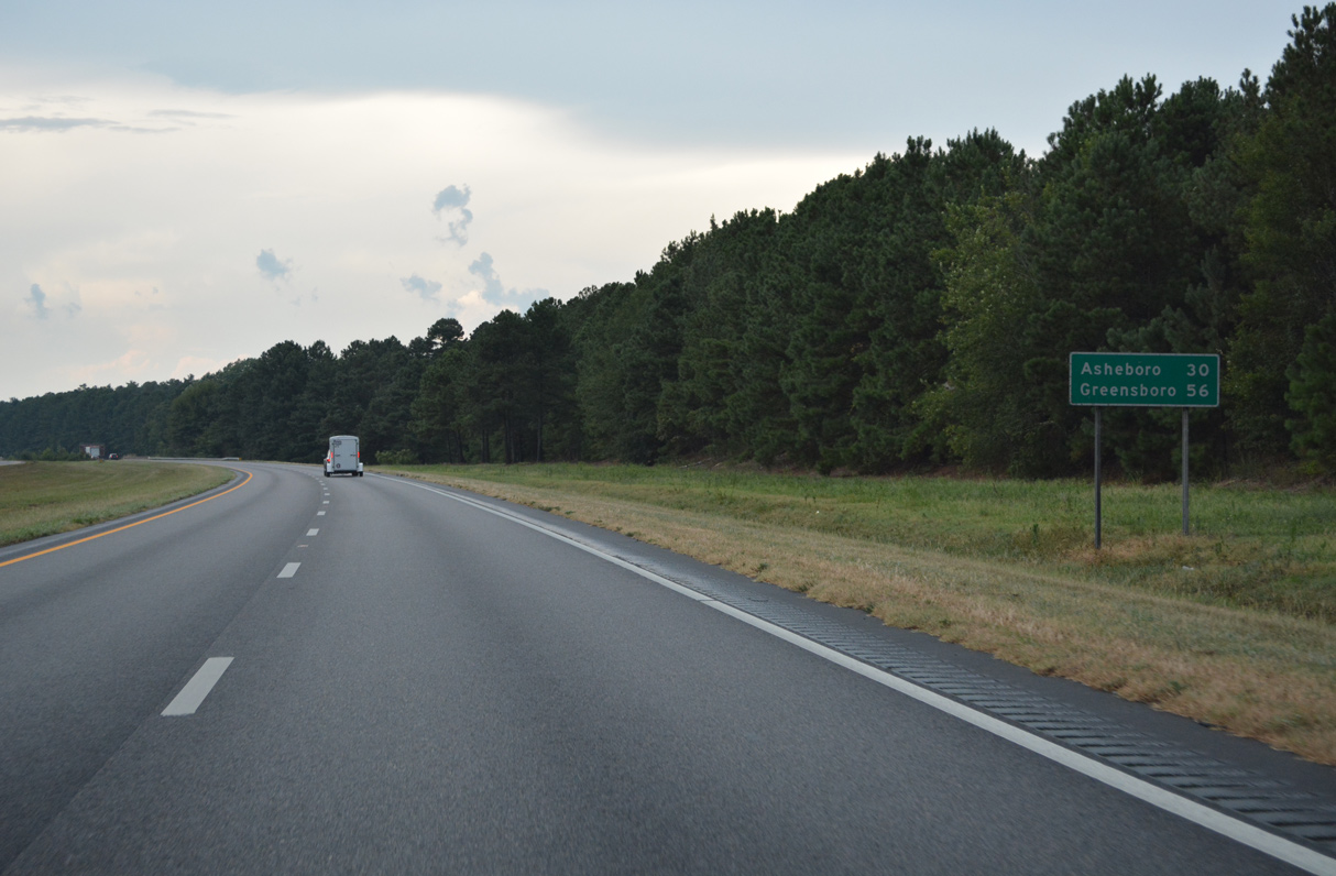
The town of Candor is 19 miles to the north in Montgomery County followed by the city of Asheboro in 52 miles.
08/14/21
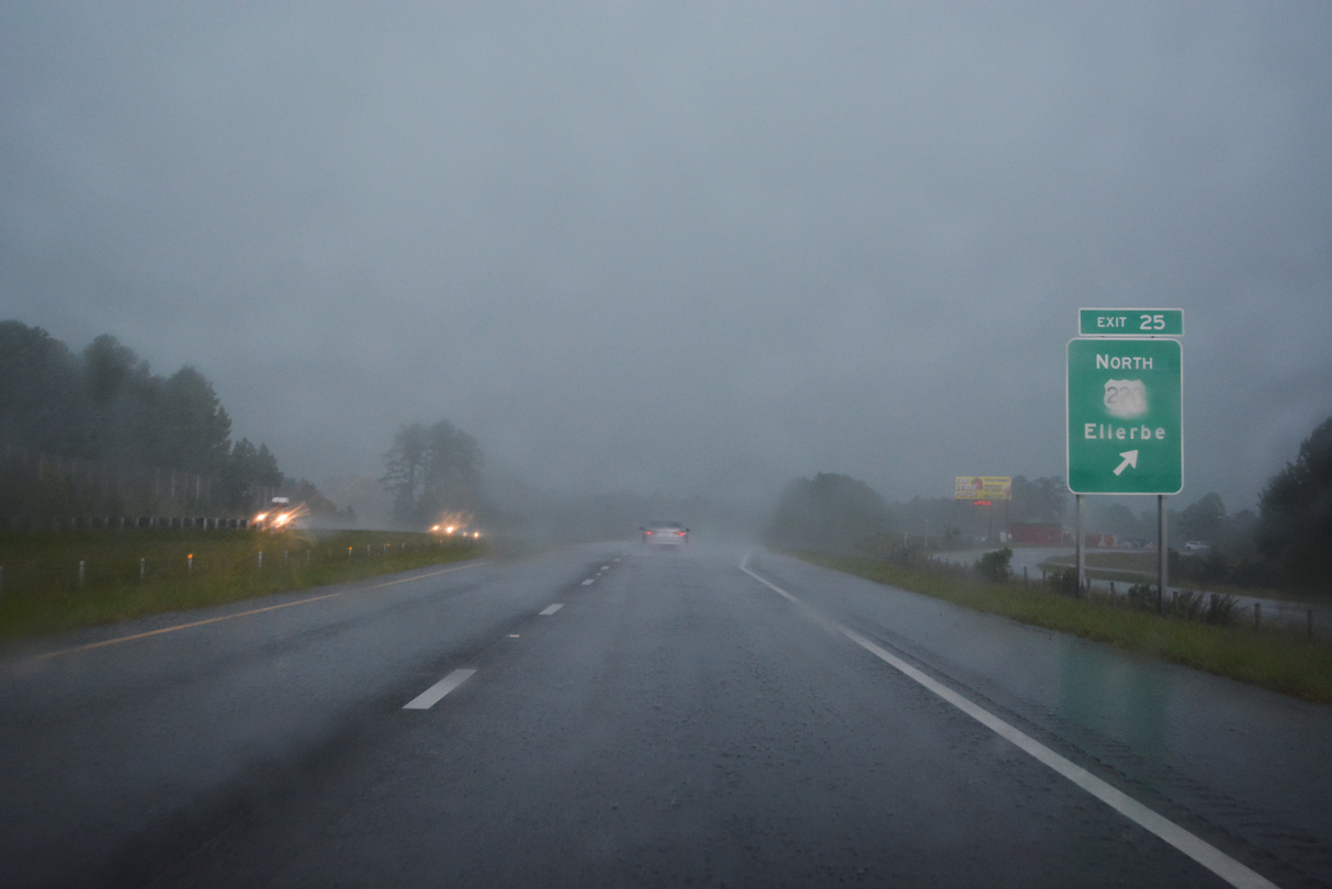
U.S. 220 branches west from I-73/74 to Main Street through the town of Ellerbe.
08/14/21
Previous guide signs for Exit 25 referenced U.S. 220 Business north into Ellerbe. Haywood Cemetery Road (SR 1446) ties into I-73/74 just north of McIntyre Road (SR 1448).
08/14/21
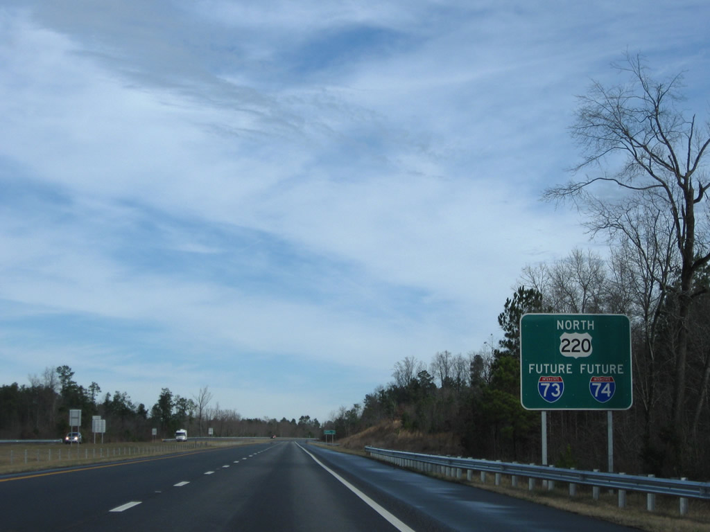
Initially large guide signs were the reassurance markers for Future I-73/74 and U.S. 220 north throughout the freeway built south of Candor.
12/21/08

Candor lies 17 miles ahead at NC 211. The freeway north from there to Asheboro is an older section of I-73/74.
12/21/08
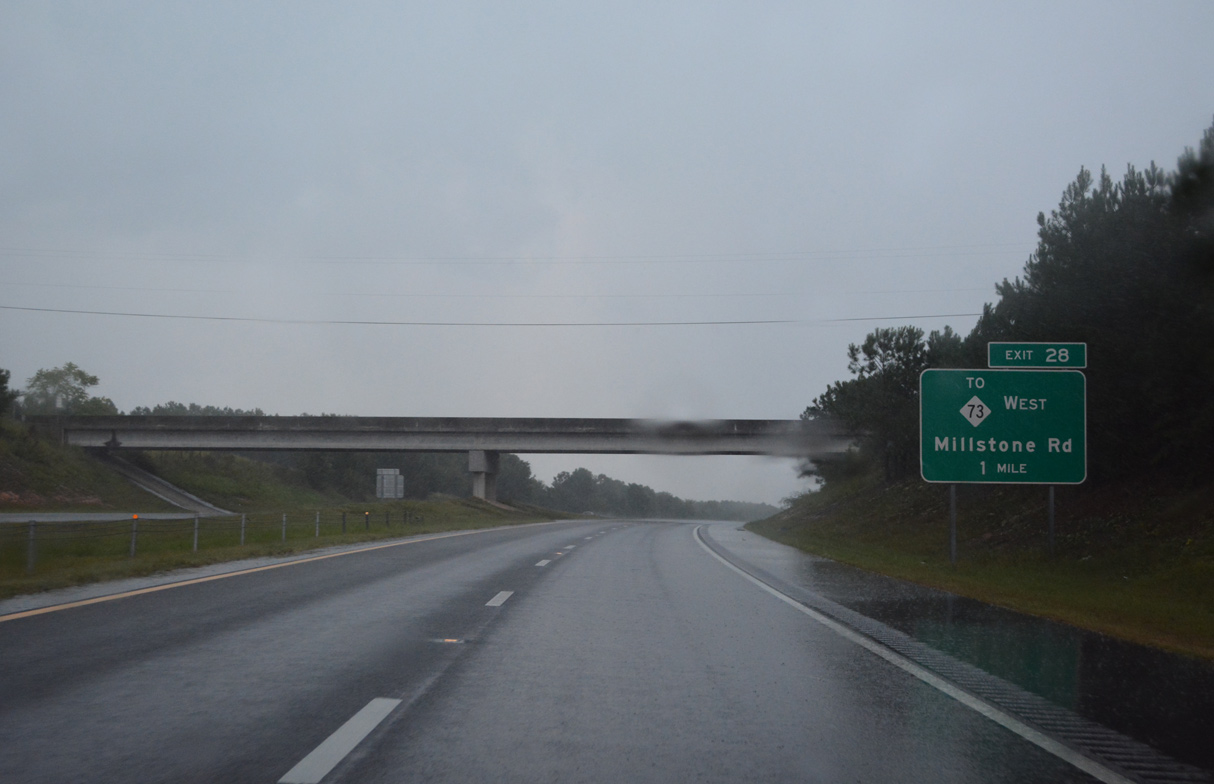
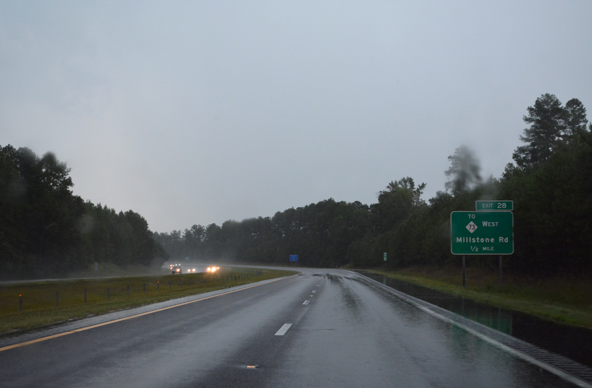
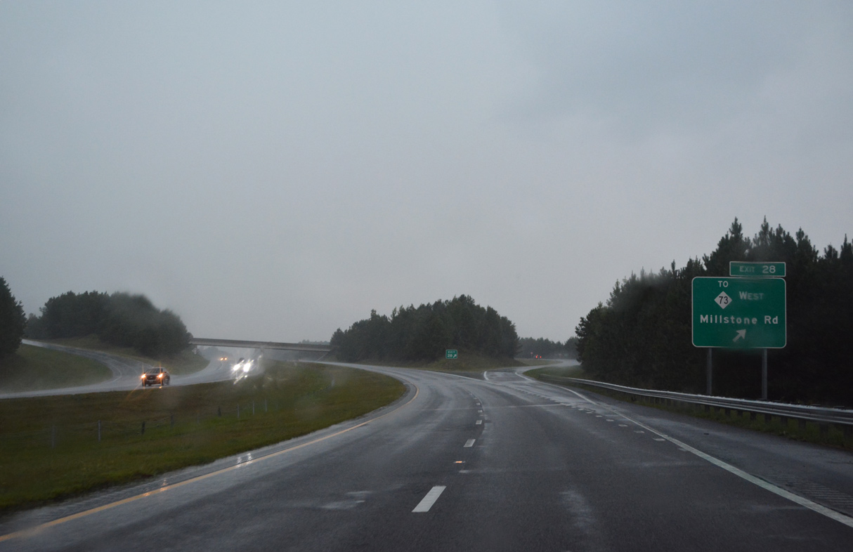
Green Lake Road (SR 1450) passes over I-73/74 one mile southwest of the diamond interchange (Exit 28) with Millstone Road (SR 1452).
08/14/21
Millstone Road (SR 1452) becomes Pressley Rankin Highway just west of I-73/74 at Church Street (SR 1499). Church Street 1.19 miles stems west into Ellerbe.
08/14/21
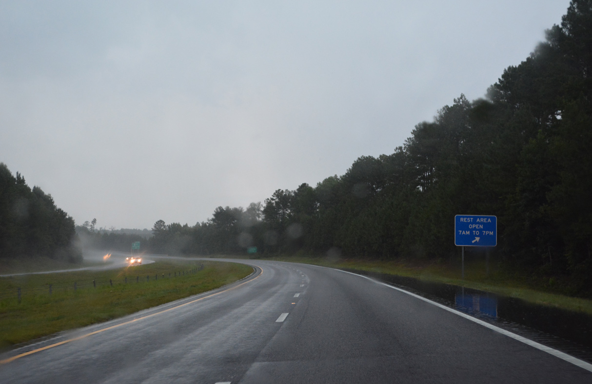
Pressley Rankin Road (SR 1452) bypasses Ellerbe northwest 2.29 miles to U.S. 220 at NC 73 and the Ellerbe Rest Area. NC 73 travels west to Albemarle.
08/14/21
East from Exit 28, Millstone Road (SR 1452) meanders into timberland en route to McDonald Church Road (SR 1475).
08/14/21
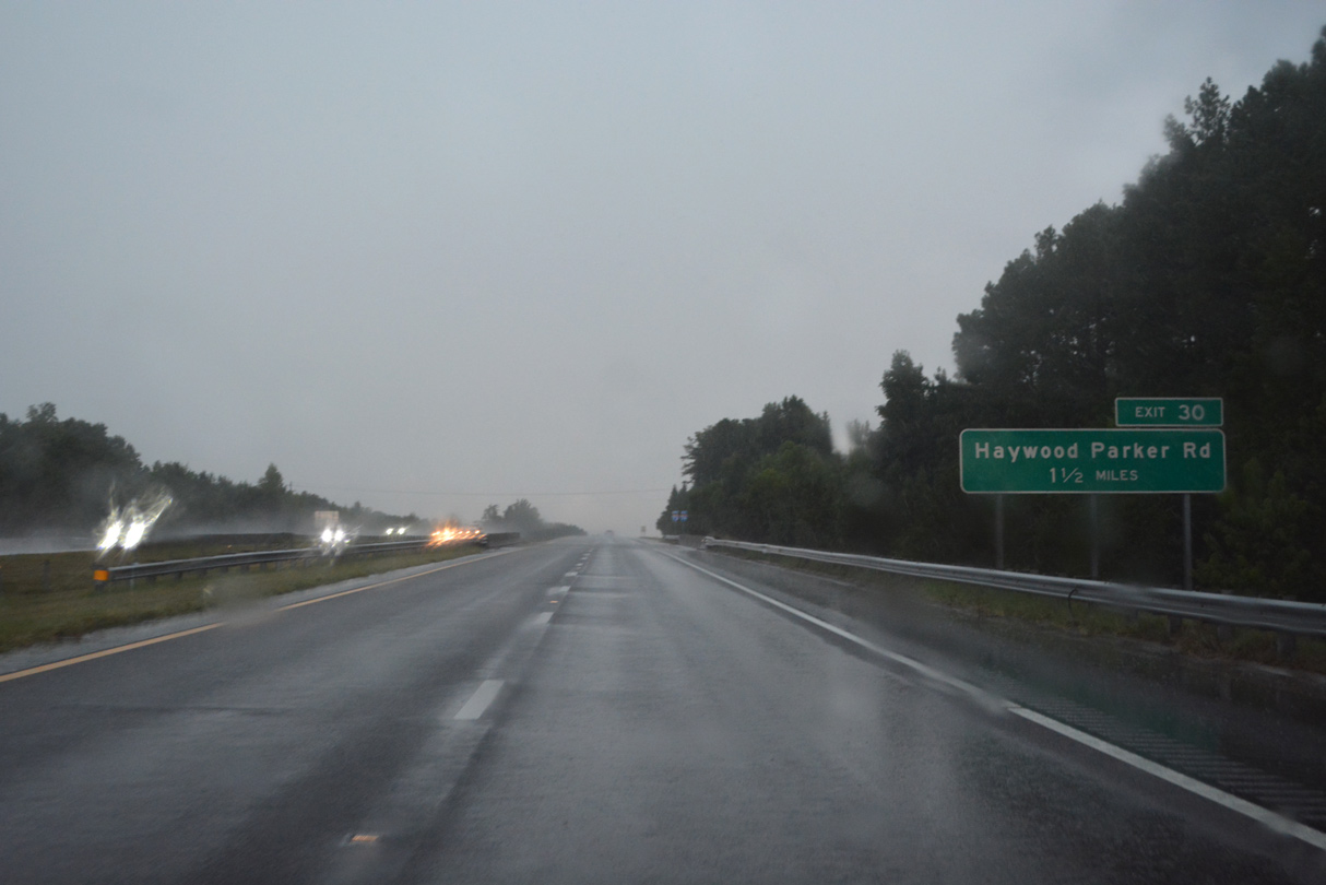
Continuing north, I-73/74 passes over Fire Tower Road (SR 1455) 1.5 miles from Exit 30 for Haywood Parker Road (SR 1441).
08/14/21
Confirming markers posted on the rural stretch northeast of Ellerbe.
08/14/21
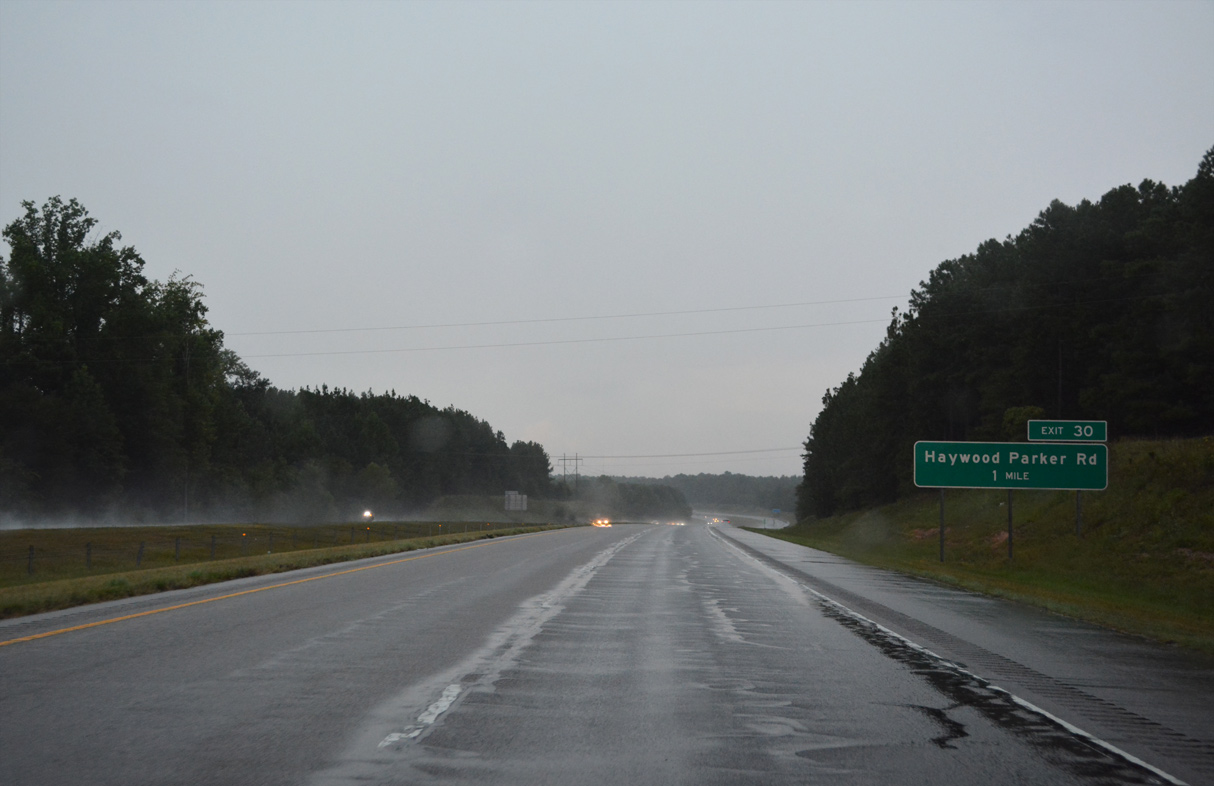
Haywood Parker Road (SR 1441) heads north from Fire Tower Road to meet I-73/74 at a diamond interchange (Exit 30) adjacent to Crawford Road (SR 1343).
08/14/21
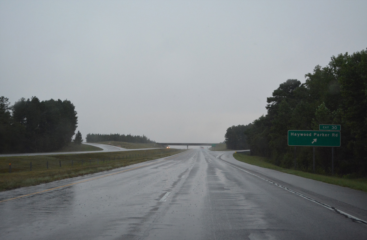
Exit 30 (former Exit 13) departs I-73/74 north for Haywood Parker Road (SR 1453). SR 1453 extends southwest along Crawford Road to Church Street in Ellerbe.
08/14/21
Reassurance markers for I-73/74 posted after Exit 30.
08/14/21
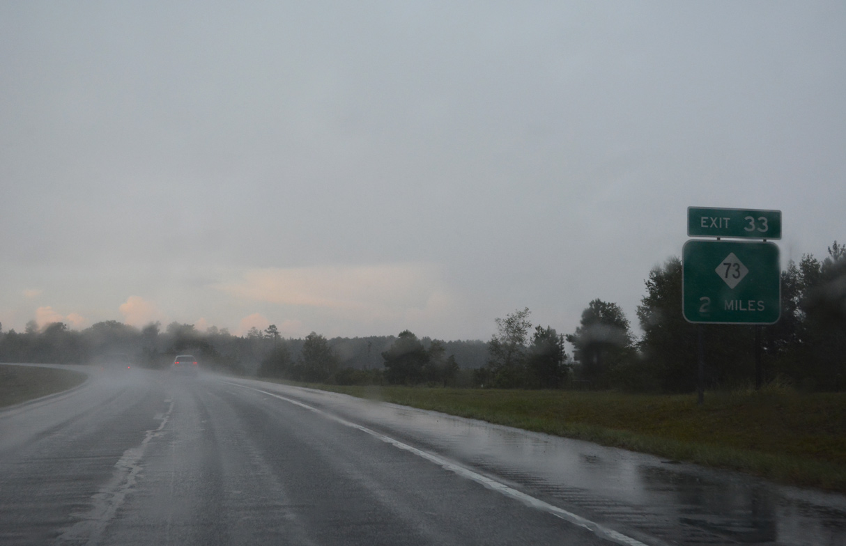
NC 73 overlaps with U.S. 220 north from Ellerbe to Plain View just west of Exit 33.
08/14/21
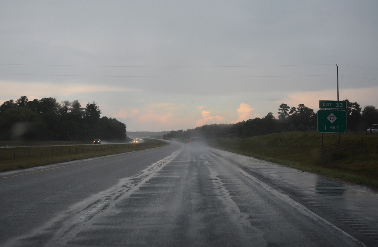
NC 73 continues northeast from Exit 33 seven miles to Jackson Springs and 11 miles to West End.
08/14/21
I-73/74 north at the diamond interchange (Exit 33) with NC 73. U.S. 220 parallels just to the west en route to Norman.
12/21/08
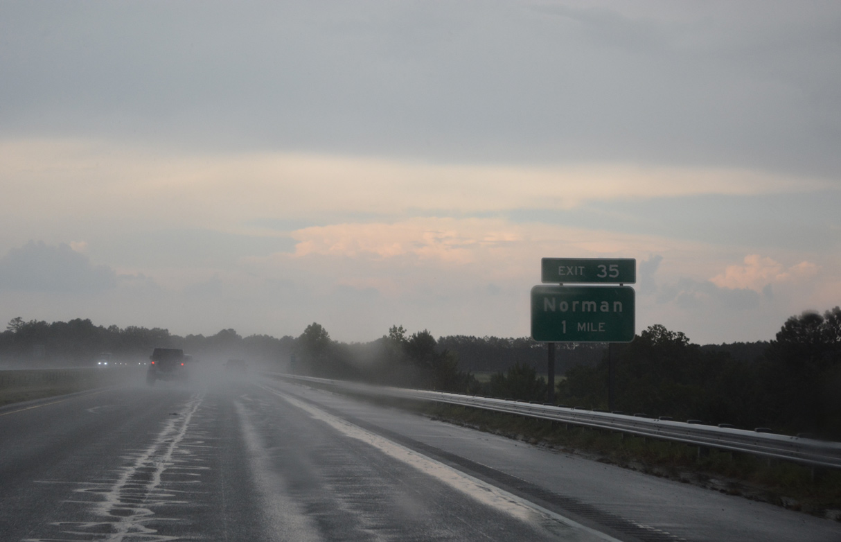
The succeeding exit lies just east of Norman with Research Farm Road (SR 1638/1321).
08/14/21
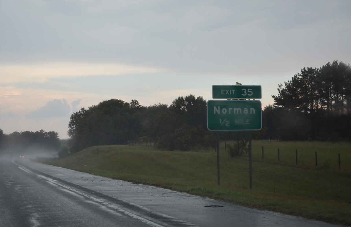
Research Farm Road (SR 1321) becomes Moore Street west from Exit 35 into the rural town of Norman.
08/14/21
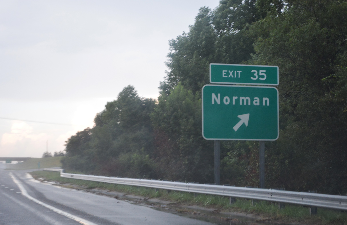
Exit 35 departs I-73/74 and U.S. 220 north. Research Farm Road straddles the Montgomery County line eastward through rural areas to NC 73.
08/14/21
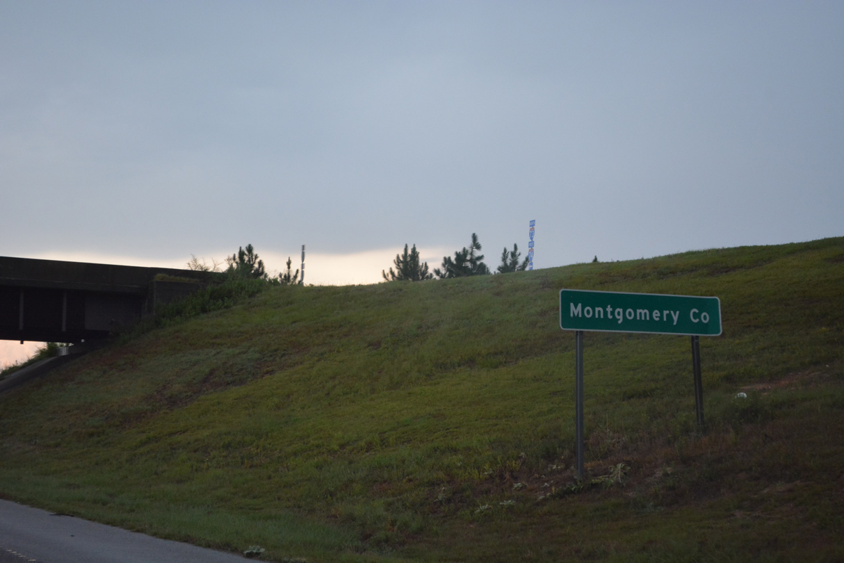
The Montgomery County line crosses I-73/74 within the exchange at Exit 35.
08/14/21
Curving northwest, I-73/74 span a tributary of Naked Creek at these confirming shields.
08/14/21
Candor lies eight miles ahead, followed by Asheboro in 40 miles. A frontage road (SR 1640) passes over I-73/74, serving local roads cut off from adjacent U.S. 220 by freeway construction here.
12/21/08
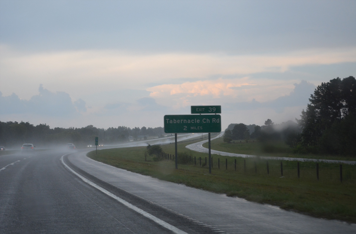
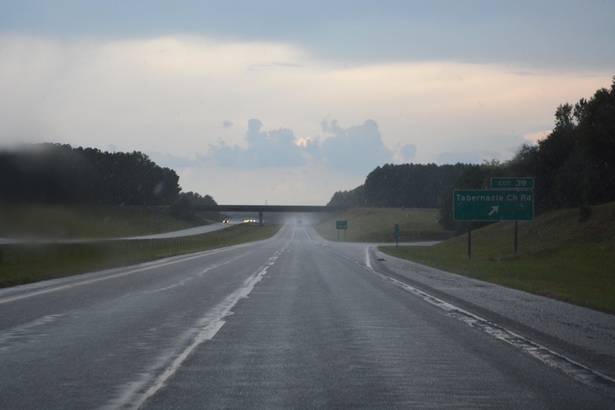
Tabernacle Church Road (SR 1524) connects with I-73/74 near the community of Emery at Exit 39.
08/14/21
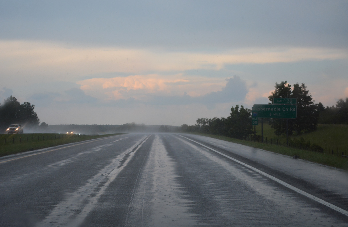
A diamond interchange (Exit 39) joins I-73/74 with Tabernacle Church Road (SR 1524) in one mile.
08/14/21
U.S. 220 passes over I-73/74 and U.S. 220 just ahead of Exit 39 en route to Tabernacle Church Road and Emery.
08/14/21
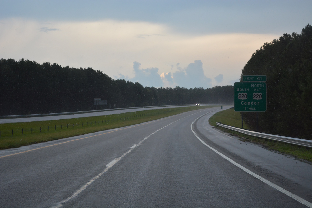
I-73/74 converges with U.S. 220 again by the the community of Emery at Exit 41.
08/14/21
I-73/74 north arcs eastward along the ensuing stretch beyond Exit 39.
08/14/21
Shifting west of I-73/74, U.S. 220 Alternate continues along the old route of U.S. 220 through the town of Candor.
08/14/21
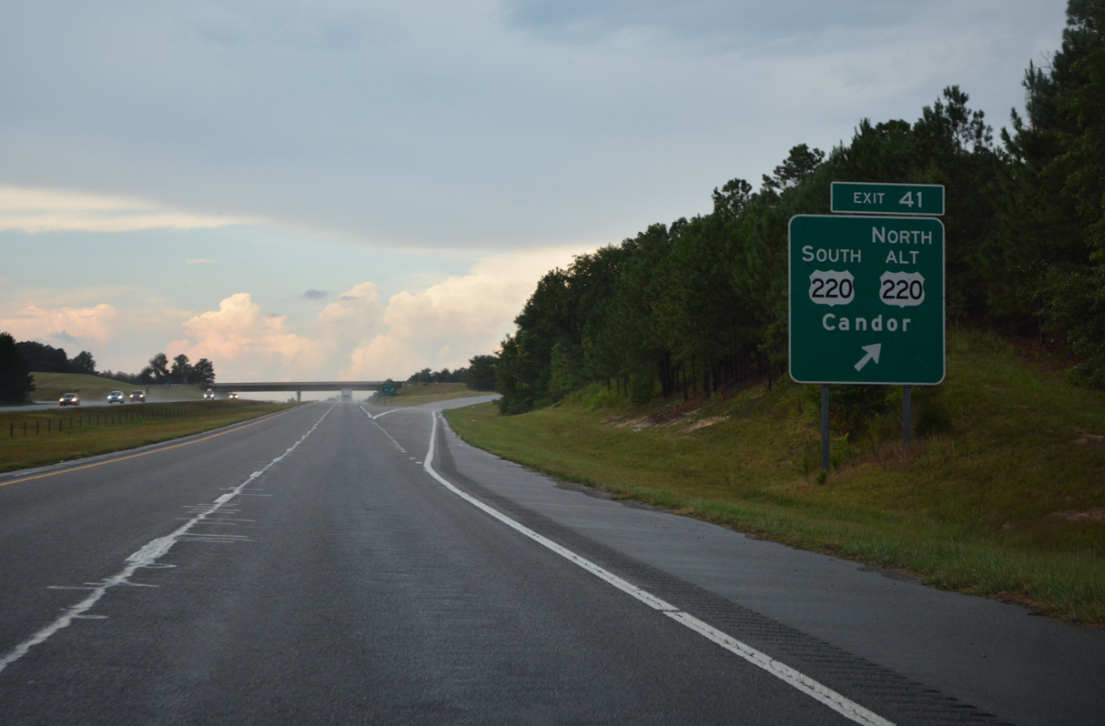
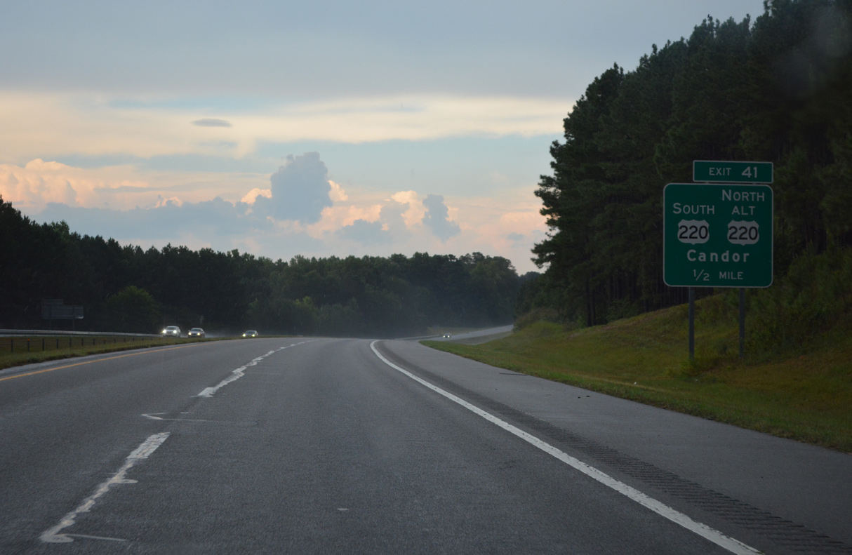
Exit 41 departs I-73/74 for U.S. 220 Alternate north and U.S. 220 south. U.S. 220 Alternate meets the east end of NC 731 in 1.89 miles outside Candor.
08/14/21
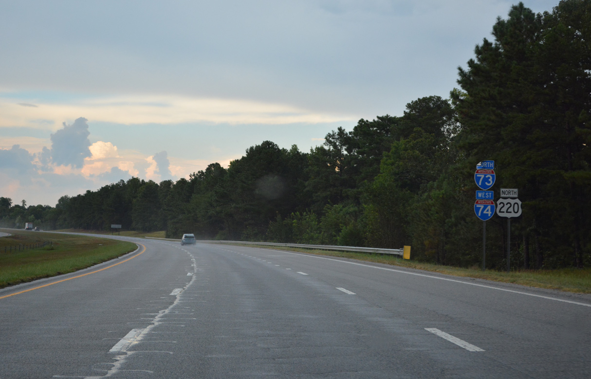
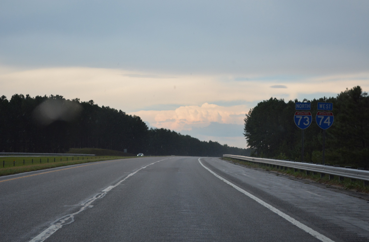
The previous future section of I-73/74 concluded along U.S. 220 north of Exit 41.
08/14/21
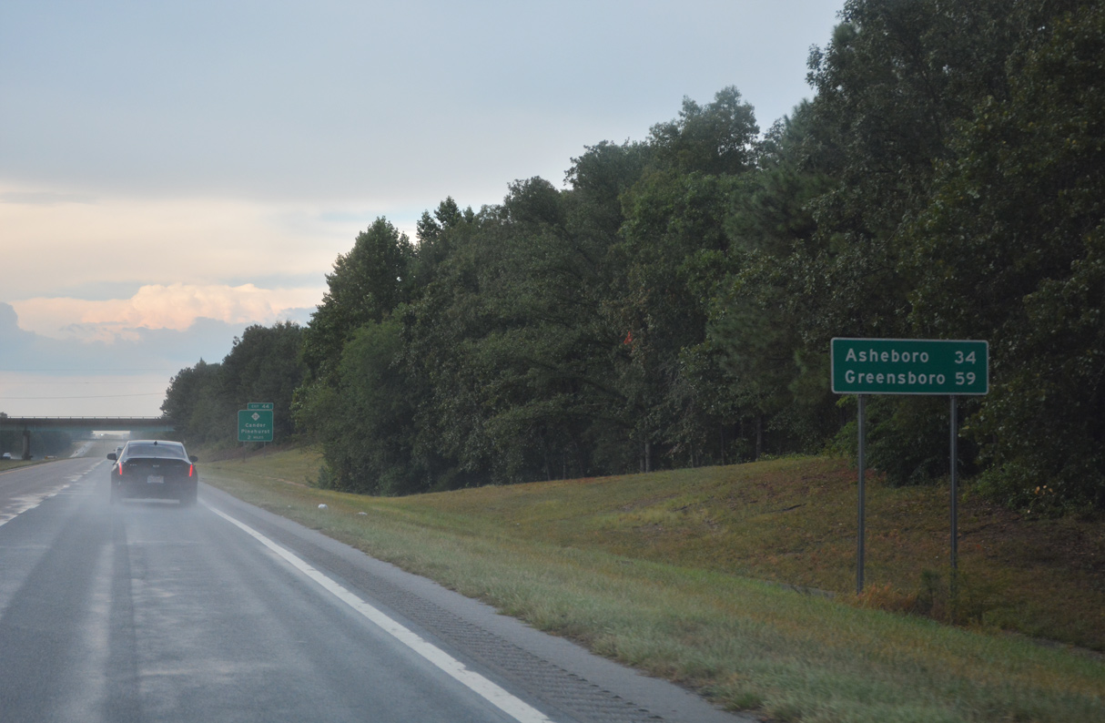
34 miles south of Asheboro and 59 miles from Greensboro along I-73/74 and U.S. 220 ahead of the Center Baptist Church Road (SR 1520) overpass.
08/14/21
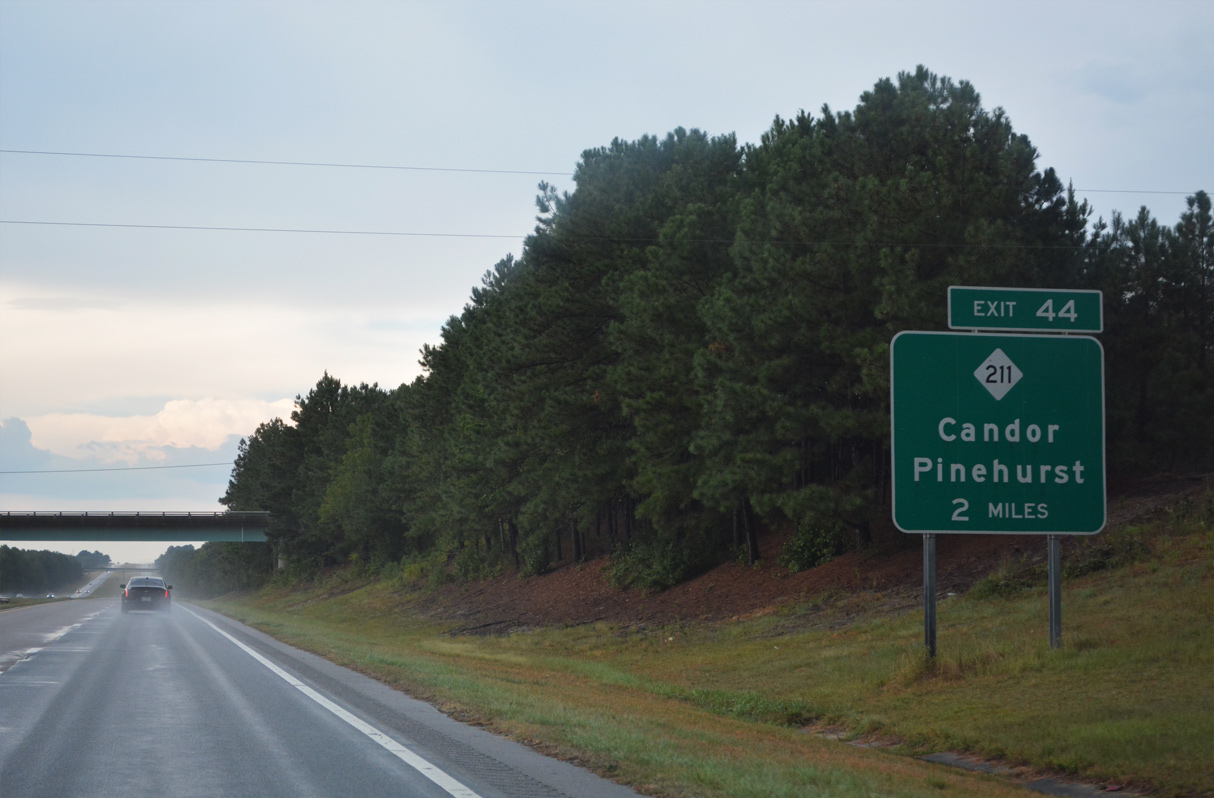
NC 211 (E Main Street) connects I-73/74 with central Candor at forthcoming Exit 44.
08/14/21
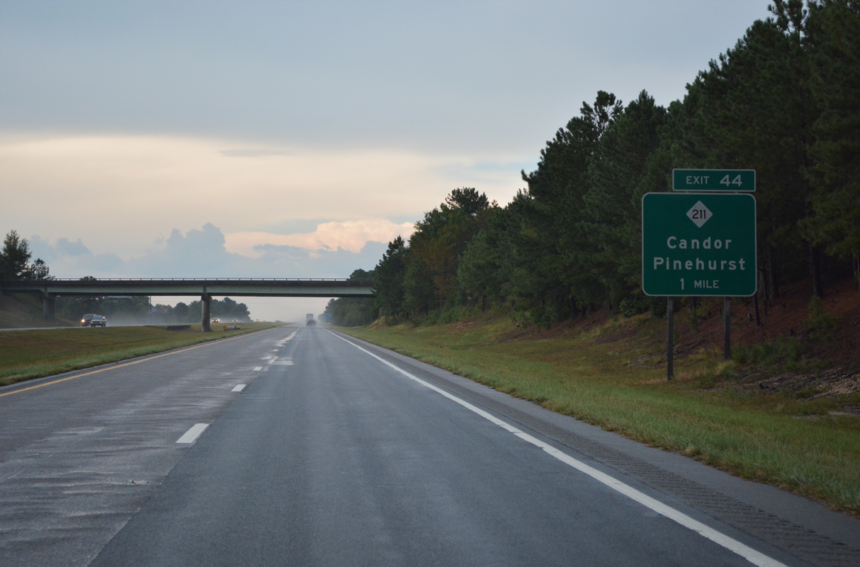
NC 211 joins Candor with Samarcand, Pinehurst and Southern Pines to the east.
08/14/21
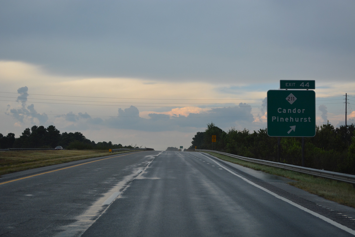
Entering the folded diamond interchange (Exit 44) with NC 211 (E Main Street) on I-73/74-U.S. 220 north.
08/14/21

I-73/74 and U.S. 220 turn northwest from Candor toward Biscoe on the 30 miles to Asheboro.
08/14/21
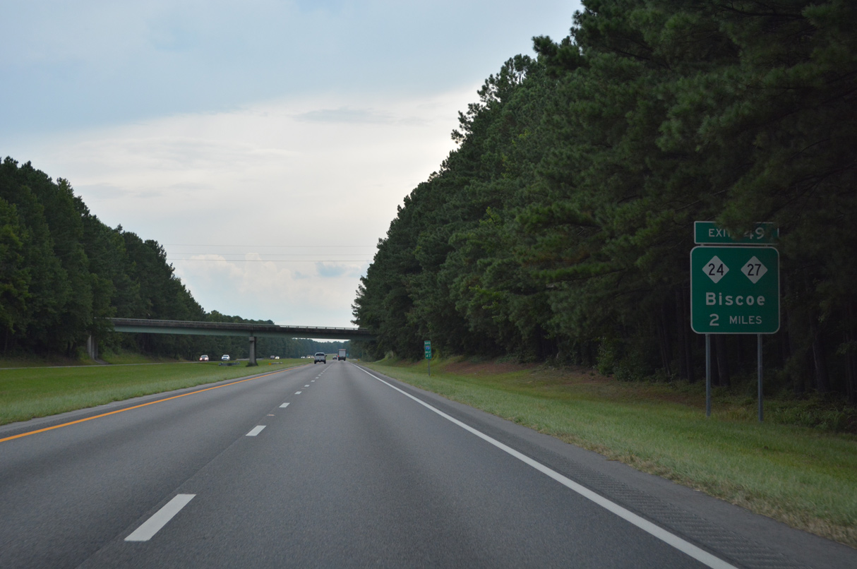
Meeting I-73/74 and U.S. 220 next is NC 24/27 at the town of Biscoe. NC 24/27 travel west to Uwharrie National Forest, Troy and Morrow Mountain State Park.
08/14/21
NC 24/27 share a lengthy overlap east to Carthage and Cameron and west to Albemarle and Charlotte.
08/14/21
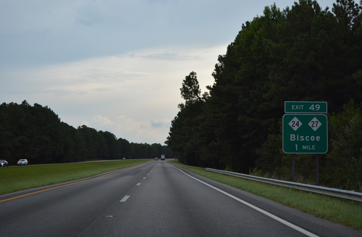
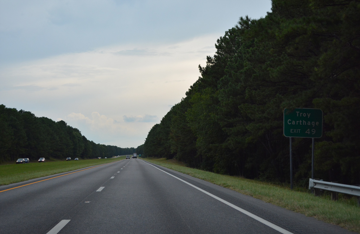
The next six exits on I-73/74 north serve area potteries. NC 24/27 follow E Main Street east from U.S. 220 Alternate (N/S Main Street) in Biscoe to a diamond interchange at Exit 49.
08/14/21
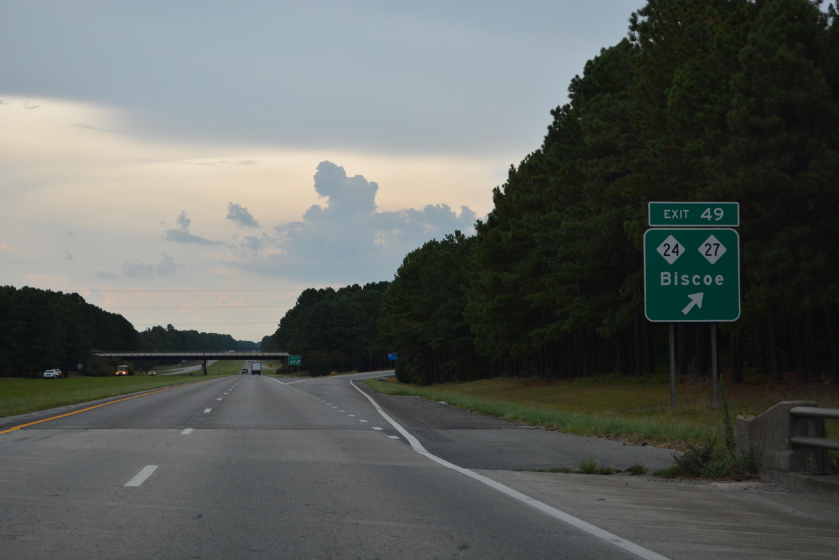
Passing over SR 1500 (Post Office Road), I-73/74-U.S. 220 northbound arrives at Exit 49 to NC 24/27 and Biscoe.
08/14/21
Confirming markers for I-73/74-U.S. 220 north posted after the entrance ramp from NC 24/27 (E Main Street) at Biscoe.
08/14/21
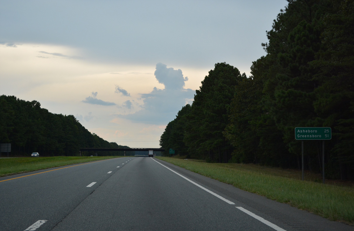
Distance sign posted on I-73-74/U.S. 220 north for Asheboro and Greensboro near the Auman Road (SR 1372) overpass. The freeway through Montgomery County has grass shoulders.
08/14/21
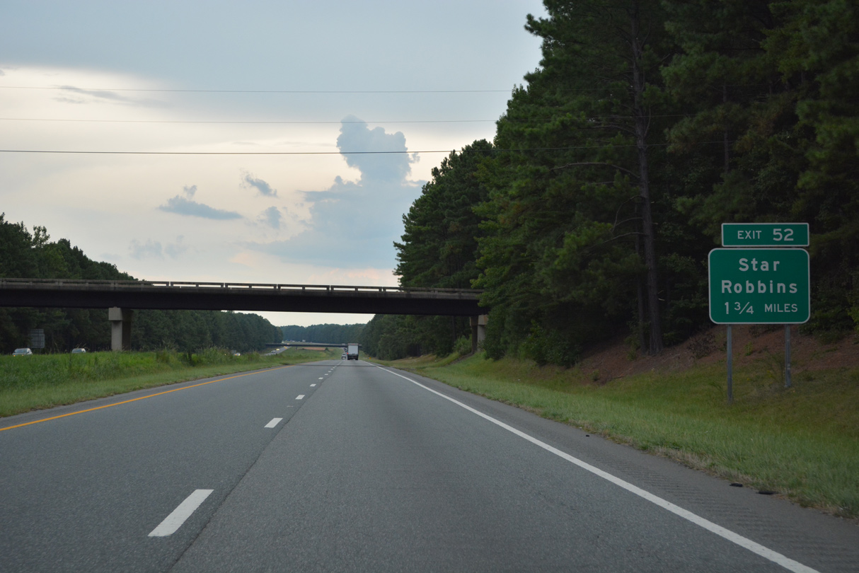
A diamond interchange connects I-73-74/U.S. 220 north with Spies Road at Exit 52.
08/14/21
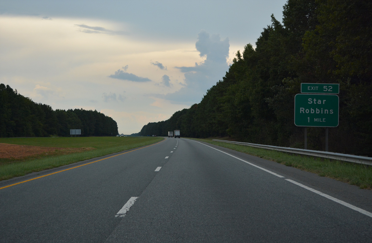
Spies Road (SR 1002) heads west from Exit 52 to U.S. 220 Alternate (N Main Street) in Star.
08/14/21
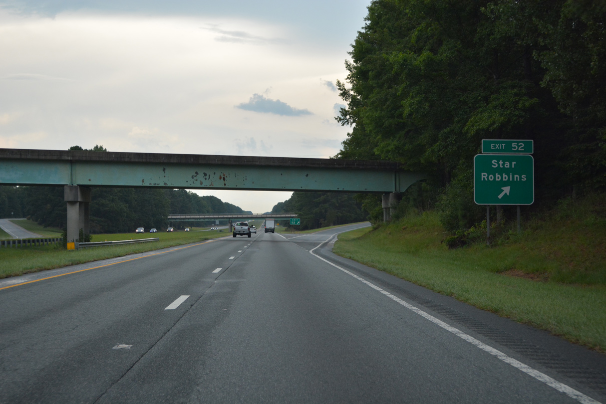
Exit 52 leaves I-73/74 north at a Norfolk Southern Railroad overpass for Spikes Road (SR 1002). Spies Road parallels the NS Railroad east to Spies and Robbins.
08/14/21
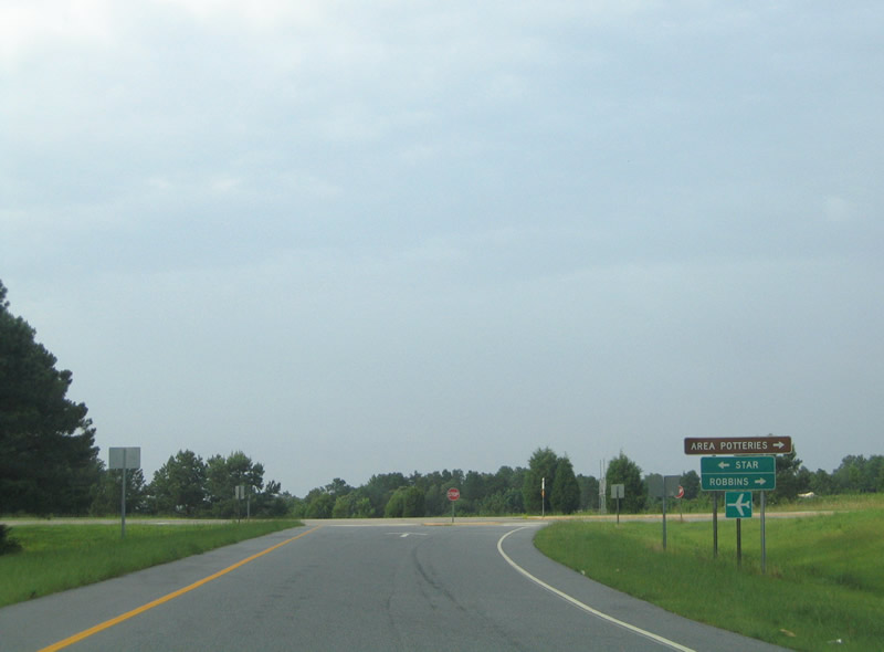
Spies Road (SR 1002) enters the town of Star just west of Exit 52. Star lies north of Montgomery County Airport (43A) along U.S. 220 ALT.
07/11/05


Photo Credits:
- Brent Ivy: 07/29/25
- Alex Nitzman: 07/11/05, 08/14/21
- ABRoads: 12/21/08
Connect with:
Page Updated Thursday December 04, 2025.