
Interstate 74 West - East Peoria to Peoria
 West
West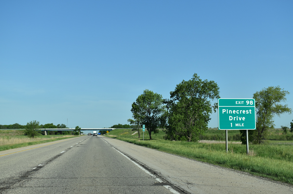
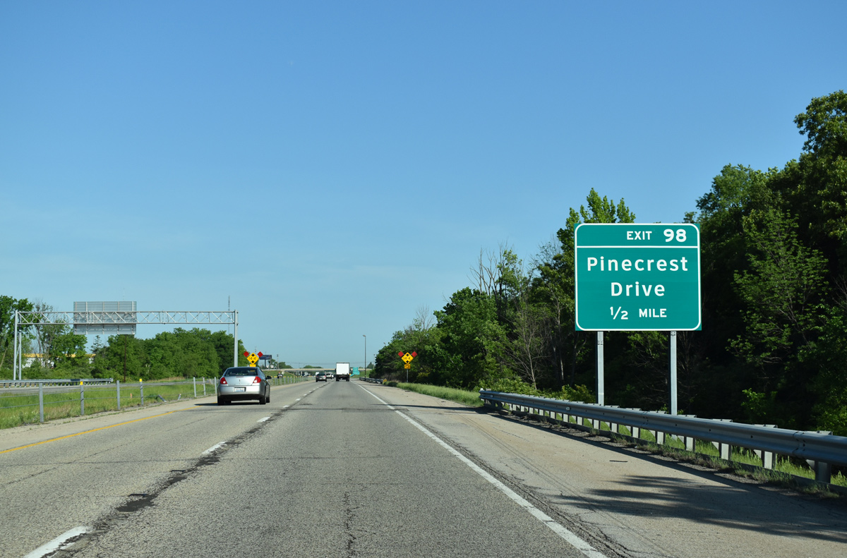
I-74 continues one mile west from a loop ramp at the east end of I-474 to Exit 98 for Pinecrest Drive in East Peoria.
05/24/18
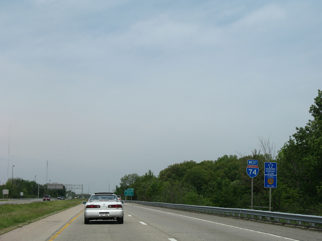
No longer in place as of 2018, this west Interstate 74 shield assembly was posted after I-474 in East Peoria.
05/24/08
Pinecrest Drive leads 1.14 miles south from the diamond interchange at Exit 98 to Tazewell County Route 22 (Muller Road) on the outskirts of East Peoria.
05/24/18
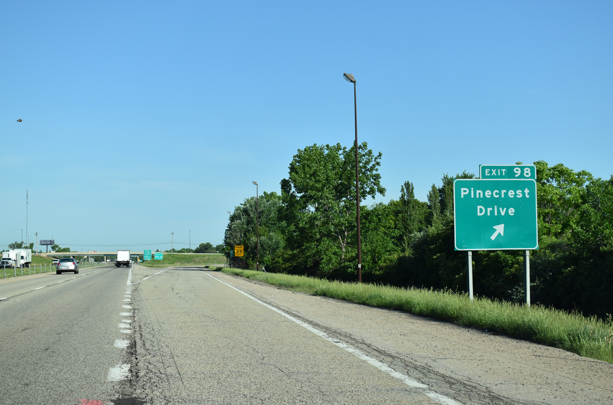
Exit 98 leaves Interstate 74 west for Pinecrest Drive.
05/24/18
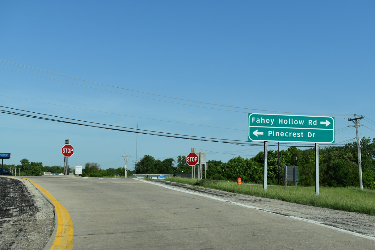
Pinecrest Drive becomes Fanley Hollow Road northwest along a forested drive 1.24 miles to Bloomington Road in East Peoria.
05/24/18
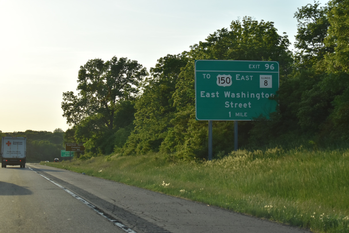
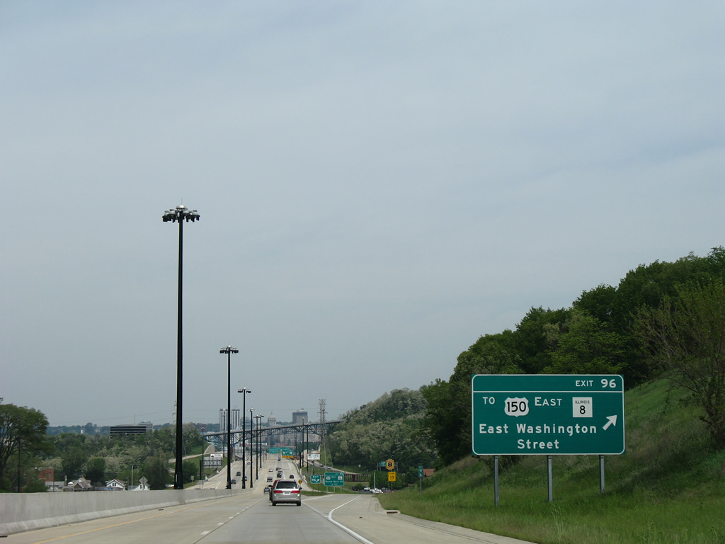
Meeting Interstate 74 next is E Washington Street at a folded diamond interchange (Exit 96).
05/24/18
Interchange sequence sign for the succeeding exits in central East Peoria. Points of interest served include Veterans Park at Exit 96, Illinois Central College at Exit 95, and the V.A. Clinic at Exit 94.
05/24/18
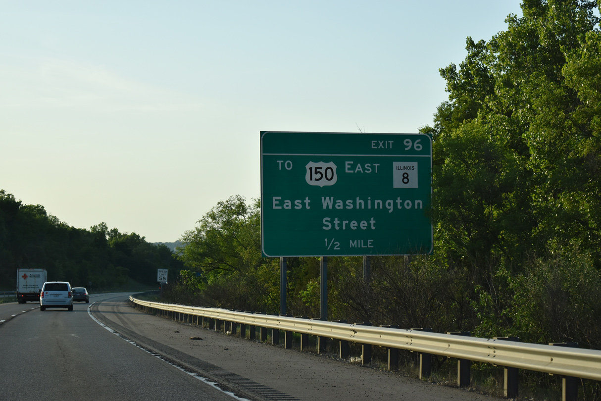
The speed limit reduces to 55 mph ahead of Exit 96 along I-74 west. Washington Street branches southwest from U.S. 150/IL 8 at Camp Street to The Levee District retail development beyond Main Street (U.S. 24/IL 29-116).
U.S. 150 combines with IL 8 west from Meadows Avenue to the intersection of Camp and Main Streets, where U.S. 150 turns north and IL 8 turns south. IL 8 follows the original route of U.S. 24 west from Washington Street.
05/24/18
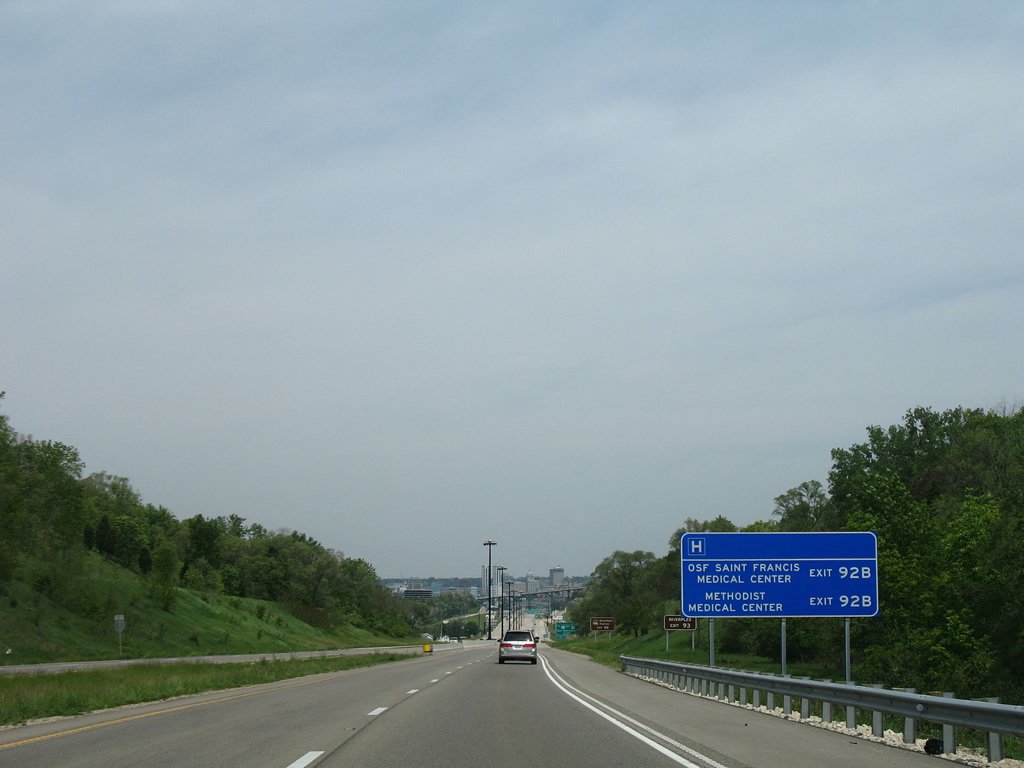
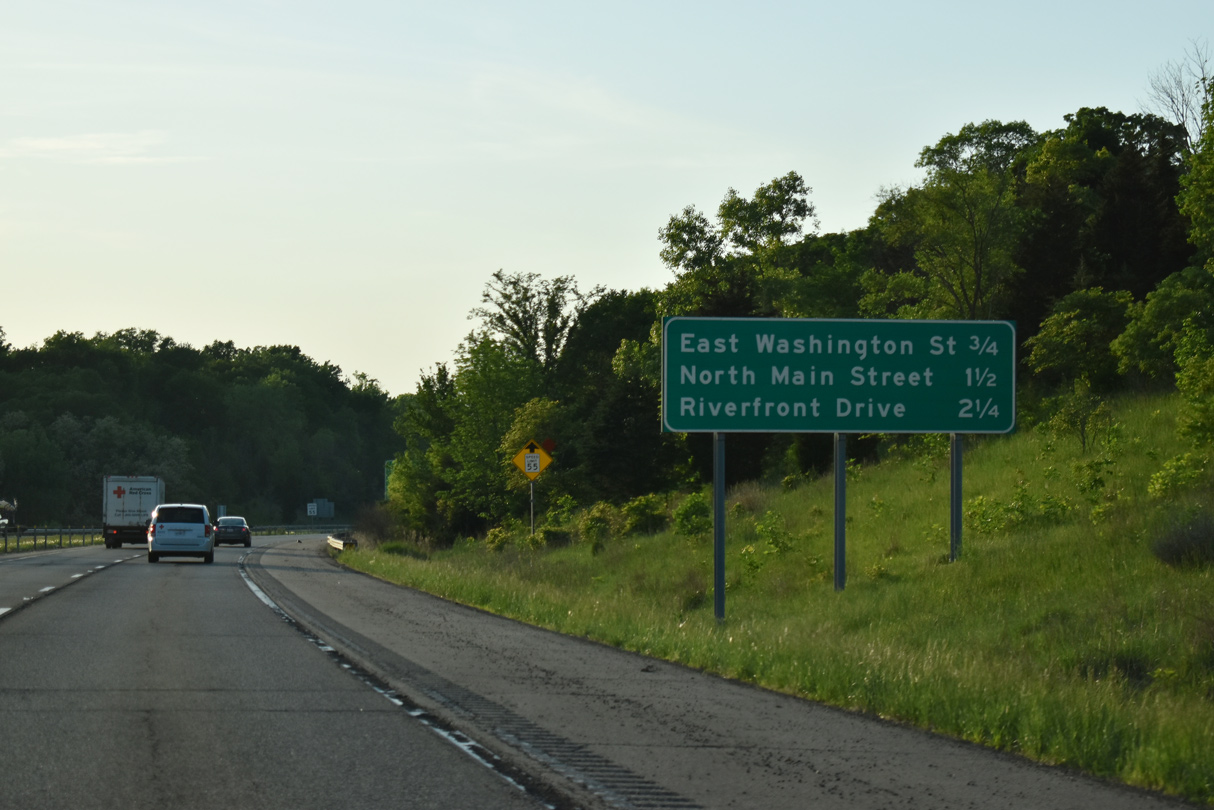
A distance sign follows for Downtown Peoria medical centers at Exits 92 B and 92 A.
05/24/08
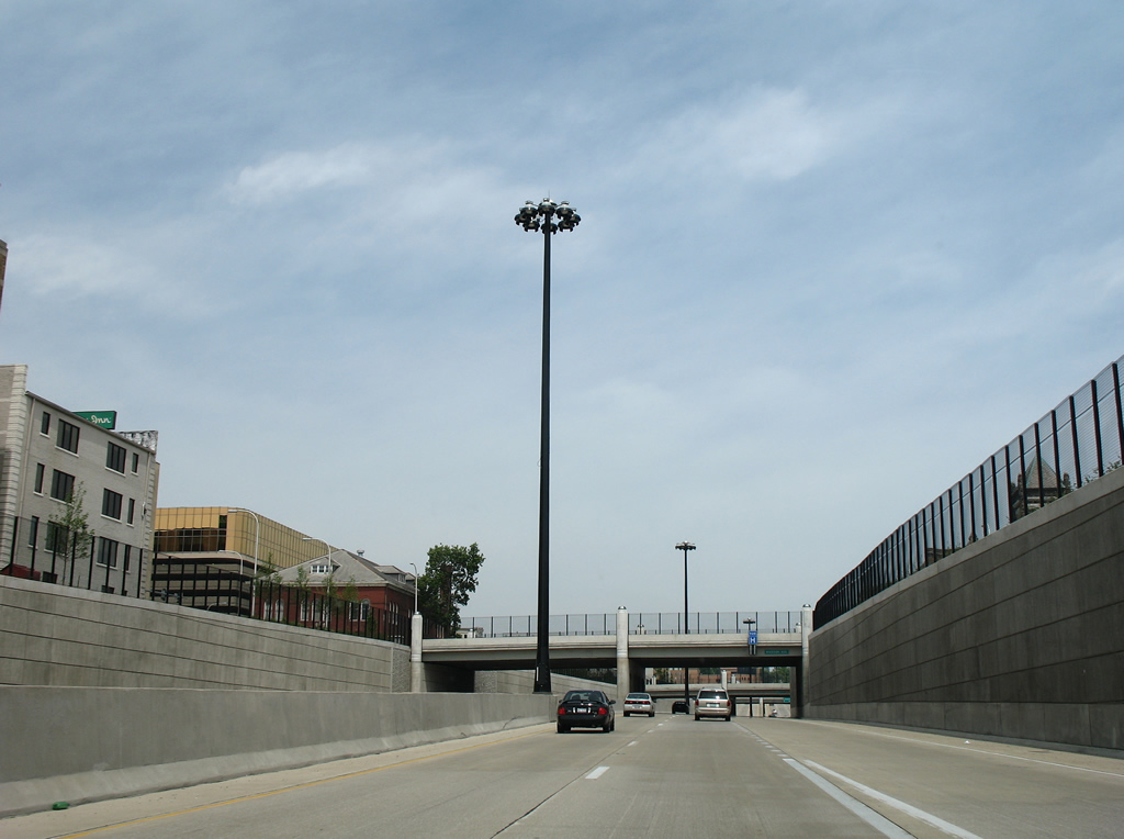
A barrier median replaces the grassy areas separating the I-74 roadways as the freeway descends into the Illinois River valley. Interstate 74 was reconstructed to modern standards between 2002 and 2007 through Peoria as part of the Upgrade 74 project.
05/24/08
With Fondulac Drive passing over the freeway in the distance, Exit 96 lowers from I-74 west to E Washington Street and U.S. 150/IL 8. U.S. 150 meets I-74 again at Exit 95 alongside U.S. 24 and IL 29-116. IL 8 overall constitutes a 47 mile route from Washington to IL 97 south of Maquon.
05/24/08
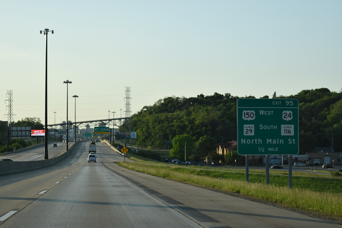
Interstate 74 drops across Farm Creek and a Norfolk Southern Railroad line ahead of Exit 95 to U.S. 150/IL 116 (N Main Street). U.S. 24 was relocated in 2010 from Peoria to follow U.S. 150/IL 116 north four miles to the Mc Clugage Bridge and Main Street south through Creve Coeur to I-474.
05/24/18
The Washington Street entrance ramp forms an auxiliary lane to Exit 95 for U.S. 24-150/IL 29-116. IL 29 was also relocated from Washington Street through Downtown Peoria to combine with I-74 across the Murray Baker Bridge.
05/24/18
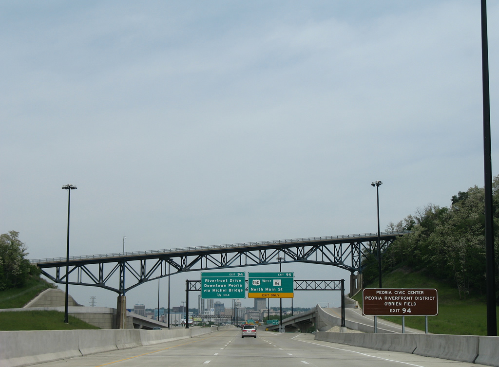
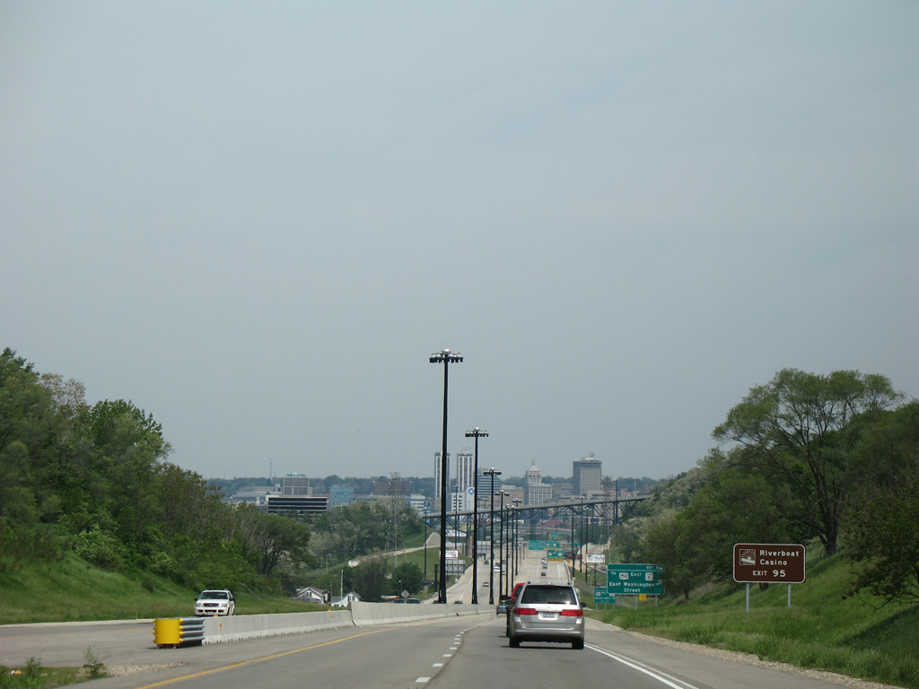
Ramps from a wye interchange (Exit 95 B) tie into Interstate 74 from Camp Street (U.S. 150/IL 8), beyond the Farm Creek levee. Exit 94 to Downtown Peoria follows for interests to Peoria Civic Center, Peoria Riverfront District, and Dozer Park, home of the Peoria Chiefs Class A minor league baseball club.
05/24/08
IL 116 travels west across the Cedar Street Bridge with IL 8 into Peoria. Eastward, the 190 mile state route continues to Germantown Hills. U.S. 150 combines with U.S. 24 to their split just east of the Mc Clugage Bridge. U.S. 150 spans the Illinois River to Grand View Park, following War Memorial Drive to again mix with Interstate 74 at Exit 89.
05/24/18
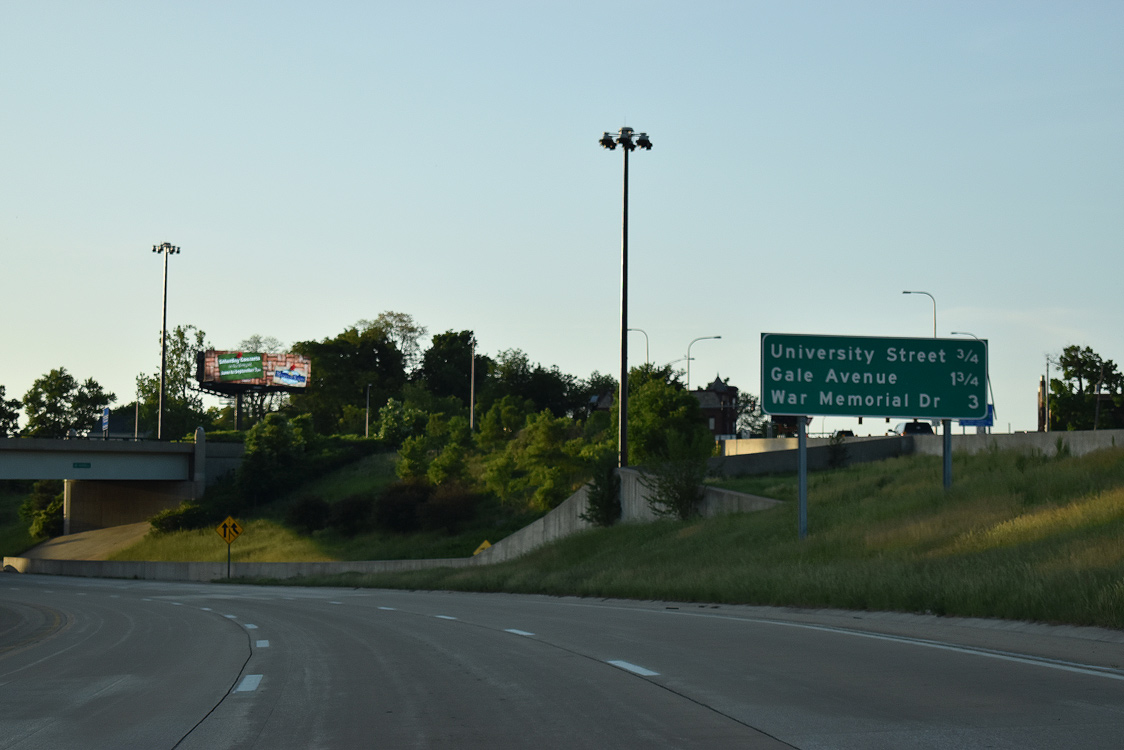
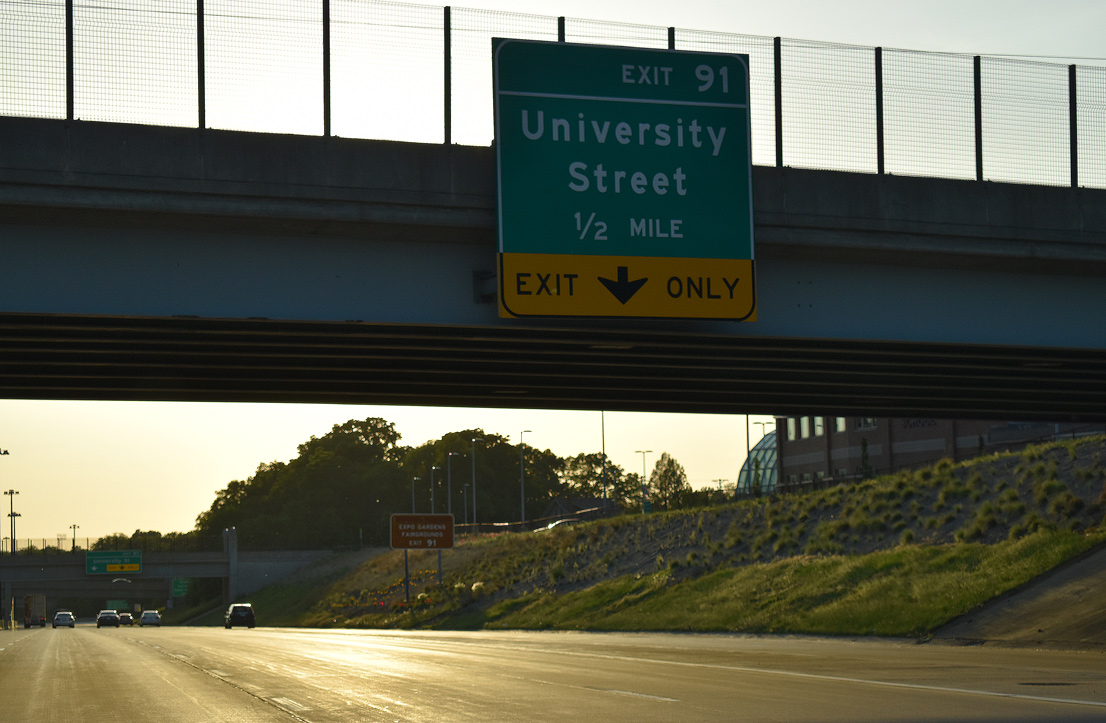
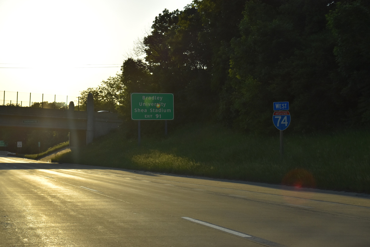
Exit 91 departs Interstate 74 east next for University Street to Bradley University. Shea Stadium, home of Bradley University soccer, lies just west of University Street along Nebraska Avenue.
05/24/18
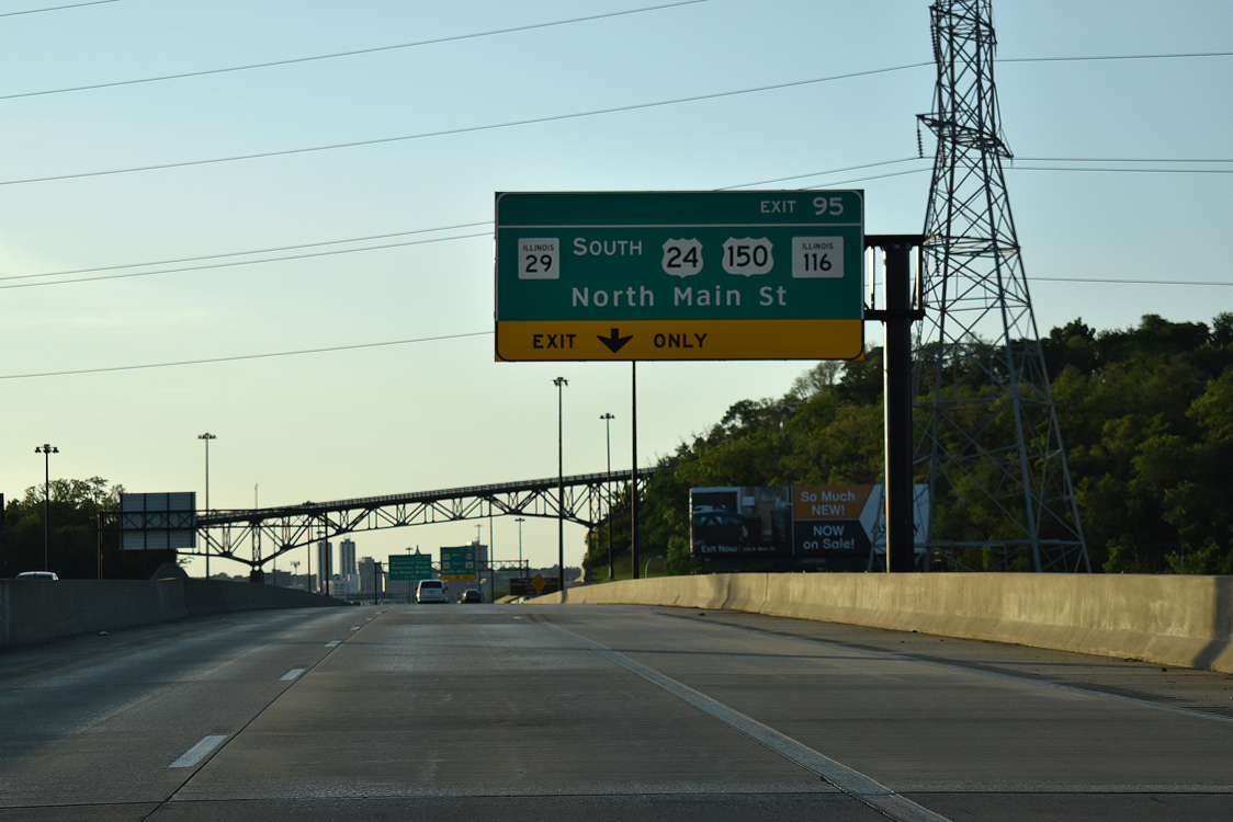
Exit 95 descends to meet U.S. 150/IL 116 (N Main Street) from under the high-level Fondulac Drive overpass. Until mid 2000s construction redesigned the exchange into a diamond interchange, a cloverleaf joined I-74 with Main Street. A historic view from Fondulac Drive shows I-74 here in 1975.
05/24/18
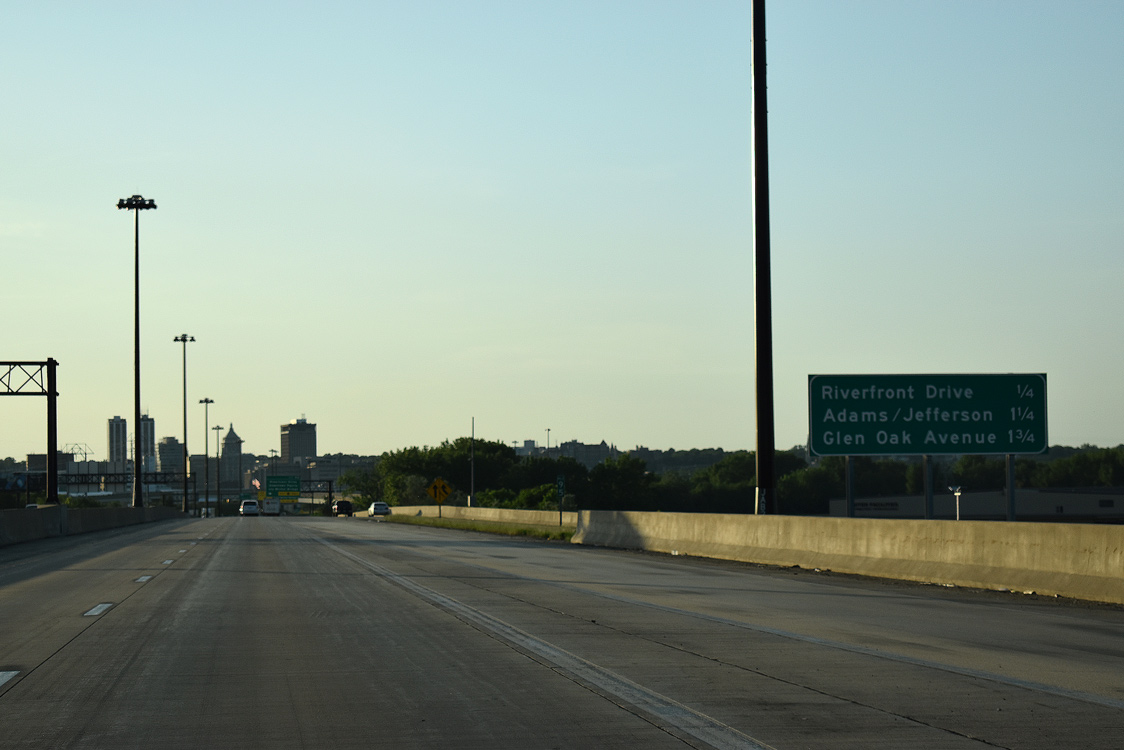
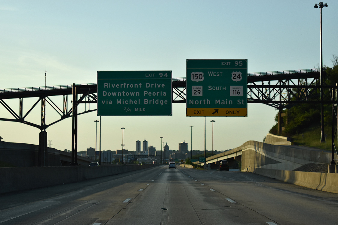
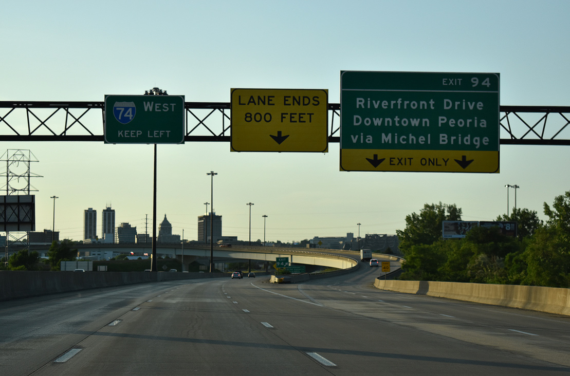
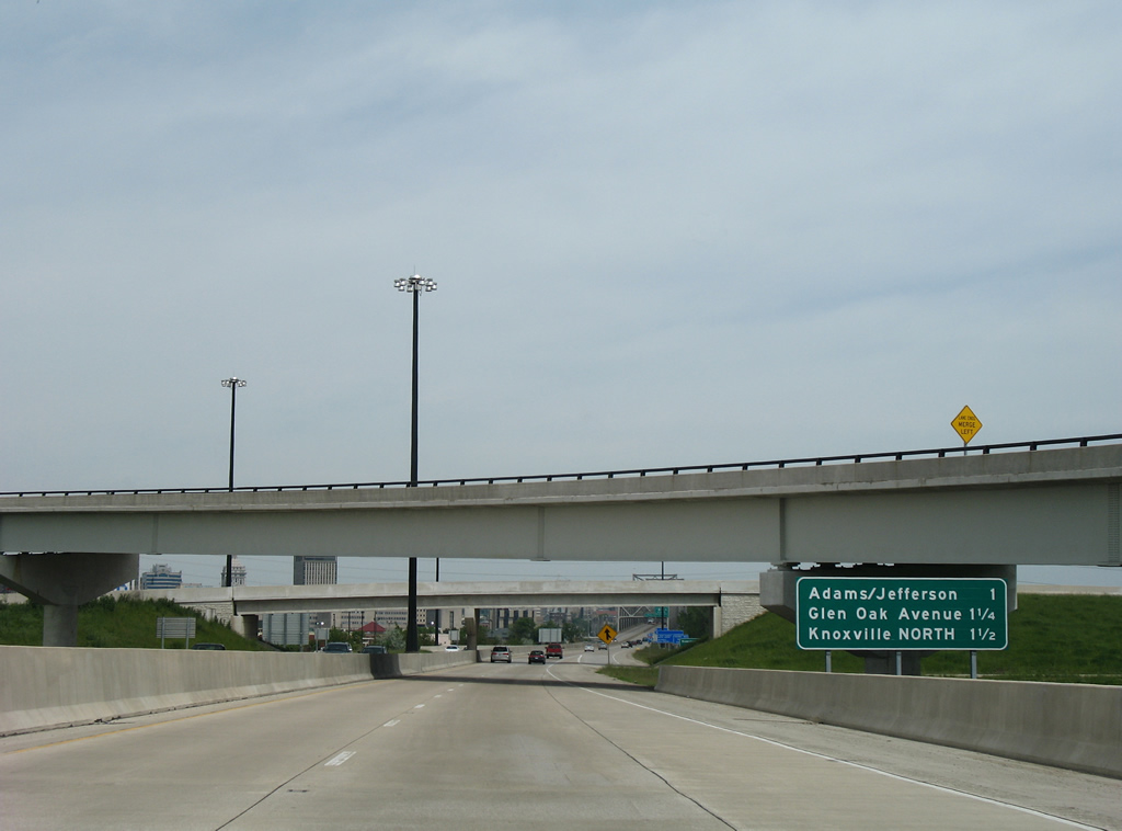
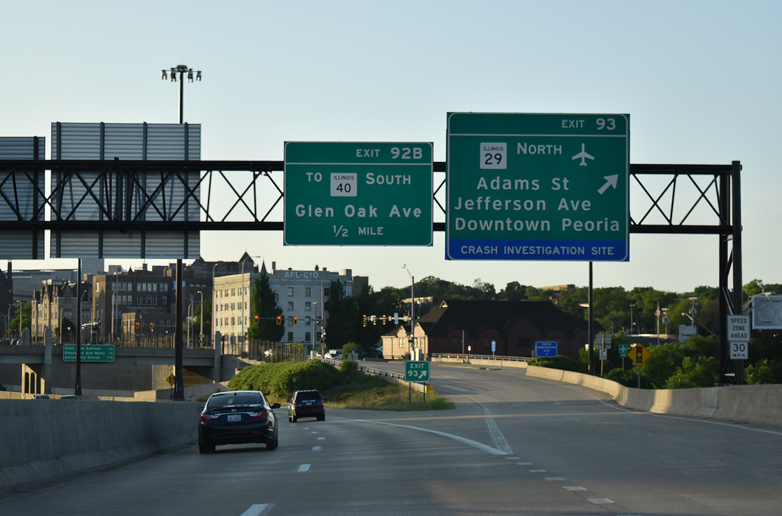
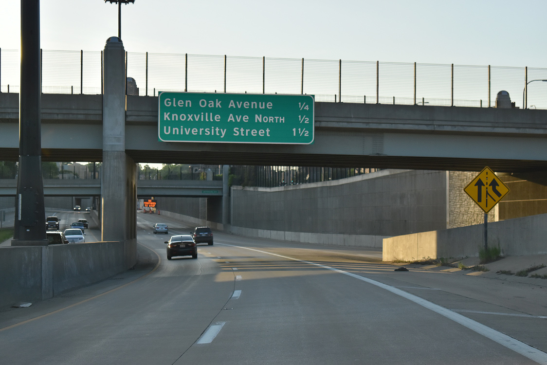
Crossing over Main Street, Interstate 74 advances a quarter mile to Exit 94 for Riverfront Drive. IL 29 (Adams / Jefferson Streets) and Glen Oak Avenue via Exit 92 B lie west of the Illinois River.
05/24/18
West  North
North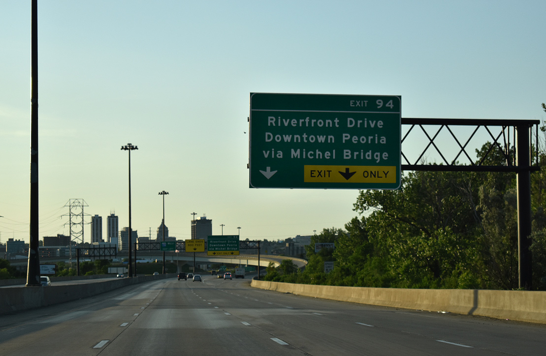
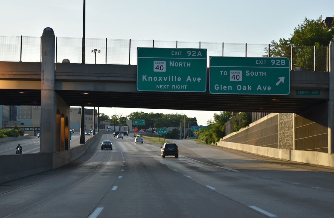
I-74/IL 29 briefly carry four westbound lanes leading into the directional cloverleaf interchange (Exit 94) with IL 40. Previously a trumpet interchange connected with the Washington Street connector to the Bob Michel Bridge into Downtown.
05/24/18
IL 40 begins at the westbound flyover (Exit 94) to Washington Street. The state route crosses the Illinois River to ramps with Adams Street near Dozer Park and Washington Street (former U.S. 24/IL 29). IL 40 travels 108 miles northward from Peoria to Mt. Carroll.
05/24/18
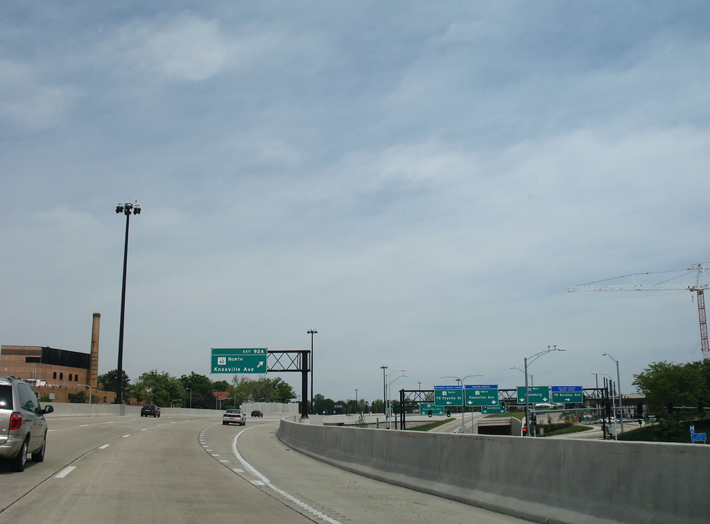
IL 29 separates from Interstate 74 west in a half mile. Glen Oak Avenue via Exit 92 B and IL 40 (Knoxville Avenue) line the freeway northwest between Methodist Hospital and St. Francis Medical Center.
05/24/08
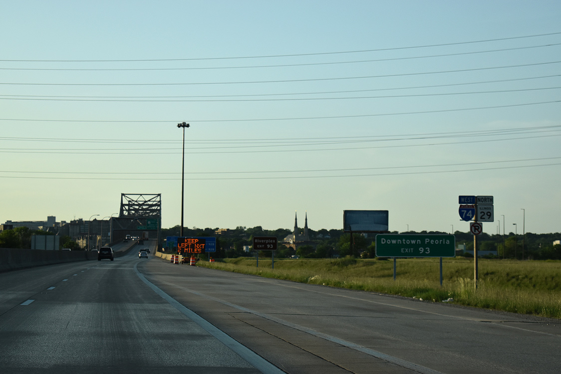
Confirming markers for I-74/IL 29 preceding the Murray M. Baker Bridge ahead of Downtown Peoria.
05/24/18
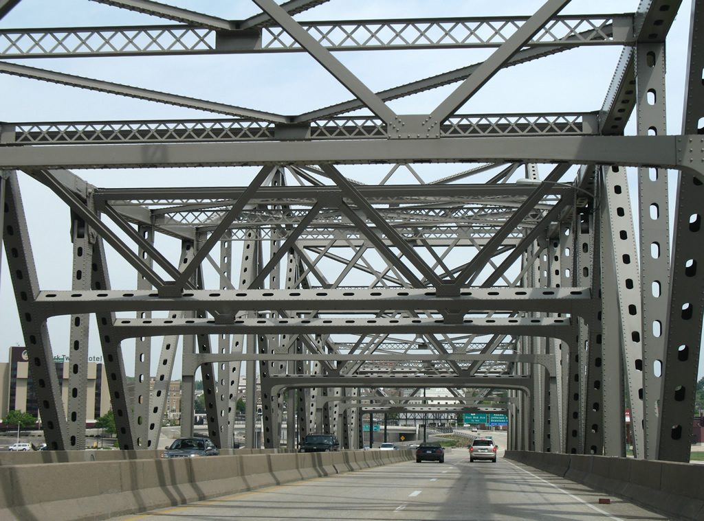
Rising onto the four lane Murray M. Baker Bridge on Interstate 74 west. This 3,036 feet long cantilever span opened in 1958.1
05/24/18
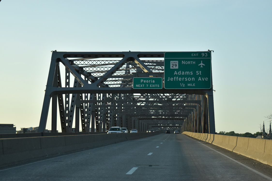
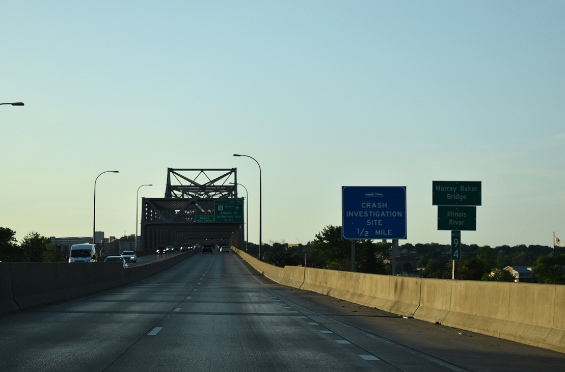
The first of seven Peoria exits is the half diamond interchange with IL 29 and old U.S. 24 (Adams Street north / Jefferson Avenue south). U.S. 24/IL 29 previously combined 3.8 miles from the Cedar Street Bridge (IL 8/116) northward to the McClugage Bridge (U.S. 150). Both routes were removed from Washington Street in 2010, when the city took over maintenance from IDOT.
05/24/18
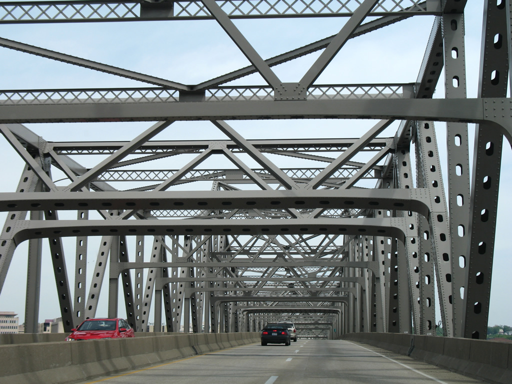
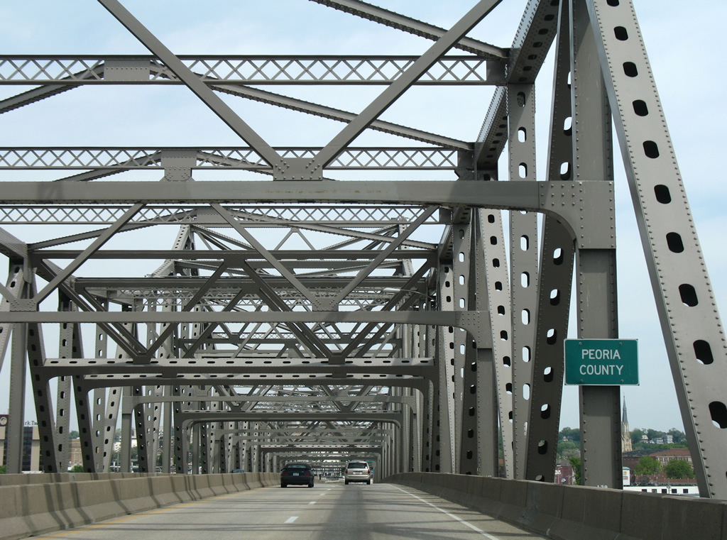
Interstate 74 crests over the Illinois River and enters Peoria County midway across the Murray M. Baker Bridge.
05/24/08
I-74/IL 29 west lower toward Exit 93 for Spalding Avenue, a north side frontage street. Originally separate ramps linked with Adams Avenue north and Jefferson Street south. The loop ramp onto Adams was eliminated during the Upgrade 74 reconstruction. During that time, the Baker Bridge was shortened 180 feet to accommodate new ramps.1
05/24/08
IL 29 north parts ways with I-74 (Murray M. Baker Bridge) west at Exit 93 to join Adams Street north from Spalding Avenue. U.S. 24 followed Washington Street from nearby Hamilton Boulevard through Downtown toward Bartonville until 2010. Northward, IL 29 follows Galena Road from U.S. 150 to Peoria Heights, north Peoria, and Mossville. The state route travels 180 miles overall from Pana to Spring Valley.
05/24/18
West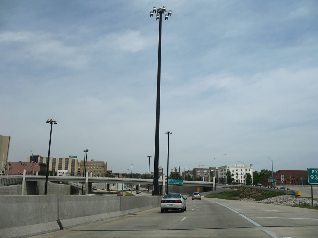
Interstate 74 drops below grade from Adams Street to Glendale Avenue. A second half diamond interchange provides return access from Waters Street.
05/24/08
Exit 92 B departs in a quarter mile for adjacent Spalding Avenue (IL 40). IL 40 emerges from Downtown Peoria via the couplet of Glendale (south) and Perry (north) Avenues to run alongside I-74 at Glen Oak Avenue. A direct ramp (Exit 92 A) connects with Knoxville Avenue (IL 40 north from Spalding) in a half mile.
05/24/18
The trenched section of Interstate 74 near the Madison Avenue overpass.
05/24/08
Exit 92 B ties into IL 40 (Spalding Avenue) north at Greenleaf Street. A turn onto Glen Oak Avenue underneath I-74 connects motorists with the state route south along Fayette Street to Glendale Avenue and the central business district.
05/24/18
Spalding Avenue forms the northbound beginning of Knoxville Avenue (IL 40) at Glen Oak Avenue. Berkley Avenue travels alongside St. Francis Medical Center and the adjacent directional wye interchange (Exit 92 A) to Pennsylvania Avenue.
05/24/08
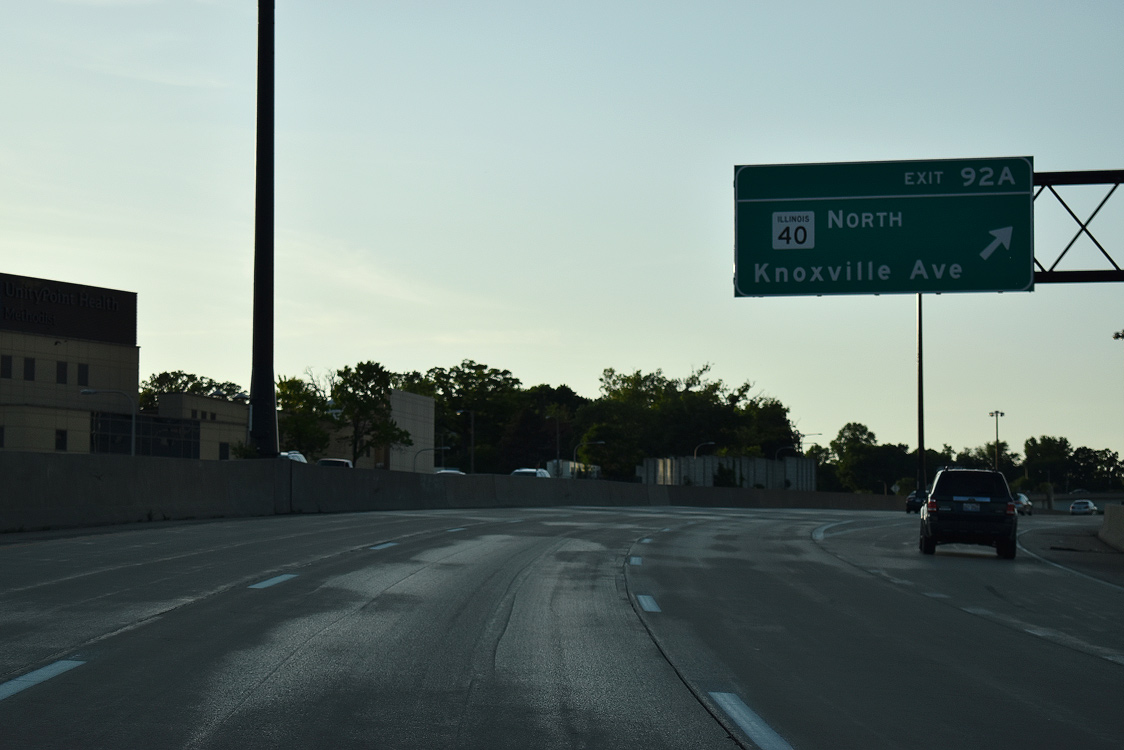
Motorists bound for IL 40 (Knoxville Avenue) leave Interstate 74 west and pass over a tunneled entrance ramp from Spalding Avenue. Knoxville Avenue comprises an arterial to IL 6 and northern reaches of the city.
05/24/18
Interstate 74 leaves the Illinois River flats and curves westward to University Street near Bradley University and Exit 91.
05/24/18
One half mile east of the six-ramp parclo interchange (Exit 91) with University Street at the North Street overpass.
05/24/18
Originally a two-ramp movement, Exit 91 carries two lanes from Interstate 74 west to University Street. University Street leads south to Bradley University and West Main Street (former IL 8) and north parallel to I-74 to U.S. 150 (War Memorial Drive).
05/24/18
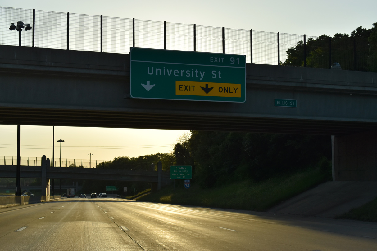
Westbound confirming marker posted between the Ellis Street and Sheridan Road overpasses. Exit 91 also serves interests to adjacent Shea Stadium, Lakeview Museum and the Expo Gardens.
05/24/18
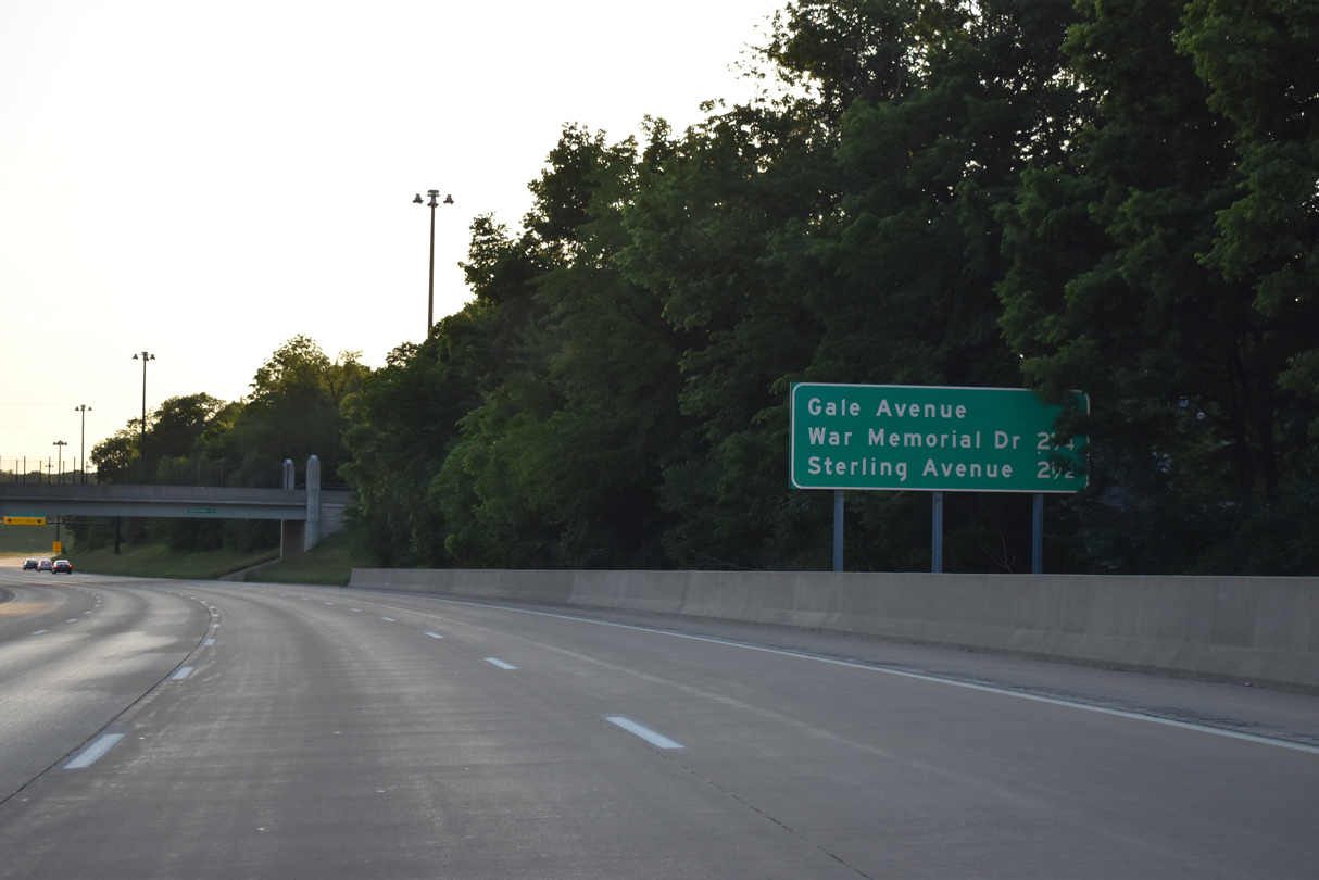
Interchange sequence sign outlining Exit 90 for Gale Avenue, Exit 89 to U.S. 150 (War Memorial Drive) and Exit 88 for Sterling Avenue.
05/24/18
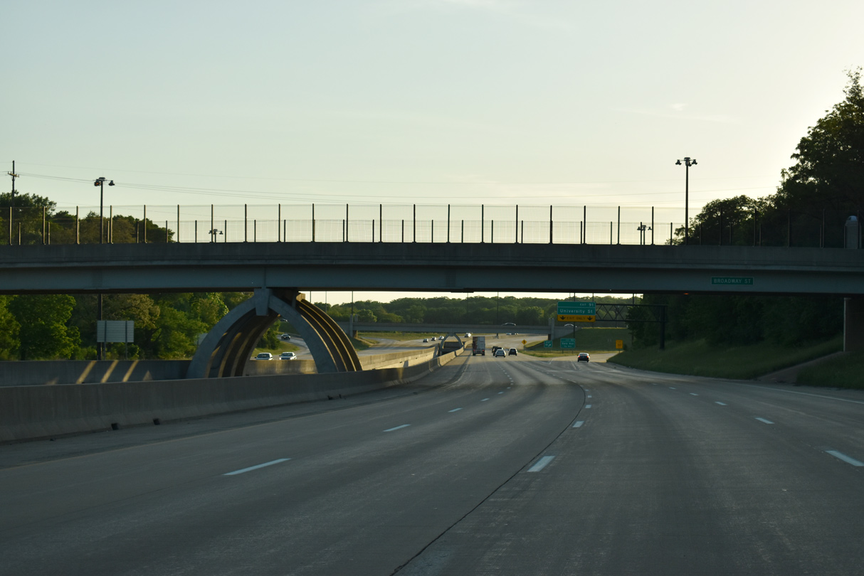
Unique support structures are found at Broadway and University Streets over the channelized Dry Run between the west and eastbound lanes of Interstate 74.
05/24/18
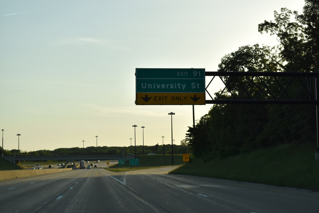
Exit 91 leaves I-74 west for University Street. University Street south becomes MacArthur Highway to the Cedar Street Bridge. Northward the arterial continues to Pioneer Parkway (former IL 381), where the street downgrades into a local road.
05/24/18
Interstate 74 turns northward between Bradley Park and Shea Stadium ahead of Gale Avenue.
05/24/18
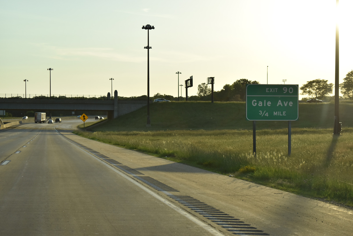
Nebraska Avenue crosses over Interstate 74 just south of the diamond interchange (Exit 90) with Gale Avenue. Gale Avenue angles northwest from Sheridan Road to meet the freeway at El Vista in Peoria.
05/24/18

Exit 90 parts ways with Interstate 74 for Gale Avenue. Gale Avenue continues 1.01 miles northwest to Sterling Avenue at W Reservoir Boulevard. Upgrade 74 construction straightened the westbound ramp at Exit 90.
05/24/18
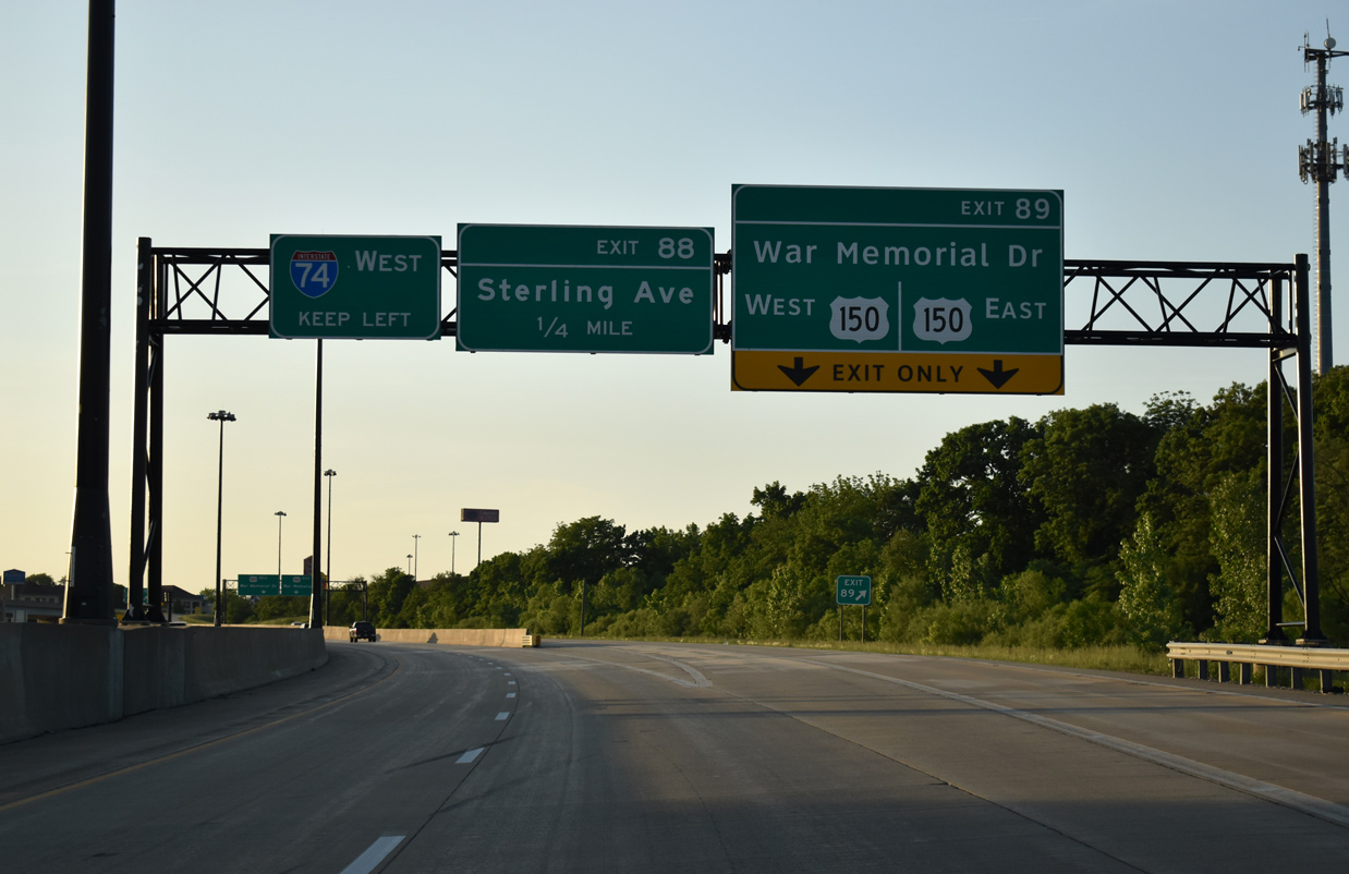
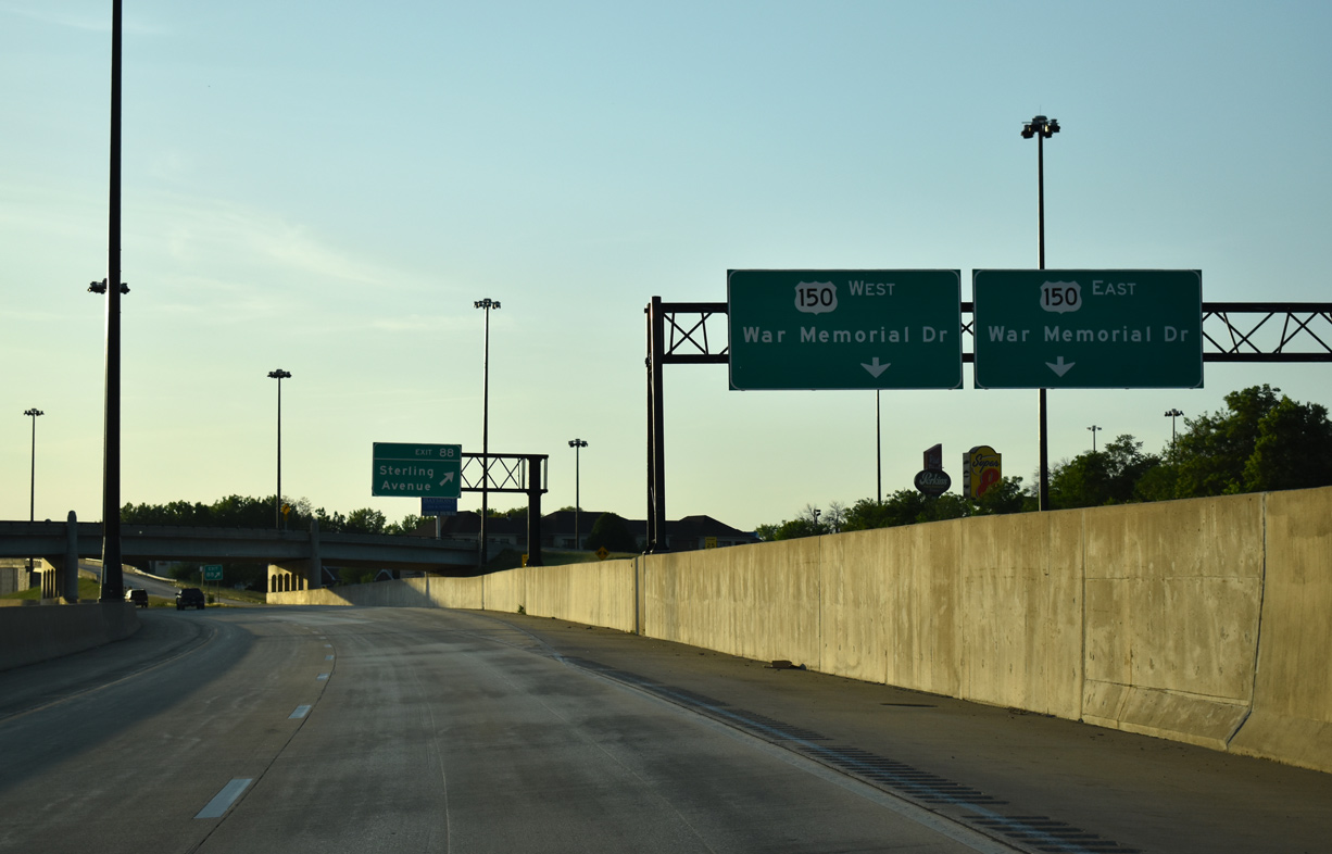
U.S. 150 (War Memorial Drive) and Interstate 74 come together by Northwoods Mall and Golden Acres at Exit 89 on 0.75 miles.
05/24/18
Interstate 474 returns to I-74 west three miles from the Forest Hill Avenue over crossing at El Vista.
05/24/18
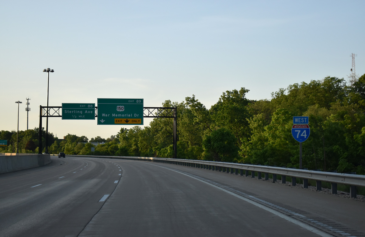
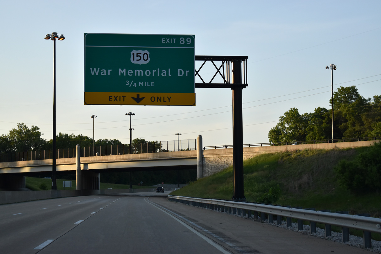
Interstate 74 reduces from six to four overall lanes west of the trumpet interchange at Exit 89.
05/24/18

Exit 89 leaves I-74 west for an access road and adjacent trumpet interchange with U.S. 150 (War Memorial Drive). U.S. 150 leads east to Peoria Heights and northwest to Golden Acres and the IL 6 freeway at Orange Prairie.
05/24/18
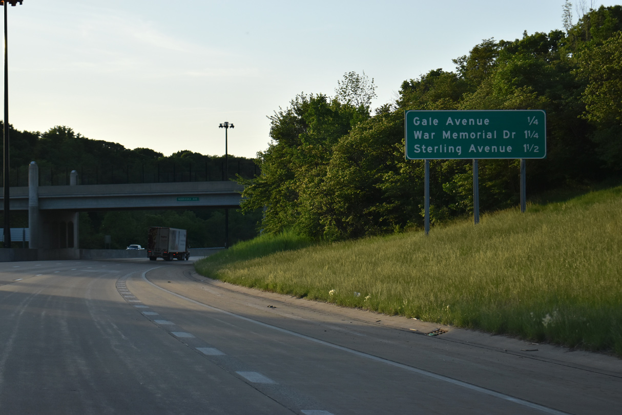
Traffic on Exit 89 partitions into separate ramps for U.S. 150 (War Memorial Drive) to the north ahead of Exit 88 for Sterling Avenue at Northwoods Mall.
05/24/18
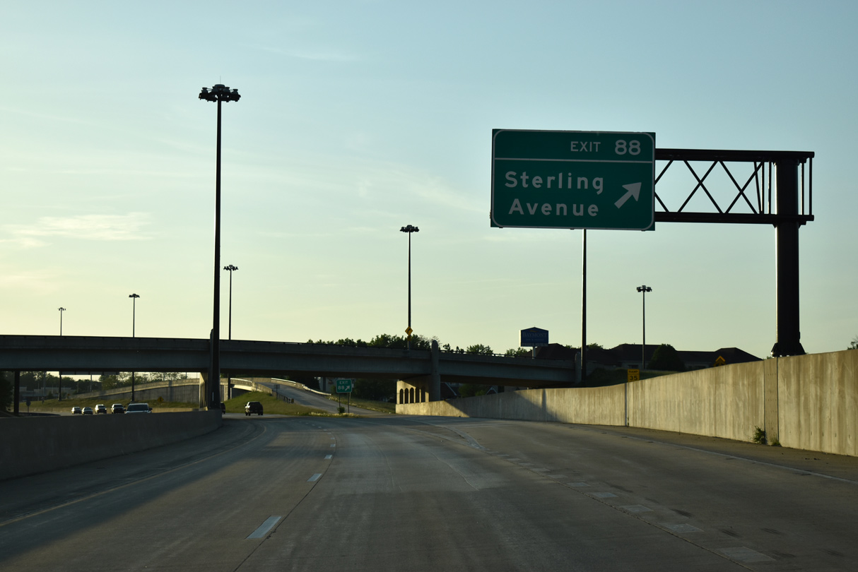
Sterling Avenue stems south from Glen Avenue and U.S. 150 (War Memorial Drive) to a diamond interchange (Exit 88) with Interstate 74. The arterial continues south from Exit 88 as Peoria County Route R54 to IL 8 (Farmington Road) beyond El Vista.
05/24/18
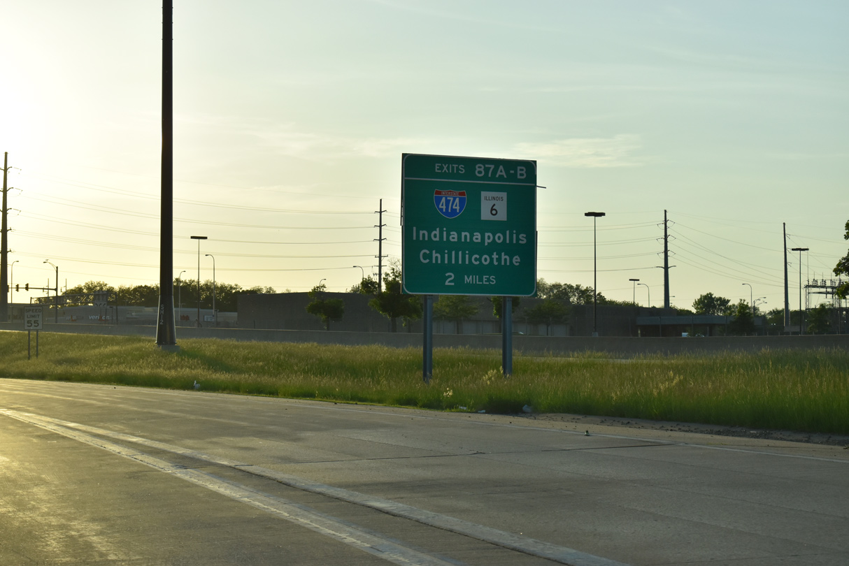
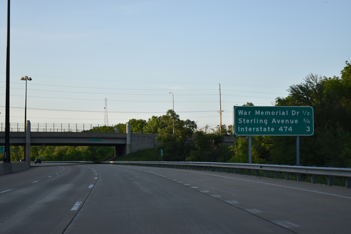
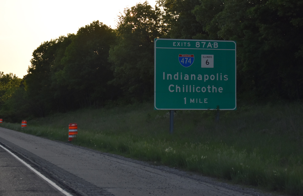
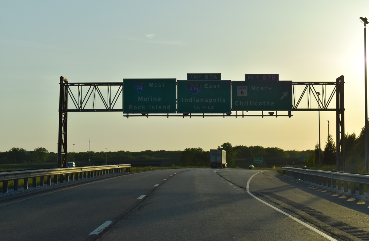
Interstate 474 west and IL 6 south come together with I-74 at a directional cloverleaf interchange (Exit 87) in two miles.
05/24/18

The freeway transitions from urban to rural design ahead of Big Hollow Creek and Interstate 474.
05/24/18
Interstate 474 loops west and south by way of Bellevue, Bartonville and Creve Coeur to provide a bypass route of Peoria. Completed in December 1979, I-474 travels 14.88 miles overall.
05/24/18
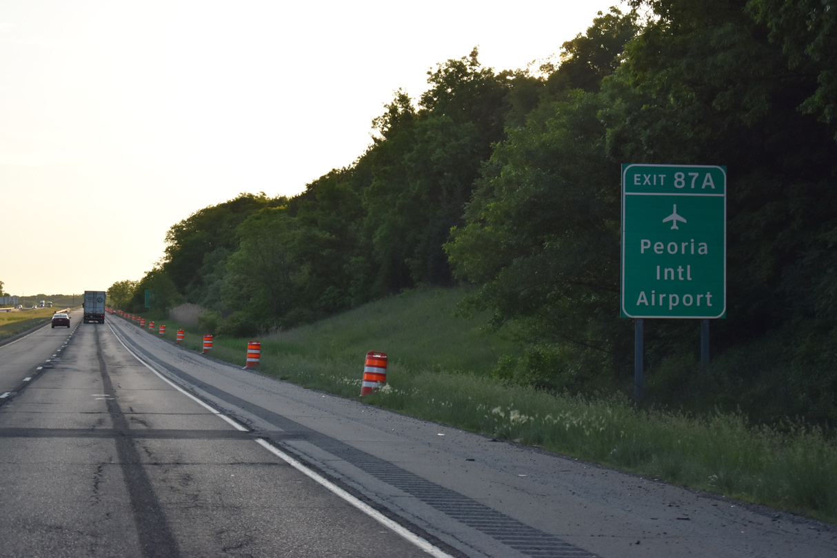
Forthcoming Interstate 474 leads five miles south from Exit 87 A to Greater Peoria Regional Airport (PIA).
05/24/18
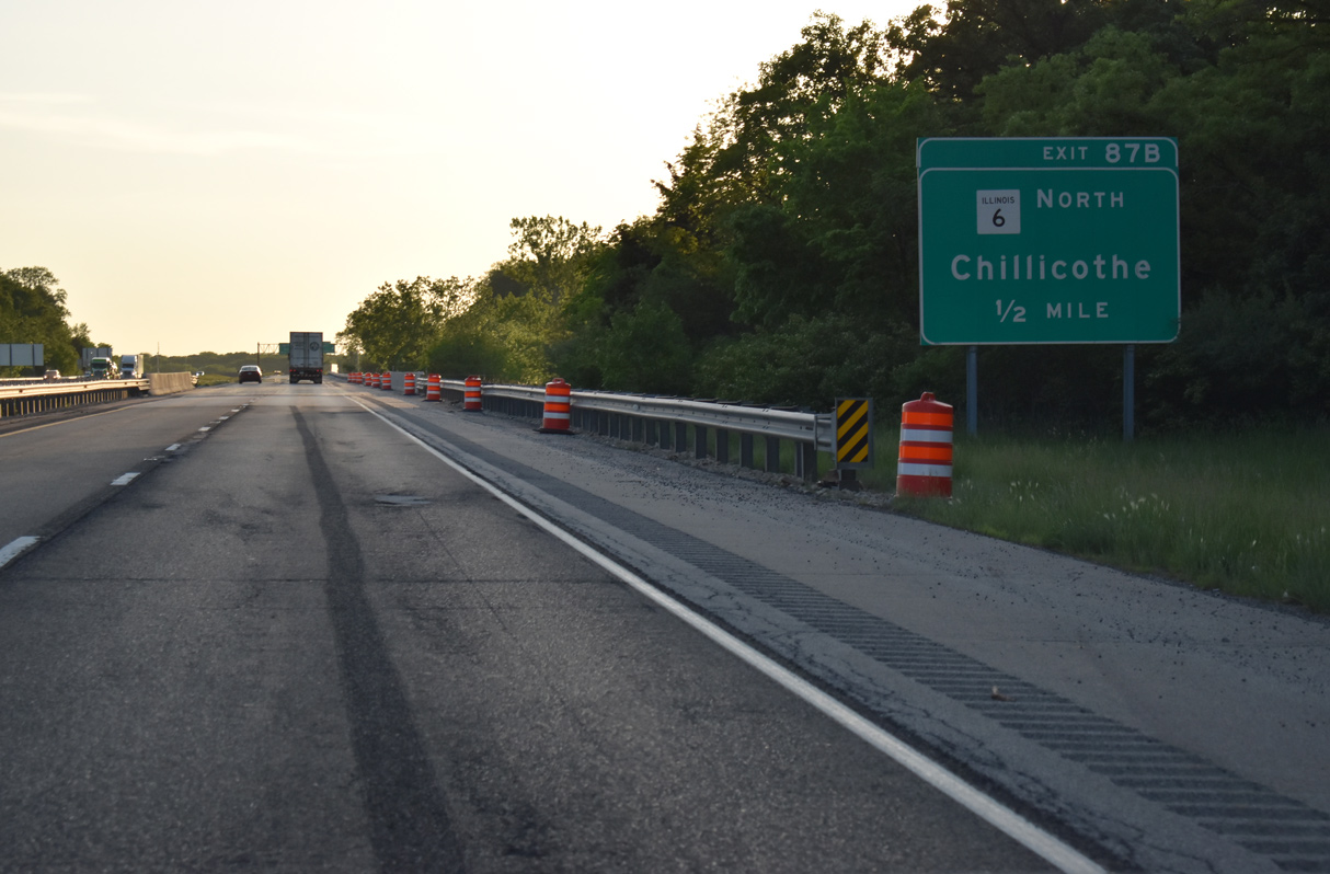
Exit 87 B leaves Interstate 74 west in one half mile for IL 6 north to Chillicothe (via IL 29). IL 6 comprises a 10.10 mile long freeway spur to IL 29 at Mossville.
05/24/18
IL 6 ends at a trumpet interchange and connector road to IL 29, eight miles south of Chillicothe. A stub at the north end alludes to two possible projects: an extension of IL 6 across the Illinois River to a freeway leading south back to I-474 at East Peoria, and a plan for either a new freeway north to I-180 or a tie in with an upgraded IL 29 expressway with bypasses of Chillicothe and Henry. Additional details on these proposals can be found on the AARoads Blog post - Corridors to Peoria.
05/24/18
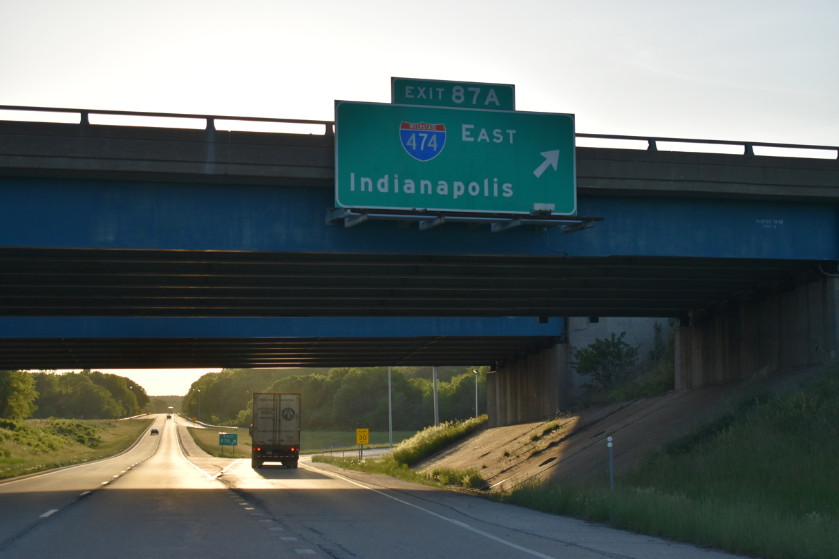
Exit 87 A loops onto the IL 6 freeway ahead of its transition to Interstate 474 east.
05/24/18


References:
- Murray Baker Bridge. Wikipedia.
Photo Credits:
- Alex Nitzman: 05/24/08, 05/24/18
Connect with:
Page Updated Wednesday June 06, 2018.