
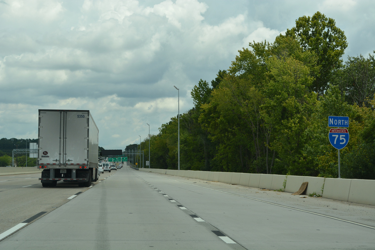
Interstate 75 North - Chattanooga
 North
North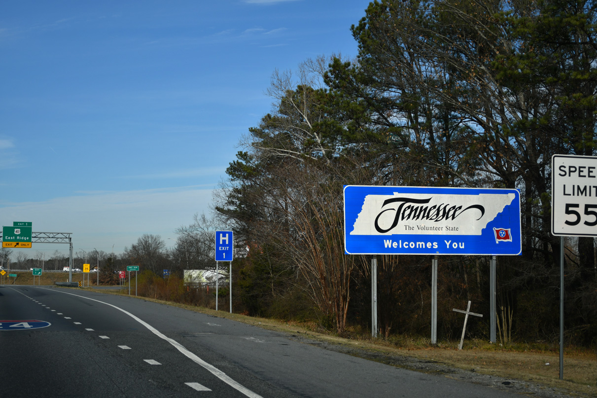
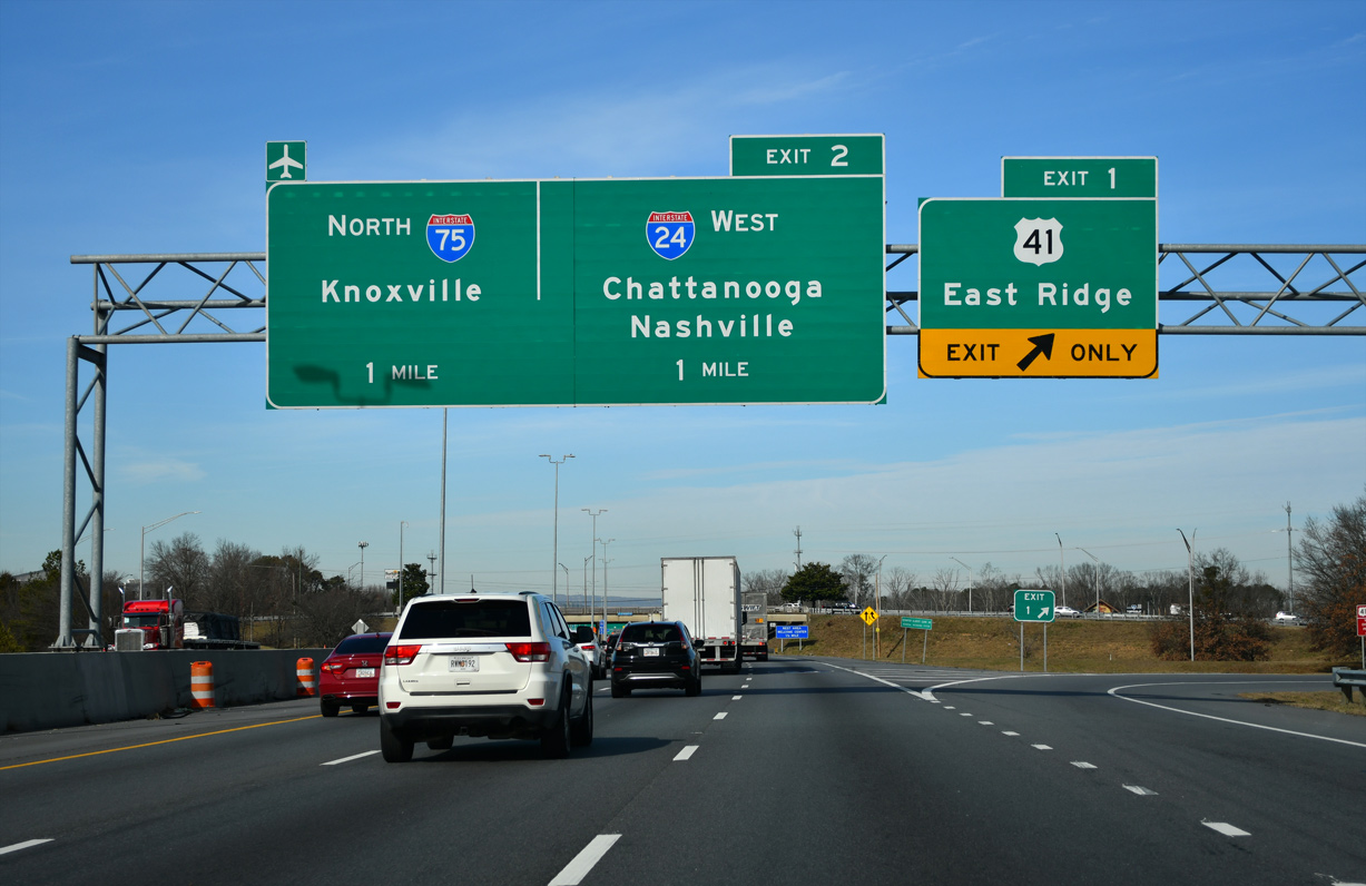
Interstate 75 enter a parclo interchange (Exit 1) with U.S. 41/76 (Ringgold Road) just beyond the state line at East Ridge. U.S. 41/76 (Ringgold Road) west converge with I-24 at Exit 181 A en route to Downtown Chattanooga.
12/20/23
The loop ramp (former Exit 1 B) to U.S. 41/76 west was removed during the I-75/I-24 interchange modification project in 2020. U.S. 41/76 overlap southeast to Indian Springs and Dalton, Georgia.
12/20/23
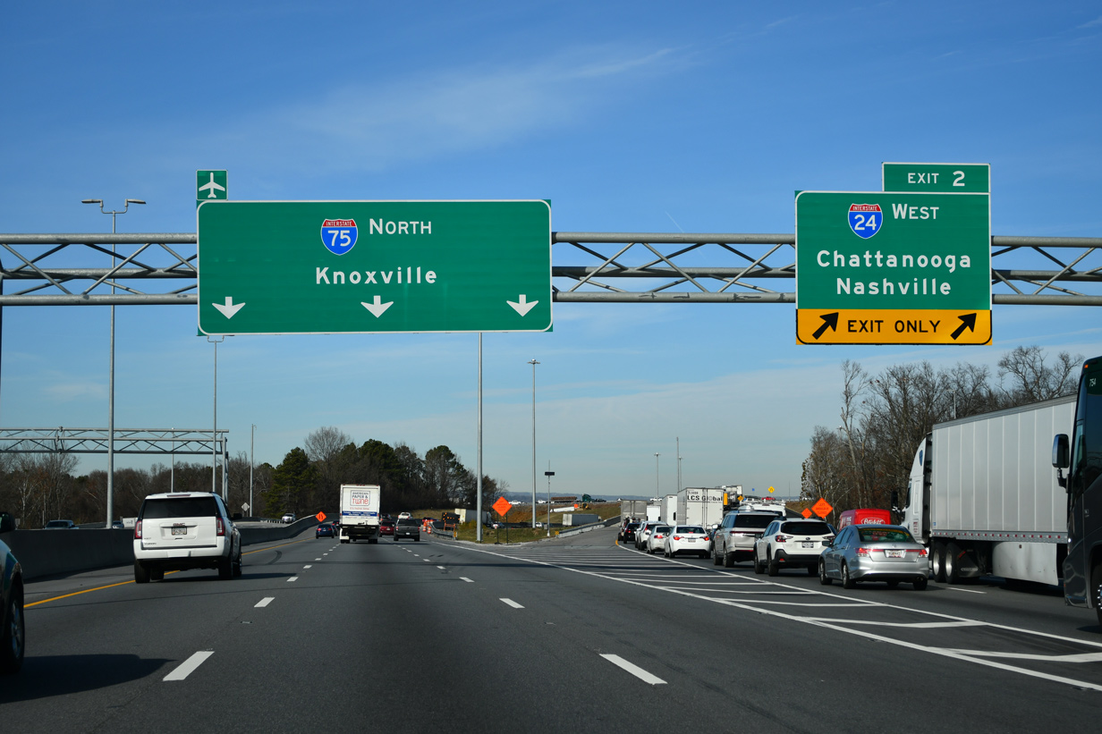
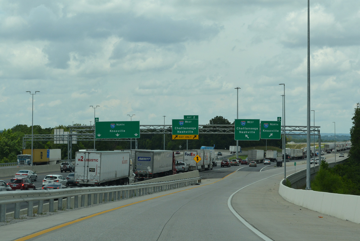
The Tennessee Welcome Center along I-75 northbound precedes Spring Creek and the partition with Interstate 24 west.
12/20/23
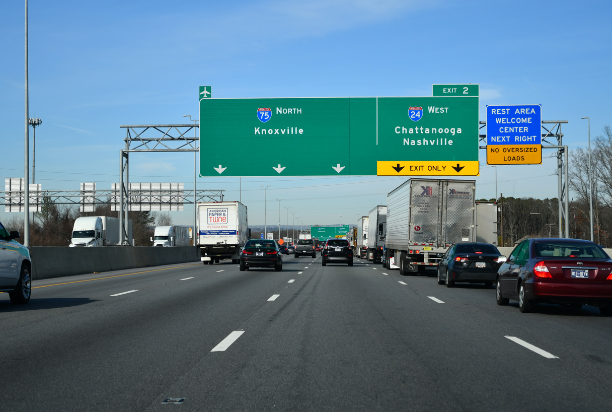
A $132.644 million contract was awarded on December 21, 2018 for the I-75/I-24 interchange modification project. Construction from Fall 2019 to late Summer 2021 rebuilt the three-wye interchange at Exit 2 to relocate left side ramps along northbound Interstate 75.1
12/20/23
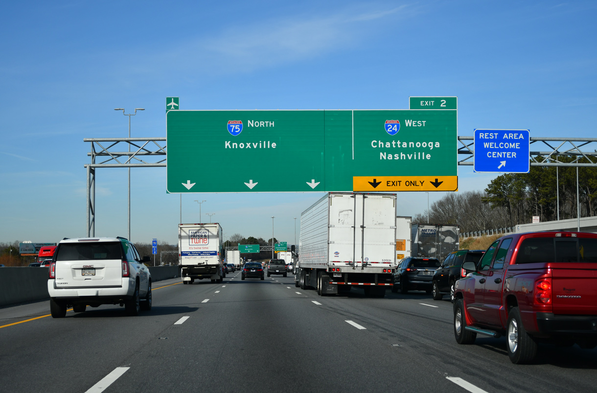
I-75 and I-24 meet just south of the former the Eastgate Town Center (former Eastgate Mall) along U.S. 11/64. 2019-21 modifications at Exit 2 shifted the two lane off-ramp for I-24 from the inside to the outside lanes.
12/20/23
Interstate 24 travels west through Chattanooga to Lookout Mountain before dipping south across the state line in 14.71 miles.
12/20/23
A distributor roadway system was added to separate merging traffic from the Tennessee Welcome Center to the adjacent exchange joining I-24/75.
07/26/22
With traffic added from I-24 east, Interstate 75 heads eastward across South Chickamauga Creek 1.5 miles to Exit 3 / SR 320.
07/26/22

Succeeding ramps depart for SR 320 (E Brainerd Road) and SR 153 north.
12/20/23
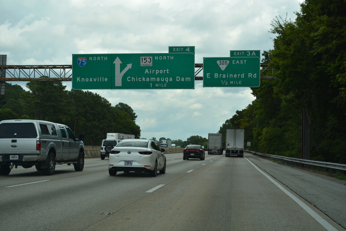
SR 153 constitutes a freeway spur leading northwest through Chattanooga to nearby Chattanooga Airport and across Chickamaunga Dam.
07/26/22
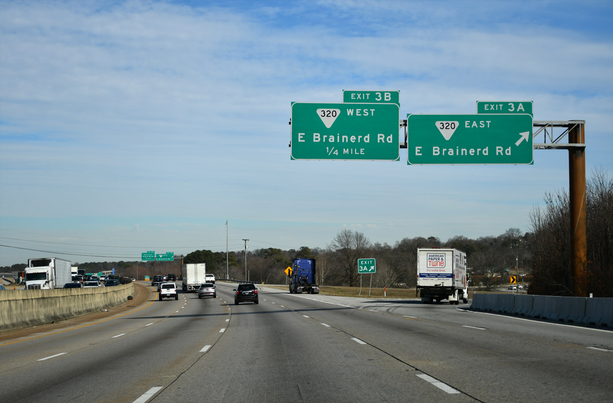
SR 320 (E Brainerd Road) weaves through suburban areas east from Exit 3 A, 5.5 miles to SR 321 in the community of East Brainerd.
12/20/23

SR 320 (E Brainerd Road) extends 1.7 miles west from Exit 3 B to U.S. 11/64 near Chattanooga Metropolitan Airport (CHA).
12/20/23
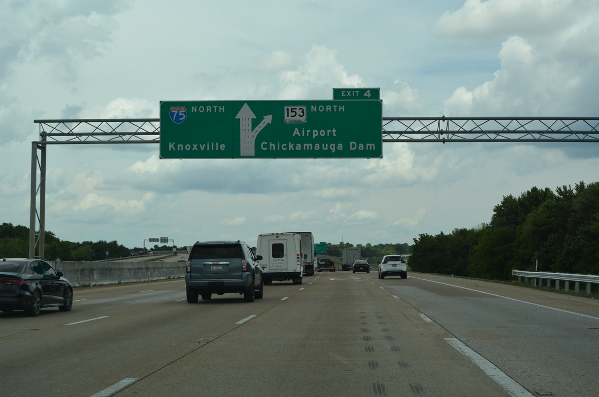
A two lane flyover (Exit 4) connects Interstate 75 north with SR 153 north. SR 153 runs 13 miles north to U.S. 27 between Hixon in north Chattanooga and Falling Water.
07/26/22
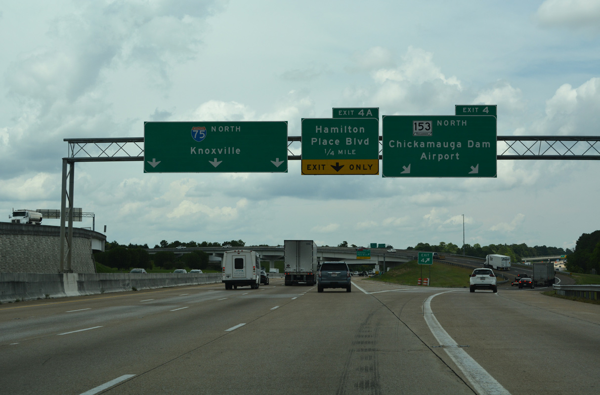
The directional T interchange (Exit 4) with SR 153 was rebuilt in 2003 to eliminate left side ramps. Exit 4 A departs from within the exchange to Hamilton Place Boulevard.
07/26/22
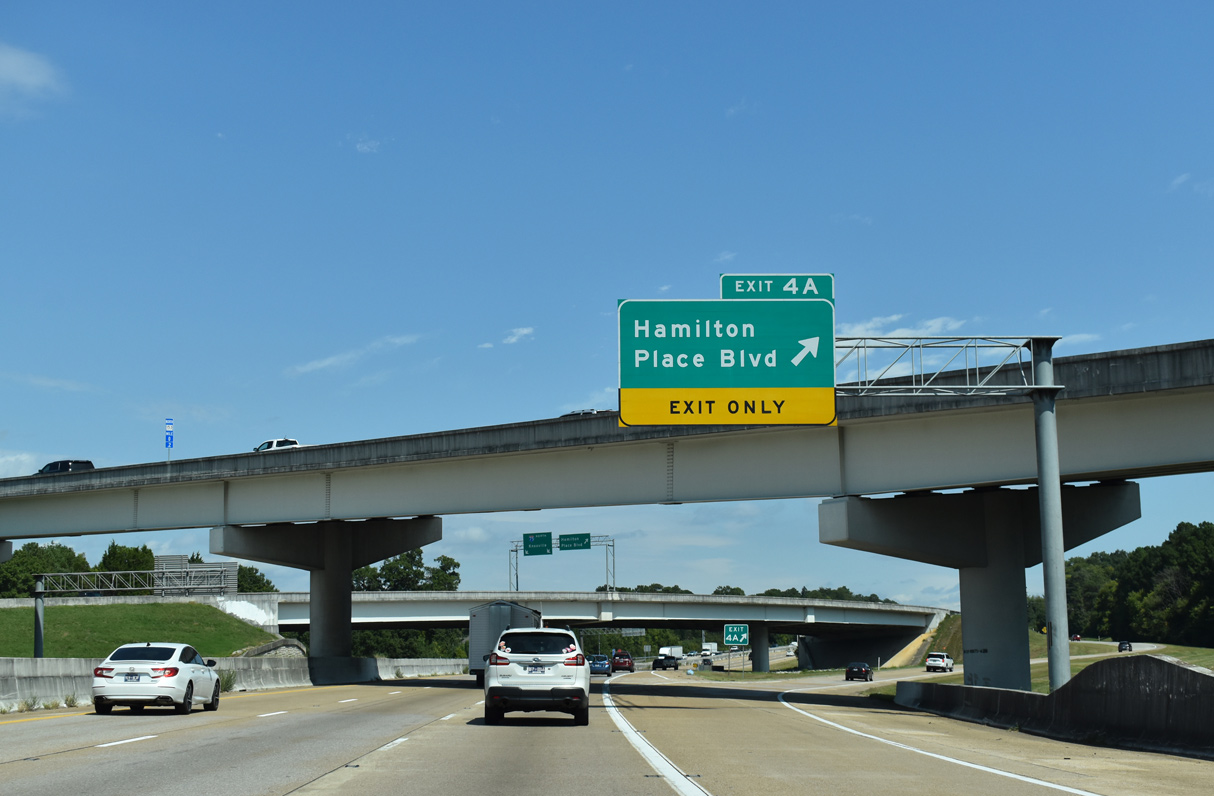
Hamilton Place Boulevard forms part of the east side frontage road system for I-75 by Hamilton Place mall.
09/22/22
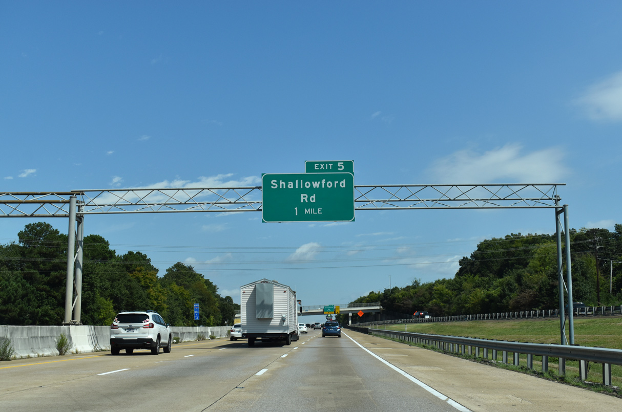
A diamond interchange (Exit 5) joins I-75 with Shallowford Road in one mile.
09/22/22
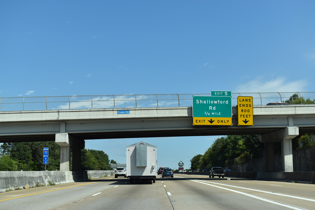
A loop ramp connects Hamilton Place Boulevard with I-75 southbound beyond the Franks Road overpass.
09/22/22
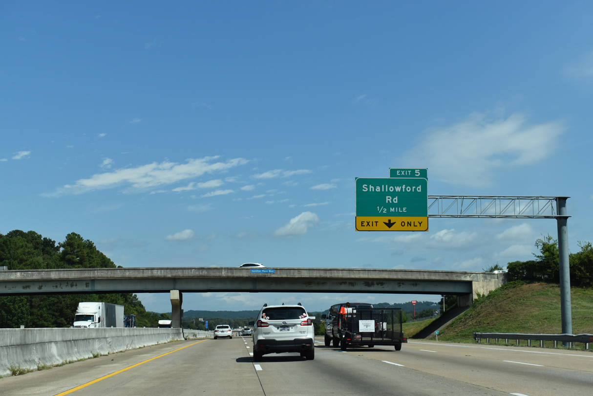
Shallowford Road constitutes a five lane commercial boulevard within the immediate vicinity of Interstate 75.
09/22/22
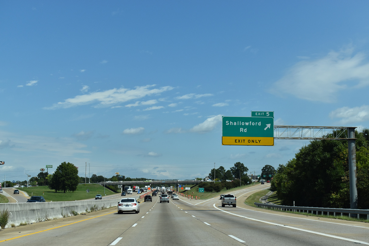
Shallowford Road winds west from parallel U.S. 11/64 to industrial areas north of Chattanooga Airport. East from Exit 5 and adjacent big box retail, Shallowford Road continues into residential areas.
09/22/22
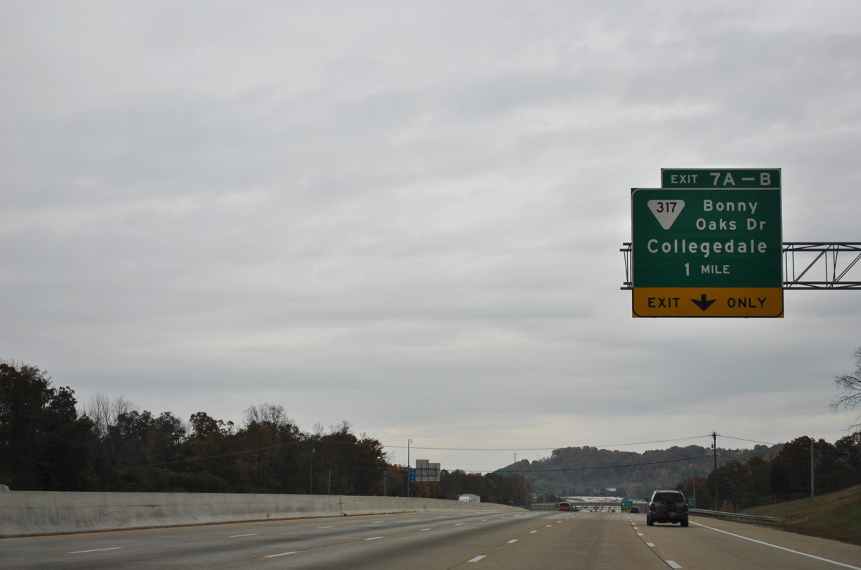
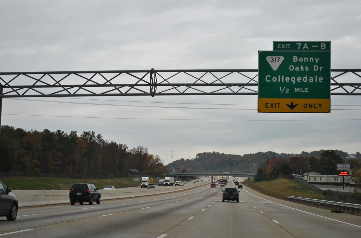
Advancing northeast, Interstate 75 separates with a collector distributor roadway (Exit 7) at U.S. 11/64 (Bonny Oaks Drive) and SR 317.
11/03/11
Although not referenced on guide signs northbound, Bonny Oaks Drive leads U.S. 11/64 west from I-75 to adjacent Lee Highway.
11/03/11
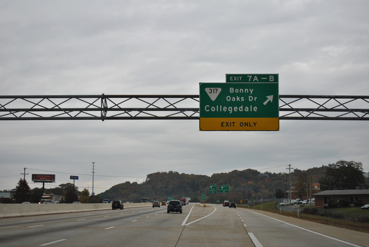
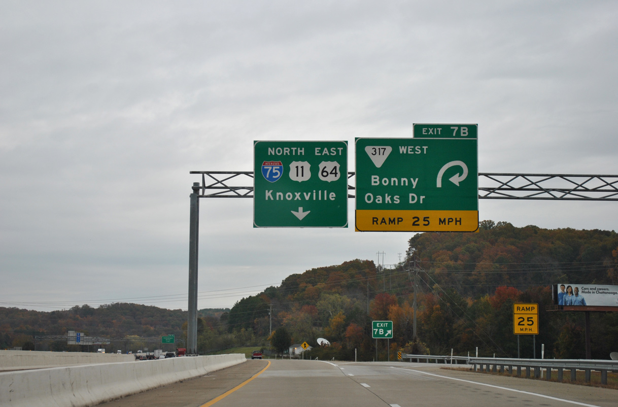
Two lanes part ways with I-75 north for the c/d roadway and six-ramp parclo interchange with SR 317 (Bonny Oaks Drive) west, Jenkins Road south and Old Lee Highway north.
11/03/11
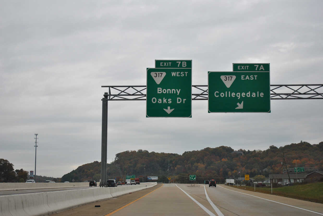
Sign changes corrected the overhead for Exit 7 A, which erroneously referenced SR 317 east to Collegedale, the subsequent exit from I-75 northbound. Exit 7 A connects with Jenkins Road south and Old Lee Highway north.
11/03/11
SR 317 overlaps with U.S. 11/64 to Lee Highway along its five mile course to SR 17 and SR 58 by Lake Hills in Chattanooga.
11/03/11
 North
North  East
East
U.S. 11 north and U.S. 64 east combine with I-75 north for 3.7 miles to Exit 11. Volkswagen Drive east and SR 317 along Apison Pike west converge with the freeway at the ensuing exit.
11/03/11
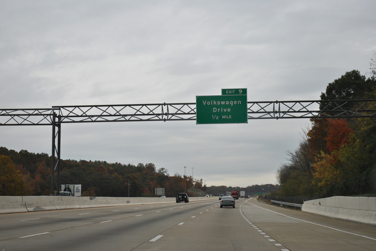
The six-ramp parclo interchange at Exit 9 was constructed to join I-75 with the Volkswagen Chattanooga plant to the northwest. The facility was built at the site of the Volunteer Army Ammunition Plant.
11/03/11
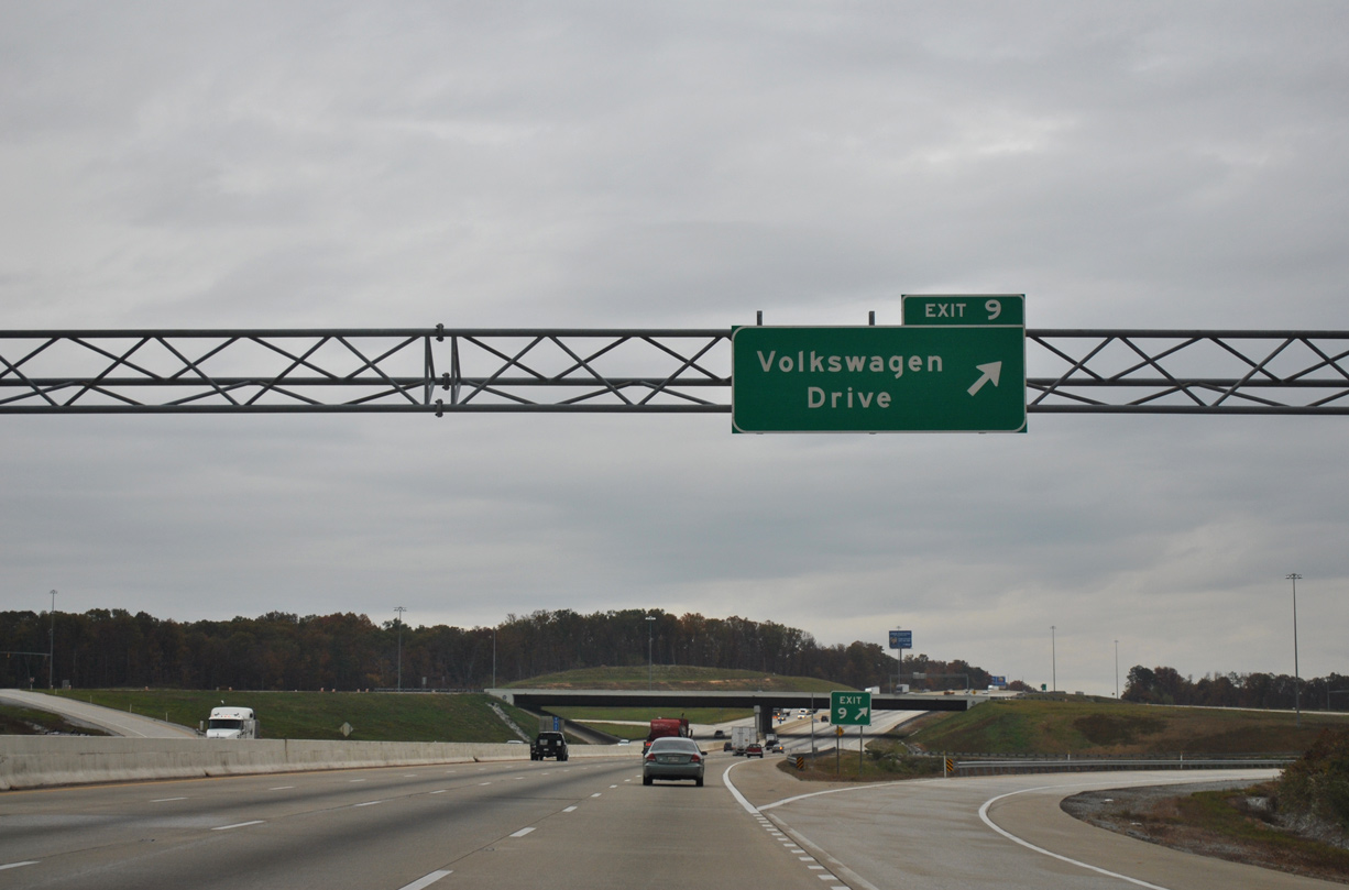
SR 317 branches east from Interstate 75 at Exit 9 through the community of Ooltewah and portions of east Chattanooga. SR 317 continues through the city of Collegedale.
11/03/11
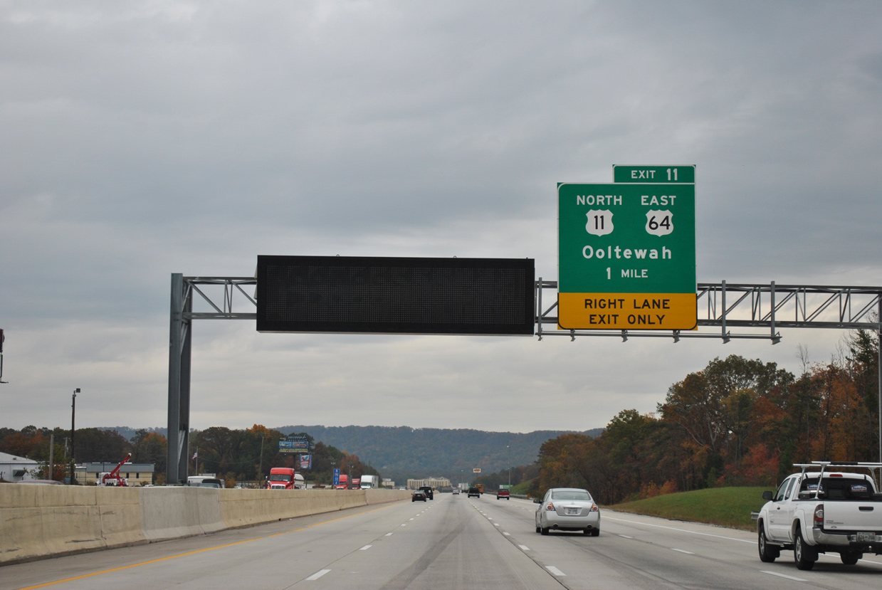
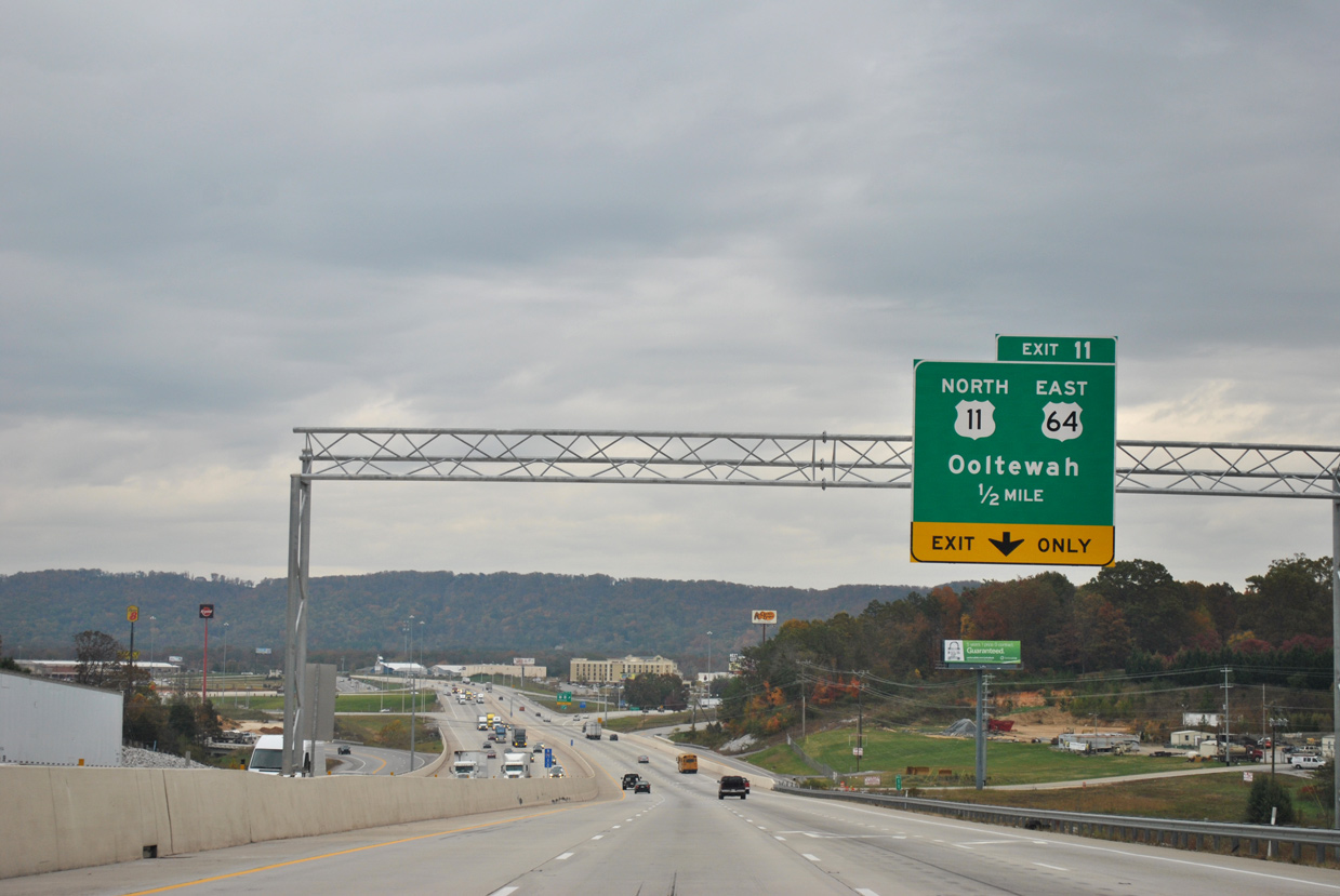
U.S. 11 north and U.S. 64 east split with Interstate 75 at a parclo interchange (Exit 11) next.
11/03/11
White Oak Mountain rises to the east of I-75 and Ooltewah. U.S. 11/64 cross the mountain range at Dead Man Gap 1.5 miles east of Exit 11.
11/03/11
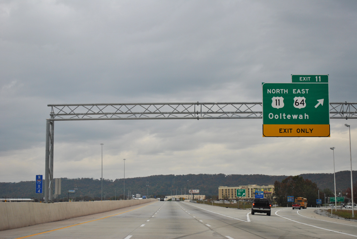
U.S. 11/64 constitute a commercial arterial east from I-75 / Exit 11 within the vicinity of Ooltewah. Their overlap continues northeast to Cleveland.
11/03/11
North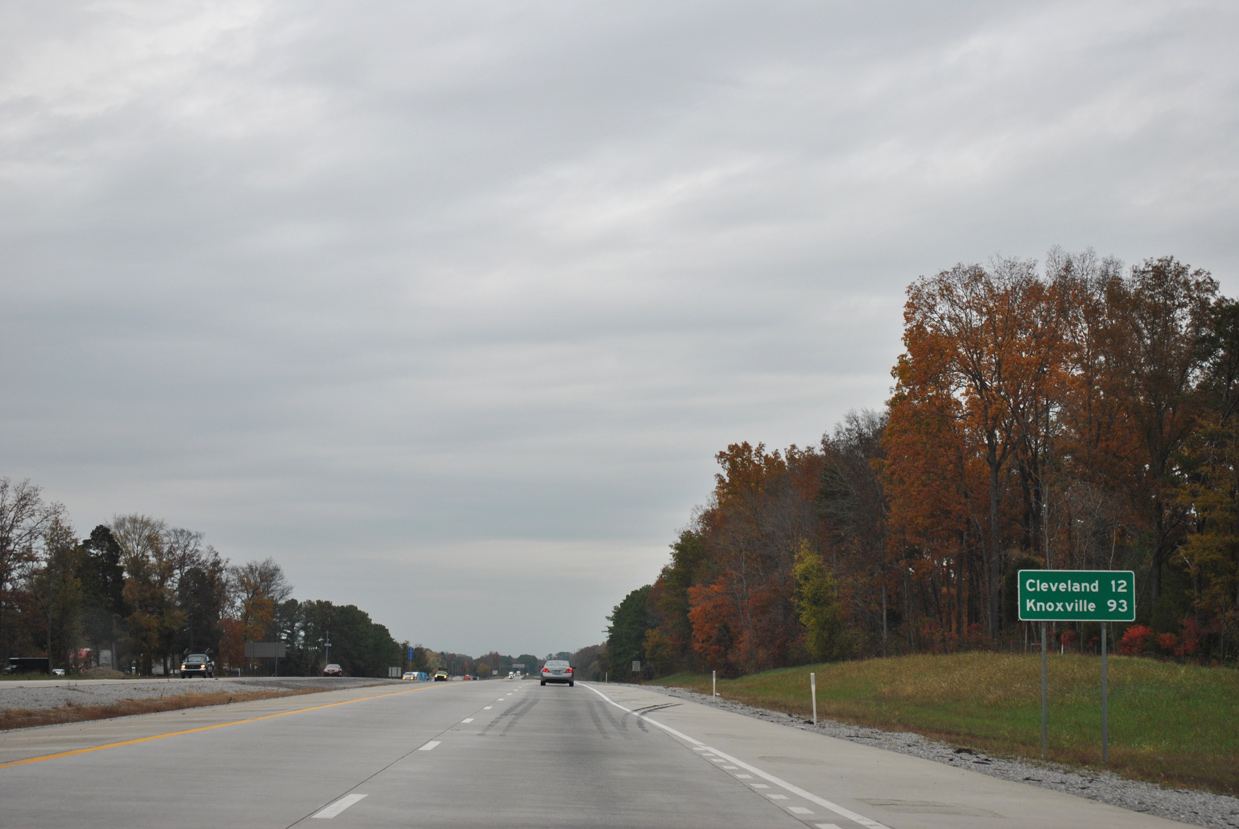
An 8.6 mile exit less stretch leads Interstate 75 northeast toward the Bradley County seat of Cleveland.
11/03/11
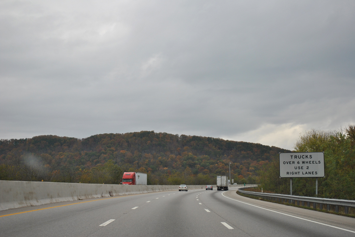
Approaching Green Gap across White Oak Mountain, semi trucks are restricted from the left lane of I-75 due to the elevation gain.
11/03/11
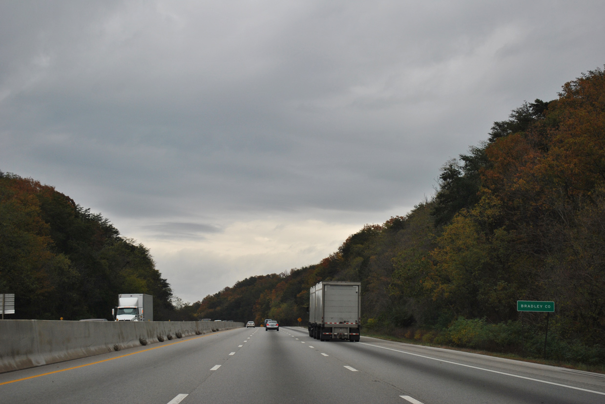
The Bradley County line crosses White Oak Mountain at Green Gap.
11/03/11


References:
- Interstate 75 Interchange at Interstate 24 - Timeline.
https://www.tn.gov/tdot/projects /region-2/i-75-interchange-at-i-24/ i-75-interchange-at-i-24-timeline.htmlTennessee Department of Transportation (TDOT), project web site.
Photo Credits:
- Alex Nitzman: 12/20/23
- Alex Nitzman, JP Nasiatka: 07/26/22
- Brent Ivy: 09/22/22
- ABRoads: 11/03/11
Connect with:
Page Updated Thursday July 25, 2024.