
Interstate 75 North - West Chester Township to Miamisburg

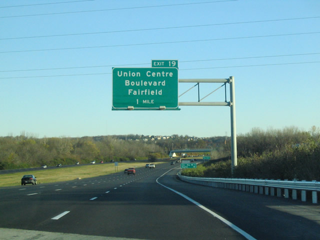
Continuing north from I-275, Interstate 75 enters Butler County and West Chester Township ahead of Exit 19 for Union Centre Boulevard.
11/13/04
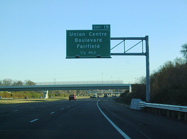
Union Centre Boulevard encircles an area of distribution centers and warehouses northwest 2.9 miles to SR 747, then continues another 1.1 miles west by additional logistics centers into the city of Fairfield.
11/13/04
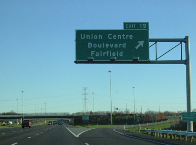
Roadwork in 2019/20 converted the diamond interchange (Exit 19) with Union Centre Boulevard into a DDI.
11/13/04

Cincinnati Dayton Road heads 1.75 miles north from Union Centre Boulevard to the diamond interchange at Exit 21.
11/13/04
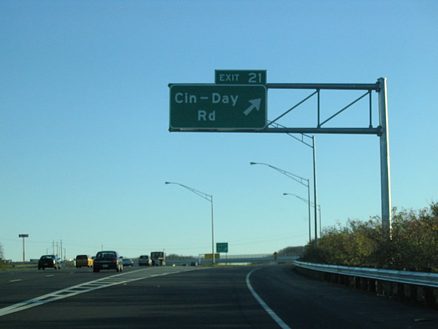
Cincinnati Dayton Road continues north 1.1 miles from I-75 to Tylersville Road at the unincorporated community of Maud.
11/13/04
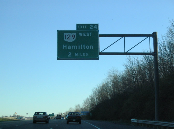
SR 129 stems west from a trumpet interchange (Exit 22) with Interstate 75 in two miles along a freeway to the Butler County seat of Hamilton.
11/13/04
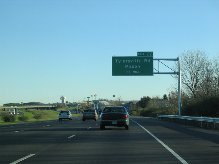
Tylersville Road runs east from Tylersville and Maud to a commercialized diamond interchange (Exit 22) with Interstate 75.
11/13/04
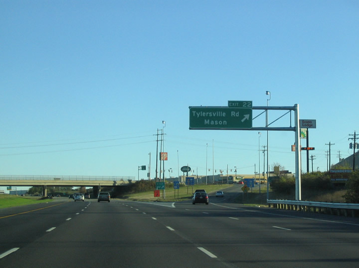
Tylersville Road heads 2.8 miles east from Interstate 75 to U.S. 42 (Reading Road) in the city of Mason.
11/13/04
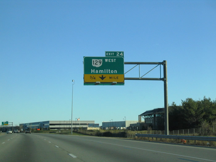
Exit 24 was expanded to incorporate new ramps with Liberty Way, an arterial paralleling SR 129 by the Liberty Center retail complex.
11/13/04
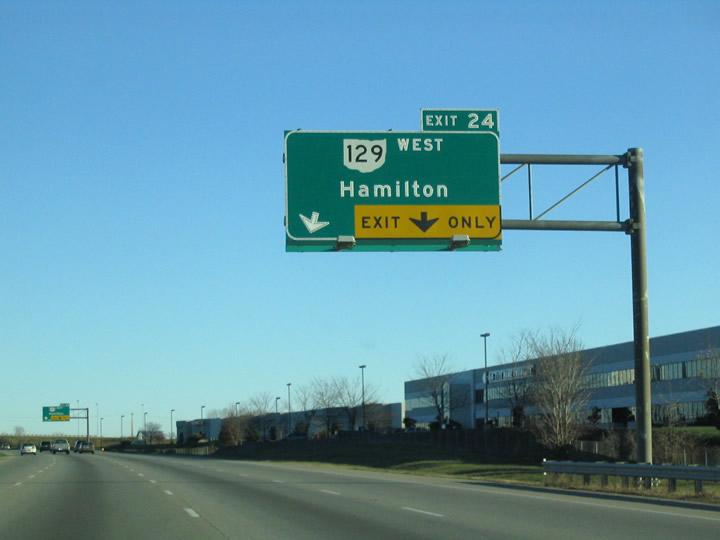
SR 129 extends west onto High Street from the freeway end at Hampshire Drive to Downtown Hamilton and Main Street spanning the Great Miami River.
11/13/04
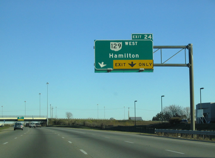
State Route 129 travels 25.2 miles west from Interstate 75 to SR 126 adjacent to Indiana State Road 252 in Morgan Township. SR 129 originally ended at SR 747, and was extended eastward to Exit 24 in 1999.
11/13/04

Exit 24 previously separated from I-75 northbound at the Liberty Way over crossing. Liberty Way leads west to Cincinnati Dayton Road by the Wetherington community and to Voice of America MetroPark and Mason Road at Deerfield Township.
11/13/04
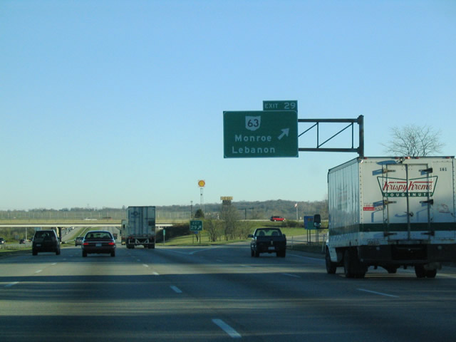
A single point interchange (Exit 29) connects Interstate 75 with SR 63 (Hamilton Lebanon Road) north beyond the Butler Rest Areas. SR 63 is an arterial running west to SR 4 (Wright Brothers Memorial Highway) in west Monroe and east to U.S. 42 in the Warren County seat of Lebanon.
11/13/04
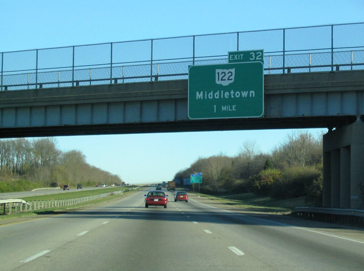
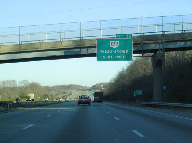
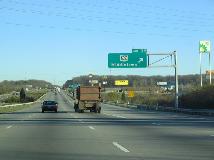
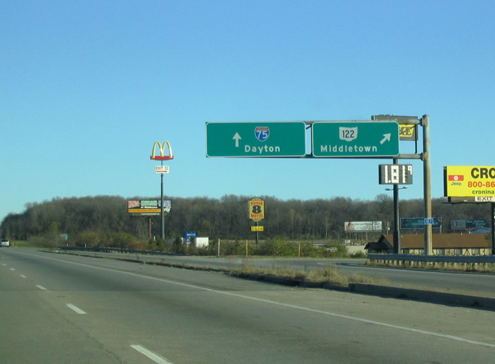
Interstate 75 heads northward from Monroe to SR 122 in the city of Middletown. Warren County Route 20 crosses I-75 one mile ahead of the parclo interchange at Exit 32. SR 122 serves Atrium Medical Center, Middletown Regional Airport (MWO) and Miami University Middletown.
11/13/04
SR 122 constitutes a commercial arterial west from Exit 32 and the community of Blue Ball onto Roosevelt Boulevard. The state route shifts north onto University Boulevard toward Downtown Middletown.
11/13/04
SR 122 heads four miles east from Interstate 75 to SR 123/741 at Red Lion and 6.6 miles to SR 48 in Clear Creek Township. SR 122 west extends 36 miles to Gratis, Eaton and Old 122 (former SR 122) ahead of Boston, Indiana
11/13/04
Connected by a c/d roadway, loop ramps previously joined northbound I-75 and SR 122 at Exit 32. The loop ramp in the northeastern quadrant was replaced with a separate ramp linking SR 122 west with I-75 north while a new ramp was constructed for Exit 32 in the southeast quadrant of the exchange.
11/13/04
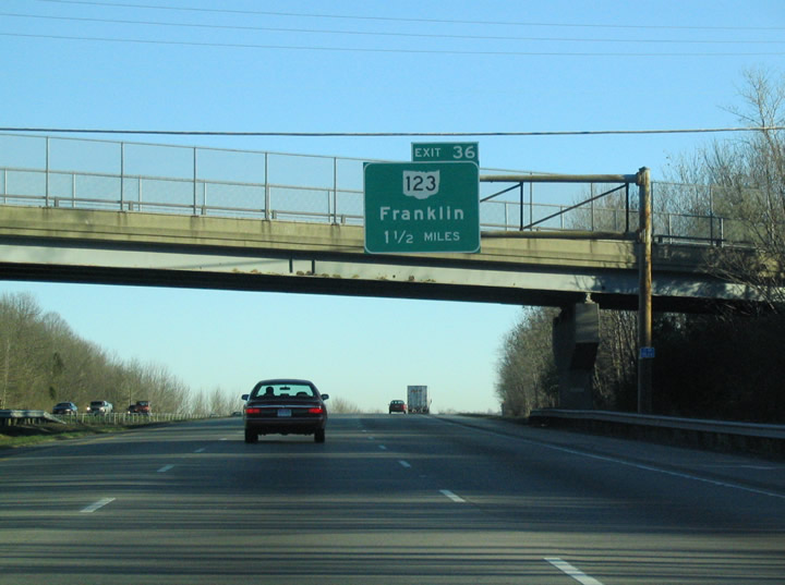
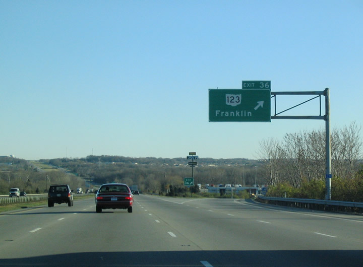
Curving northeast, Interstate 75 advances to meet SR 123 (Franklin Lebanon Road) in the city of Franklin. SR 123 angles 4.2 miles northwest from SR 122 at Red Lion to the diamond interchange at Exit 36.
11/13/04
SR 123 combines with SR 73 (Riley Boulevard) north in 1.2 miles at E 6th Street outside Downtown Franklin. SR 123 continues northwest from Franklin to Carlisle and SR 4 near Germantown.
11/13/04
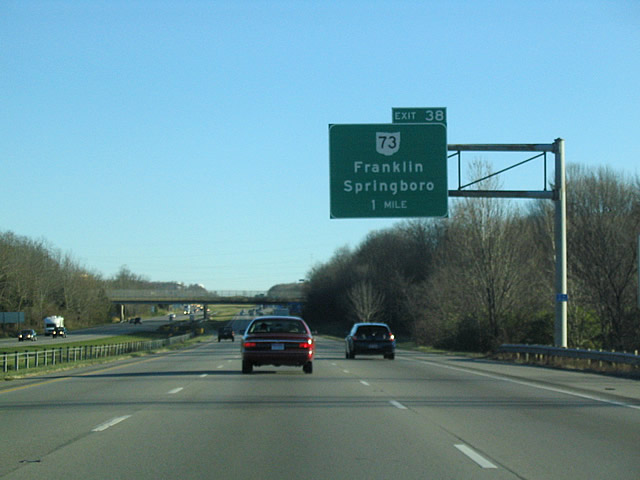
SR 73 branches east from Riley Boulevard along E 2nd Street 1.75 miles to Interstate 75 at Exit 38 along the Franklin and Springboro city line.
11/13/04
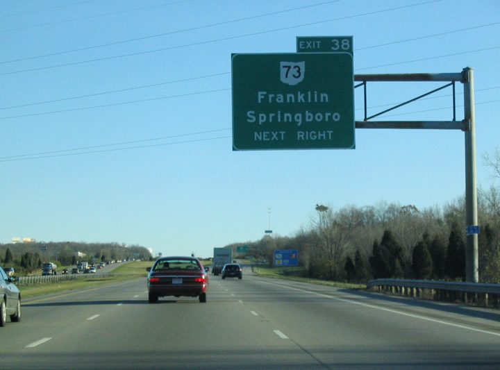
SR 73 continues two miles east along Central Avenue to SR 741 (Main Street) in central Springboro. The state route joins Springsboro with U.S. 42 at Waynesville, 10.4 miles east from I-75.
11/13/04
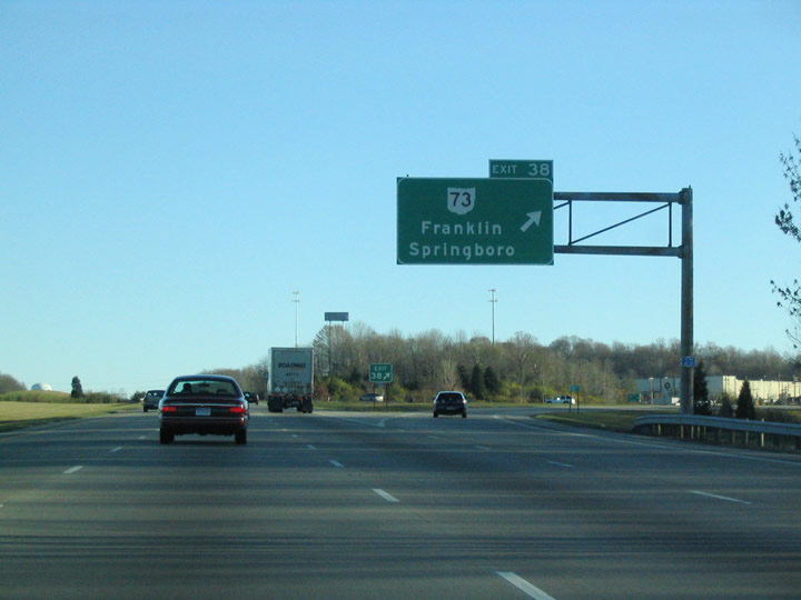
Interstate 75 north at the parclo interchange (Exit 38) with SR 73 (E 2nd Street / Central Avenue). Overall SR 73 travels 134.80 miles between U.S. 27 at Oxford and U.S. 23/SR 104 at Portsmouth.1
11/13/04
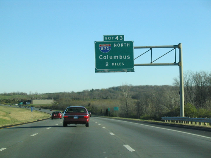
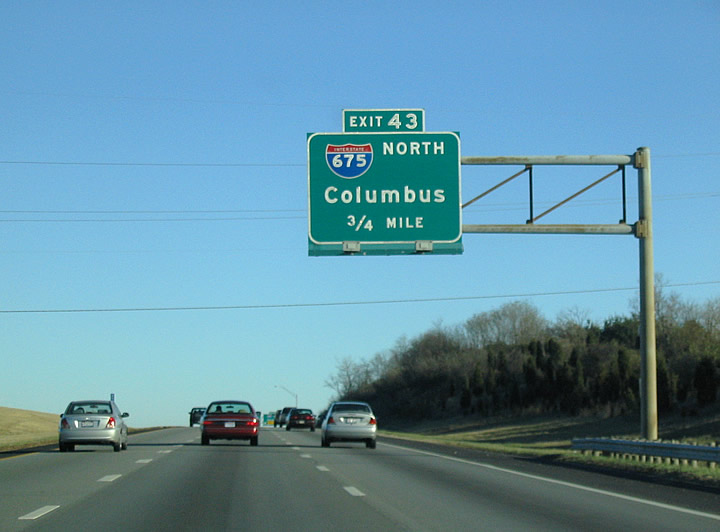
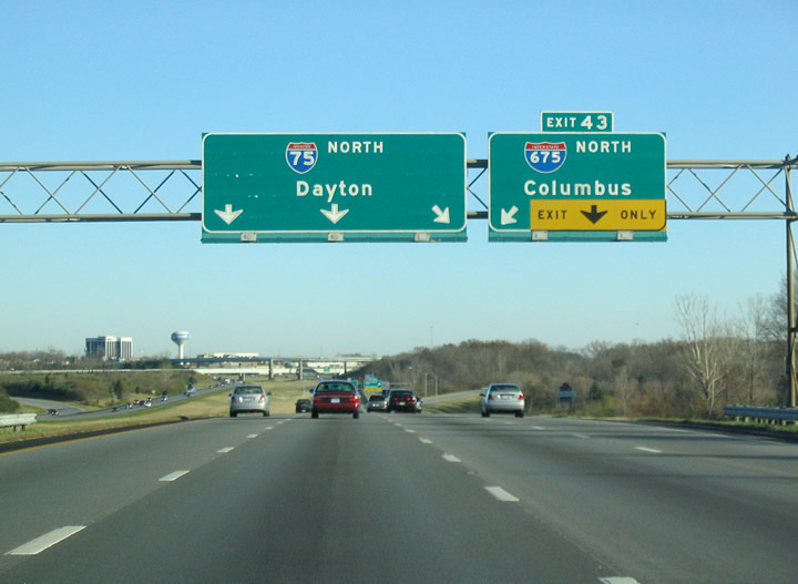
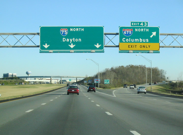
I-75 crosses the Montgomery County line ahead of the diamond interchange (Exit 41) with Austin Boulevard. Dedicated on August 16, 2010 and costing $20 million to built, the exchange opened two months ahead of schedule on July 2, 2010.2 Exit 41 departs I-75, 1.4 miles ahead of Exit 43 for Interstate 675.
11/13/04
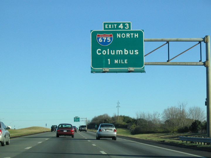
Interstate 675 constitutes an outer bypass route of Dayton and Kettering from Exit 43 northeast to I-70 near Medway.
11/13/04
Measuring 26.53 miles in length, Interstate 675 runs east to Centerville before turning north through Beavercreek to Fairborn and Wright-Patterson Air Force Base.
11/13/04
I-675 was approved as a future Interstate in 1962. The freeway loop opened between I-70 and Exit 15 in 1976, and between I-75 and Exit 4 / SR 48 in 1986. Interstate 675 fully opened to traffic by 1989.3
11/13/04
Interstate 675 travels 13.4 miles to the freeway along U.S. 35 at Beavercreek and 15.2 miles to the south entrance to Wright Patterson Air Force Base. I-675 connects with I-70 across from Spangler Road (CR 335) in Mad River Township, west of Springfield.
11/13/04
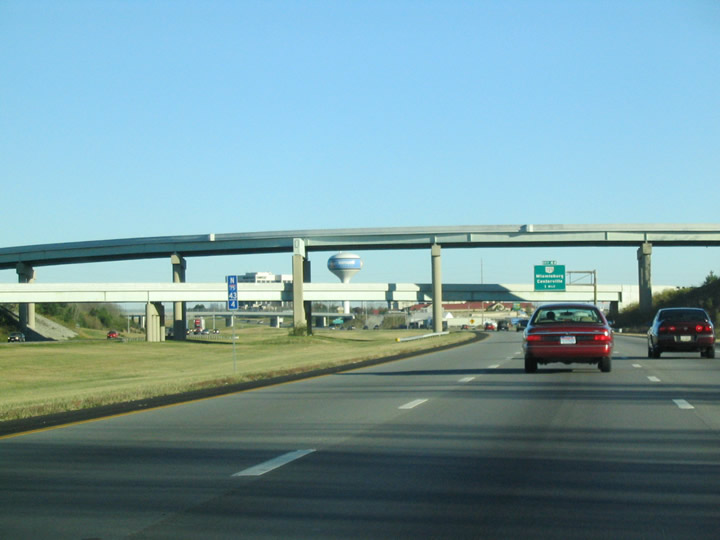
The directional T interchange joining I-75/675 spreads east of the Miamisburg city line in Miami Township.
11/13/04


References:
- Ohio State Route 73. AARoads Wiki.
- "Austin Boulevard interchange ramps opening today." Dayton Daily News (OH), July 2, 2010.
- Route 675.
http://pages.prodigy.net/ john.simpson/highways/675.htmlThe Unofficial Ohio State Highways Web Site (John Simpson).
Photo Credits:
- Carter Buchanan: 11/13/04
Connect with:
Page Updated Wednesday March 20, 2024.