
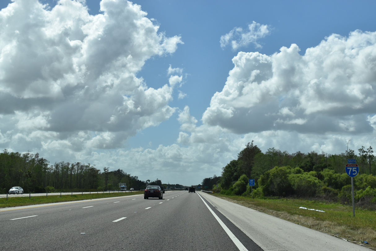
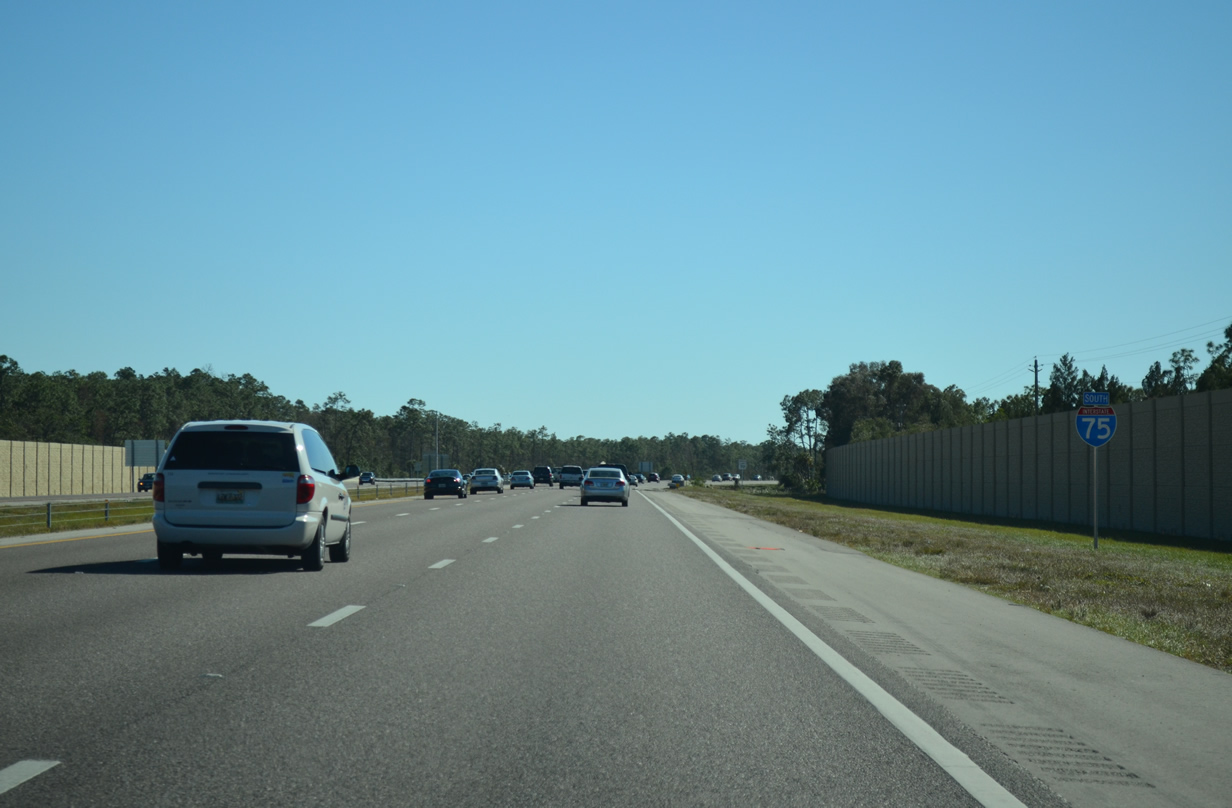
Interstate 75 South - Lee County
 South
South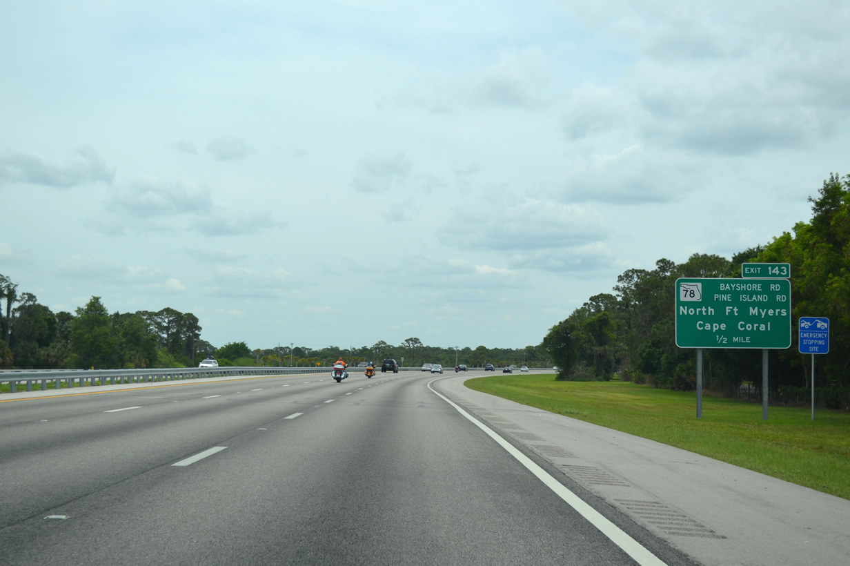
SR 78 constitutes an 18.94 mile highway between CR 765 (Burnt Store Road) in west Cape Coral and SR 31 by the Lee County Civic Center. SR 78 carries two lanes east of I-75 and up to six lanes west of Exit 143.
04/30/16
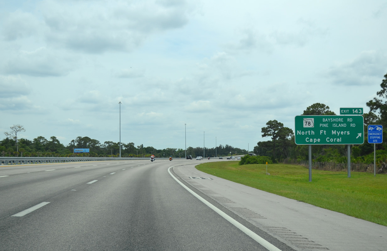
Interstate 75 south enters the diamond interchange (Exit 143) with SR 78 (Bayshore Road).
04/30/16
SR 78 west navigates through North Fort Myers and Cape Coral. North Fort Myers is an unincorporated area lying north of the Caloosahatchee River along U.S. 41 Business. Cape Coral lies further west and is the largest incorporated city in Lee County.
08/28/18
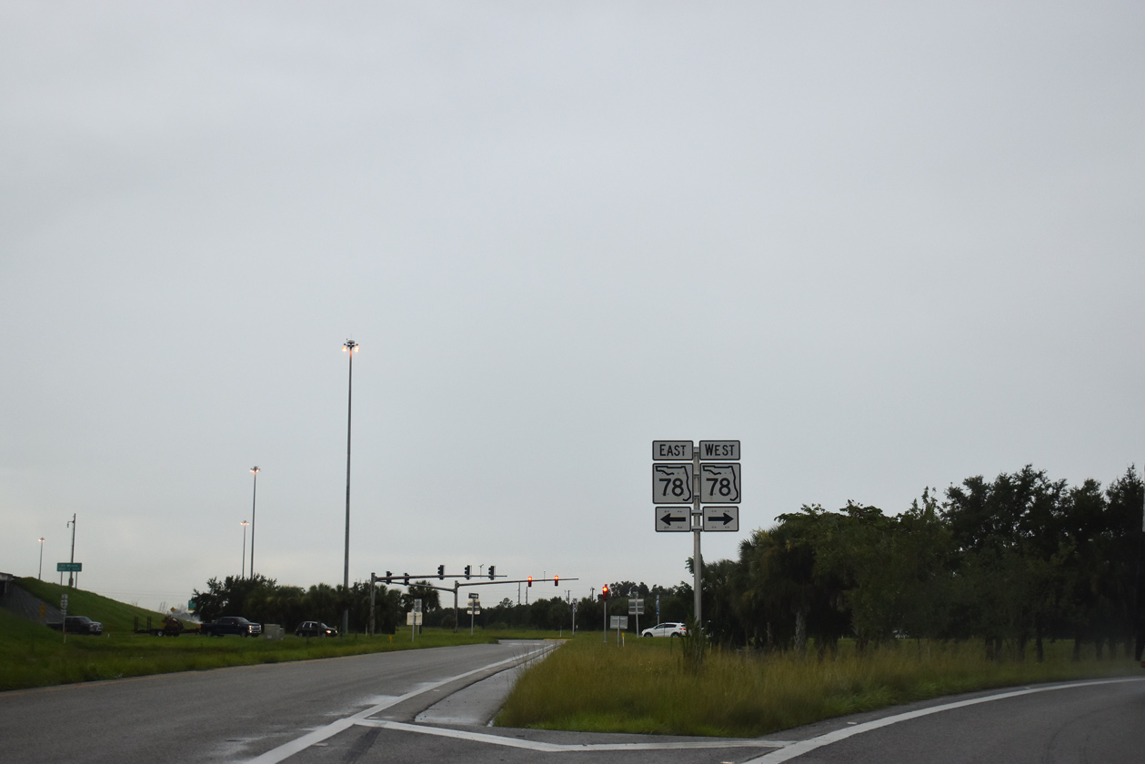
Sections of County Road 78 exist both to the west and east in Lee County. A second State Road 78 segment also exists between U.S. 27 in Glades County and U.S. 98/441 in Okeechobee.
08/28/18
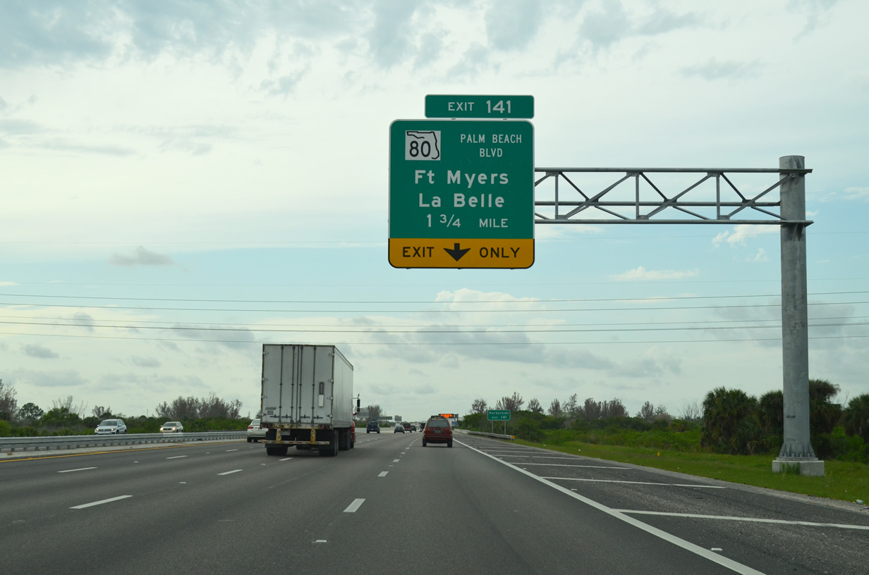
The first of four Fort Myers based interchanges lies 1.76 miles ahead with State Road 80. SR 80 (Palm Beach Boulevard) provides a connection between Fort Myers and Palm Beach on the Atlantic coast. Totaling 123.9 miles, the state road passes through La Belle, Clewiston, and Belle Glade on its trek across the peninsula.
Fort Myers was named after Abraham Myers, a colonel during the Seminole Indian Wars in the 1850s, and has hosted many famous winter residents, including Thomas Edison, Henry Firestone, and Henry Ford.
04/15/16
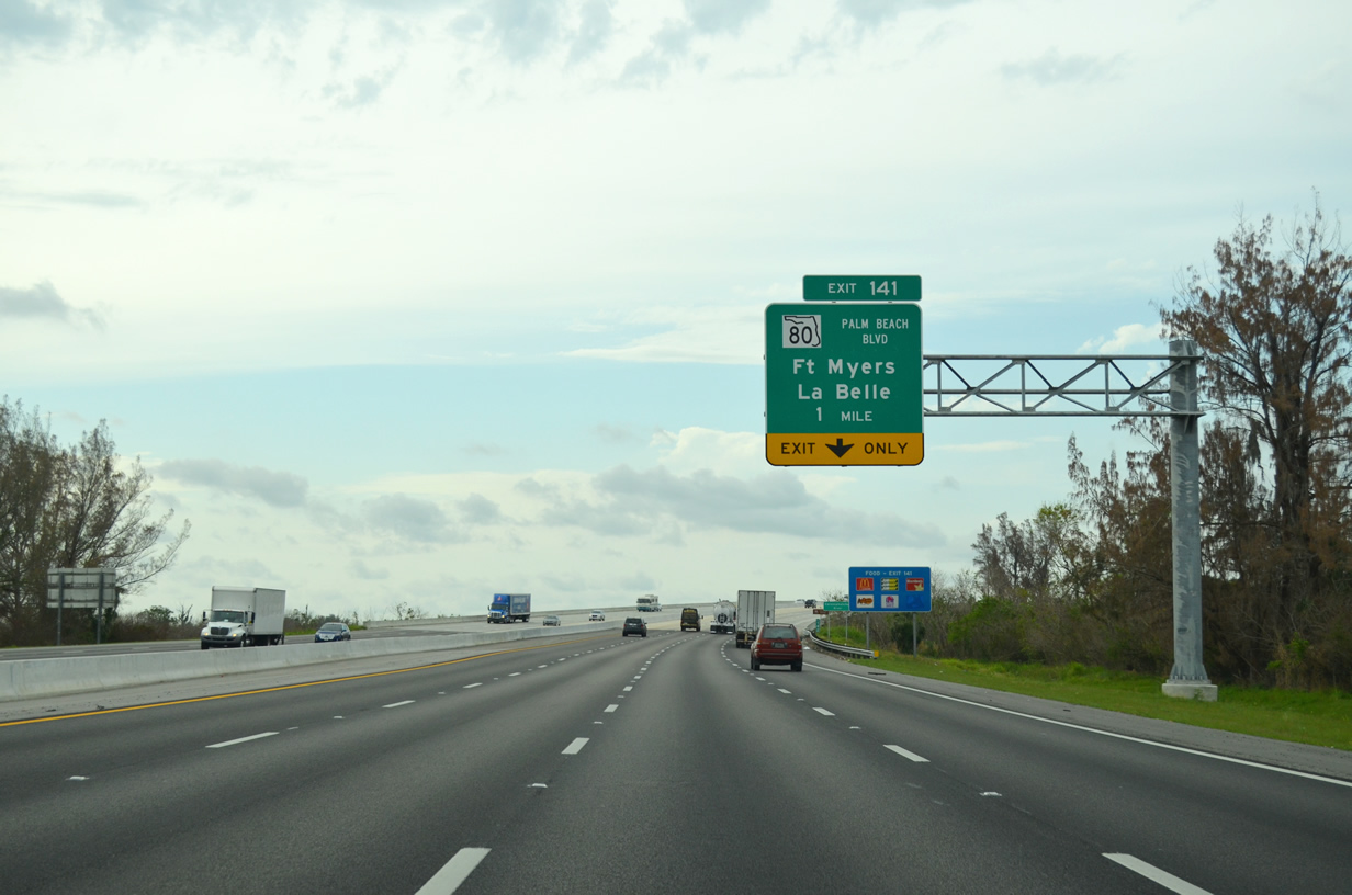
Interstate 75 elevates across the Caloosahatchee River to the diamond interchange (Exit 141) with SR 80 (Palm Beach Boulevard). The 3,904 foot spans were widened to accommodate eight lanes of traffic during a $72 million project completed on November 5, 2015.1
04/15/16

The 67 mile long Caloosahatchee River meanders from near Lake Okeechobee westward through Glades and Hendry counties before entering Lee County near the community of Alva. The river widens to over one mile in width as it makes its way west and eventually southwest toward the Gulf of Mexico. A dredged canal links the Caloosahatchee River with Lake Okeechobee.
04/30/16
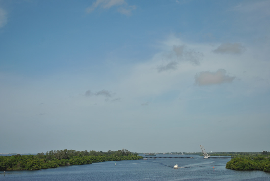
The Seminole Gulf Railway (SGLR) bridge crosses the Caloosahatchee River approximately one mile west of I-75. As well as running freight, the railroad is also known by locals and visitors for its murder mystery dinner train themed excursions.
07/05/11
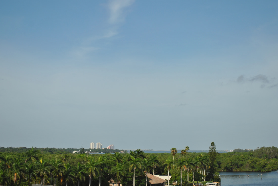
The twin spans that carry Interstate 75 across the Caloosahatchee River provide outstanding views of the surrounding area as well as a glimpse at the high rise condominium buildings that now make up the Downtown area of Fort Myers.
This part of southwest Florida is also known for its abundance of royal palms, which line many arterial and local roads throughout the city. Because of the abundance of royal palms, Fort Myers is often referred to as the City of Palms.
07/05/11

Exit 80 leaves I-75 south for State Road 80. Also known as Palm Beach Boulevard, SR 80 links the freeway with Downtown Fort Myers. Eastward, SR 80 takes motorists toward La Belle. Located along the banks of the Caloosahatchee River in adjoining Hendry County, La Belle is 24.4 miles from I-75.
04/15/16

Continuing south, Interstate 75 the ensuing exit is with Luckett Road (former CR 810) in 1.25 miles. The freeway between SR 80 and Luckett Road was expanded to six overall lanes during a $29.2 million project from June 2011 to summer 2014.2
04/30/16
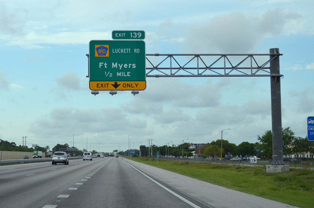
The freeway passes to the east of Billy Creek Commerce Center ahead of the diamond interchange (Exit 139) with Luckett Road.
04/15/16

Truckers and travelers depart for Luckett Road (Exit 139). The east-west road was county-maintained west 0.8 miles from I-75 to Ortiz Avenue (unsigned CR 865). CR 810 was generally unsigned during its existence.
04/15/16
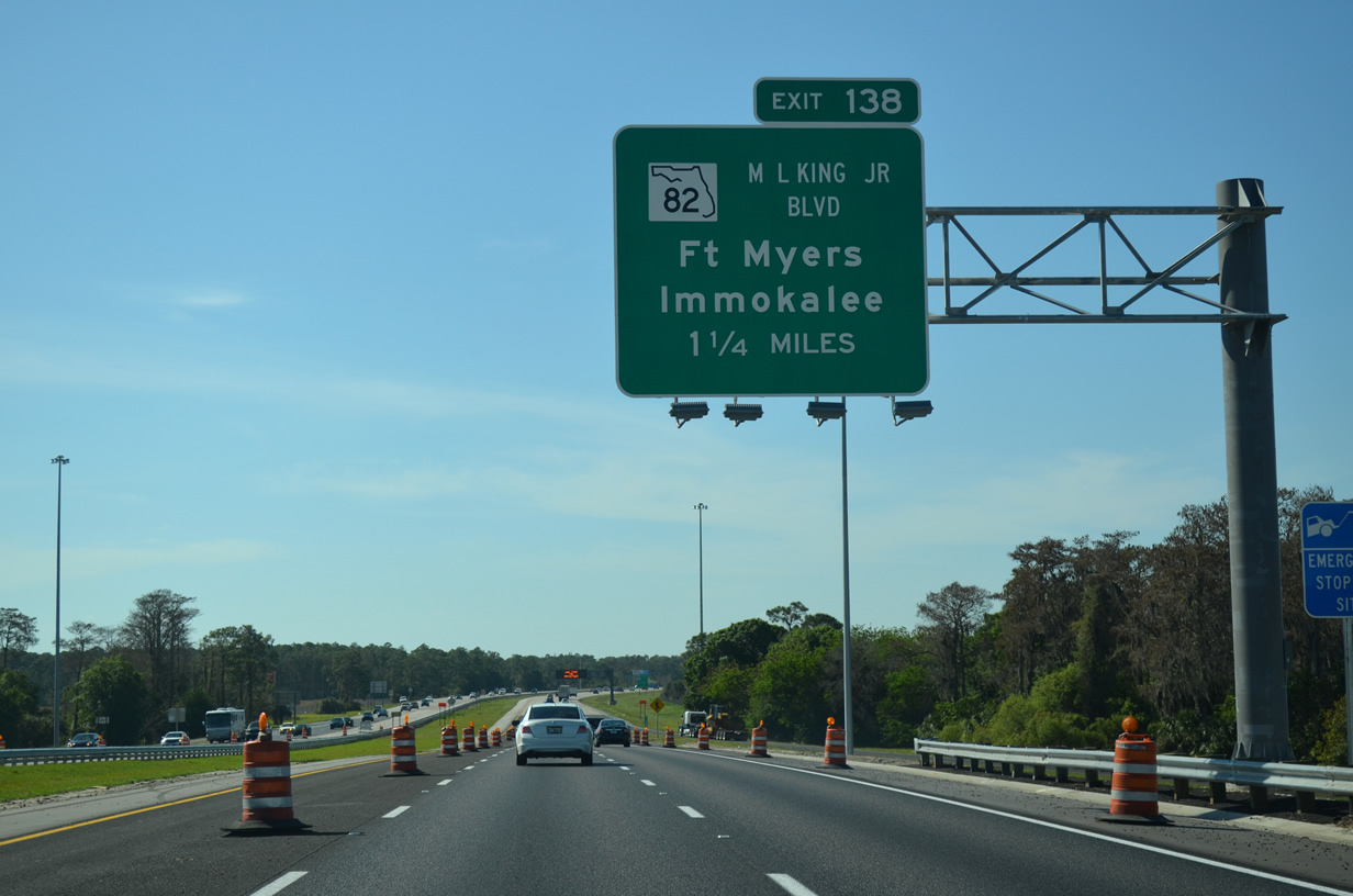
Beyond the apex of Exit 139 the first overhead guide sign for SR 82 (Dr. Martin Luther King, Jr. Boulevard) comes into view. Six-laning of I-75 south from Luckett Road to SR 82 was completed in July 2011. The $9 million project started in May 2010 and ran in tandem with subsequent widening south to Colonial Boulevard.3
03/04/14
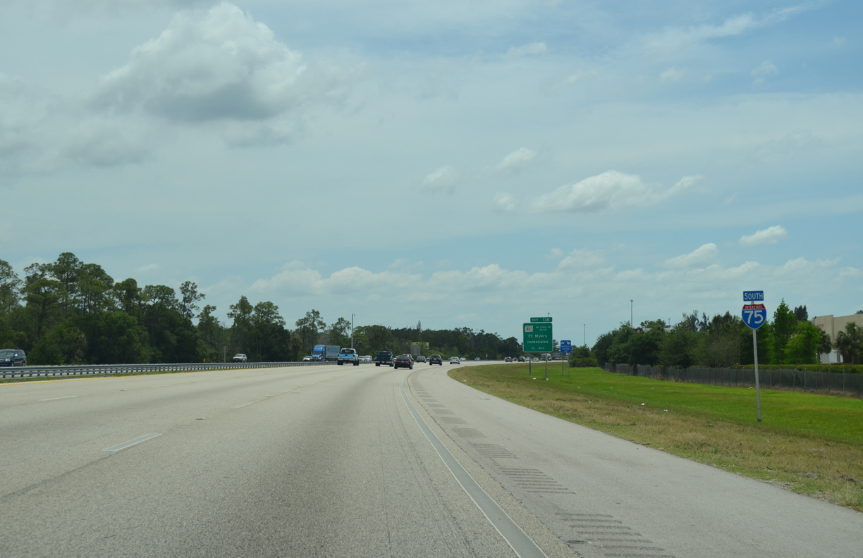
A reassurance marker for Interstate 75 south posted between Luckett Road and SR 82 (Exit 138).
04/30/16
SR 82 (Martin Luther King, Jr. Boulevard) constitutes a 29.88 mile route beginning at U.S. 41 in Downtown Fort Myers and heading southeast along the outskirts of Lehigh Acres to SR 29 in northeastern Collier County.
04/30/16
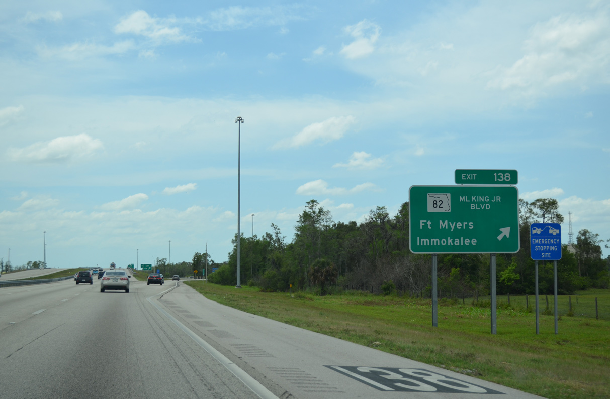
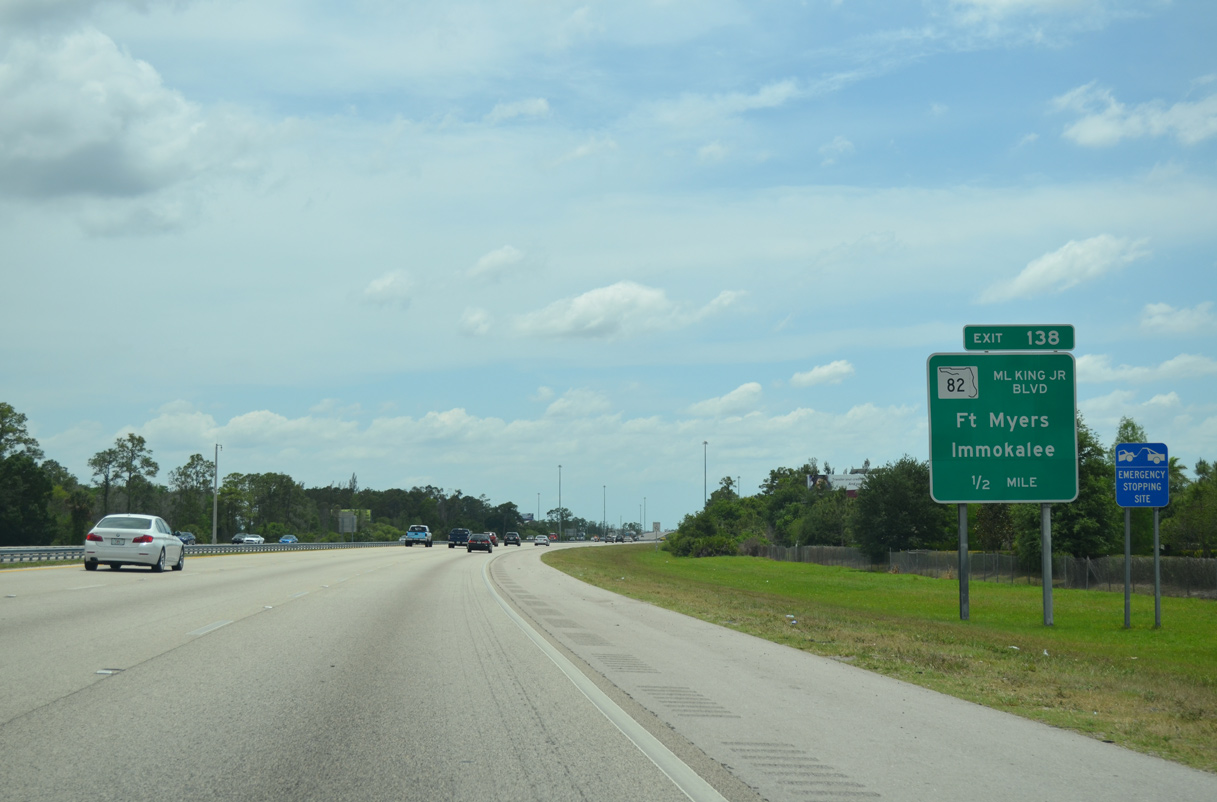
Interstate 75 south reaches the egress point for SR 82 (Exit 138) west to Ft. Myers and east to SR 29 south to Immokee. Prior to being named Martin Luther King, Jr. Boulevard, SR 82 west of the interstate was known as Anderson Avenue.
04/30/16
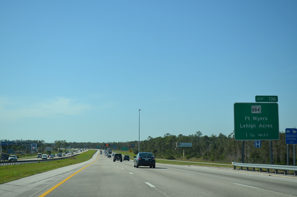
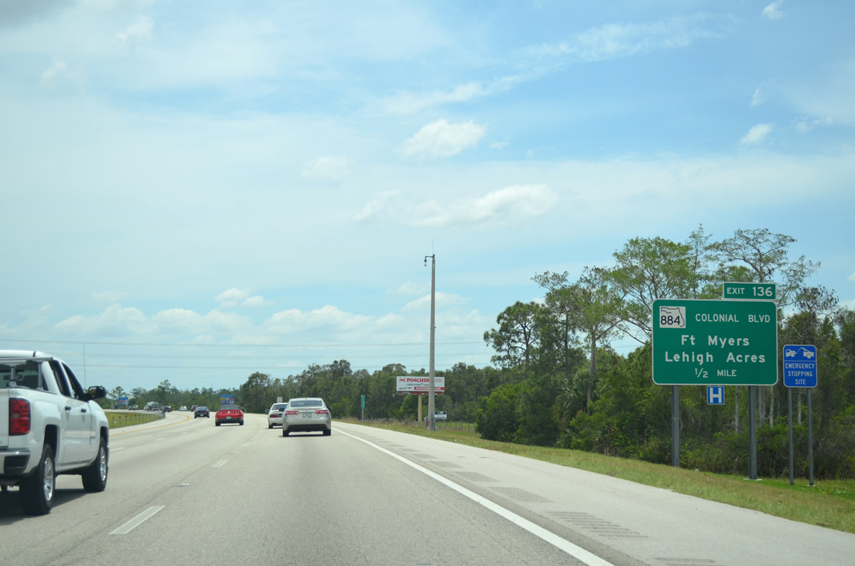
Part of a major east-west corridor, forthcoming SR 884 (Colonial Boulevard) links I-75 with Fort Myers and Cape Coral to the west and Lehigh Acres and Alva to the east.
03/04/14
Finished in September 2011, the $9.7 million widening from SR 82 to SR 884 (Colonial Boulevard) extended the six lane portion of Interstate 75 northward from the IROX project.4
07/05/11
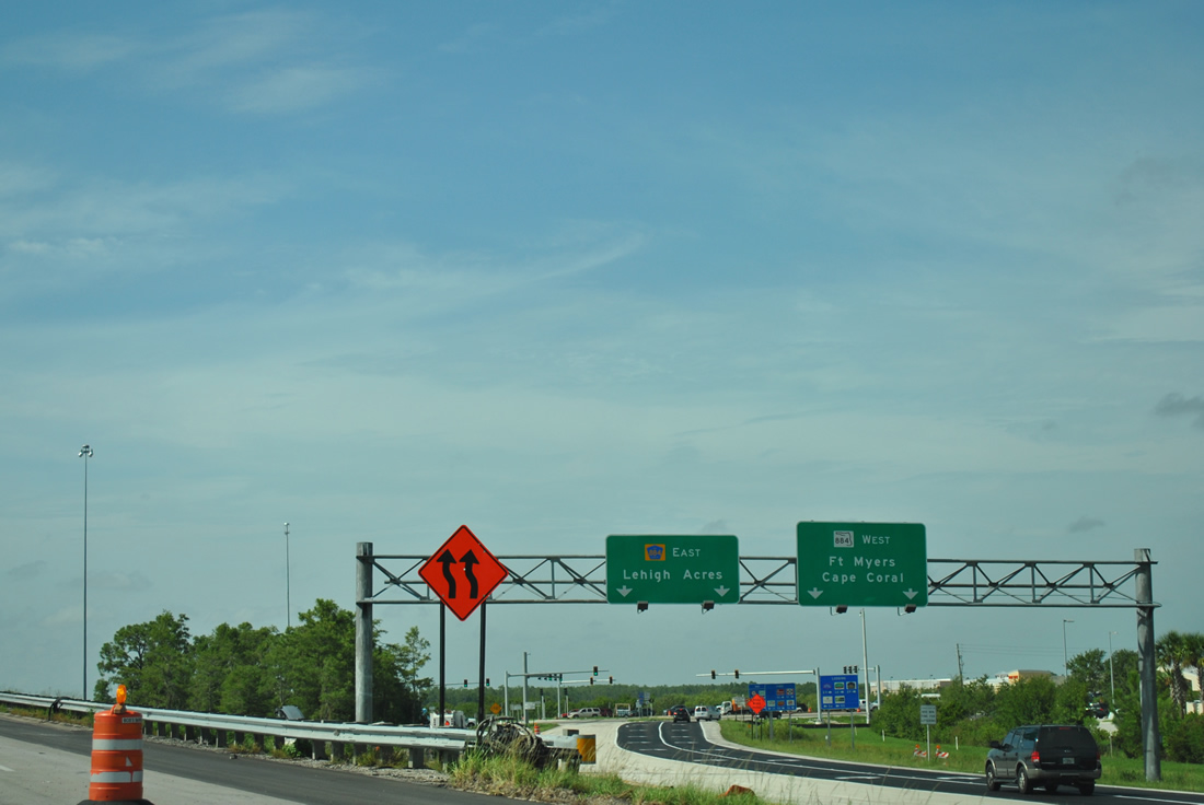
SR 884 follows only the portion of Colonial Boulevard west from I-75 to U.S. 41 (Cleveland Avenue) in Fort Myers. CR 884 extends west into Cape Coral via the tolled Midpoint Bridge, eventually connecting with SR 78 (Pine Island Road).
04/30/16
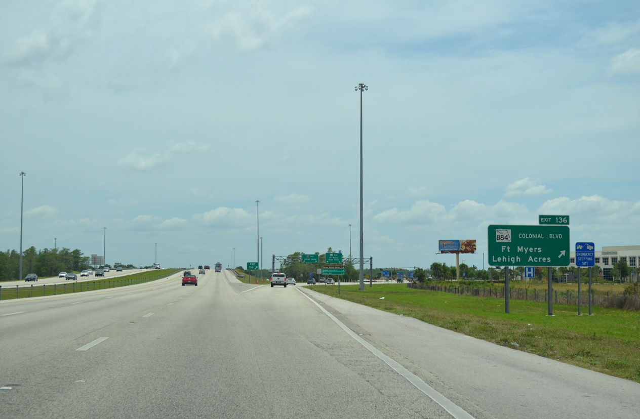
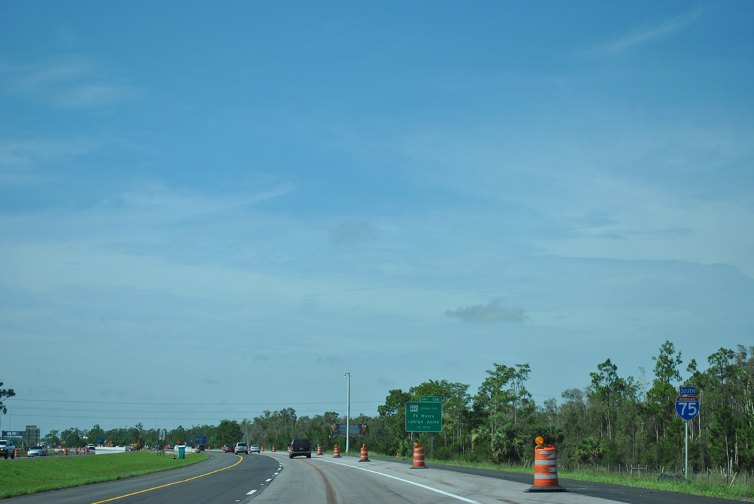
Construction anticipated to begin in 2019 will redesign the parclo interchange (Exit 136) with SR 884 (Colonial Boulevard) into a DDI. Adjacent work along Colonial Boulevard includes rebuilding the intersection with 6 Mile Cypress Parkway (CR 865) to a CFI and creating a Superstreet intersection with Forum Boulevard to the east.5
04/30/16
Going east from Exit 136, Colonial Boulevard (CR 884) was expanded into a six lane arterial 2.3 miles to its intersection with SR 82. The center of Lehigh Acres is located 10.6 miles to the east via CR 884 and Homestead Road. Colonial Boulevard west continues with six overall lanes to McGregor Boulevard along the Caloosahatchee River.
07/05/11
Just south of SR 884 (Exit 136), Interstate 75 plies across Six Mile Cypress Slough Preserve.
03/21/20
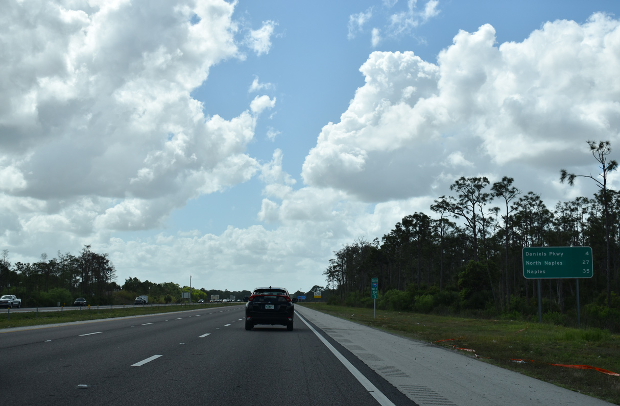
Daniels Parkway (CR 876) meets I-75 in four miles while North Naples (27 miles) and Naples (35 miles) lie around one-half hour away.
03/21/20
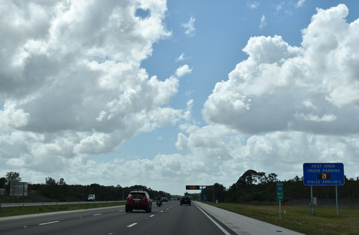
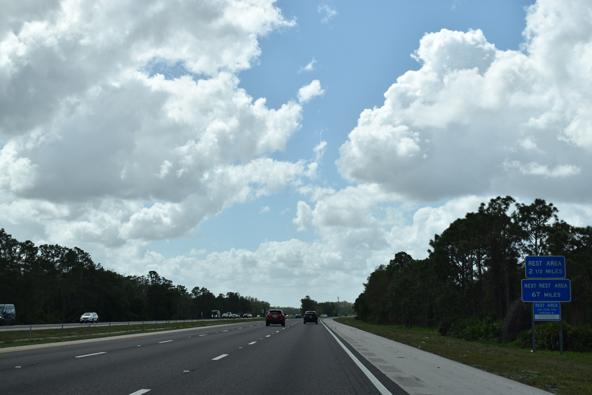
An off freeway rest area lies 2.5 miles ahead along Daniels Parkway east. The next facility is located 67 miles to the southeast on Alligator Alley in Collier County.
03/21/20
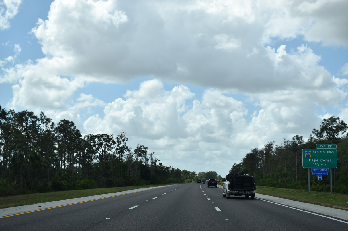
The $458 million iROX mega project widened 30 miles of I-75 south from SR 884 to Golden Gate Parkway in Collier County. Running from June 2007 to December 2009, expansion work finished one year ahead of schedule.6 The ensuing exit is with CR 876 (Daniels Parkway) in 1.25 miles.
03/21/20
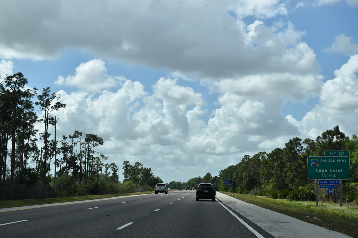
CR 876 lines Daniels Parkway west from Treeline Avenue to U.S. 41 (Cleveland Avenue) and SR 867 (McGregor Boulevard). Daniels Parkway indirectly provides the final access point into Cape Coral via U.S. 41 (Cleveland Avenue) north to College Parkway west. College Parkway connects with Downtown Cape Coral across the tolled Cape Coral Bridge.
03/21/20
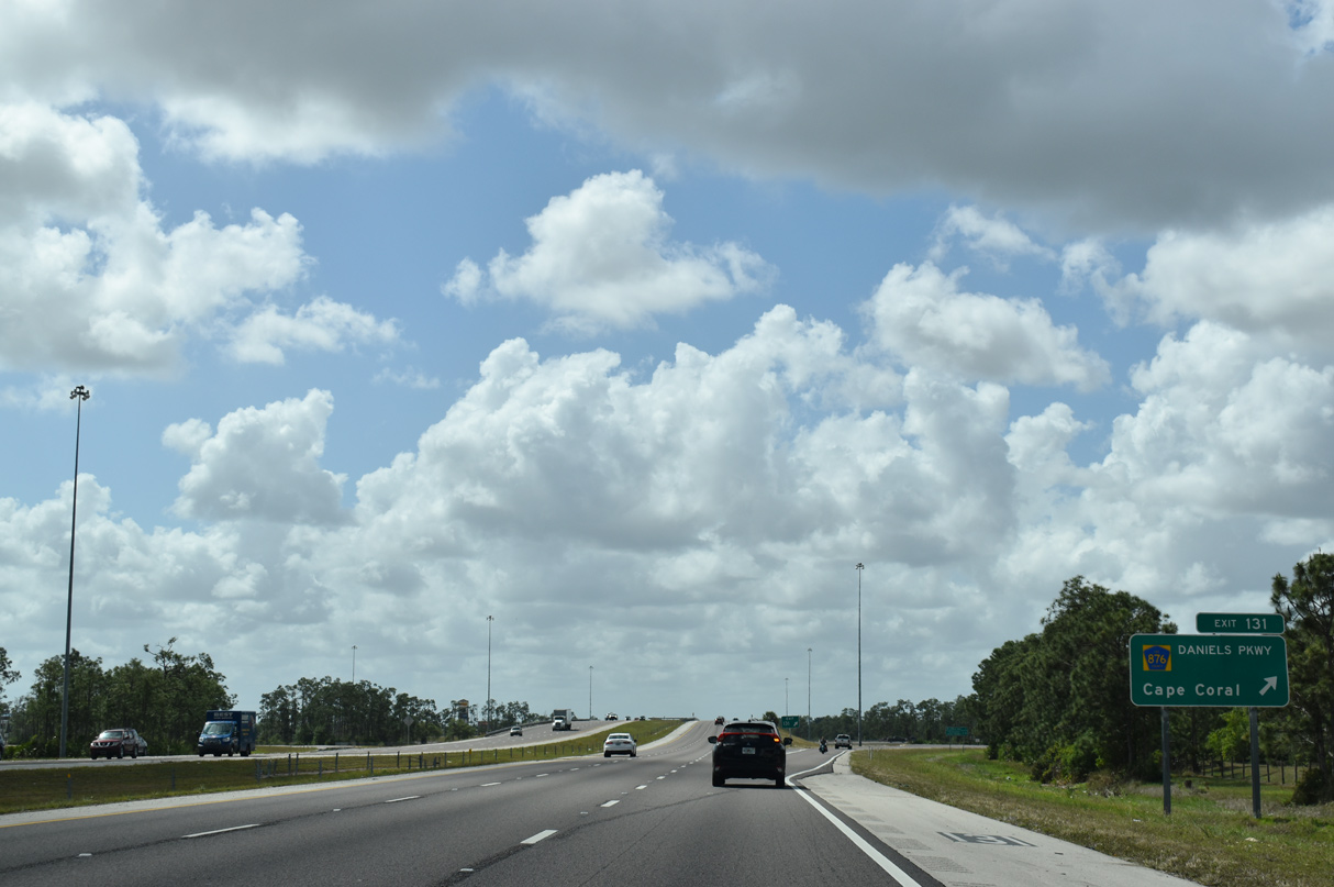
Daniels Parkway (CR 876) constitutes a six lane arterial west from the parclo interchange (Exit 131) with I-75 through a bevy of commercial and residential development to SR 867 (McGregor Boulevard). East of the adjacent rest area, Daniels Parkway continues toward SR 82 and Lehigh Acres.
03/21/20
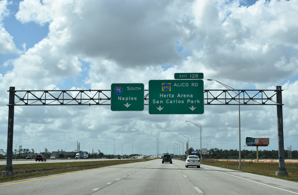
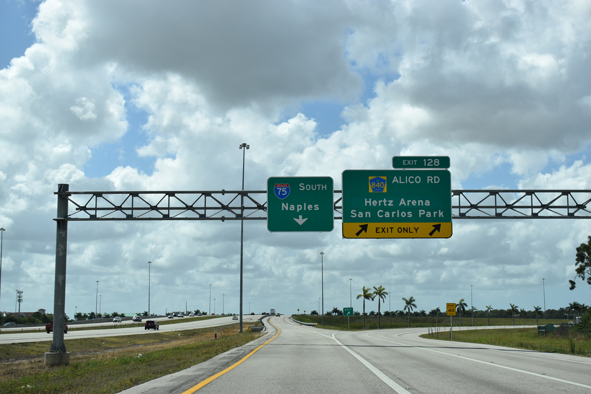
Two lengthy collector distributor roadways were added during the I-75 Airport Direct Connect project underway from Fall 2012 to March 2015, linking with new ramps to Terminal Access Road and realigned ramps with Alico Road.7
03/21/20
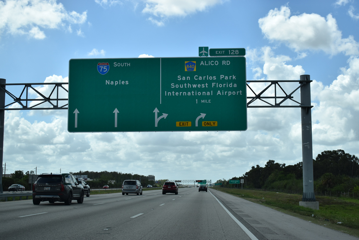
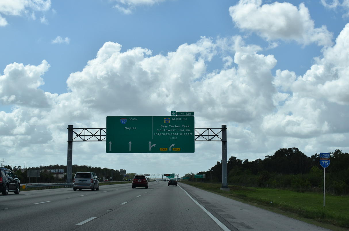
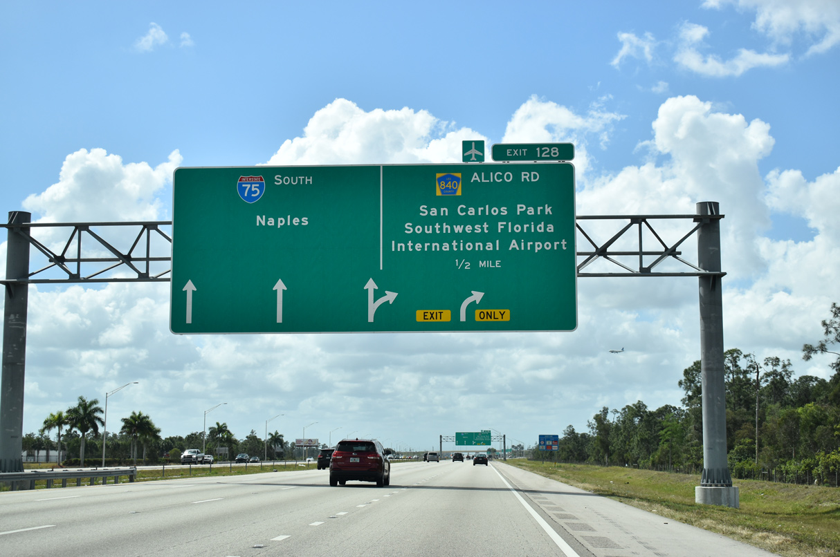
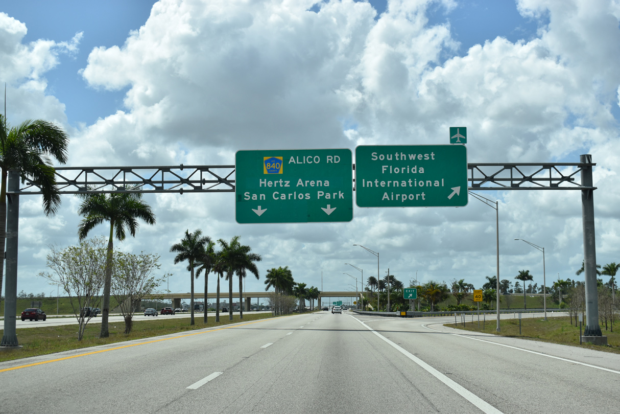
A series of arrow-per-lane (APL) signs outline the two lane c/d roadway for the trumpet interchange (Exit 128) linking Interstate 75 with Terminal Access Road to Southwest Florida International Airport (RSW).
03/21/20
The village of Estero debuts at 10 miles out on distance signage preceding the c/d roadway (Exit 128) to RSW and Alico Road. Naples is a 30 mile drive from this point.
03/21/20
Opened March 2015 at a cost of $54.1 million8,9, Terminal Access Road spurs 3.2 miles northeast to the passenger terminal of RSW. Prior to the Direct Connect project, Daniels Parkway (Exit 131) or Alico Road (Exit 128) to parallel Treeline Avenue connected I-75 with the airport.
03/21/20
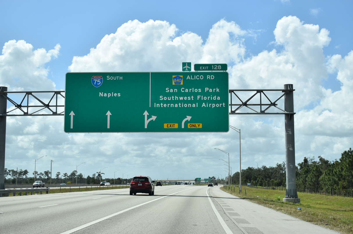
Alico Road extends west from I-75 to U.S. 41 (Tamiami Trail) near San Carlos Park. Alico Road east connects with Ben Hill Griffin Parkway south to Florida Gulf Coast University (FGCU).
03/21/20
Terminal Access Road east defaults directly to Southwest Florida International Airport (RSW) while a half diamond interchange joins westbound with Treeline Avenue. A subsequent widening project started in April 2016 expanded the access road to six lanes between Treeline Avenue and Air Cargo Lane.10
03/21/20
The c/d roadway expands to three southbound lanes to the six-ramp parclo interchange (Exit 128) with Alico Road. Coupled with a healthy housing market, development along the Alico Road corridor blossomed during the 2000s with the addition of nearby Florida Gulf Coast University (FGCU).
03/21/20
Two lanes leave for Alico Road and San Carlos Park. Hertz Arena stands between I-75 and Ben Hill Griffin Parkway south of the FGCU campus. The multipurpose arena is the primary home to the Florida Everblades hockey team (ECHL franchise).
03/21/20
South from Alico Road, I-75 passes between Three Oaks Park and the Gulf Coast Town Center retail complex. FDOT recorded 109,000 vehicles per day (vpd) along this stretch in 2019, up 28,500 from vpd counted in 2013.
03/21/20
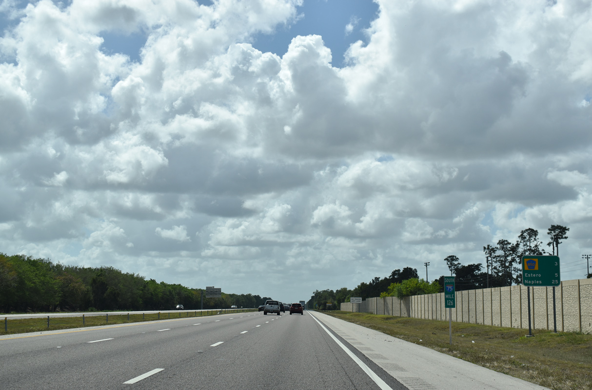
Corkscrew Road (former CR 850) lies three miles ahead along Interstate 75 south. Estero, centered where Corkscrew Road and U.S. 41 meet, follows in five miles.
03/21/20
Corkscrew Road (old CR 850) extends two miles west from Exit 123 to U.S. 41 (Tamiami Trail) by Koreshan State Park in Estero.
03/21/20

Built in 2009, the Estero Parkway overpass spans I-75 one mile north of the diamond interchange (Exit 123) with Corkscrew Road. Estero Parkway was extended east from Three Oaks Parkway to Ben Hill Griffin Parkway.
03/21/20
Corkscrew Road continues east 19.5 miles to SR 82 (Immokalee Road), with the easternmost 3.75 miles doubling as Collier County Road 850.
03/21/20
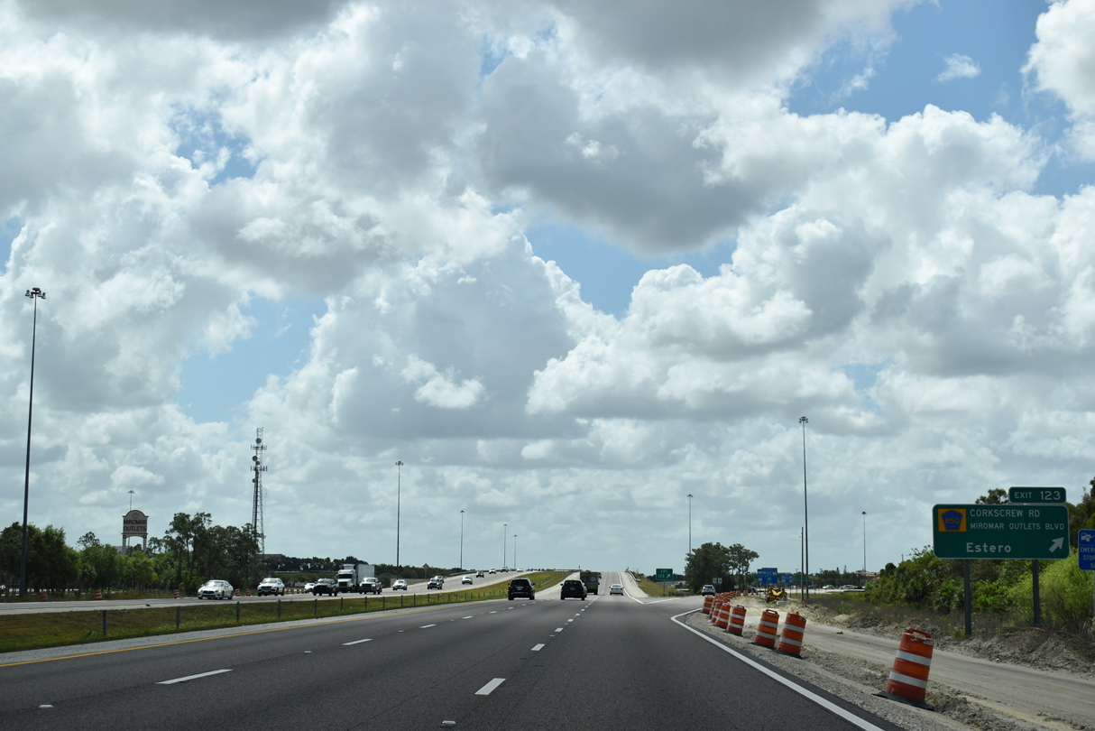
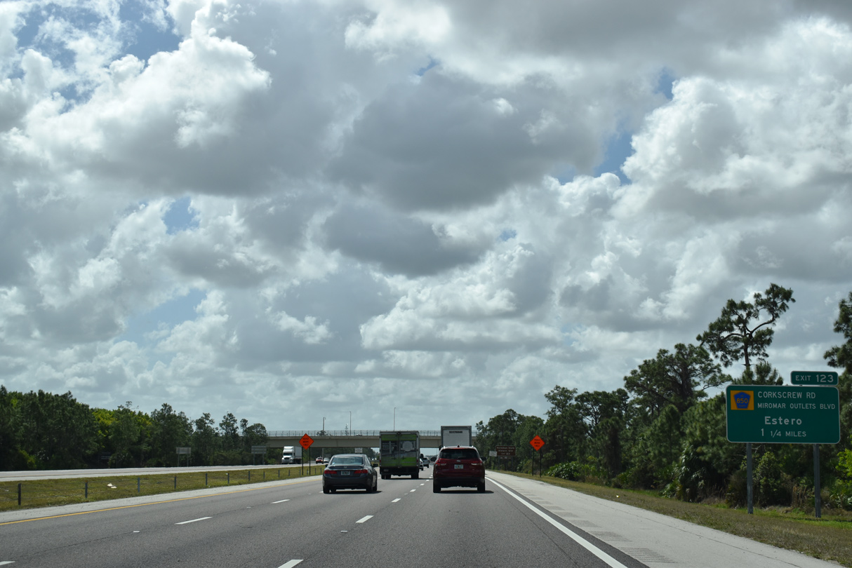
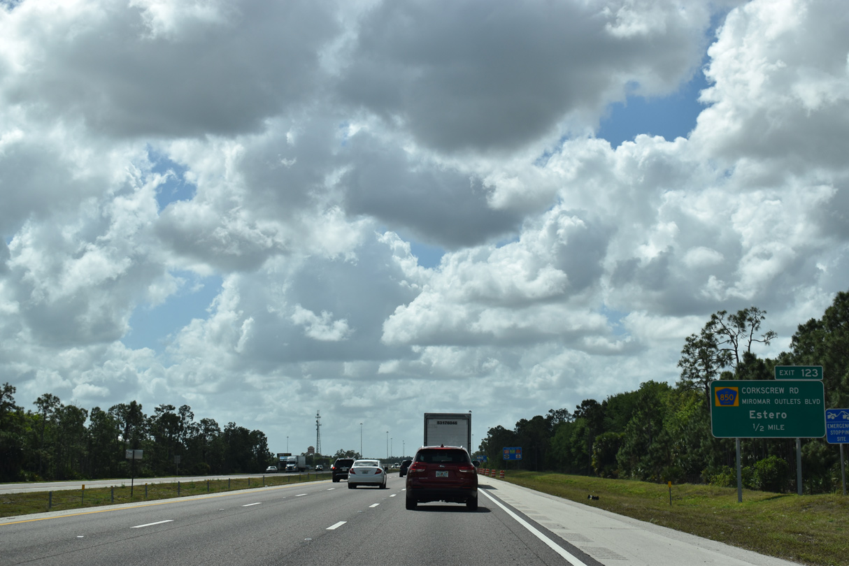
Exit 123 departs I-75 for Corkscrew Road. Miromar Outlets anchors the adjacent retail area west of Ben Hill Griffin Parkway and south of Hertz Arena.
03/21/20
An $8.6 million project underway from October 16, 2019 to Spring 2021 extends the ramps at Exit 123 and adds turn lanes along Corkscrew Road.11 This confirming marker was removed during construction.
11/22/12
Continuing south of Exit 123, Interstate 75 skirts the eastern edge of the Estero area on the nine mile drive to Bonita Springs.
03/21/20
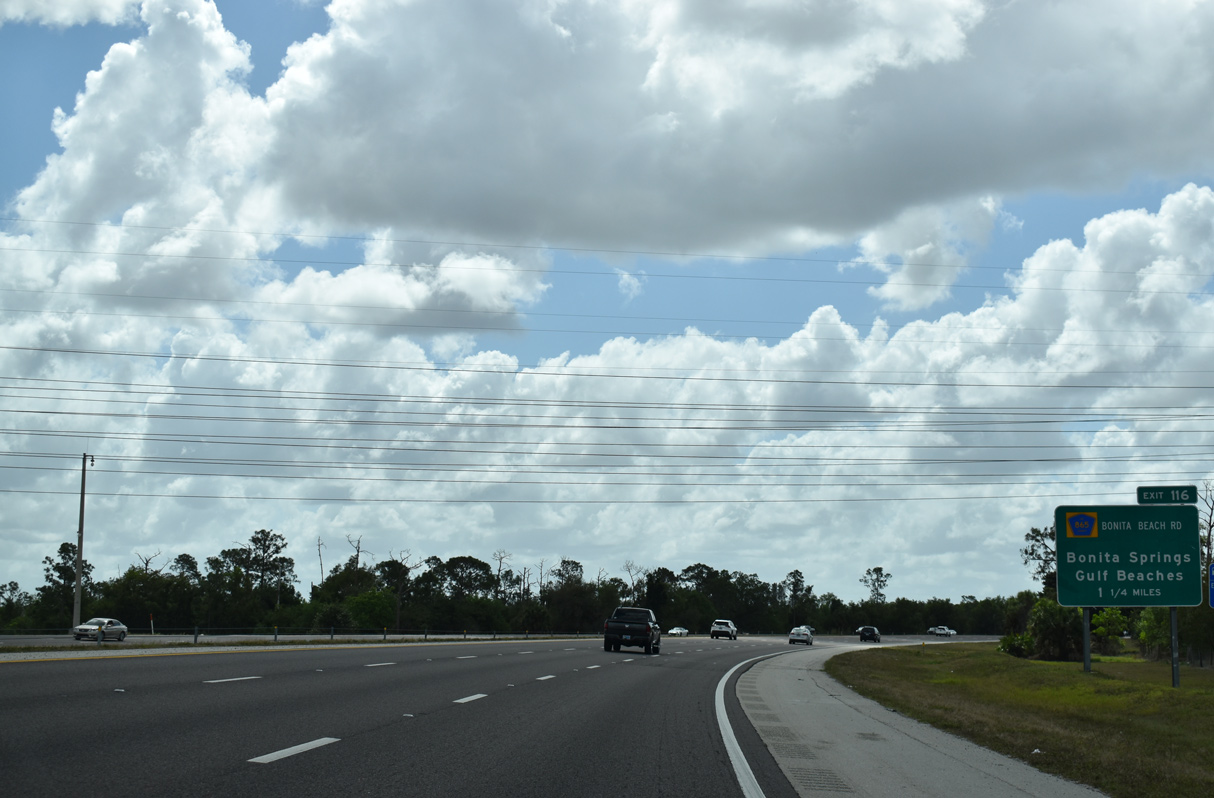
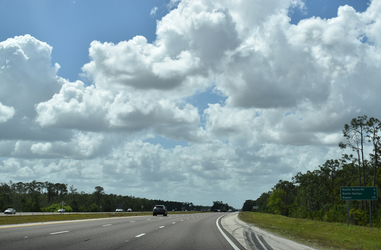
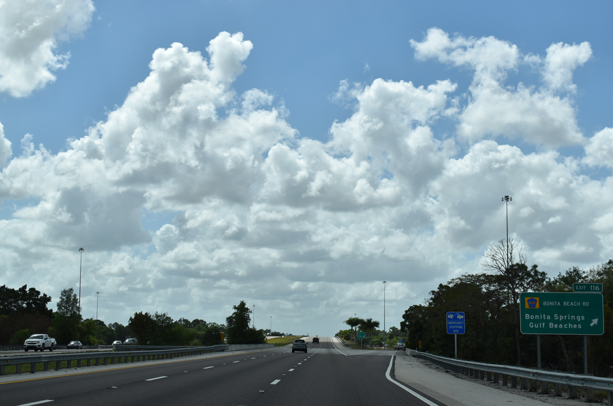
A diamond interchange (Exit 116) joins Interstate 75 with Bonita Beach Road (CR 865) in 1.25 miles. The arterial leads west from I-75 to the city of Bonita Springs and beaches along the Gulf of Mexico.
03/21/20
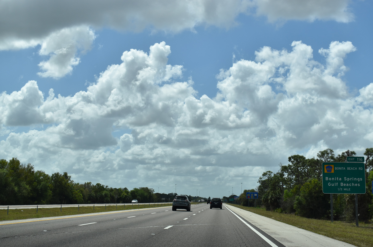
CR 865 (Bonita Beach Road) runs west across Bonita Springs before turning northwest along Hickory Boulevard near Barefoot Beach. CR 865 straddles coastal areas to Fort Myers Beach, where it becomes SR 865 (San Carlos Boulevard).
03/21/20
CR 865 (Bonita Beach Road) extends westward with six lanes along commercial frontage from the diamond interchange at Exit 116 to U.S. 41. With four lanes, Bonita Beach Road spurs five miles east to the gate for Bonita National golf course community by a number of residential subdivisions.
03/21/20
Golf course communities line both sides of Interstate 75 over the next five miles.
03/21/20
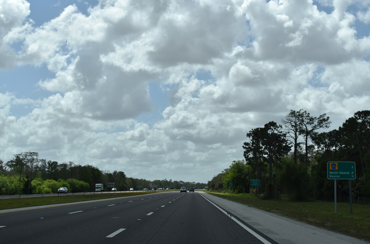
Naples is just 11 miles away, with County Road 846 (Immokalee Road) and Naples Park preceding the county seat at the succeeding exits.
03/21/20
Interstate 75 traverses nearly 64 miles of Collier County, eventually turning eastward toward the Atlantic coast and the greater Fort Lauderdale-Miami metropolitan area.
03/21/20

References:
- "No. 3 - I-75 Caloosahatchee River Bridge Widening." Roads&Bridges.
- I-75 On The Go - I-75 from Luckett Road to SR 80.
http://i75onthego.com:80/homeLuckettRdSR80.html. FDOT District 1 project web site. - I-75 On The Go - I-75 from SR 82 to Luckett Road*.
http://i75onthego.com:80/homeSR82.html. FDOT District 1 project web site. - I-75 On The Go - I-75 from Colonial Boulevard to SR 82*.
http://i75onthego.com:80/homeColonial.html. FDOT District 1 project web site. - I-75 at Colonial Boulevard (SR 884). FDOT Distrct 1 project news letter, May 2017.
- Project Profile: I-75 Roadway Expansion (iROX). FHWA - Center for Innovative Finance Support - Project Profiles.
- I-75 On The Go - I-75 - Airport Direct Connect.
http://i75onthego.com:80/homeAirportDC.html. FDOT District 1 project web site. - "Alico exit relocation first part of project to open", Fort Myers Newspress, August 18, 2014.
- "I-75 direct connect to RSW opens", www.nbc-2.com (news and TV).
- "EHC, Inc. Awarded Terminal Access Road Widening Project", EHC Inc. Construction (website)
- Interstate 75 at Corkscrew Road Interchange Improvement Project in Lee County (Project ID 406225-6-52-01).
http://www.swflroads.com/ i75/corkscrewrdinterchange.pdfFlorida Department of Transportation (FDOT).
Photo Credits:
- Alex Nitzman: 04/30/16
- Brent Ivy: 04/15/16, 08/28/18
- ABRoads: 07/05/11, 03/21/20
- Alex Nitzman, Chris Kalina: 03/04/14
- AARoads: 11/22/12
Connect with:
Page Updated Thursday October 08, 2020.