
Interstate 75 South - Walton to Lexington
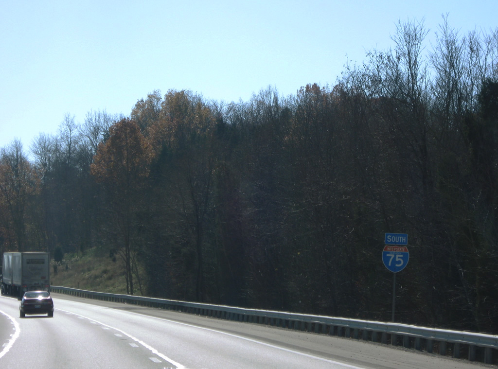
 South
South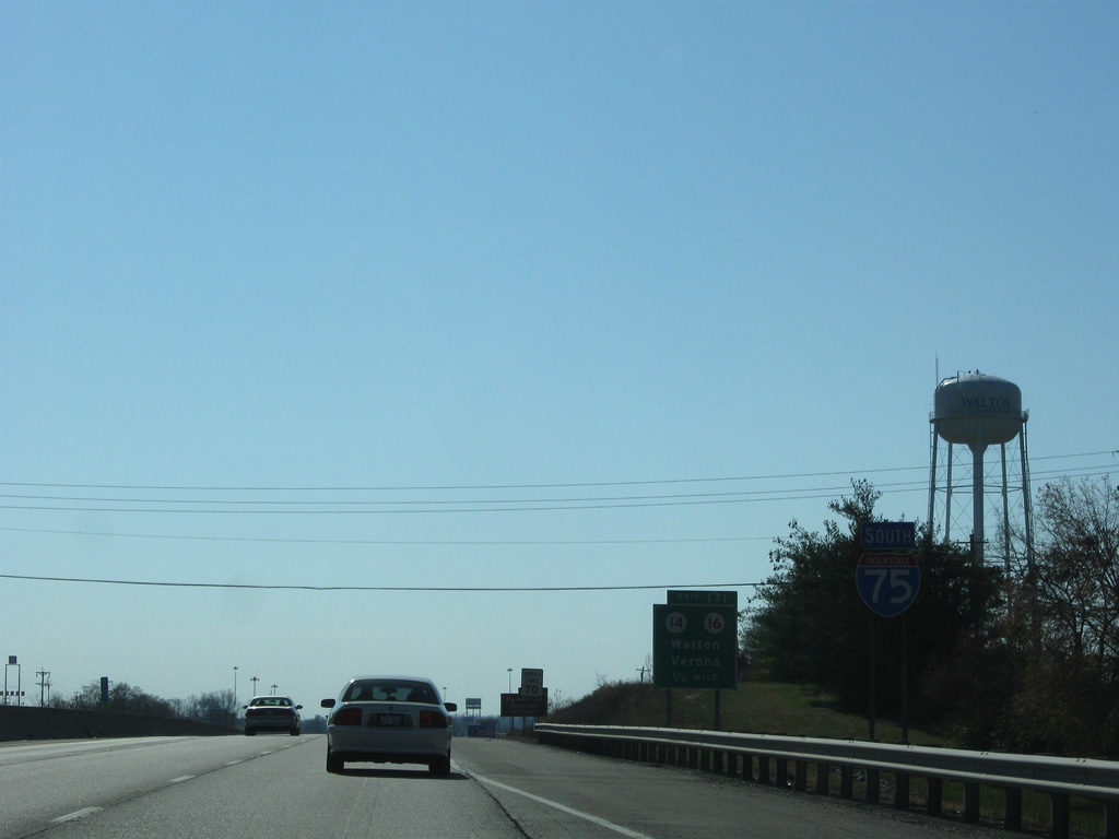
Interstate 75 continues south by the growing suburb of Walton in southern Boone County from I-71.
11/08/09
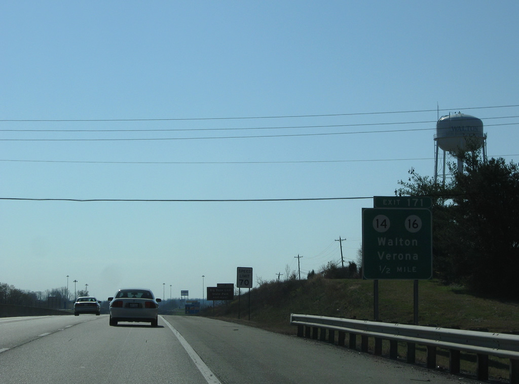
Approaching the diamond interchange (Exit 171) with KY 14 & 16 (Mary Grubbs Highway) at Walton. The two highways overlap for 4.9 miles west from U.S. 25 (Main Street) nearby to Verona.
11/08/09
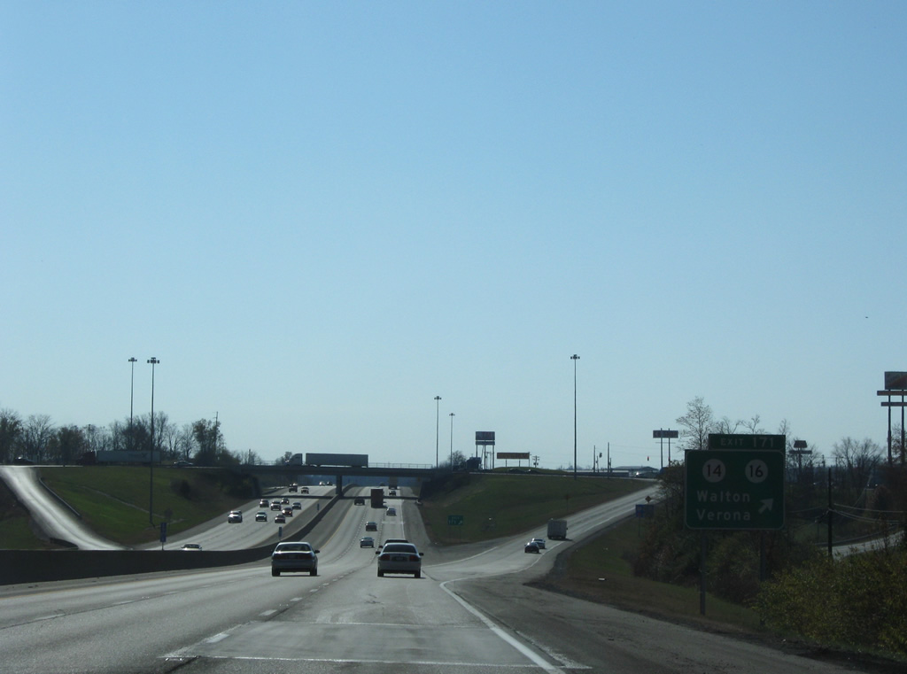
Southbound Interstate 75 arrives at the Exit 171 off-ramp. KY 14 arcs northwest from Vernona to U.S. 42 & 127 at Hume. KY 16 continues southwest to Glencoe.
11/08/09
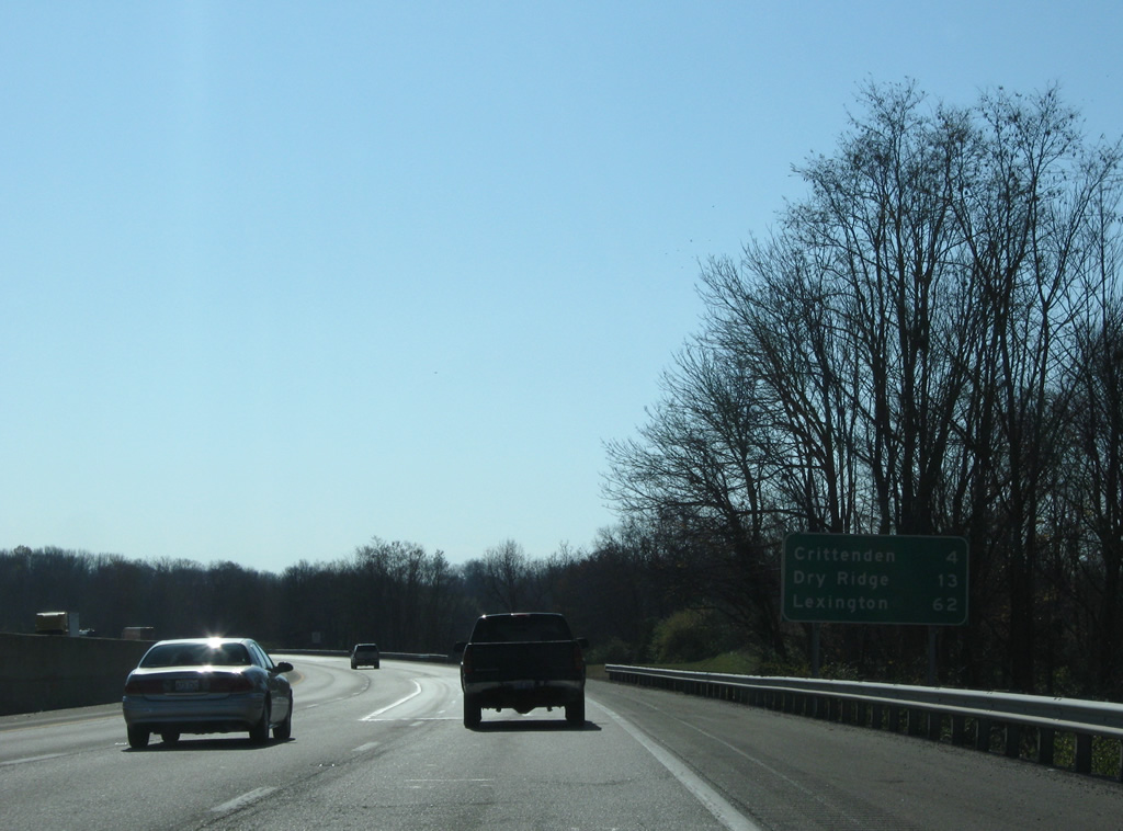
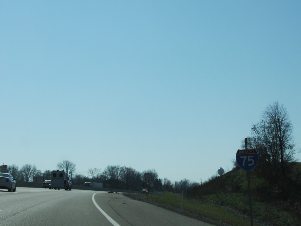
Interstate 75 reaches Crittenden and Dry Ridge over the next 13 miles in Grant County. Lexington, Kentucky's second largest city, is 62 miles to the south.
11/08/09
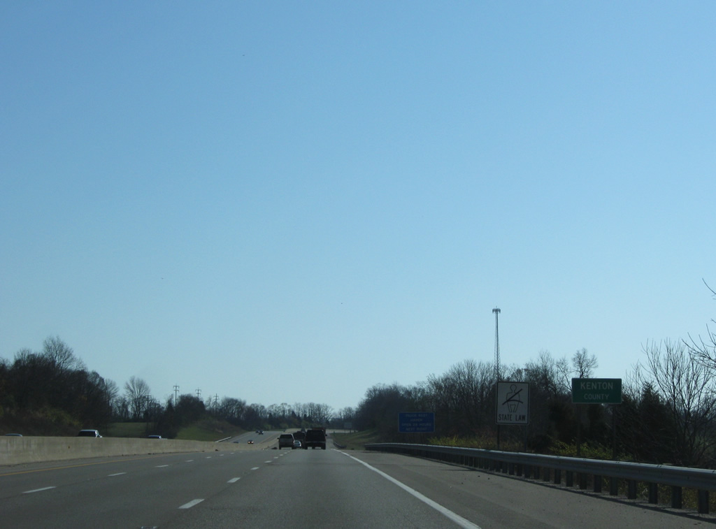
Interstate 75 nips the southwest corner of Kenton County. This includes a stretch by Mullins Wildlife Management Area.
11/08/09
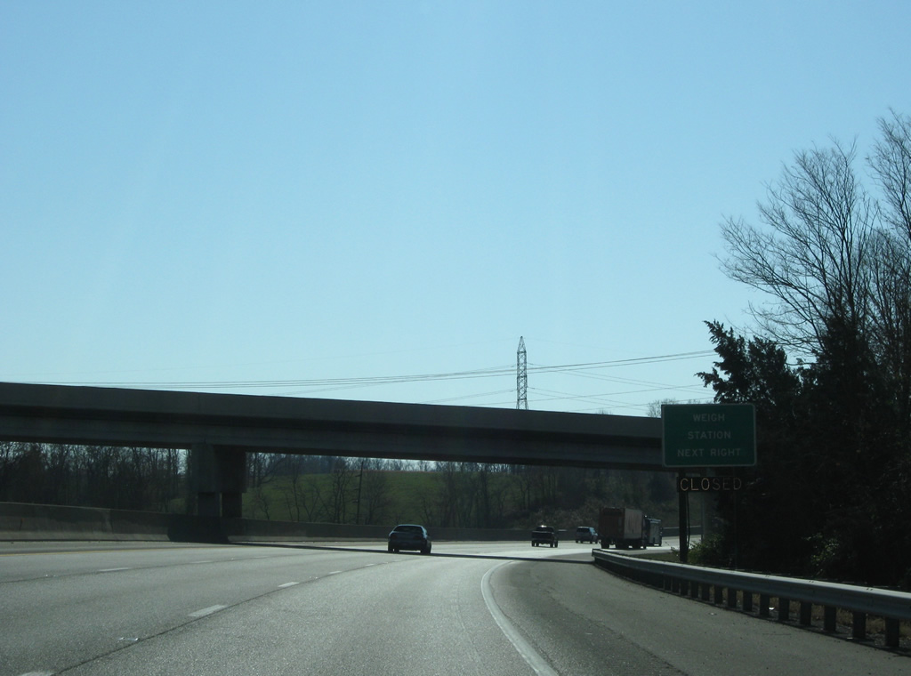
Eads Road passes over Interstate 75 ahead of a southbound side Weigh Station.
11/08/09
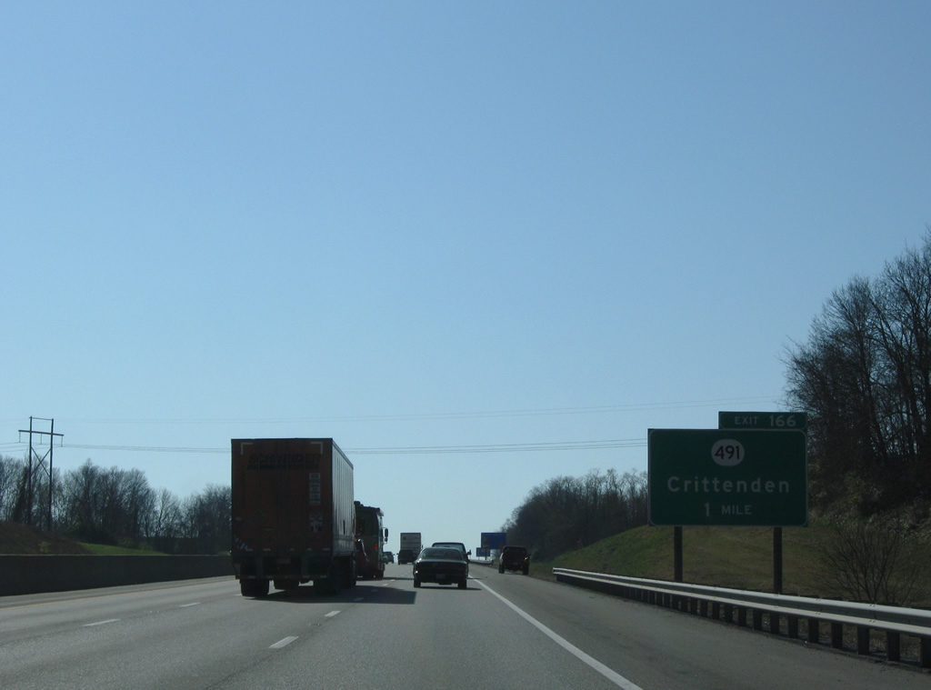
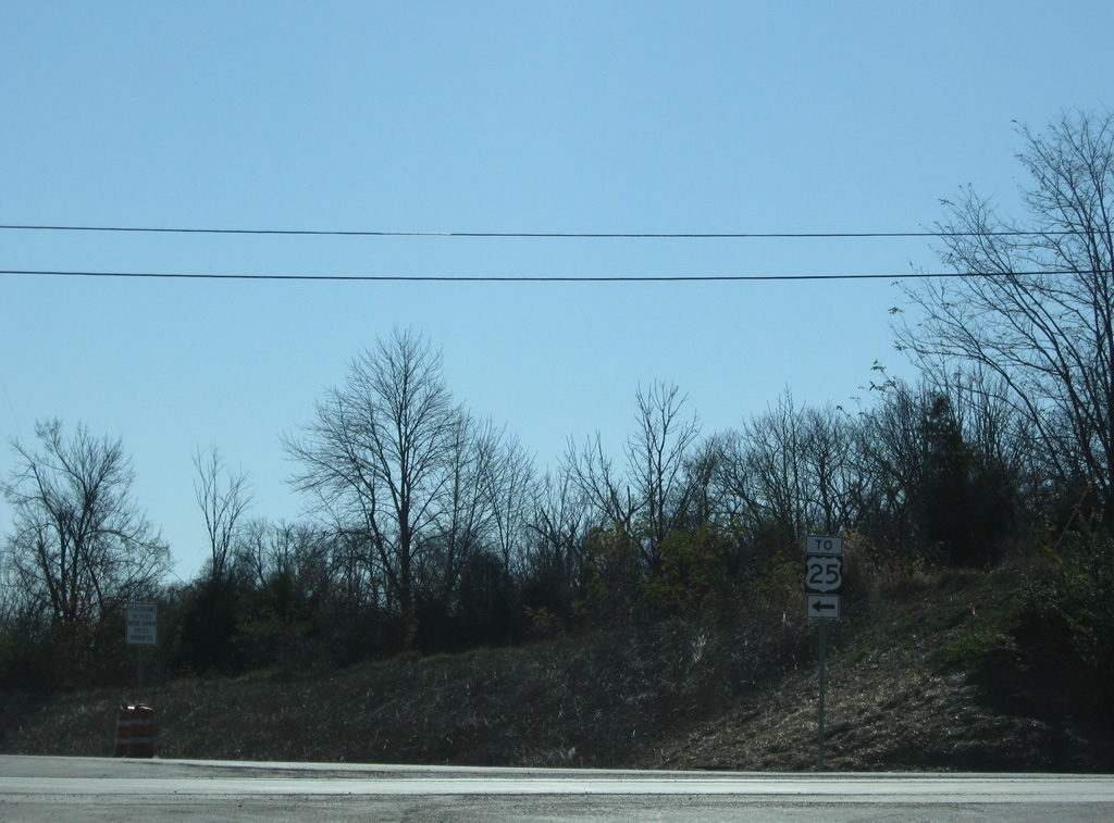
Interstate 75 southbound approaches KY 491 and Exit 166. The town of Crittenden is directly to the east of the interchange.
11/08/09
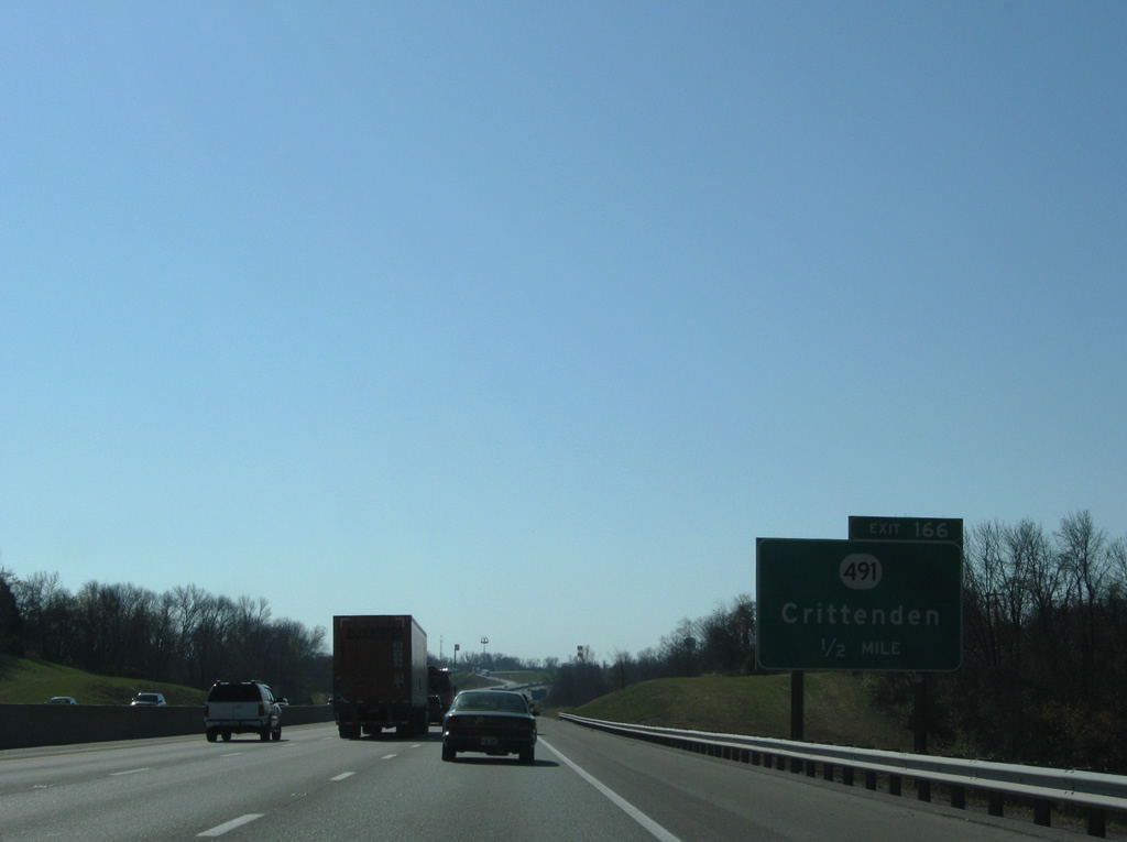
KY 491 begins in Verona at the intersection with KY 14 and KY 16 and travels east, with a brief multiplex with U.S. 25 in Crittenden before heading east to a terminus with KY 17.
11/08/09
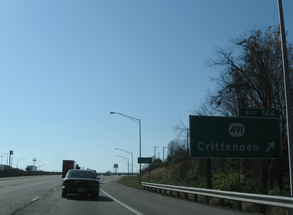
Crossing over Bullock Pen Creek, Interstate 75 enters Grant County and reaches the Exit 166 off-ramp to KY 491 (Violet Road).
11/08/09
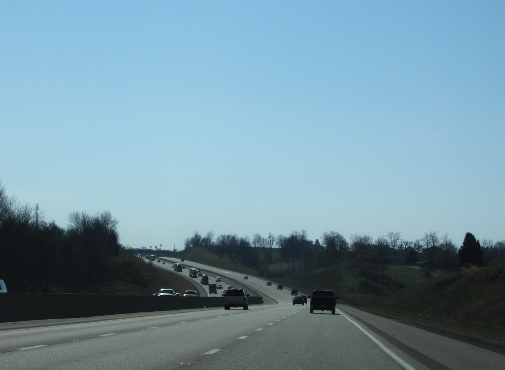
12 miles out from Williamstown, the Grant County seat. U.S. 25 parallels nearby along Dixie Highway south through Sherman.
11/08/09
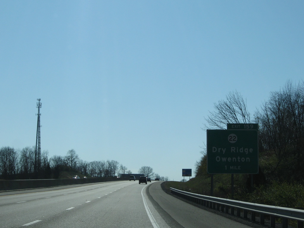
The diamond interchange with KY 22 at Exit 159 provides motorists heading eastbound with direct access to U.S. 25 via the Dry Ridge Connector. This connector route provides a bypass of the downtown area of Dry Ridge. Opened to traffic in 2005, the connector carries the KY 22 and U.S. 25 banners, while the former routes have been redesignated as business routes.
11/08/09
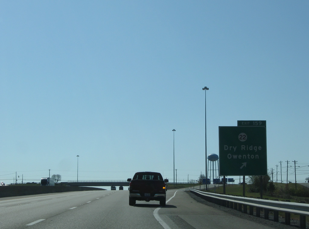
Exit 159 leaves Interstate 75 southbound at Dry Ridge. Traveling almost 101 miles, KY 22 joins Dry Ridge with Owenton to the southwest on a path that concludes in Louisville.
11/08/09
Six lanes of Interstate 75 wind southeast from Dry Ridge four miles into Williamstown.
11/08/09
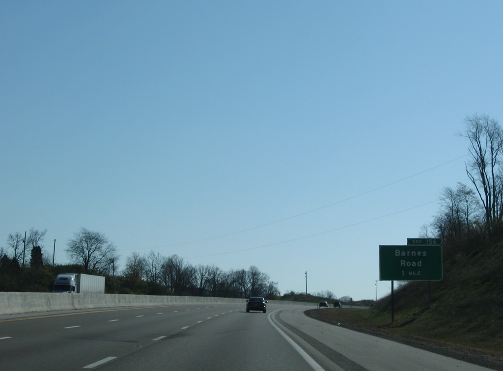
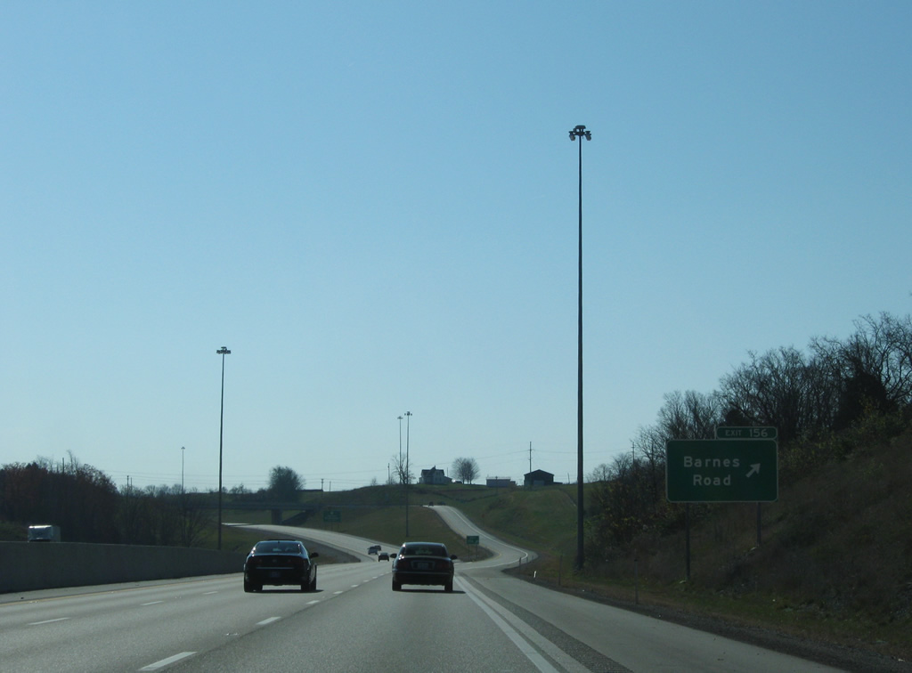
Approaching Exit 156 with Barnes Road, a diamond interchange opened to traffic on October 7, 2003.
11/08/09
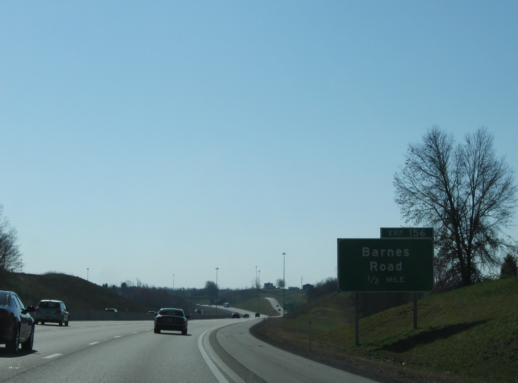
Exit 156 also provides a connection to U.S. 25, 0.90 miles to the east. Barnes Road stretches only 2.10 miles to the west of Interstate 75 serving a handful of local residences before ending.
11/08/09
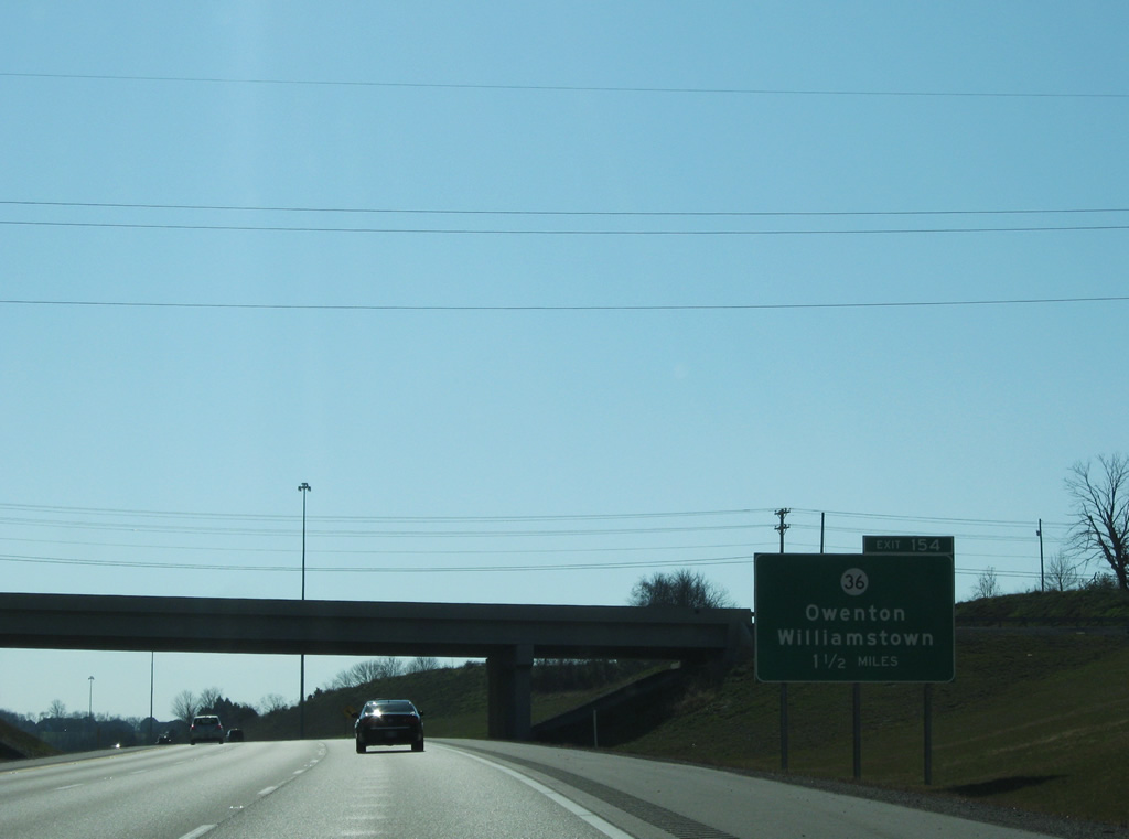
Still within the diamond interchange of Exit 156, motorists are alerted to KY 36 and Exit 154.
11/08/09
A roadway split along Interstate 75 near Steammill Branch in Williamstown.
11/08/09
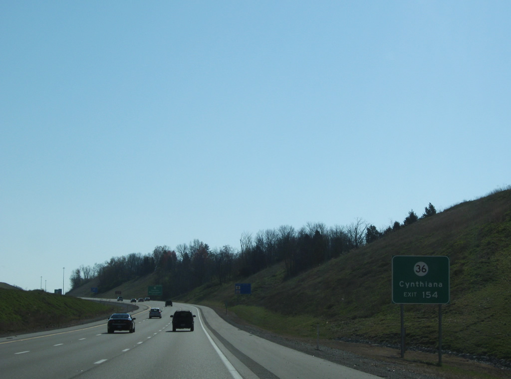
KY 36 links Williamstown with the Harrison County seat of Cythiana to the southeast. The state route first shares 1.4 miles of pavement with U.S. 25 (Main Street) from near Exit 154.
11/08/09
KY 36 constitutes a 120.27 mile route beginning at U.S. 421 in Milton near the Kentucky/Ohio border and ending at U.S. 460 in Frenchburg.
11/08/09
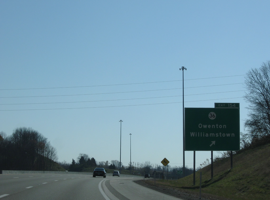
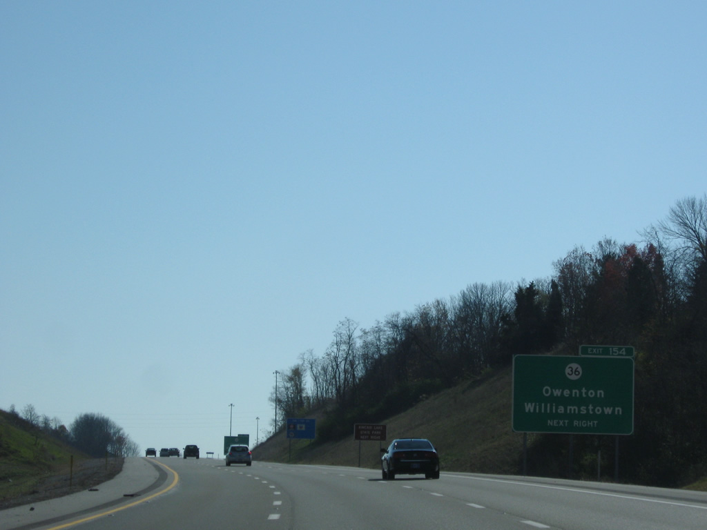
Entering the Exit 154 diamond interchange with KY 36 (Stewartsville Road). U.S. 25 and Williamstown lie directly to the east while Owenton is situated 24 miles to the southwest via KY 36 and KY 22.
11/08/09
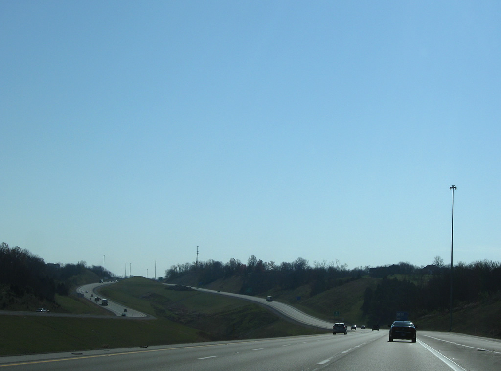
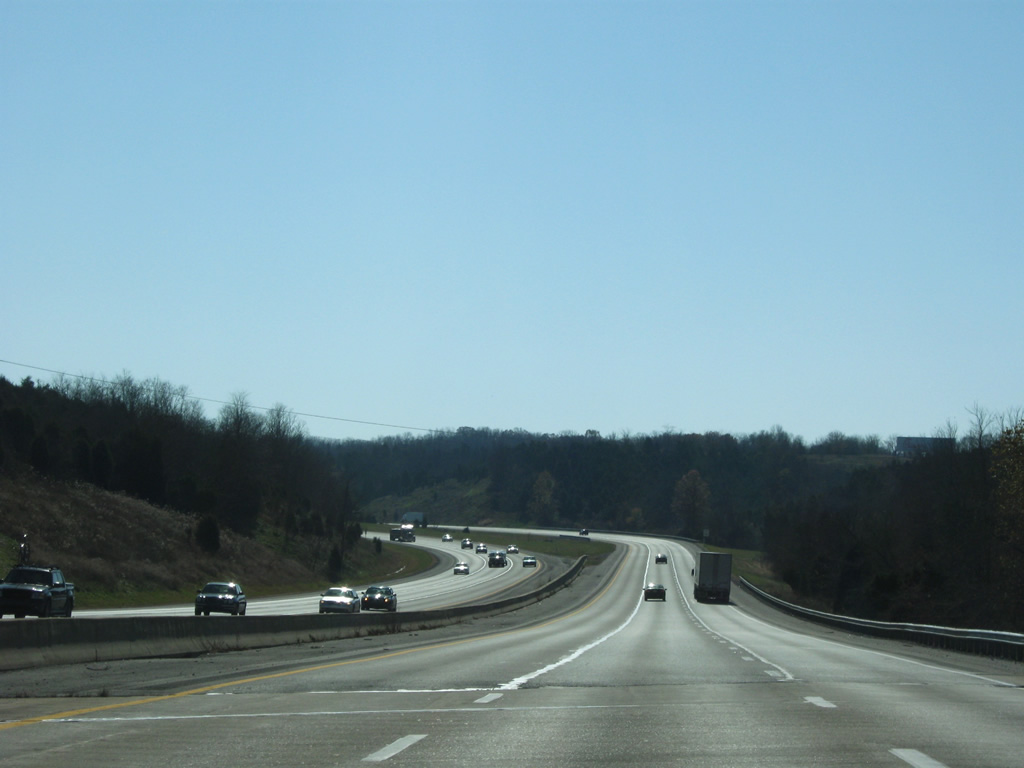
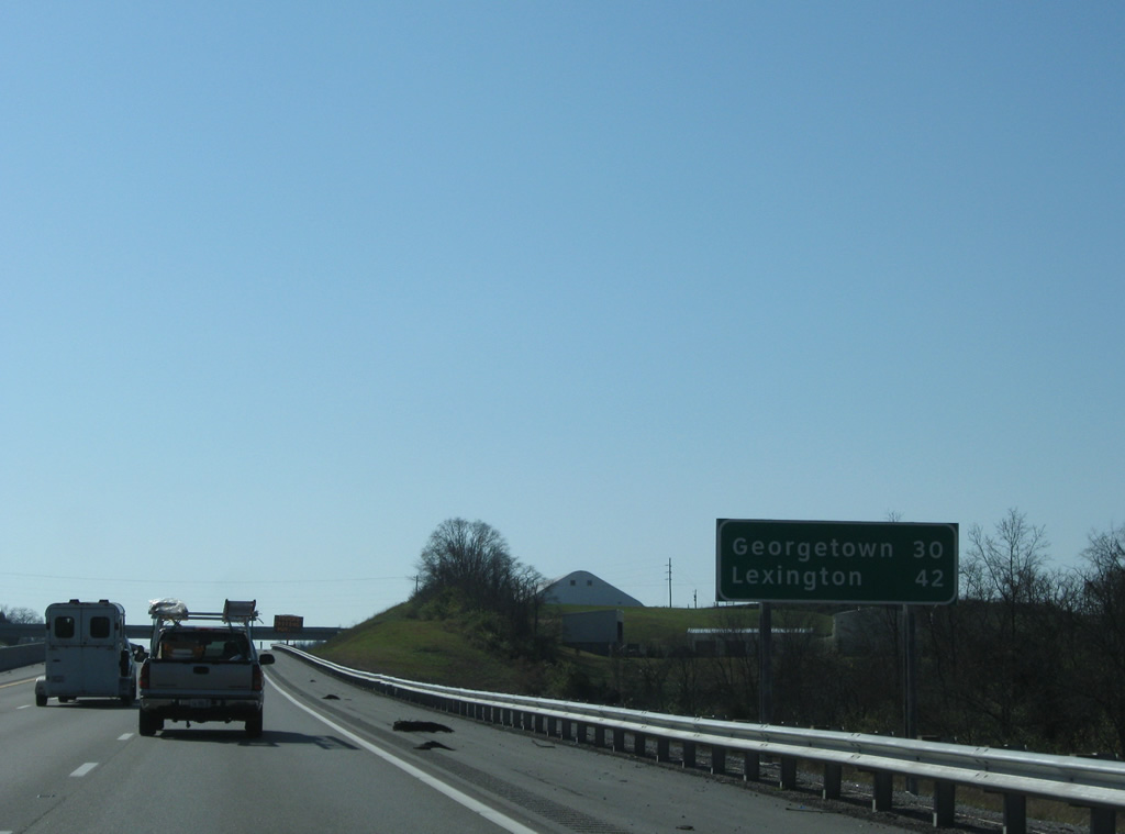
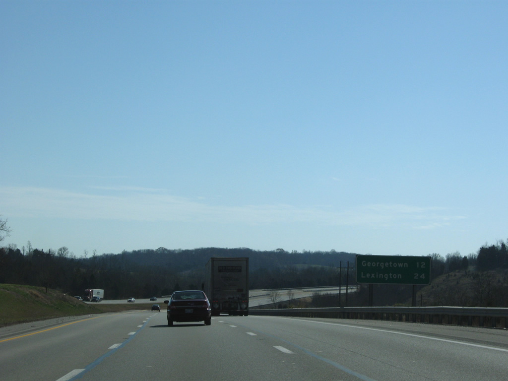
Continuing south along Interstate 75, 30 miles to Georgetown, the seat of Woodford County, and 42 miles to Lexington.
11/08/09

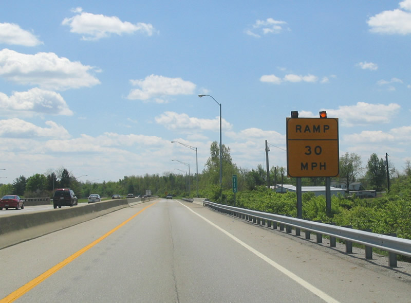
Construction was nearing completion in November 2009 to expand Interstate 75 to six overall lanes between Exits 154 and 144. Overall the freeway is at least six lanes width from Cincinnati south to the Rockcastle County line (south of Exit 76).
11/08/09
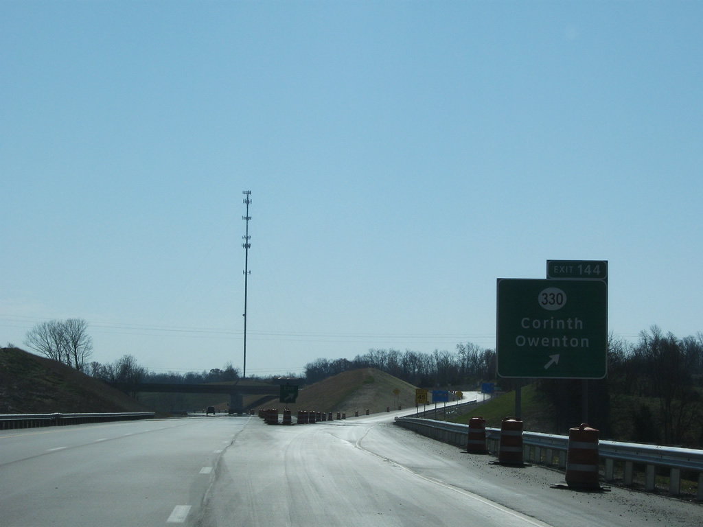
Approaching KY 330 and Exit 144. Like KY 36, KY 330 provides indirect access to Owenton via KY 227 (former U.S. 227) and KY 22.
11/08/09
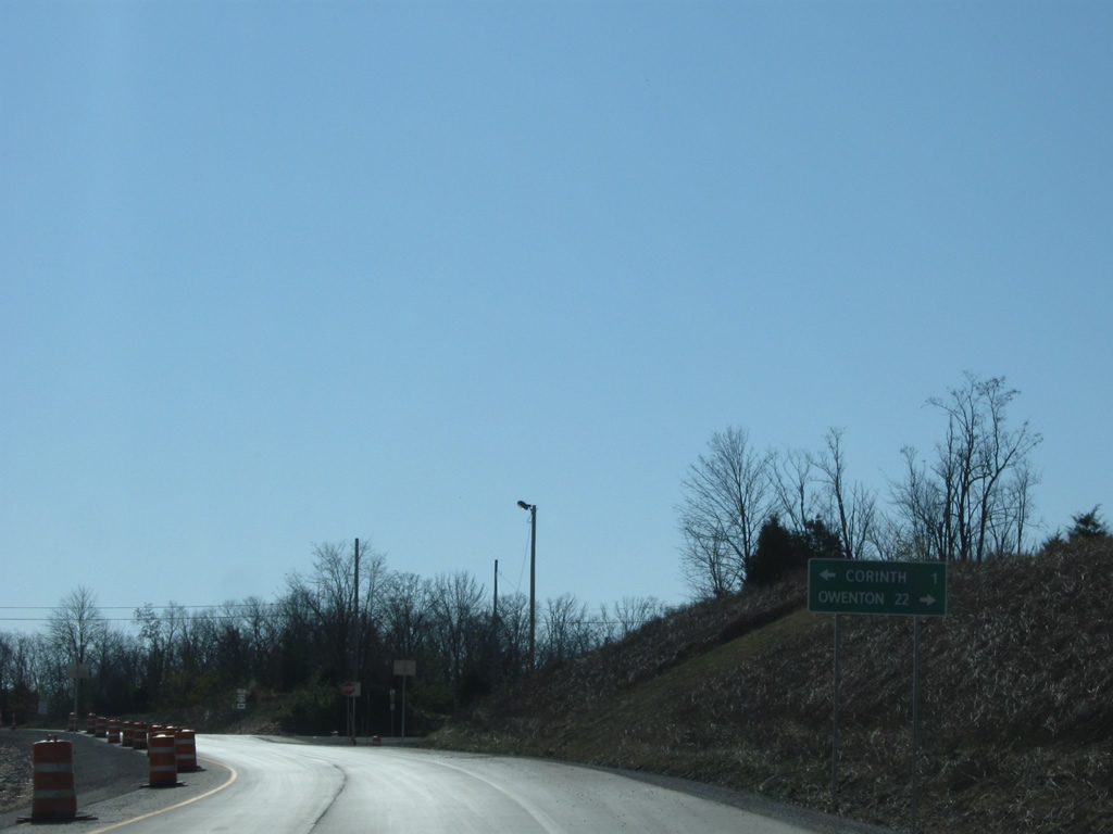
The town of Corinth lies 1.40 miles east of Exit 144 at U.S. 25 (Dixie Highway).
11/08/09
Interstate 75 enters Scott County just south of the interchange with KY 330 (Owenton Road).
11/08/09
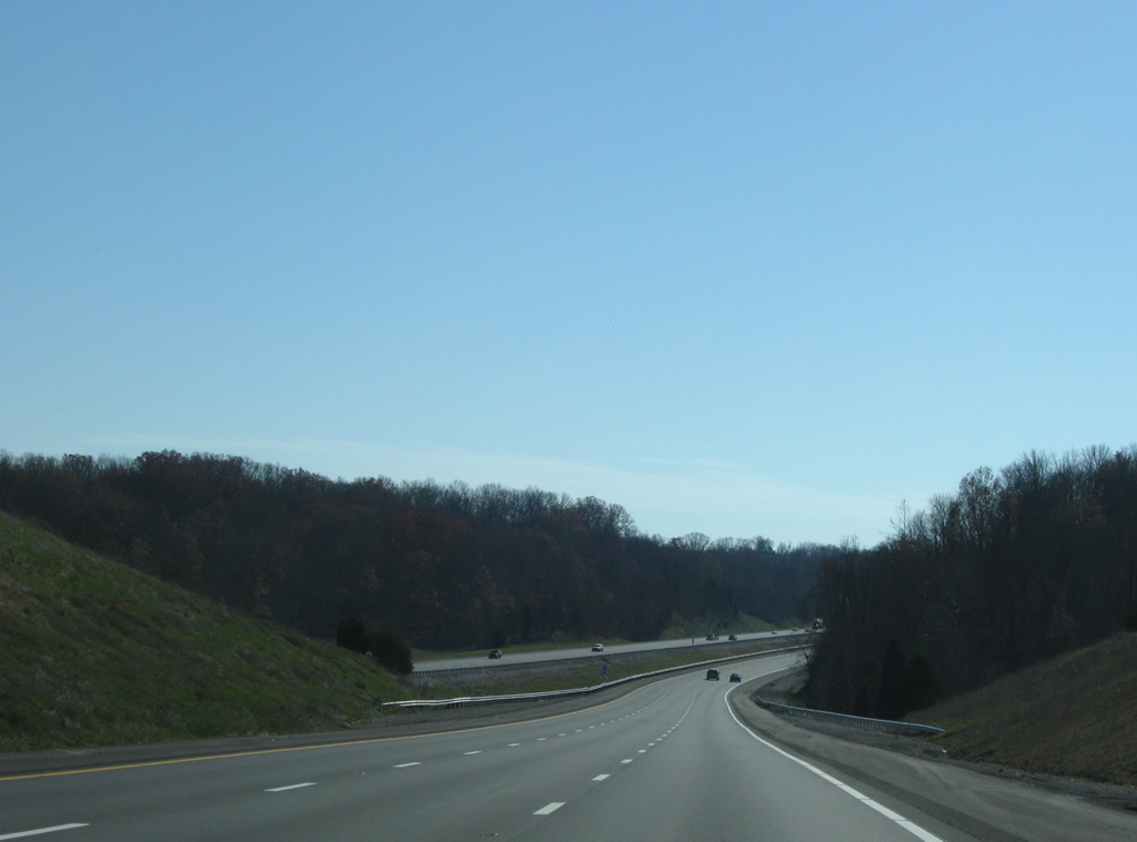
Low rolling hills set the tone for the drive of Interstate 75 in northern Scott County. This scene looks near the crossing of South Rays Fork.
11/08/09
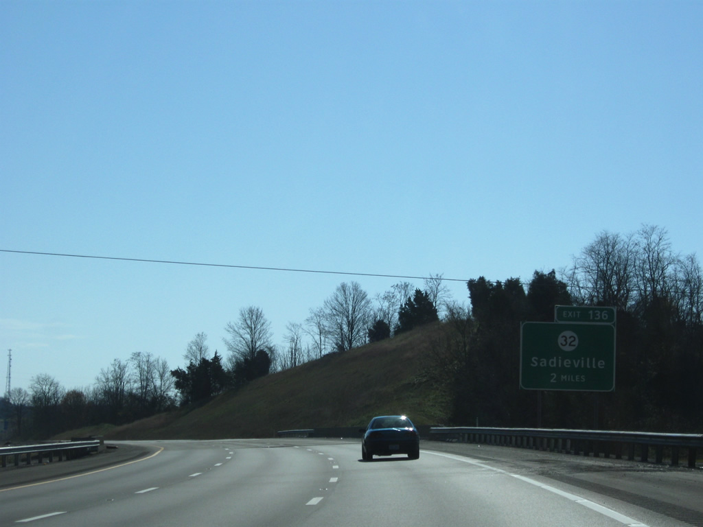
Two miles north of the Exit 36 diamond interchange with KY 32 (Porter Road) on Interstate 75 south. KY 32 serves the town of Sadieville, located 2.10 miles to the east via a very brief multiplex with U.S. 25.
11/08/09

KY 32 west of Interstate 75 meanders in a loop that pushes the route southwesterly then southeasterly again for an eventual end at U.S. 25 in the northwest quadrant of Georgetown.
11/08/09
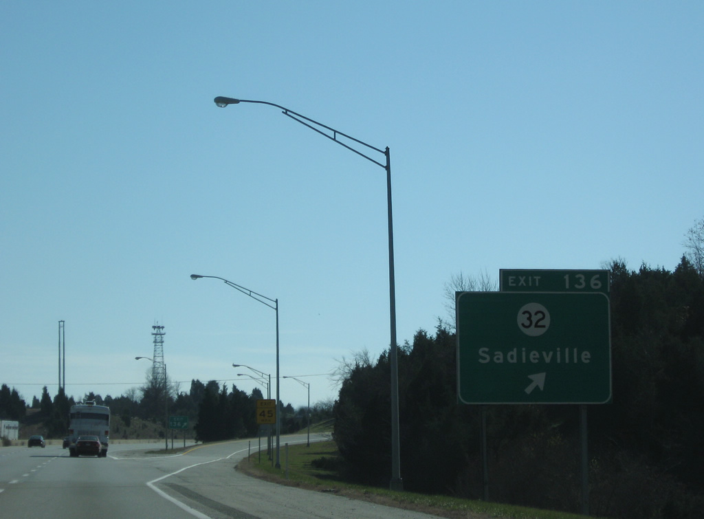
Exit 136 departs Interstate 75 south for KY 22 (Porter Road). Overall, the state route travels almost 161 miles from Georgetown east to Cynthiana, Carlisle, Morehead and an end at Louisa by the West Virginia state line.
11/08/09
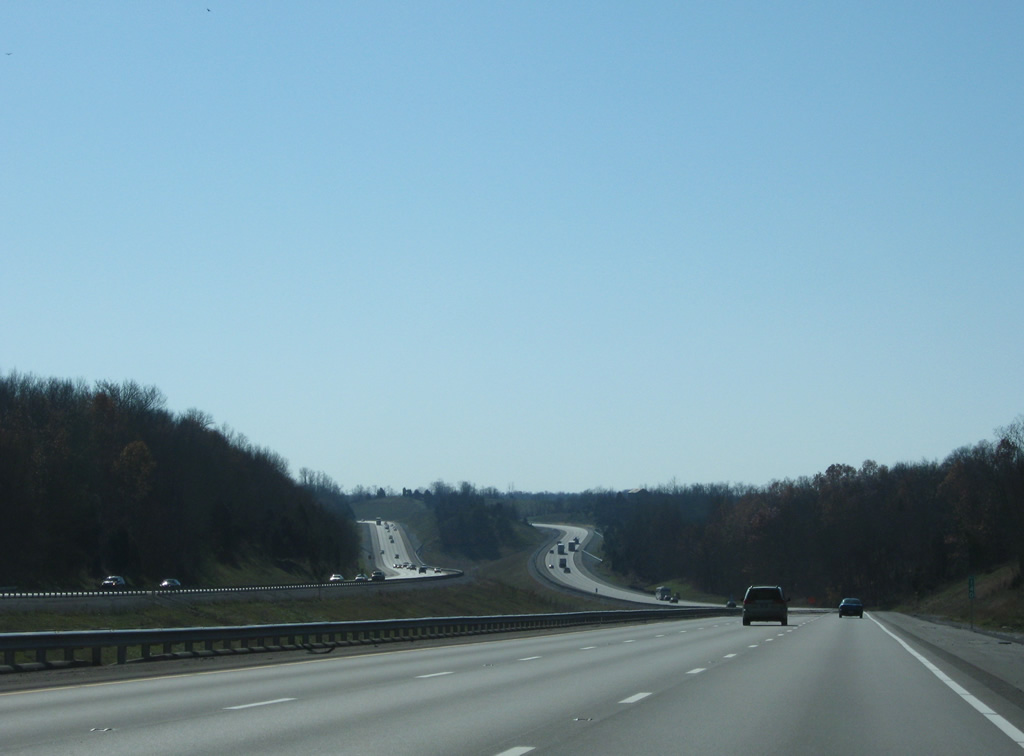
Heading south along Interstate 75, U.S. 25 stays to the east through Double Culvert before switching sides with the freeway on the 12 mile drive to Georgetown.
11/08/09
Beyond the U.S. 25 (Cincinnati Road) under crossing, Interstate 75 widens to accommodate a grassy median.
11/08/09
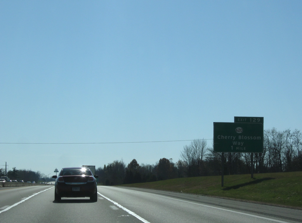
KY 620 (Cherry Blossom Way) crosses paths with Interstate 75 at the Exit 129 diamond interchange in one mile at Delaplain.
11/08/09
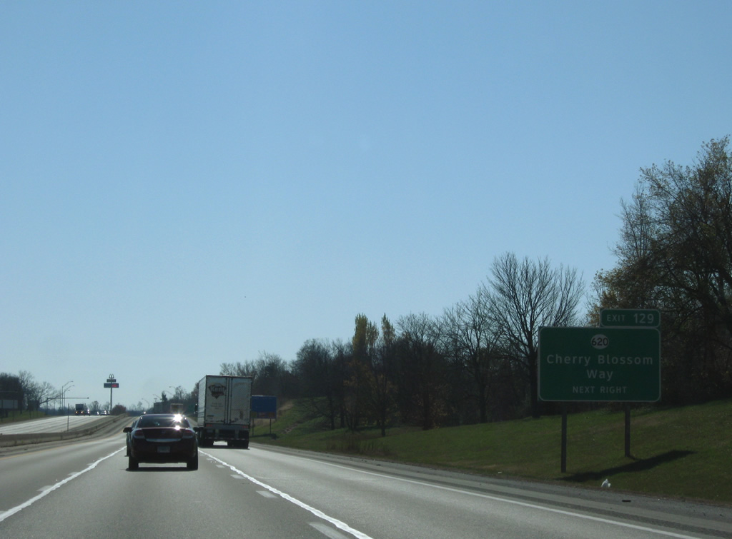
Passing by a former weigh station side, Interstate 75 nears the Exit 129 off-ramp to KY 620 (Cherry Blossom Way). KY 620 totals 19.05 miles in a loop beginning at KY 3487 nearby and leading northwest to Biddle and east to Double Culvert and Turkey Foot.
11/08/09

KY 620 follows Cherry Blossom Way eastward from Delaplain Road and U.S. 25 (Cincinnati Road) to KY 3487, which links U.S. 62 with KY 620 along the east side of the Georgetown Toyota Plant. Cherry Blossom Way constitutes a multi-lane arterial encircling the manufacturing plant between Delaplain and Georgetown.
11/08/09

Continuing southward into the greater Lexington area, the Georgetown city center is five miles to the southwest.
11/08/09

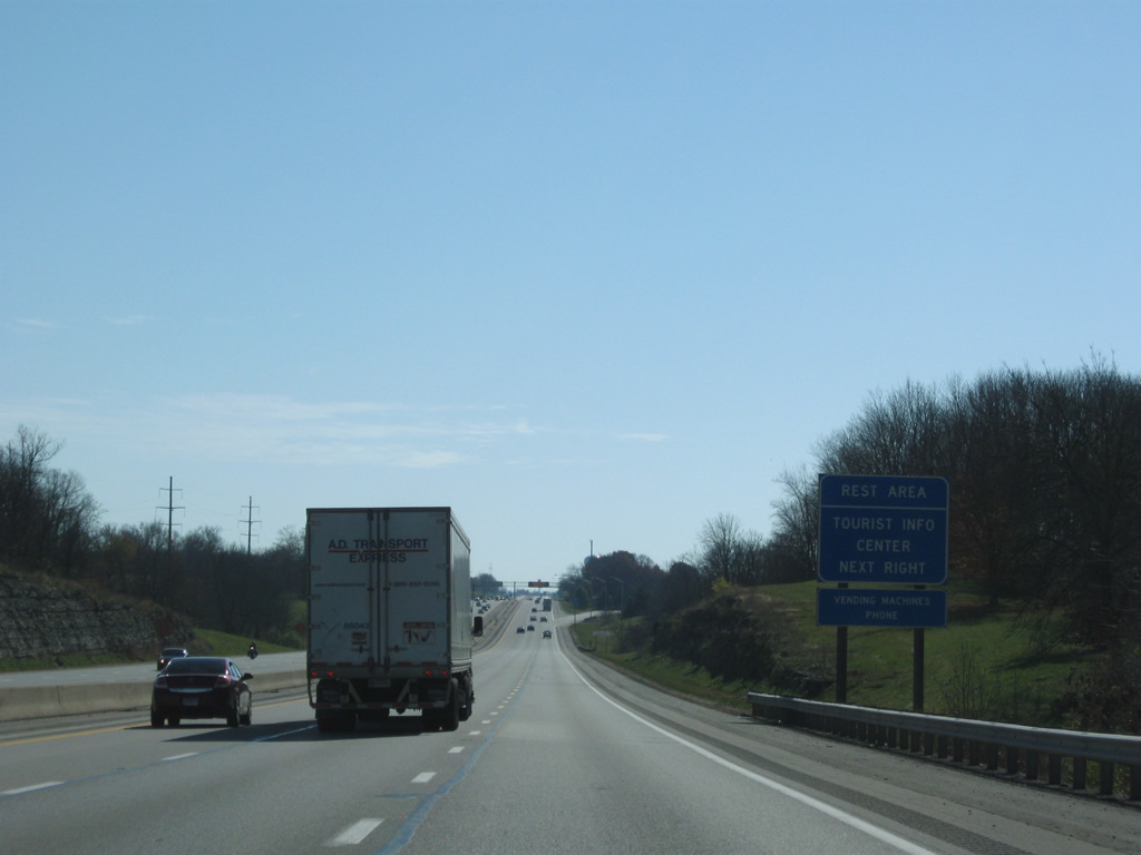
Passing by the Toyota plant to the east, Interstate 75 travelers see a set of rest areas in both directions. The southbound facility includes a tourist information center.
11/08/09
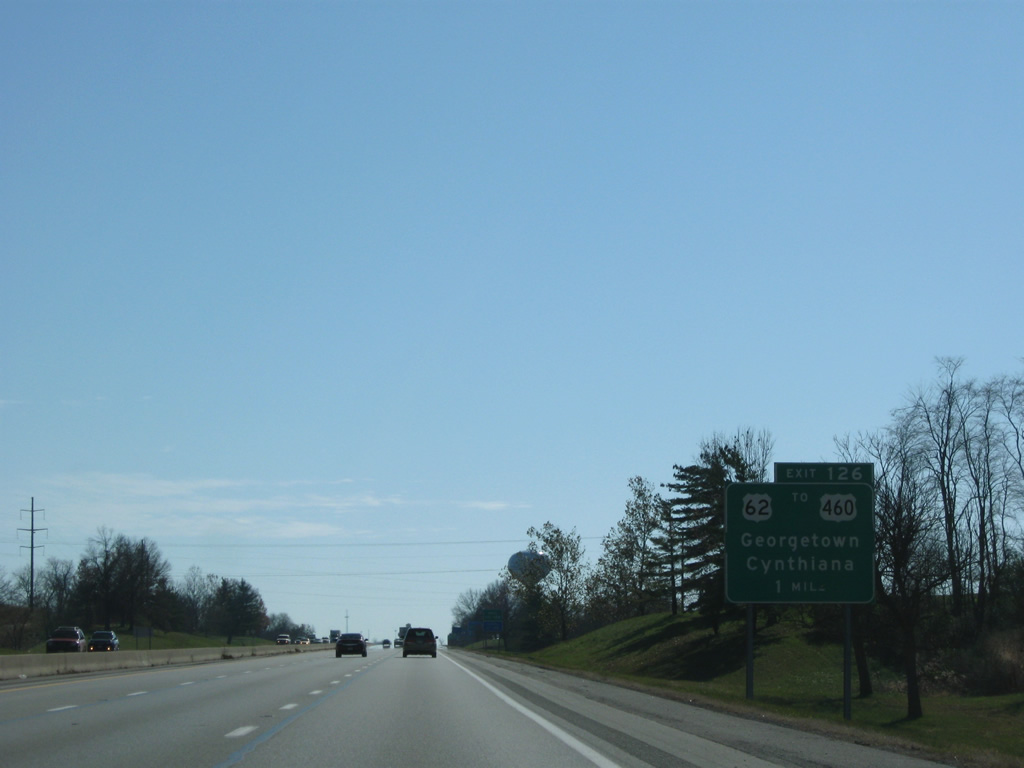
U.S. 62 overtakes Cherry Blossom Way from KY 3487 on the drive south from Cynthiana, Broadwell, Leesburg and Oxford. The highway expands to four lanes from KY 3487 south with suburban growth enveloping the diamond interchange (Exit 126) at Interstate 75.
11/08/09
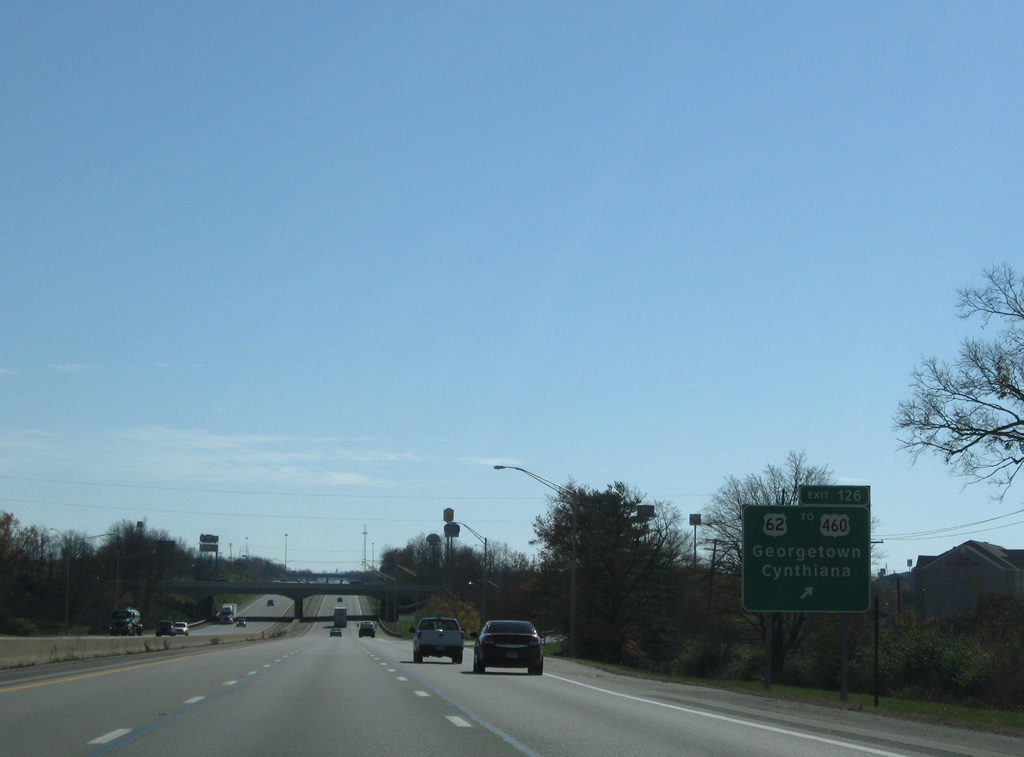
Southbound at the Exit 126 ramp departure to U.S. 62 (Cherry Blossom Way) at Georgetown. U.S. 62 intersects U.S. 460 (Paris Pike) just to the south. There is no direct access to U.S. 460 from I-75 south, so motorists must use Cherry Blossom Way to make the connection. U.S. 460 enters Georgetown from Paris to the east along the original corridor of U.S. 227.
11/08/09
Reassurance marker posted at the U.S. 62 (Cherry Blossom Way) overpass. A half diamond interchange adds additional traffic from U.S. 460 (Paris Pike) nearby.
11/08/09
Leaving the U.S. 460 on-ramp, Interstate 75 sees another shield ahead of the crossing over North Elkhorn Creek.
11/08/09
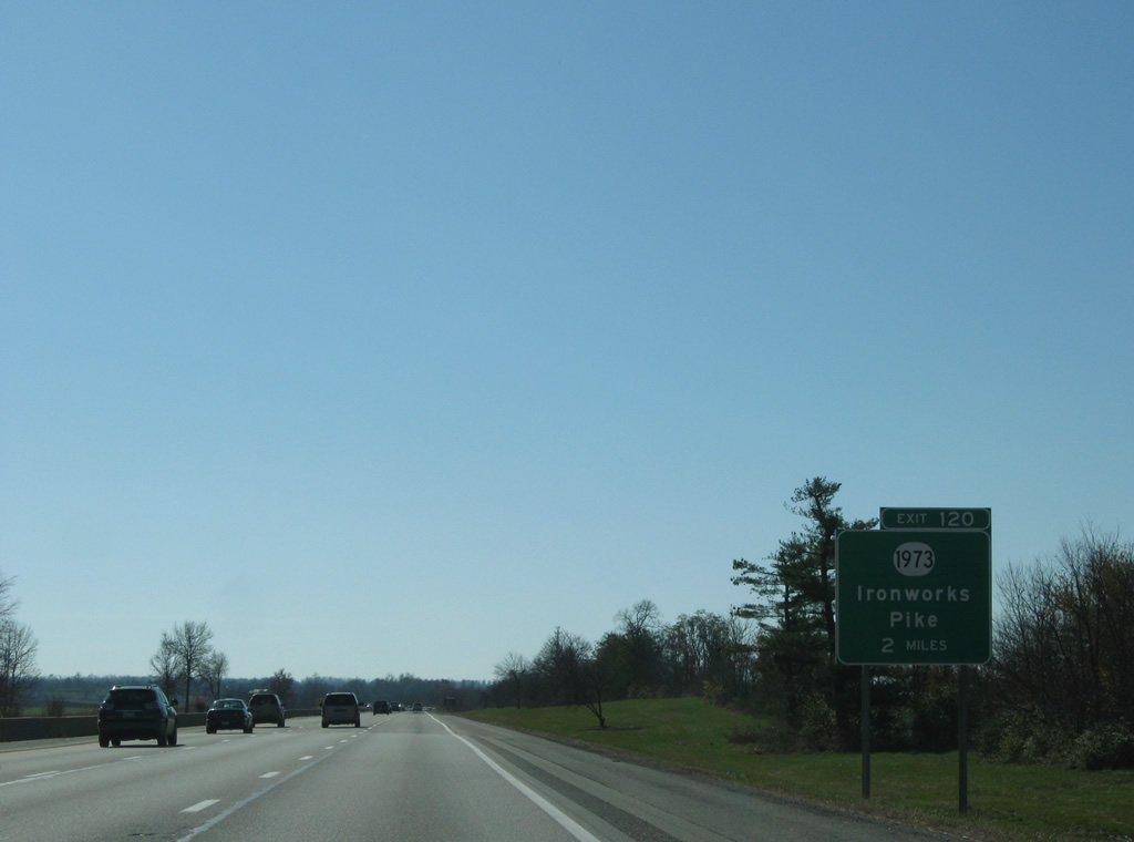
Two miles north of the Exit 120 diamond interchange with KY 1020 (Ironworks Pike) at the Kentucky Horse Park.
11/08/09
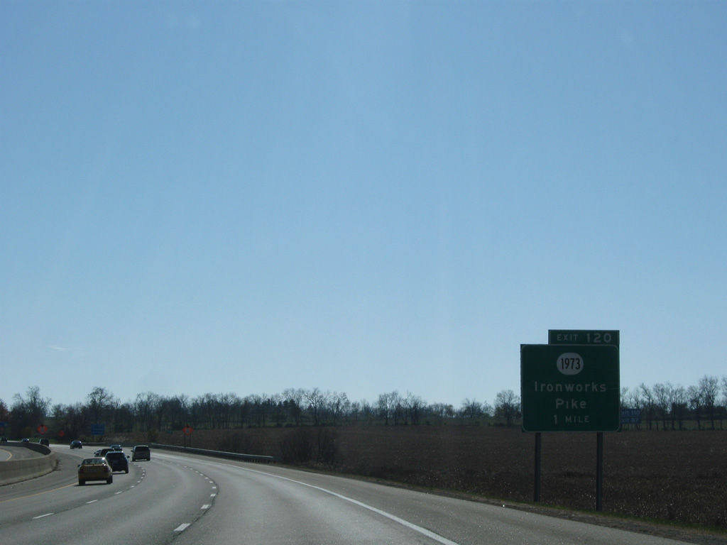
U.S. 25 (Lexington Road) leaves Georgetown and merges with KY 1973 briefly west of Exit 120 and Donerail. The US Highway continues south into Lexington as KY 1973 follows Ironworks Pike southeast to U.S. 27 (Paris Pike).
11/08/09

Crossing into Fayette County along Interstate 75 south. The city of Lexington and county merged to form a common government in 1974, thus the city limits of match the county lines.
11/08/09

Exit 120 departs for KY 1973 (Ironworks Pike). KY 1973 ventures northwest from U.S. 25 (Lexington Road) to White Sulphur and U.S. 460.
11/08/09
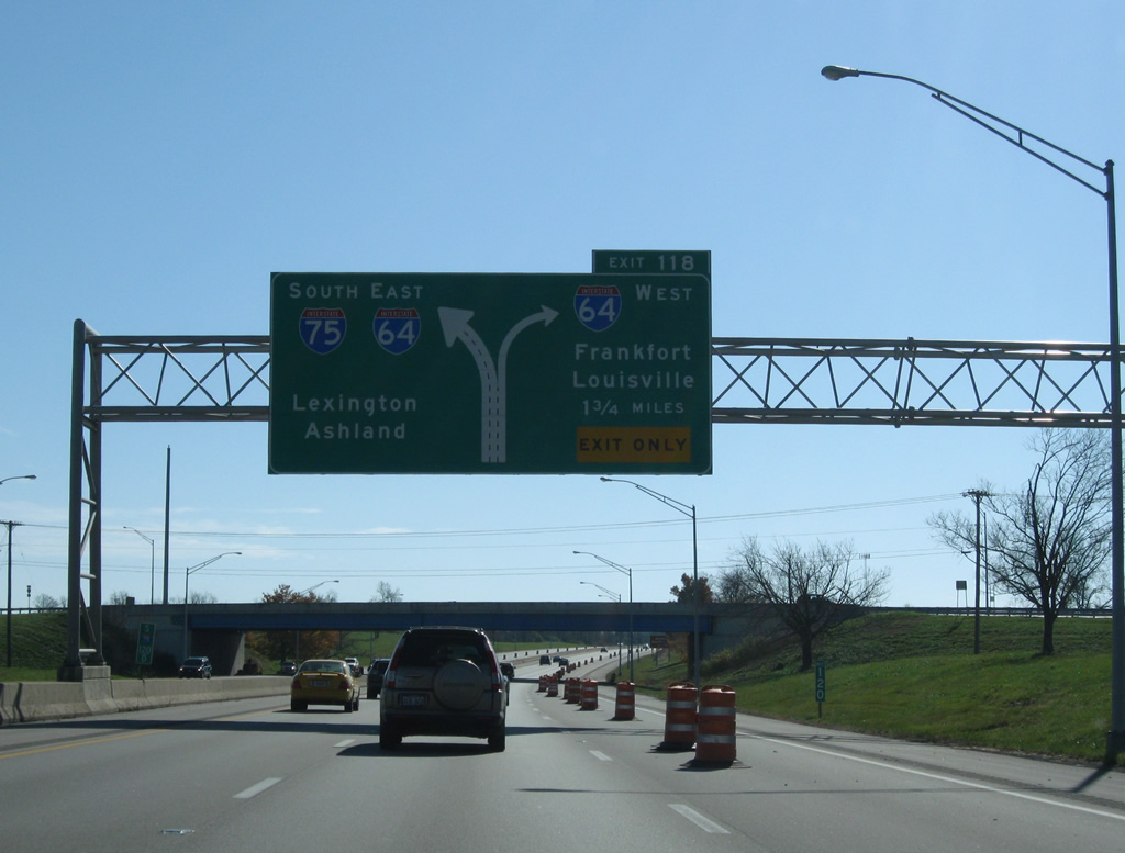
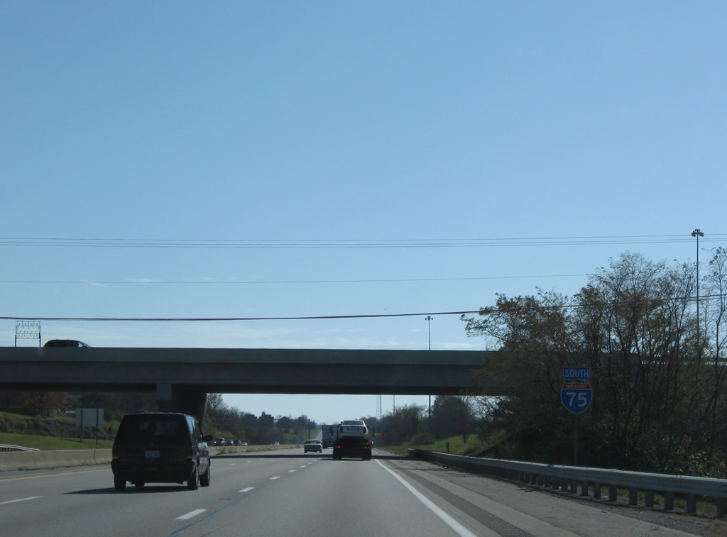
Interstate 64 enters Lexington from Frankfort and Louisville to merge with Interstate 75 south in 1.75 miles.
11/08/09
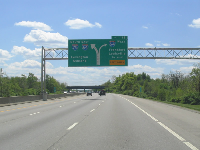
U.S. 25 passes over Interstate 75 on the 0.75 mile approach to Exit 118 with Interstate 64 west. Interstate 64 travels 968 miles overall between Wentzville, Missouri and Hampton Roads, Virginia. 185 of those miles join Lexington with Ashland to the east and Louisville to the west.
05/01/05

A single-lane ramp connects Interstate 75 south with Interstate 64 west at Exit 118. Interstate 64 travels 20 miles west to the capital city.
05/01/05
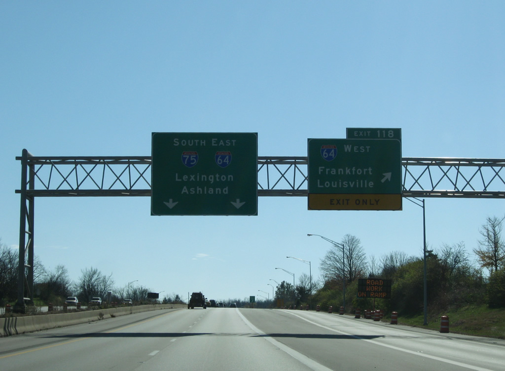
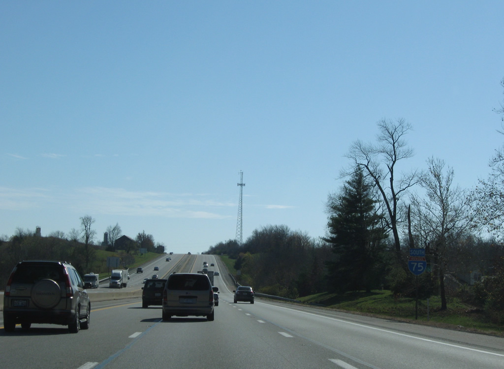
Interstate 64 east & 75 south begin their 6.3 mile overlap through the city of Lexington at Exit 118. Interstate 64 west continues 75 miles to Louisville along a scenic and rural route which makes up the southern side of Kentucky's "Golden Triangle".
11/08/09
Exit 118 consists of a tight ramp to Interstate 64 as part of an overall trumpet interchange.
05/01/05
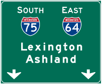

Photo Credits:
- ABRoads: 11/08/09
- Carter Buchanan: 05/01/05
Connect with:
Page Updated Friday March 09, 2012.