
Interstate 80 West - Teaneck to Parsippany

 West
West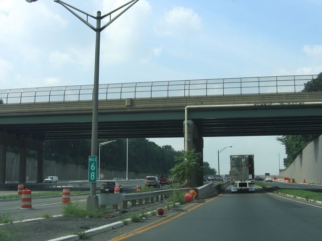
Milepost 68 for Interstate 80 precedes the Teaneck Road (CR 39) overpass as the northbound ramp from I-95 partitions into ramps for the Local and Express lanes.
08/29/05
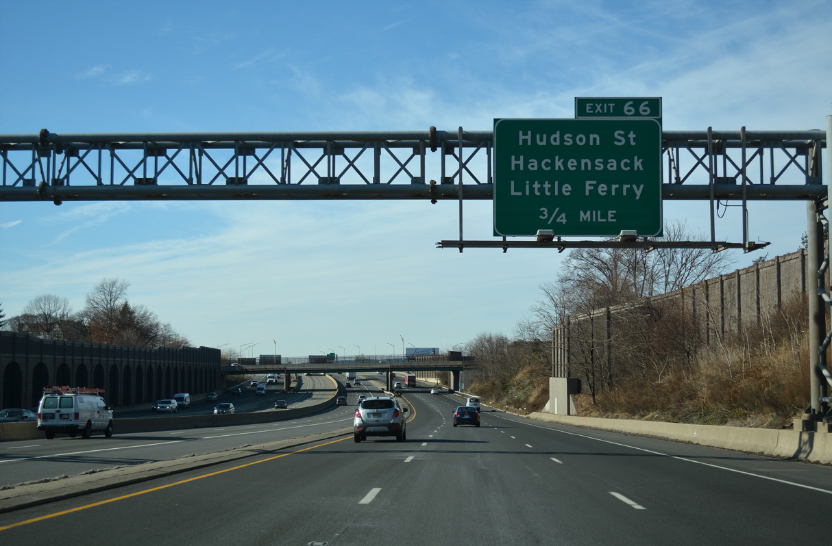
Interstate 80 travels with ten overall lanes below the street grid of Teaneck Township, Ridgefield Park and Bogota to the city of Hackensack. A wye interchange links with Kennedy Street in south Hackensack at Exit 66.
12/19/16
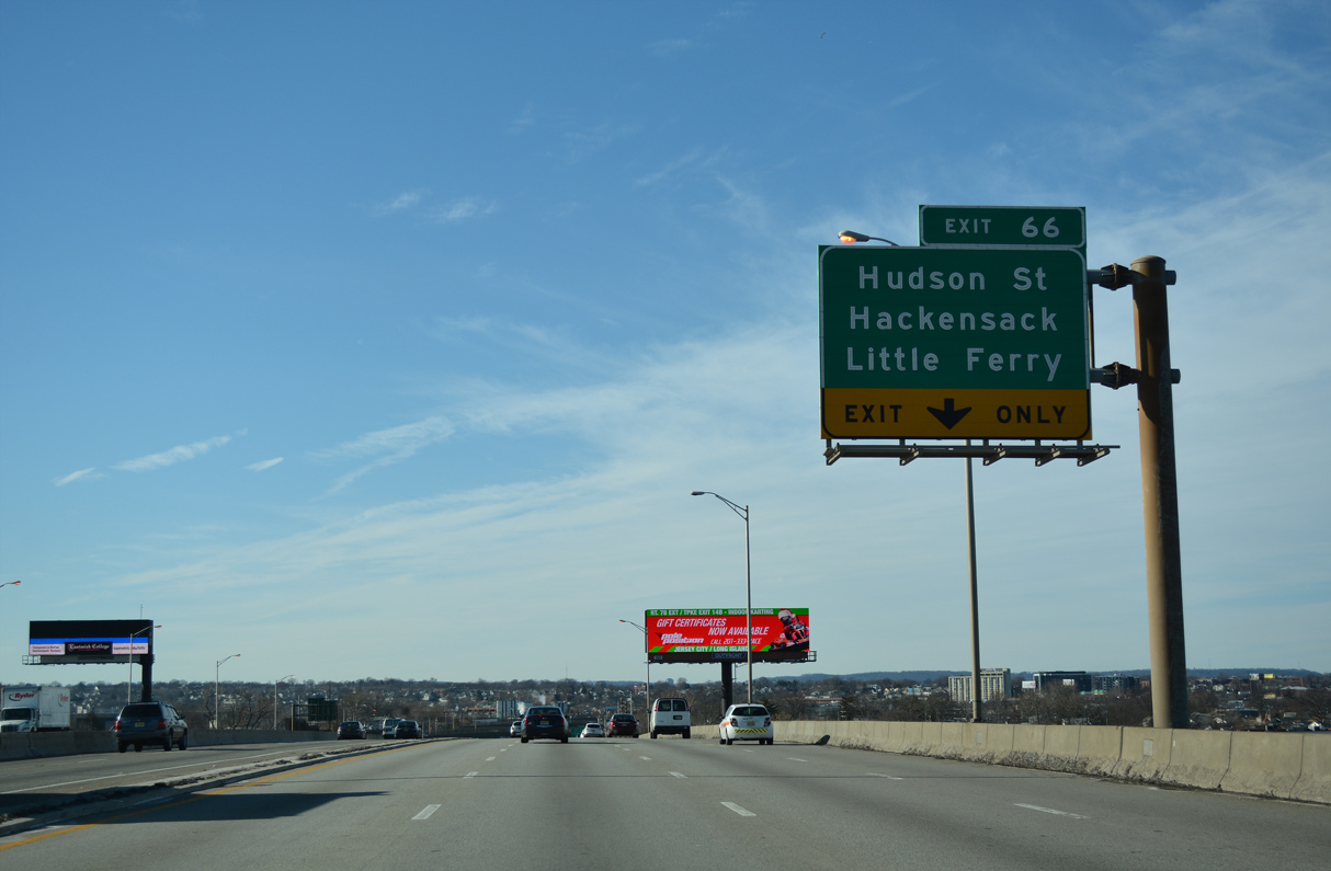
Kennedy Street runs east two blocks to Hudson Street (CR 124) and 0.25 miles to River Street (CR 503). Both routes lead south to the borough of Little Ferry.
12/19/16
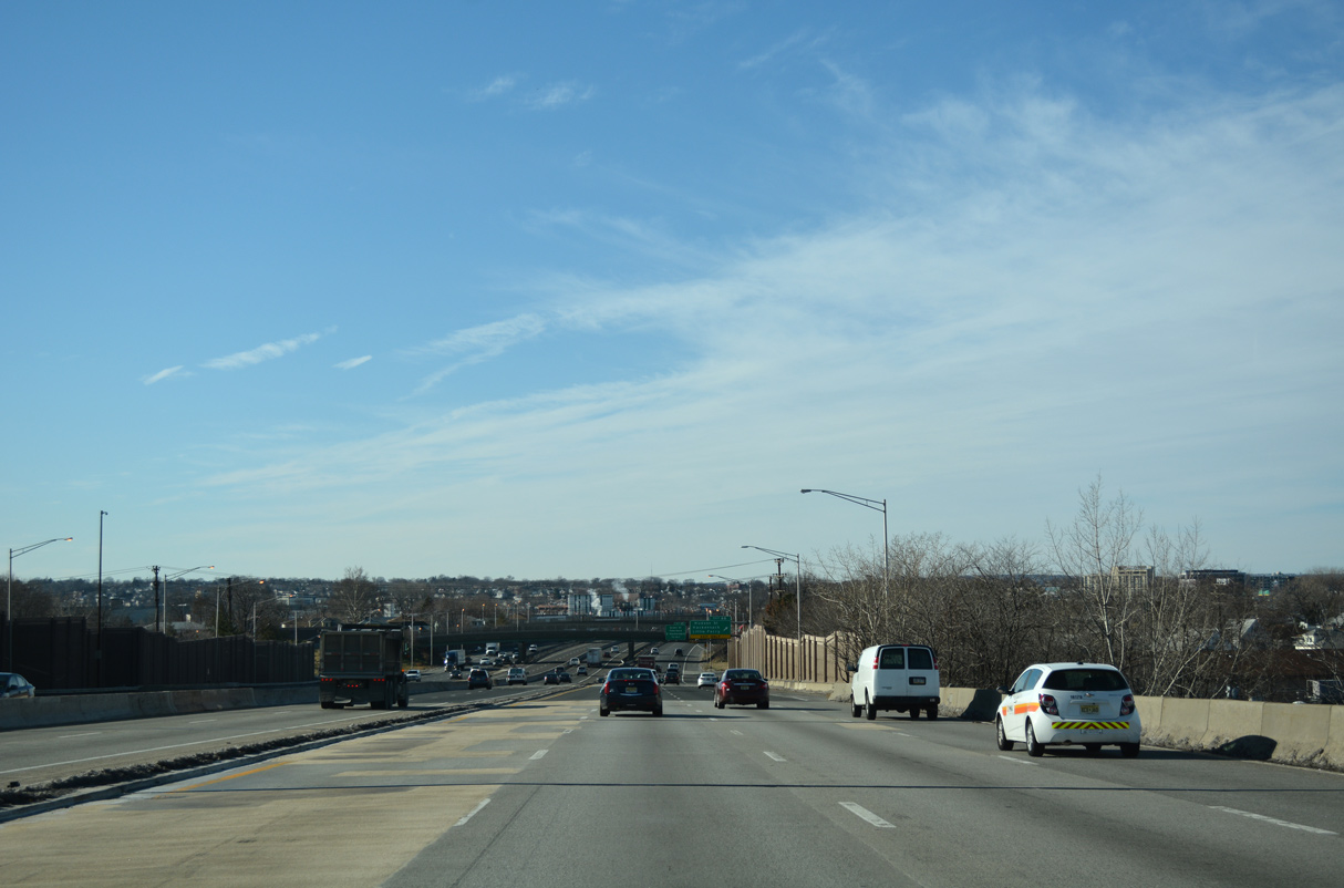
Interstate 80 spans the Hackensack River west ahead of Exit 66.
12/19/16
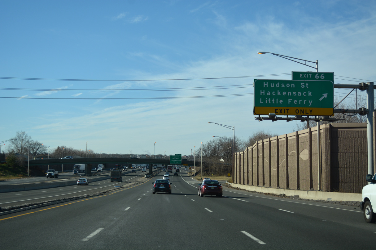
Exit 66 parts ways with the Local lanes of I-80 west beyond the Hudson Street underpass. CR 503 (River Street) parallels the Hackensack River north to Downtown Hackensack. The 17.93 mile long route originates at Route 120 in Carlstadt to the south and ends as NY 304 in Montvale to the north.
12/19/16
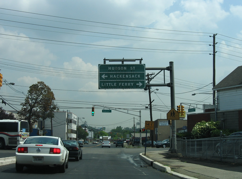
Exit 66 defaults onto Kennedy Street east. Hudson Street (CR 124) runs south directly to CR 503 and north to the Bergen County Judicial Center and Hackensack City Hall. Hackensack is the Bergen County seat.
08/29/05
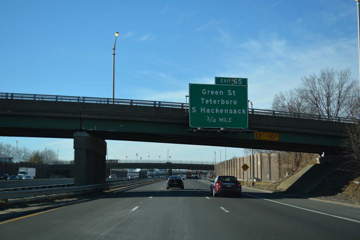
Right in right out RIRO ramps link I-80 with parallel Wesley and North Streets at forthcoming Exit 65. Wesley Street extends Kennedy Street west through South Hackensack Township.
12/19/16
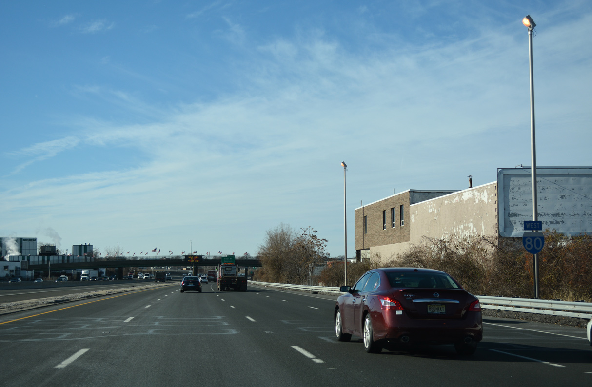
The first confirming marker for Interstate 80 west stands between the Phillips Avenue and Huyler Street (CR S40) overpasses in South Hackensack Township.
12/19/16
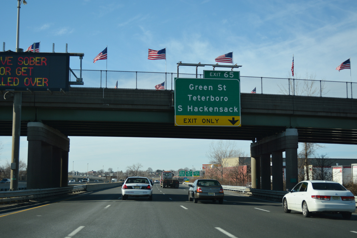
Exit 65 connects with adjacent Wesley Street, midway between intersections with Green and Huyler Streets.
12/19/16
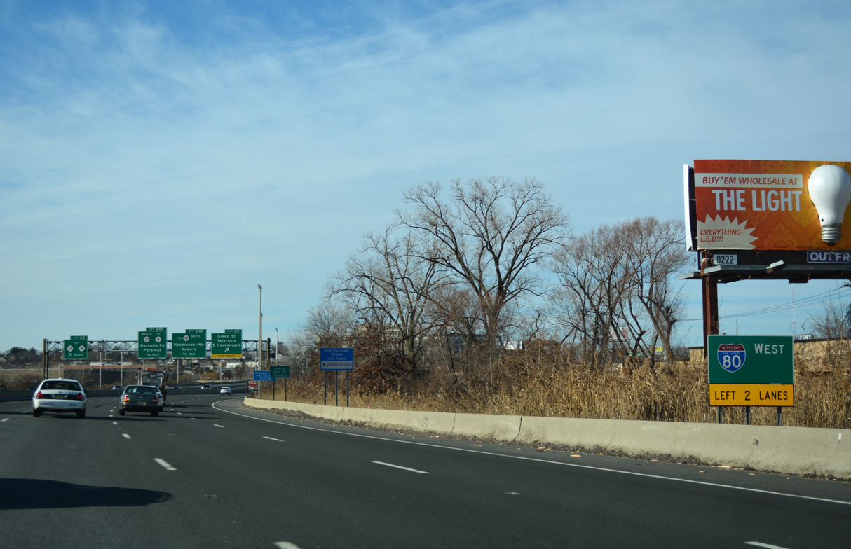
Exit 65 leaves the Interstate 80 Local lanes of I-80 for Wesley Street at Teterboro.
12/19/16
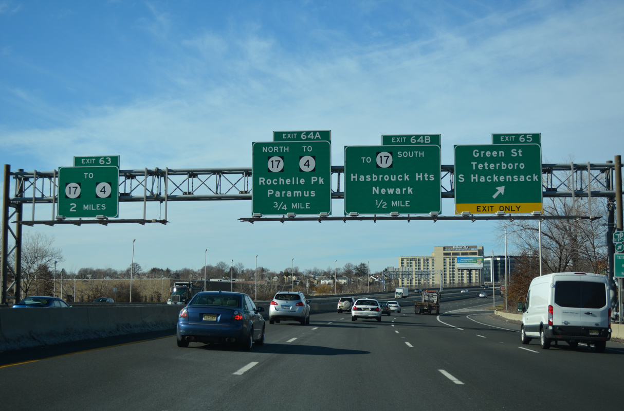
Route 17 converges with I-80 north from the borough of Hasbrouck Heights at the ensuing exit in a half mile.
12/19/16
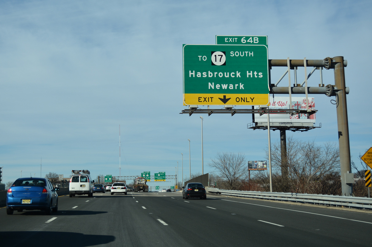
An indirect connection from I-80 west to Route 17 south utilizes Terrace Avenue (CR 55) south from Exit 64 B in Hackensack.
12/19/16
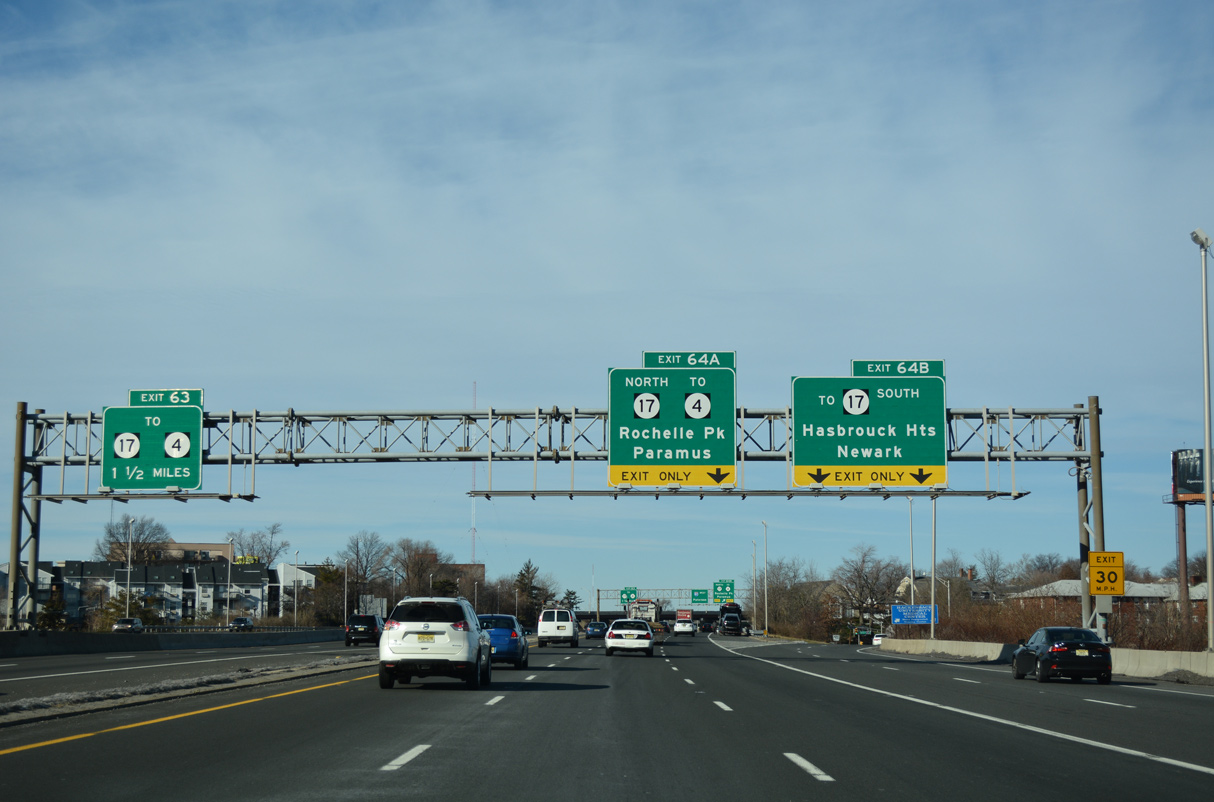
Exit 63 to Riverview Avenue in Lodi follows the merge of the I-80 Express and Local Lanes in 1.5 miles.
12/19/16
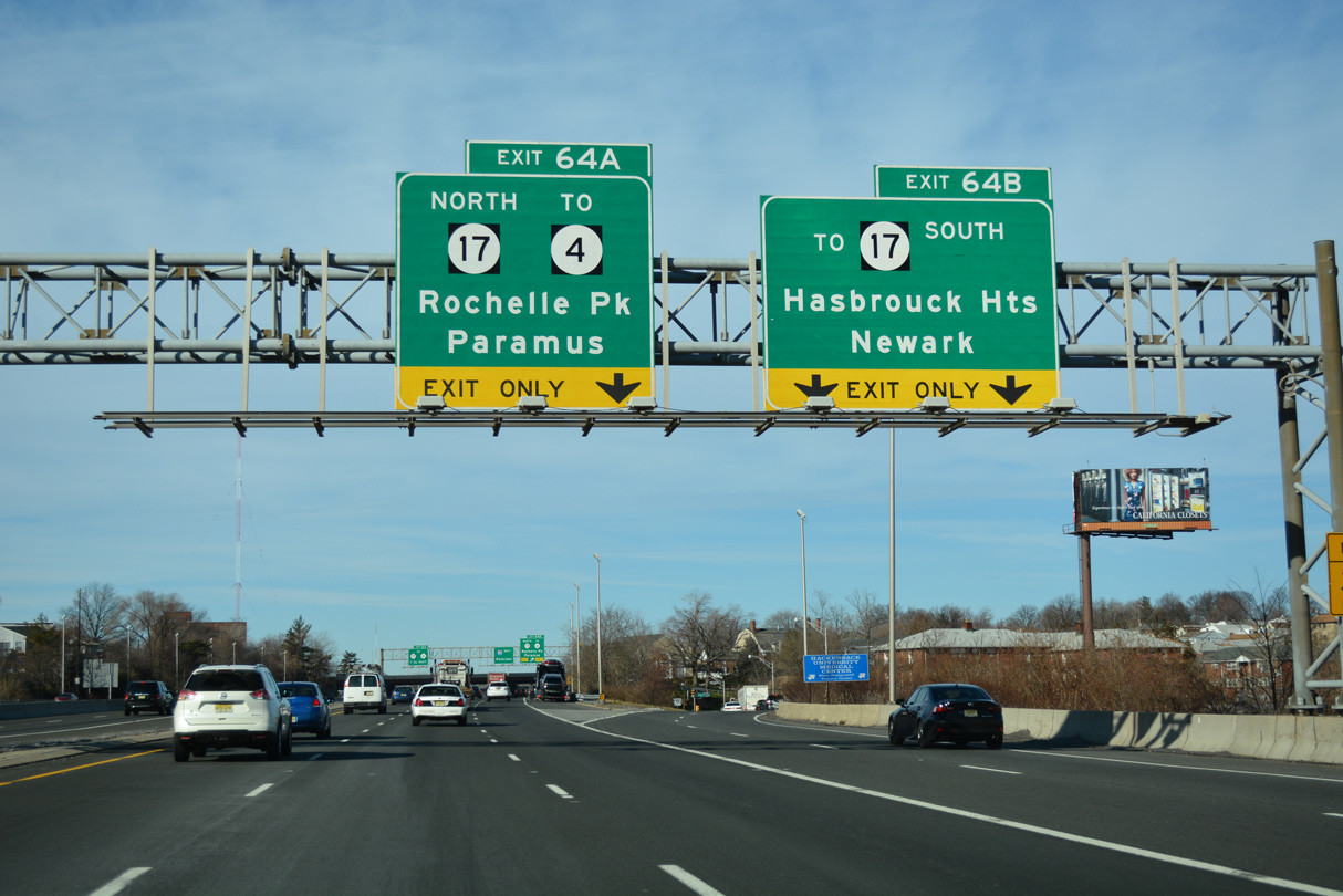
Route 17 travels south from U.S. 46 along the Hasbrouck Heights and Teterboro line. The six to eight lane arterial continues to Route 3 in Rutherford.
12/19/16
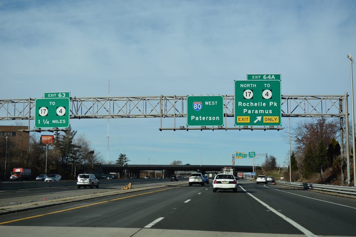
The roadways along Route 17 separate to run alongside the I-80 Local Lanes from southwest Hackensack into Lodi. Exit 64 A directly links I-80 westbound with Route 17 north to Route 4 at Paramus.
12/19/16
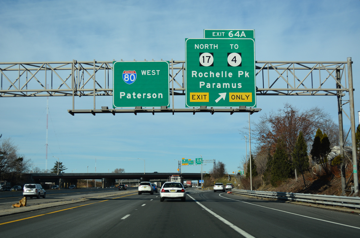
Route 17 branches north from I-80 to Rochelle Park Township. Forming a multi state highway with NY 17 west to Binghamton, Route 17 extends north to I-287 at Mahwah.
12/19/16
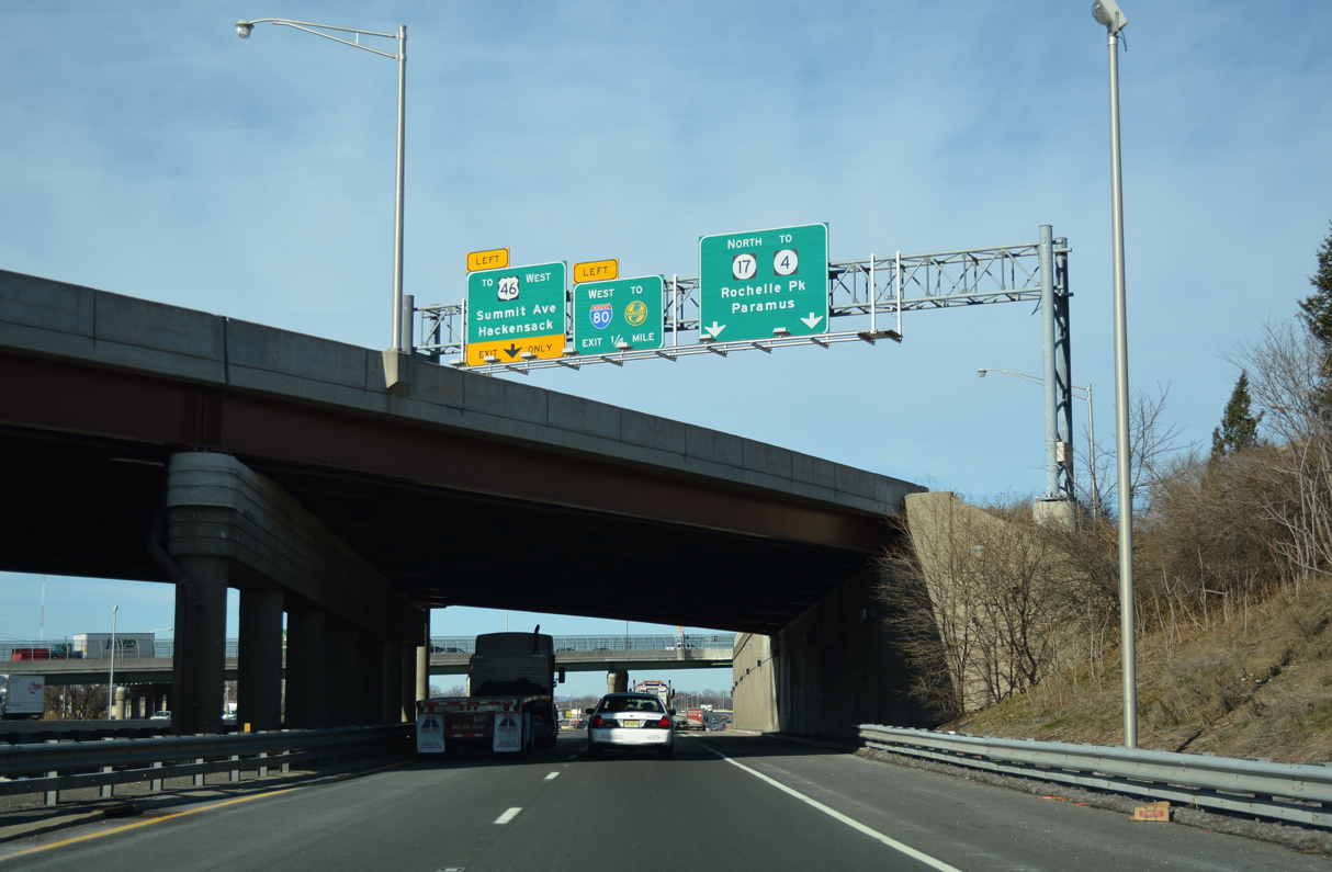
Route 17 northbound spanning Interstate 80 west.
12/19/16
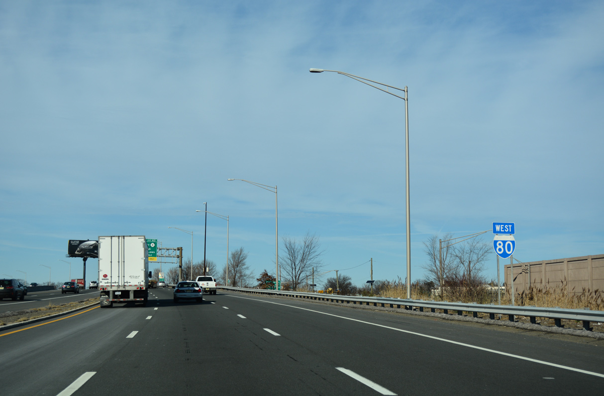
Route 17 diverges north into the southwest corner of Maywood while Interstate 80 west enters the borough of Lodi.
12/19/16
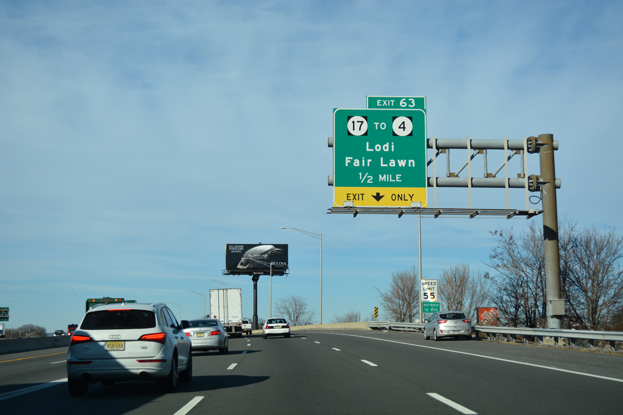
The I-80 Express and Local Lanes merge a half mile ahead of the diamond interchange (Exit 63) with Riverview Avenue.
12/19/16
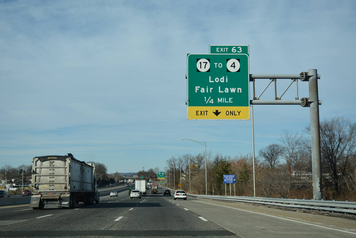
Riverview Avenue links I-80 with parallel Essex Street (CR 56) west of RIRO ramps with Route 17.
12/19/16
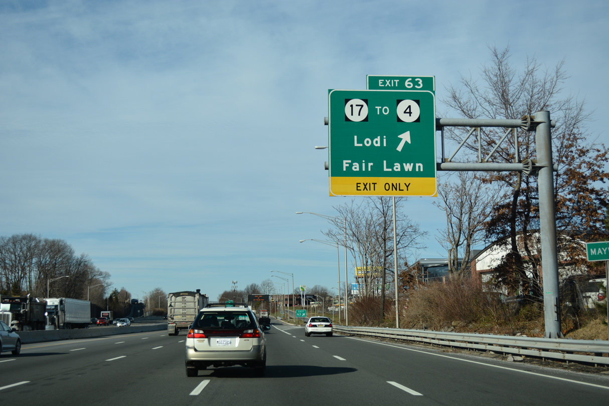
Essex Street (CR 56) runs along the Rochelle Park Township line west from Riverview Avenue to become Market Street across the Saddle River. Saddle River Road (CR 79) stems north from Market Street to Fair Lawn.
12/19/16
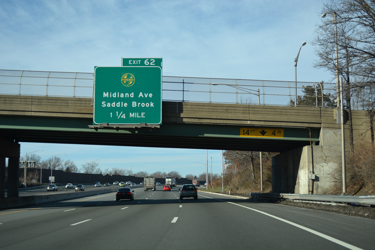
A trumpet interchange and access road joins Interstate 80 west with the Garden State Parkway (GSP) and Pehle Avenue (CR 105) at Exit 62 in 1.25 miles.
12/19/16
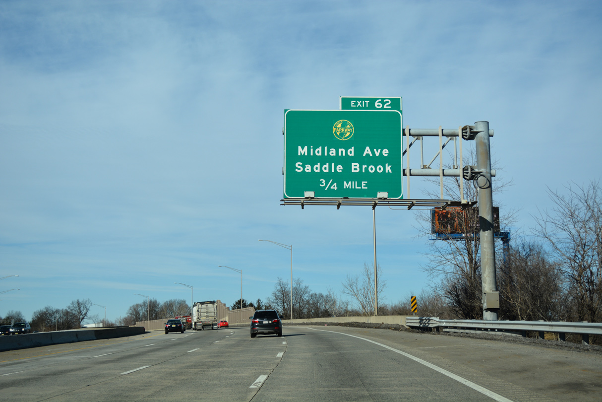
Interstate 80 crosses the Saddle River northwest into Saddle Brook Township ahead of Exit 62.
12/19/16
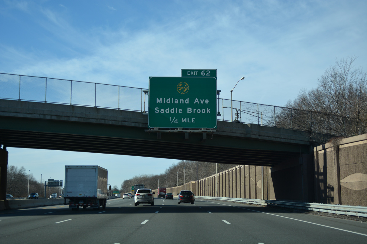
The Garden State Parkway, a 172.40 mile long toll road from Cape May to Chestnut Ridge, New York, weaves through North Jersey between Newark and Paterson. The Garden State Parkway Extension north links with I-87/287 along the New York State Thruway.
12/19/16
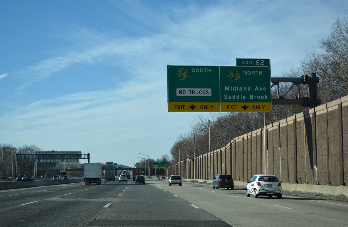
Two lanes depart from Interstate 80 west at Exit 62 for the GSP north to Paramus and south to Clifton.
12/19/16
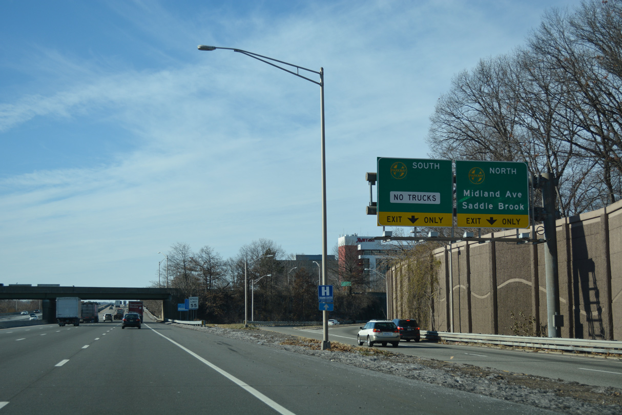
0.80 miles in length, Pehle Avenue (CR 105) leads west from Exit 62 to Midland Avenue (CR 67) and east to Saddle River Road (CR 105).
12/19/16
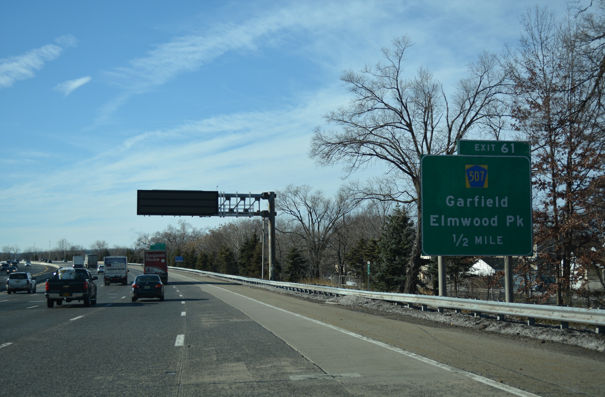
Advancing west, the succeeding exit along Interstate 80 is for CR 507 (River Drive) in the borough of Elmwood Park.
12/19/16
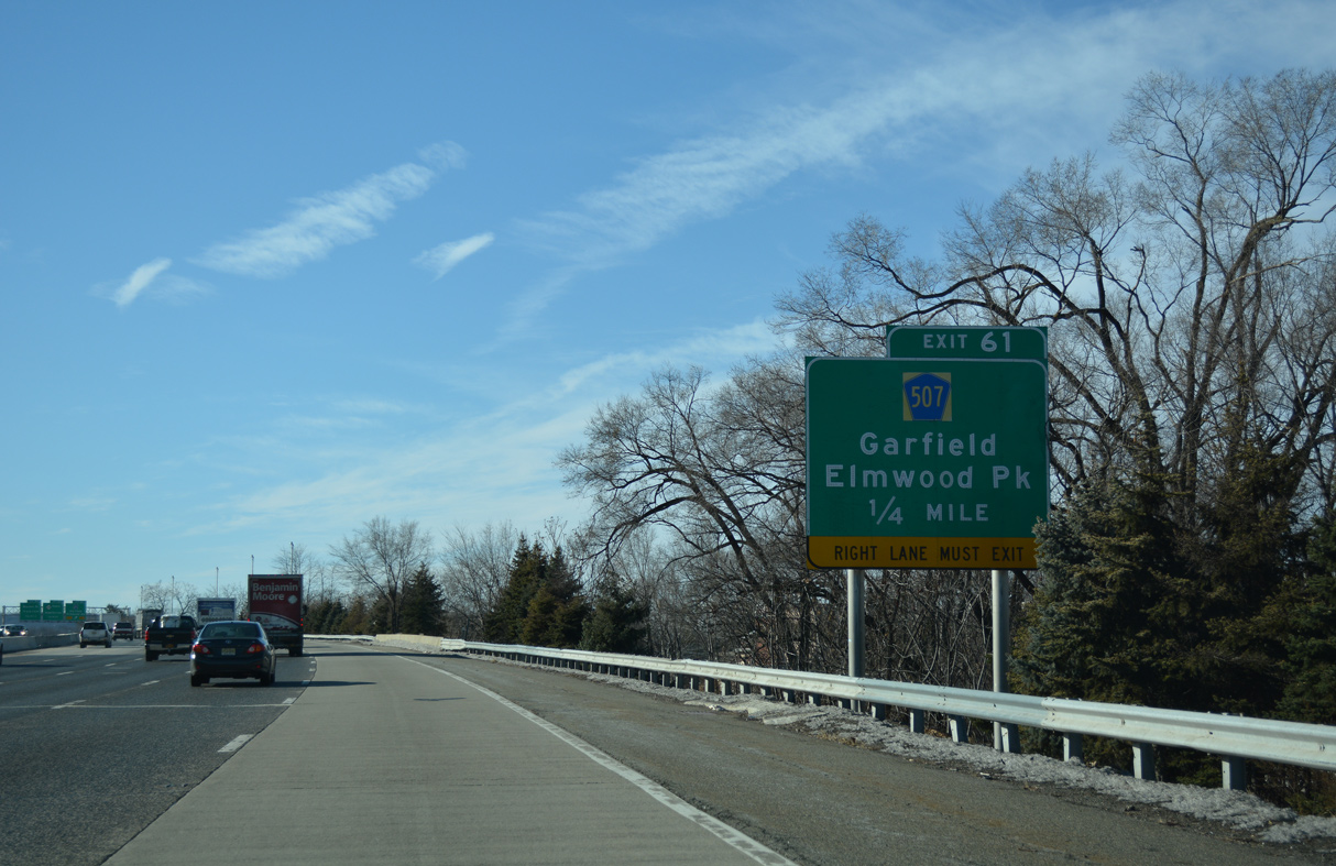
CR 507 follows the Passaic River south from Exit 61 to the city of Garfield and north to Route 4 (Broadway) in Elmwood Park.
12/19/16
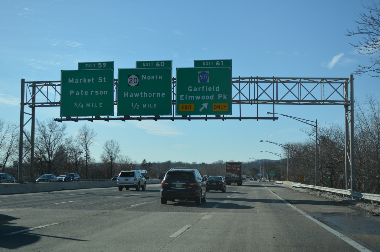
The parclo interchange at Exit 61 joins I-80 with CR 507 (River Drive) adjacent to Market Street (CR 56). Exit 60 lies just west of the Passaic River with Route 20 in Paterson.
12/19/16
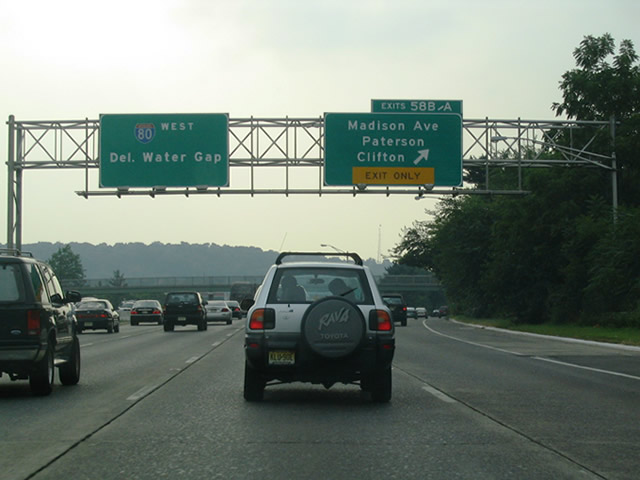
Exit 58 B links I-80 wesr with adjacent 23rd Avenue ahead of Madison Avenue (CR 649) north to Riverside in the city of Patterson. Exit 58 A follows as a loop ramp onto Madison Avenue south to CR 601 (Main Street) south to the city of Clifton.
08/11/04
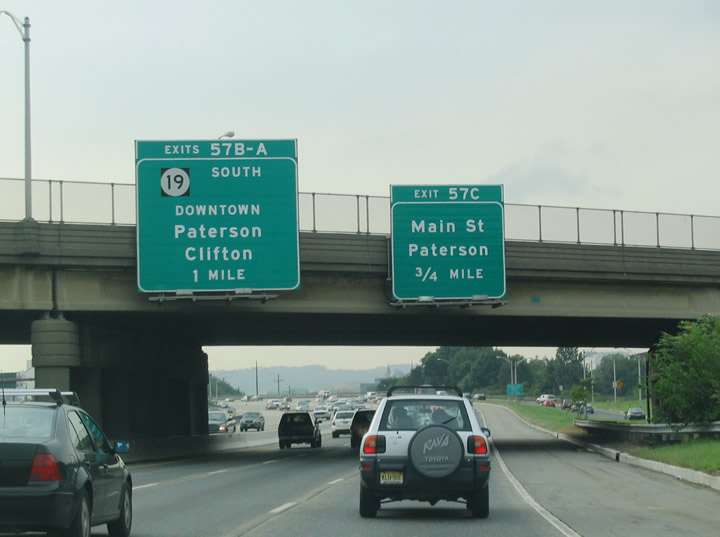
I-80 takes a viaduct west from Beckwith Avenue to 21st Avenue and Exit 57 C to County Route 509 (Main Street), south of Downtown Paterson.
08/11/04
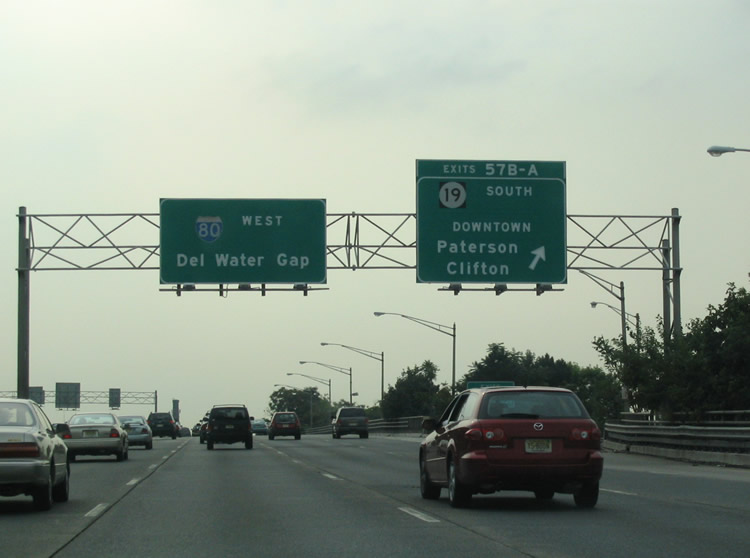
Exits 57 B/A depart I-80 west in unison for Route 19. Route 19 constitutes a freeway southward from Oliver Street in Paterson to the Garden State Parkway, U.S. 46, and Broad Street (CR 509) in Clifton. Route 19 north takes Oliver Street and Ward Street east to CR 509 (Main Street) in Downtown.
08/11/04
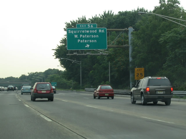
Squirrelwood Road loops west from New Street and Rifle Camp Road to meet Interstate 80 in Woodland Park. A six-ramp parclo interchange (Exit 56) joins Squirrelwood Road with I-80 just south of the Paterson city line.
08/11/04
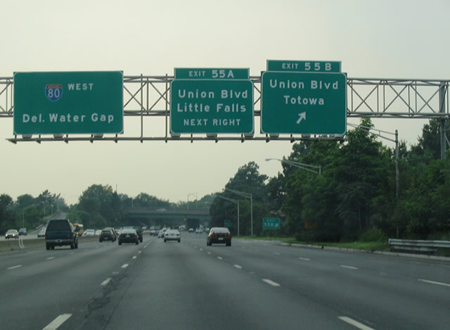
I-80 winds west into the borough of Totowa ahead of Exit 55 to Union Boulevard (Route 62). Union Boulevard travels north from Main Street (CR 631) in Little Falls Township across the Passaic River to U.S. 46 and I80 in Totowa. North from Exit 55 B, Union Boulevard (CR 646) continues to Broadway (CR 673) in Paterson.
08/11/04
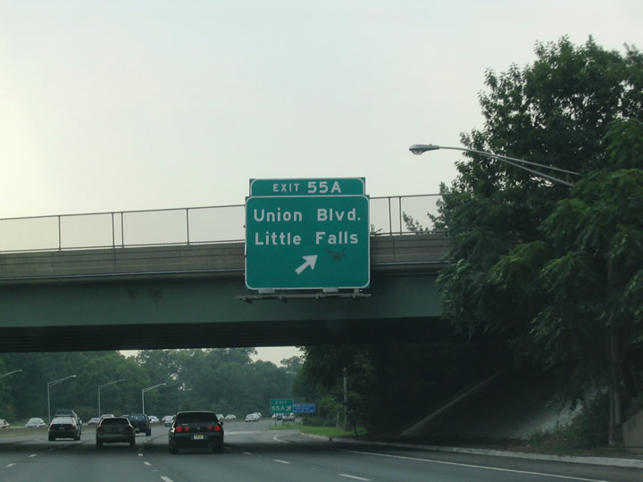
Exit 55 A loops onto Union Boulevard (Route 62) south from Interstate 80 west. Route 62 lines Union Boulevard for 0.47 miles from the parclo interchange with I-80 to an exchange with U.S. 46.
08/11/04
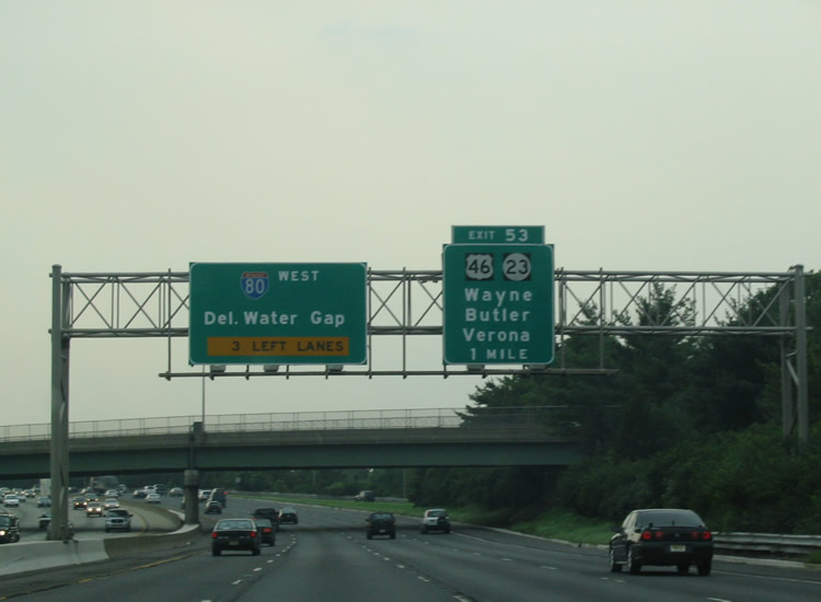
One mile east of the complex interchange joining I-80, U.S. 46 and Route 23 at the Minnisink Road (CR 642) overpass. Route 23 intermingles with U.S. 46 and I-80 as an expressway from U.S. 202 and Wayne to the north. U.S. 46 returns to I-80 with ramps to/from the freeway before again diverging westward to North Caldwell.
08/11/04
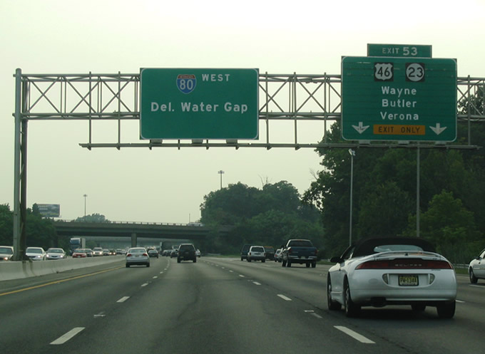
Two lanes depart Interstate 80 westbound for the directional ramps to Route 23 north to Butler, Route 23 south to Verona, and U.S. 46 to North Caldwell and Little Falls. Route 23 meets U.S. 202, 1.5 miles to the north at Wayne.
08/11/04
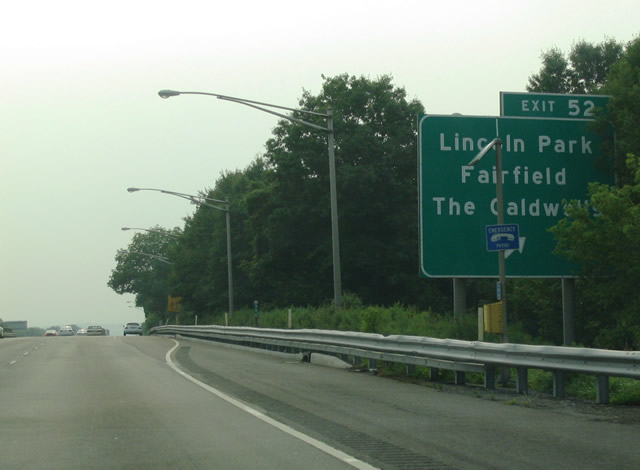
I-80 westbound crosses the Passaic River into Essex County ahead of Exit 52 at Fairfield. Crossing I-80 here is Two Bridges Road midway between U.S. 46 and the borough of Lincoln Park.
Exit 52 utilizes Lane Road east to access Two Bridges Road (CR 613). CR 613 follows Passaic Avenue south of U.S. 46 toward The Caldwells.
08/11/04
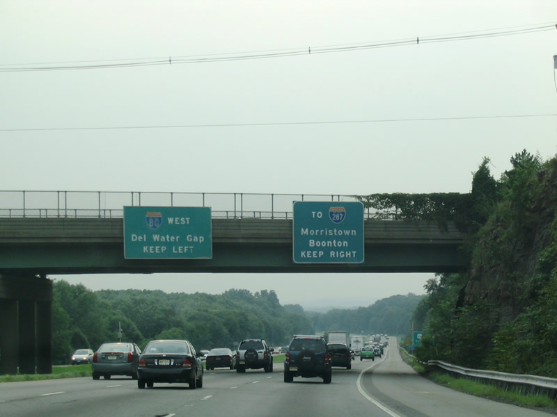
I-80 weaves west and south across Great Piece Meadows to enter Morris County at the Passaic River. Beyond the river, the I-80 converges with I-280 west.
Pictured here were original guide signs, since removed, for a collector distributor split to Exit 43 for I-287. Interstate 287 ended at Boonton until November 1993, when the segment between Exit 44 / U.S. 202 and Mahwah opened to traffic.
08/11/04
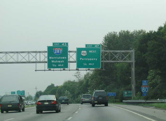
Departing I-80 west next is Exit 47 onto U.S. 46 west through Parsipanny-Troy Hills Township.
08/11/04
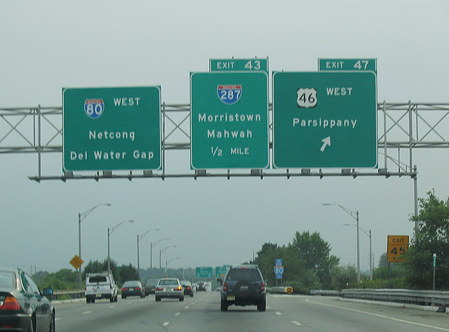
Exit 47 leaves I-80 west for U.S. 46 west to Parsippany. Entrance ramps from both U.S. 46 and Interstate 280 west join the c/d roadway for Exit 43 ahead. I-280, which runs northwest from the NJ Turnpike at Kearny through Newark and The Oranges, concludes at a double wye interchange.
08/11/04
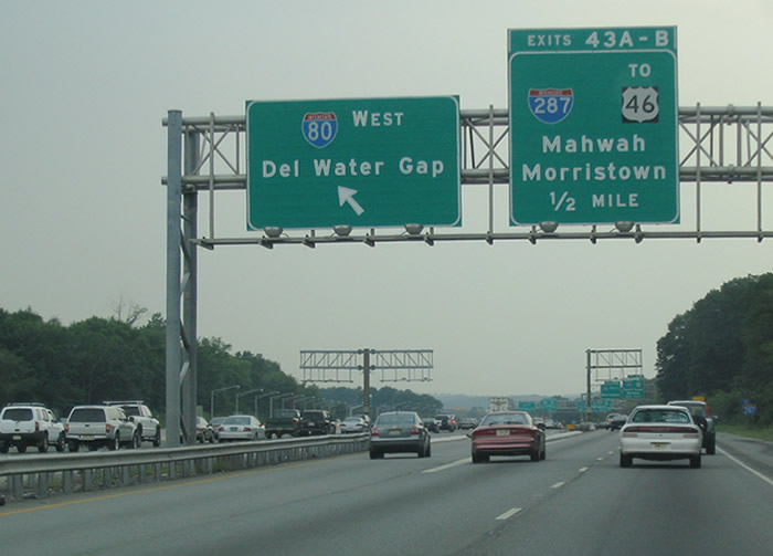
A crossover provides access to the Interstate 80 westbound mainline from the c/d roadway to Exit 43 within the half diamond interchange at Beverwyck Road (CR 637).
08/11/04
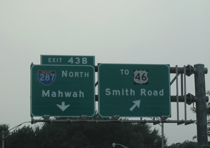
Exit 43 B partitions into ramps for Interstate 287 north to Boonton and Mahwah and Littleton Road (CR 630) east to Smith Road and U.S. 46. U.S. 46 parallels I-80 to the north from Parsippany to Denville between Exits 47 and 38. I-287 northbound combines with I-87 (New York Thruway) 28 miles to the northeast.
08/11/04
Photo Credits:
- AARoads: 08/29/05
- Alex Nitzman: 12/19/16
- Carter Buchanan: 08/11/04
Connect with:


Page Updated Wednesday July 05, 2023.