
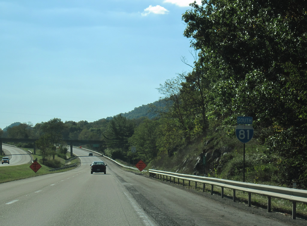
Interstate 81 South - Wytheville to Chilhowie
 North
North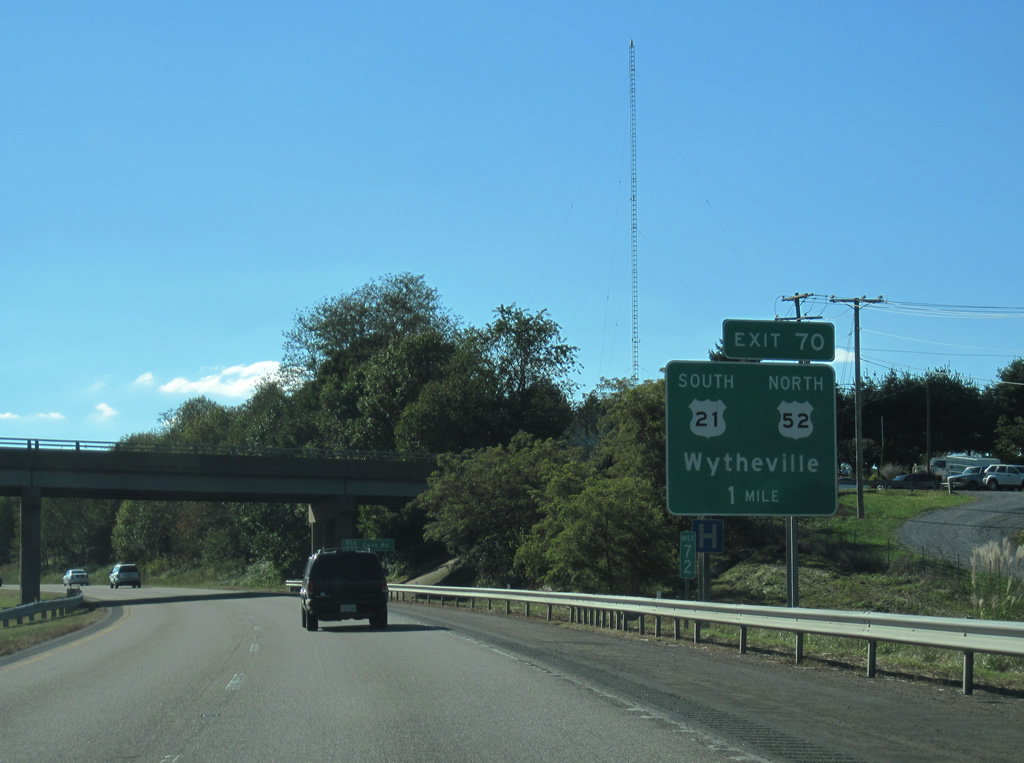
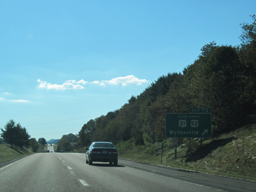
U.S. 52 parts ways with I-81 west at Exit 70 for N 4th Street in Wytheville. U.S. 52 climbs onto Walker Mountain north of Favonia to Bland. The forthcoming diamond interchange marks the northern end of U.S. 21 as well.
10/02/10
U.S. 21 heads south along 4th Street to Downtown Wytheville, where it combines with U.S. 11 for four blocks west on Main Street. U.S. 21 extends 35.15 miles south to the North Carolina line beyond Independence.
10/02/10
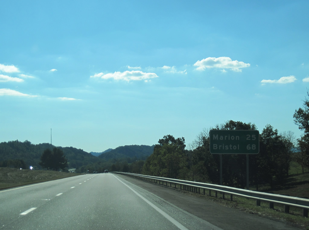
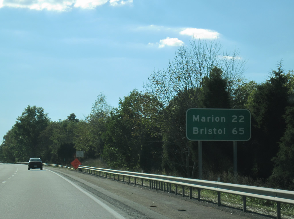
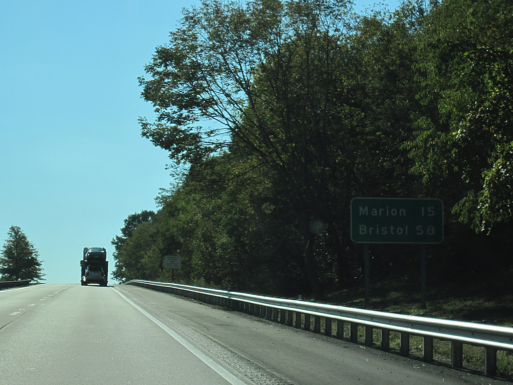
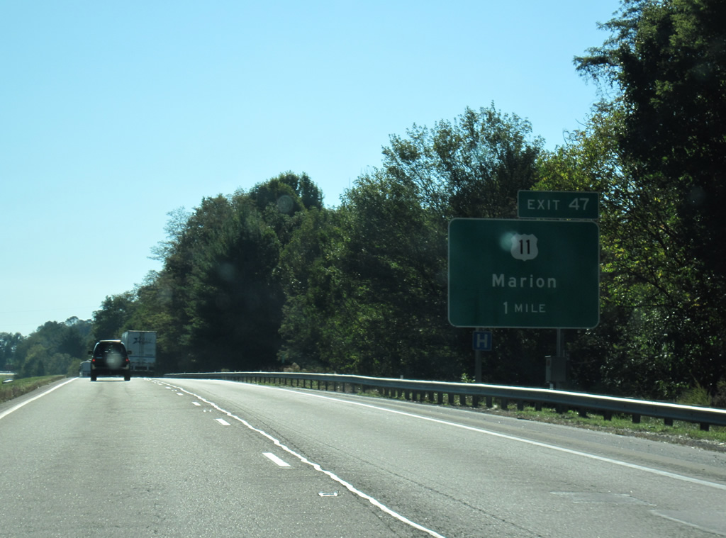
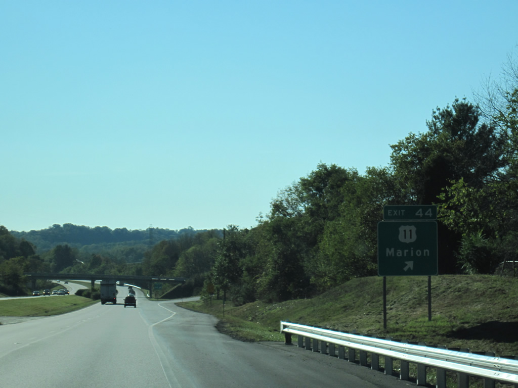
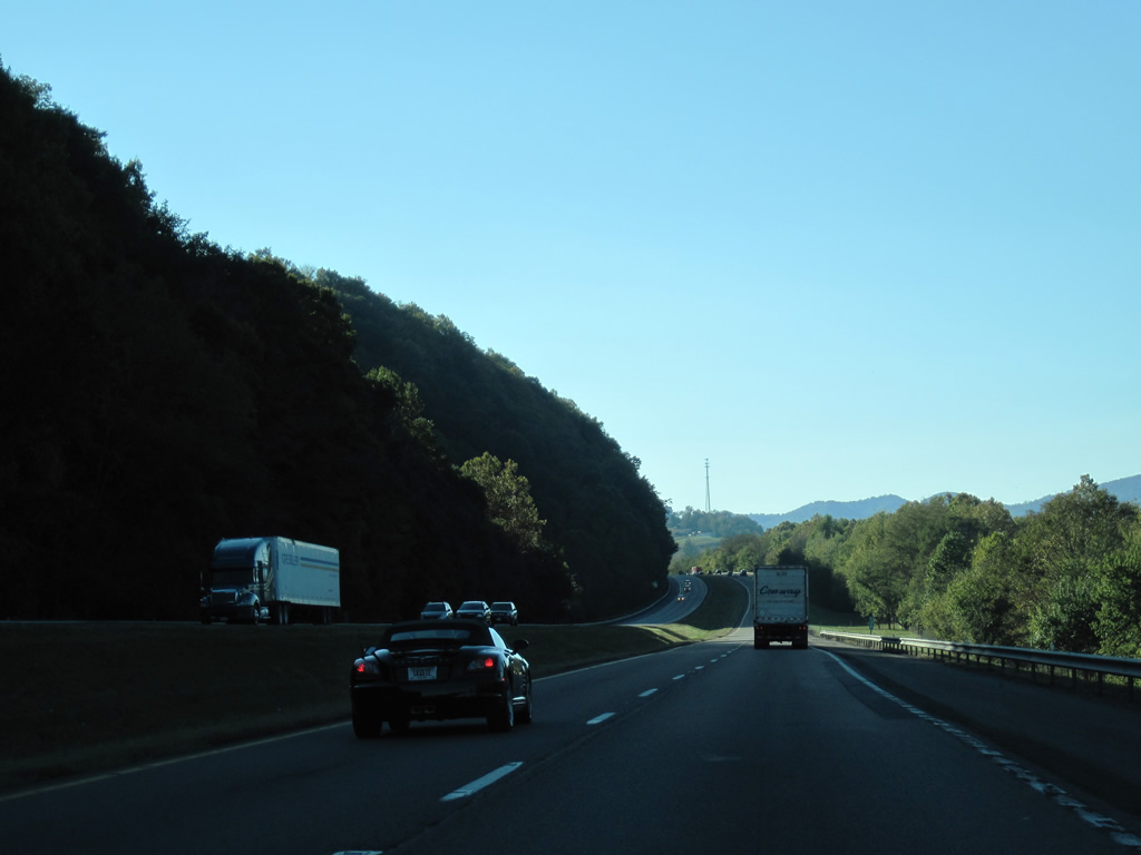
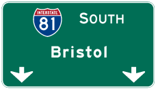
The Smyth County seat of Marion lies 25 miles southwest of Wytheville along I-81. Bristol follows by the state line in 68 miles.
10/02/10
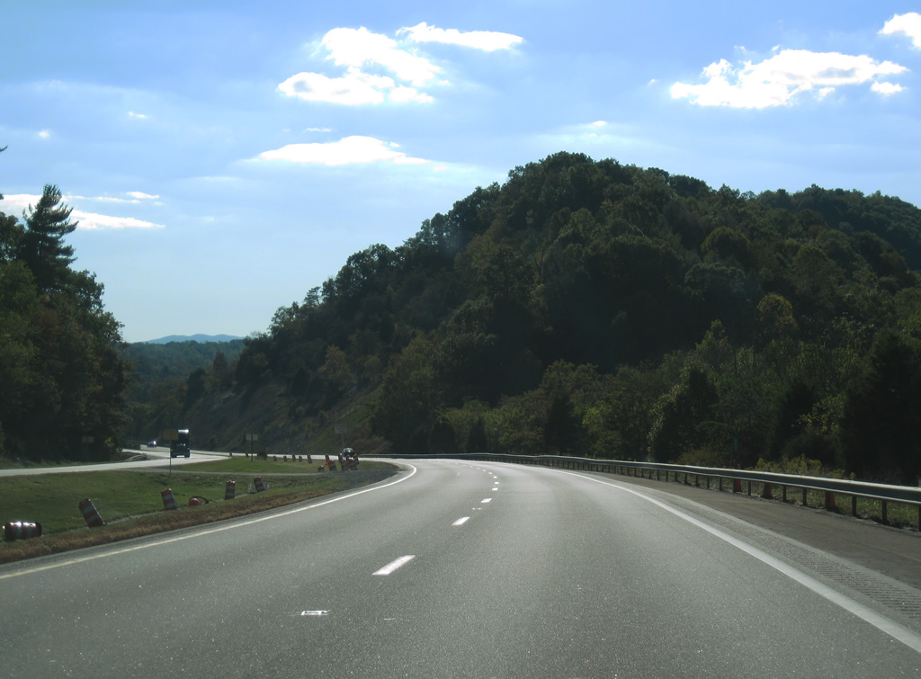
Interstate 81 passes through a rock cut across Pine Ridge just ahead of Reed Creek.
10/02/10
A wye interchange connects U.S. 11 (W Lee Highway) with Interstate 81 southbound between Petunia and Cline.
10/02/10
Interstate 81 parallels the south side of Pine Ridge along the ensuing stretch west to Exit 60.
10/02/10
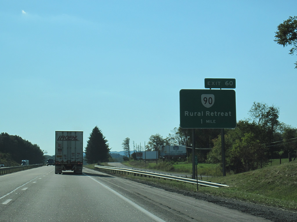
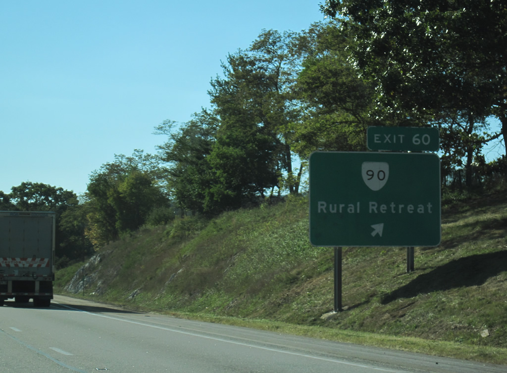
The final exit in Wythe County joins Interstate 81 with SR 90 (Black Lick Road), a 1.73 mile long spur south into the town of Rural Retreat.
10/02/10
Black Lick Road (SR 680) continues 7.38 miles northeast from SR 90 and the diamond interchange at Exit 60 to Blacklick and U.S. 52 near Favonia.
10/02/10
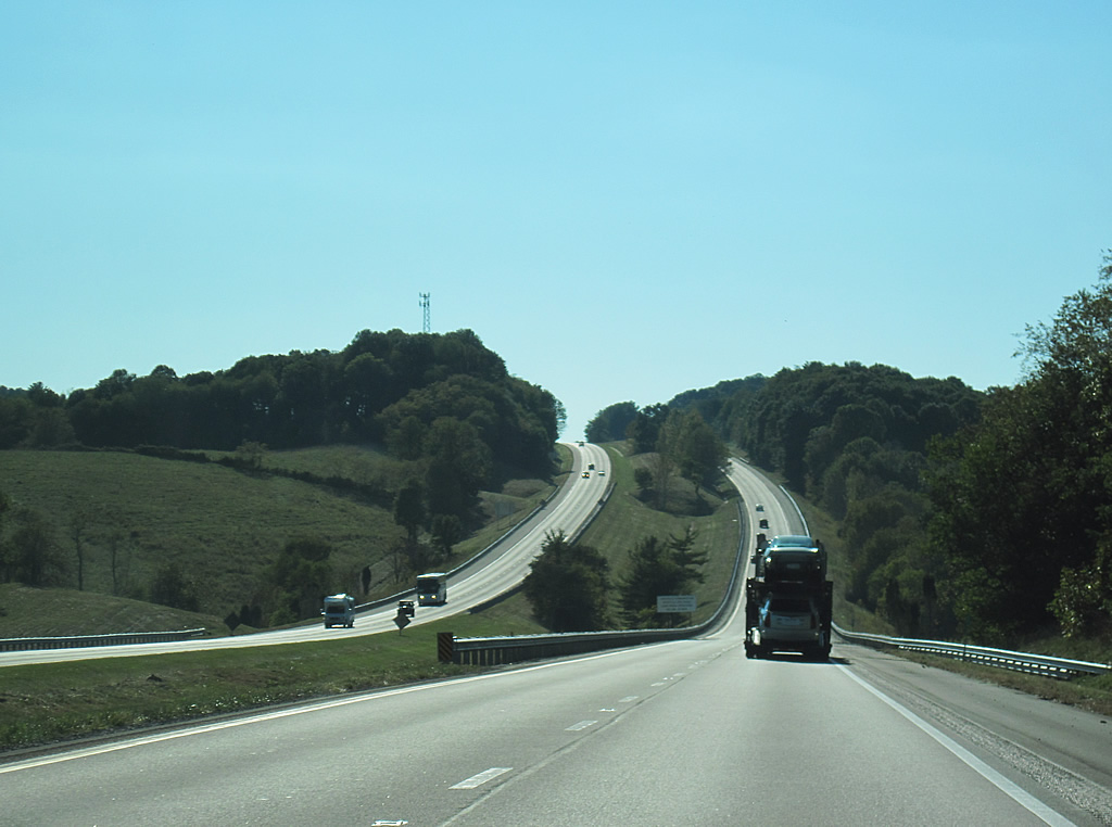
Advancing 15 miles west to Marion, Interstate 81 continues beyond a mixture of forest stands and farm land to the Smyth County line.
10/02/10
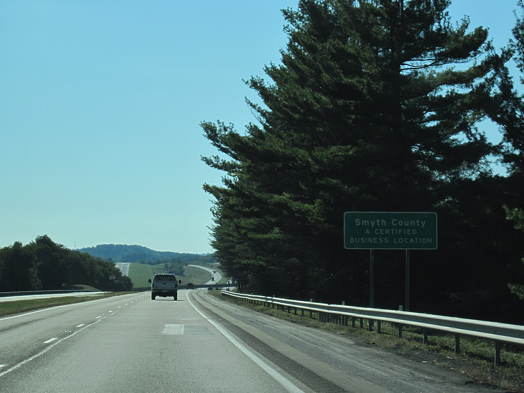
Smyth County was formed from portions of Washington and Wythe counties on February 23, 1832. It is named for Alexander Smyth, a general during the War of 1812 and eventual Representative to the U.S. Congress.1
10/02/10
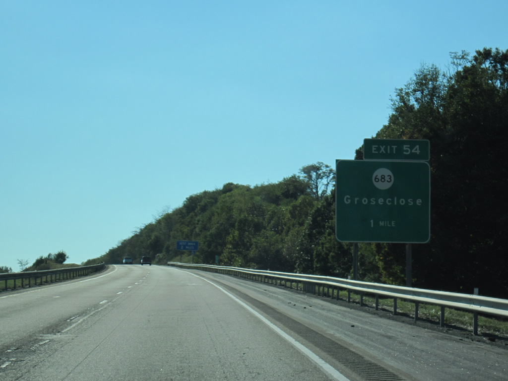
Interstate 81 runs alongside Mountain Empire Airport (MKJ) ahead of the diamond interchange (Exit 54) with SR 683 (Winsor Road).
10/02/10
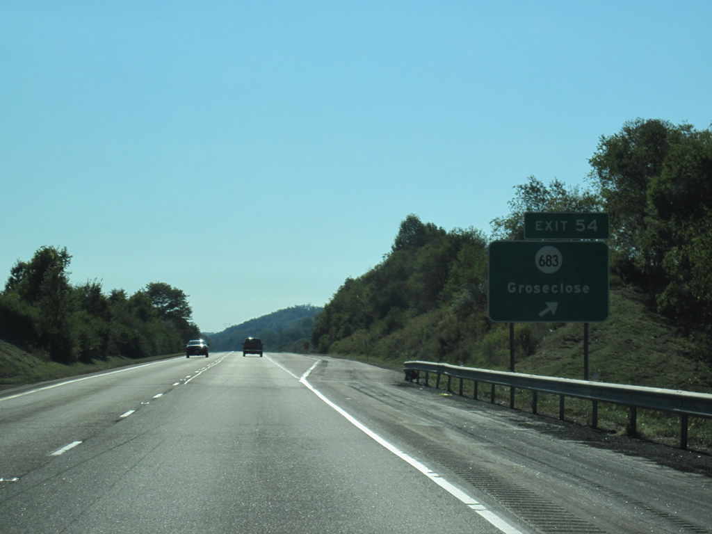
SR 683 (Winsor Road) links I-81 with adjacent U.S. 11 (Lee Highway) at the settlement of Groseclose. Northward from Exit 54, Winsor Road extends through Davis Valley to SR 617.
10/02/10
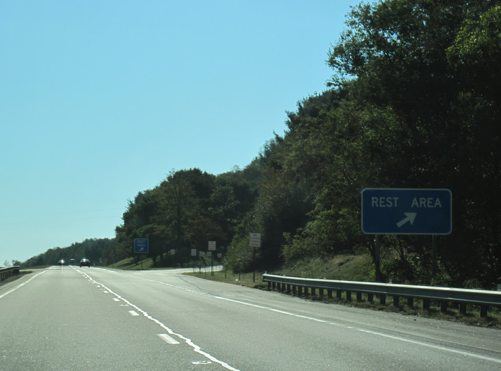
The Smyth Safety Rest Area follows Exit 54 along Interstate 81 near Crow Hollow. This is the last facility southbound in Virginia.
10/02/10
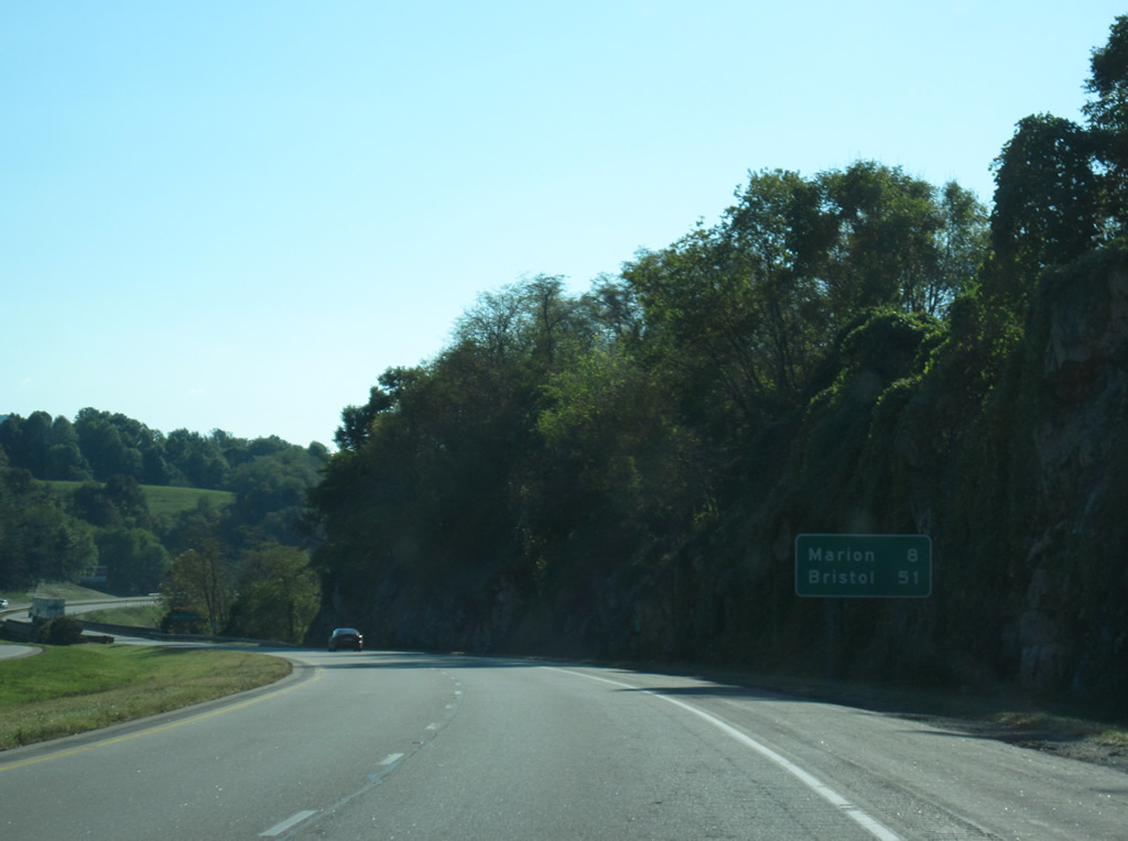
The town of Marion is eight miles west along Interstate 81 south. Bristol is 51 miles away.
10/02/10
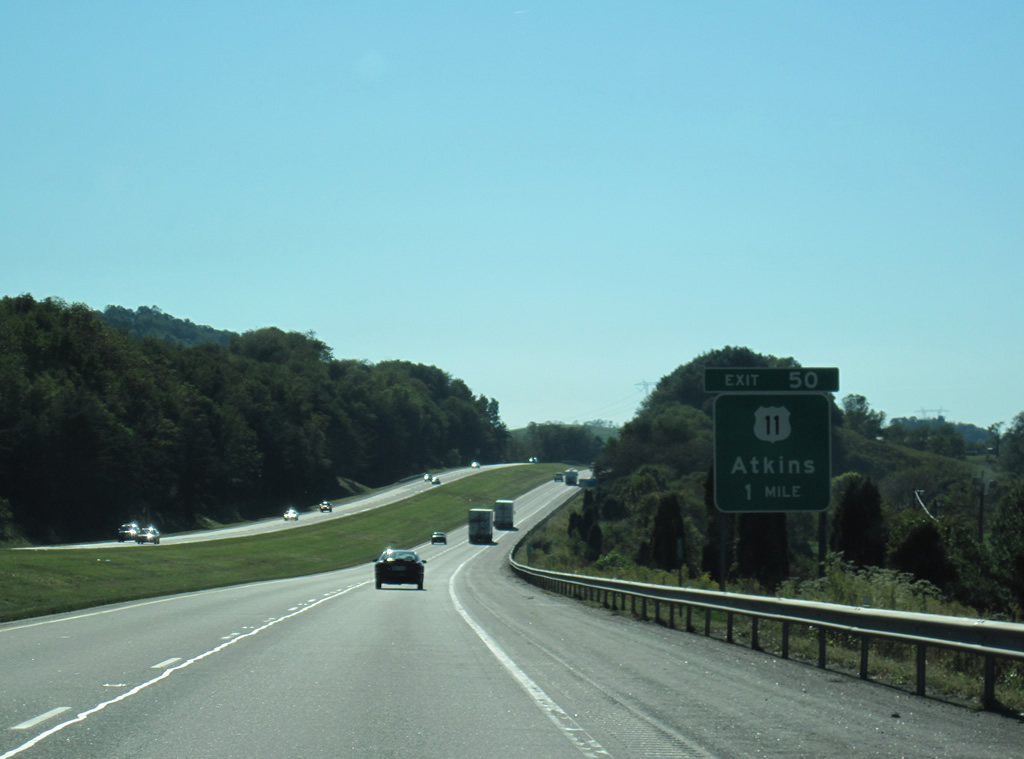
U.S. 11 switches sides with Interstate 81 just west of the rest area en route to Atkins. Exit 50 joins the two parallel routes via SR 622 at Exit 50.
10/02/10
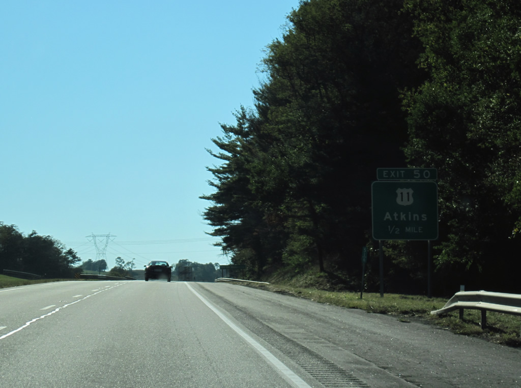
A diamond interchange (Exit 50) joins Interstate 81 with SR 622 (Nicks Creek Road) for U.S. 11 and Atkins in a half mile.
10/02/10
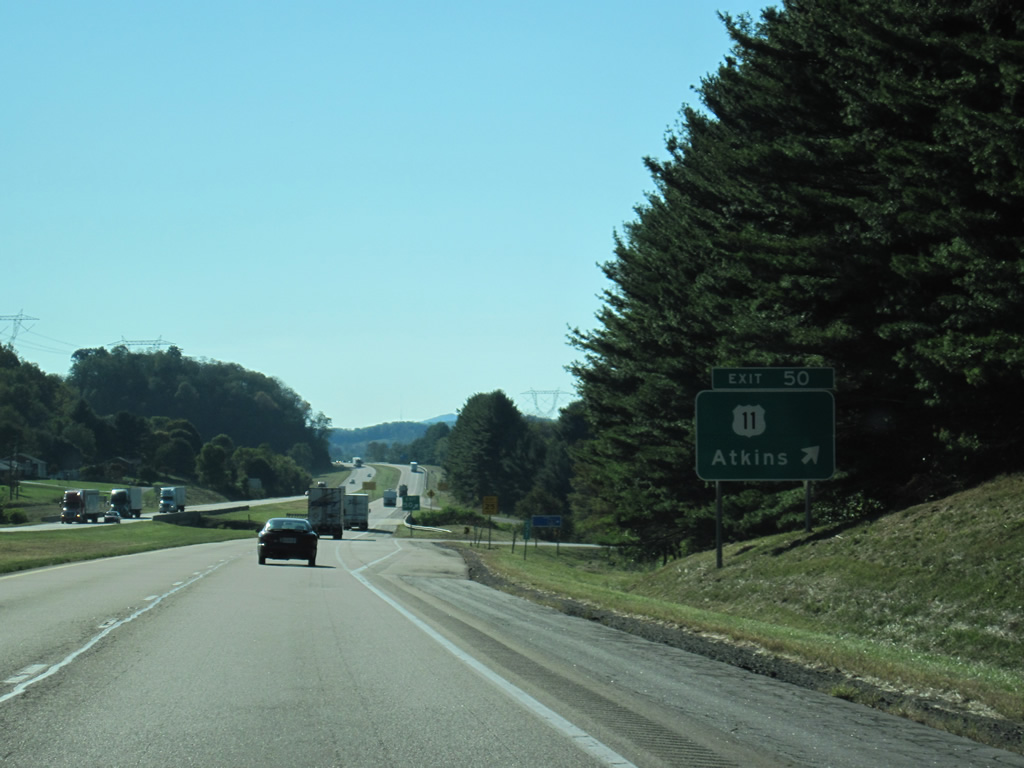
SR 622 (Nicks Creek Road) leads south from Exit 50 to SR 16 on Brushy Mountain. SR 16 heads south from there to Sugar Grove and Troutdale. Northward from Atkins and U.S. 11, SR 622 traverses Little Brushy and Walker Mountains to SR 42.
10/02/10
Interstate 81 west from Atkins to Mt. Carmel and Marion dates to 1963 and 1964.2
10/02/10
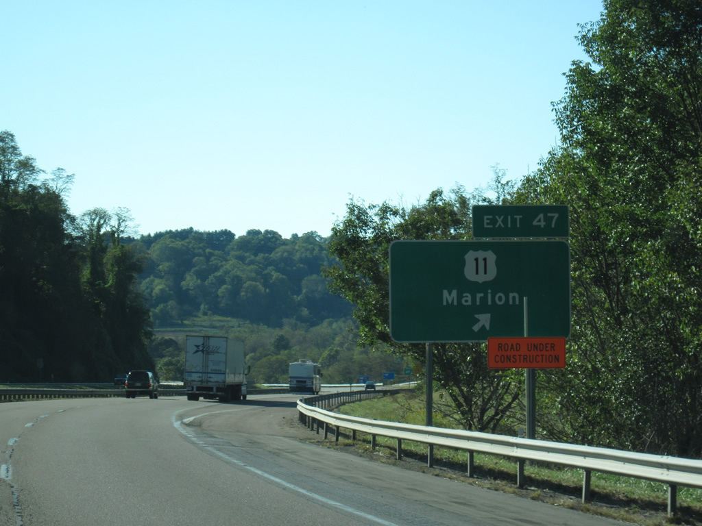
U.S. 11 (Lee Highway) and Interstate 81 come together again at Exit 47 and Mt. Carmel.
10/02/10
Following Main Street through Marion, U.S. 11 acts as a business loop for I-81 between Exit 47 and 44.
10/02/10
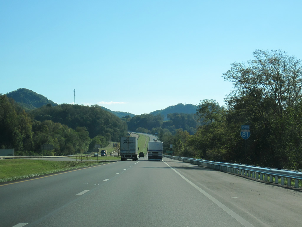
Interstate 81 straddles the hillside of Goodpasture Ridge above Marion between Exit 47 and 45.
10/02/10
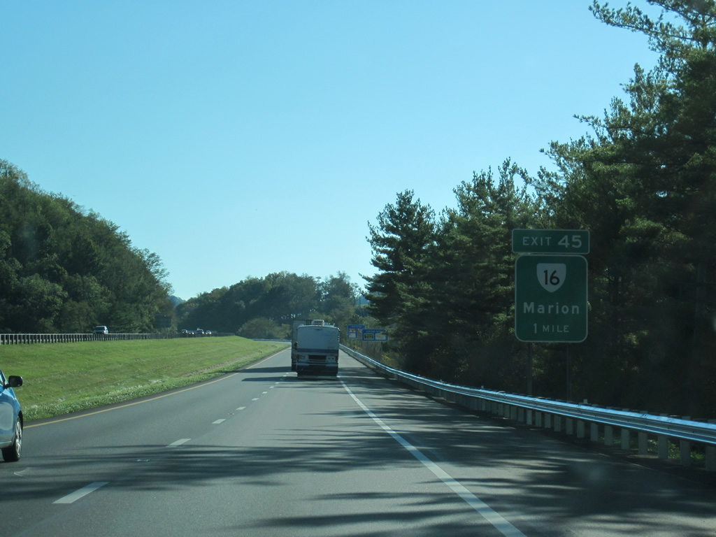
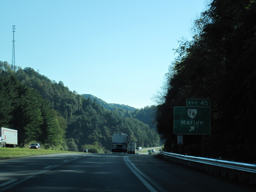
SR 16 (Commerce Street) and I-81 converge at a diamond interchange (Exit 45) in one mile. SR 16 lines the Staley Creek valley east from Marion to Furnace Hill and Attoway. South from Brushy Mountain, SR 16 continues to cross the Iron Mountains en route to Troutdale and U.S. 58.
10/02/10
SR 16 takes Commerce Street north from Exit 45 to U.S. 11 (E Main Street). U.S. 11/SR 16 overlap 1.19 miles long overlap to N Main Street and Park Boulevard, where SR 16 branches north toward Tazwell.
10/02/10
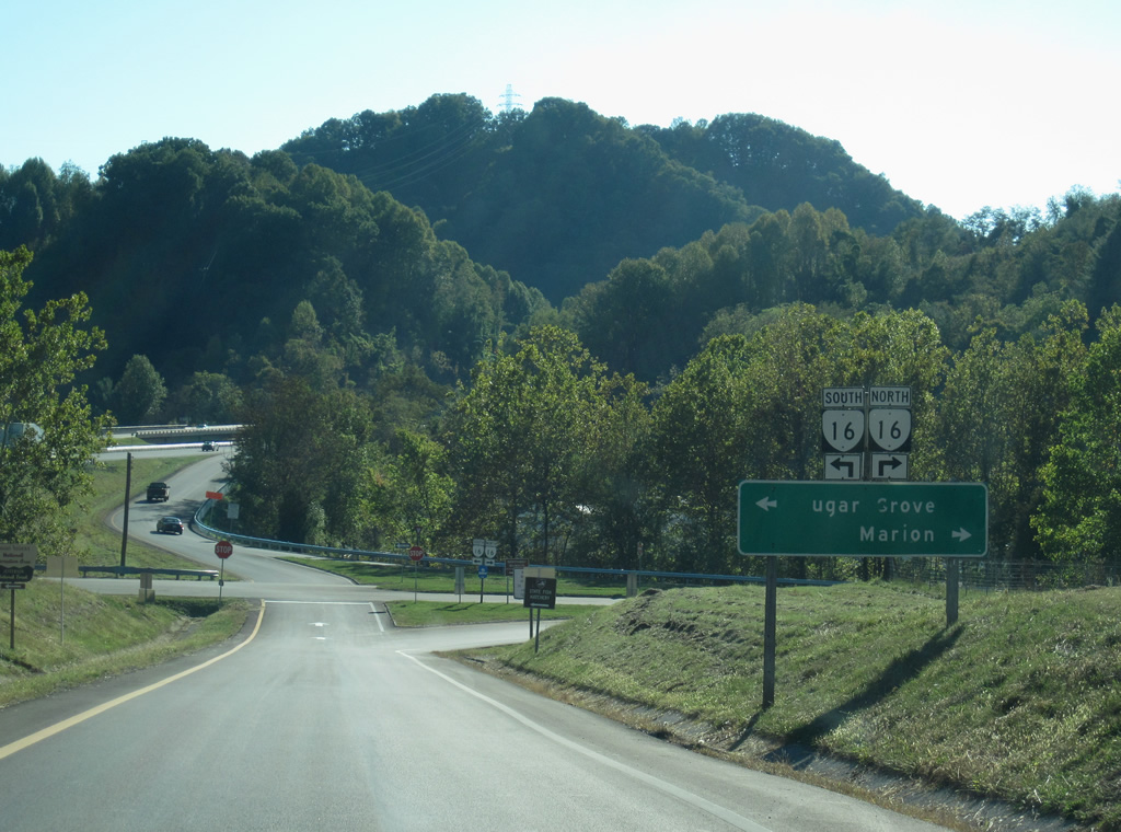
Interstate 81 enters the town limits of Marion at Exit 45 for SR 16 south to Sugar Grove and north to Downtown. SR 16 is part of a multi state route between Waxhaw, North Carolina and St. Mary's, West Virginia.
10/02/10
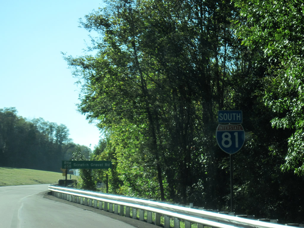
Just west of the SR 16 entrance amp, Interstate 81 passes over SR 658 (Scratch Gravel Road), a local road southwest from Marion to Holston Mill.
10/02/10
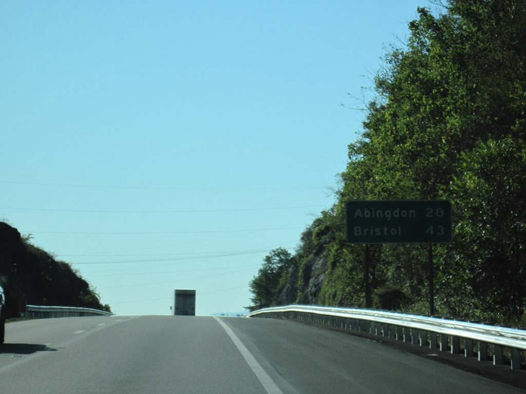
Seat of Washington County, the town of Abingdon is 28 miles southwest of Marion.
10/02/10
A half diamond interchange (Exit 44) connects U.S. 11 (Main Street) with Interstate 81 on the west side of Marion via SR 730 (Washington Avenue).
10/02/10

The southbound entrance ramp from U.S. 11 (Lee Highway) lies 1.03 miles west from Exit 44. This confirming marker precedes the Laurel Springs Road (SR 707) overpass.
10/02/10
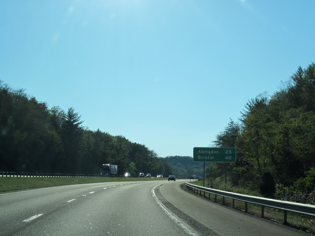
West of Laurel Springs Creek, Interstate 81 is 25 miles from Abingdon and 40 miles from Bristol.
10/02/10
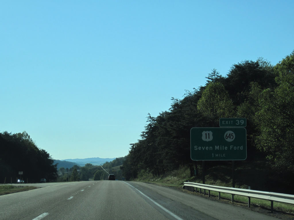
U.S. 11 stays close to Interstate 81 from McMullin west to Seven Mile Ford. A diamond interchange with SR 645 (Chestnut Ridge Road) connects the two routes.
10/02/10
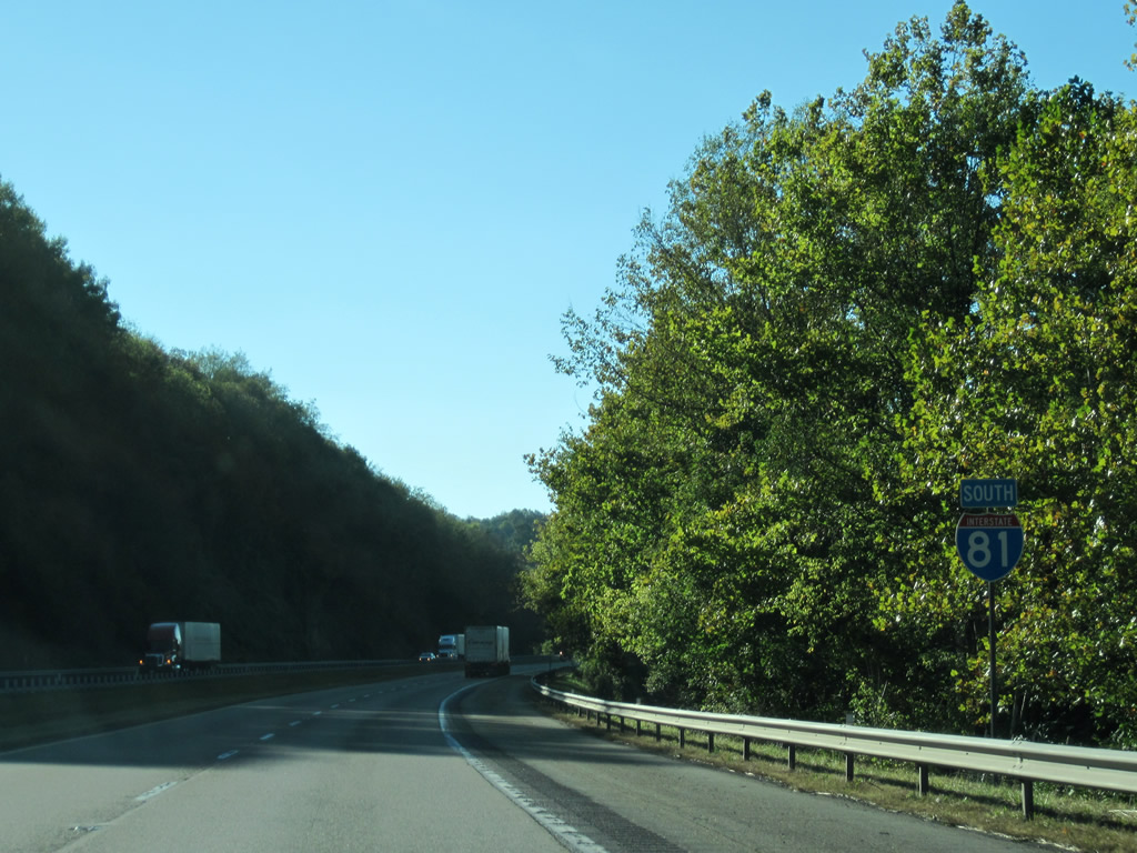
Interstate 81 southbound shield assembly posted at Seven Mile Ford. The Middle Fork of the Holston River flows between the freeway and U.S. 11 to Chilhowie.
10/02/10
Interstate 81 lines the northern hillside above the Holston River Middle Fork valley.
10/02/10
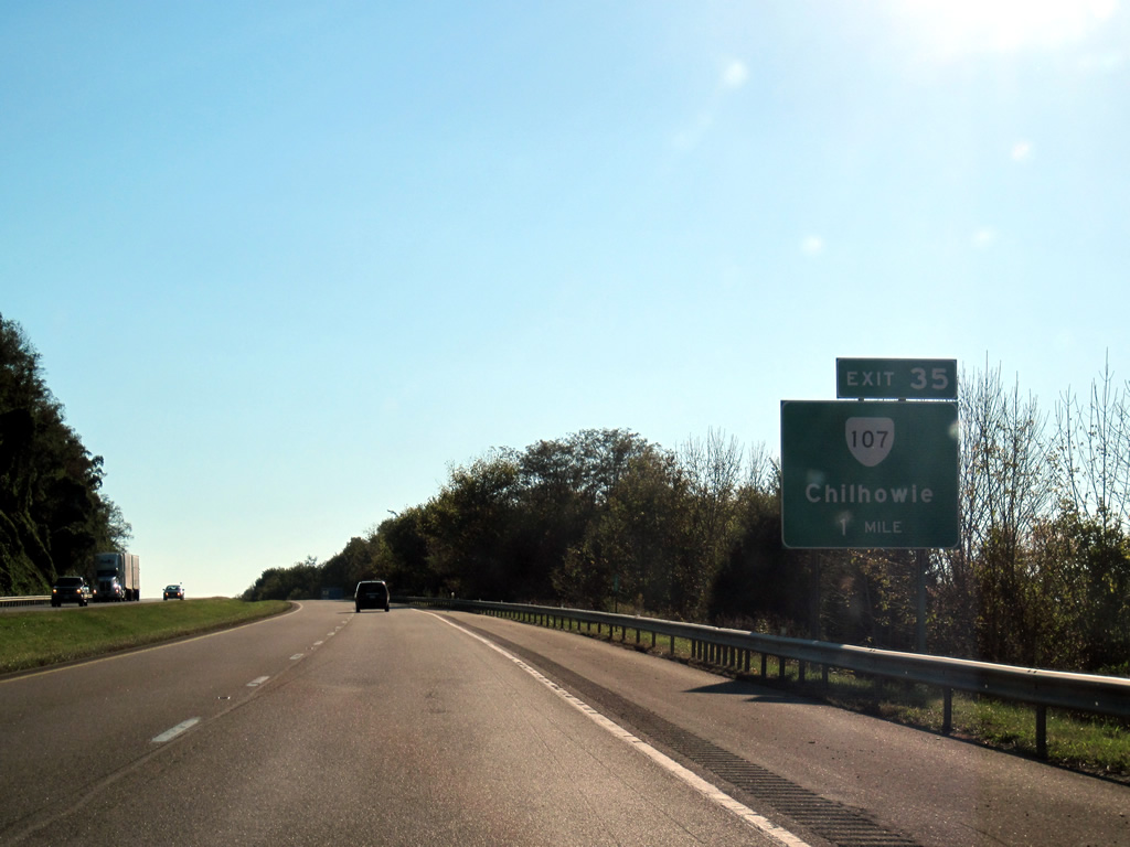
SR 107 constitutes an 8.39 mile long route north from Exit 35 at Chilhowie to SR 91 (Main Street) at Saltville.
10/02/10
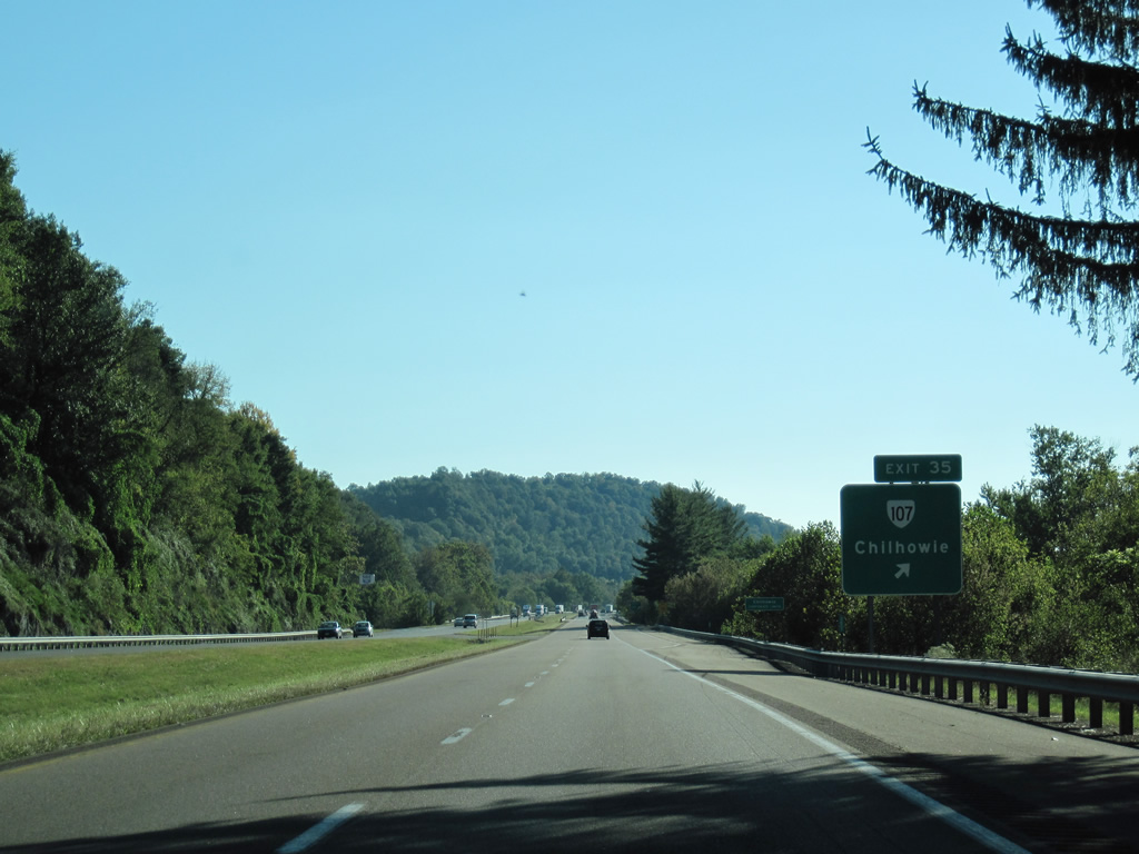
Exit 35 leaves Interstate 81 south for SR 107 (Whitetop Road) north into Chilhowie business district and SR 762 south to St. Clair Bottom.
10/02/10
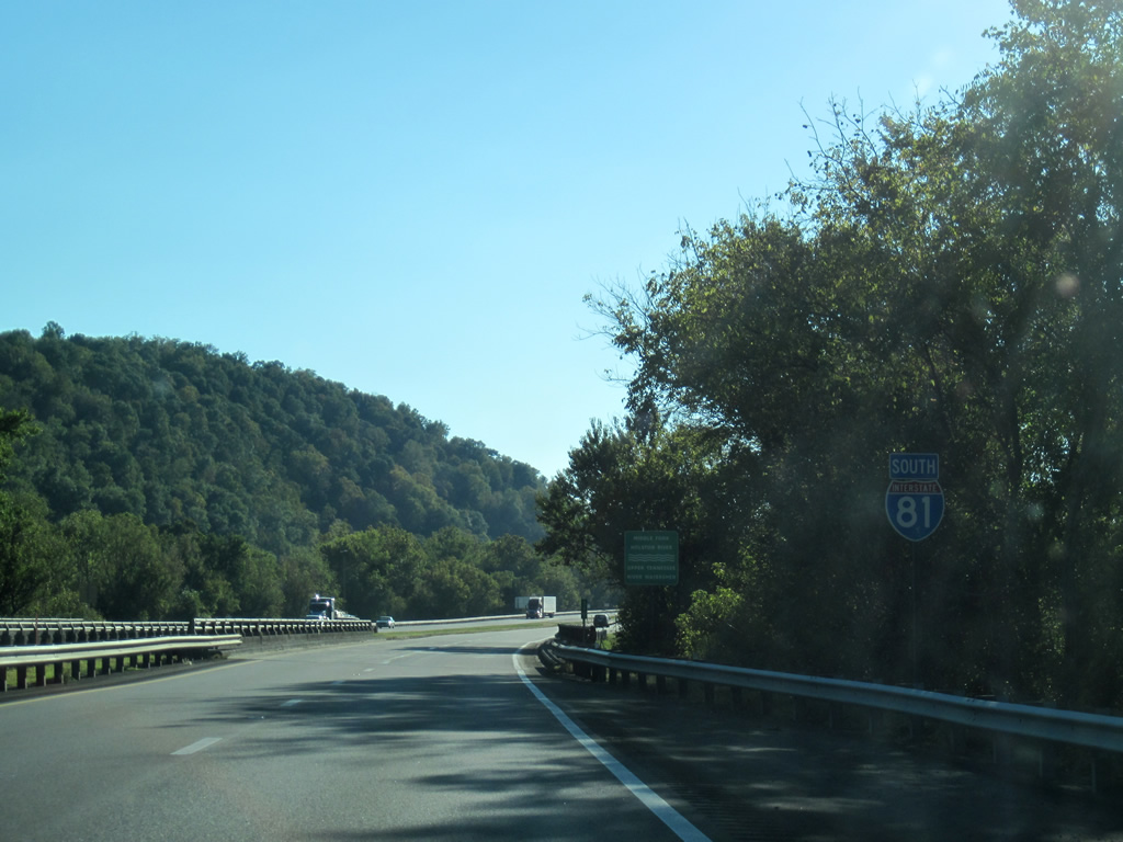
Interstate 81 spans the Holton River Middle Fork just west of Exit 35 and enters Washington County a short distance ahead.
10/02/10

References:
- Smyth County, Virginia. Wikipedia.
- I-81. Virginia Highways Page.
Photo Credits:
- ABRoads, Carter Buchanan: 10/02/10
Connect with:
Page Updated Wednesday April 28, 2021.