
U.S. 52
U.S. 52 follows Interstate 77 throughout its 82 mile course across western Virginia. The route serves local traffic from North Carolina to Fort Chiswell through the Carroll County seat of Hillsville and Fancy Gap among other communities. The original overlap with U.S. 11 along Lee Highway was replaced by Interstates 77 and 81 between Fort Chiswell and Wytheville, leading both highways to follow the freeway.
An overlap with U.S. 11 through Wytheville was eliminated in favor of continuing U.S. 52 along Interstate 81 to bypass the city. North from Crowgeys, U.S. 52 follows a mountainous route to Bland and Rocky Gap before combining with I-77 through the East River Mountain Tunnel into Bluefield, West Virginia. This stretch was also U.S. 21 until its truncation to Wytheville in 1979.
 South
South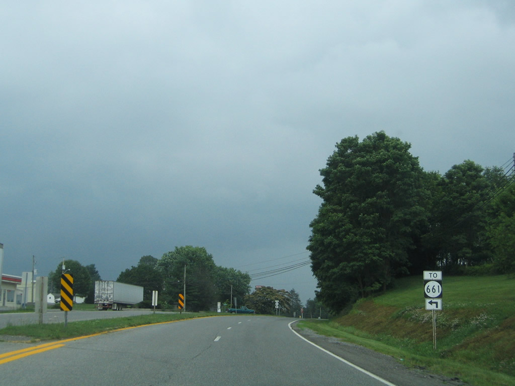
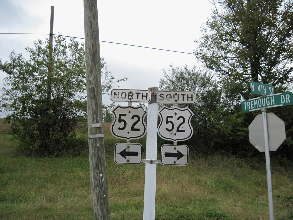
Entering Crowgeys, U.S. 52 (North 4th Street) meets SR 661 (Fairview Road). SR 661 leads north to Haven and SR 659 at Queens Knob.
07/16/05
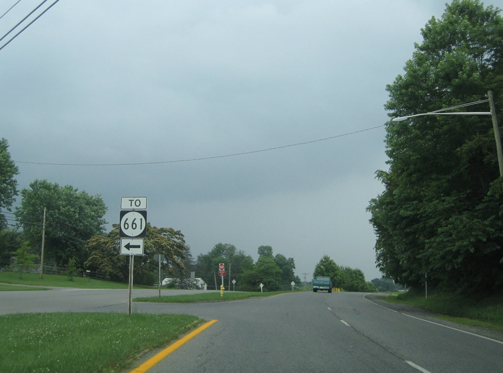
U.S. 52 (North 4th Street) south at SR 661 (Fairview Road) north. SR 661 travels a circuitous route west to Fairview and Kegleys, ending at SR 600.
07/16/05
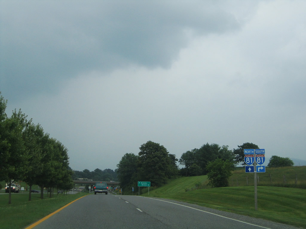
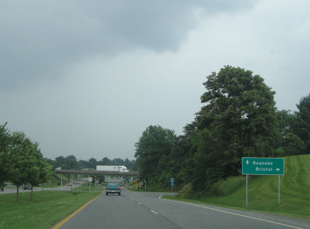
Continuing south from Crowgeys, U.S. 52 enters a diamond interchange with Interstate 81 (Exit 70).
07/16/05
Interstate 81 joins Wytheville with Bristol and Knoxville, Tennessee to the south.
07/16/05
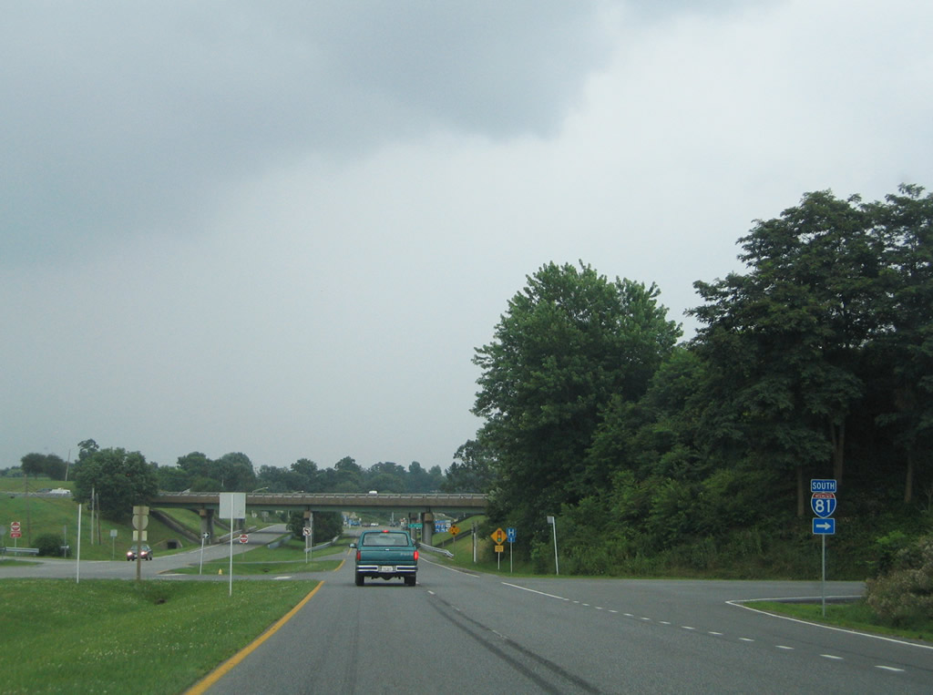
The interchange between U.S. 52 and Interstate 81 doubles as the southbound beginning of U.S. 21.
07/16/05
U.S. 52 joins Interstate 81 north for ten miles to bypass Wytheville.
07/16/05
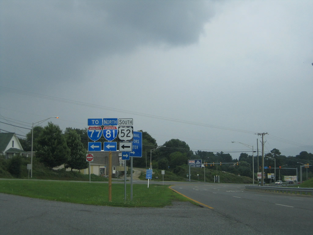
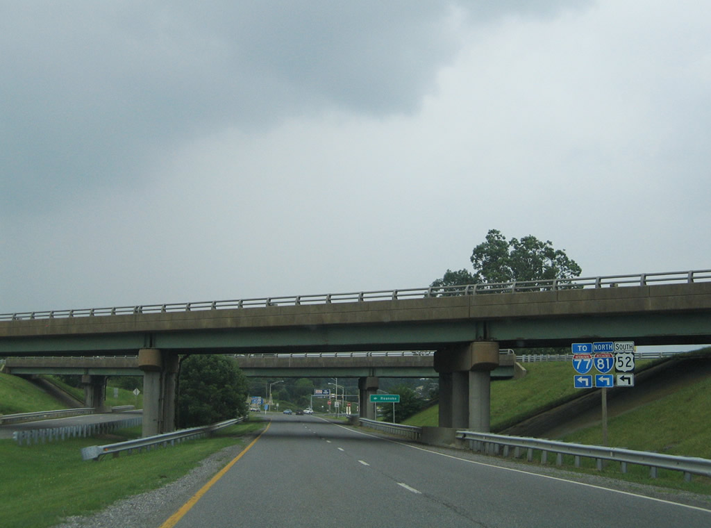
U.S. 21 continues along North 4th Street to merge with U.S. 11 (West Main Street) in downtown Wytheville. U.S. 52 used to follow this alignment as well, but was moved onto the freeway in 1986.
07/16/05
North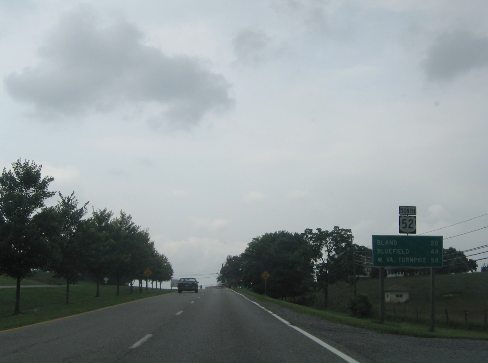
U.S. 52 continues away from Wytheville and Interstate 81 on a 20 mile drive to Bland. U.S. 21 used to continue north with U.S. 52.
07/16/05
scenes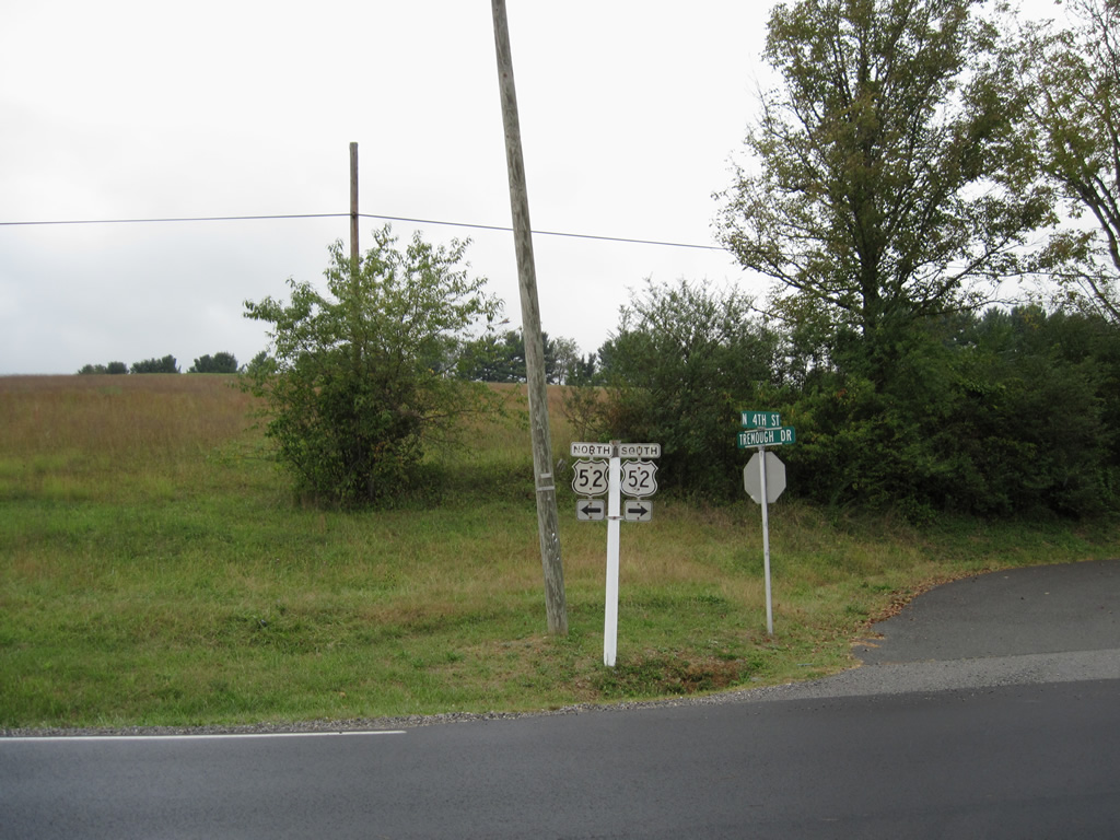
Ridge Road (SR 656) meanders northward from U.S. 11 at Petunia to U.S. 52 outside Wytheville (Stony Fork Road). A set of cutouts remains in place at the rural intersection west of Crowgeys.
U.S. 21 used to overlap along this stretch of roadway as well.
09/29/10
Photo Credits:
- Alex Nitzman: 07/16/05
- ABRoads, Carter Buchanan: 09/29/10
Connect with:
Page Updated Thursday February 14, 2013.