
Interstate 82 East - Prosser to Oregon

 East
East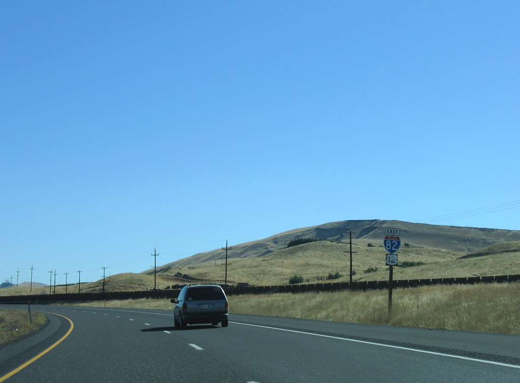
I-82/U.S. 12 encircles the northern reaches of Horse Heaven Hills from Prosser east to Benton City.
08/31/06
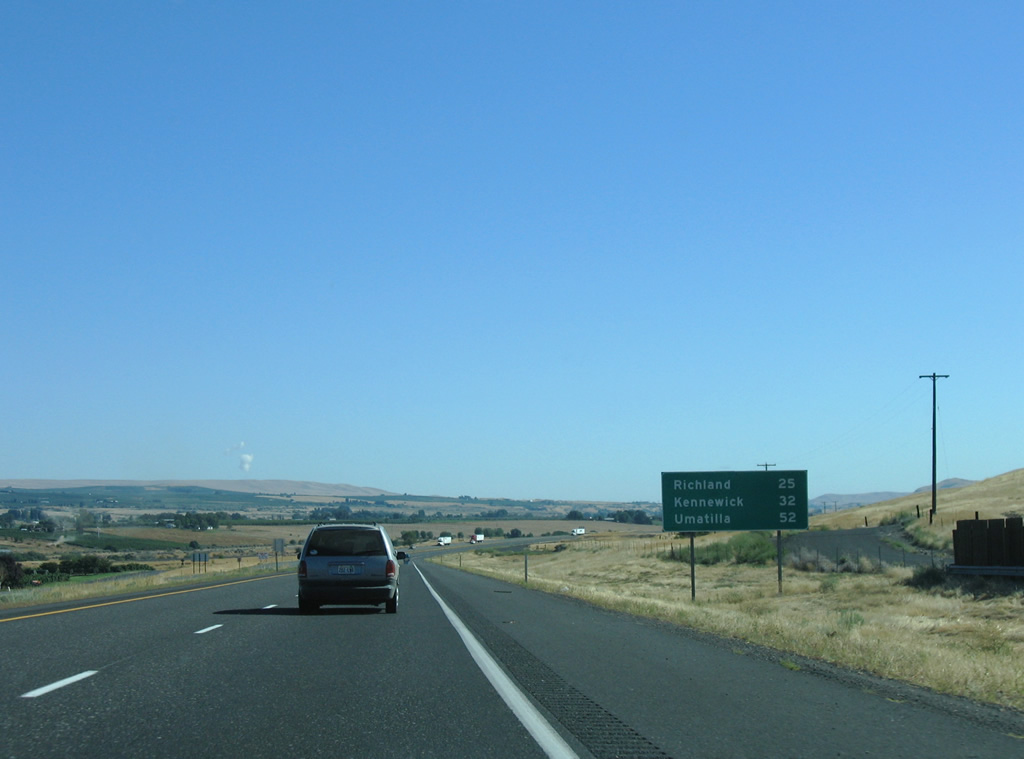
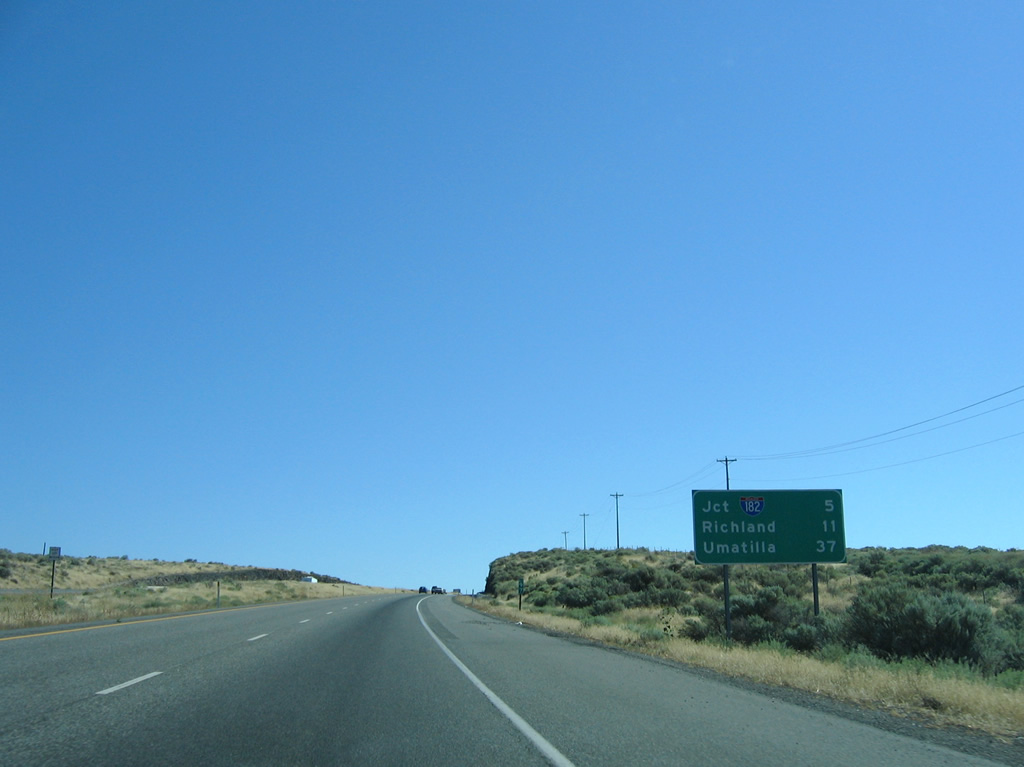
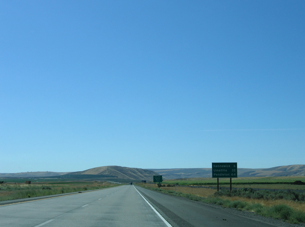
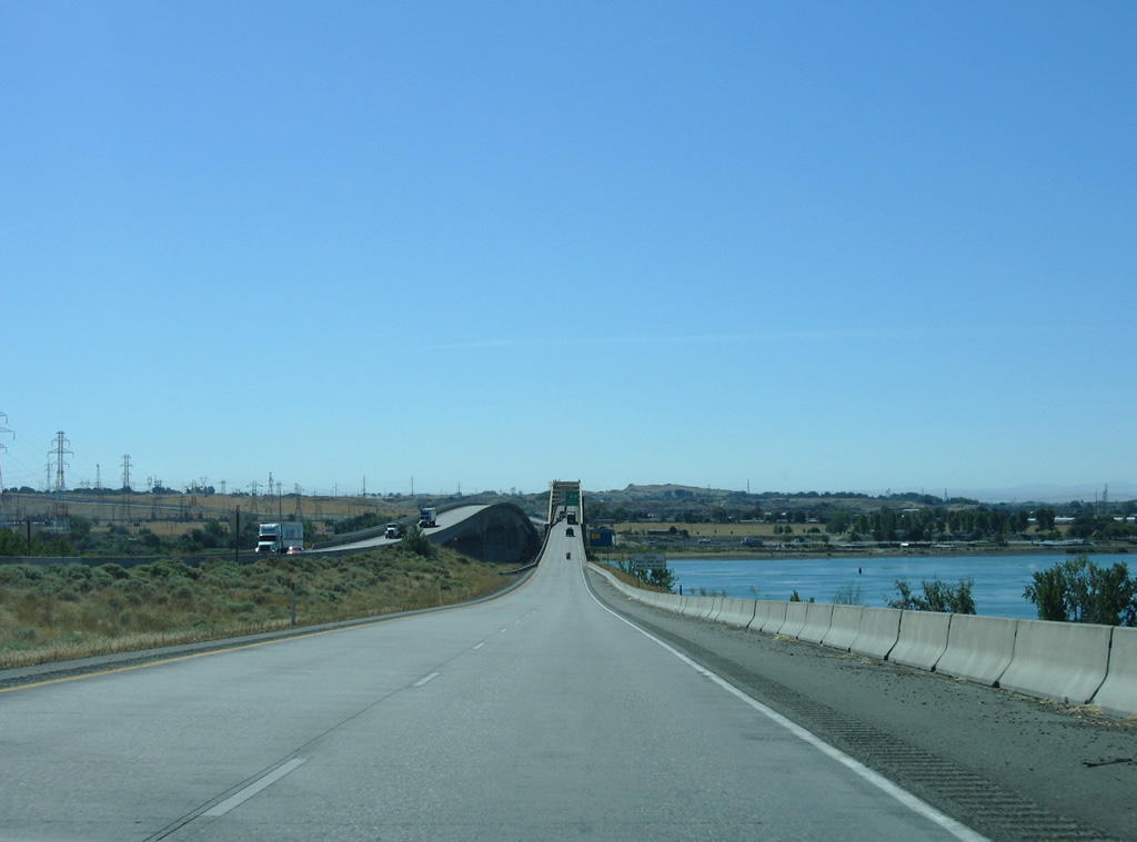
52 miles away, Umatilla, Oregon lies just across the Columbia River, The Tri-Cities is 25 miles to the east.
08/31/06
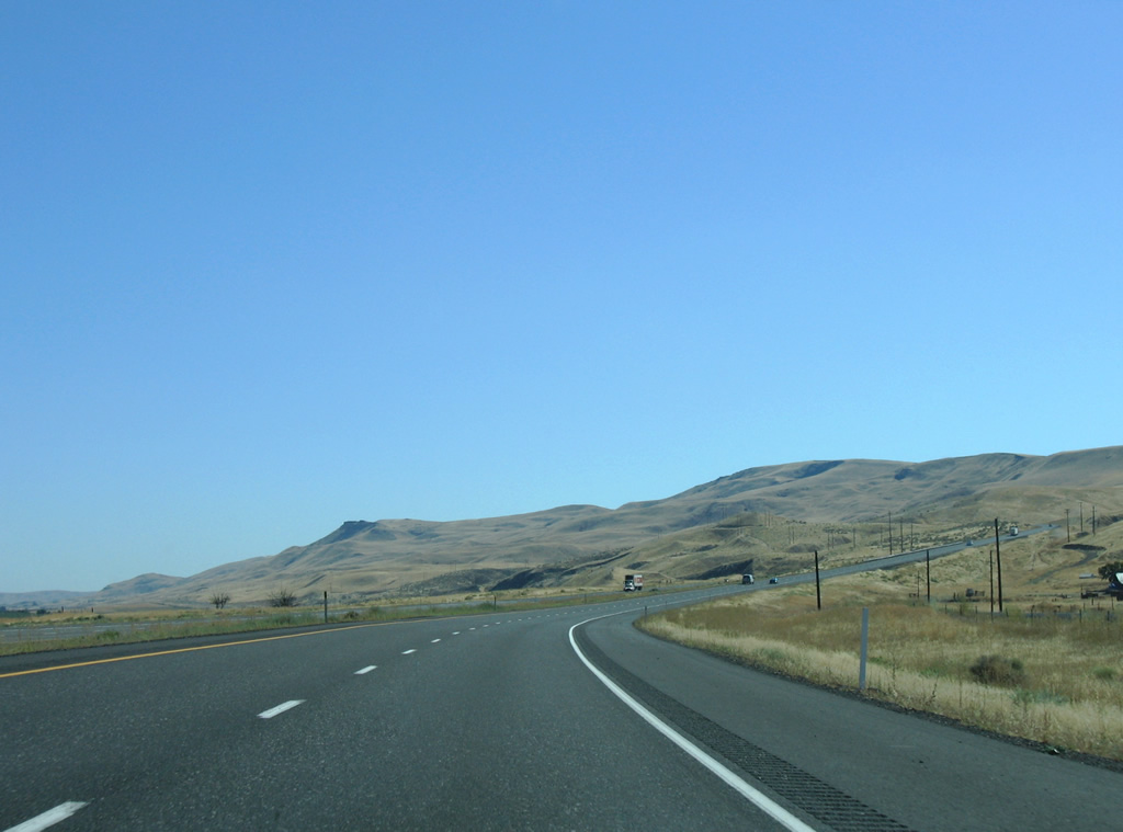
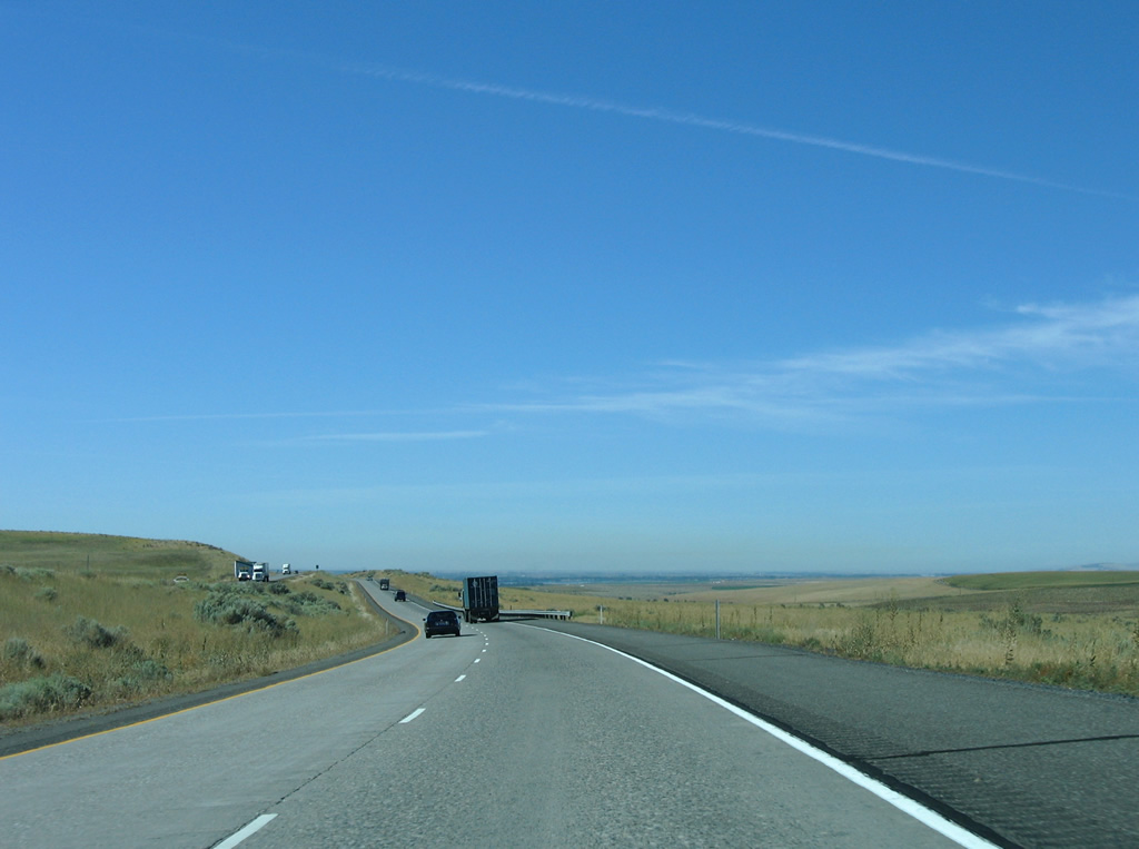
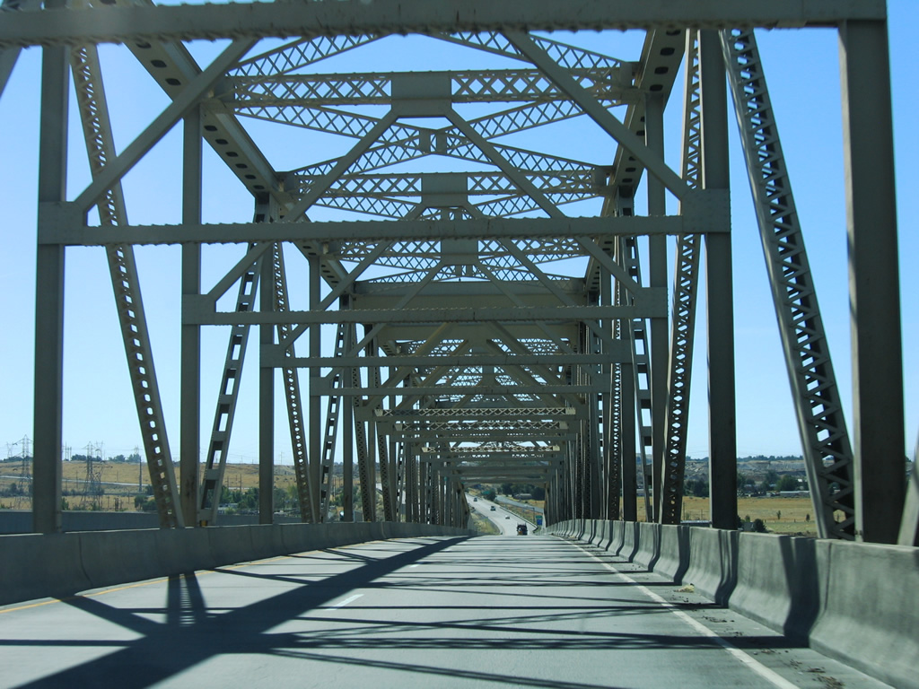
Roadways of Interstate 82 diverge as the freeway rises onto Horse Heaven Hills above the Yakima River. The westbound lanes directly replaced the original U.S. 410 and U.S. 12 alignment while a new roadway was built for I-82 eastbound.
08/31/06
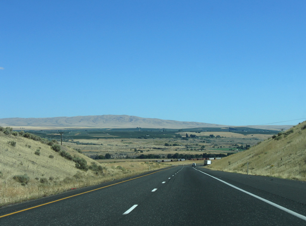
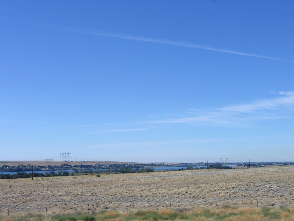
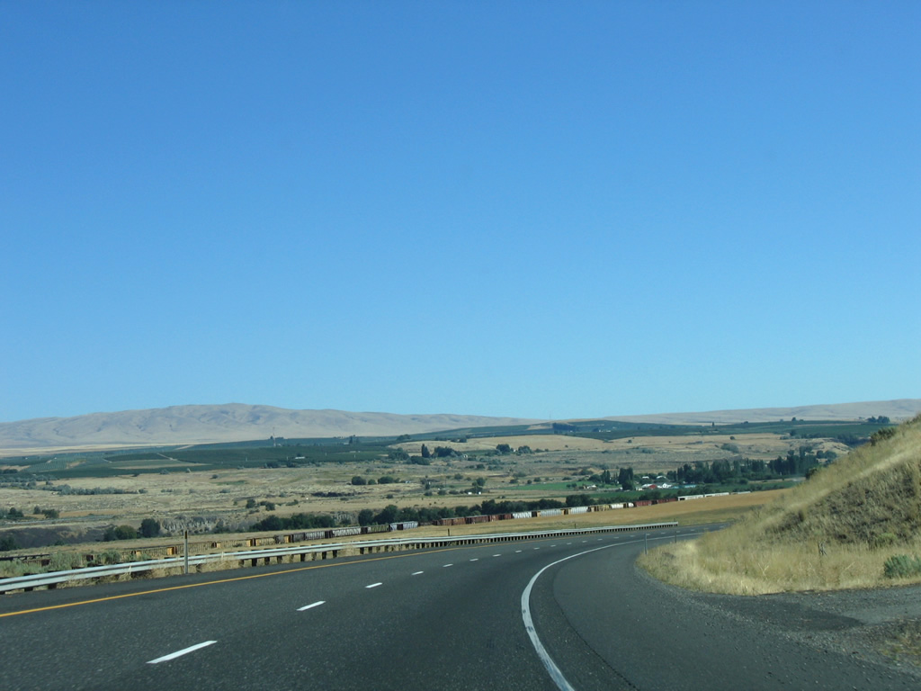
The BNSF Railroad line from Prosser comes into view as I-82/U.S. 12 lower from Horse Heaven Hills near Gibbon. A flat area of agricultural land falls between the Yakima River and Old Inland Empire Highway to the north.
08/31/06
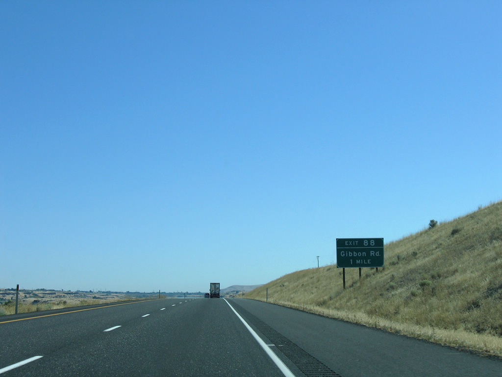
Gibbon Road connects the freeway with an isolated area bound by Horse Heaven Hills and the Yakima River near Gibbon. Yakitat Road parallels Interstate 82 to the east, eventually utilizing a portion of old U.S. 410 and U.S. 12 eastbound.
08/31/06
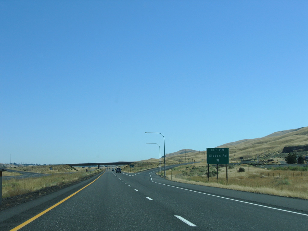
A diamond interchange links I-82/U.S. 12 and Gibbon Road at Exit 88.
08/31/06
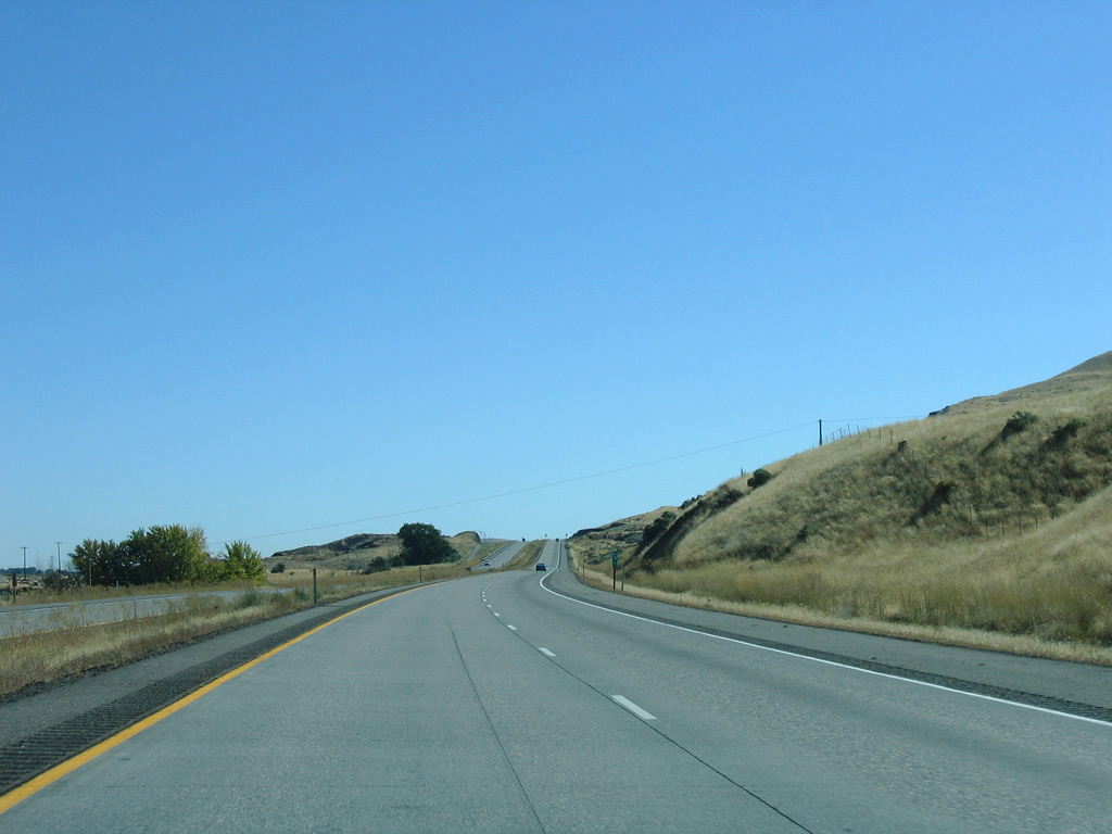
Both directions of Interstate 82 replaced the original westbound roadway of U.S. 12. Yakitat Road parallels the freeway on the original eastbound lanes, eventually disappearing from view on a higher course.
08/31/06
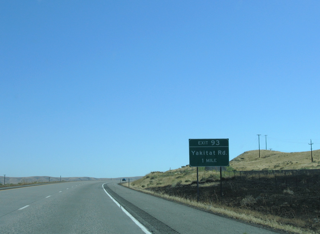
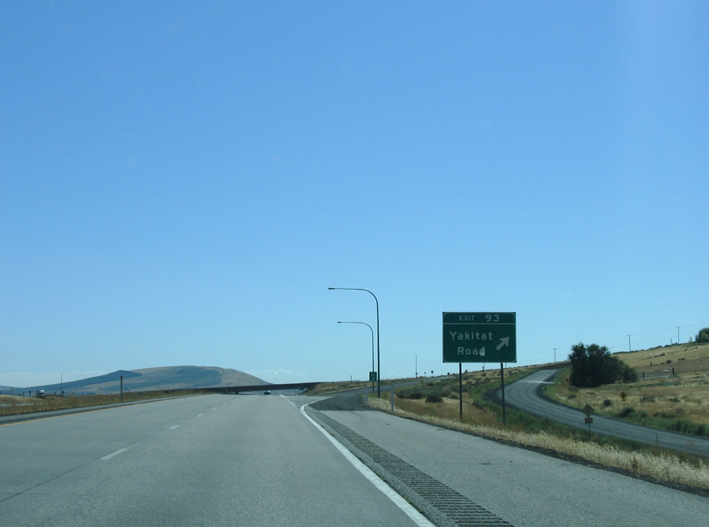
Yakitat Road ties into I-82/U.S. 12 at a diamond interchange (Exit 93) in Benton City.
08/31/06
Yakitat Road connects I-82/U.S. 12 with a subdivision to the south and parallel Chandler Road to the north. Chandler Road provides access to farming areas north of Kennewick Main Canal and south of the Yakima River.
08/31/06
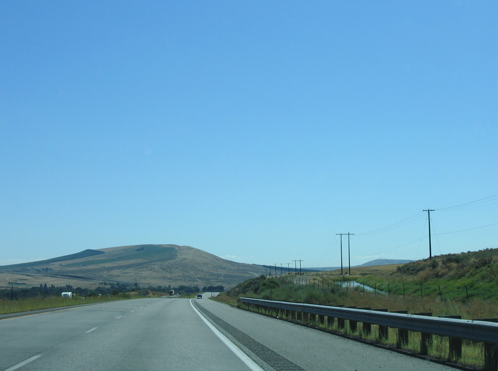
Kennewick Main Canal comes into view alongside Interstate 82 near Exit 93. The canal follows the north side of Horse Heaven Hills into Kennewick.
08/31/06
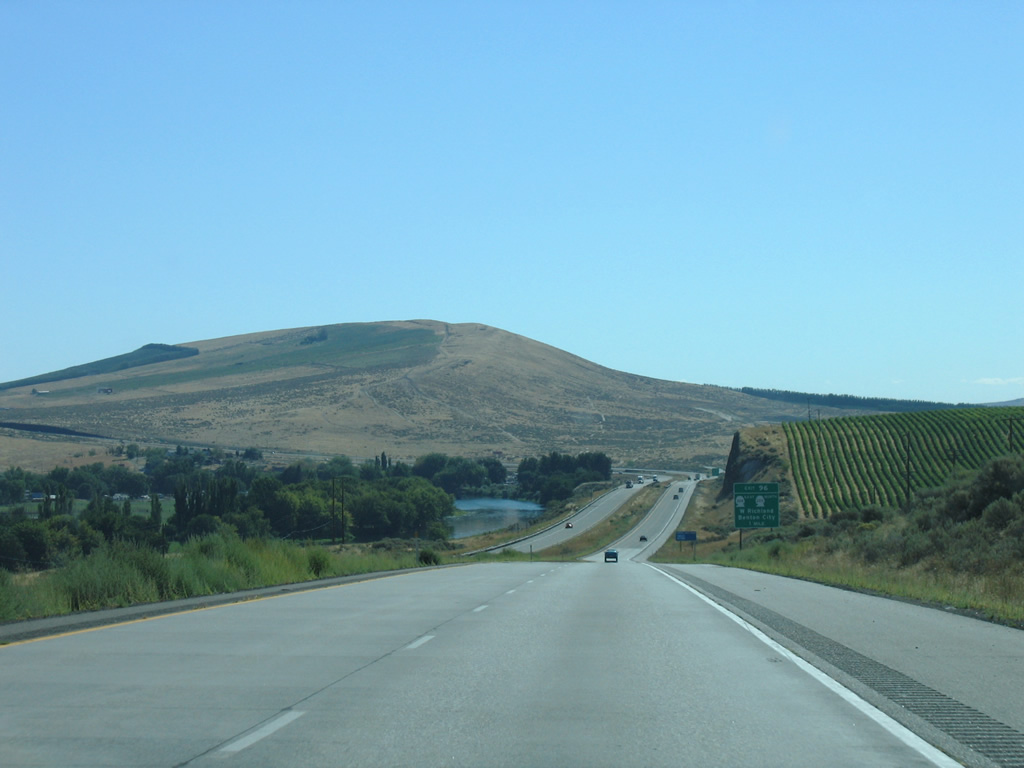
Goose Hill rises to the east as I-82/U.S. 12 dip to Kiona. The freeway directly replaced old U.S. 410 and U.S. 12 to Exit 96.
08/31/06
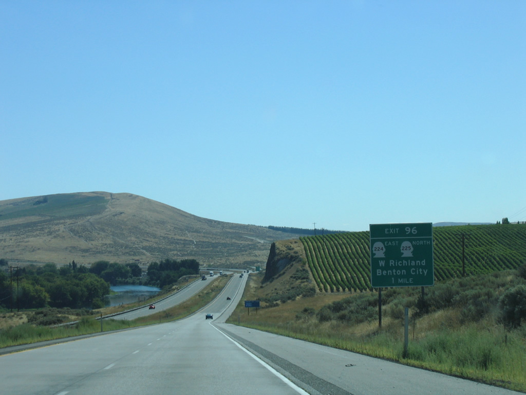
SR 224 east and SR 225 north begins at Exit 96 in Benton City. The two routes partition at a roundabout with SR 225 following 1st Street to Babs Avenue west and 9th Street into the city center. SR 224 turns northeasterly along Kennedy Road (old U.S. 410/U.S. 12) briefly before continuing to West Richland.
08/31/06
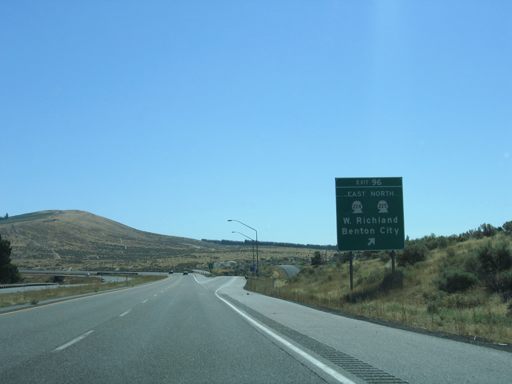
Exit 96 lowers from I-82/U.S. 12 east to Webber Canyon Road north of Weber Canyon. SR 225 forms an 11.32 mile long arc between Benton City and SR 240 outside West Richland and Richland.
08/31/06
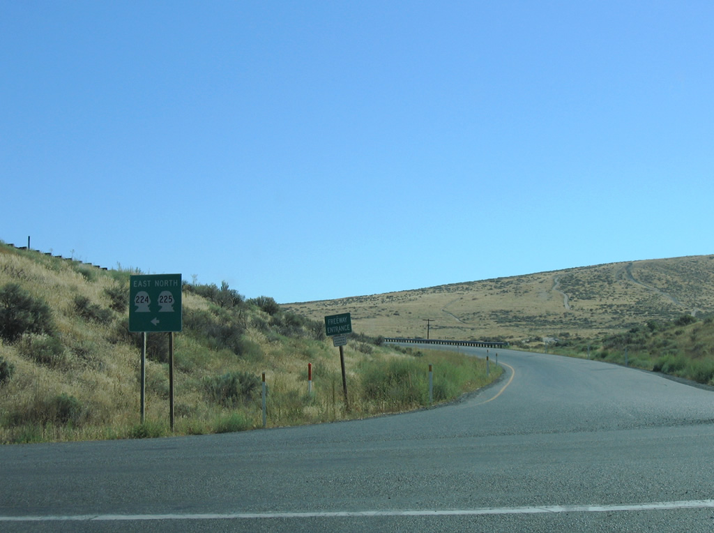
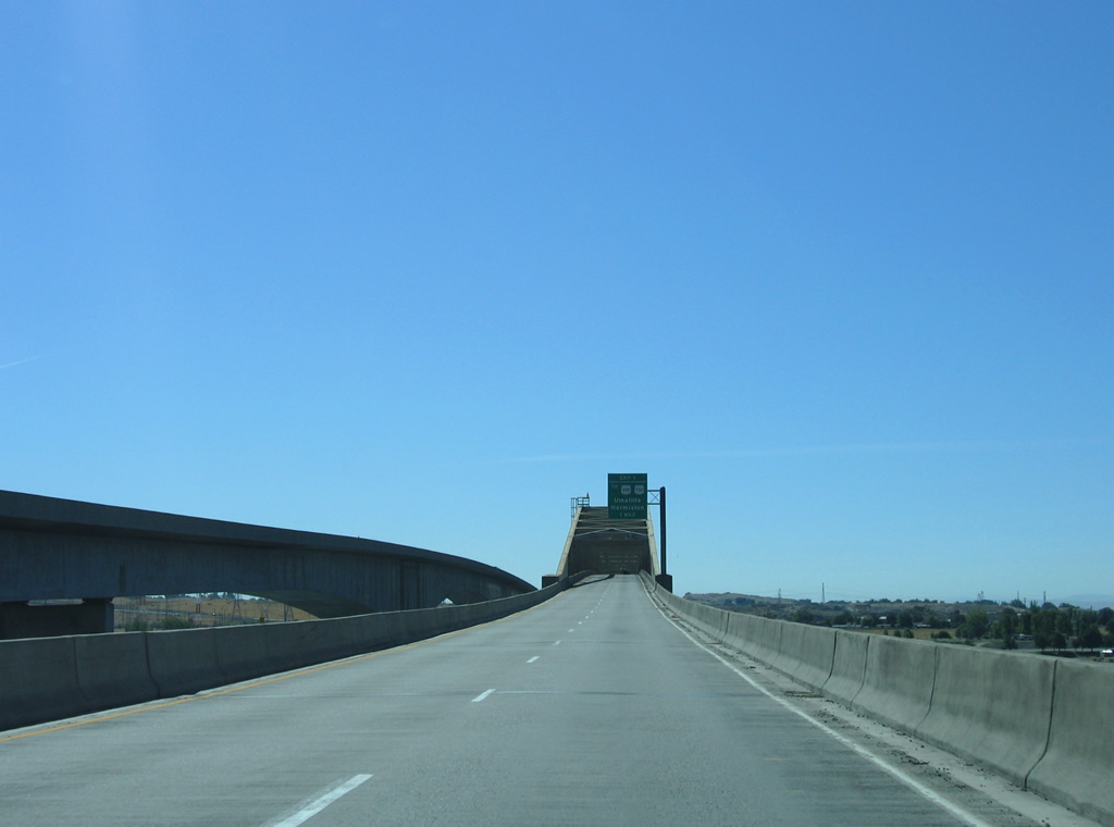
SR 225 spans the Yakima River on a bridge built in 1957 north along 1st Street en route to the Benton City center. SR 224 branches east along Kennedy Road on a 9.90 mile long course to SR 240 at Richland.
08/31/06
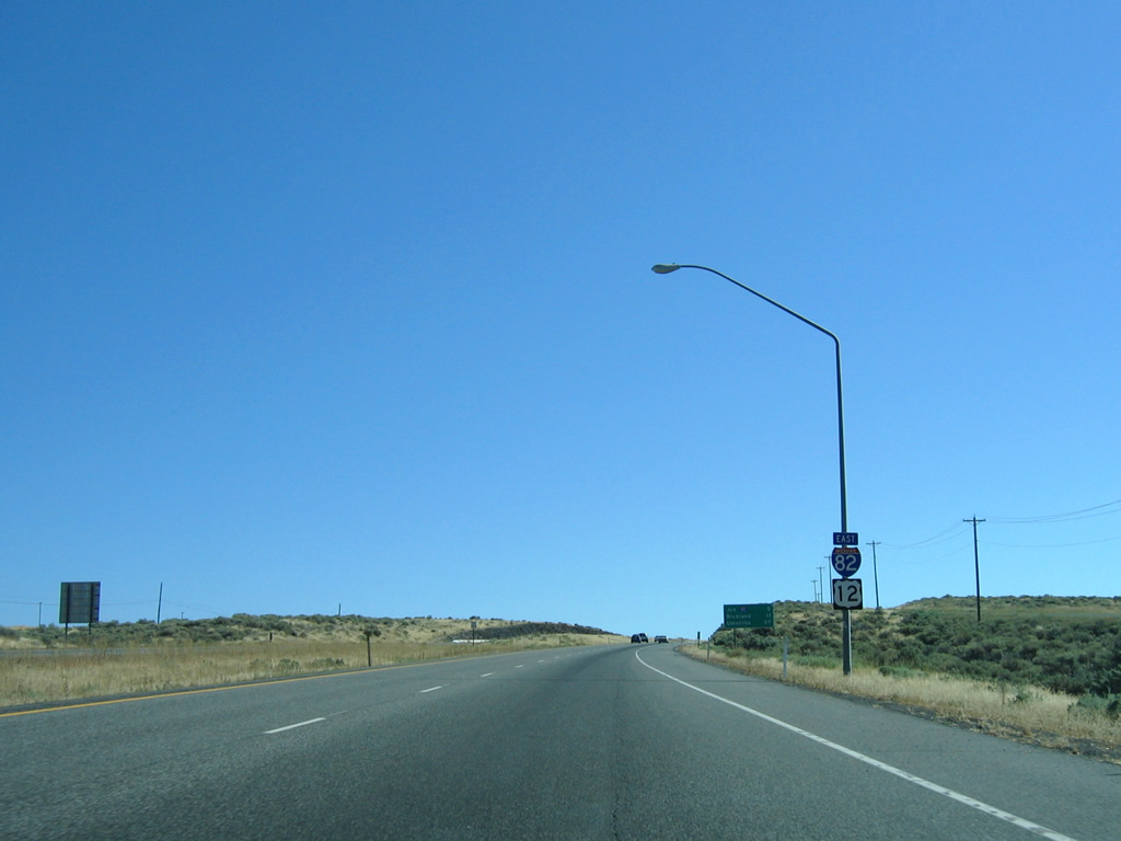
Interstate 82 and U.S. 12 conclude a 71.17 mile overlap east of Benton City at the succeeding exit.
08/31/06
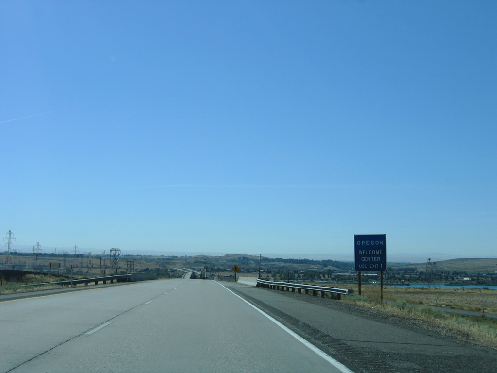
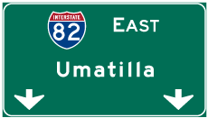
I-82/U.S. 12 split in five miles at the west end of Interstate 182. Umatilla appears on this distance sign for the southward turn of the freeway into Oregon.
08/31/06
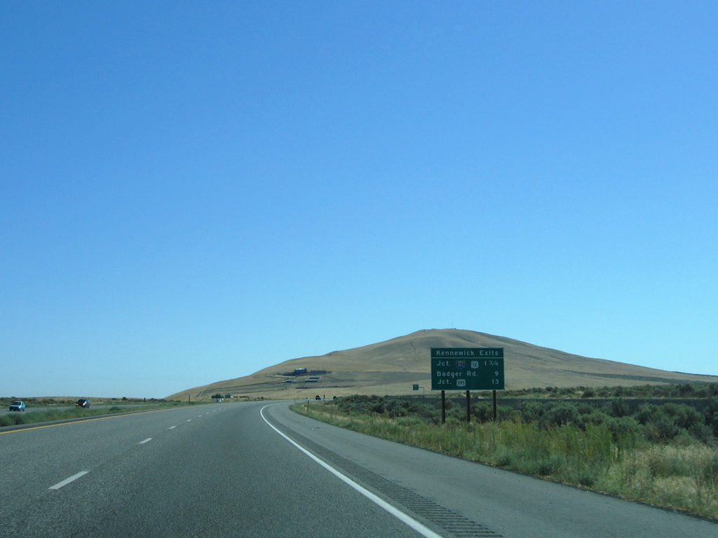
Interstate 82 generally stays west of the Tri-Cities along a mostly rural course with the exception of a stretch near Exit 109. Three exits serve the city of Kennewick from the freeway.
08/31/06
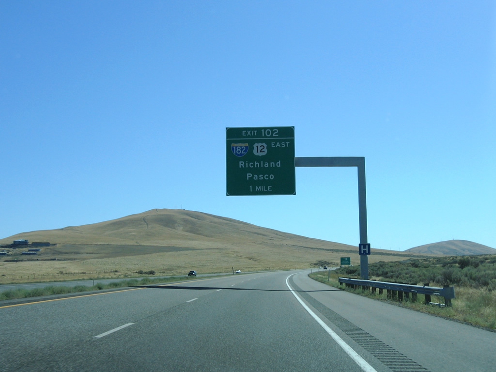
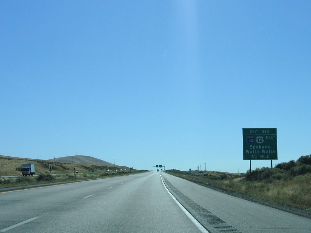
Candy Mountain rises to the east of I-82/U.S. 12 ahead of the trumpet interchange (Exit 102) with Interstate 182.
08/31/06
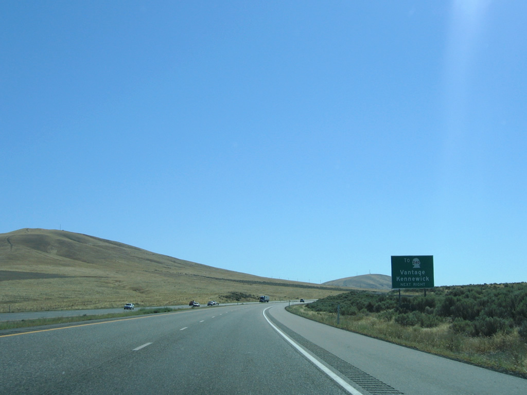
SR 240 constitutes a 41.31 mile route from SR 24 near the Vernita Bridge, to U.S. 395 near downtown Kennewick. Connections with SR 24 and SR 243 link the Tri-Cities with the Interstate 90 Columbia River crossing at Vantage.
08/31/06
U.S. 12 follows all 15.19 miles of Interstate 182 through Richland and Pasco. U.S. 12 continues from the freeway end to Burbank in Walla Walla, County.
08/31/06
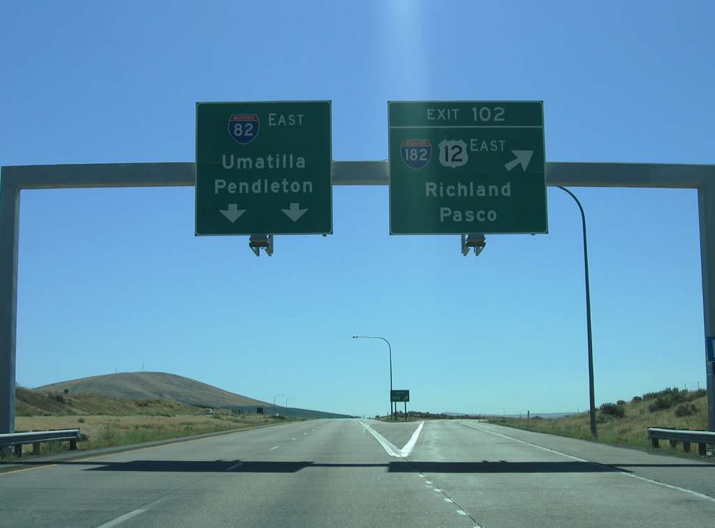
Exit 102 departs Interstate 82 for I-182/U.S. 12 east at Goose Gap. I-182 enters Richland, north of Badger Mountain. Fully opened to traffic in 1986, I-182 was envisioned as an alternative to routing I-82 southeastward along the Columbia River from the Tri-Cities.
08/31/06
East
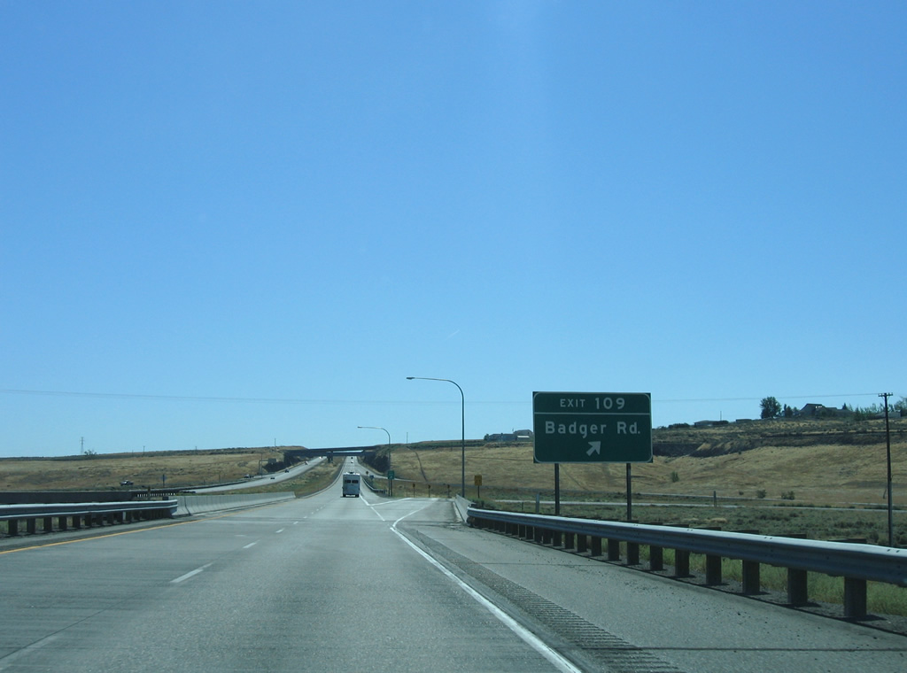
Turning more southerly, Interstate 82 straddles northern reaches of Horse Heaven Hills to U.S. 395. This view looks southwesterly toward Badger Road and the adjacent hills.
08/31/06
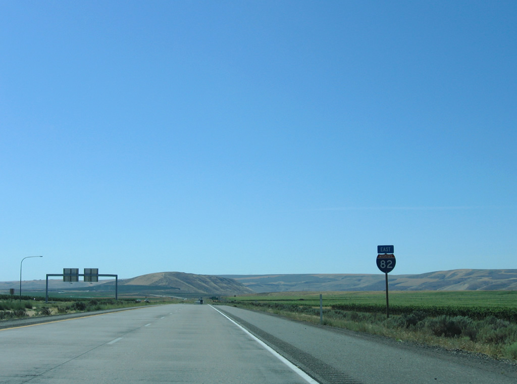
Interstate 82 travels without a U.S. highway for the first time in Washington between Exits 102 and 113.
08/31/06
This distance sign is posted six miles out from the Kennewick city limits along I-82 east. Pendleton joins as the third destination for Interstate 84 east from the east end of I-82 in Oregon.
08/31/06
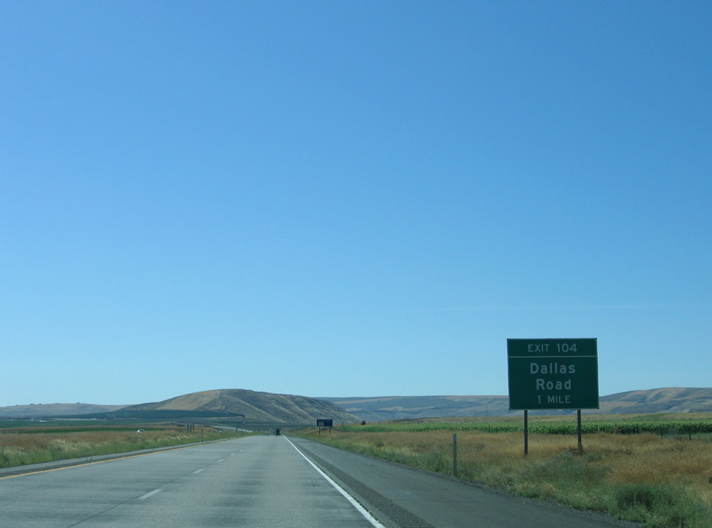
Dallas Road meanders south from West Richland to meet Interstate 82 at a diamond interchange (Exit 104) near Badger.
08/31/06
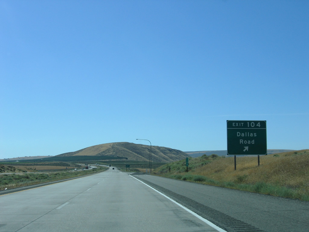
Dallas Road turns westward from Interstate 82 to connect with Badger Road nearby.
08/31/06
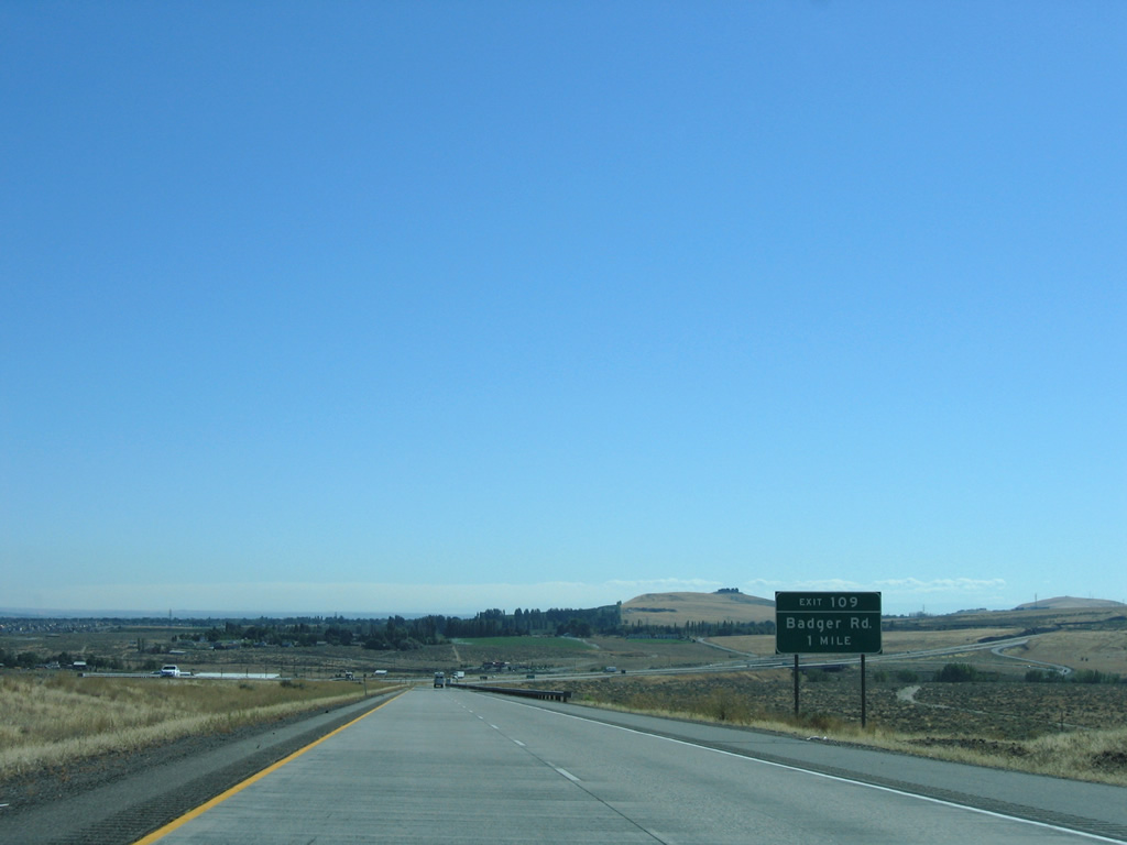
Interstate 82 passes through suburban areas in west Richland leading to Exit 109 for Badger Road at the Kennewick city line.
08/31/06
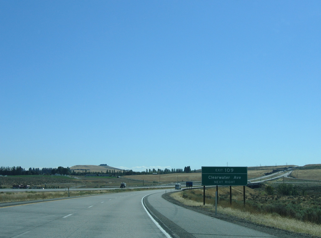
Badger Road becomes Clearwater Avenue leading east from Exit 109 into Kennewick. The arterial gradually transitions from suburban to commercial en the drive to U.S. 395 (Ely Street) near the city center.
08/31/06
The folded diamond interchange at Exit 109 lies opposite from the Washington Central Railroad. Badger Road arcs westward to Kiona.
08/31/06
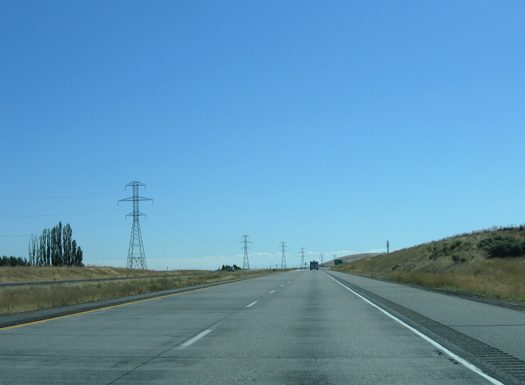
A power line corridor parallels Interstate 82 eastward from Amon Canyon in south Kennewick.
08/31/06
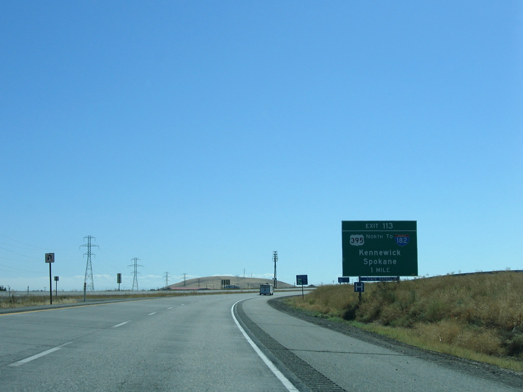
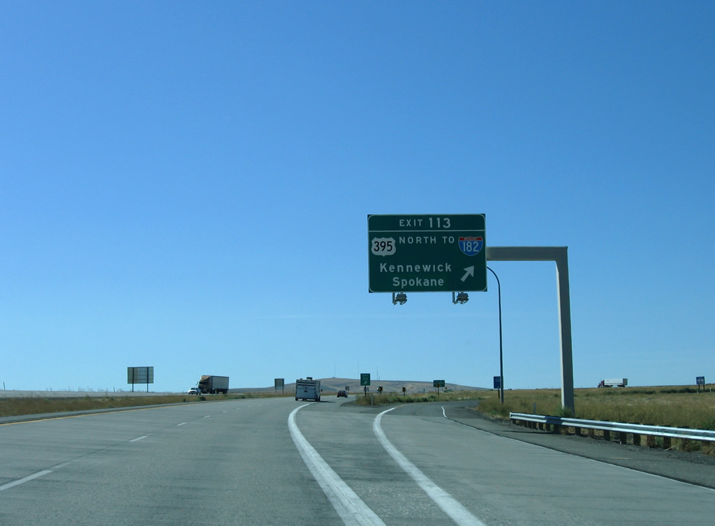
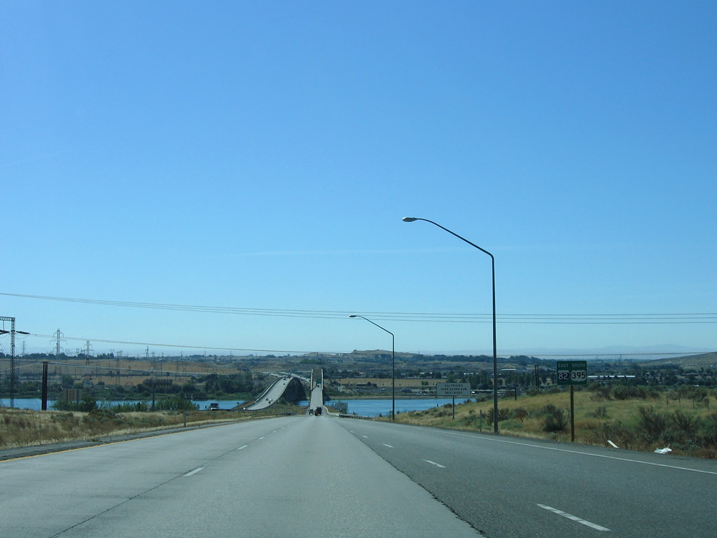
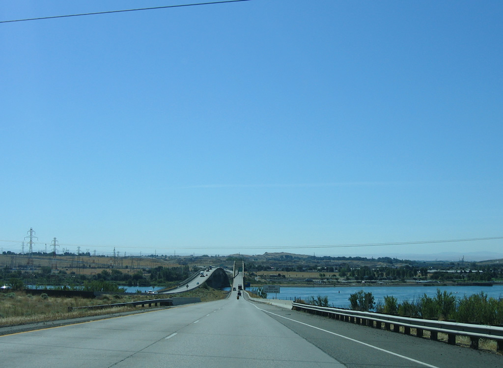
U.S. 395 south converges with I-82 east at a trumpet interchange (Exit 113) in mile. U.S. 395 constitutes a busy arterial leading northeast 5.2 miles to SR 240 near the Kennewick city center and a freeway from the Blue Bridge over the Columbia to I-182/U.S. 12.
08/31/06
U.S. 395 is a part of an expressway corridor joining the Tri-Cities with Spokane including a 2.11 mile long overlap with I-182/U.S. 12 in Pasco and a long overlap with Interstate 90 east from Ritzville.
08/31/06
East  South
South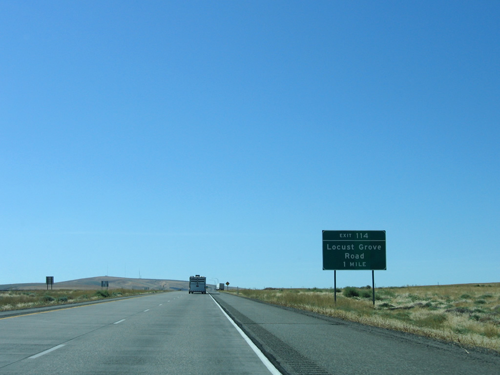
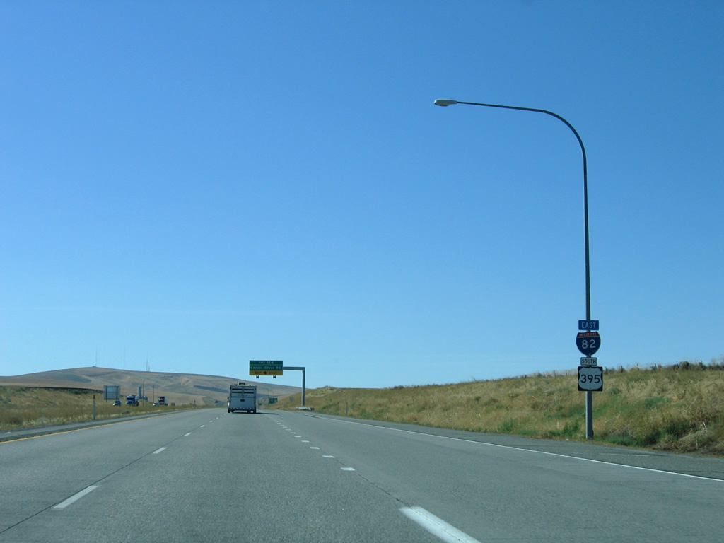
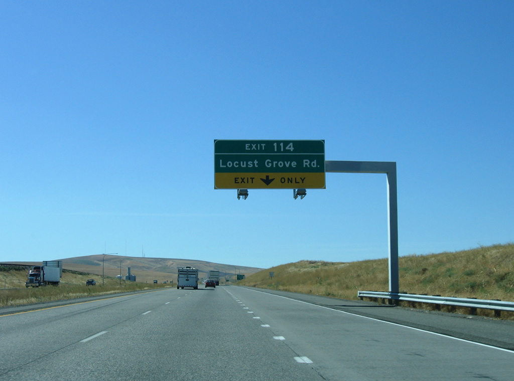
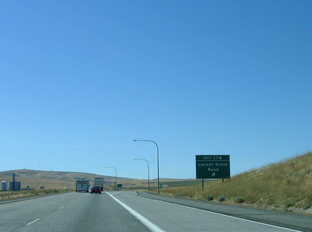
A diamond interchange (Exit 114) joins I-82/U.S. 395 with Locust Grove Road and SR 397 north to Finley in one mile.
08/31/06
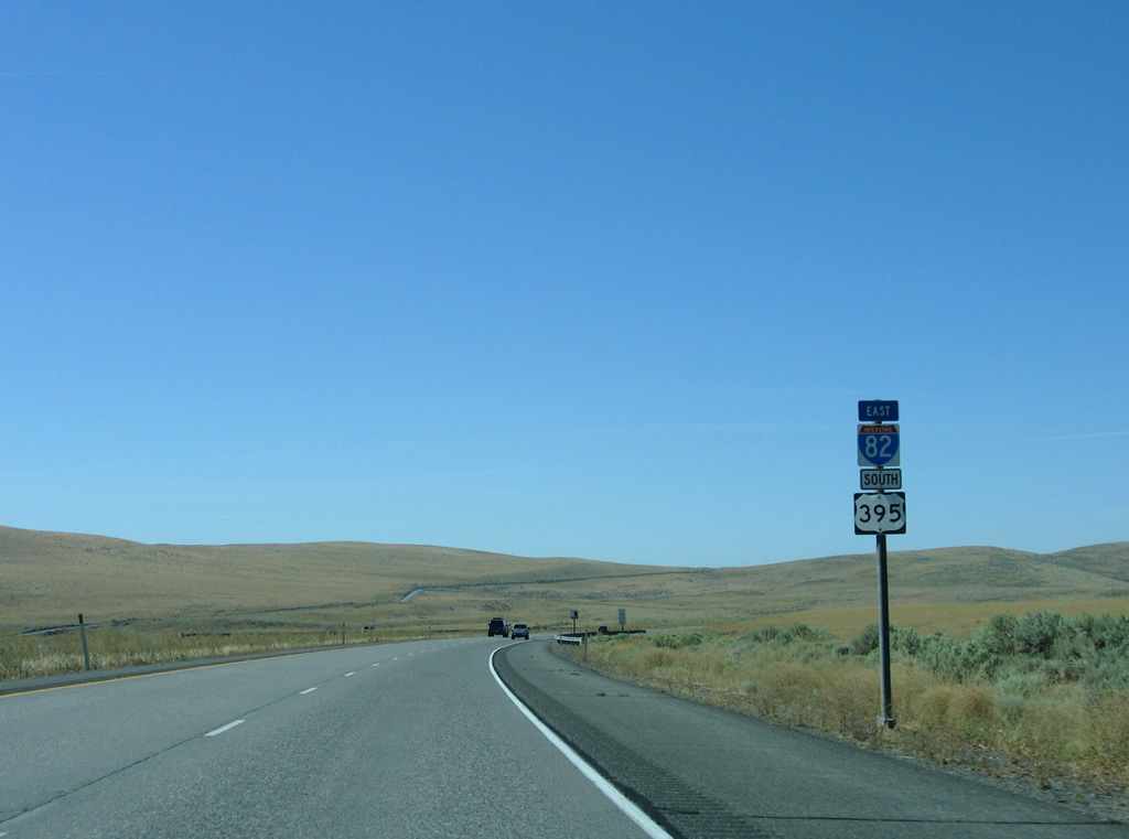
U.S. 395 combines with Interstate 82 for the final 19.81 miles in Washington state.
08/31/06
Locust Grove Road extends west from SR 397 and Exit 114 to Coyote Canyon at Horse Heaven Hills.
08/31/06
Completed in October 2008, construction lengthened SR 397 west 11.03 miles from Finley to I-82/U.S. 395. The project provided for an alternate route into south Kennewick via Olympia Street.1 SR 397 runs 22.31 miles overall east and then northwest to I-182/U.S. 12-395 at Pasco.
08/31/06
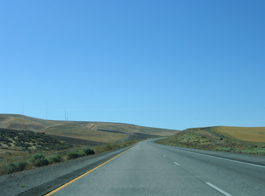
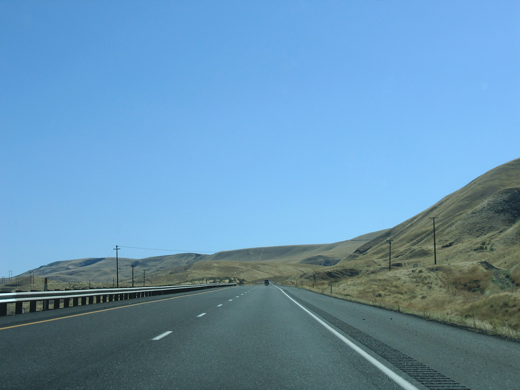
Heading south, I-82/U.S. 395 ascend onto Horse Heaven Hills.
08/31/06
Several power line corridors appear as the freeway angles southwest toward Bofer Canyon.
08/31/06
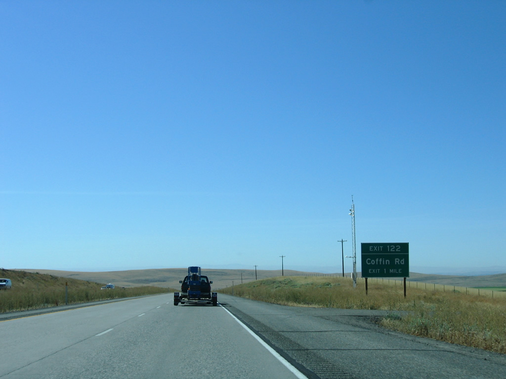
One mile north of the diamond interchange (Exit 122) with Coffin Road on I-82 east / U.S. 395 south.
08/31/06
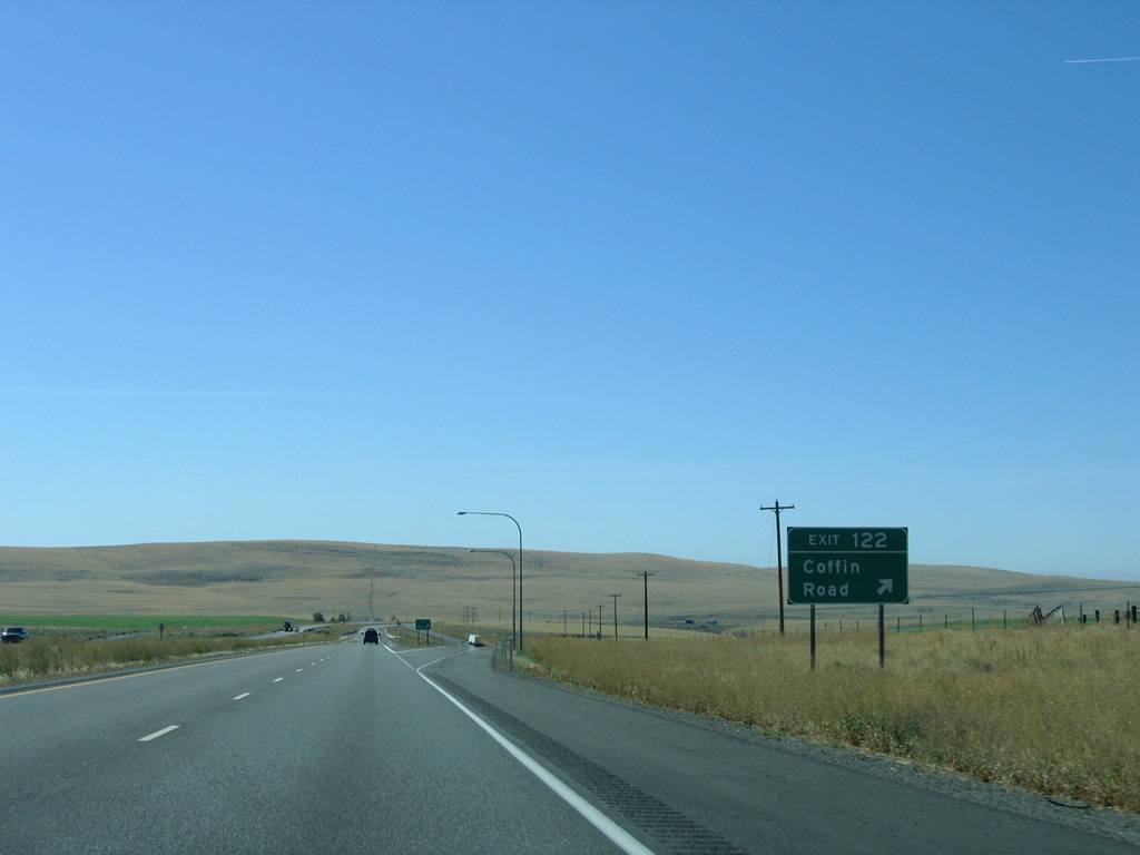
Exit 122 generally serves isolated agricultural areas as Coffin Road leads east to Nine Canyon Road.
08/31/06
Bofer Canyon Road (former SR 14) comes into view as the freeway turns westward alongside Fourmile Canyon.
08/31/06
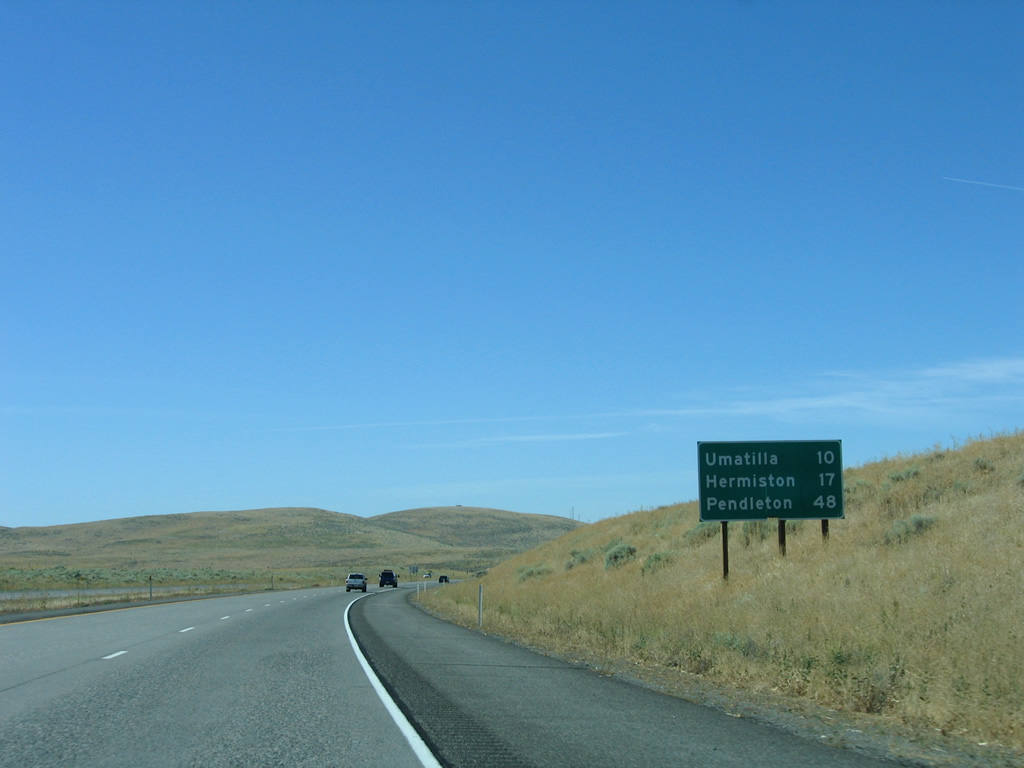
Umatilla and Hermiston are the final destinations along Interstate 82 east from Washington. Pendleton, Oregon lies 18 miles beyond the east end along I-84/U.S. 30.
08/31/06
I-82/U.S. 395 south overtake the original alignment of SR 14 from Prospect Canyon southward to Plymouth. The eastern extent of SR 14 was replaced by U.S. 395 when the route shifted westward from an overlap with U.S. 730.
08/31/06
The freeway again curves southward, parting ways with Fourmile Canyon, toward the Columbia River.
08/31/06
SR 14 begins at the diamond interchange with I-82/U.S. 395 at Exit 113. The state route stretches 180.77 miles westward along the north banks of the Columbia River to Interstate 5 at Vancouver.
08/31/06
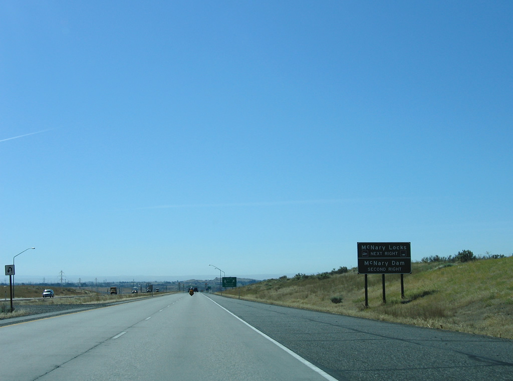
McNary Road stems east from Interstate 82 and SR 14 to the McNary Locks. Interests to McNary Dam are directed to remain on the I-82 to Exit 1 in Oregon for Devore Road north.
08/31/06
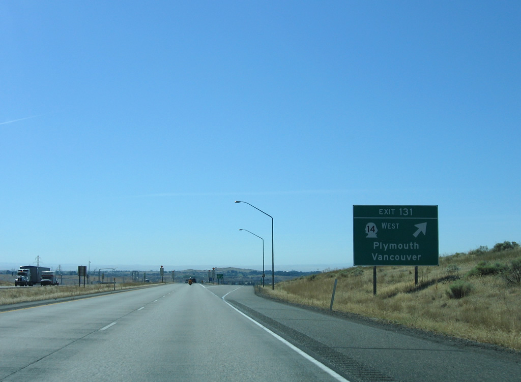
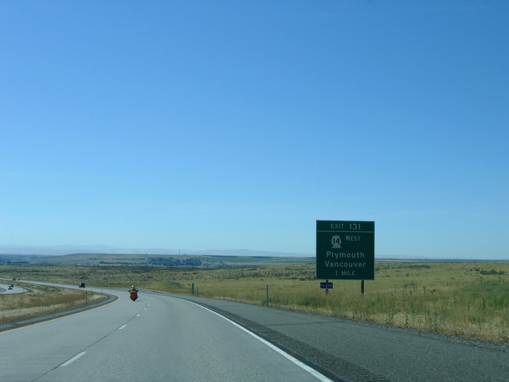
Exit 131 leaves I-82 east / U.S. 395 south for SR 14 west. Plymouth lies along Lake Umatilla of the Columbia River nearby.
SR 14 replaced all of U.S. 830 between Maryhill and Vancouver in 1968.
08/31/06
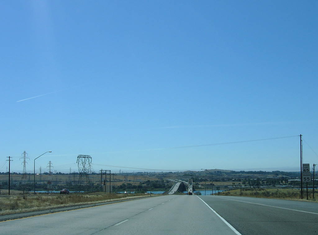
Speed limits along I-82/U.S. 395 reduce to 65 MPH for cars and 55 MPH for trucks as the freeway advances to the Columbia River bridge.
08/31/06
Several transmission lines spread to the west from McNary Dam and Umatilla.
08/31/06
The last reassurance markers for I-82 east / U.S. 395 south in Washington. Truckers are required to use the right lane for the next 1.5 miles for weigh in motion sensors.
08/31/06
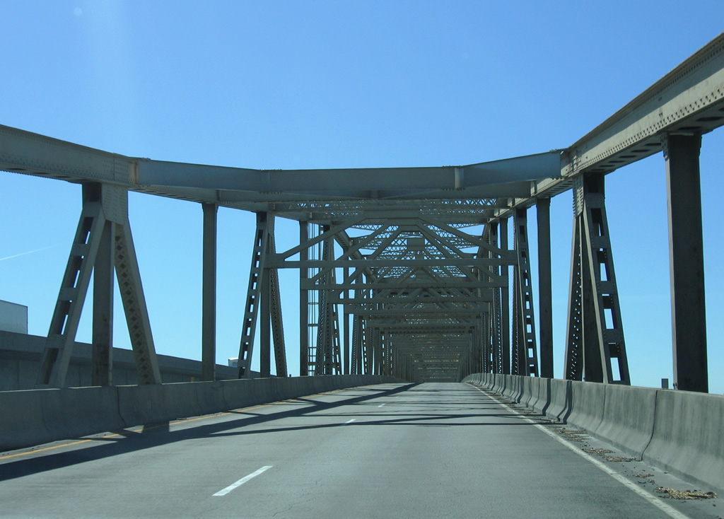
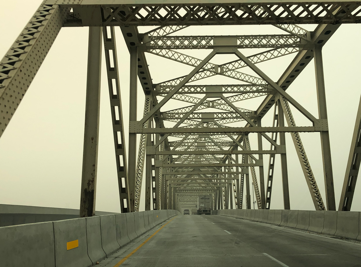
Interstate 82 lower to cross a BNSF Railroad line before rising onto the original U.S. 395 bridge spanning the Columbia River.
08/31/06
The cantilever span across the Columbia River opened in 1955 and was upgraded as part of Interstate 82 after the new westbound span was completed in 1987.2
08/31/06
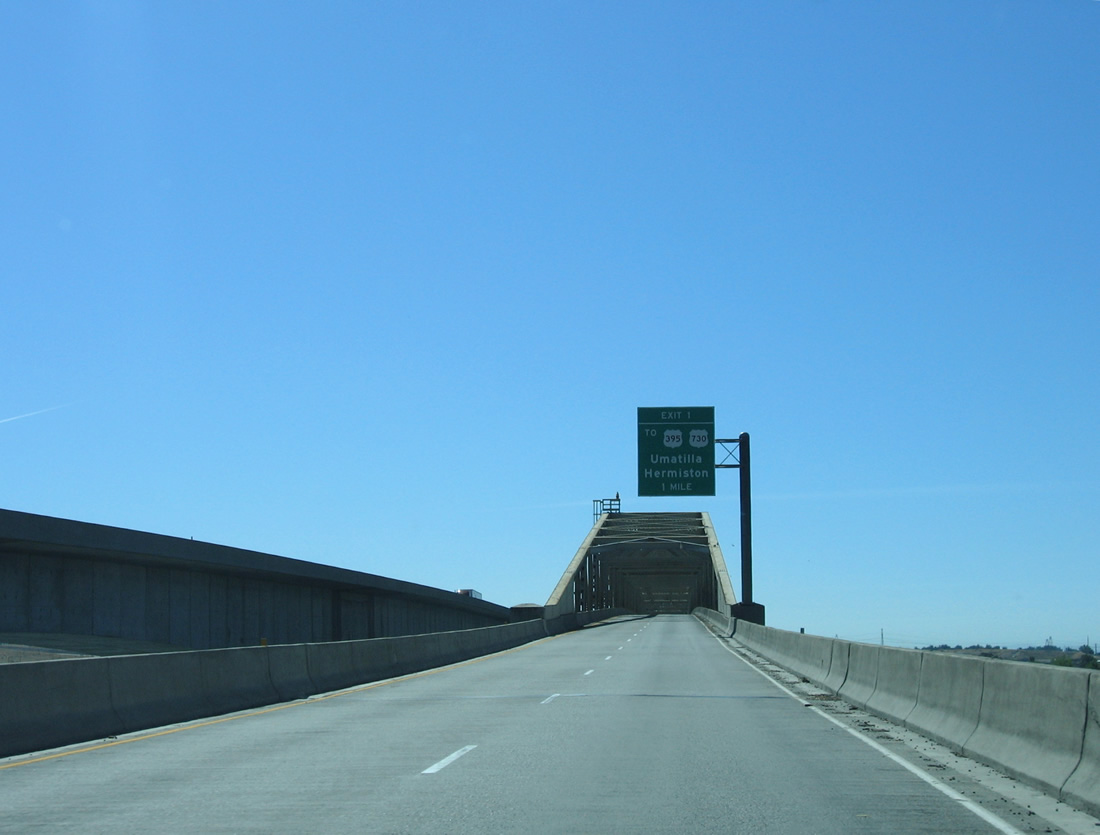
U.S. 395 splits with Interstate 82 east at Umatilla in one mile. Joining U.S. 730 (6th Street) at Exit 1, U.S. 395 turns east 0.78 miles to Umtilla-Stanfield Highway south to Hermiston.
08/31/06
The eastbound span travels 3,308 feet in length at height of 85 feet above the Columbia River. Known as the Umatilla Bridge, it was tolled until 1974.2
08/31/06
09/15/20

References:
http://www.wsdot.wa.gov/ projects/i82/sr397intertie/.- Umatilla Bridge. Wikipedia.
Photo Credits:
- AARoads, Chris Kalina: 08/31/06
- Peter Johnson: 09/15/20
Connect with:
Page Updated Tuesday October 04, 2011.