
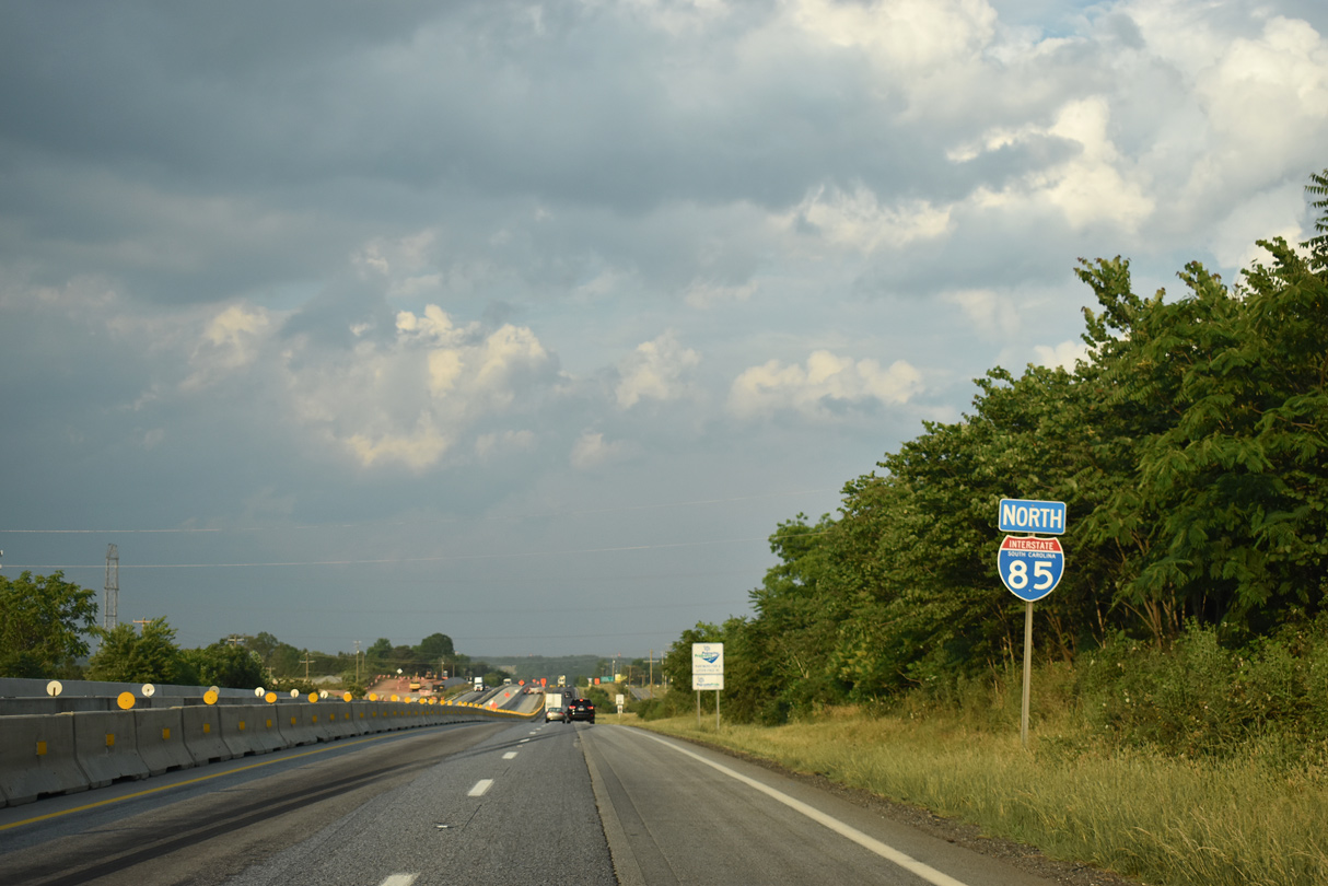
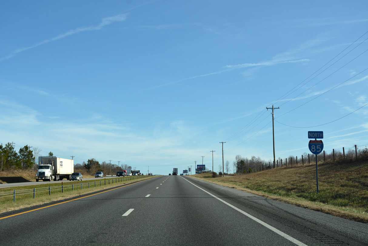
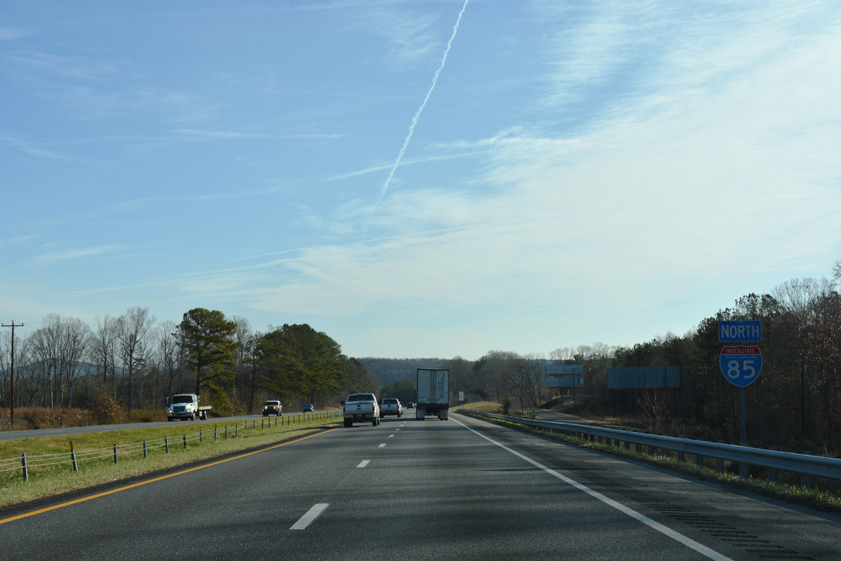
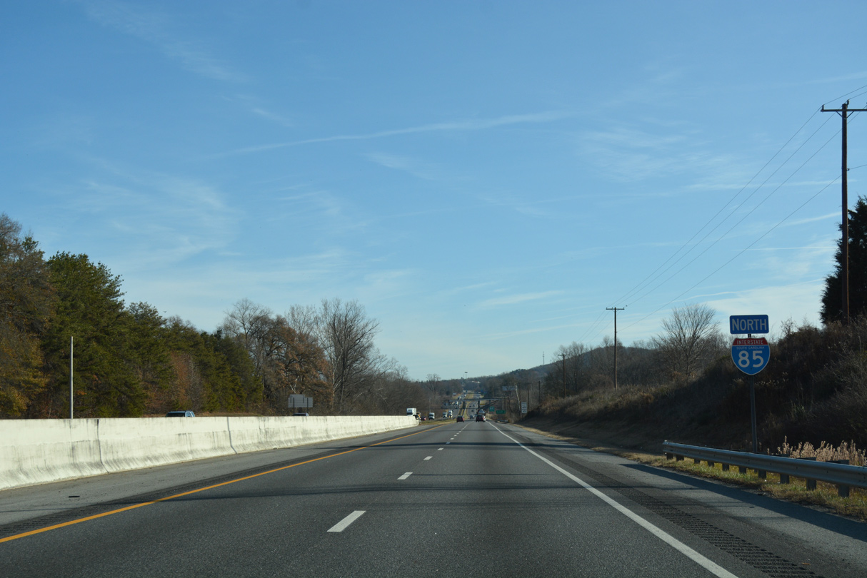
Interstate 85 North - Cherokee County
 North
North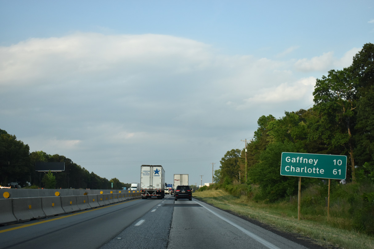
Interstate 85 meets Green River Road (Road 39) at the unincorporated community of Macedonia at the succeeding exit. Gaffney is ten miles to the east along parallel U.S. 29.
05/25/21
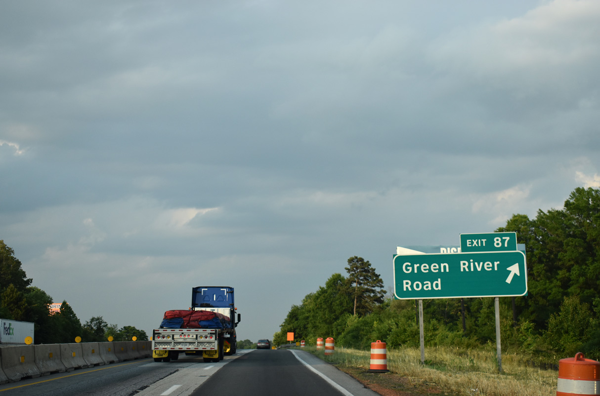
Widening of I-85 reconstructs the diamond interchange at Exit 87. Green River Road (Road 39) leads 4.42 miles south to U.S. 29 at Thicketty and north toward Thicketty Mountain.
05/25/21
Old Post Road (Road 665) and Overbook Drive (Road 31) run alongside I-85 to the east of Macedonia.
05/25/21
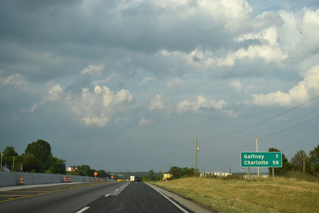
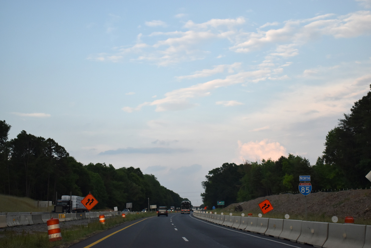
Interstate 85 continues seven miles toward Gaffney and 58 miles to Charlotte from ahead of Thicketty Creek.
05/25/21
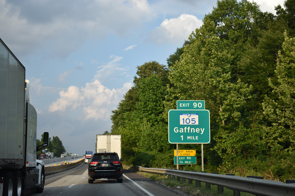
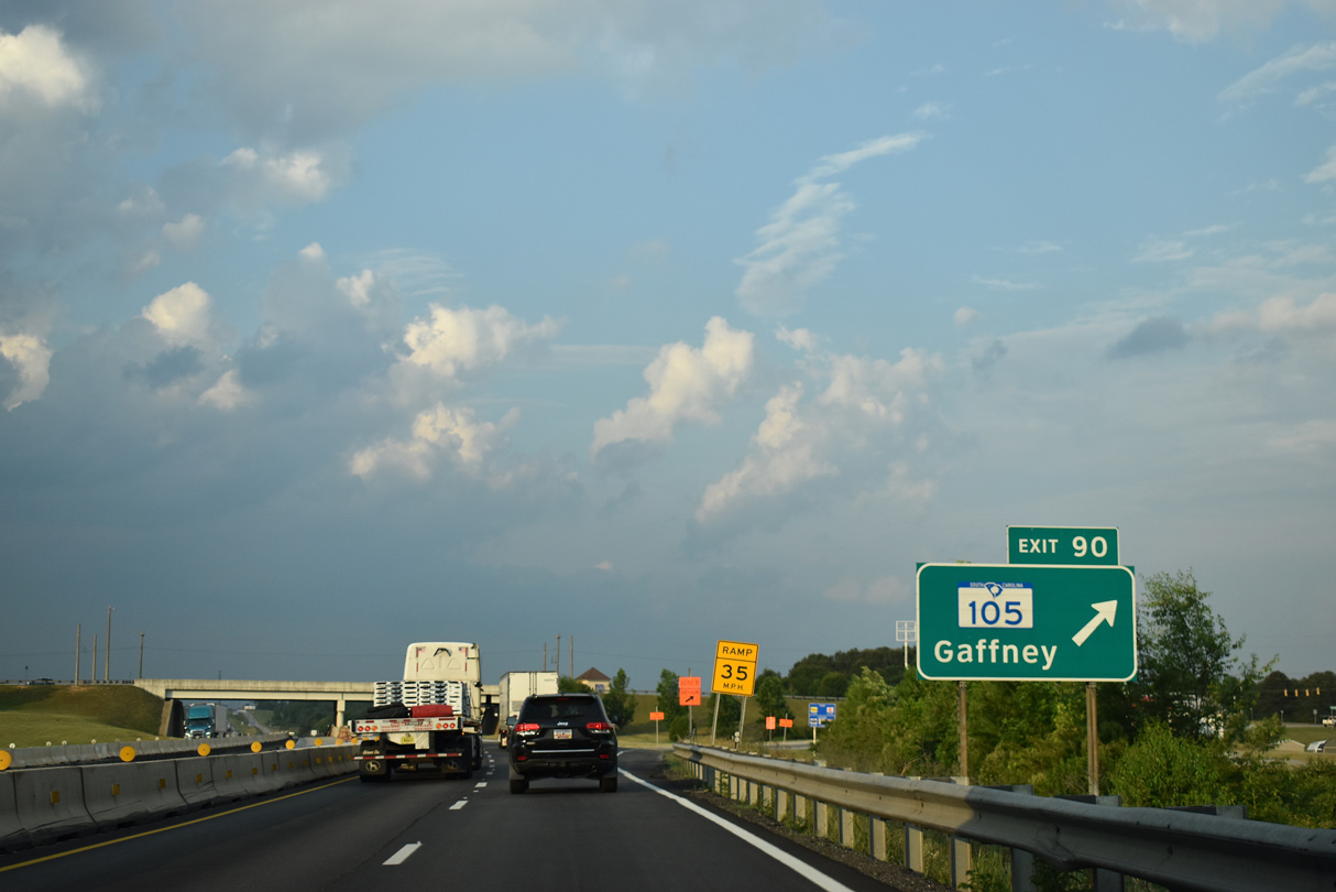
The north end of S.C. 105 is the diamond interchange (Exit 90) joining I-85 with Hyatt Street. A rest area formerly preceded Exit 90.
05/25/21
S.C. 105 (Hyatt Street) angles 3.15 miles southeast to SR 105 (Limestone Street) southwest of Downtown Gaffney. Hyatt Street (Road 81) extends 1.29 miles north from I-85 by the Gaffney Outlet Marketplace to Old Post Road (Road 61).
05/25/21

S.C. 105 constitutes a 33.22 mile long highway south to S.C. 49 in Union County.
05/25/21
Interstate 85 proceeds east through northern reaches of the Gaffney town limits between Exit 90 and 92.
12/15/16
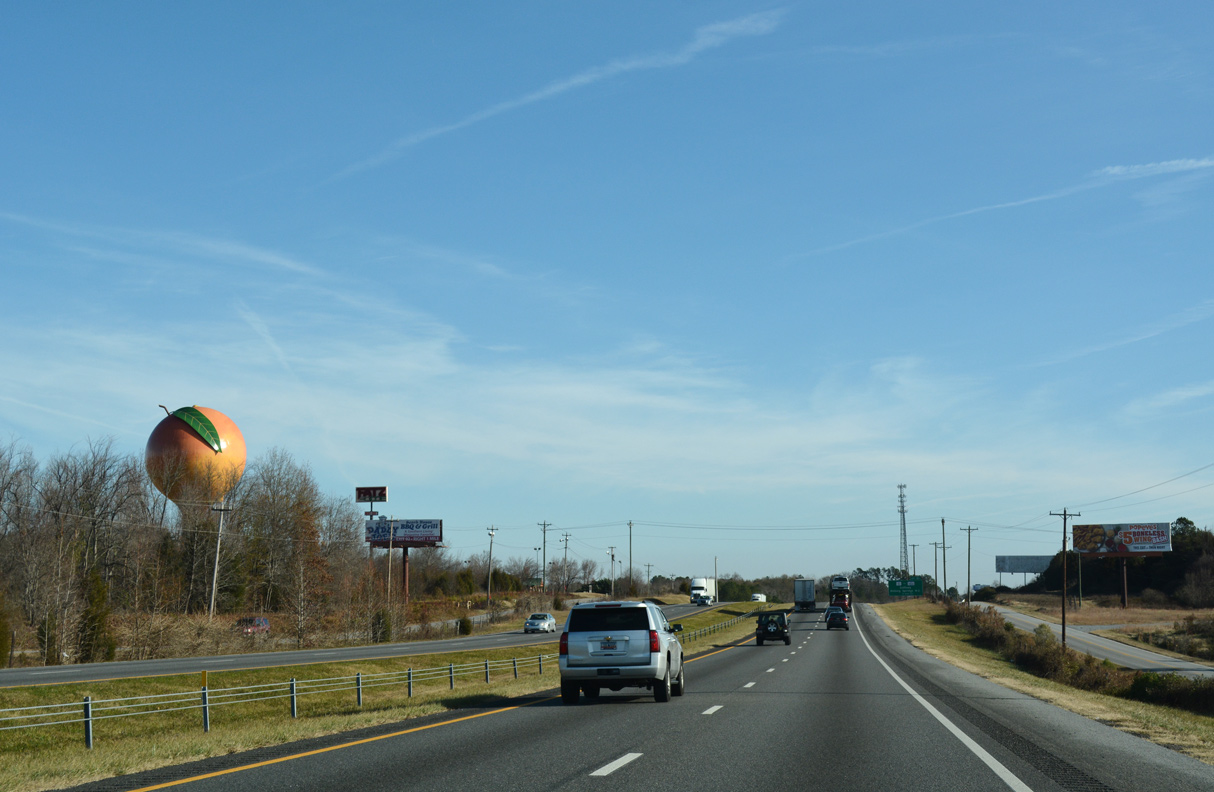
The Peachoid, a 135 foot high water tower, stands along the north side of I-85 by the Spartanburg Community College - Cherokee Campus. Erected in 1981, the tower was designed to resemble a peach to represent the once prevalent Gaffney area peach orchards.1
12/15/16
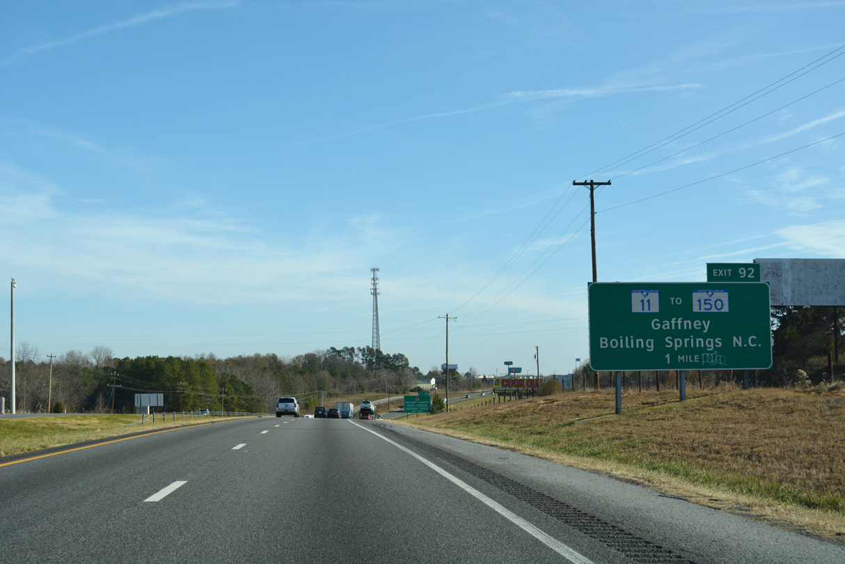
S.C. 11 (Floyd Baker Boulevard) heads northwest from Downtown Gaffney along a commercial arterial to I-85 at forthcoming Exit 92. Parallel Wilcox Avenue (Road 668) links S.C. 11 with S.C. 150 (Boiling Springs Highway), 0.8 miles to the east.
12/15/16
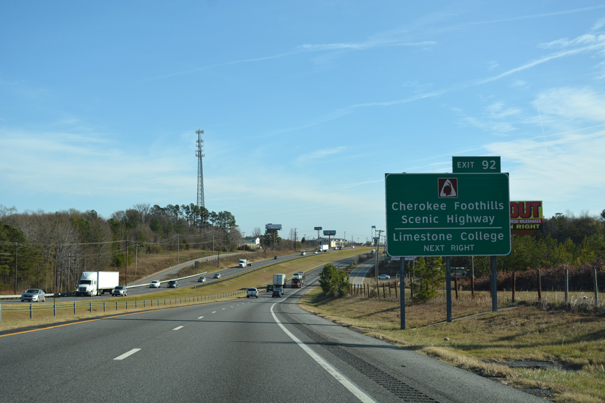
S.C. 11 originated from Interstate 85 at Exit 1 near Lake Hartwell State Park. Cherokee Foothills Scenic Highway overlays the 119.85 mile long route of S.C. 11 east through Gowensville, Campobello, New Prospect and Chesnee to Exit 90.
12/15/16
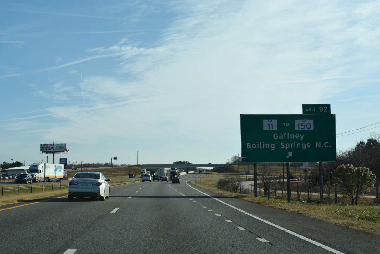
S.C. 11 concludes 1.92 miles southeast of the six-ramp parclo interchange (Exit 92) with I-85 at S.C. 18 (Frederick Street) and S.C. 150 (Limestone Street) in Uptown Gaffney. S.C. 150 heads southwest from Gaffney to Pacolet and north to Boiling Springs, North Carolina as part of a 218 mile multi-state route to Shelby.
12/15/16
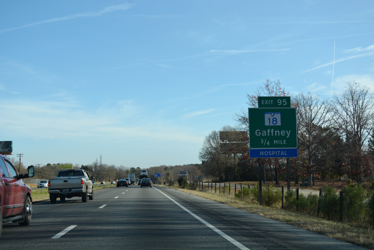
S.C. 18 (N Limestone Street) angles northeast through East Gaffney to Pleasant School Road at Exit 95. Continuing east, S.C. 18 (Shelby Highway) runs alongside I-85 to S.C. 329 (Victory Trail Road).
12/15/16
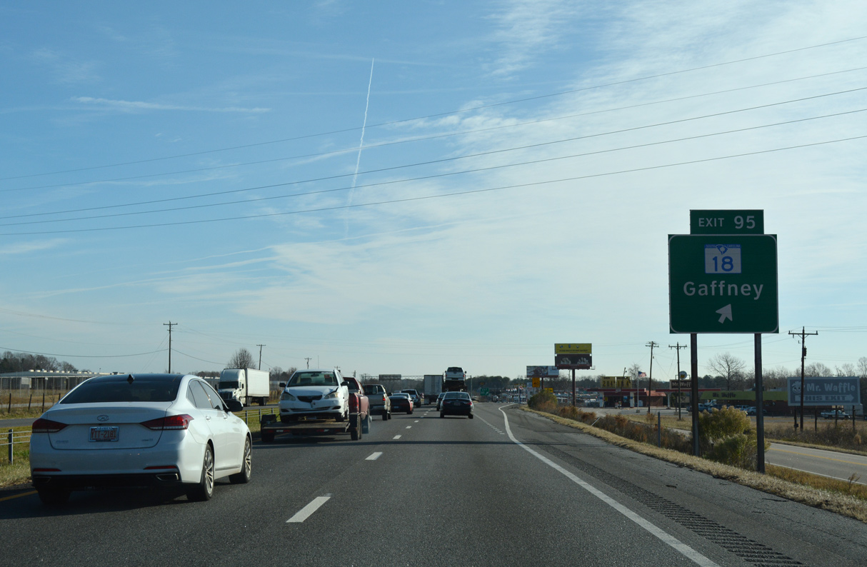
I-85 reconstruction removes the slip ramp to Hampshire Drive at Exit 95 and realigns Pleasant School Road through a new diamond interchange just north of S.C. 18 (Shelby Highway).
12/15/16
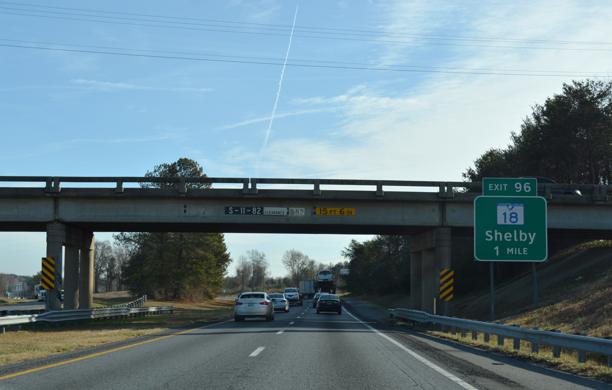
S.C. 18 (Shelby Highway) turns north from S.C. 329 to meet Interstate 85 directly at Exit 96. 5.11 miles to the northeast, S.C. 18 becomes NC 18 en route to Shelby, North Carolina in 11 miles.
12/15/16
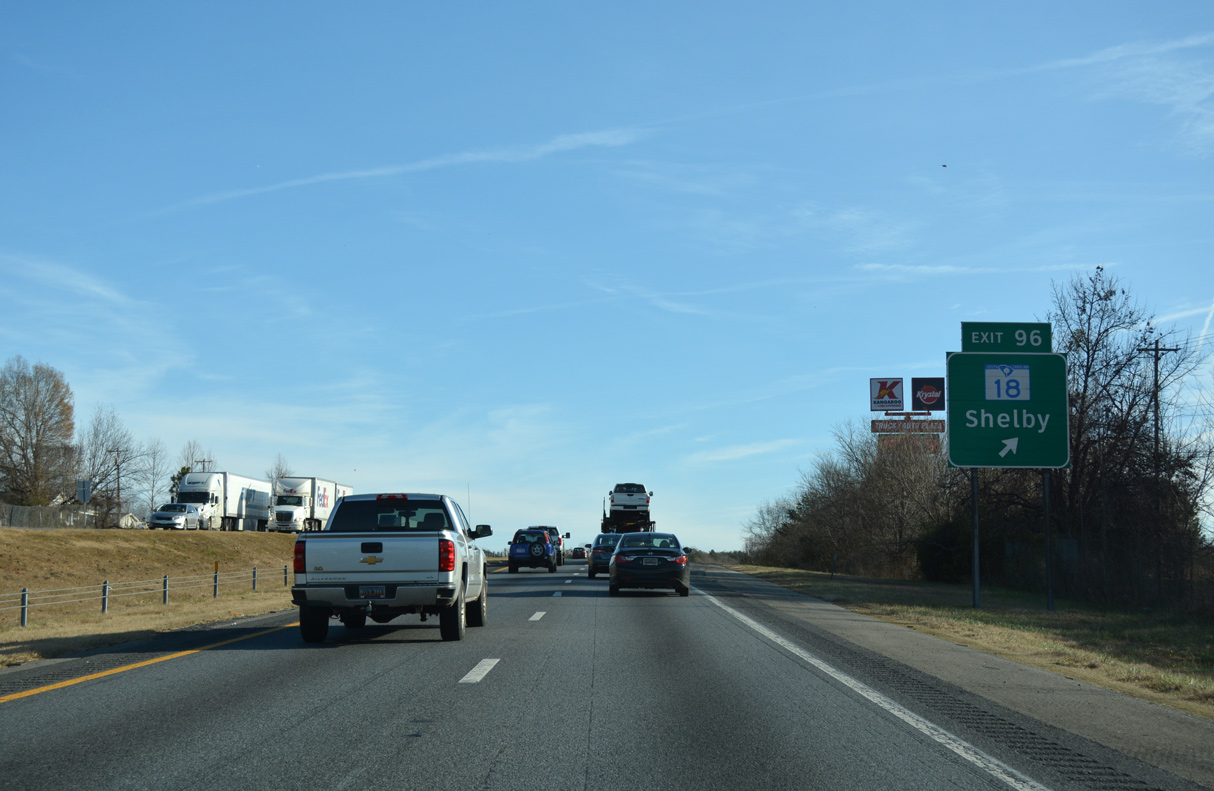
A dogbone interchange replaces the modified diamond interchange with S.C. 18 (Shelby Highway) and Wilcox Avenue) at Exit 96. S.C. 18 is also being realigned to adjacent S.C. 329, which bypasses Gaffney south 6.35 miles to S.C. 105.
12/15/16
Interstate 85 passes north of Cherokee Speedway on the ensuing rural stretch.
12/15/16

The succeeding two exits connect I-85 with the town of Blacksburg.
12/15/16
Removed during construction to widen I-85, a slip ramp (Exit 95) previously departed from northbound beyond the Broad River for the south Frontage Road (Road 670).
12/15/16
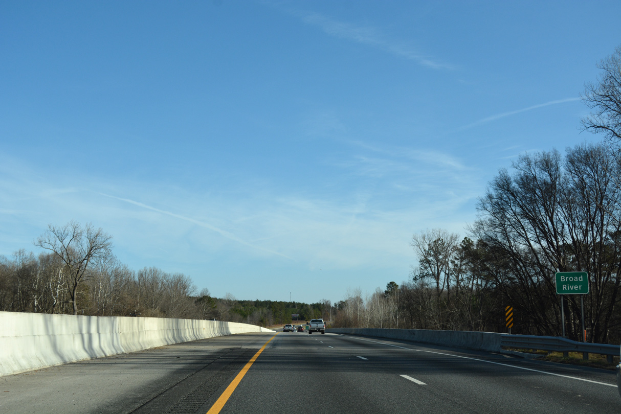
The six lane bridge taking Interstate 85 across the Broad River was completed in 2004.
12/15/16

Blacksburg Highway (Road 11) arcs southeast 1.51 miles from Exit 100 onto Carolina Street in the town of Blacksburg.
05/25/21
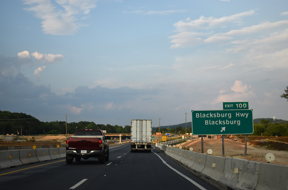
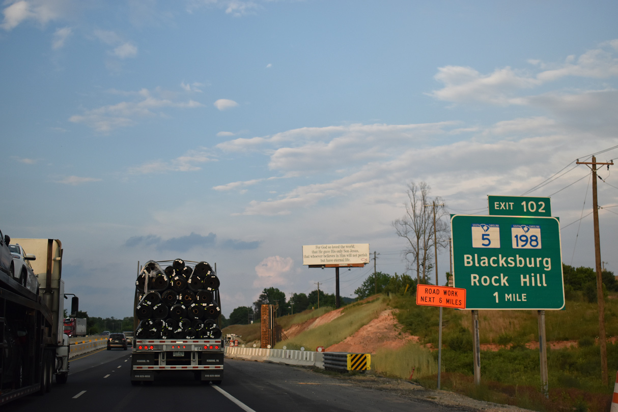
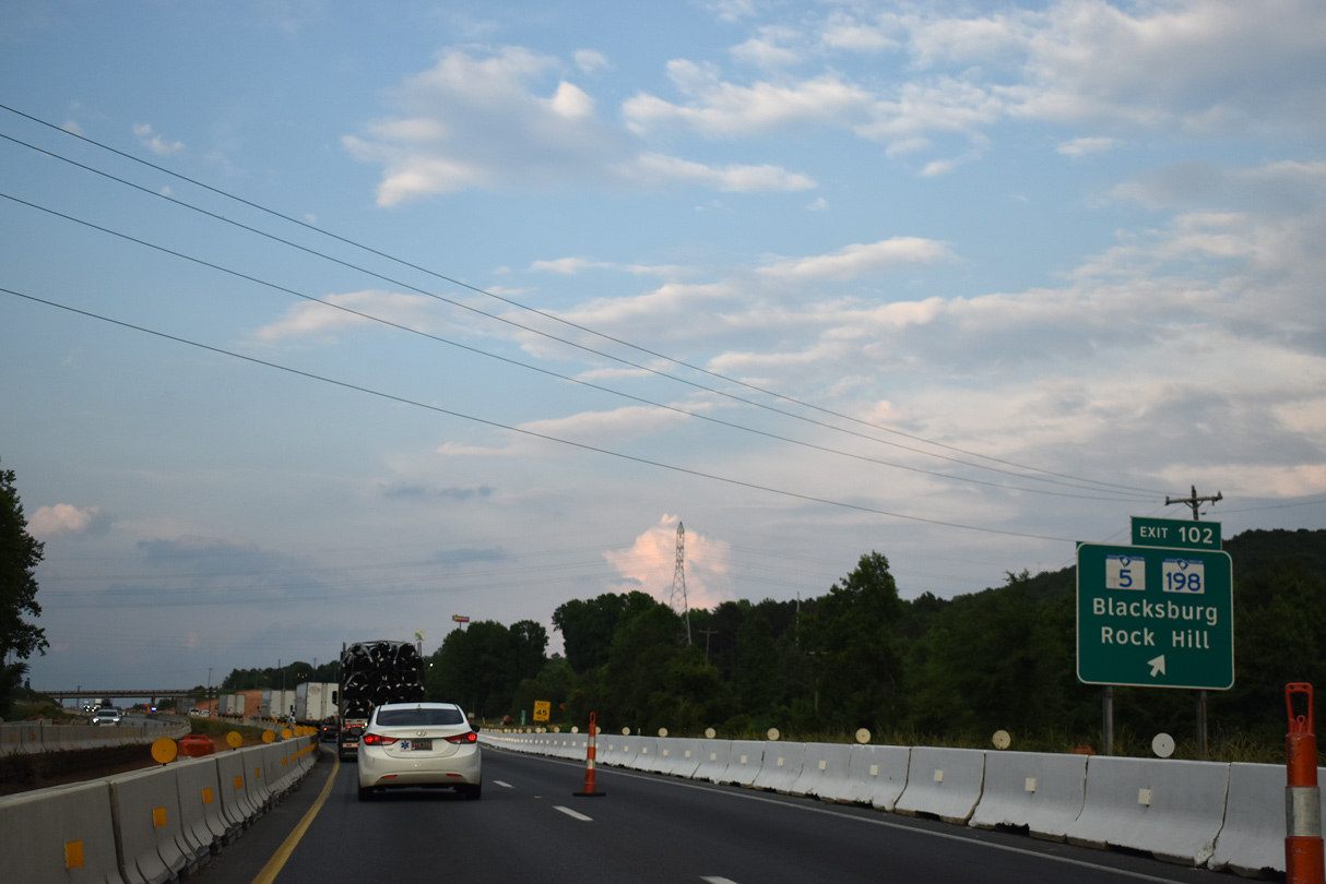
Blacksburg Highway (Road 11) continues 2.15 miles north from Exit 100 to S.C. 18 (Shelby Highway). Blacksburg Highway south into Blacksburg was previously apart of S.C. 5. S.C. 5 was realigned eastward over part of S.C. 198 north to I-85 at Exit 102.
05/25/21
SCDOT awarded a $181.73 million contract for the reconstruction and expansion of I-85 between mile marker 88 and 106 on March 15, 2018. Work includes rebuilding the exchanges at Exit 100, 102, 104 and 106 into diamond interchanges.2
12/15/16
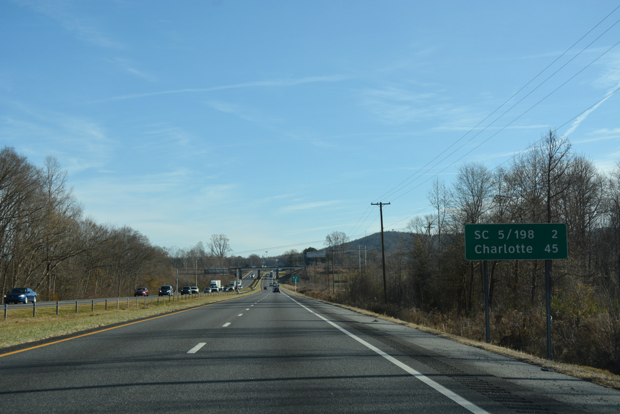
S.C. 5 (Mountain Street) crosses Whitaker Mountain northeast from Blacksburg to forthcoming Exit 102. Charlotte is 45 miles to the east.
12/15/16
Widening of I-85 included the replacement of the Norfolk Southern Railroad bridge one mile west of the diamond interchange (Exit 102) with S.C. 5 south and S.C. 198 north along Mountain Street.
05/25/21
The city York lies 19 miles to the southeast via S.C. 5 and S.C. 5 Business. S.C. 5 continues east from the York County seat to Rock Hill.
12/15/16
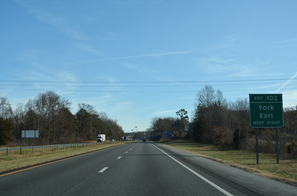
S.C. 198 extends 2.66 miles north from I-85/S.C. 5 to the North Carolina state line. NC 198 continues the route 4.24 miles north to the town of Earl and NC 180 outside Patterson Springs.
05/25/21
Interstate 85 straddles the north side of Whitaker Mountain between Exit 102 and 104.
12/15/16
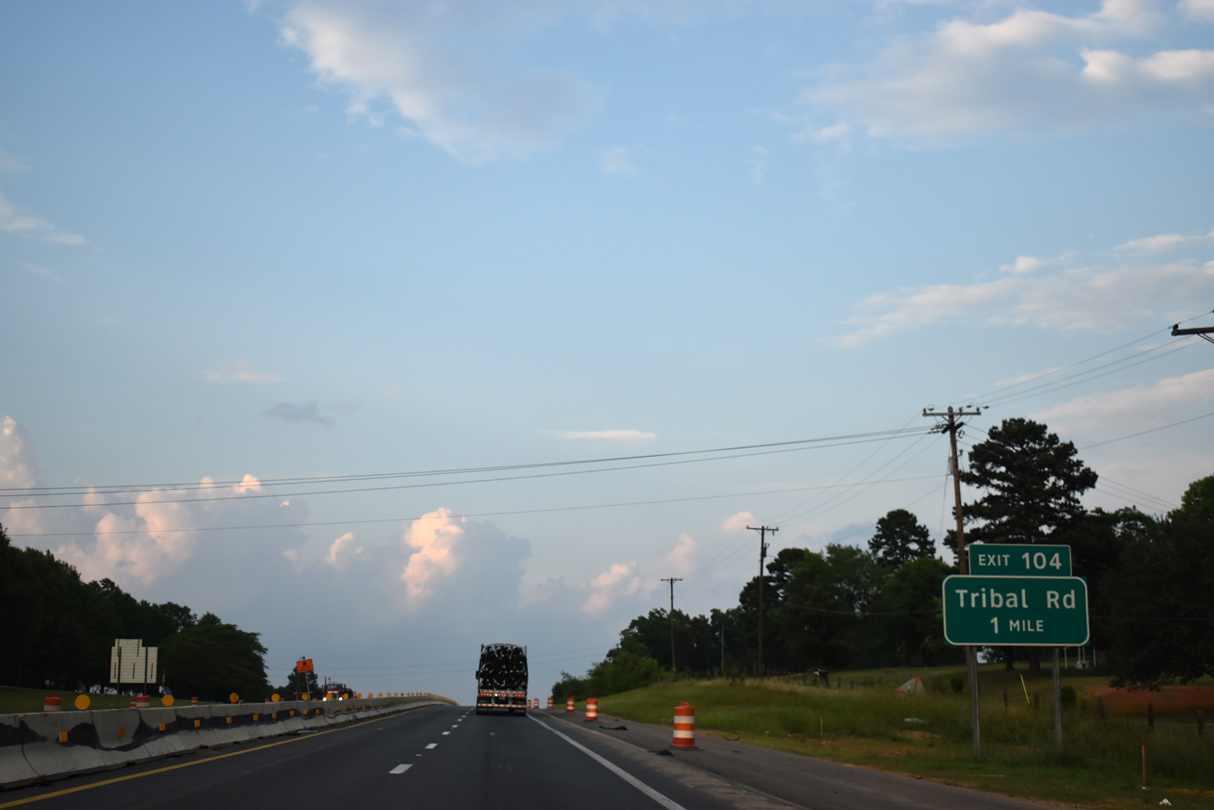
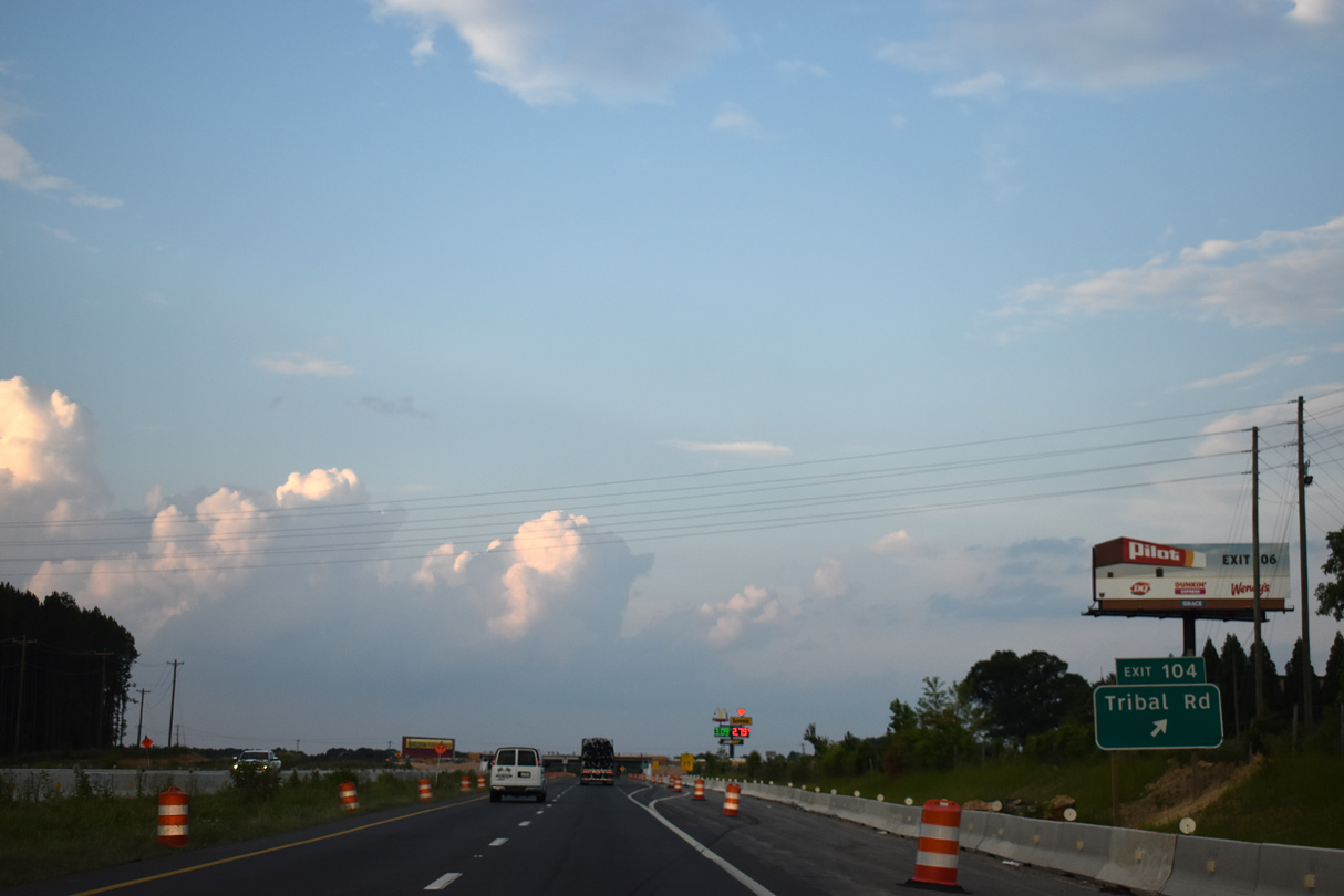
Tribal Road (Road 99) meets I-85 at a diamond interchange (Exit 104) northeast of Whitaker Mountain. The rural highway links Interstate 85 with U.S. 29, 1.43 miles to the south.
05/25/21
Exit 104 departs Interstate 85 north for Tribal Road, which continues 0.85 miles north to Hollyridge Road. Hollyridge Road (Road 65) parallels the state line 1.90 miles west to S.C. 198 and east 0.98 miles to Mulberry Road.
05/25/21
Interstate 85 shifts east through an S-curve across a Norfolk Southern Railroad line.
12/15/16
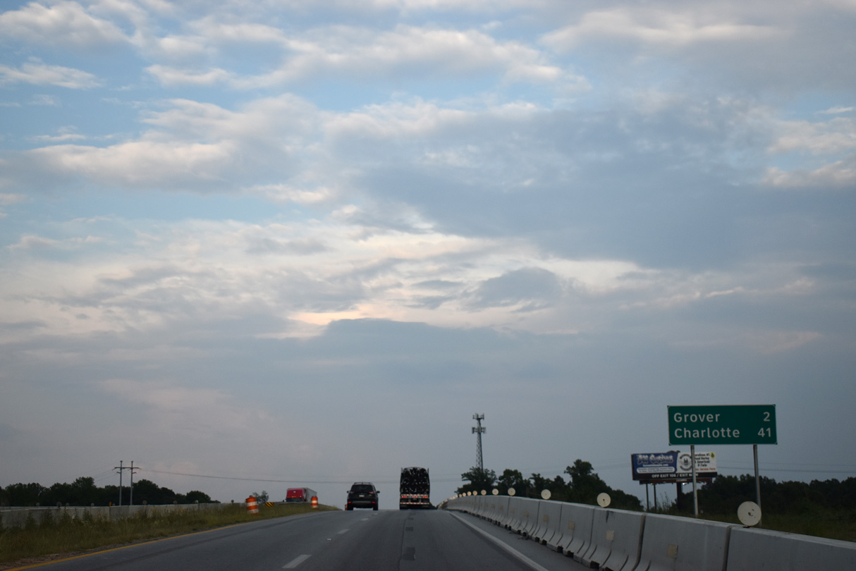
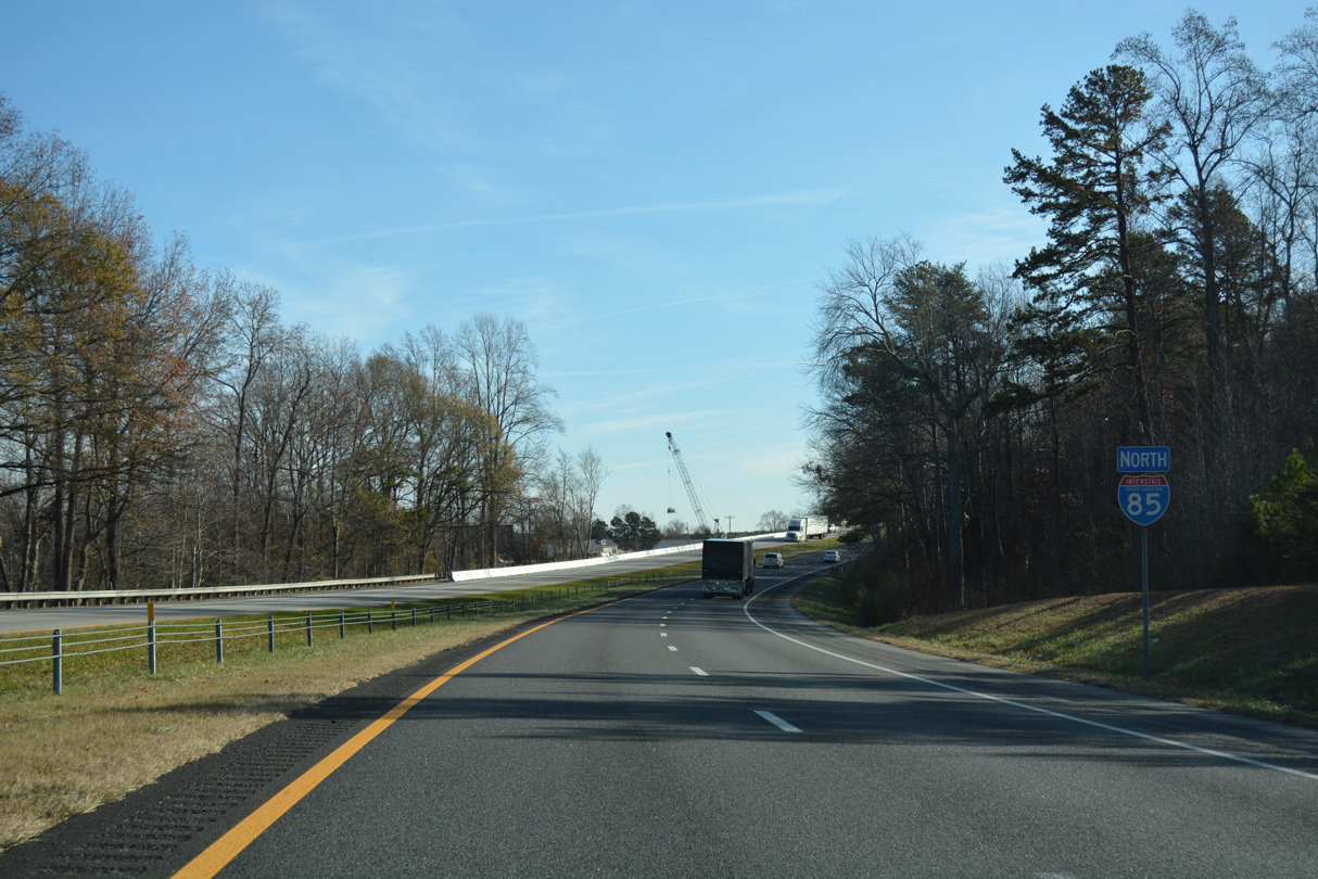
The town of Grover, North Carolina lies just north of Exit 106. I-85 continues 32 miles east to Interstate 485 in Charlotte.
05/25/21
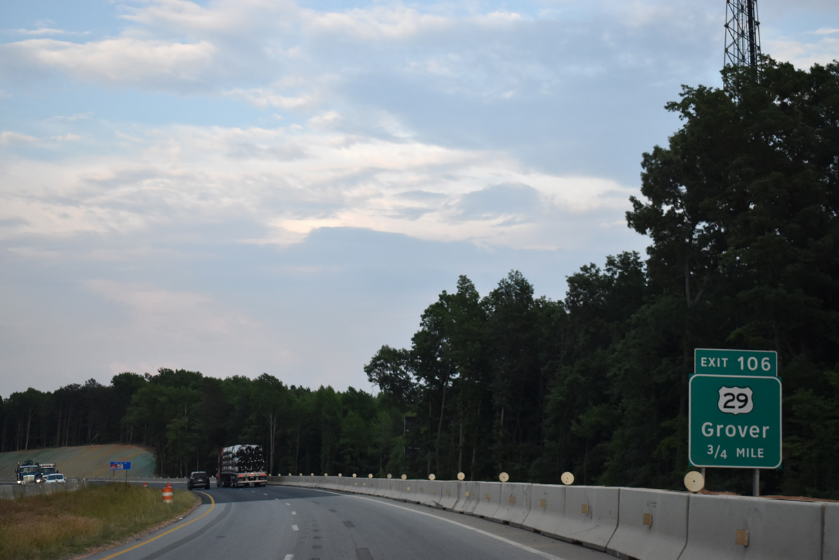
U.S. 29 (Cherokee Street) curves northward from Blacksburg to meet Interstate 85 at Exit 106. The forthcoming parclo interchange will be replaced by a diamond interchange and westward realignment of U.S. 29.
05/25/21
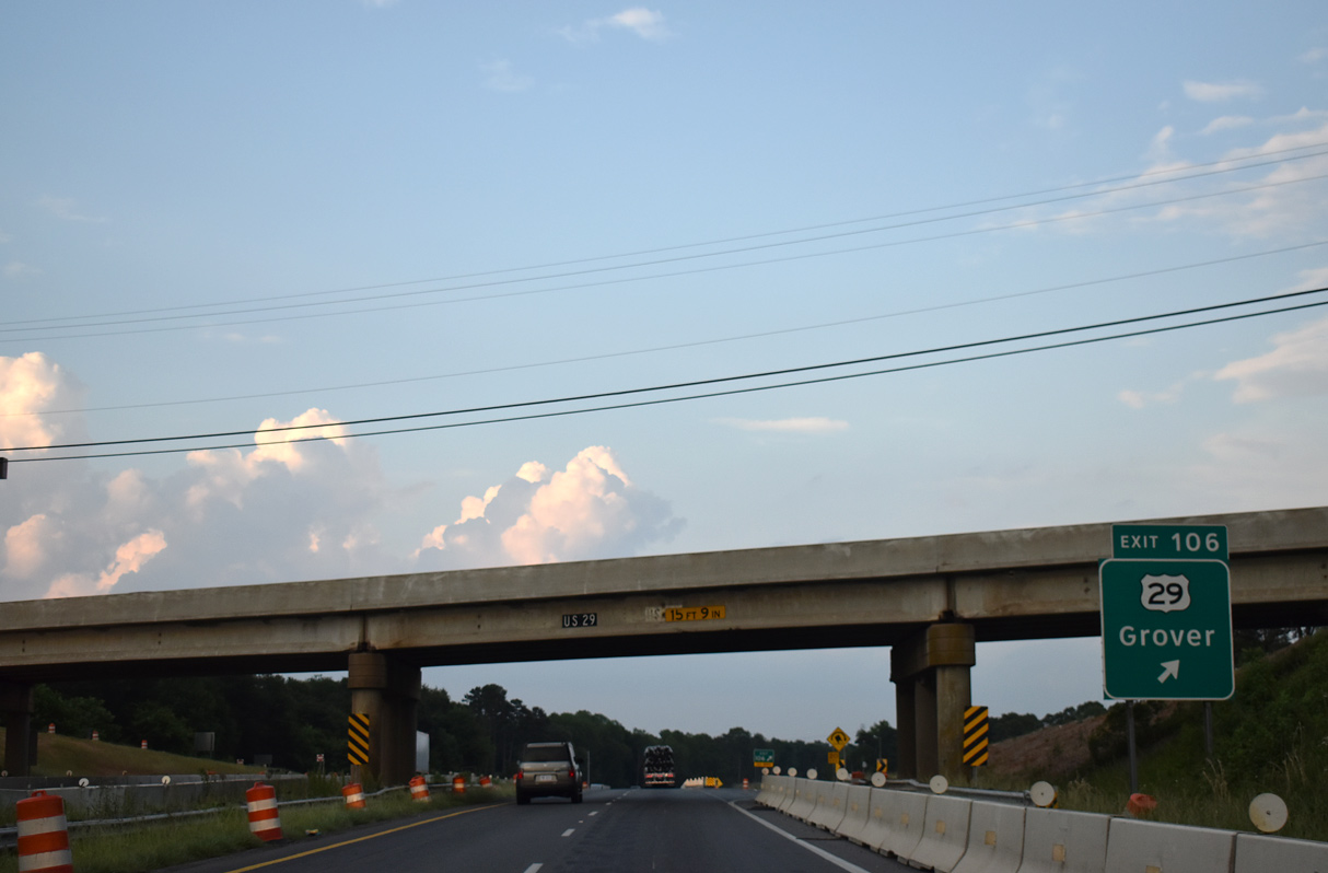
U.S. 29 crosses into Grover, North Carolina 0.29 miles north of I-85. Paralleling the freeway northeast to Archdale, U.S. 29 combines with I-85 in 4.06 miles to the city of Kings Mountain.
05/25/21
Interstate 85 crosses into North Carolina after 106.28 miles through the Palmetto State.
05/25/21
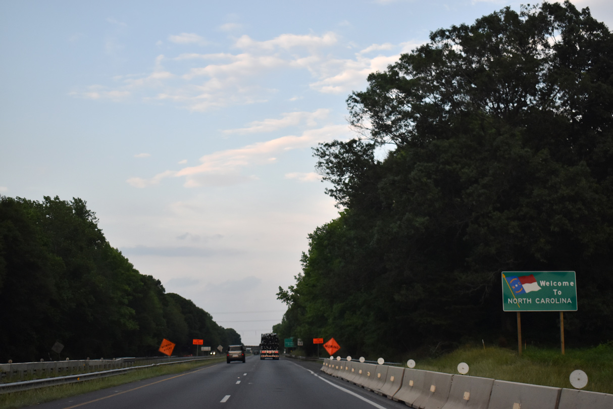
Interstate 85 north enters the Cleveland County, North Carolina through corner of Grover.
05/25/21


References:
- Peachoid. Wikipedia.
- I-85 Widening (MM 98 to 106). South Carolina Department of Transportation (SCDOT), project web page.
Photo Credits:
- Brent Ivy: 05/25/21
- Alex Nitzman: 12/15/16
Connect with:
Page Updated Friday June 18, 2021.