
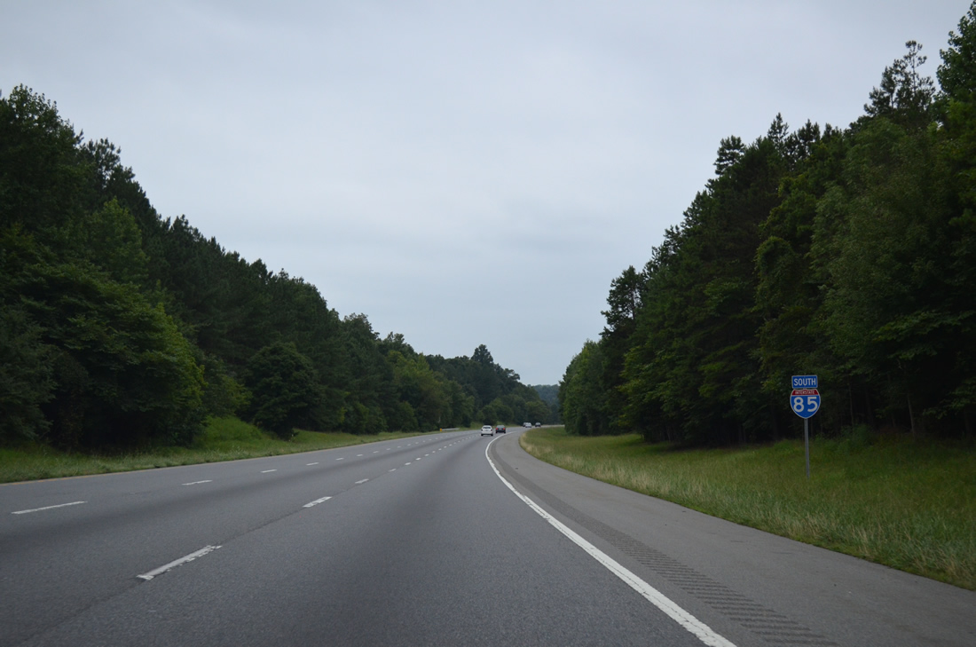
Interstate 85 South - High Point to Lexington

A $201.5 million investment, the I-85 Corridor Improvement Project rebuilt the freeway from Business Loop I-85 southward to a point north of Exit 81 in Rowan County. Split into two parts, the Northern Segment involved widening 3.8 miles of the freeway to eight overall lanes while the Southern Segment expanded I-85 to eight lanes from NC 150 southward 3.3 miles toward Long Ferry Road. This work ran from September 29, 2010 to late September 2013.1
The Southern Segment of the I-85 Corridor Improvement Project included constructing the Yadkin River Veterans Memorial Bridge. I-85 was relocated southward onto the twin four lane bridges. The freeway previously crossed the Yadkin River on a four-lane bridge built in 1955. The northbound span opened with two-way traffic on May 5, 2012. I-85 southbound shifted onto a new crossing on March 9, 2013.1
5.5 miles of Interstate 85 southwest from Lake Road (Exit 102) to U.S. 64 (Exit 96) are dedicated as the Richard Childress Freeway. Richard Childress is a NASCAR team owner and former driver. Richard Childress Racing is based out of Welcome, along I-285/U.S. 52 north of Lexington, and Childress also owns Childress Vineyards in Lexington.
Childress enterprises has invested over $100 million in the Davidson County economy and created over 500 jobs. Because of his efforts, the Davidson County Board of Commissioners requested the road naming, which took place on December 16, 2008.2
 South
South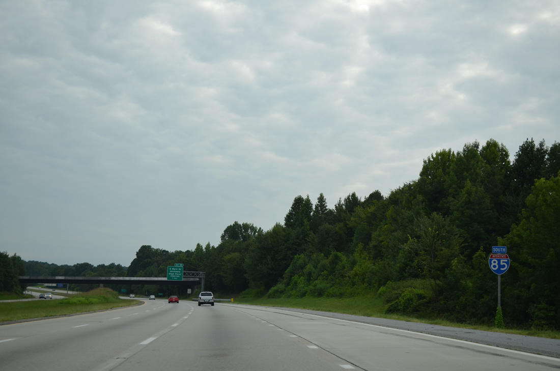
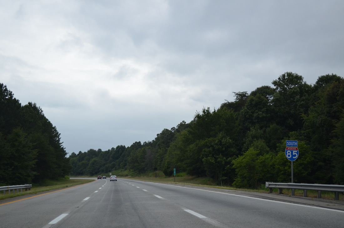
Confirming marker for Interstate 85 posted south of the Guilford County line in Archdale.
08/06/13
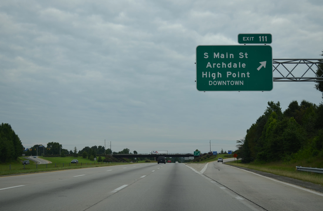
U.S. 311 followed Main Street through both the cities of Archdale and High Street before shifting eastward onto I-74. U.S. 311 relocated onto the High Point bypass as it opened in stages between 1997 and November 20, 2004. U.S. 311 Business was posted along Main Street (SR 1009) through High Point until November 2010, when U.S. 311 vacated Archdale for I-74 southeast to Randleman.
08/06/13

Trees separate I-85 from an adjacent business park as the freeway turns westerly through Archdale. Speed limits are posted at 70 miles per hour.
08/06/13
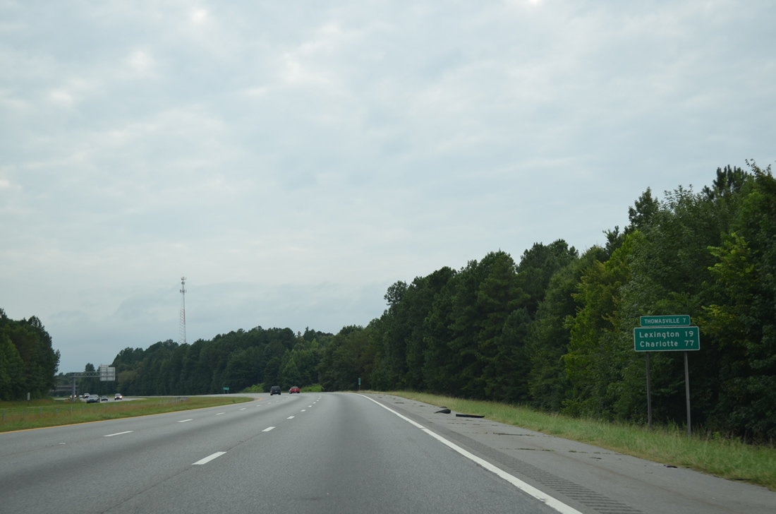
Thomasville in adjoining Davidson County, is seven miles ahead. Lexington, where U.S. 29 returns along side I-285/U.S. 52-70, follows in 19 miles.
08/06/13
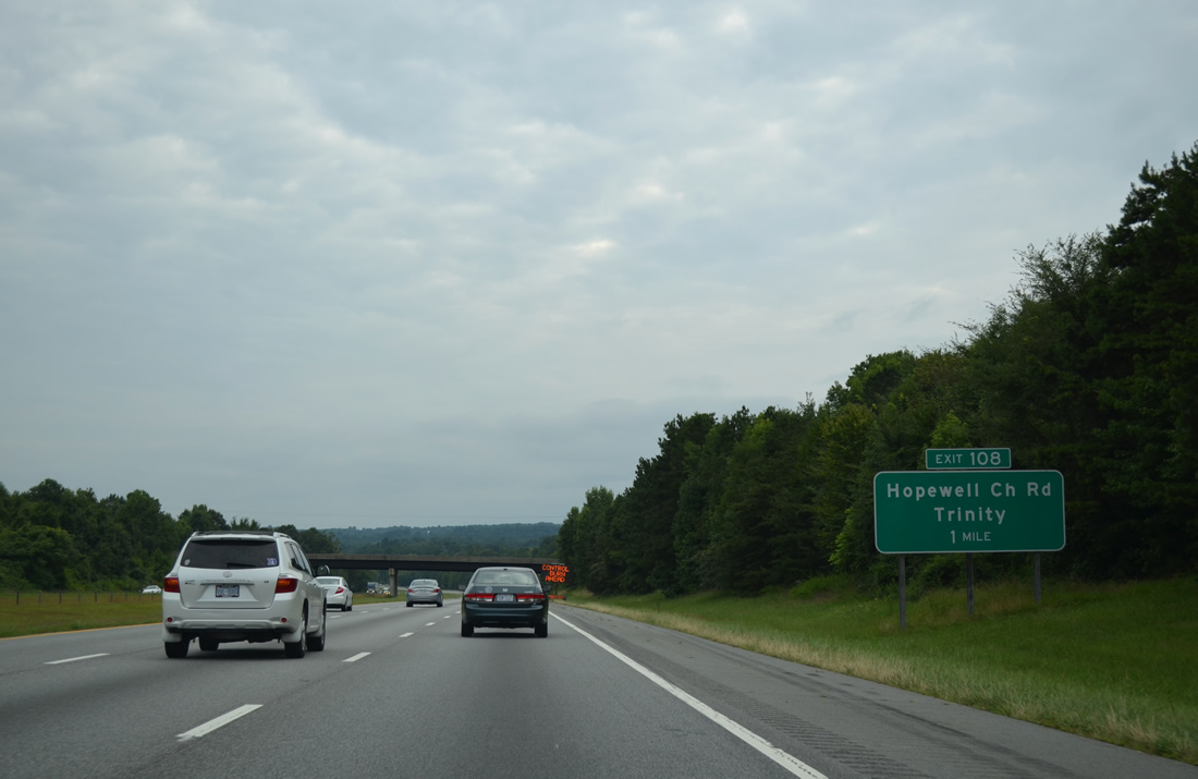
Hopewell Church Road (SR 3252) ties into Interstate 85 south from Surrett Drive and NC 62 at the city of Trinity in one mile. Surrett Drive (SR 1595) continues to the industrial west side of Archdale.
08/06/13
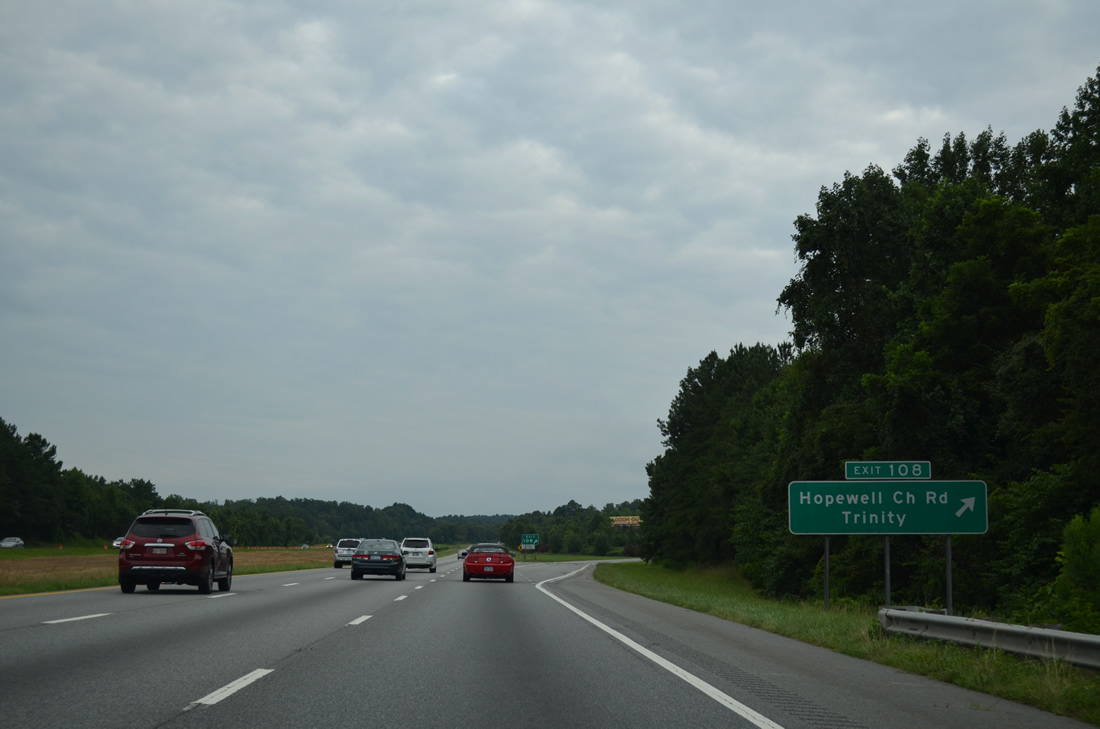
Hopewell Church Road (SR 3252) meanders southward from a parclo A2 interchange (Exit 108) with I-85 along a rural course to Meadowbrook Road (SR 1564). Northward, SR 3252 meets adjacent NC 62 at Trinity Center City, an area targeted for redevelopment by the city as a village center.
08/06/13
The second Trinity exit and last within Randolph County joins Interstate 85 south with Finch Farm Road (SR 1547) next.
08/06/13
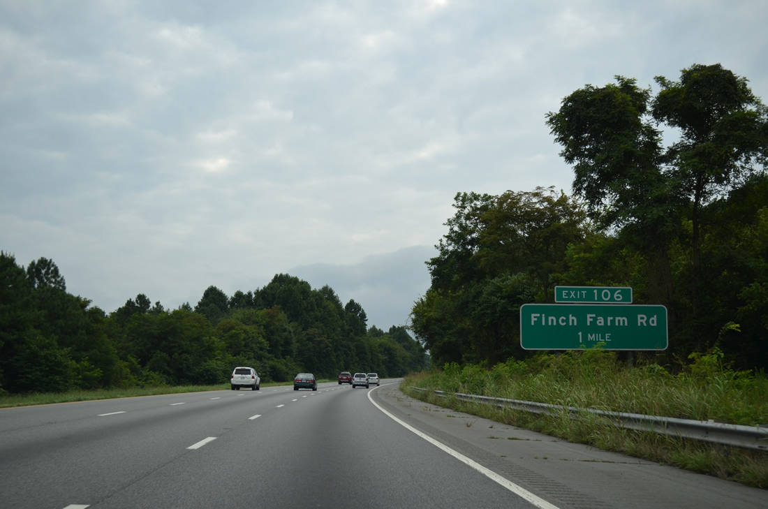
Southward from the forthcoming diamond interchange (Exit 106) with I-85, Finch Farm Road (SR 1547) serves a handful of rural subdivisions in south Trinity en route across forested hills near Fuller Mill.
08/06/13
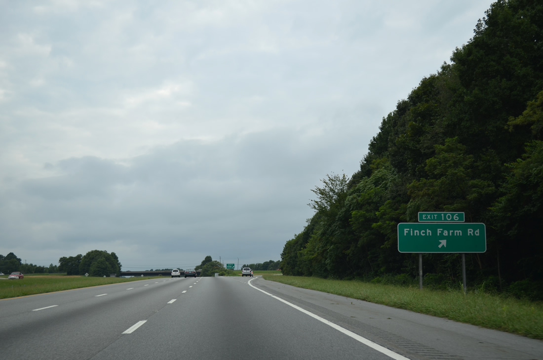
Finch Farm Road leads north from Exit 106 to become Unity Street (SR 2051) at the Thomasville city line. Unity Street encircles the city west to NC 109 (Salem Street) near U.S. 29.
08/06/13
Interstate 85 crosses the Little Uwharrie River ahead of this reassurance marker.
08/06/13
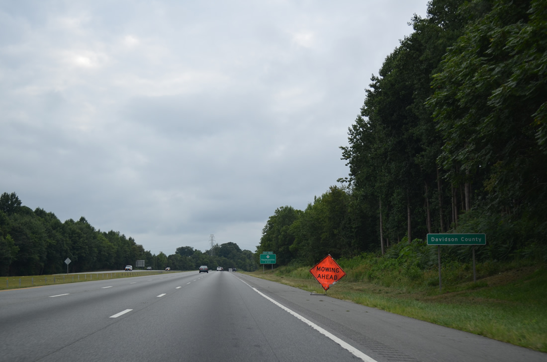
Interstate 85 enters Davidson County and leaves the Trinity city limits.
08/06/13
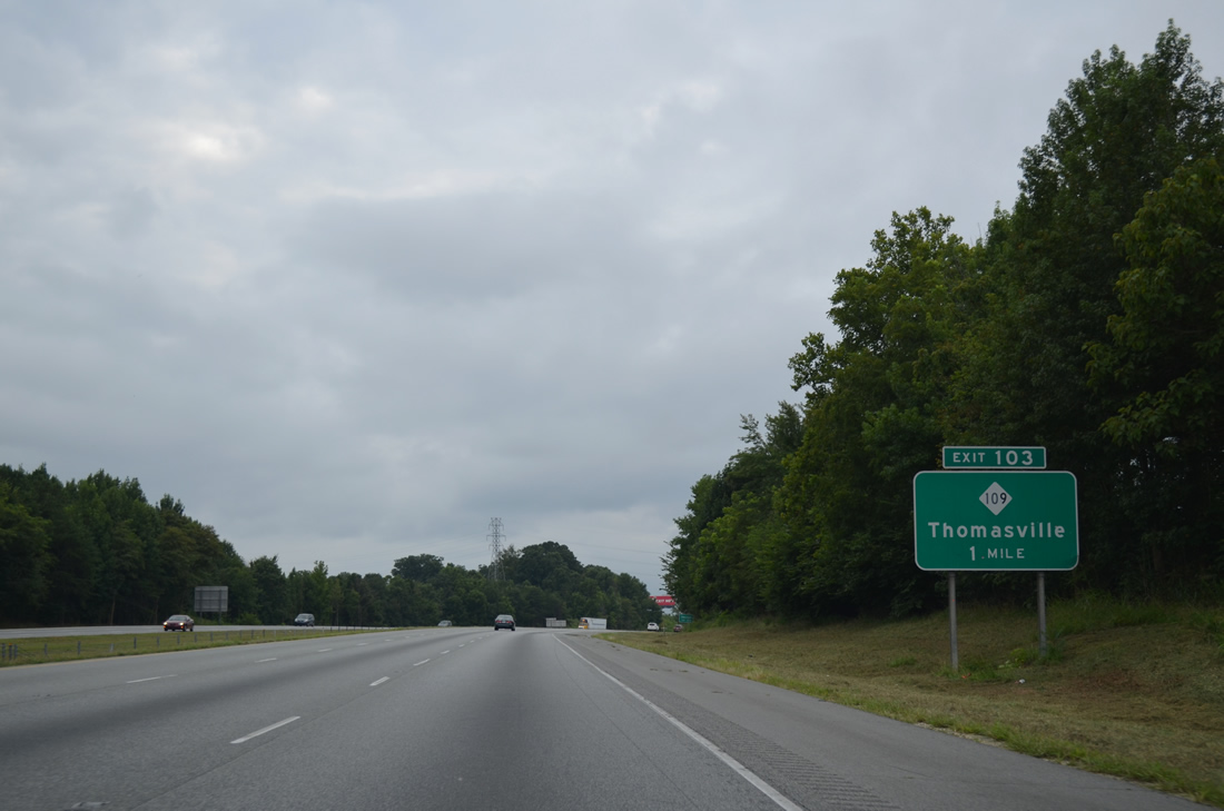
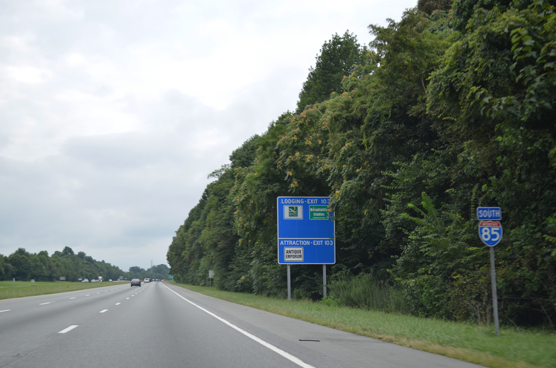
NC 109, a 120 mile long multi-state route with S.C. 109 from McBee to Winston-Salem, joins Interstate 85 with Downtown Thomasville at Exit 103.
08/06/13
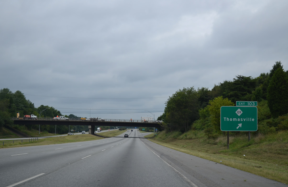
NC 109 (Randolph Street) constitutes a commercial gateway northward into the Thomasville city center from I-85 northward. Heading south, NC 109 transitions into a rural highway to Denton and Troy.
08/06/13
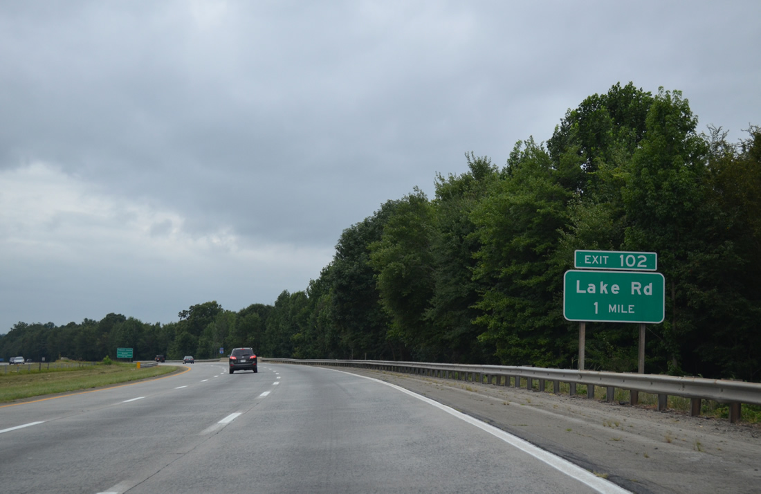
Lake Road (SR 2085) loops west from Fisher Ferry Road (SR 2183) to a parclo interchange (Exit 102) with Interstate 85 in one mile.
08/06/13
Interstate 85 arcs southwest by the community of Fair Grove at the Ferndale Drive underpass.
08/06/13
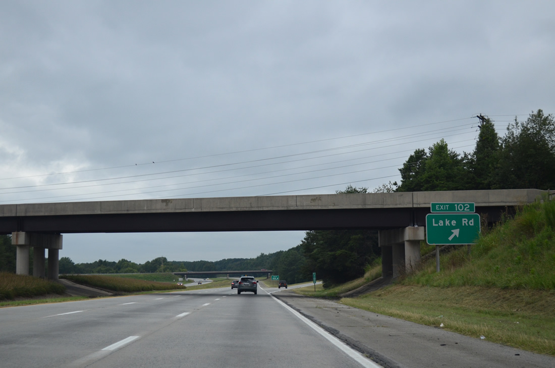
Exit 102 leaves I-85 south beyond the Kendall Mill Road (SR 2060) overpass for Lake Road in south Thomasville. SR 2085 extends north along Baptist Childrens Home Road to Johnsontown and Lexington Avenue (former U.S. 29A/70A).
08/06/13
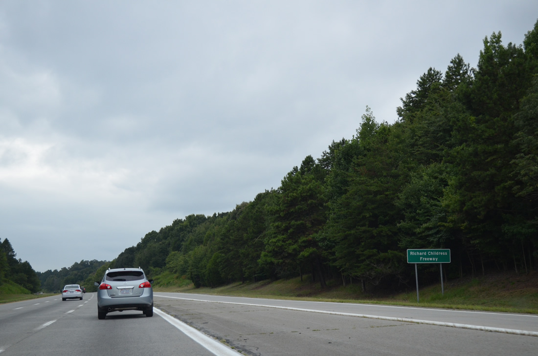
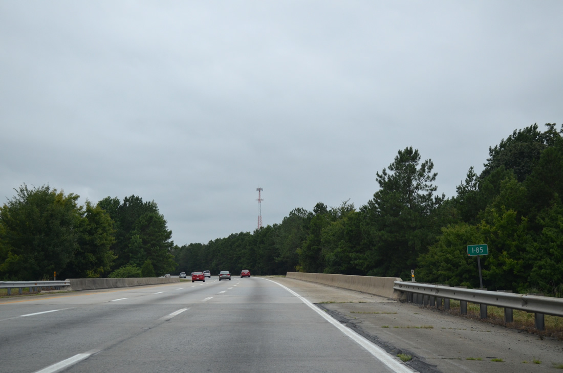
The succeeding 5.5 mile stretch of Interstate 85 south from Lake Road (SR 2085) to U.S. 64 is the Richard Childress Freeway.
08/06/13
Interstate 85 navigates through a unique traffic pattern beyond milepost 101 where the roadways switch sides as the freeway parallels Hamby Creek.
08/06/13
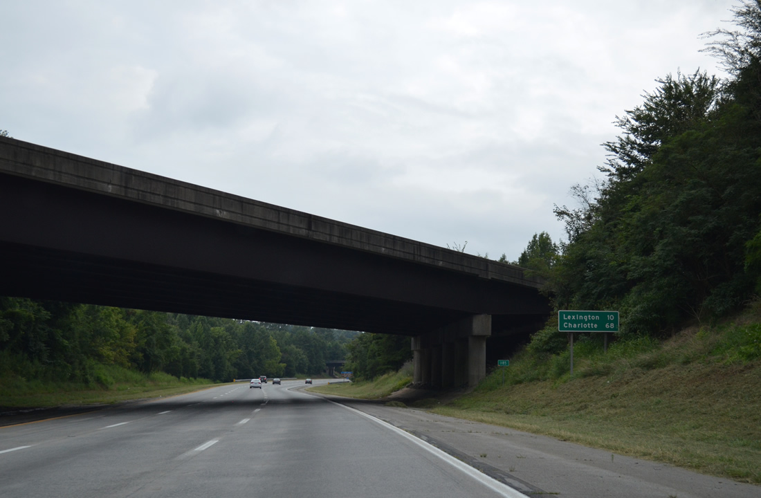
The northbound lanes of I-85 pass over the southbound roadway at this distance sign posted ten miles east of Lexington and 68 miles from Charlotte.
08/06/13
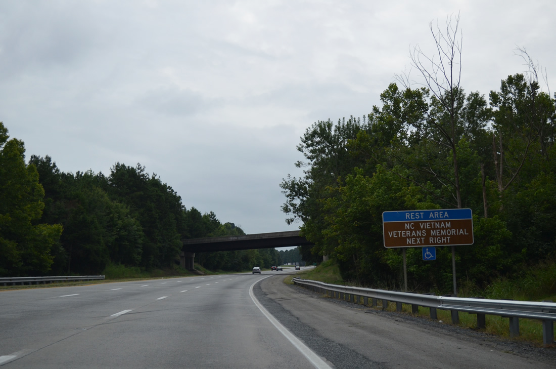
Johnsontown Road (SR 2031) spans Interstate 85, 0.61 miles from the Davidson County Rest Area. The northbound rest area lies nearby, with the North Carolina Vietnam Veterans Memorial situated in between.
08/06/13
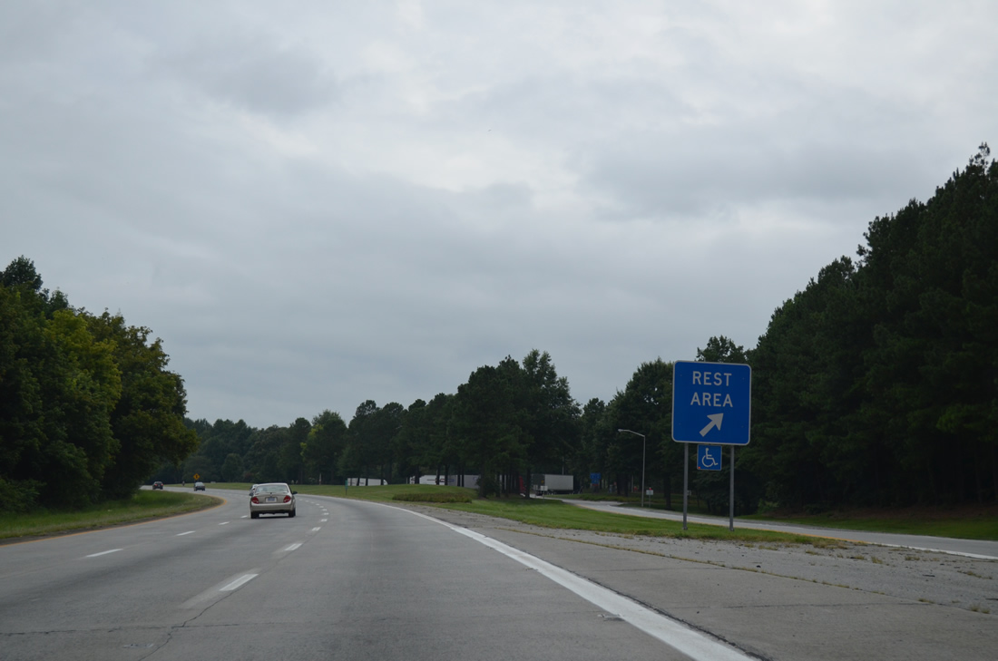
Rest area off-ramps remain on the right side of both roadways. Waters from Hamby Creek flow between the two directions through an undeveloped swath of timberland.
08/06/13
I-85 resumes with a conventional orientation 1.59 miles south of the rest area. Generally located where terrain or cost issues with a standard setup are prohibitively high, roadways switches are rare on the Interstate system. Other examples include I-5 along the Castaic Grade in California and I-275 at south St. Petersburg, Florida.
08/06/13
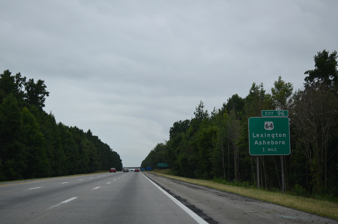
The longest route across the state at 604 miles, U.S. 64 meets I-85 at a diamond interchange (Exit 96) in one mile.
08/06/13
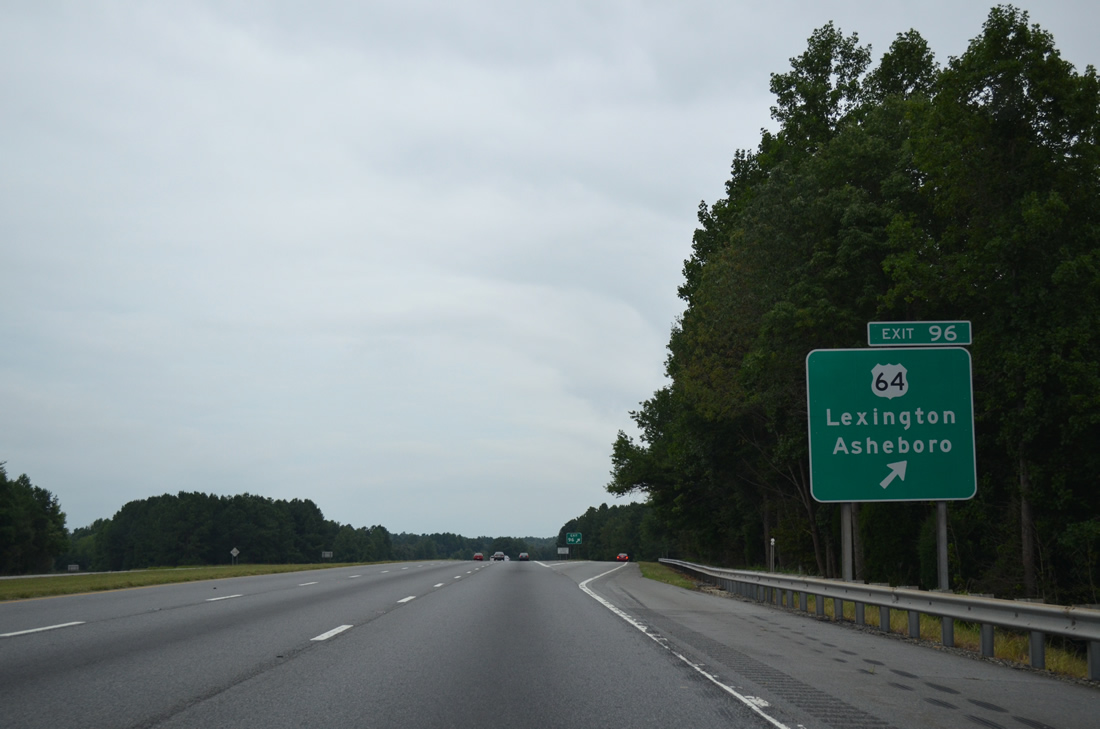
U.S. 64 leads west from Exit 96 to combine with U.S. 29/70 at Main Street in Lexington. Eastward, U.S. 64 travels along a rural route 19.5 miles from Holly Grove to the freeway bypass around Asheboro.
08/06/13
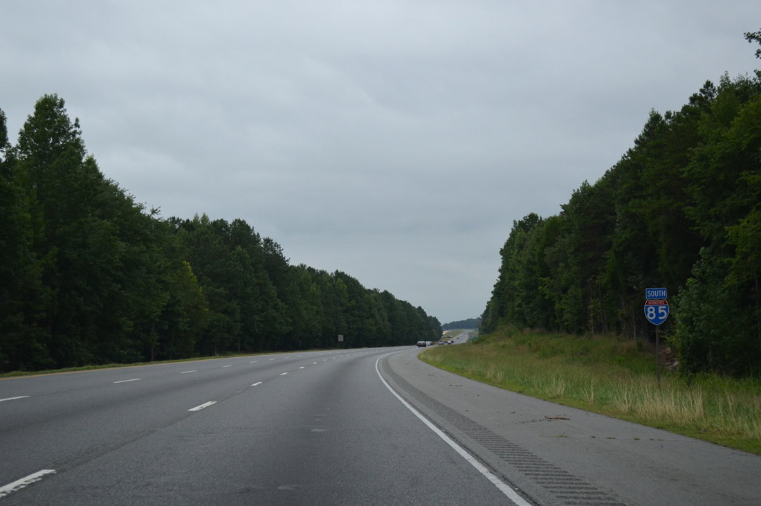
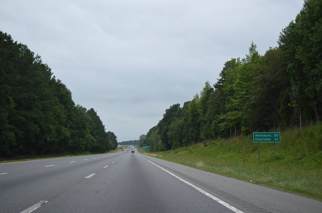
Interstate 85 shifts more westerly toward southern reaches of the Lexington city limits. Salisbury, seat of Rowan County, is 20 miles away followed by Charlotte in 61 miles.
08/06/13
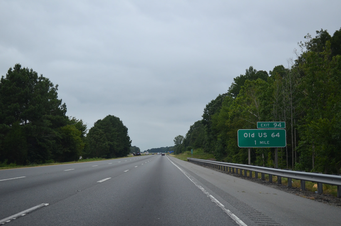
Old US 64 (SR 2205) represents the pre-1953 alignment of U.S. 642 southeast from Raleigh Road and Lexington to Interstate 85 at Exit 94 and Sandy Grove.
08/06/13

Old US 64 (SR 2205) meanders east from Exit 94 to Hedrick Grove, the Three Hat Mountain area, NC 109 at Silver Valley and U.S. 64 ahead of Rush Mountain in Randolph County.
08/06/13
A forested median separates the roadways of Interstate 85 ahead of the Lexington city line at Abbotts Creek.
08/06/13
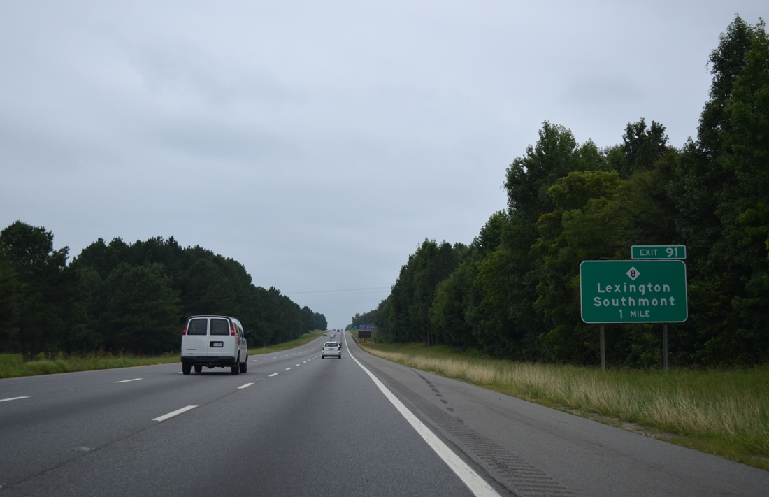
NC 8 follows a circuitous route around Downtown Lexington and emerges along Cotton Grove Road south to a folded diamond interchange (Exit 91) with Interstate 85.
08/06/13
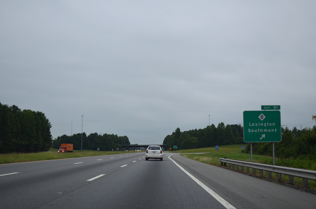
A 94 mile long highway, NC 8 continues Virginia Route 8 south at Coleville to Winston-Salem, Lexington and New London. Much of the route north from Lexington coincides with I-285/U.S. 52 while the route south from Exit 91 parallels a CSX Railroad line through the rural communities of Cotton Grove, Feezor and Southmont.
08/06/13
Interstate 85 straddles the Lexington city line westward toward Davidson County Airport (EXX).
08/06/13
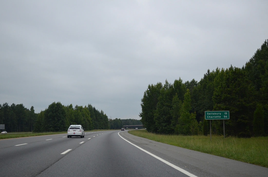
Salisbury is another 15 miles to the southwest along Interstate 85 while Charlotte is 56 miles away.
08/06/13
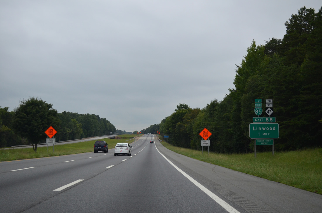
NC 47 (Hargrave Road) meets I-85 at a diamond interchange (Exit 88) in one mile near Linwood and EXX Airport.
08/06/13
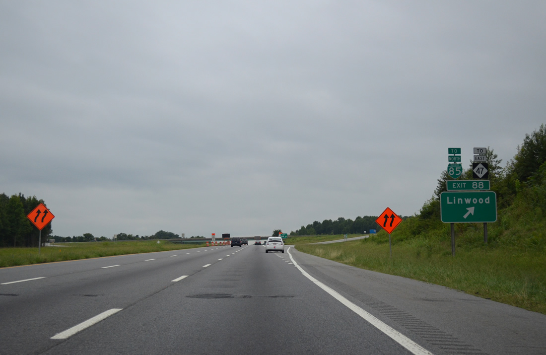
NC 47 (Hargrave Road) provides access to I-285/US. 29-52-70 north along the west side of Lexington. NC 47 constitutes a 24.33 mile long route southeast to Denton and NC 49 in Randolph County.
08/06/13
U.S. 29-52-70 merge onto I-85 south at a wye interchange two miles from Exit 86 for Belmont Road (SR 3159).
08/06/13

 South
South  West
West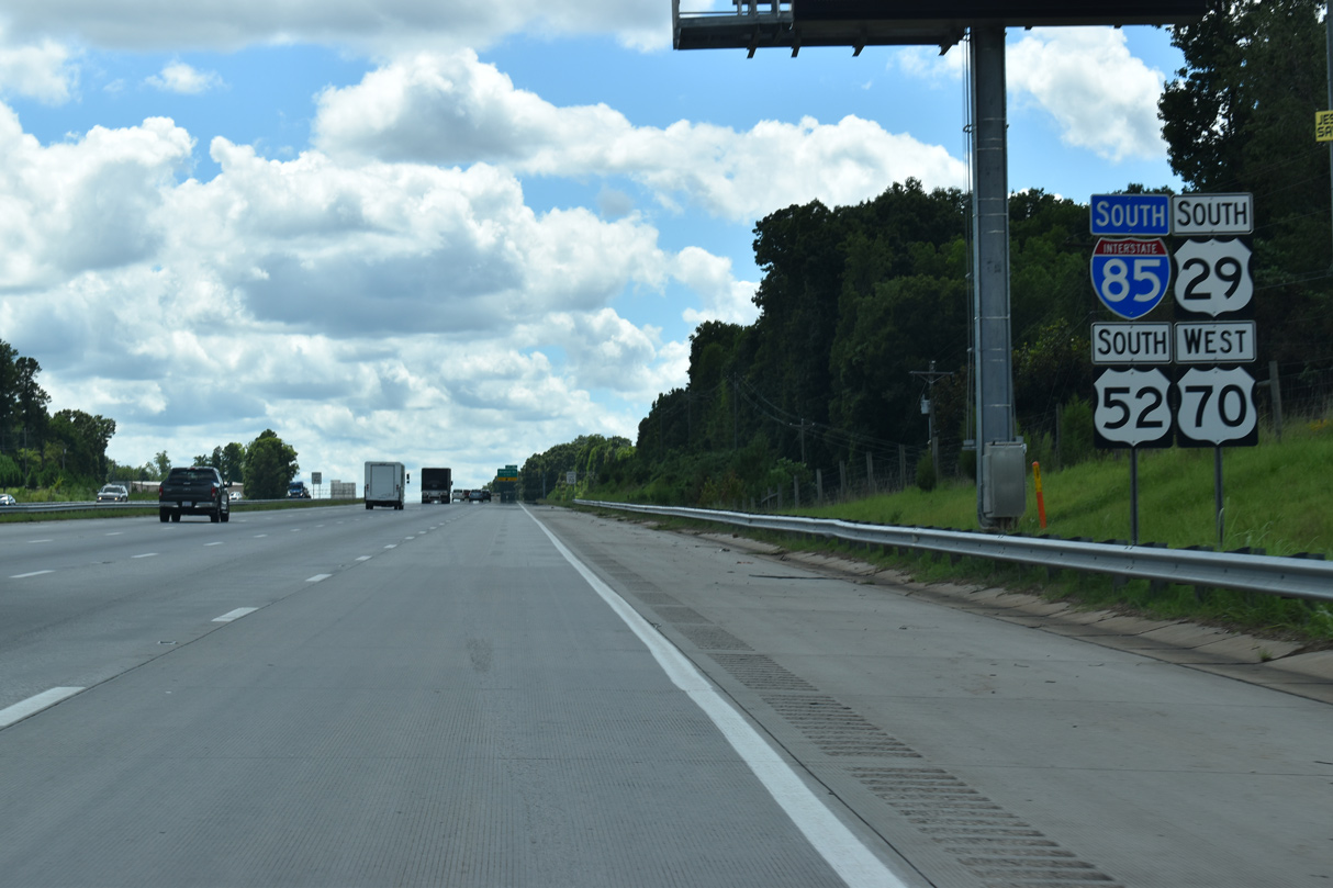
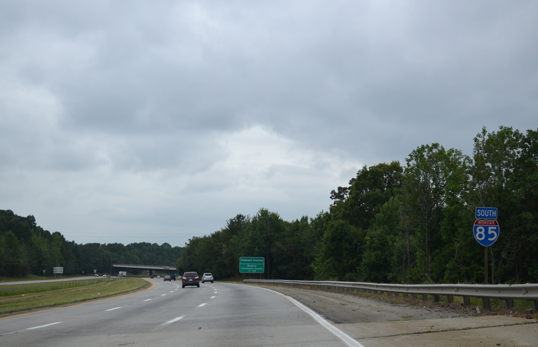
Interstate 285 south from Winston-Salem concludes as U.S. 29-52-70 combine with I-85 south.
08/18/21
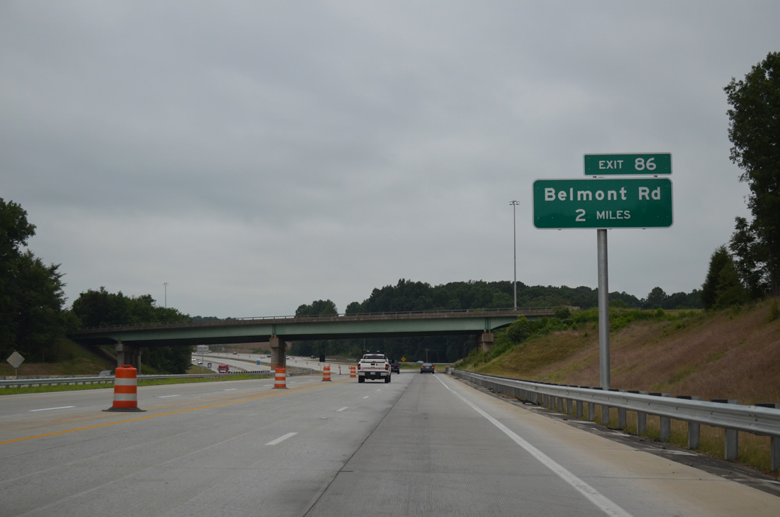
The $65.5 million Northern Segment of the I-85 Corridor Improvement Project1 included the reconstruction of Exit 86 from a modified diamond that used adjacent frontage roads to a folded diamond interchange directly with Belmont Road.
08/18/21
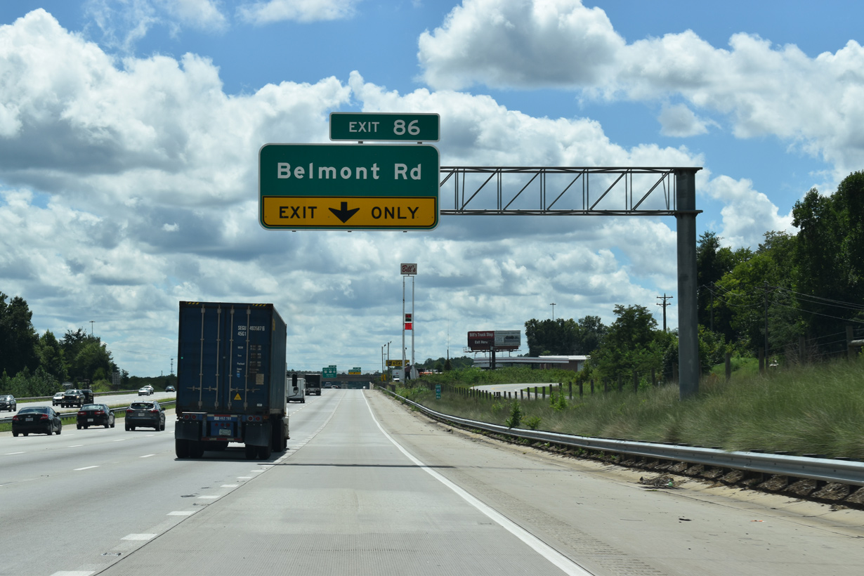
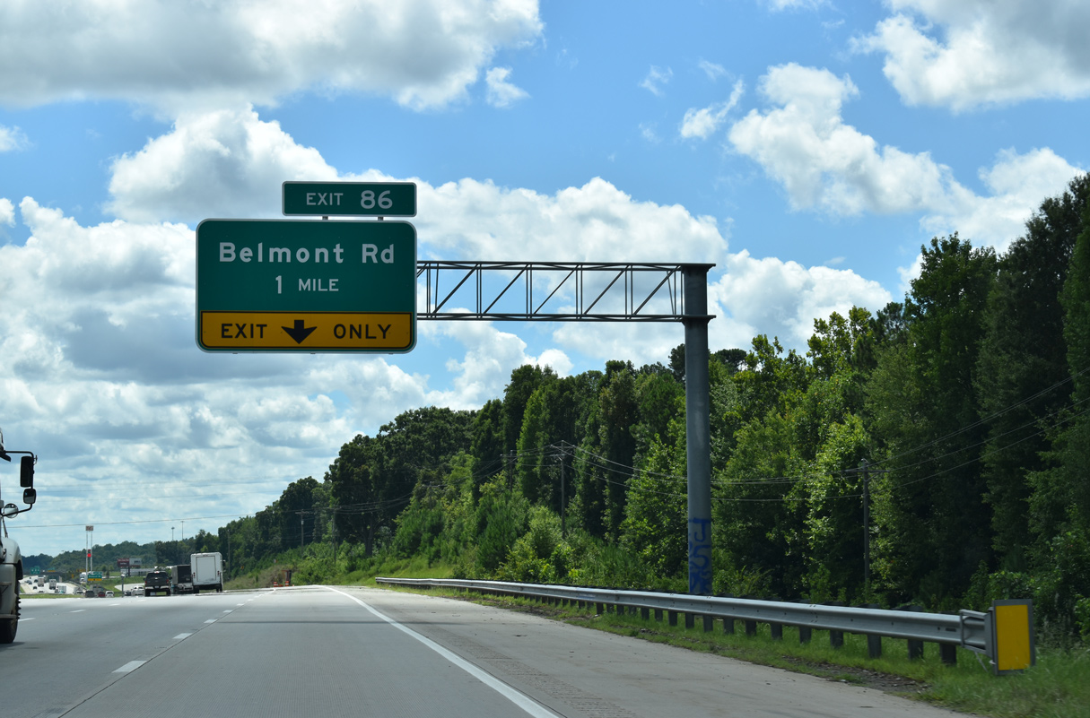
SR 1289 (I-85 Service Road) appears along the north side of Interstate 85 ahead of Exit 86 to Belmont Road (SR 3159). Belmont Road links parallel Old Salisbury Road (old U.S. 29/70) with NC 47 (Old Linwood Road) at Linwood.
08/18/21
Exit 86 loops away from I-85/U.S. 29-52-70 south for Belmont Road (SR 1133 / 3159). Old Salisbury Road (SR 1147) leads west from Belmont Road to Lakeview. Removed during I-85 widening, the diamond interchange at Exit 85 formerly provided a shorter route to Lakeview via Clark Road (SR 1295).
08/18/21
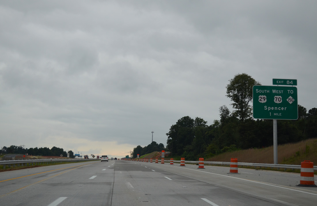
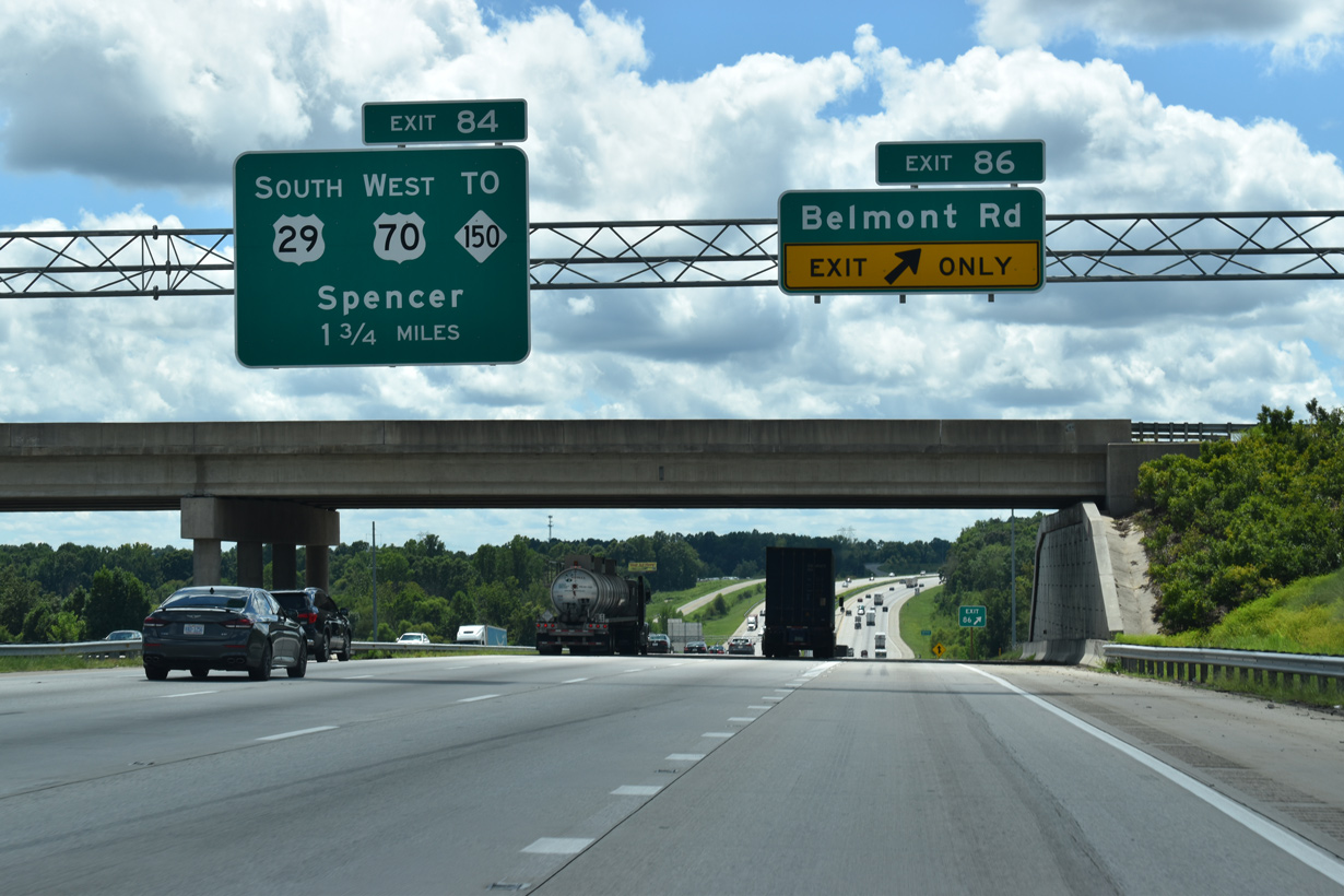
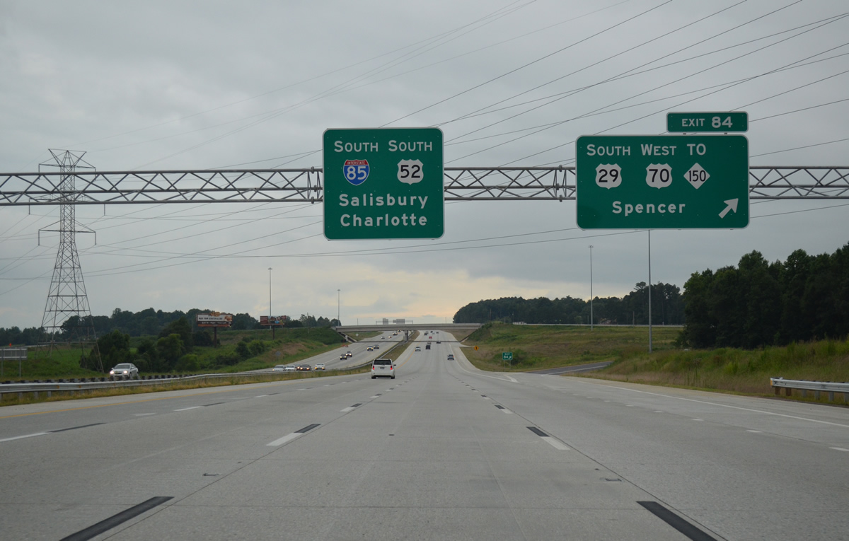
The I-85 Corridor Improvement Project consolidated succeeding wye interchanges at NC 150 and the split with U.S 29/70 into a single parclo finished in April 2013. The previous ramp for Exit 84 closed in October 2010.3 U.S. 29/70 shift north onto a frontage road to a new two lane crossing over the Yadkin River into Spencer.
08/06/13
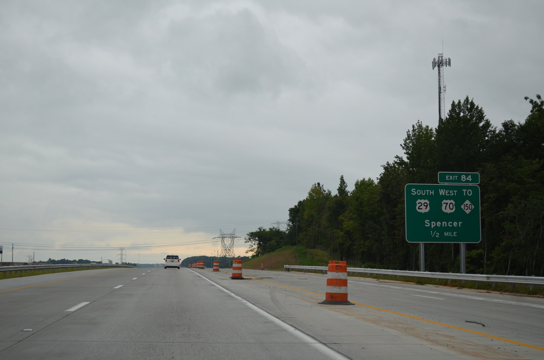
NC 150 meanders northwest then northeast from Exit 84 and Seven Oaks Drive (SR 3508) to Churchland, Tyro and U.S. 64 at Reeds Crossroads. The 183 mile long route continues to Winston-Salem, Kernersville and Yanceyville.
08/06/13
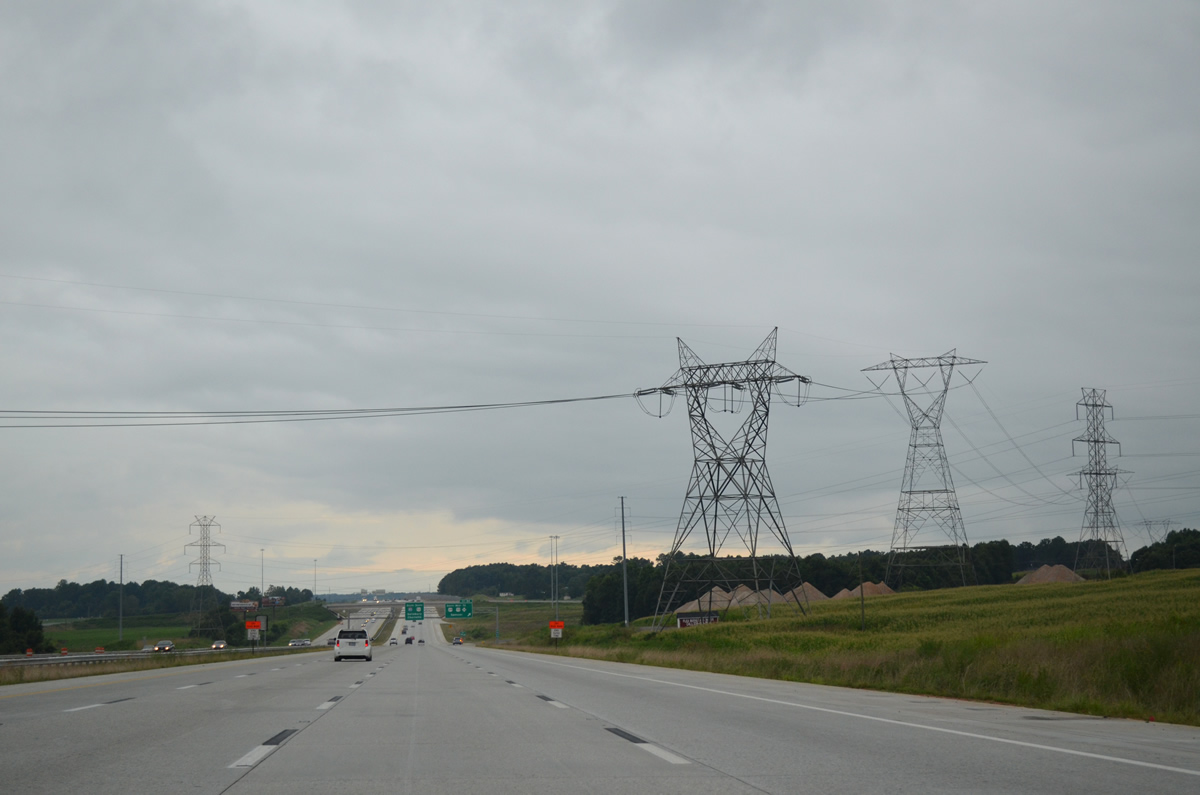
A transmission corridor passes over Interstate 85 and U.S. 29-52-70 leading west from south of Thomasville to the Cowans Ford Hydro Station at Lake Norman.
08/06/13
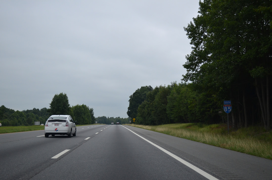
U.S. 29 south / U.S. 70 west diverge from I-85/U.S 52 through the town of Spencer and the city of Salisbury. NC 150 west follows the pair to Mooresville Road while U.S. 70 branches northward from Salisbury to Cleveland and Statesville.
08/06/13
South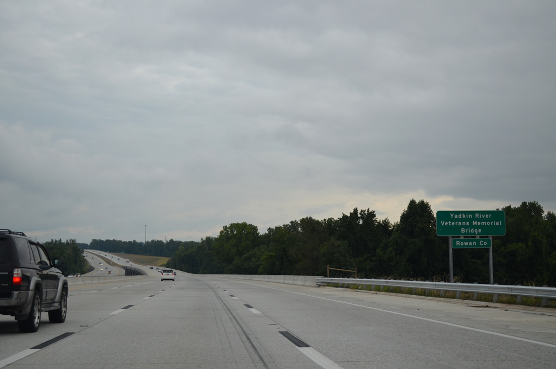
The Yadkin River Veterans Memorial Bridge spans the Yadkin River into Rowan County with eight overall lanes.
08/06/13

References:
http://www.i-85yadkinriver.com- "Part of I-85 in NC named For Richard Childress."
http://www.jayski.com/news/teams/ archive/story/_/page/ 07-30-Childress-NASCAR-Team-News-ArchiveJayski's® NASCAR Silly Season Site - Team News Archive, 2008. - NCRoads.com: U.S. 64.
- "NCDOT Opens New Ramp to I-85 North from N.C. 150 in Davidson County." North Carolina Department of Transportation (NCDOT), press release. September 11, 2013.
Photo Credits:
- Alex Nitzman: 08/06/13
- Andy Field: 08/18/21
Connect with:
Page Updated Tuesday January 24, 2023.