
Interstate 90 East - Missoula to Clinton
07/18/23
07/18/23

07/18/23
07/18/23
06/28/15
07/18/23

Missoula Montana Airport (MSO) and the Smokejumper Station line the south side of Old Highway 10 east of Exit 96 in the city of Missoula.
07/18/23
07/18/23
07/18/23
07/18/23

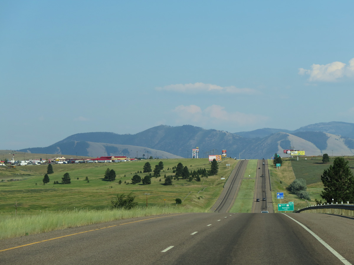
I-90/U.S. 93-MT 200 line the north side of Missoula from Butler Creek ahead of Exit 99 to Mount Jumbo and Hellgate Canyon.
07/18/23
07/18/23

A modified diamond interchange joins I-90/U.S. 93-MT 200 with Airway Boulevard at Exit 99.
07/18/23
07/18/23
 South
South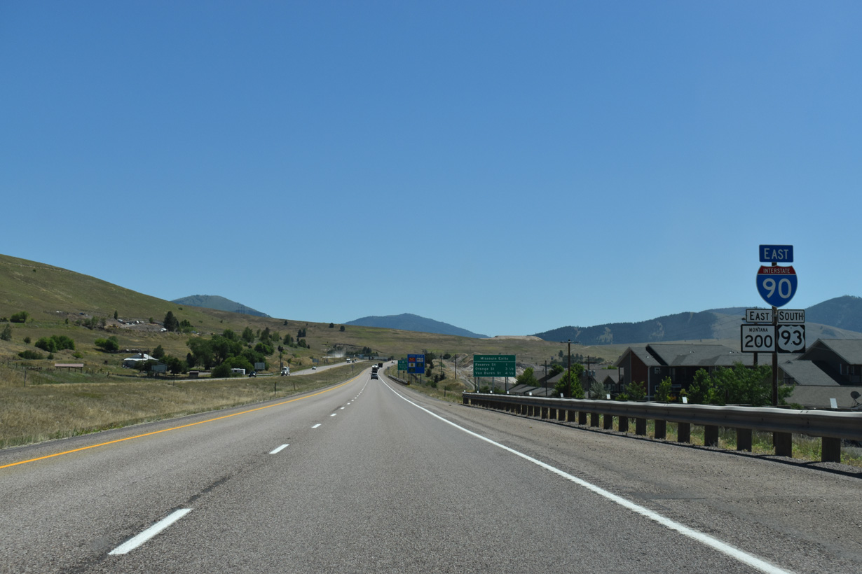
I-90/U.S. 93-MT 200 continue east from Airway Boulevard by the Canon Creek Village development.
07/18/23
07/18/23

The succeeding three exits from I-90 east fall within the Missoula city limits.
07/18/23
07/18/23
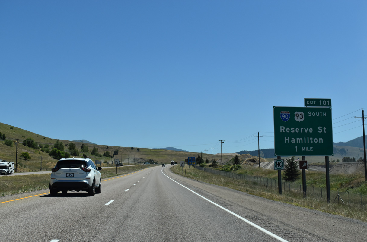
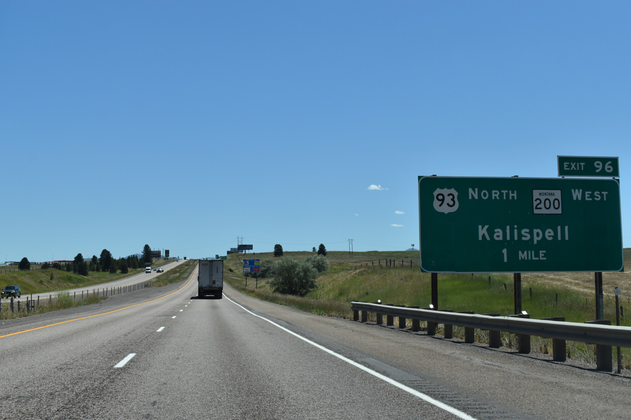
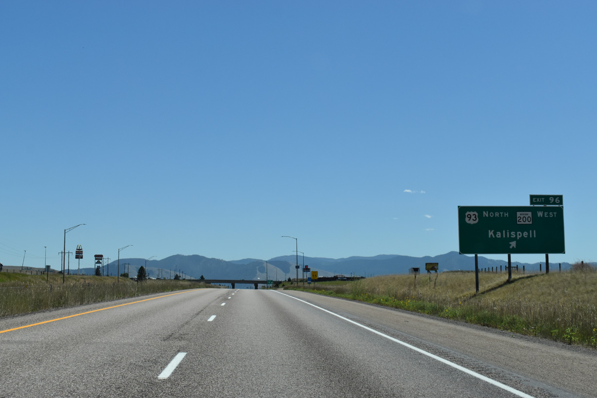
U.S. 93 separates with I-90/MT 200 east for Reserve Street south from Exit 101. Business Loop I-90 overlaps with U.S. 93 for 1.01 miles south to a folded diamond interchange at Broadway Street, where the route turns east along Old U.S. 10 to the Missoula city center.
07/18/23
07/18/23

U.S. 93 constitutes a commercial arterial southward to the Clark Fork river, maintaining at least four lanes through the Orchard Homes area and the Fort Missoula Historic District to U.S. 12.
07/18/23
07/18/23

Guide signs for Exit 101 on Interstate 90 eastbound have erroneously referenced Business Loop I-90 at I-90 since 2015.
07/18/23
07/18/23
Exit 101 leaves I-90 east for Reserve Street south and Grant Creek Road north.
07/18/23
07/18/23

Grant Creek Road spurs north into Lolo National Forest. The continuation of Grant Creek Road south separates from Reserve Street nearby to the North Reserve Business Center.
07/18/23
07/18/23

South from Missoula, U.S. 12/93 combine for 7.5 miles to Lolo. Beyond their separation, where U.S. 12 turns west to Lolo Pass and U.S. 93 continues south to the Ravalli County seat of Hamilton.
07/18/23
07/18/23
Mount Sentinel and University Mountain come into view along I-90/MT 200 eastbound.
07/18/23
07/18/23
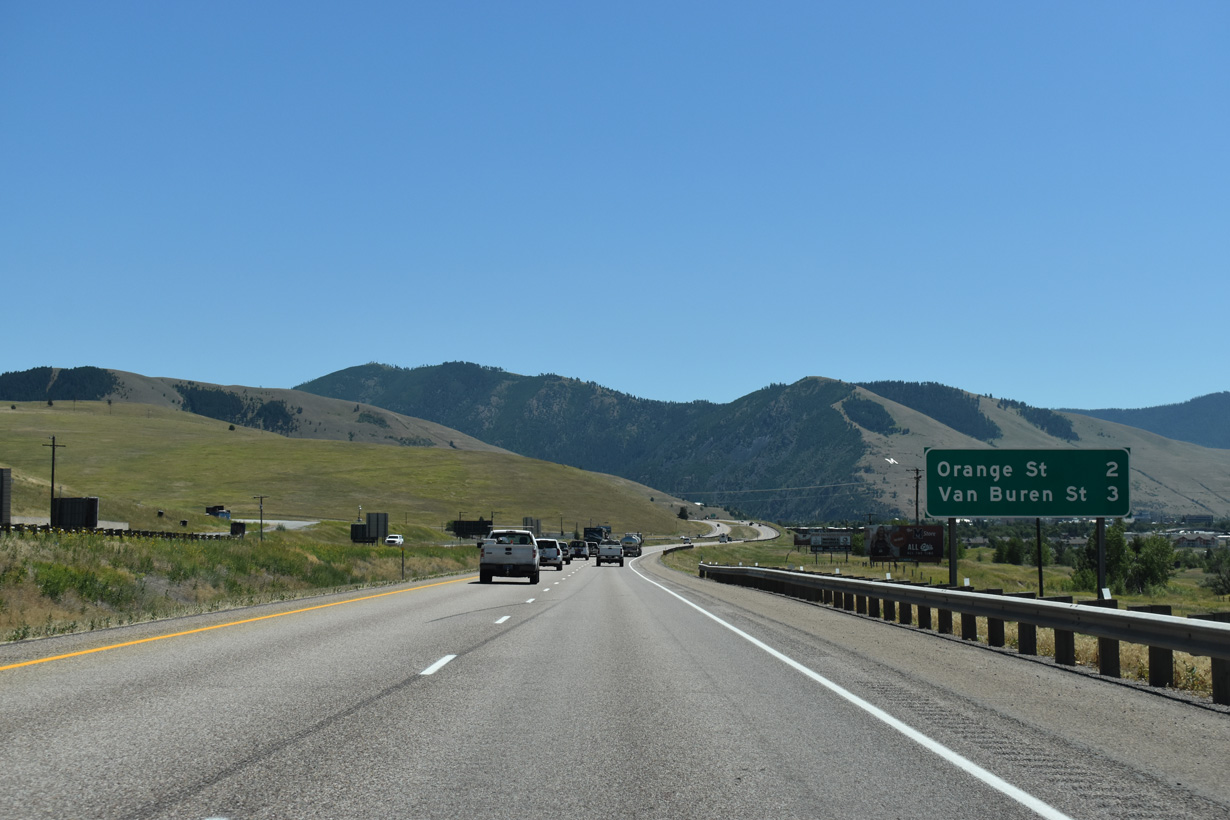
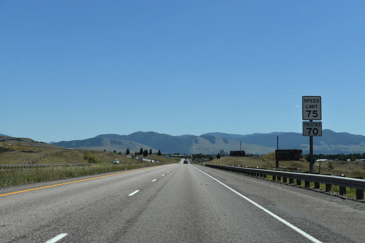
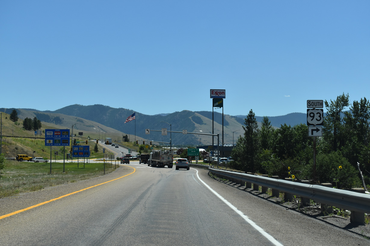
The speed limit reduces to 65 miles per hour along I-90/MT 200 east of Exit 101. The succeeding exits for Missoula join Interstate 90 with Orange Street in two miles and Van Buren Street in three miles.
07/18/23
07/18/23

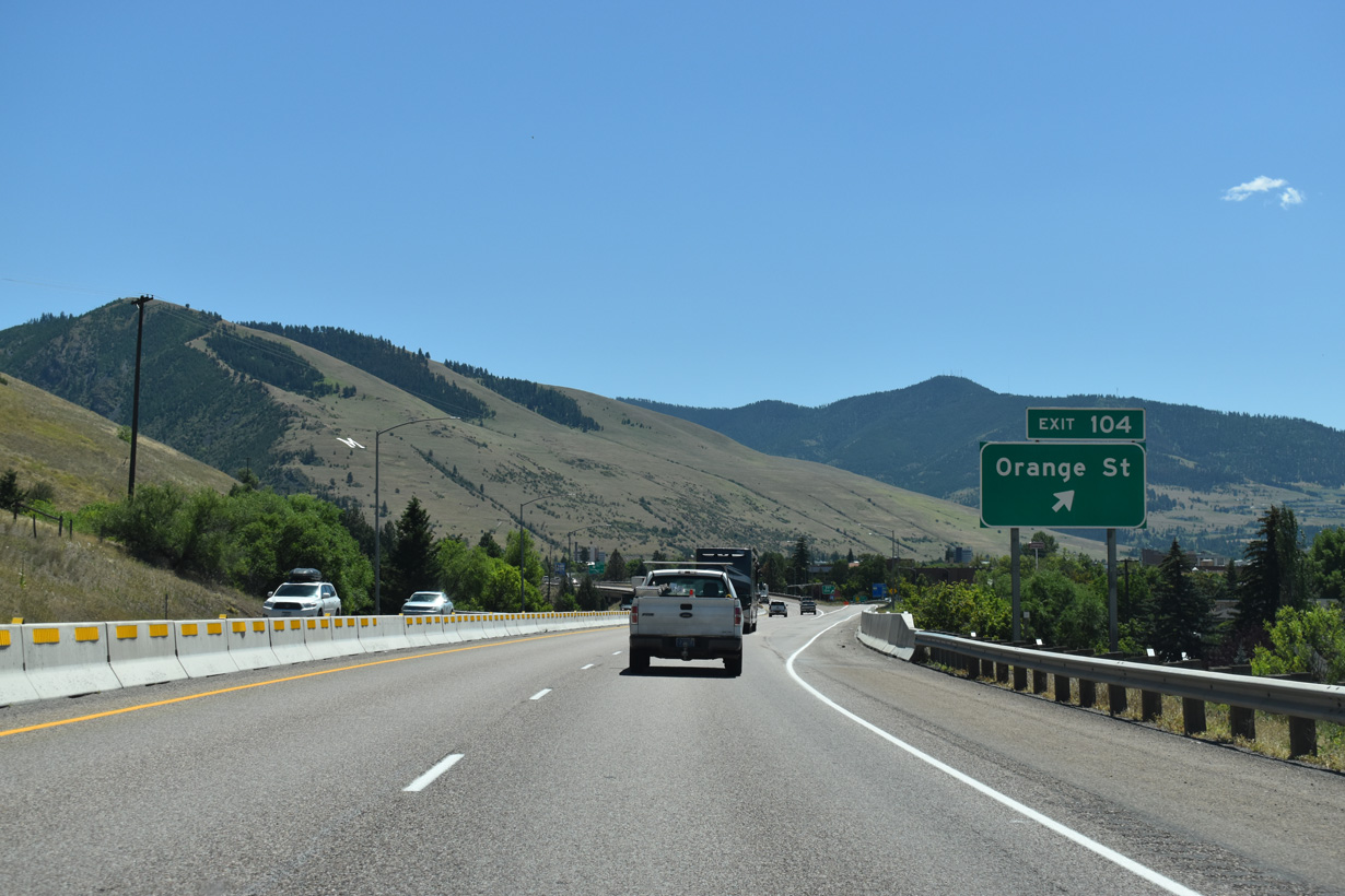
A roundabout interchange (Exit 104) joins I-90/MT 200 with Orange Street (U.S. 93 Business) south at N 5th Street W in one mile.
07/18/23
07/18/23
Orange Street intersects Broadway Street (Business Loop I-90) a half mile south of Exit 104 and doubles as U.S. 93 Business to Stephens Avenue.
07/18/23
07/18/23

The spire of the Missoula County Courthouse appears to the southeast of Interstate 90. Mount Dean Stone abuts southern reaches of the street grid at an elevation of 6,204 feet.
06/29/15
06/29/15
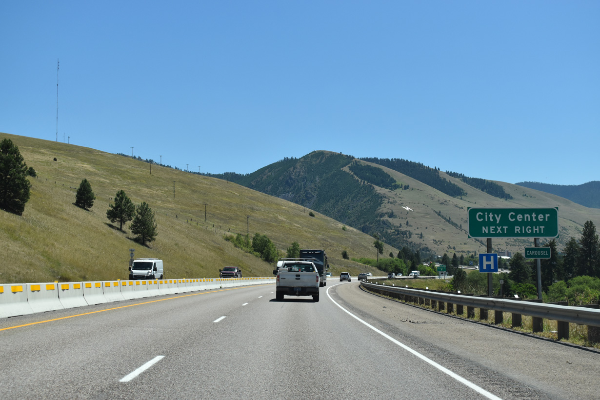
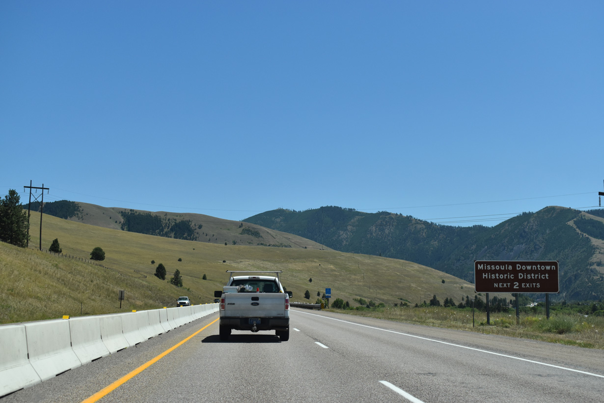
Orange Street provides the most direct route from I-90/MT 200 east into the Missoula city center.
07/18/23
07/18/23
Unsigned from I-90, U.S. 93 Business travels 2.30 miles from Exit 104 and Orange Street to U.S. 12 (Brook Street) south of the Rose Park neighborhood. U.S. 12/93 Business combine southwest from there by the Missoula County Fairgrounds and Southgate Mall to Reserve Street and U.S. 93.
07/18/23
07/18/23

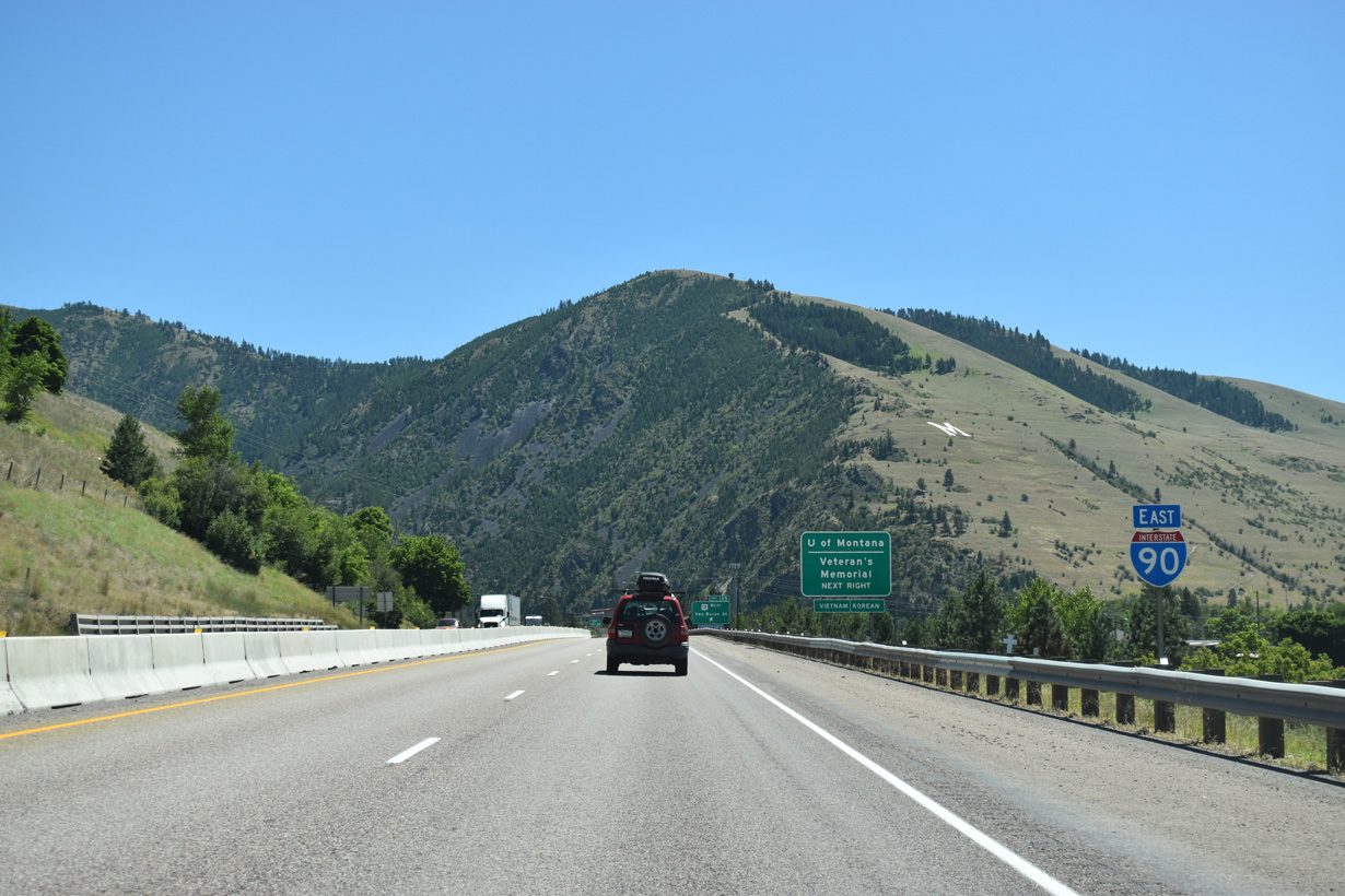
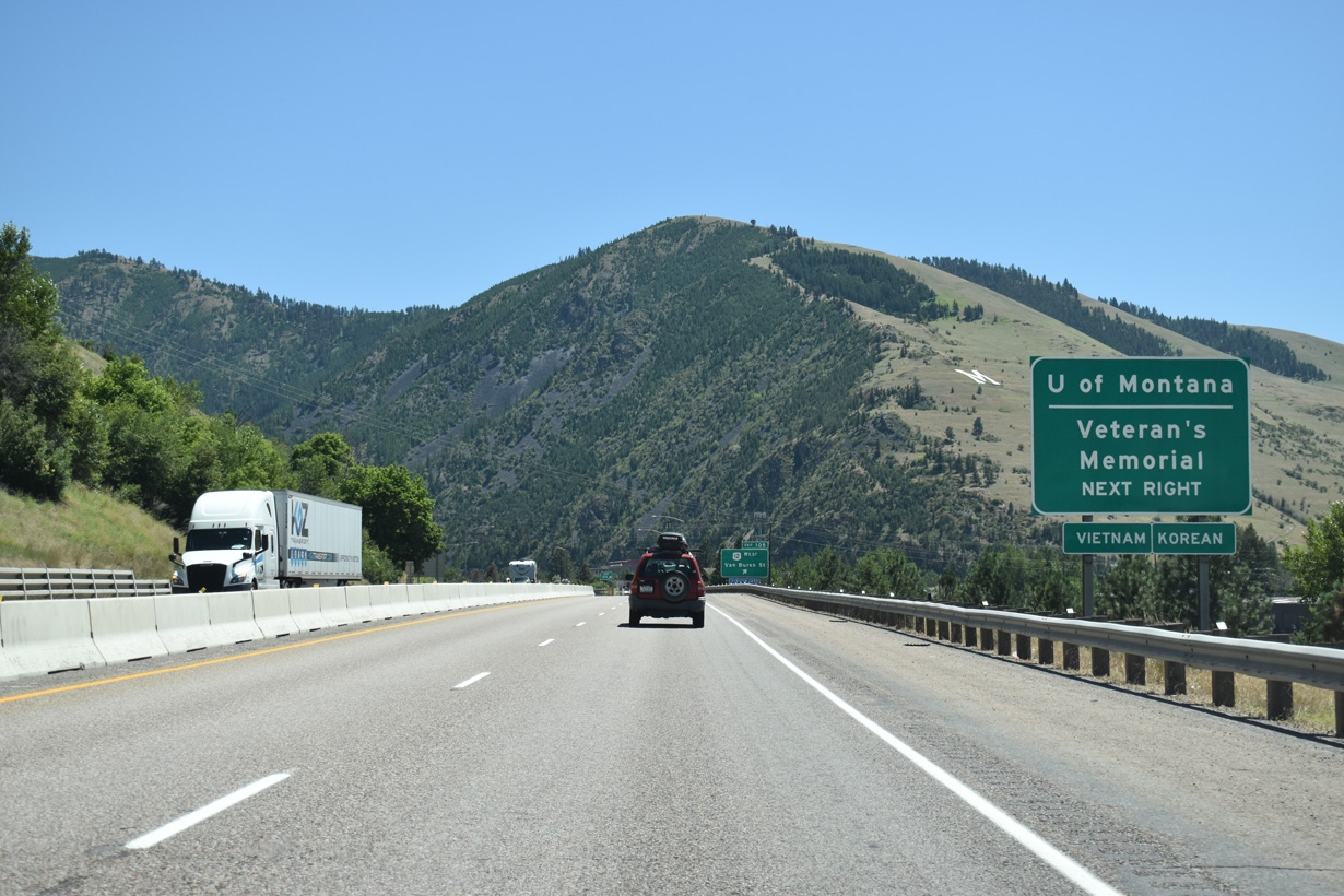
I-90/MT 200 pass north of the Missoula city center ahead of the dumbbell interchange (Exit 105) with U.S. 12 (Van Buren Street) west to the University of Montana campus.
07/18/23
07/18/23
07/18/23
U.S. 12/Business Loop I-90 follow Van Buren Street south to Broadway Street west across Rattlesnake Creek. Once at Madison Street, U.S. 12 turns southward toward the University of Montana and a couplet of 5th and 6th Streets.
07/18/23
07/18/23

Higgins Avenue and Broadway Street through the Missoula city center represent U.S. 12 Business. South from the couplet of 5th/6th Streets, U.S. 12 follows Higgins Avenue onto Brook Street southwest.
07/18/23
07/18/23
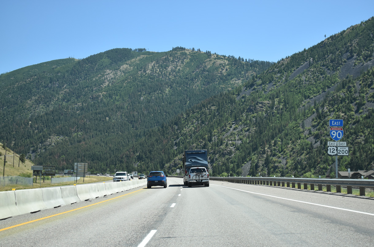
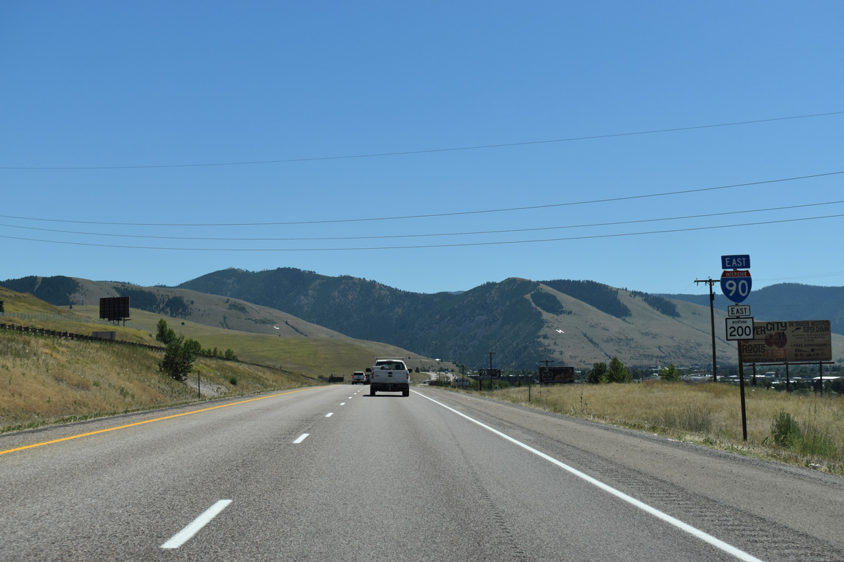
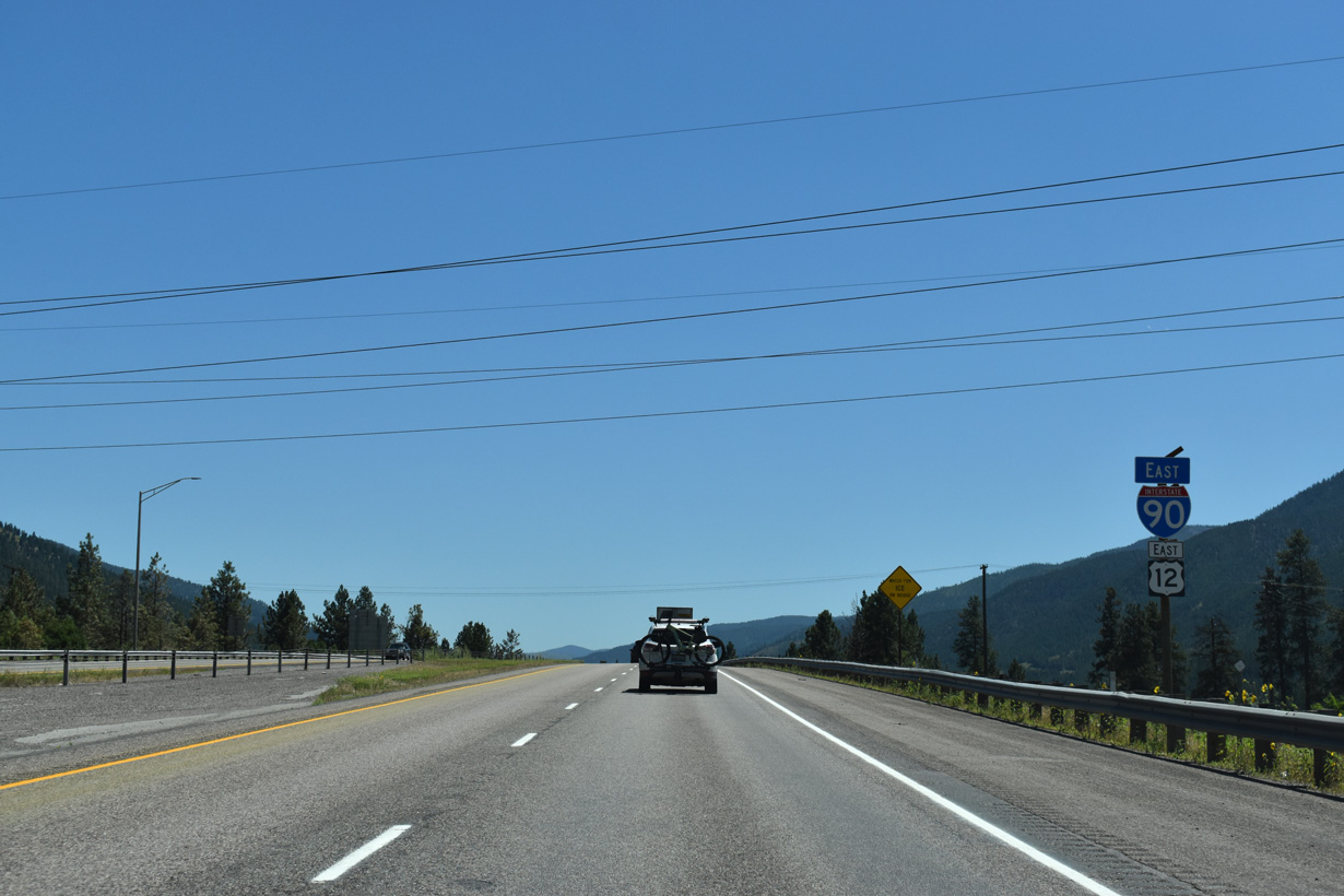
U.S. 12 combines with Interstate 90 east from Missoula to Garrison and Exit 174. Old U.S. 10-12 and MT 200 parallel the freeway and adjacent BNSF Railroad to the south along Broadway Street east to Exit 107.
07/18/23
07/18/23

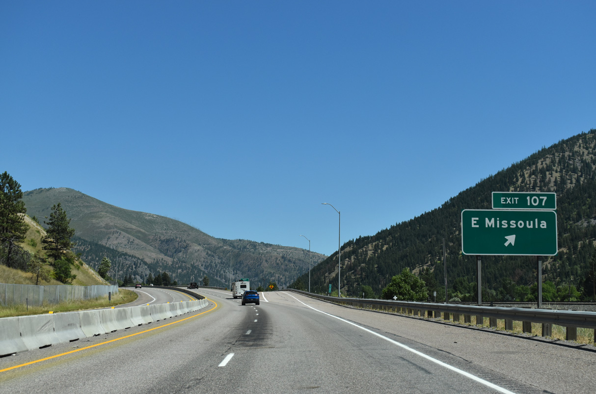
I-90/U.S. 12-MT 200 travel east through Hellgate Canyon between Mount Jumbo to the north and University Mountain to the south. Broadway Street follows the Clark Fork river east before crossing the BNSF Railroad north into the diamond interchange at Exit 107.
07/18/23
07/18/23
The former alignment of U.S. 10/12 and MT 200 along Broadway Street becomes "Montana 200" north of Exit 107 through unincorporated East Missoula. The local arterial ties into 1st Street adjacent to MT 200 east of Exit 109. Despite the name, MT 200 remains overlapped with I-90 to Exit 109.
07/18/23
07/18/23
Woody Mountain comes into view where I-90/U.S. 12-MT 200 advances east from East Missoula to West Riverside.
07/18/23
07/18/23
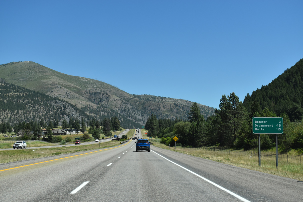
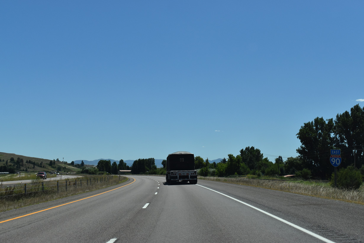
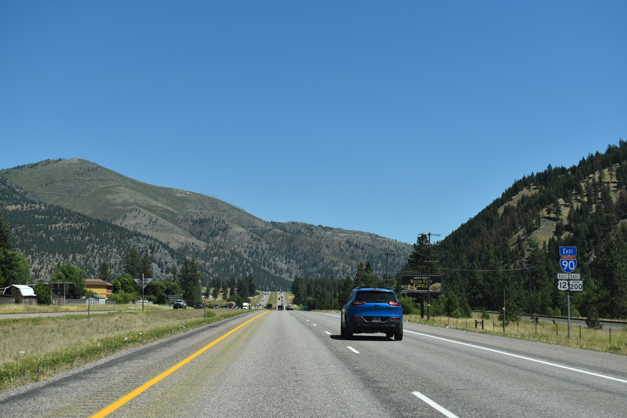
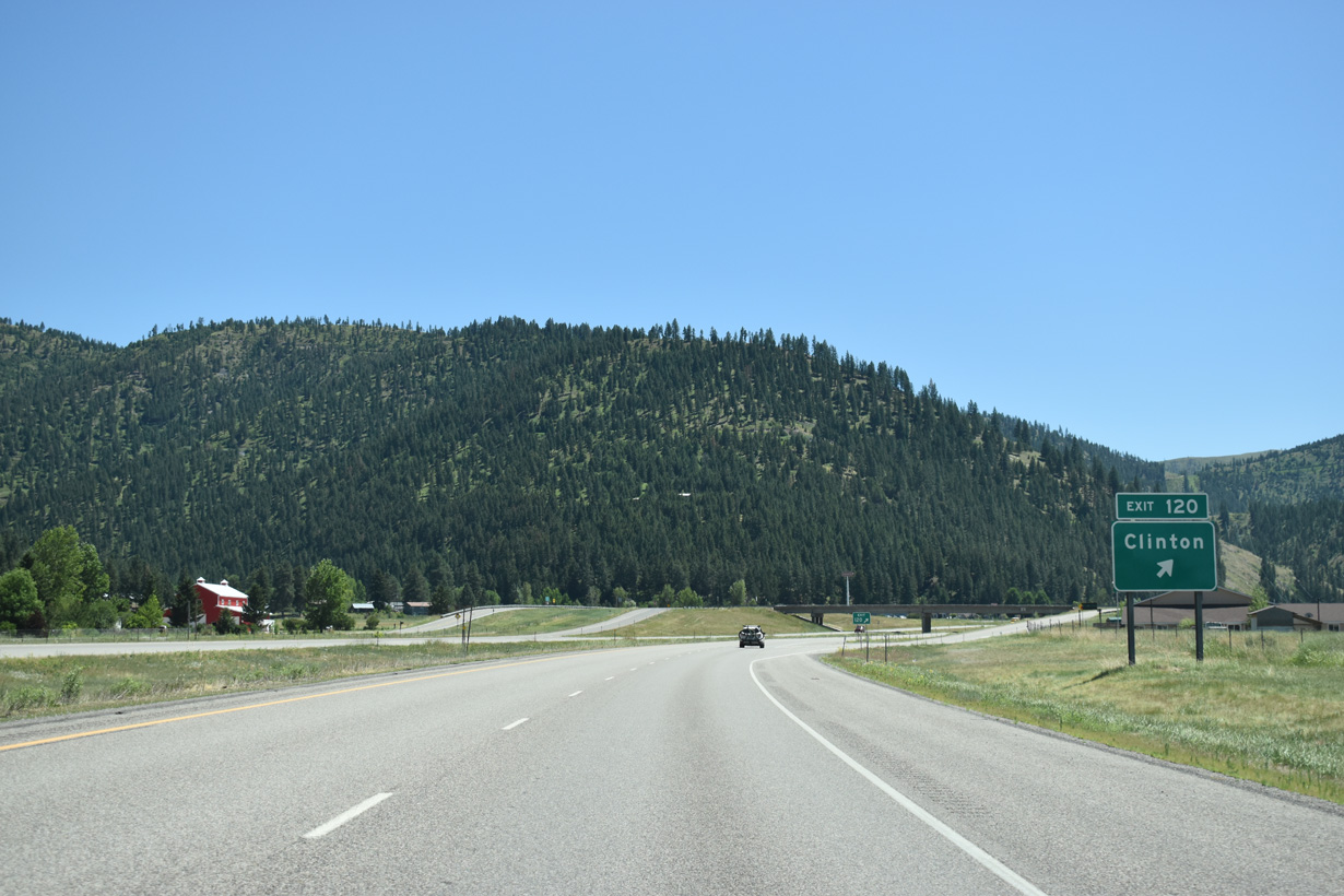
Bonner lies along MT 200 just east from I-90/U.S. 12. Drummond at MT 1 follows in 45 miles. Butte, the eastbound control city, is 115 miles away.
07/18/23
07/18/23
Interstate 90 spans the Clark Fork river twice by the Bandmann Flats between East Missoula and West Riverside. The freeway and river parallel one another from St. Regis (Exit 33) to Warm Springs (Exit 201).
07/18/23
07/18/23
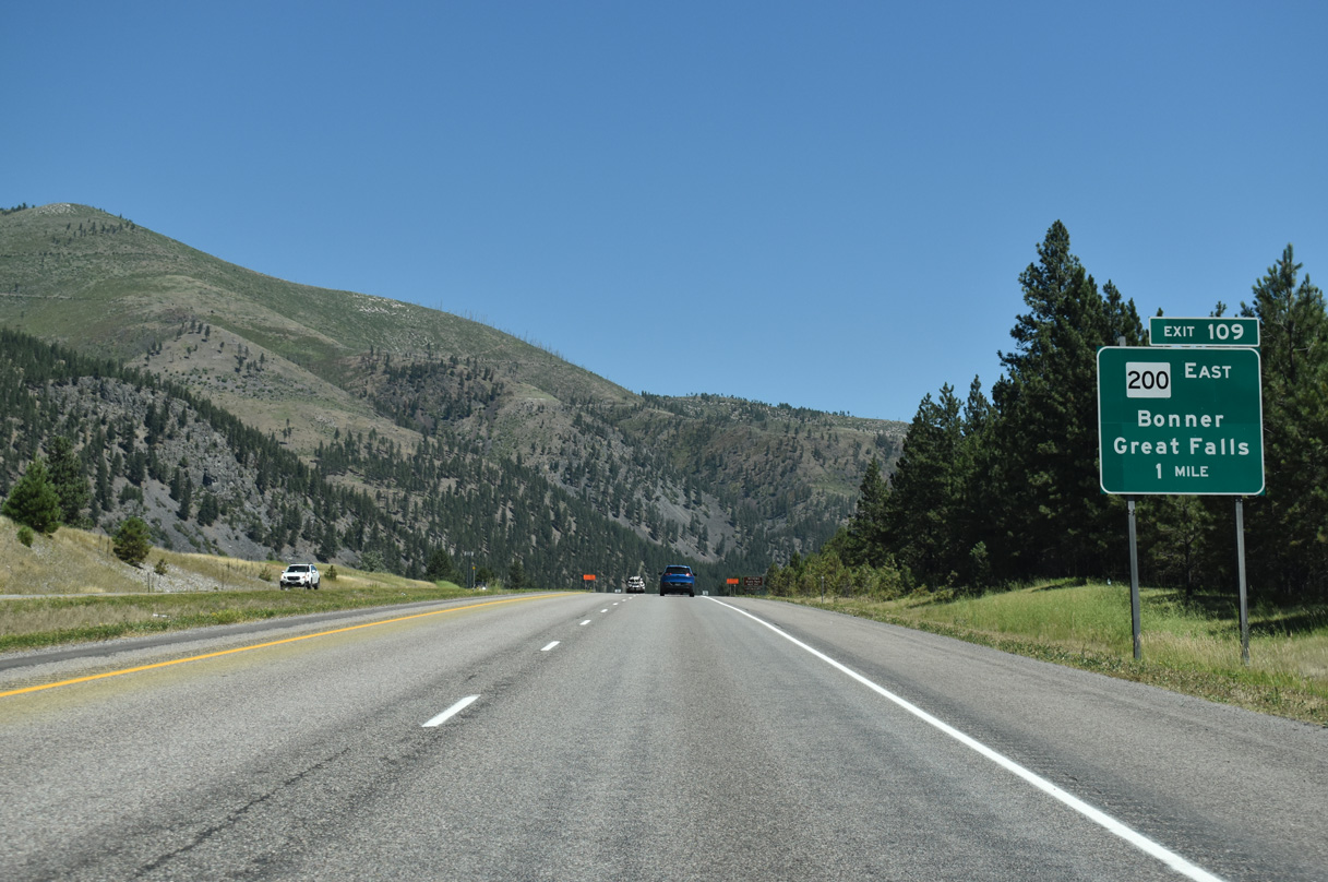
The 13.5 mile long overlap with MT 200 on Interstate 90 concludes at Exit 109 and West Riverside. The multi state route continues east through nearby Bonner to Lincoln and Great Falls while I-90 turns southward to Drummond and Deer Lodge.
07/18/23
07/18/23
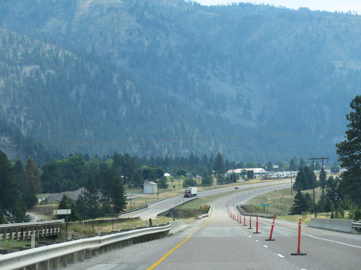
The second I-90 crossing over the Clark Fork river east of Missoula follows Deer Creek Road. The 310 mile long river flows northwest from near Butte to Lake Pend Orielle in northern Idaho. This stretch of I-90 was completed in 1965.
06/29/15
06/29/15
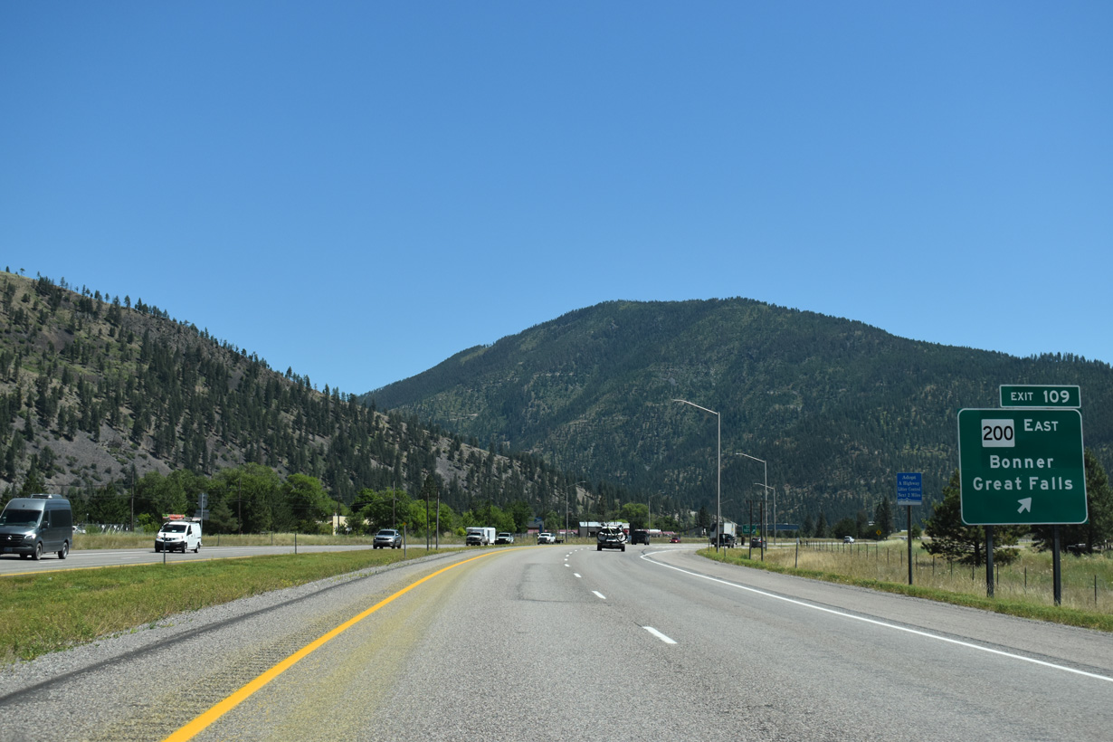
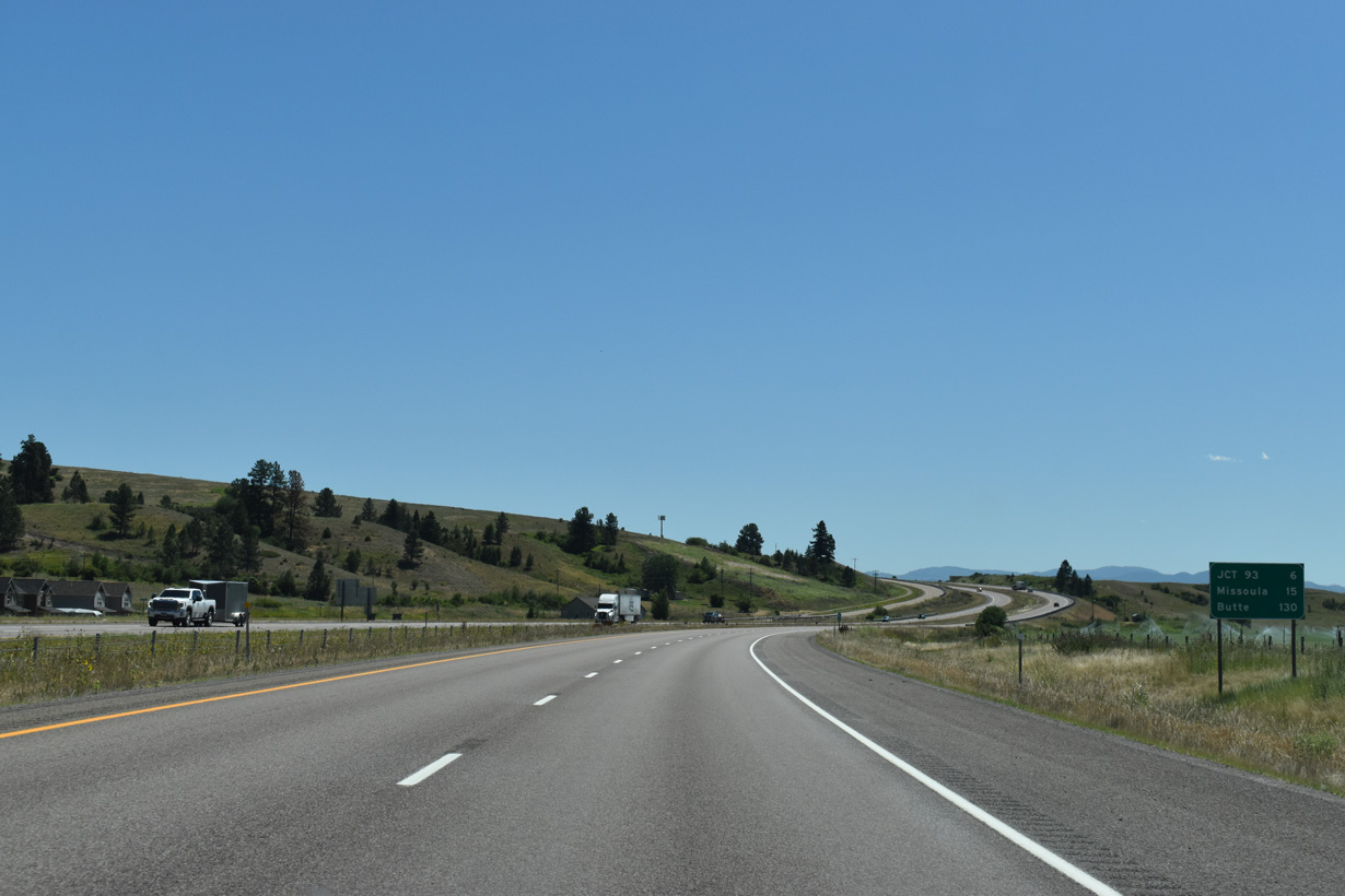
MT 200 is part of a 1,361 mile long route stretching from U.S. 2/95 at Sandpoint, Idaho to U.S. 2 at Northeast Aitkin, Minnesota. The state highway joins Missoula with Great Falls, 160 miles to the northeast.
07/18/23
07/18/23
07/18/23

07/18/23

07/18/23

07/18/23
07/18/23
07/18/23
07/18/23
07/18/23
07/18/23
07/18/23
Photo Credits:
- Brent Ivy: 07/18/23
- Andy Field: 06/28/15, 06/29/15
Connect with:
Page Updated Wednesday January 28, 2026.