
Interstate 90 East - Seattle to Bellevue
 East
East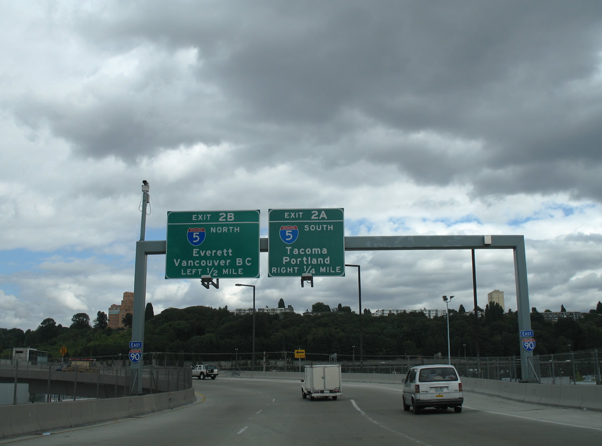
Ramps from 4th Avenue S and Edgar Martinez Drive S, both a part of SR 519, combine to form the eastbound beginning of Interstate 90 east of T-Mobile Park. Originally I-90 commenced from 4th Avenue S near Airport Way.
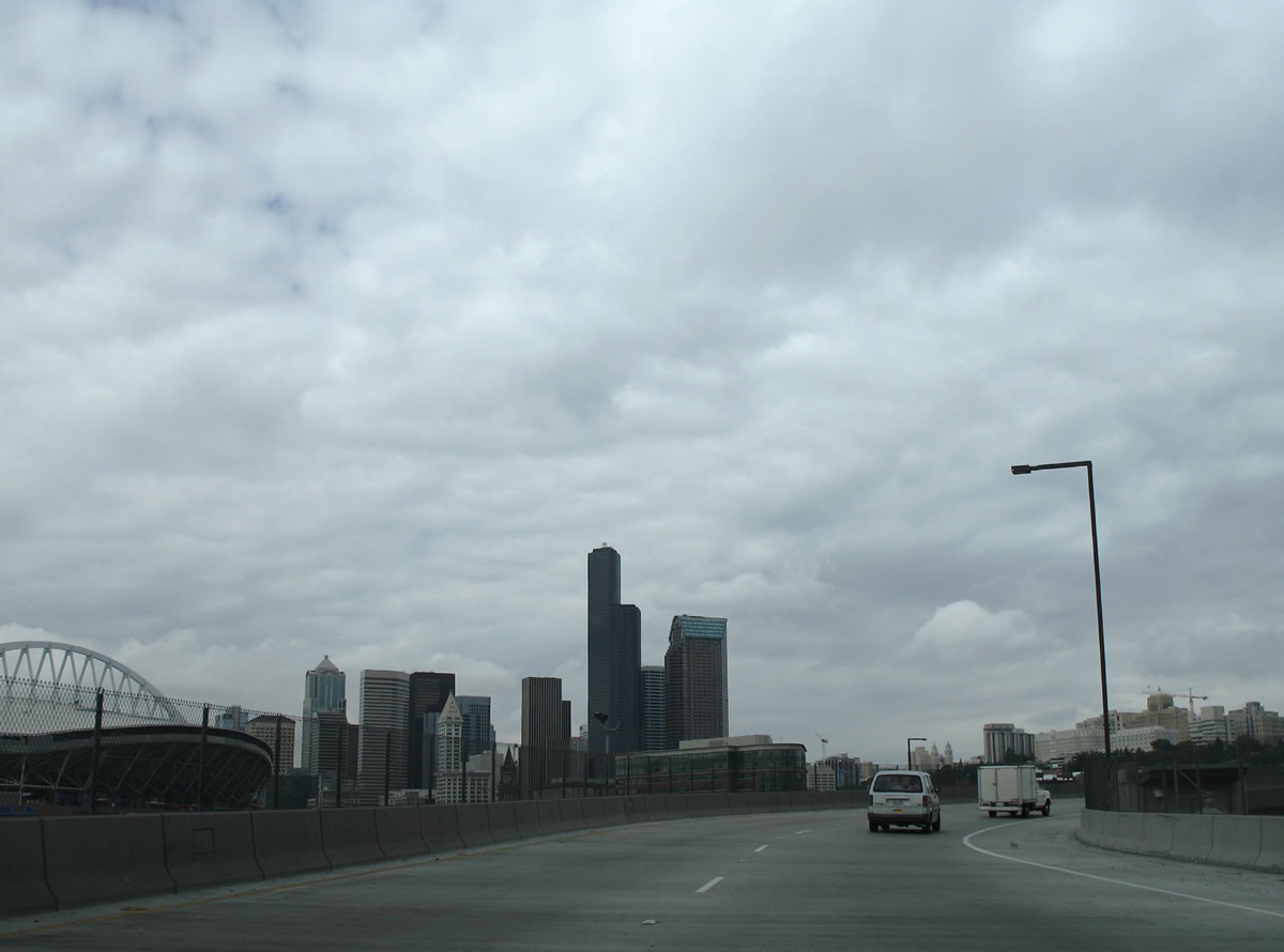
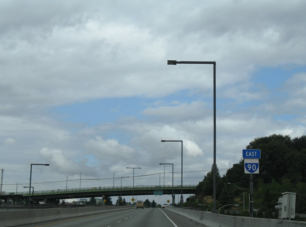
The first eastbound reassurance markers for I-90 appeared a quarter mile ahead of Exits 2 A/B. I-90 travels a viaduct east from 4th Avenue S to the systems interchange with I-5 over an an industrial area east of the stadiums.
08/29/06
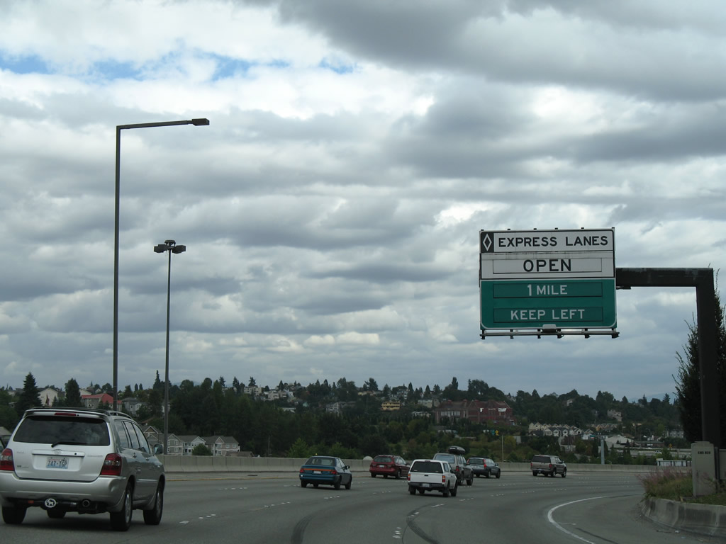
The ramp from SR 519 curves northward before joining the viaduct over 6th Avenue S. Since replaced with mass transit, the I-90 Express Lanes began at the intersection of Seattle Boulevard, Dearborn Street, and 5th Avenue S nearby.
08/29/06
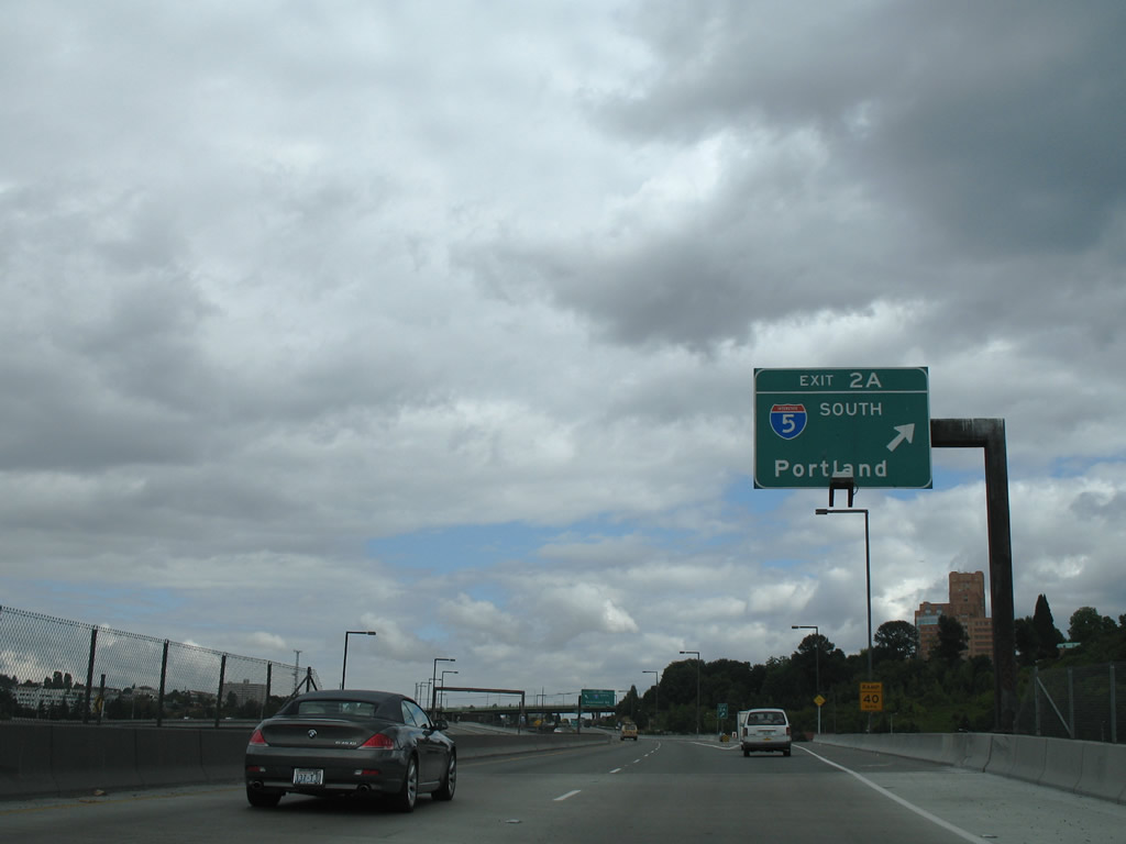
Exit 2 A leaves Interstate 90 east above 6th Avenue S. Interstate 5 leave the city of Seattle south to Federal Way, Tacoma, Olympia and Portland, Oregon.
08/29/06
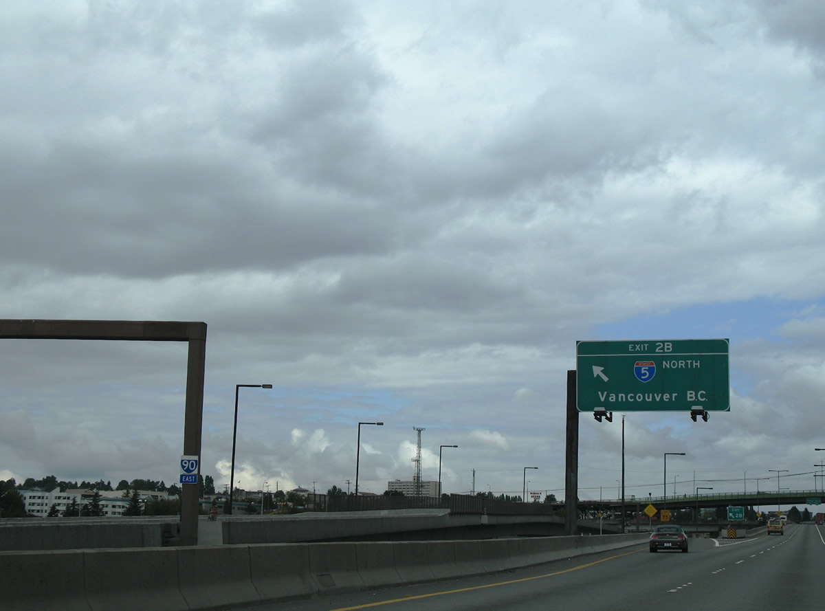
Left Exit 2 B follows onto Interstate 5 north as the I-90 Express Lanes cameinto view. Interstate 5 lines eastern reaches of the Seattle business district north from I-9. The freeway continues to Shoreline, Everett, Bellingham, and Vancouver, British Columbia via B.C. Highway 99 north.
08/29/06
The eastbound roadway travels above the westbound lanes along the double decked section of Interstate 90 through the exchange with I-5. The two roadways align side by side east of the 12th Avenue S overpass.
08/29/06
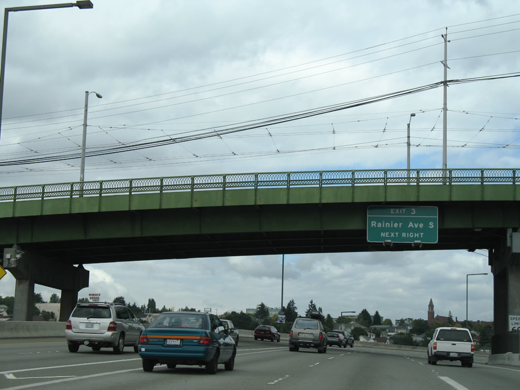
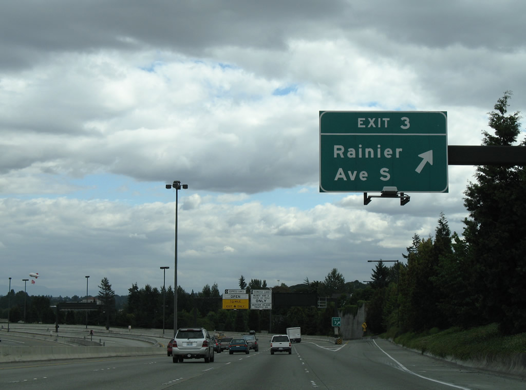
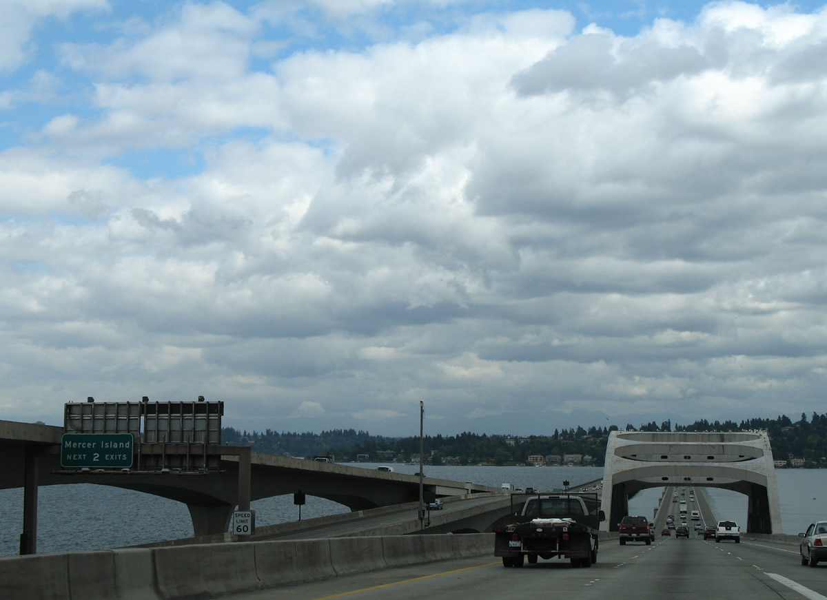
Interstate 90 encircles Beacon Hill to the north ahead of Exit 3 to Rainier Avenue S. Rainier Avenue was part of SR 900 south from I-90 to Martin Luther King, Jr. Way at I-5 until April 1, 1992.1
08/29/06
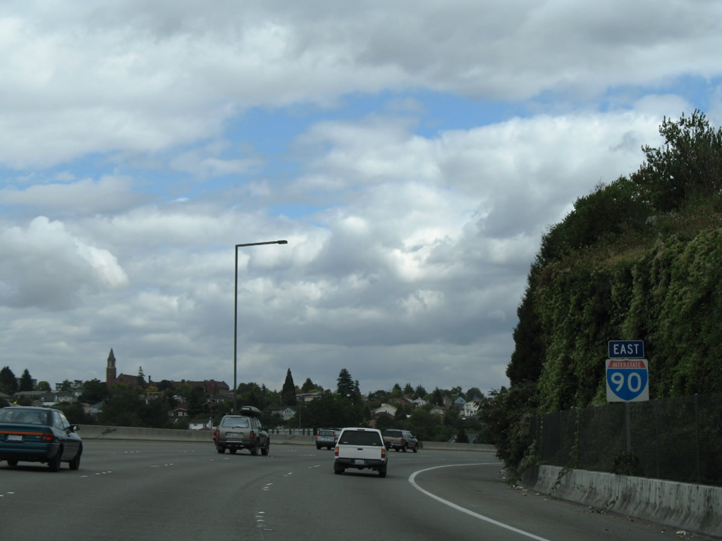
Eastbound Interstate 90 reassurance shield posted along the southeast turn at Sturgus Park.
08/29/06
An ingress point from the general travel lanes joined the I-90 Express Lanes within the parclo interchange (Exit 3) at Rainier Avenue.
08/29/06
Rainier Avenue extends Boren Avenue south from the International District and Yesler Terrace to Interstate 90. Rainier Avenue S continues southeast to Mt. Baker and Martin Luther King, Jr. Way, where SR 167/900 previously split.
08/29/06
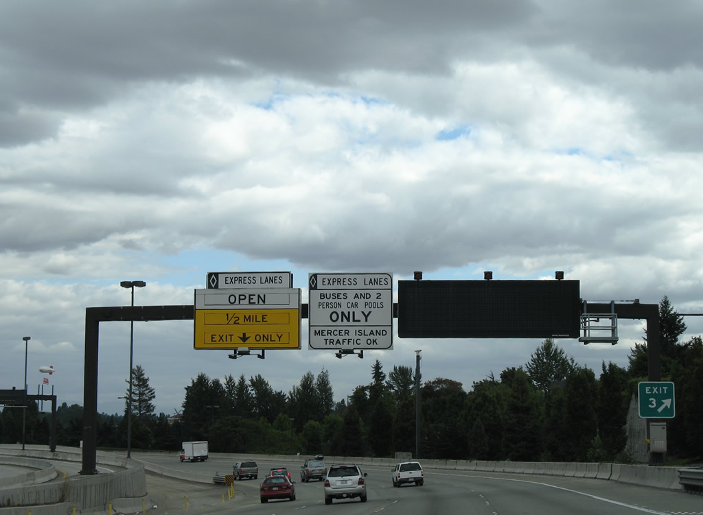
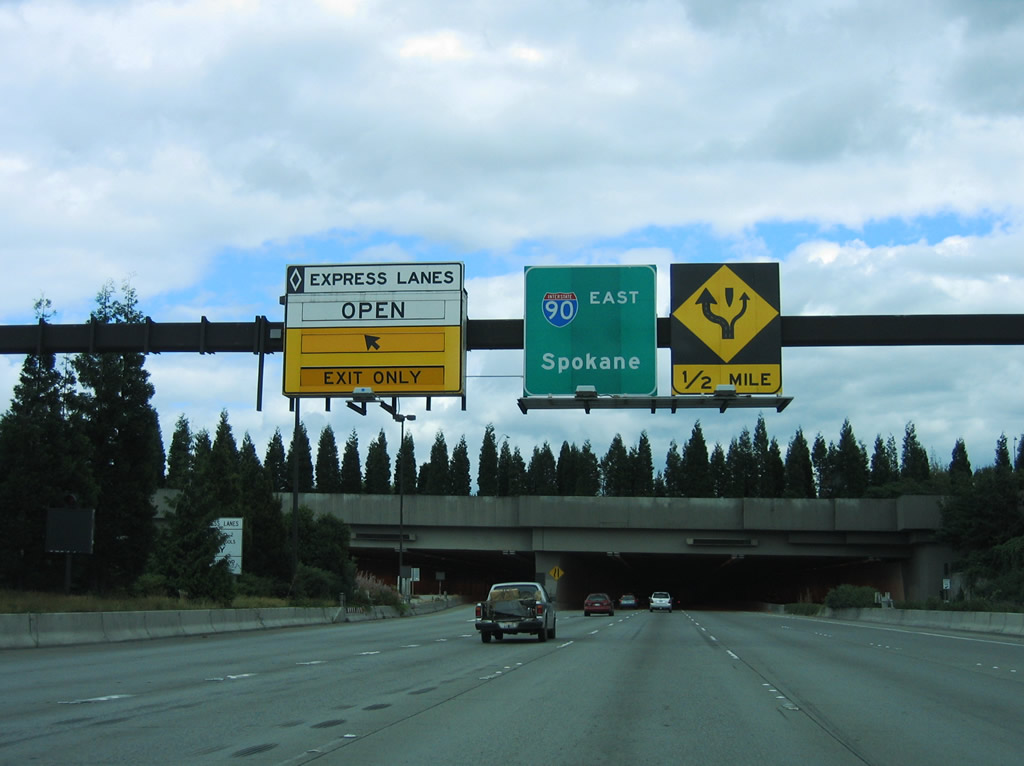
A bus ramp for Judkins Park Station lines the inside lanes of I-90 at Rainier Avenue S. Beyond the mass transit stop was a slip ramp for the Express Lanes at Mount Baker Tunnel. The Express Lanes were open to all transit vehicles and HOV-2 traffic.
08/29/06
The Interstate 90 Express Lanes, like those on I-5, were reversible and the flow depended upon time of day or special event in progress. Replaced with mass transit in 2017/18 construction, the HOV lanes extended 7.51 miles from Airport Way and 5th Avenue S in Seattle to Bellevue Way SE in Bellevue.
08/29/06

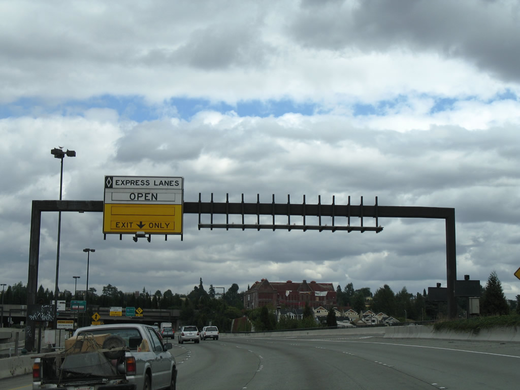
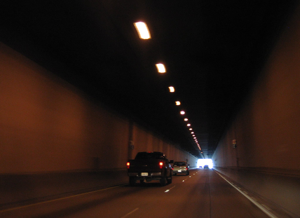
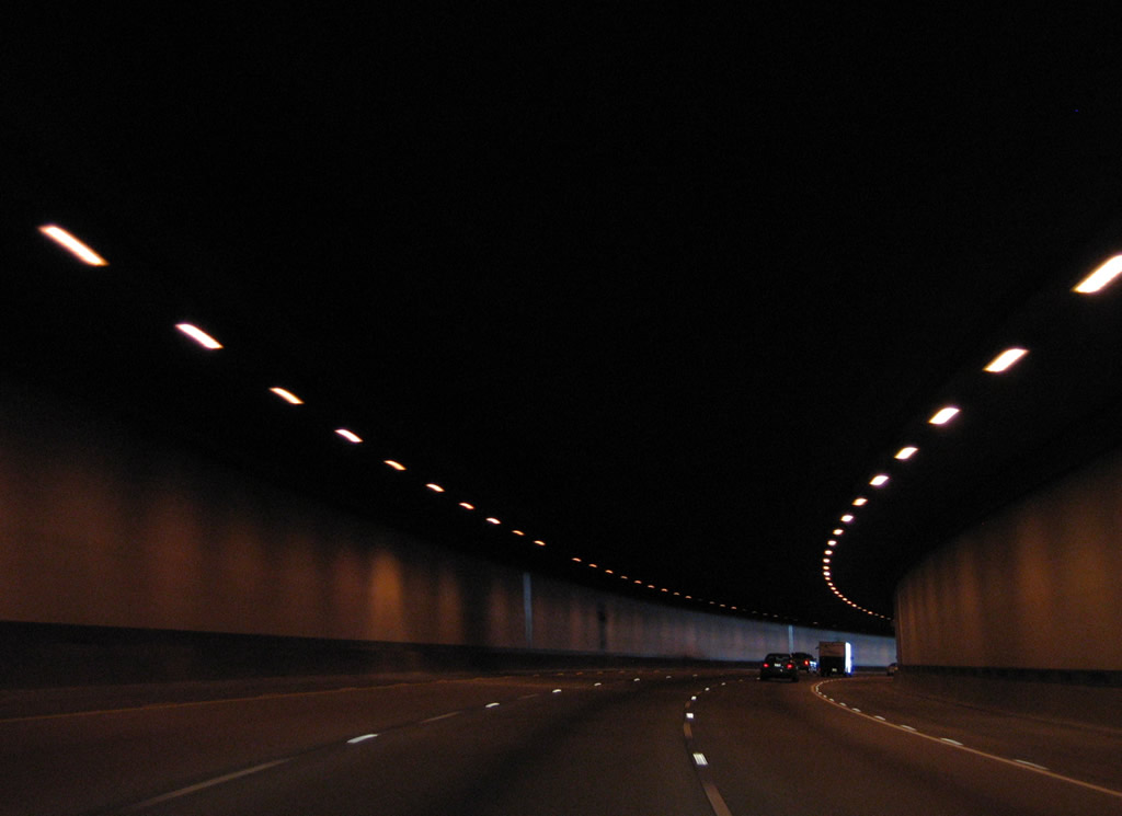
The bus lane formerly partitions into ramps for the Interstate 90 general travel lanes and the Express Lanes ahead of the Mount Baker Tunnel under Mount Baker Ridge.
08/29/06
Interstate 90 east at the Mt. Baker Tunnel.
08/29/06
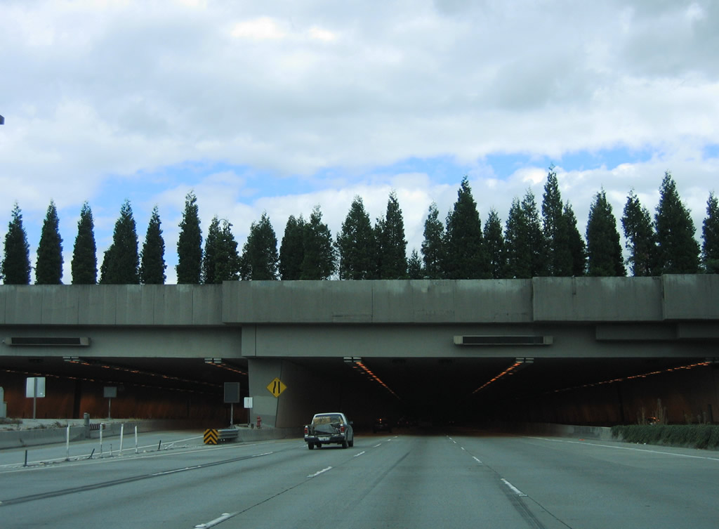
1,440 feet in length, the Mount Baker Tunnels were built in 1940 and originally carried four lanes of U.S. 10. Expansion of the facility to include a third bore occurred in 1993 as part of the upgrade to Interstate 90.2
08/29/06
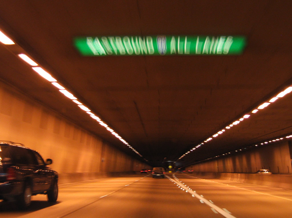
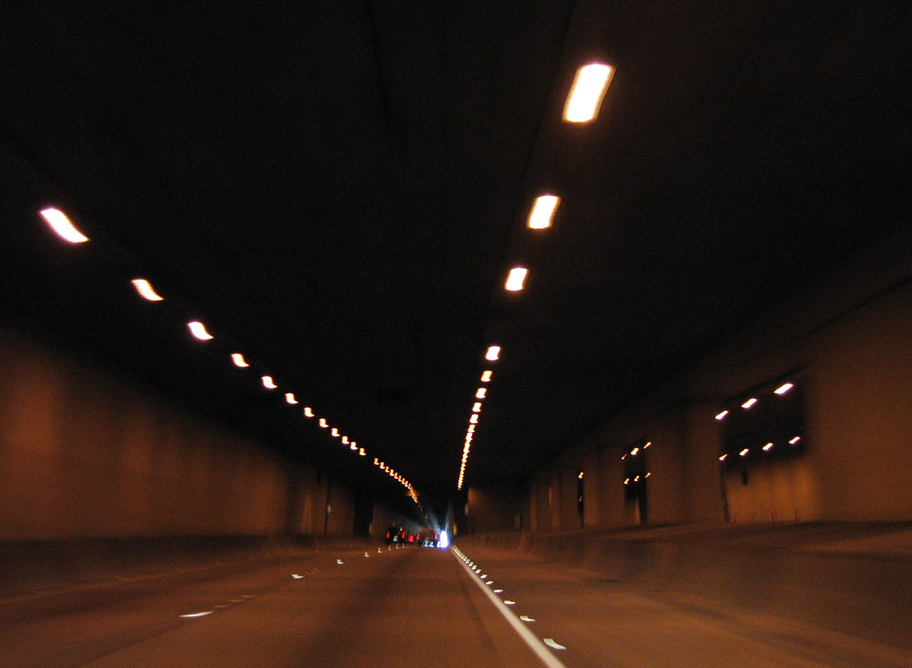
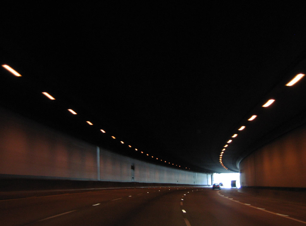
Eastbound Interstate 90 partitions into a pair of two lane roadways through the original tunnel. The roadways combine onto a three lane roadway across the Lacey V. Murrow Murrow Memorial Bridge at the eastern portal.
08/29/06
The inside roadway of I-90 east runs through what was the original westbound tunnel for U.S. 10. The I-90 westbound roadway and the transit line the replaced the reversible roadway utilizes a double decked tunnel to the north. That tunnel was built between 1991 and 1993.2
08/29/06
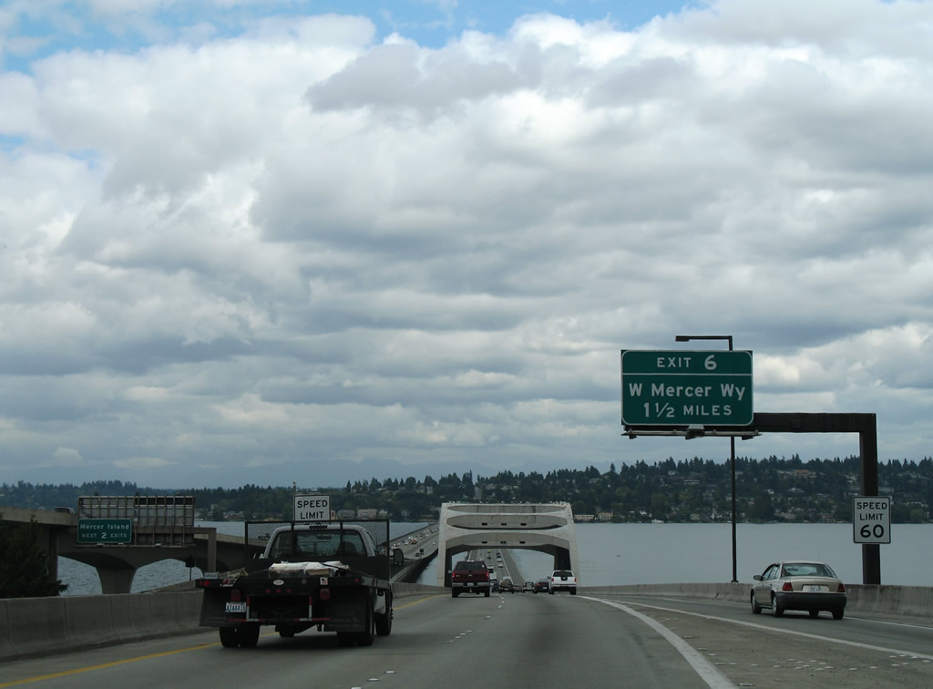
Emerging from the Mt. Baker Tunnel, Interstate 90 eastbound lowers onto the Lacey V. Murrow Memorial Bridge over Lake Washington. The succeeding exit is for W Mercer Way in 1.50 miles.
08/29/06
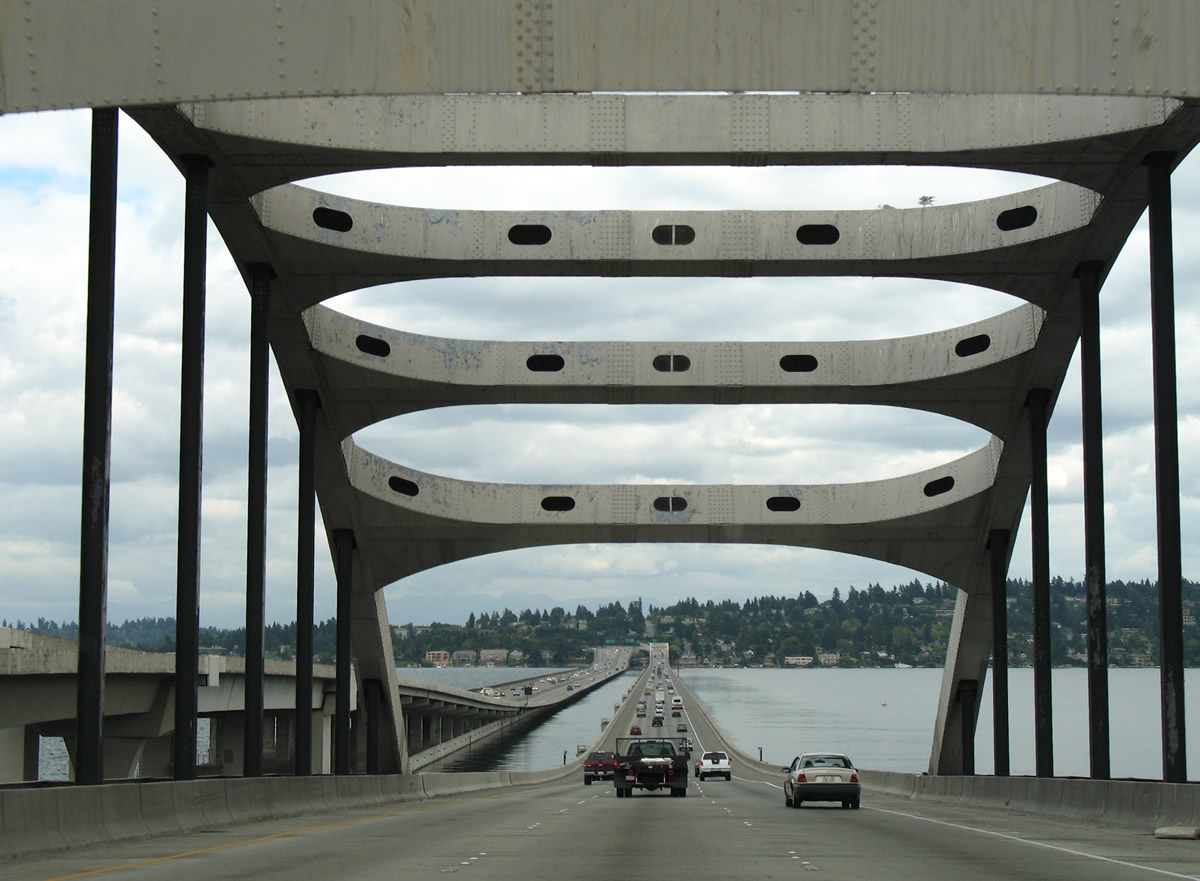
The mass transit line that replaced the I-90 Express Lanes accompanies the westbound roadway for I-90 across adjacent the Homer M. Hadley Memorial Bridge. 5,811 feet in length, the Hadley Bridge accommodates three general travel lanes, an HOV lane and a multi use path. It opened on June 4, 1989.3
08/29/06
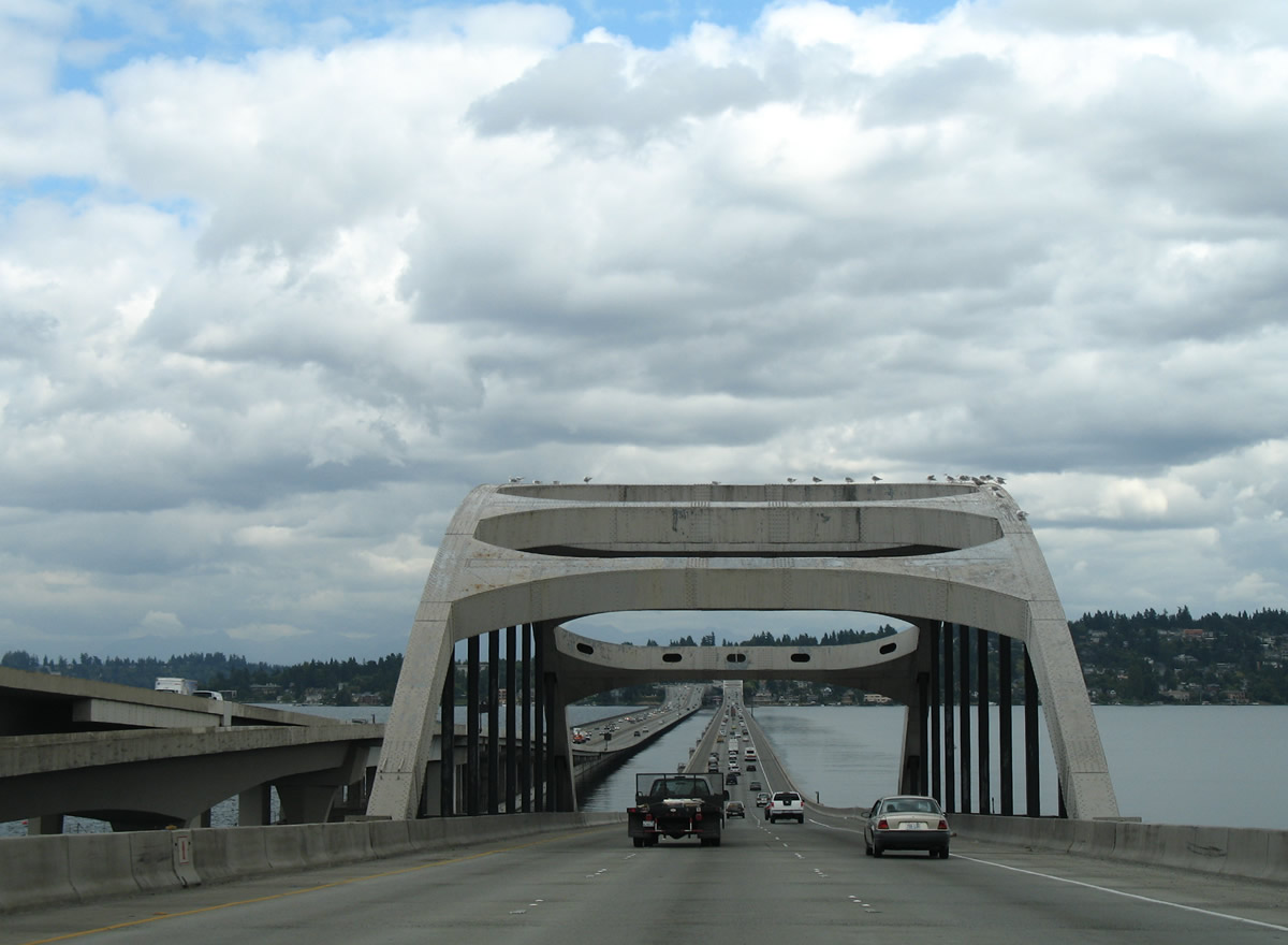
A steel arch supports a fixed span of the Lacey V. Murrow Memorial Bridge over the west channel of Lake Washington.
08/29/06
The majority of the Lake Washington crossing along I-90 constitutes a floating bridge. The Murrow Bridge stretches 6,620 feet and carries three overall lanes with full shoulders. It opened to traffic in 1993, three years after the original (1940) bridge sank after a ferocious storm November 22-24, 1990.4
08/29/06
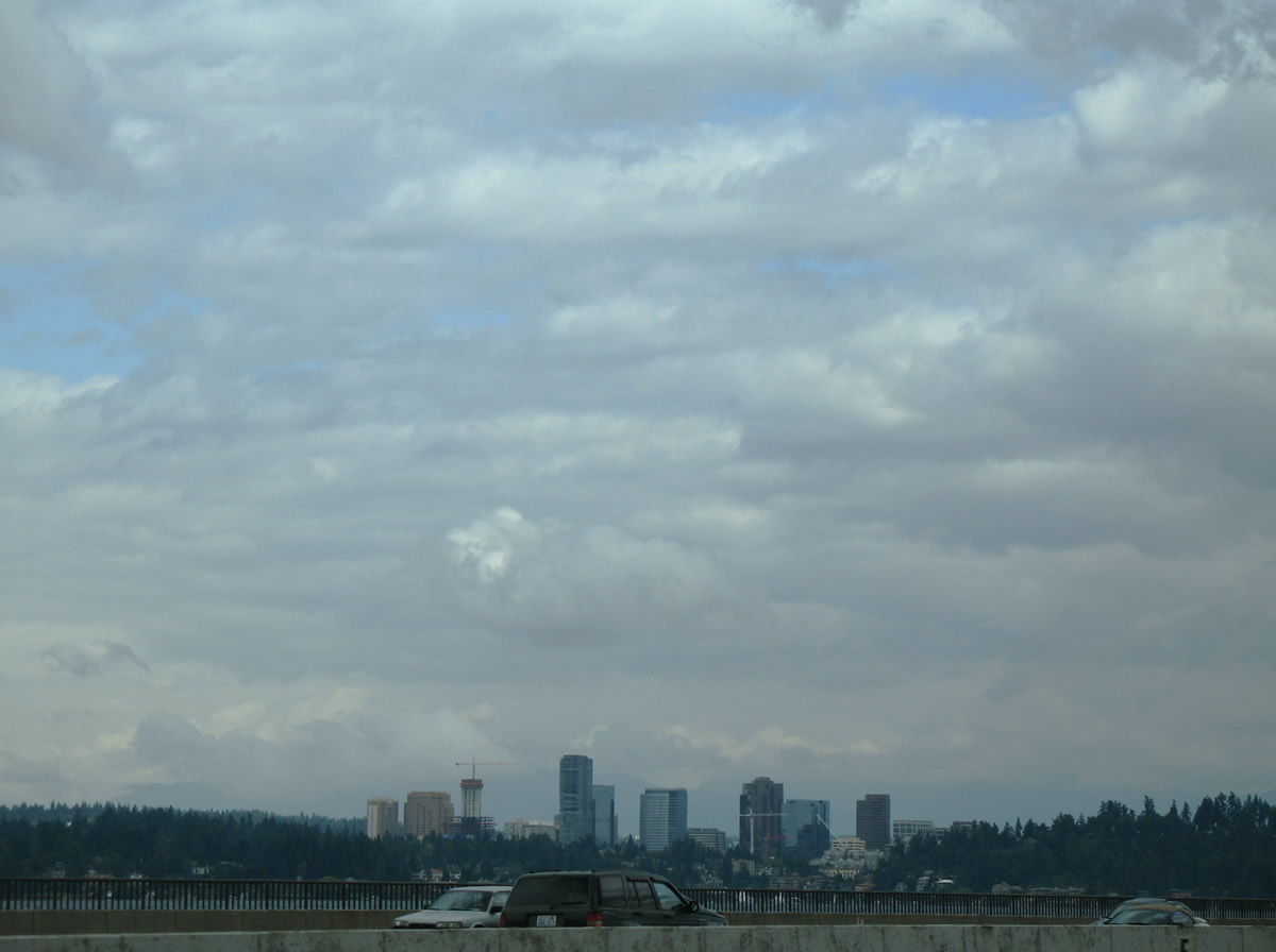
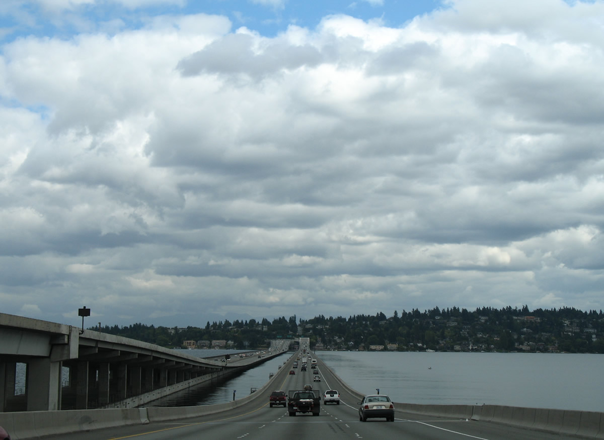
The Bellevue skyline comes into view beyond Meydenbauer Bay on Lake Washington, north of Mercer Island.
08/29/06
The original Lake Washington floating bridge opened in 1940 as a four lane toll crossing for U.S. 10. Tolls were levied until 1949 and the bridge was in service until 1990, when crews were widening the span during the fatal storm of Thanksgiving Weekend 1990.4
08/29/06
Rising onto Mercer Island, the Lacey V. Murrow Memorial Bridge transitions from a floating bridge onto a fixed span over the east navigation channel of Lake Washington.
08/29/06
A wye interchange connects Interstate 90 east with W Mercer Way at the city of Mercer Island. Encircling the entire island, Mercer Way meets I-90 again at Exit 8. Ramps linked the former I-90 Express lanes with Exits 7 A/B on Mercer Island.
08/29/06
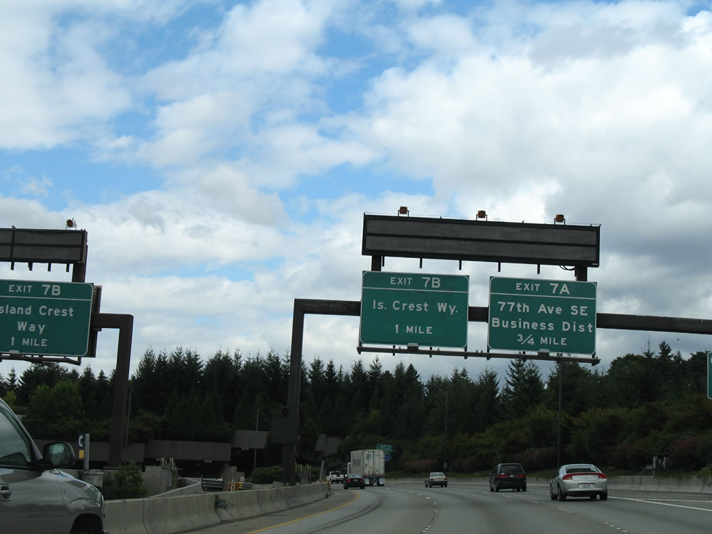
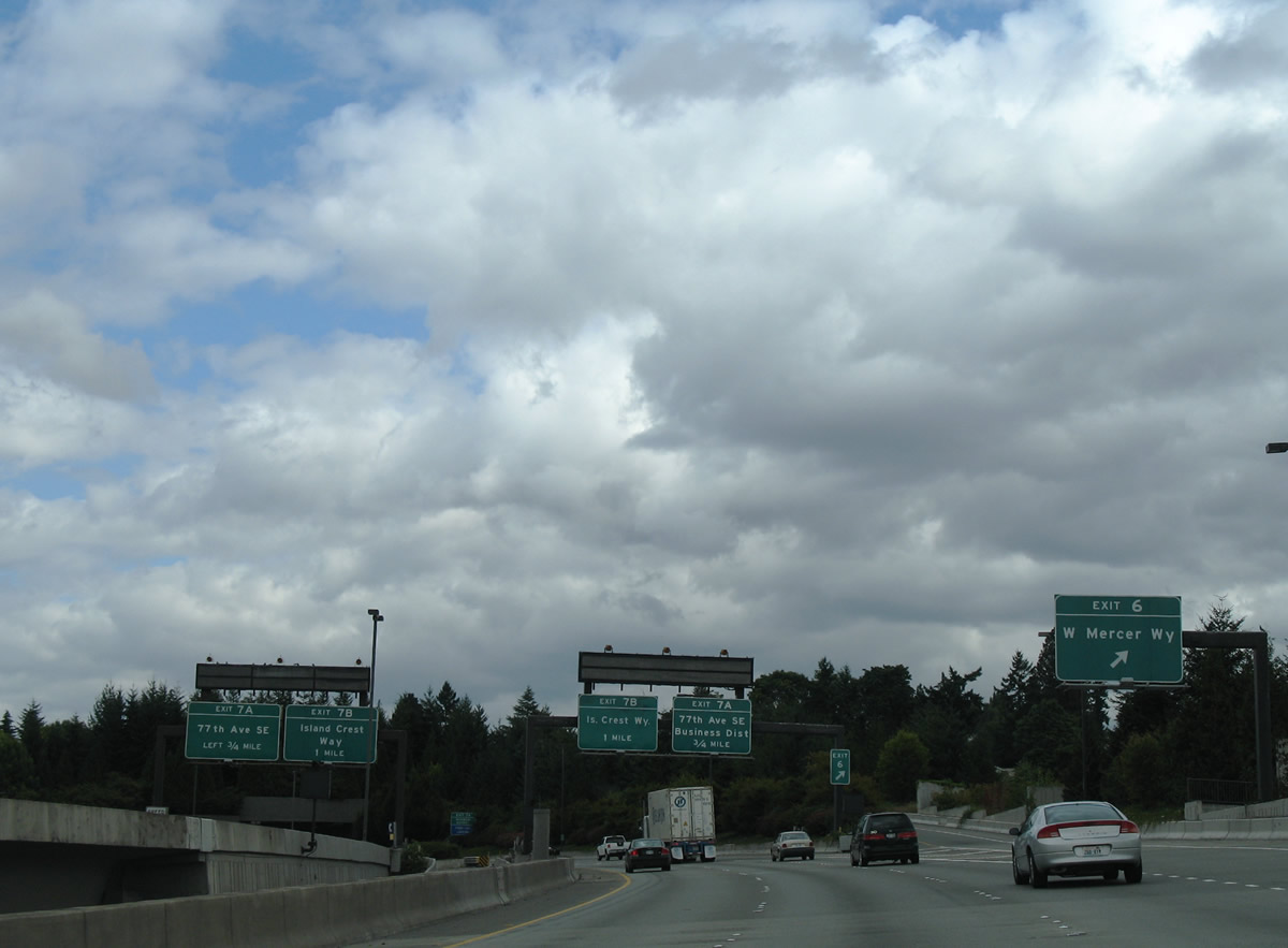
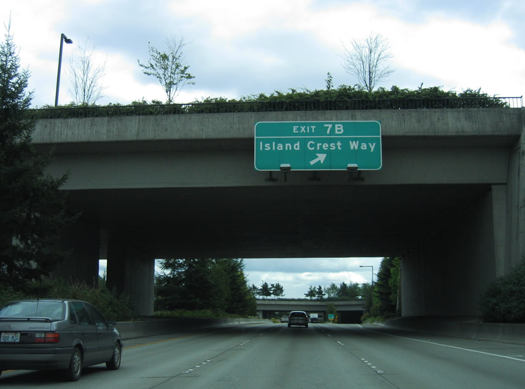
Exit 7 A joins I-90 with 77th Avenue SE south to the city center. Exit 7 B follows for Island Crest Way, the main arterial to the south end of the Mercer Island.
08/29/06
The Mercer Island Lid, a cut and cover tunnel, follows Exit 6 along Interstate 90 eastbound.
08/29/06
A half mile in length, the Mercer Island Lid supports Aubrey Davis Park (formerly Park on the Lid), W Mercer Way and 72nd Avenue SE.
08/29/06
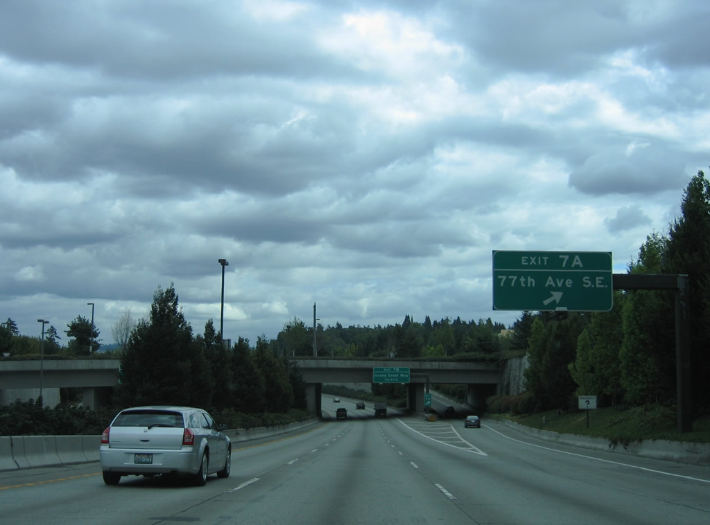
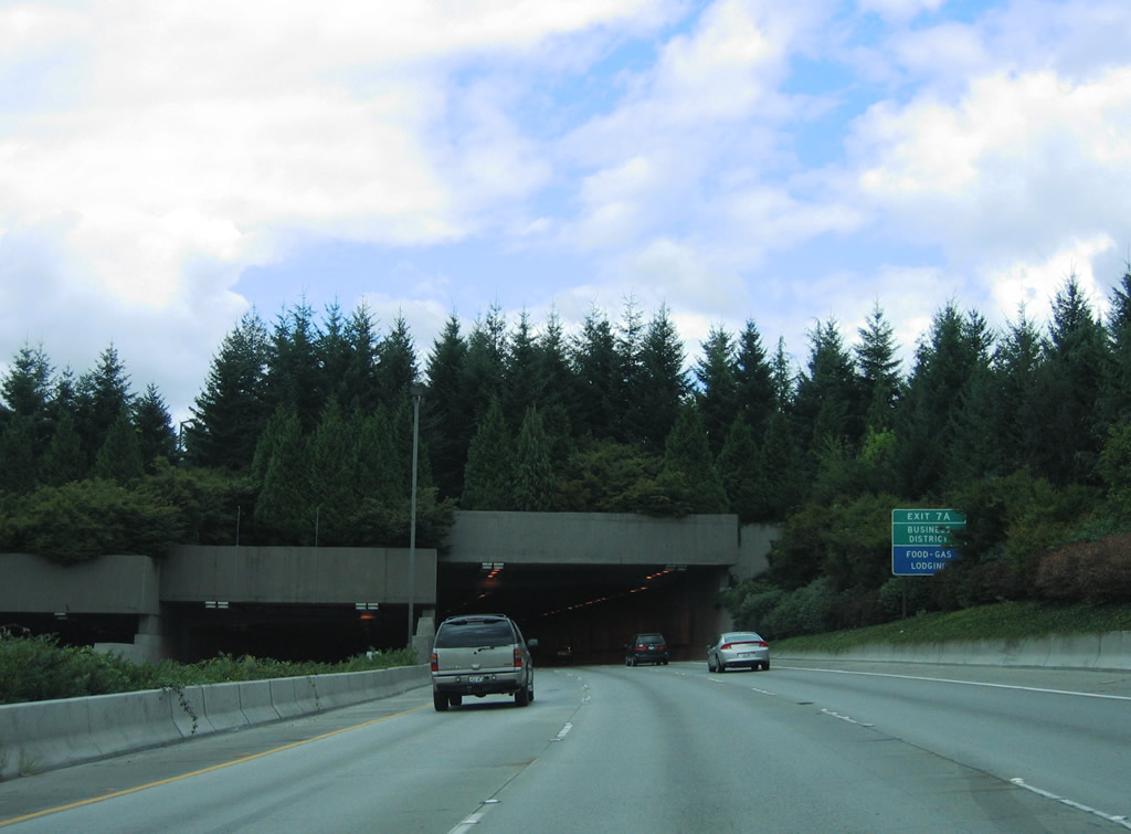
Advancing southeast from the tunnel, Interstate 90 travels below grade north of the Mercer Island central business district. Exit 7 A ascends to 77th Avenue SE between Sunset Highway and N Mercer Way.
08/29/06

Angling southward onto Island Crest Way at SE 30th Street, Exit 7 B parts ways with I-90 east at the 77th Avenue SE overpass. Island Crest Way connects the central business district with Pioneer Park to the south.
08/29/06
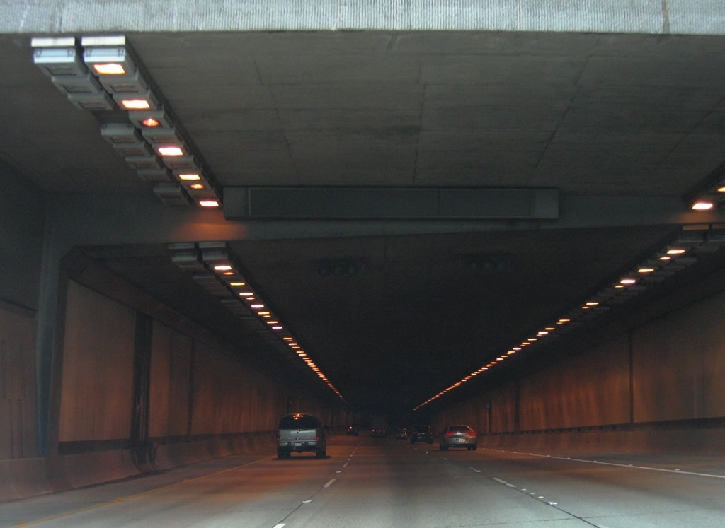
Exit 7 B passes through a short tunnel under 80th Avenue SE and SE 27th Street onto Island Crest Way east of the Mercer Island business district.
08/29/06
The entrance ramp from Island Crest Way north joins Interstate 90 east through a short cut and cover tunnel (lid).
08/29/06
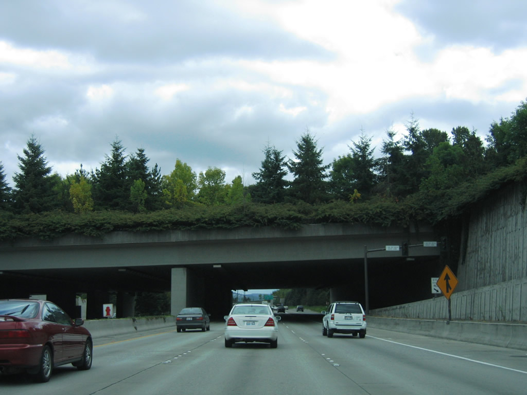
Interstate 90 eastbound reassurance marker posted on Mercer Island ahead of the Shorewood Drive lid.
08/29/06
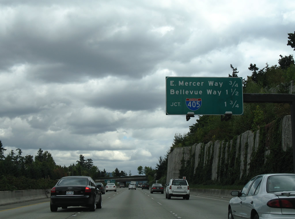
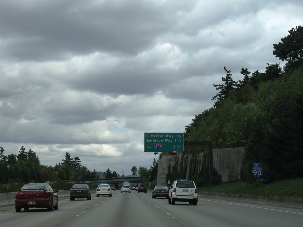
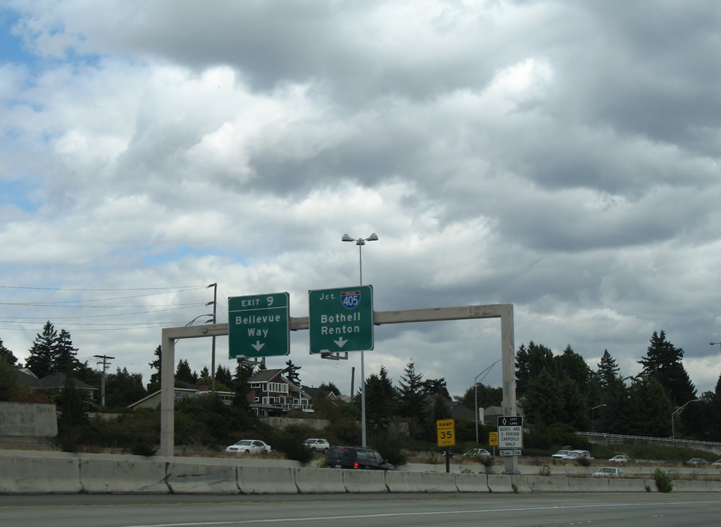
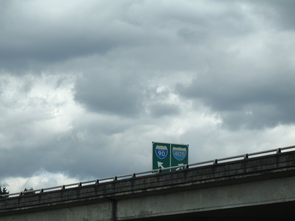
Interchange sequence sign listing the connections with E Mercer Way at Exit 8, Bellevue Way, where the Express Lanes used to end, and Interstate 405 at Exit 10 A.
08/29/06
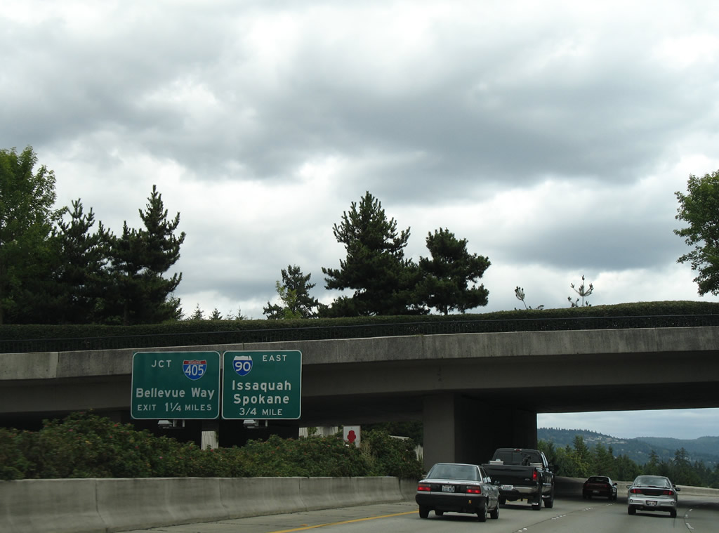
The Express Lanes continued across the East Channel bridge to separate ramps for the I-90 general travel lanes, I-405 and Bellevue Way north to Beaux Arts Village and the Bellevue city center.
08/29/06
N Mercer Way passes over Interstate 90 on the lid above Exit 8. The circumferential route leaves the north side of Mercer Island near Barnabie Point to become E Mercer Way at Exit 8.
08/29/06
The final Mercer Island lid supports East Mercer Way between SE 36th Street and SE 35th Place within the diamond interchange at Exit 8. Interstate 90 leaves the island ahead of Exit 9 to Bellevue Way. The multi level interchange at Exit 10A with I-405 follows in 0.75 miles.
08/29/06
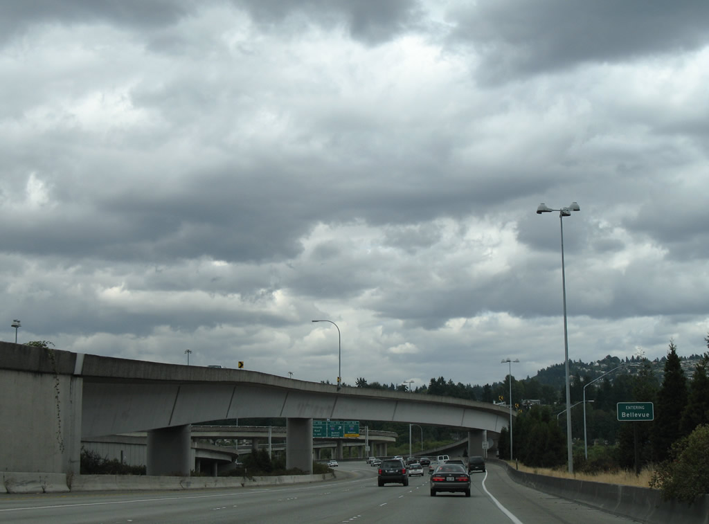
Exit 9 leaves Interstate 90 east for Bellevue Way north just beyond the East Channel Bridge on Lake Washington. Bellevue Way weaves northward to western reaches of the Bellevue city center from Mercer Slough.
08/29/06
The Express Lanes concluded at the partition into ramps for Bellevue Way north and a flyover for Exit 10 A to Interstate 405.
08/29/06
The directional T interchange with Bellevue Way north spreads across wetland areas at Mercer Slough.
08/29/06
Interstate 405 constitutes a 30 mile long urban loop between Renton and Lynnwood in Snohomish County. The freeway provides a direct route to Downtown Bellevue and Bothell to the north.
08/29/06
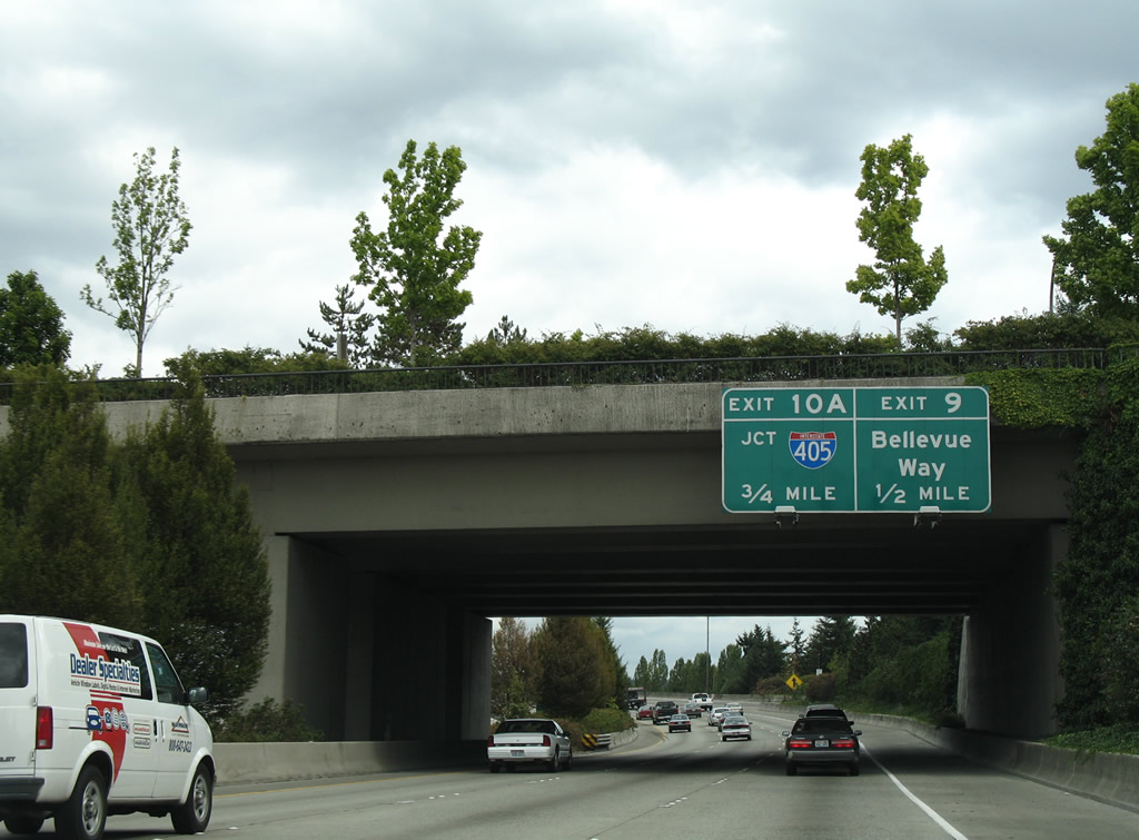
Bellevue Way south connects with both I-90 east and the ramps at Exit 10A for Interstate 405.
08/29/06
Removed button copy sign at the ramp split from Bellevue Way south to I-90 east and Interstate 405.
08/29/06
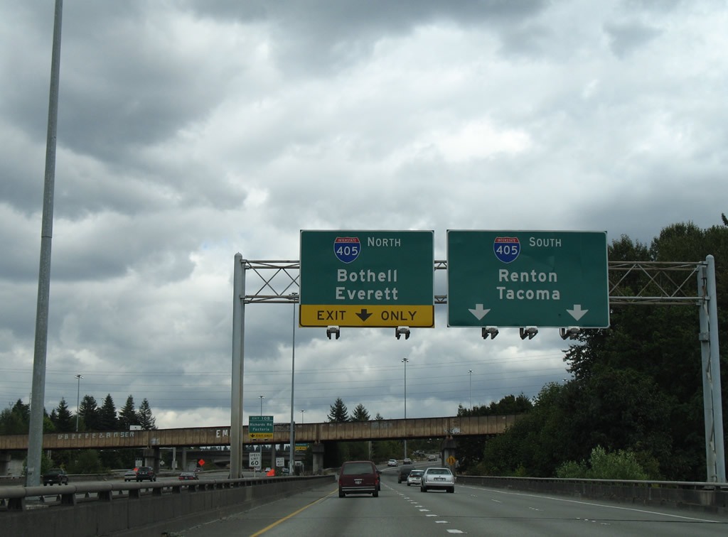
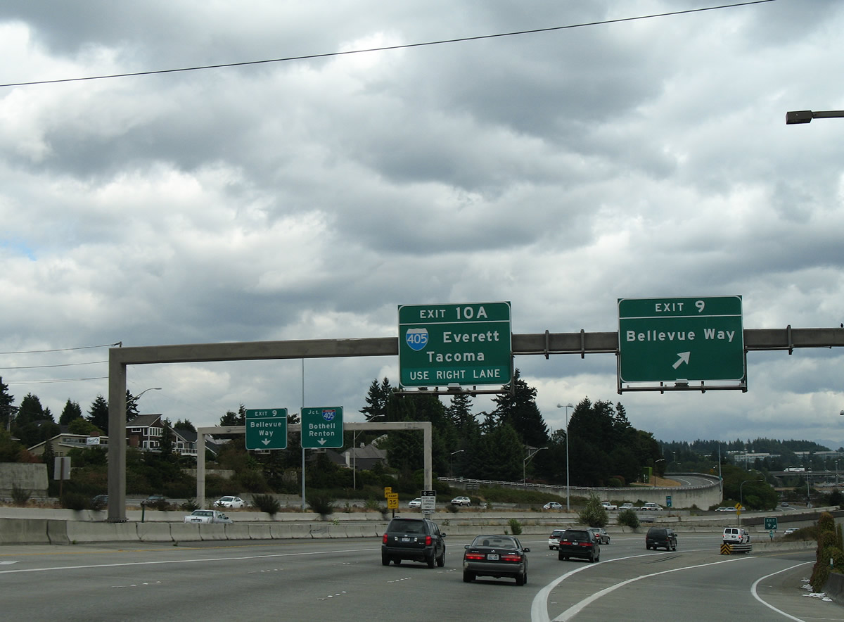
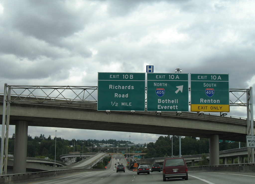
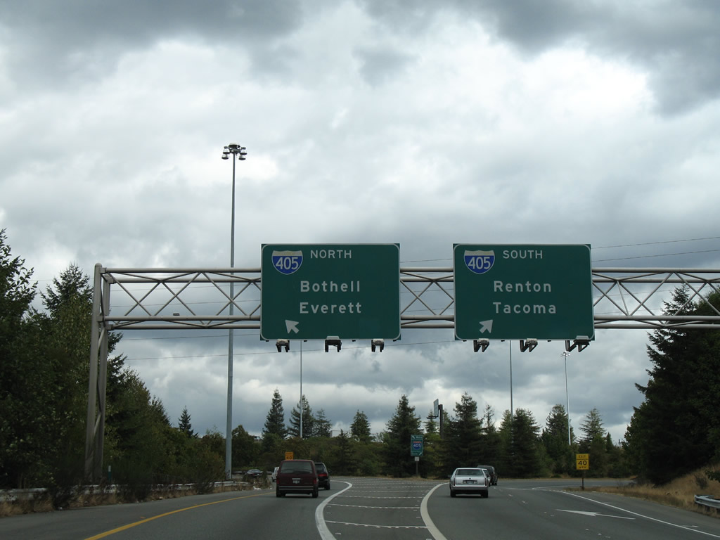
Exit 10 A separates for Interstate 405 south to Newcastle, Renton and Tacoma via I-5 south. The flyover for I-405 north leads to Kirkland and Everett via I-5 north.
08/29/06
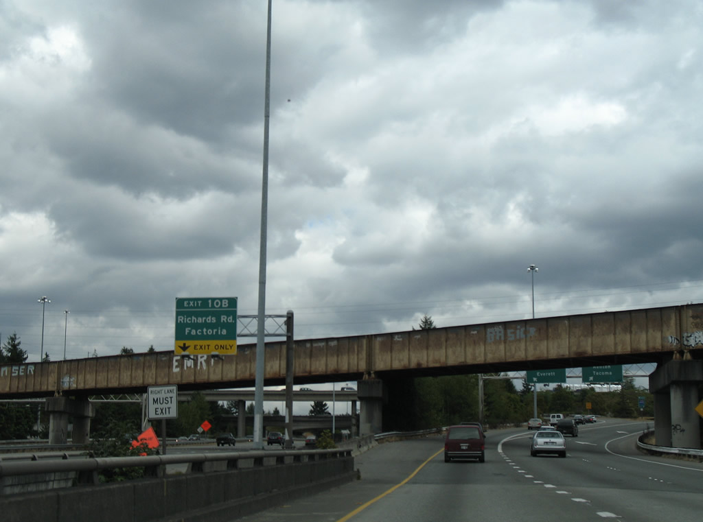
Exit 10 B leaves I-90 east from within the systems interchange at I-405 for SE 36th Street east at Richards Road SE north and Factoria Boulevard SE south. An abandoned BNSF Railroad line passes above the exchange here.
08/29/06
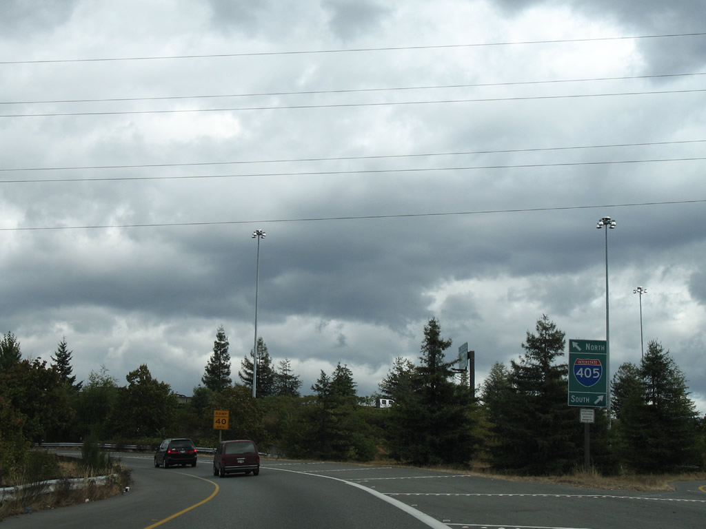
With ten overall lanes, I-405 north from I-90 leads to Downtown Bellevue. I-405 south connects with Coal Creek Parkway at Factoria and Newport Shores in south Bellevue.
08/29/06
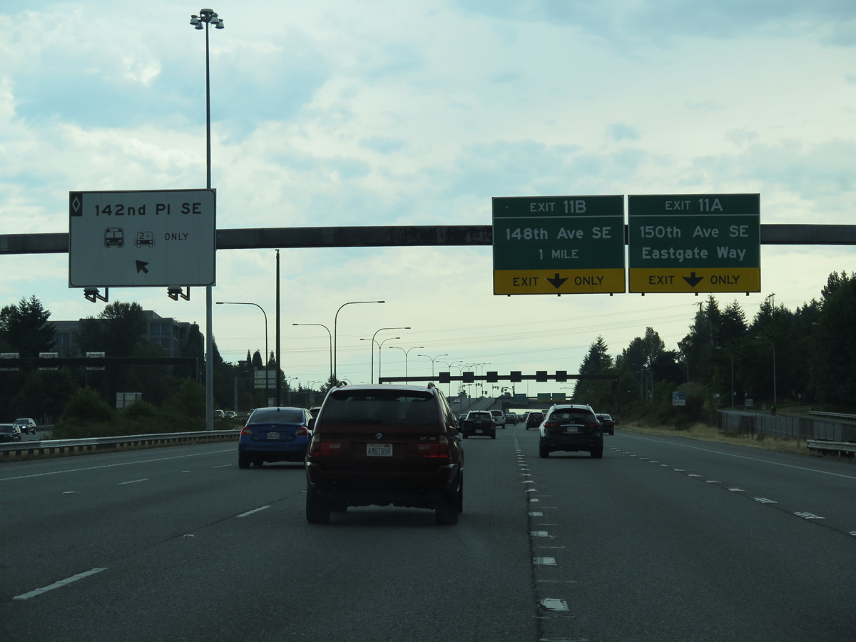
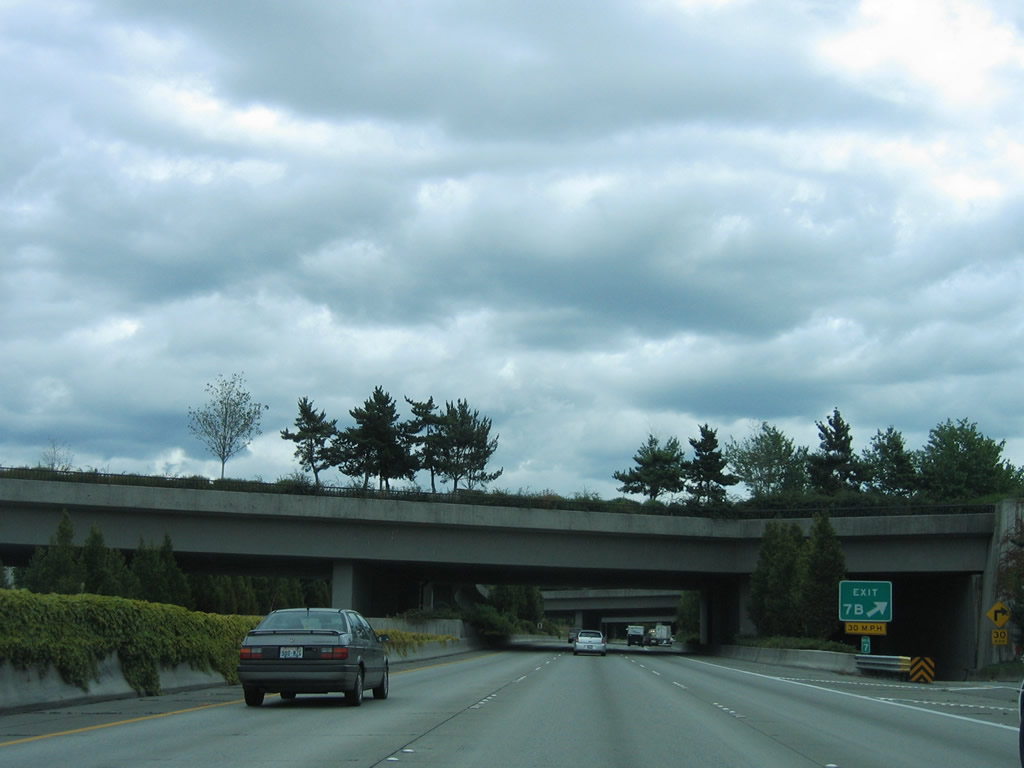
Interstate 90 next meets 150th Avenue SE south and 148th Avenue SE at Eastgate in Bellevue. Added after 2006, HOV ramps also connect I-90 with 142nd Place SE ahead of the cloverleaf interchange at Exit 11.
06/28/15
A c/d roadway for Exit 11 A separates from I-90 east at 142nd Place SE. Ramps follow to the intersection of SE 37th Street and 150th Avenue SE south and 150th Avenue SE northbound. 150th Avenue SE heads south toward the Hilltop and Somerset communities in south Bellevue.
08/31/06
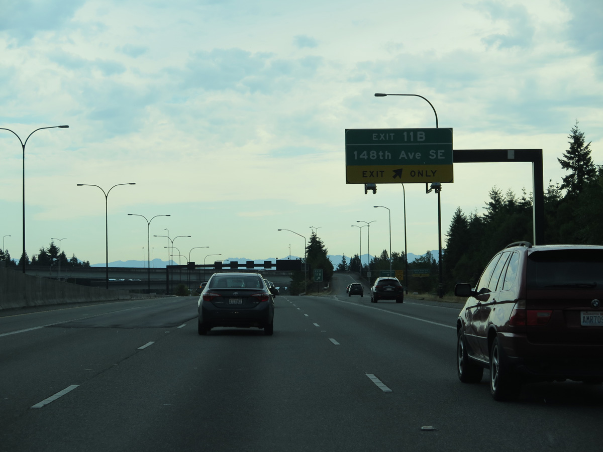
Exit 11 B is a wye interchange within the exchange at Exit 11 A directly linking Interstate 90 east with 148th Avenue SE north to Robinswood, Larsen Lake and SR 520 at the Redmond city line.
06/28/15
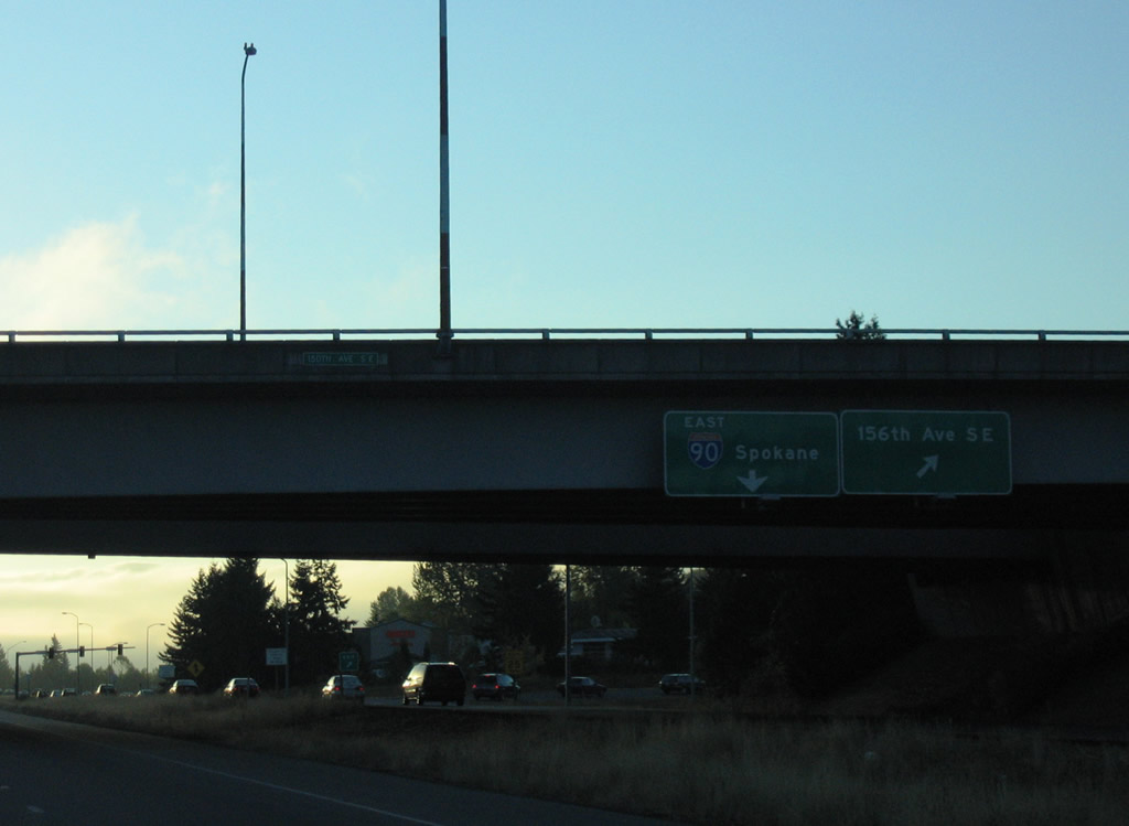
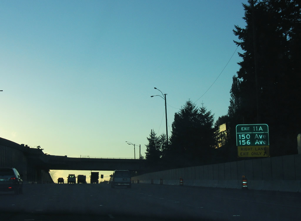
A loop ramp joins Exit 11 A onto 150th Avenue SE north to Eastgate Way and 148th Avenue SE north. SE 156th Avenue stems northeast from Eastgate Way to Phantom Lake and Crossroads in east Bellevue.
08/31/06
References:
- Washington State Route 900. Wikipedia.
- Mount Baker Tunnel. Wikipedia.
- Homer M. Hadley Memorial Bridge. Wikipedia.
- Lacey V. Murrow Memorial Bridge. Wikipedia.
Photo Credits:
- AARoads: 08/29/06
- Andy Field: 06/28/15
- AARoads, Chris Kalina: 08/31/06
Connect with:
Page Updated Monday July 10, 2023.