
Interstate 94 East - Hudson

 East
East
Immediately crossing the St. Croix River into Wisconsin Interstate 94 and U.S. 12 east encounter WIS 35 at Exit 1 and Hudson. The state trunk highway will run in tandem with I-94 and U.S. 12 for the next 2.6 miles before departing for River Falls and Prescott.
04/23/07
East  South
South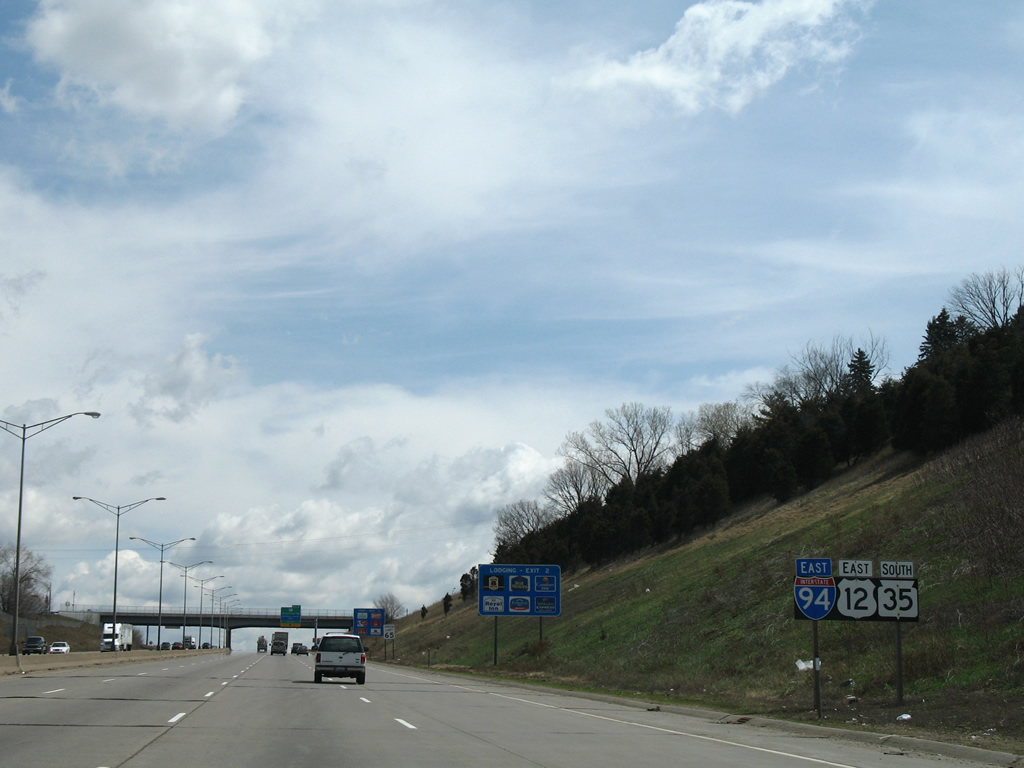
Interstate 94 traverses the state of Wisconsin along a 348.2 mile course to the Illinois line near the west shore of Lake Michigan. U.S. 12 totals 339.4 miles as it makes its way southeast through the Badger State. Representing the longest route in the state, Wis 35 trumps both routes by traveling just over 412 miles from the Illinois state line in the southwest corner of Wisconsin, northward parallel to the Mississippi and St. Croix rivers to I-535 and U.S. 53 in Superior.
04/23/07
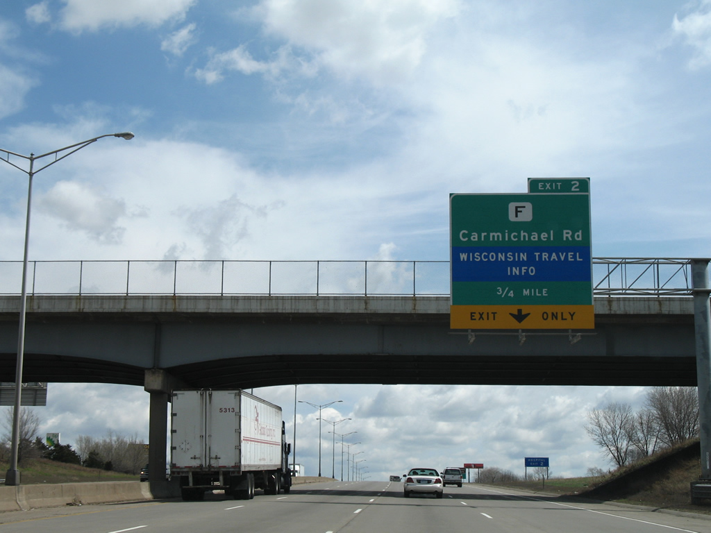
The concurrent highways approach Carmichael Road (Exit 2) in 0.75 miles. A traveler information center lies to the southwest of the diamond interchange along Crest View Drive.
04/23/07
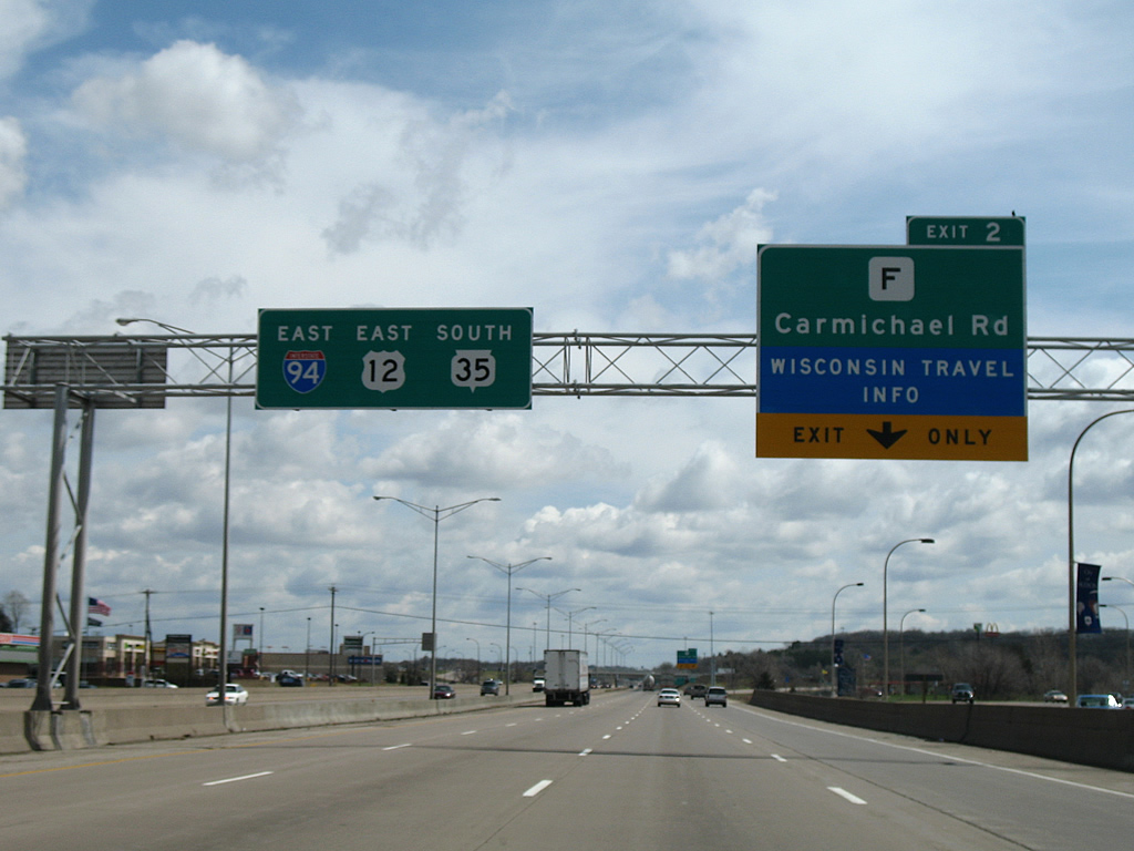
Carmichael Road (County F) stems south from the freeway toward Kinnickinnic State Park and Prescott, both situated along the St. Croix River in adjoining Pierce County. Carmichael Road continues north from Exit 2 bordering Hudson before turning east toward County U in the vicinity of U.S. 12.
04/23/07
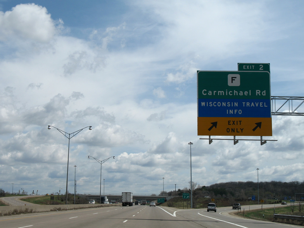
Dual lanes depart for Carmichael Road (County F). Commercial centers line both sides of the arterial route by the exchange with I-94/U.S. 12.
04/23/07
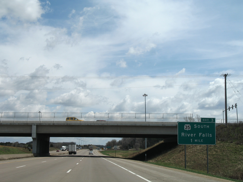
The concurrency of Interstate 94, U.S. 12, and WIS 35 concludes in one mile as the state trunk highway resumes its southerly track through the west central part of Wisconsin.
04/23/07
Confirming markers posted beyond the Carmichael Road entrance ramp at Exit 2.
04/23/07
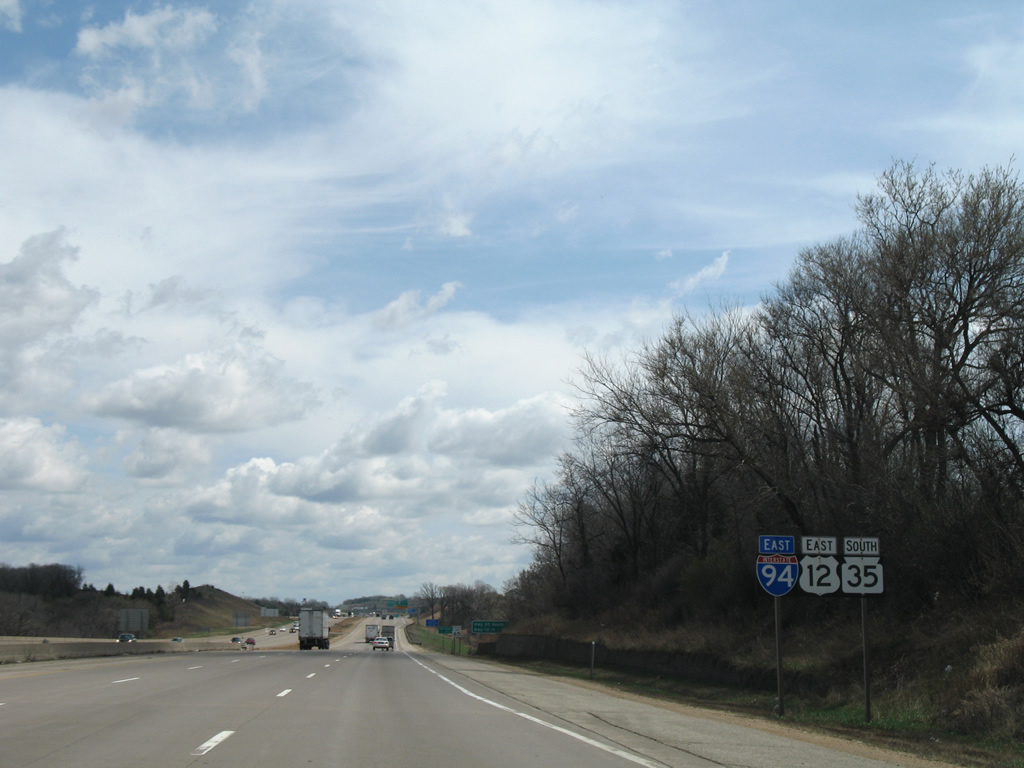
Interstate 94 continues alone beyond the succeeding separations with Wis 35 and U.S. 12 over the next 1.75 miles.
04/23/07
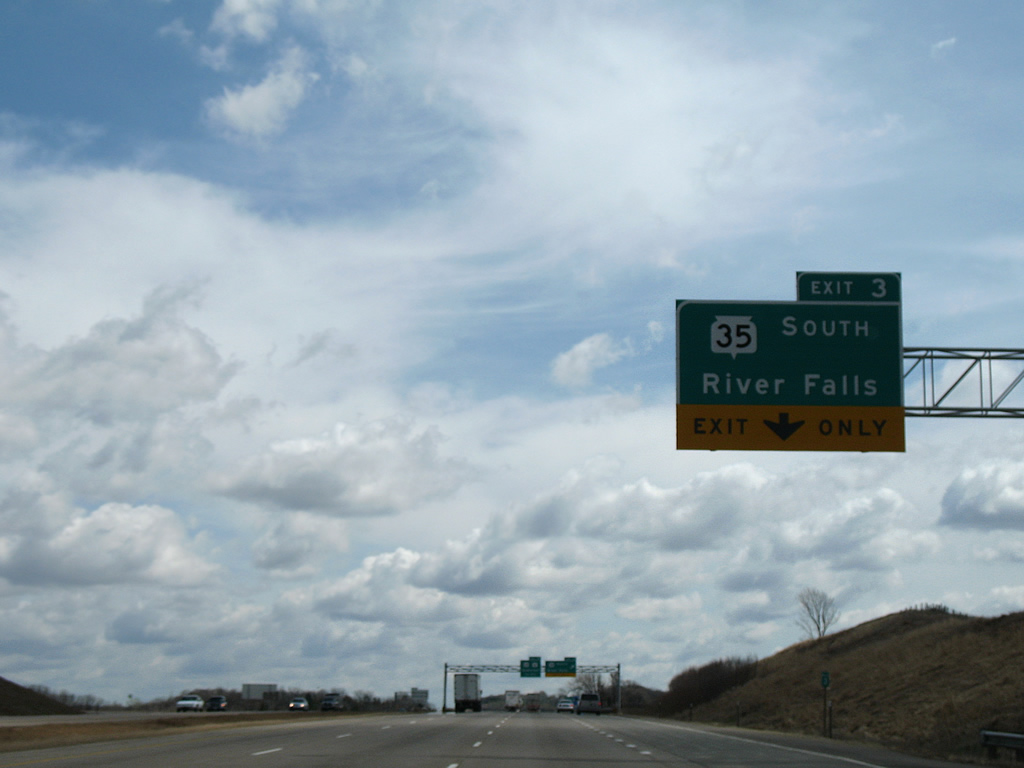
STH 35 parts ways with I-94 south toward River Falls in a half mile. A 2.5 mile freeway segment opened in the late 1990's, realigning the state trunk highway west of its former alignment. Wis 35 meets I-94 and U.S. 12 at a modified trumpet interchange located just west of its previous footprint.
04/23/07
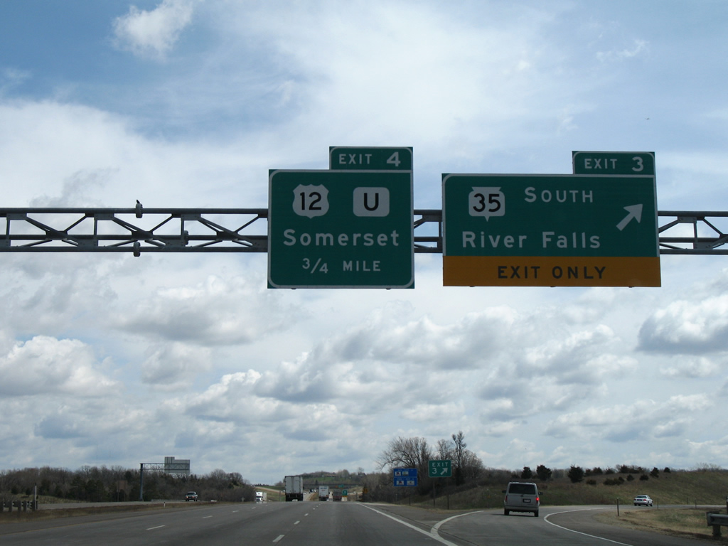
Travelers depart for Wis 35 south (Exit 3) to River Falls and beyond. The city of 15,000 (2010 census) is situated 8.3 miles southeast of I-94 and U.S. 12. The U.S. highway will also depart in 0.75 miles.
04/23/07
East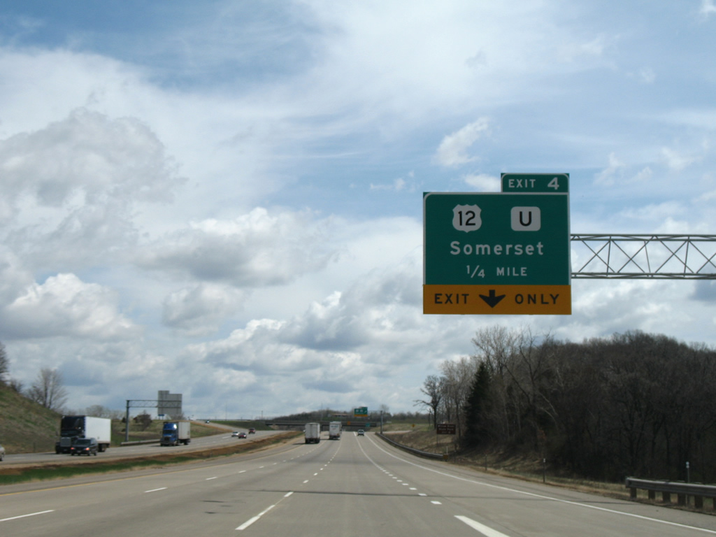
U.S. 12 east splits with Interstate 94 at Exit 4. County U stems 0.2 miles south to intersect County N while U.S. 12 shoots north 1.7 miles before turning east toward Roberts and Hammond.
04/23/07
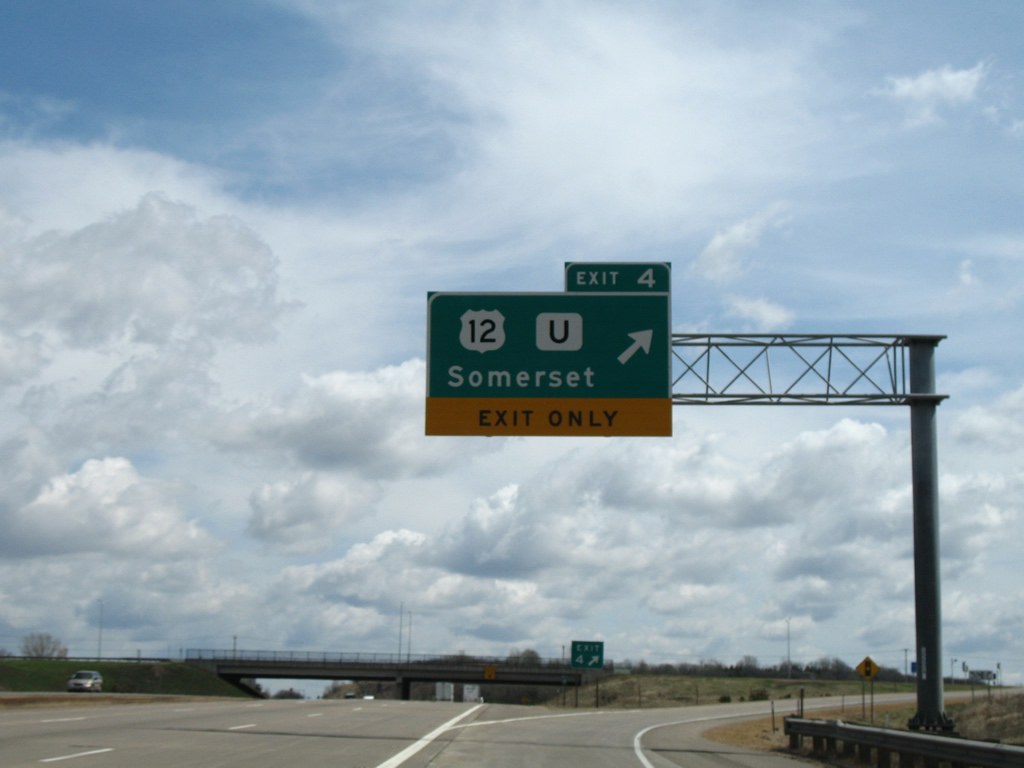
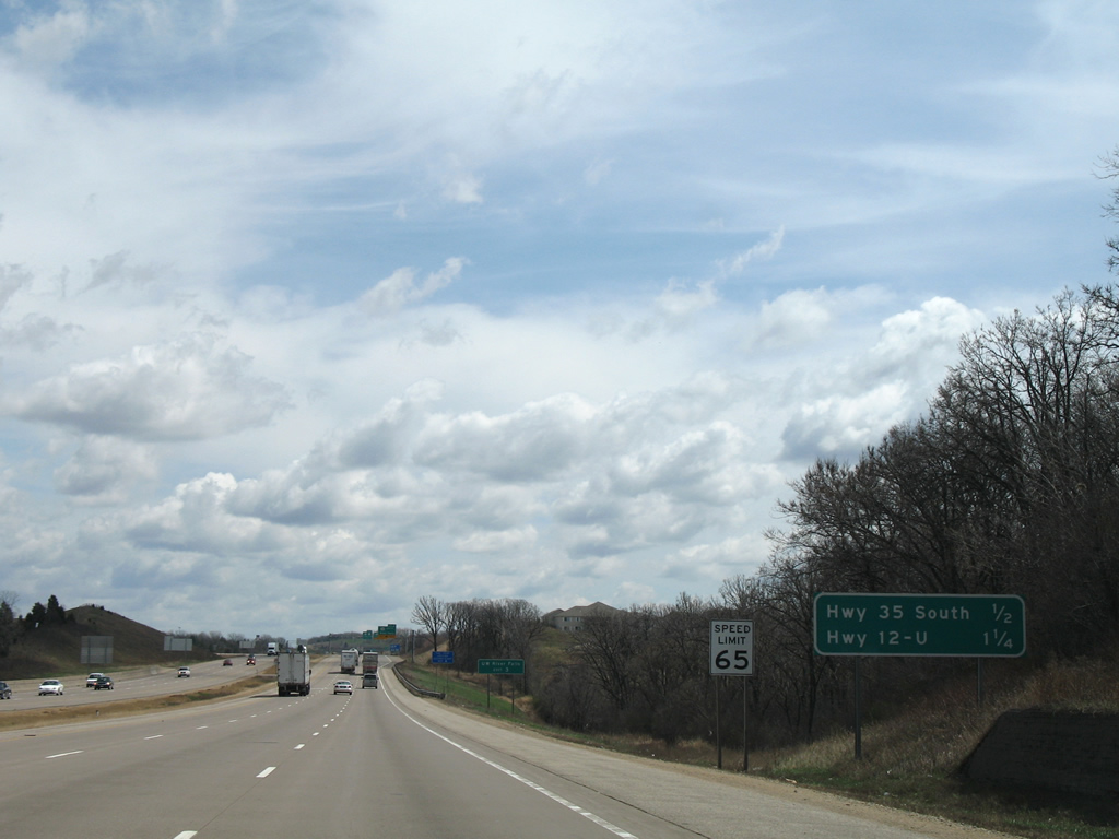
U.S. 12 parallels I-94 to the north for 41.1 miles east to Menomonie where the two highways swap positions. Willow River State Park is reached via U.S. 12 east, County U and County A north. Interstate 94 advances 142 miles east to the merge with transcontinental I-90 near Tomah.
04/23/07

Photo Credits:
- Alex Nitzman: 04/23/07
Connect with:
Page Updated Wednesday April 04, 2012.