
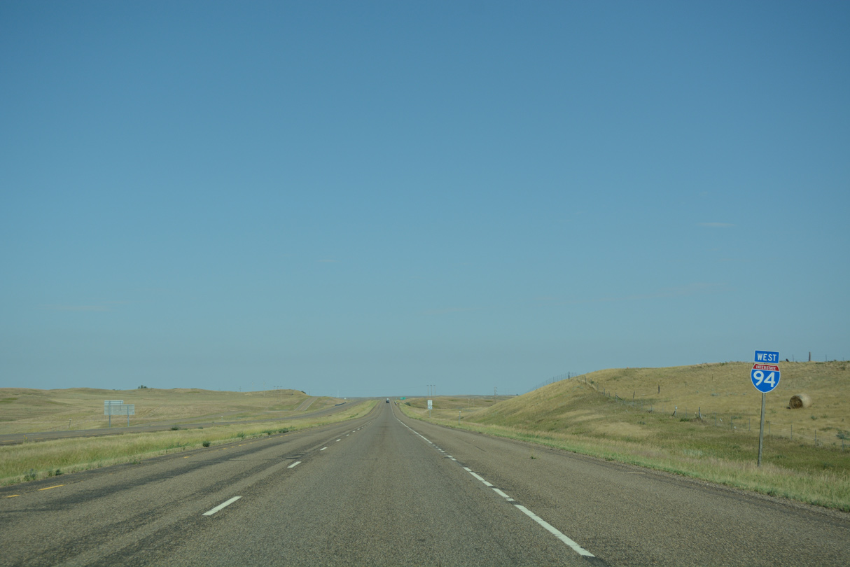
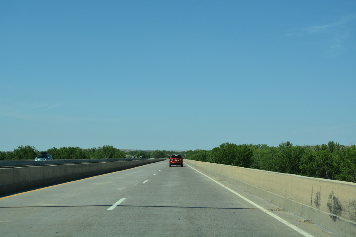
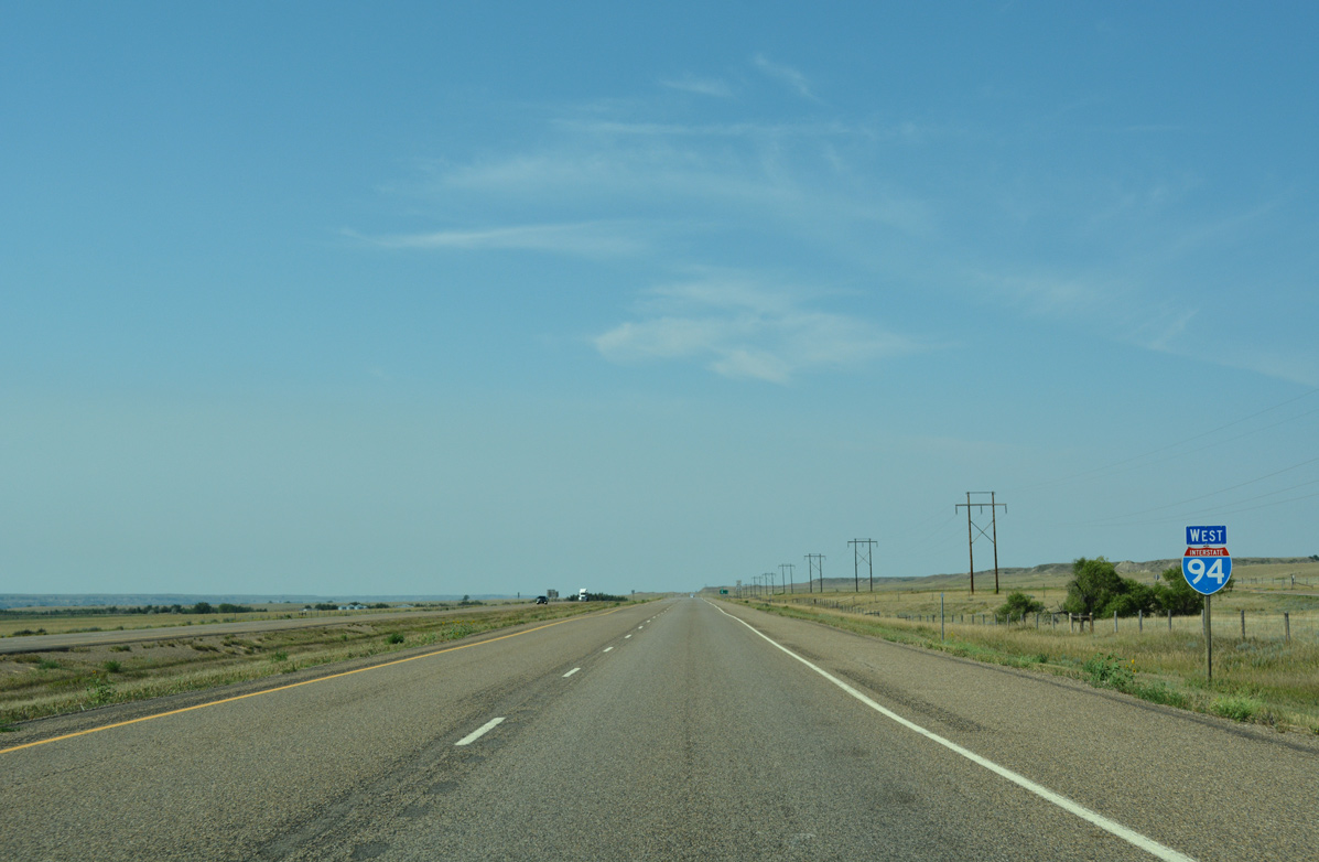
Interstate 94 West - Wibaux & Dawson Counties
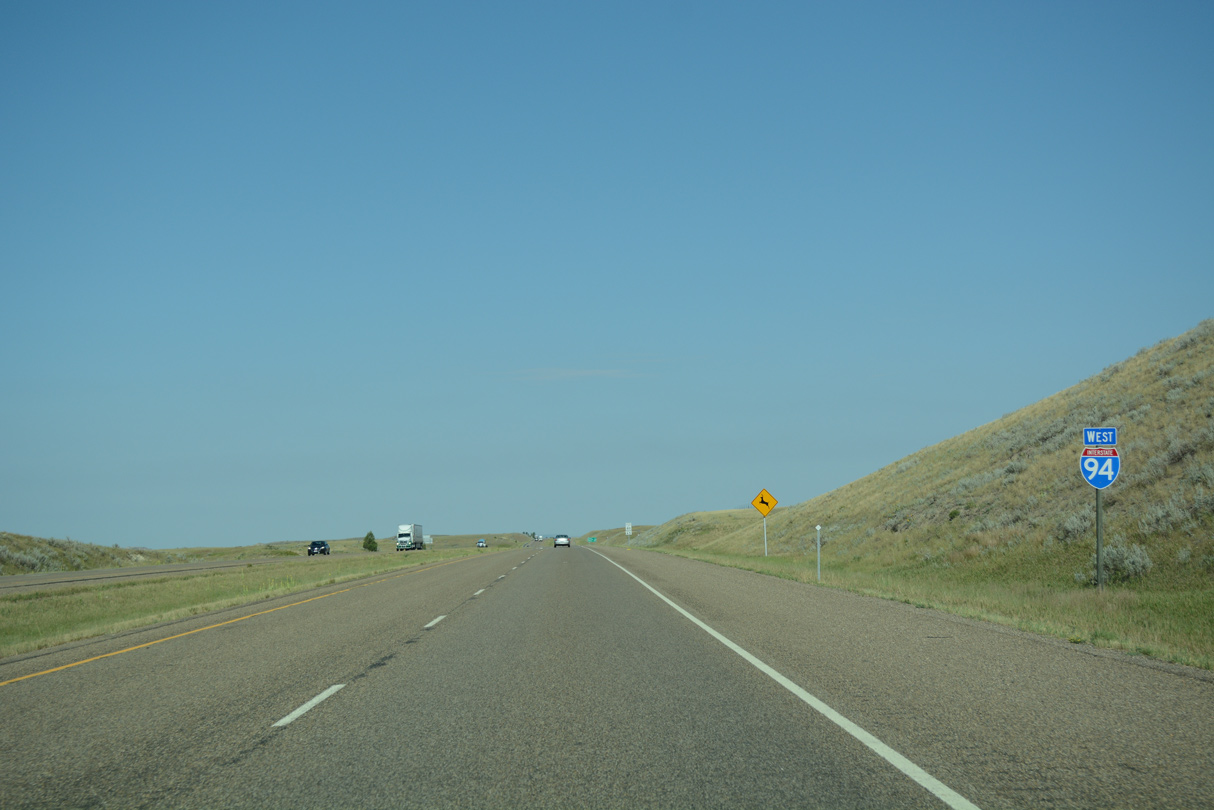
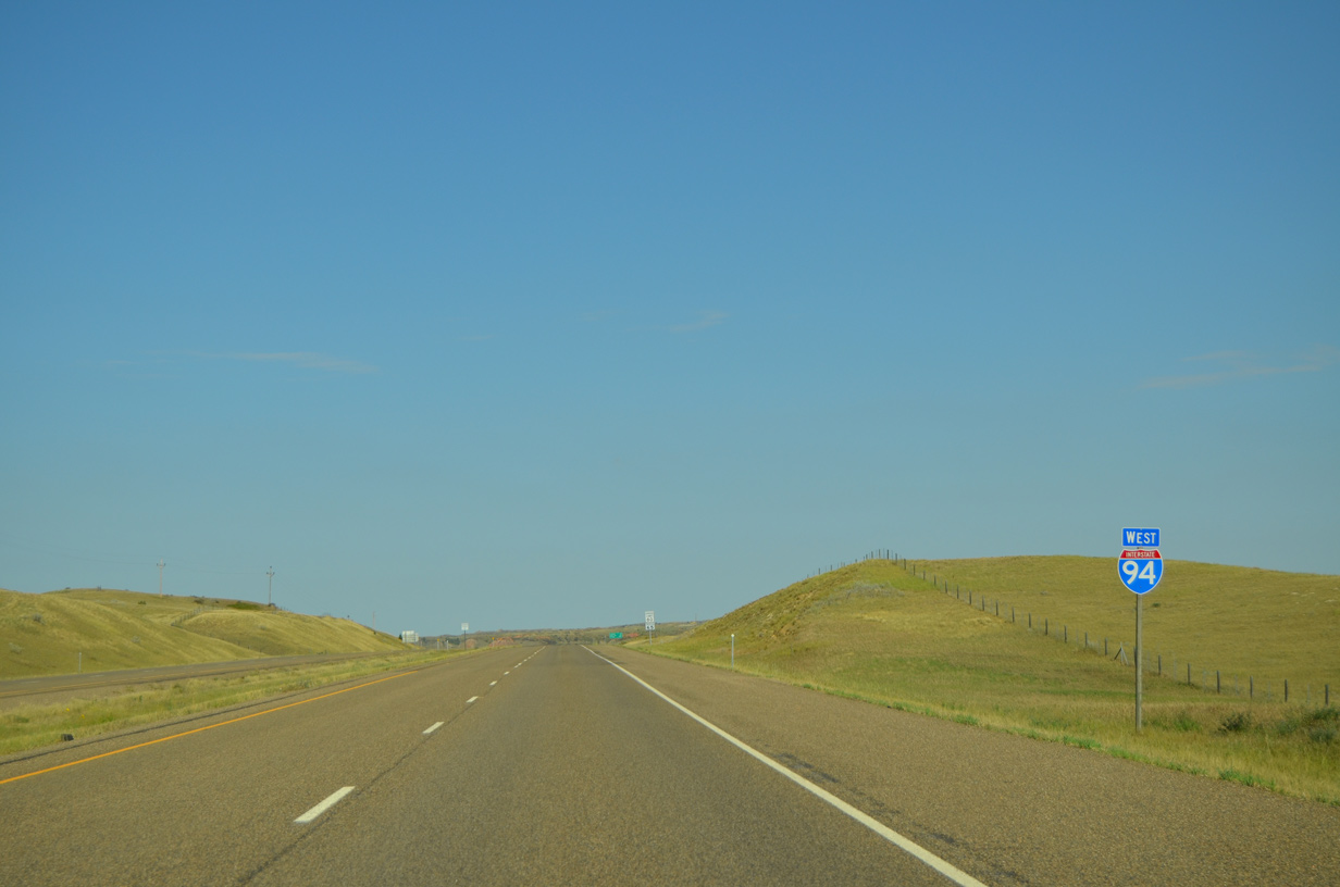
 West
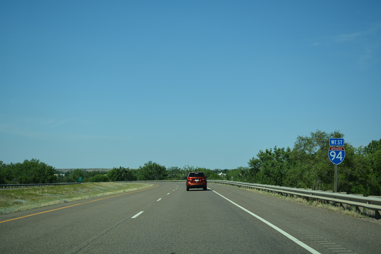
West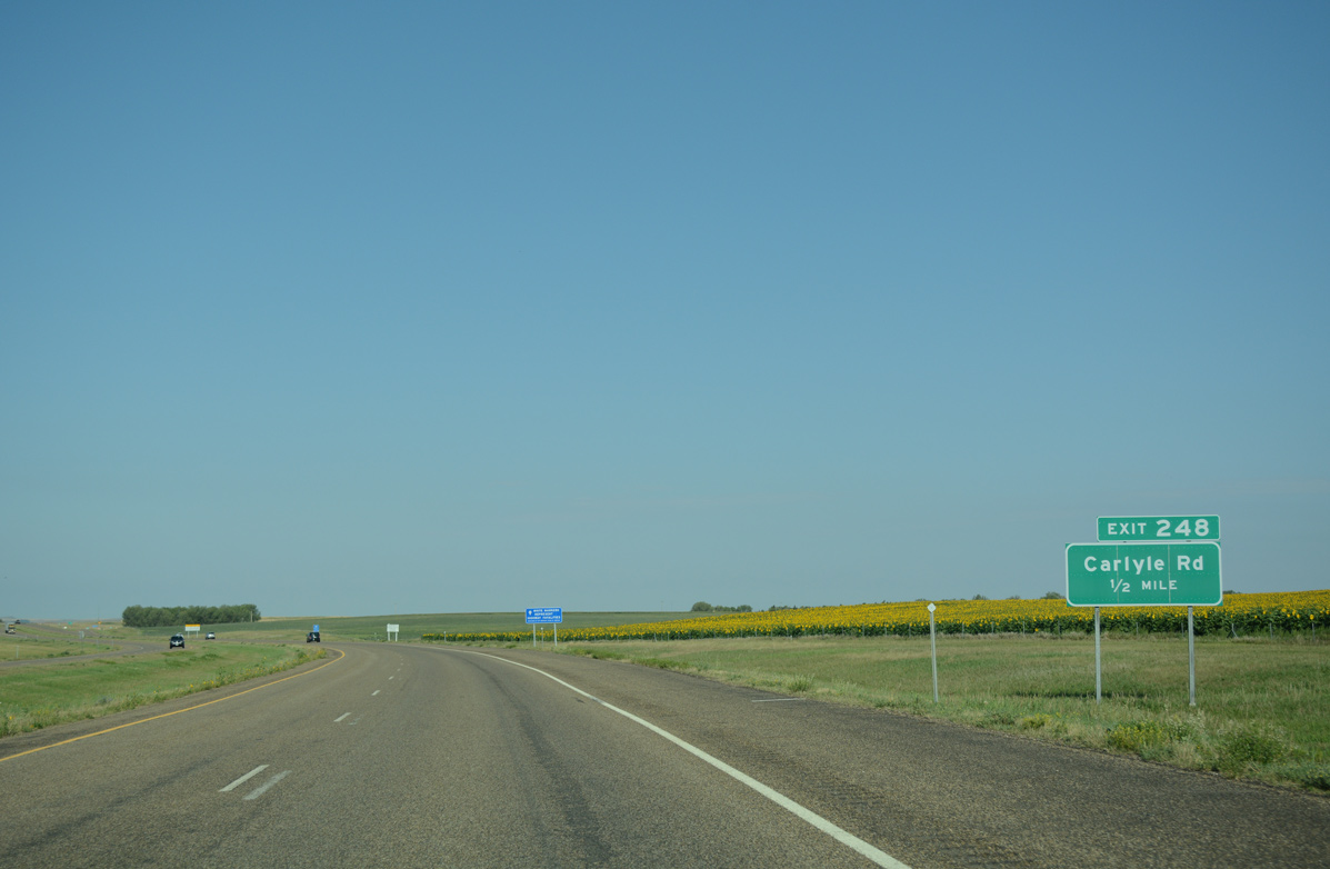
Interstate 94 crosses paths with Carlyle Road a half mile beyond the North Dakota state line at a diamond interchange (Exit 248).
08/07/16
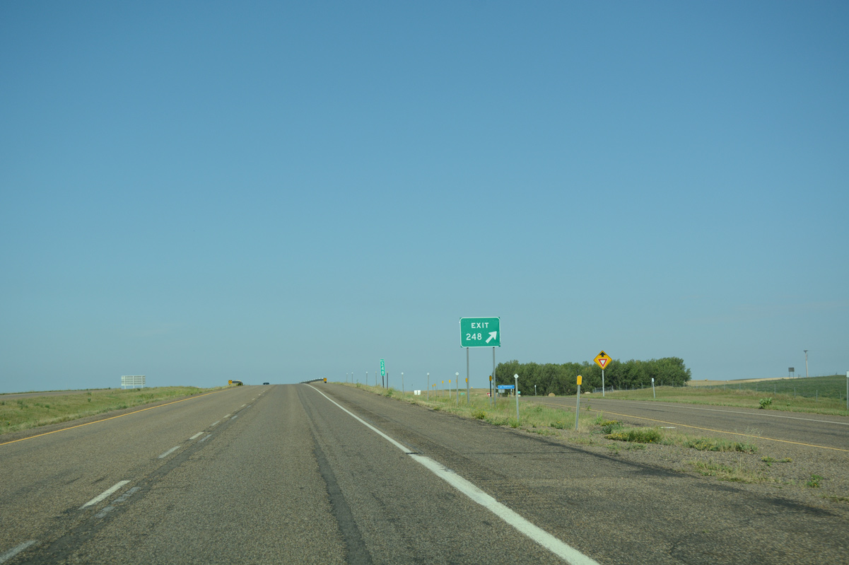
Ranch road exits in Montana are generally signed with just one advance sign. Pictured here is the Exit 248 gore point for Carlyle Road, an unpaved road heading south to the settlement of Carlyle in southeast Wibaux County.
08/07/16
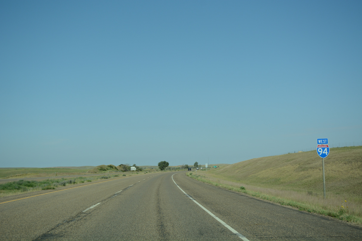
The first confirming marker for Interstate 94 west posted in the Glacier State.
08/07/16
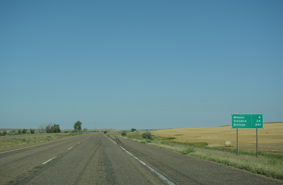
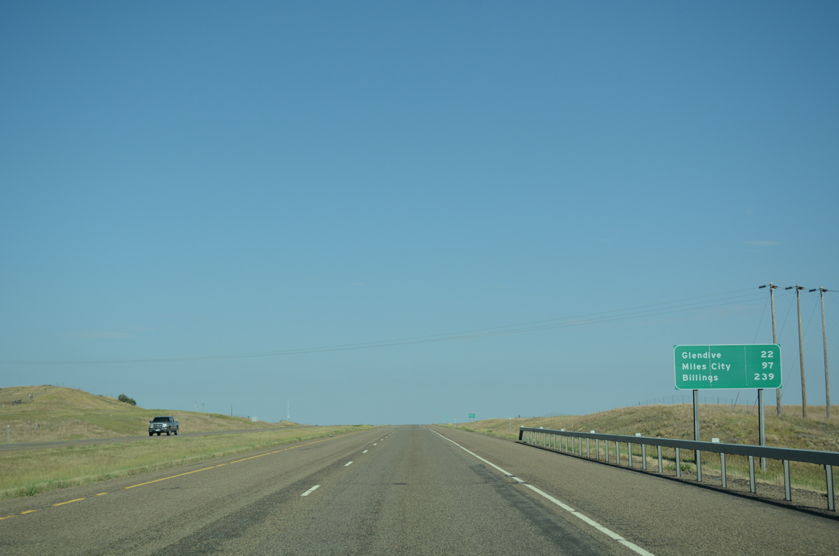
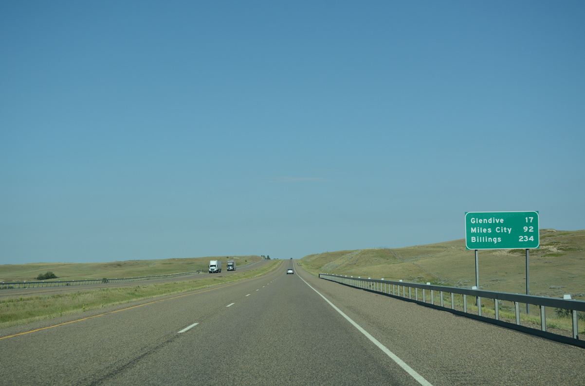
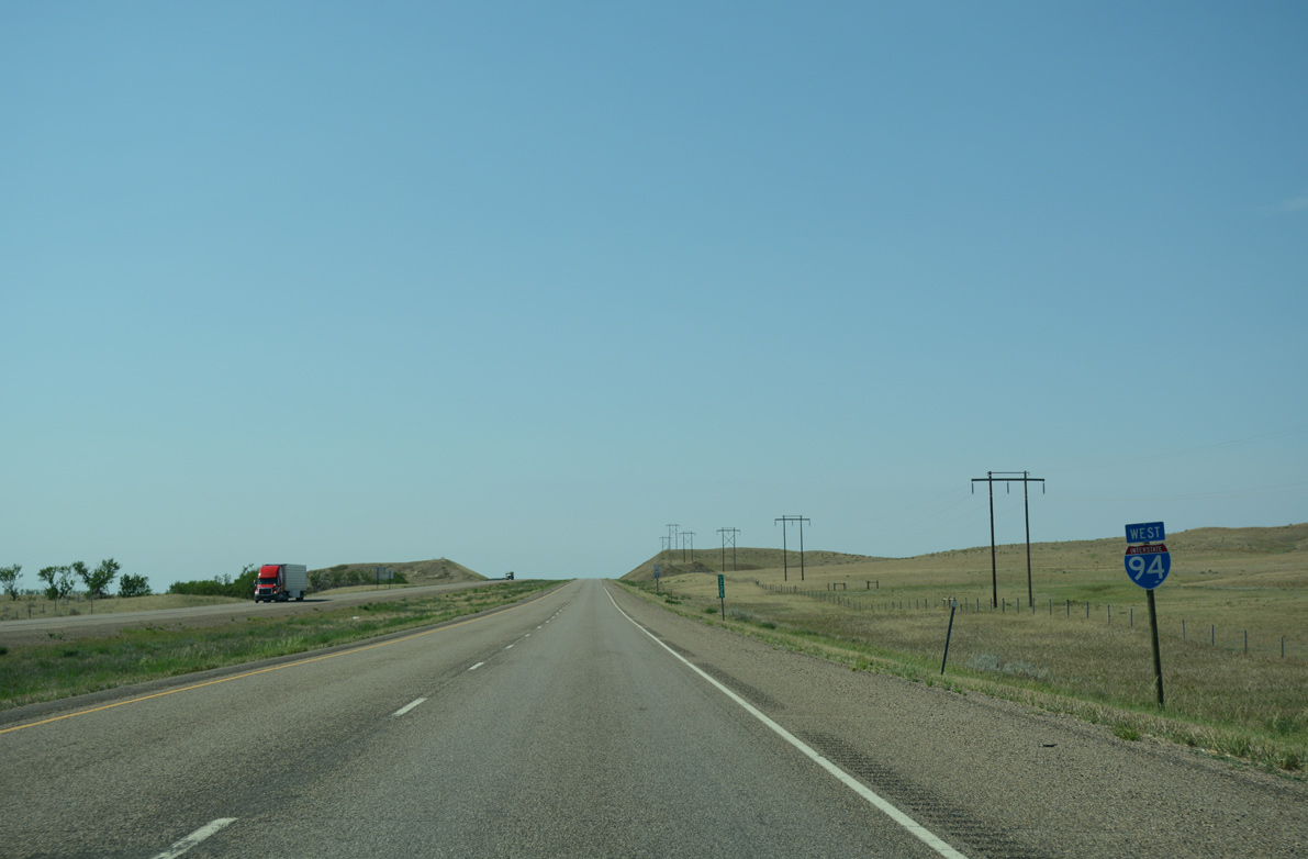
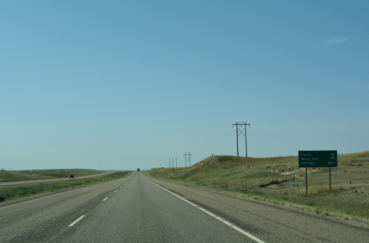
The Wibaux County seat of Wibaux lies six miles ahead. Glendive follows in a half hour, while Billings is 251 miles away beyond the west end of Interstate 94.
08/07/16
A BNSF Railroad parallels the west side of I-94 on the northwesterly turn alongside Yates Creek.
08/07/16
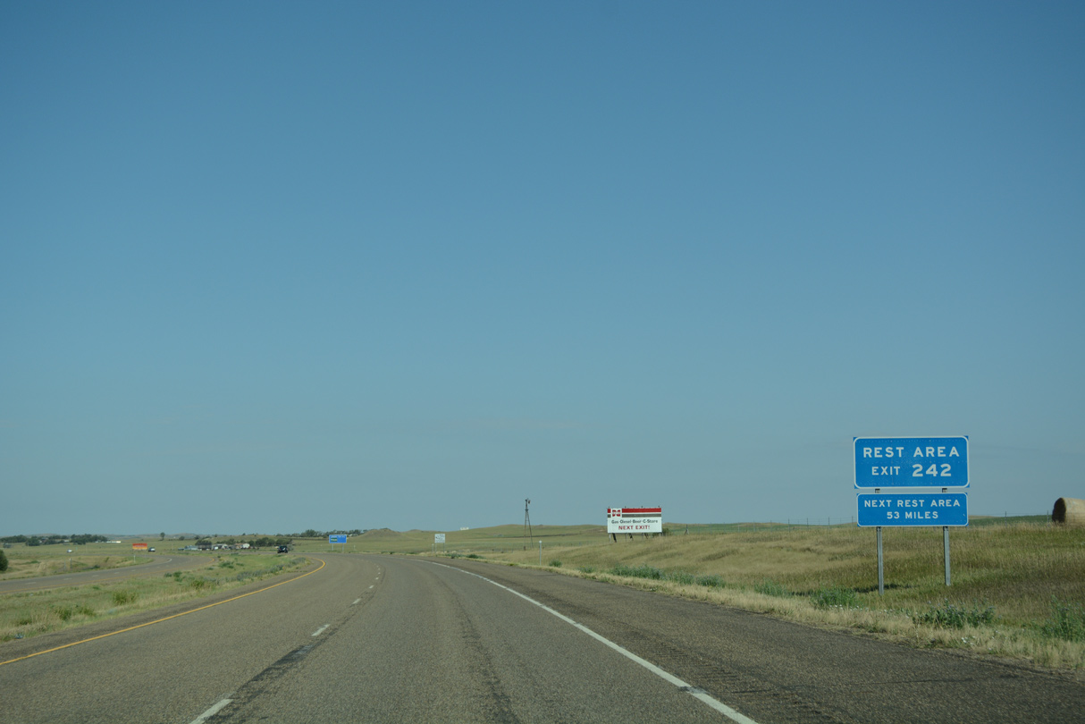
A rest area lies just off the freeway at the forthcoming split diamond interchange (Exit 242) with Montana 7 in Wibaux.
08/07/16
Montana 7 commences a 80.6 mile route south from Interstate 94 at Exit 242. The state highway travels to Montana Secondary 323 in the Carter County seat of Ekalaka.
08/07/16
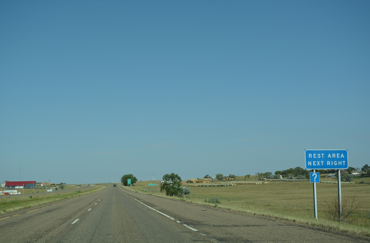
Montana 7 overtakes 2nd Avenue NE (old U.S. 10) west from Exit 242 to the Montana rest area and Wibaux Street, where it turns south through the town center.
08/07/16
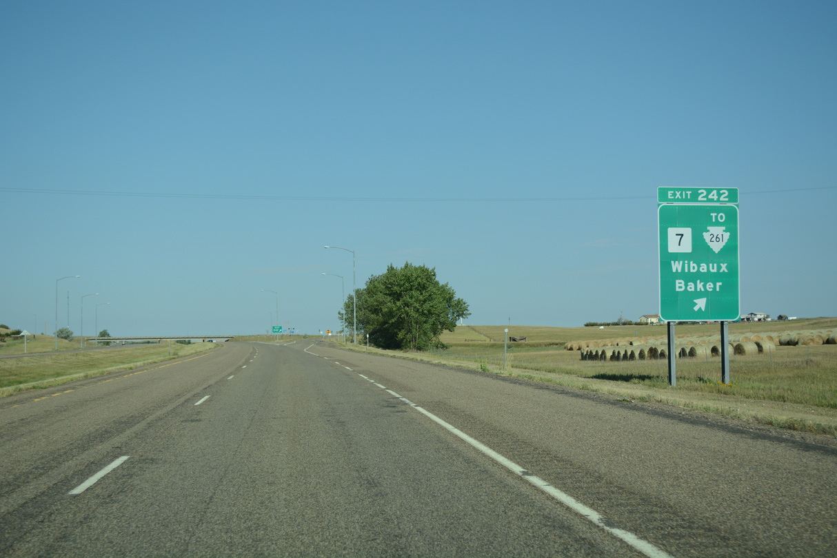
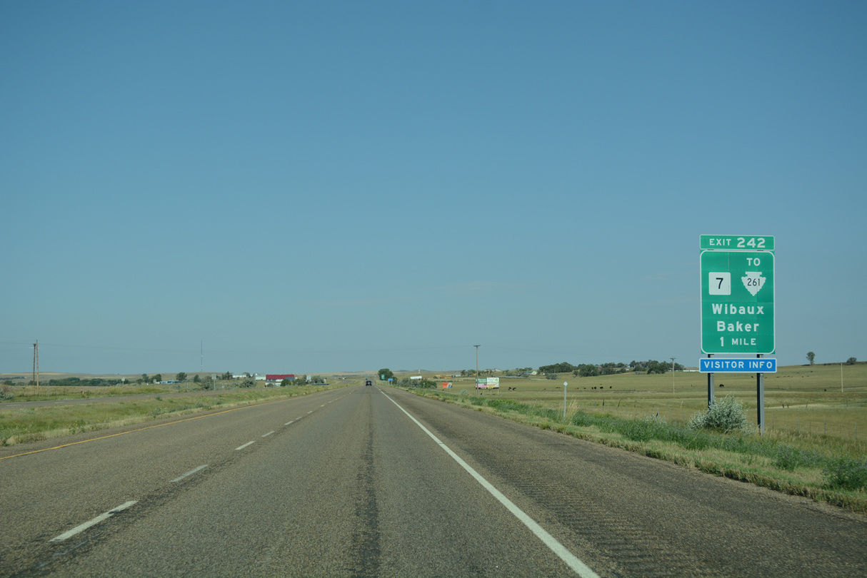
Exit 242 departs Interstate 94 west for Montana 7 south to the Fallon Seat of Baker, where it intersects U.S. 12. Montana Secondary 261 stems 51.7 miles north from Wibaux to MT 23 near the MT 200 corridor and the city of Sidney.
08/07/16
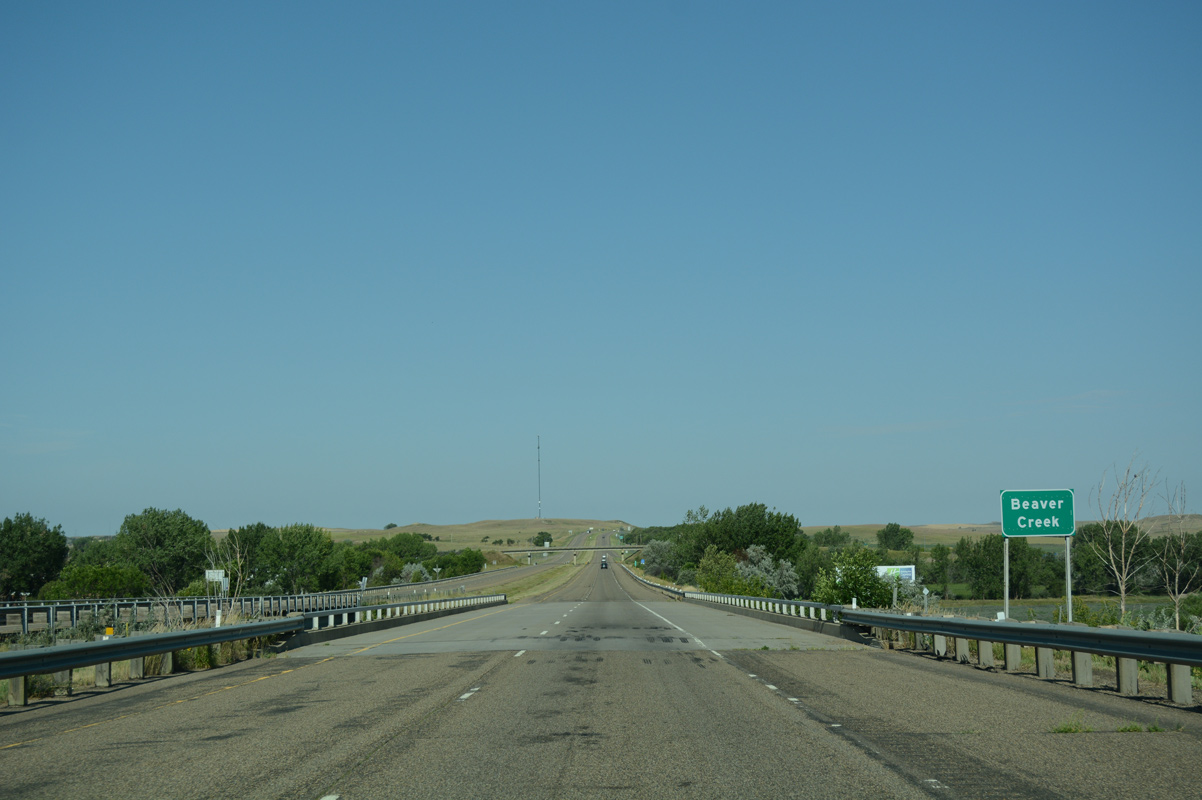
Interstate 94 crosses Beaver Creek midway between the MT 7 and MT 261 overpasses in Wibaux. The parallel alignment of 2nd Avenue NE / NW (old U.S. 10) was formerly posted as Business Loop I-94.
08/07/16
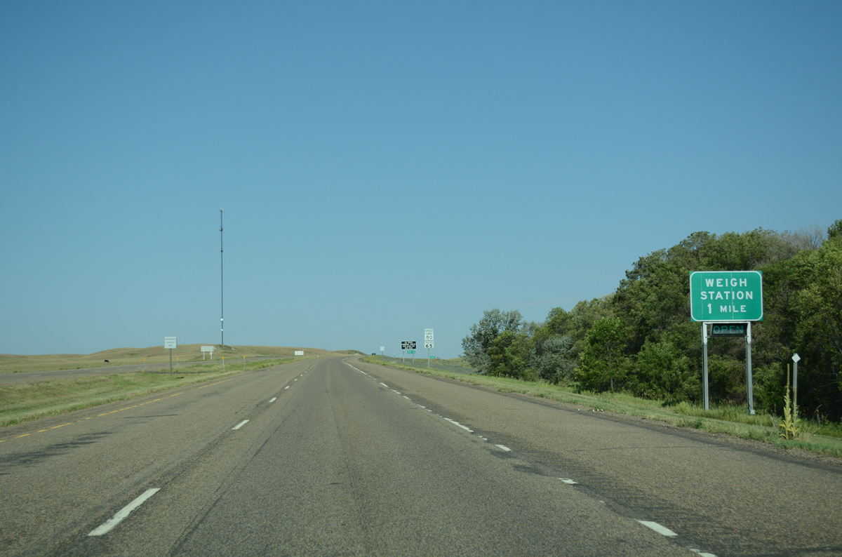
Leaving the Wibaux town limits, drivers along I-94 next approach a westbound weigh station.
08/07/16
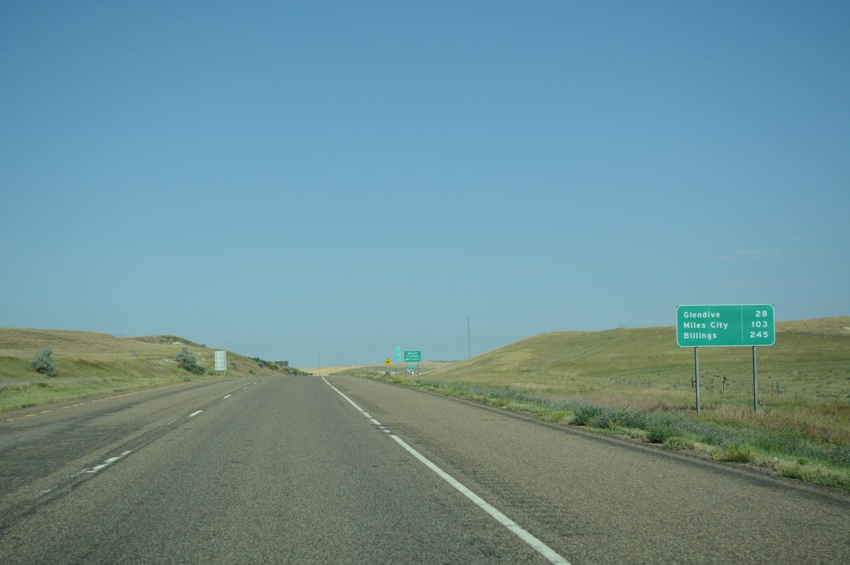
Glendive, a community of over 5,000, is now 28 miles to the west, followed by Miles City in 103 miles.
08/07/16

Interstate 94 directly overlaid the original alignment of U.S. 10 northwest from Wibaux and by the westbound weigh station.
08/07/16
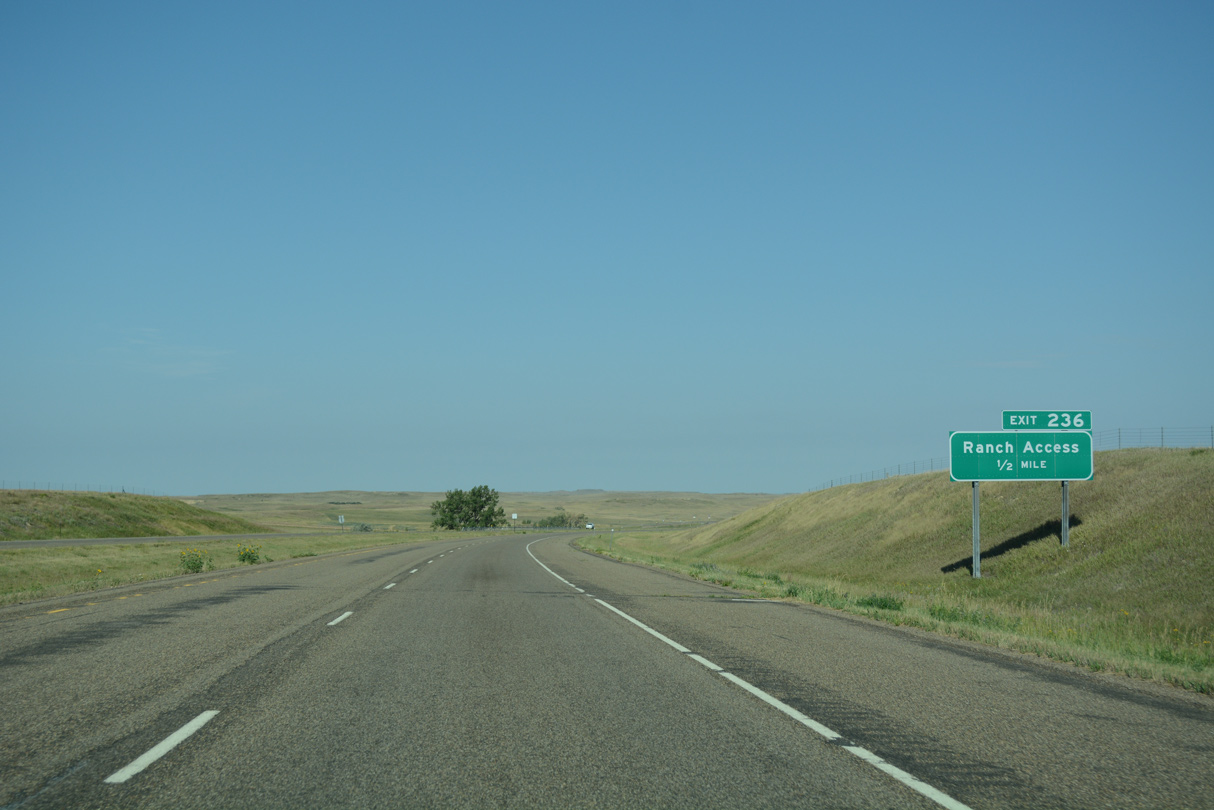
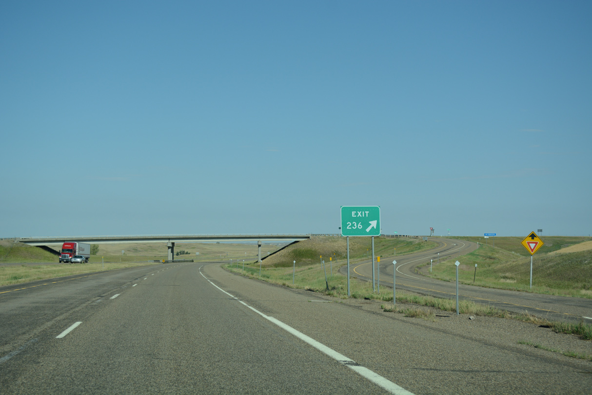
A diamond interchange connects Interstate 94 with ranch areas at Exit 236.
08/07/16
County Highway heads south from Exit 236 while Road 106 parallels I-94 west as old U.S. 10 into Dawson County.
08/07/16
Interstate 94 again turns to the northwest, to eventually run alongside Krug Creek.
08/07/16
Advancing west, Glendive is 22 miles away, followed by Miles City in 97 miles. Billings is now around three hours away.
08/07/16
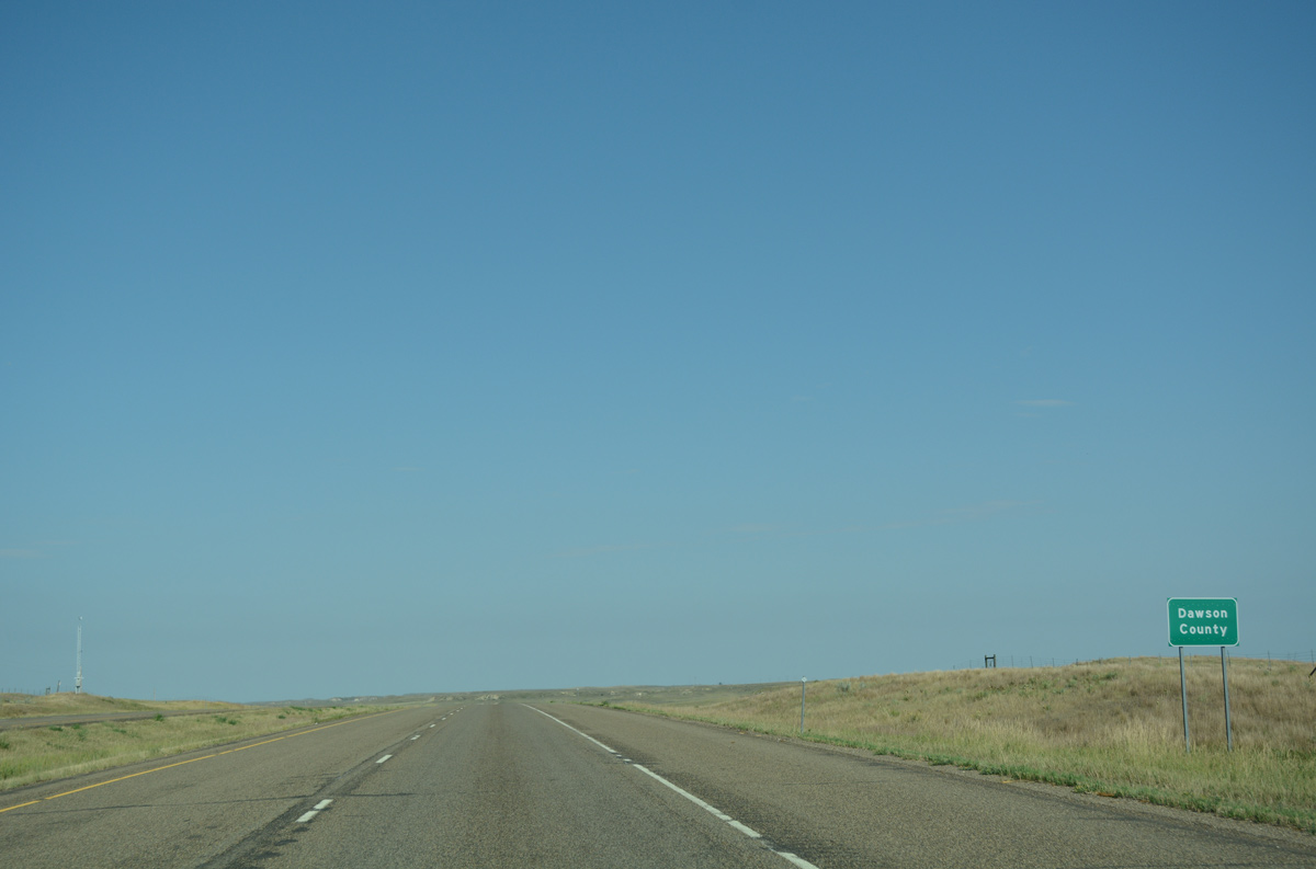
Travelers cross the Dawson County line a mile west from Exit 236.
08/07/16
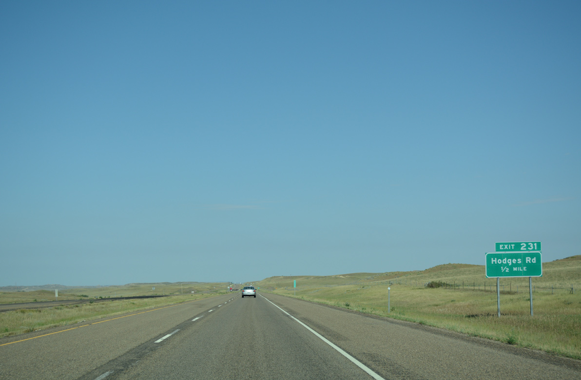
A rural diamond interchange (Exit 231) joins I-94 with ranch areas via Hodges Road in a half mile.
08/07/16
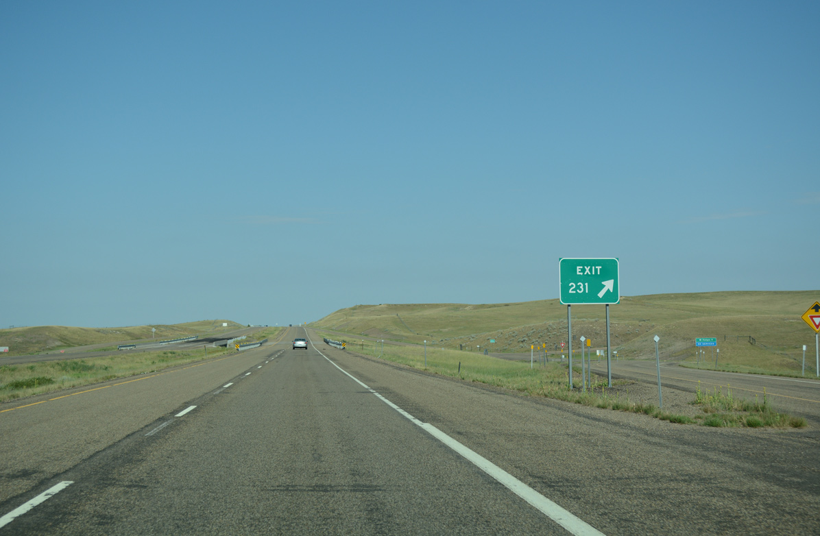
Hodges Road meanders south from Exit 231 to the BNSF Railroad siding of Hodges.
08/07/16
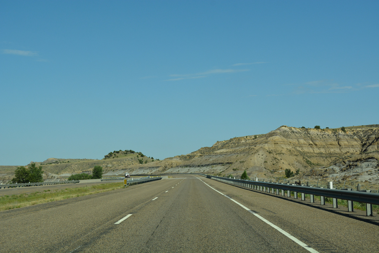
Interstate 94 traverses an array of hills rising north of Krug Creek and old U.S. 10.
08/07/16
The Dawson County seat of Glendive lies two exits ahead in 17 miles. Miles City follows in another hour.
08/07/16
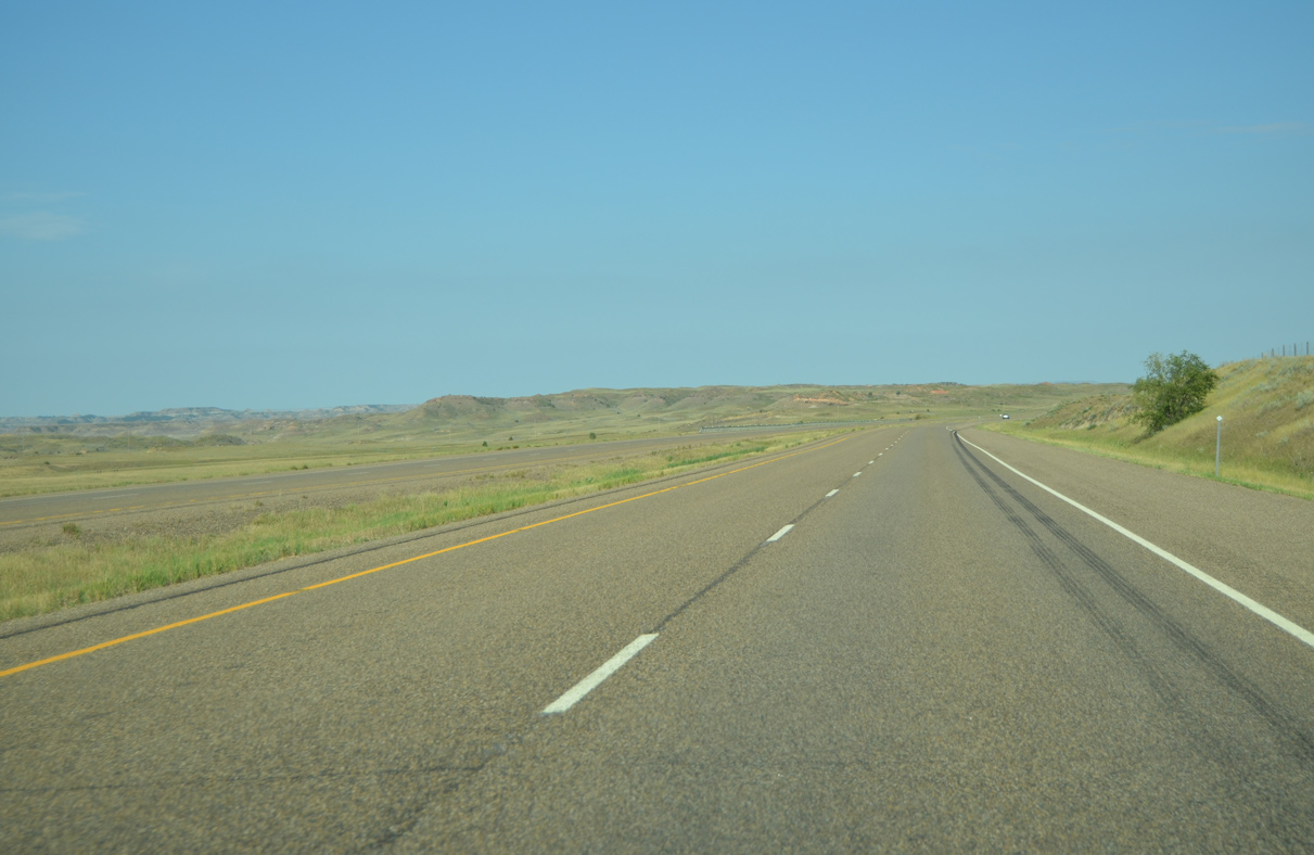
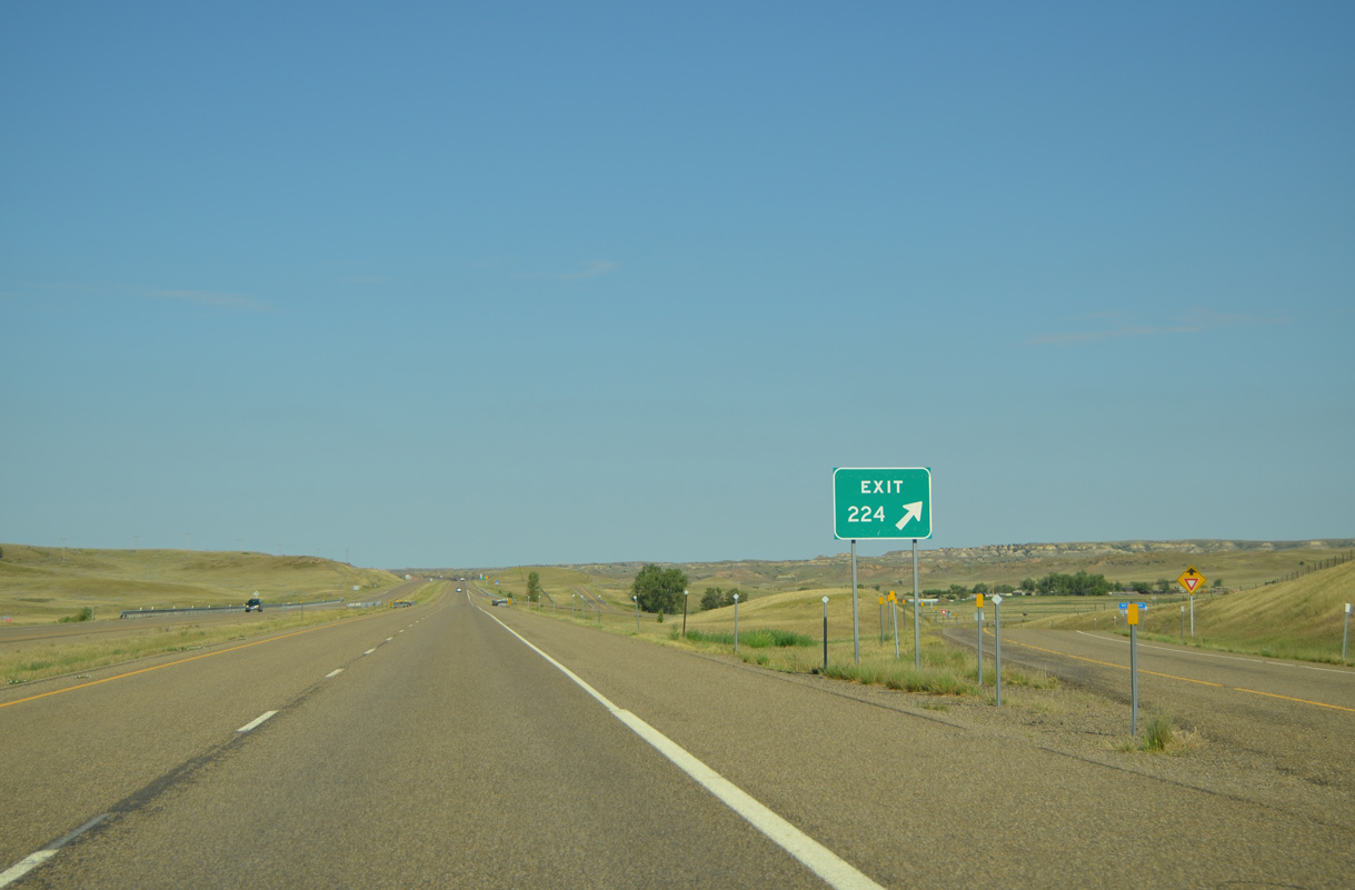
An abandoned rest area lines the north side of Interstate 94 near this scene preceding Exit 224.
08/07/16
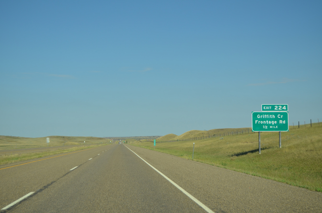
Old U.S. 10 ties into I-94 at the upcoming diamond interchange (Exit 224).
08/07/16
A north side Frontage Road accompanies I-94 west from Exit 224 to end at Griffith Creek.
08/07/16
Confirming marker for Interstate 94 west, posted after Exit 224. The freeway travels around 2,400 feet above sea level at this point.
08/07/16
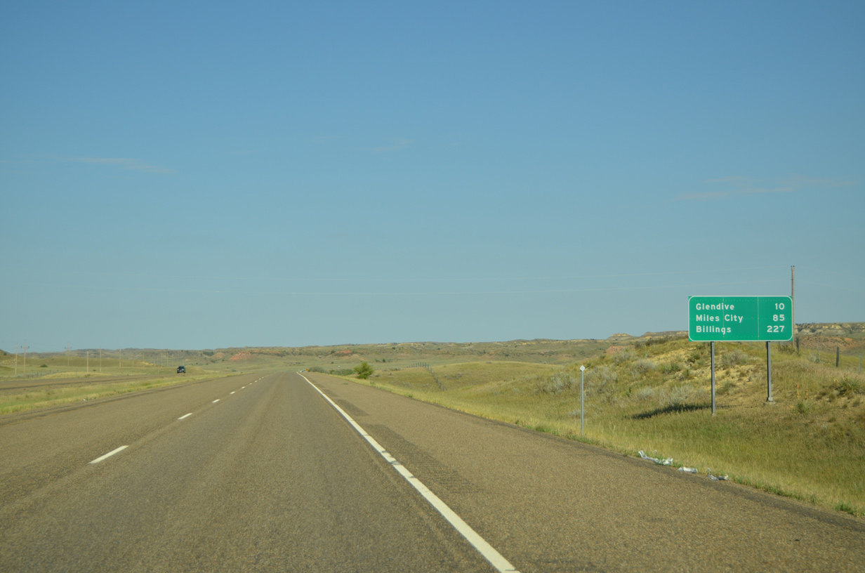
80 mile per hour speed limits are in effect on the ten mile approach to Glendive via I-94 west. Billings lies 227 miles to the southwest.
08/07/16
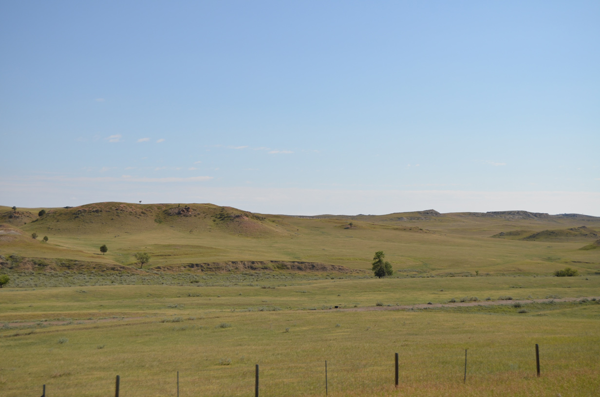
Hills rise 100 feet or more to the north of old U.S. 10 and Interstate 94.
08/07/16
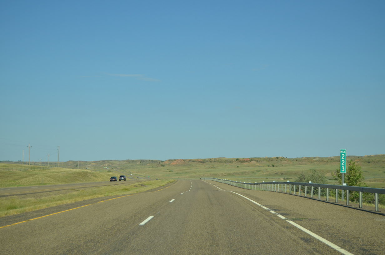
Interstate 94 makes the first in a series of S-curves to Glendive westward from milepost 223.
08/07/16
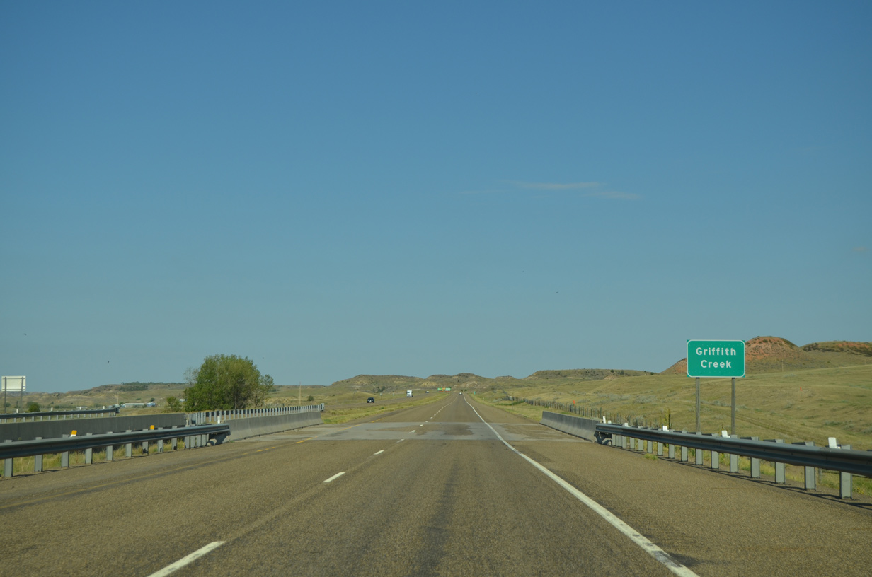
Waters in Griffith Creek flow westward below Interstate 94 to Glendive Creek near the BNSF Railroad siding of Curry.
08/07/16
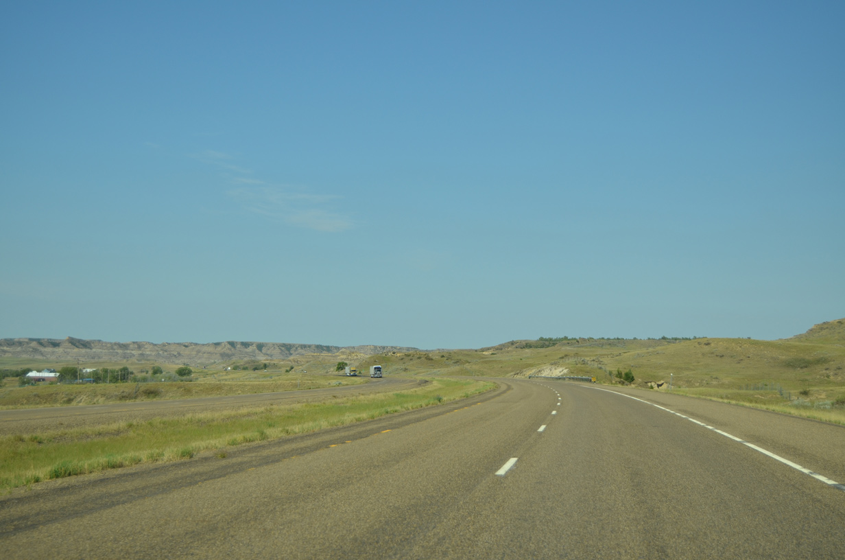
A gradual curve takes I-94 west parallel to Griffith Creek by mileposts 221 and 220.
08/07/16
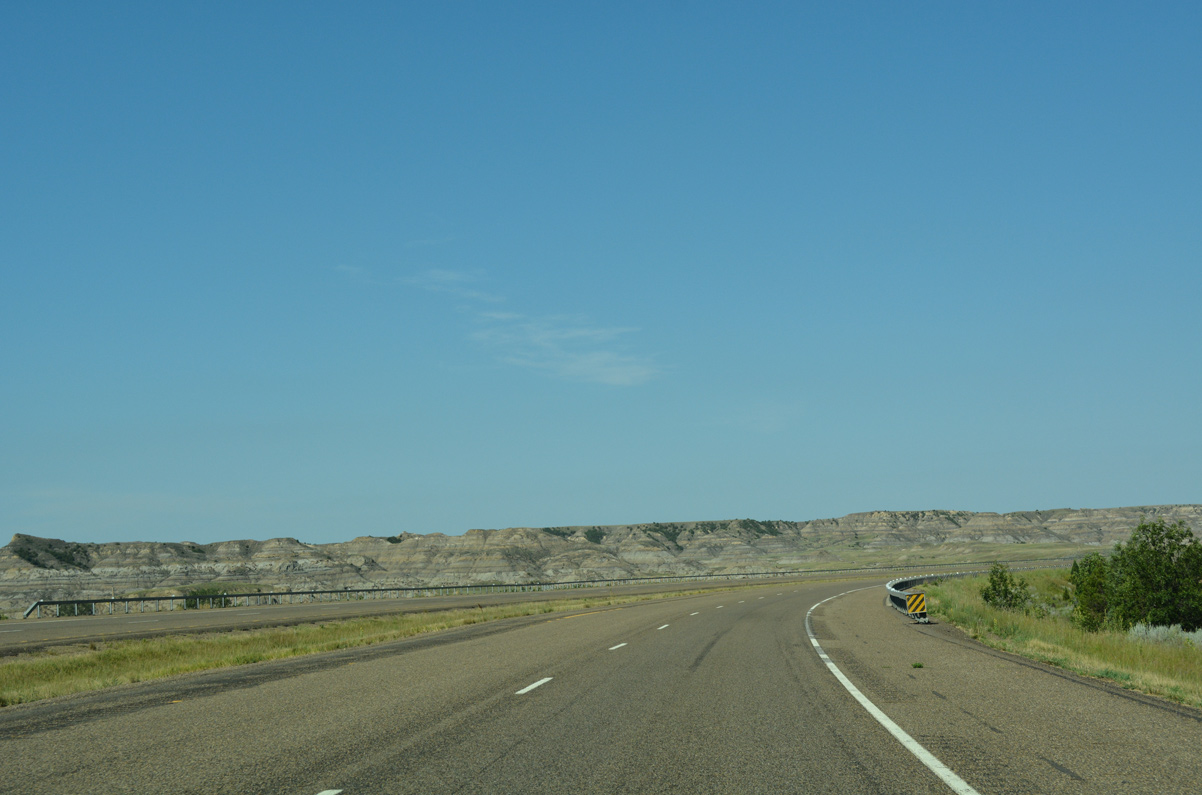
Interstate 94 swings north around a ridge line east of Glendive.
08/07/16
The freeway stays east of Glendive Creek and the BNSF Railroad line by a separate ridge line. Road 300 passes under I-94 in this scene.
08/07/16
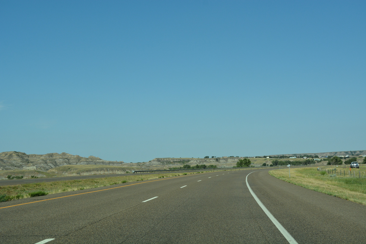
The outskirts of Glendive including the county fairgrounds come into view along Interstate 94 west.
08/07/16
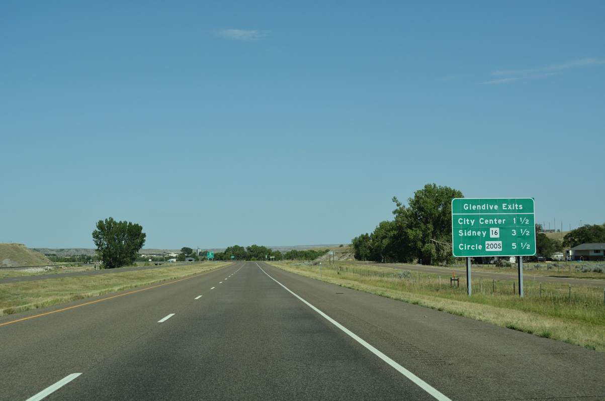
A community interchanges identification sign outlines the three Glendive Exits ahead of Exit 215 with Business Loop I-94 (Merrill Avenue). Old U.S. 10 transitions to State Street on the north side of the freeway on this stretch.
08/07/16
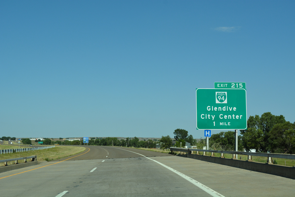
Business Loop I-94 branches southwest from Exit 215 along Merrill Avenue to the Glendive city center and Towne Street west to West Glendive. Connections from downtown lead motorists south to Makoshika State Park.
08/07/16
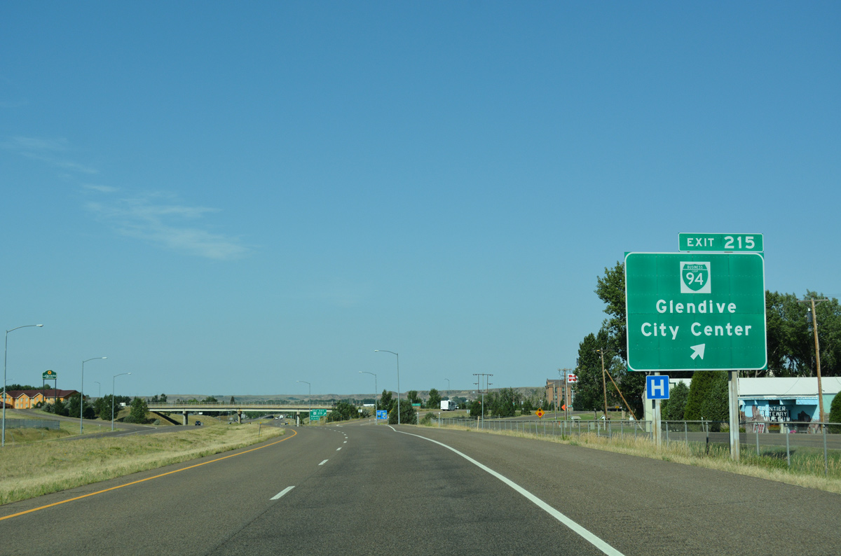
Entering the diamond interchange (Exit 215) with Business Loop I-94 (Merrill Avenue) on I-94 west. The 6.7 mile business loop follows old U.S. 10 to Exit 210. Merrill Avenue north leads to an array of lodging options.
08/07/16
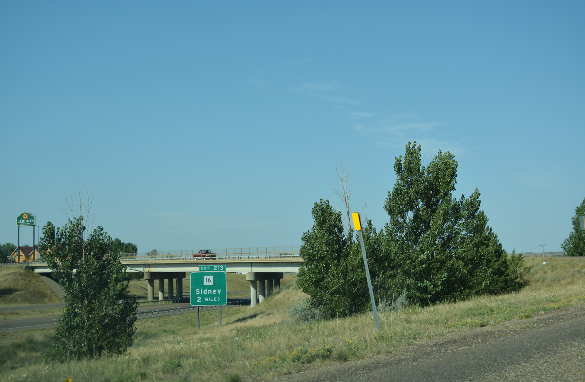
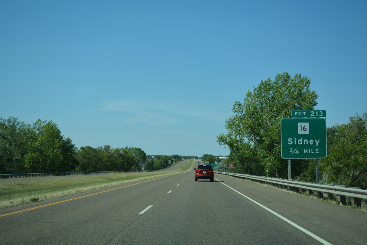
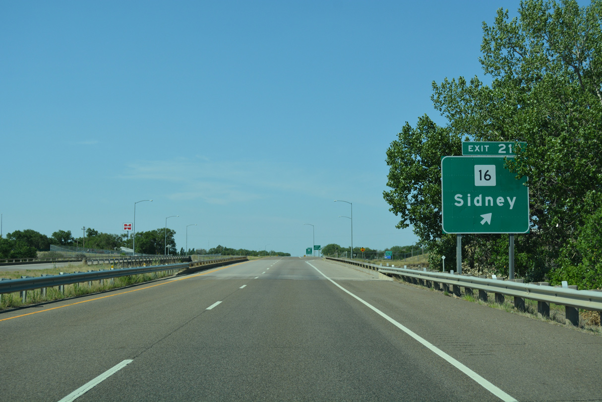
MT 16 ventures 50 miles south from MT 200 and Sidney to meet Interstate 94 at the succeeding interchange (Exit 213).
08/07/16
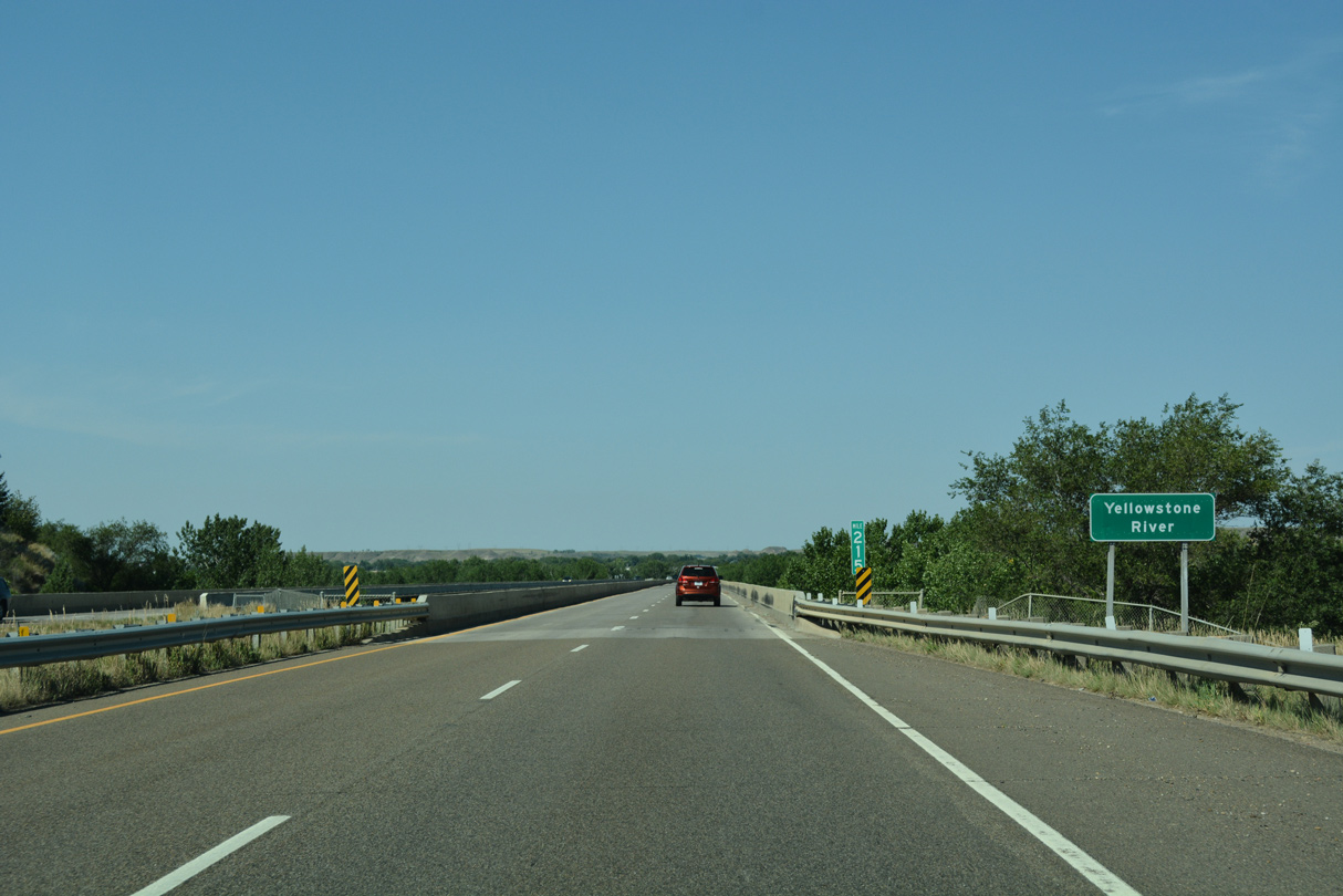
Interstate 94 leaves the Glendive city limits at the first crossing over the Yellowstone River.
08/07/16
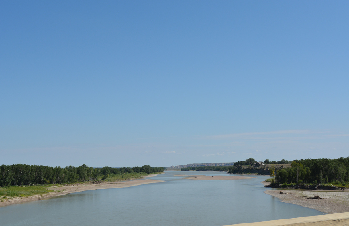
The Yellowstone River flows northeast from Glendive to the Missouri River just across the North Dakota state line by Buford.
08/07/16
Both I-94 bridges across the Yellowstone River are substandard without shoulders. They were built in 1968.
08/07/16
A confirming marker for motorists joining Interstate 94 west from Merrill Avenue stands just west of the Yellowstone River.
08/07/16
MT 16 lines several NHS Routes northeast from Glendive to Sidney, Culbertson and Plentywood in northeast Montana.
08/07/16
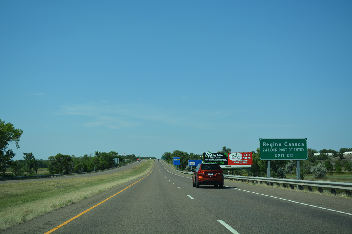
Traveling 151 miles overall, MT 16 leads north to the Port of Regway at the Canadian border. Highway 6 extends 98 miles north from the port of entry to Regina, Saskatchewan.
08/07/16
Westbound motorists reach the diamond interchange (Exit 213) with MT 16. The state highway ends just to the south at Business Loop I-94 (Towne Street) in unincorporated West Glendive.
08/07/16
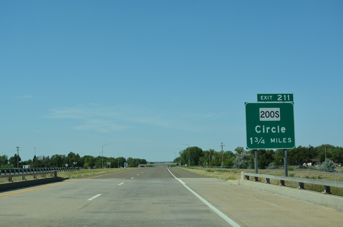
Interstate 94 proceeds southwest 1.75 miles to the half diamond interchange (Exit 211) with MT 200S.
08/07/16
Jefferson School Road spans the freeway beyond this westbound I-94 shield assembly.
08/07/16
Motorists cross Dry Creek on the 0.75 mile approach to Exit 211. MT 200S originates a 45.2 mile route to Circle in West Glendive from Business Loop I-94 (Towne Street).
08/07/16
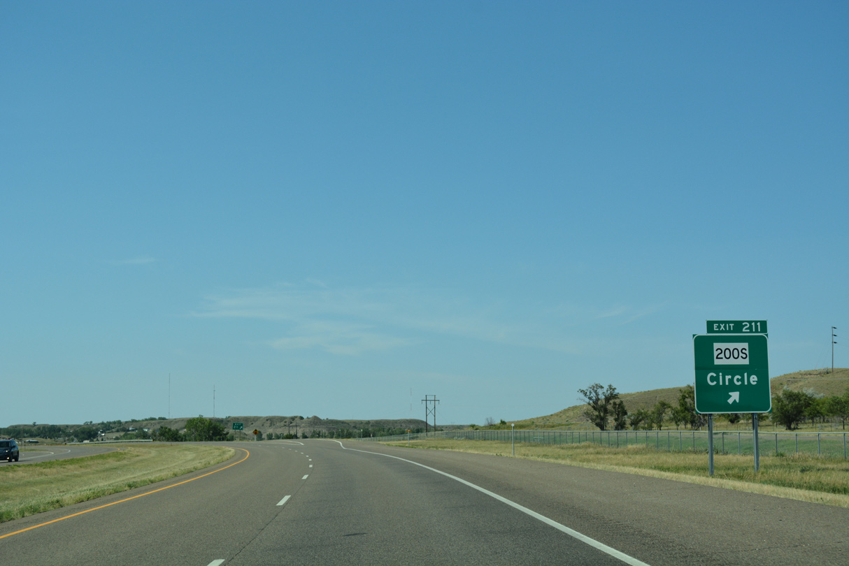
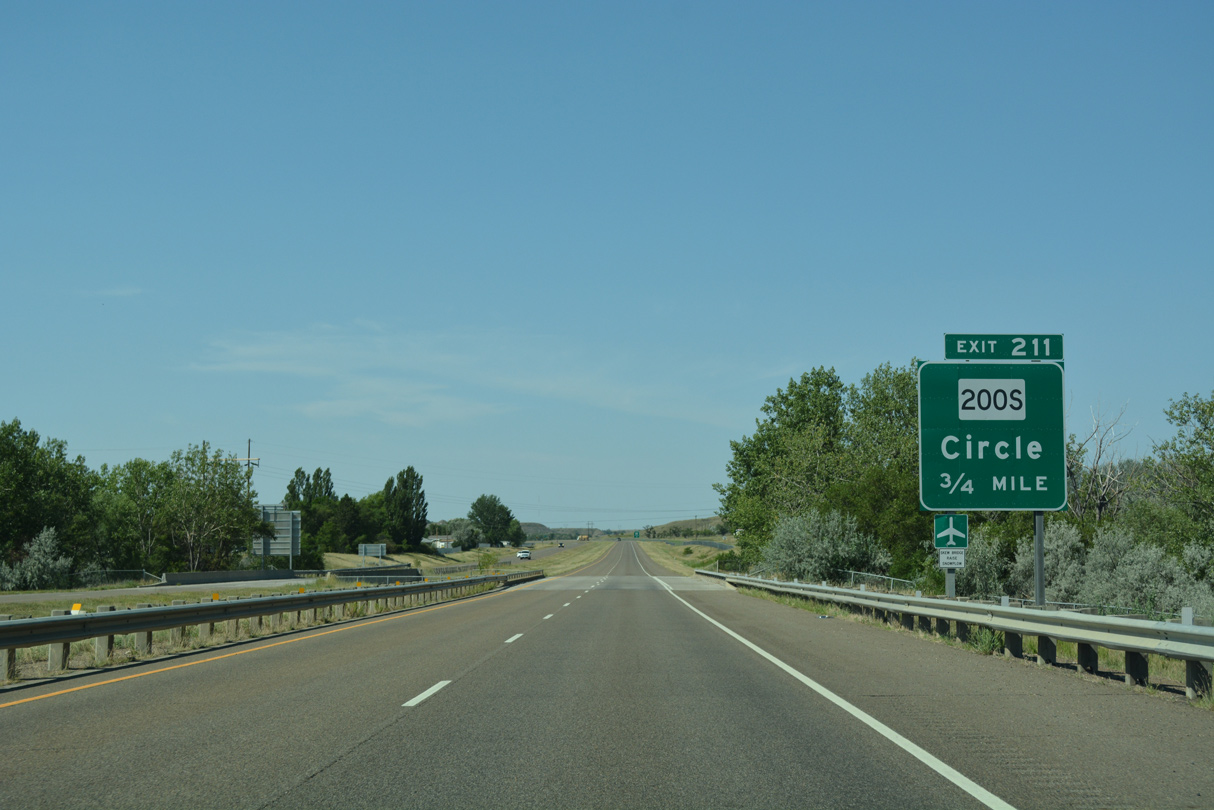
Exit 211 parts ways with I-94 west for MT 200S. MT 200S forms part of a NHS route with MT 200 leading west to Jordan, Winnett, Grass Range and Lewistown. MT 200 is part of a 1,361 mile long, multi state route stretching west from Minnesota to Idaho.
08/07/16
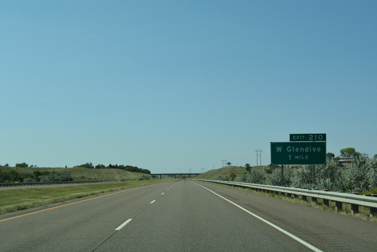
Advancing south from the Forest Park community in West Glendive, Interstate 94 and Business Loop I-94 converge at a trumpet interchange (Exit 210) in one mile.
08/07/16
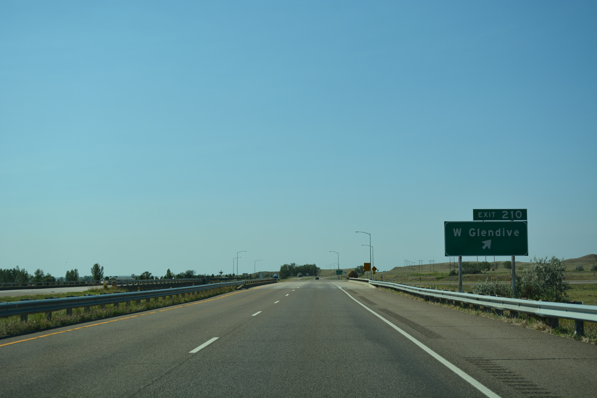
Business Loop I-94 (Towne Street) leads back east through the industrial south side of West Glendive to become a commercial arterial after MT 200S.
08/07/16
Interstate 94 replaced the 1950s-roadway of U.S. 10 directly from Exit 210 southward. An older alignment stays closer to the Yellowstone River through agricultural areas.
08/07/16
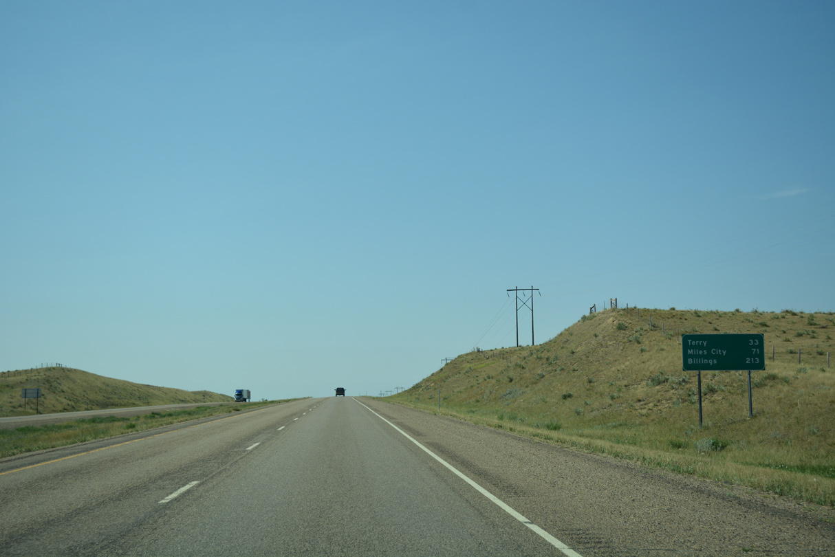
The Prairie County seat of Terry lies 33 miles to the southwest of Glendive. Miles City (71 miles) and Billings (213 miles) follow.
08/07/16
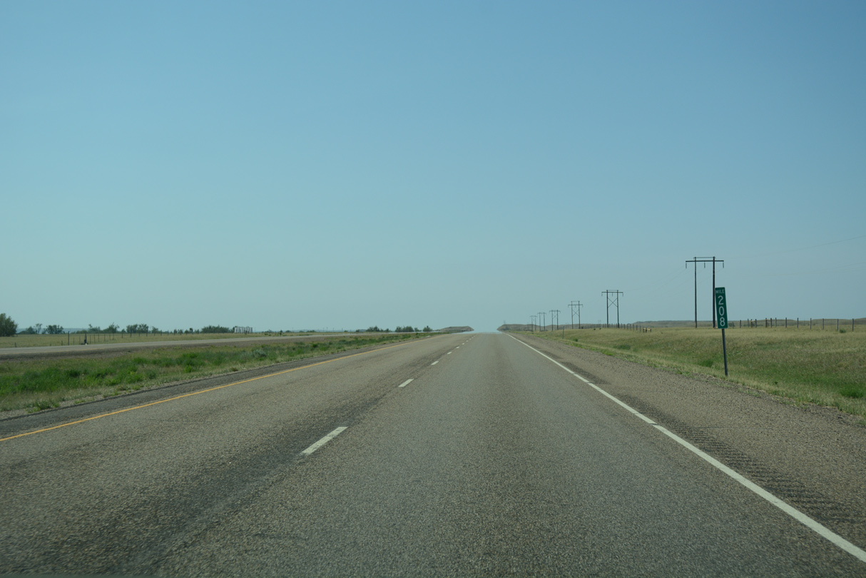
Interstate 94 flattens out in this scene at milepost 208. 4,930 vehicles per day (vpd) were recorded by MDT on this stretch in 2015.
08/07/16
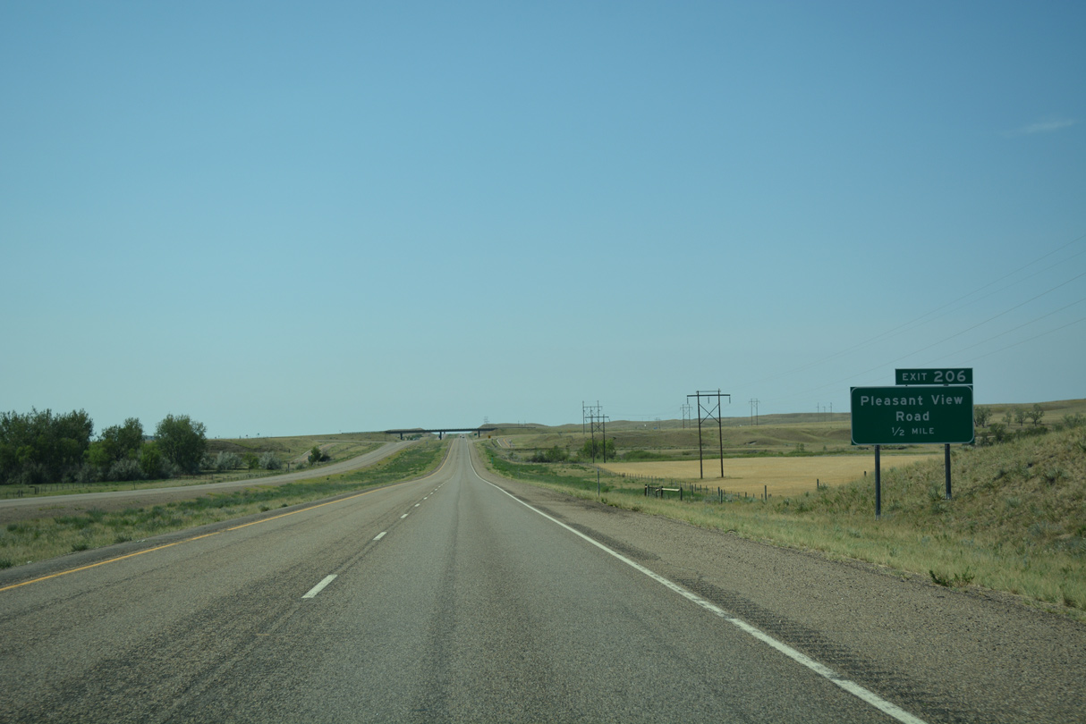
Pleasant View Road stems west from old Highway 10 to meet Interstate 94 in a half mile.
08/07/16
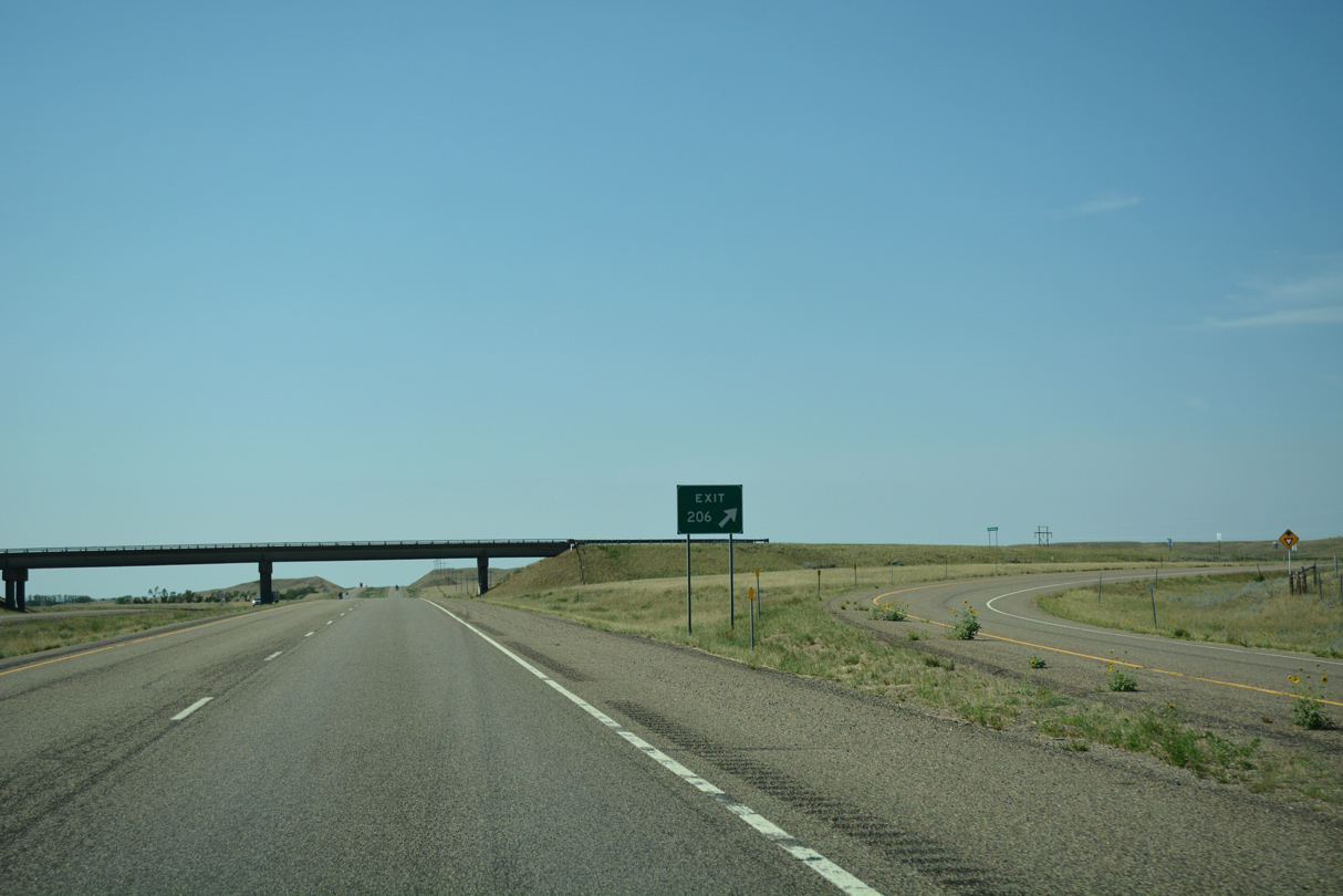
The rural diamond interchange (Exit 206) provides access to farm land to the east and ranch land west to the settlement of Pleasant View.
08/07/16
Interstate 94 travels across the Glendive Oil Field south of milepost 206.
08/07/16
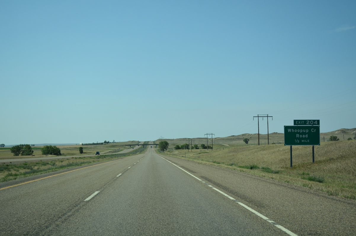
Whoopup Creek Road connects with I-94 west from old Highway 10 at a forthcoming diamond interchange (Exit 204).
08/07/16
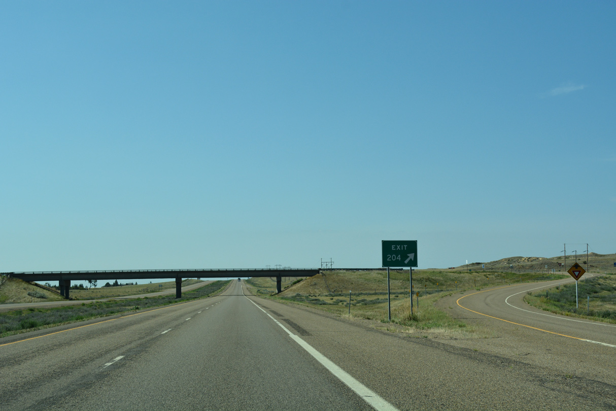
Exit 204 departs from I-94 west after Whoopup Creek. Whoopup Creek Road extends west to ranch land ahead of Clear Creek.
08/07/16
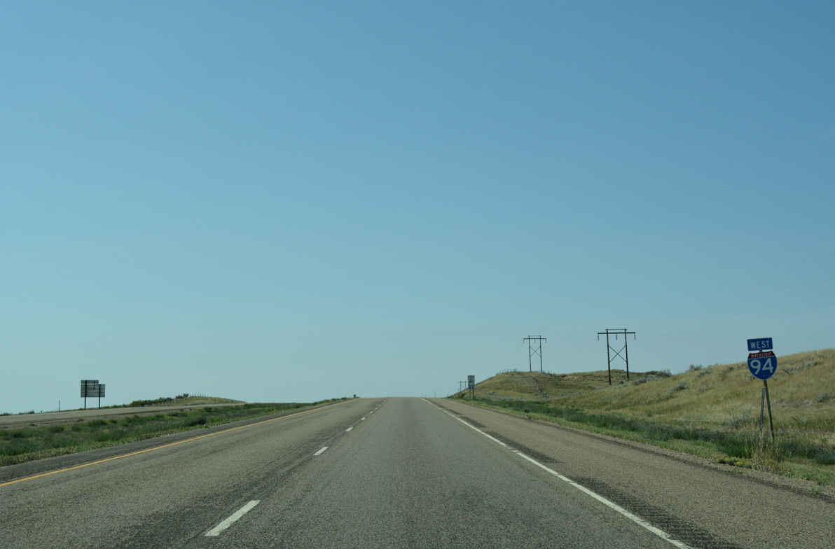
Westbound travelers along I-94 rise to an elevation of 2,300 feet above sea level south of Exit 204.
08/07/16
The unincorporated town of Fallon is the next population center along I-94 west in 18 miles. The freeway reaches Miles City in 65 miles.
08/07/16
A sweeping curve takes Interstate 94 southwest across Clear Creek at this vista.
08/07/16
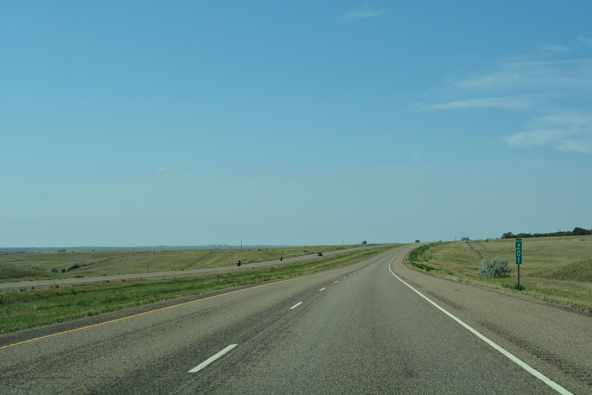
Passing by milepost 201, the freeway continues to follow the trajectory of the nearby Yellowstone River over the next 13 miles.
08/07/16
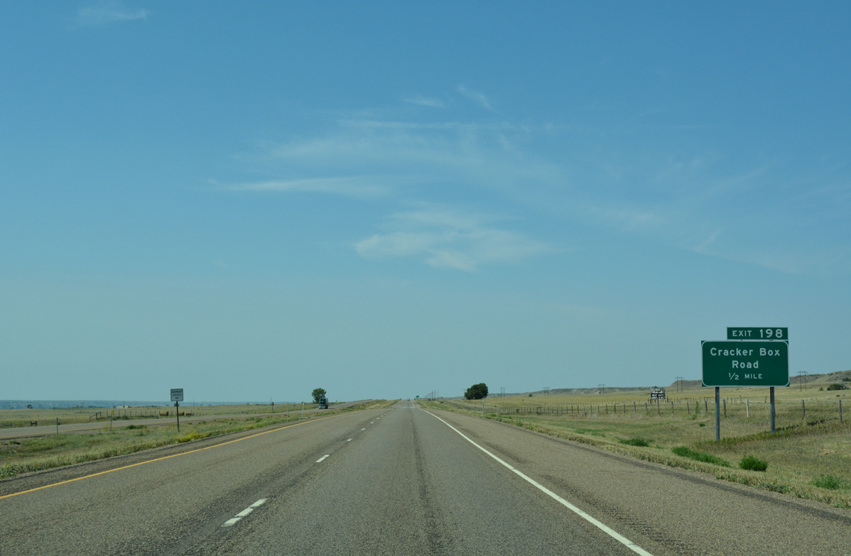
The ranch exit at Cracker Box Road links I-94 with a north side frontage road and old Highway 10 to the south.
08/07/16
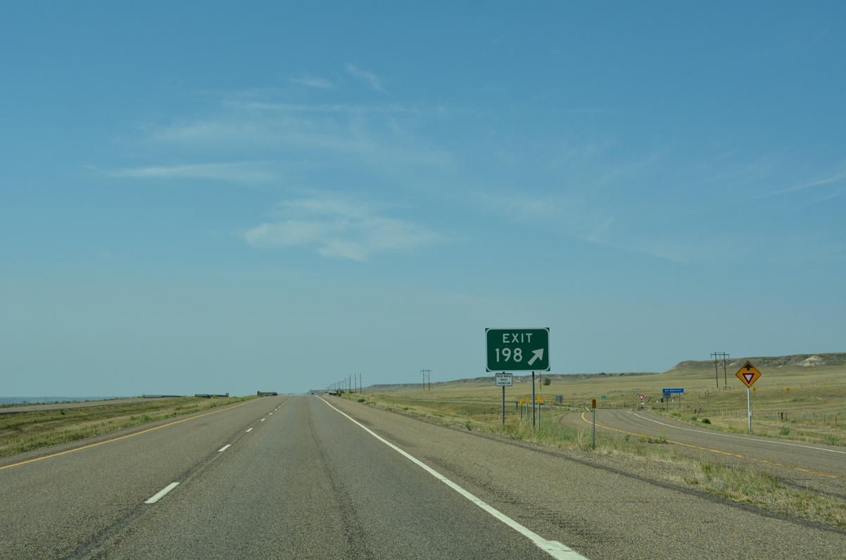
Westbound at the diamond interchange (Exit 198) with Cracker Box Road on I-94 west.
08/07/16
Interstate 94 bee lines southwest and crosses Cracker Box Creek beyond this confirming marker.
08/07/16
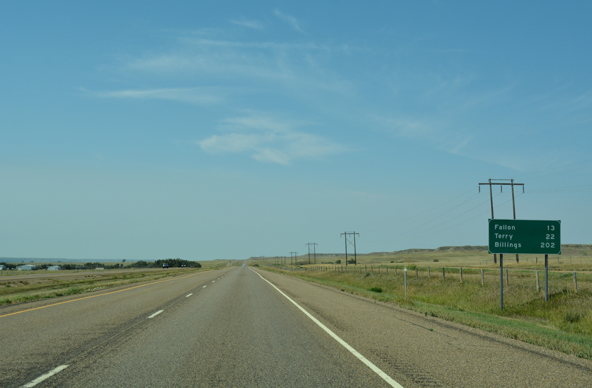
Fallon is now 13 miles away, followed by Terry in 22 miles. Billings is still a two and a half hour drive.
08/07/16
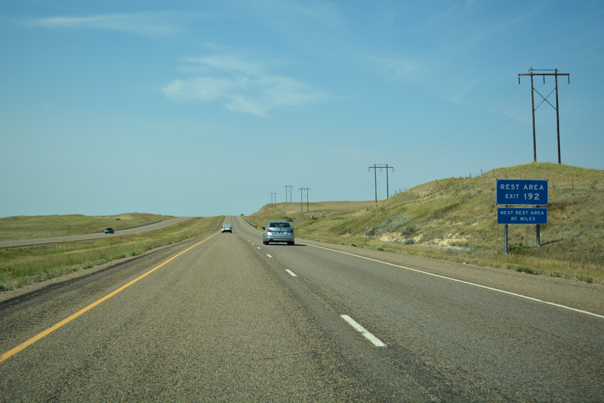
The second Montana rest area for westbound I-94 lies off the freeway at Exit 192.
08/07/16
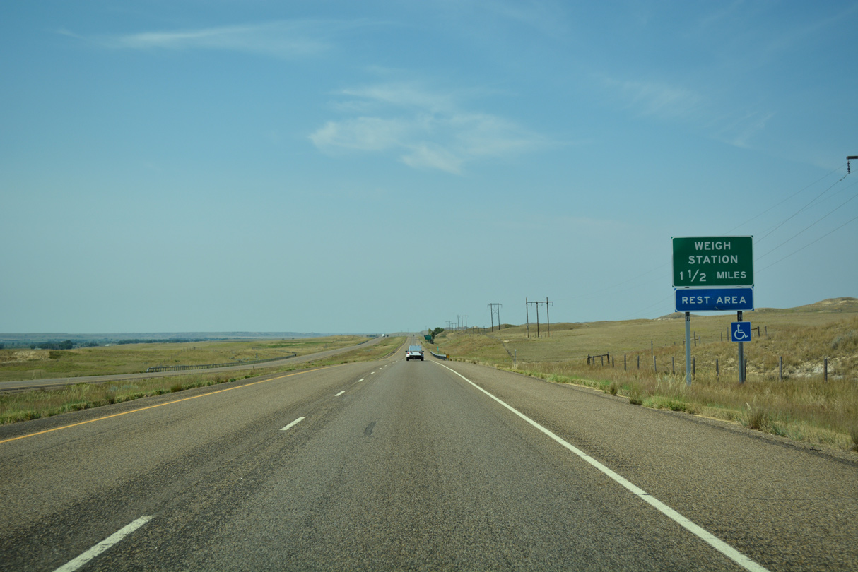
The forthcoming rest area along Bad Route Road doubles as a truck weigh station.
08/07/16
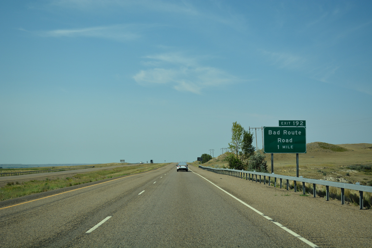
Bad Route Road parallels Bad Route Creek to ranch land north from Exit 192 and south to old Highway 10 and farm land alongside the Yellowstone River.
08/07/16
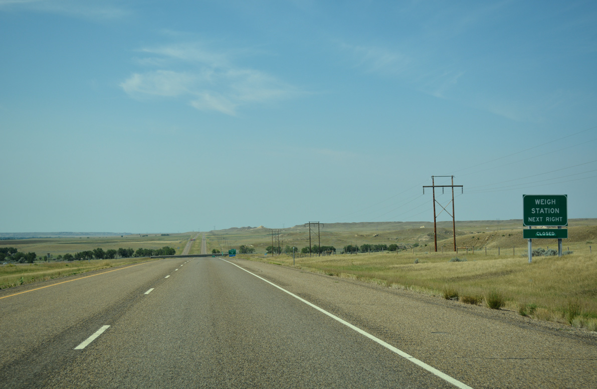
The rest area and weigh station are located just south of Exit 192. Commercial trucks made up 27.8% of the 4,720 vpd recorded by MDT here in 2015.
08/07/16
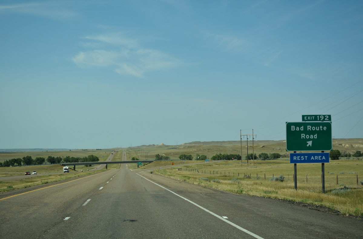
Entering the diamond interchange (Exit 192) with Bad Route Road on I-94 west.
08/07/16
Reassurance marker for I-94 west posted after the culverted Bad Route Creek.
08/07/16
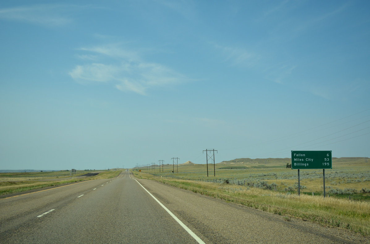
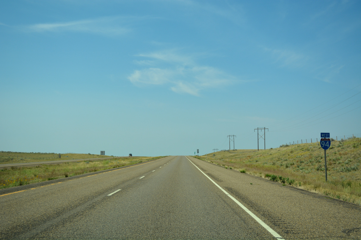
Distance sign posted 6 miles from Fallon, 53 miles from Miles City and 195 miles from the west end of I-94 at Billings.
08/07/16
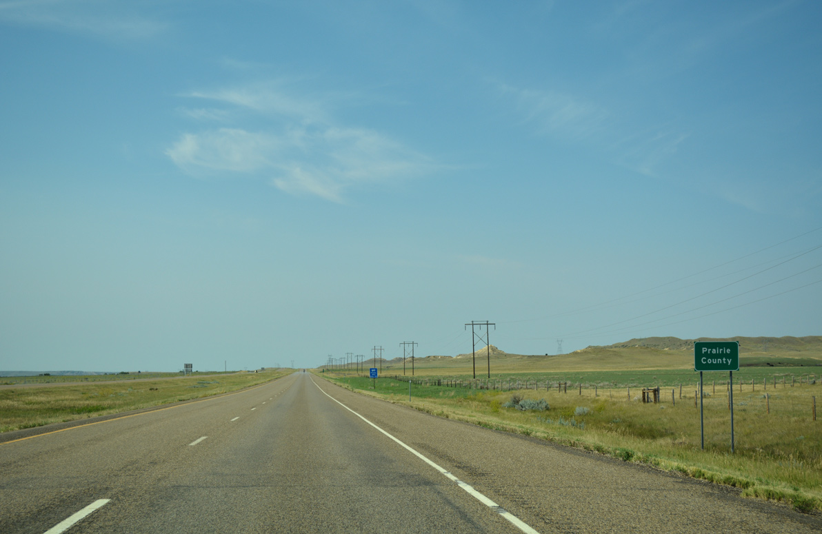
With a population just over 1,100, the third county along Interstate 94 west is rural Prairie County.
08/07/16

Photo Credits:
- ABRoads: 08/07/16
Page Updated Wednesday January 11, 2017.