
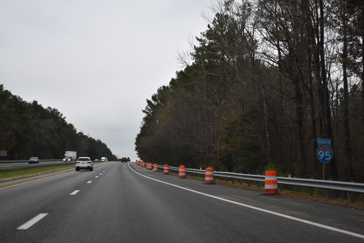
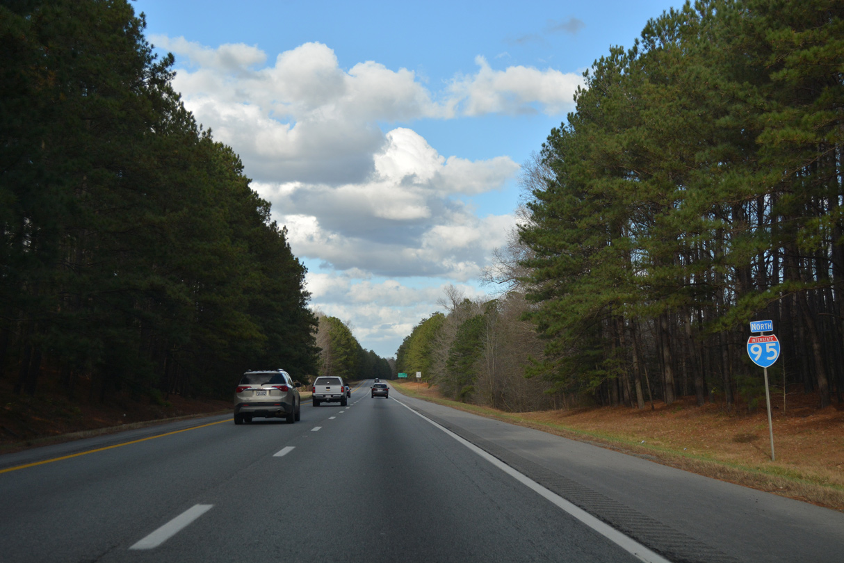
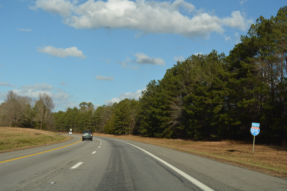
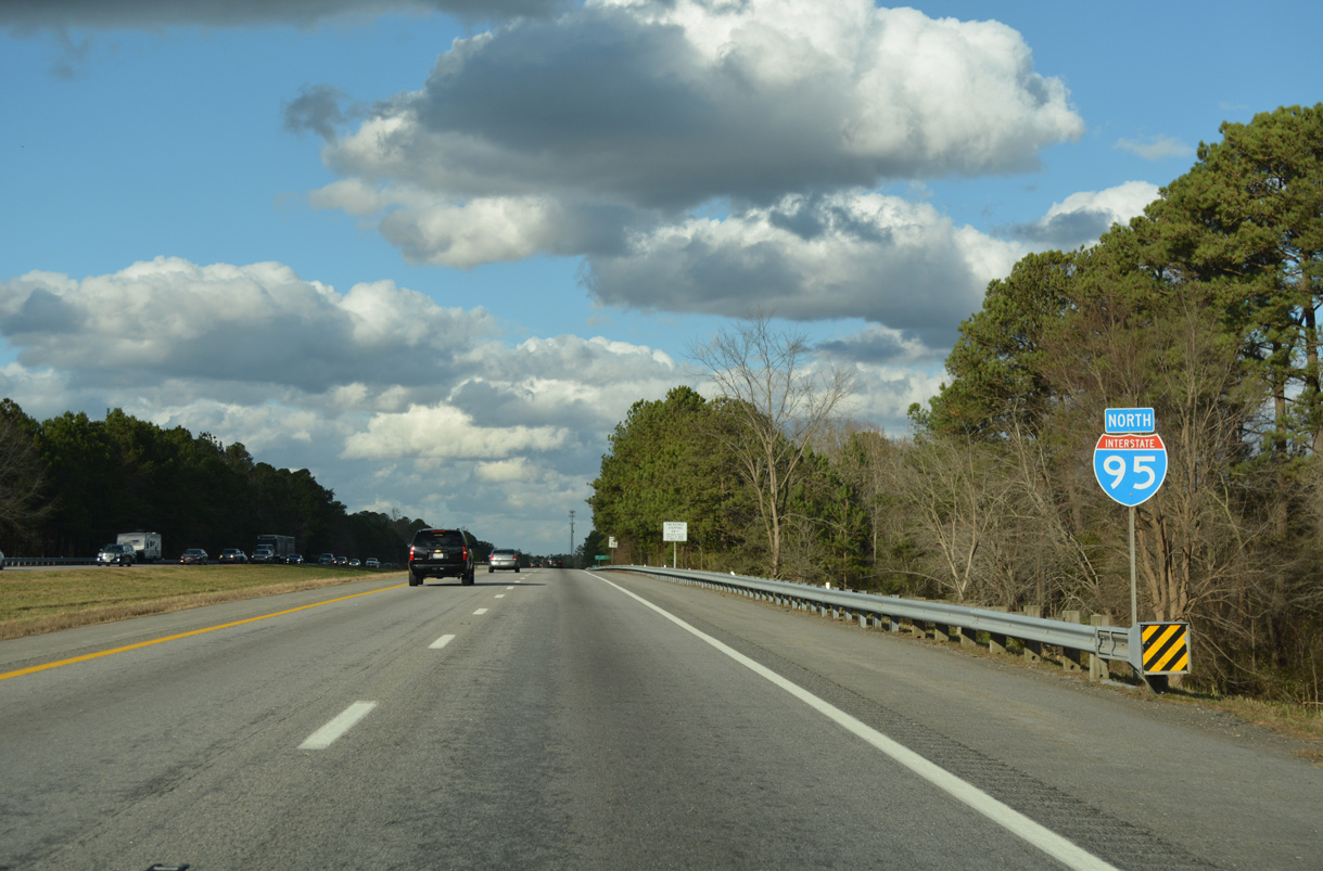
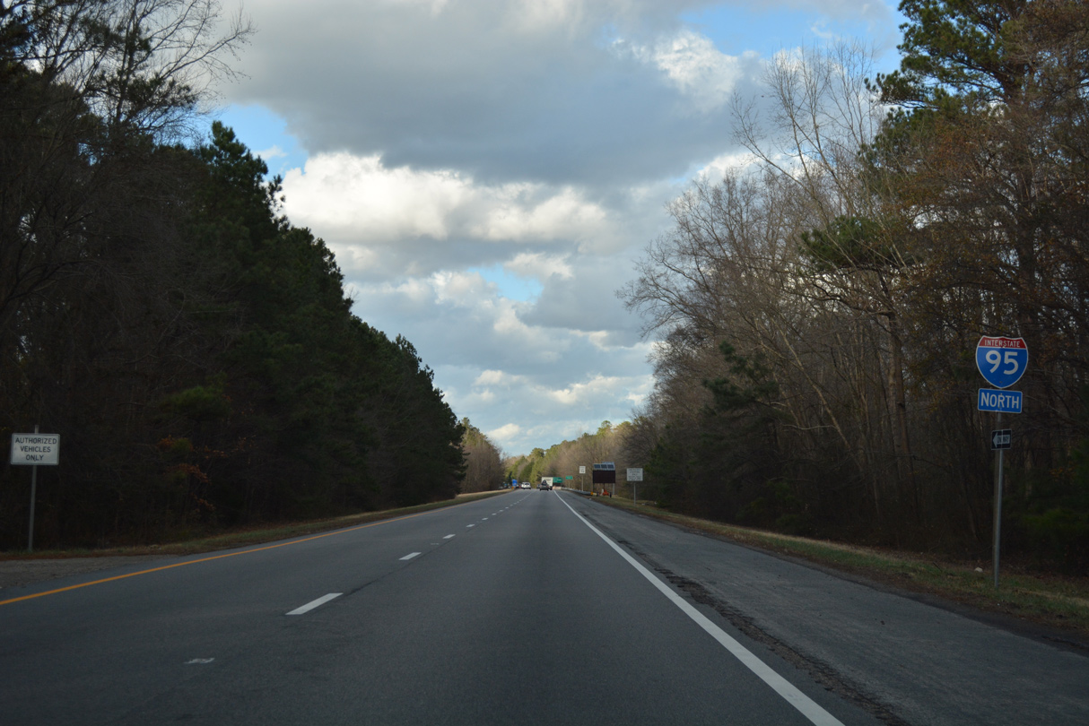
Interstate 95 North - Emporia to Stony Creek
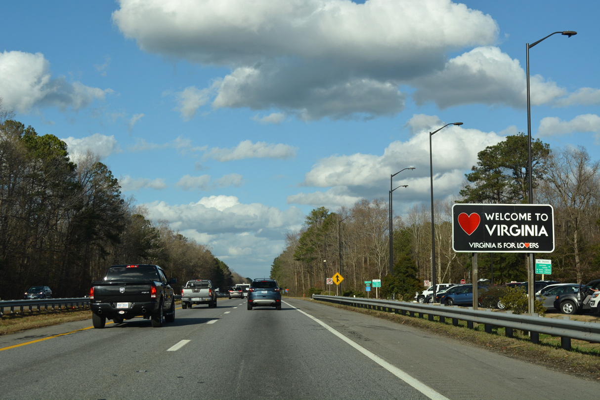
The Welcome to Virginia sign stands next to the state welcome center near Turners Crossroads.
12/21/18
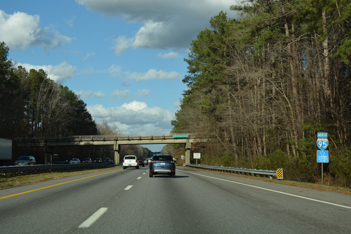
The first confirming marker in Virginia for I-95 north precedes the SR 631 (Church Road) overpass.
12/21/18
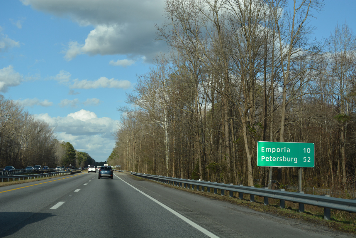
Distance sign posted near Beaverpond Creek, ten miles south of Emporia. Located 52 miles away, Petersburg replaces Richmond as the second entry.
12/21/18
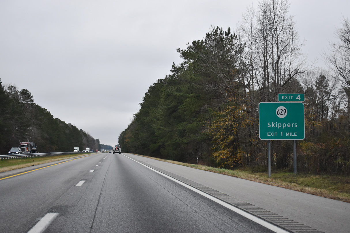
The first exit within the Commonwealth of Virginia joins I-95 with SR 629 (Moores Ferry Road). SR 629 travels north from Turners Crossroads to Mitchells Mill and U.S. 301 at Skippers.
12/17/20
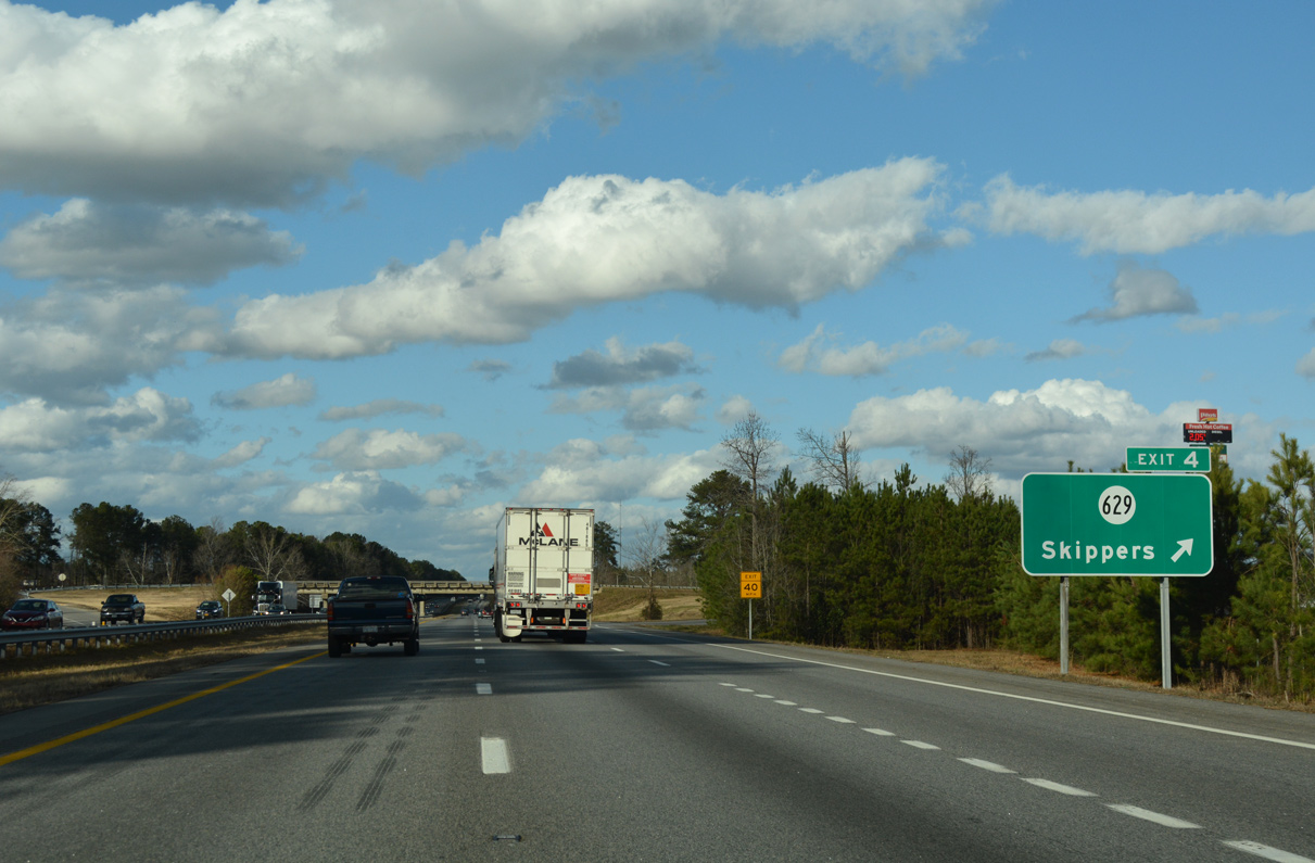
A frontage road lines the east side of I-95 from SR 631 (Spring Church Road) to SR 629 (Moores Ferry Road) at Exit 4. The freeway spans Fontaine Creek ahead of the diamond interchange west of Skippers.
12/21/18
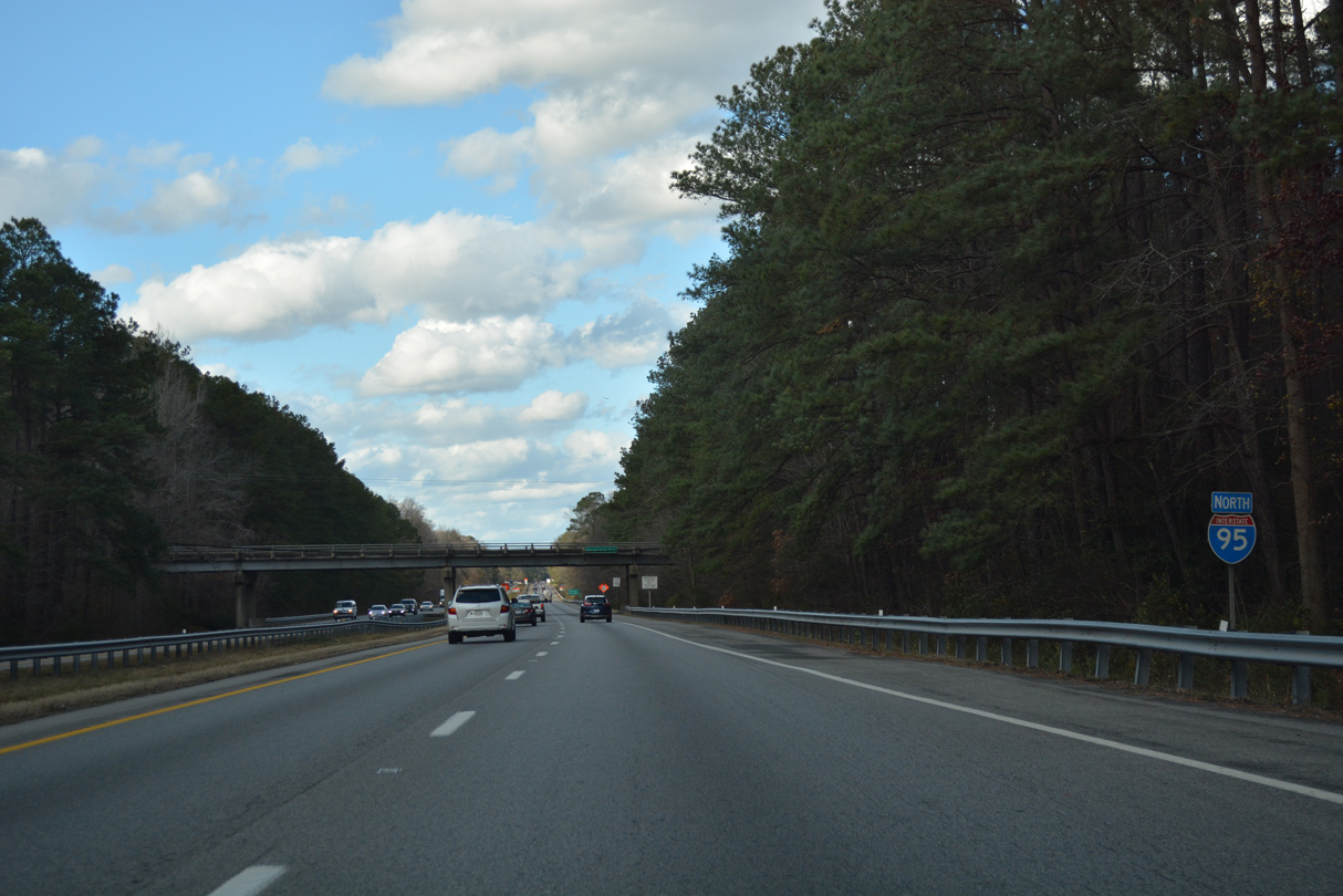
Advancing north, Interstate 95 reaches the city of Emporia in six miles.
12/17/20
12/21/18
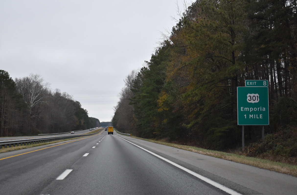
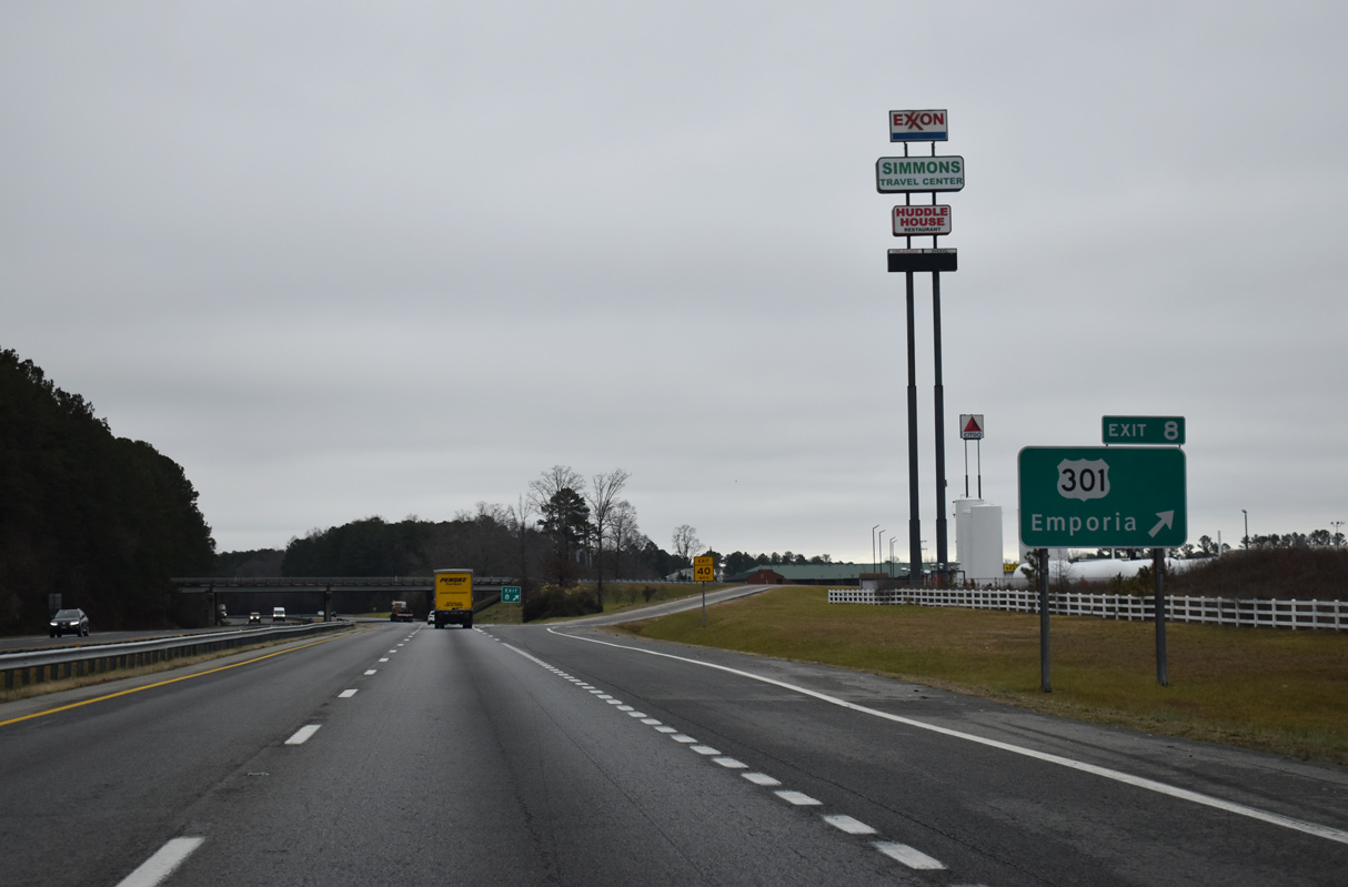
U.S. 301 converges with Interstate 95 north from Skippers, paralleling the freeway at Exit 8 outside Emporia. A trumpet interchange links the two routes in one mile.
12/17/20
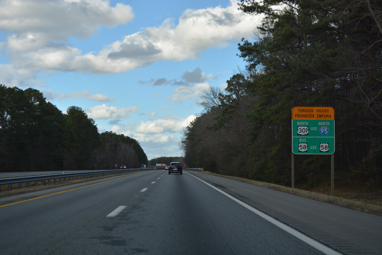
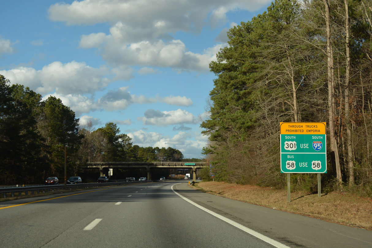
Trucks are restricted on U.S. 301 (Main Street) and U.S. 58 Business (Atlantic Street) through Emporia. Through trucks are directed onto the U.S. 58 expressway bypass around the north side of the city or to remain along I-95 to the west.
12/21/18
Exit 8 leaves Interstate 95 north for the connector with U.S. 301. U.S. 301 (Skippers Road) follows S Main Street from the city line northward to Downtown.
12/17/20
Brink Road (SR 672) spans I-95 north of this confirming marker.
12/21/18
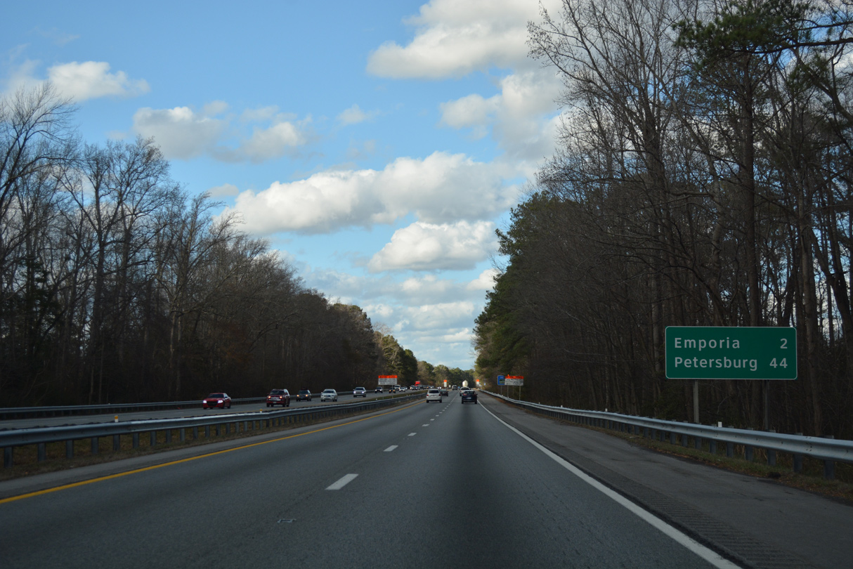
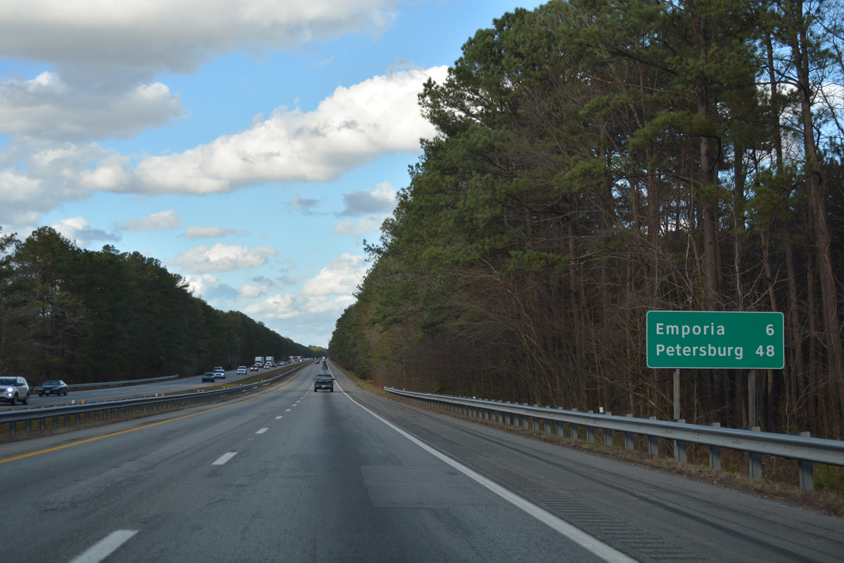
Petersburg lies 42 miles beyond Emporia via Interstate 95 northbound.
12/21/18
A second sign for the truck restrictions on U.S. 301 (Main Street) and U.S. 58 (Atlantic Street) through Emporia stands along the Emporia city line south of SR 611 (Dry Bread Road).
12/21/18
Originating at Cumberland Gap, Tennessee, U.S. 58 is a major highway that spans the southern tier of Virginia. Serving such disparate locations as Bristol, Danville and Emporia, U.S. 58 stretches across the state to Virginia Beach in Hampton Roads. Much of the route is expressway grade.
12/17/20

The original bridges carrying I-95 across the Meherrin River in Emporia were constructed in 1959 as part of an Emporia bypass for U.S. 301. Construction from January 18, 2016 to Fall 2019 replaced both bridges, starting with the southbound span.1
12/17/20
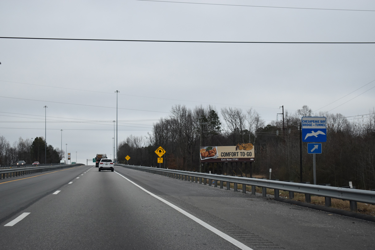
Long distance travelers bound for the Delmarva Peninsula are directed onto U.S. 58 east to Hampton Roads to access the Chesapeake Bay Bridge Tunnel. Crossing Chesapeake Bay, the toll bridge system joins Virginia Beach with Northampton County.
12/17/20
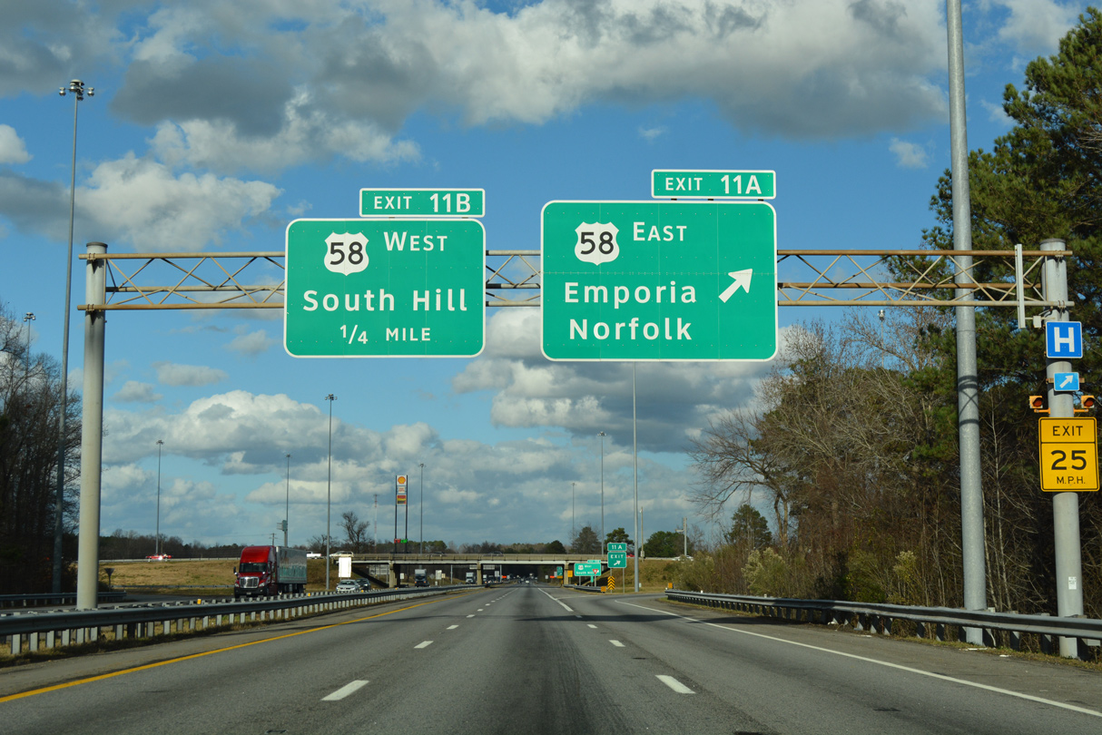
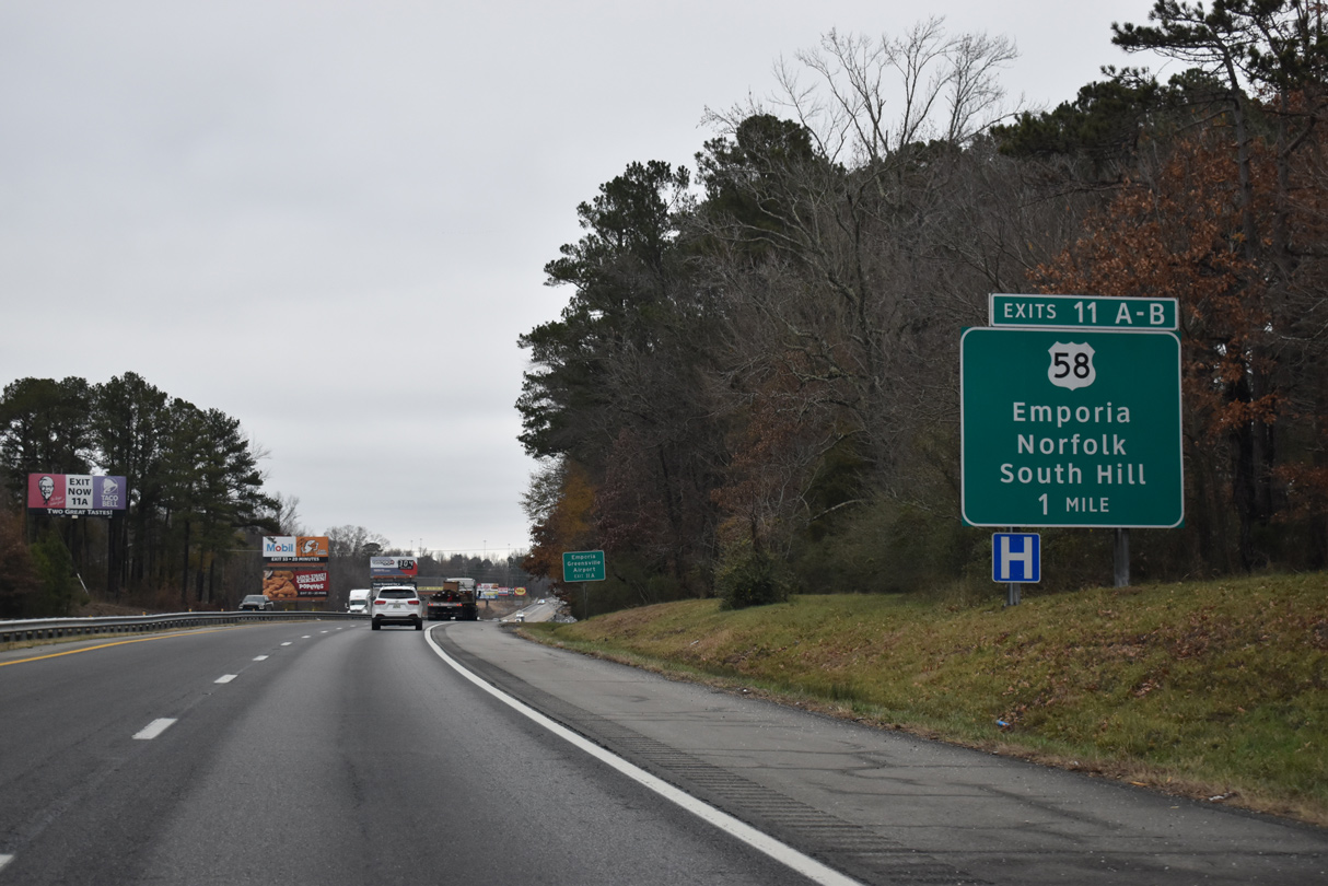
A cloverleaf interchange (Exits 11A/B) joins I-95 with U.S. 58 (Atlantic Street) east of Kingsberry and northwest of Downtown Emporia. U.S. 58 splits with a business route nearby as the mainline follows a 1987-completed bypass to the north. The four lane highway continues east from Emporia to Franklin, Suffolk and Norfolk.
12/21/18
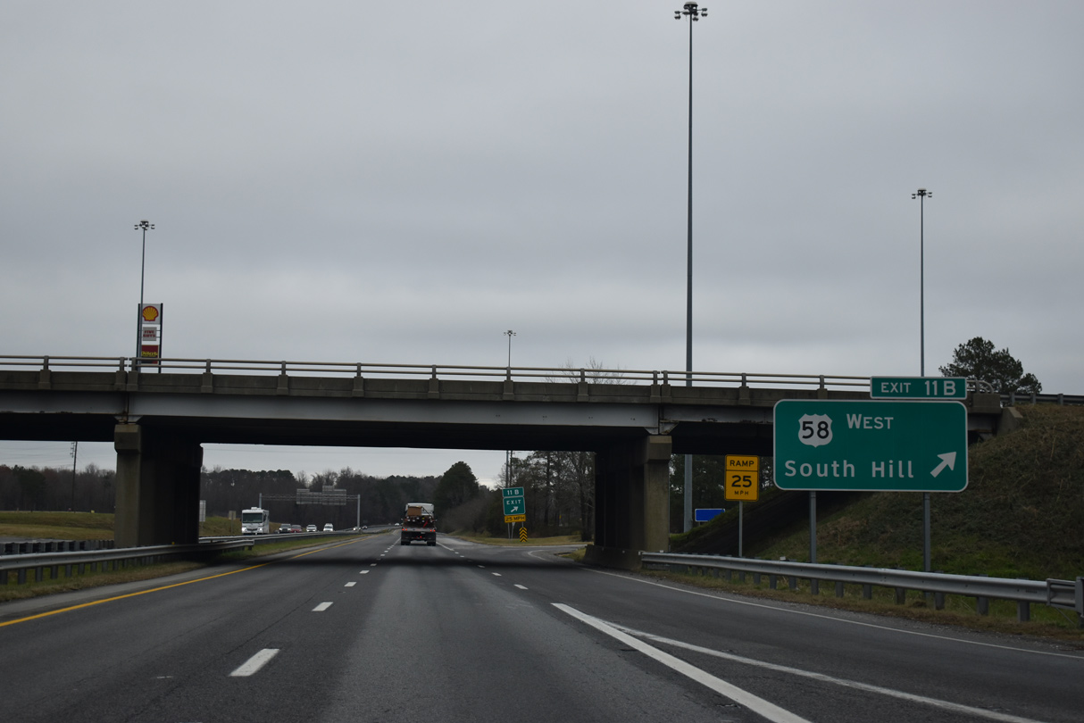
A loop ramp (Exit 11B) joins I-95 north with U.S. 58 (Atlantic Street) west to Lawrenceville and South Hill.
12/17/20
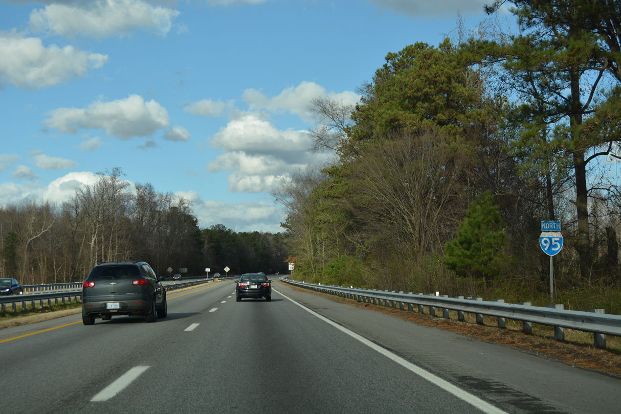
Curving northeast, Interstate 95 exits the independent city of Emporia and reenters Greensville County.
12/21/18
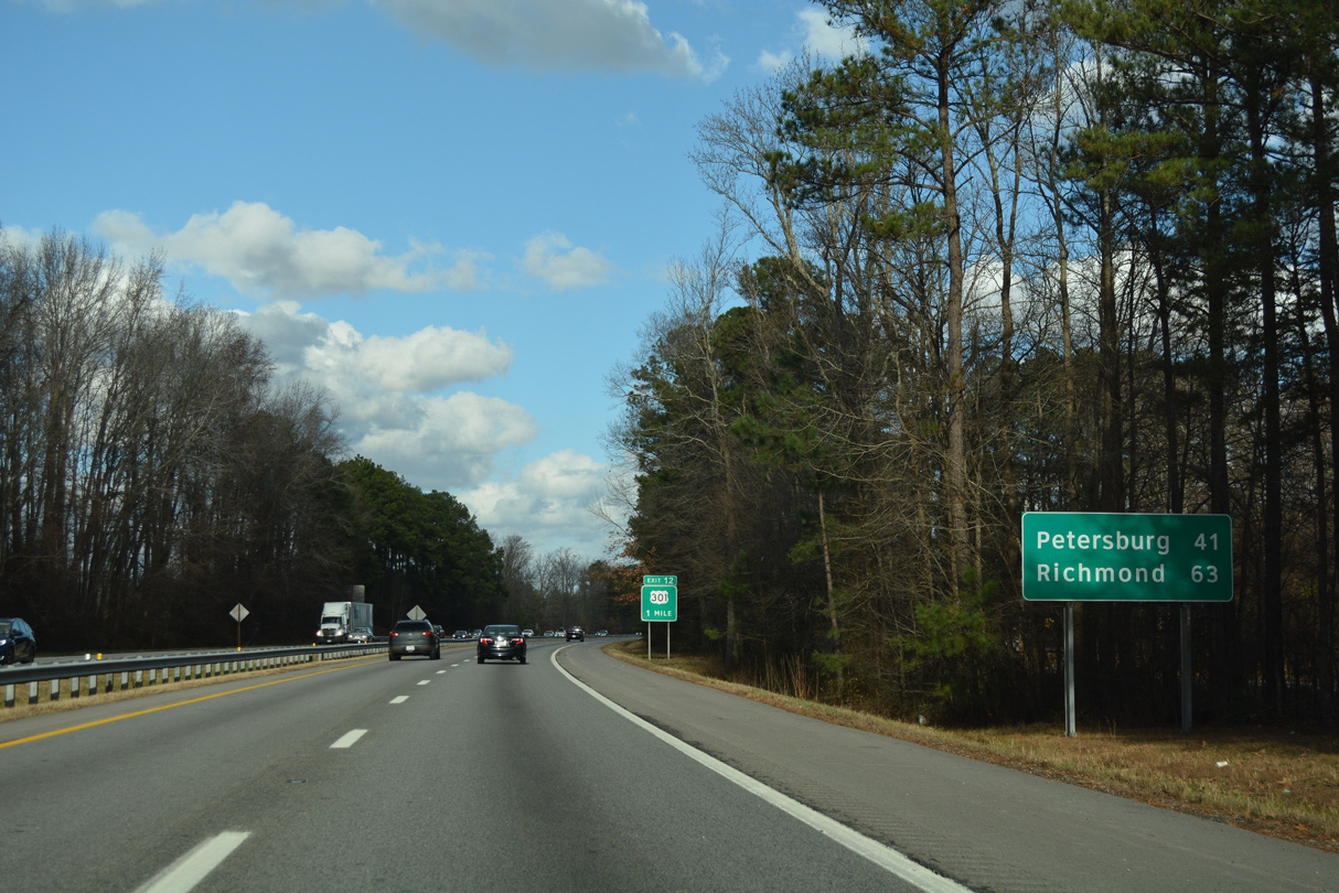
The 41 mile drive to Petersburg remains vastly rural as Interstate 95 and parallel U.S. 301 intertwine northward from Emporia.
12/21/18
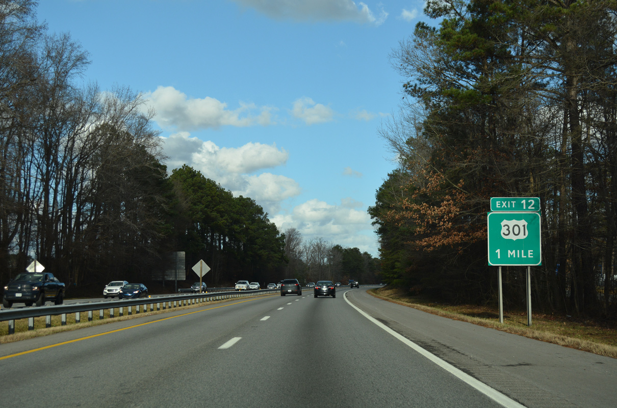
U.S. 301 (Sussex Drive) leaves Emporia and converges with the east side of I-95 at forthcoming Exit 12.
12/21/18
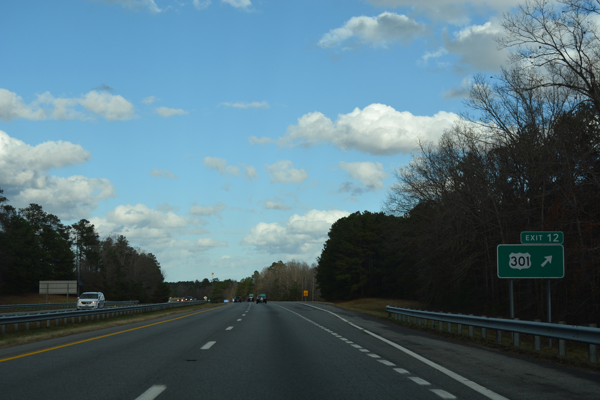
U.S. 301 remained the through route from Emporia north to Prince George County until the 1982 completion of I-95. A number of industrial businesses line the four lane highway as it loops eastward between Exit 12 and 17.
12/21/18
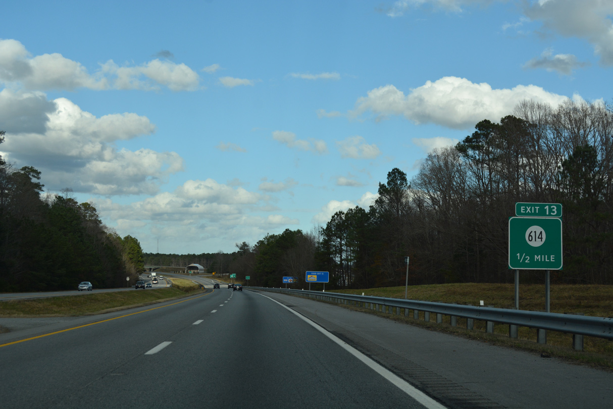
SR 614 (Otterdam Road) meets Interstate 95 at the adjacent diamond interchange (Exit 13) from U.S. 301.
12/21/18
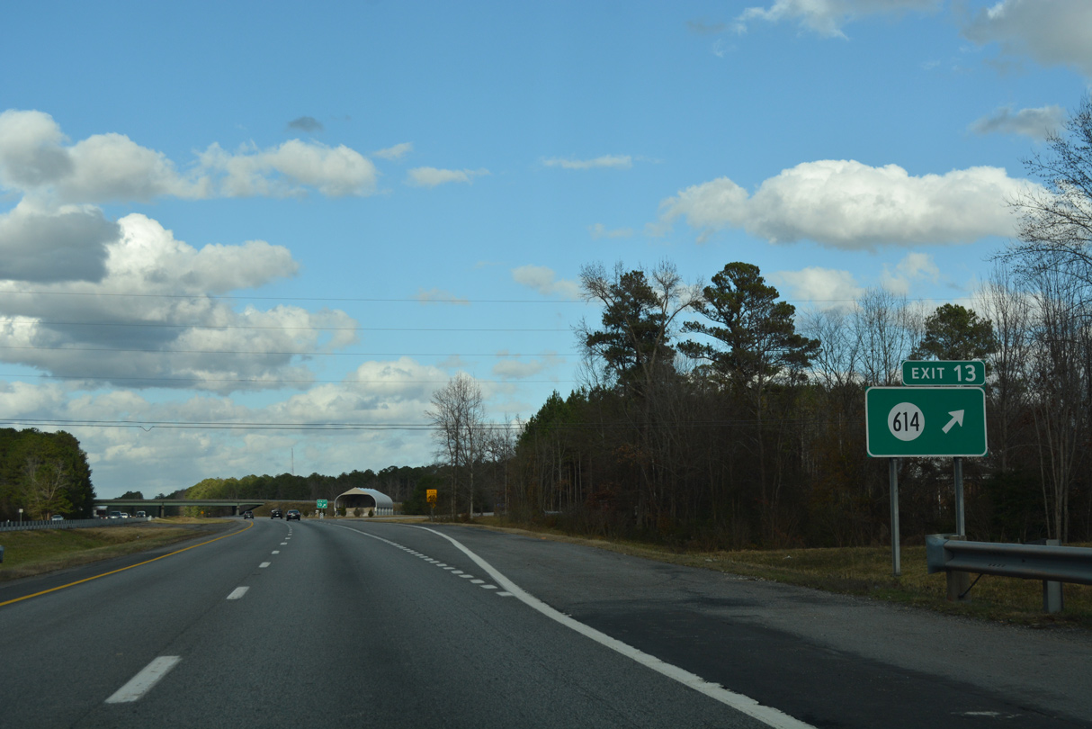
SR 614 (Otterdam Road) branches north from SR 616 (Moonlight Road) near Moonlight to Slagles Lake and SR 610 (Allen Road) west of Jarratt. A multi phase construction project administered by Greensville County widened 3.9 miles of the route northward from Exit 13. Supporting future economic development, the $9.1 million project was scheduled from Fall 2015 through May 2017.2
12/21/18
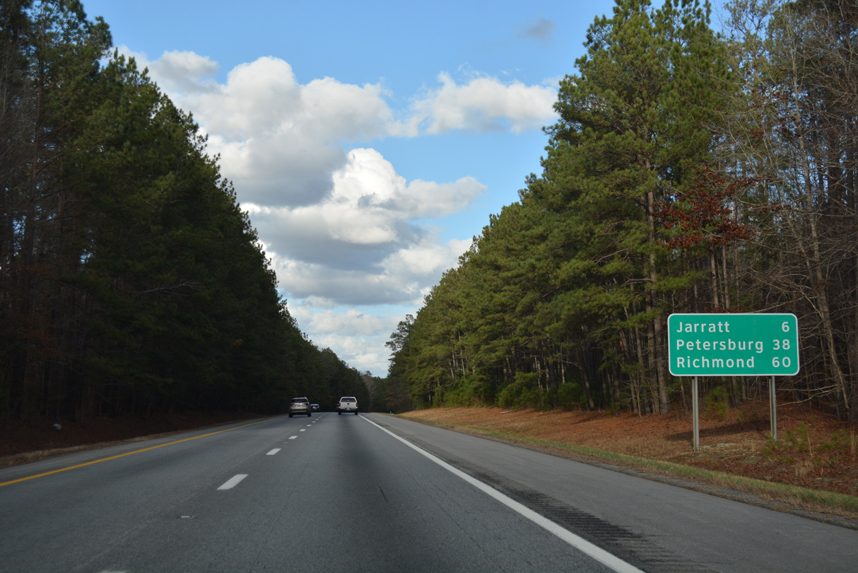
Traversing an area of timberland adjacent to Uriah Branch, Interstate 95 progresses north six miles to Jarratt and 60 miles to the capital city.
12/21/18
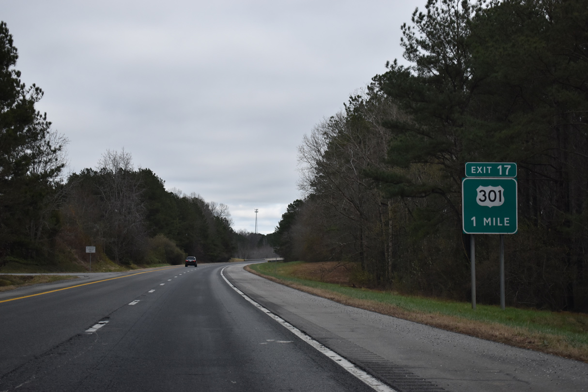
Northward from the diamond interchange at Exit 17, U.S. 301 stays west of Interstate 95 to Jarratt.
12/17/20
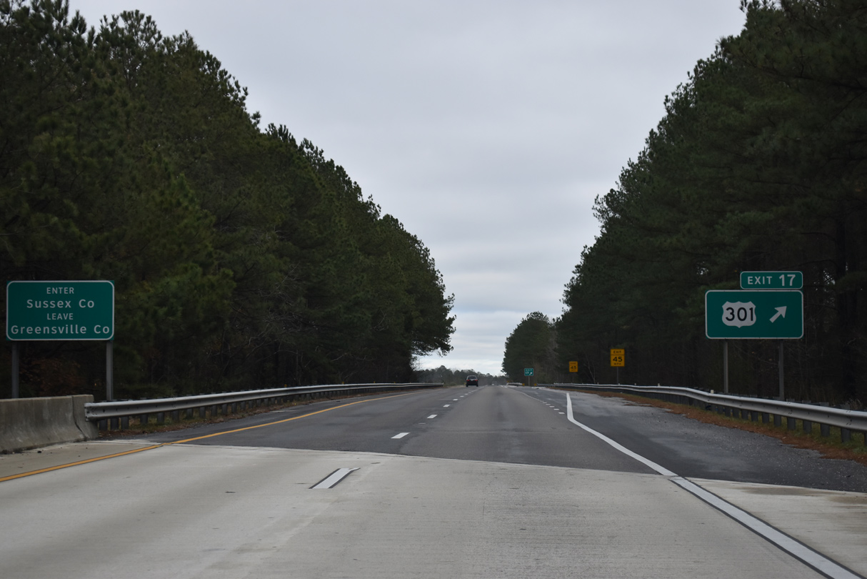
U.S. 301 (Blue Star Highway) converges with Interstate 95 again just across the Sussex County Line at Exit 17.
12/17/20
Curving back to the north, Interstate 95 runs east of U.S. 301, a CSX Railroad line and the Greensville County line.
12/21/18
Washington appears for the first time on a northbound Interstate 95 sign in southern Sussex County.
12/21/18
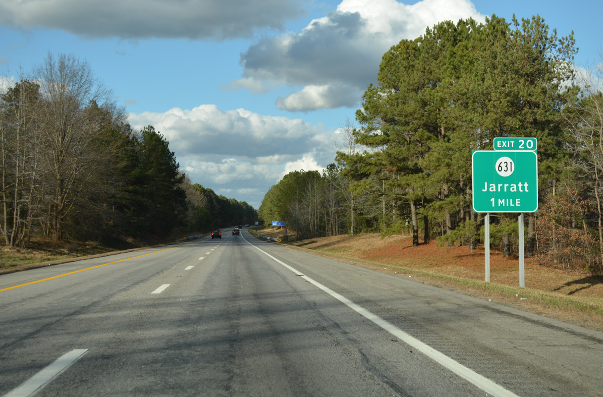
Meeting Interstate 95 east of Jarratt at Exit 20 is SR 631. SR 631 (Henry Road) links the freeway with U.S. 301 (Blue Star Highway) at SR 139 (Henry Street) west.
12/21/18
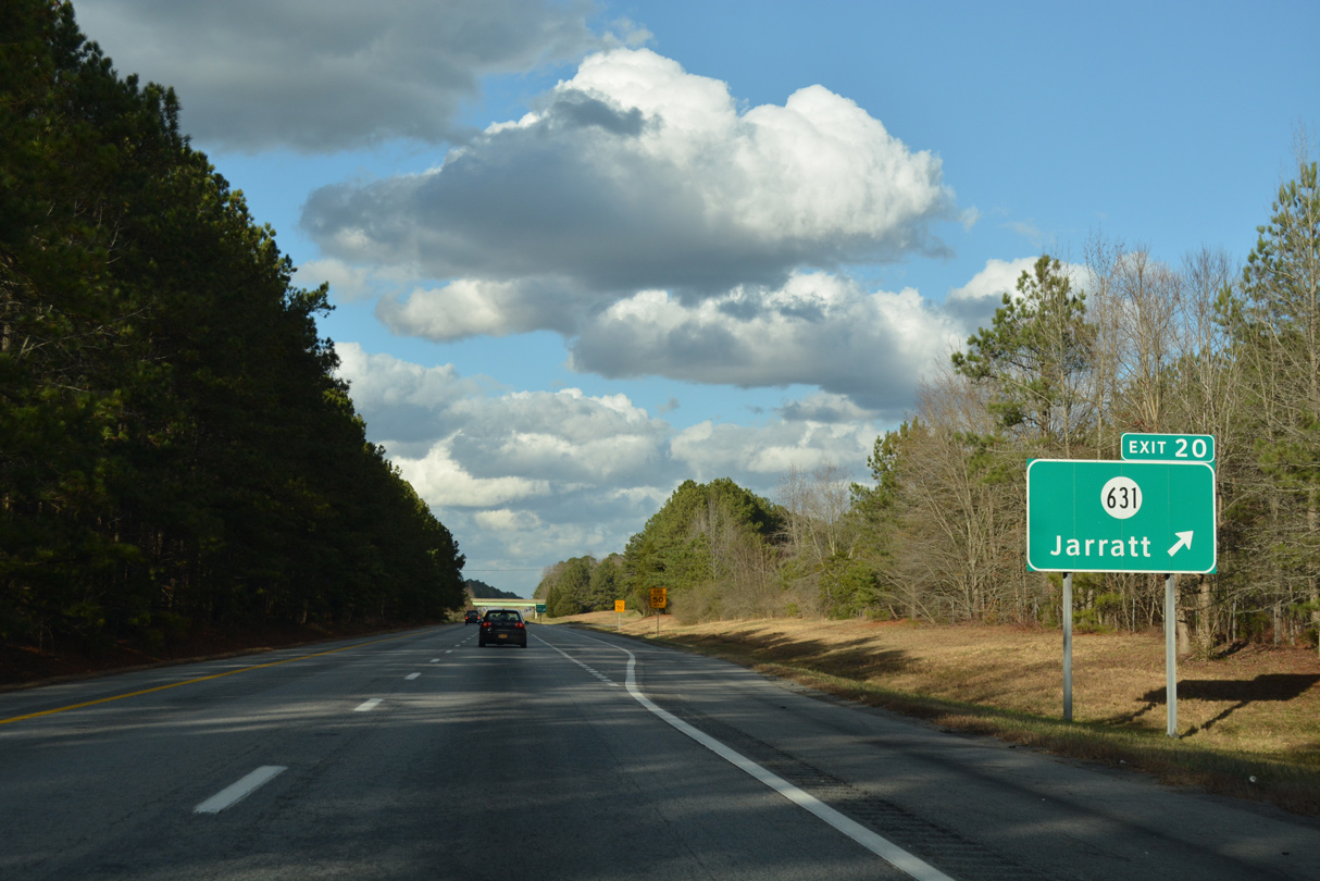
Entering the diamond interchange (Exit 20) with SR 631 (Henry Road) on I-95 north. State Route 139, a 1.48 mile spur from U.S. 301 through the town of Jarratt, extends west from SR 631. Eastward, SR 631 continues to Henry, Gray and SR 35 at Barretts Store (SR 35).
12/21/18
Reassurance marker for Interstate 95 posted ahead of the Klentz Road under pass east of Jarratt. U.S. 301 returns along the freeway ahead and forms a west side frontage road.
12/21/18
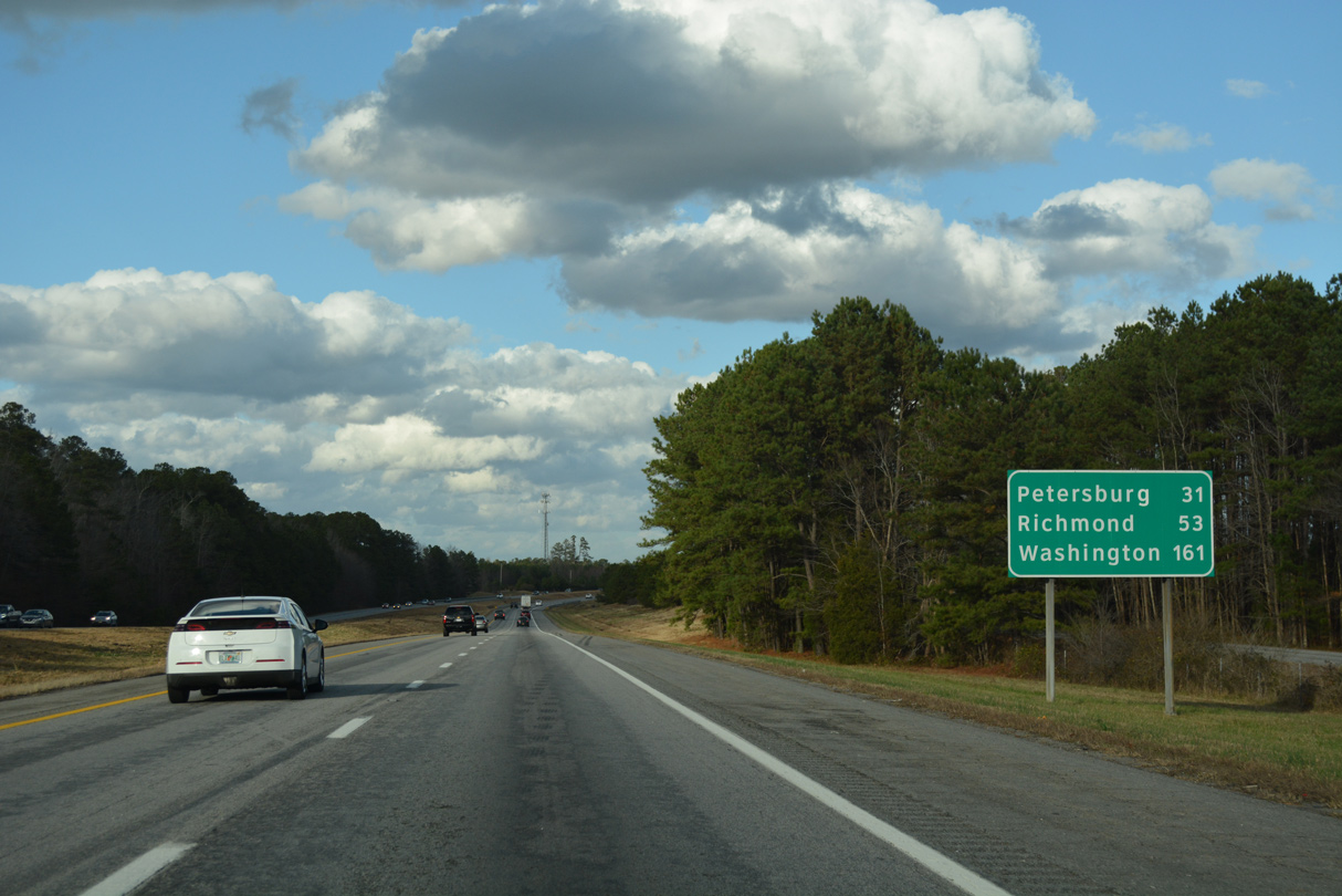
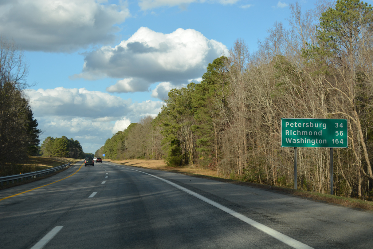
Petersburg is 31 miles to the north. Washington is 161 miles away via I-95 and I-395 north.
12/21/18
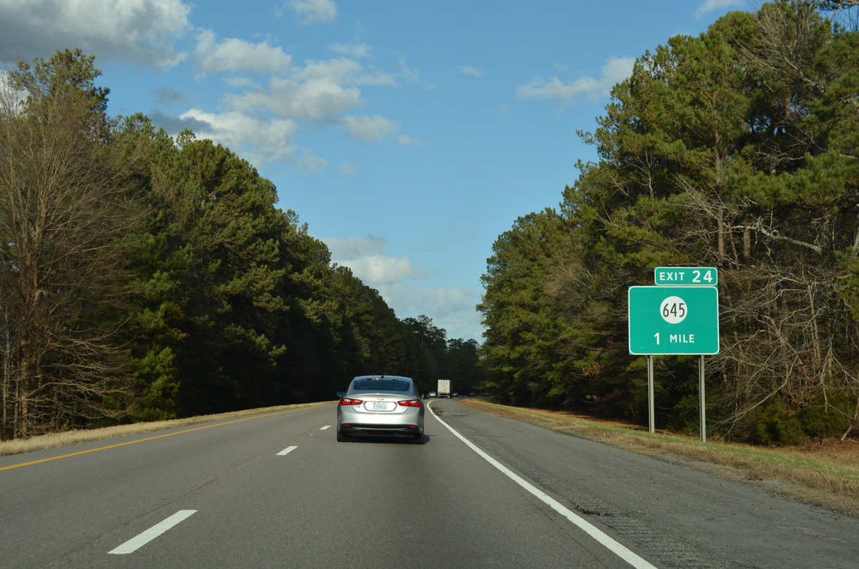
A forested median separates the roadways of I-95 one mile ahead of Exit 24 with SR 645 (Green Church Road). Andrews Road accompanies the freeway as a frontage road to the east.
12/21/18
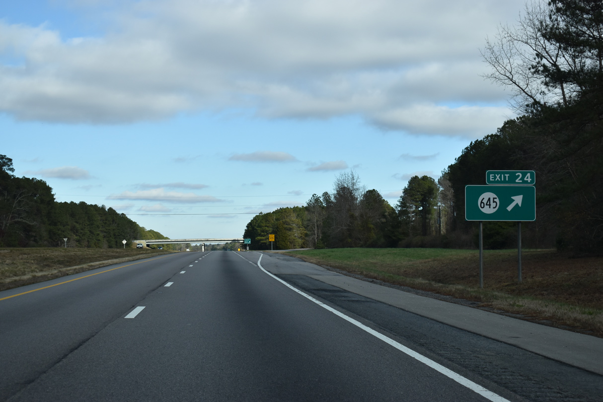
Northbound at the diamond interchange (Exit 24) with SR 645 at Owens. SR 645 stems south along Owen Road from U.S. 301 to Henry and northwest on Green Church Road to SR 649 (Huske Road).
12/17/20
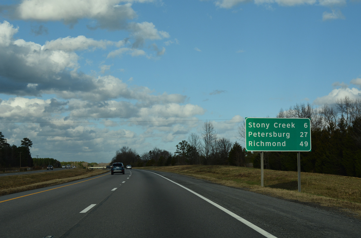
Northbound distance sign posted six miles south of Stony Creek and 27 miles out from Petersburg.
12/21/18
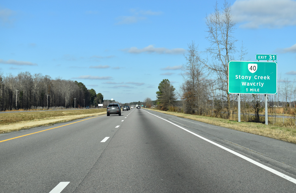
I-95 converges with SR 40 (Sussex Drive) at diamond interchange (Exit 31) in one mile. SR 40 constitutes a 220 mile long highway from SR 8 at Woolvine to SR 10 at Spring Grove.
12/17/20
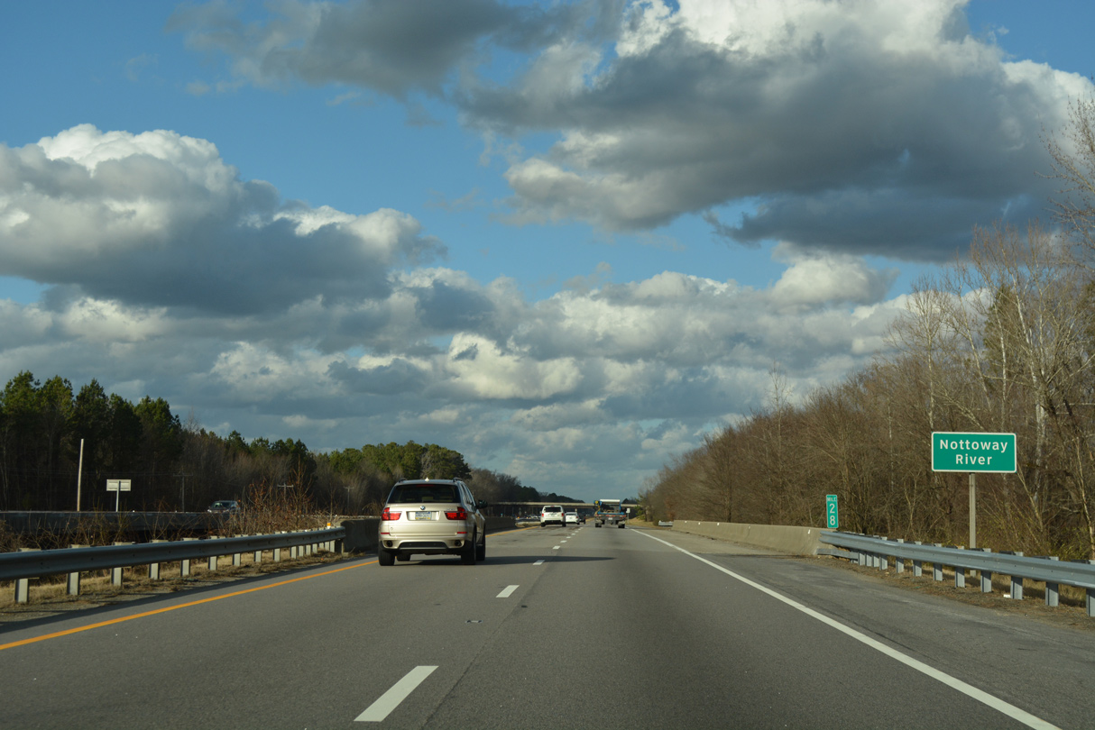
Interstate 95 spans the Nottaway River at mile marker 28.
12/21/18
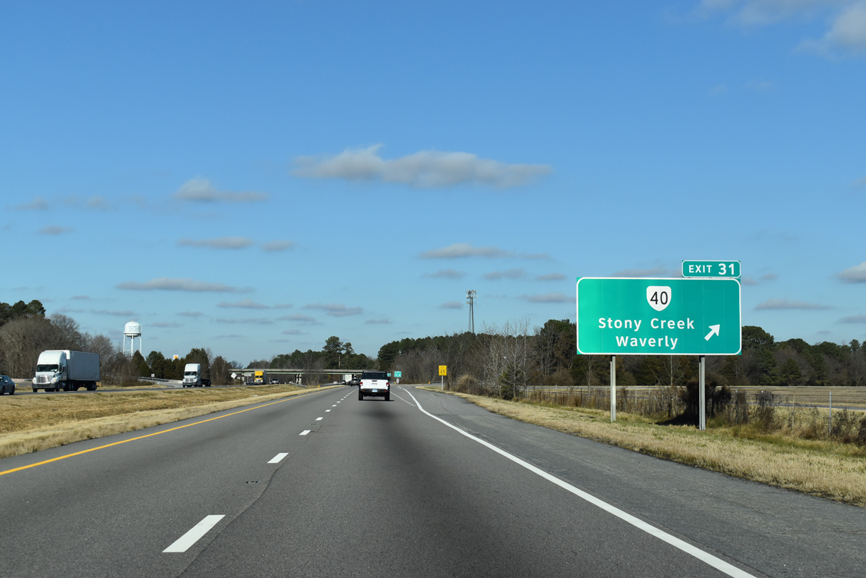
SR 40 travels west from Exit 31 to Stony Creek and east to Sussex, the seat of Sussex County. East from there, SR 40 continues east to meet U.S. 460 in Waverly and overall to SR 10 in Spring Grove.
12/17/20

Setzer Road (SR 670) passes over Interstate 95 after the freeway crosses Stony Creek.
12/17/20
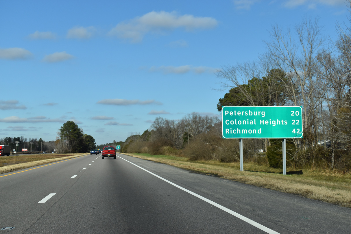
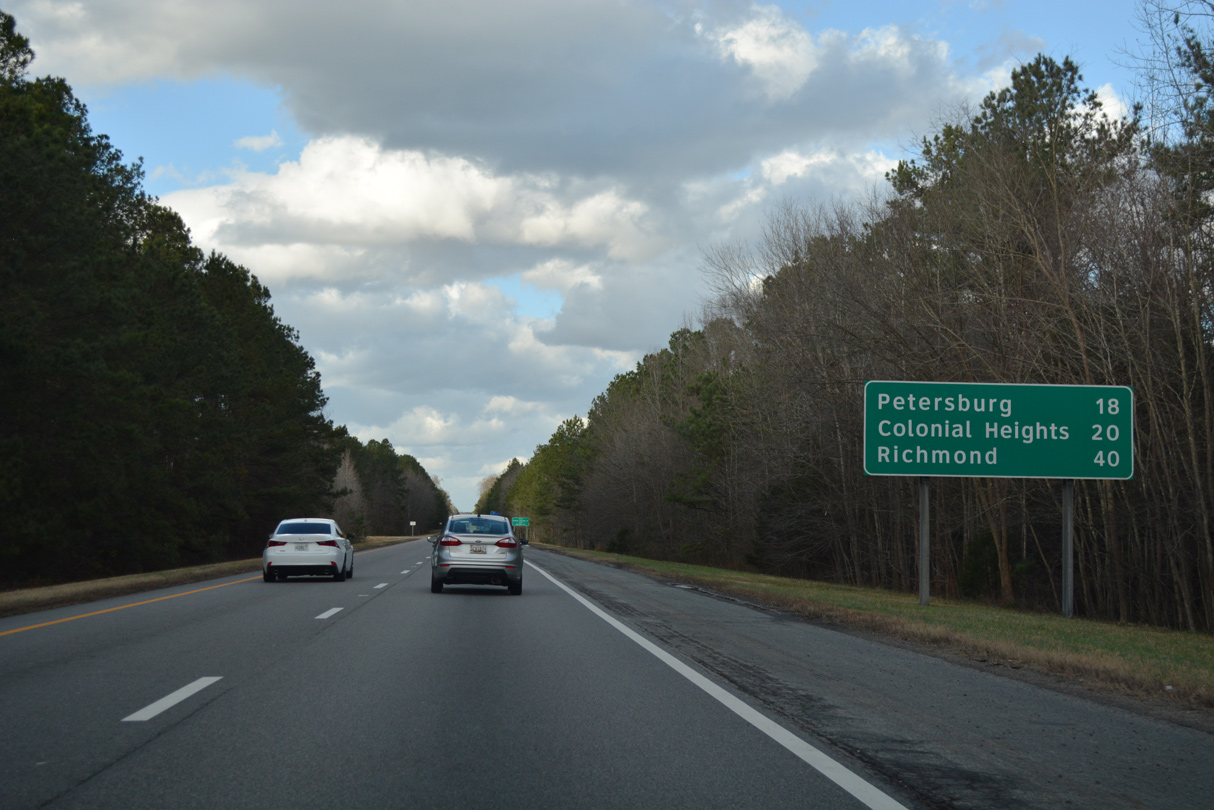
Colonial Heights, an independent city north of Petersburg, joins Richmond on this northbound distance sign. U.S. 301 (Blue Star Highway) and Slagle Road comprise the frontage roads for Interstate 95 north to Exit 33.
12/17/20
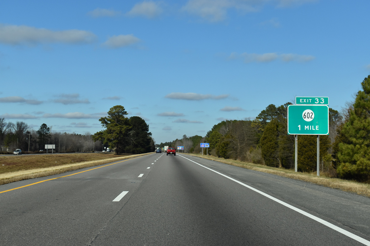
The next exit along northbound Interstate 95 joins the freeway with SR 602 (Cabin Point Road). SR 602 weaves through a mixture of timber land and farm fields to SR 35 by Belsches Millpond and the settlement of Lambs.
12/17/20
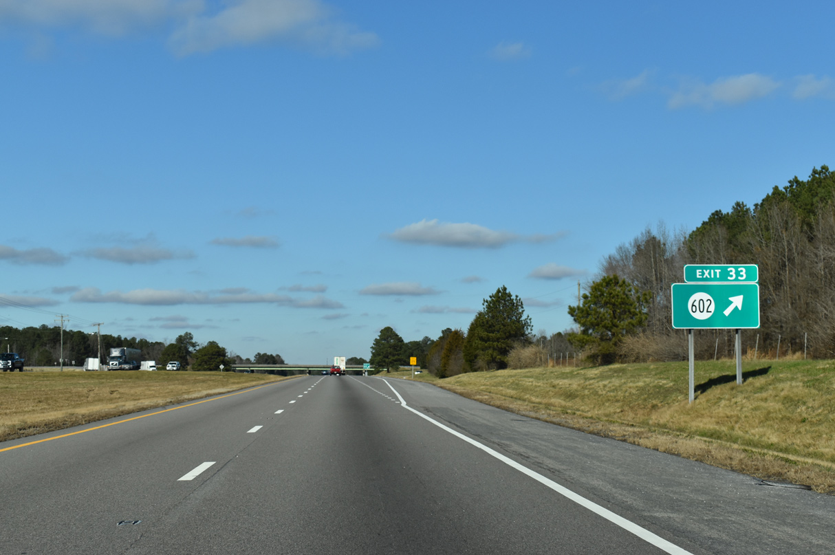
West from the diamond interchange (Exit 33) with I-95, SR 602 takes St. John Church Road to Galley Road (SR 657) and Halifax Road (SR 618) north of Stony Creek.
12/17/20
Confirming marker and distance sign posted along Interstate 95 north near Rowanty Creek.
12/21/18
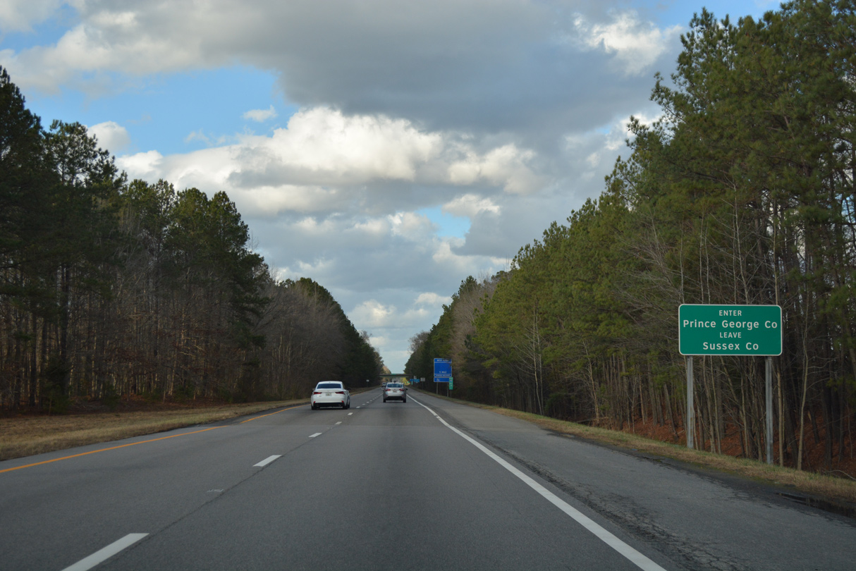
Interstate 95 enters Prince George County after an 18 mile stretch through Sussex County.
12/21/18
References:
- "I-95 Bridge Replacement over the Meherrin River." Virginia Department of Transportation (VDOT), project web site. Accessed December 15, 2018.
- "Greensville County Otterdam Road Improvement Project, Phase I Construction Update." Greensville County, Virginia, press release. October 21, 2015.
Photo Credits:
- Alex Nitzman: 12/21/18, 12/17/20
Connect with:
Page Updated Monday February 08, 2021.