
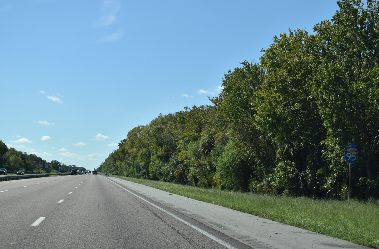
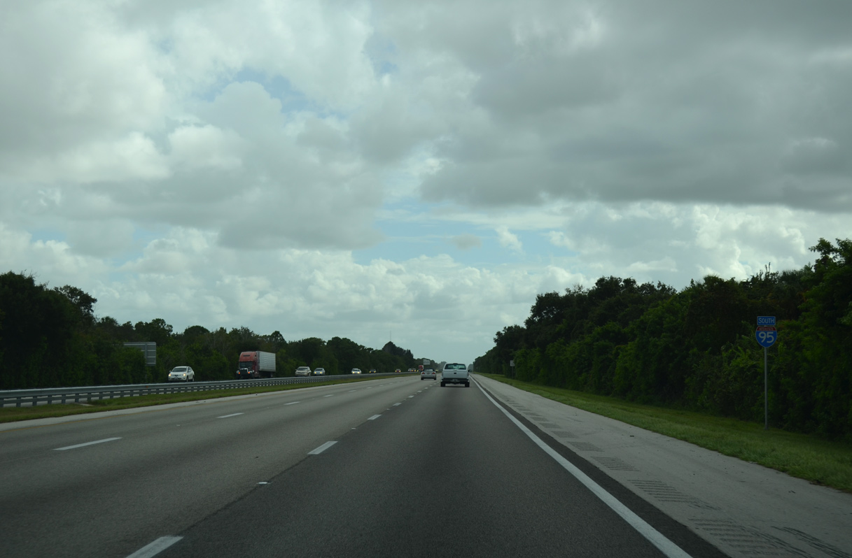
Interstate 95 South - Titusville to Melbourne
 South
South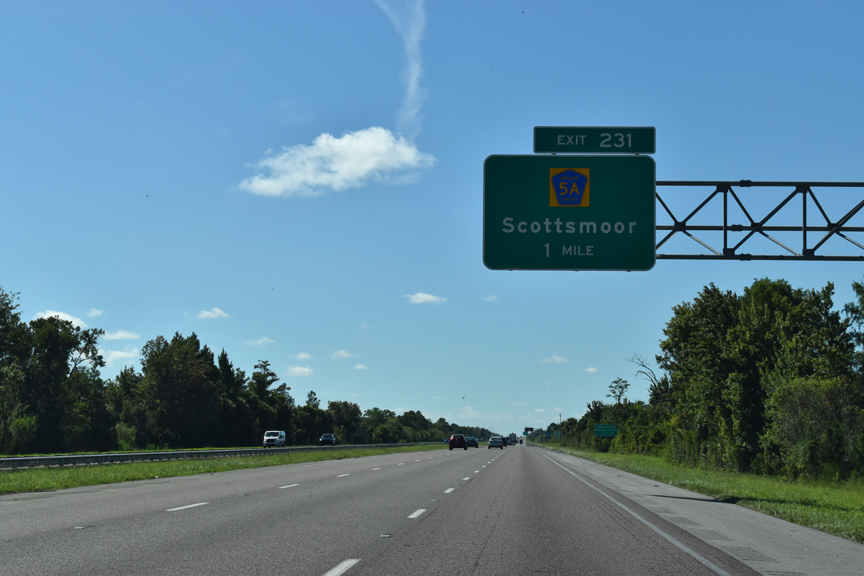
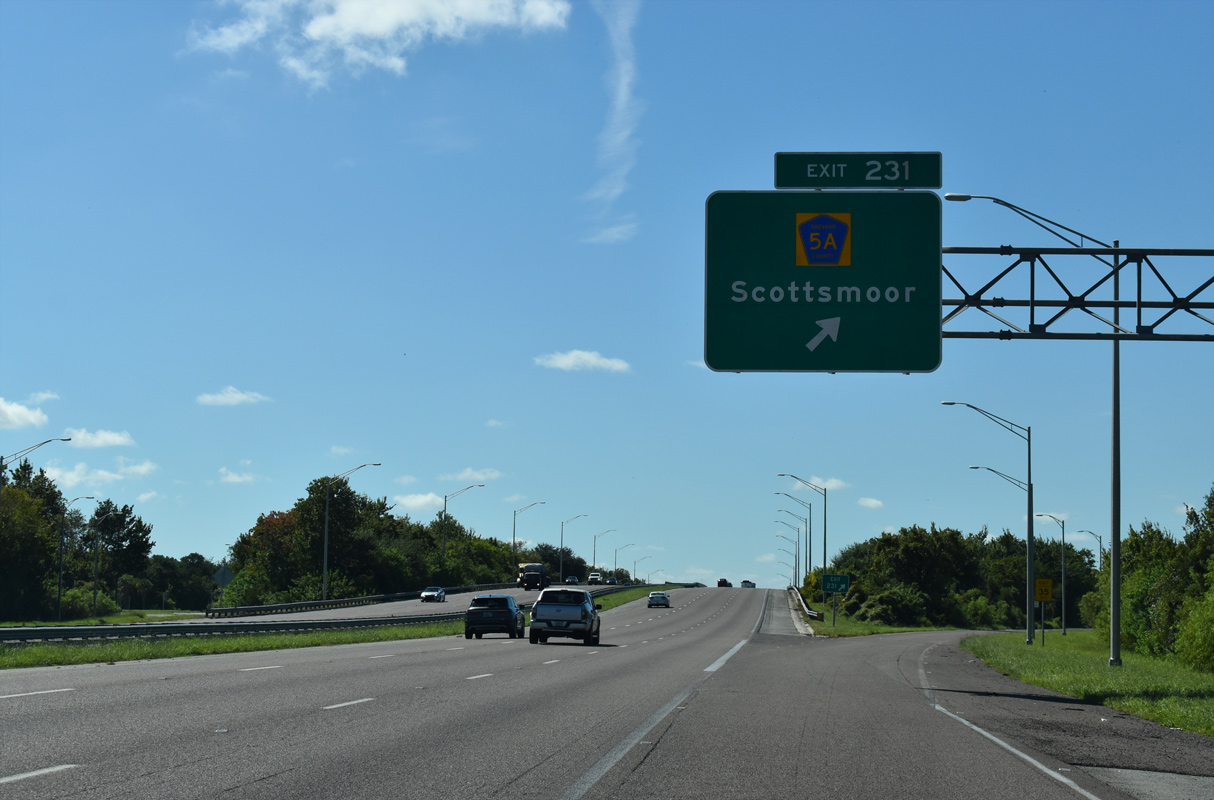
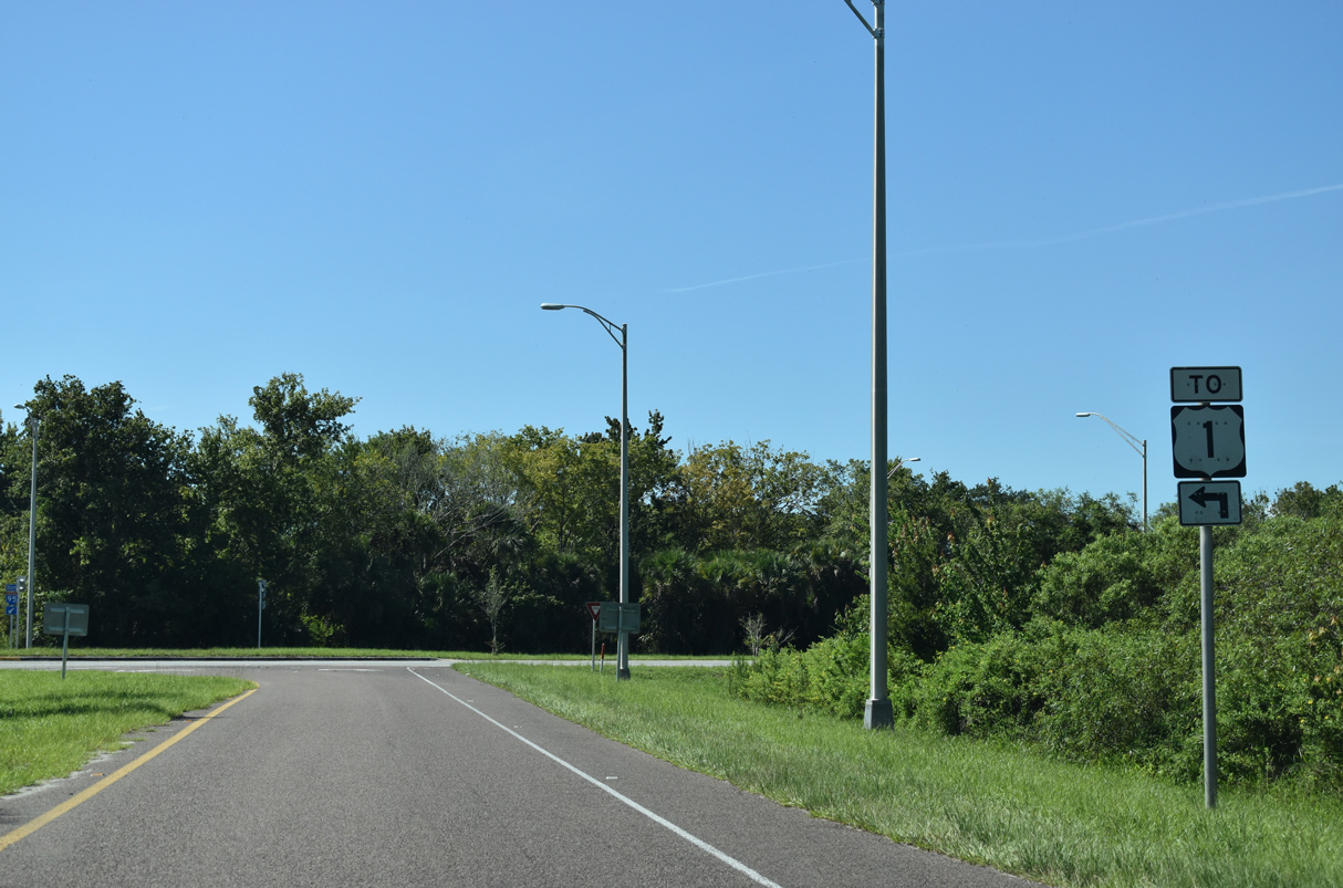
County Road 5A (Deering Parkway) links Interstate 95 with parallel U.S. 1 at the unincorporated community of Scottsmoor via Exit 231 one mile.
09/12/22
Unsigned beyond guide signs for Exit 231, CR 5A measures just 1.11 miles east from the diamond interchange at Exit 231 to U.S. 1.
09/12/22
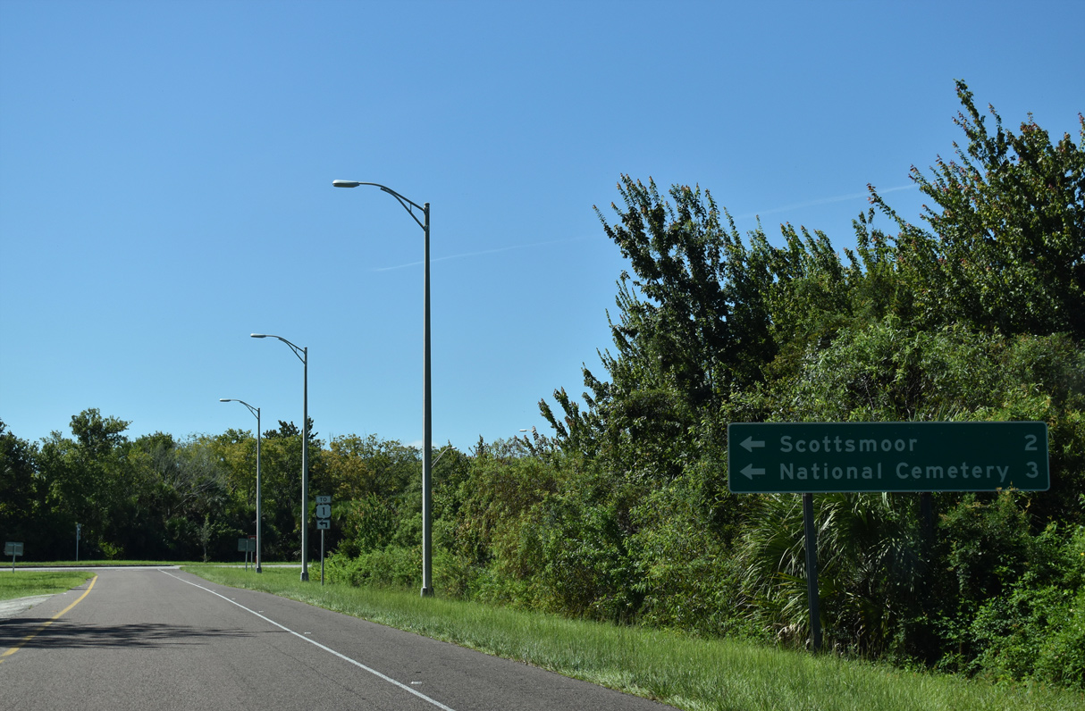
Deering Parkway dead ends just west of Exit 231. Scottsmoor is two miles to the east.
09/12/22
U.S. 1 leads back north into Volusia County from CR 5A (Deering Parkway) en route to northern reaches of John F. Kennedy Space Center and the city of Oak Hill.
09/12/22
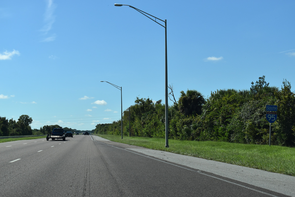
The 72.71 miles of I-95 through Brevard County ranks second in overall mileage within one county along the entire route. Penobscot County, Maine tops the list with 105 miles.
09/12/22
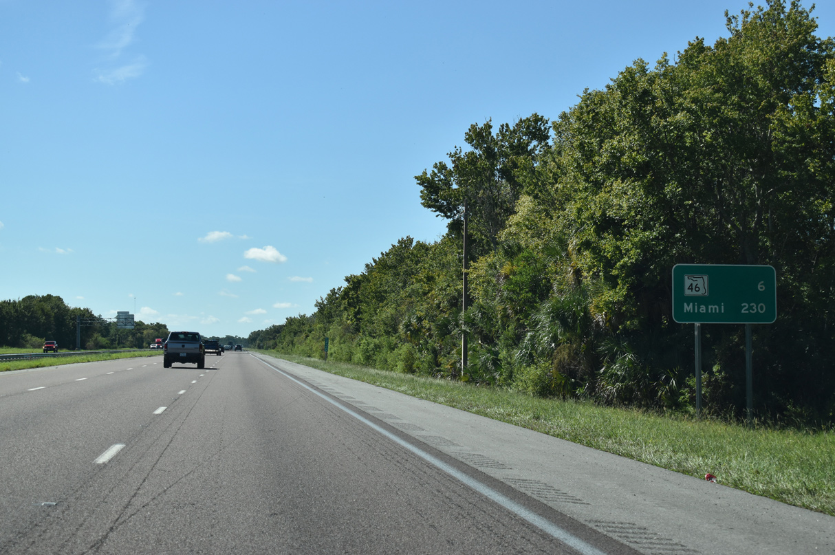
Northern Brevard County is vastly rural, with limited development along U.S. 1 between I-95 and the Indian River. The succeeding exit is with SR 46 six miles to the south.
09/12/22
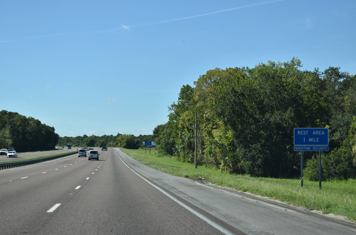
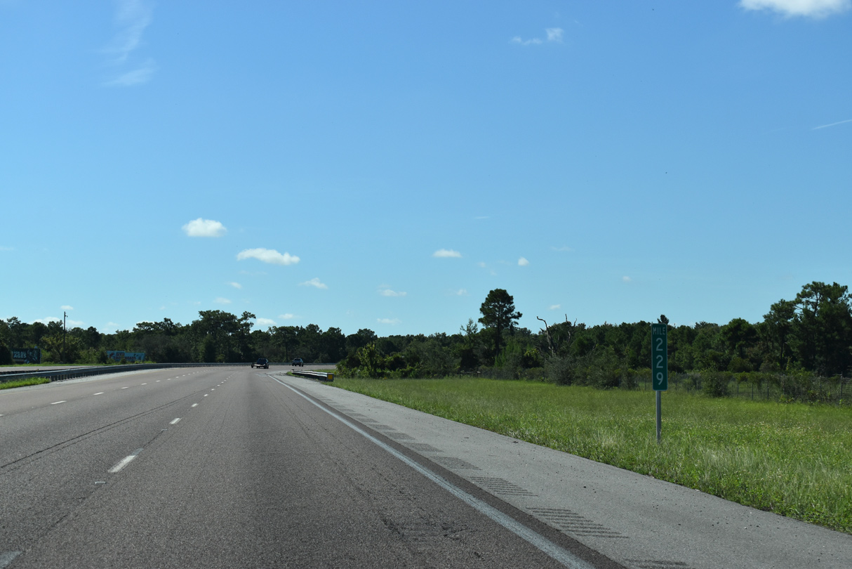
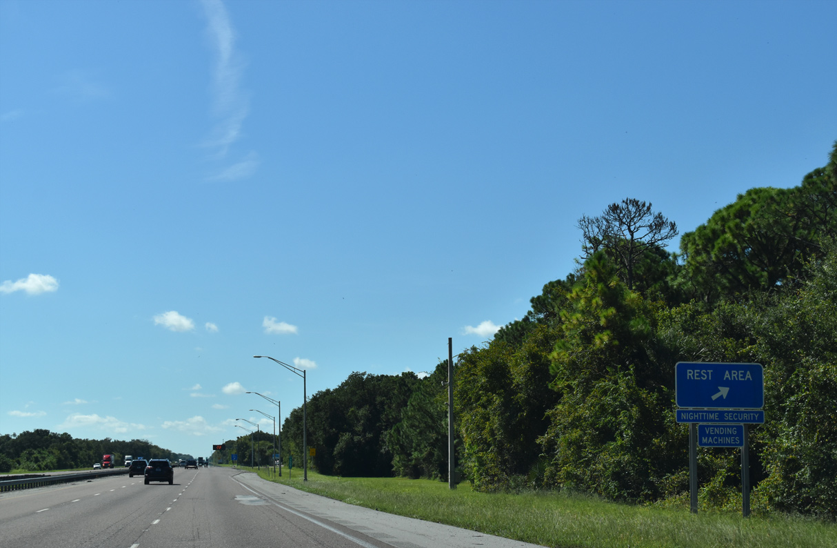
The fourth rest area along Interstate 95 south in Florida lies beyond mile marker 227 at Mims.
09/12/22
South of the rest area, Interstate 95 runs between Buck Lake Conservation Area and Indian River Preserve Golf Club.
09/12/22
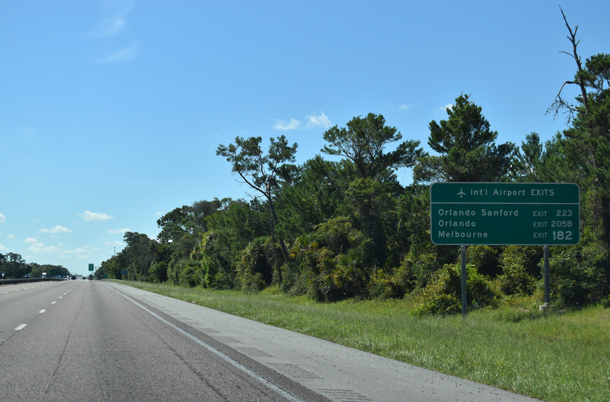
Three International Airports serve the greater Orlando metropolitan area and the Space Coast. Melbourne Orlando International Airport (MLB) is the closest to Interstate 95 via Ellis Road east from Exit 182.
09/12/22
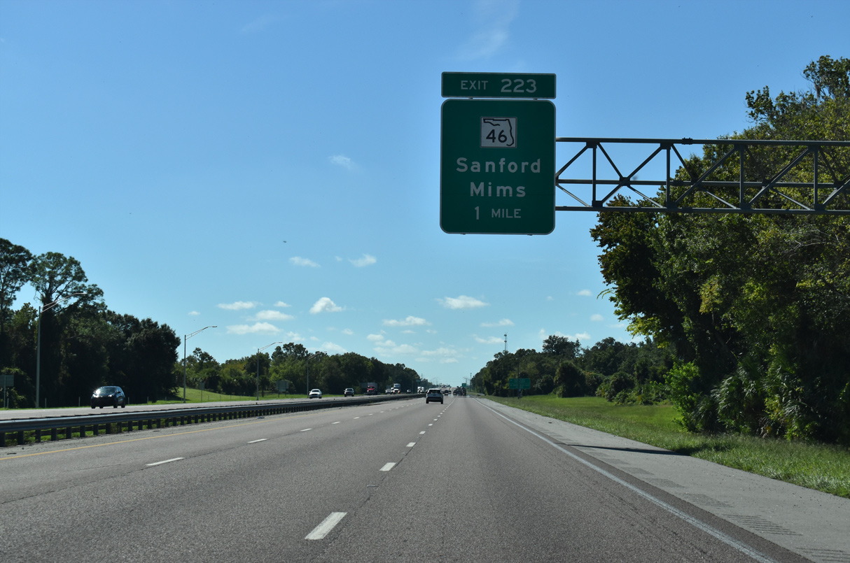
Mims is an unincorporated area centered around the east end of SR 46 (Main Street) and U.S. 1.
09/12/22
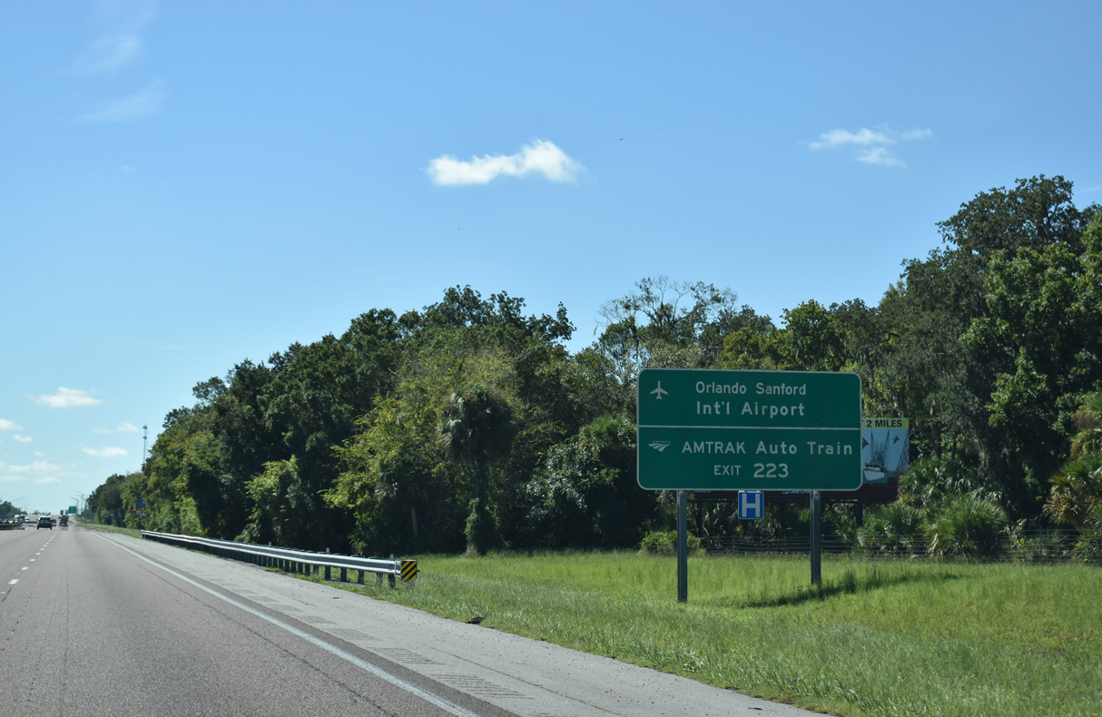
SR 46 west to Sanford leads to both Orlando Sanford International Airport (SFB) via Lake Mary Boulevard and AMTRAK Auto Train.
09/12/22
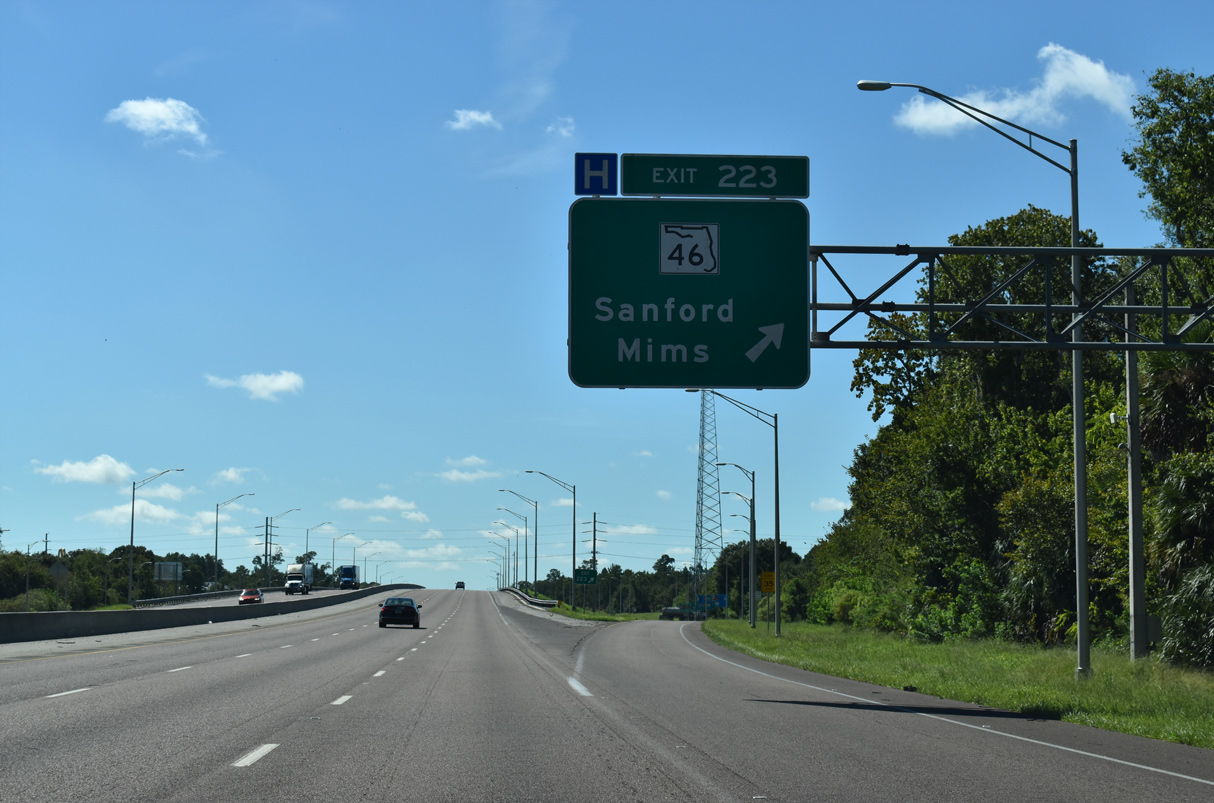
The diamond interchange at Exit 223 connects Interstate 95 with SR 46, 1.53 miles west of U.S. 1.
09/12/22
Confirming marker posted south of the SR 46 entrance ramp at Mims and east of Sherwood Golf Club.
09/12/22
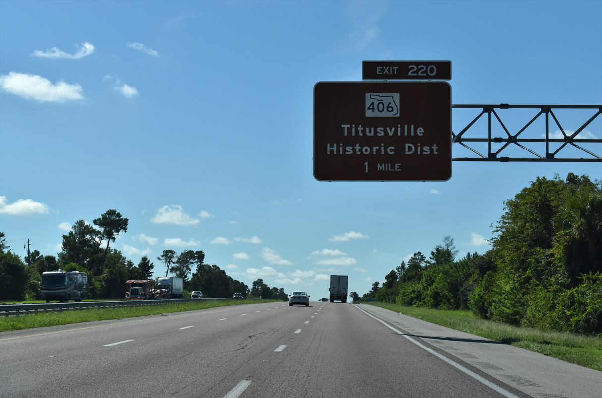
Advancing south from the Dairy Road overpass, I-95 travels through western reaches of Titusville. The upcoming exchange with SR 406 is the first of three exits for the Brevard County seat.
09/12/22
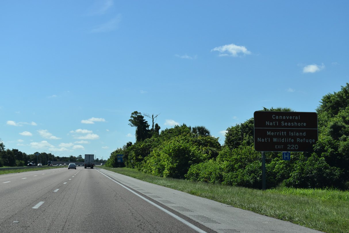
SR 406 leads 4.35 miles east from Interstate 95 to A. Max Brewer Memorial Parkway across the Indian River to Merritt Island National Wildlife Refuge. The parkway extends another ten miles east to Canaveral National Seashore.
09/12/22
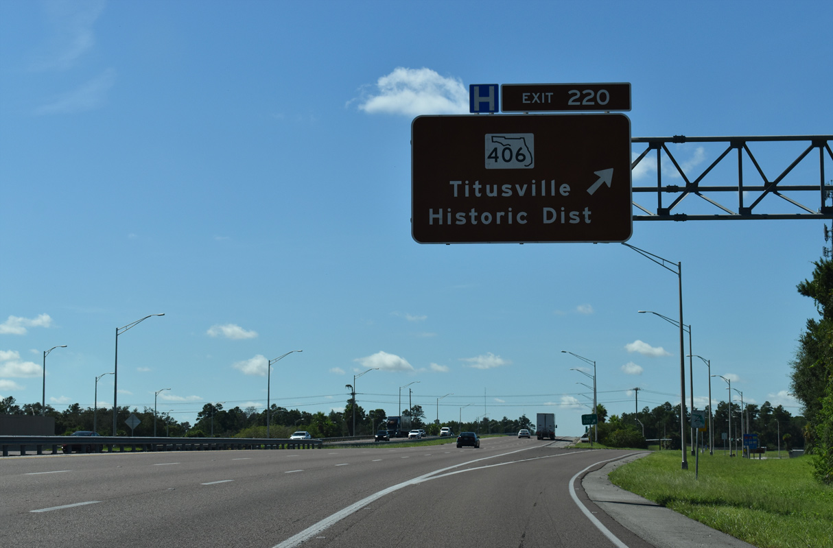
Entering the diamond interchange (Exit 220) with Garden Street and SR 406 on I-95 south. Garden Street constitutes a five lane commercial boulevard east to U.S. 1 at Downtown Titusville.
09/12/22
South from SR 406 (Garden Street), Interstate 95 passes through western reaches of Titusville city between Carpenter Road and SR 405 (South Street).
09/12/22
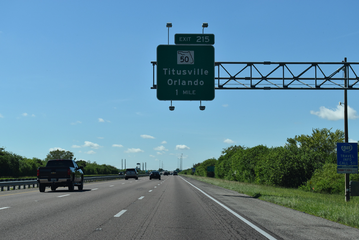
Interstate 95 advances four miles south from SR 406 to SR 50 (Cheney Highway) at Exit 215.
09/12/22
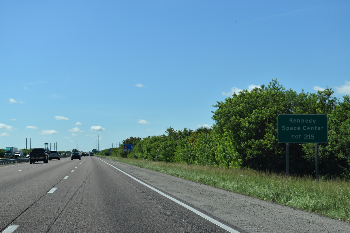
Parallel SR 405 arcs southeast from SR 50 (Cheney Highway) nearby to NASA Causeway (CR 405) east to Kennedy Space Center.
09/12/22
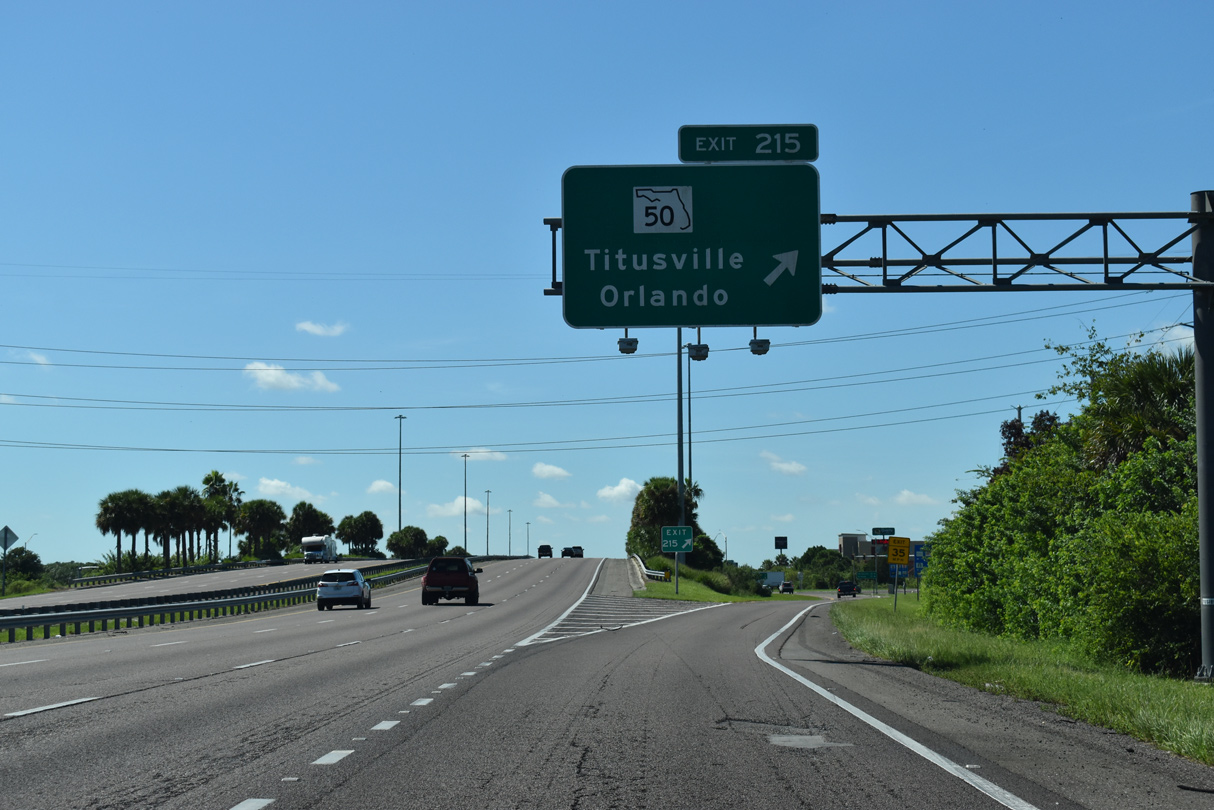
State Road 50 travels the width of the Florida Peninsula between U.S. 19 at Weeki Wachee and U.S. 1 in Titusville. The four lane corridor represents one of the three routes joining the Space Coast with Orlando.
09/12/22
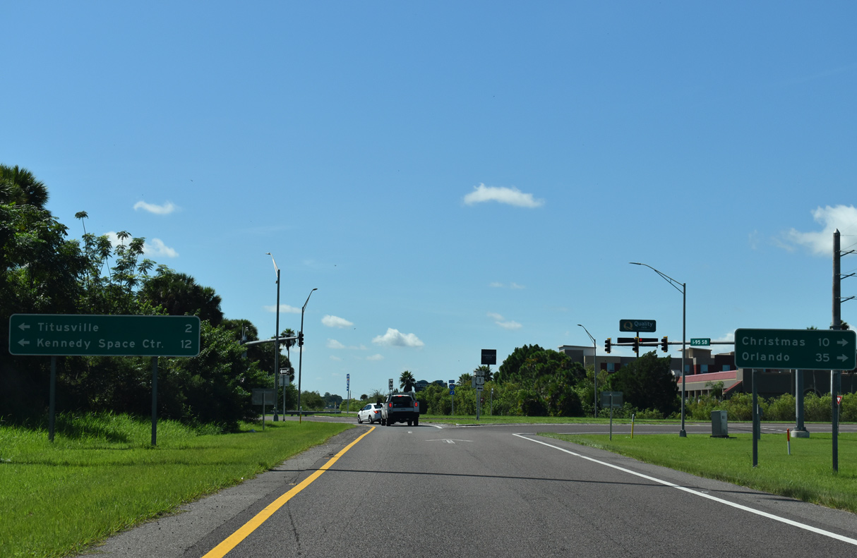
SR 50 (Cheney Highway) travels ten miles west from Exit 215 to the rural community of Christmas in Orange County. The Orlando city center lies 25 miles further along Colonial Drive.
09/12/22
East from Exit 215, SR 50 (Cheney Highway) constitutes a commercial boulevard 3.4 miles to U.S. 1 along the Indian River in Titusville.
09/12/22
The 7.550 mile section of I-95 between SR 406 to SR 528 (Beachline Expressway) was widened to six lanes at a cost of $59.5 million. Work finished in Spring 2013.1
09/28/13
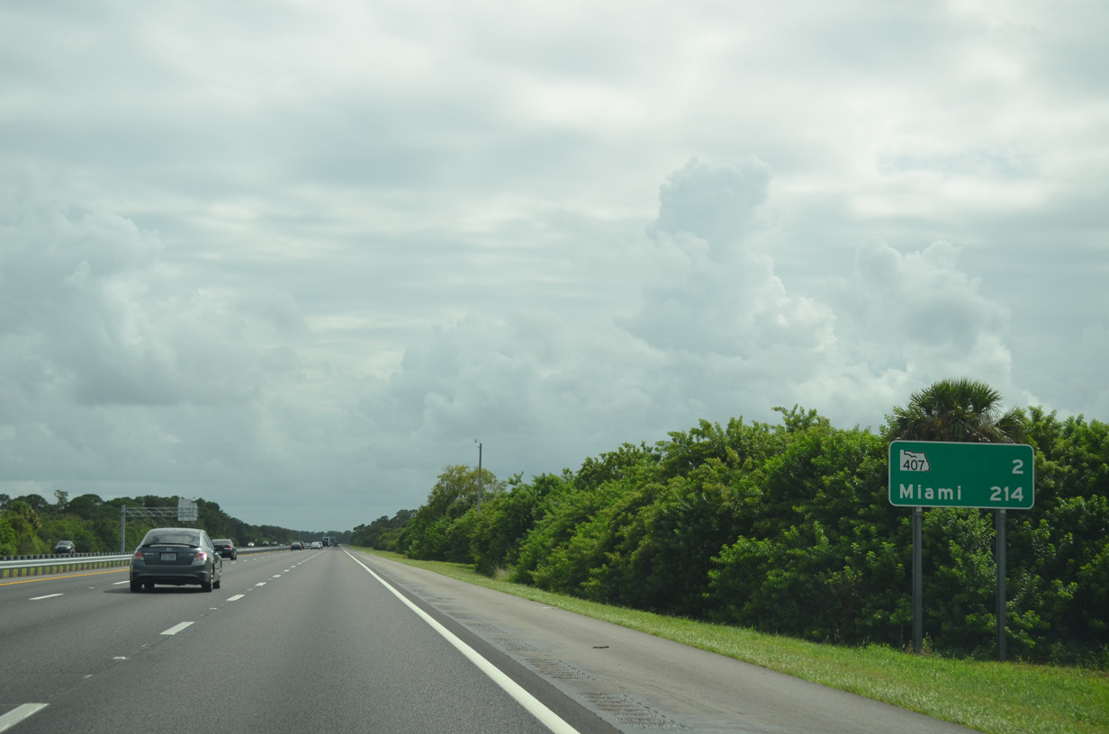
Interstate 95 leaves the Titusville city limits and curves southeast between the Great Outdoors Golf Resort and Windover Farms development. The succeeding exit is with SR 407 (Challenger Memorial Parkway).
09/28/13
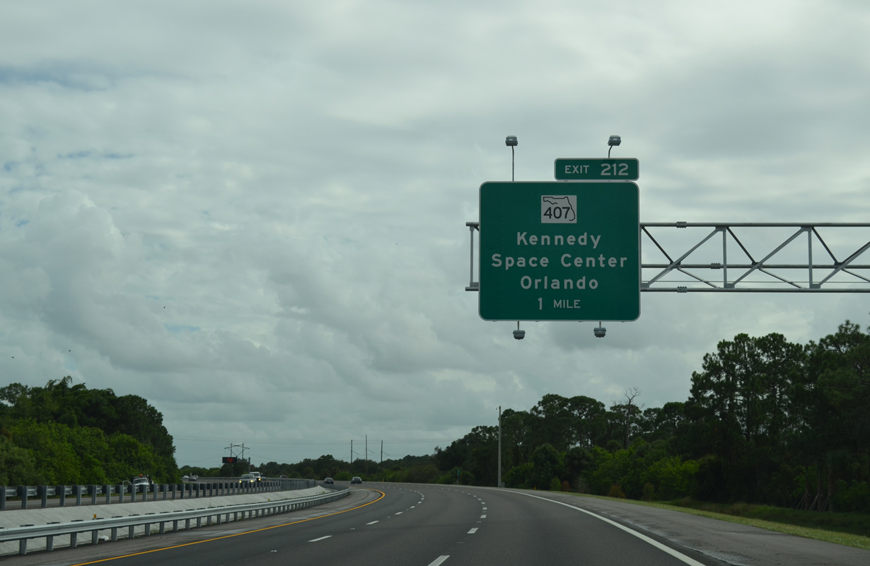
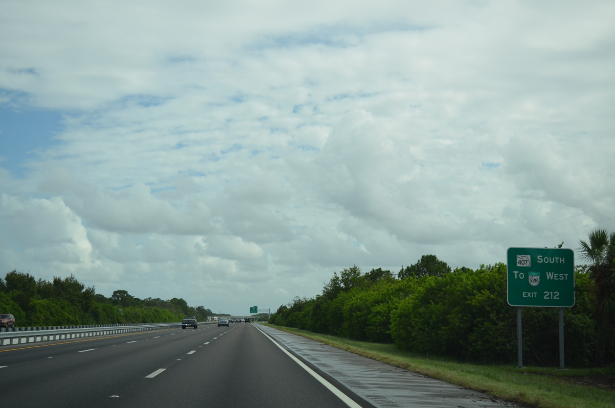
A parclo A2 interchange (Exit 212) joins Interstate 95 with SR 407 (Challenger Memorial Parkway) in one mile. Modifications completed in 2013 expanded the ramps to provide full access between the two roadways.
09/28/13
SR 407 (Challenger Memorial Parkway) angles southwest from SR 405 (Columbia Boulevard) to connect Titusville with the Beachline Expressway west to Orlando.
09/28/13
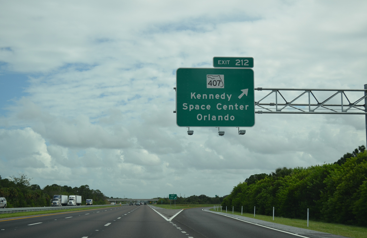
SR 407 north leads motorists to both Space Coast Regional Airport (TIX) and SR 405 (Columbia Boulevard) east to NASA Causeway and Kennedy Space Center. The 6.79 mile long controlled access road defaults onto SR 528 west ahead of the St. Johns River.
09/28/13
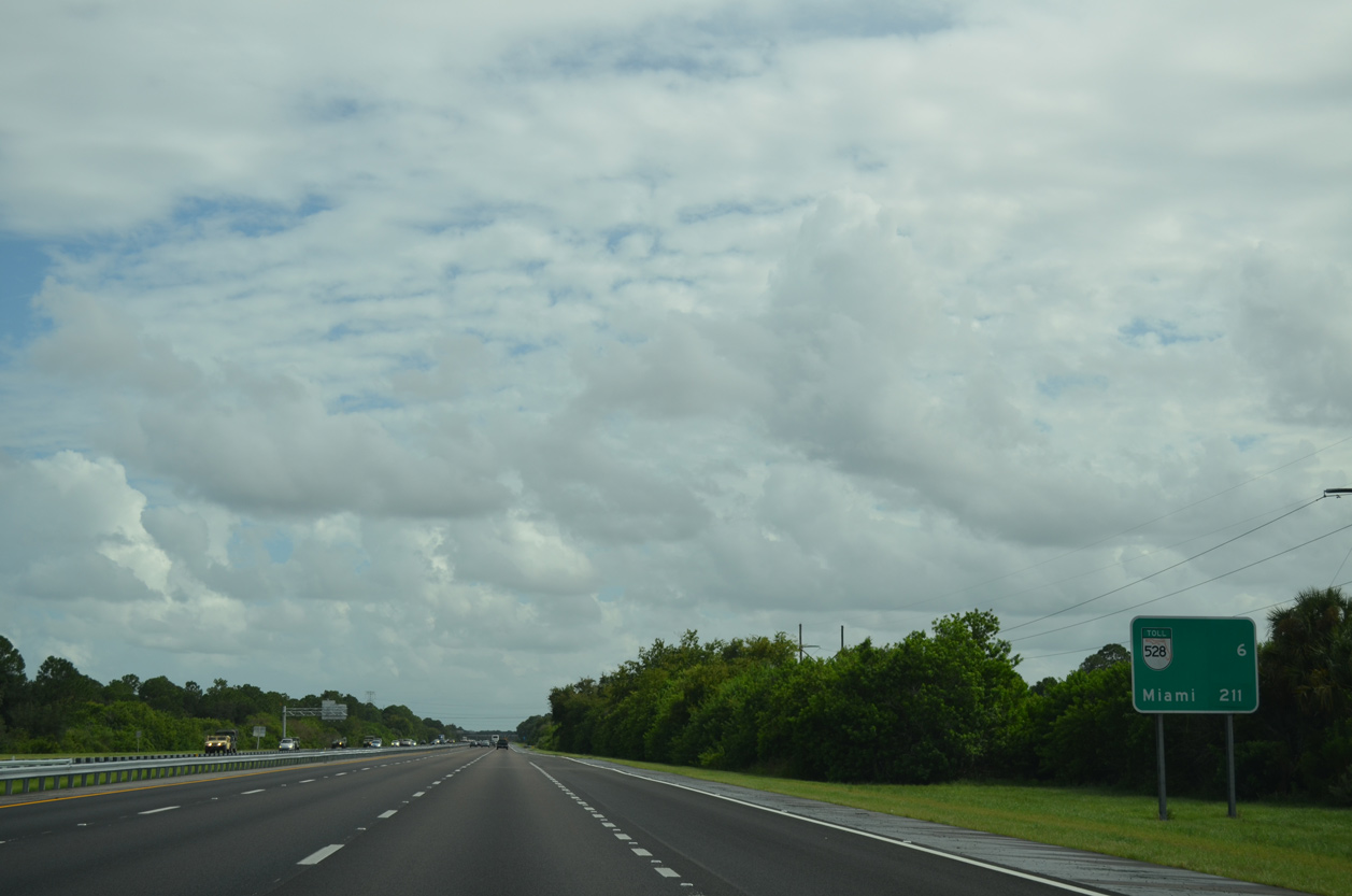
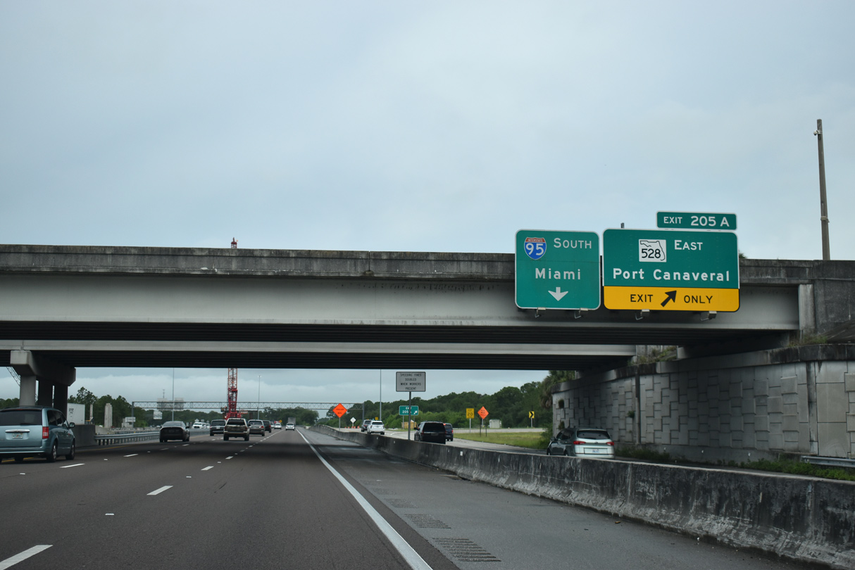
Interstate 95 and SR 528 (Beachline Expressway) meet directly in six miles at west Cocoa. Miami lies 205 miles further south.
09/28/13
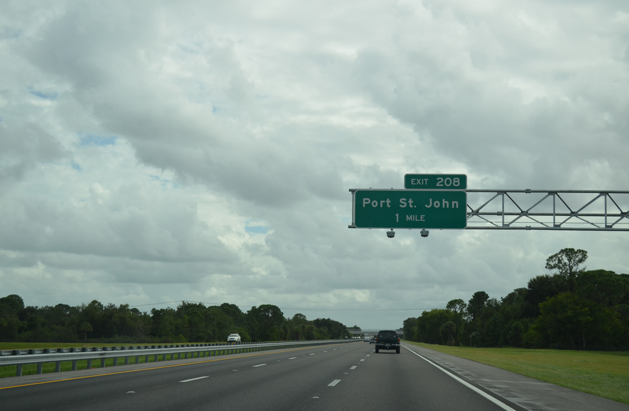
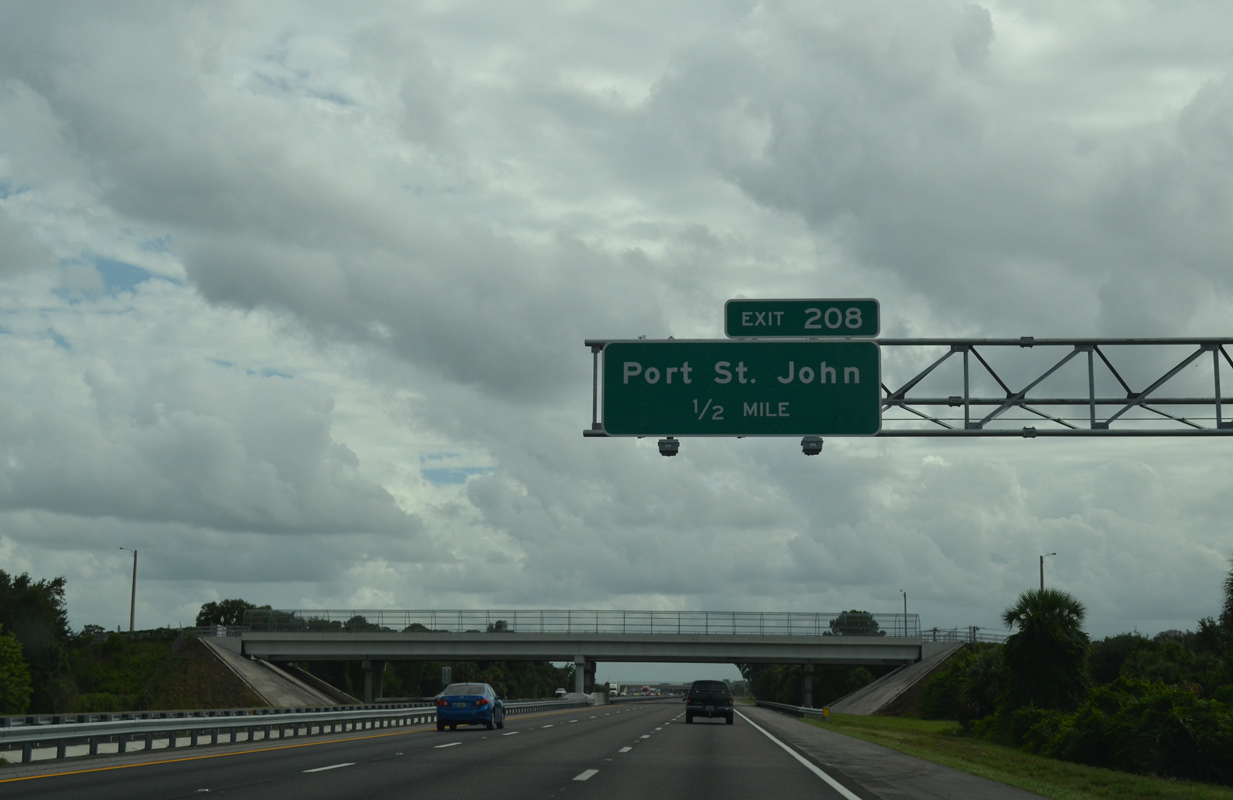
The upcoming diamond interchange (Exit 208) with Port St. John Parkway opened to traffic in 1998.
09/28/13
Port Saint John Parkway links I-95 with Golfview Avenue and Grissom Parkway north into the unincorporated Port St. John community.
09/28/13
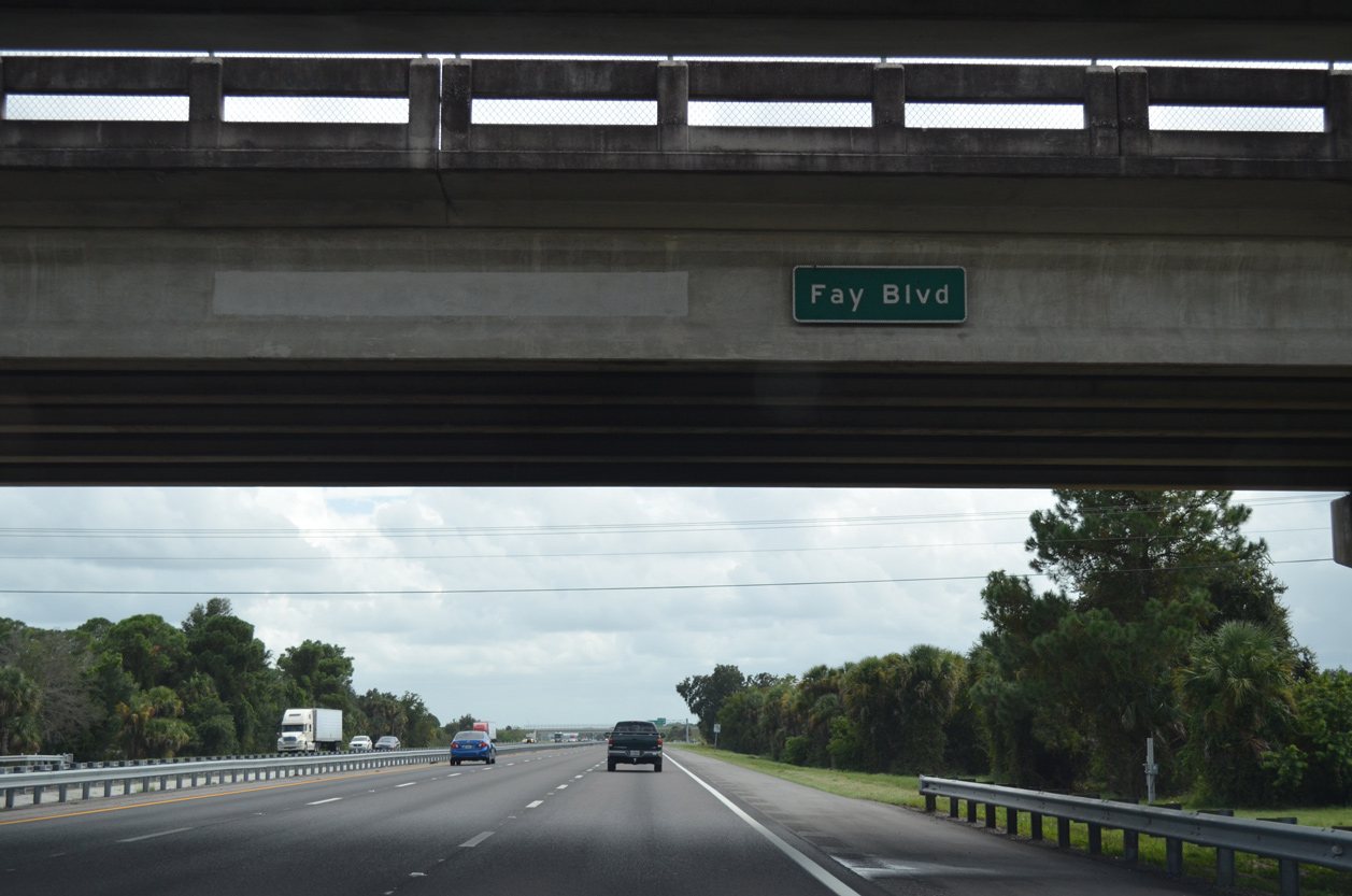
A button copy sign identifies the Fay Boulevard overpass along I-95 southbound in Port St. John.
09/28/13
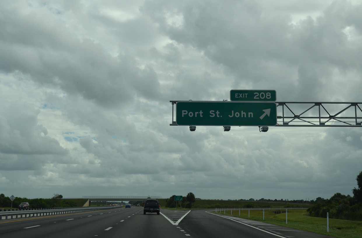
Exit 208 leaves southbound Interstate 95. Port St. John Parkway east to Grissom Parkway south provides an alternate route to the city of Cocoa.
09/28/13

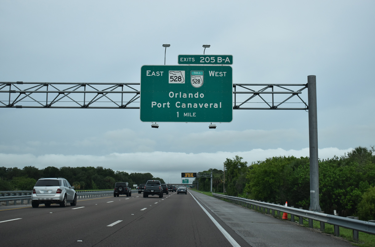
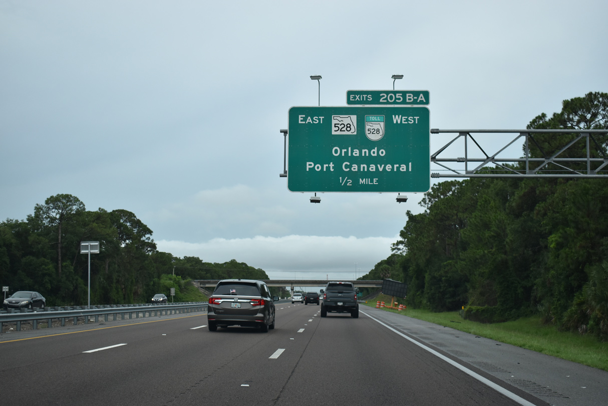
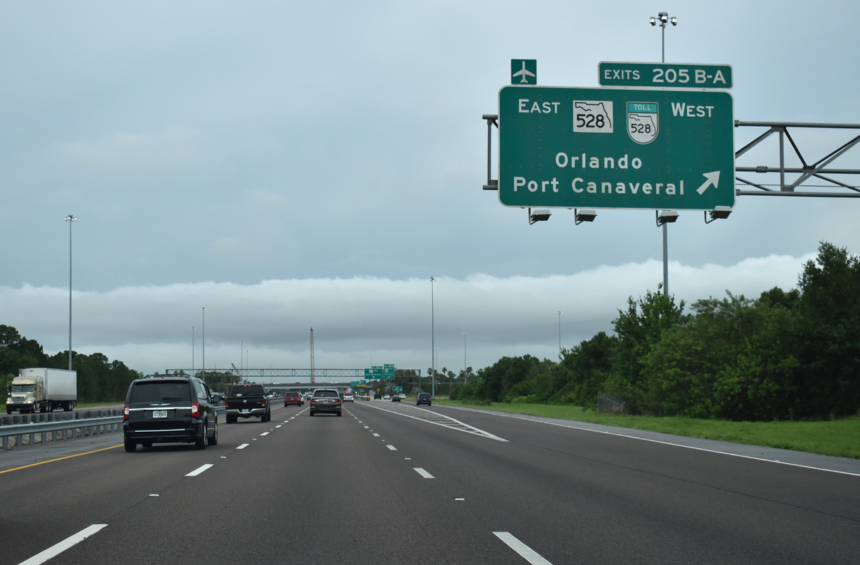
A full cloverleaf interchange (Exit 205) follows with SR 528 (Beachline Expressway) by the Canaveral Groves community.
09/28/13
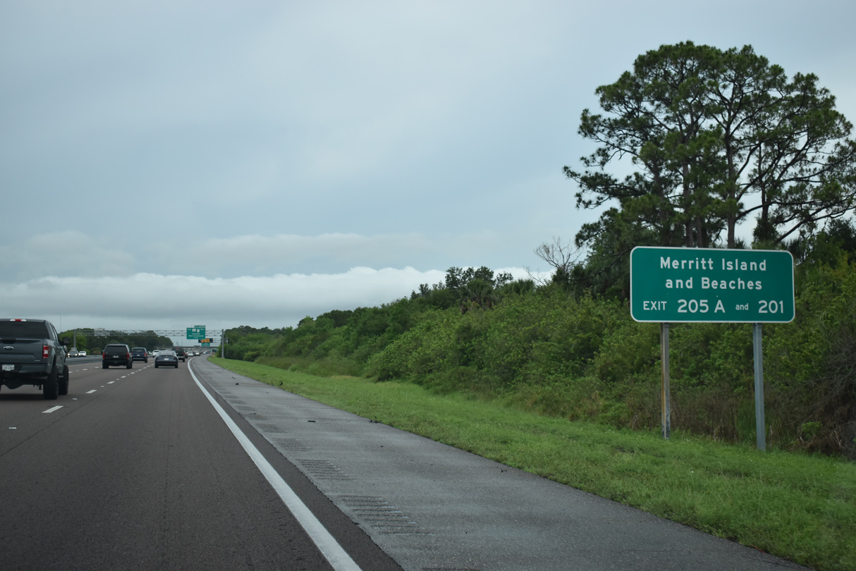
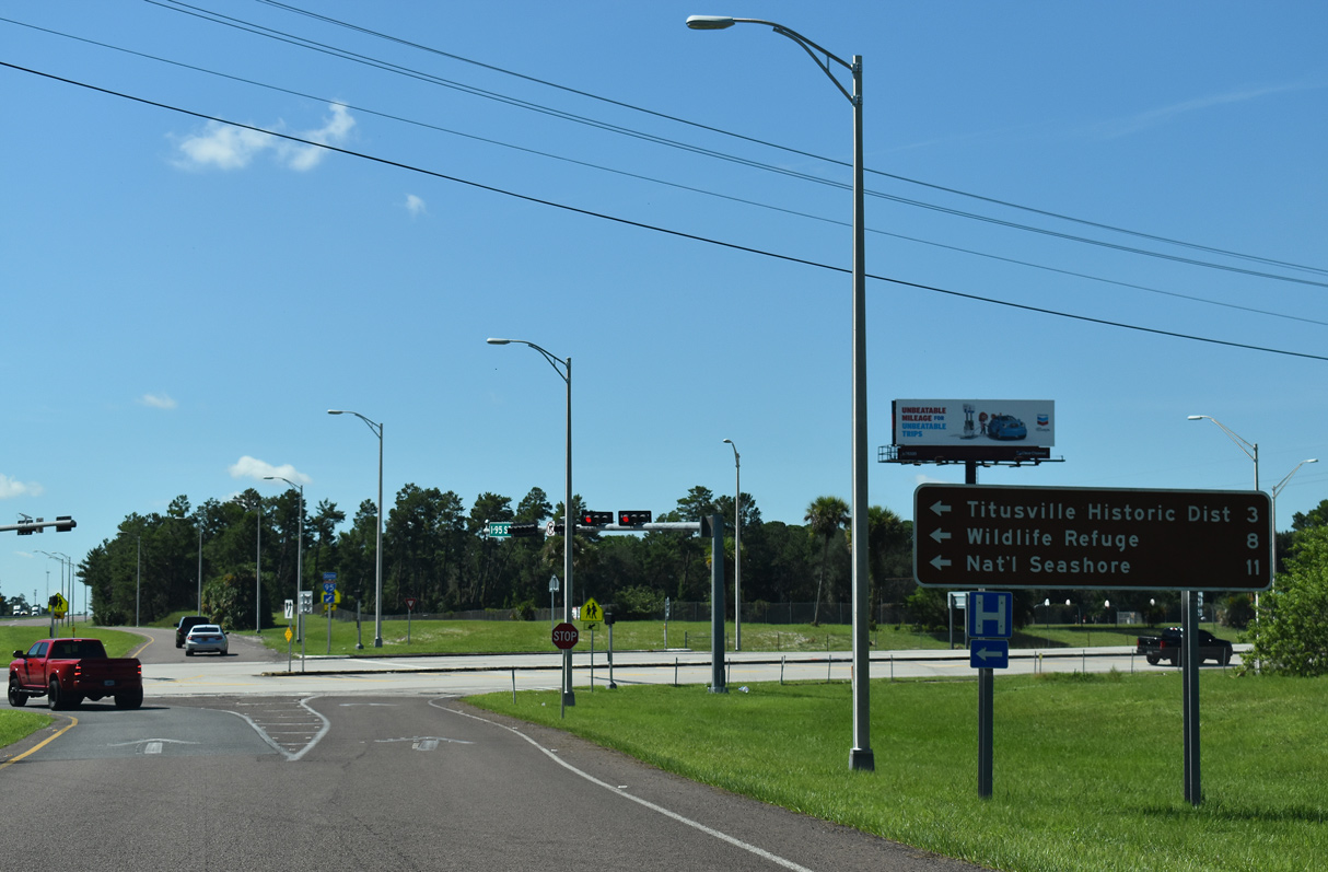
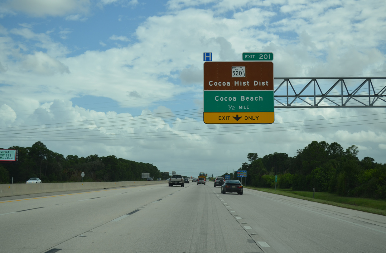
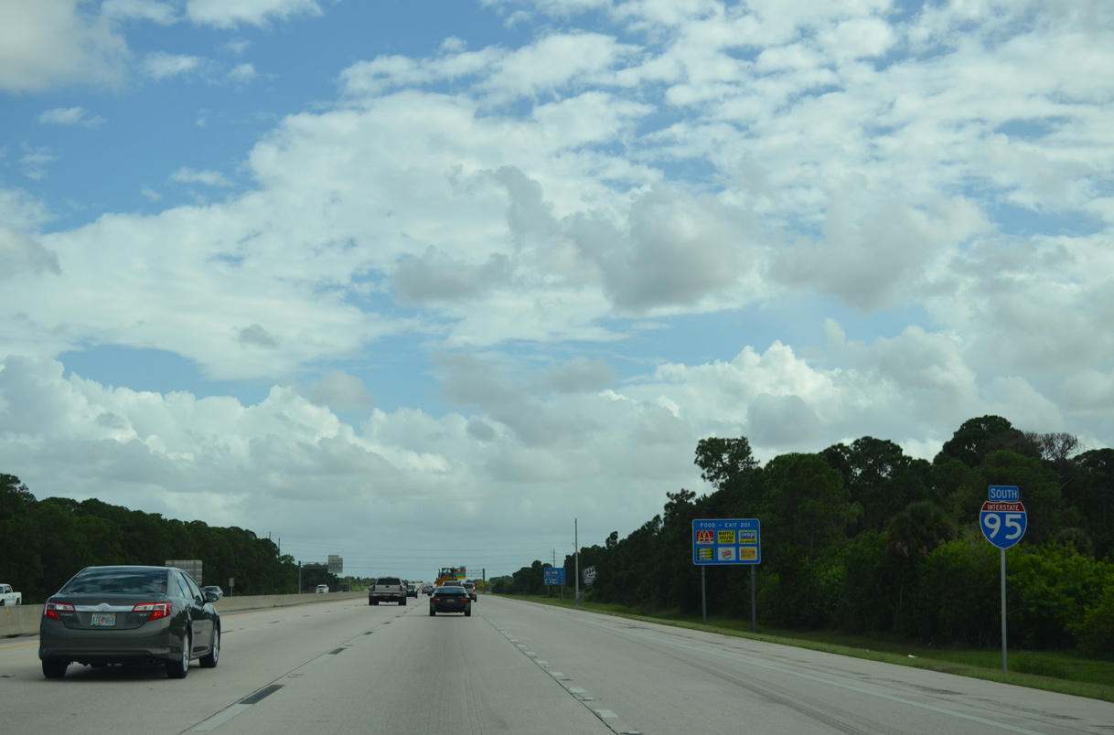
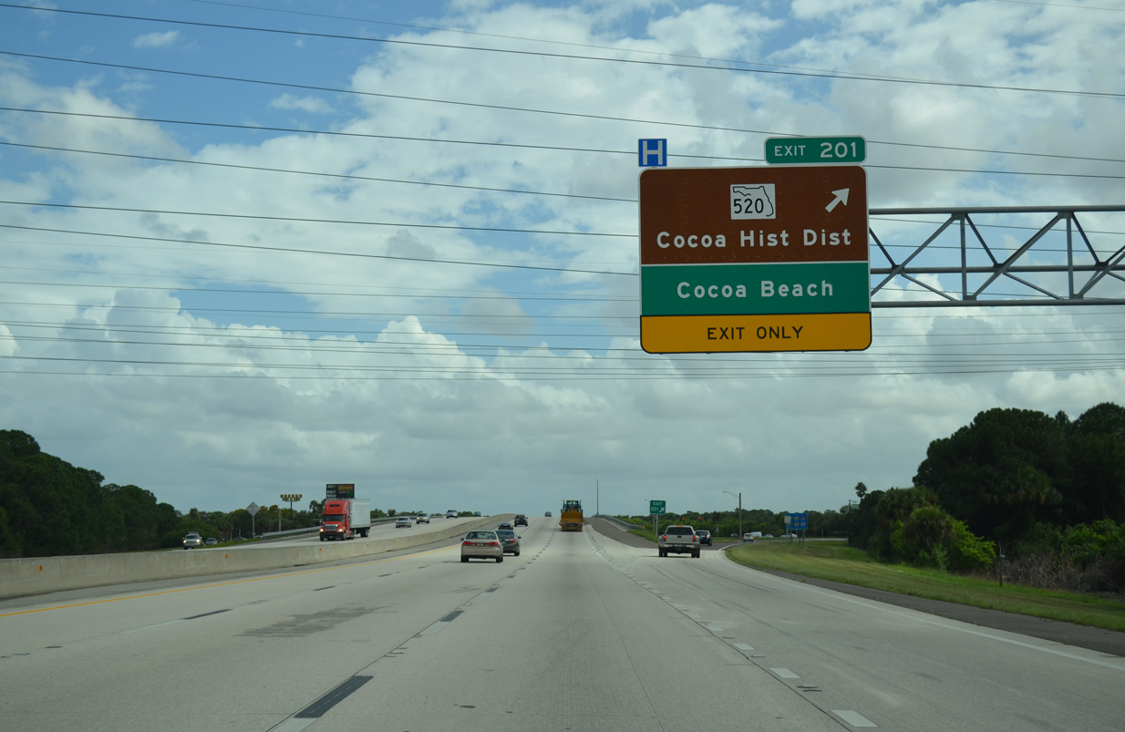
SR 528 (Beachline Expressway) east to Bennett Causeway (SR A1A) provides one of two routes spanning the Indian River to Merritt Island and the Banana River to Cape Canaveral. SR 520 (Merritt Island Causeway) extends east from Exit 201 to SR A1A at Cocoa Beach.
05/27/20
The Beachline Expressway (SR 528) represents a regional transportation corridor connecting the Space Coast with the greater Orlando area and Orlando International Airport (MCO). The toll road is jointly maintained by Florida's Turnpike Enterprise (FTE) and the Central Florida Expressway Authority (CFX).
05/27/20
Citrus Boulevard spans I-95 a half mile ahead of the c/d roadway for SR 528 west to Orlando and east to Cocoa and Port Canaveral.
05/27/20
The exchange with the Beeline Expressway originally was a parclo B2 interchange with no access to SR 528 west from I-95 south. The ramp addition enhanced access between the toll road and Port St. John.
SR 528 was renamed the Beachline Expressway by state legislation in July 2005 to help promote tourism for Brevard and Volusia County beaches.2
05/27/20
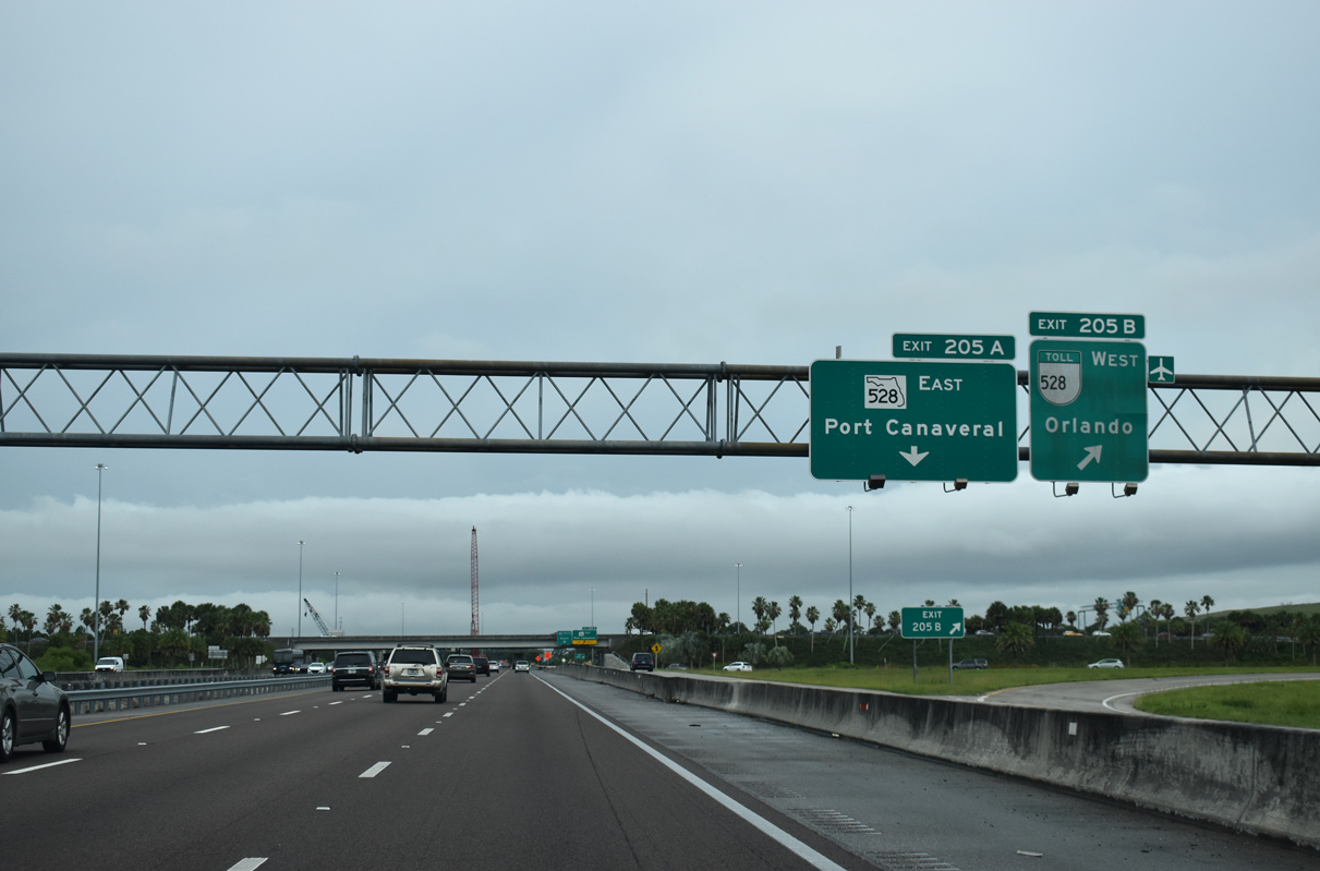
Exit 205 B departs the c/d roadway from I-95 south for SR 528 (Beachline Expressway) westbound. The toll road travels 11 miles to SR 520 in rural eastern Orange County and 42 miles to Interstate 4 near the I-Drive Resort area.
05/27/20
East from I-95, SR 528 (Beachline Expressway) is a toll free route stretching 4.2 miles across north Cocoa to U.S. 1 and SR A1A. Bennett Causeway continues the freeway east to Merritt Island and Cape Canaveral.
05/27/20
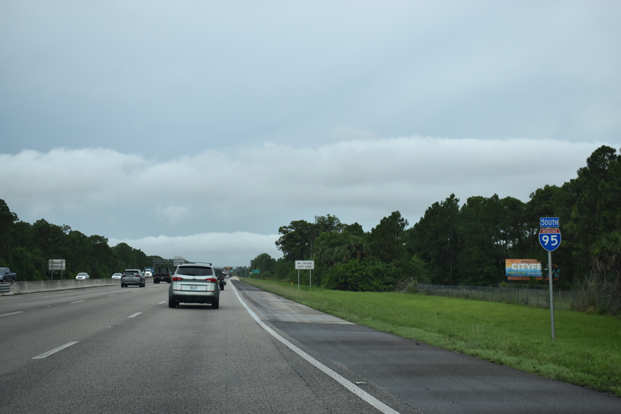
Interstate 95 trends eastward over a ten mile stretch through western reaches of Cocoa and Rockledge.
05/27/20
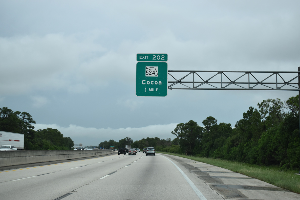
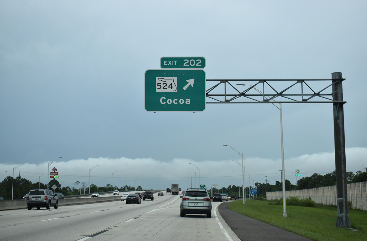
SR 524 branches northeast a rural wye with SR 520 near Lake Poinsett to cross under I-95 at a diamond interchange (Exit 202) next.
05/27/20
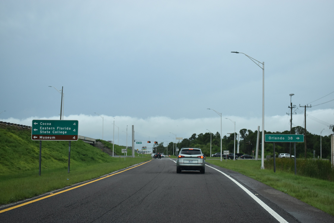
A 4.75 mile long route, SR 524 extends northeast through Cocoa to SR 501 (Clearlake Road) south and Industry Road at the Beachline Expressway (SR 528).
05/27/20
Three quarters of a mile separate the exchanges with SR 524 and SR 520 (King Street). SR 520 leads east from I-95 to Downtown Cocoa and the Hubert Humphrey Causeway across the Indian River to Merritt Island.
09/28/13
Auxiliary lanes accompany both roadways of I-95 between Exits 202 and 201 at west Cocoa.
09/28/13
Representing the second of five Brevard County bridges spanning Indian River Lagoon southward, SR 520 extends 11.4 miles east from I-95 to Cocoa Beach. The state road runs 23 miles northwest across Tosohatchee Wildlife Management Area to SR 50 near Bithlo.
09/28/13
Separating unincorporated subdivisions including Poinsett Villas, sounds walls were erected along the east side of I-95 by this confirming marker in 2014.
09/28/13
The ten mile section of I-95 southeast from SR 528 to SR 519 (Fiske Boulevard) was widened to six lanes by 2009.
09/28/13
Bypassing Rockledge, I-95 traverses wetland areas from Rockledge Creek and Lake Florence.
09/28/13
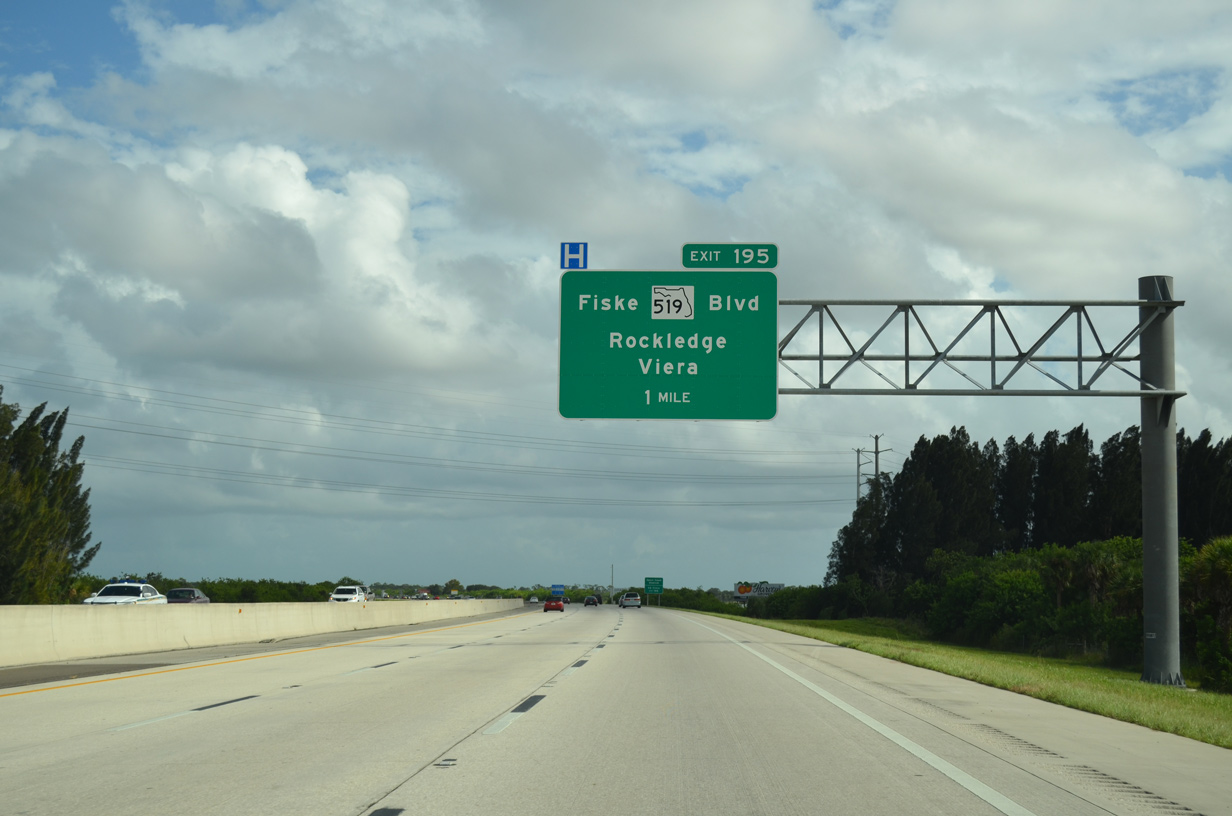
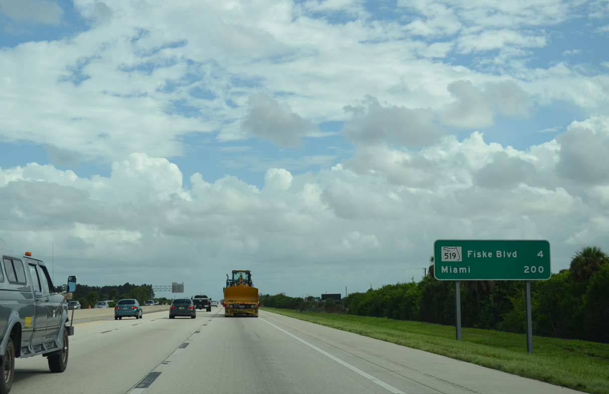
SR 519 is an urban arterial following Fiske Boulevard south 4.60 miles from SR 520 (King Street) in Cocoa to Interstate 95, Barnes Boulevard (CR 502) east and Stadium Parkway south.
09/28/13
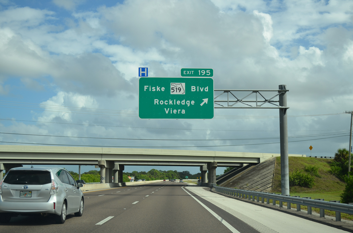
A parclo B2 interchange (Exit 195) connects I-95 with SR 519 (Fiske Boulevard) north into Rockledge and Stadium Parkway south to the master planned community of Viera.
09/28/13

Development encroaches both sides of I-95 as it veers southward between the Summer Lakes community at Viera and the Viera East Golf Club in Rockledge.
09/28/13
Distance sign posted ahead of the Viera Boulevard overpass. FDOT Project 428238-1-52-01, underway from Fall 2017 to Summer 2019, added a diverging diamond interchange (Exit 194) with the arterial connecting Viera with U.S. 1.
09/28/13
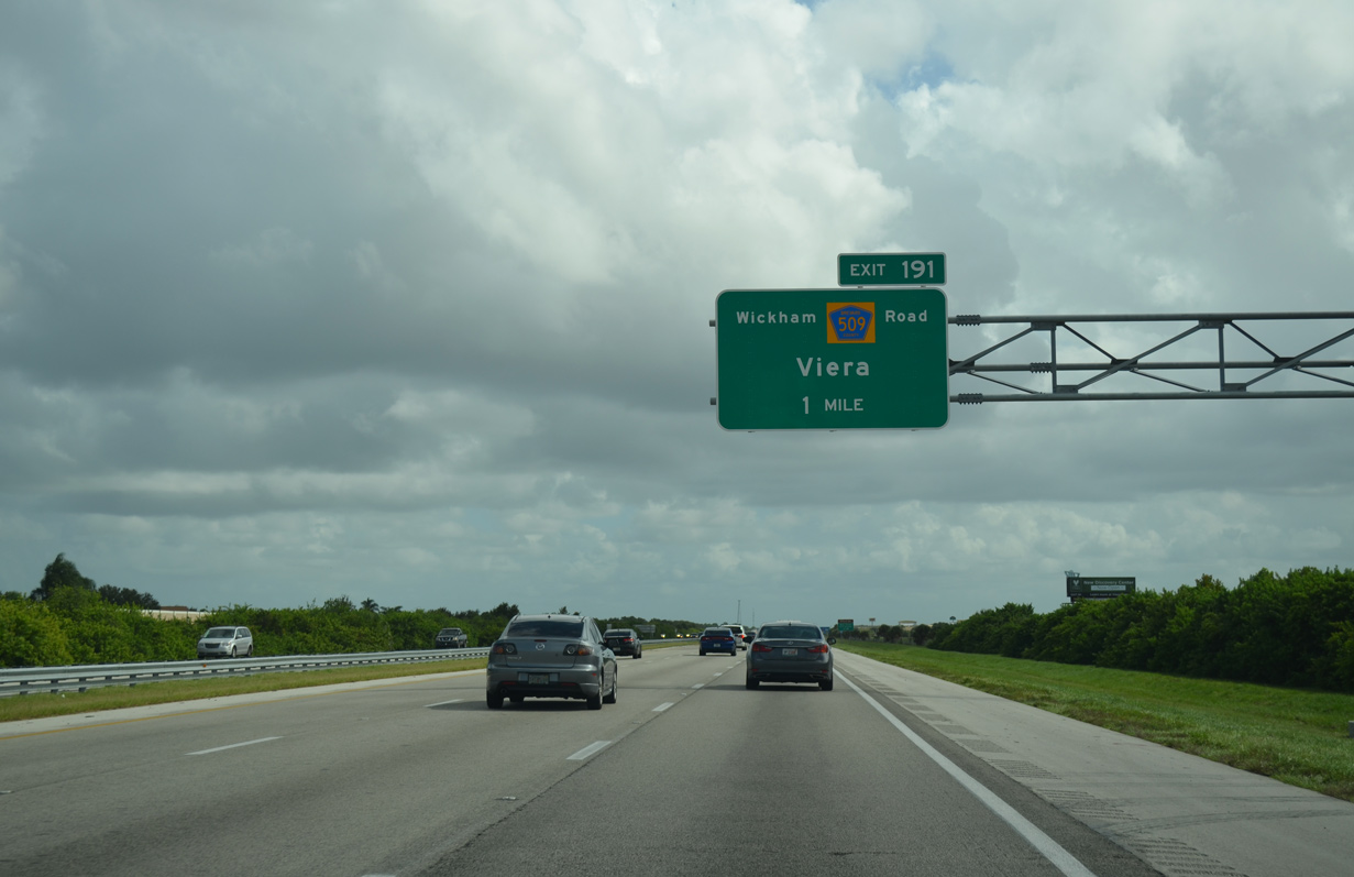
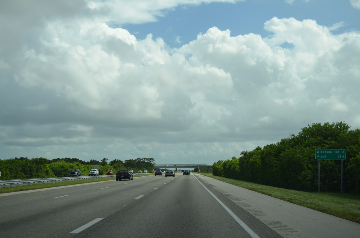
Wickham Road (CR 509) provides access to south Viera via a diamond interchange (Exit 191) with Interstate 95.
09/28/13
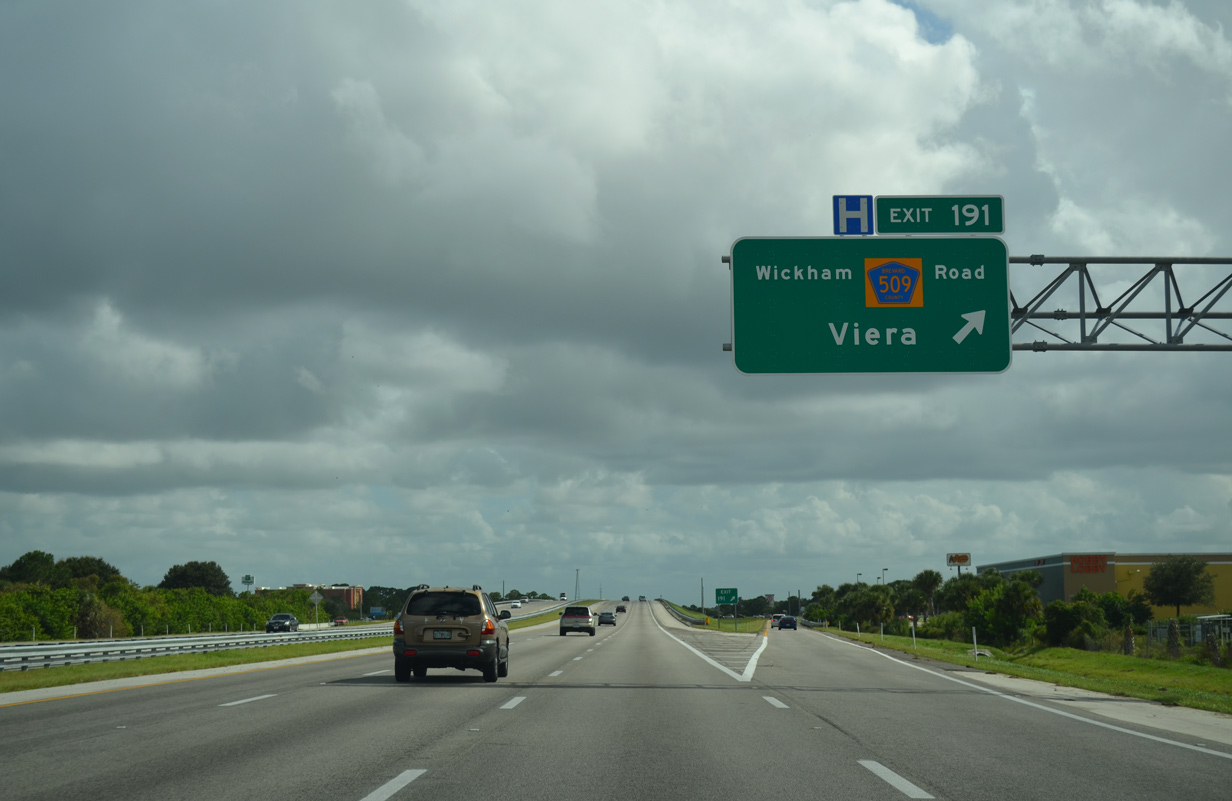
Wickham Road spurs west from I-95 to newer development including Heritage Isle and Trasona At Addison Village. Southeast from Exit 191, Wickham Road (CR 509) expands into a commercial arterial to SR 404 (Pineda Causeway).
09/28/13
Suburban development along the extension of Stadium Parkway claimed the bulk of remaining rural land along I-95 south from Viera to Melbourne. An 18 mile section of I-95 south from SR 519 to Palm Bay was expanded to six miles by 2009.
09/28/13
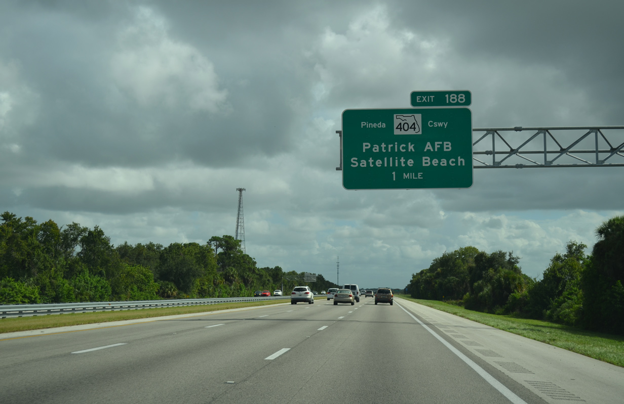
The succeeding exit along southbound joins I-95 with Pineda Causeway east to U.S. 1 at Palm Shores, and SR 404 across the Indian and Banana Rivers to SR A1A at South Patrick Shores.
09/28/13
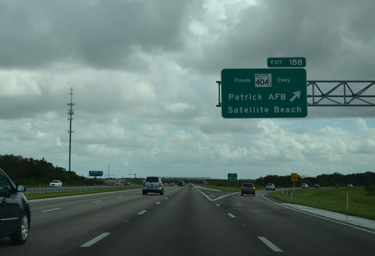
Pineda Causeway was extended west from U.S. 1 at Palm Shores to Interstate 95 in May 2011. The extension is locally maintained, while the expressway linking U.S. 1 with SR 513 at Patrick Air Force Base is state maintained and signed as SR 404.
09/28/13
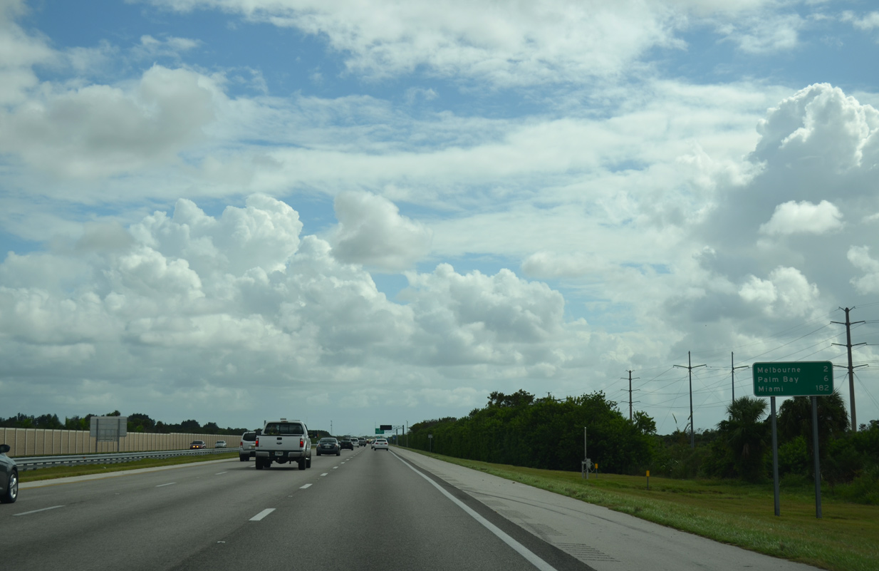
Interstate 95 passes through a section of the Melbourne city limits by the Woodshire Preserve development beyond this reassurance marker.
09/28/13
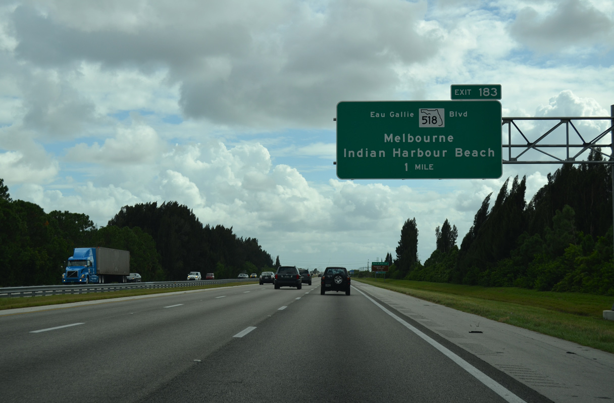
A diamond interchange (Exit 183) joins Interstate 95 with SR 518 (Eau Gallie Boulevard) in one mile.
09/28/13
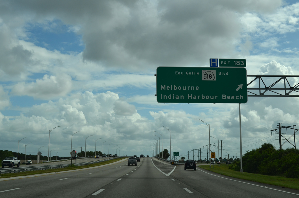
Eau Gallie Boulevard originates as an unpaved road near Lake Washington to the west. SR 518 commences a 8.10 mile course at Exit 183, following the four lane arterial east to U.S. 1 (Dixie Highway) at Downtown. Continuing across the Indian River on Eau Gallie Causeway, SR 518 travels to SR A1A between Indian Harbour Beach and Melbourne at Eau Gallie Beach.
09/28/13

Construction started on October 2, 2018 extended Ellis Road west from CR 511 (John Rodes Boulevard) to a new parclo interchange built at I-95. Costing 38.8 million, the new exchange provides a more direct route to Orlando Melbourne International Airport (MLB) via Nasa Boulevard / SR 508.3
09/28/13
I-95 passes through the West Melbourne city limits from Ellis Road south to Exit 180 for U.S. 192 east to Downtown Melbourne. Opened to traffic on June 2, 2020, the new ramps with Ellis Road tie into an northern extension of St. Johns Heritage Parkway.3 Initially running south from U.S. 192, the arterial beltway promotes development through western areas of Melbourne and Palm Bay.
09/28/13
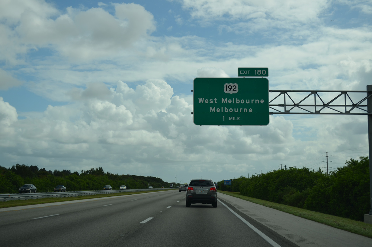
U.S. 192 (New Haven Avenue) meets Interstate 95 at Exit 180 in West Melbourne. A regionally important corridor, U.S. 192 joins the Space Coast with St. Cloud and Kissimmee in Osceola County.
09/28/13
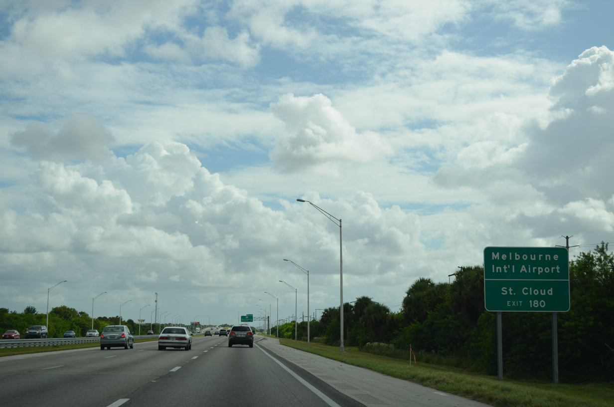
Following a four lane commercial arterial across West Melbourne to Melbourne Square Mall, U.S. 192 connects I-95 with Orlando Melbourne International Airport (MLB). St. Cloud lies 39 miles to the northwest.
09/28/13
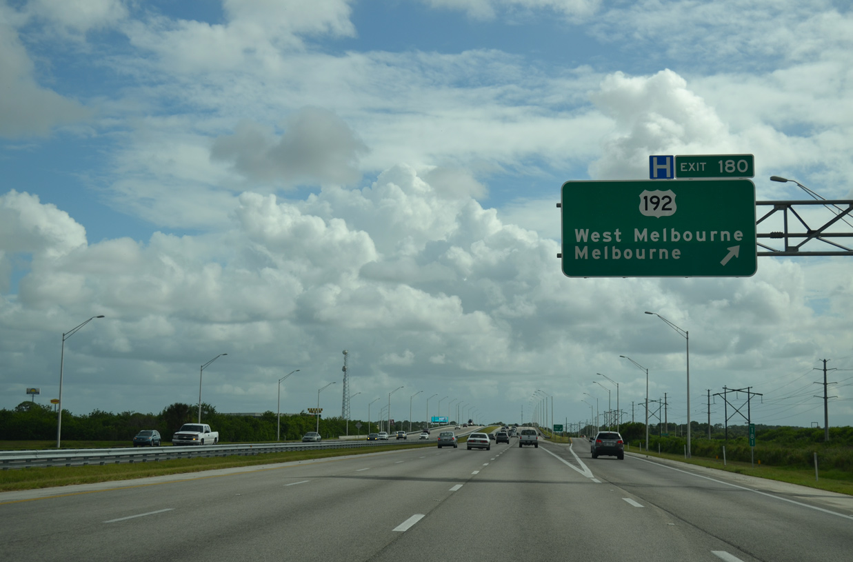
Entering the diamond interchange (Exit 180) with U.S. 192 (New Haven Avenue) on I-95 south. U.S. 192 stretches nearly 75 miles from Four Corners in the Orlando area to Downtown Melbourne and across Melbourne Causeway to Indialantic.
09/28/13


References:
- 405506-2 I-95 Widening from SR 528 to south of SR 406.
http://www.cflroads.com/ project/405506-2/ i-95_widening_from_sr_528_to_south_of_sr_406CFLRoads - Florida Department of Transportation District 5 web site. - "BeachLine will ease path to sand, surf." Orlando Sentinel, The (FL), May 14, 2005.
- "Work starts on I-95 interchange at Ellis Road, creating future link to Melbourne airport." Florida Today, October 3, 2018.
Photo Credits:
- Alex Nitzman: 05/27/20, 09/12/22
- ABRoads, JP Nasiatka: 09/28/13
Connect with:
Page Updated Friday October 28, 2022.