
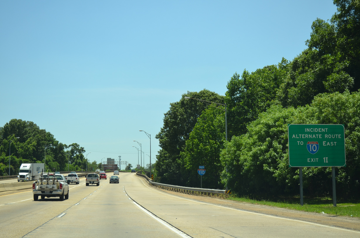
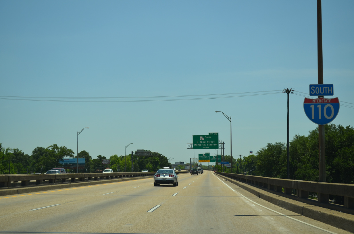
Interstate 110 South
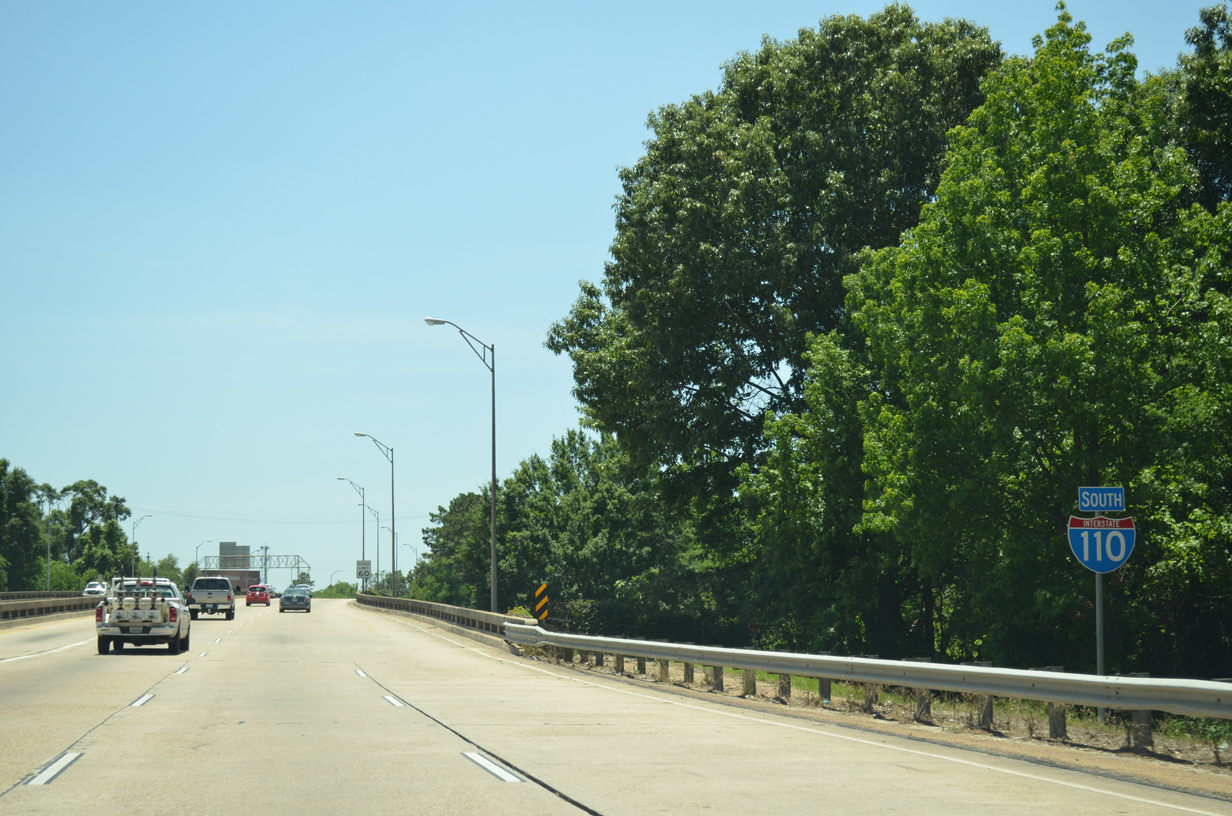
 South
South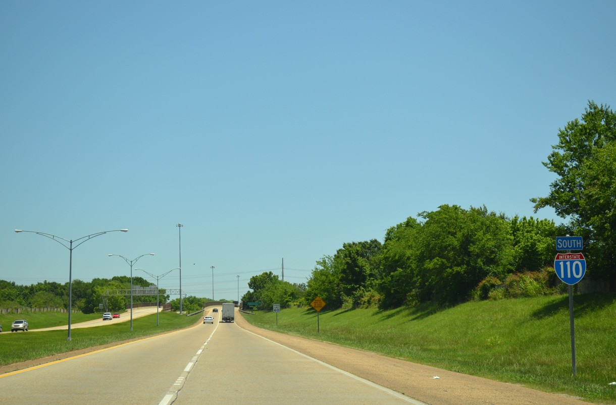
Interstate 110 initially leads east, traveling at-grade between Progress and Central Roads. The first confirming marker stands beyond the two-wye interchange with U.S. 61 (Scenic Highway).
05/19/14
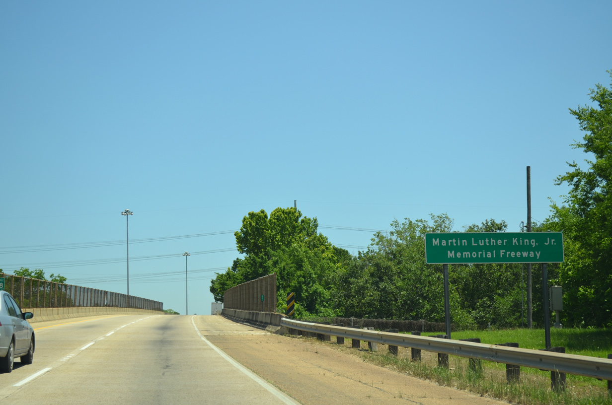
The freeway elevates onto a viaduct through the half diamond interchange (Exit 8A from northbound) with LA 19 (Scotland Avenue). Interstate 110 is formally named the Martin Luther King, Jr. Memorial Freeway.
05/19/14
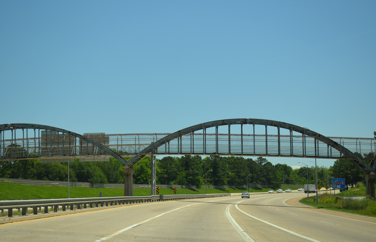
A pedestrian bridge spans I-110 beyond the LA 19 on-ramp. The crossing connects an adjacent high school and community center.
05/19/14
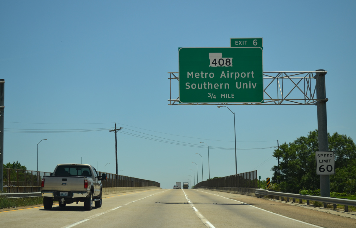
I-110 expands to six lanes from LA 19 southward along a 6,085 foot long viaduct built in 1982.1 A parclo interchange (Exit 6) lies one mile ahead with LA 408 (Harding Boulevard).
05/19/14
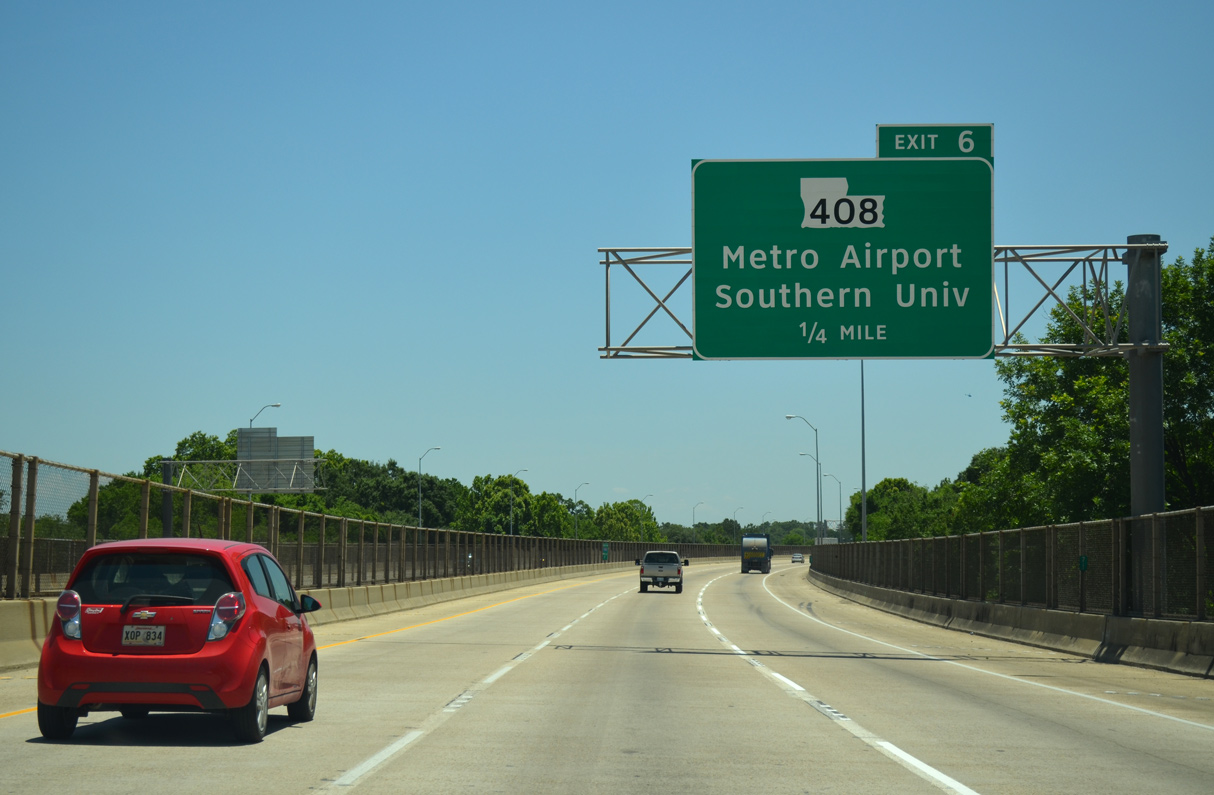
Passing over the Baton Rouge street grid, Exit 6 departs in a quarter mile for LA 408 (Harding Boulevard) to adjacent Baton Rouge Metropolitan Airport (BTR).
05/19/14
LA 408 travels 9.94 miles overall, west from Exit 6 to U.S. 61 (Scenic Highway) by the campus of Southern University, and east to the city of Central and LA 37 near Greenwell Springs.
05/19/14
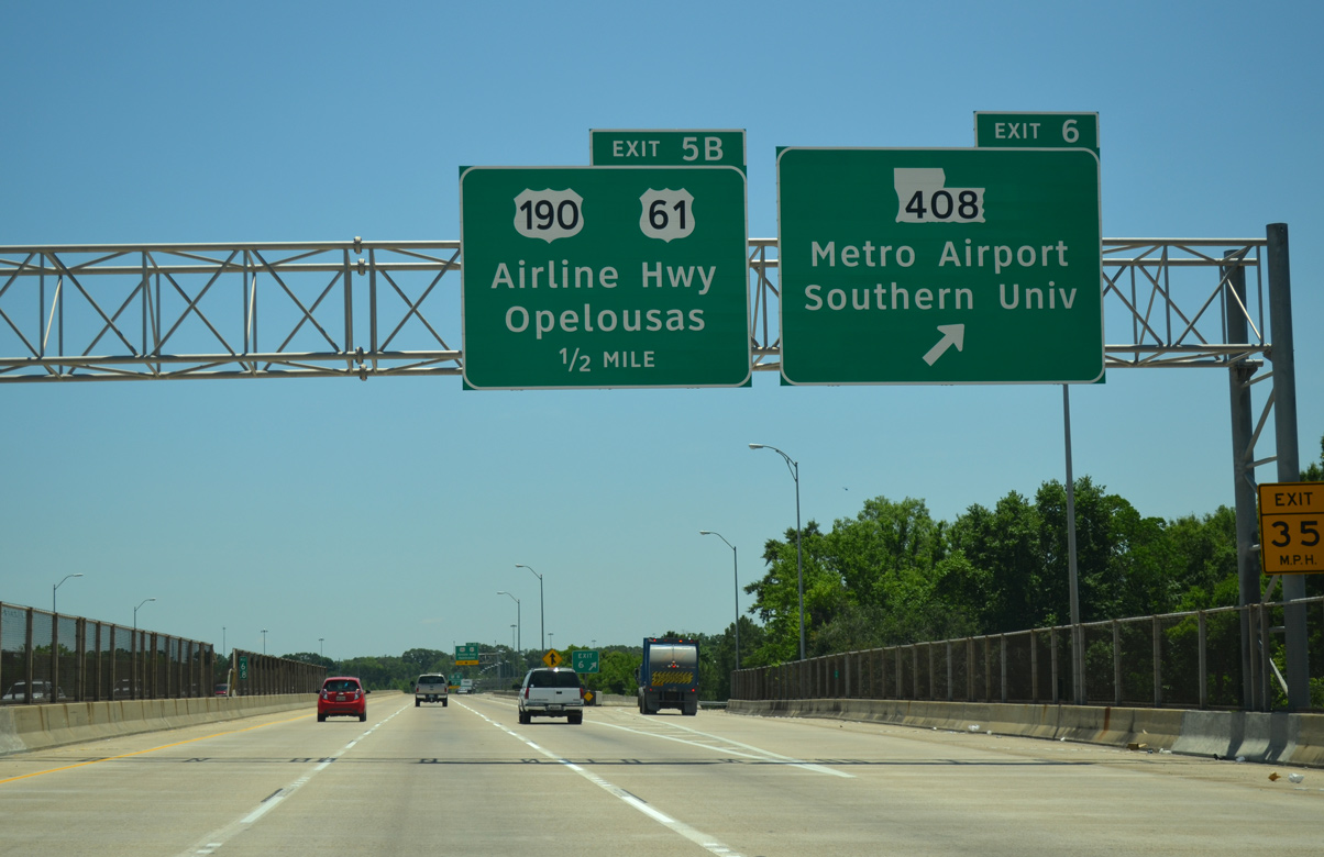
Advancing south, motorists on I-110 next separate with a distributor roadway (Exit 5B) for U.S. 61 & 190 (Airline Highway). U.S. 61 & 190 overlap for 6.5 miles between Scotlandville and Broadmoor through north and eastern reaches of Baton Rouge.
05/19/14
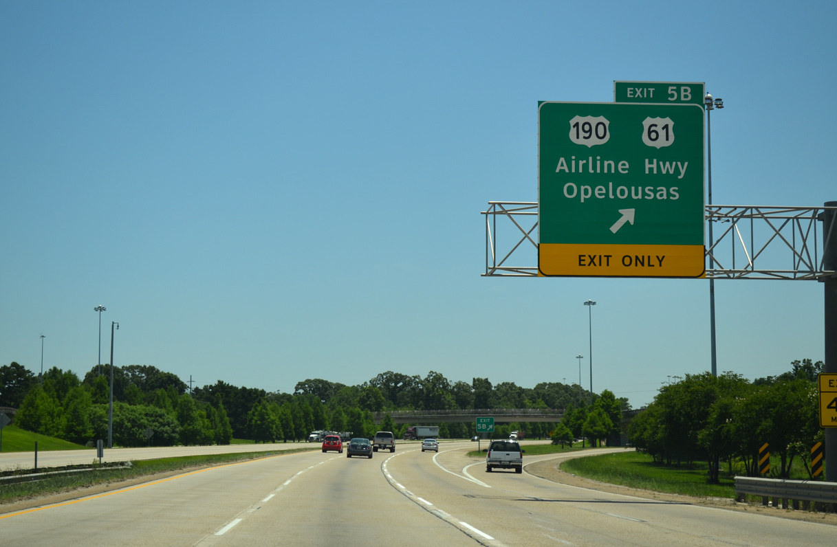
Exit 5B departs from I-110 south to combine with a ramp from LA 408 to flyovers for U.S. 61 & 190. U.S. 190 (Airline Highway).
05/19/14

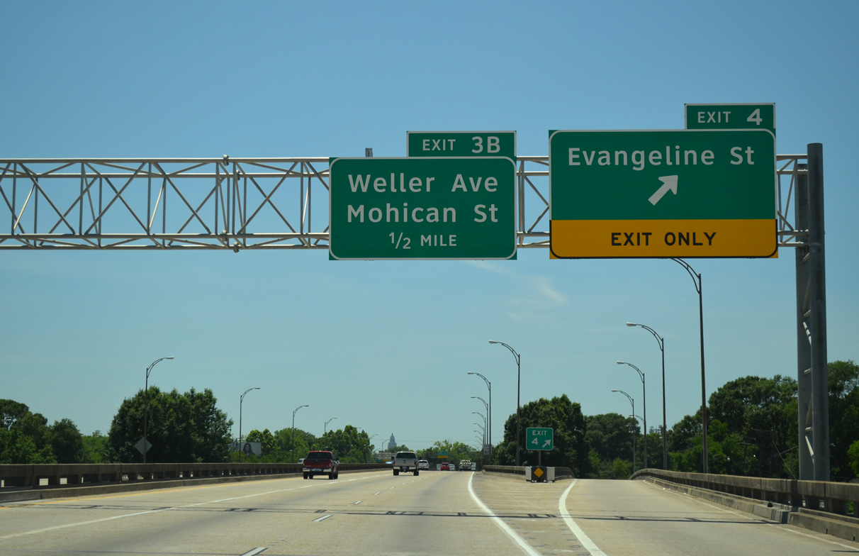
The southbound mainline of I-110 continues 1.5 miles from the 72nd Avenue overpass to Evangeline Street (Exit 4).
05/19/14
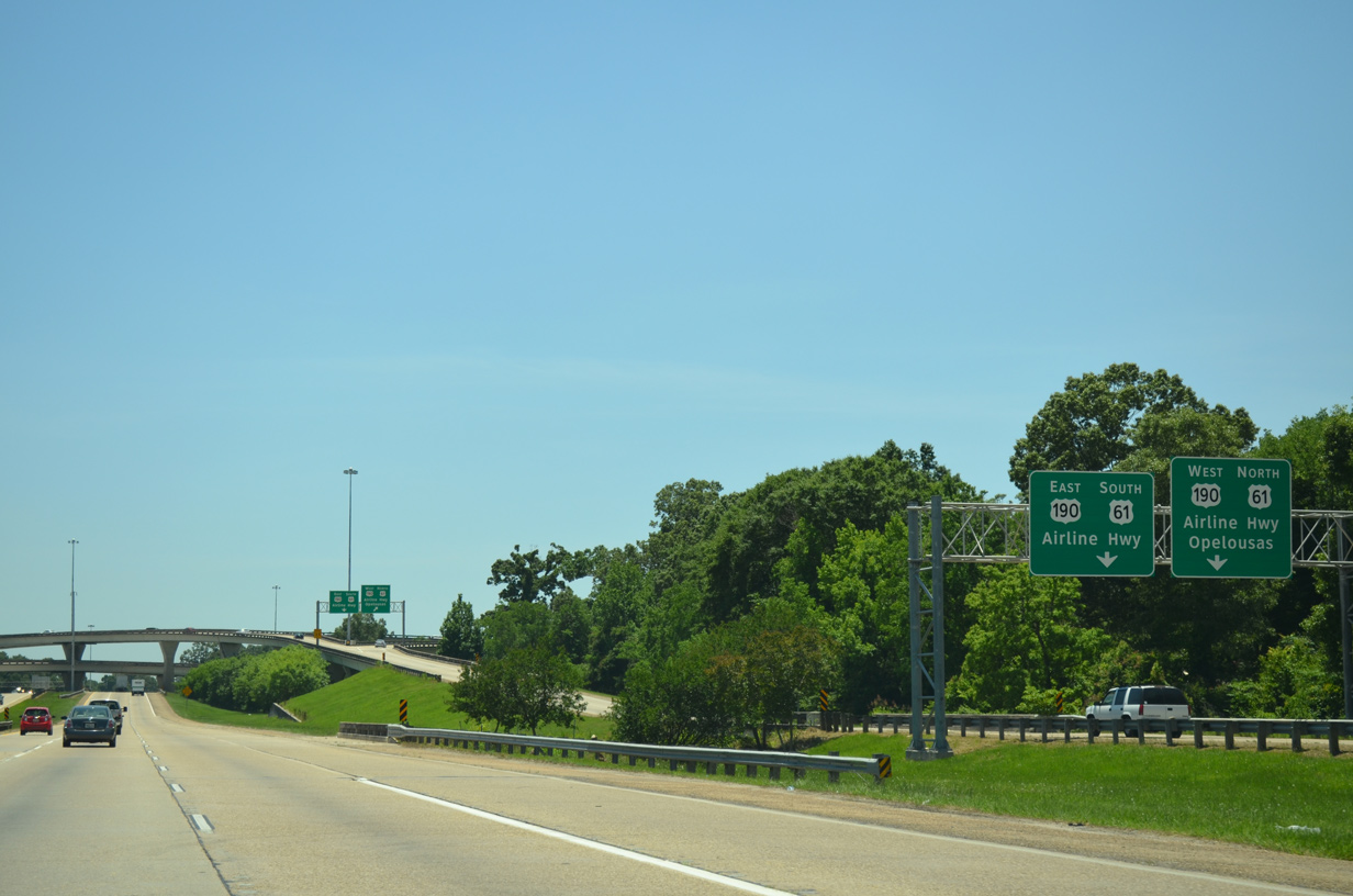
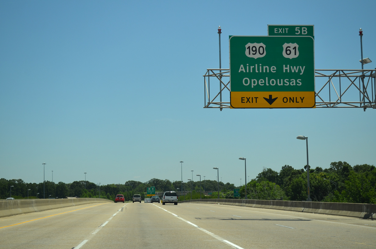
Traffic partitions on Exit 5B. U.S. 61 north & 190 split just west of Interstate 110 at the north end of U.S. 61 Business & 190 Business. U.S. 190 (Airline Highway) continues west from there across the Mississippi River Bridge to Lobdell Station, Krotz Springs and I-49 at Opelousas.
05/19/14
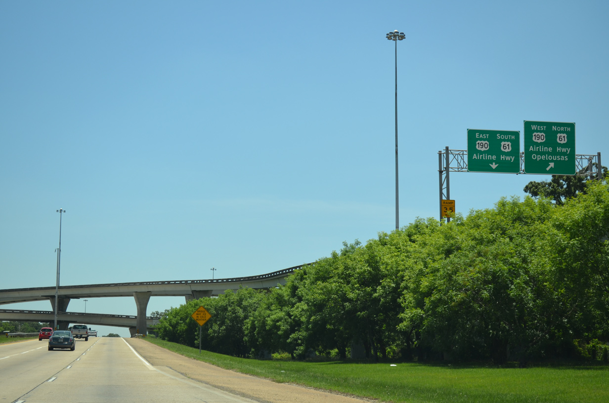
Motorists taking the high speed flyover to U.S. 61 south & 190 east join Airline Highway ahead of the LA 67 (Plank Road) overpass. The US highways transition into a slow moving commercial arterial southeast to their split at Florida Boulevard (U.S. 61 Business & 190 Business) and Cortana Mall.
05/19/14
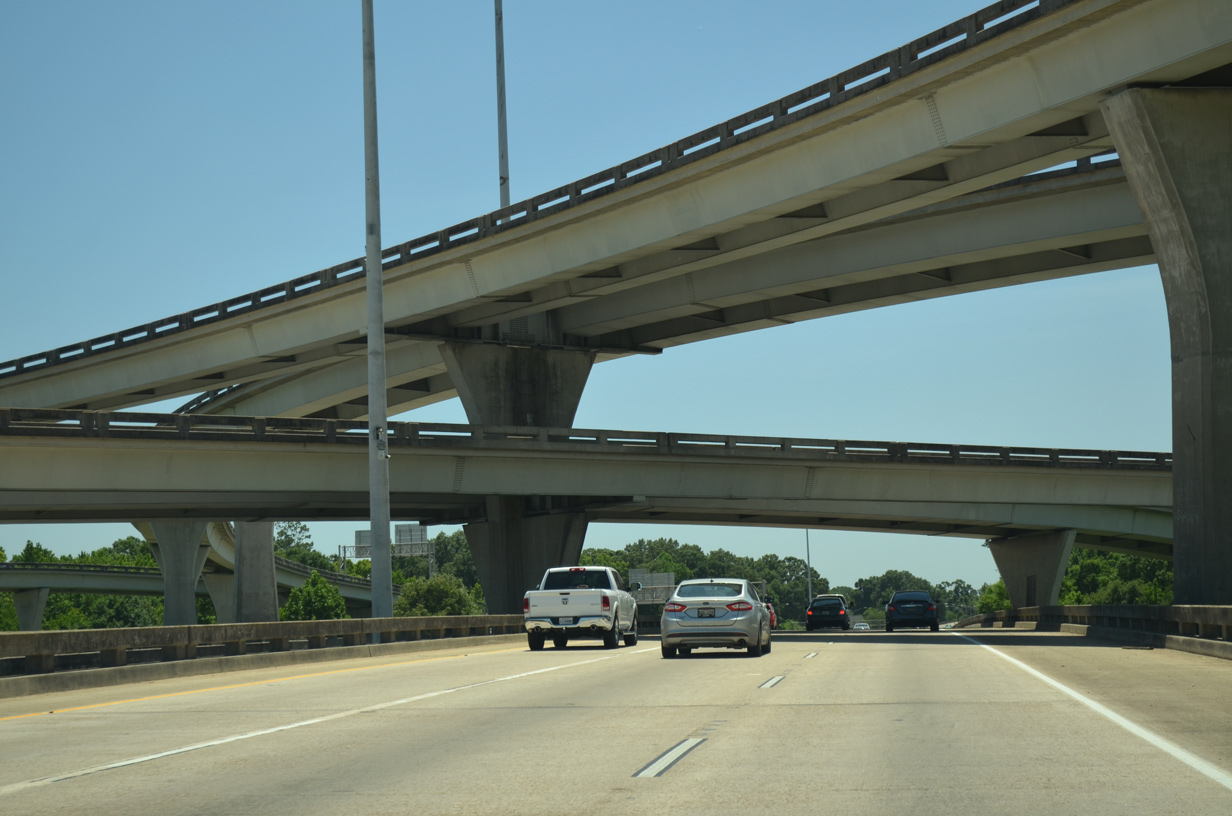
A four-level interchange joins Interstate 110 with the limited access portion of Airline Highway. The exchange was constructed in 1976.
05/19/14
An emergency detour route to I-10 east lines U.S. 190 east from LA 415 Spur at Lobdell Station to I-110 south.
05/19/14
Southbound reassurance shield posted at the viaduct crossing Monte Sano Bayou and Greenwell Street.
05/19/14
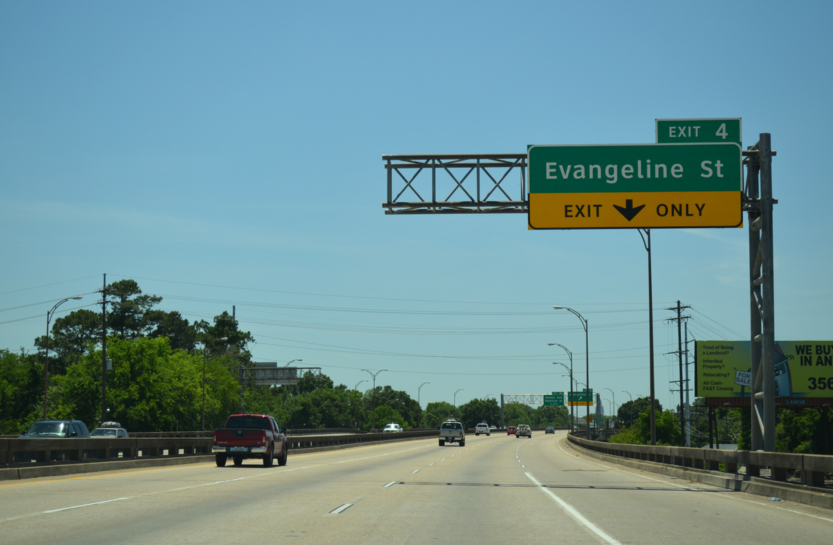
An auxiliary lane opens from the Hollywood Street on-ramp along I-110 south to the diamond interchange (Exit 4) with Evangeline Street.
05/19/14
Evangeline Street constitutes an urban arterial west to U.S. 61-190 Business (Scenic Highway) and the oil refinery complexes. East from Exit 4, Evangeline Street passes through the Delmont Place, North Highlands and Brookstown neighborhoods to U.S. 61-190 (Airline Highway).
05/19/14
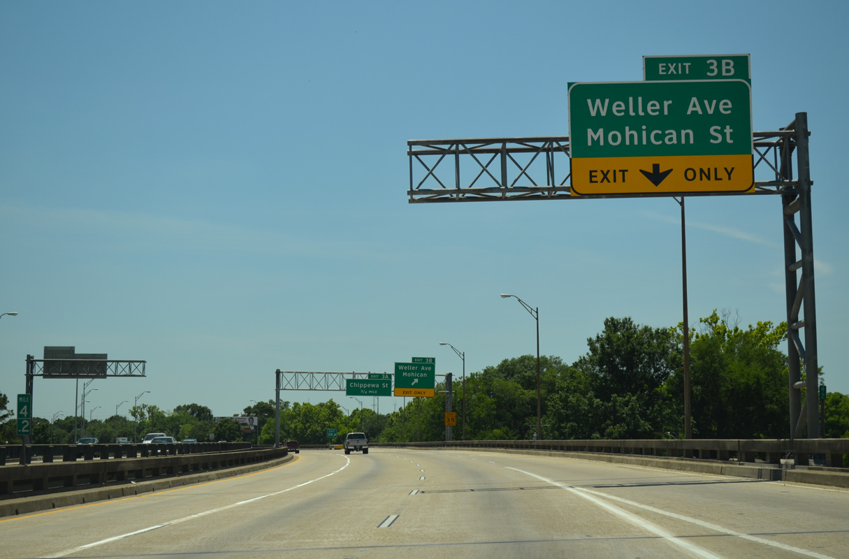
Interstate 110 curves southwest by a mostly vacant street grid to a split diamond interchange (Exit 3B) with Weller Avenue and Mohican Street.
05/19/14
Exit 3B lowers to form the west side frontage road of Nokomis Street. Weller Avenue and Mohican Street link I-110 with Scenic Highway three blocks to the west, and with LA 67 (Plank Road) by the Istrouma neighborhood, nine blocks to the east.
05/19/14
I-110 remains elevated across Weller Avenue on a 1970 built bridge system. A confirming marker precedes the return ramp from Nokomis Street at Wyandotte Street.
05/19/14
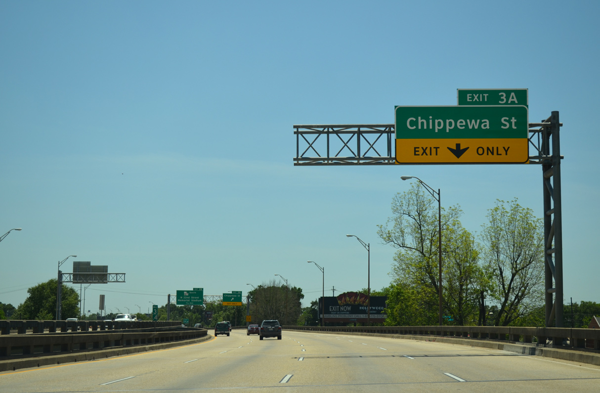
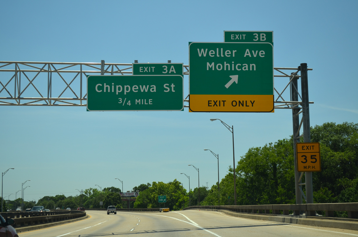
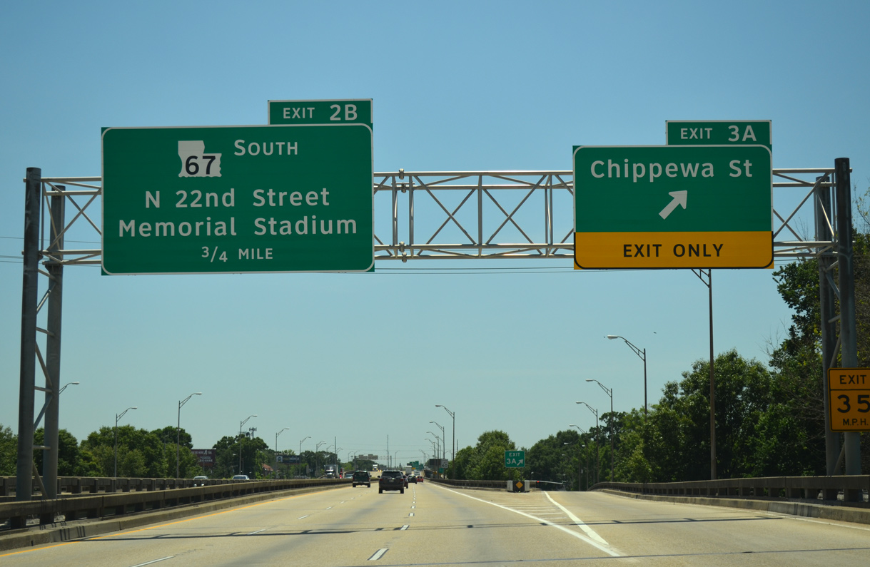
The viaduct shifts west a block and a half to run between Hiawatha and Pocahontas Streets to the diamond interchange (Exit 3A) with Chippewa Street.
05/19/14
Chippewa Street stems west from LA 67 (Plank Road) to become U.S. 61-190 Business west of parallel Scenic Highway (LA 3164). U.S. 61-190 Business arc west through the Mississippi River side industrial area to River Road south by Capitol Lake.
05/19/14
LA 3164 (Scenic Highway) runs one block west of the I-110 viaduct. The state highway ends where the freeway curves west ahead of Memorial Stadium.
05/19/14
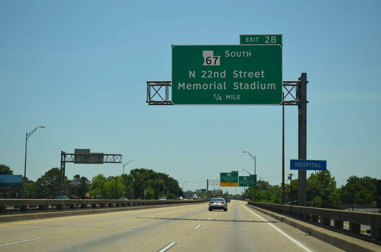
LA 67 (Plank Road) angles south from the Istrouma neighborhood to cross paths with Interstate 110 at Exit 2B in one quarter mile.
05/19/14
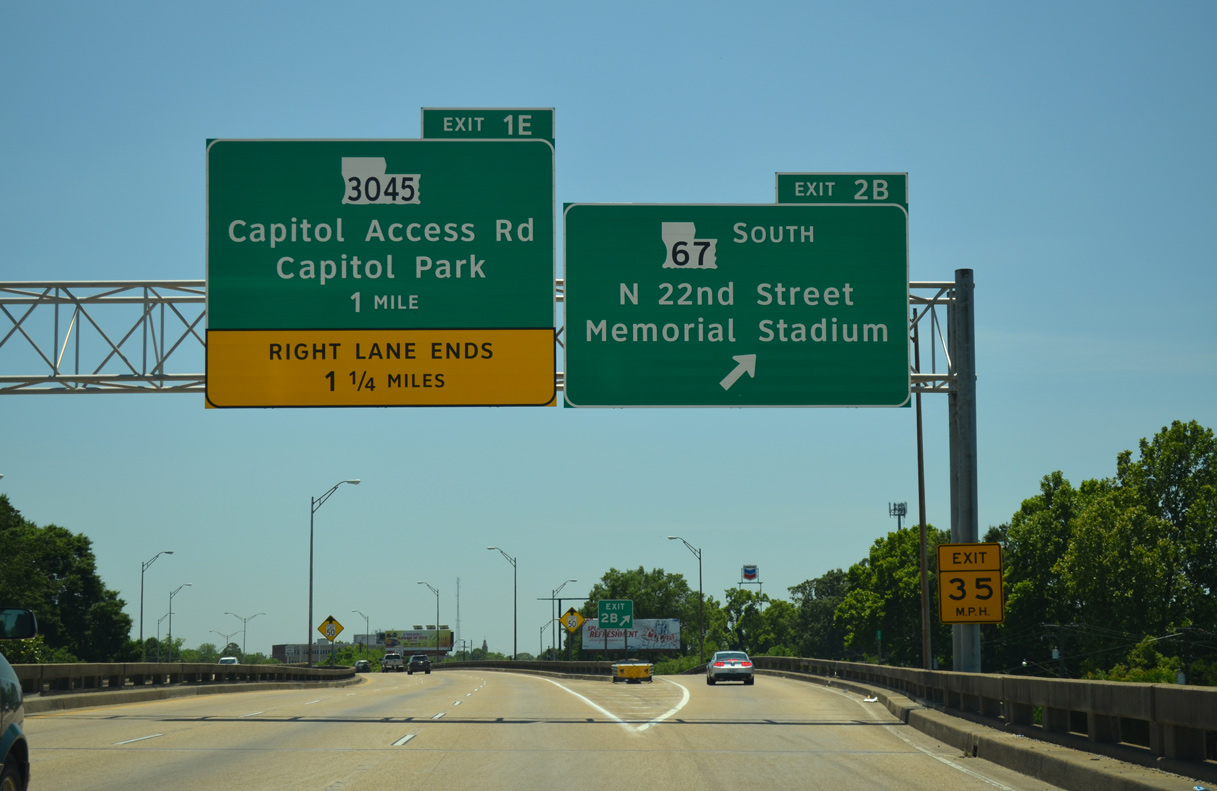
Interstate 110 begins the sweeping curve onto the original Baton Rouge Expressway at the ramp departure of Exit 2B for LA 67 (22nd Street) south. LA 67 concludes a 31.9 mile route from the East Feliciana Parish town of Clinton at LA 73 (Government Street) in Mid-City Baton Rouge.
05/19/14
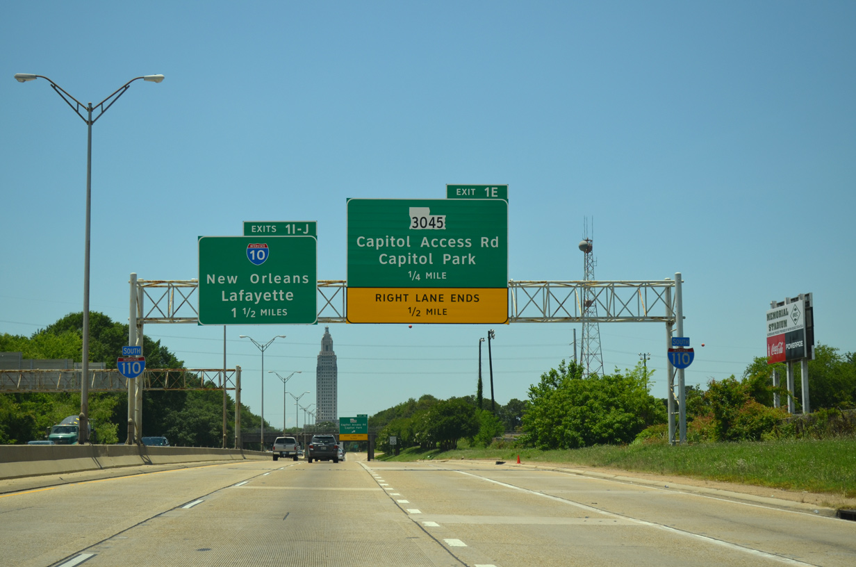
The Louisiana State Capitol building comes into view as a trio of on-ramps tie into the southbound freeway from 22nd Street, LA 3164 and 19th Street by Memorial Stadium. I-110 progresses west otherwise one half mile to a trumpet interchange (Exit 1E) with LA 3045 (Capitol Access Road), and 1.5 miles to Interstate 10 (Exits 1I-J).
05/19/14
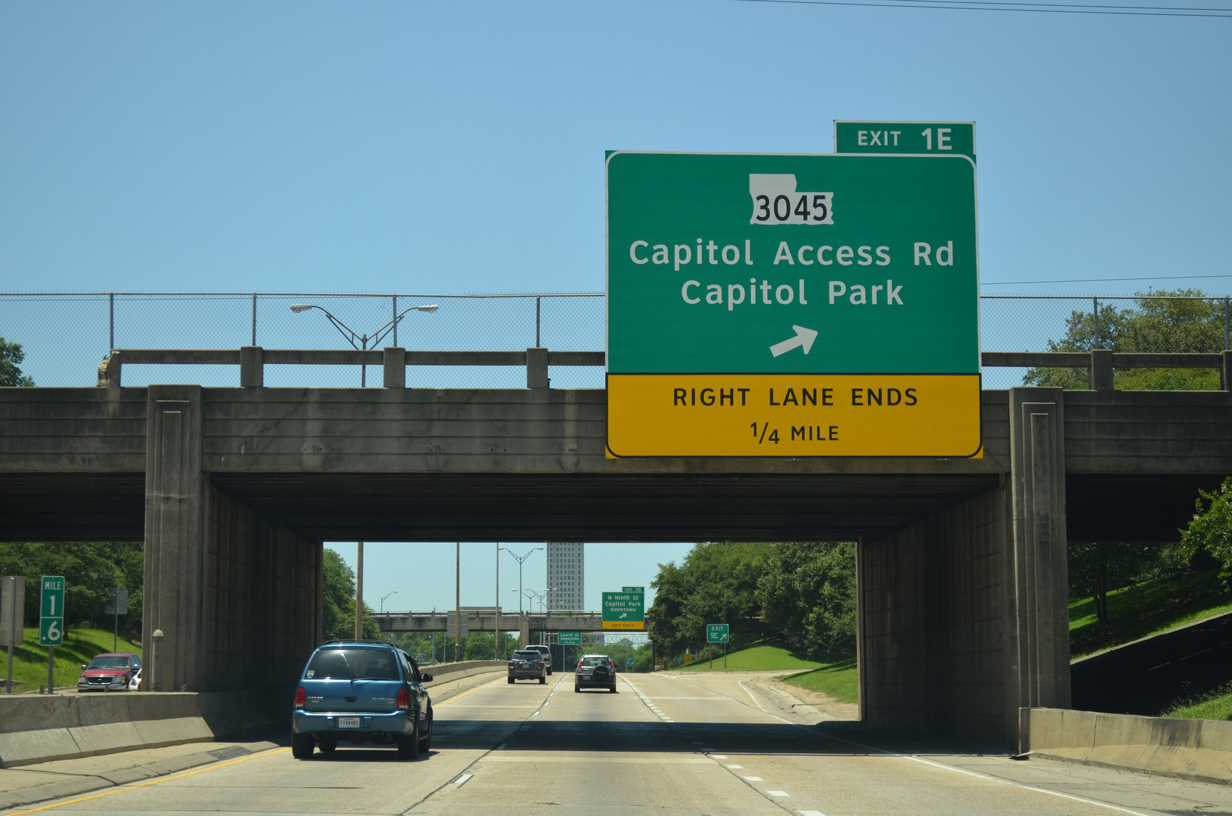
LA 3045 consists of a 0.48 mile, L-shaped route. The east-west branch lines Capitol Access Road west from Exit 1B to Arsenal Park and the State Capitol complex. The north-south component spurs north along West Highway Drive to Leesville Avenue.
05/19/14
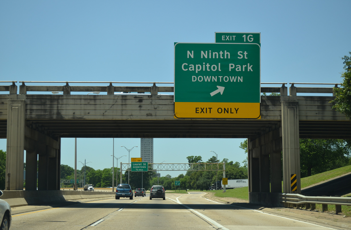
Exit 1G quickly follows as a collector distributor roadway linking LA 3045 with 9th Street. 9th and 10th Streets accompany I-110 as freeway passes east of Downtown Baton Rouge.
05/19/14
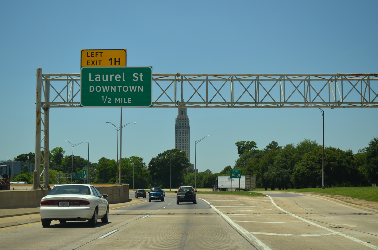
A 90 degree curve takes I-110 south by Capitol Lake. The left exit to Laurel Street departs in a half mile.
05/19/14
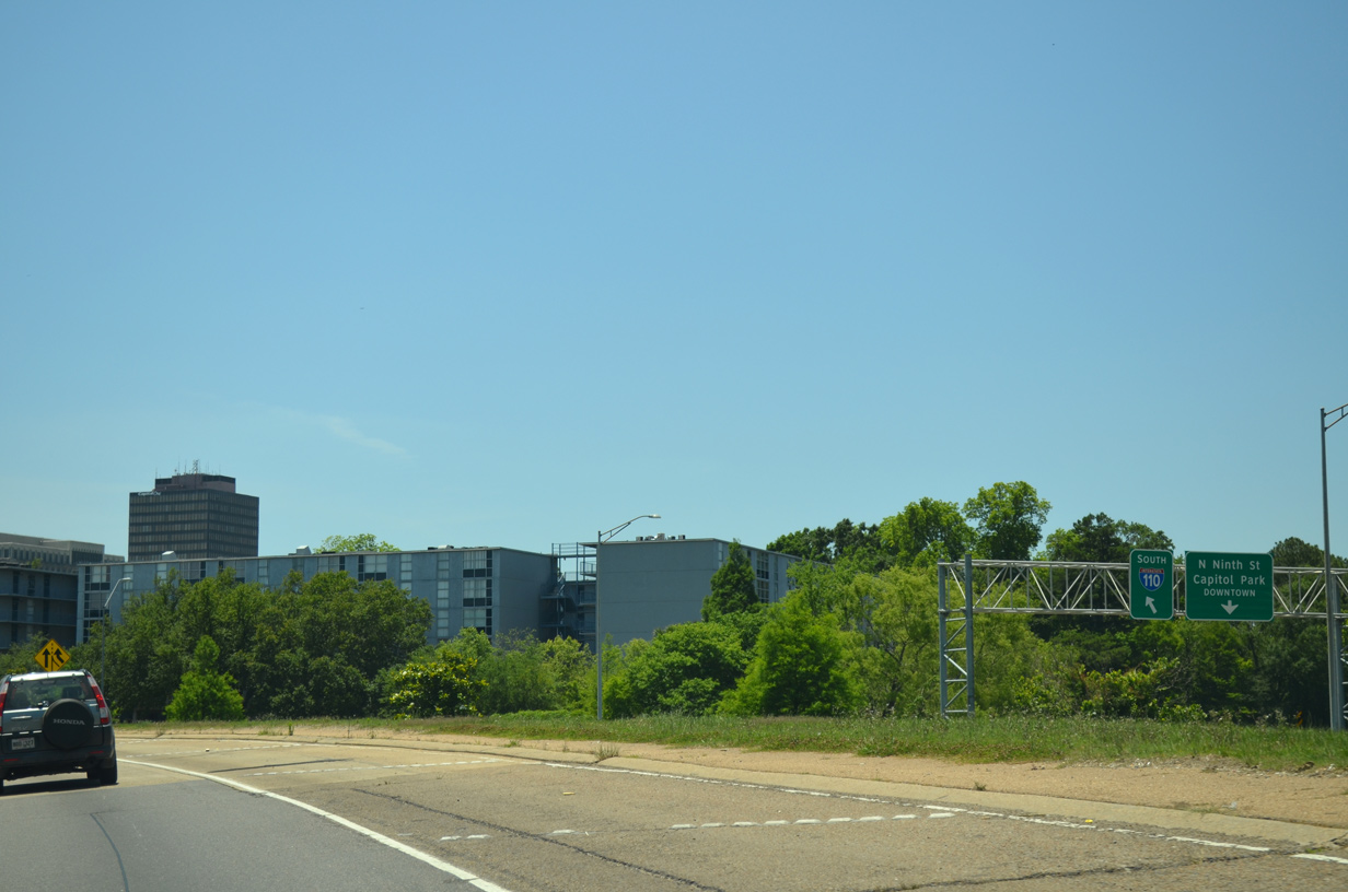
9th Street separates from the adjacent c/d roadway ahead of Spanish Town Road west to State Capitol Park.
05/19/14
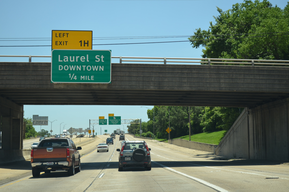
Spanish Town Road spans I-110 on the quarter mile approach to Exit 1H for Laurel Street. Laurel Street leads motorists west through Downtown Baton Rouge to U.S. 61-190 Business (River Road).
05/19/14
Separate viaducts carry motorists on I-110 south from Exit 1H to Exit 1A (LA 73) and Interstate 10. LA 73 (Government Street) is a 26.25 mile highway between Baton Rouge and Geismar (LA 75).
05/19/14
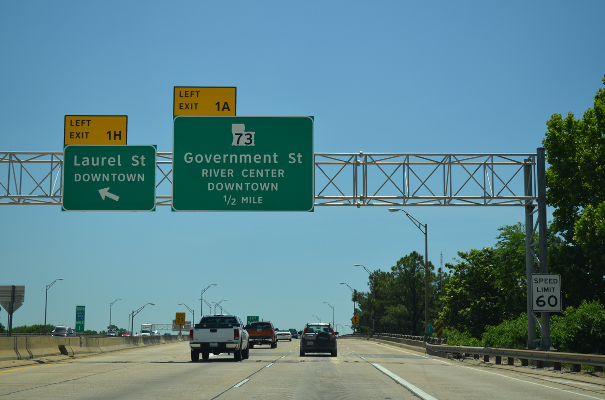
On-ramps from Main and Florida Streets join I-110 south ahead of the left side ramp (Exit 1A) for LA 73 (Government Street) and Interstate 10 (Exits 1I-J). Points of interests for Exit 1A include the U.S.S. Kidd, the Louisiana Naval War Museum and the Casino district of Baton Rouge.
05/19/14
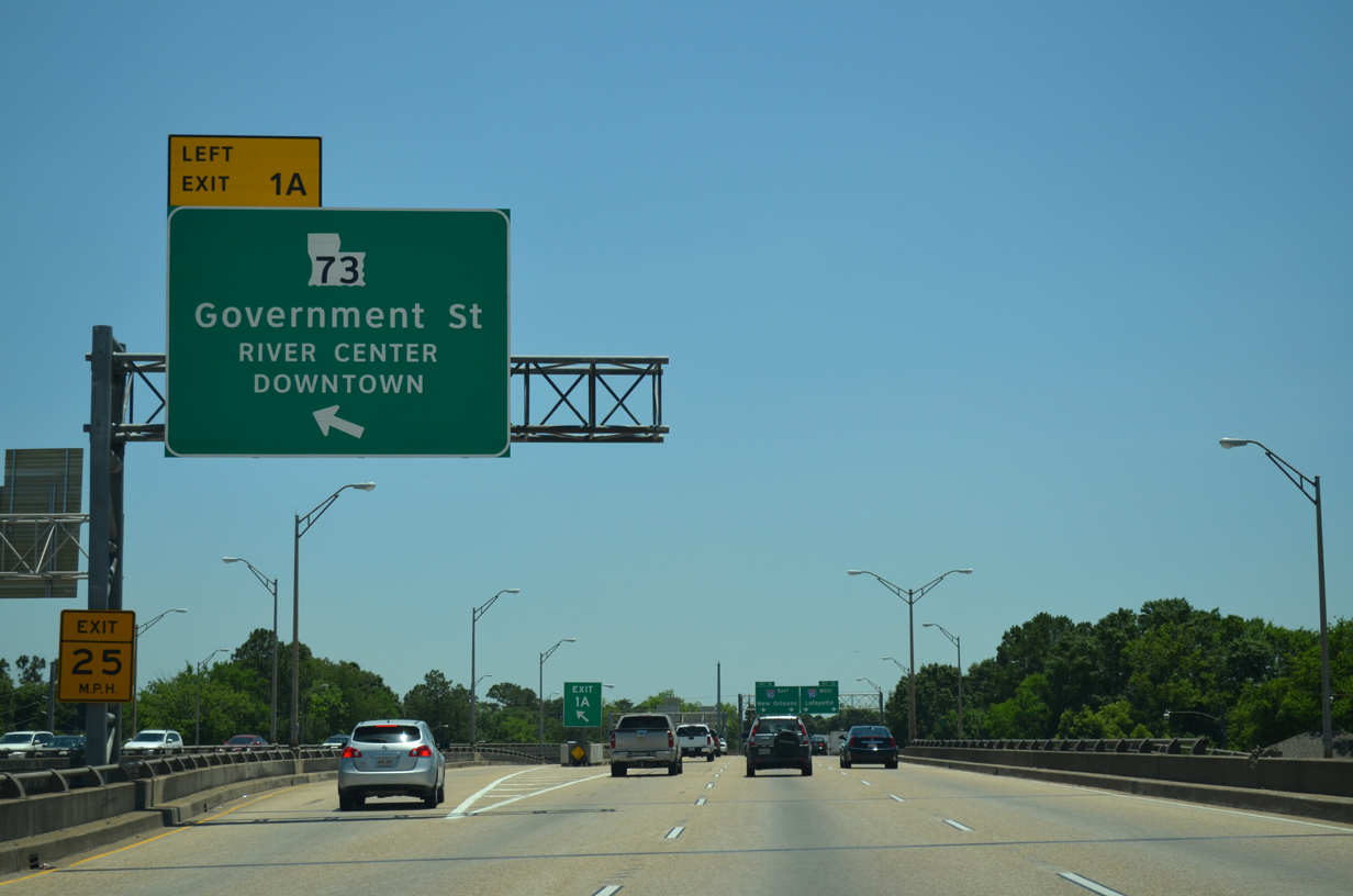
LA 73 ends nine blocks to the west by the River Center sports and concert arena, at the intersection of Government Street and LA 30 (St. Phillip Street).
05/19/14
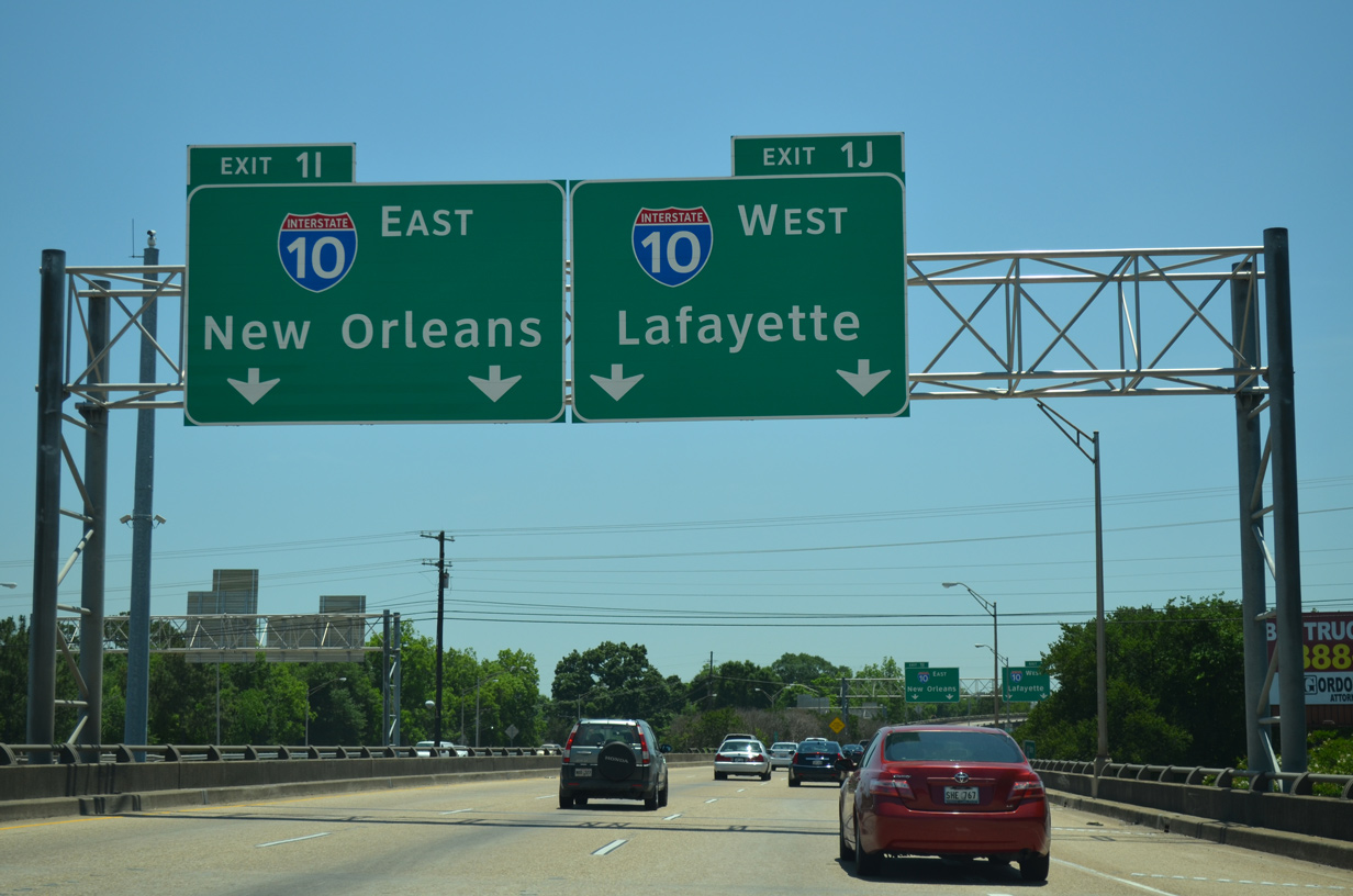
Interstate 110 advances south with three lanes to the directional T interchange (Exit 1I-J) with Interstate 10.
05/19/14
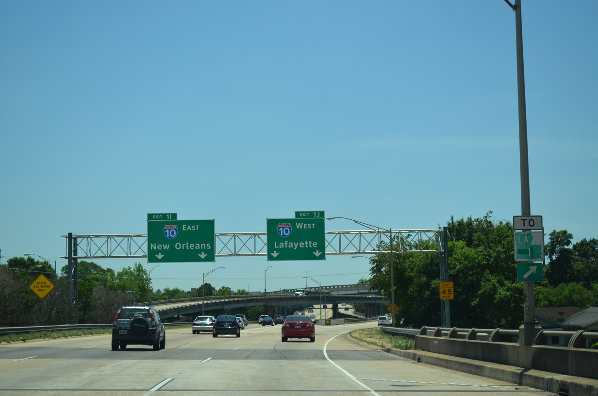
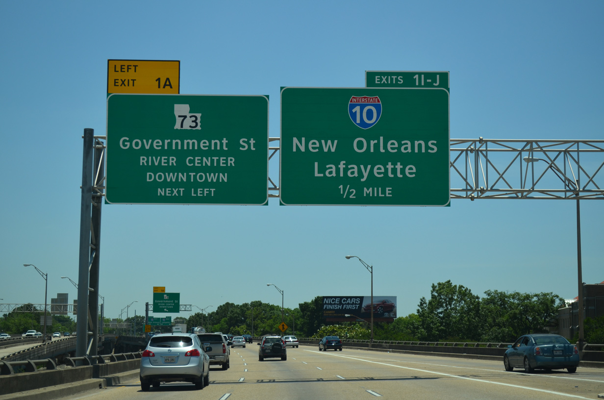
A trailblazer for LA 1 directs motorists onto I-10 west across the Horace Wilkinson Bridge to Port Allen. LA 1 parallels the Mississippi River south to Plaquemine and north to U.S. 190.
05/19/14
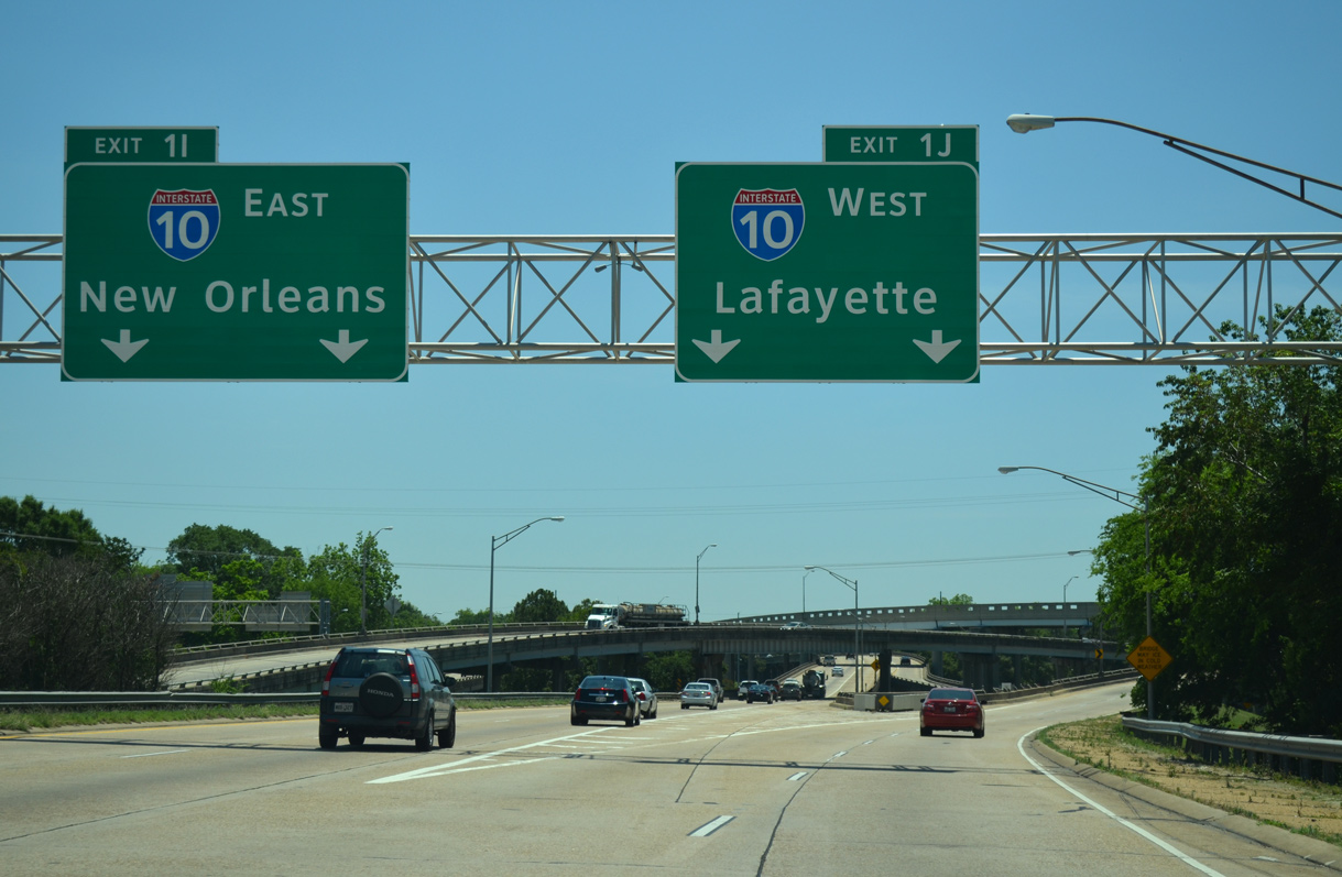
Southbound traffic partitions into two lane ramps for Interstate 10 west to Lafayette (Exit 1J) and east to New Orleans (Exit 1I). Prior to 2003, a third lane carried commuters from Downtown Baton Rouge to the eastern suburbs and I-12 at what was then an unnumbered interchange.
05/19/14
References:
- I0110 over LA 408; BADLEY ST; PARK, East Baton Rouge Parish, Louisiana. http://bridgereports.com/1231911 BridgeReports.com.
Photo Credits:
- ABRoads: 05/19/14
Connect with:
Page Updated Thursday March 30, 2017.