
Interstate 126
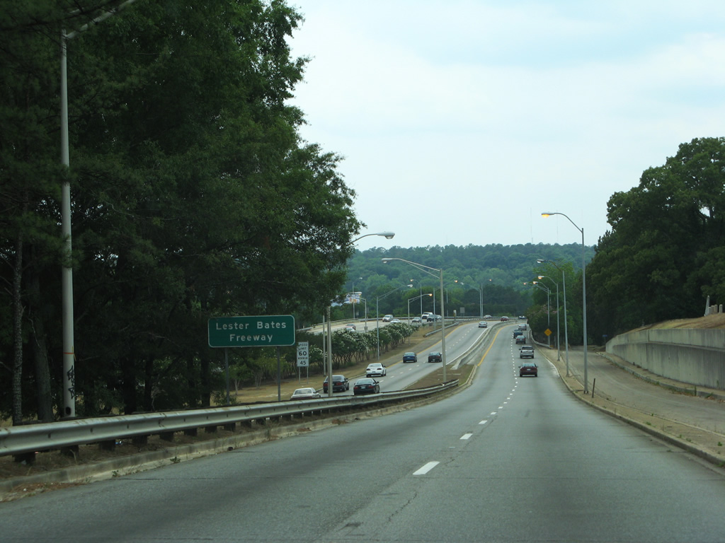
Interstate 126 joins the capital city of Columbia with Interstate 26. The 3.68 mile long freeway spans the delta of the Broad and Congaree Rivers to the northwest of the Congaree Vista neighborhood of the city en route to Riverbanks Zoo and the St. Andrews area. I-126 is formally named the Lester Bates Freeway.
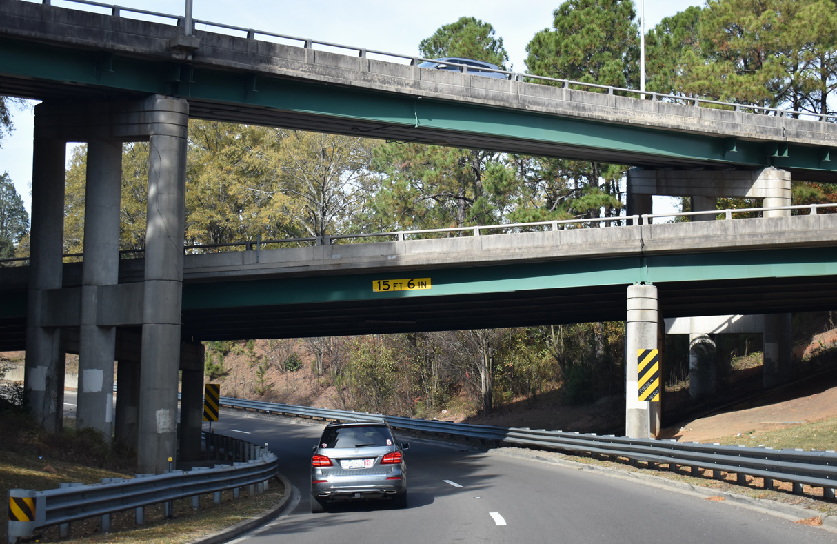
U.S. 76 overlaps with the six to eight lane freeway from Interstate 26 to Elmwood Avenue. Interchanges are unnumbered, a distinction I-126 alone holds in the S.C. Interstate system.
Signs posted along Interstate 26 east within the "Malfunction Junction" interchange complex at I-20/126 display I-126 with "Route I-126". Signs were changed in an effort to reduce confusion to motorists entering I-26 east from nearby Interstate 20. In The State news article "A Failure to Communicate? - Travelers Follow the Signs to Crossroads of Confusion" published on May 26, 1994, director of traffic engineering at the Department of Transportation Richard Werts commented regarding the motorist confusion of I-26 and I-126:
The folks who number highways shouldn't have chosen 126 as a spur off I-26. He said planners have been trying to figure out a way to give it a new number. They've even gone to the extent of taking 126 off some of the main directional signs where I-26 East splits off and heads to Charleston.
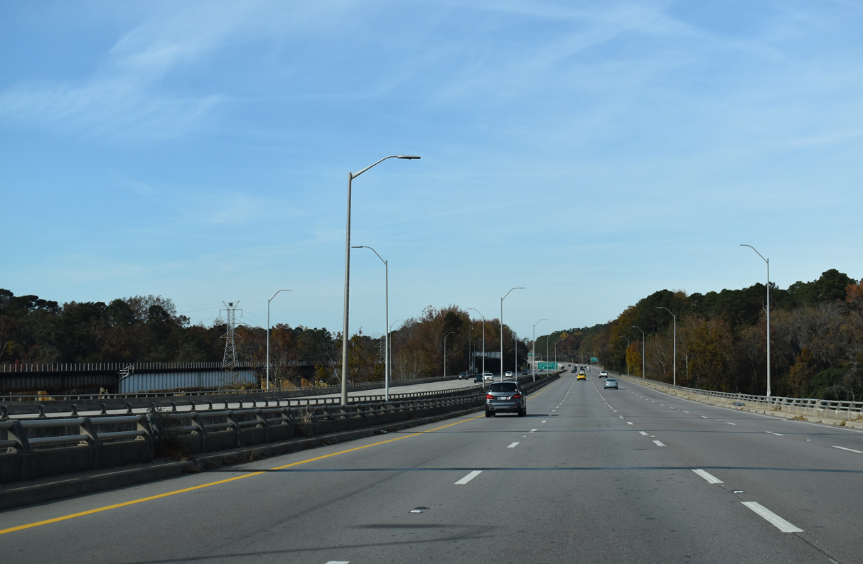
Widening of Interstate 126 to eight overall lanes between I-26 and Greystone Boulevard was completed in conjunction with an expansion of Greystone Boulevard to five lanes by November 1988.

 East
East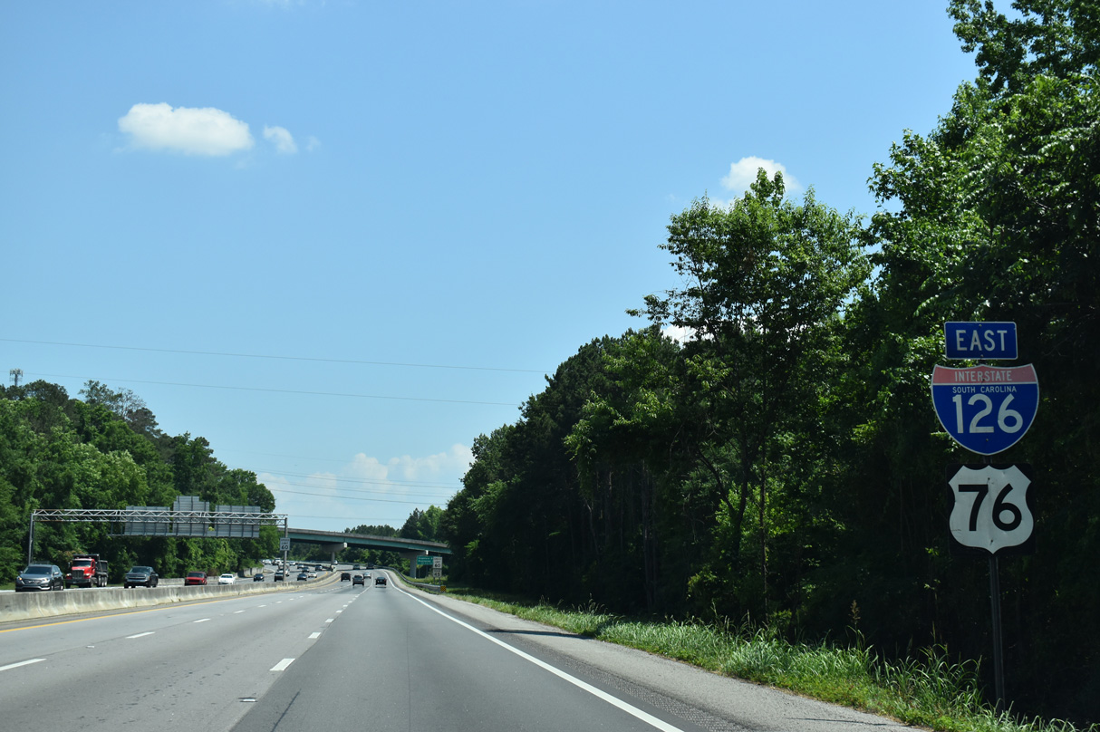
Joining I-126 from a three lane left exit, U.S. 76 concludes a 6.3 mile long overlap with Interstate 26.
05/24/19
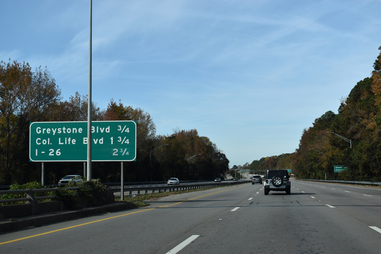
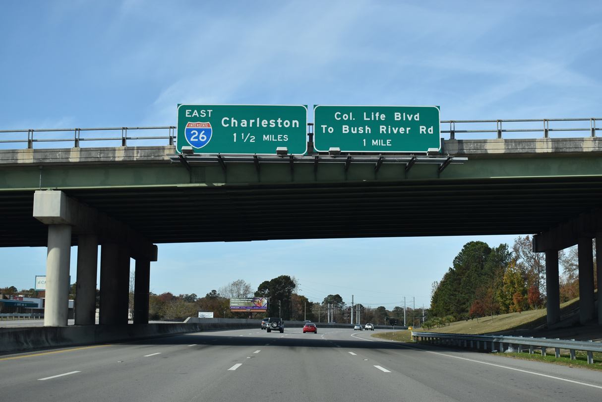
A wye interchange connects Colonial Life Boulevard south with I-126/U.S. 76 east, 1.25 miles from the exit to Greystone Boulevard.
05/24/19
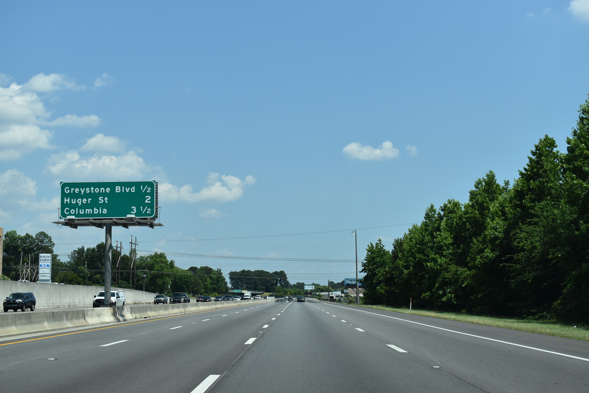
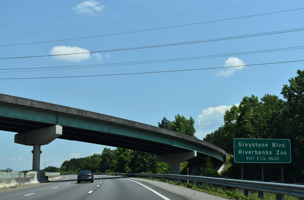
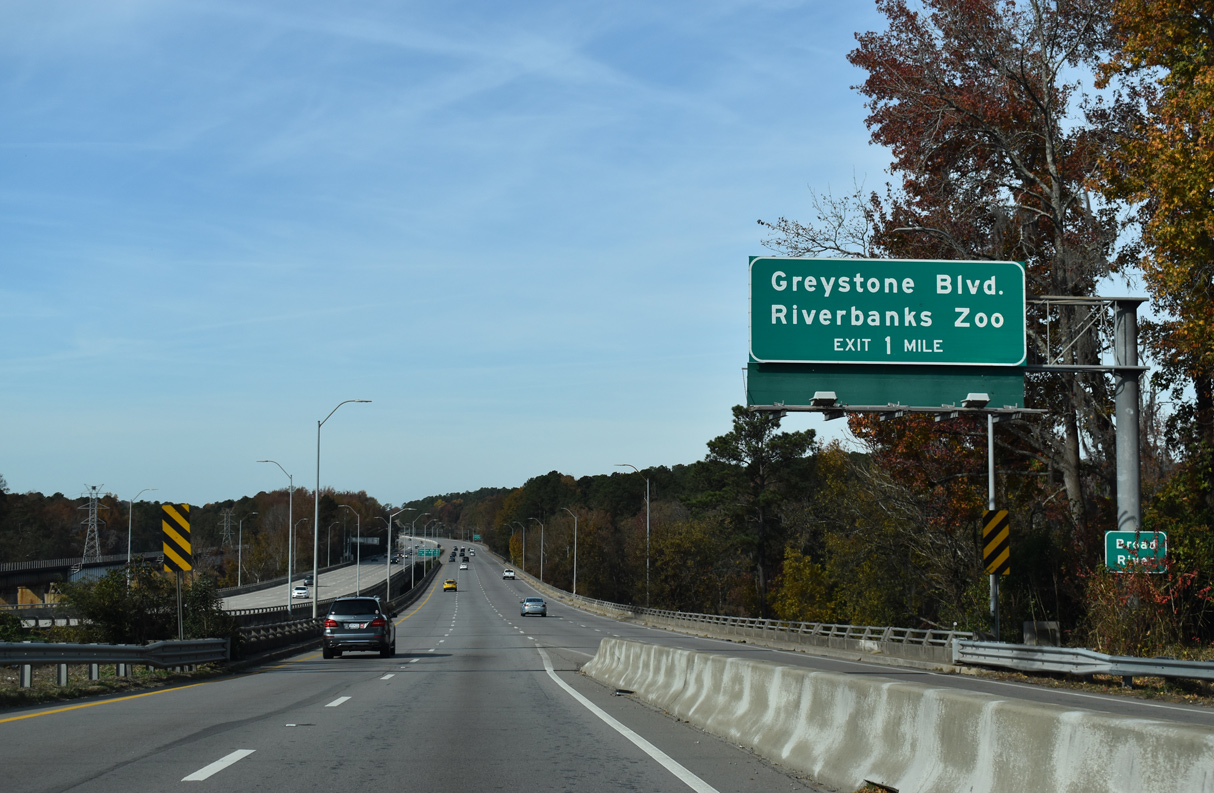
Interstate 126 expands to eight overall lanes between Colonial Life Boulevard and the parclo interchange with Greystone Boulevard for Riverbanks Zoo and Garden.
05/24/19
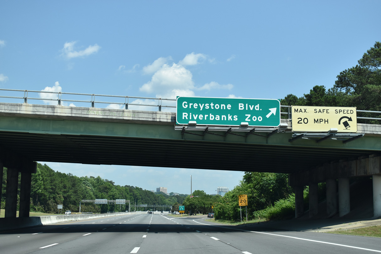
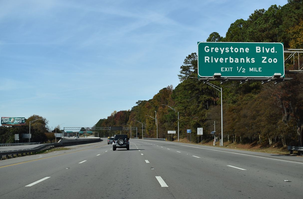
A loop ramp departs I-126/U.S. 76 east for Greystone Boulevard. Greystone Boulevard stems 0.99 miles north from the adjacent frontage roads of Candi Lane west and Rivermont Drive east to U.S. 176 (Broad River Road).
05/24/19
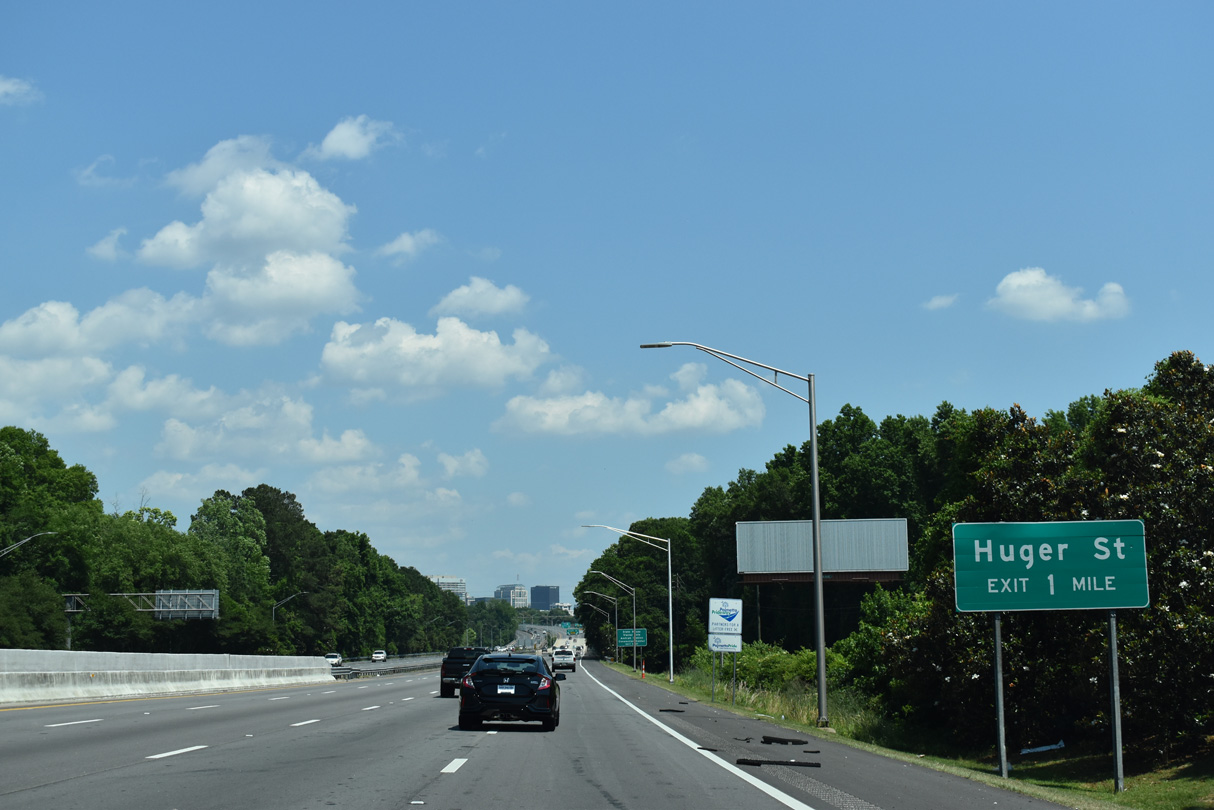
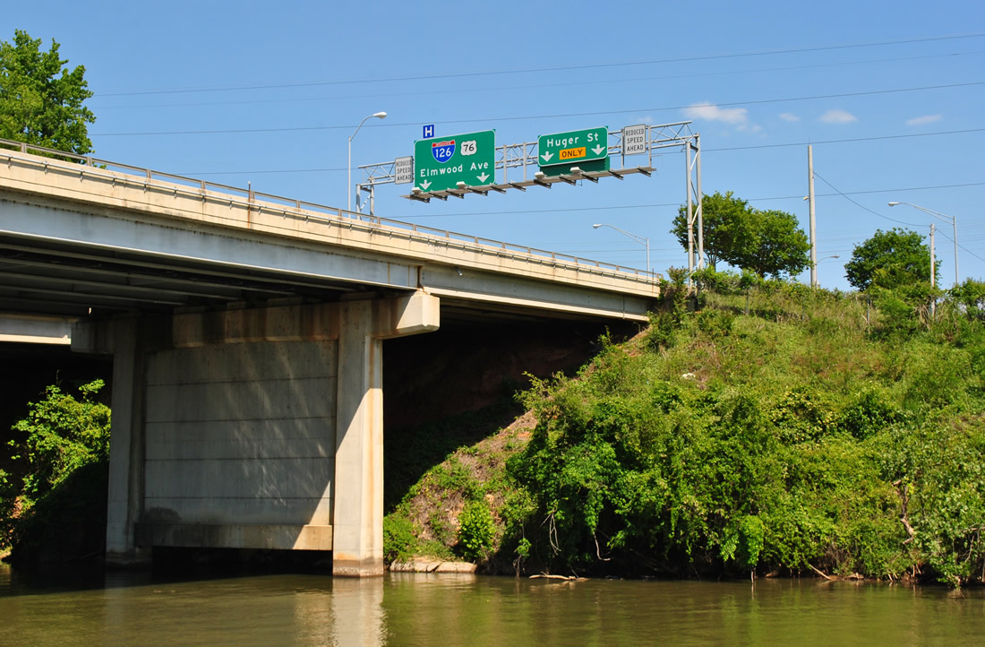
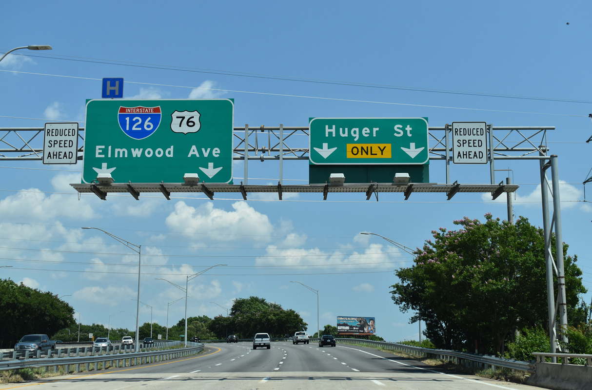
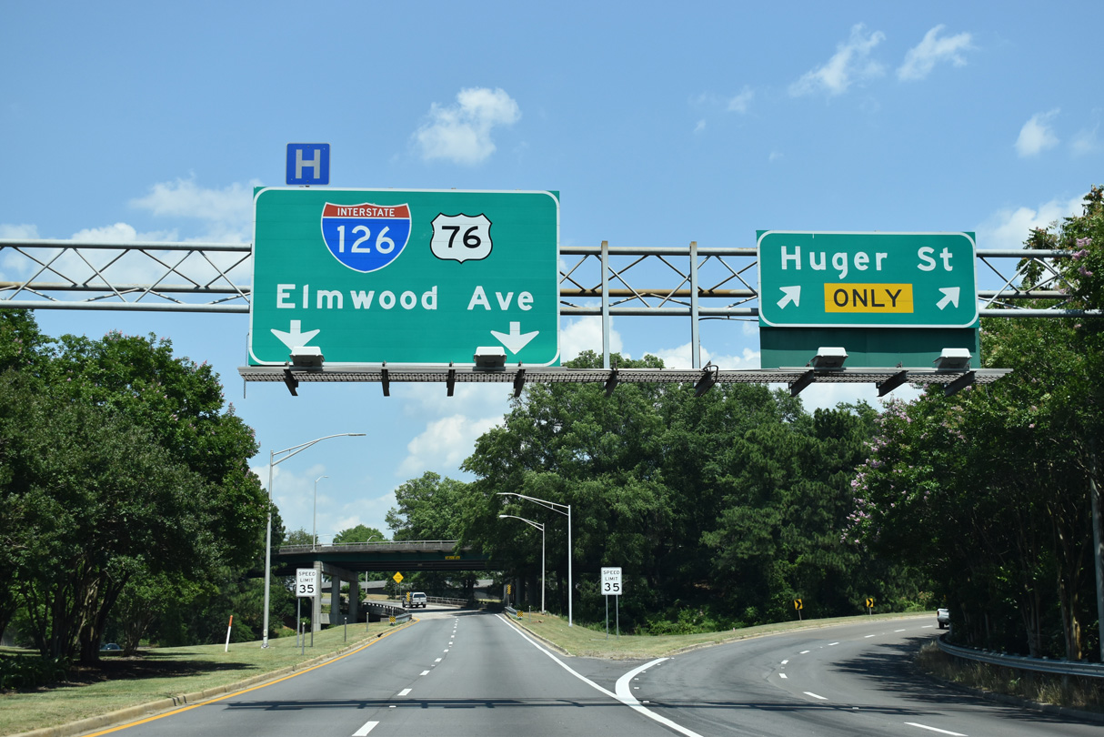
A three-wye interchange joins the east end of I-126 with U.S. 21/176/321 (Huger Street) south and Elmwood Avenue east. Huger Street leads south past Downtown Columbia and the State House toward the University of South Carolina (USC).
05/24/19

I-126/U.S. 76 cross the Broad River over an eight lane span. Two lanes separate for both Huger Street U.S. 21-176-321 south and the continuation of U.S. 76 east onto Elmwood Avenue (U.S. 21-176-321 north).
05/24/19
U.S. 21/176/321 overlap south to Cayce and north to the Elmwood neighborhood in Columbia. U.S. 76 lines Elmwood Avenue east 0.58 miles to S.C. 277 (Bull Street).
05/24/19
U.S. 21-176-321 extend 1.31 miles south along Huger Street to Blossom Street near USC. A half mile of Elmwood Avenue east is also unsigned Business Spur I-126.
05/24/19
U.S. 76 (Elmwood Avenue) east joins U.S. 21-176-321 north for five blocks to Main Street. U.S. 76 turns south along Bull Street to U.S. 1/378 (Gervais Street) by the Main Street District and Downtown.
05/24/19
West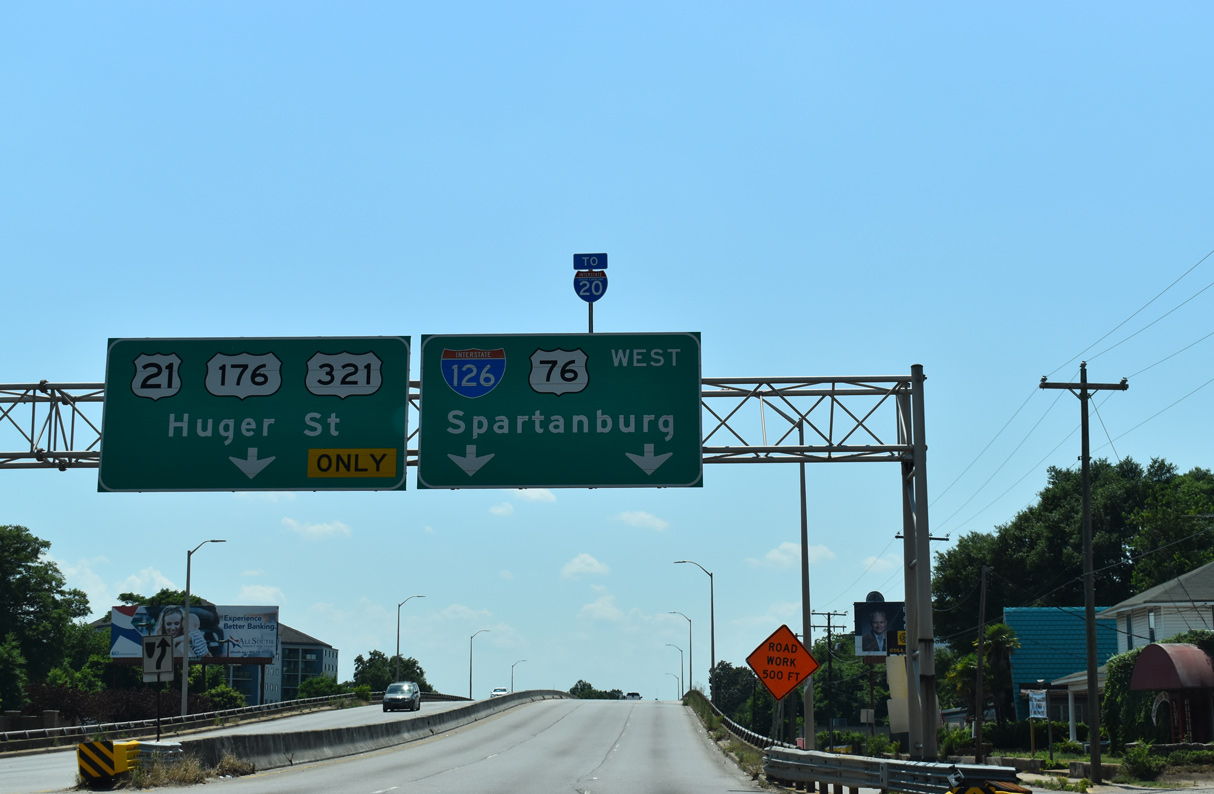
I-126 commences westbound from the Elmwood neighborhood in Columbia across the Elmwood Street viaduct taking U.S. 21/76/176/321 over Wayne Street and a former CSX railroad line.
05/24/19
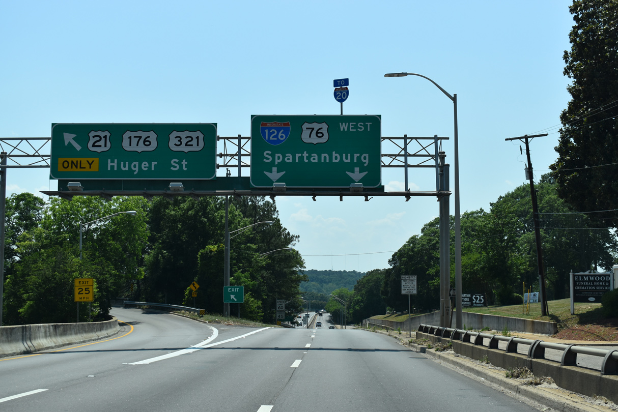
I-126/U.S. 76 west part ways with U.S. 21-176-321 south at the flyover for Huger Street. U.S. 21-176-321 continue south to Blossom Street along western reaches of the Columbia central business district.
05/24/19
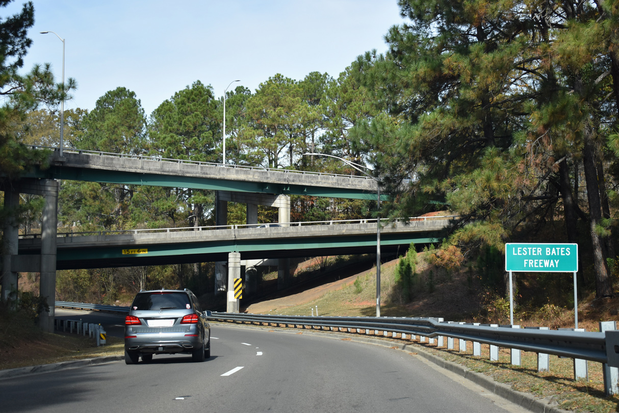
Interstate 126 is officially designated the Lester Bates Freeway. Bates served as mayor of Columbia between 1958 and 1970.
11/21/21
The three level interchange joining Elmwood Avenue, Hugher Street and Interstate 126 was built in 1959.
11/21/21
Two lane ramps from Huger Street (U.S. 21/176/321) north and Elmwood Avenue (U.S. 76) west converge ahead of a CSX and Norfolk Southern Railroad underpass.
06/01/07

I-126/U.S. 76 expands to four lanes westbound across Columbia Canal.
11/21/21
I-126/U.S. 76 proceed west from the Broad River to a parclo interchange with Greystone Boulevard.
11/21/21
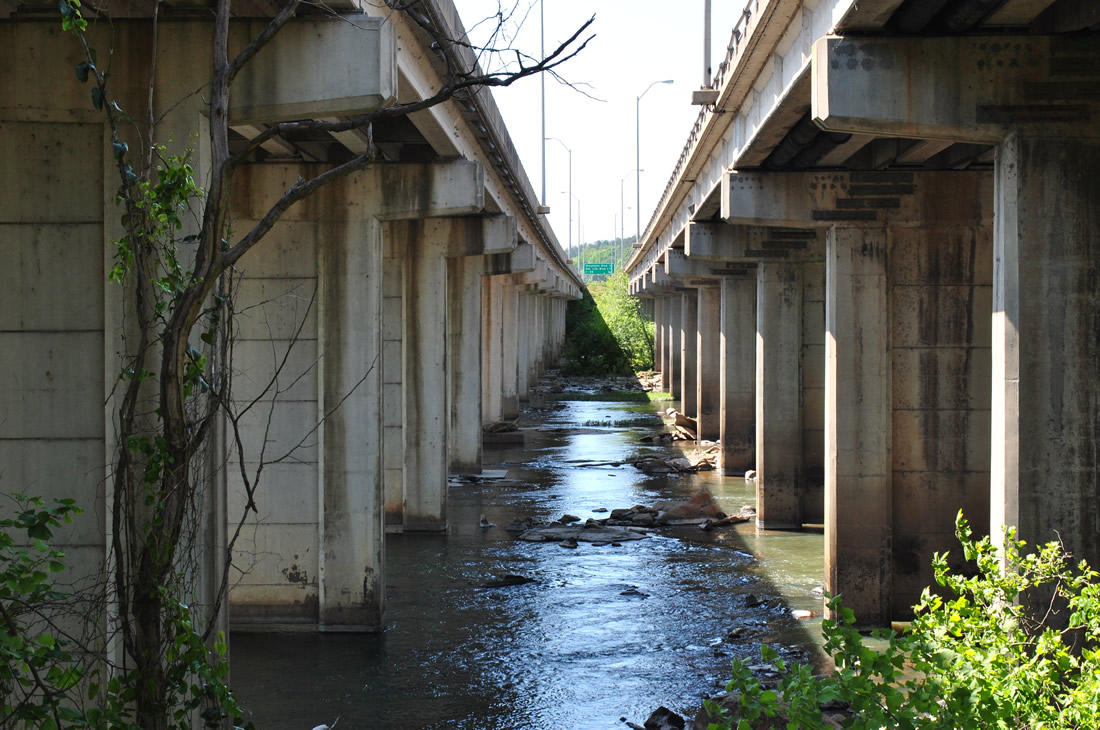
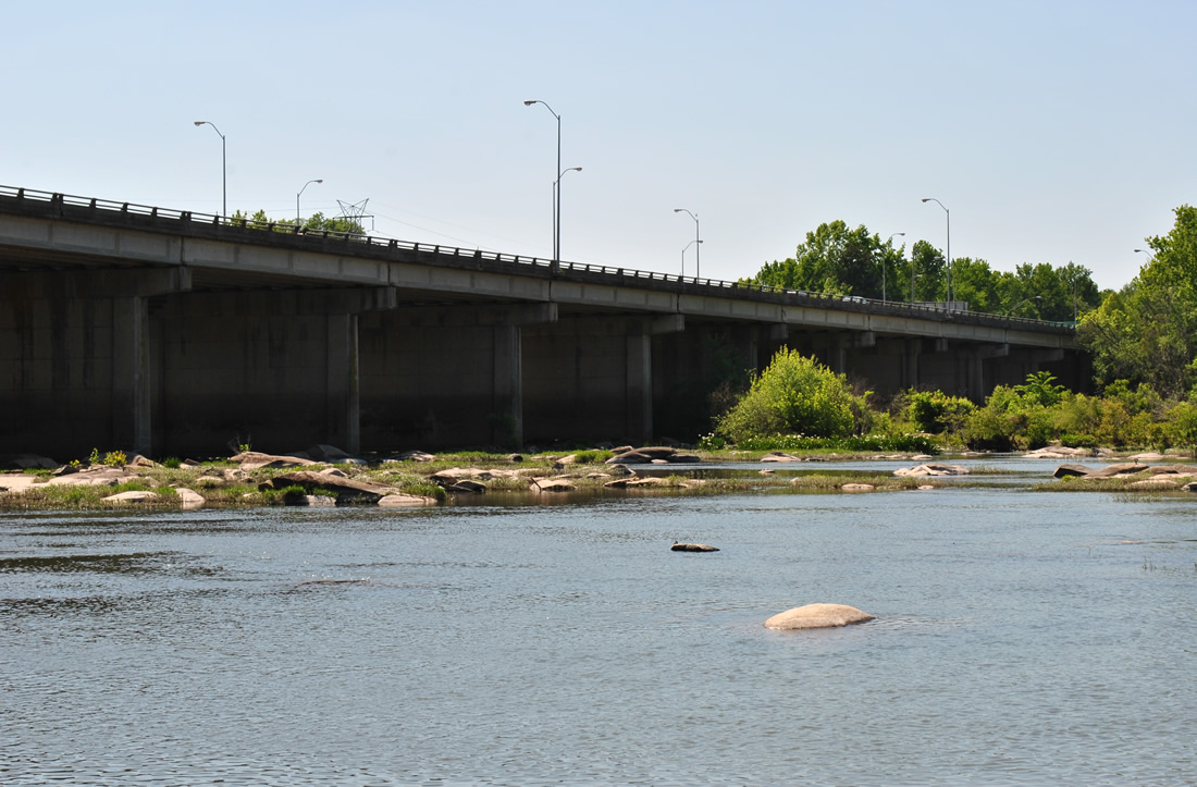
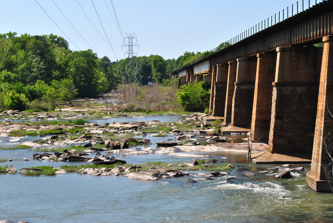
I-126/U.S. 76 parallel a CSX Railroad line as both span the Broad River. The Broad River combines with the adjacent Saluda River to form the Congaree River flowing south between Columbia and West Columbia.
11/21/21
The succeeding two exits and Interstate 26 west serve the community of St. Andrews.
11/21/21
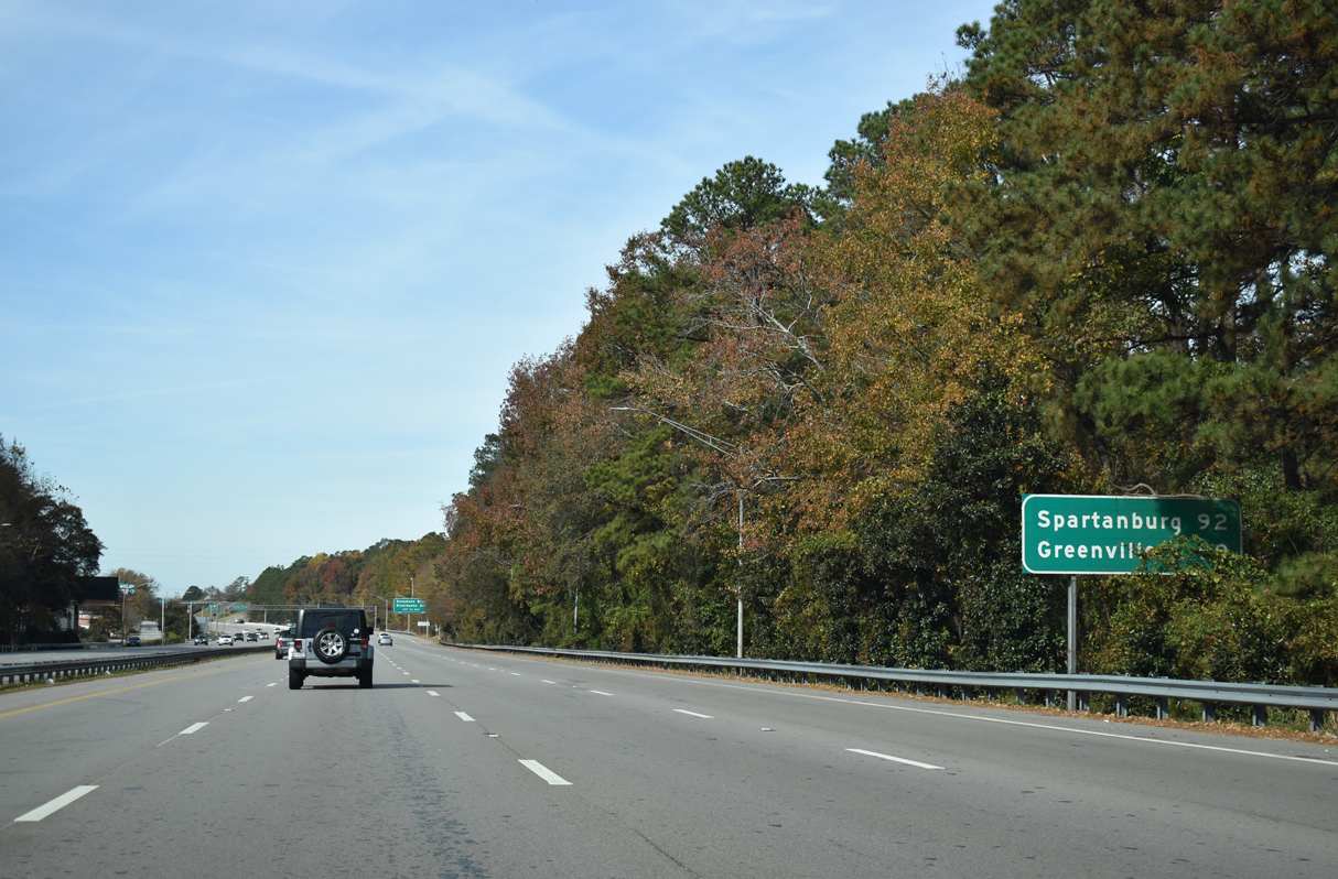
Spartanburg lies 92 miles north of Columbia via I-26 west in the Upstate. Greenville is 99 miles northwest via I-26 to I-385 north.
11/21/21
Greystone Boulevard is a four to five lane commercial boulevard extending 0.99 miles north from Candi Lane and Rivermont Drive to U.S. 176 (Broad River Road).
11/21/21
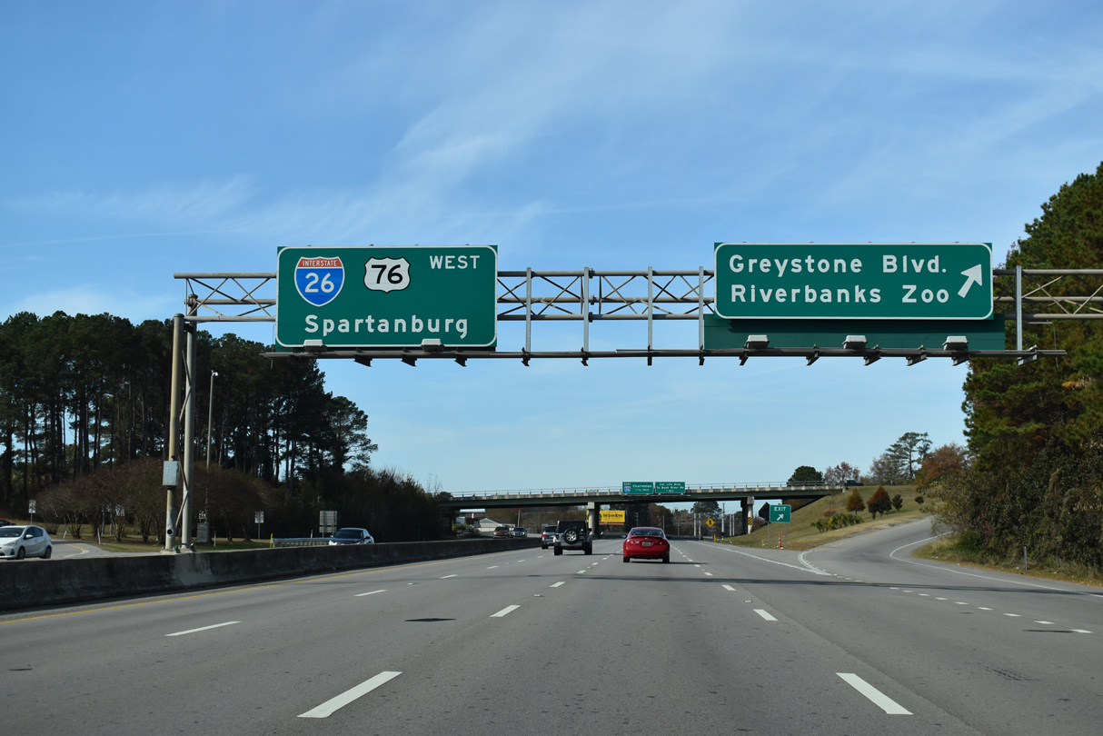
Riverbanks Zoo and Gardens lies just south of I-126/U.S. 76 and Greystone Boulevard along the Saluda River.
11/21/21
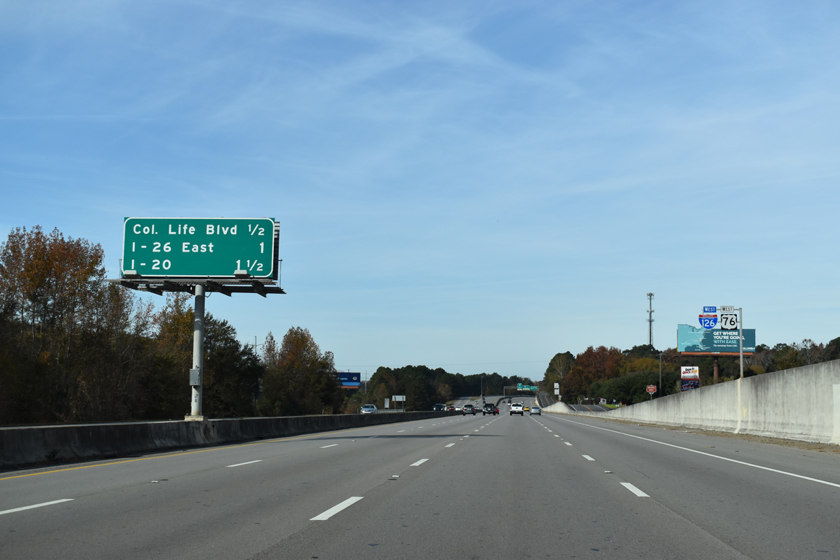
A wye interchange joins I-126/U.S. 76 west with Colonial Life Boulevard north one half mile ahead of the flyover for I-26 east.
11/21/21
Colonial Life Boulevard branches 0.77 miles north from I-126/U.S. 76 to Bush River Road (Road 31) at the Dutch Square retail center.
11/21/21
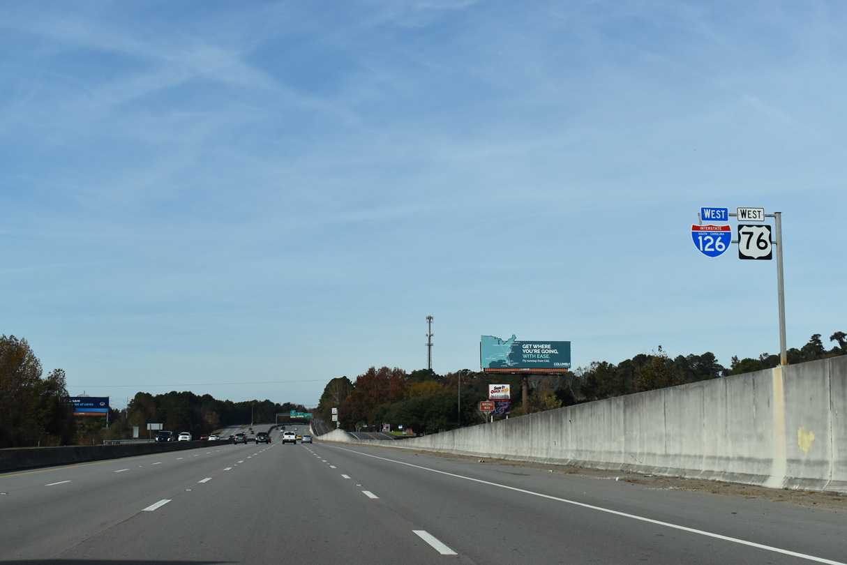
The lone set of reassurance markers for I-126/U.S. 76 west.
11/21/21
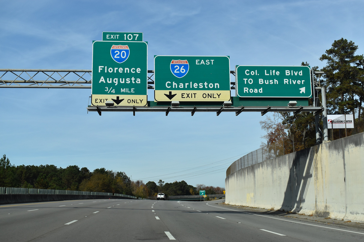
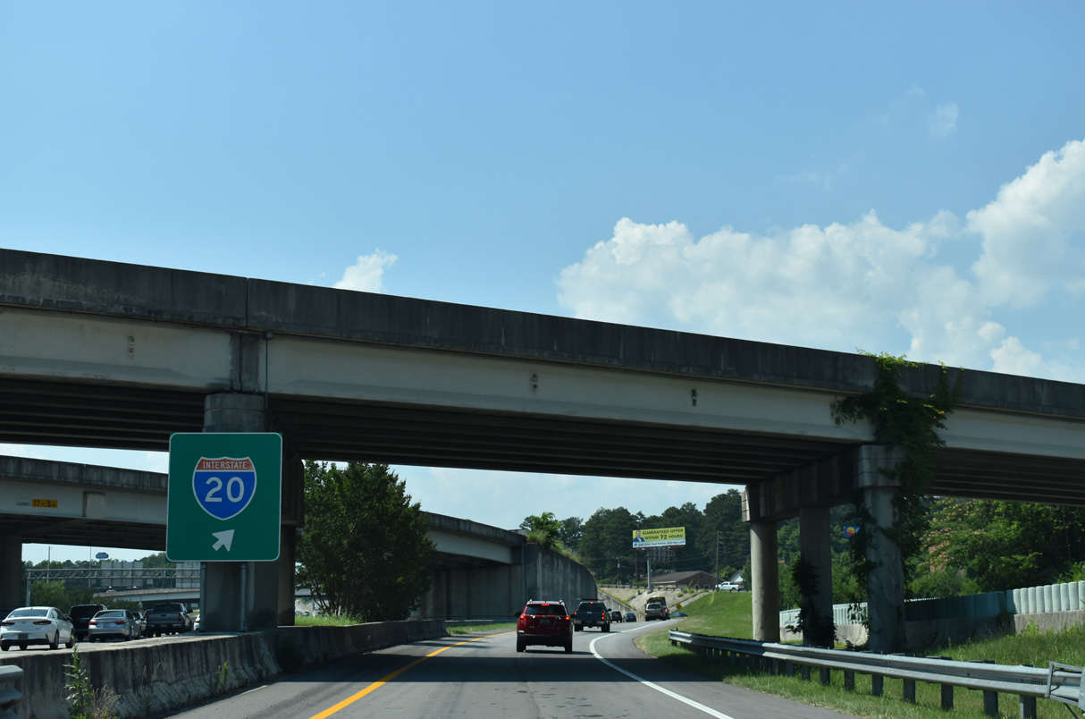
Bush River Road (Road 31) stems west from U.S. 176 (River Road) to Colonial Life Boulevard at St. Andrews en route to the town of Irmo. I-126 concludes in 1.11 miles beyond Exit 107 for Interstate 20.
11/21/21

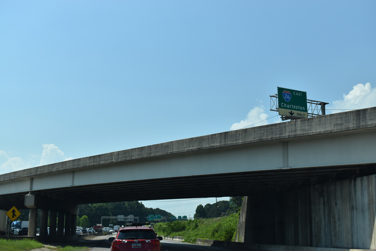
The flyover for Orangeburg, Charleston and the South Carolina LowCountry joins Interstate 26 eastbound beyond the Saluda River.
11/21/21
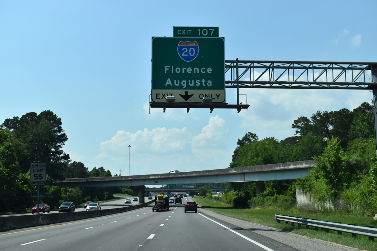
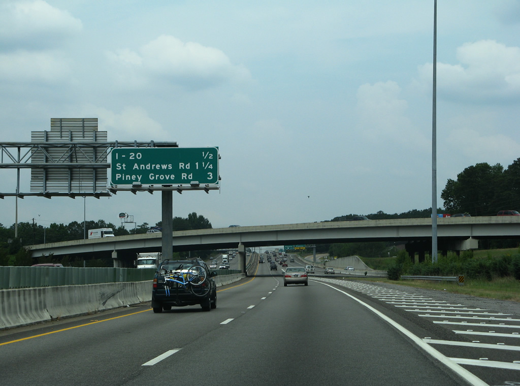
Exit 107 circumvents the merge where I-126/U.S. 76 and I-26 west come together to form an auxiliary lane to the Carolina Crossroads interchange with Interstate 20.
05/24/19
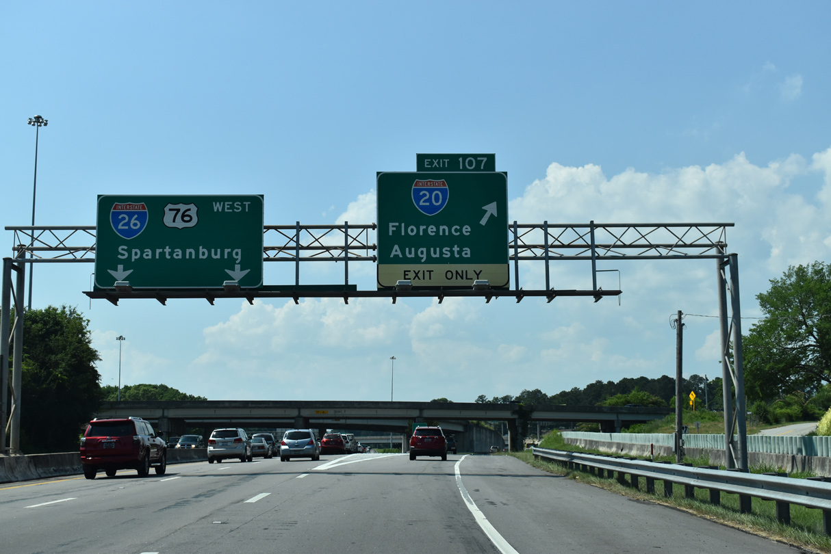
The Interstate 126 mainline defaults onto I-26 west with overall lanes. U.S. 76 overlaps with I-26 to Exit 101, north of Irmo.
05/24/19
Exit 107 constitutes a bypass lane, reducing weaving traffic on I-26 west between the end of I-126 and the exchange with I-20.
05/24/19
An entrance ramp from Morninghill Drive ties into the exit for I-20 from the overlaying parclo interchange with Bush River Road.
05/24/19
I-126/U.S. 76 converge with the left lanes of Interstate 26, one half mile from the cloverleaf interchange (Exit 107) with I-20.
06/01/07
Photo Credits:
- Brent Ivy: 05/24/19
- ABRoads: 11/21/21
- Andy Field: 06/01/07
Connect with:
Page Updated Thursday December 30, 2021.