
Interstate 140 East
 east
east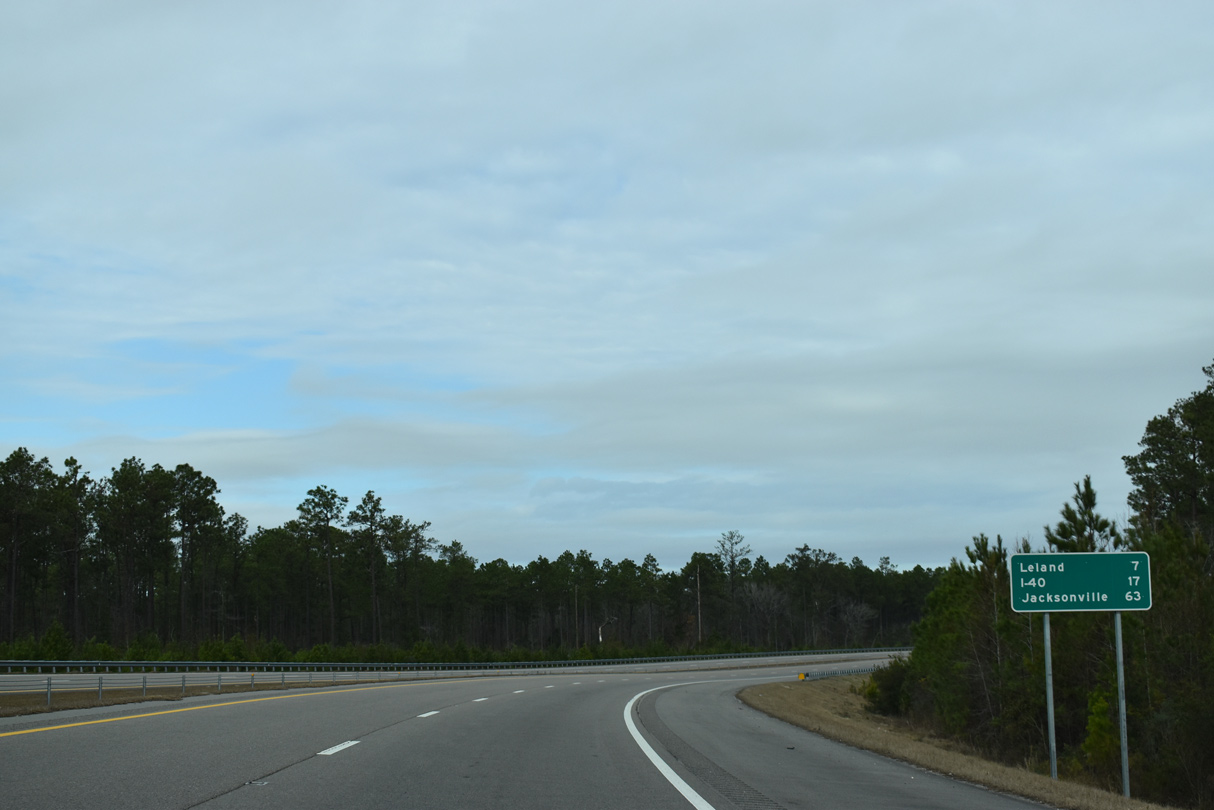
01/19/19

01/19/19
01/19/19
01/19/19
01/19/19
01/19/19
01/19/19
01/19/19
01/19/19
01/19/19
01/19/19
01/19/19
01/19/19
01/19/19
01/19/19
01/19/19
01/19/19
01/19/19
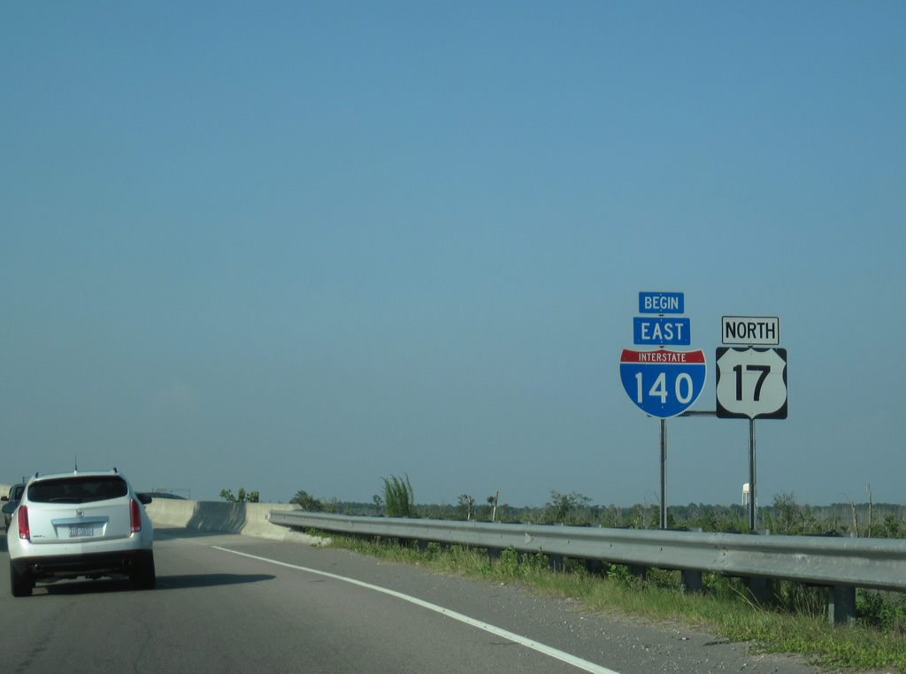
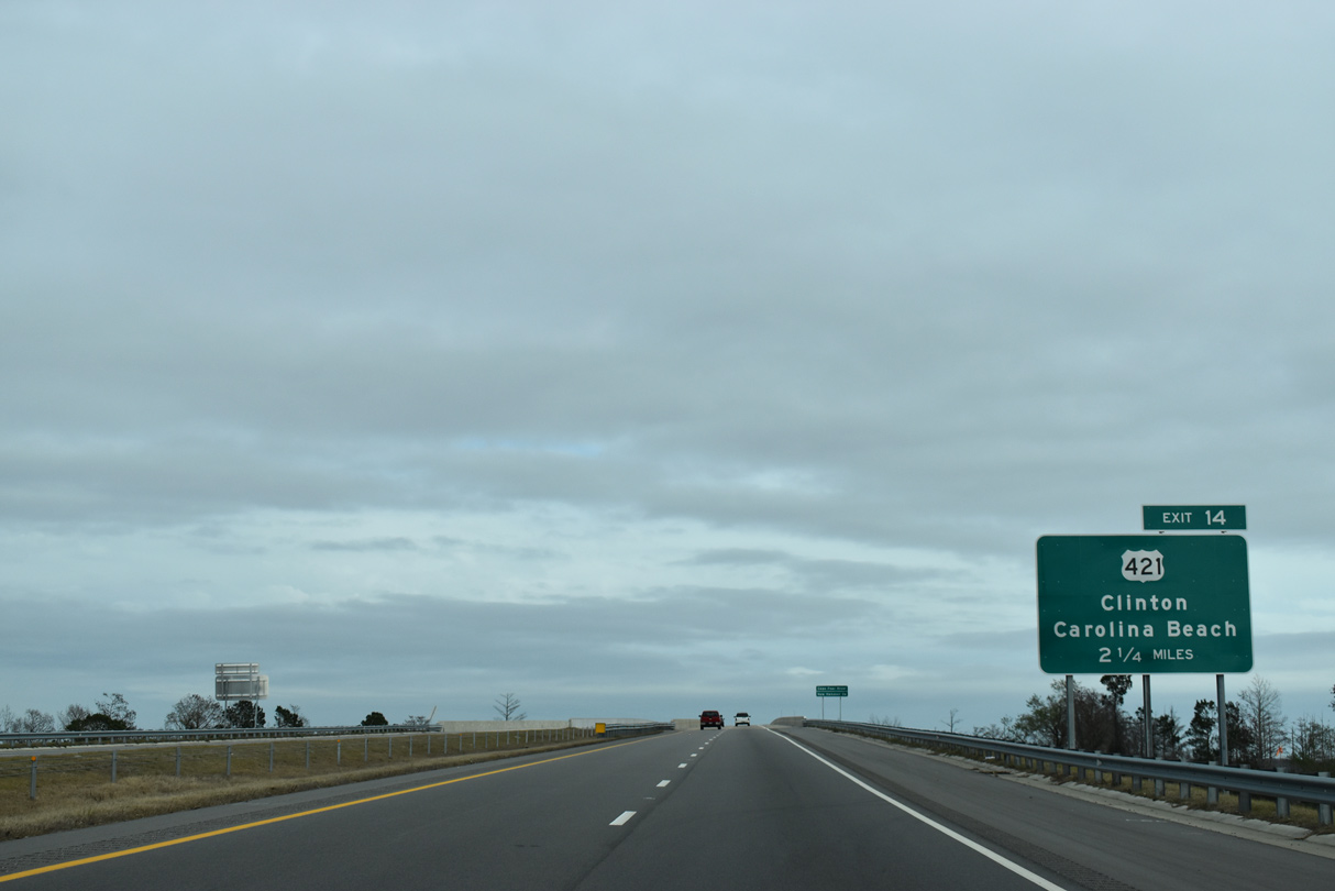
A begin shield for I-140 previously stood along the entrance ramp linking U.S. 421 with the Dan Cameron Bridge spanning the Northeast Cape Fear River.
06/24/10
06/24/10
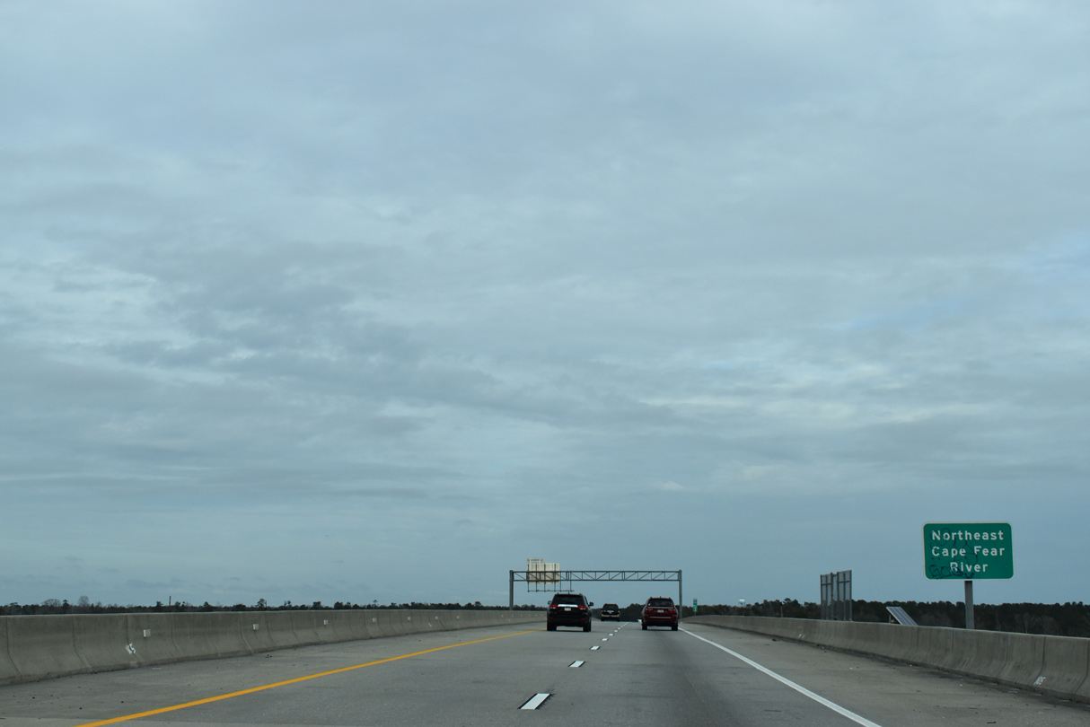
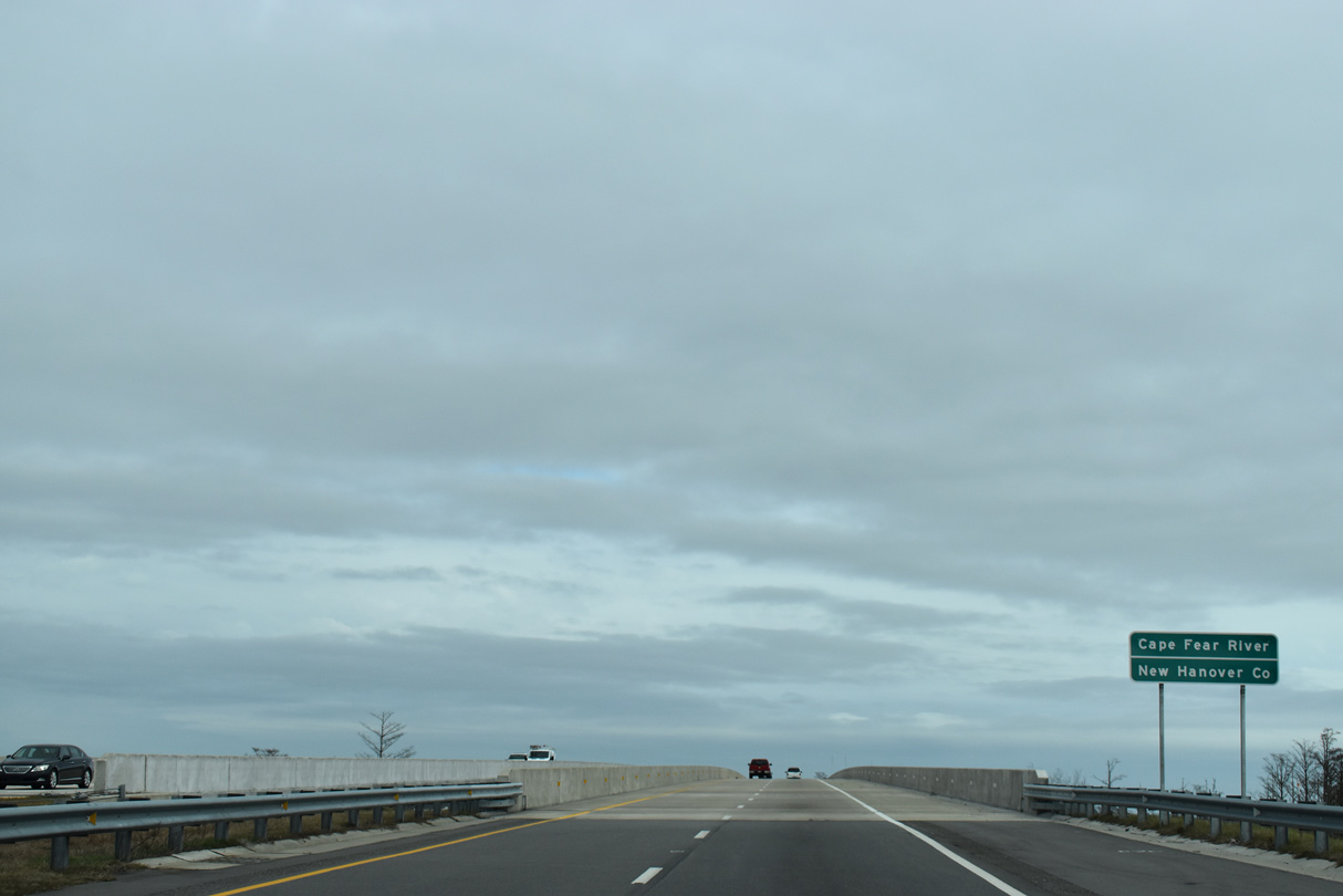
Measuring 7,402 feet in length, the Dan Cameron Bridge spans marshland and the Northeast Cape Fear River at a maximum height of 65 feet.1
01/19/19
01/19/19

The Northeast Cape Fear River converges with the Cape Fear River south along side Downtown Wilmington.
06/24/10
06/24/10
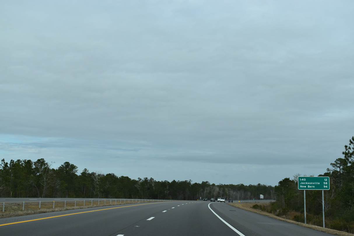
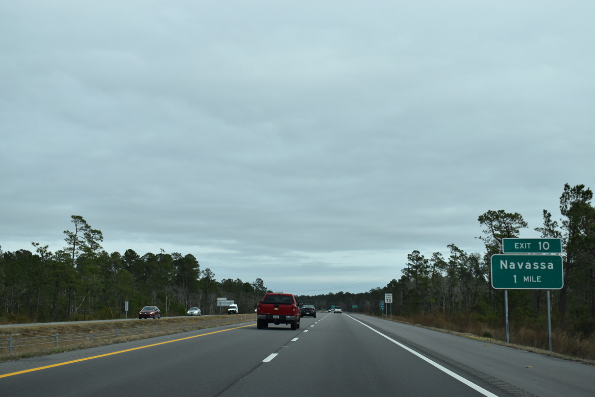
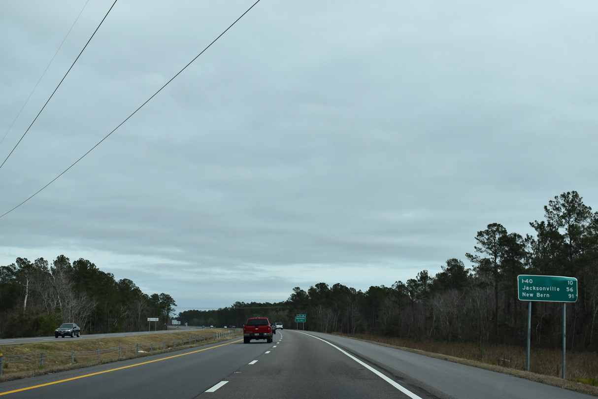
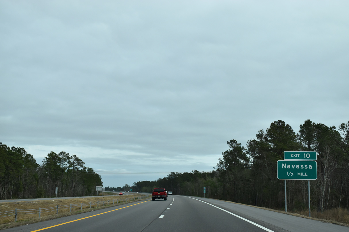
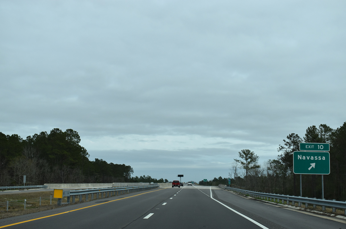
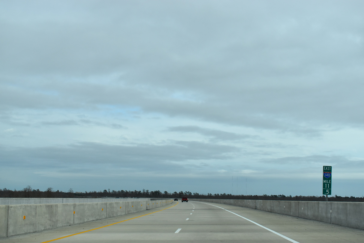
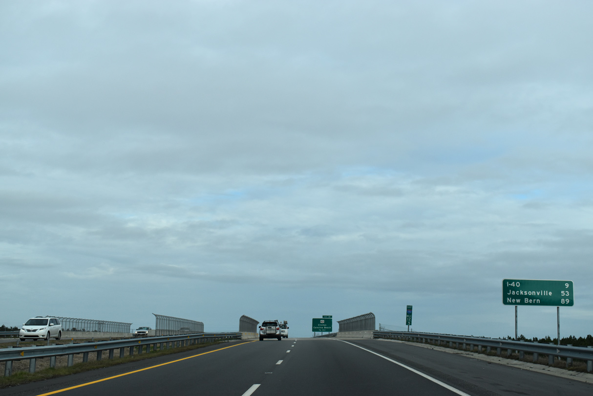
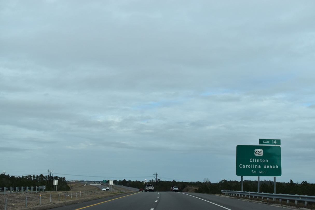
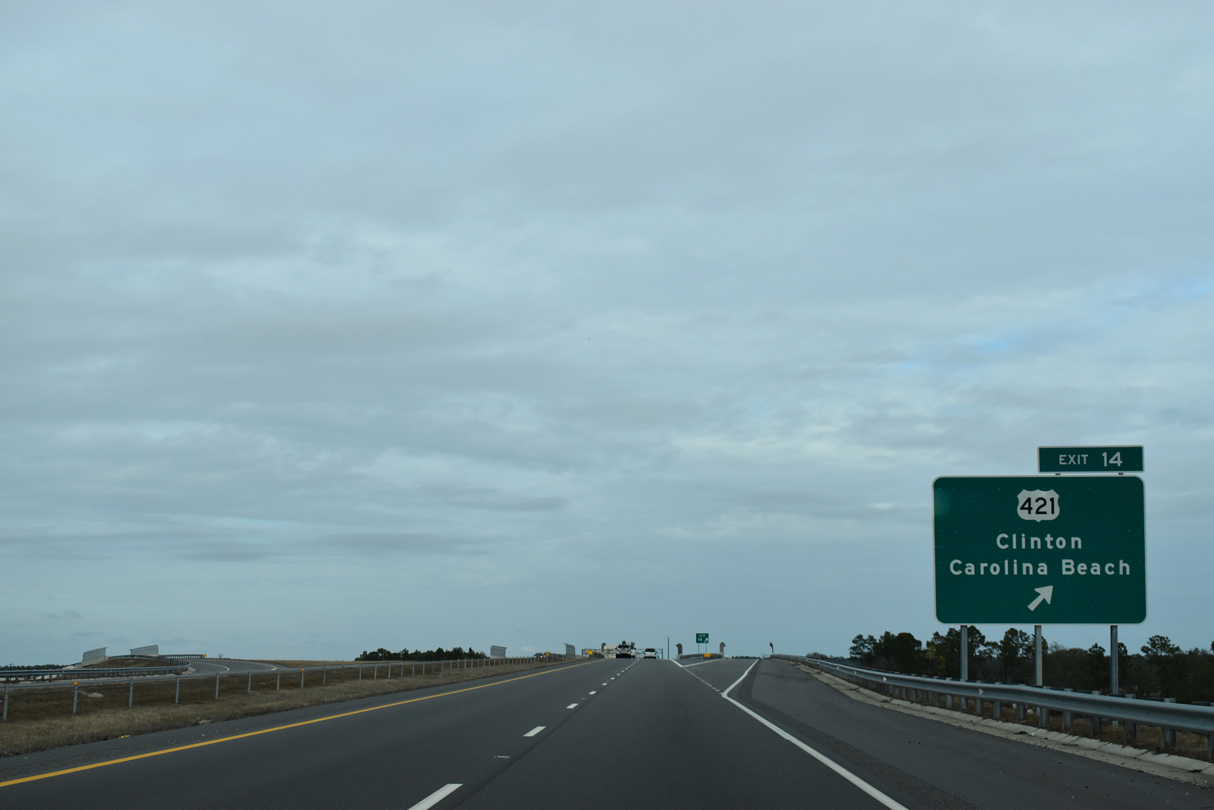
Interstate 140 advances five miles east from the Dan Cameron Bridge to I-40. Jacksonville lies another 41 miles beyond the east end of I-140 along U.S. 17.
01/19/19
01/19/19
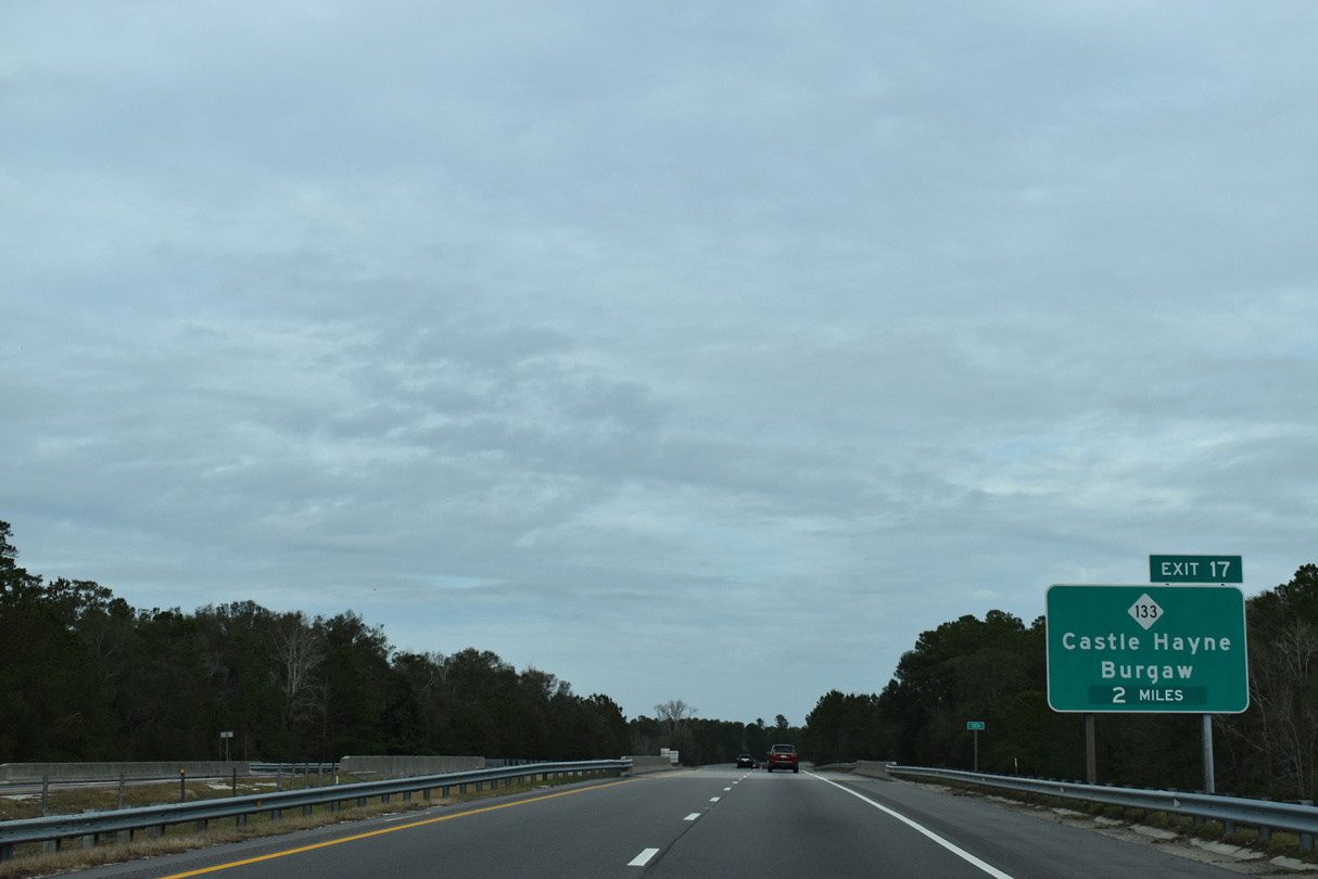
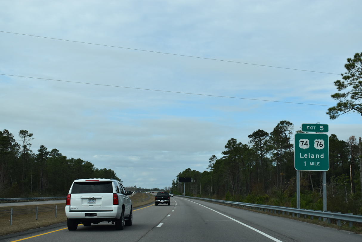
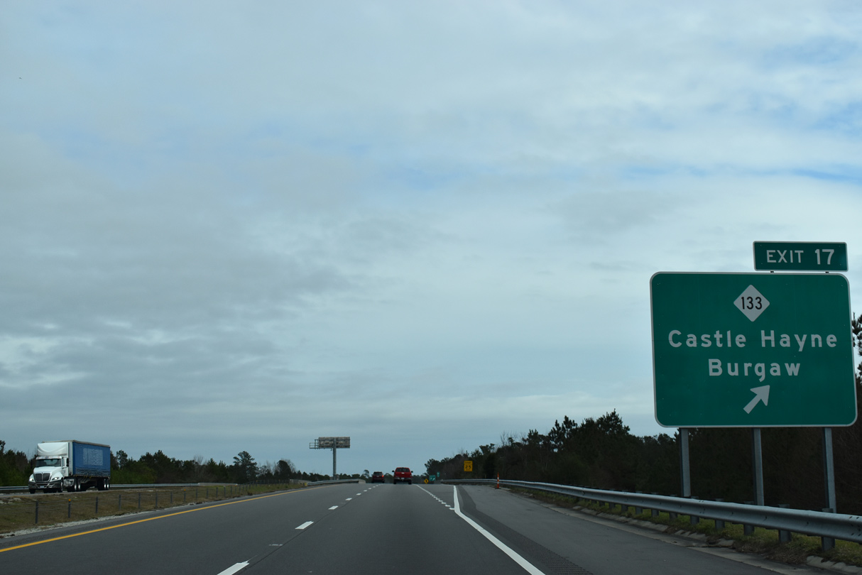
Spanning Rockhill Road (SR 1331), two miles ahead of a folded diamond interchange (Exit 17) with NC 133 (Castle Hayne Road).
01/19/19
01/19/19

NC 133 (Castle Hayne Road) leads south to Wilmington International Airport (ILM) and Hightsville and north to U.S. 117 at Castle Hayne.
01/19/19
01/19/19
NC 113 (Castle Hayne Road) combines with U.S. 117 north 2.74 miles from Castle Hayne into Pender County. U.S. 117 continues from there to the county seat of Burgaw while NC 133 turns northwest to NC 210.
01/19/19
01/19/19
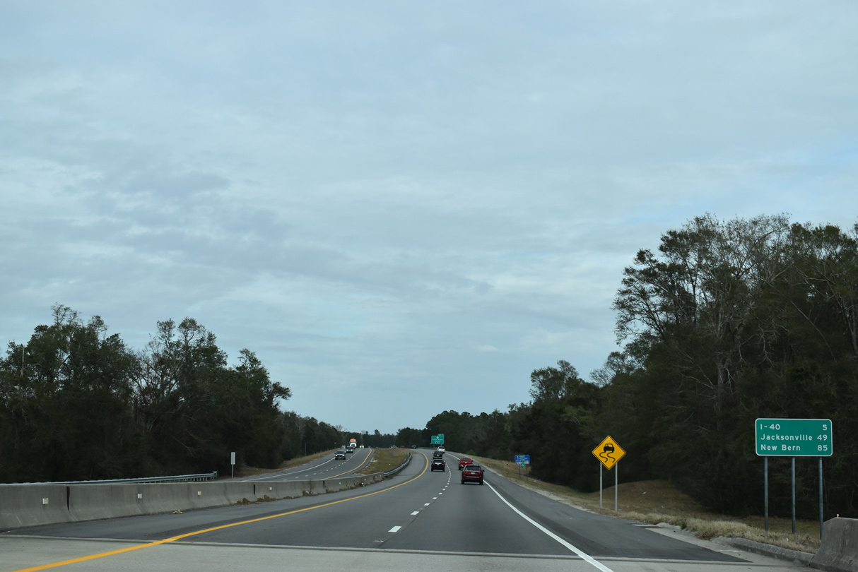
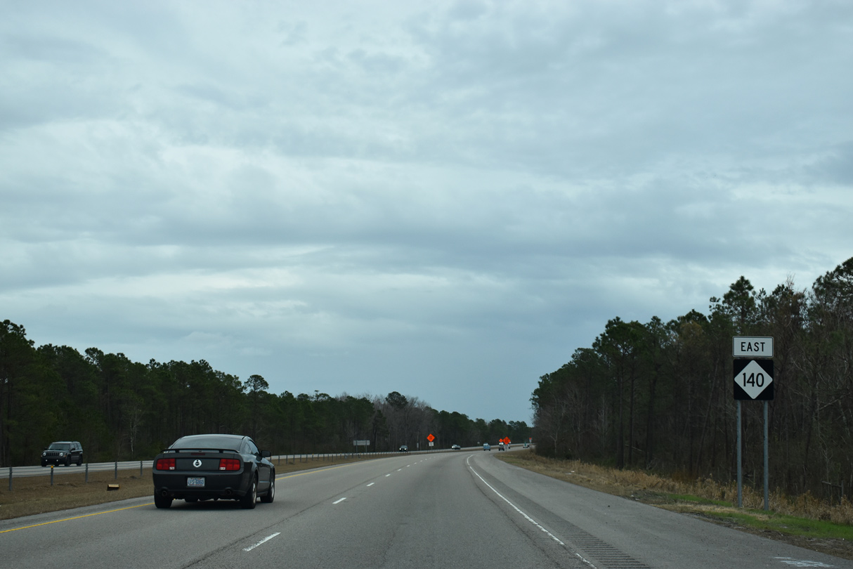
Reassurance markers for I-140 east / U.S. 17 south after NC 133 (Castle Hayne Road). 18,000 vehicles per day (vpd) were recorded on this stretch by NCDOT in 2016.
01/19/19
01/19/19
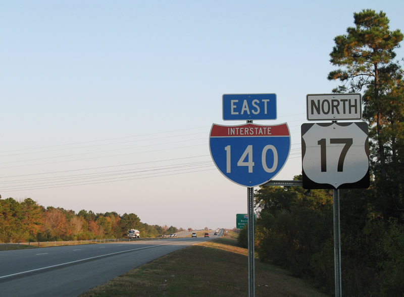
Shields for U.S. 17 were removed from I-140 in 2018.
11/11/06
11/11/06
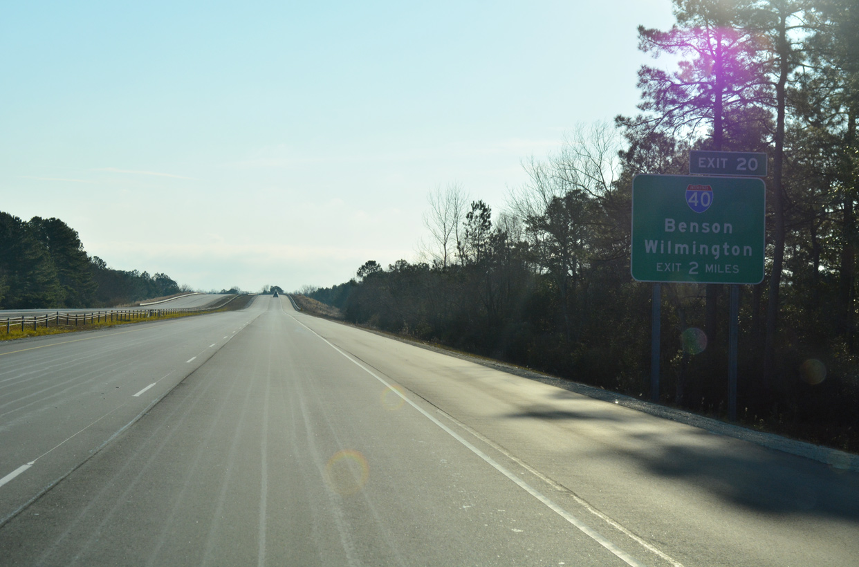
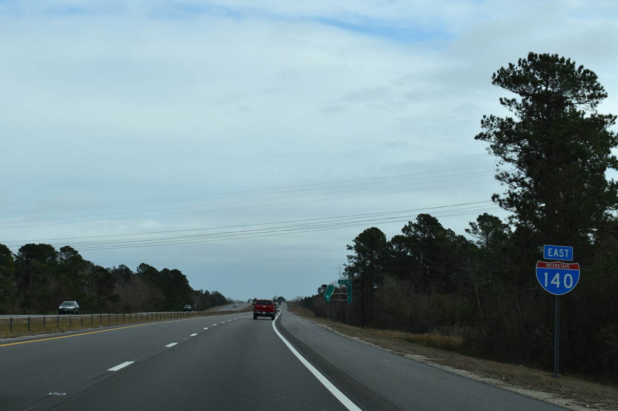
The freeway navigates through a broad S-curve and crosses a CSX Railroad two miles ahead of the directional cloverleaf interchange (Exit 20) with Interstate 40.
12/31/17
12/31/17
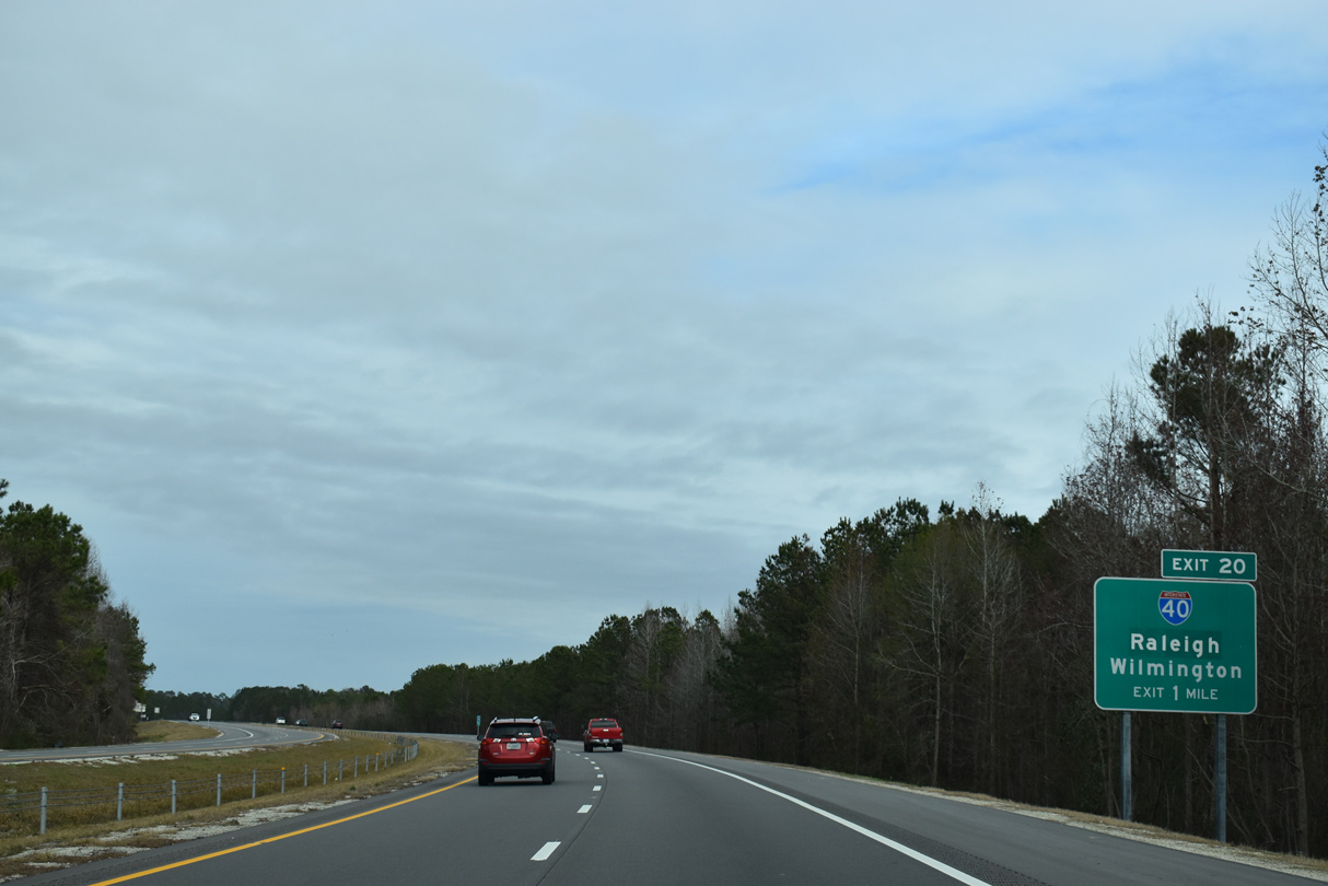
Interstate 40 originates just south of I-140 from U.S. 117 near the Wilmington city line. The cross-state freeway initially travels north to Raleigh and then west from Durham to Greensboro.
01/19/19
01/19/19
U.S. 117/NC 132 (N College Road) span I-140 just ahead of the exchange with I-40.
12/31/17
12/31/17
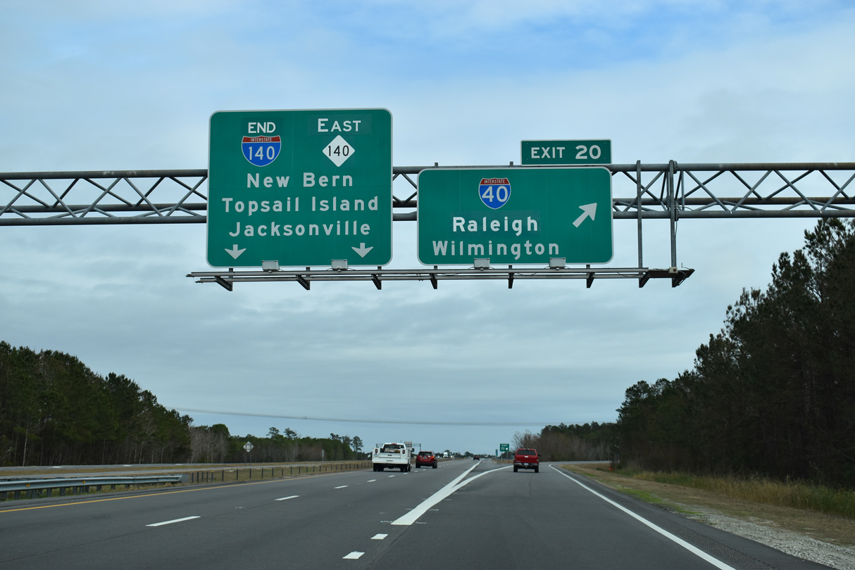
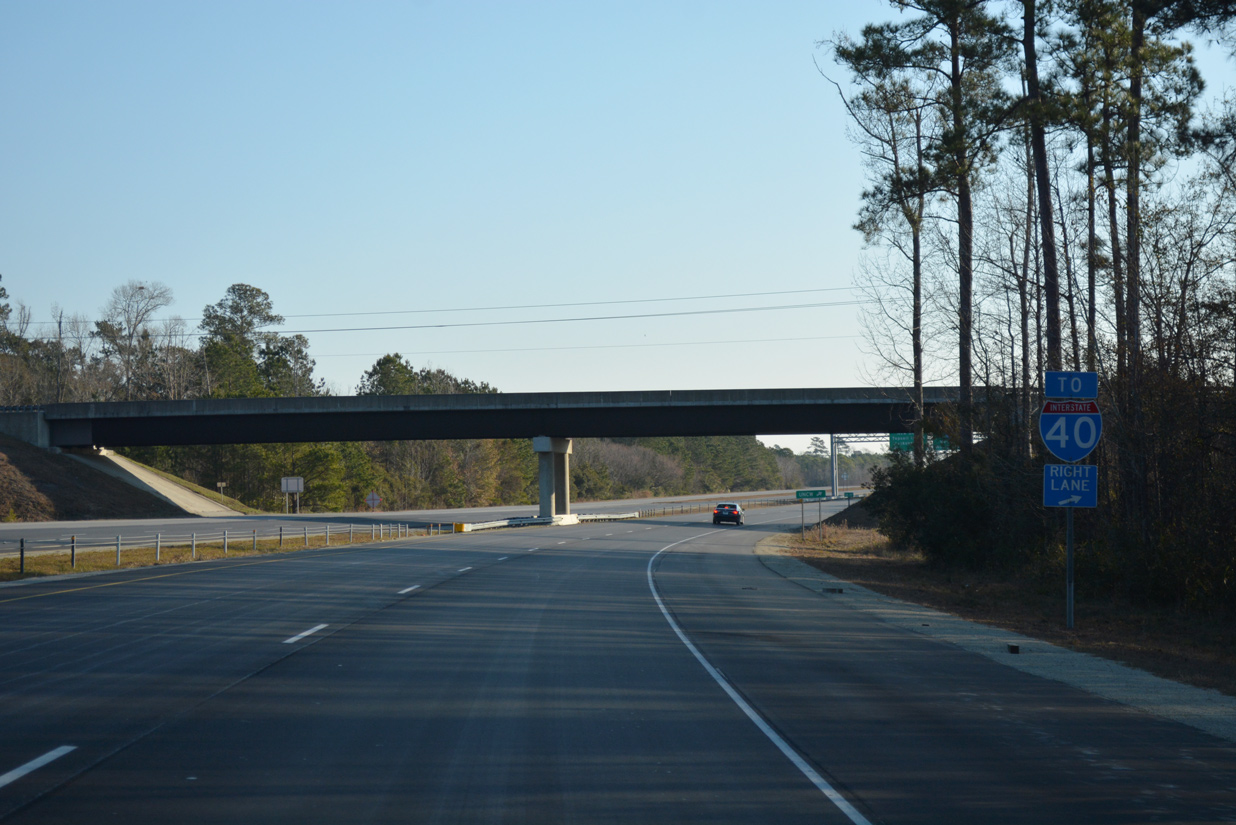
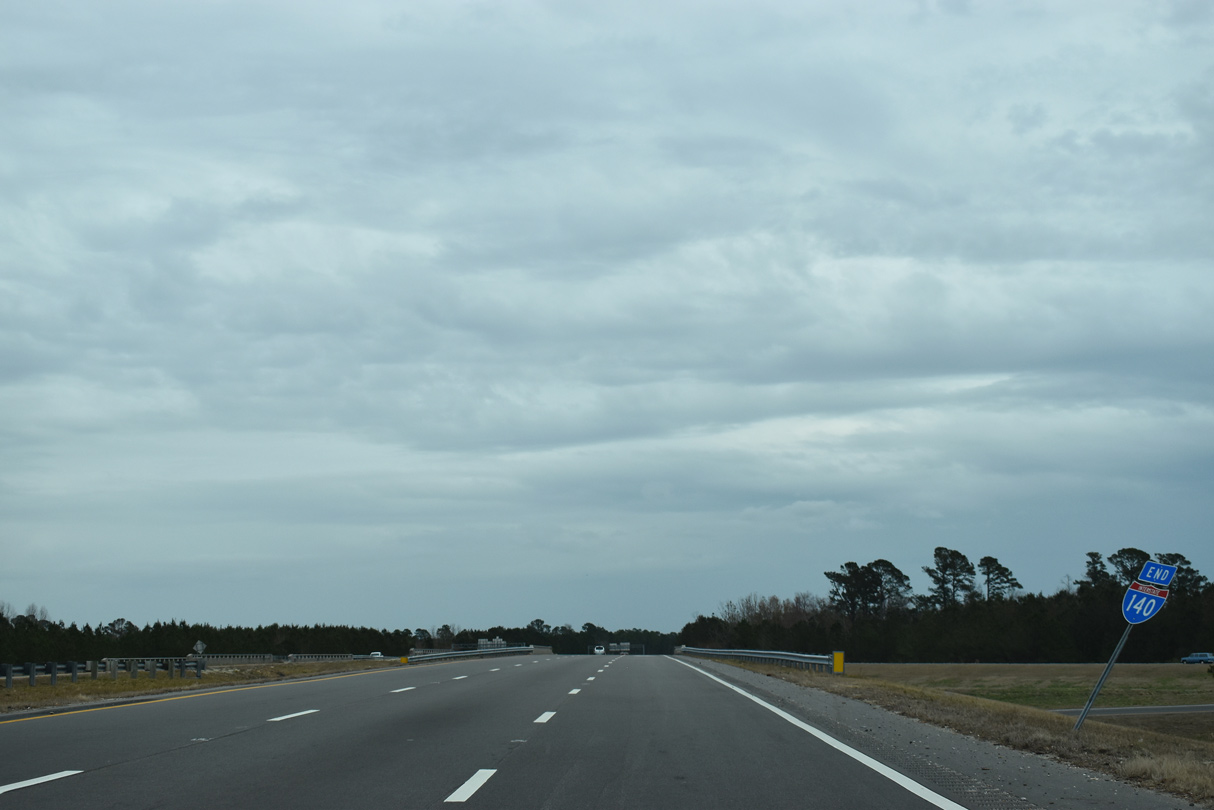
Motorists bound for either direction of Interstate 40 depart in unison from I-140 east at Exit 20. I-140 becomes NC 140.
01/19/19
01/19/19
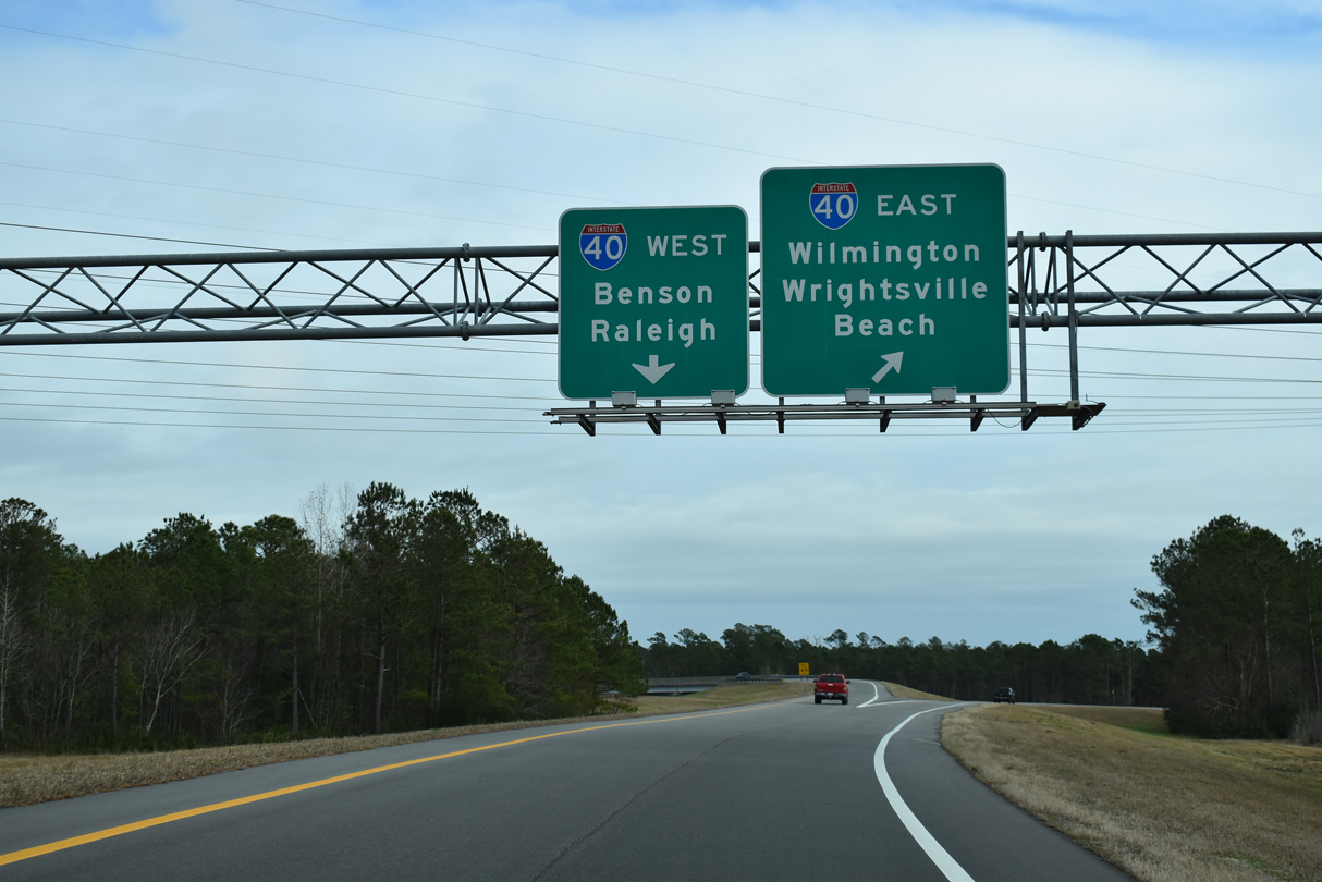
I-40 concludes 3.40 miles to the south along U.S. 117/NC 132 (N College Road) at Kings Grant. U.S. 117 extends 1.60 miles south from there to U.S. 74, which angles southeast to Wrightsville Beach. North from I-140, I-40 continues 90 miles to I-95 near Benson and 115 miles to Raleigh.
01/19/19
01/19/19
01/19/19
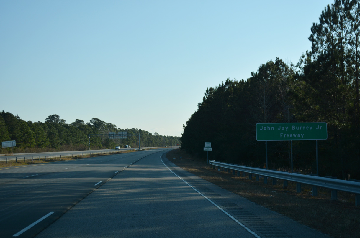
I-140/NC 140 is named after John J. Burney, Jr., a Wilmington native and former State Senator.
12/31/17
12/31/17
NC 140 progresses 5.08 miles east through undeveloped timberland to U.S. 17 at Kirkland.
01/19/19
01/19/19
U.S. 17 connects the Wilmington area with Jacksonville and New Burn, both cities with important military ties.
01/19/19
01/19/19
Passing north of Murraysville, two miles ahead of the trumpet interchange with U.S. 17 (Market Street). Construction for an interchange with the Hampstead Bypass (U.S. 17) started here in 2018.
01/19/19
01/19/19
U.S. 17 north rejoined its original alignment northward from the merge with Market Street into Pender County and Scotts Hill. AASHTO approved changing U.S. 17 back through Wilmington on May 14, 2015.
01/19/19
01/19/19
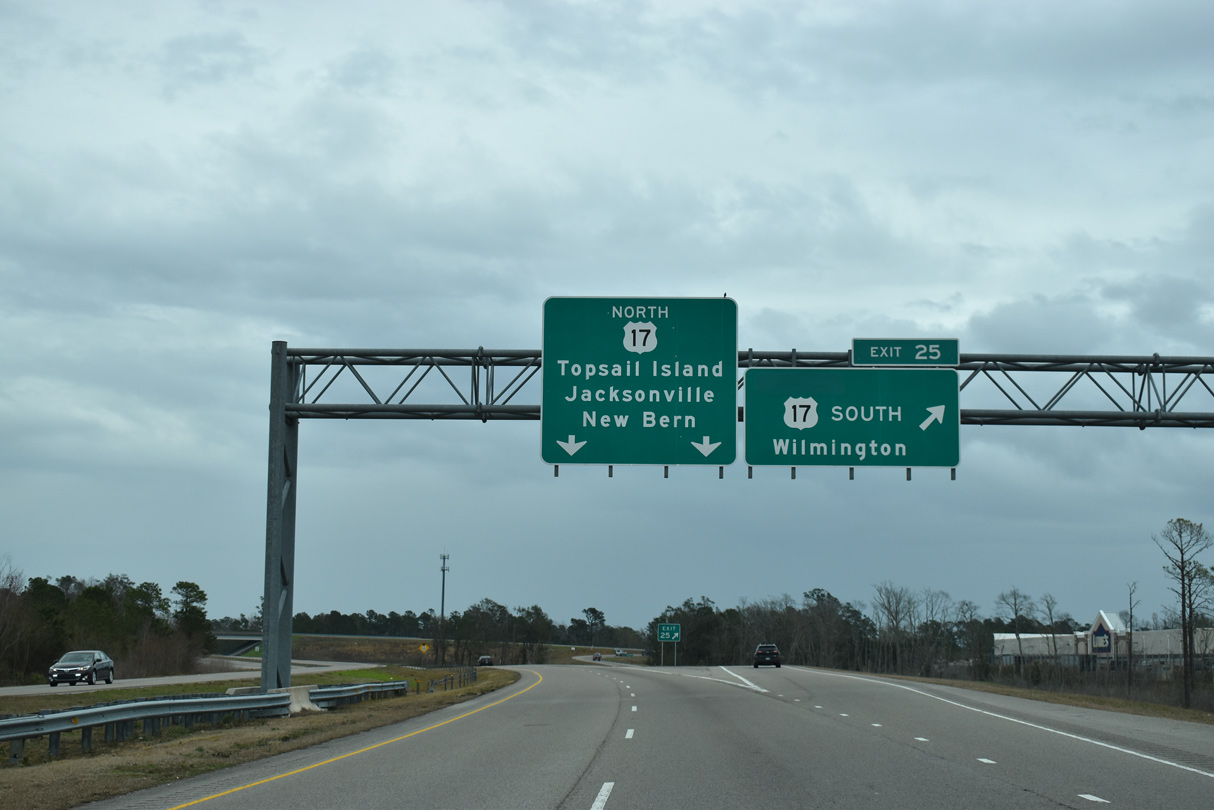
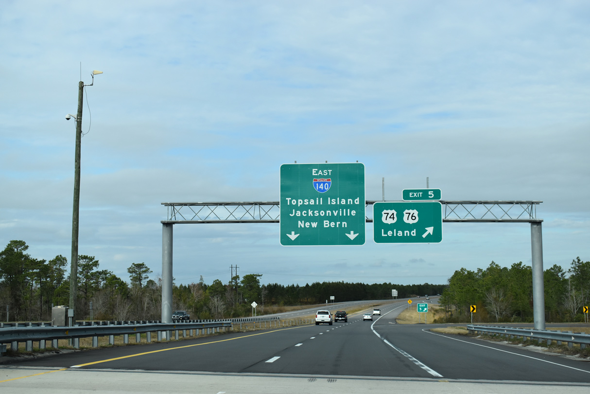
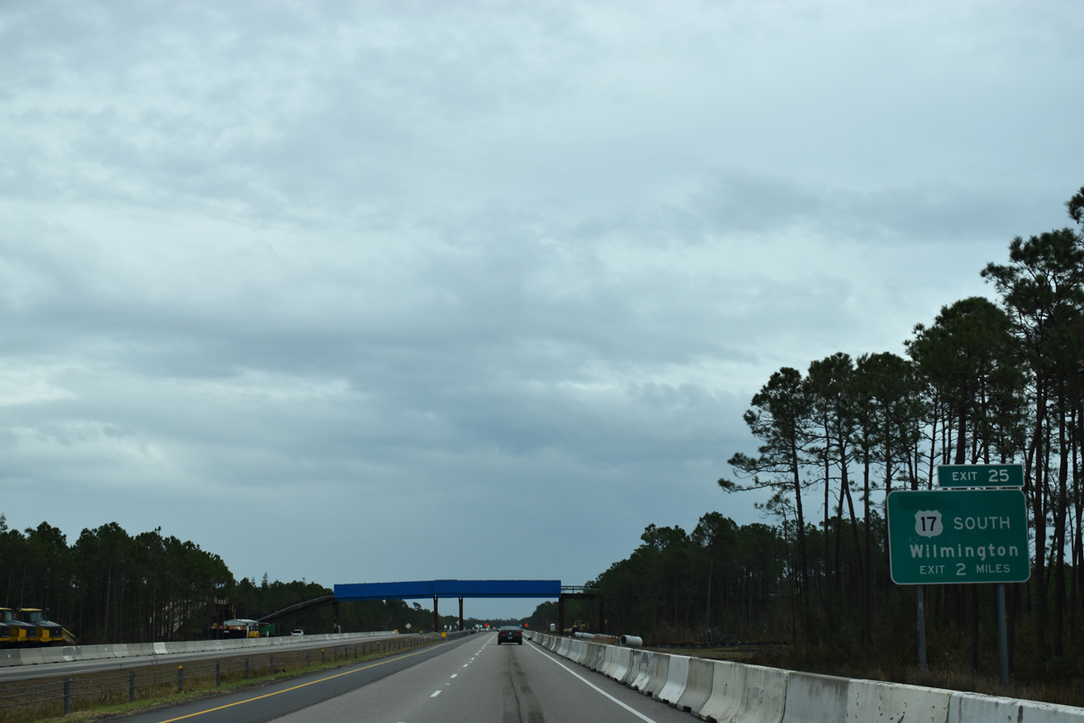
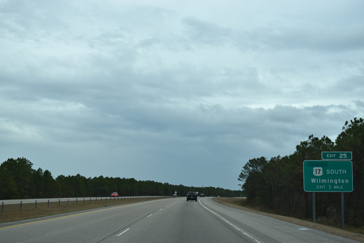
Exit 25 leaves NC 140 east U.S. 17 south toward Ogden, Wrightsville Beach and Wilmington.
01/19/19
01/19/19
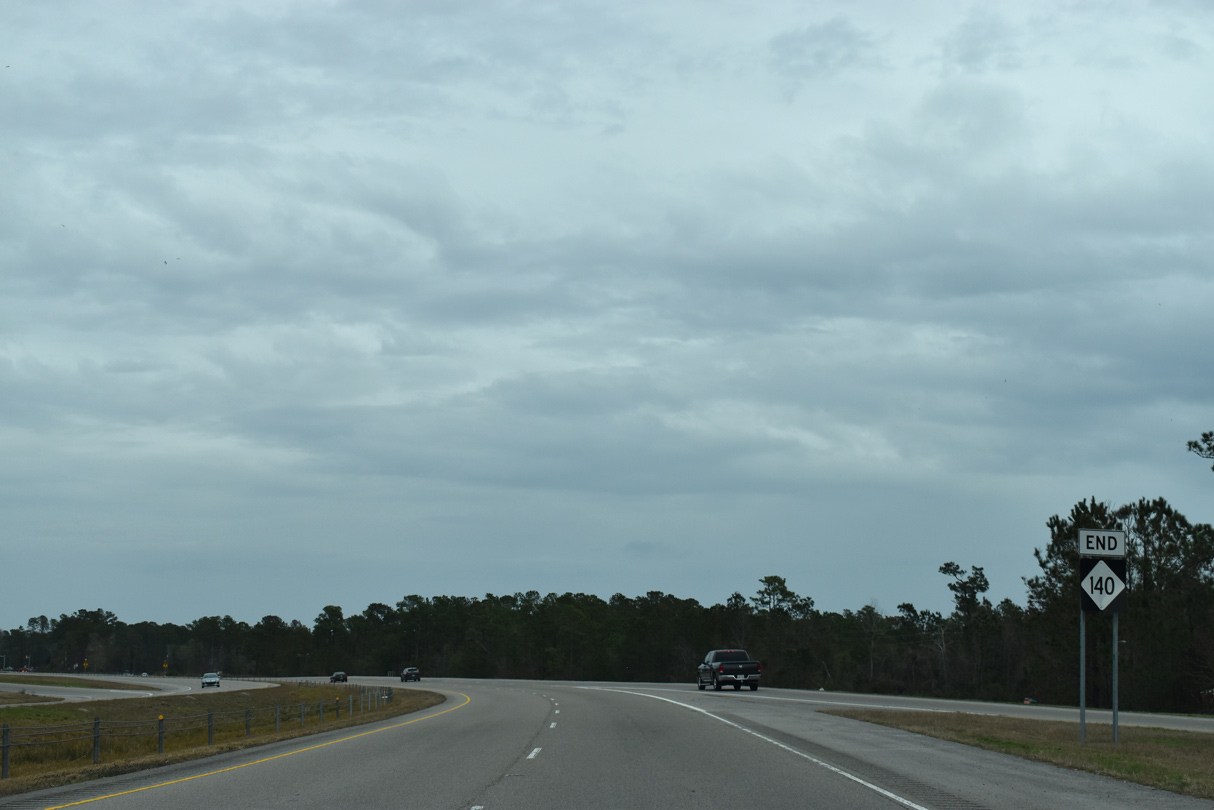
U.S. 17 merges with the end of NC 140 and continues 1.37 miles to the Pender County line. The four lane highway stays just inland by the coastal communities along Topsail Island en route to Camp LeJeune Marine Base.
01/19/19
01/19/19
References:
- I140, US17 BYP over US421/NE CAPE FEAR RIVER, New Hanover County, North Carolina. http://bridgereports.com/1332543 BridgeReports.com
Photo Credits:
- Brent Ivy: 01/19/19
- ABRoads: 06/24/10
- Alex Nitzman, Justin Cozart: 11/11/06
- Alex Nitzman: 12/31/17
Connect with:
Page Updated Friday July 17, 2020.