
Interstate 185 North
 North
North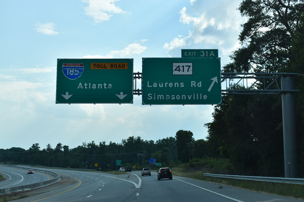
I-185 (Southern Connector) provides the connection from Interstate 385 south to S.C. 417 (NE Main Street) at Exit 31A. S.C. 417 converges with U.S. 276 (S Main Street) 1.43 miles to the northwest in Mauldin and continues south into the city of Simponsville.
05/25/21
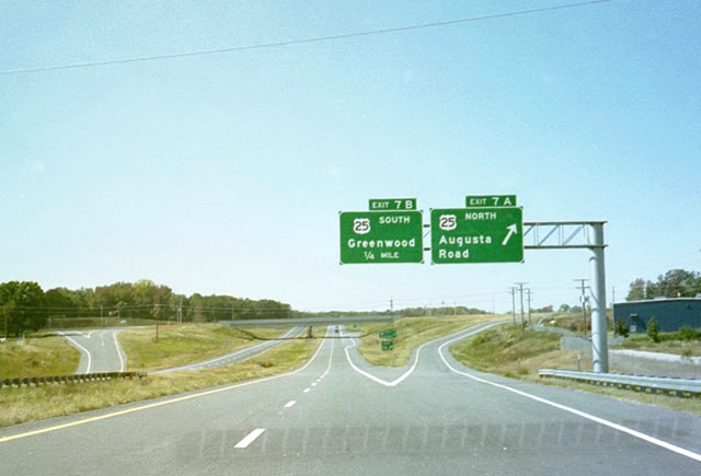
Representing the main route south from Greenville to Greenwood, U.S. 25 is a four lane highway. A parclo interchange (Exits 7A/B) joins I-185 north with separate ramps for U.S. 25 north along Augusta Road to Donaldson Center Airport (GYH) and south to town of Ware Shoals, Ware Place and Moonville.
10/15/01
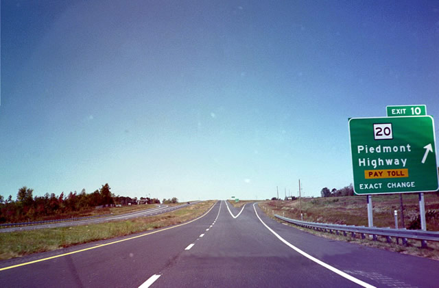
Interstate 185 (Southern Connector) winds westward to cross Grove Creek ahead of the parclo interchange (Exit 10) with S.C. 20 (Piedmont Highway). S.C. 20 follows the former alignment of U.S. 29 south from Greenville to Golden Grove, Piedmont, West Pelzer and Williamston.
10/15/01
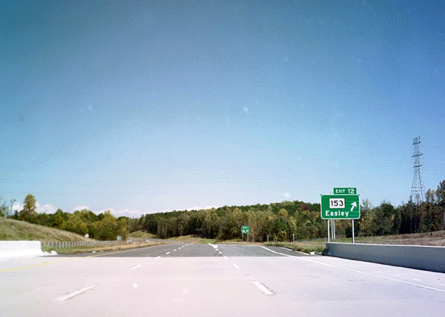
Coinciding with the completion of the Southern Connector was the extension of S.C. 153 eastward from I-85. Beginning at a parclo interchange (Exit 12), S.C. 153 runs northwest 7.1 miles to U.S. 123 (Calhoun Memorial Highway) on the east side of Easley. Brown Road ties into Exit 12 from a quarry and S.C. 20 (Piedmont Highway) to the east.
10/15/01
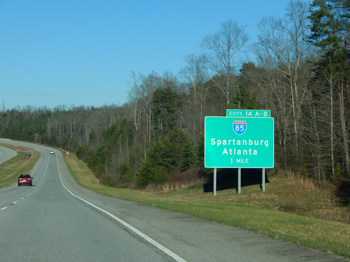
Turning northward, I-185 passes by the Lakeside Quarry one mile to Exits 14A/B with Interstate 85 and U.S. 29.
01/13/16
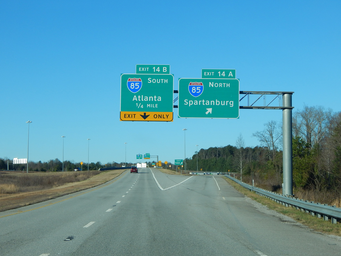
Exit 14A links the end of the Southern Connector with Interstate 85 north to south Greenville, Greenville-Spartanburg International Airport (GSP) and Spartanburg.
01/13/16
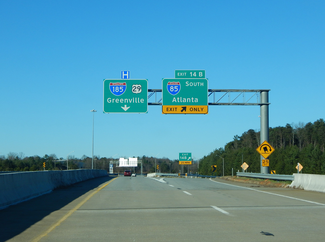
Interstate 185 combines with U.S. 29 northeast toward Downtown Greenville beyond Exit 14B for I-85/U.S. 29 south to Anderson and Atlanta, Georgia.
01/13/16
 North
North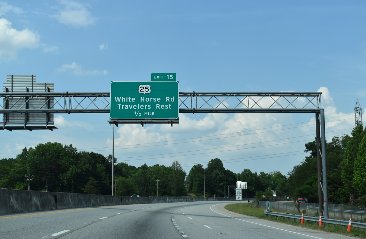
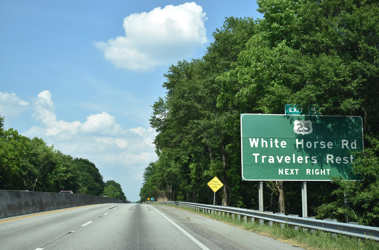
Angling northeast, I-185/U.S. 29 meet U.S. 25 (White Horse Road) at a half diamond interchange (Exit 15) in one half mile. U.S. 25 circumvents Greenville along an arterial bypass through Gantt and White Horse to U.S. 276 (Poinsett Highway) south of Travelers Rest.
05/25/21
An older button copy still in service precedes Exit 15 to U.S. 25 (White Horse Road). Industrial business line White Horse Road adjacent to CSX and Norfolk Southern Railroad lines. Numerous signals line the route to Travelers Rest, but north of there, U.S. 25 transitions into an expressway en route to Hendersonville, North Carolina.
05/25/21
A wye interchange provides access from parallel S.C. 20 (Grove Road) north onto I-185/U.S. 29. Grove Road represents the pre-freeway route of U.S. 29 north to Mills Avenue.
05/25/21
The last northbound shield for Interstate 185 stands ahead of the Butternut Drive overpass by the Chestnut Hills subdivision.
05/25/21
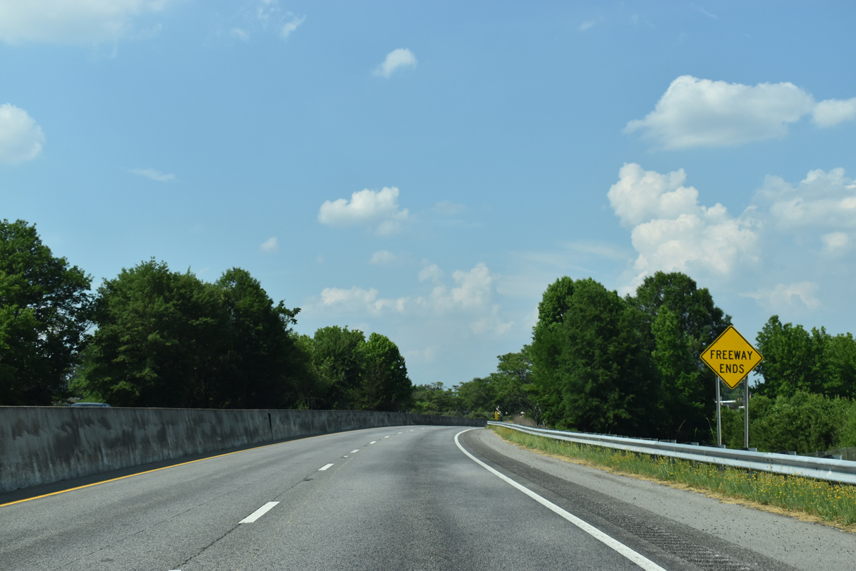
An end freeway sign stands beyond the W Faris Road (Road 149) underpass along I-185/U.S. 29 northbound ahead of the transition onto Mills Avenue.
05/25/21
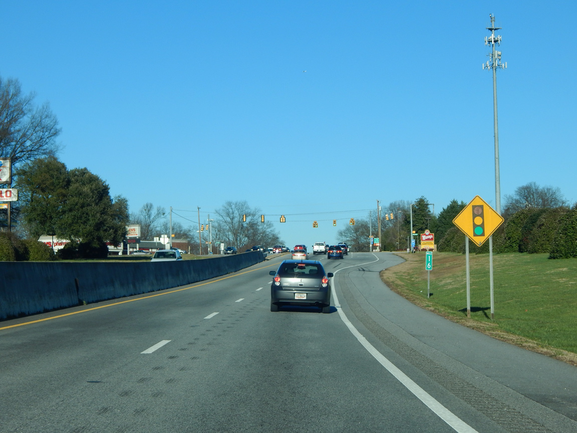
The speed limits reduces to 40 miles per hour ahead of mile marker 16 and the traffic light at Henrydale Avenue. I-185 is 16.40 miles in length per SCDOT GIS data. This figure does not include the stretch paralleling I-385 east from U.S. 276 at Mauldin.
01/13/16
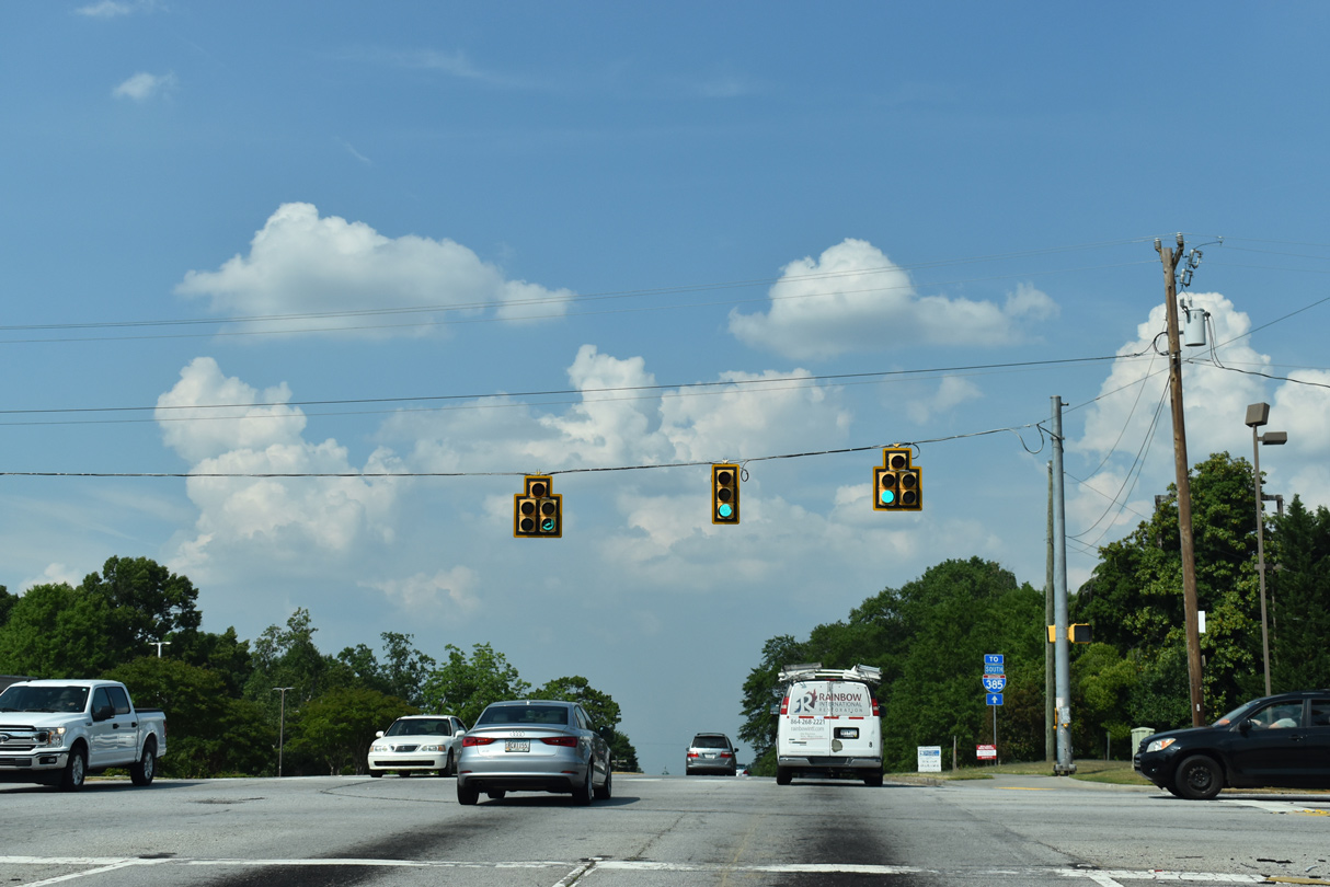
Henrydale Avenue connects U.S. 29 (Mills Avenue) with nearby S.C. 20 (Grove Road), an adjacent shopping center at Marue Drive and Stevens Street into the Dunean community. U.S. 29 follows Mills Avenue north to Church Street and the east side of Downtown.
05/25/21
Photo Credits:
- Brent Ivy: 05/25/21
- AARoads: 10/15/01
- Carter Buchanan: 01/13/16
Connect with:
Page Updated Monday June 21, 2021.