
Interstate 195 West


 West
West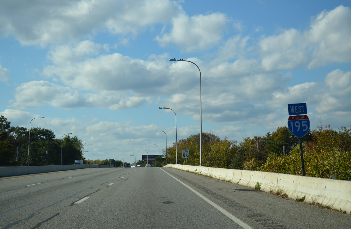
The first westbound shield for Interstate 195 posted in Rhode Island as the freeway passes over Warren Avenue. U.S. 6 follows Warren Avenue from Highland Avenue to the north end of the East Shore Expressway.
10/06/14
Interstate 195 travels through the City of East Providence. A welcome sign precedes the wye interchange (Exit 7 on eastbound) with the East Shore Expressway.
10/06/14
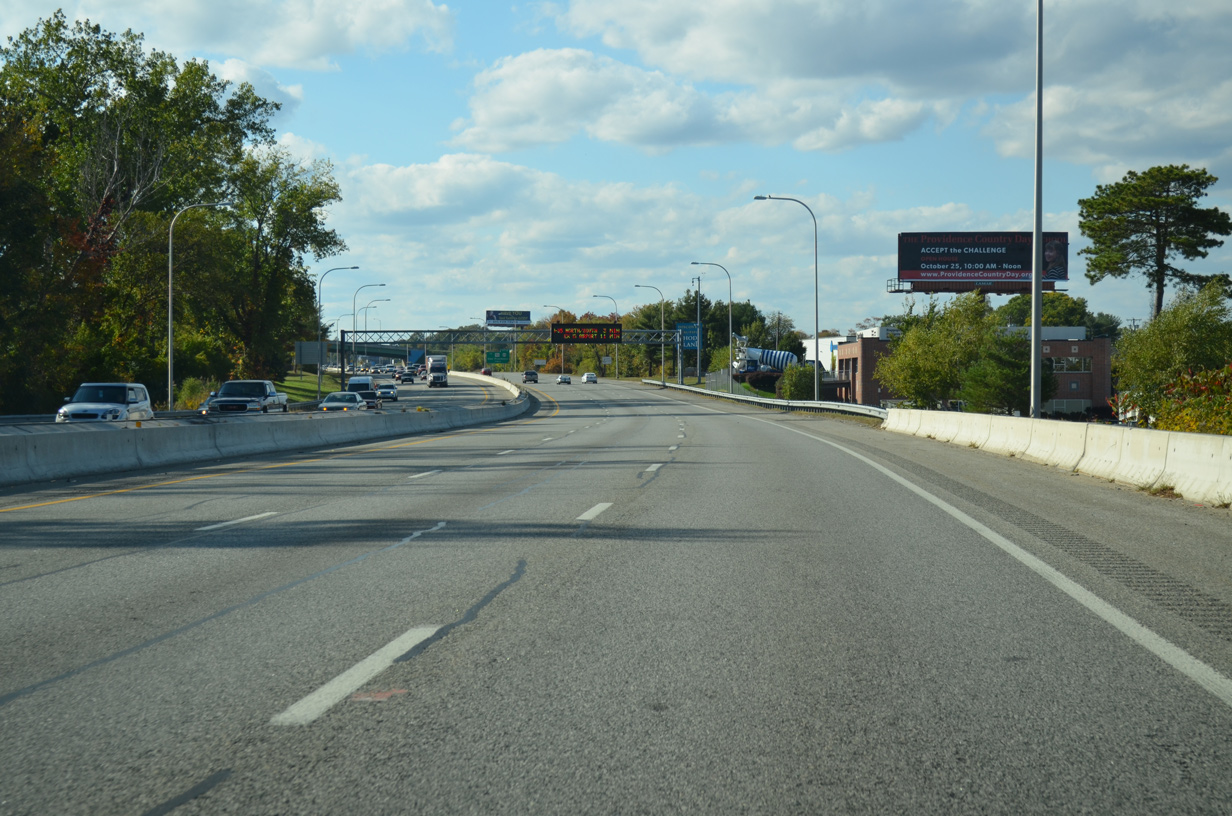
One mile east of the off-ramp (Exit 6) to Broadway, Interstate 195 merges with the north end of the East Shore Expressway, joining U.S. 6 westbound in the process.
10/06/14
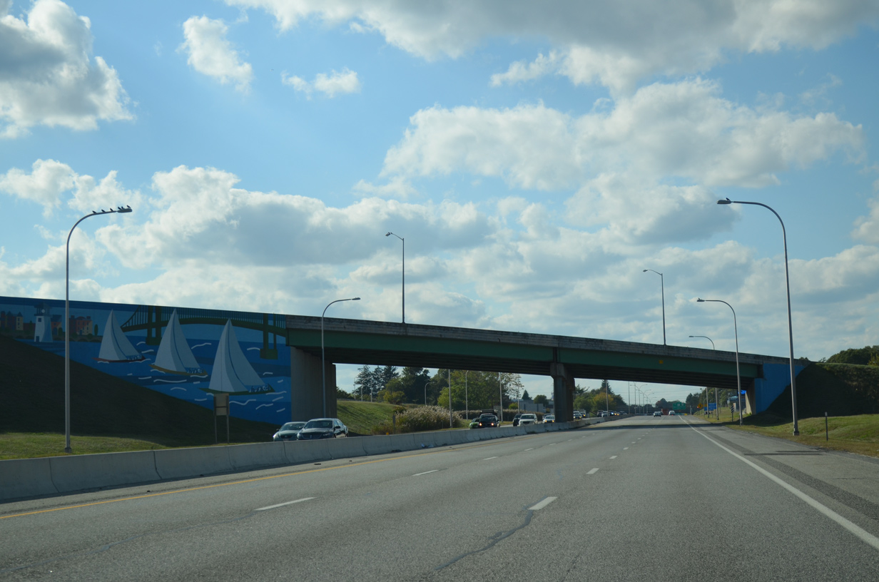
A decorative mural adorns the bridge abutment for the U.S. 6 westbound overpass above I-195.
10/06/14
 West
West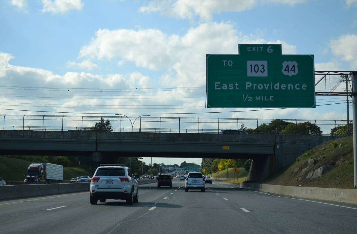
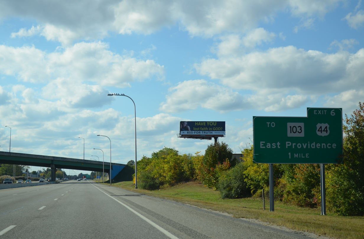
Lowering below grade, Interstate 195 & U.S. 6 pass under Pawtucket Street (Route 114). Exit 6 follows onto Broadway, a north-south commercial street linking the freeway with Six Corners to the north. South from Warren Avenue, Broadway doubles as Route 103 to Veterans Memorial Parkway at Watchemoket Cove.
10/06/14
West  South
South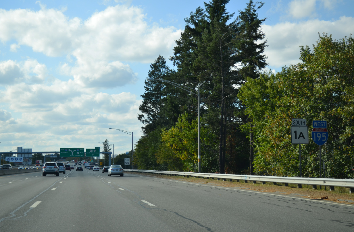
U.S. 1A south, shown incorrectly as R.I. 1A here, joins Interstate 195 & U.S. 6 west from the Pawtucket Avenue on-ramp. The US route continues with the freeway to Exit 2.
10/06/14
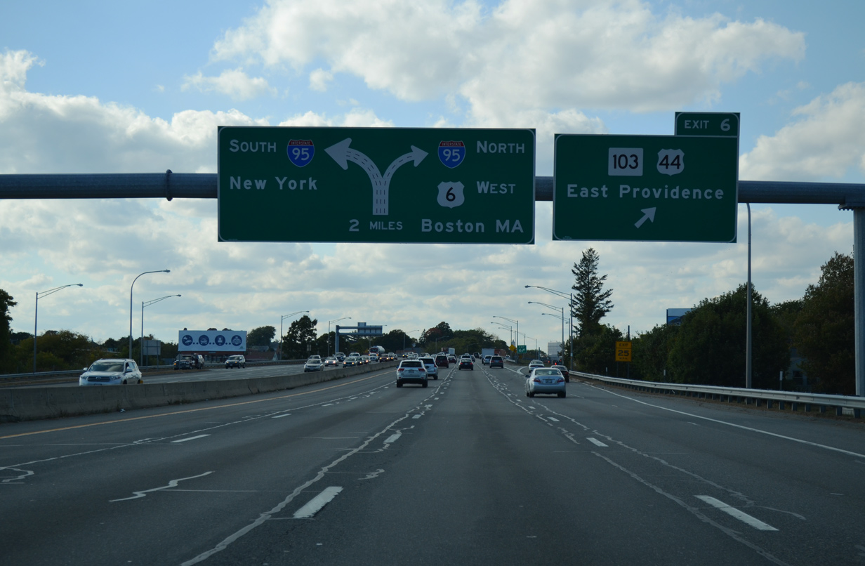
A diagrammatic sign outlines the separation of traffic for Interstate 95 at the west end of the upcoming Iway bridge as Exit 6 departs Interstate 195 & U.S. 1A-6 west for Broadway. Broadway meets U.S. 44 (Waterman Avenue) east at Six Corners. Route 103 goes for 11.3 miles from Exit 5 of Interstate 195 to the Massachusetts state line at Barrington.
10/06/14
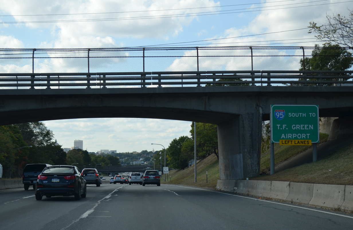
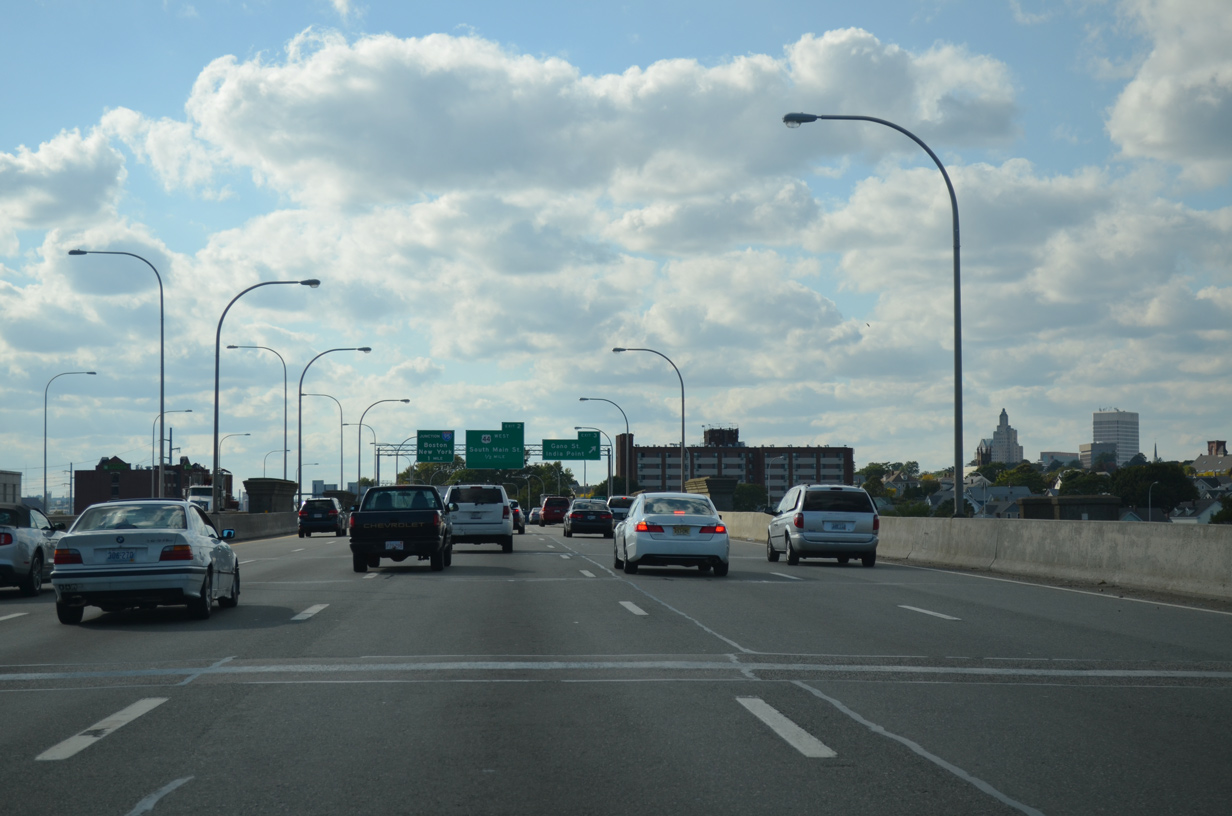
High rises of Downtown Providence come into view as Interstate 195 lowers under Lyon Avenue. Interests to T.F. Green Airport (PVT) are advised to follow Interstate 95 south from the west end of I-195.
10/06/14
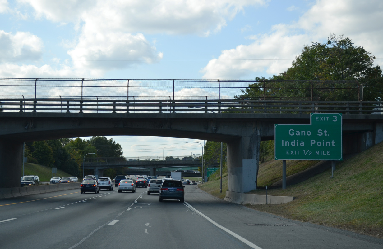
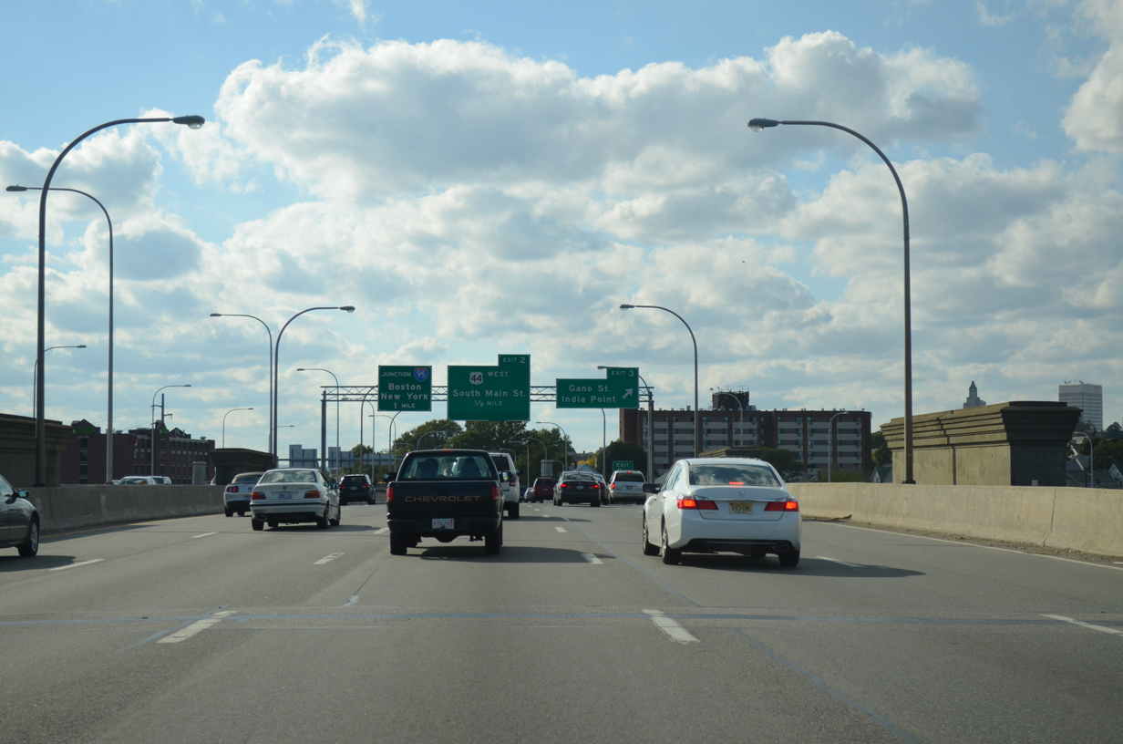
Nearing the Washington Bridge over the Seekonk River, Interstate 195 & U.S. 1A-6 meet Gano Street and India Point Park in one half mile.
10/06/14
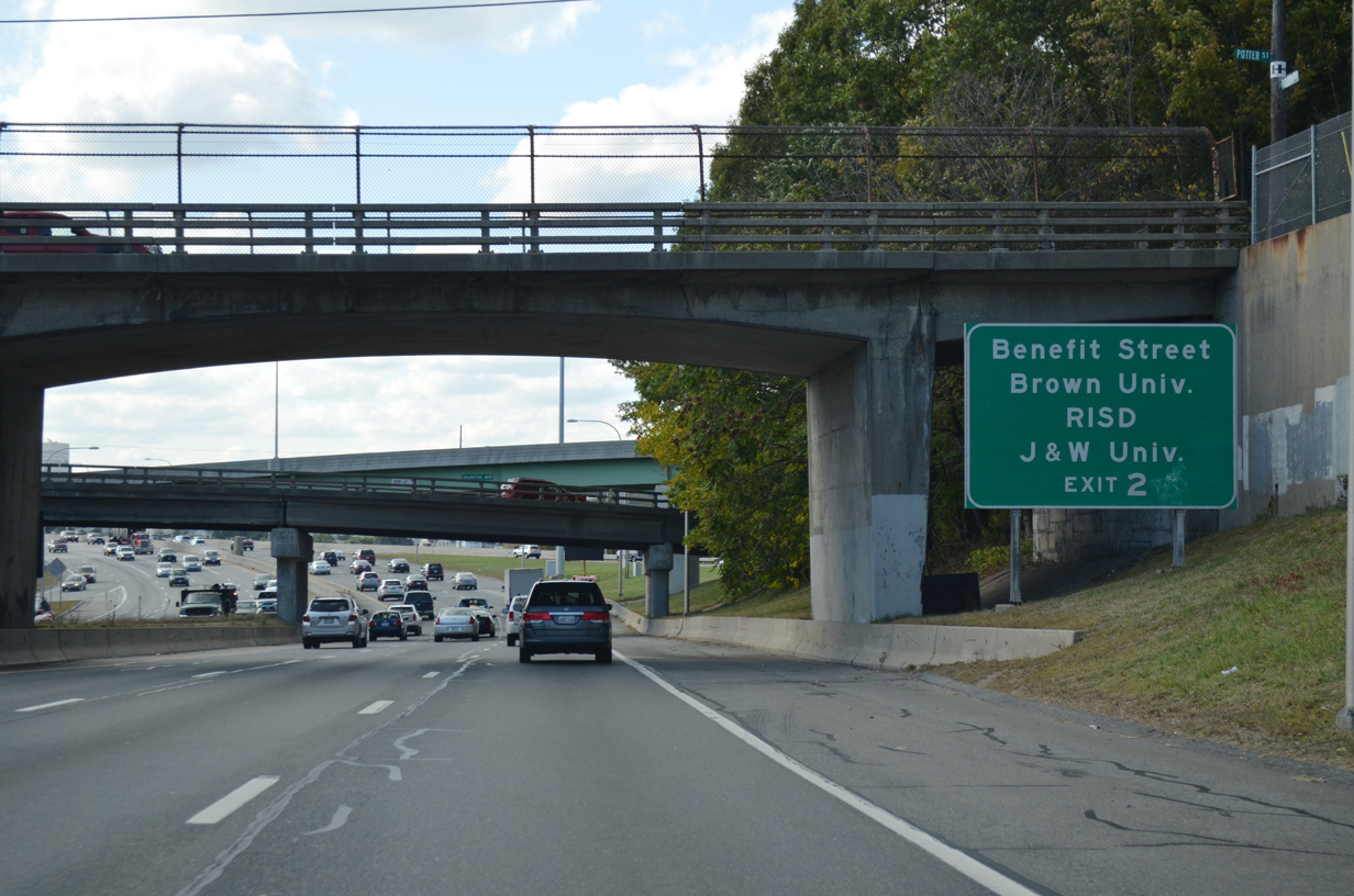
A pair of wye interchanges bring U.S. 44 west from Taunton Avenue and traffic from Veterans Memorial Parkway north onto the Washington Bridge ahead of Exit 3. Exit 2 ties into the Providence street grid via Benefit Street north. The ramp serves interests to Brown University, Rhode Island School of Design (RISD) and Johnson & Wales University.
10/06/14
 West South
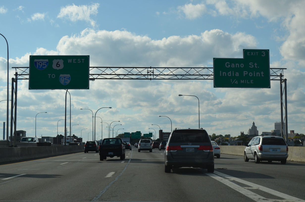
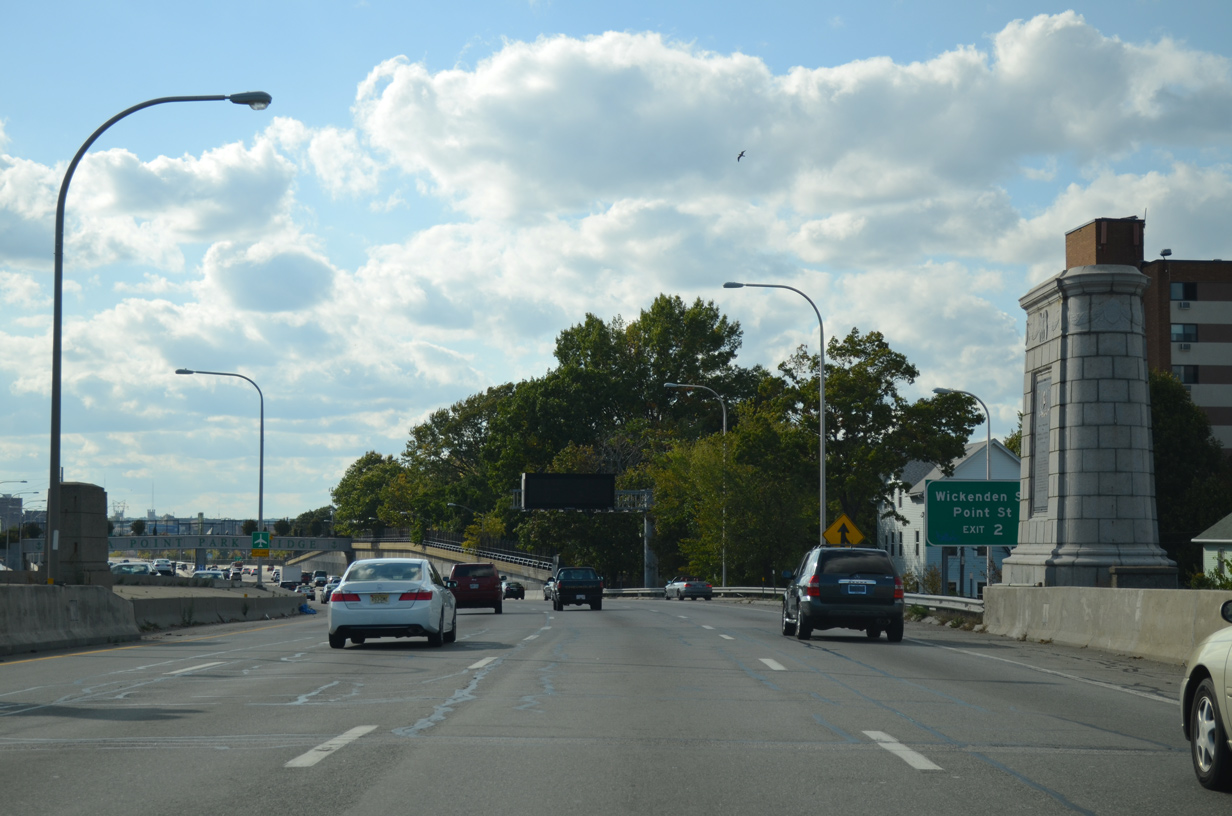
Exit 3 leaves the freeway at the west end of Washington Bridge as Interstate 195 travels north of India Point Park and south of Wickenden Street.
10/06/14
2001-08 construction rebuilt the Washington Bridge across the Seekonk River, bringing the overall lanes of Interstate 195 & U.S. 1A-6-44 to ten. Originally traffic was partitioned between a 1932-built eastbound span and a 1968-westbound bridge. The 1932 bridge was replaced with a new span completed on December 5, 2008 while the westbound bridge was reconstructed and expanded from four lanes.
10/06/14
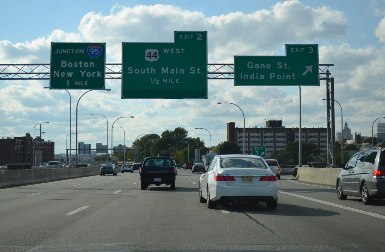
Interstate 195 enters the City of Providence and quickly splits with Exit 3 to Gano Street on the half mile approach to Exit 2, South Main Street (U.S. 1A south & 44 west). One mile of Interstate 195 remains to the three-wye interchange with I-95.
10/06/14
Leaving the Washington Bridge, and on-ramp joins Interstate 195 & U.S. 6 west from Gano Street.
10/06/14

The India Point pedestrian Bridge spans Interstate 195 & U.S. 1A-6-44 next. The $9.5 million bridge was built in conjunction with the overall Iway project for I-195 through Providence. The 48 foot wide span includes concrete benches, landscaping and decorative light posts. It opened after a ribbon cutting ceremony held on the morning of October 15, 2008.1
10/06/14
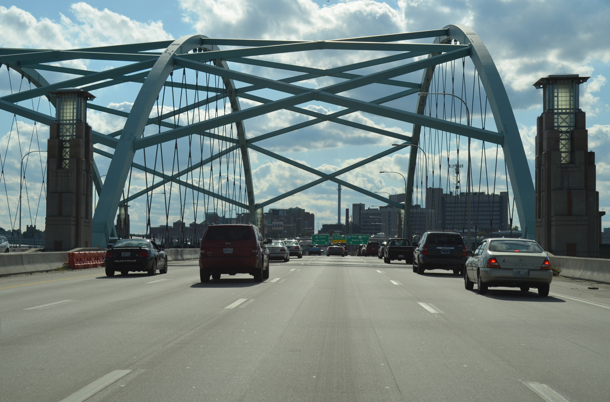
Stacks of the Dominion Energy Manchester Street Station rise from the west banks of the Providence River as the signature light green arches of the Iway bridge come into view. A cut and cover tunnel also appears to the left, accommodating the eastbound on-ramp from South Water Street.
10/06/14
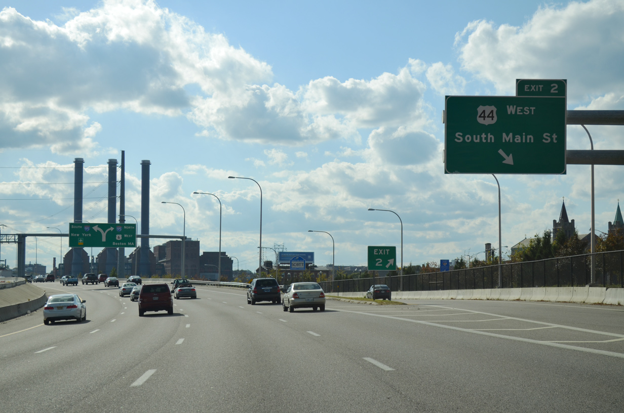
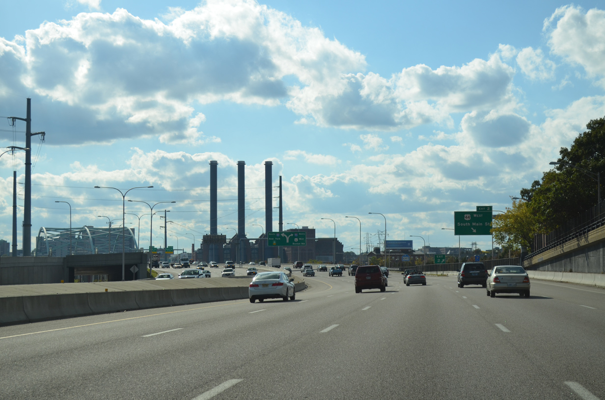
U.S. 1A north & 44 west part ways with Interstate 195 & U.S. 6 west via Exit 2 onto South Main Street northbound. U.S. 44 west travels along Main Street parallel to the Providence River to Smith Street west and the Rhode Island State House. U.S. 1A splits with U.S. 44 nearby to span the river across the Point Bridge to Eddy Street and Allens Avenue south.
10/06/14
West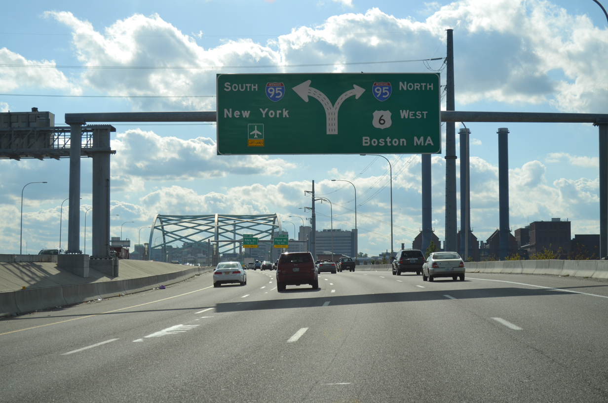
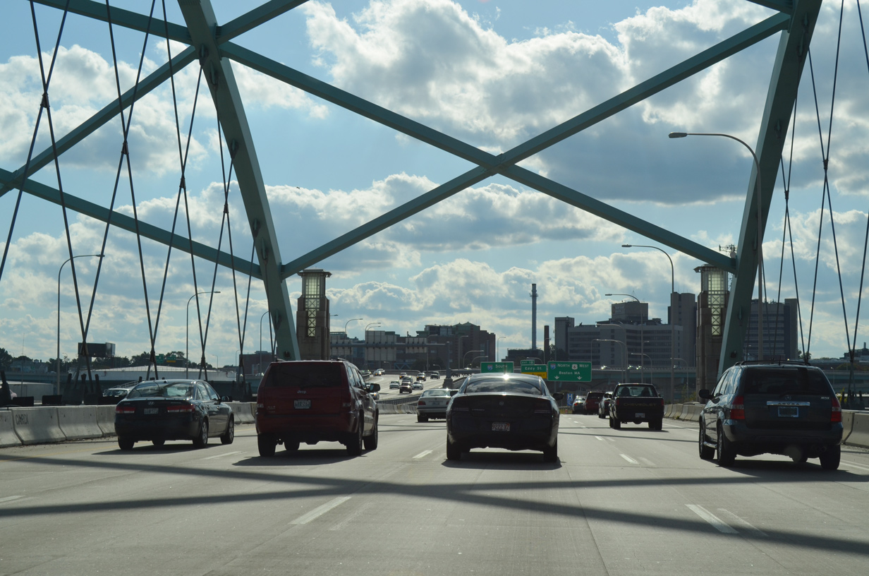
Turning more southerly, Interstate 195 & U.S. 6 elevate onto the Iway bridge across Main and Water Streets and the Providence River. Four westbound lanes partition into ramps for Interstate 95 south to New York and the continuation of U.S. 6 west onto I-95 north for Hartford, Connecticut and Boston, Massachusetts.
10/06/14
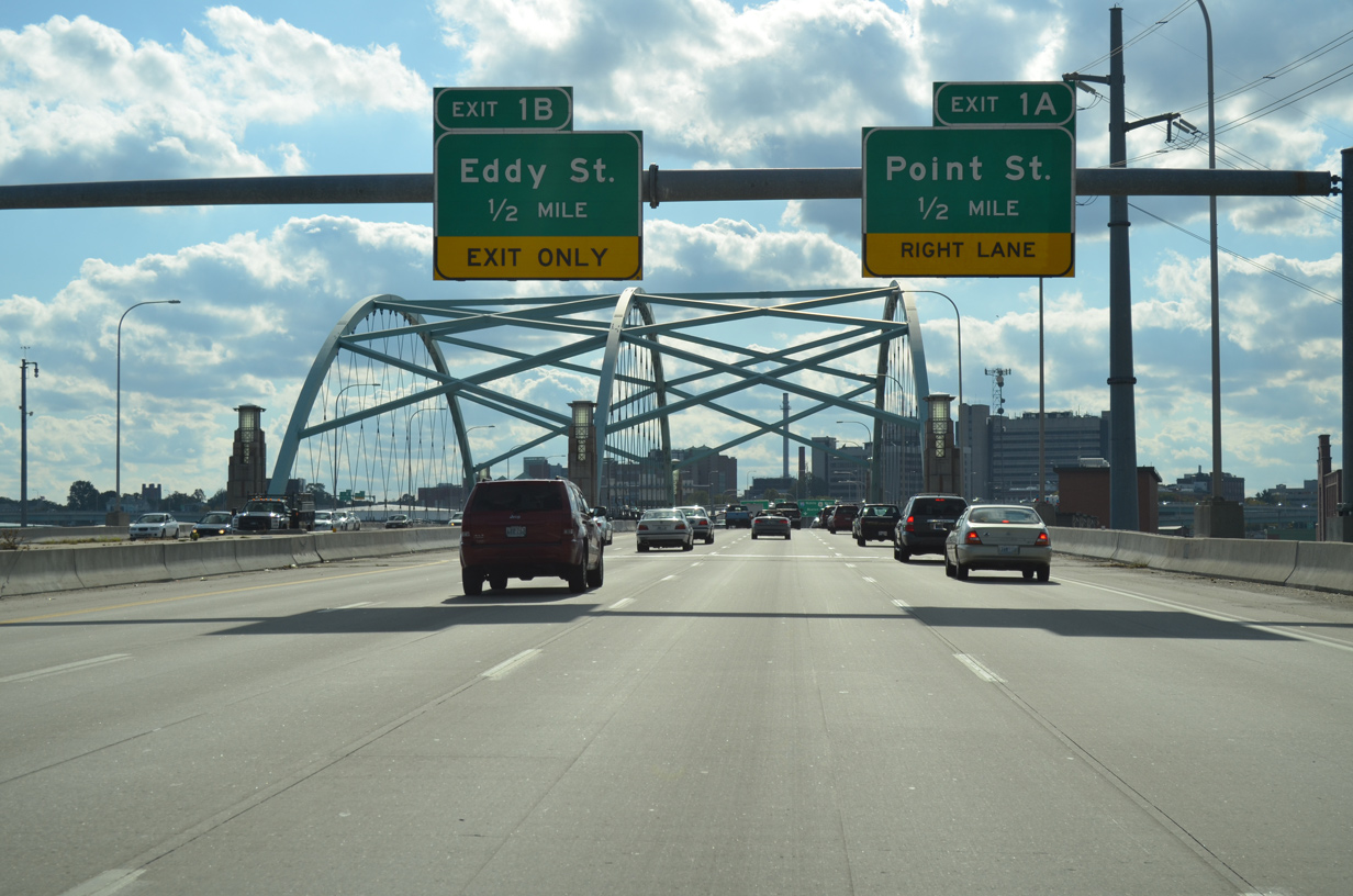
The respective ramps to Interstate 95 include location connections with Point Street (Exit 1A) via northbound and Eddy Street (Exit 1B) via southbound.
10/06/14
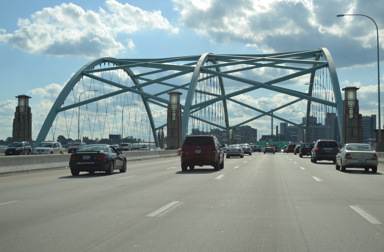
The centerpiece of the $623 million reconstruction of I-195 is the Iway Bridge crossing the mouth of the Providence River between Fox and Collier Points. The westbound portion of the 1,200 foot long bridge opened to traffic on October 22, 2009 along with the new northbound ramp to I-95.2
10/06/14
The 400 foot long steel arch section of the Iway bridge was floated by barge northward 12 miles from its assembly location in August 2006. It features crisscrossing steel cables.
The bridge opened initially to eastbound travelers on November 5, 2007, allowing RIDOT to close the original eastbound freeway to the north.3
10/06/14
Design work on the $623 million Iway project was completed in 1999, with major construction commenced in 2003. While all elements effecting Interstate travelers were completed in November 2009. Side work on city streets and demolition of the old roadway continued through 2012.4
10/06/14
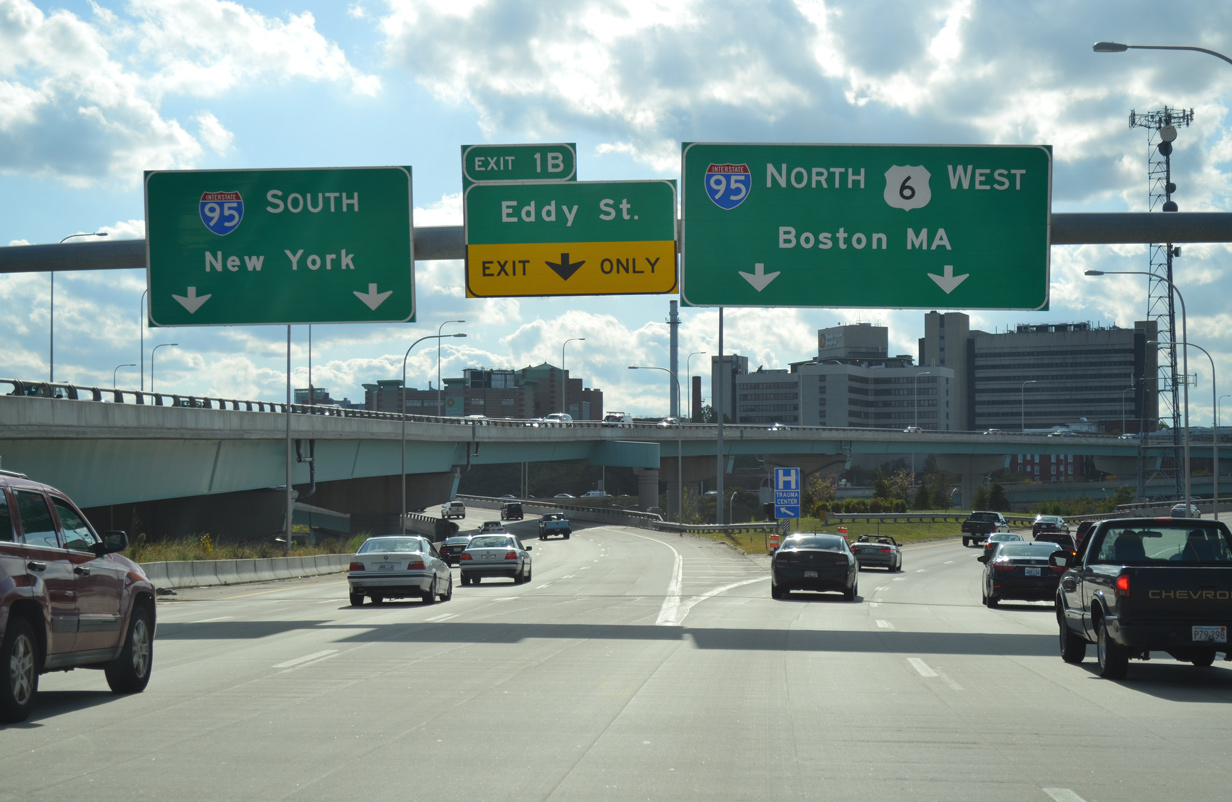
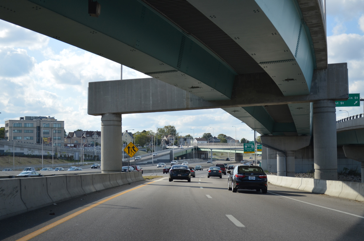
Two lanes veer away from I-195 & U.S. 6 west for Interstate 95 south to Cranston, T.F. Green Airport (PVD) and New London, Connecticut. A third lane heading south departs for Eddy Street at Willard Avenue and Rhode Island Hospital.
10/06/14
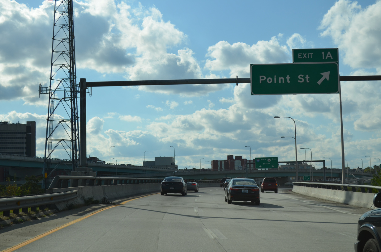
Motorists heading to I-95 north next encounter the departure of Exit 1A to Franklin Street north at Point Street for the Jewelry District south of Downtown Providence.
10/06/14
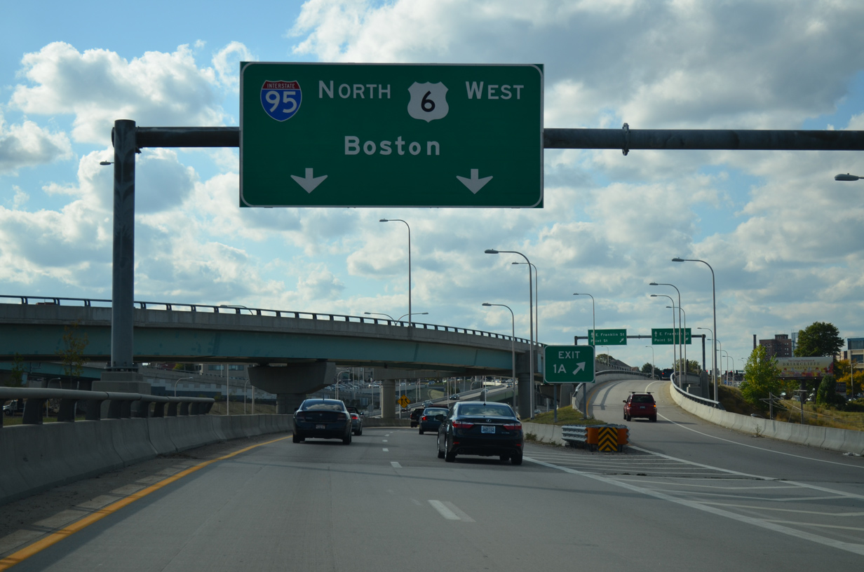
U.S. 6 west joins the I-95 northbound mainline for just a half mile before turning west along the Huntington Expressway (R.I. 10) to Olneyville and an exit of the city to Johnston.
10/06/14
A flyover combines with Exit 1A ahead of Point Street from I-95 north (Exit 20) as U.S. 6 west merges onto the northbound mainline.
10/06/14
References:
- "A passage to India - DOT opens pedestrian bridge connecting Fox Point to India Point Park." Providence Journal, October 16, 2008.
- "Iway split: traffic is moving along." Providence Journal, October 22, 2009.
- "TWILIGHT FOR THE OLD 195." Providence Journal, November 6, 2007.
- "TRANSPORTATION - Major elements of Rte. 195 relocation are done - The remaining work won't be completed until 2012." Providence Journal, November 25, 2009.
Photo Credits:
- ABRoads: 10/06/14
Connect with:
Page Updated Thursday February 26, 2015.