
Interstate 264 East - Norfolk


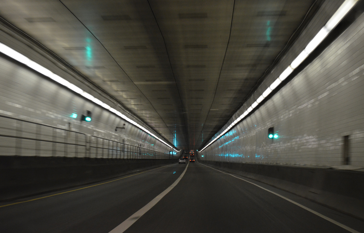
The Downtown Tunnel crosses the Southern Branch of the Elizabeth River east to Berkley in the city of Norfolk.
07/28/13
07/28/13
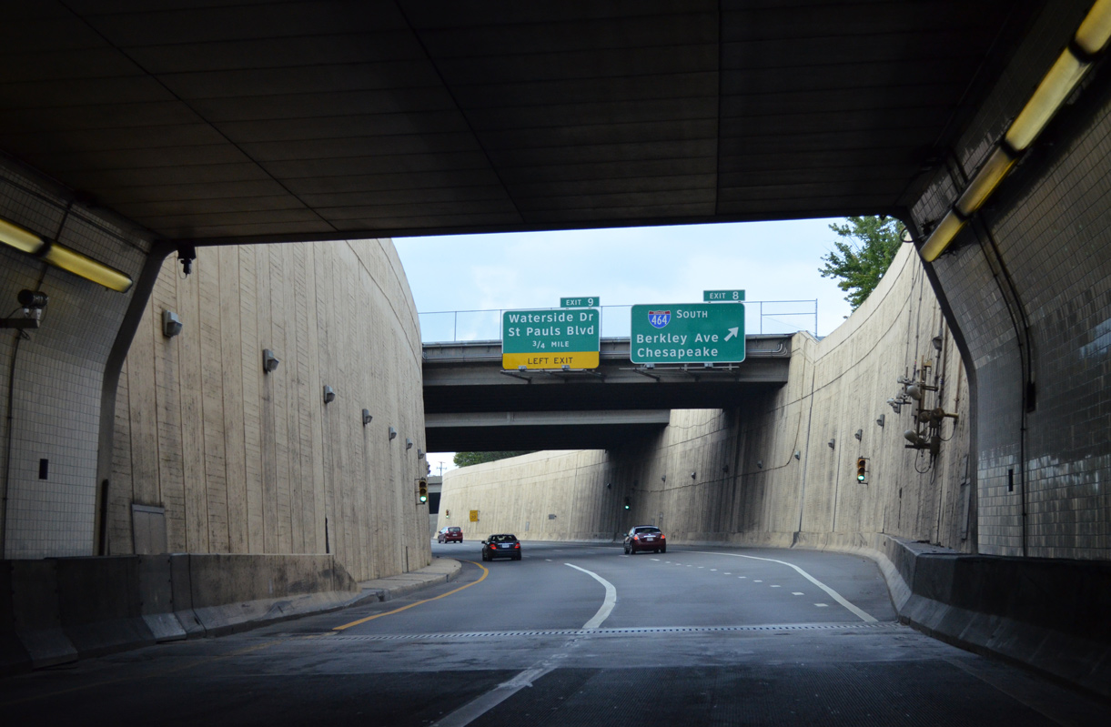
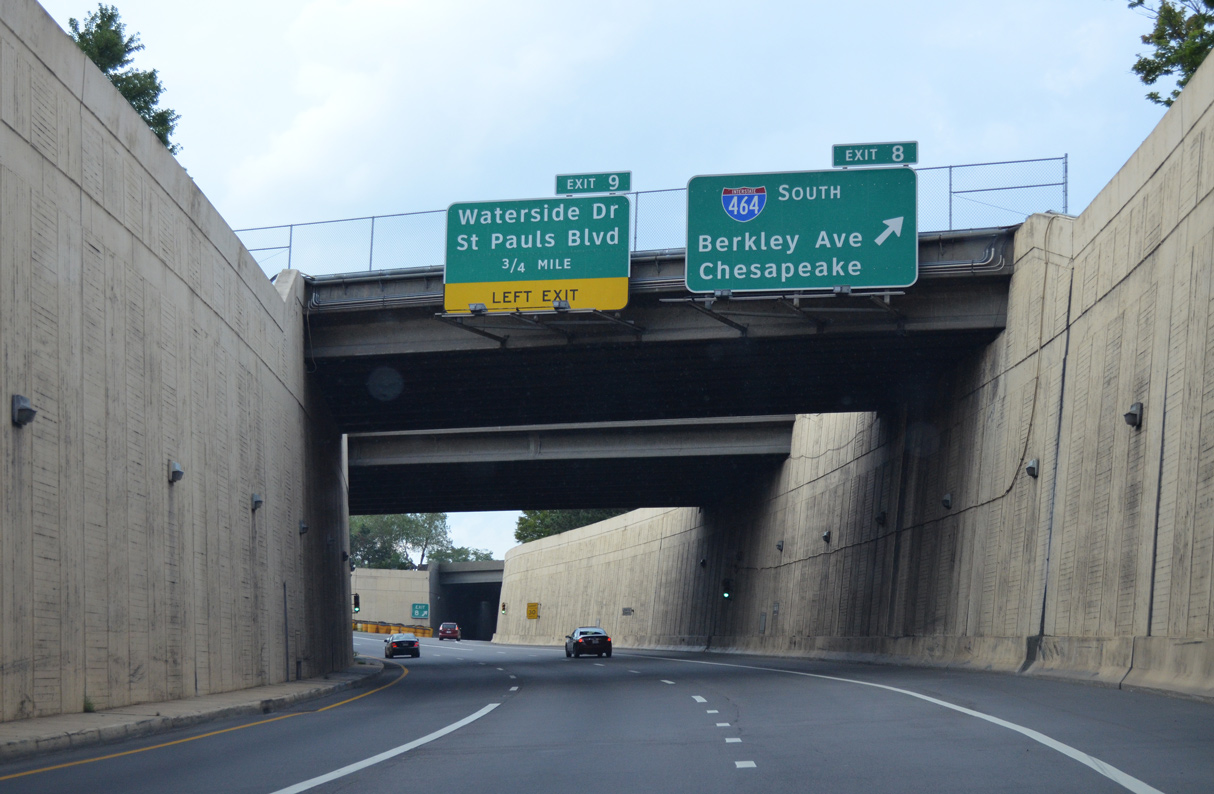
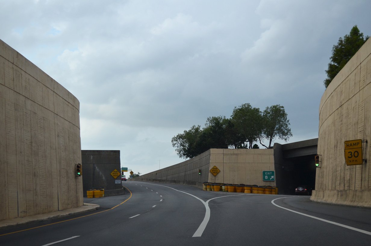
I-264/U.S. 460 ALT enter an inverted trumpet interchange (Exit 8) with I-464 south from the east portal of the Downtown Tunnel.
07/28/13
07/28/13
Interstate 464 runs 5.83 miles south from I-264 in Norfolk to the exchange joining I-64 with U.S. 17 (Dominion Boulevard) and SR 168 (Oak Ridge Connector) in the city of Chesapeake.
07/28/13
07/28/13
07/28/13
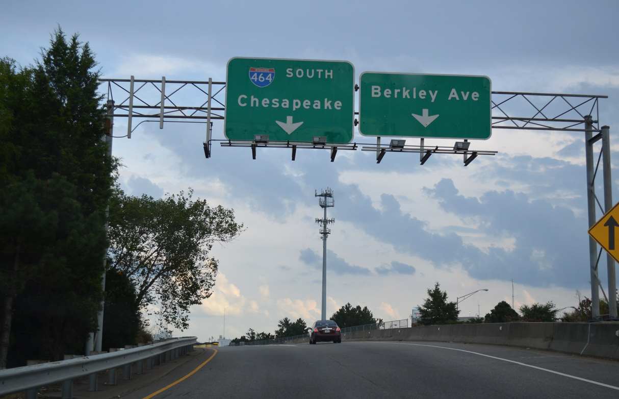
Exit 8 partitions with a slip ramp to Berkley Avenue before joining I-464 south from I-264 west.
07/28/13
07/28/13
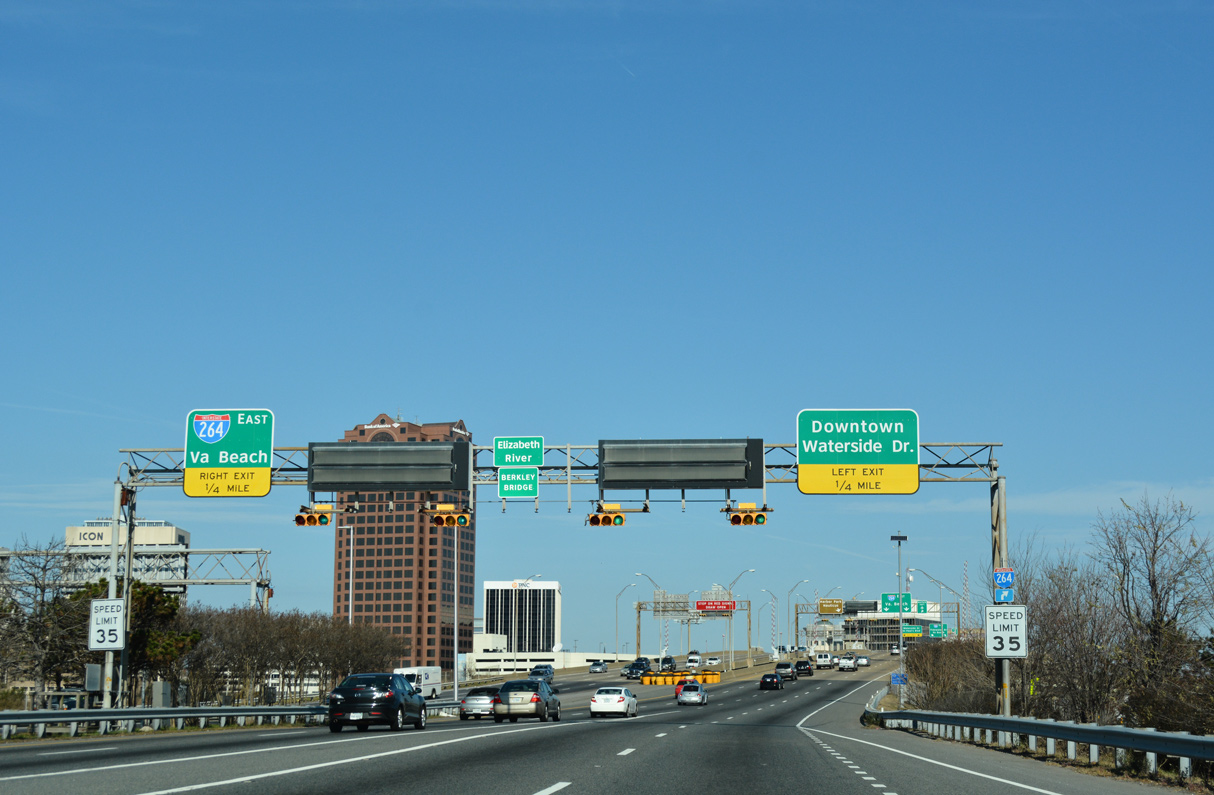
Traffic from I-464 north / SR 337 east expands I-264 eastbound to four lanes across the Berkley Bridge. A weaving traffic ensues northward to Left Exit 9 for Waterside Drive (SR 337 ALT) and U.S. 460 ALT on St. Paul's Boulevard.
12/14/17
12/14/17
The eastbound span at the Berkley Bridge is a bascule bridge opened to traffic on May 24, 1990. The westbound crossing was built in 1952.
07/23/13
07/23/13
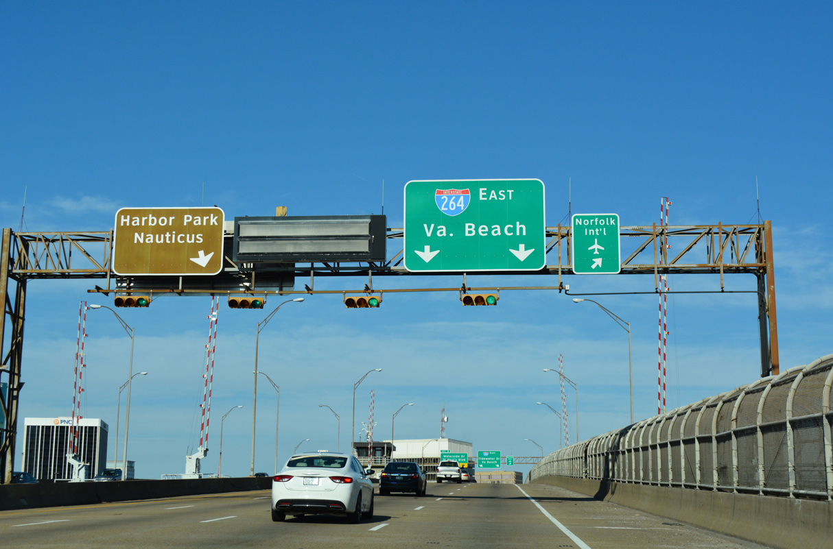
SR 337 ALT (Waterside Drive) encircles Downtown Norfolk west to Bousch Street at Nauticus, the Hampton Roads Naval Museum. SR 337 ALT follows Bousch Street north to U.S. 58/SR 337 (Brambleton Avenue).
12/14/17
12/14/17
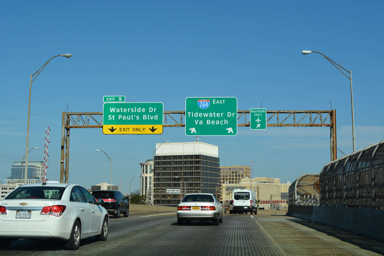
Unmarked on I-264, U.S. 460 ALT extends 0.51 miles from Left Exit 9 to St. Paul's Boulevard. U.S. 460 ALT navigates north 0.44 miles to SR 337 (Brambleton Avenue) at the Norfolk Scope Arena and east 0.31 miles to U.S. 460 at Church Street.
12/14/17
12/14/17
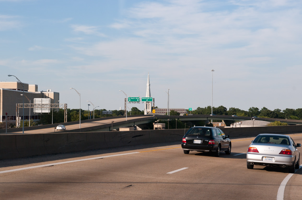
Exit 9 partitions into flyovers for U.S. 460 ALT (St. Paul's Boulevard) and Market Street west to MacArthur Center mall and Waterside Drive (SR 337 ALT) west.
09/05/10
09/05/10
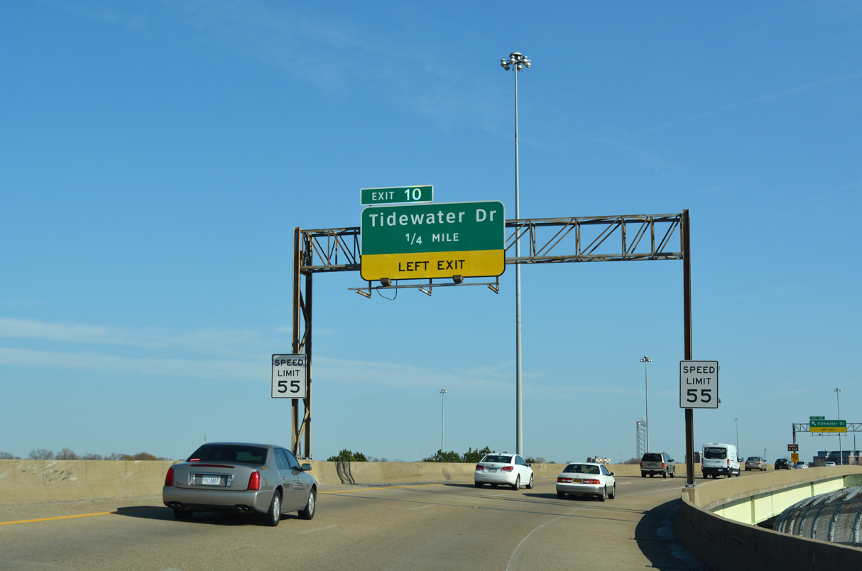
Tidewater Drive, an urban arterial with expressway segments, branches north from a wye interchange (Left Exit 10) between the elevated roadways along Interstate 264.
12/14/17
12/14/17
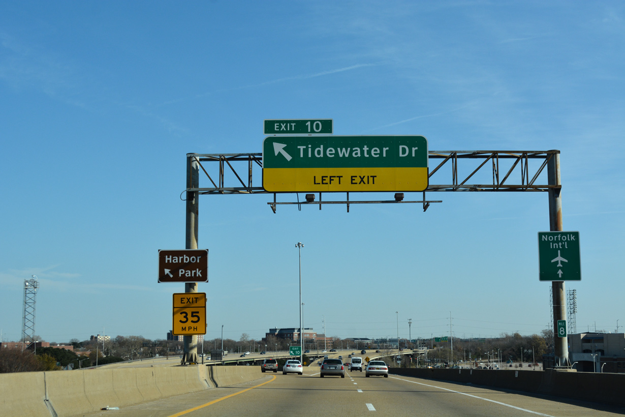
SR 337 separates from I-264 east along Tidewater Drive north 0.71 miles from Left Exit 10 to U.S. 460/SR 168 (Brambleton Avenue). SR 168 continues Tidewater Drive north to Huntersville and Willard Park.
12/14/17
12/14/17
East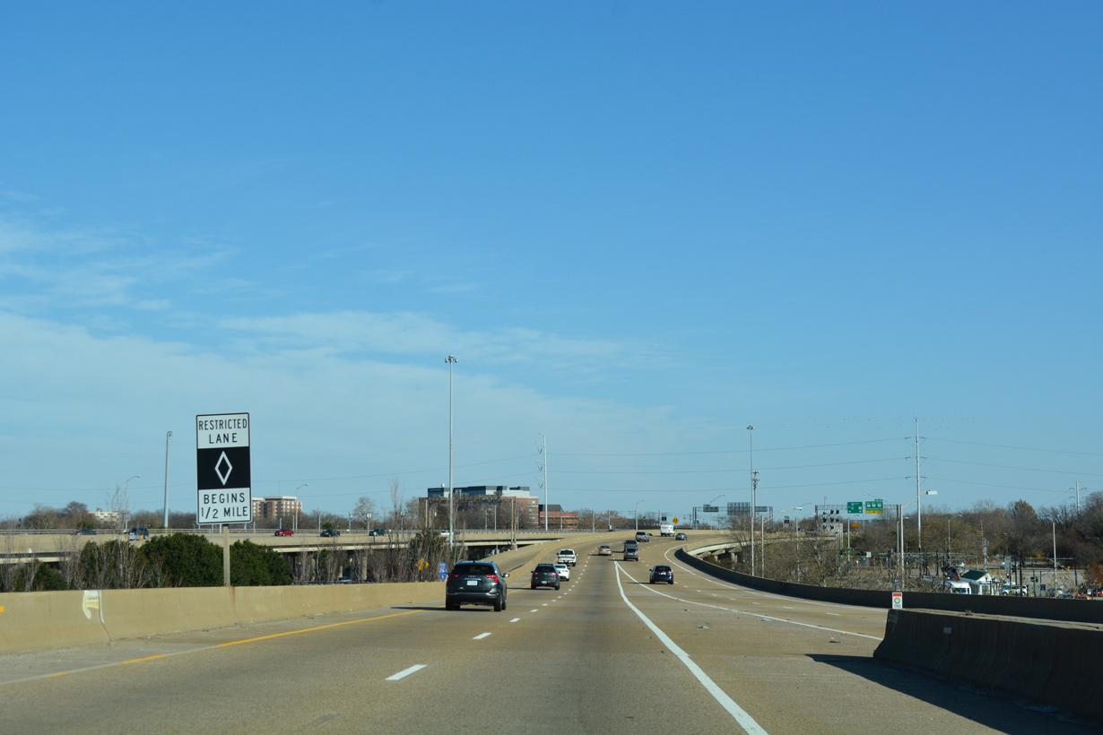
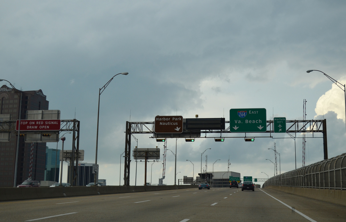
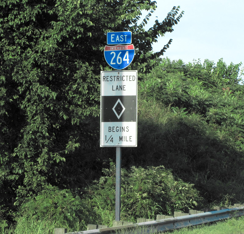
I-264 expands to an eight lane freeway east from the exchange with Waterside Drive (SR 337 ALT). HOV-2 lanes commence in a half mile.
12/14/17
12/14/17
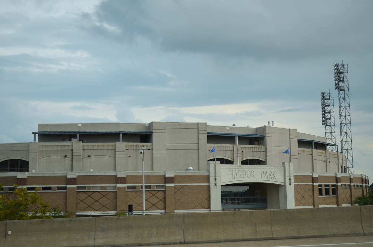
Interstate 264 passes just north of Harbor Park, home of the Norfolk Tides AAA Baseball team, along the Elizabeth River Eastern Branch.
07/23/13
07/23/13
A left side entrance ramp joins I-264 east from City Hall Avenue, one half mile ahead of the HOV-2 lane.
12/14/17
12/14/17
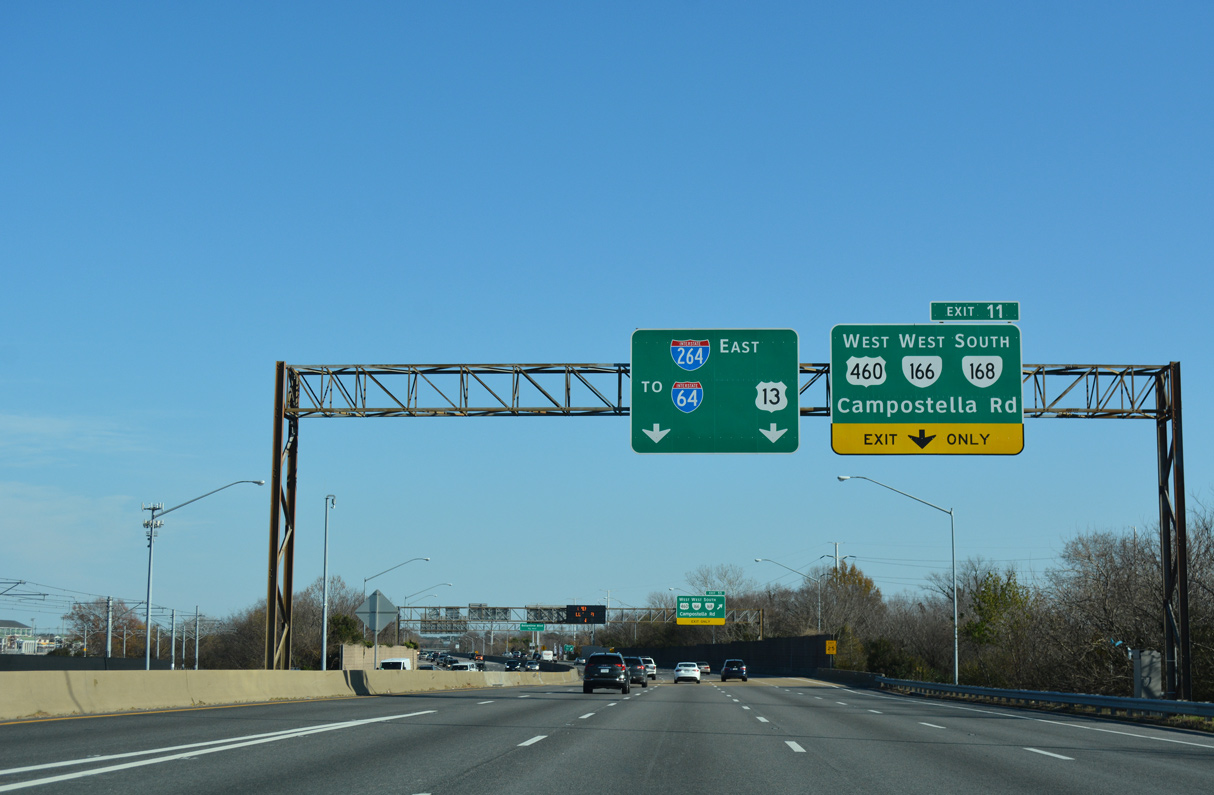
A six-ramp parclo interchange (Exit 11) joins I-264 with U.S. 460/SR 166 east and SR 168 south across the the 1986-built Campostella Bridge to Campostella Heights.
12/14/17
12/14/17
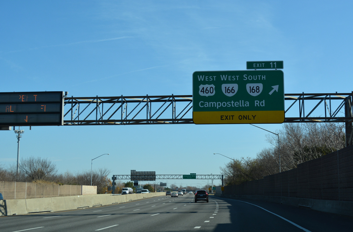
U.S. 460/SR 166-168 combine south from adjacent Brambleton and Park Avenues to Wilson Road at Campostella Heights. U.S. 460/SR 166 follow Wilson Road southwest to Cloverdale and Poindexter Street (SR 337) in Chesapeake. SR 168 extends south along Campostella Road to Atlantic Avenue.
12/14/17
12/14/17
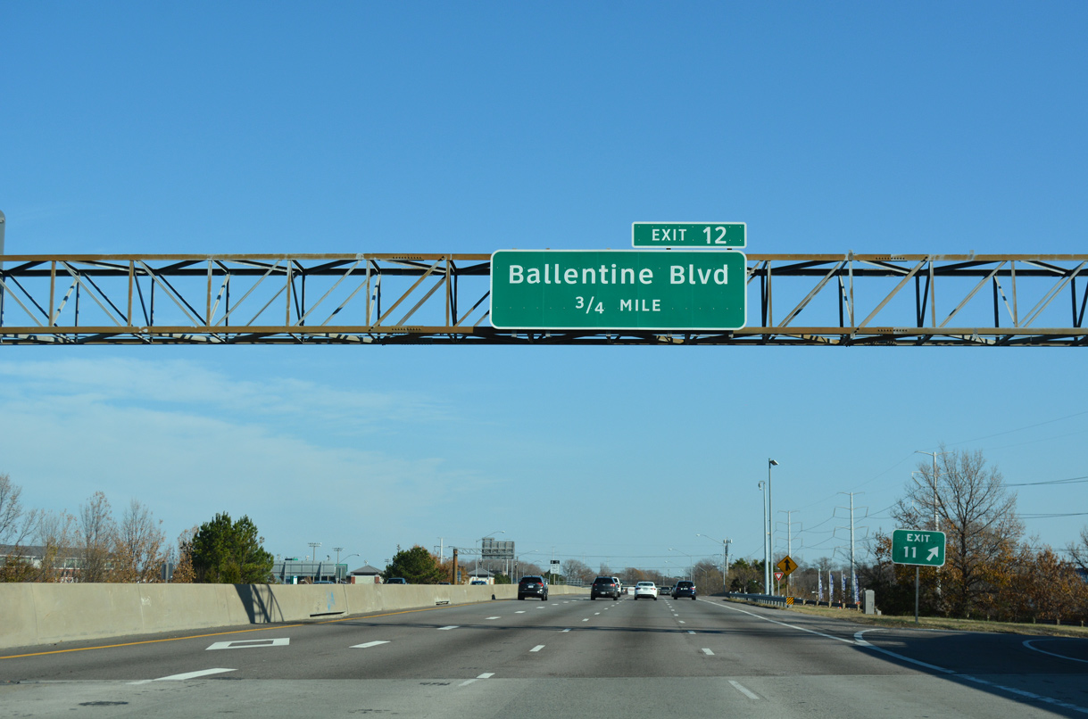
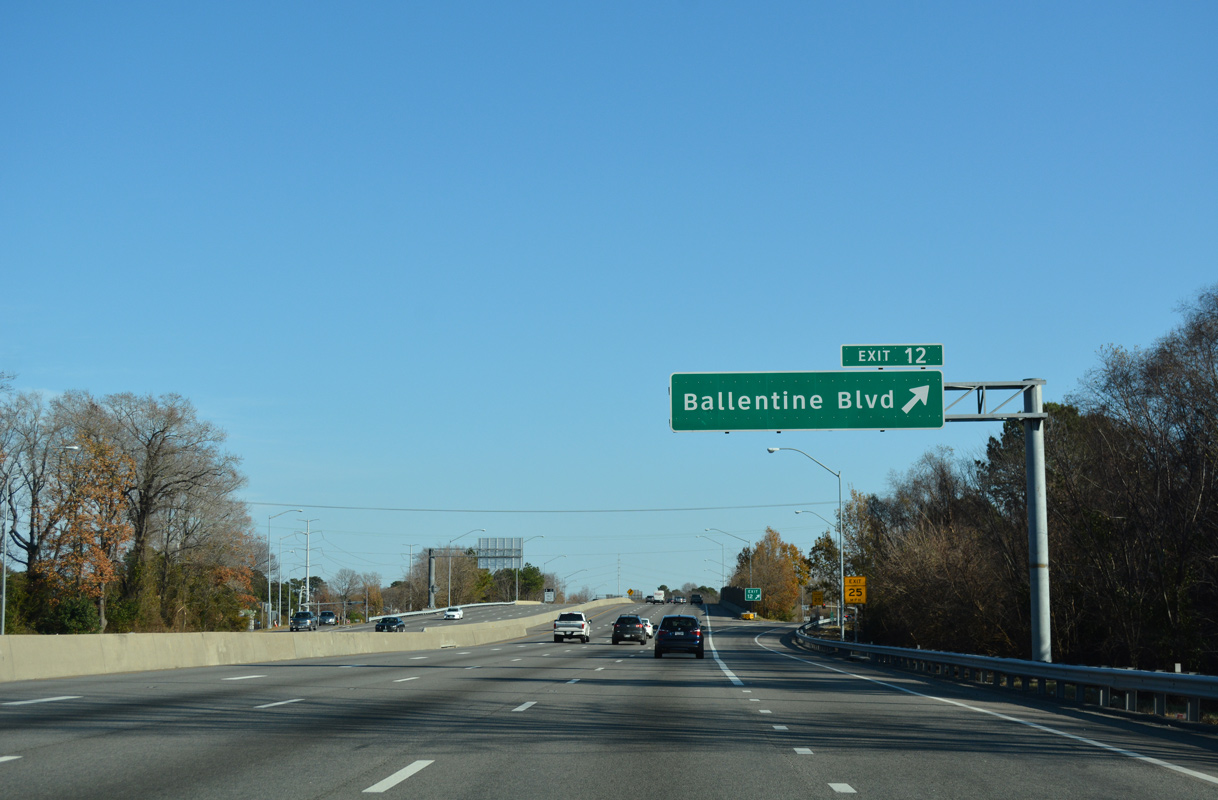
Ballentine Boulevard north 0.64 miles from I-264 at forthcoming Exit 12 to U.S. 58 (Virginia Beach Boulevard) was previously designated as SR 405.1
12/14/17
12/14/17
A diamond interchange (Exit 12) links I-264 with Ballentine Boulevard east beyond U.S. 460/SR 166-168 (Campostella Road).
12/14/17
12/14/17
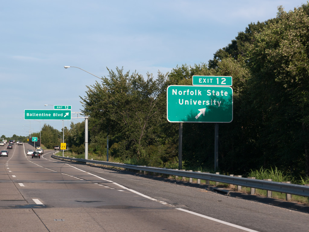
Norfolk State University lines the north side of Interstate 264 between Park Avenue (SR 166) and Ballentine Boulevard.
09/05/10
09/05/10
Merrimac Avenue originally connected with Exit 12 and Grandy Park. The development of the Middle Towne Arch neighborhood included an extension of Ballentine Boulevard north to SR 166 (Princess Anne Road).
12/14/17
12/14/17
12/14/17
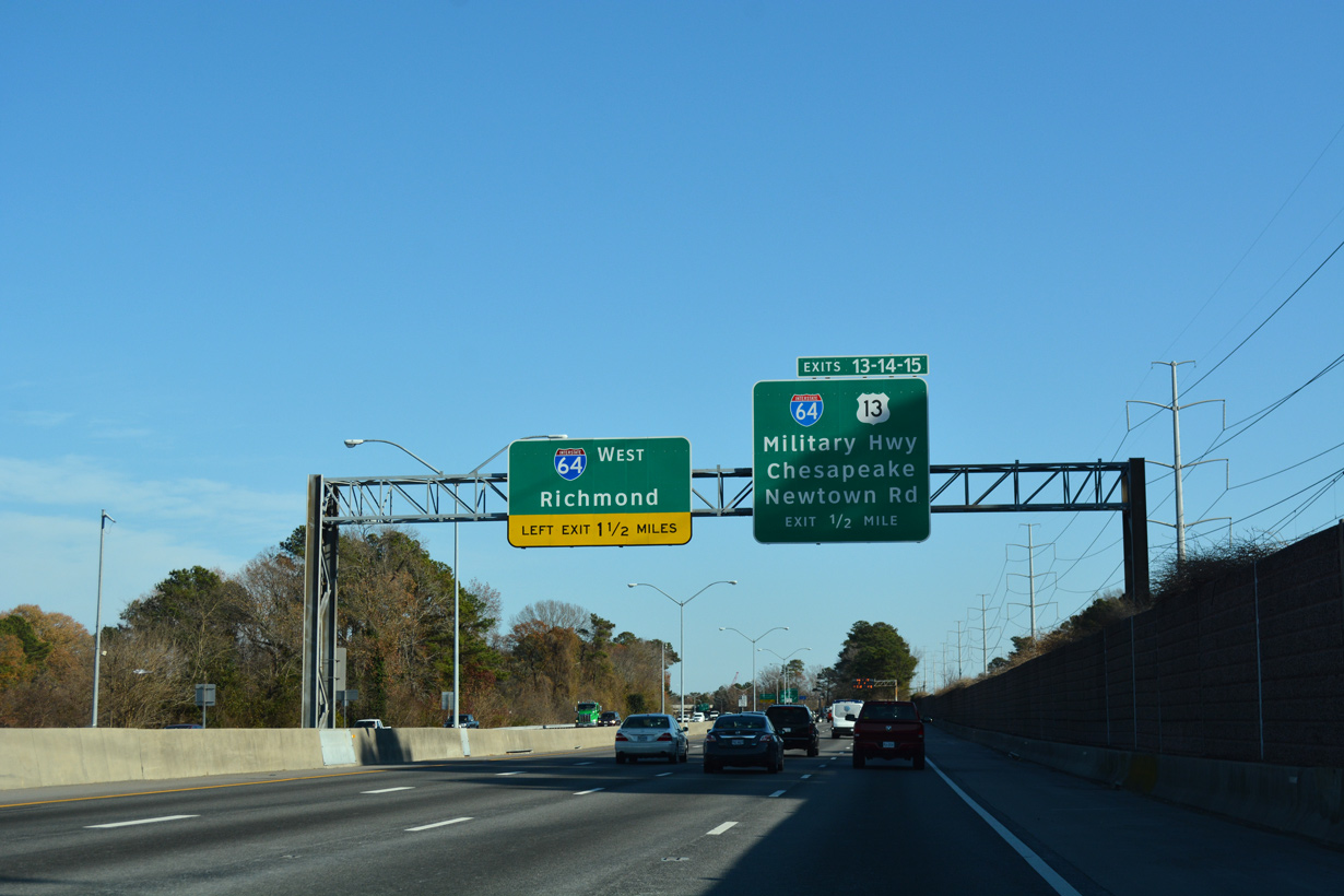
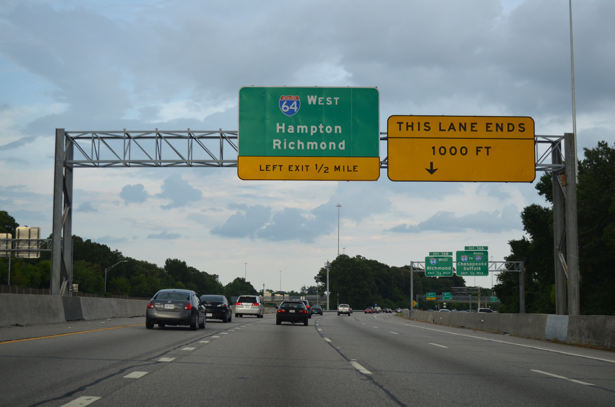
A 2.04 mile long c/d roadway separates from I-264 beyond the Ingleside and Ventosa neighborhoods for Exits 13, 14 and 15. An unnumbered left exit follows for I-64 west ahead of U.S. 13 (Northampton Boulevard) to the Chesapeake Bay Bridge Tunnel (CBBT).
12/14/17
12/14/17
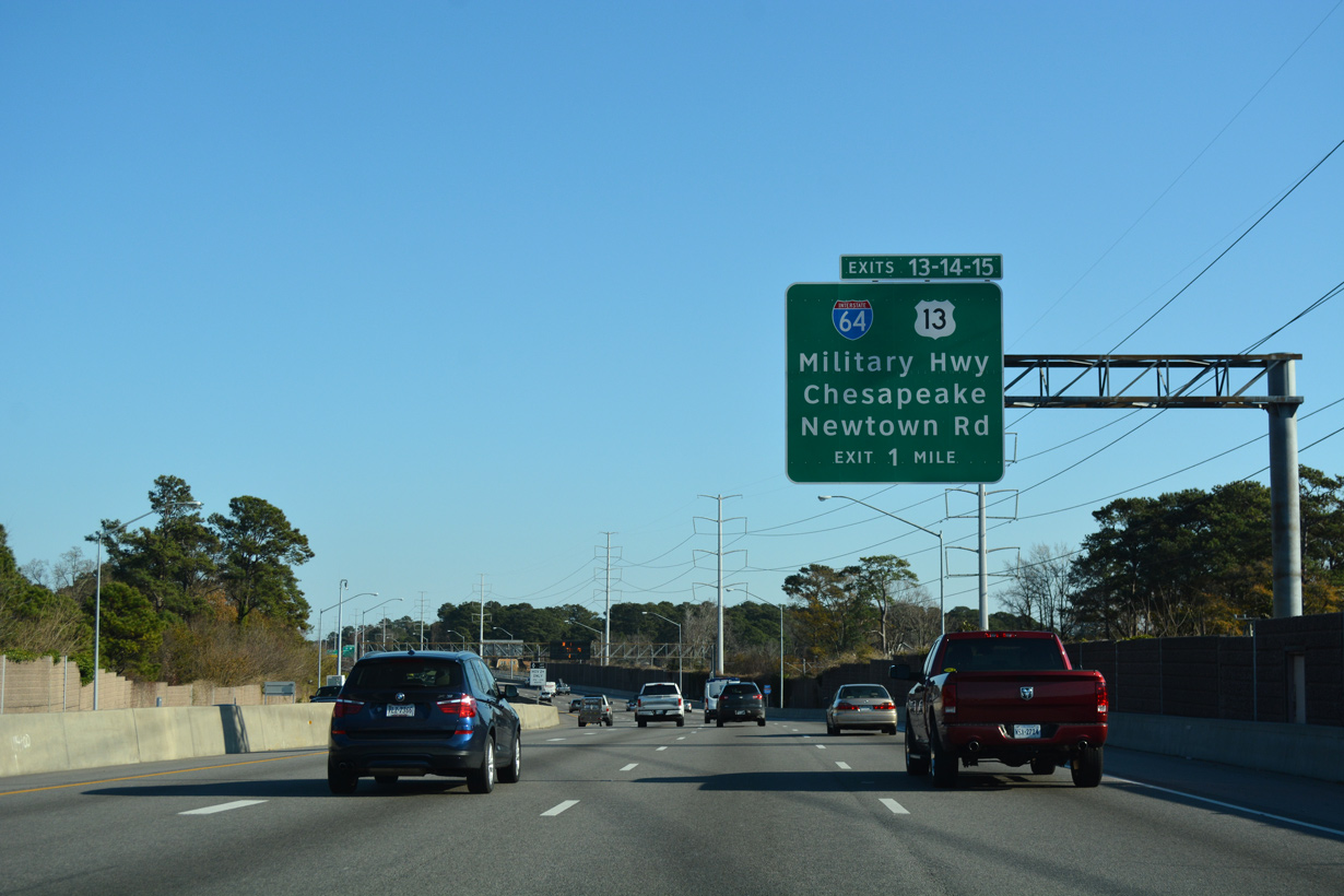
U.S. 13 (Military Highway) meets Interstate 264 at a cloverleaf interchange (Exit 13) next.
12/14/17
12/14/17
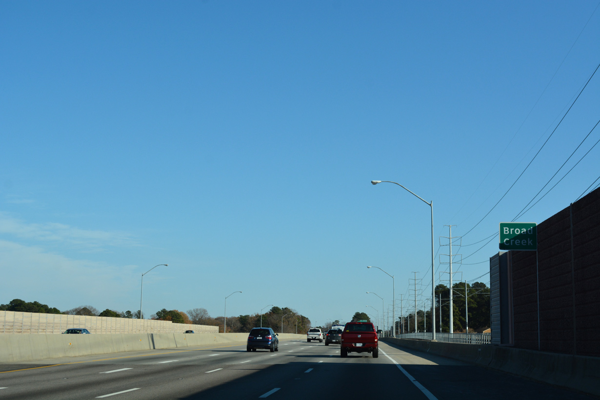
Interstate 264 east crosses Broad Creek beyond this confirming marker.
12/14/17
12/14/17
12/14/17
U.S. 13 (Military Highway) encircles Norfolk north to SR 165 (Northampton Boulevard) and SR 166 (Princess Anne Road) at Lansdale and southwest to Chesapeake.
12/14/17
12/14/17
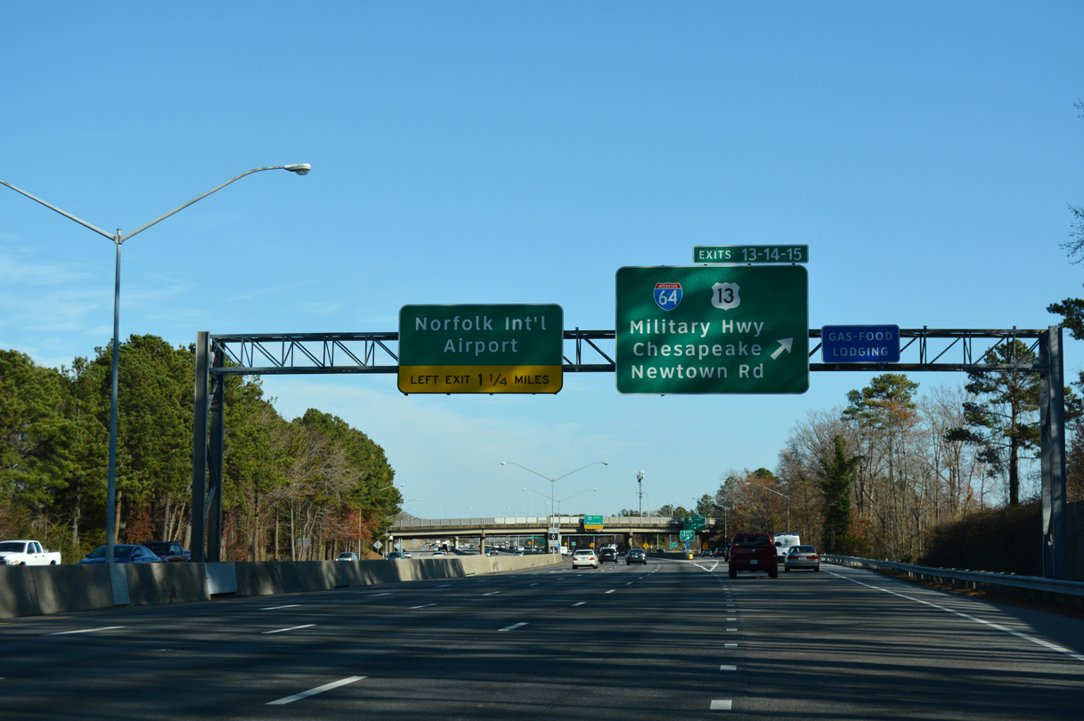
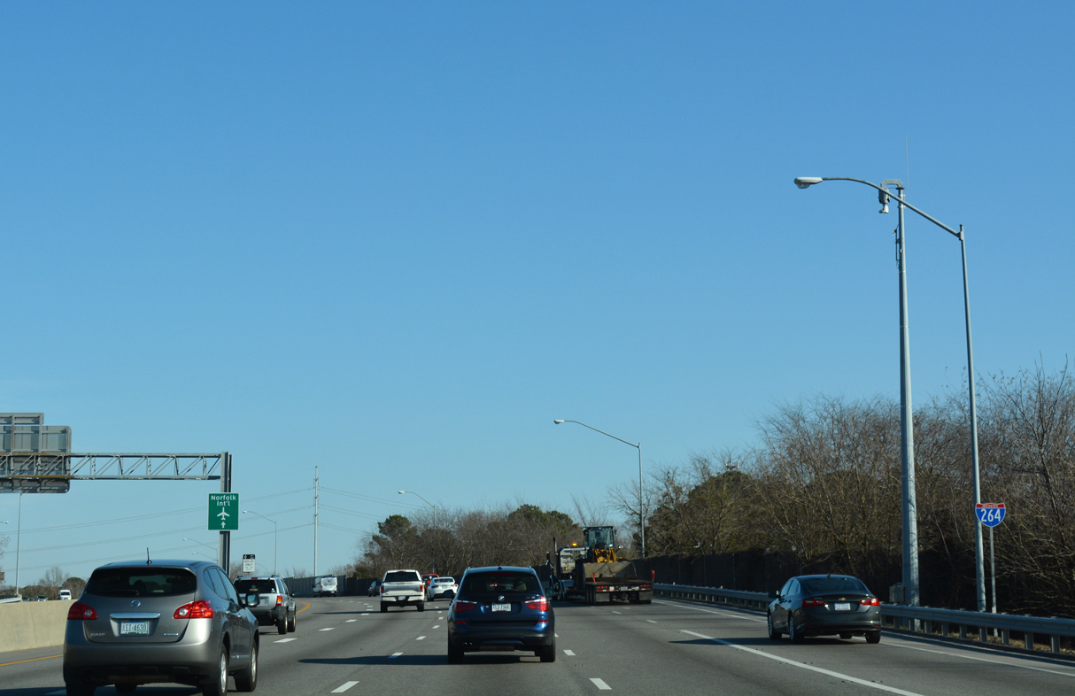
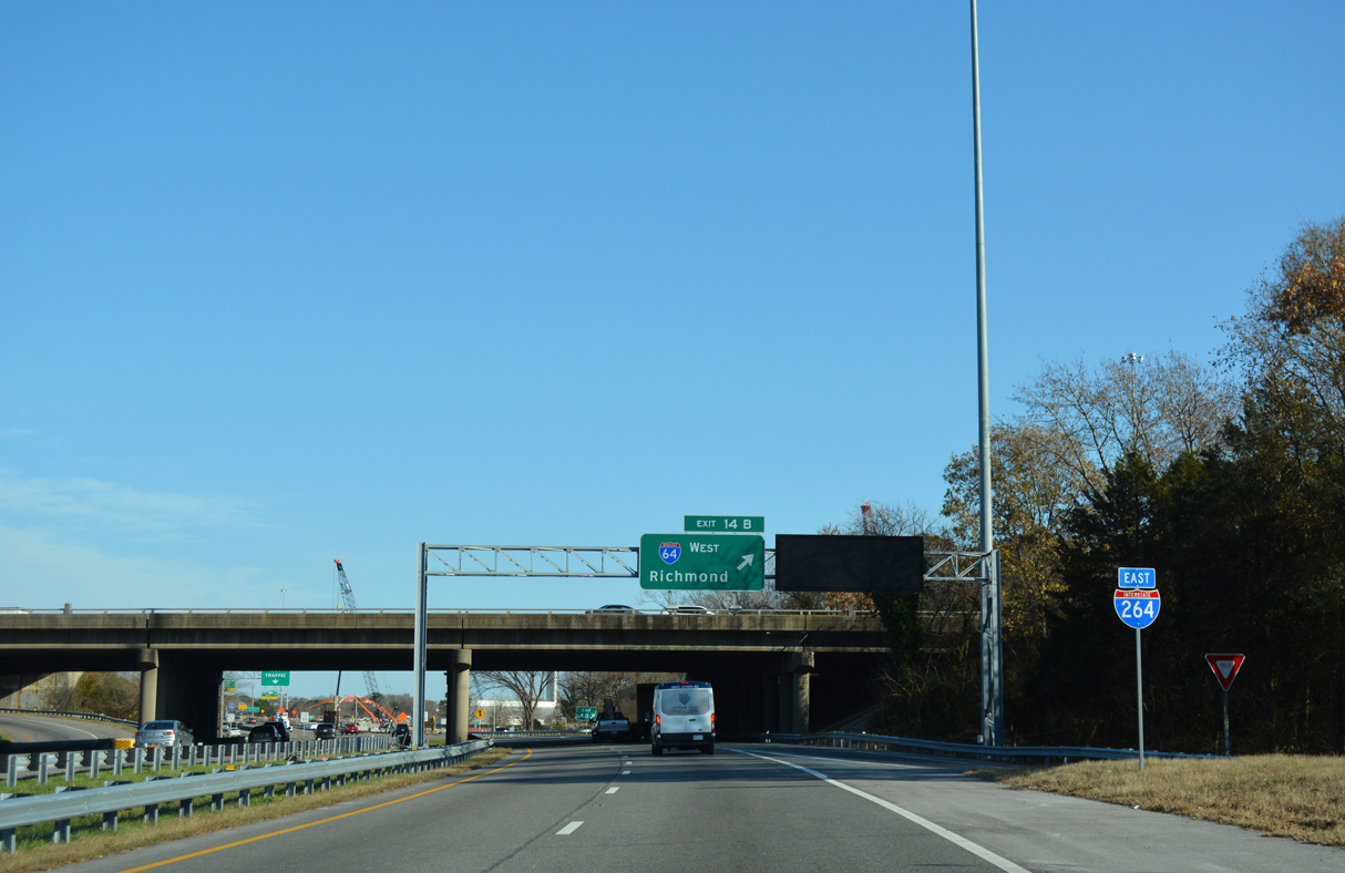
The c/d roadway for U.S. 13 (Military Highway) I-64 and Newtown Road (SR 403) departs. The left exit for I-64 west joins the Hampton Roads Beltway ahead of Norfolk International Airport (ORF) and 94 miles from Richmond.
12/14/17
12/14/17
Exit 13A leaves the c/d roadway for U.S. 13 (Military Highway) southbound to Knob Hill in Virginia Beach and Indian River Park in Chesapeake.
12/14/17
12/14/17
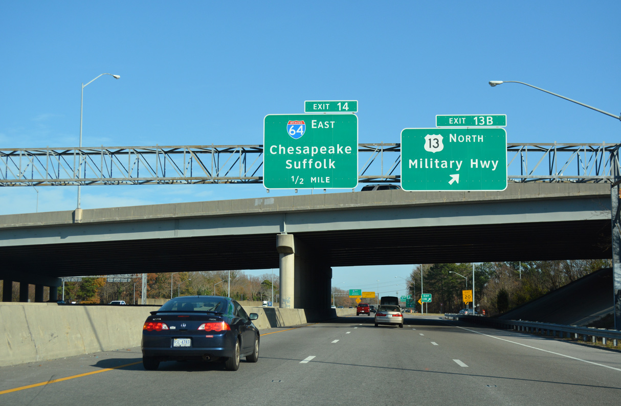
Exit 13B loops onto U.S. 13 (Military Highway) north to Poplar Halls, Military Circle Mall and a SPUI with U.S. 58 (Virginia Beach Boulevard).
12/14/17
12/14/17
12/14/17
The eastbound main line for I-264 advances a half mile east from the exchange with U.S. 13 to the left exit for Interstate 64 west to Hampton.
07/23/13
07/23/13
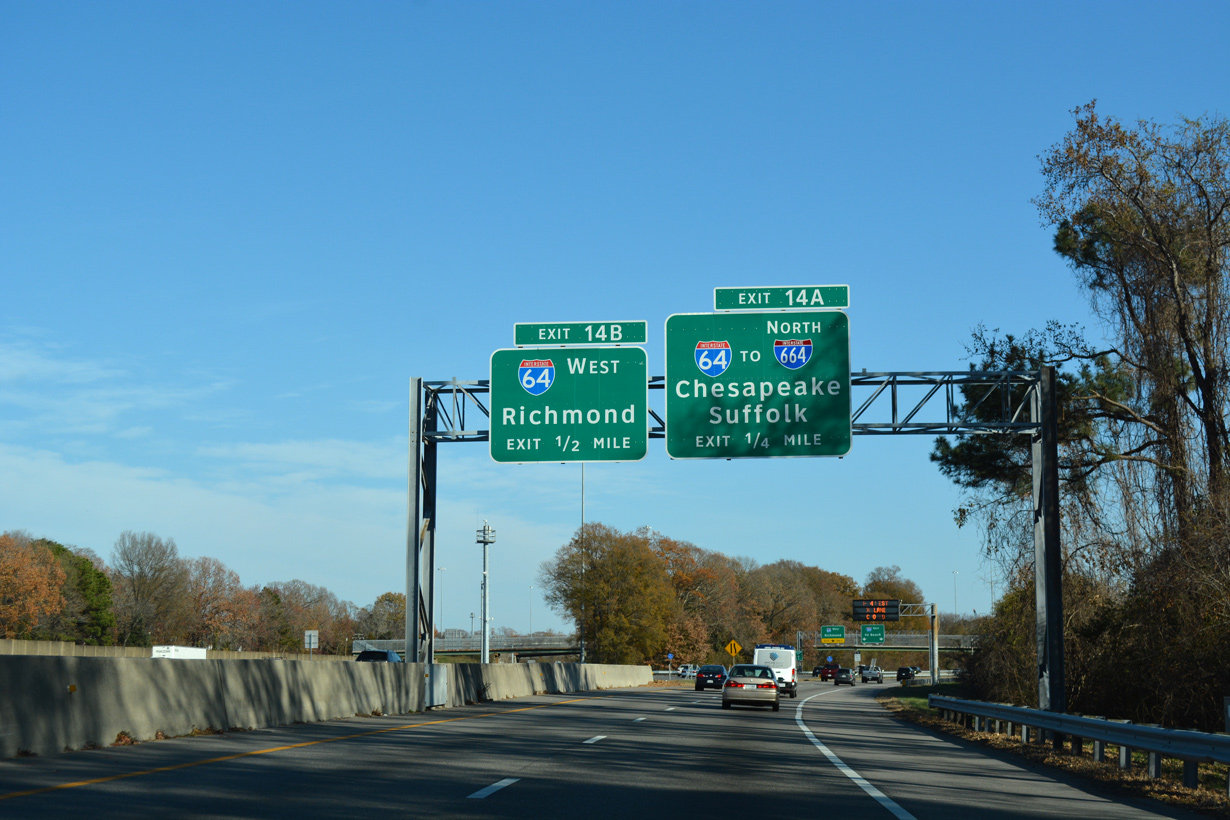
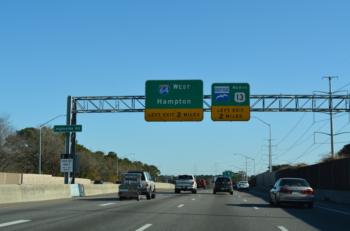
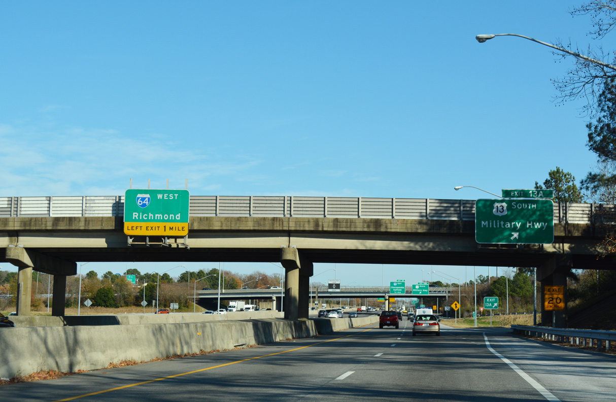
The c/d roadway continues east from U.S. 13 (Military Highway) to exit ramps for both directions of Interstate 64 (Hampton Roads Beltway).
12/14/17
12/14/17
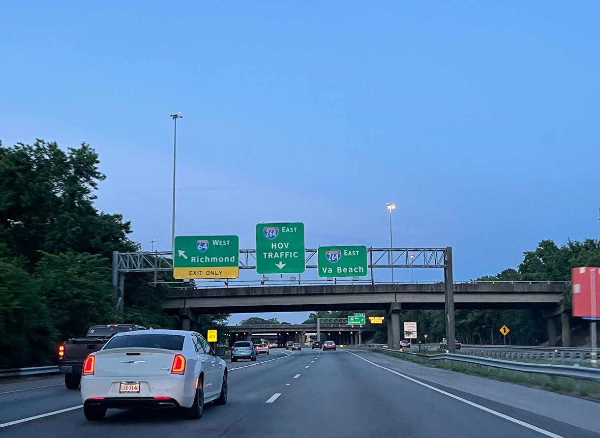
I-64 west connects with U.S. 13 (Northampton Boulevard) to the CBBT in 2.1 miles and I-564 (Admiral Taussig Boulevard) west to Naval Station Norfolk in 7.4 miles.
07/23/13
07/23/13
Interstate 64 curves southwesterly 15 miles from Exit 14A to I-264/664 at Bowers Hill in Chesapeake.
12/14/17
12/14/17
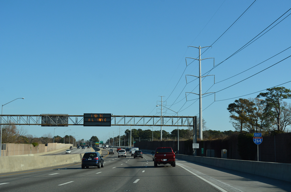
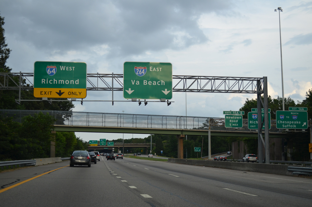
The HOV lane resumes along Interstate 264 east of Exit 14.
09/05/10
09/05/10
06/06/21
12/14/17
12/14/17
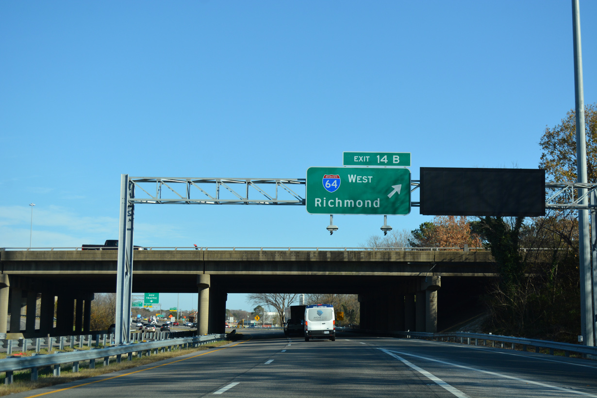
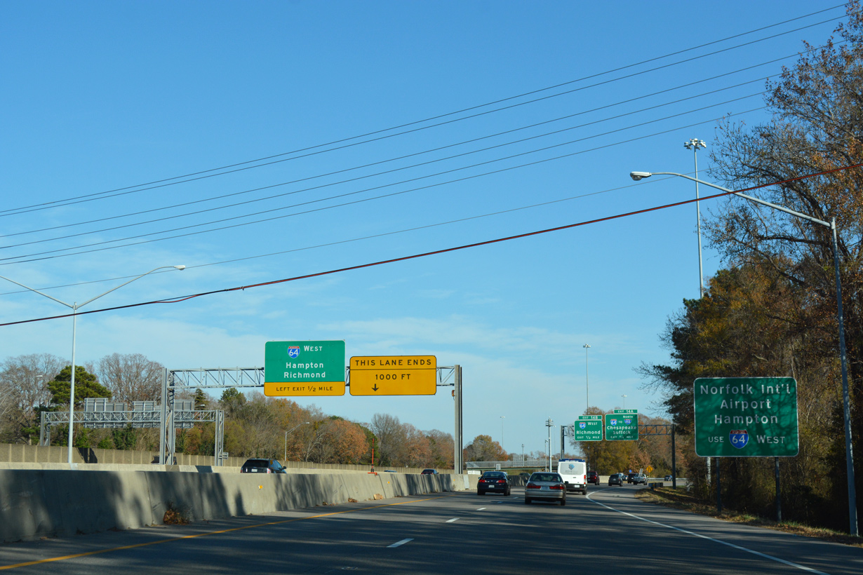
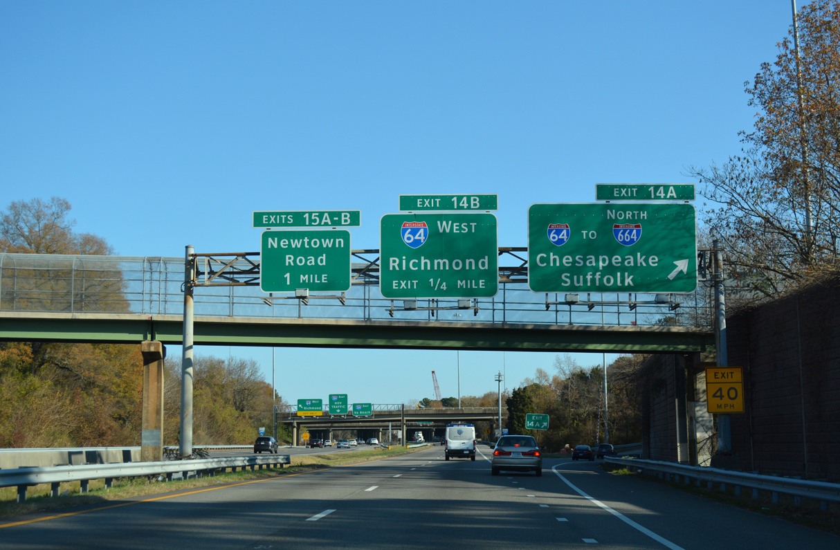
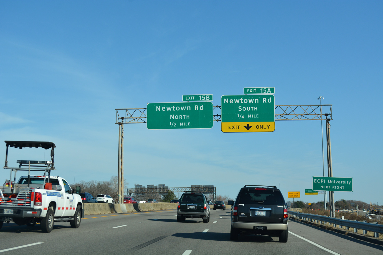
Exit 14B loops onto Interstate 64 west from the c/d roadway. A parclo interchange (Exit 15) with Newtown Road follows at the community of Greenwich.
12/14/17
12/14/17
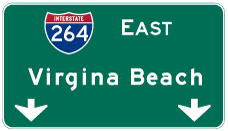

Photo Credits:
- AARoads: 07/23/13, 07/28/13
- ABRoads: 12/14/17
- Will Weaver: 09/05/10
- Peter Johnson: 06/06/21
Connect with:
Page Updated Thursday April 08, 2021.