
Interstate 287 North - Somerville to Parsippany

Interstate 287 curves eastward onto Second Watchung Mountain, leveling out through southern Far Hills borough.
07/20/05
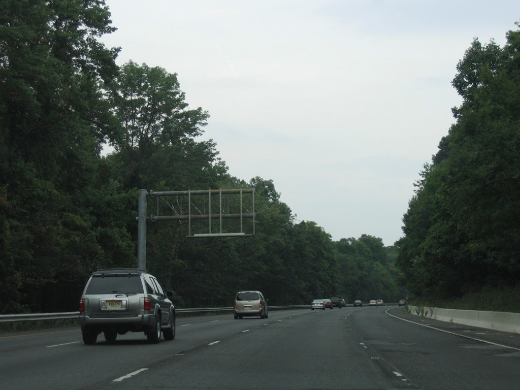
An overhead sign structure posted over the left lane of Interstate 287 north remained from when HOV lanes were striped in 1998.
08/29/05
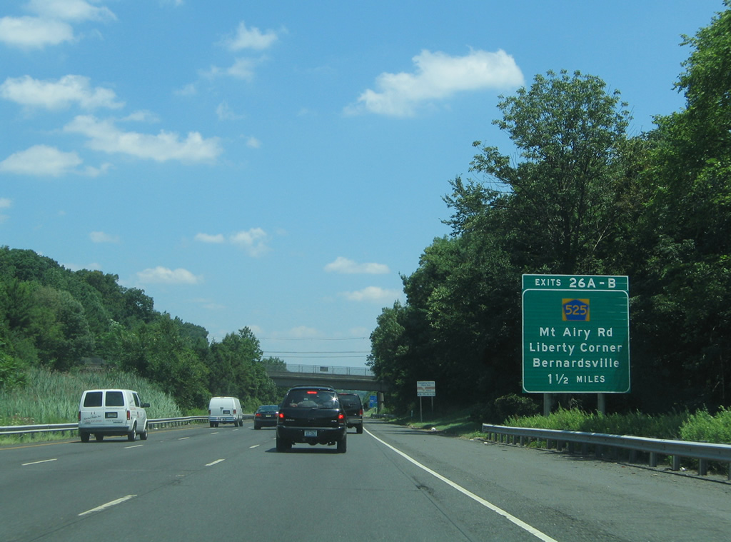
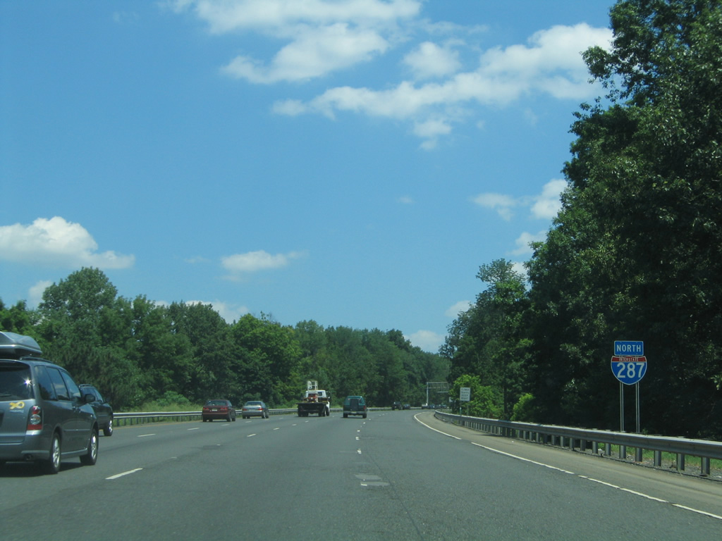
Entering Bernards Township, Interstate 287 advances to a six-ramp parclo interchange (Exits 26 A/B) with County Route 525 (Mount Airy Road).
07/20/05
Forthcoming Exit 26 A onto CR 525 (Mount Airy Road) south serves both the USGA Museum at Far Hills and the Lyons VA Medical Center. County Route 525 runs south to Liberty Corner and I-78 at Exit 33.
06/30/05
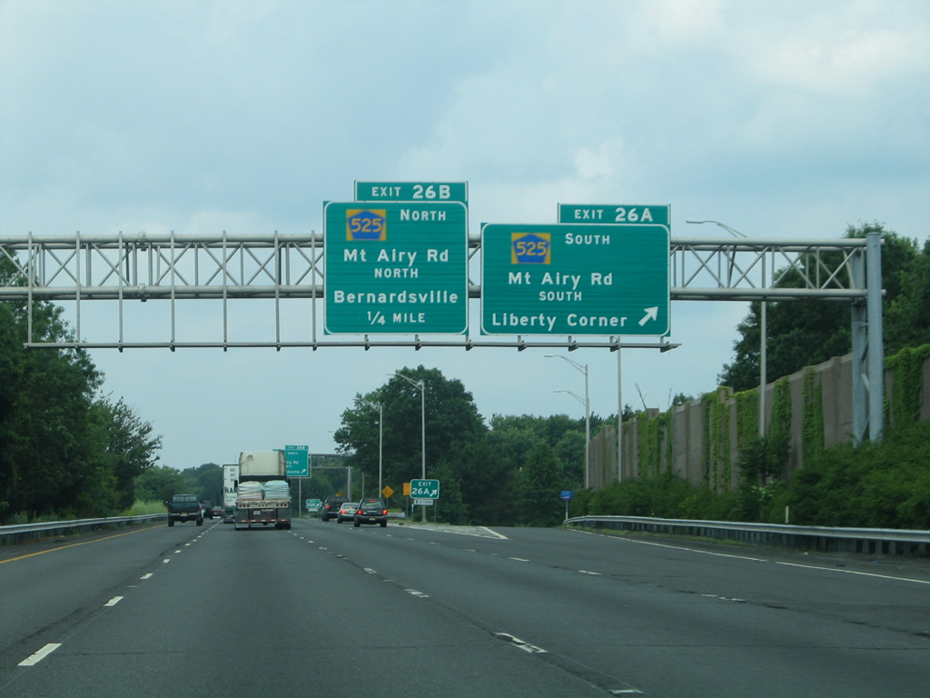
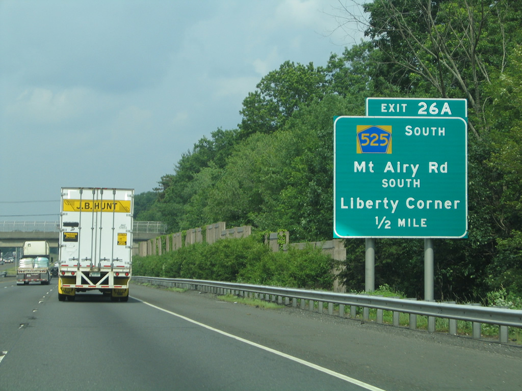
Exit 26 A departs Interstate 287 north for Somerset County Route 525 (Mount Airy Road) south. CR 525 winds southward to New Jersey Route 28 in Bound Brook.
06/30/05
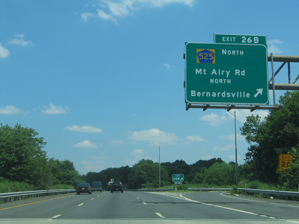
The 16.88 mile route of CR 525 extends northward by way of Bernardsville to CR 510 at the borough of Mendham.
07/20/05
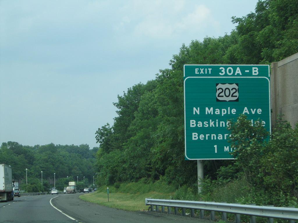
Interstate 287 passes between Bernardsville and Basking Ridge to next meet North Maple Avenue at Exits 30 A/B.
06/30/05
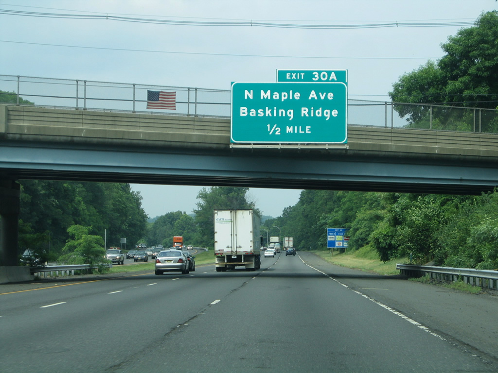
North Maple Avenue leads back south to Basking Ridge from Exit 30 A.
06/30/05
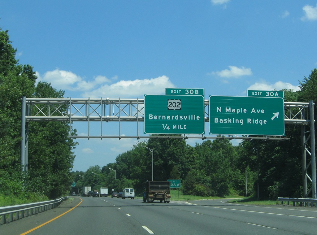
Exit 30 A leaves I-287 north for N Maple Avenue south to Madisonville. A loop ramp follows onto Maple Avenue north to adjacent U.S. 202 outside Bernardsville.
07/20/05
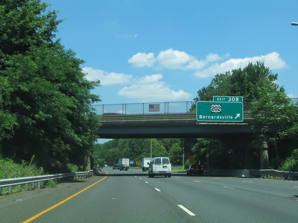
U.S. 202 parallels the west side of Interstate 287 from Bernardsville northward to Mount Kemble in Harding Township.
07/20/05
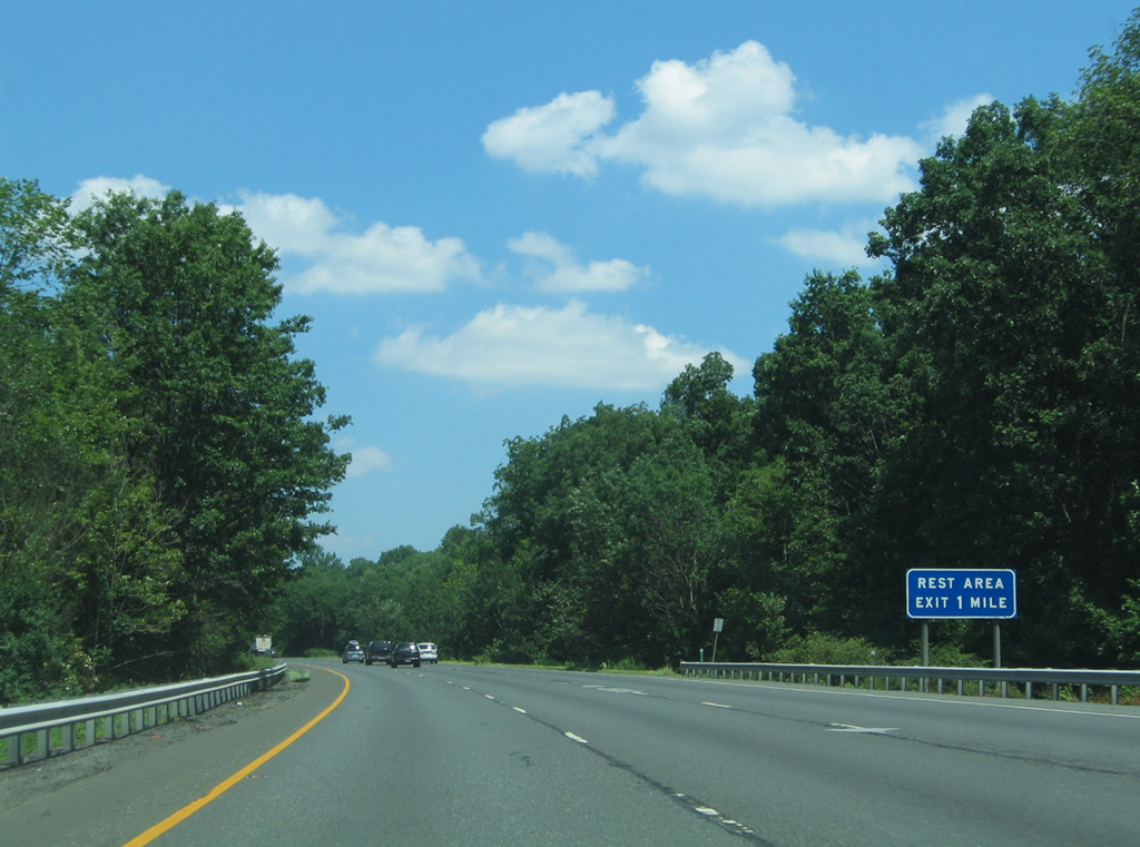
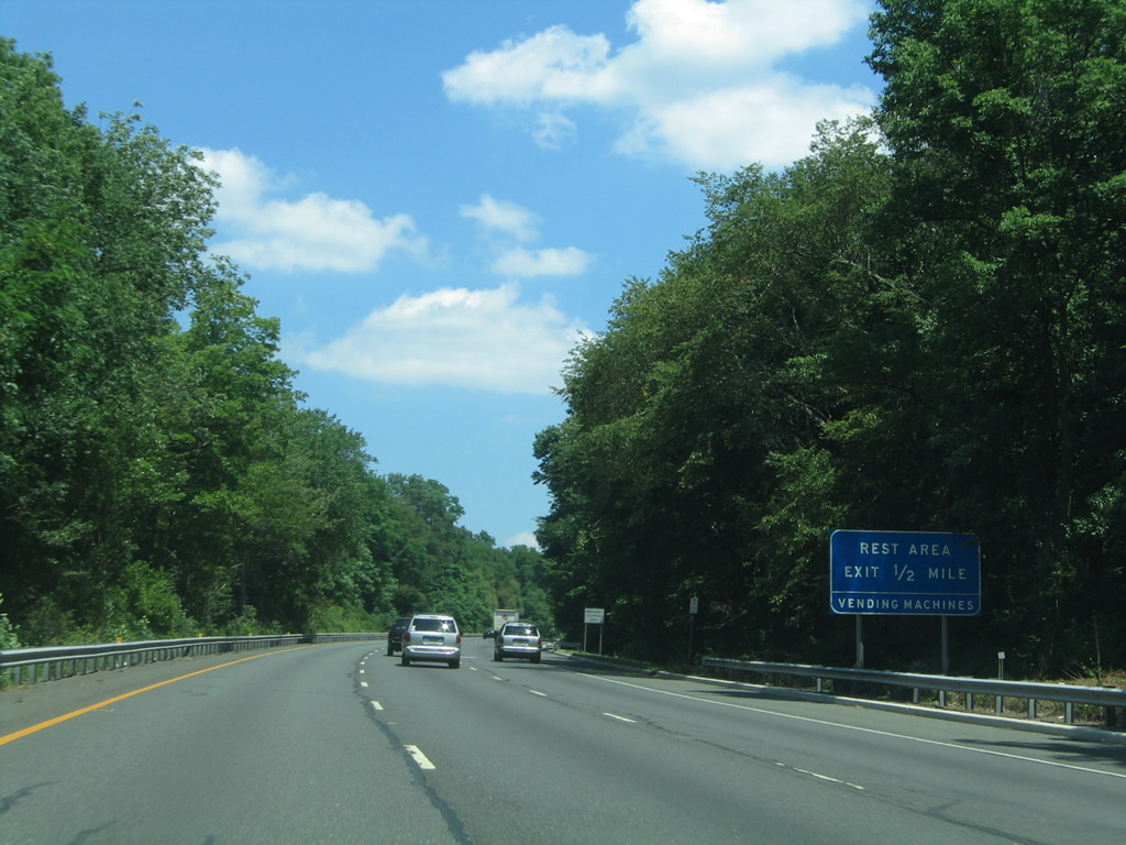
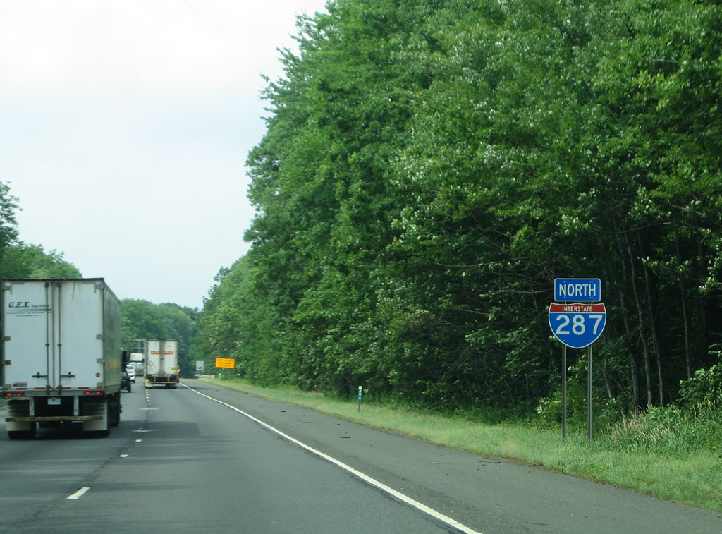
Interstate 287 crosses the Morris County line ahead of a northbound truck rest area near Mount Kemble.
07/20/05
Northbound reassurance marker for I-287 posted near Glen Alpin in Harding Township.
06/30/05
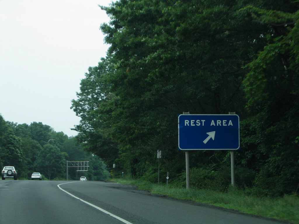
Travelers along I-287 north reach the lone rest area along the nearly 99 mile route. This facility was restricted to trucks only after 2008.
06/30/05
Interstate 287 diverges from the hillside of Mount Kemble toward Exit 33 in south Morris Township.
07/20/05
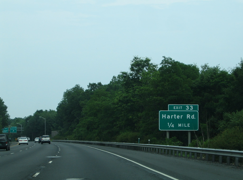
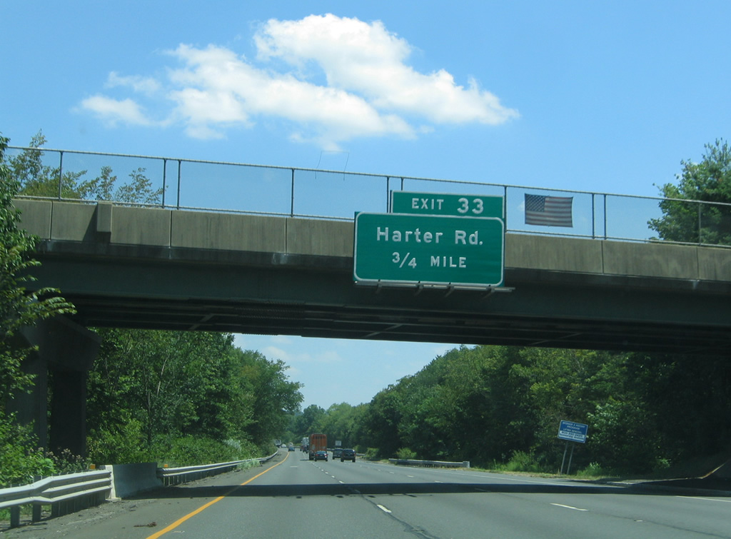
Upcoming Exit 33 joins I-287 with Harter Road via adjacent Tiger Lily Lane. Trucks over five tons are prohibited from using Harter Road.
06/30/05

Harter Road is a local residential road linking I-287 with CR 663 (James Street) to the east and U.S. 202 (Mount Kemble Avenue) to the west. Return access to I-287 north is provided via a ramps from James Street and Southgate Parkway nearby.
06/30/05
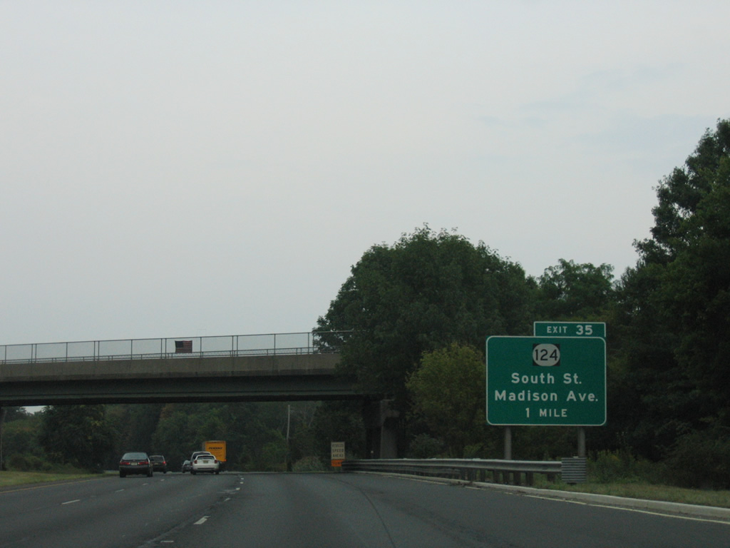
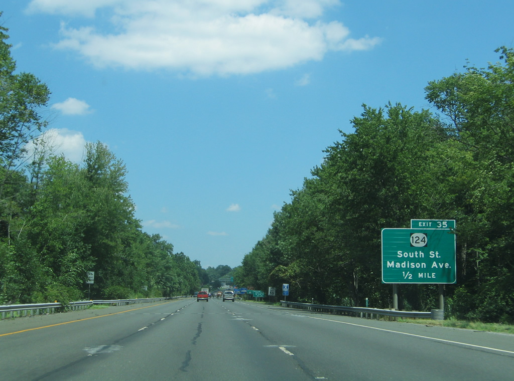
Exit 35 with South Street is the first of three interchanges serving the Morris County seat of Morristown from Interstate 287 north.
08/29/05
Route 124 (Madison Avenue) travels 14.74 miles from U.S. 202 in Downtown Morristown east to CR 603 (Springfield Avenue) at the Maplewood / Irvington Township line.
07/20/05
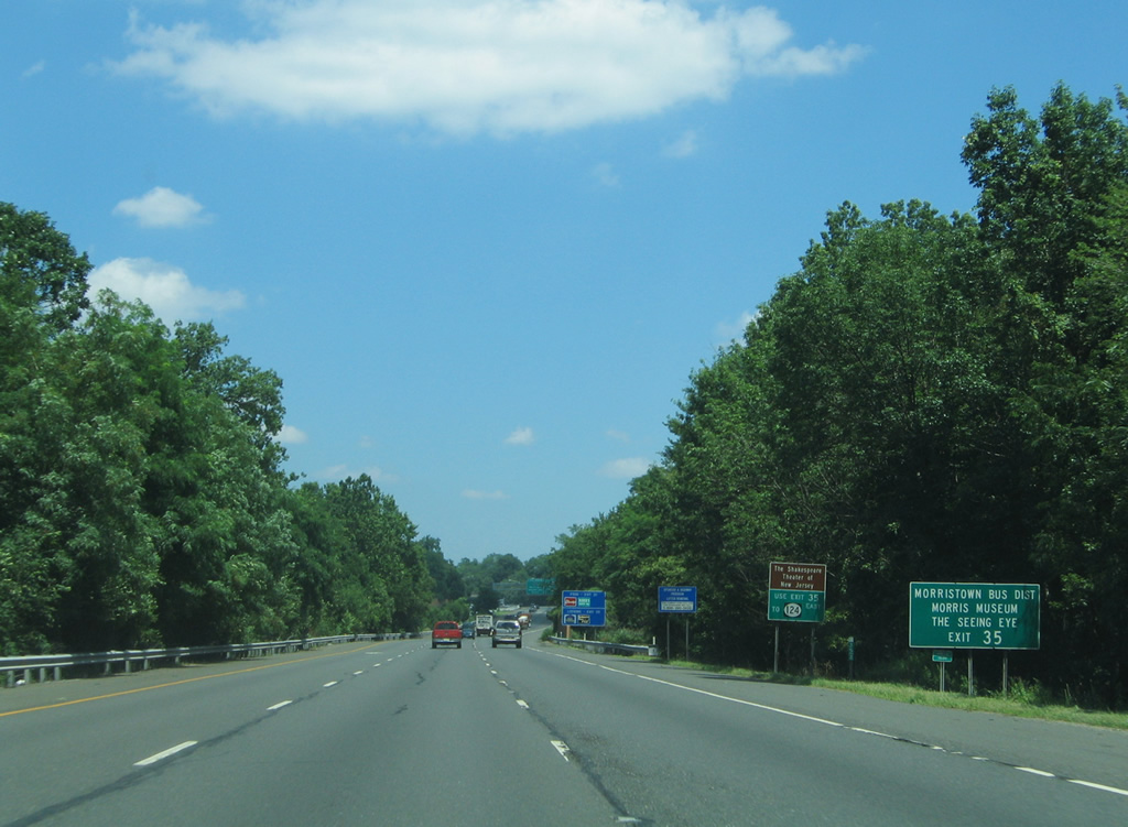
Exit 35 joins I-287 north with South Street (CR 601) ahead of Route 124 (Madison Avenue) toward the Morristown business district. The exit serves The Shakespeare Theater of New Jersey and the Morris Museum via Route 124 east and The Seeing Eye guide dog school via Route 124 west to CR 510.
07/20/05
Route 124 takes South Street to Downtown Morristown while Madison Avenue leads the route southeast to the borough of Madison. The state route represents the pre-freeway alignment of New Jersey Route 24 between Morristown and Summit.
07/20/05
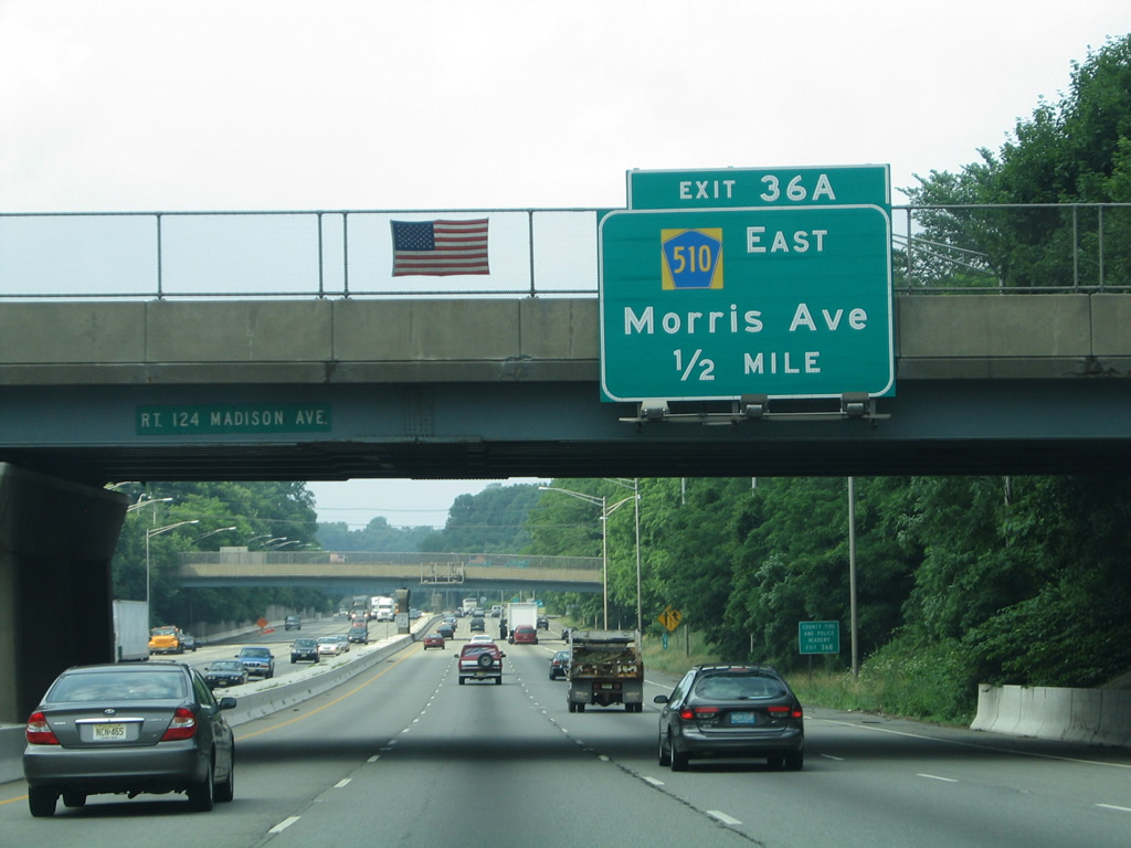
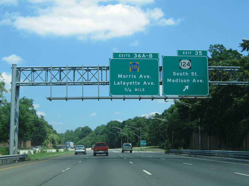
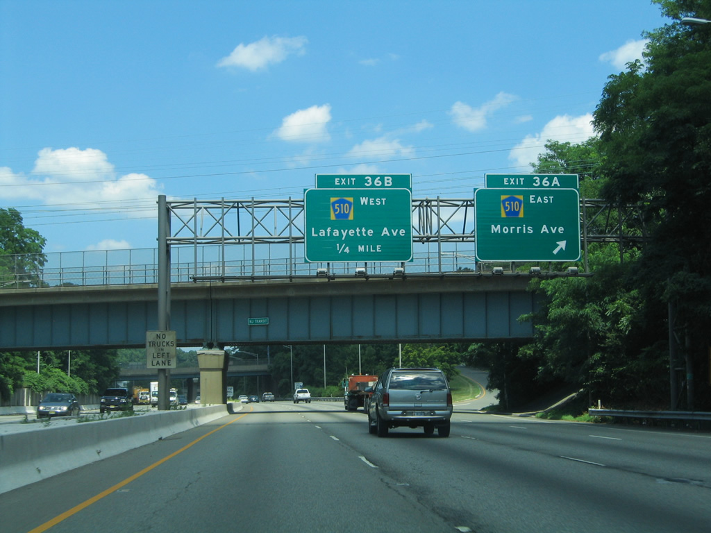
Continuing through the town of Morristown, I-287 next meets County Route 510 (Morris Avenue) east at Exit 36 A.
06/30/05
County Route 510 (Morris Avenue) heads east from Morristown to Florham Park, Livingston Township and ultimately Newark. The route overall runs 29.58 miles from CR 513 in Chester to the west.
07/20/05
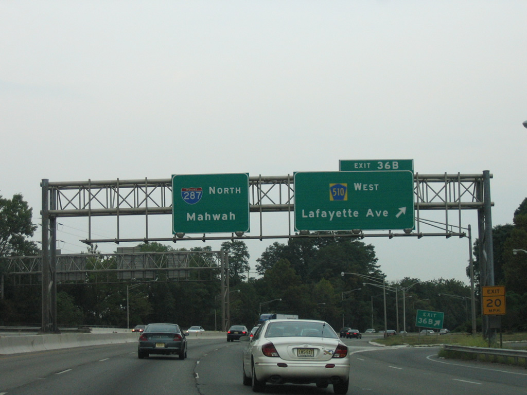
Exit 36 B follows onto Lafayette Avenue (CR 510Z) west to CR 510 (Morris Street) into Downtown Morristown. The county route extends west from the town along the former route of Route 24 to Mendham.
08/29/05
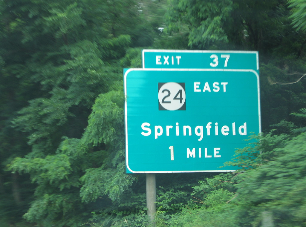
Interstate 287 leaves Morristown for Hanover Township ahead of the trumpet interchange (Exit 37) with the New Jersey Route 24 freeway.
06/30/05
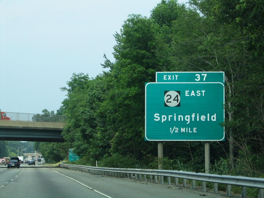
New Jersey Route 24 angles southeast 10.42 miles from I-287 to I-78 at Springfield. The entire route is a limited access highway.
06/30/05
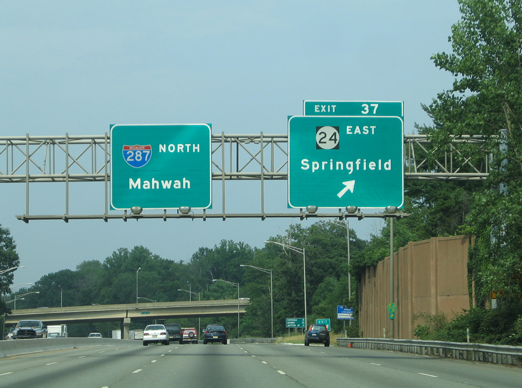
Exit 37 departs I-287 north for Route 24 east to Springfield. The freeway comprises a busy commuter route, as well as the best way from Morristown to I-78 east for Newark Liberty International Airport (EWR).
06/30/05
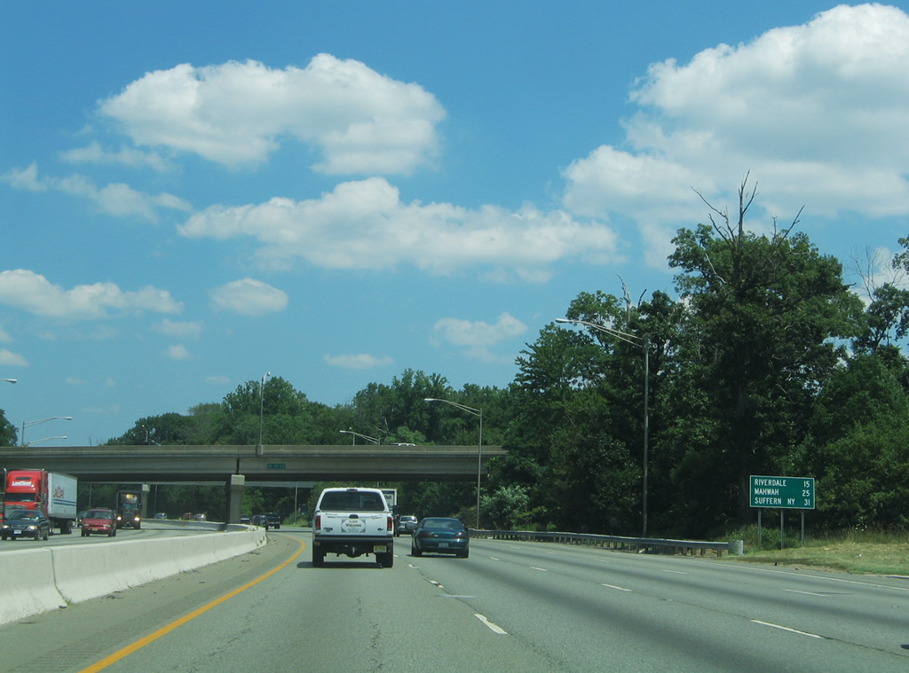
Northbound distance sign posted 15 miles south of the borough of Riverdale, 25 miles from Mahwah near the state line and 31 miles from the overlap with I-87 (NY Thruway) at Suffern, New York.
07/20/05
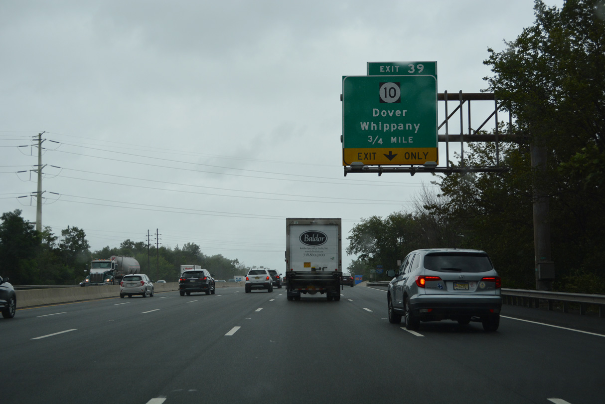
Route 10 meets Interstate 287 north at a directional cloverleaf interchange (Exit 39), west of Whippany, in one mile.
08/19/21
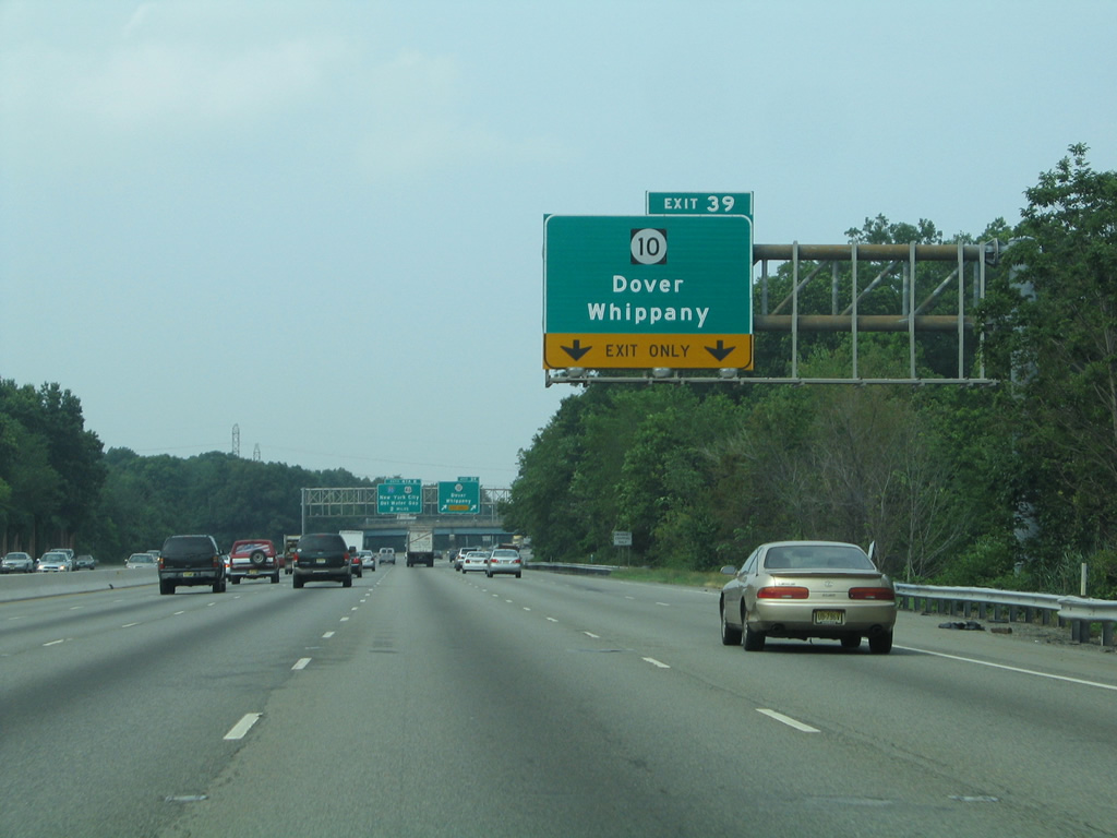
I-287 north expands to six lanes ahead of Exit 39 for Route 10. Measuring 23.51 miles in length, Route 10 travels from U.S. 46 in Roxbury Township to CR 577 in West Orange.
06/30/05
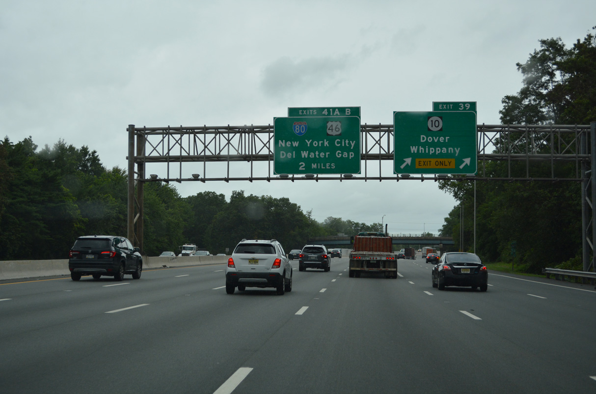
Exit 39 departs from I-287 north for Route 10, 2.6 miles from Exit 41 A to Interstate 80 east. Route 10 leads northwest toward the town of Dover by the borough of Morris Plains and through Denville Township.
08/19/21
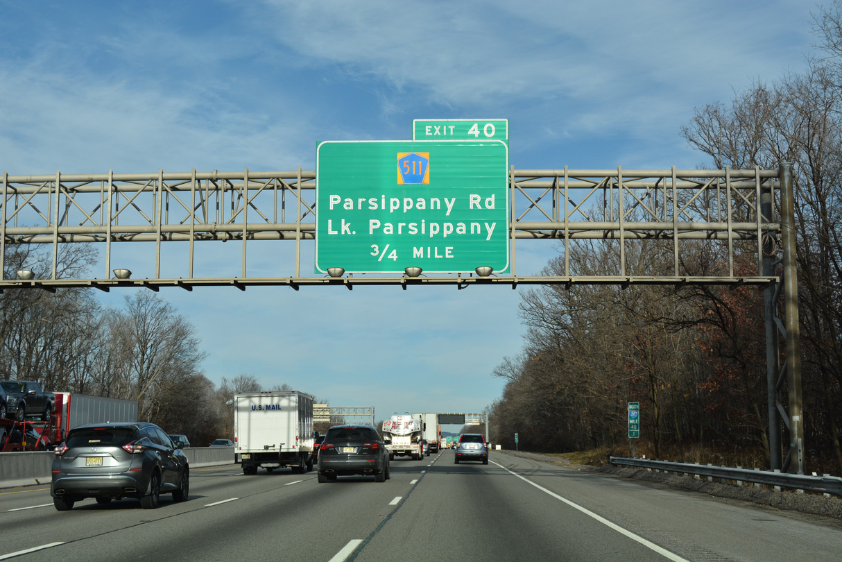
County Route 511 (Parsippany Road) heads north from Whippany to meet I-287 at Exit 40 by Lake Parsippany in 0.75 miles.
12/19/16
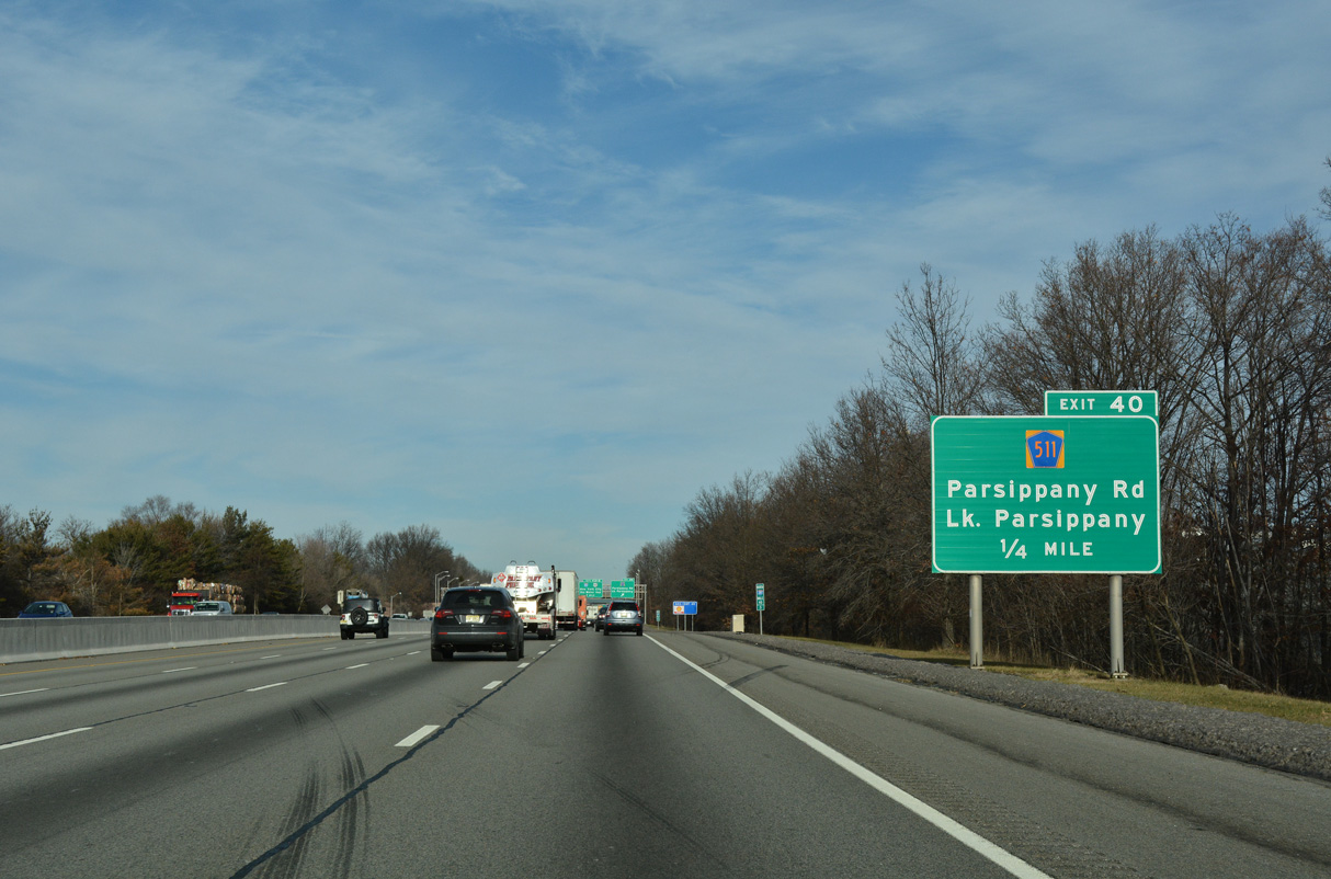
Interstate 287 north crosses the Parsippany-Troy Hills Township line ahead of Exit 40 to CR 511 (Parsippany Road) and E Halsey Road.
12/19/16

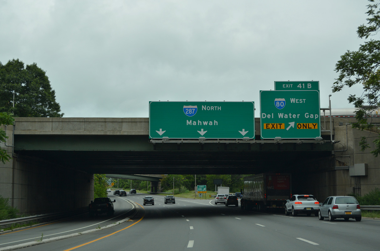
Exit 40 parts ways with I-287 north for CR 511 north to U.S. 202 at Parsippany. The junction with Interstate 80 follows in in one mile. Traveling 68.54 miles across the Garden State, I-80 runs east to I-95 at Ridgefield Park and west into Pennsylvania at Delaware Water Gap.
12/19/16
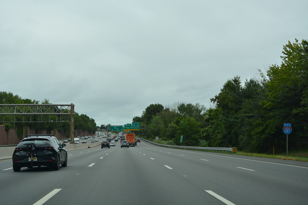
An auxiliary lane opens along I-287 northbound from the Parsippany Road entrance ramp to Exit 41 A.
08/19/21

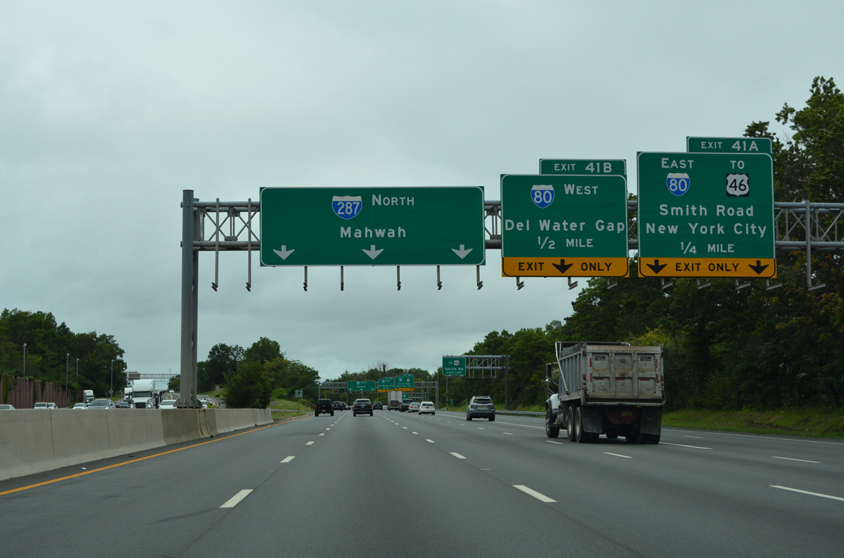
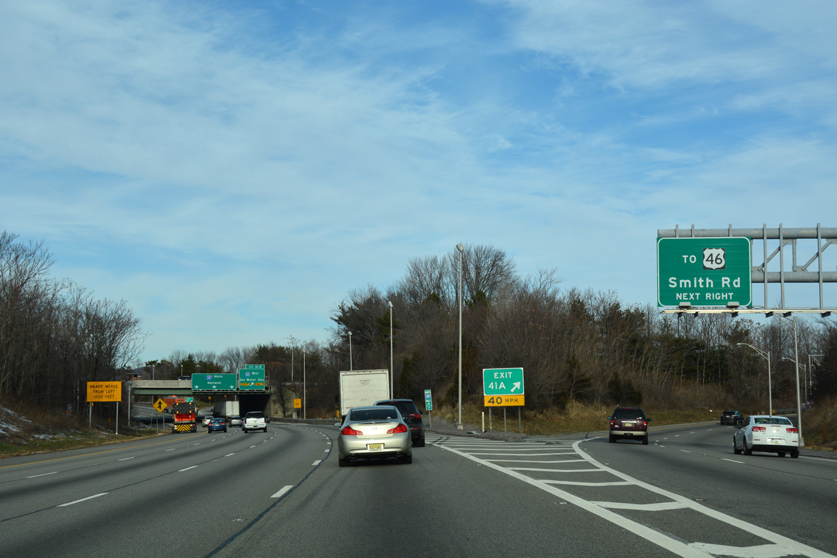
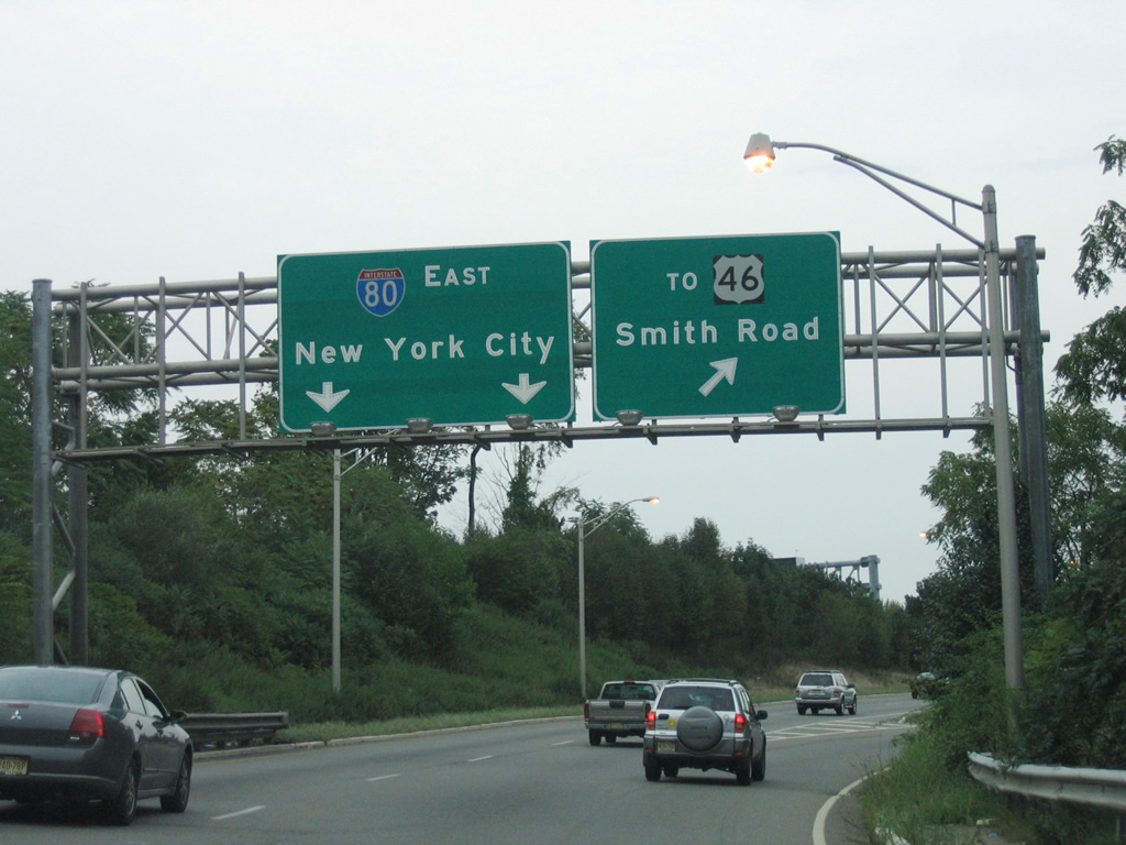
A directional cloverleaf interchange with left exit ramps joins I-287 and I-80 near Parsippany and the junction of U.S. 46 and U.S. 202. Two lanes drop at Exit 41 A in a half mile for I-80 east to New York and adjacent Smith Road to U.S. 46.
12/19/16
Interstate 80 travels east through Totowa, Paterson and Hackensack to I-95 ahead of Fort Lee and the George Washington Bridge into New York. I-280 partitions from I-80 nearby on a southward course to The Oranges and Newark.
08/19/21
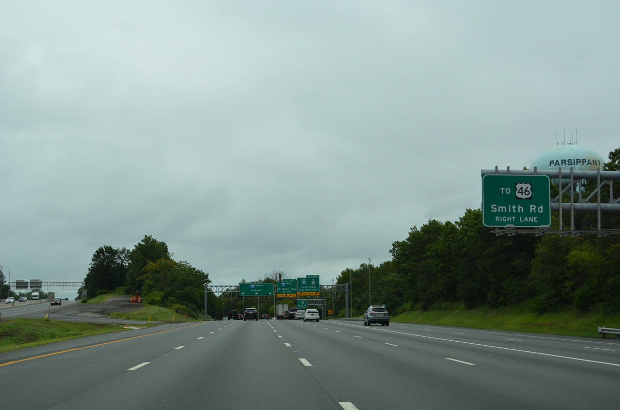
Smith Road connects Exit 41 A with U.S. 46 to the north while curving southward through a business park.
08/19/21

Exit 41 A parts ways with I-287 north for I-80 east and Smith Road. Exit 41 B follows as a loop ramp onto I-80 west to Dover, Wharton, Netcong and Stroudsburg, Pennsylvania.
08/19/21
U.S. 46 parallels I-80 through most of North Jersey, extending east to the George Washington Bridge and west to Columbia near Delaware Water Gap.
12/19/16
Interstate 95 enters New York City midway across the George Washington Bridge, 28.7 miles to the east.
08/29/05
Interstate 80 travels west from North Jersey nearly 2,900 miles overall to San Francisco, California. The bulk of the route west beyond Netcong is rural to Youngstown, Ohio. There I-80 joins the Ohio Turnpike west to Cleveland, the next major city along the transcontinental route.
08/19/21
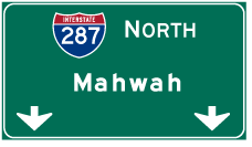
Photo Credits:
- Alex Nitzman: 07/20/05, 08/19/21
- AARoads: 08/29/05
- Carter Buchanan: 06/30/05
- Alex Nitzman, Carter Buchanan: 12/19/16
Connect with:
Page Updated Tuesday April 21, 2026.