
Interstate 295 South - Sandston to Petersburg
 South
South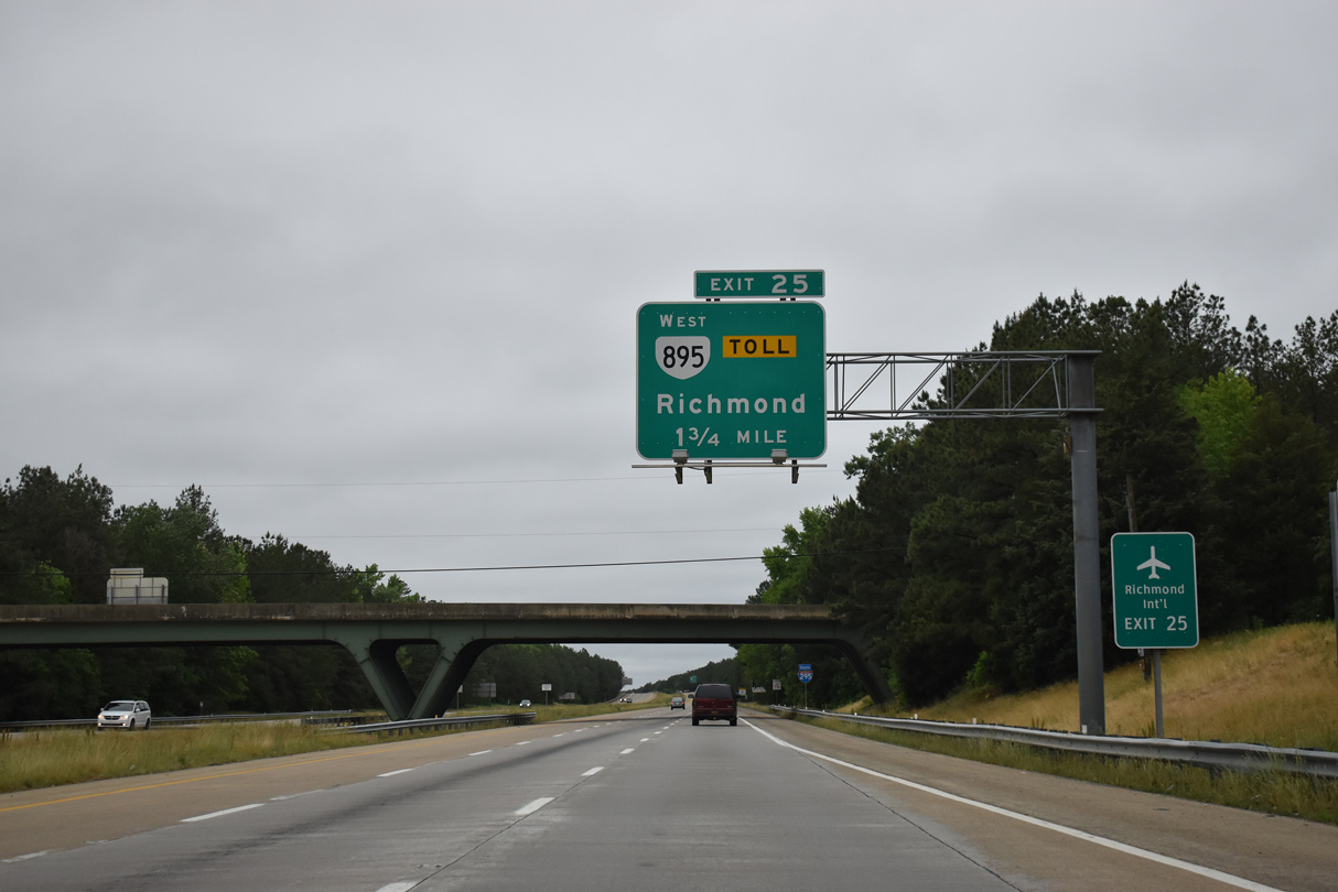
Advancing south from I-64/U.S. 60, I-295 next meets SR 895 (Pocahontas Parkway) at Exit 25. Pocahontas Parkway is an 8.8 mile long toll road west to I-95/SR 150 (Chippenham Parkway).
05/29/21
Confirming marker posted by the La France Road overpass south of White Oak Swamp.
05/29/21
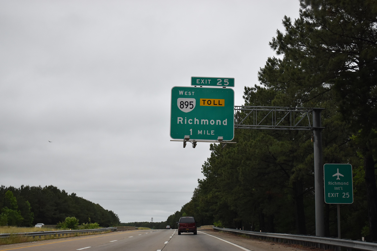
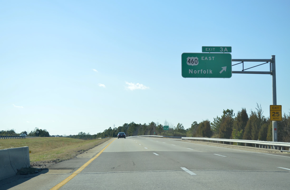
SR 895 forms a southeastern bypass of Richmond between I-295 and I-95 at Bensley. Pocahontas Parkway also serves Richmond International Airport (RIC) via Airport Drive north. The exchange with Airport Drive opened on January 14, 2011.
05/29/21
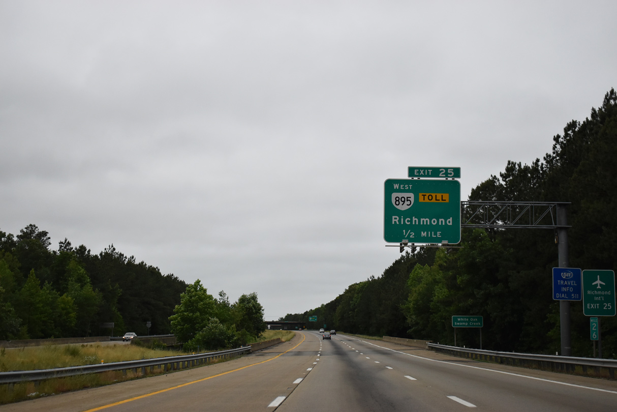
Interstate 295 spans White Oak Swamp Creek a half mile ahead of the trumpet interchange (Exit 25) with Pocahontas Parkway.
05/29/21
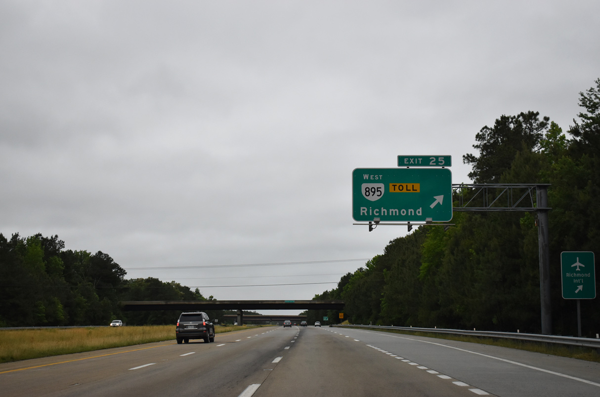
Exit 25 leaves I-295 south for SR 895 (Pocahontas Parkway) west back toward Richmond. The main line toll plaza lies east of the high level Vietnam Veterans Memorial Bridge spanning the James River.
05/29/21
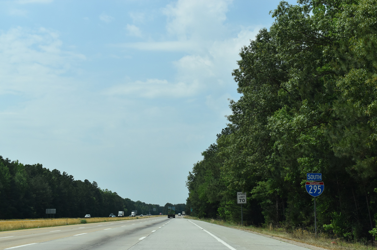
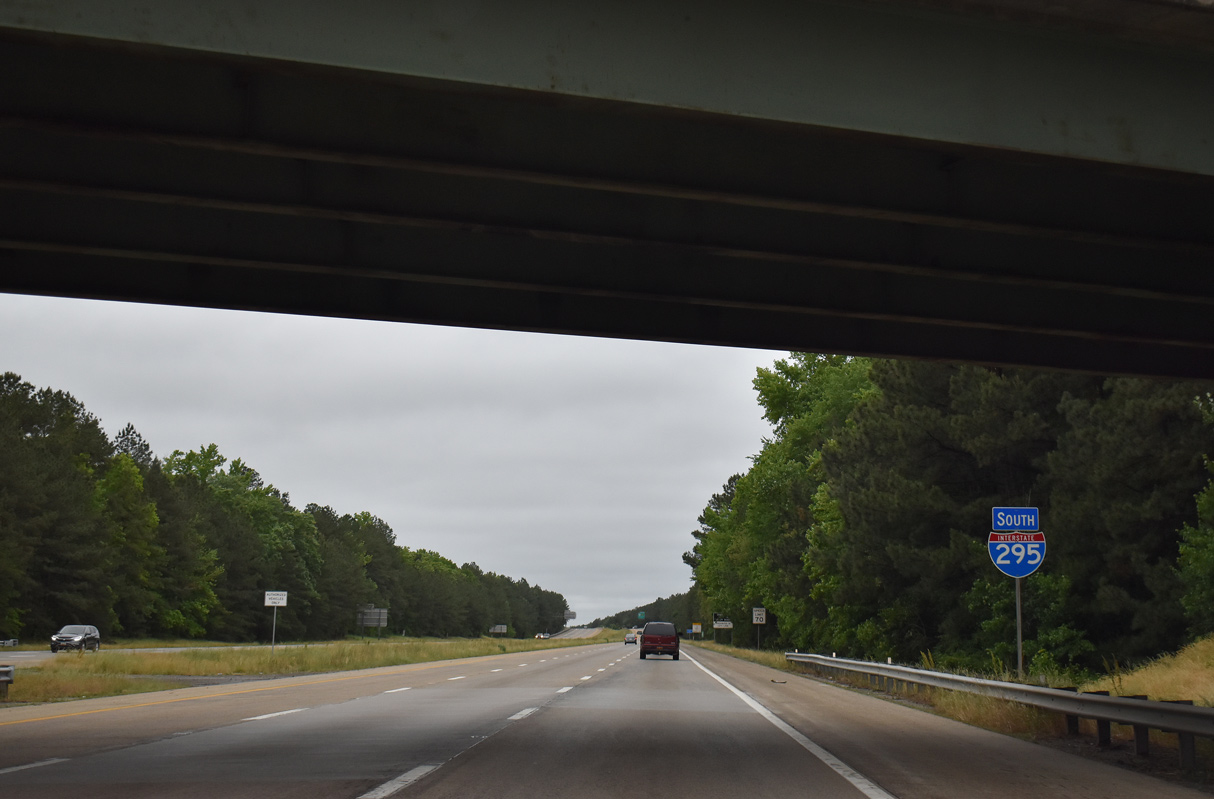
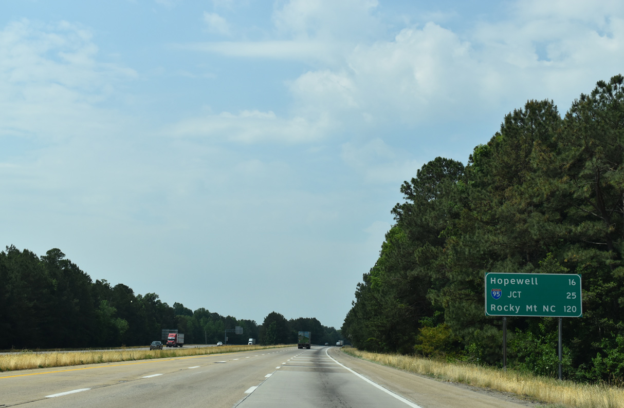
Interstate 295 continues 16 miles south from Pocahontas Parkway to Hopewell and 25 miles to I-95 outside Petersburg.
05/28/21
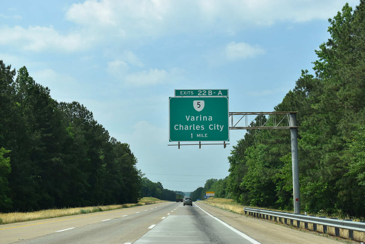
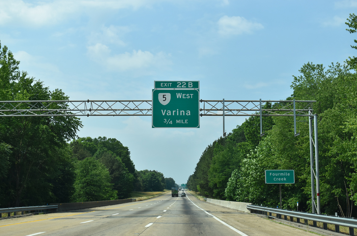
A cloverleaf interchange (Exit 22) joins Interstate 295 with SR 5 (New Market Road) in one mile.
05/28/21
Straddling the James River valley, SR 5 (New Market Road) navigates along a rural course southeast from Varina to Williamsburg.
05/28/21
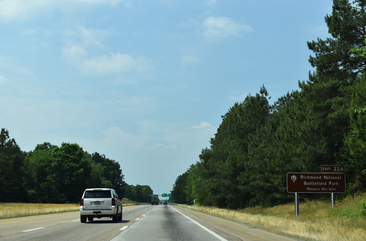
State Route 5 east to the Malvern Hill Unit of Richmond National Battlefield Park is part of the Jamestown 2007 Discovery Trail, a Virginia Scenic Byway.
05/28/21

Exit 22B departs Interstate 295 south for SR 5 (New Market Road) north to Varina, Richmond National Battlefield Park and Richmond. A 53.78 mile long route, SR 5 runs between U.S. 60 (York Street) in Williamsburg to U.S. 60 (Main Street) in Richmond.
05/28/21
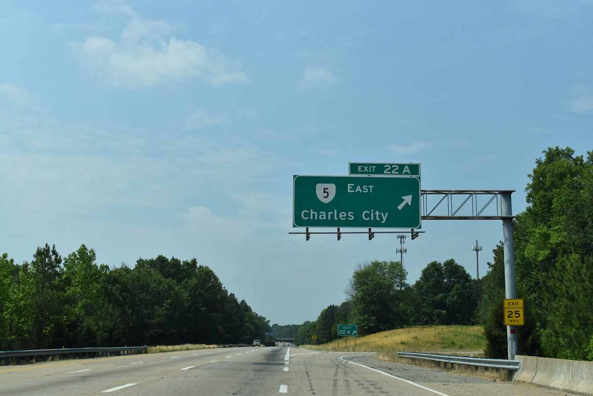
Heading east from Exit 22A, SR 5 continues along New Market Road to combine with SR 156 near Jones Neck. Charles City, seat of the same county, is 21 miles from I-295.
05/28/21
Interstate 295 enters a 6.8 mile exit less stretch that culminates with the Varina-Enon Bridge over the James River. Commercial vehicles are prohibited from the left lane of the span.
05/29/21
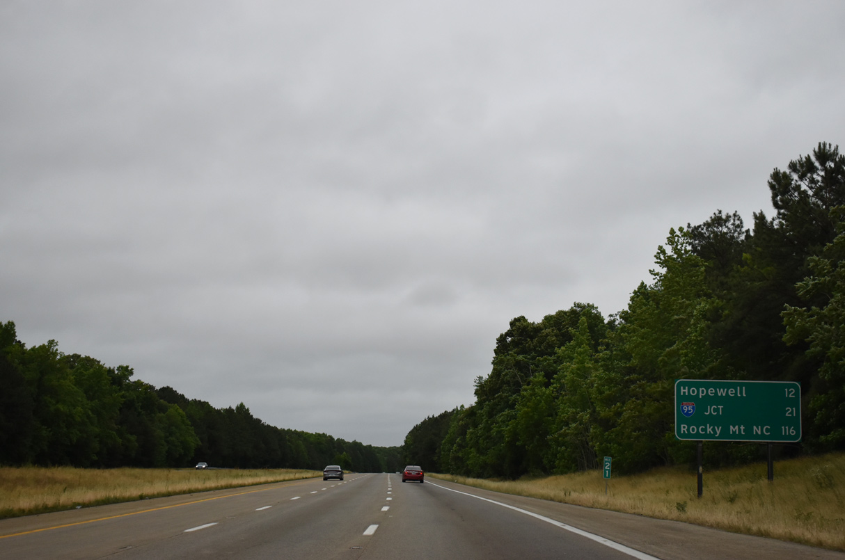
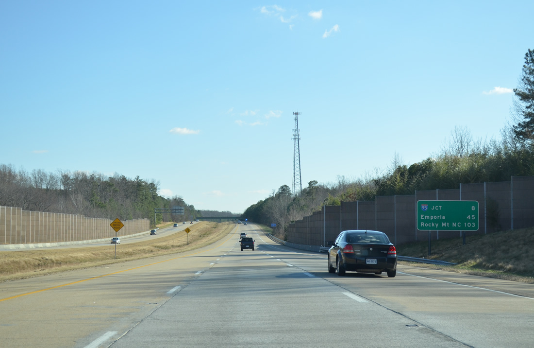
Located off of I-95 midway between Petersburg and Fayetteville, North Carolina in 116 miles, the distance to Rocky Mount appears for the first time along I-295 south.
05/29/21
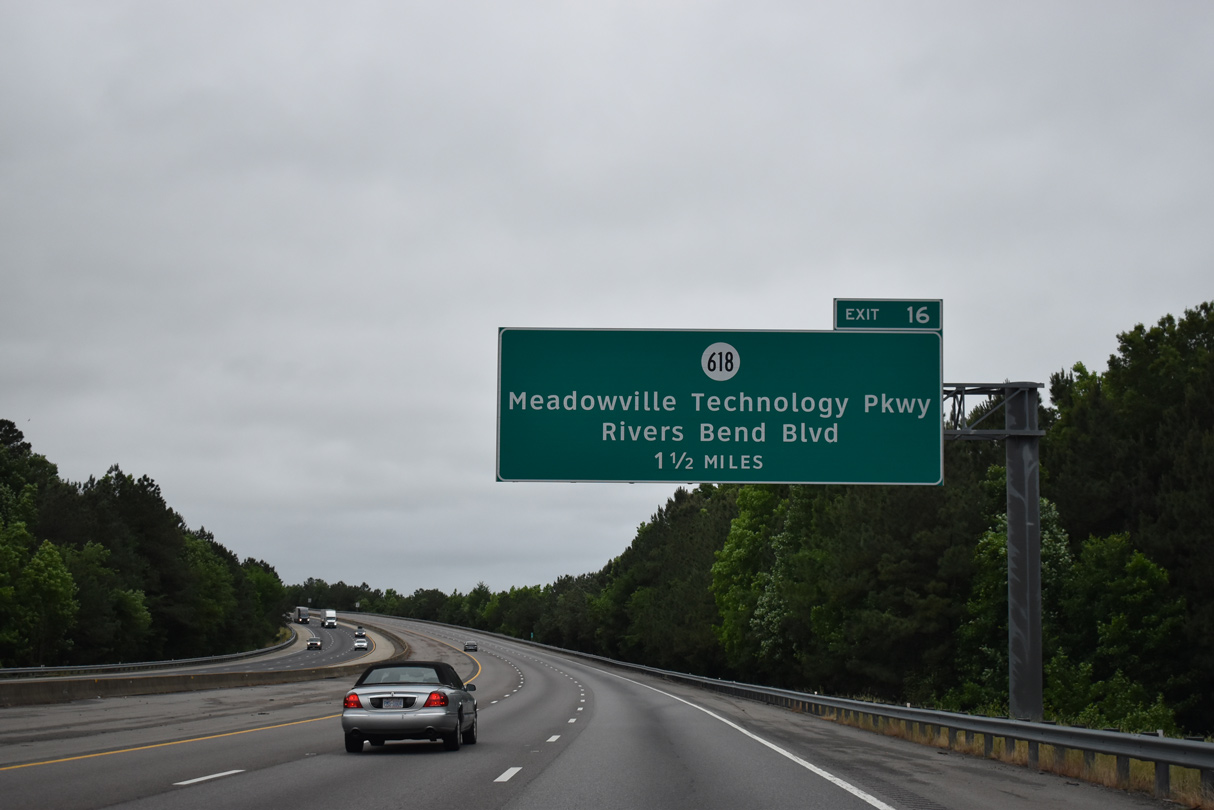
The diamond interchange (Exit 16) with SR 618 (Meadowville Technology Parkway) just south of the Varina-Enon Bridge opened to traffic on December 15, 2011.
05/29/21
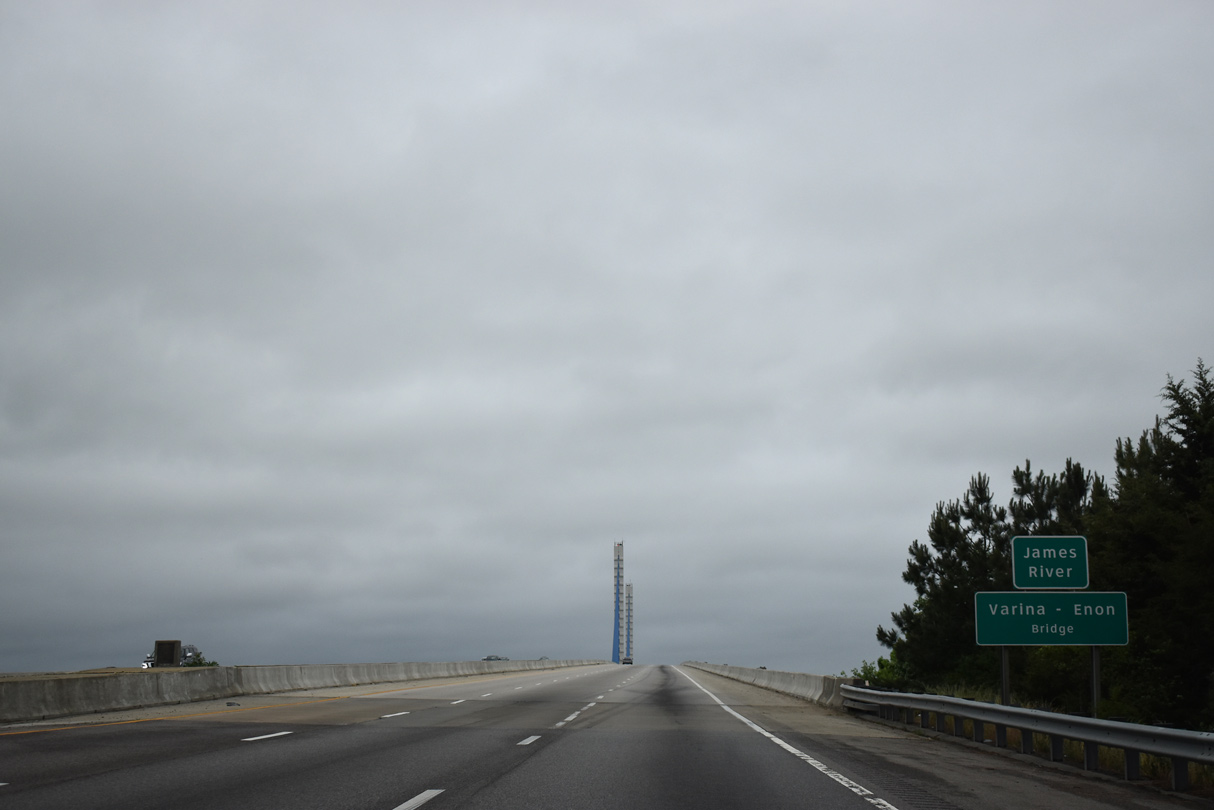
Spanning the James River with a 630 foot main span, the Varina-Enon Bridge opened to traffic in July 1990.
05/29/21
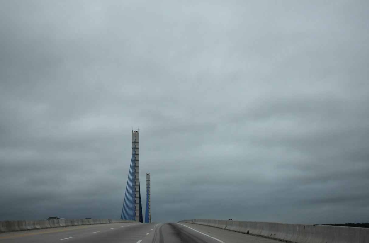
The cable-stayed bridge along I-295 is similar in design to William V. Roth, Jr. Bridge taking Delaware Route 1 over the Chesapeake & Delaware Canal and the Sunshine Skyway Bridge spanning Tampa Bay along I-275 in Florida.
05/29/21
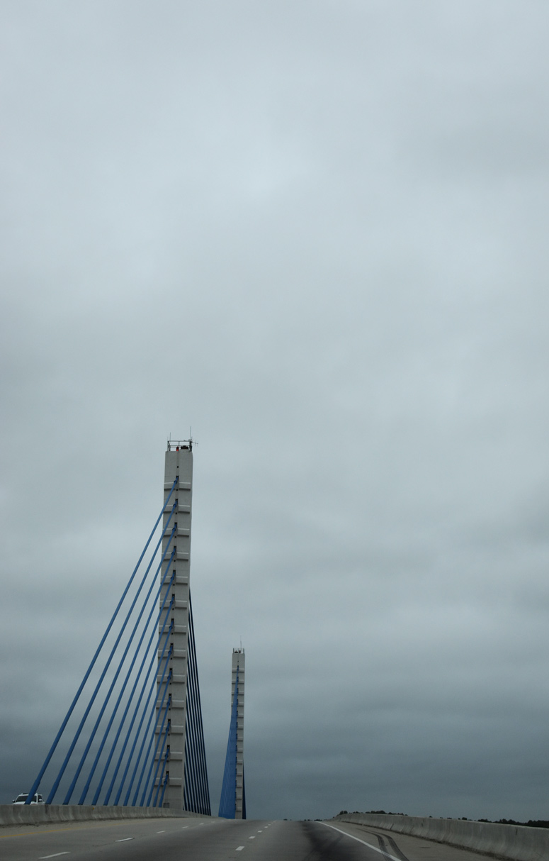
The towers supporting the Varina-Enon Bridge deck top out at 145 feet.1
05/29/21
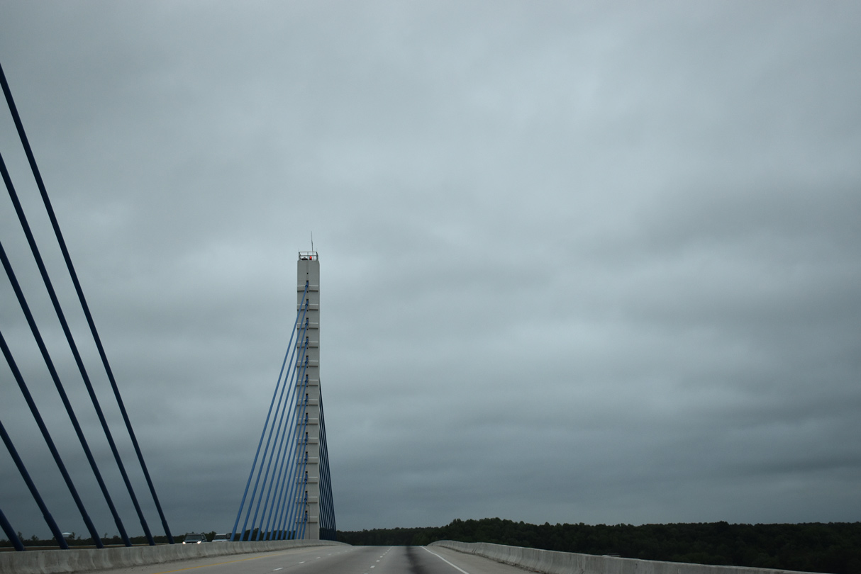
A tornado crossed over the Varina-Enon Bridge on August 6, 1993.2 Overall the span is 4,680 feet in length.3
05/29/21
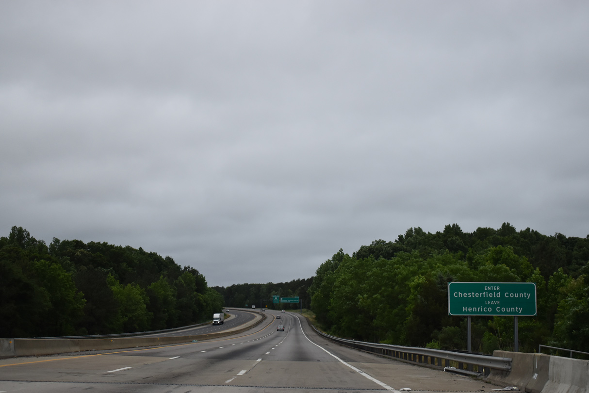
Interstate 295 crosses into Chesterfield County midway across the James River.
05/29/21
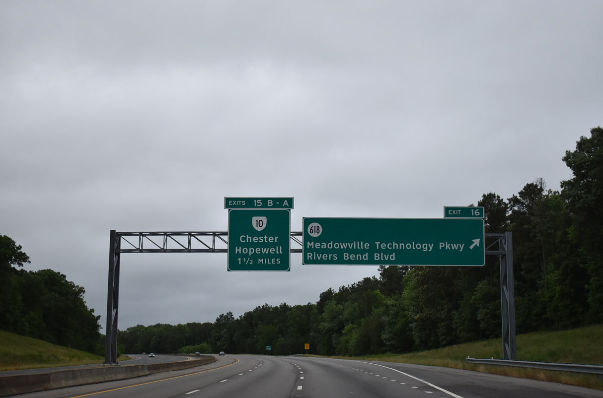
SR 618 (Rivers Bend Boulevard) arcs northeast from SR 10 (Hundred Road) to I-295 at Meadowville Technology Park. Costing $11.7 million, the exchange at Exit 16 was built in 13 months and includes provisions to be upgraded to a cloverleaf interchange.4
05/29/21
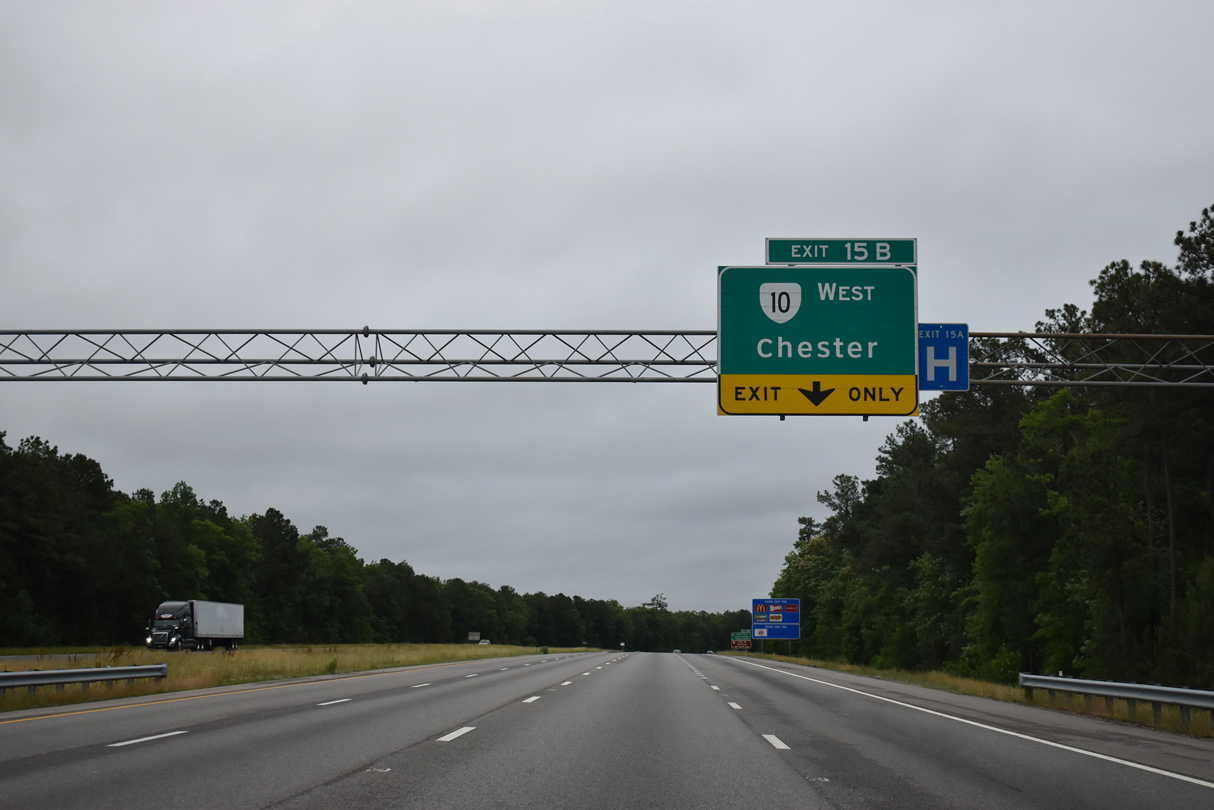
An auxiliary lane opens south from the SR 618 entrance ramp to the cloverleaf interchange with SR 10. Exit 15B joins SR 10 (E Hundred Road) west 3.9 miles to I-95 at Chester.
05/29/21
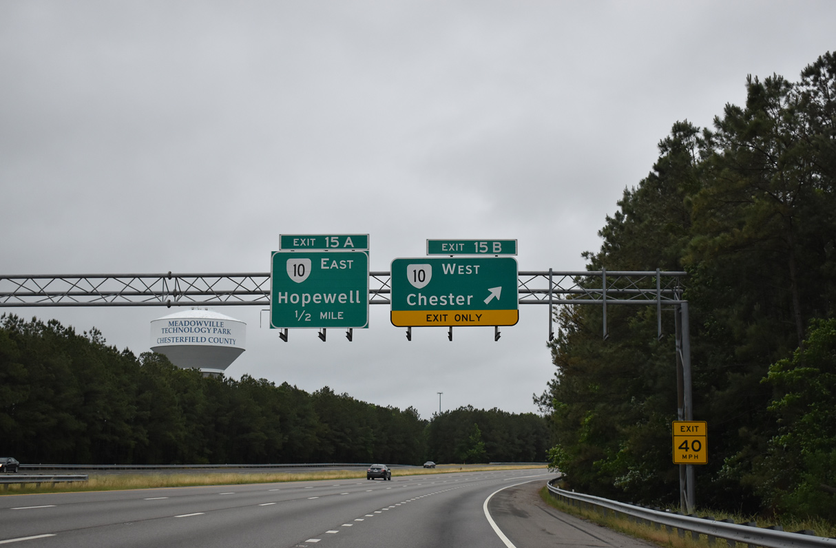
SR 10 (East Hundred Road) leads west to Dutch Gap and I-95 at Exit 61. Henricus Historical Park lies north of SR 10 west via Old Stage Road north.
05/29/21
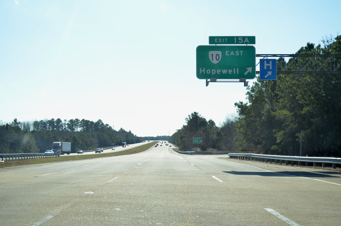
Exit 15A is the first of two linking I-295 south with the city of Hopewell. SR 10 crosses the Appomattox River into Hopewell 3.5 miles to the southeast. The state route concludes in 67 miles at Suffolk.
12/30/12
Interstate 295 progresses southward through an S-curve between several subdivisions, apartments and two schools west of Rivermont.
05/29/21
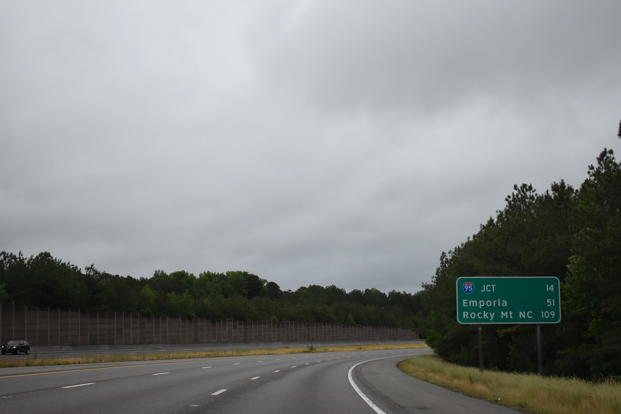
14 miles of Interstate 295 south remain. Emporia is an hour drive from the exchange with SR 10.
05/29/21
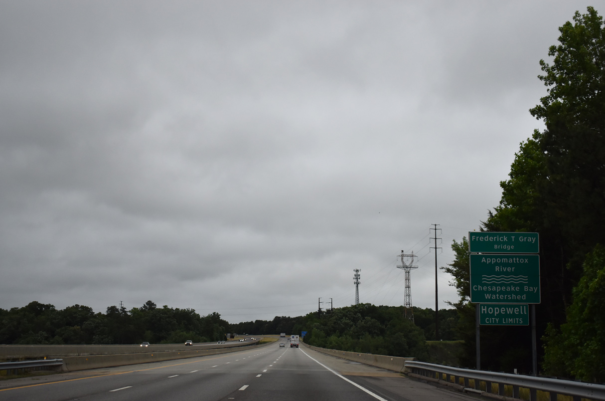
Interstate 295 spans the Frederick T. Gray Bridge over the Appomattox River. The stretch nips the western boundary of the independent city of Hopewell.
05/29/21
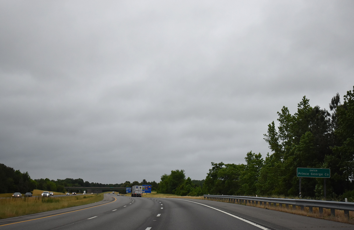
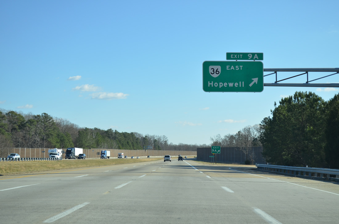
Interstate 295 straddles the boundary between Prince George County and independent city of Hopwell south from the Appomattox River to Exit 9 with SR 36 (Oaklawn Boulevard).
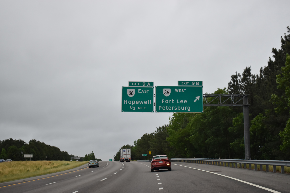
05/29/21
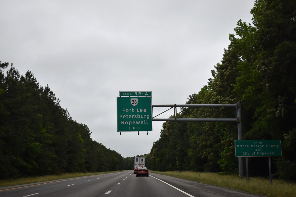
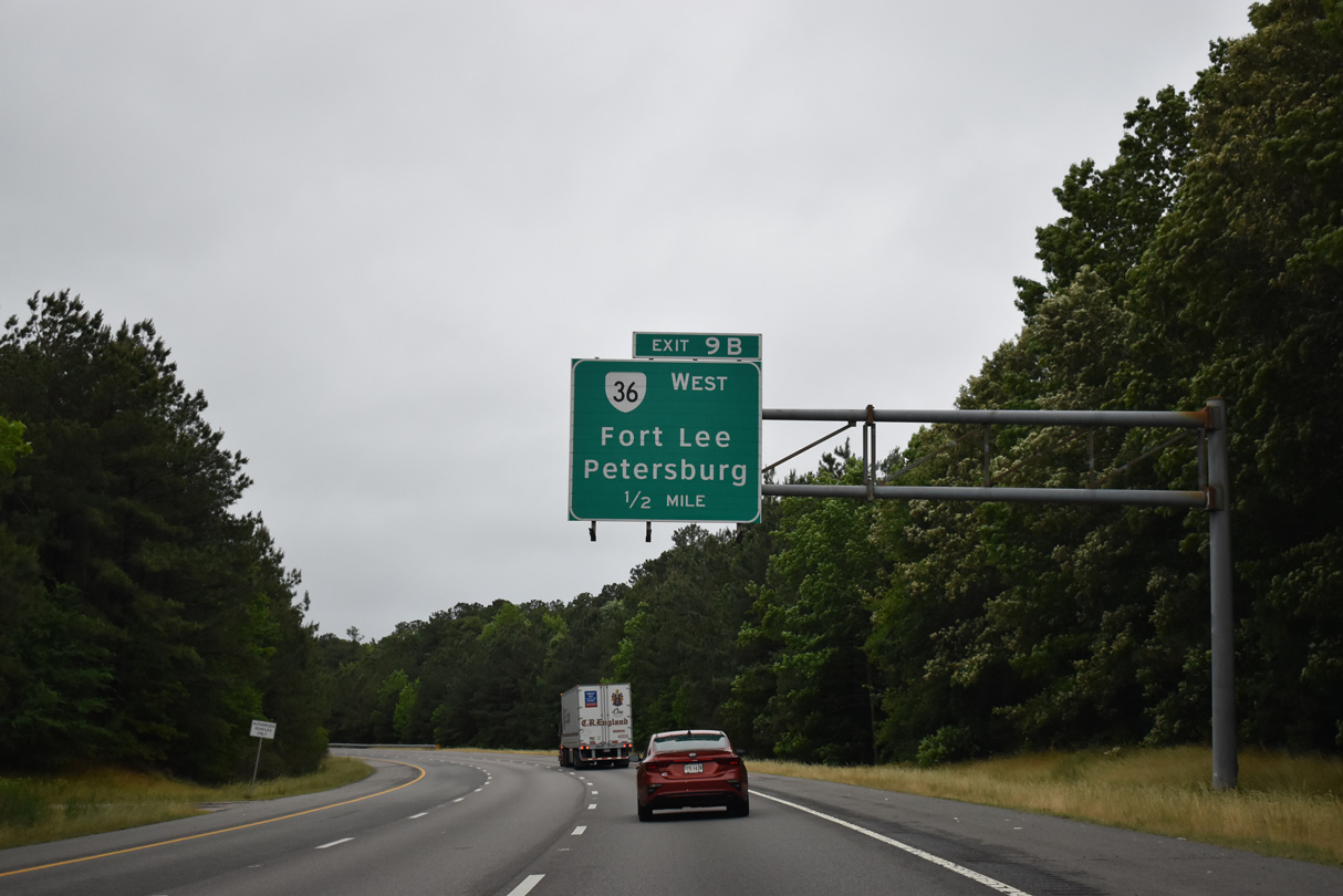
Forthcoming SR 36 (Oaklawn Boulevard) travels between Petersburg and Downtown Hopewell.
05/29/21
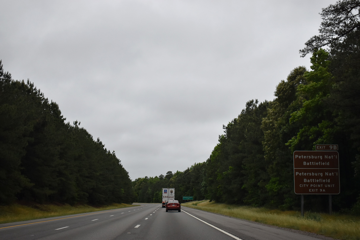
SR 36 serves the nearby Fort Lee Military Reservation and Petersburg National Battlefield.
05/29/21
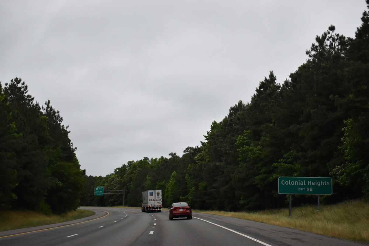
The city of Colonial Heights lies beyond the Appomattox River along SR 144 at I-95 and U.S. 301. SR 144 branches west from SR 36 in 0.75 miles.
05/29/21
SR 36 constitutes a 16.70 mile long route between Matoaca in Chesterfield County and SR 10 in the city of Hopewell.
05/29/21
Northeast from Exit 9A, SR 36 splits into a one way couplet along Oaklawn Boulevard (east) and Woodlawn Street (west) through a business district in south Hopewell.
12/30/12
The six lane portion of Interstate 295 concludes just south of SR 36.
12/30/12
Interstate 295 circumvents Fort Lee to the east on the eight mile drive to I-95 outside Petersburg.
12/30/12
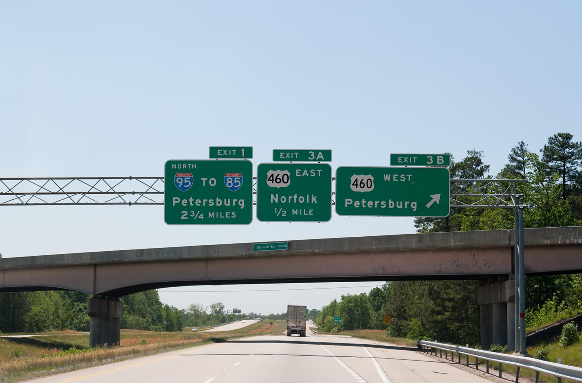
Interstate 295 arcs southwest from the SR 106 (Courthouse Road) underpass at Prince George to Exit 3 with U.S. 460 (County Drive).
12/30/12
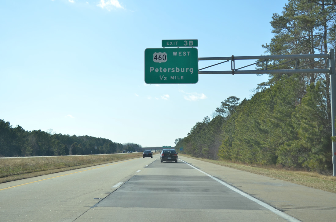
U.S. 460 (County Drive) angles southeast from Petersburg to meet I-295 by New Bohemia. U.S. 460 combines with I-95 north to Interstate 85.
12/30/12
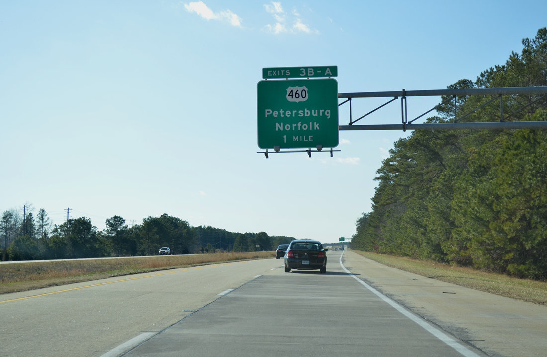
Exit 3B separates from I-295 south at the Bull Hill Road overpass for U.S. 460 west to Wagner Road and Petersburg National Battlefield. 2.75 miles of I-295 south remain.
05/08/10
U.S. 460 represents the main highway connecting Petersburg with Hampton Roads. U.S. 460 combines with U.S. 13/58 on the Suffolk Bypass in 49 miles.
12/30/12
The final southbound shield for Interstate 295 stands west of New Bohemia and Hanzlik Pond.
01/04/19
Interstate 295 combines with I-95 south via a left side entrance ramp 1.6 miles ahead.
01/04/19
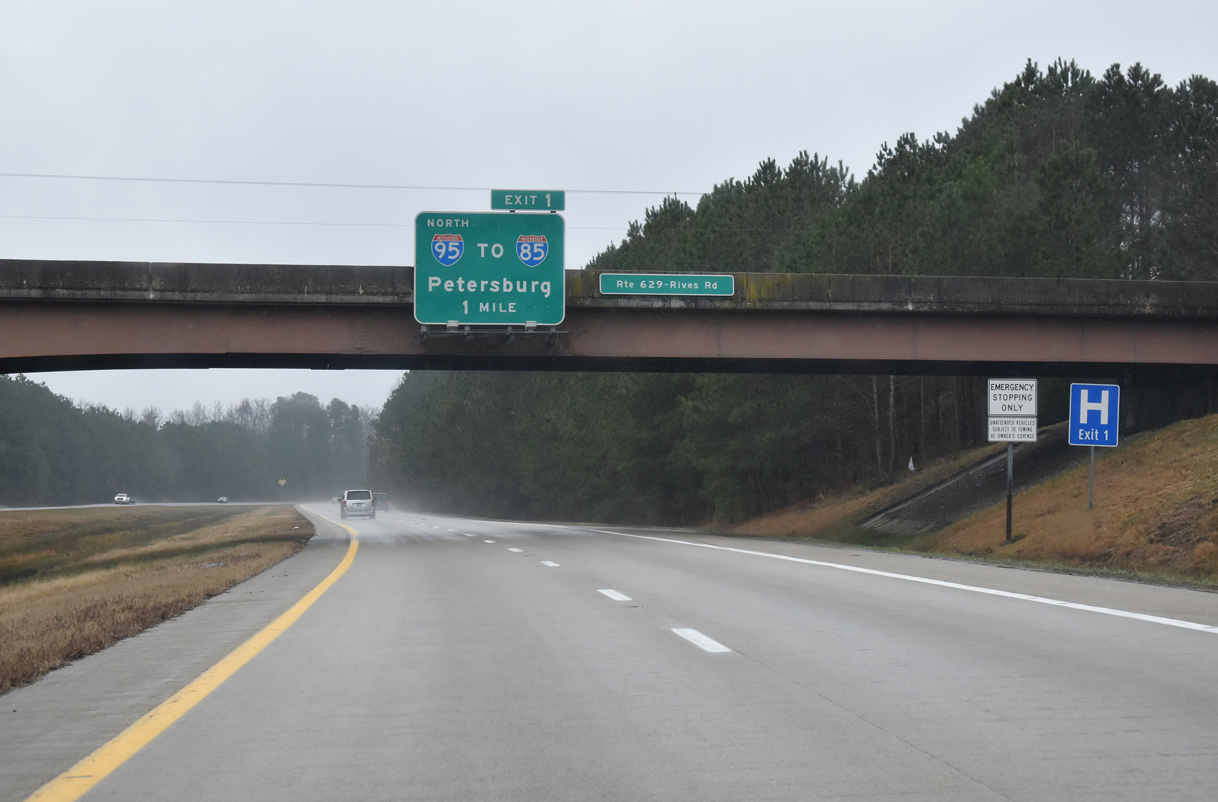
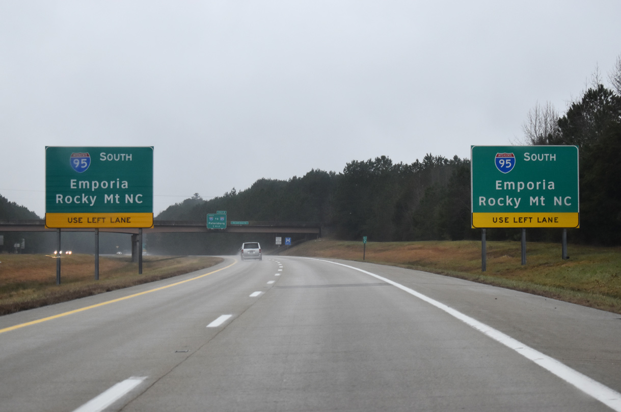
SR 629 (Rives Road) spans Interstate 295, one mile ahead of Exit 1 for I-95 north to I-85 south in Petersburg.
01/04/19
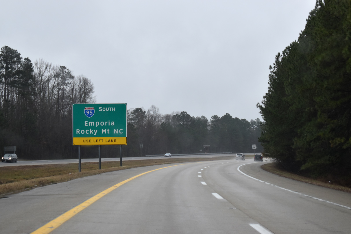
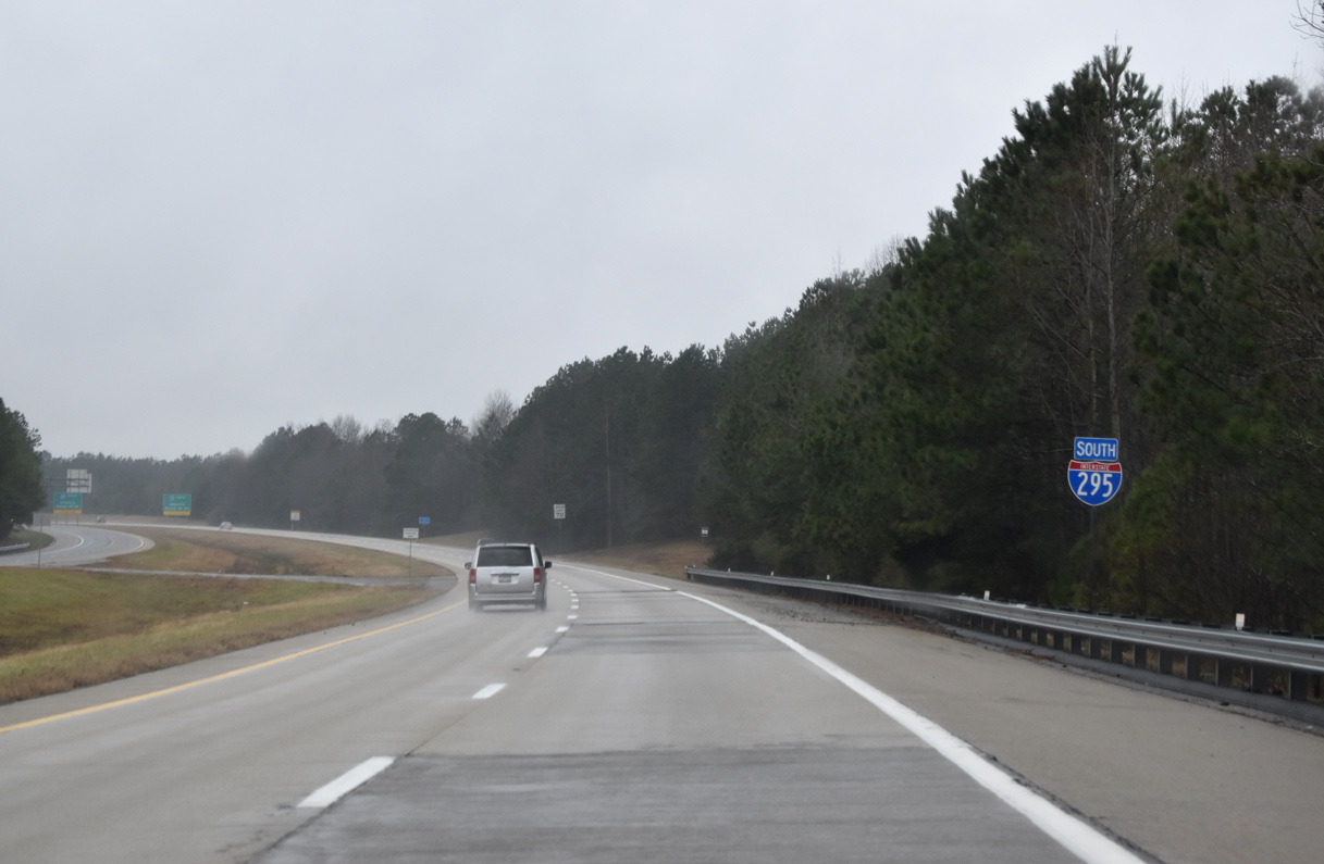
Interstate 295 ends at I-95, 34 miles north of the independent city of Emporia.
01/04/19
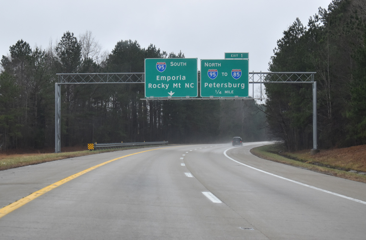
The Virginia Department of Transportation recorded 19,000 vehicles per day on the southernmost segment of I-295 in 2019. I-95 connects with I-85 south to Durham, North Carolina four miles north of Exit 1.
01/04/19
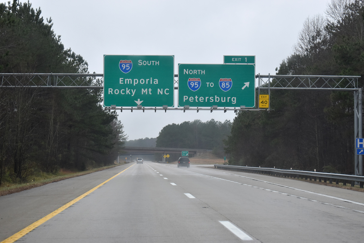
Exit 1 parts ways from I-295 south at the three wye interchange with Interstate 95.
01/04/19

References:
- Kozel, Scott. Interstate 295 in Virginia.
- FIGG Varina-Enon Bridge.
http://www.figgbridge.com/varina_enon_bridge.html - Varina-Enon Bridge @ Wikipedia.org.
- "I-295 exit 16 near technology park opens to interstate traffic." Hopewell News & Patriot (VA), December 16, 2011.
Photo Credits:
- Brent Ivy: 05/28/21, 05/29/21
- AARoads: 12/30/12
- Will Weaver: 05/08/10
- Alex Nitzman: 01/04/19
Connect with:
Page Updated Thursday August 12, 2021.