
Interstate 310 South
 South
South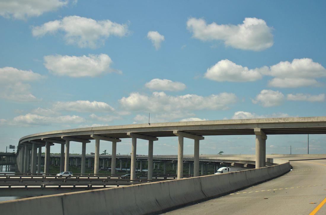
A directional T interchange joins I-10 with I-310 above wetlands west of Duncan Canal and the Jefferson Parish line. Elevated lanes continue along I-310 south to a point two miles beyond Exit 2 (U.S. 61). I-310 in conjunction with I-10 west to Exit 210 (I-55), and the southernmost 23 miles of I-55 represent the longest continuously elevated highway in the world at 38 miles.
04/20/12
06/10/06
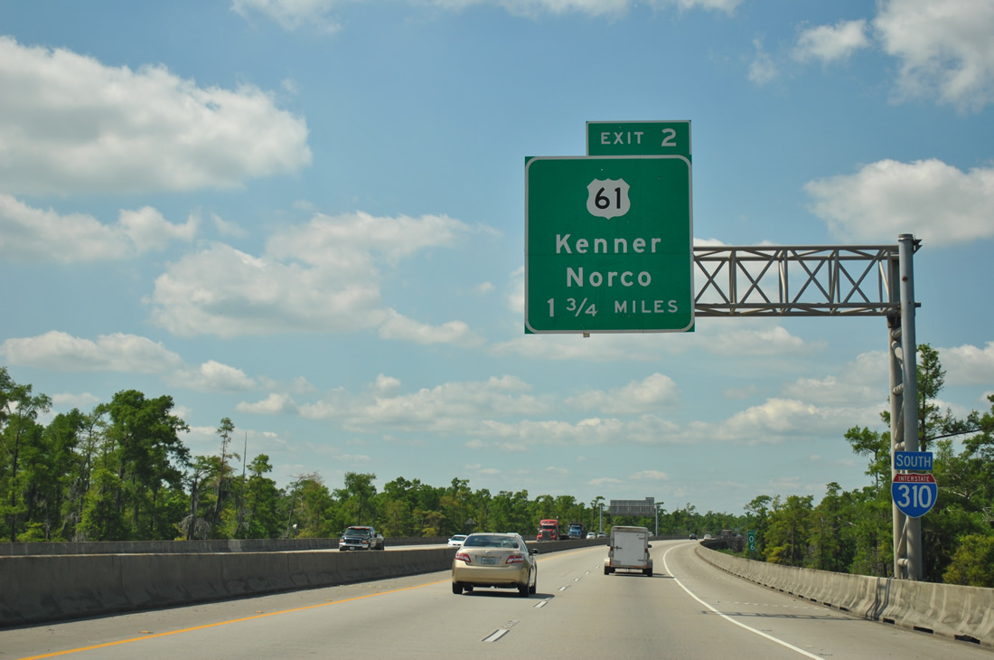
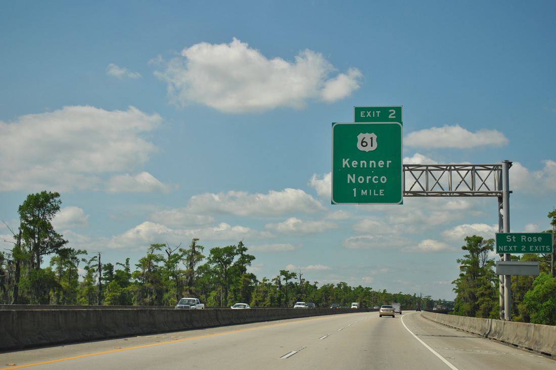
The first southbound interchange of Interstate 310 is the symmetrical stack with U.S. 61 (Airline Highway). Exit 2 serves the community of Saint Rose via nearby LA 50 (Almedia Road) and LA 626 (Saint Rose Avenue).
04/20/12
One mile north of the Exit 2 ramps to U.S. 61 (Airline Highway) along I-310 south. Airline Highway enters Jefferson Parish and the city of Kenner two miles to the east near Louis Armstrong New Orleans International Airport (MSY).
04/20/12

I-310 advances a half mile south to the ramps for U.S. 61 (Airline Highway) at Exit 2D. U.S. 61 historically overlapped with U.S. 65 southward from Natchez, Mississippi to New Orleans.
04/20/12
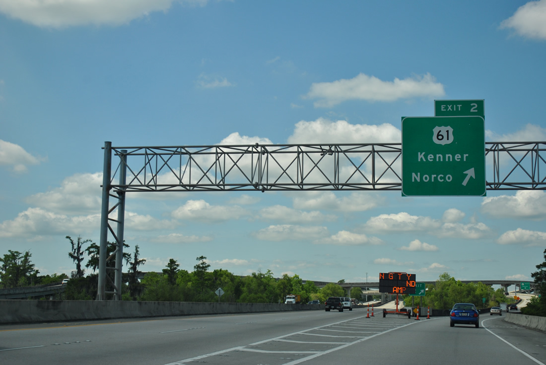
All traffic to U.S. 61 departs Interstate 310 in unison at Exit 2. Airline Highway carries U.S. 61 from Tulane Avenue in New Orleans westward to Kenner and Norco. West of I-310, U.S. 61 continues along Airline Highway to Gramercy and Gonzalez en route to the capital city of Baton Rouge.
04/20/12
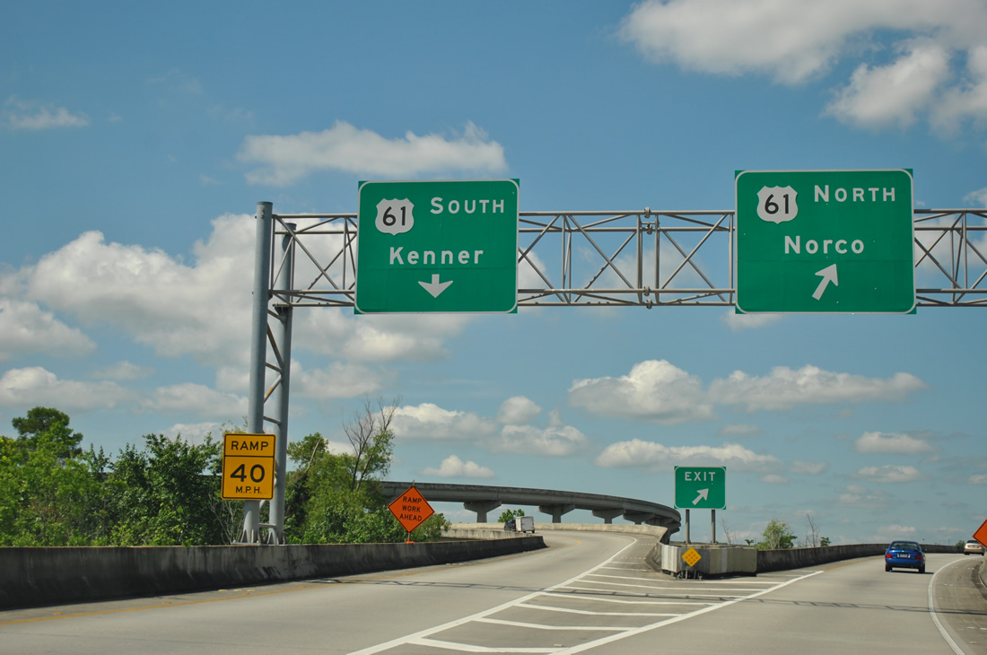
The ramp to U.S. 61 (Airline Highway) partitions into high speed ramps. U.S. 61 travels five miles west to Norco and 11 to Laplace and the south end of U.S. 51. A Shell Oil Corporation Refinery and the Cypress Plant of Dow Chemical Company reside along Airline Highway midway between I-310 and Laplace.
04/20/12
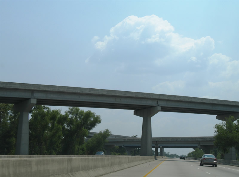
Viewing some of the high-speed flyovers that join Interstate 310 and U.S. 61 from southbound. The use of flyovers between the two highways limited the disturbance to area wetlands.
06/10/06

Interstate 310 reassurance marker posted after the U.S. 61 stack interchange. The freeway touches ground within two miles.
06/10/06
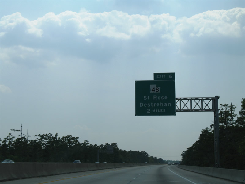
The next southbound interchange joins Interstate 310 with LA 48 (River Road) at the community of Destrehan. LA 48 follows the north banks of the Mississippi River from Harahan west to Norco.
06/10/06
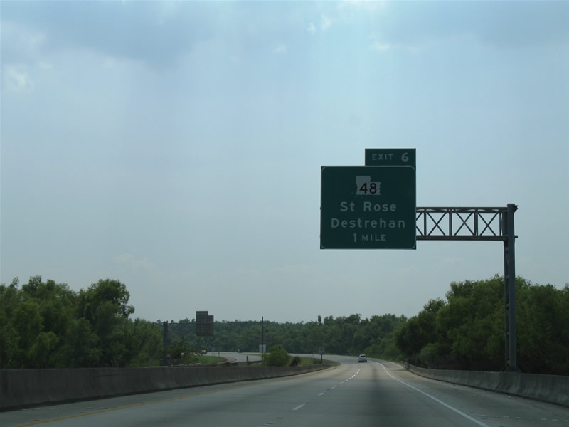
Guide signage for Exit 6 / LA 48 on Interstate 310 south. Saint Rose is shown as a control city, even though it is closer to the U.S. 61 / Exit 2 interchange to the east. Speed limits increase from 60 to 70 miles per hour as the freeway lowers from a viaduct.
06/10/06
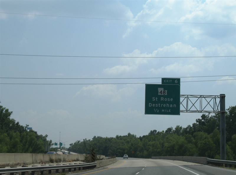
One half mile north of the directional ramps to LA 48 (River Road) on Interstate 310 south. River Road carries LA 48 west through Destrehan, New Sarpy and Good Hope on the four mile drive to Norco. St. Rose lies four miles to the east.
06/10/06
At the onset of the Mississippi River bridge on Interstate 310 southbound is the Exit 6 off-ramp for LA 48 (River Road). This highway, similar to LA 18 on the south banks of the river, straddles the north banks of the Mississippi.
06/10/06
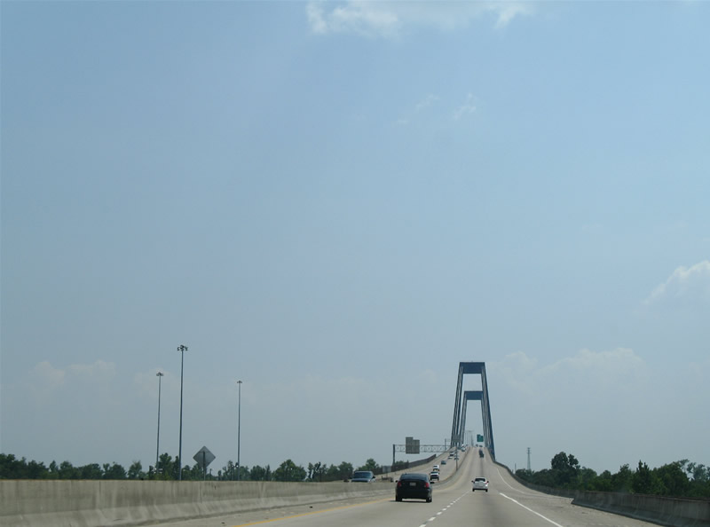
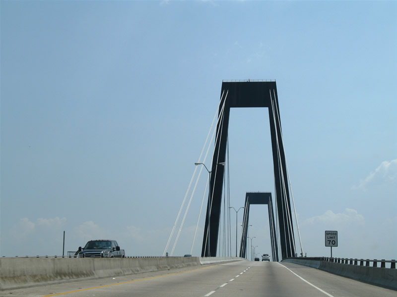
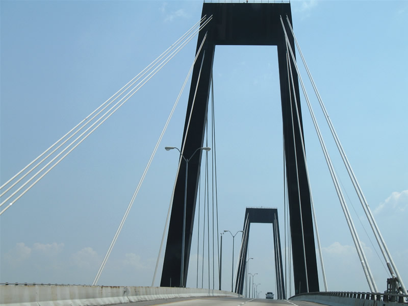
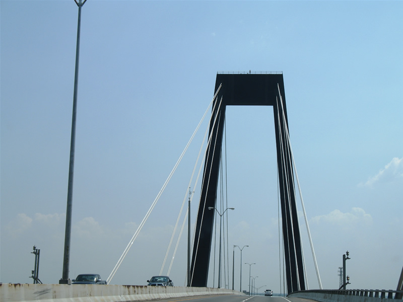
Southbound Interstate 310 crosses the Hale Boggs Bridge over the Mississippi River. Both approaches to the cable-stayed bridge are greeted with interchanges.
06/10/06
The Hale Boggs Bridge opened to traffic in 1983 and received the 1984 Outstanding Civil Engineering Achievement Award by the American Society of Engineers. The bridge replaced a ferry service and is located 121.7 miles upstream from the mouth of the Mississippi River.1
06/10/06
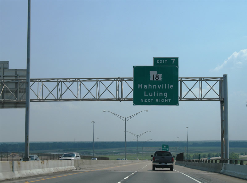
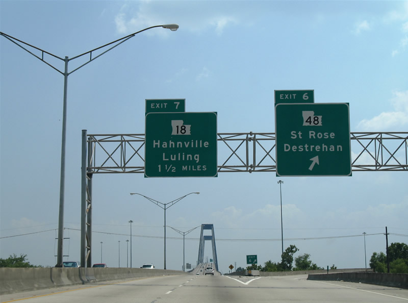
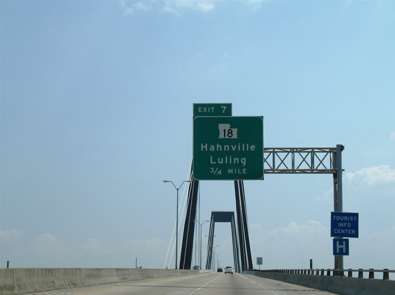
Continuing southward toward the Exit 7 directional stack interchange with LA 18 (River Road). LA 18 follows the south banks of the Mississippi River through the St. Charles Parish seat of Hahnville to the west and Luling to the east.
06/10/06
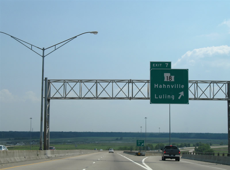
Drivers bound for LA 18 (River Road) depart Interstate 310 southbound at Exit 7. LA 18 heads 16 miles west from U.S. 90 at Bridge City through Avondale, Waggaman, Ama, Lone Star, and Luling to Interstate 310. The state highway continues northwest 16 miles to Hahnville, Killona, and the St. John the Baptist Parish seat of Edgard.
06/10/06
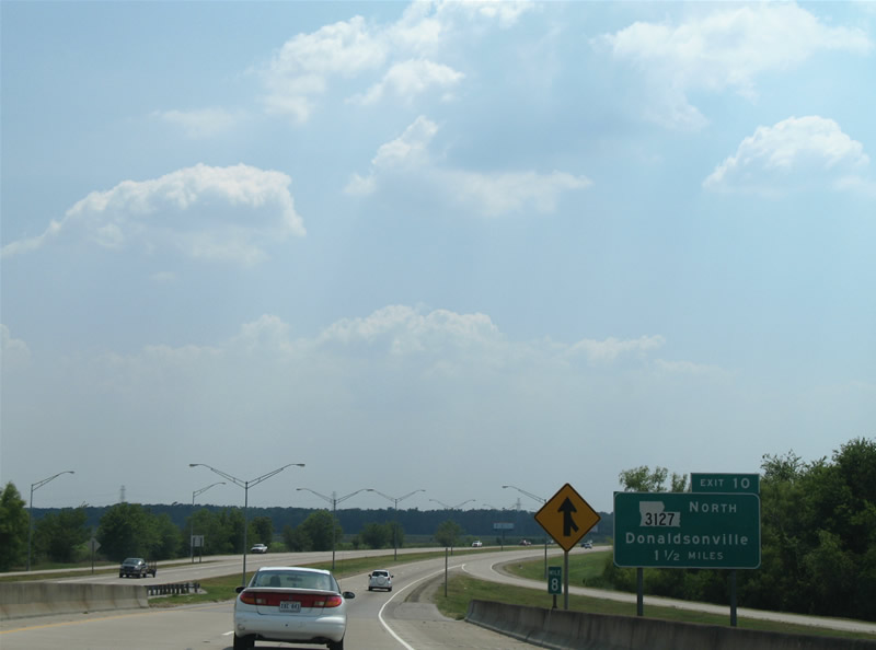
The 1.50 mile guide sign for LA 3127 (Exit 10) resides at the LA 18 on-ramp to Interstate 310 south. Interstate 310 merges with LA 3127 ahead of its final approach to Boutte.
06/10/06
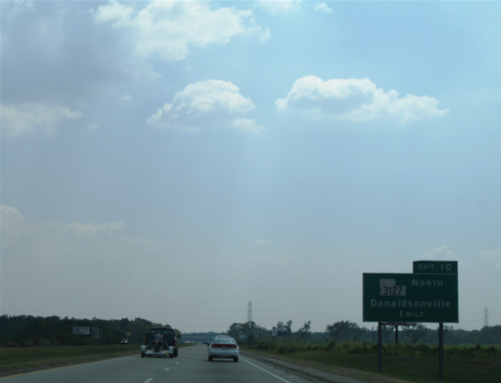
LA 3127 north travels 44 miles to Donaldsonville in Ascension Parish. The state highway follows a multi-lane divided highway seven miles northwest to LA 3141 at Killona.
06/10/06
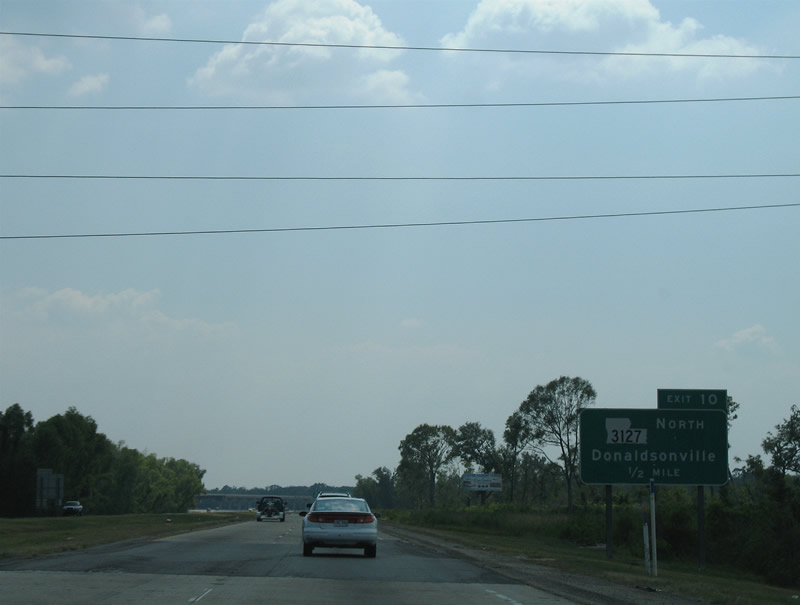
A high-speed directional interchange facilitates the movements between Interstate 310 and LA 3127 at Exit 10. LA 3127 stays south of the Mississippi River as a bypass route of LA 18 for such communities as Edgard, Vacherie, St. James, and Welcome.
06/10/06
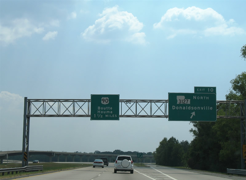
Interstate 310 turns southeast on the 1.50 mile drive to U.S. 90 near Boutte. Departing here is Exit 10 to LA 3127 north. Donaldsonville represents the seat of Ascension Parish, a parish within the Baton Rouge metropolitan area.
06/10/06
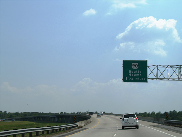
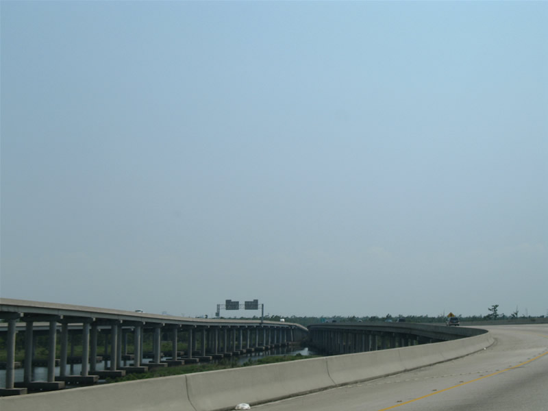
Interstate 310 & LA 3127 south travel over Eighty Arpent Canal on the 1.25 mile approach to U.S. 90. U.S. 90 comprises the most direct route between the greater New Orleans area and the TerreBonne Parish cities of Raceland, Thibodaux, and Houma. The US highway travels the future Interstate 49 freeway west from the parish to Morgan City, Franklin, and Jeanerette.
06/10/06
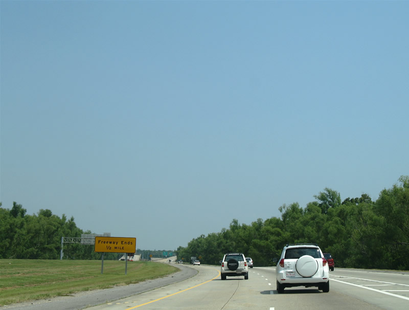
Freeway ends one half mile sign posted ahead of the Interstate 310 & LA 3127 viaduct over LA 631 (Old Spanish Trail) and a BNSF Railroad. LA 631 represents the original alignment of U.S. 90 west from Boutte to Paradis and Des Allemands.
06/10/06
Freeway stubs are in place at the current half diamond interchange of Interstate 310 & LA 3127 and U.S. 90 for an eventual southward extension to future Interstate 49.
06/10/06

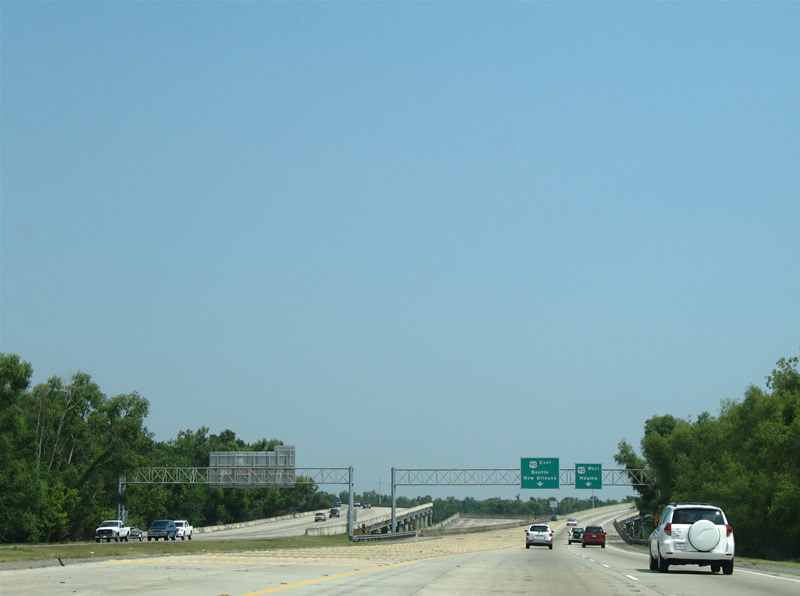
Interstate 310 southbound at the current southern terminus. At present all traffic is directed to the unnumbered off-ramp onto U.S. 90. Houma represents the next major destination for U.S. 90 westbound traffic. The community resides 31 miles to the southwest.
06/10/06
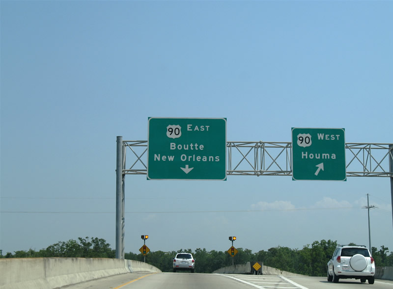
Traffic splits for ramps to U.S. 90 east to Boutte, Westwego, Jefferson, and New Orleans, and U.S. 90 west to Houma, Morgan City, and Lafayette. LA 3127 ends at the traffic light ahead.
06/10/06
References:
- "Major Bridges of Louisiana." Preconstruction Pages (LADOTD), Volume 2,1.
Photo Credits:
- ABRoads: 04/20/12
- Alex Nitzman: 06/10/06
Connect with:
Page Updated Friday September 07, 2012.