
Interstate 405 North - Tukwila to Bellevue

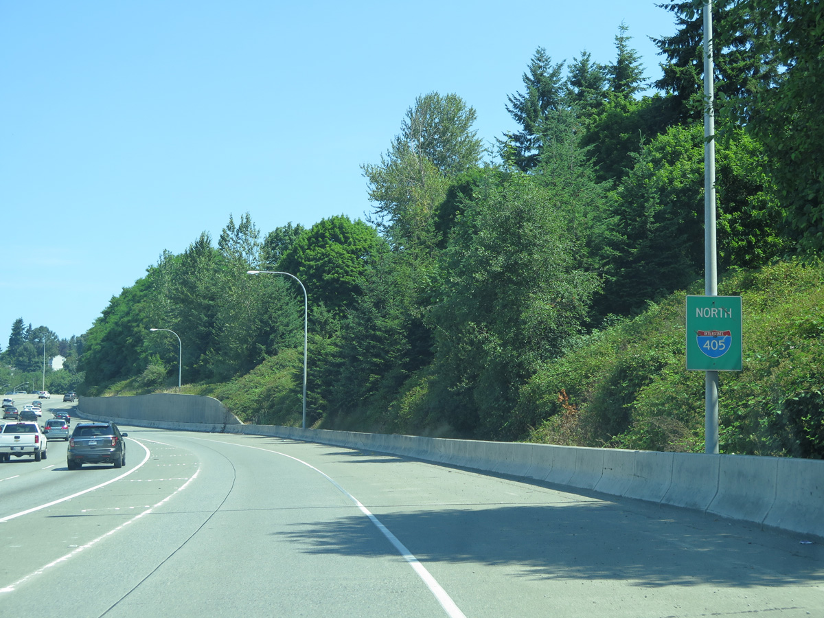
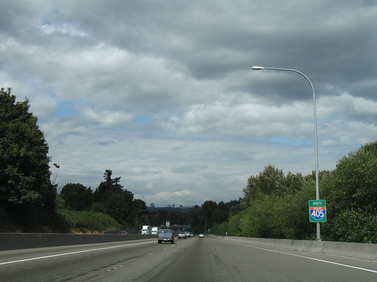
 North
North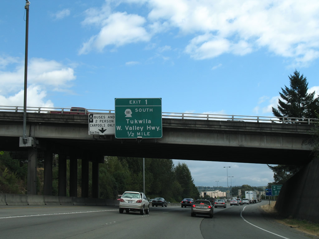
Interstate 405 leaves the directional cloverleaf interchange with I-5/SR 518 and passes by Southcenter Mall within the city of Tukwila. A folded diamond interchange (Exit 1) ahead joins the freeway with the north end of SR 181.
08/29/06
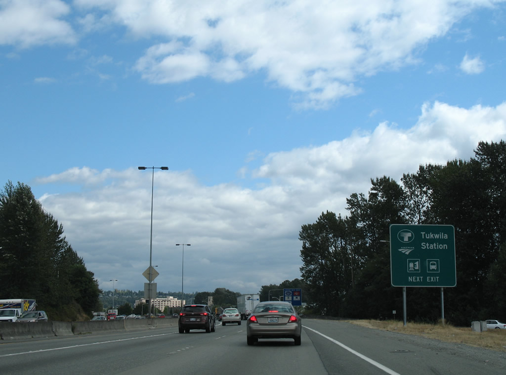
Tukwila Station is located south of Exit 1 and east of SR 181 (West Valley Highway) at Longacres Way and Drive.
08/29/06
An on-ramp adds traffic from parallel Tukwila Parkway at the first reassurance shield for Interstate 405.
08/29/06
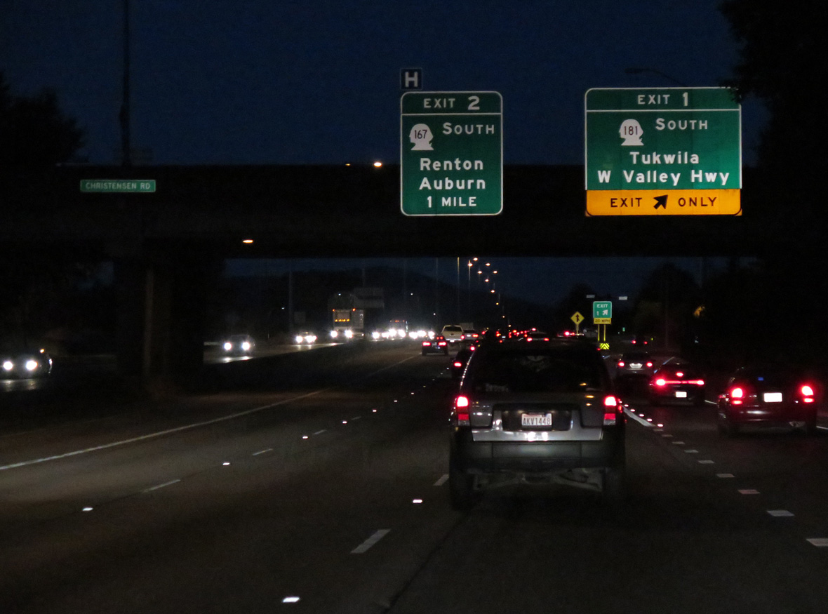
Exit 1 departs Interstate 405 north at the Christensen Road overpass. The freeway spans the Green River just west of SR 181. SR 181 constitutes a 6.05 mile long route between Tukwila and SR 516 near the Kent city center. SR 181 originally continued north via Interurban Avenue to Boeing Access Road and the junction of I-5 and SR 900 at Exit 158.1
06/24/15
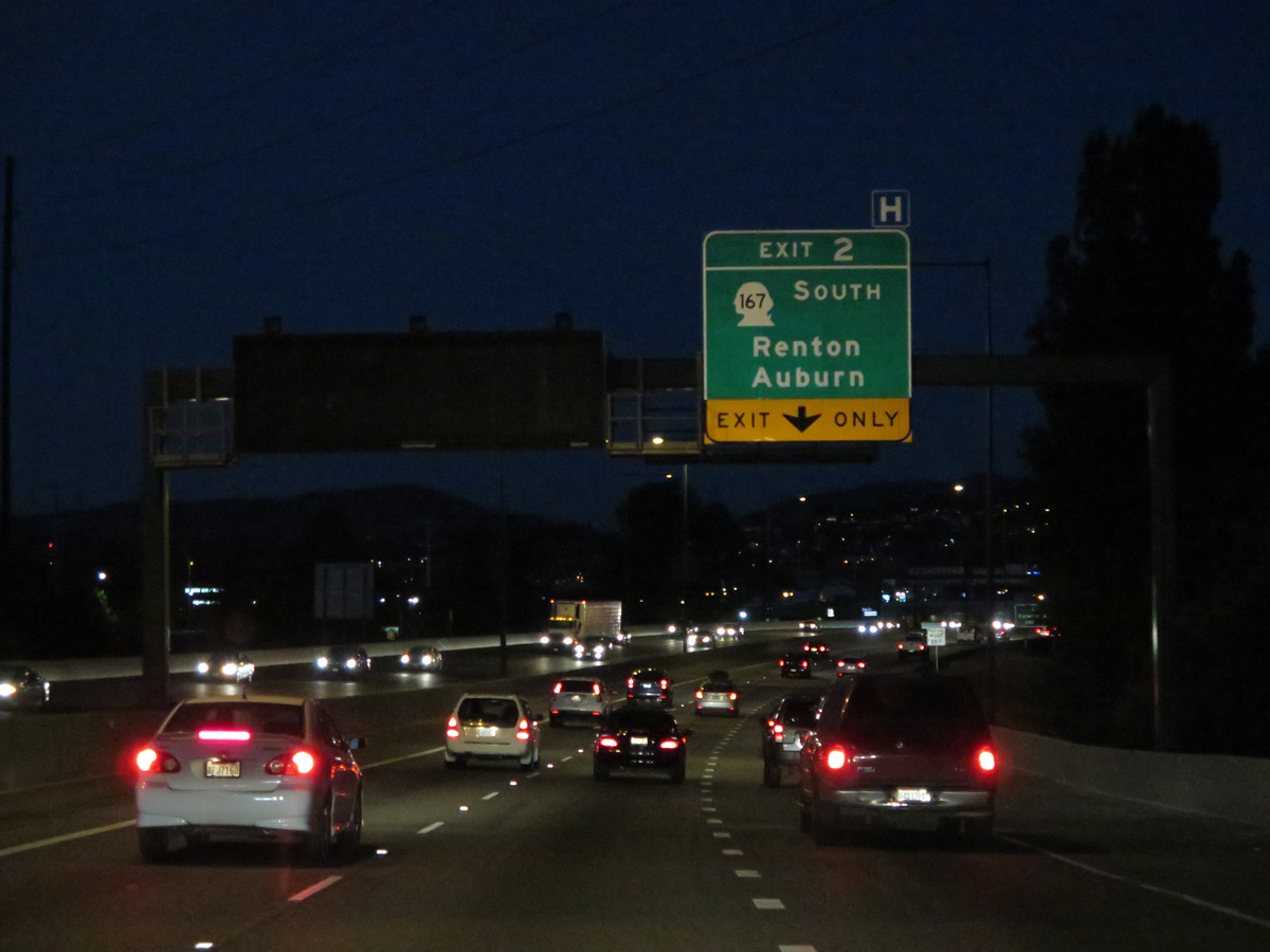
Continuing east, Interstate 405 enters the city of Renton and meets SR 167 at Exit 2.
06/24/15
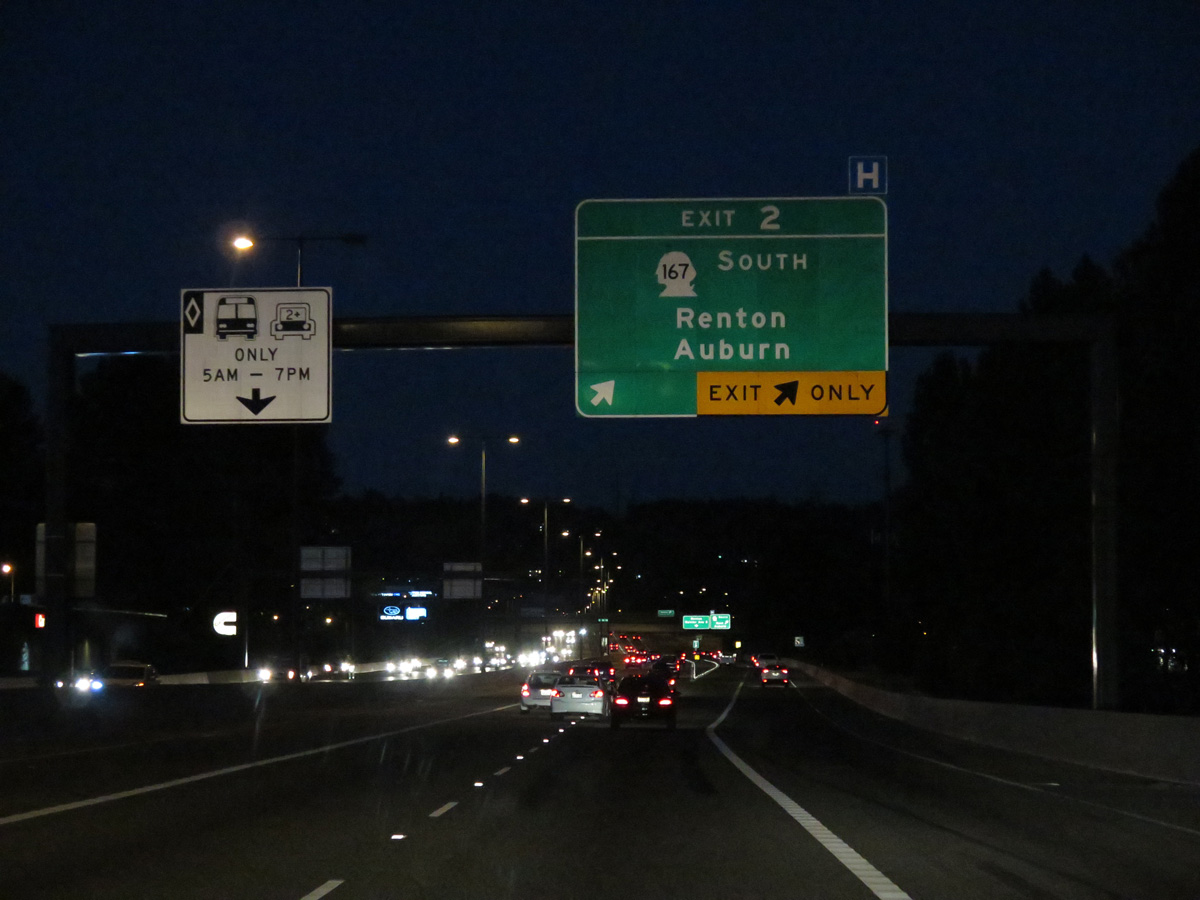
Interstate 405 follows a viaduct over Union Pacific and BNSF Railroad lines and Longacres Drive SW ahead of Exit 2. SR 167 travels 28.49 miles south from Renton to Auburn, Sumner, and Puyallup, mostly as the Valley Freeway, before turning west to Tacoma along former U.S. 410.
06/24/15
A collector distributor roadway connects with SR 167 south to Kent and north to the Renton city center. A busy commuter freeway, SR 167 includes HOT (High Occupancy Toll) lanes from SW 41st Street in Renton to 15th Street SW at the Auburn / Algona city line. Toll lanes were added to the freeway in 2008.
08/29/06
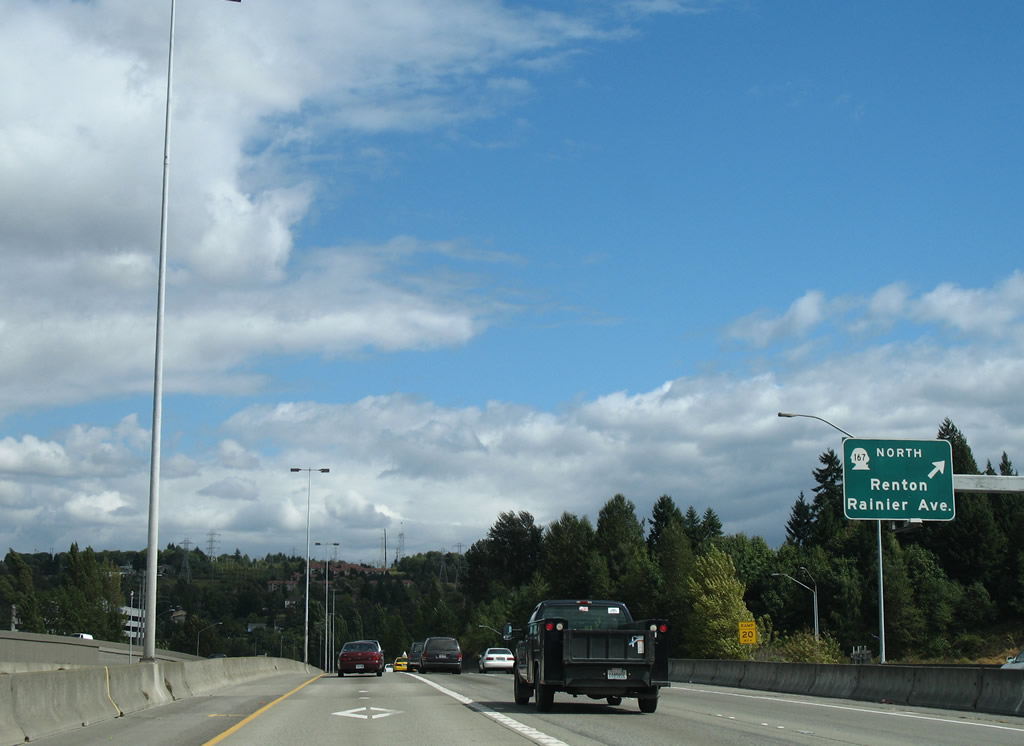
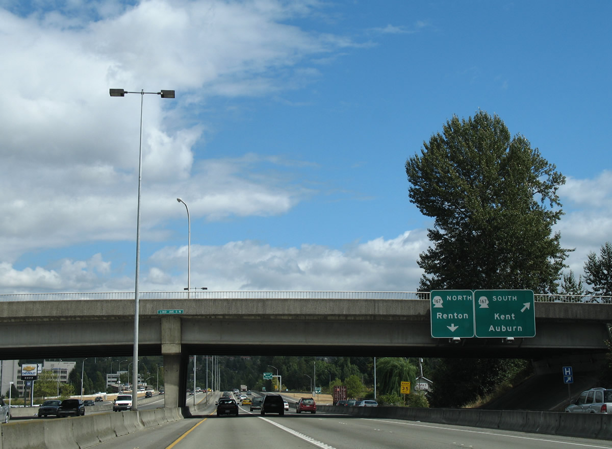
SR 167 follows Rainier Avenue north from the Valley Freeway at Grady Way nearby to end at SR 900 (Sunset Boulevard). Until 1991, SR 167 continued north from Renton via Rainier Avenue to Bryn Mawr, Lakeridge and Mt. Baker in Seattle.2
08/29/06
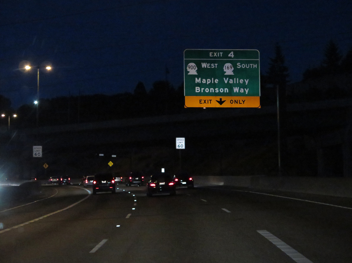
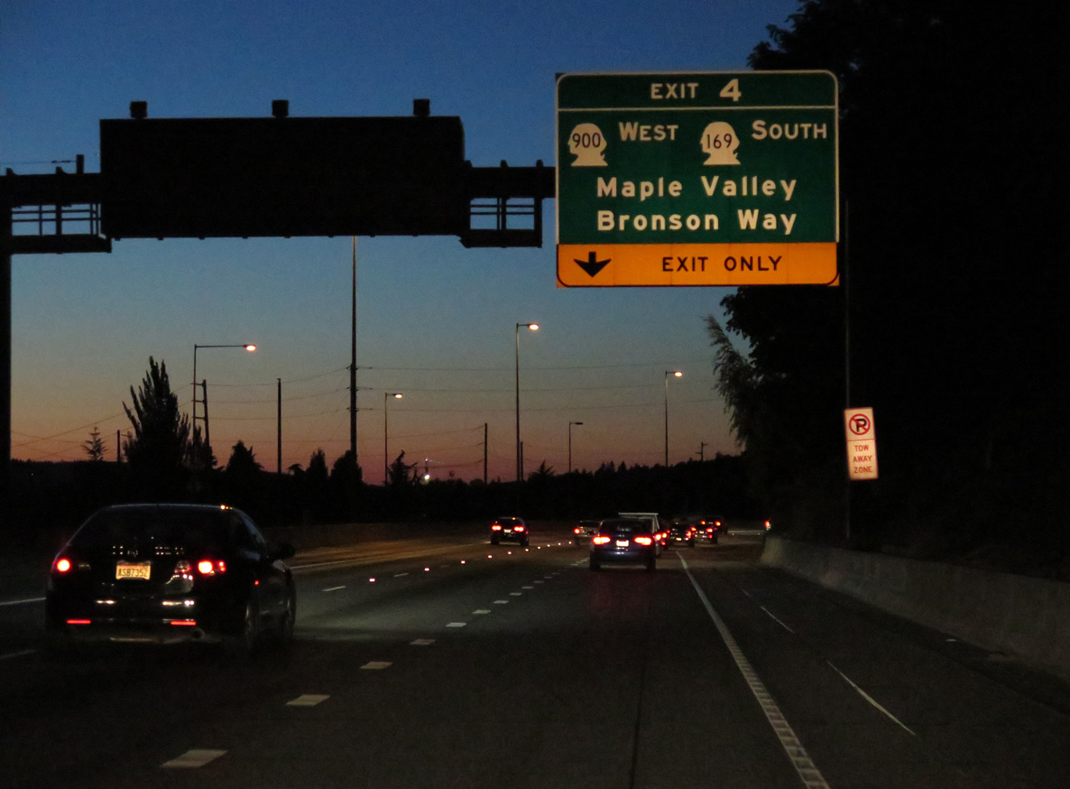
Interstate 405 makes a northward turn encircling the Renton city center to Exit 4 with SR 169 (Maple Valley Highway) to SR 900 (Sunset Boulevard / Bronson Way). SR 900 comprises a 5.62 mile route from Exit 4 west to Boeing Access Road by I-5 at Exit 158.
06/24/15
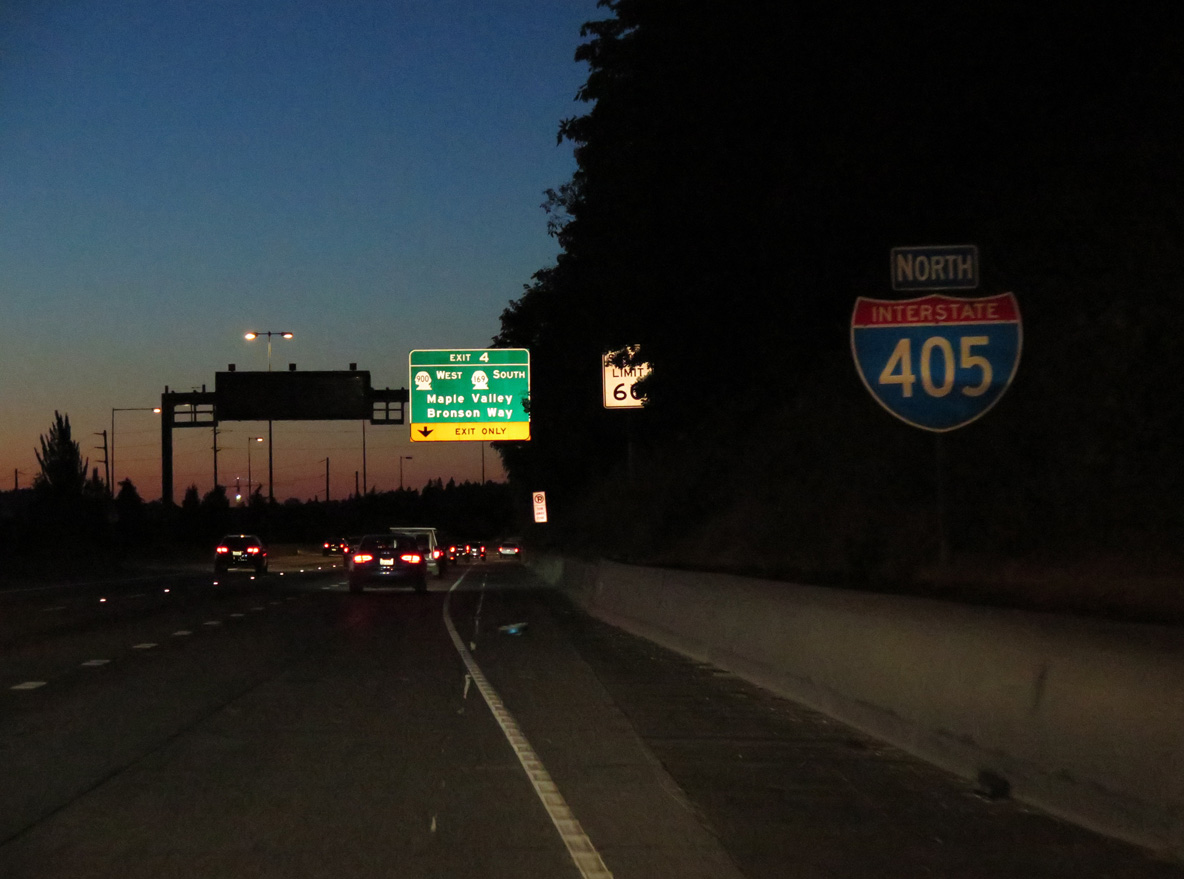
A parclo interchange joins Interstate 405 with SR 169 (Maple Valley Highway) at Exit 4.
06/24/15
SR 169 begins at adjacent SR 900 and travels east 13 miles to Maple Valley and 25.15 miles overall to SR 164 at Enumclaw.
06/24/15
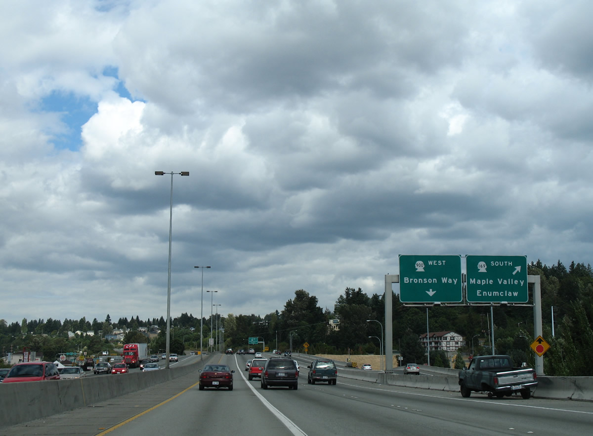
Exit 4 partitions and provides a loop ramp onto SR 169 west for SR 900. SR 900 west begins at a half diamond interchange with I-405 nearby and follows Sunset Boulevard alongside the freeway to Maple Valley Highway. Bronson Way carries the route southwest to S 2nd Street and the Renton city center.
08/29/06
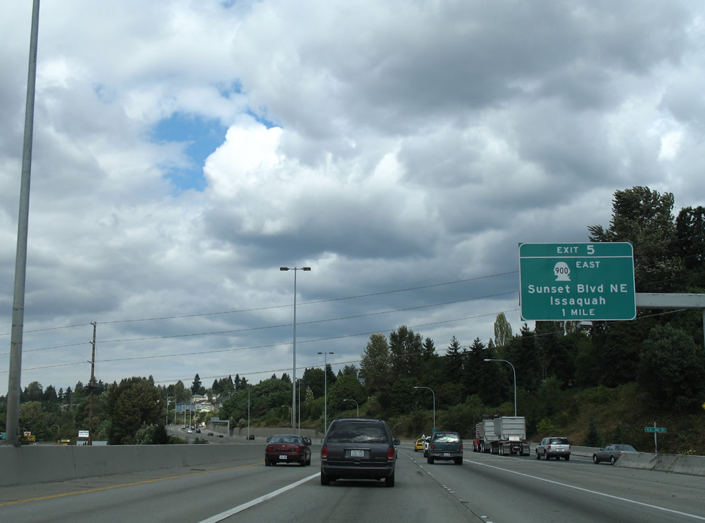
Traveling north, Interstate 405 meets Southport Drive west and SR 900 (NE Park Drive) east to Sunset Boulevard NE and Issaquah. Southport Drive leads west to Logan Avenue, The Landing retail complex and Boeing's Renton operations.
08/29/06
Confirming marker posted north beyond the NE 3rd Street underpass.
06/27/15
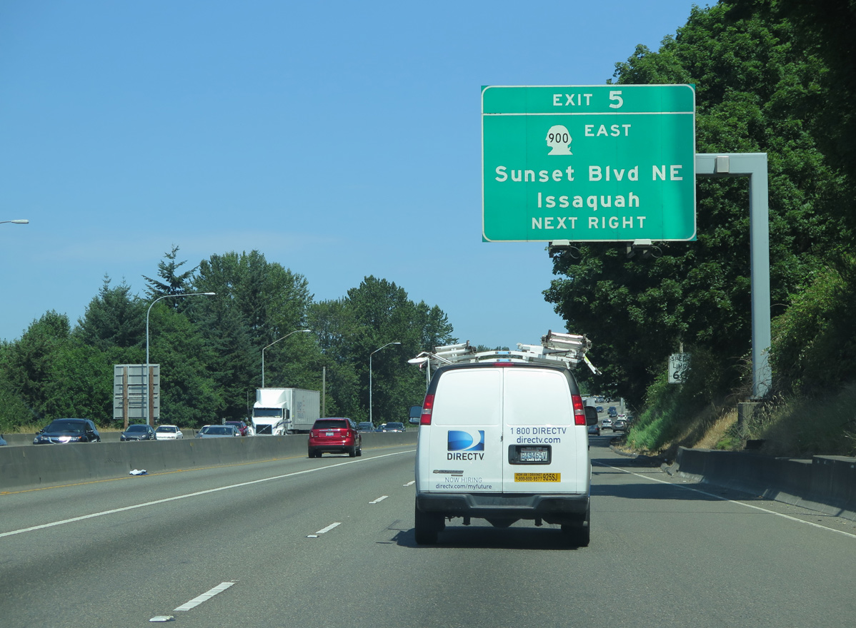
An on-ramp adds traffic from Sunset Boulevard N onto Interstate 405 a half mile south of Exit 5. The stretch of Sunset Boulevard between southbound Exit 4 and Park Drive was formerly part of SR 900.
06/27/15
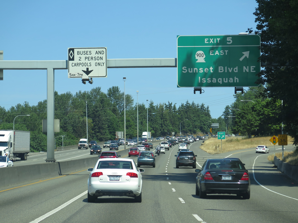
Northbound at the parclo interchange (Exit 5) with Park Drive west and SR 900 east to Issaquah. The eastern component of SR 900 travels 9.14 miles from I-405 to I-90 at Exit 15.
06/27/15
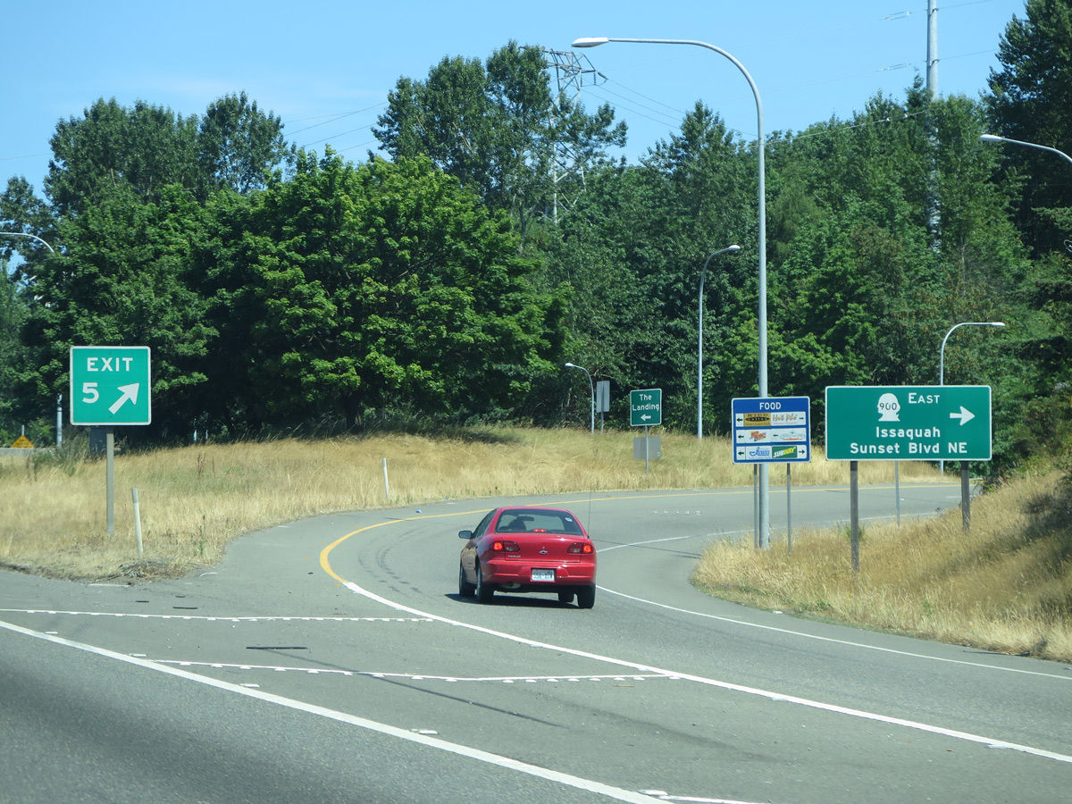
SR 900 between Seattle and Issaquah represents the alignment of U.S. 10 from before 1940 and U.S. 10 Alternate between 1940 and 1955.3
06/27/15
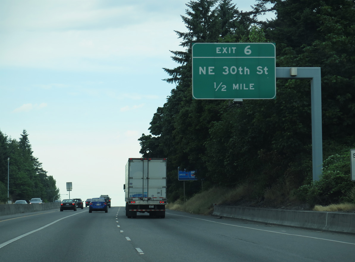
Exit 6 follows as a diamond interchange with NE 30th Street at the Kennydale section of north Renton.
06/28/15
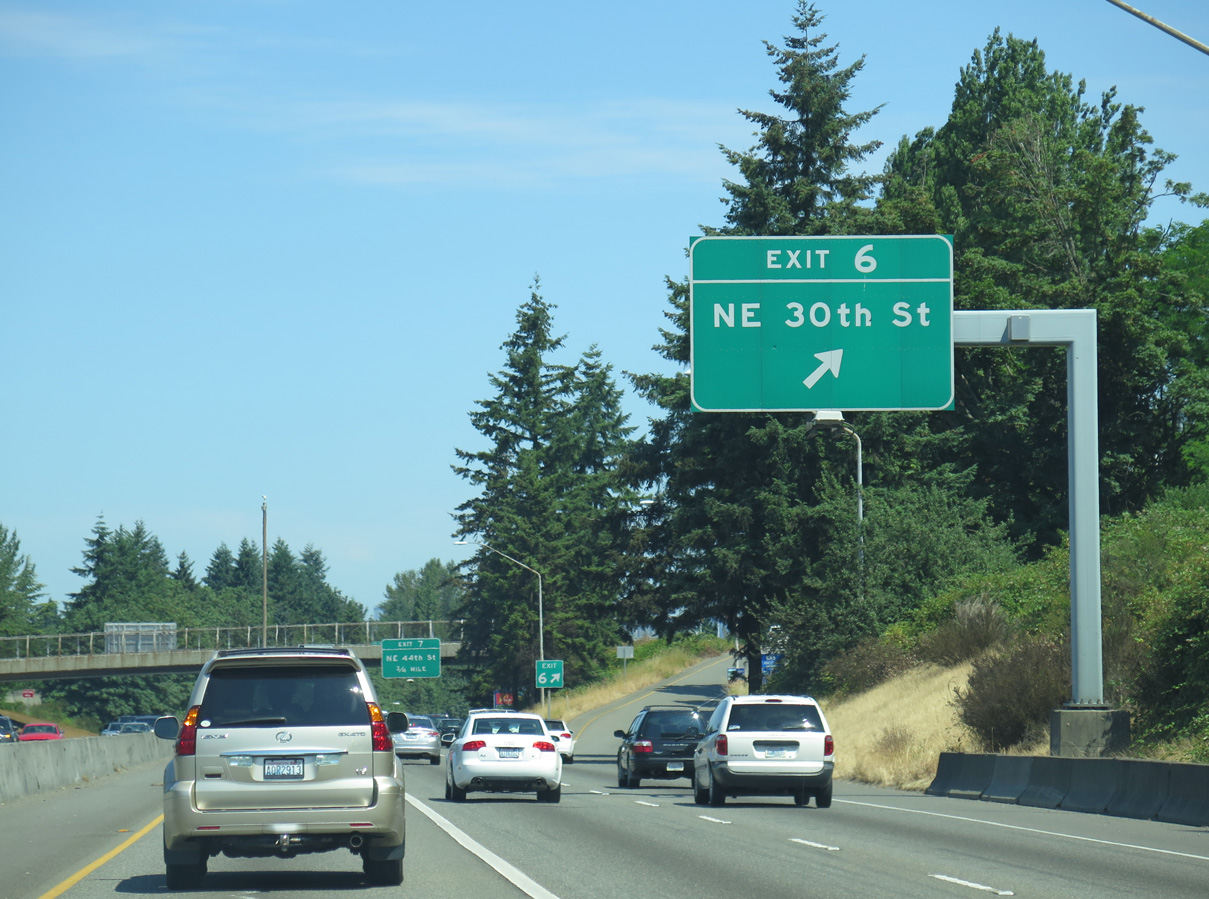
NE 30th Street heads west to Coleman Point on Lake Washington and east to become NE 27th Street and Edmonds Avenue NE south toward Highlands Park.
06/27/15
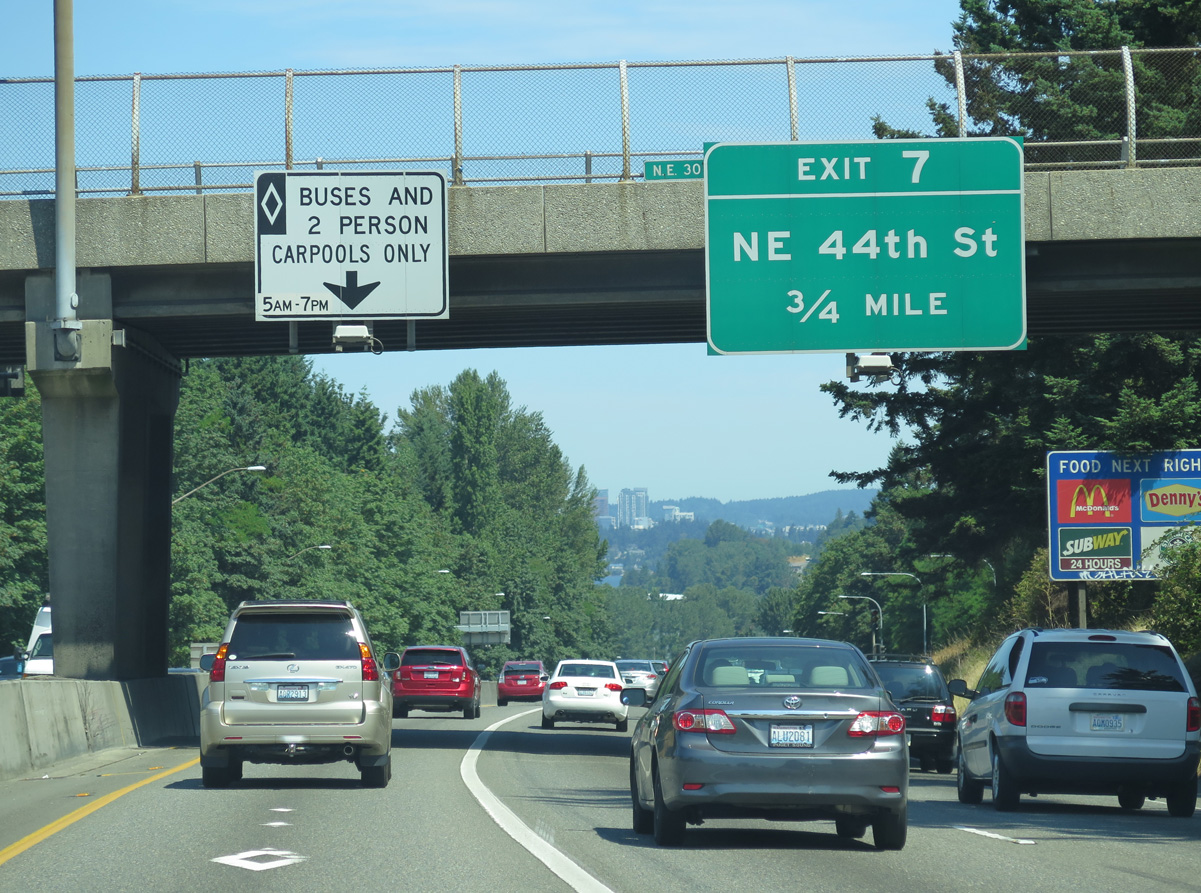
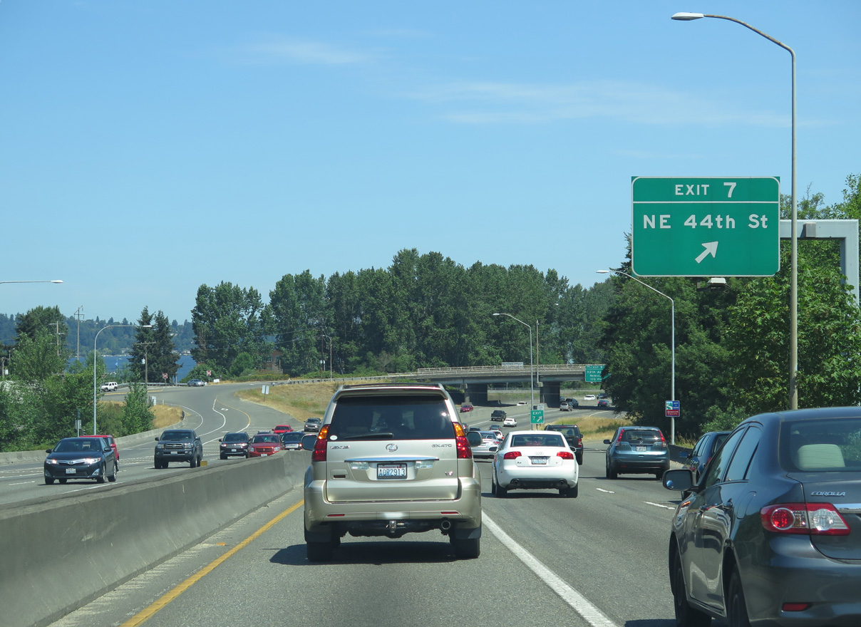
Interstate 405 advances 0.75 miles north to the parclo interchange (Exit 7) with NE 44th Street near the May Creek and Quendall area of north Renton.
06/27/15
Many of the shields posted along Interstate 405 fall within small guide signs. This assembly lies along northbound between Exits 6 and 7.
08/29/06
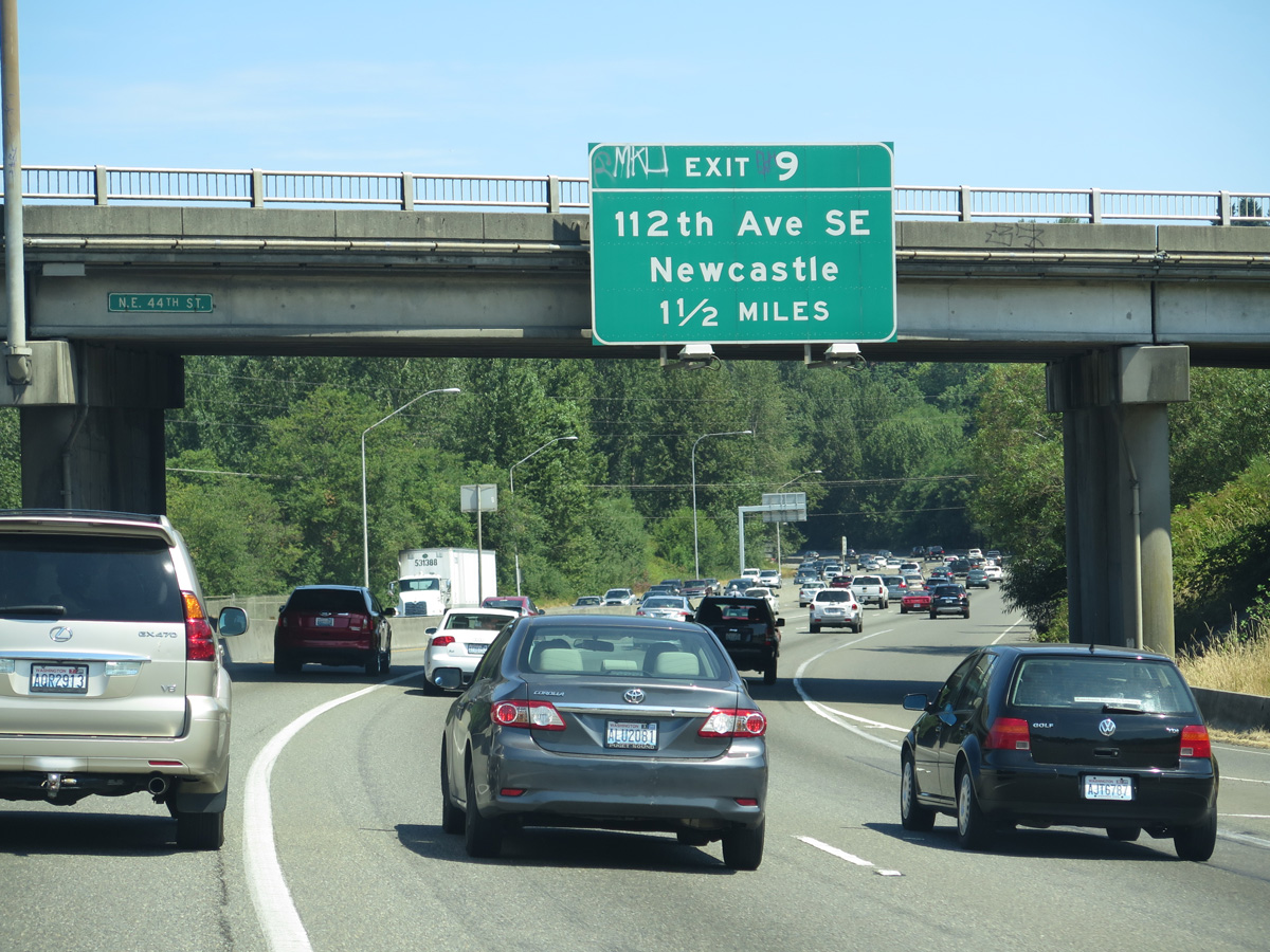
The I-405/Renton to Bellevue Widening and Express Toll Lanes Project underway through 2025 converts Exit 7 into a dumbbell interchange. NE 44th Street connects the freeway with Lake Washington Boulevard southwest along Lake Washington in Renton and north along I-405 to 112th Avenue SE in Newcastle.
06/27/15
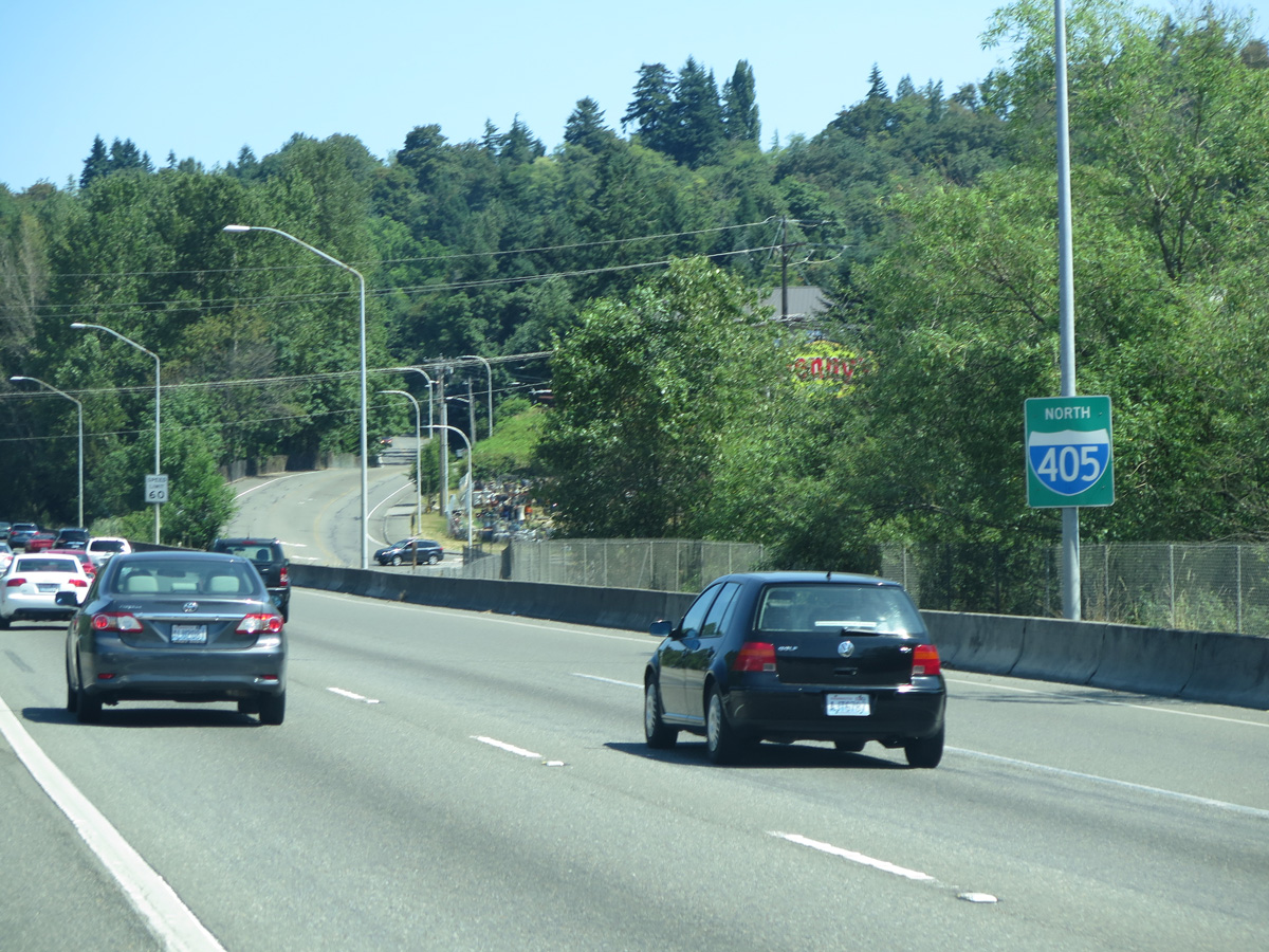
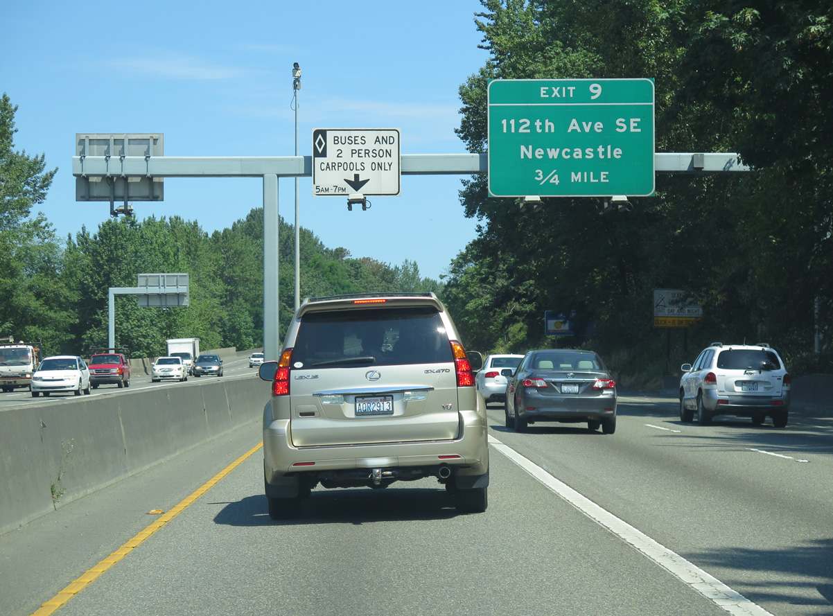
Interstate 405 stays just west of the Newcastle municipal limits on the 1.50 miles preceding Exit 9 with 112th Avenue SE and Lake Washington Boulevard.
06/27/15
Reassurance marker posted for Interstate 405 north alongside Lake Washington Boulevard NE.
06/27/15
Interstate 405 travels the closest to Lake Washington on the stretch northward to the diamond interchange at Exit 9.
06/27/15
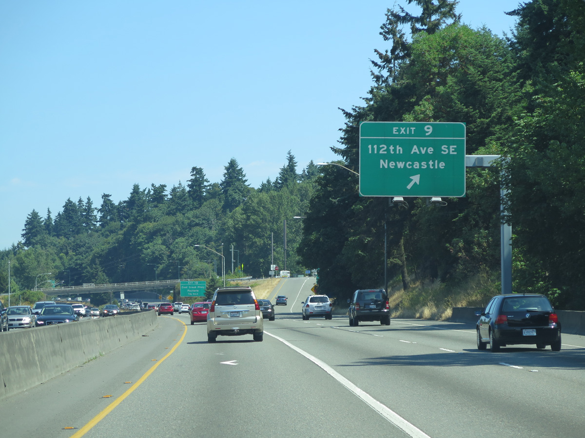
Exit 9 departs I-405 north for Newcastle and 112th Avenue SE south to SE 60th Street within the Hazelwood community. Lake Washington Boulevard ties in from the west to link the freeway with Newcastle Beach Park to the north and Pleasure Point to the south.
06/27/15
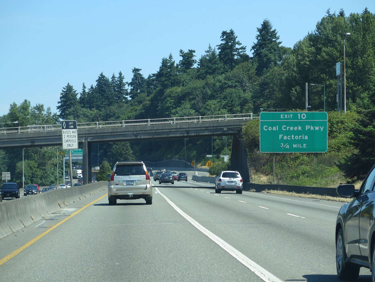
Within the city limits of Bellevue, Interstate 405 advances to Exit 10 for Coal Creek Parkway to Factoria, Newport Shores and Lake Heights.
06/27/15
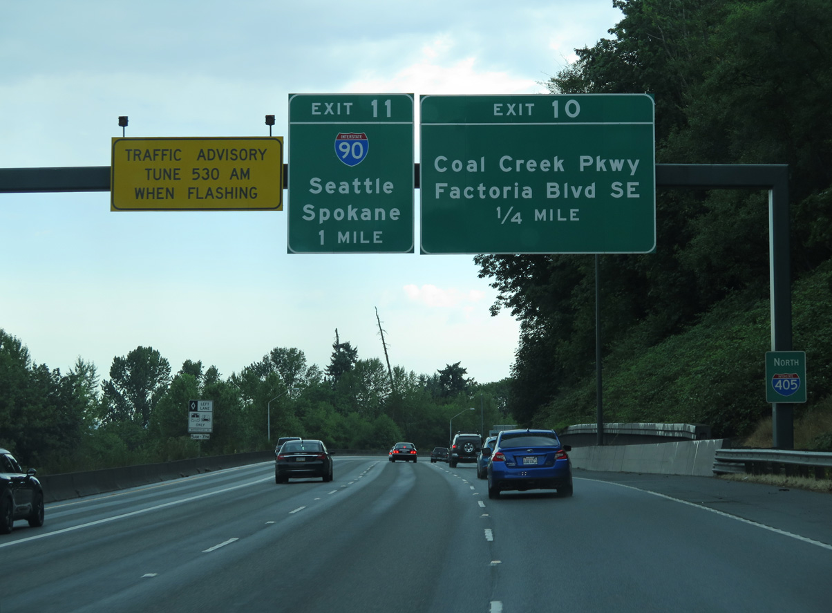
Interstate 405 meets I-90 one mile beyond Exit 10 for Coal Creek Parkway. Interstate 90 provides one of the two Lake Washington crossings between Bellevue and Seattle.
06/28/15
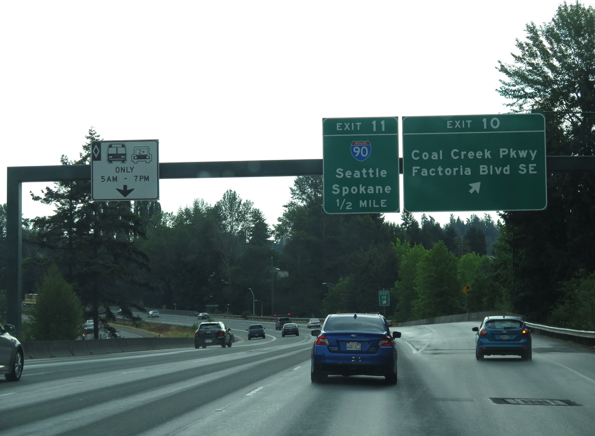
Coal Creek Parkway meanders southeast from Exit 10 to the Newcastle city center and northward as Lake Washington Boulevard SE into the Newport Shores area of Bellevue. The Marketplace at Factoria retail complex lies to the northeast.
06/28/15
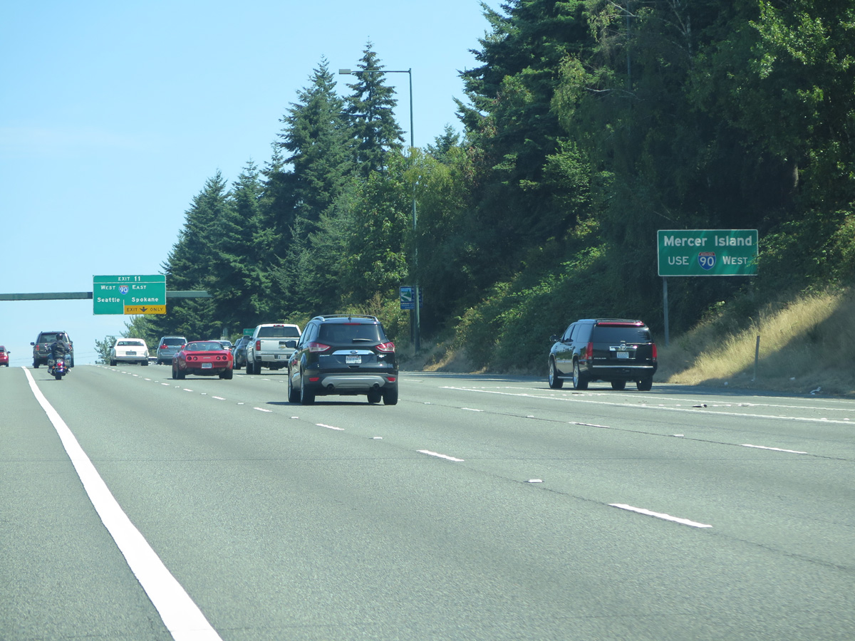
Interstate 90 crosses the East Channel along Lake Washington west from Bellevue to the city of Mercer Island by Barnstable Point.
06/27/15
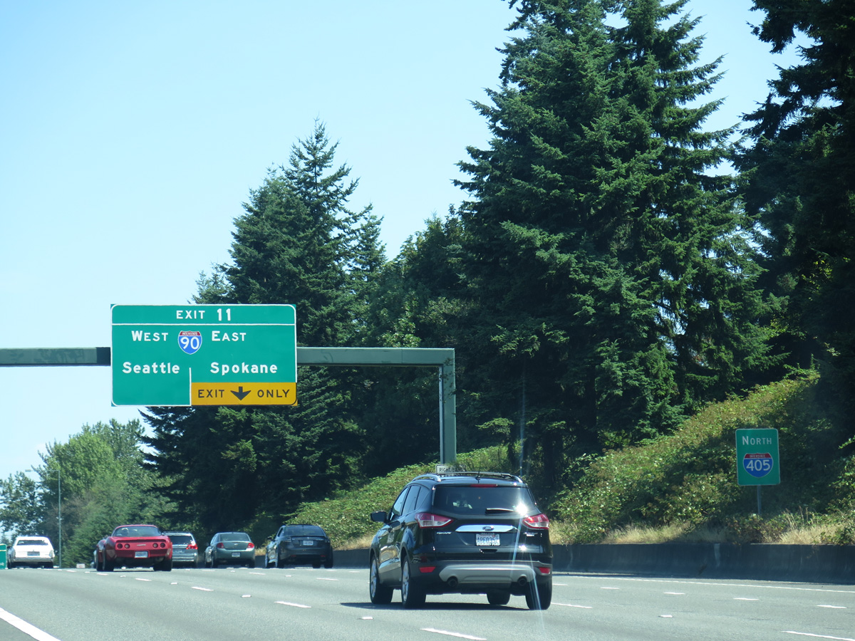
The forthcoming exchange between I-405 and I-90 was reconstructed between 2006 and 2008. A new wider southbound roadway was added through the multi level interchange as part of the overall expansion project widening Interstate 405 to ten lanes north of Exit 11.
06/27/15

Construction in 2008 shifted the carpool lane onto a separate roadway utilizing what was southbound I-405. Two general purpose continue north high above I-90.
06/27/15
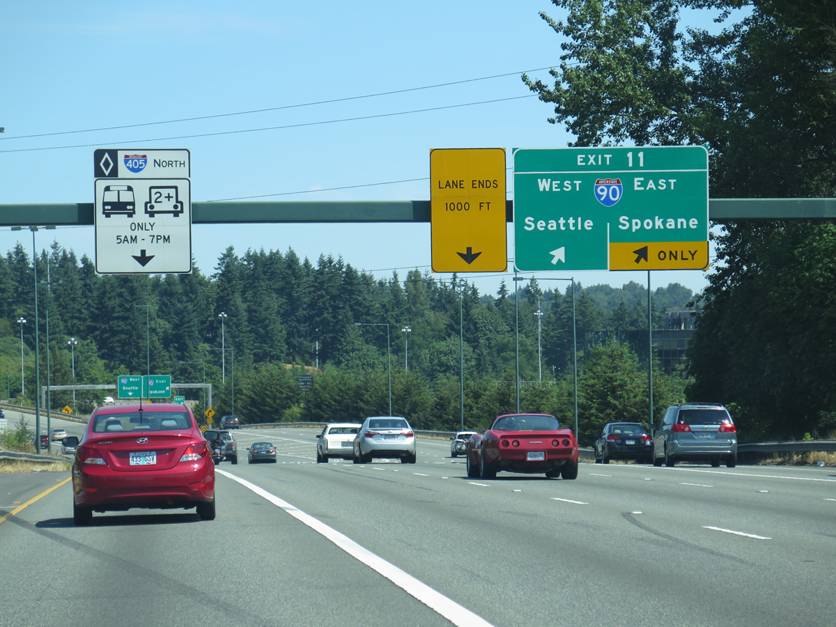
Exit 11 partitions for Interstate 90 east to Issaquah and Spokane and I-90 west to Mercer Island and Seattle. The westbound ramp includes a connection with the flyover to Bellevue Way north.
06/27/15
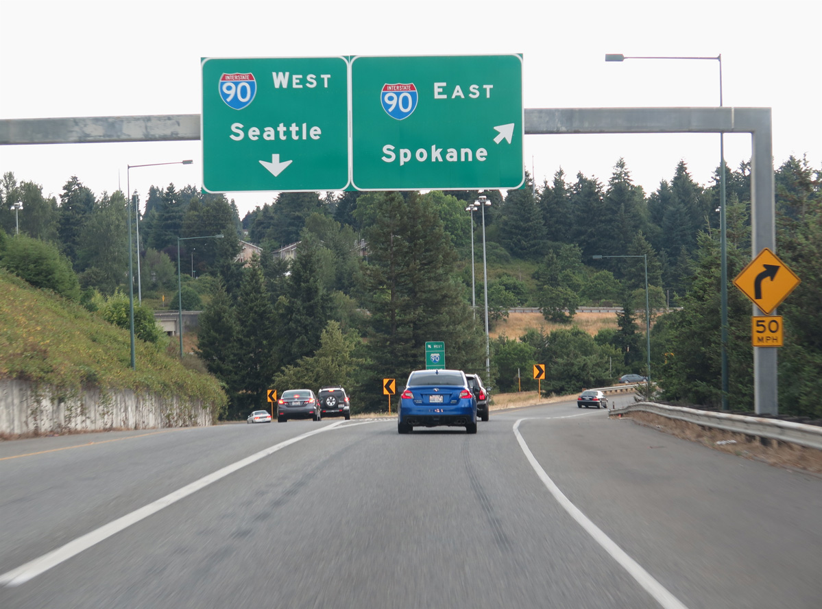
Interstate 90 travels 297.51 miles across Washington from the Idaho state line near Liberty Lake to I-5 and 4th Avenue S in Seattle.
06/28/15
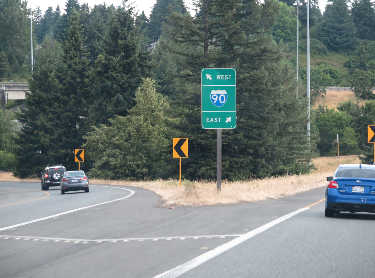
The ramp from I-405 to Interstate 90 west or Bellevue Way north utilizes the lowest level of the systems interchange.
06/28/15
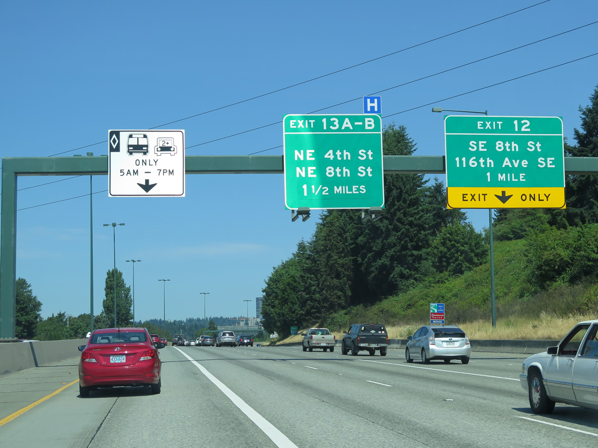
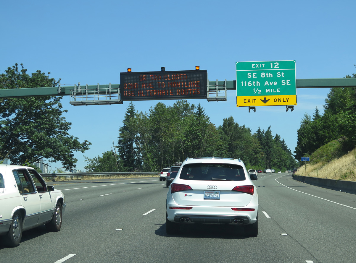
North from I-90, Interstate 405 lines the hillside east of Mercer Slough. Exit 12 follows to both SE 8th Street and 116th Avenue SE / Lake Hills Connector at Wilburton.
06/27/15
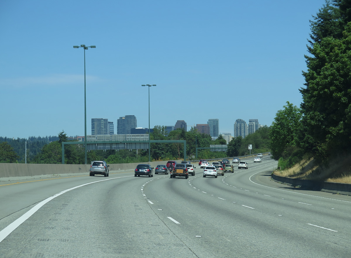
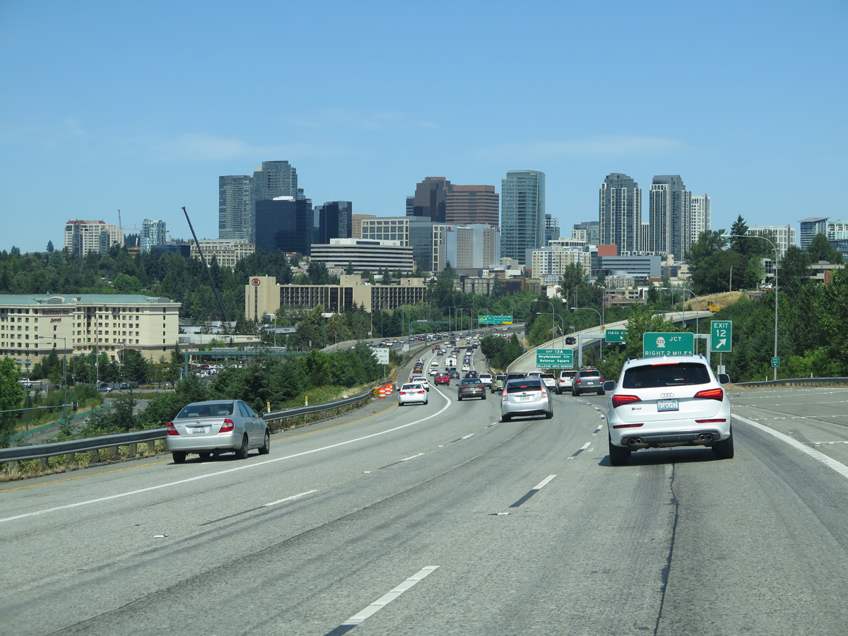
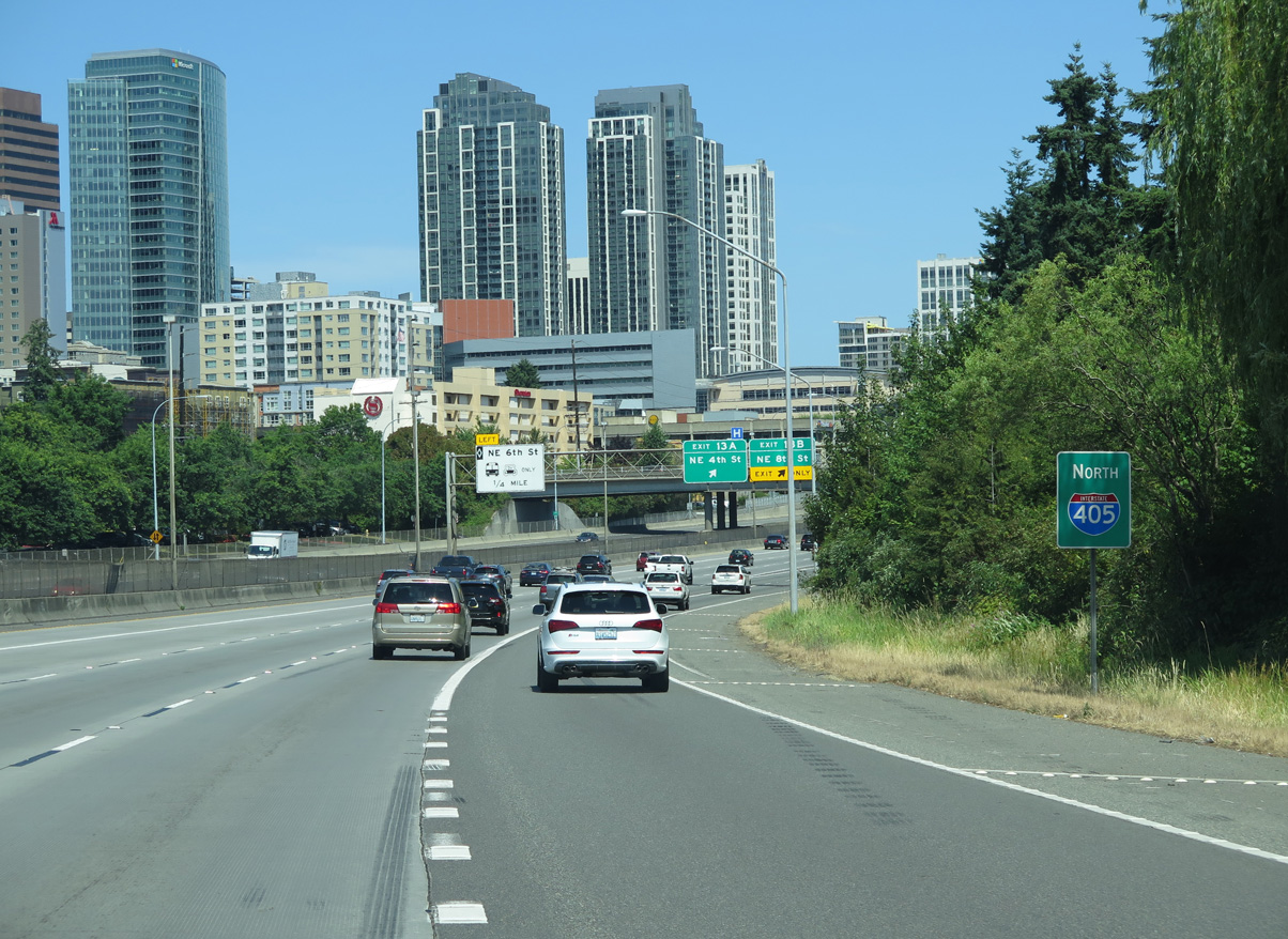
The Bellevue skyline comes into view.
06/27/15
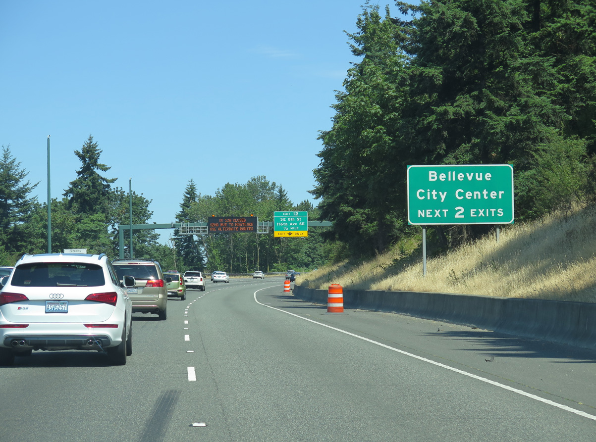
Exit 12 is a diamond interchange with SE 8th Street and a northbound flyover to 116th Avenue SE / Lake Hills Connector. SE 8th Street leads west to 112th Avenue SE south of the Bellevue city center.
06/27/15
116th Avenue SE follows I-405 north from the Lake Hills Connector to Rose Hill in Kirkland.
06/27/15
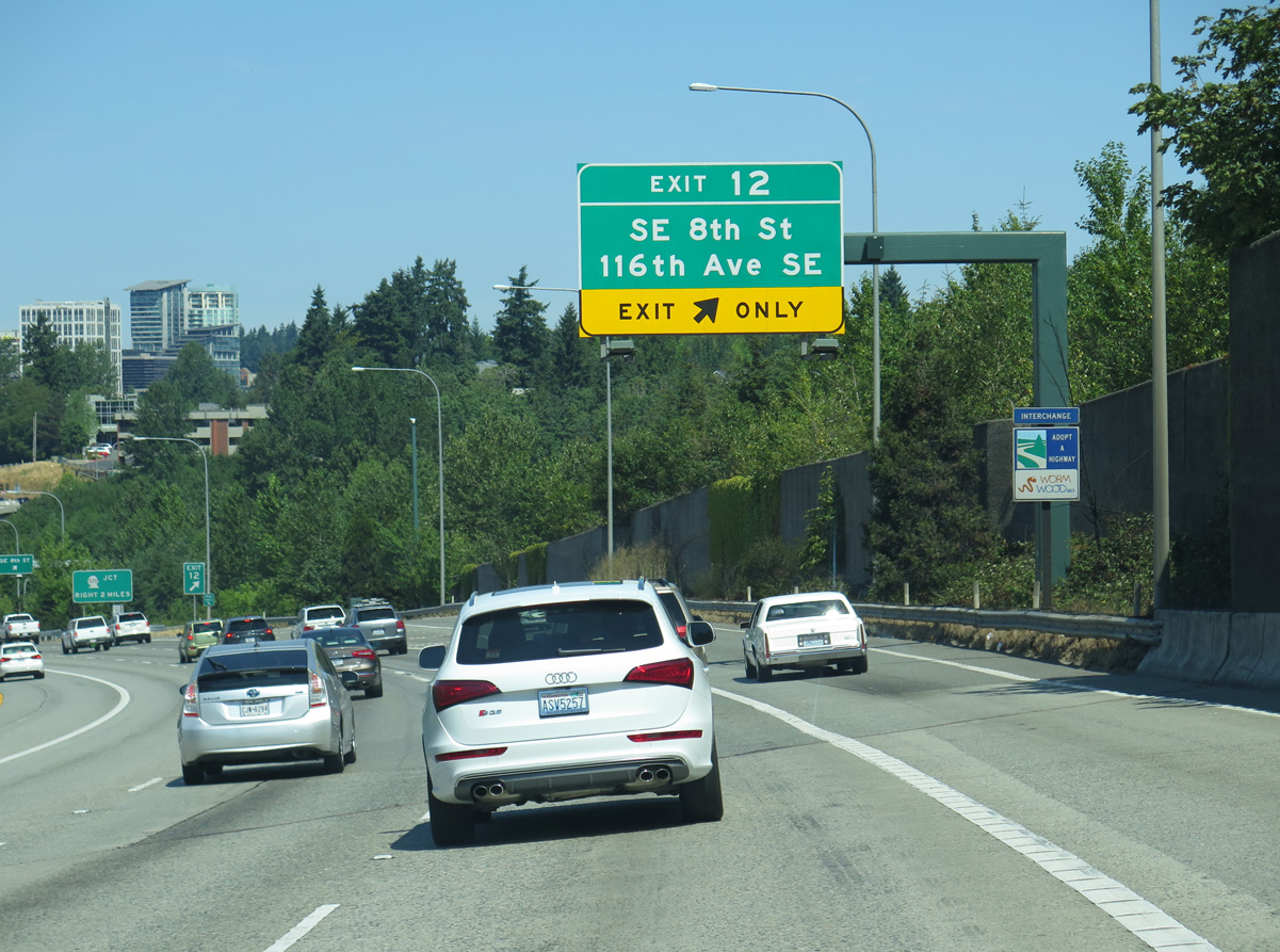
Lake Hills Connector extends eastward from 116th Avenue SE and Exit 12 to SE 8th Street at 140th Avenue SE near Robinswood.
06/27/15
Downtown Bellevue
06/27/15
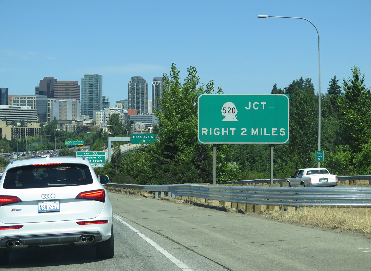
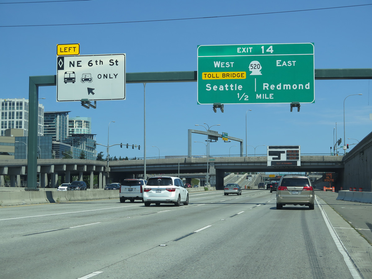
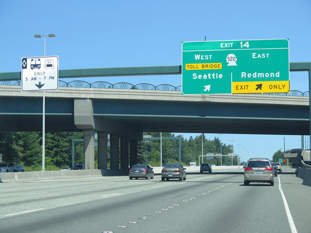
Interstate 405 continues another two miles to Exit 14 for SR 520, the second Lake Washington crossing between Bellevue and Seattle.
06/27/15
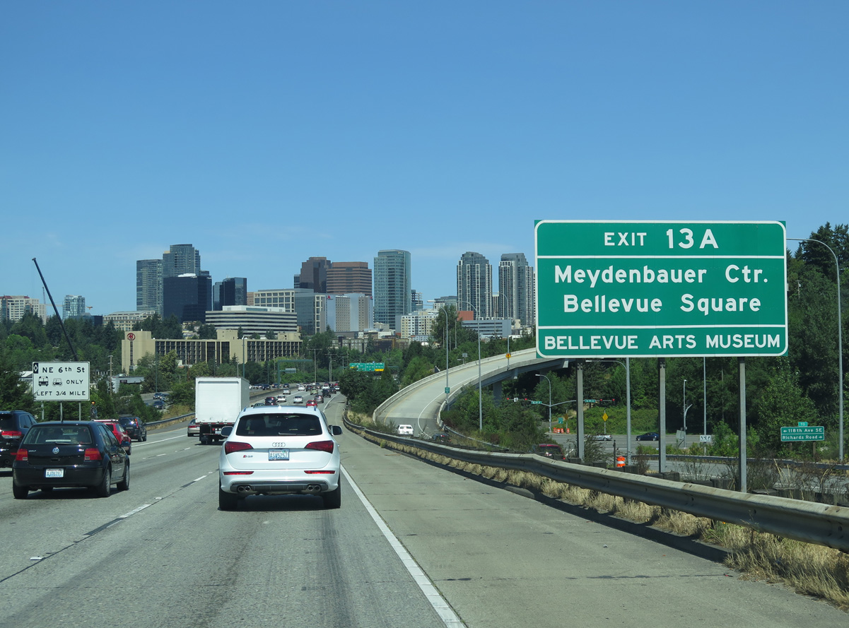
Forthcoming Exit 13 A serves Downtown interests to Bellevue Square mall and the Meydenbauer (convention) Center.
06/27/15
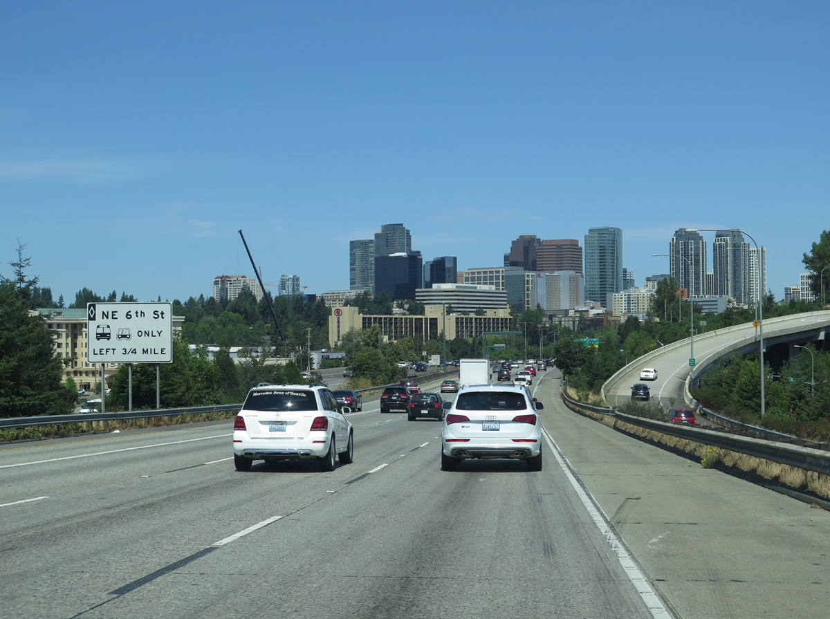
A separate ramp from the HOV lane connects I-405 north to NE 6th Street west to the central business district nearby.
06/27/15
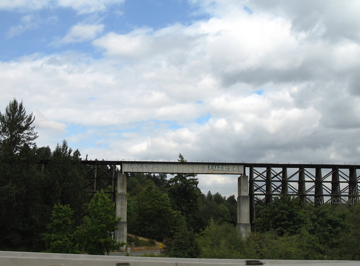
Located just east of Interstate 405 near Exit 12 is the historic wooden Wilburton Trestle. The 102 foot high bridge is part of an abandoned line along the BNSF Railroad.4
08/29/06
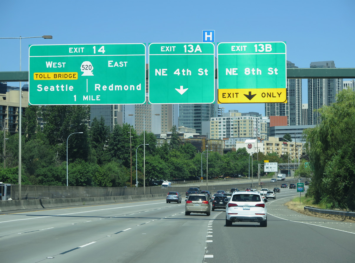
SR 520 joins Bellevue with Clyde Hill, Medina, and Seattle to the west and the high tech business corridor in Redmond to the northeast.
06/27/15
Confirming marker posted northbound ahead of the Main Street overpass.
06/27/15
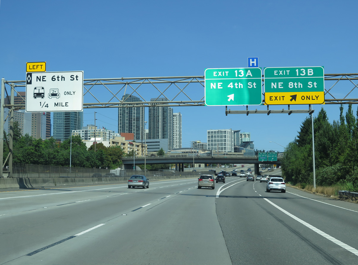
Serving Downtown Bellevue, a c/d roadway links I-405 with the diamond interchange at Exit 13 A for NE 4th Street and the cloverleaf interchange at Exit 13 B for NE 8th Street.
06/27/15
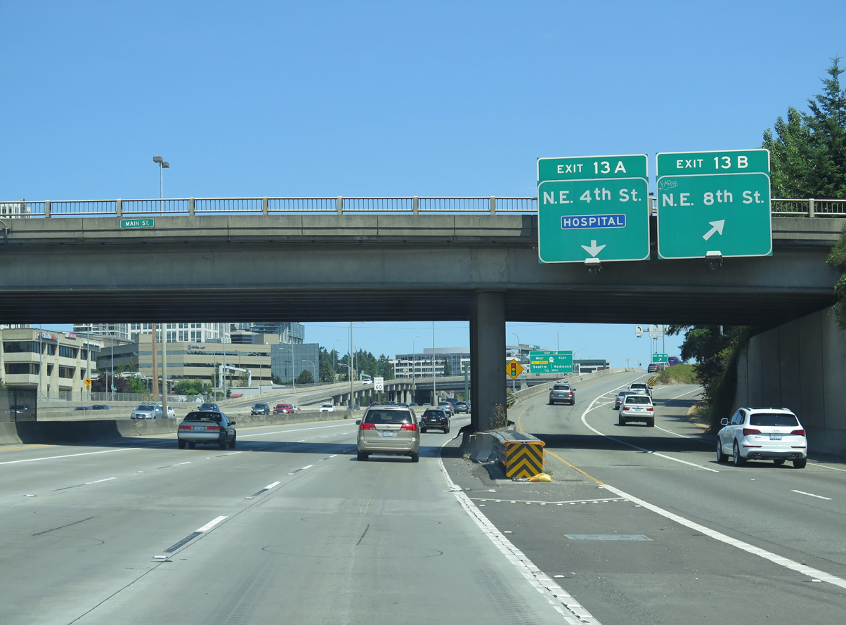
Exit 13 B rises to meet NE 4th Street between 116th and 112th Avenues NE.
06/27/15
NE 6th Street spurs west from the center lanes of Interstate 405 to the Bellevue Transit Center at 110th Avenue NE. NE 6th Street is a pedestrian street mall from 108th Avenue NE to Bellevue Square mall.
06/27/15

Passing under NE 4th Street at the HOV exit to NE 6th Street.
06/27/15
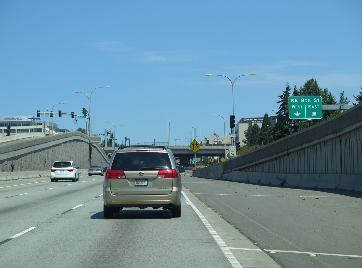
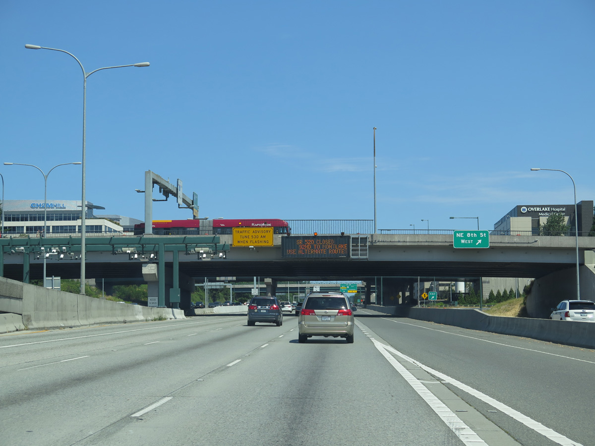
NE 8th Street leads east from Exit 13 B to Midlakes and Belridge and west to the north central business district.
06/27/15
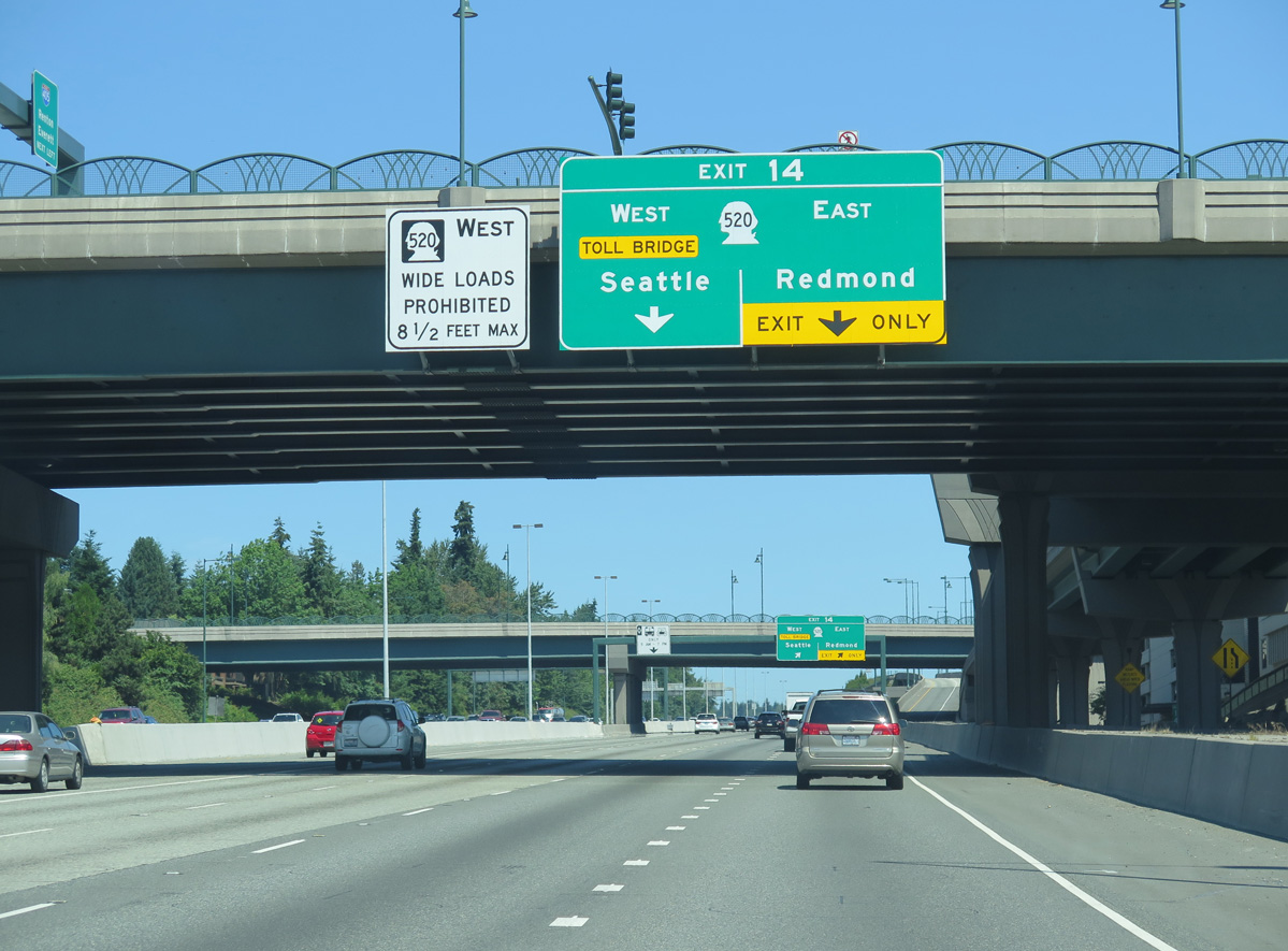
SR 520 stretches 12.83 miles between Interstate 5 in Seattle and SR 202 in Redmond. A cloverstack interchange (Exit 14) joins the two freeways in a valley between the Ashwood and Northrup neighborhoods in Bellevue.
06/27/15
Construction at I-405 and SR 520 replaced the NE 12th Street overpass here and added a new entrance ramp from NE 10th Street to SR 520. Work coincided with the separation of the c/d roadway at Exit 13 from the mainline ramp at Exit 14 to SR 520.5
06/27/15
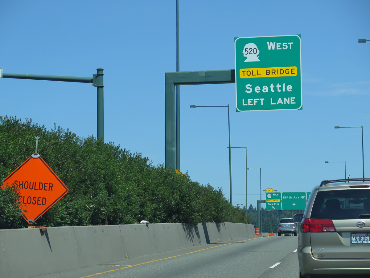
SR 520 is a major commuting corridor between Redmond and Seattle. A major project replaced the original Evergreen Point Floating Bridge across Lake Washington dating back to 1963. Widening SR 520 to the east, work rebuilt the corridor westward with a new tolled floating bridge and several cut and cover tunnels.6
06/27/15
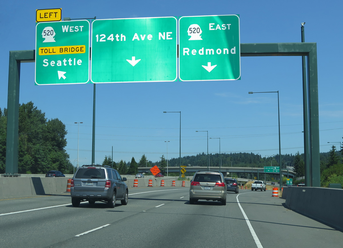
Yarrow Point and Clyde Hill lie to the west along SR 520 while the Redmond city center is 7.5 miles to the northeast.
06/27/15
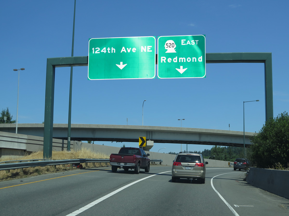
Construction underway in 2011 expanded the exit for SR 520 east with a flyover passing over the nearby exchange with 124th Avenue NE.
06/27/15

References:
- Washington State Route 181. Wikipedia.
- Washington State Route 167. Wikipedia.
- Washington State Route 900. Wikipedia.
- Wilburton Trestle.
- WSDOT I-405 - NE 8th St to SR 520 Braided Ramps.
http://www.wsdot.wa.gov/ Projects/i405/NE8thtoSR520/WSDOT project web page. http://www.wsdot.wa.gov/ projects/SR520Bridge/
Photo Credits:
- AARoads: 08/29/06
- Andy Field: 06/24/15, 06/27/15, 06/28/15
Connect with:
Page Updated Monday July 10, 2023.