
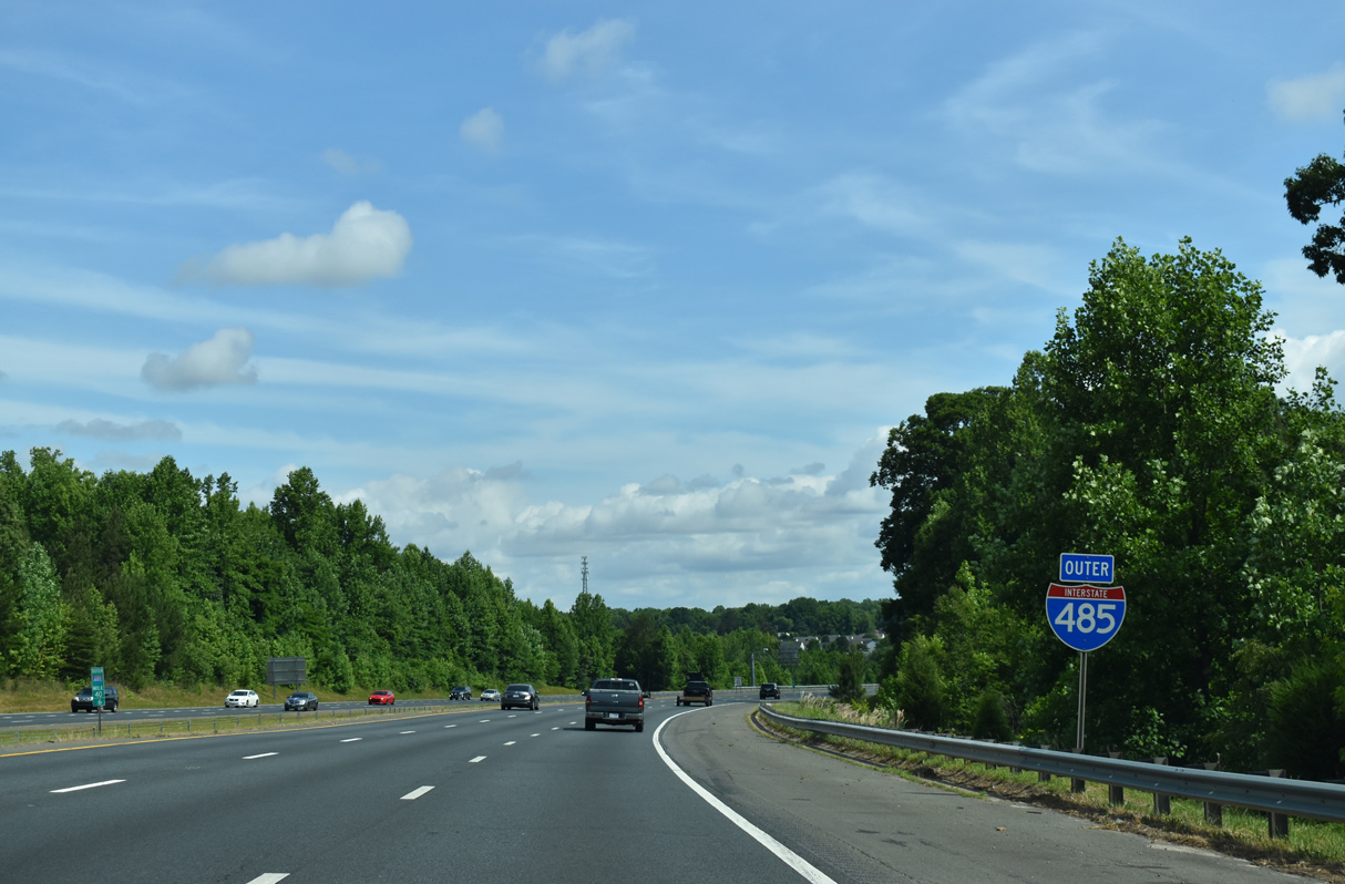
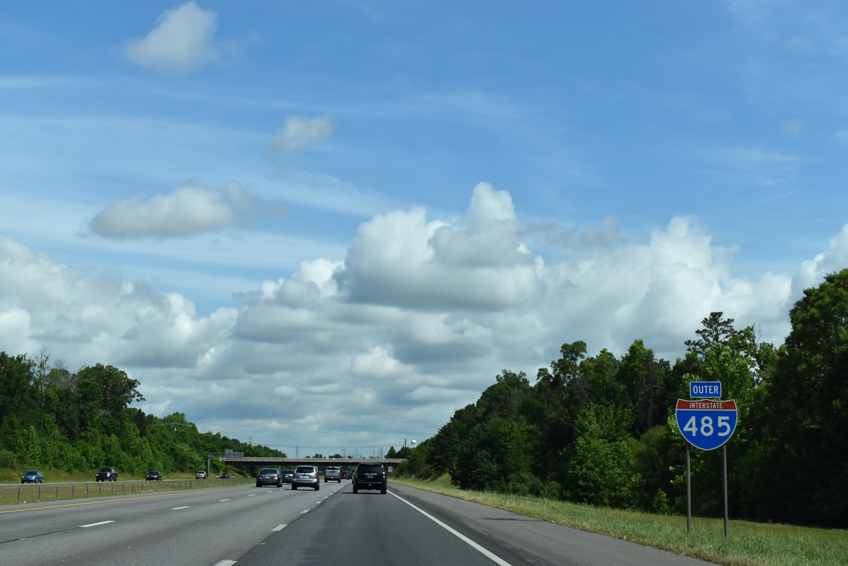
Interstate 485 North - Mint Hill to North Charlotte
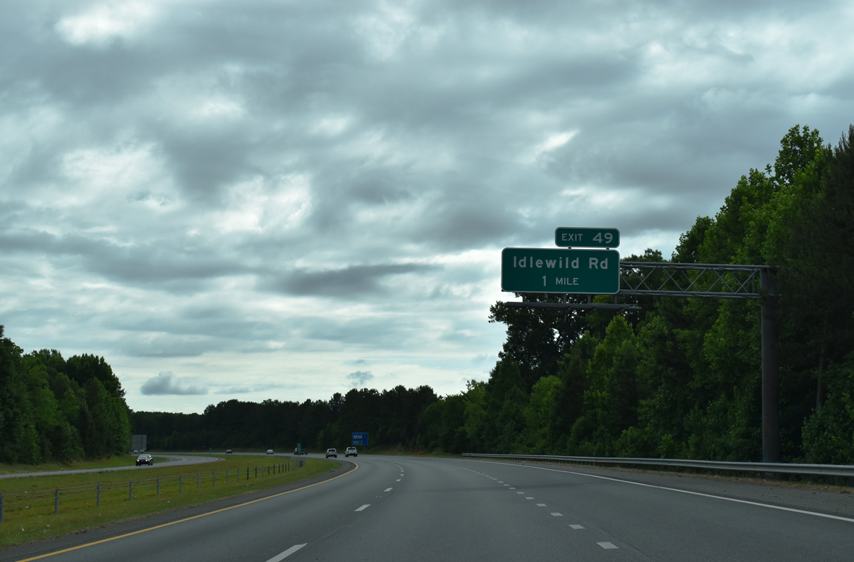
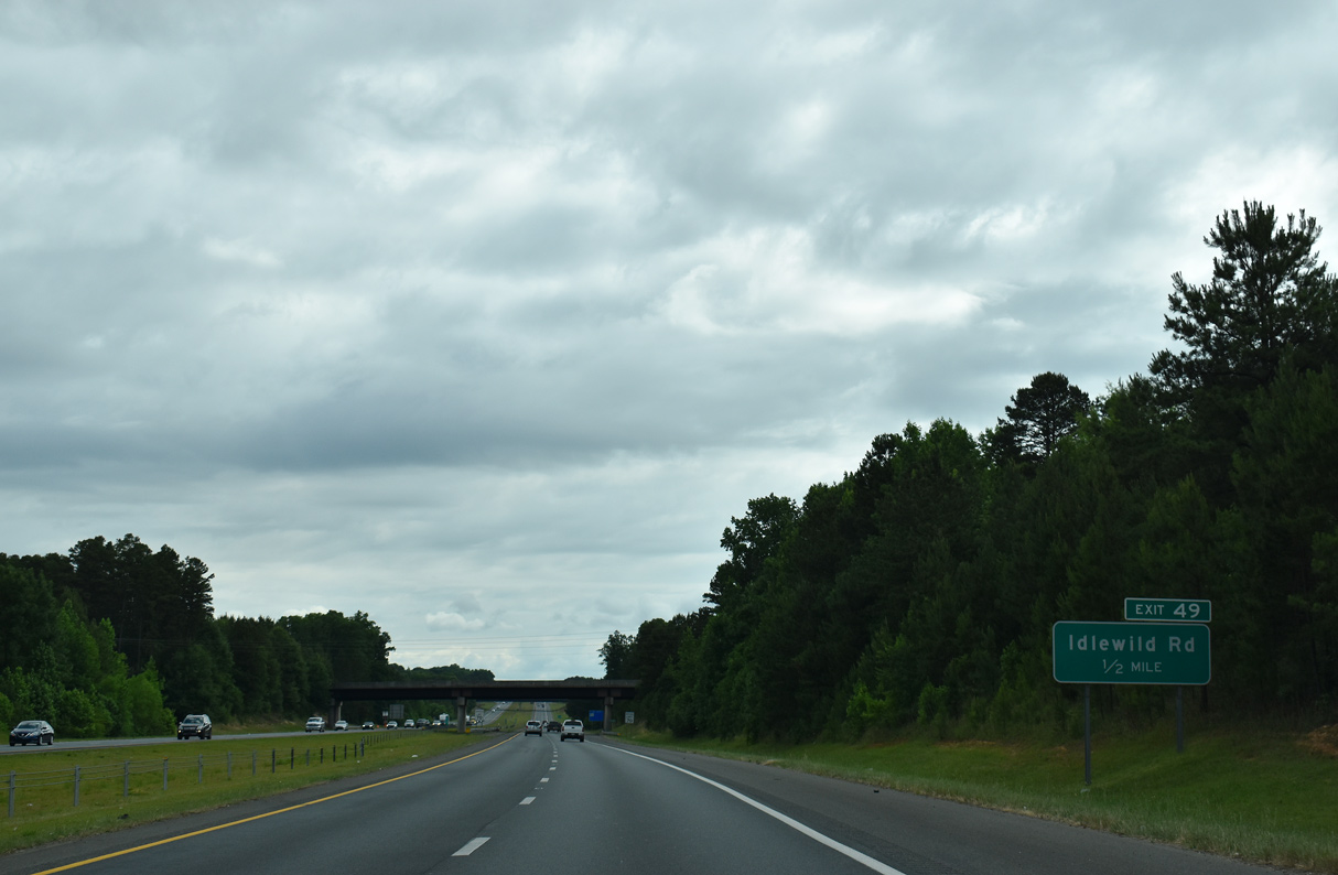
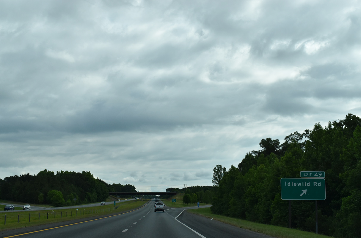
Interstate 485 parallels the Union County line to Exit 49 with Idlewild Road (SR 3174).
05/31/21
Idlewild Road meanders northwest from I-485 to NC 51 and U.S. 74 along the town lines of Matthews and Mint Hill.
05/31/21
South from Exit 49, Idlewild Road (SR 1501) leads into the town of Hembly Bridge.
05/31/21

I-485 passes between Stevens Creek Nature Preserve and The Divide Golf Club ahead of Stevens and Goose Creeks.
05/31/21
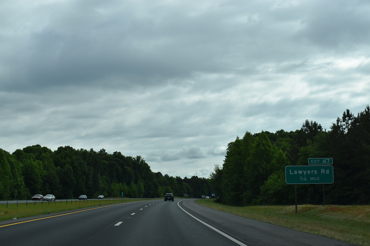
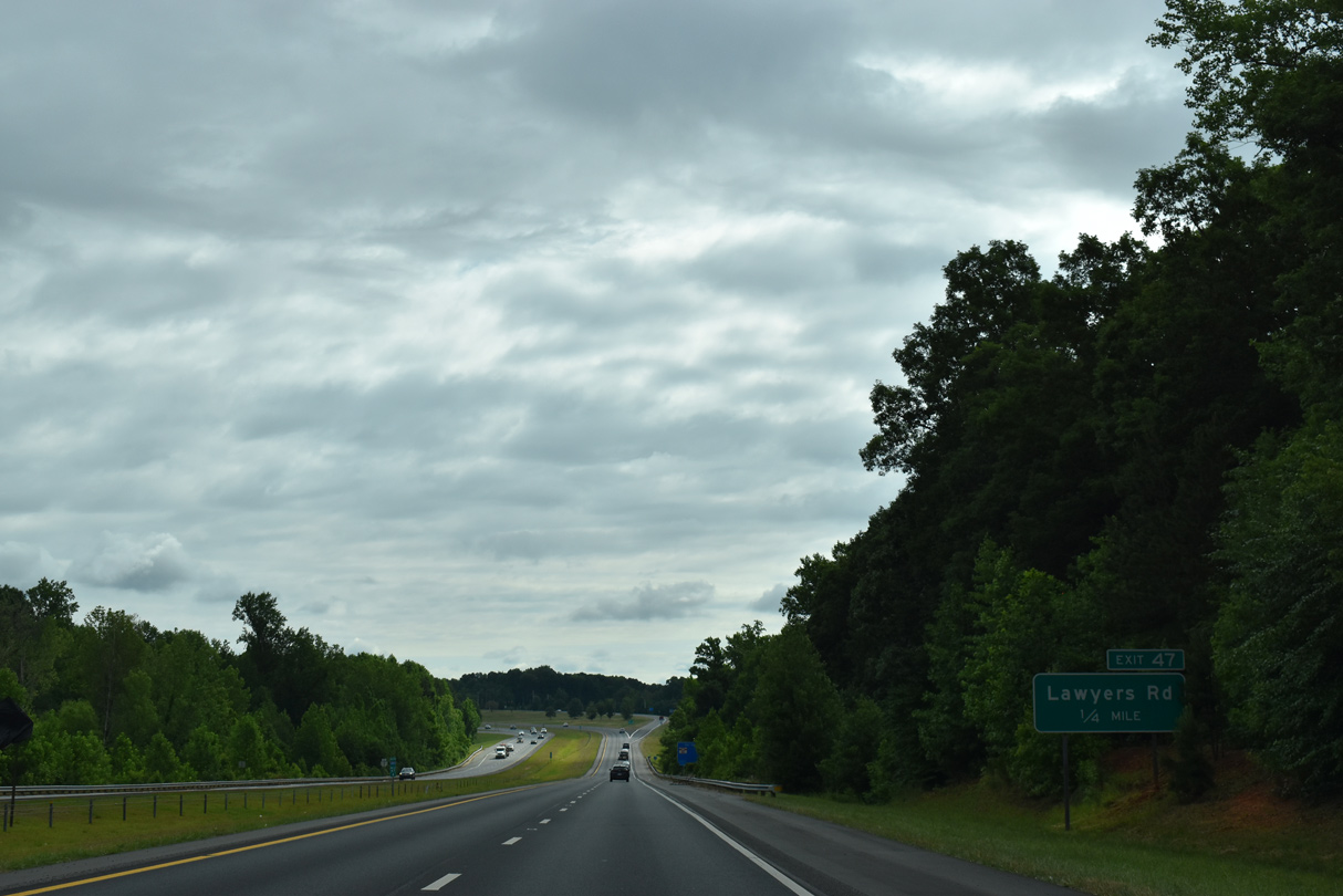
Lawyers Road (SR 1004) connects with I-485 at the succeeding diamond interchange (Exit 47).
05/31/21
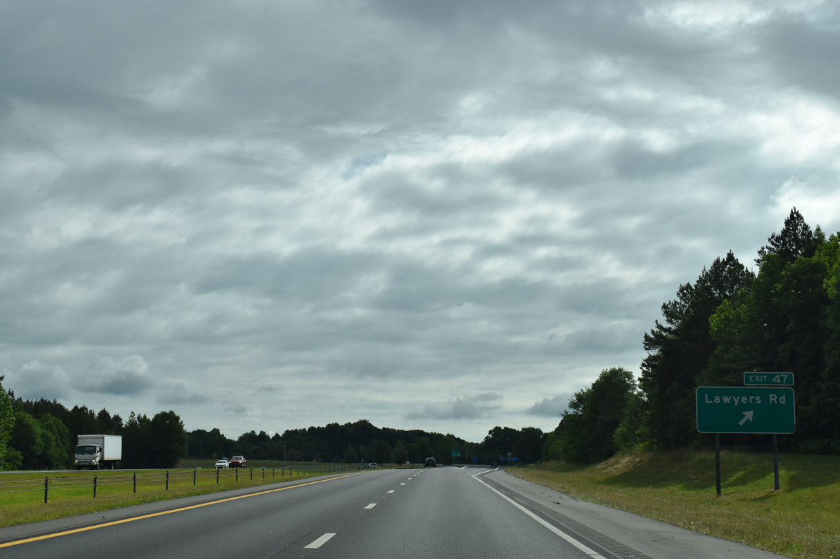
Northbound I-485 at Exit 47 to Lawyers Road (SR 1004). Lawyers Road meets NC 51 (Matthews Mint Hill Road) in the town of Mint Hill.
05/31/21
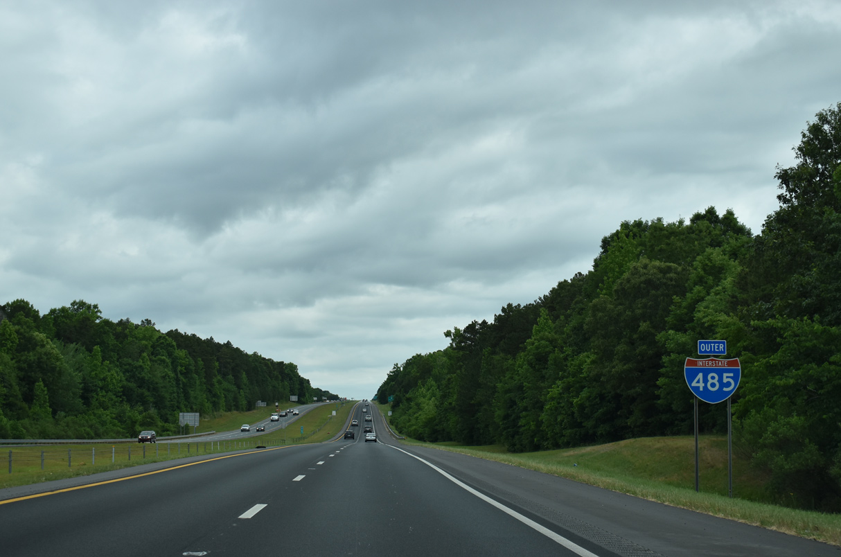
Paralleling Goose Creek, Interstate 485 heads north away from the Union County line.
05/31/21
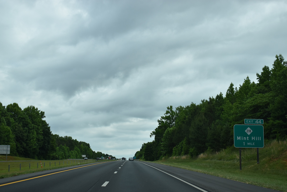
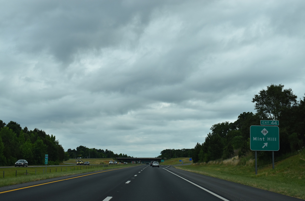
NC 218 stems 1.08 miles east from NC 51 at Mint Hill to a diamond interchange (Exit 44) with Interstate 485.
05/31/21

NC 218 (Fairvew Road) heads 6.26 miles east from Interstate 485 at Exit 44 to U.S. 601 (Concord Highway) at Fairview.
05/31/21
NC 218 constitutes a 31.67 mile long route from NC 51 at Mint Hill to U.S. 74 at Polkton.
05/31/21
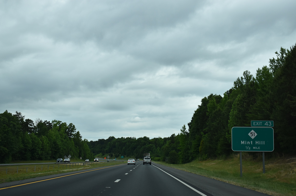
NC 51 (Blair Road) returns to Interstate 485 at Exit 43.
05/31/21
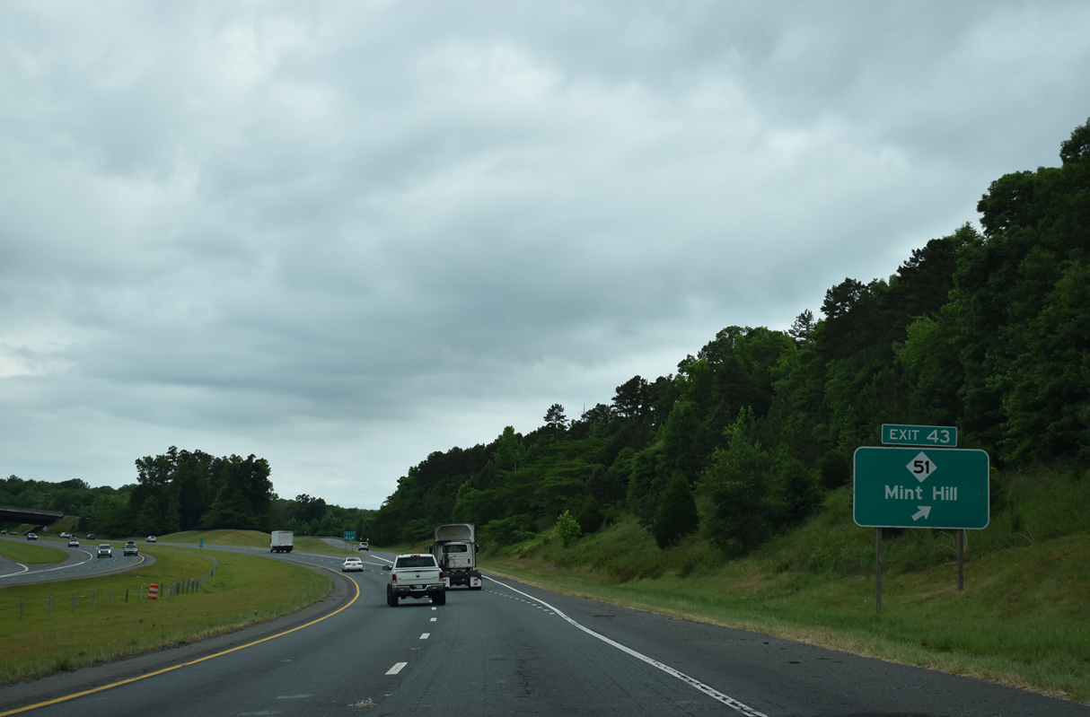
A 22.22 mile route wholly within Mecklenburg County, NC 51 concludes 1.52 miles north of I-485 at NC 24/27 (Albemarle Road).
05/31/21
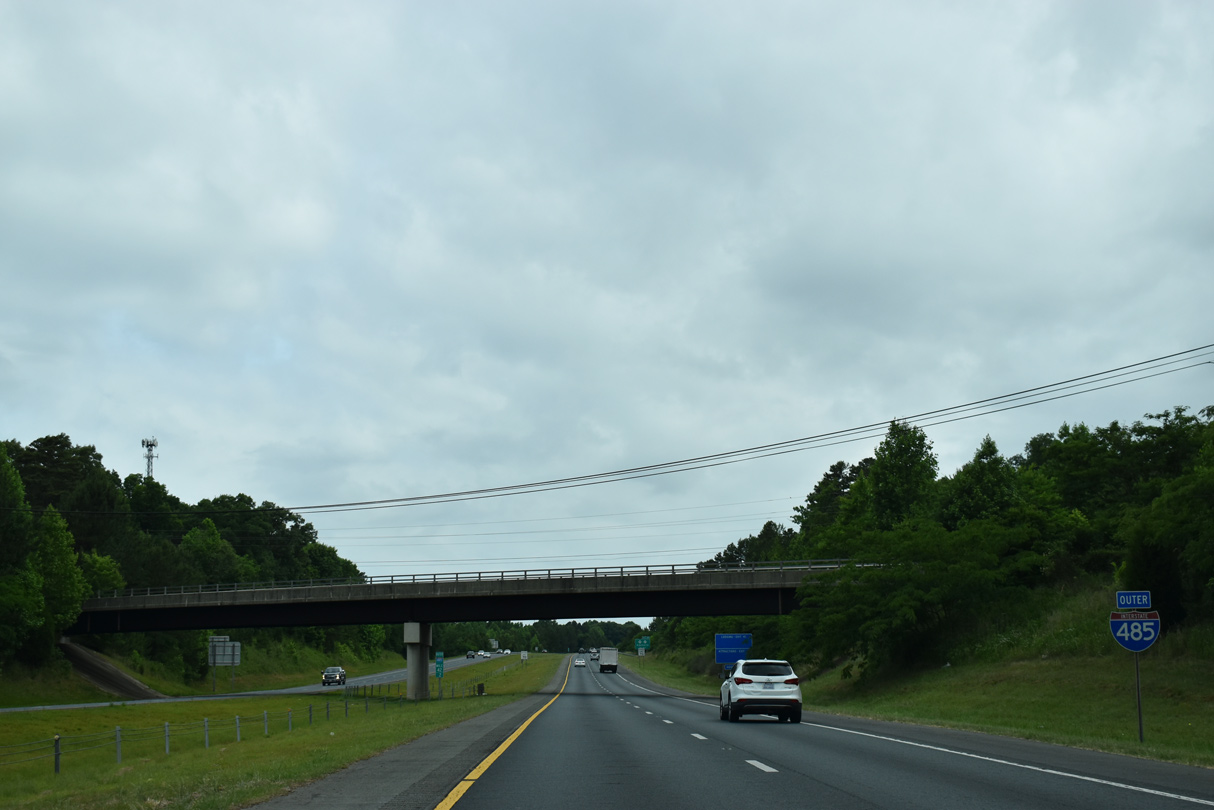
Angling northwest, Interstate 485 passes under Truelight Church Road and west of Rocky River High School on the ensuing stretch.
05/31/21
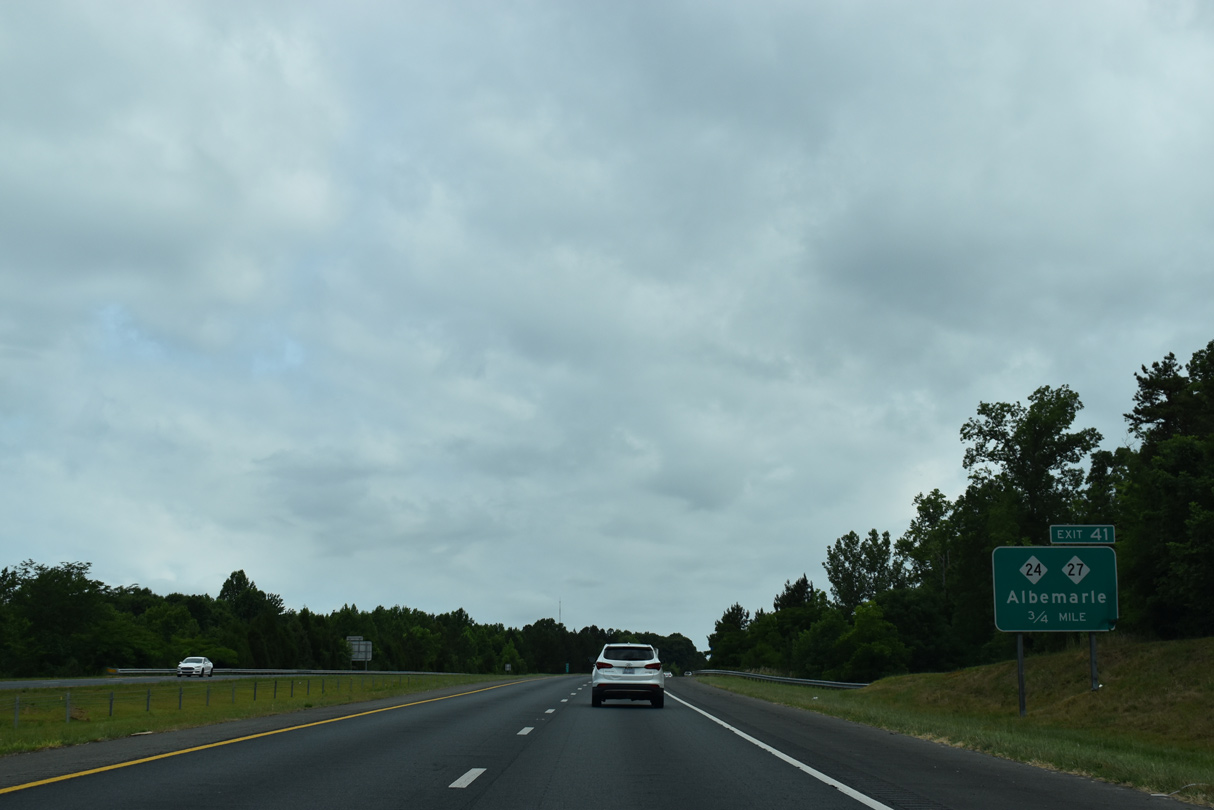
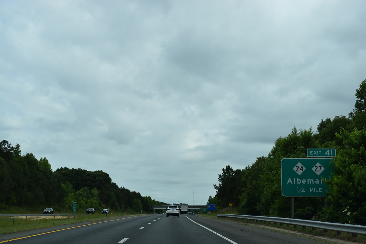
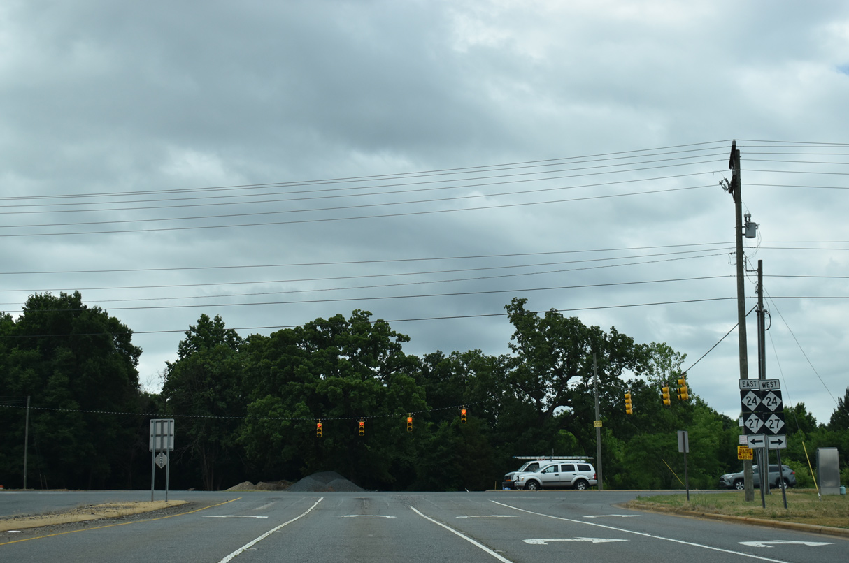
NC 24/27 meet I-485 at a folded diamond interchange (Exit 41) along the north side of Mint Hill.
05/31/21
West of Exit 41, Albemarle Road leads NC 24 to Harris Boulevard and NC 27 to U.S. 74 along the Independence Expressway.
05/31/21
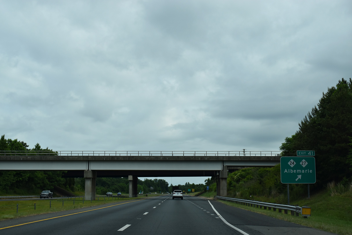
Exit 41 leaves Interstate 485 north beyond a Norfolk Southern Railroad overpass.
05/31/21
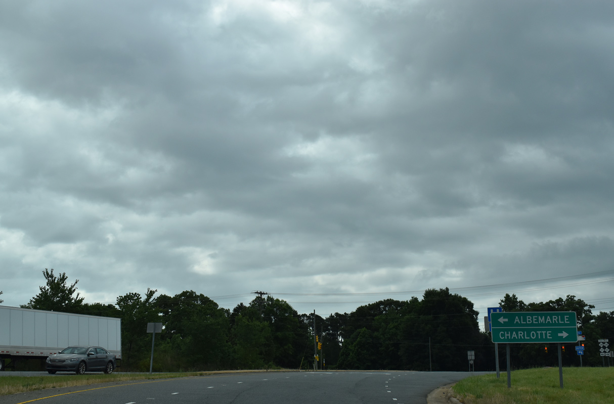
NC 24/27 combine along an extended overlap from Charlotte east to Albemarle and Johnsonville.
05/31/21
NC 24/27 constitutes a four lane corridor east from Allen (NC 51) 13 miles to Locust and 17 miles to Red Cross
05/31/21
I-485 advances north through an S-curve alongside McKee Creek and the Larkhaven Hills development.
05/31/21
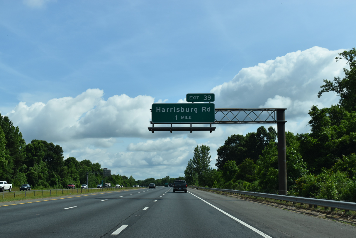
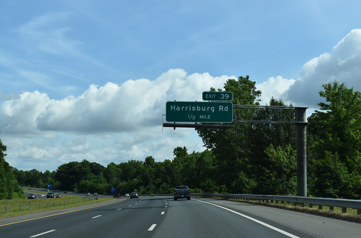
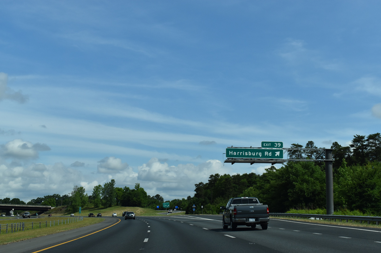
Harrisburg Road (SR 2805) stems 3.57 miles north from NC 24/27 (Albemarle Road) to the diamond interchange at Exit 39.
05/31/21
Harrisburg Road (SR 2805) continues north from Interstate 485 into Cabarrus County as Robinson Church Road (SR 1168).
05/31/21
Interstate 485 curves northwest from Exit 39 (Harrisburg Road) parallel to the Cabarrus County line.
05/31/21
Confirming marker posted along I-485 northbound between Reedy Creek and the Plaza Road Extension (SR 2803) over crossing.
05/31/21
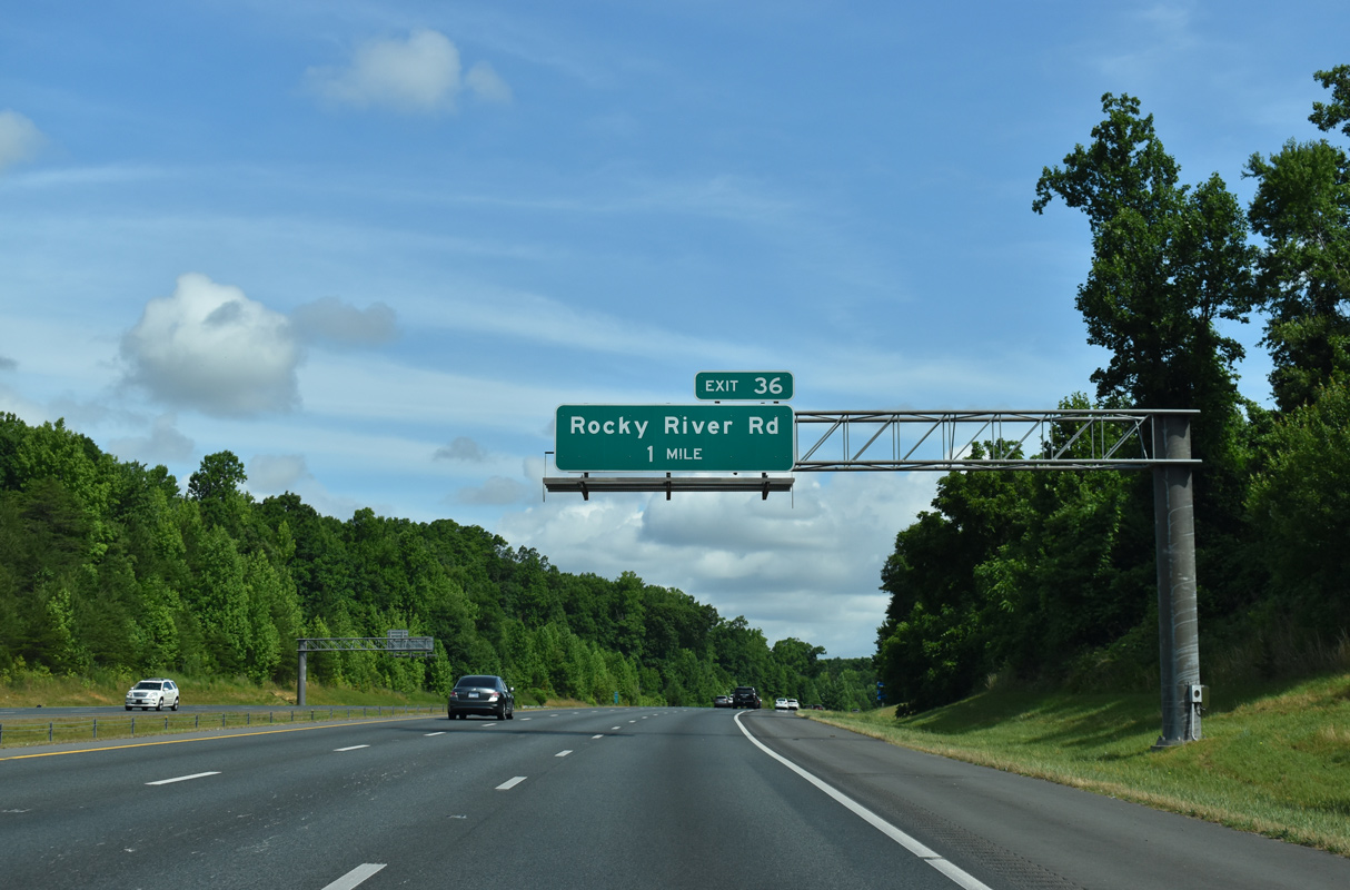
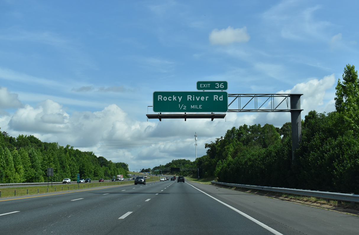
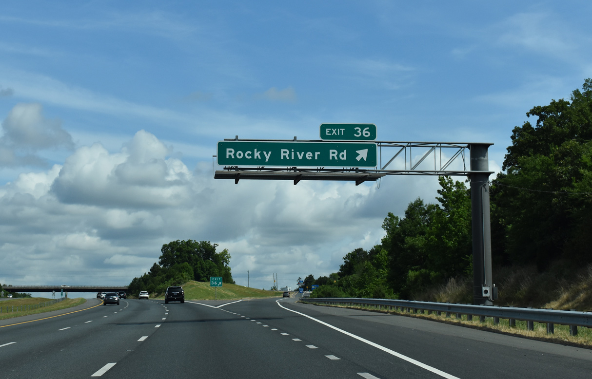
The succeeding exit along northbound I-485 is at the diamond interchange with Rocky River Road (SR 2802).
05/31/21
Rocky River Road (SR 1139) arcs eastward through a varying landscape of woods and subdivisions to Rocky River and NC 49.
05/31/21
West of Exit 36, Rocky River Road (SR 2802) meanders to the Newell section of Charlotte and NC 24 (Harris Boulevard E).
05/31/21
Subdivisions line both sides of the beltway northwest to Back Creek.
05/31/21
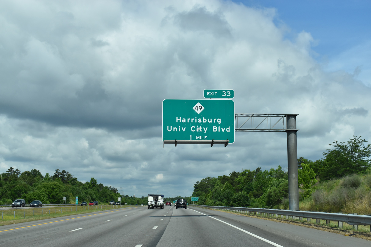
The ensuing exit along I-485 north is the folded diamond interchange with NC 49 (University City Boulevard).
05/31/21

Pavilion Boulevard runs north from NC 49 along I-485 to the PNC Music Pavilion and U.S. 29. Cabarrus Arena & Events Center is 13.5 miles to the east along NC 49.
05/31/21
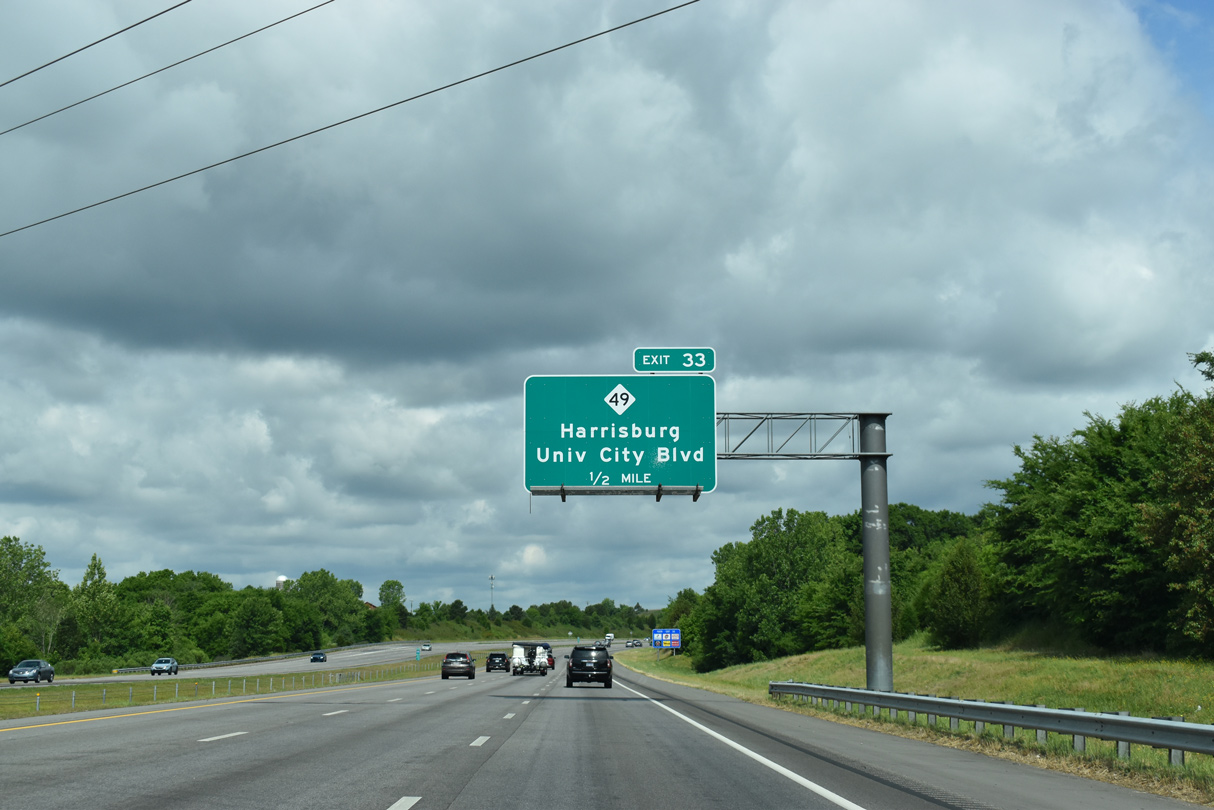
University City Boulevard extends west from a heavily developed retail corridor along NC 49 and U.S. 29 to N Graham Street. Previous guide signs for Exit 33 omitted University City Boulevard.
05/31/21
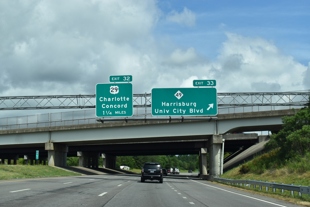
Exit 33 departs Interstate 485 north for NC 49 (University City Boulevard). NC 49 parallels a NC Railroad line eastward to Harrisburg. Westward, NC 49 combines with U.S. 29 along Tryon Street into Downtown Charlotte
05/31/21
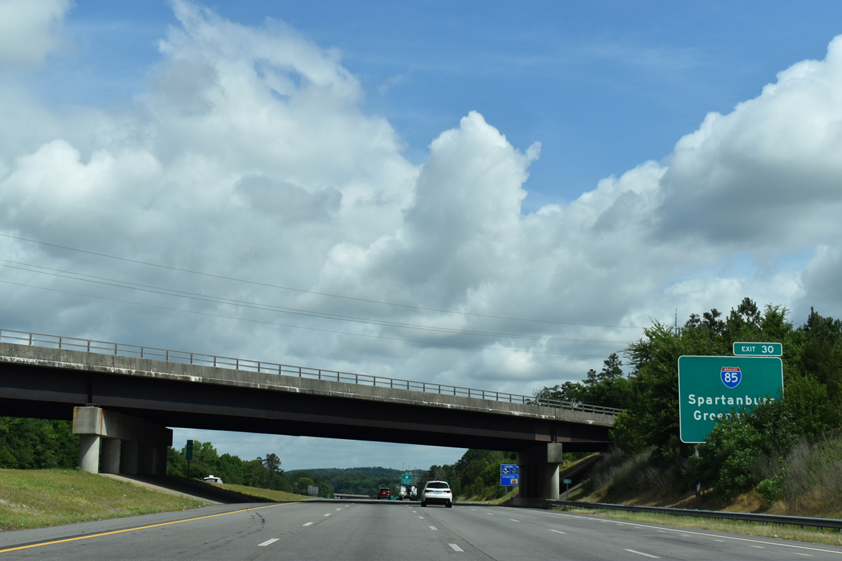
Interstate 485 converges with I-85 two miles north of the Pavilion Boulevard overpass at Exit 30.
05/31/21
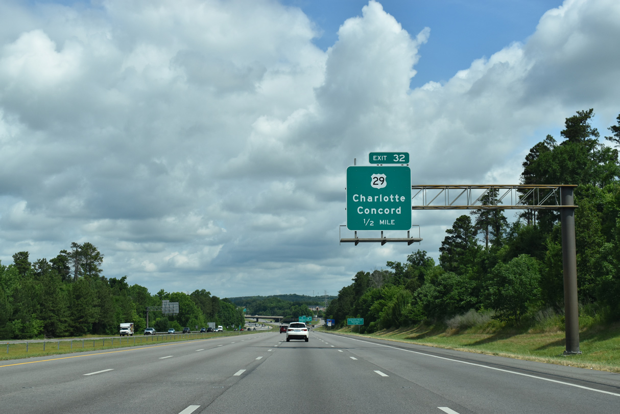
U.S. 29 (Tryon Street) continues 3.60 miles northeast from NC 49 (University City Boulevard) to meet Interstate 485 at Exit 32.
05/31/21
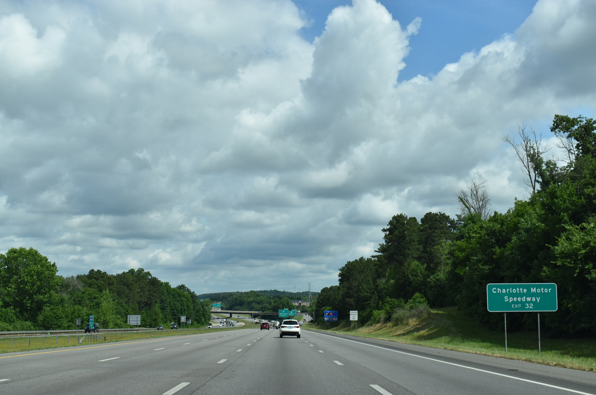
Charlotte Motor Speedway lies along U.S. 29 just beyond the Cabarrus County line.
05/31/21
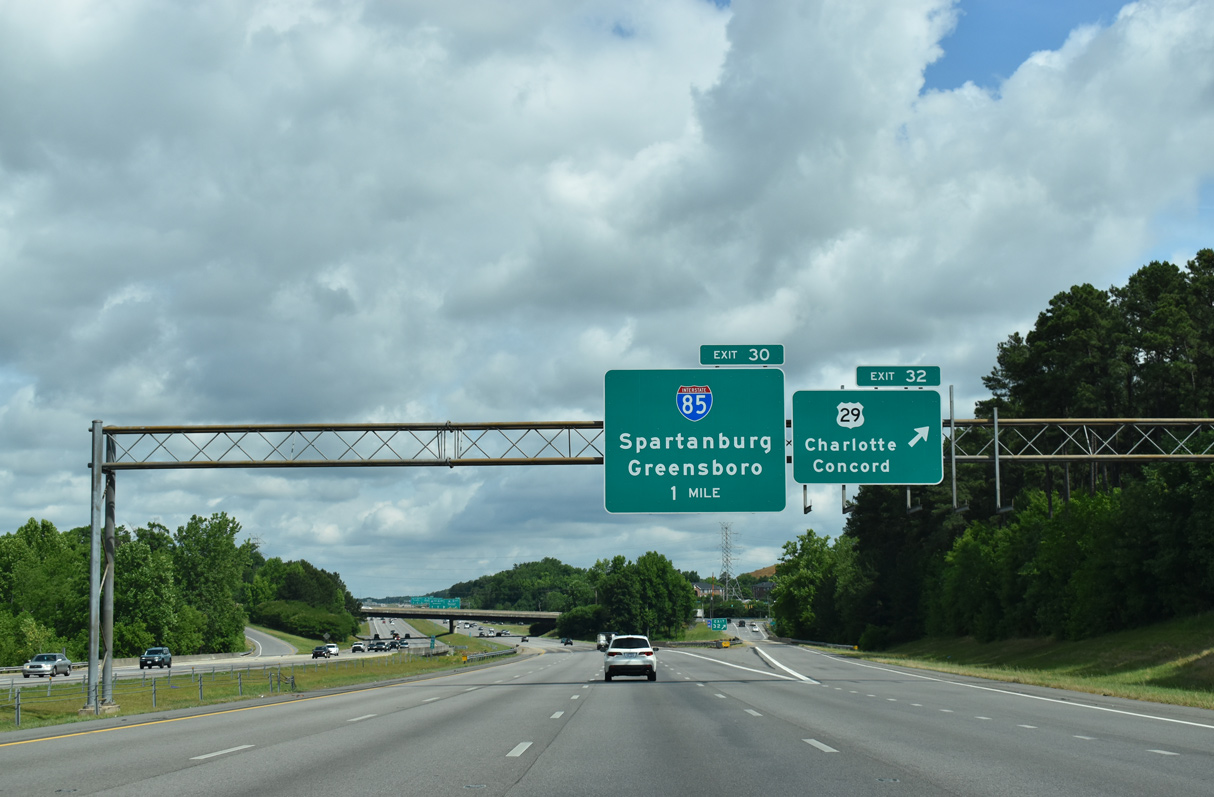
Entering the parclo interchange (Exit 32) with U.S. 29 (Tryon Street) on I-485. U.S. 29 accompanies the Interstate 85 corridor northeast to Concord.
05/31/21
Designated in 1999, the oldest section of I-485 links U.S. 29 and Interstate 85. Upgrades made prior to the establishment of I-485 included reconfiguring the previous trumpet interchange with U.S. 29 at Exit 32.
05/31/21
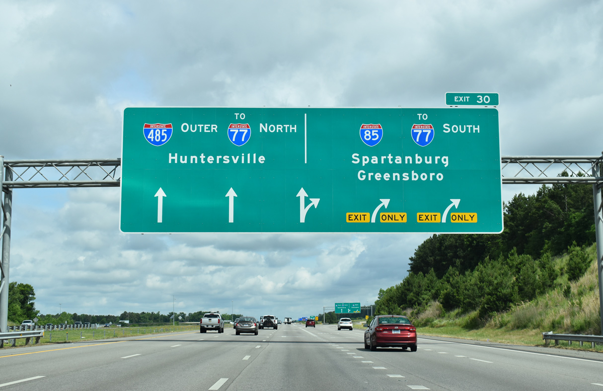
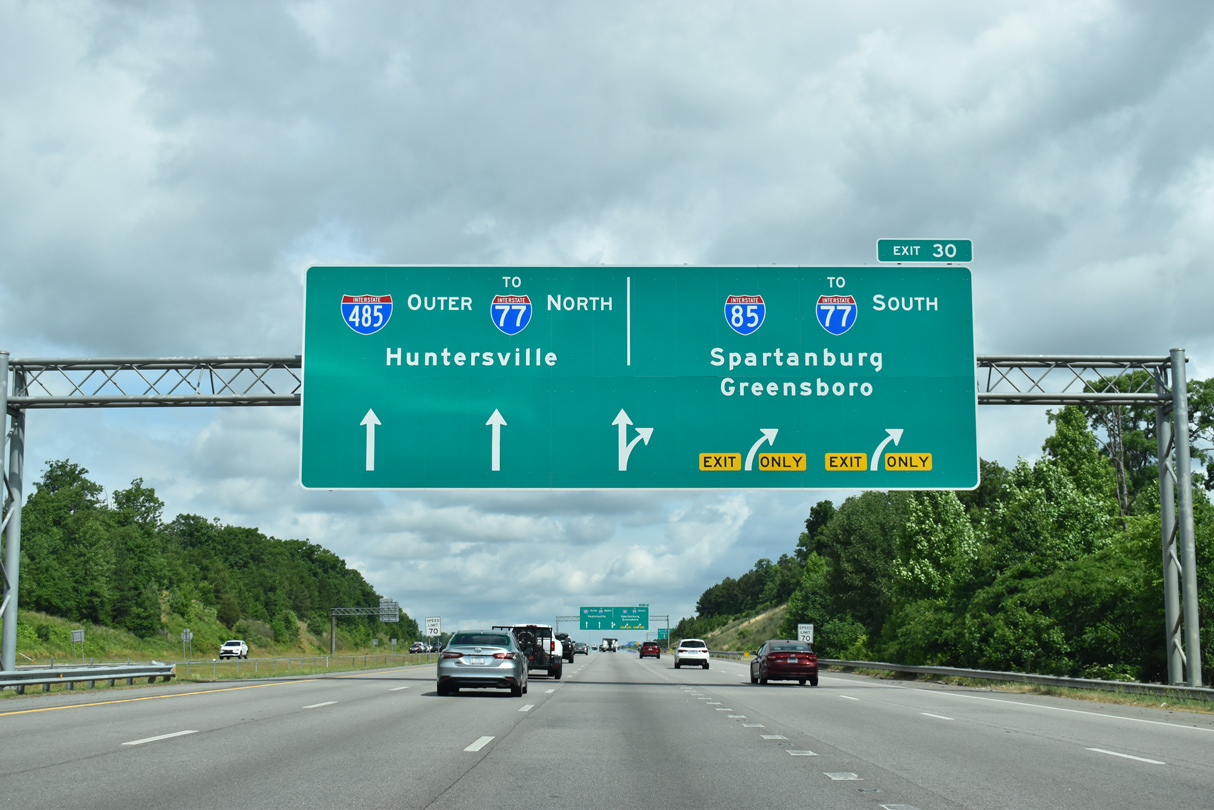
A substandard trumpet interchange formerly connected I-485 north with I-85 at Exit 30. The exchange was rebuilt as a turbine interchange during the final phase of beltway construction through north Charlotte.
05/31/21
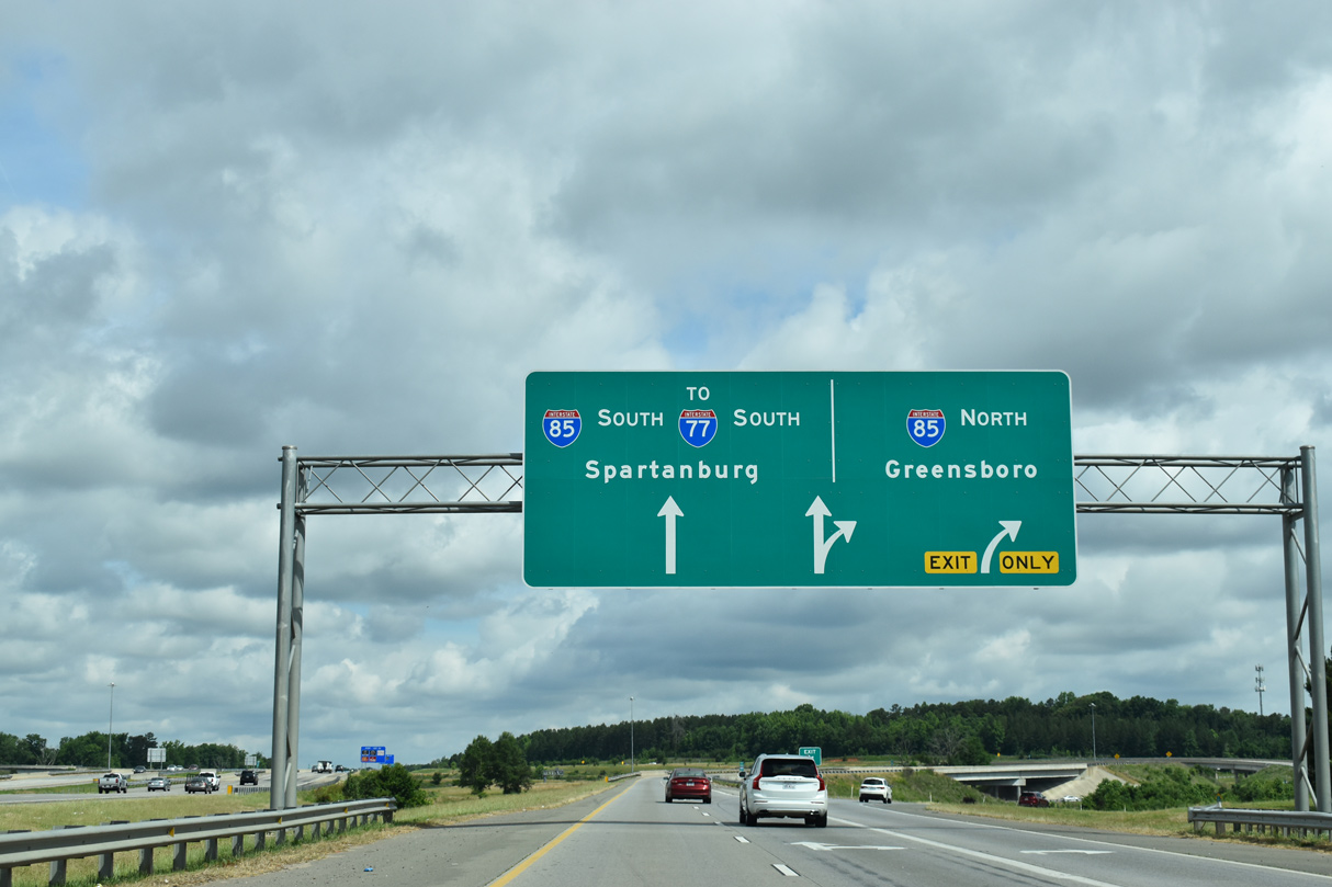
Traffic partitions at Exit 30 for Interstate 85 south toward Downtown Charlotte, Gastonia and Spartanburg, South Carolina and north to Concord, Kannapolis and the Piedmont Triad region.
05/31/21
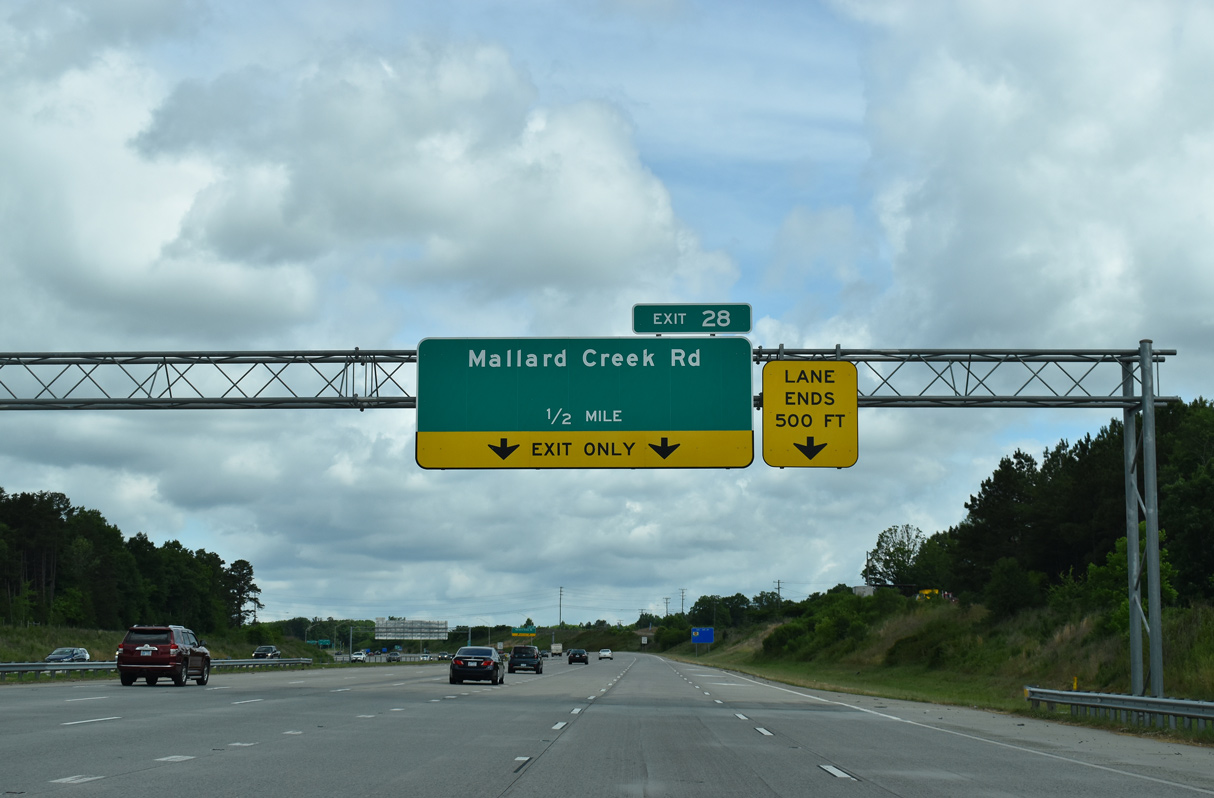
A diverging diamond interchange (DDI) connects Interstate 485 with Mallard Creek Road (SR 2467) at Exit 28.
05/31/21
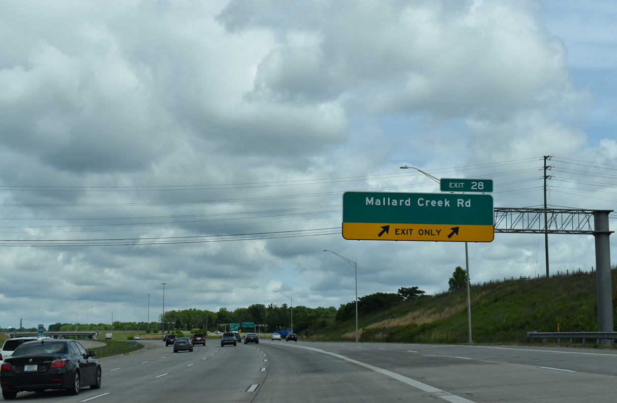
Mallard Creek Road (SR 2467) weaves through northeast Charlotte to I-485 between Mallard Creek Regional Park and Concord Mills Mall in Cabarras County.
05/31/21
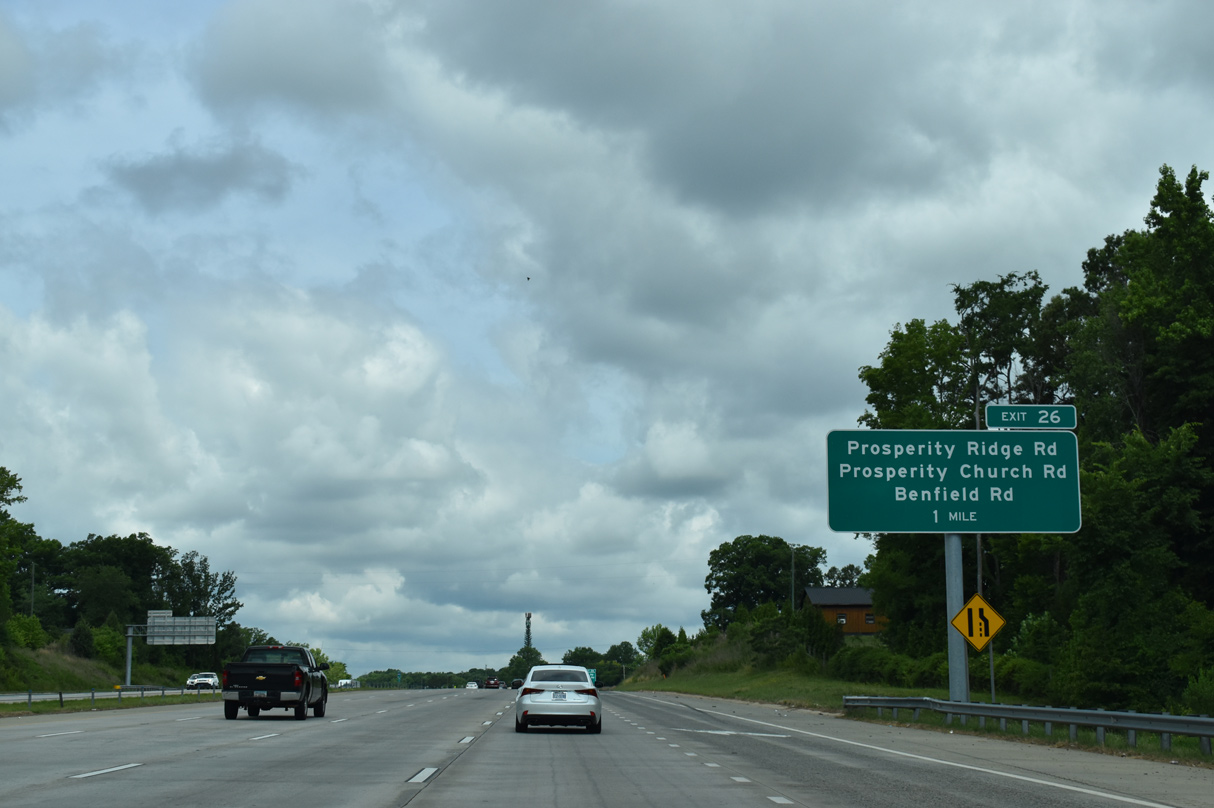
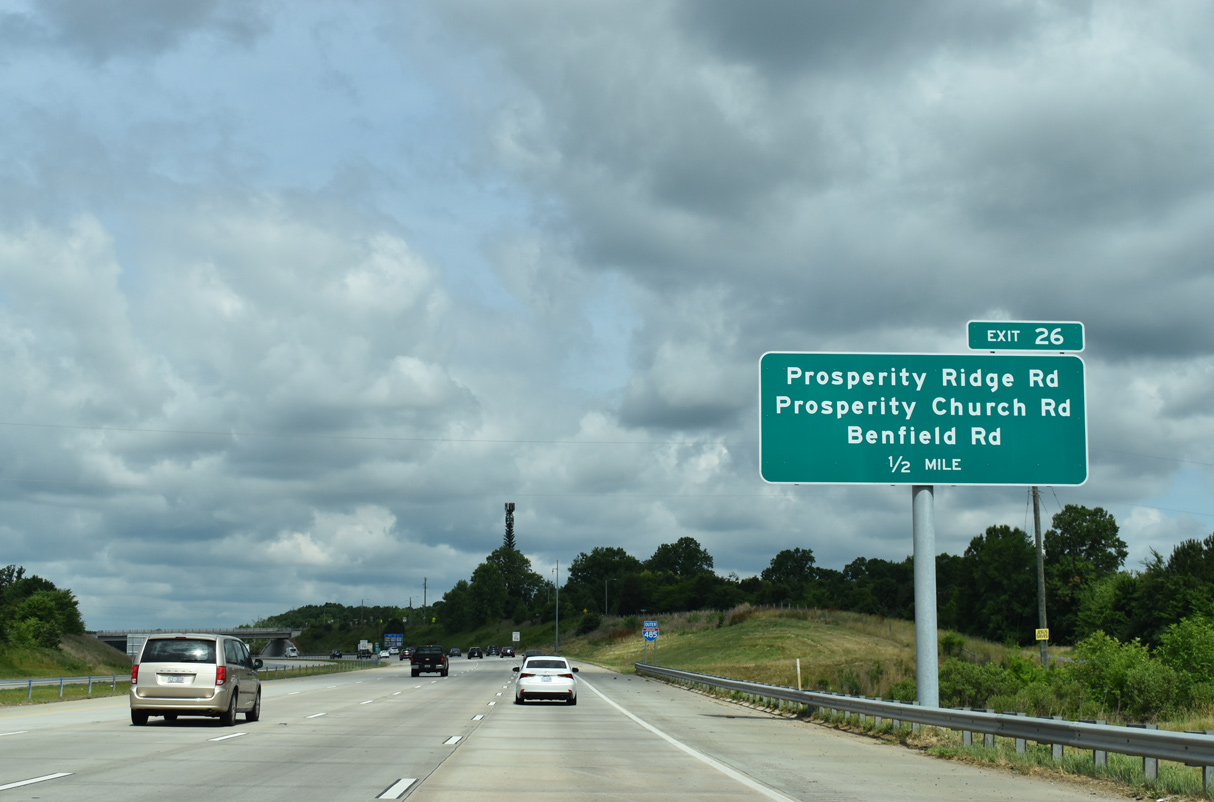
Interstate 485 curves westward to a split dumbbell interchange (Exit 26) with Prosperity Ridge, Prosperity Church and Benfield Roads.
05/31/21
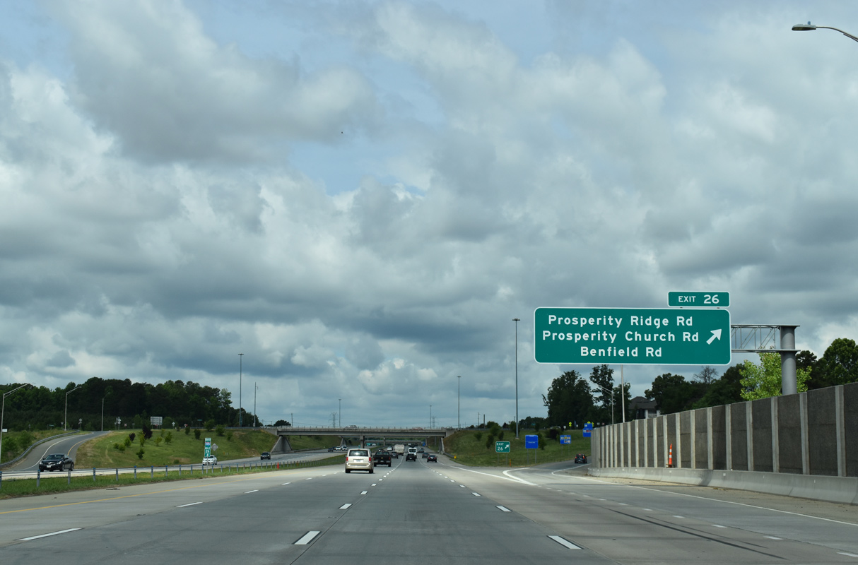
Prosperity Ridge and Benfield Roads encircle a retail area along Prosperity Church Road near the exchange (Exit 26) with Interstate 485. Prosperity Church Road extends north to Eastfield Road (SR 2459).
05/31/21
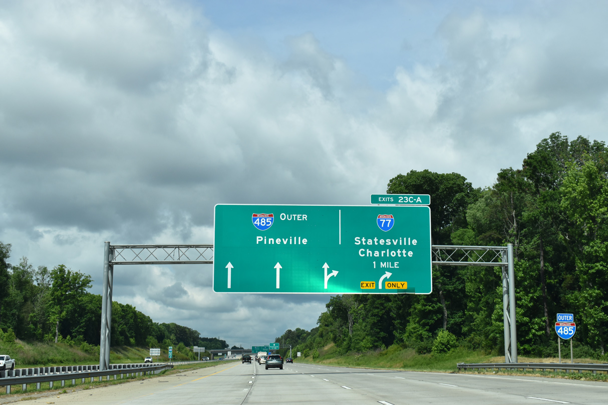
A two lane c/d roadway separates from the I-485 outer loop for Interstate 77 at Exit 23.
05/31/21
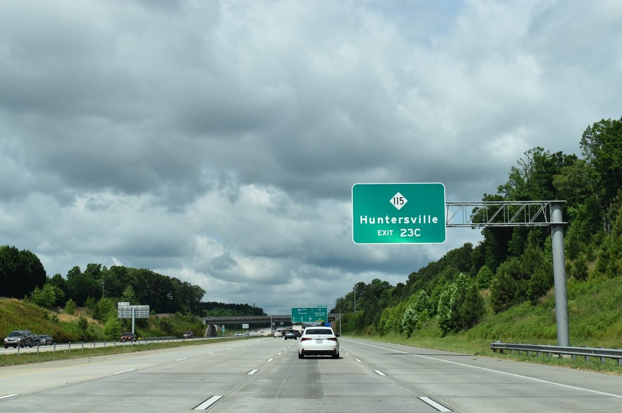
The c/d roadway for Interstate 77 connects I-485 and the folded diamond interchange with NC 115 (Old Statesville Road) at Exit 23C.
05/31/21
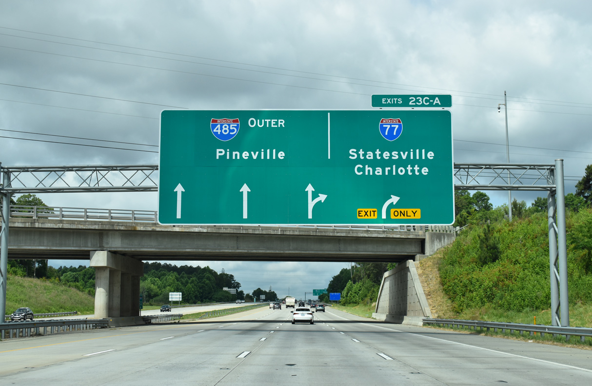
I-485 opened west from NC 115 (Exit 23C) and Interstate 77 (Exit 23B/A) on December 5, 2008.
05/31/21
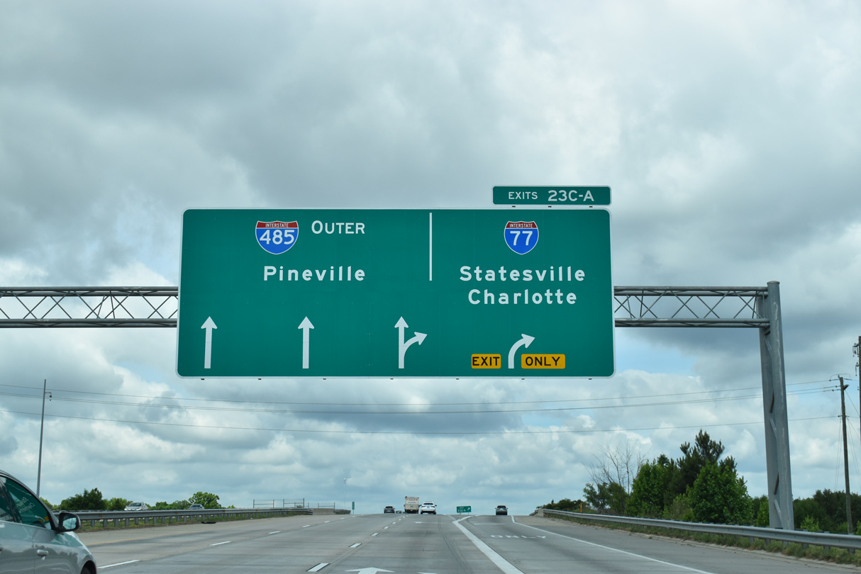
Interstate 77 is a heavily traveled commuter route south to Downtown Charlotte and north to Huntersville and Mooresville.
05/31/21
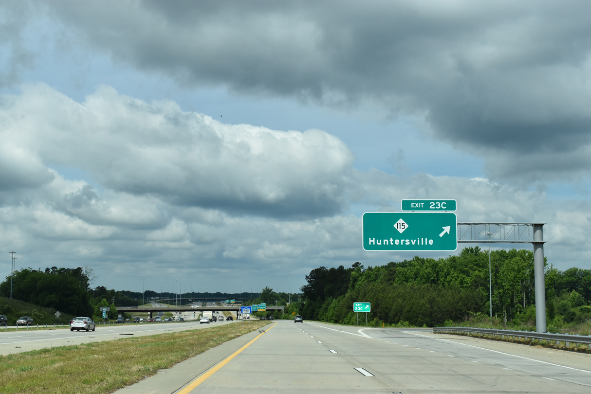
NC 115 (Old Statesville Road) serves a number of distribution centers, an auto mall and North Mecklenburg High School within the immediate vicinity of Interstate 485.
05/31/21
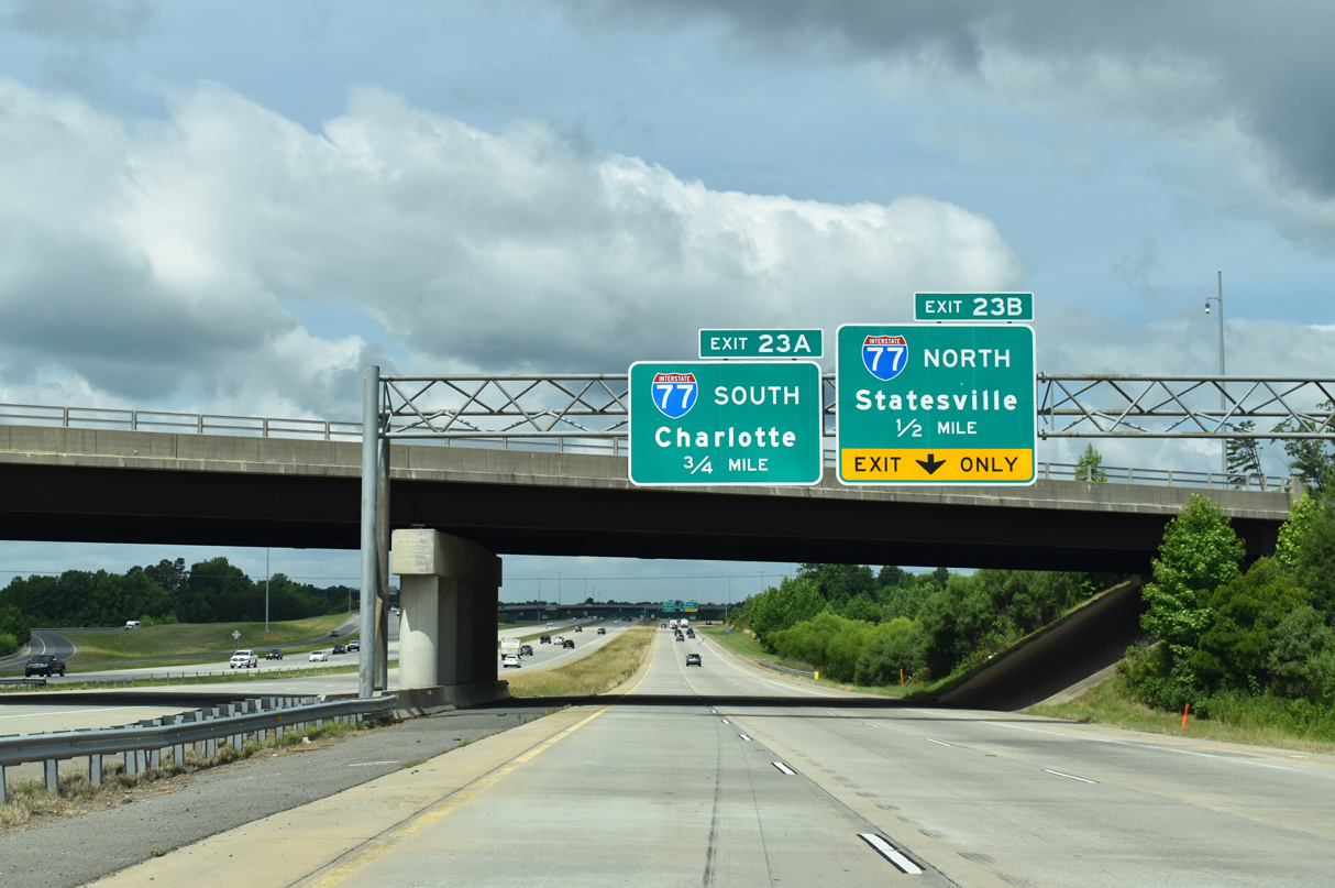
Exit 23B leaves the c/d roadway ahead of the U.S. 21 (Statesville Road) underpass for Interstate 77 north to Statesville.
05/31/21

A reassurance marker shield stands along the c/d roadway west of the NC 115 entrance ramp.
05/31/21
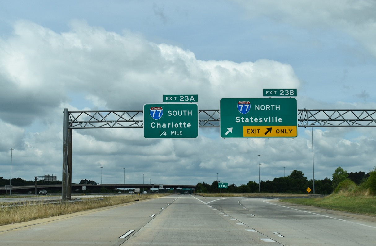
Exit 23B departs I-485 as the outer loop enters the cloverstack interchange with Interstate 77.
05/31/21
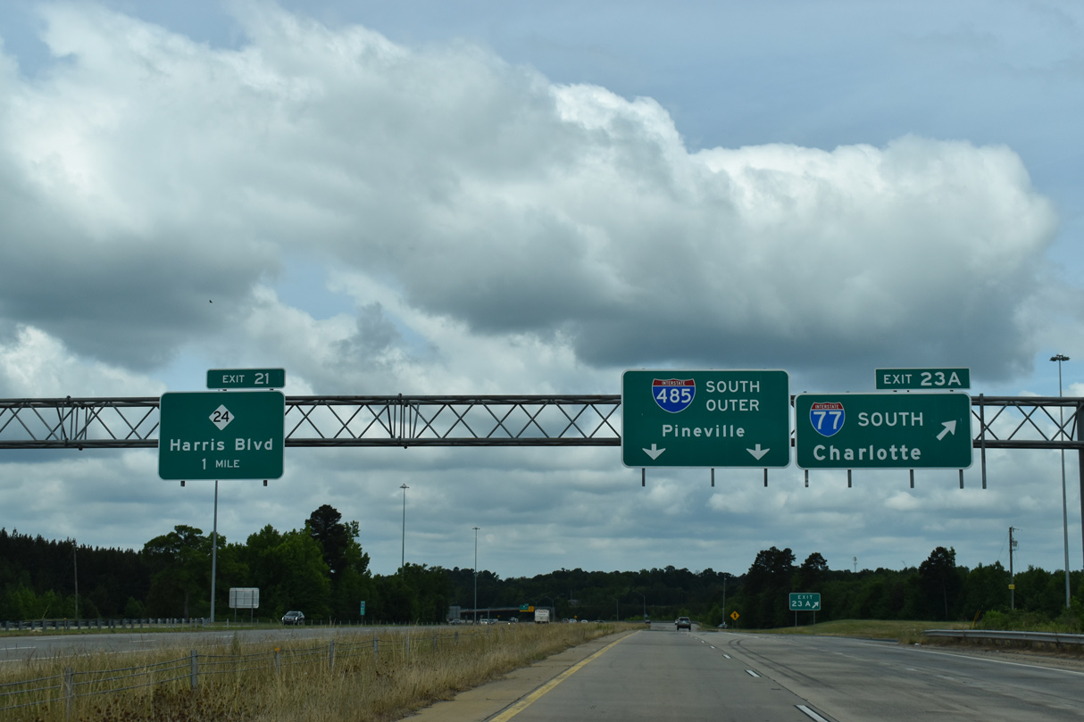
Exit 23A follows as a loop ramp onto Interstate 77 south to Downtown Charlotte, Rock Hill and Columbia, South Carolina. Spartanburg was greened out with Pineville for I-485 here.
05/31/21
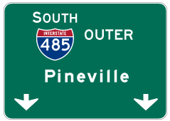
Photo Credits:
- Brent Ivy: 05/31/21
- Alex Nitzman: 05/31/21
Connect with:
Page Updated Thursday February 02, 2023.