
Interstate 495 South - Tysons to Springfield
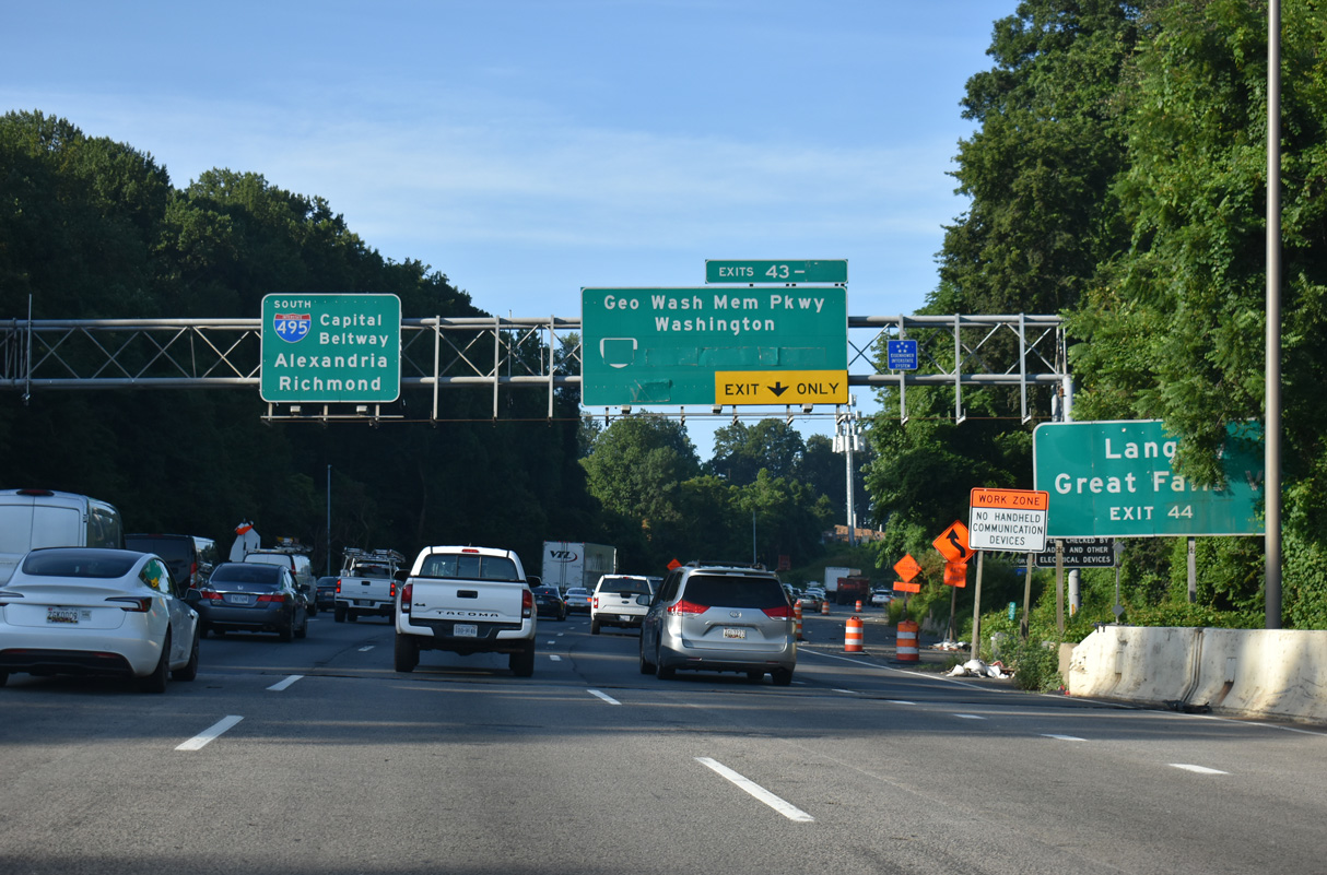
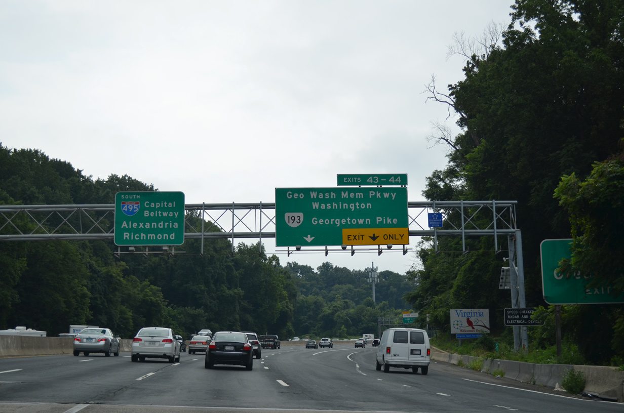
I-495 south enters Fairfax County over the south banks of the Potomac River. The trumpet interchange (Exit 43) with George Washington Memorial Parkway precedes the diamond interchange (Exit 44) with SR 193 (Georgetown Pike) to Great Falls and Langley.
07/28/25
Maintained by the National Park Service, George Washington Memorial Parkway generally follows the Potomac River southward to Arlington, Reagan National Airport (DCA), Alexandria and Mount Vernon.
07/28/25
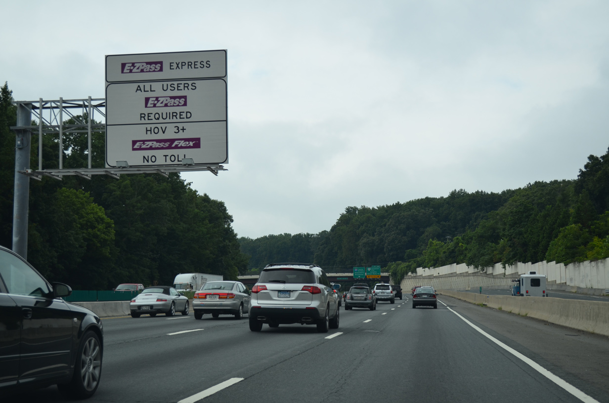
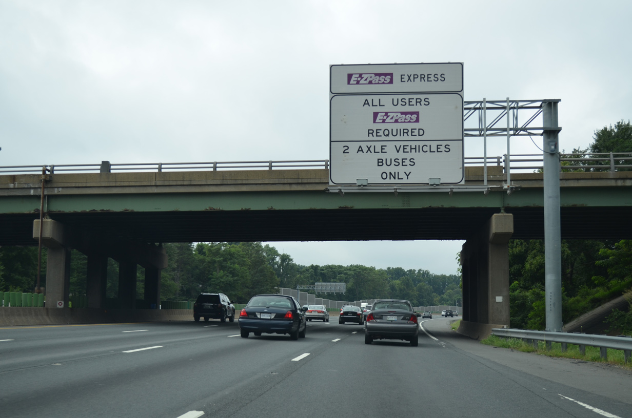
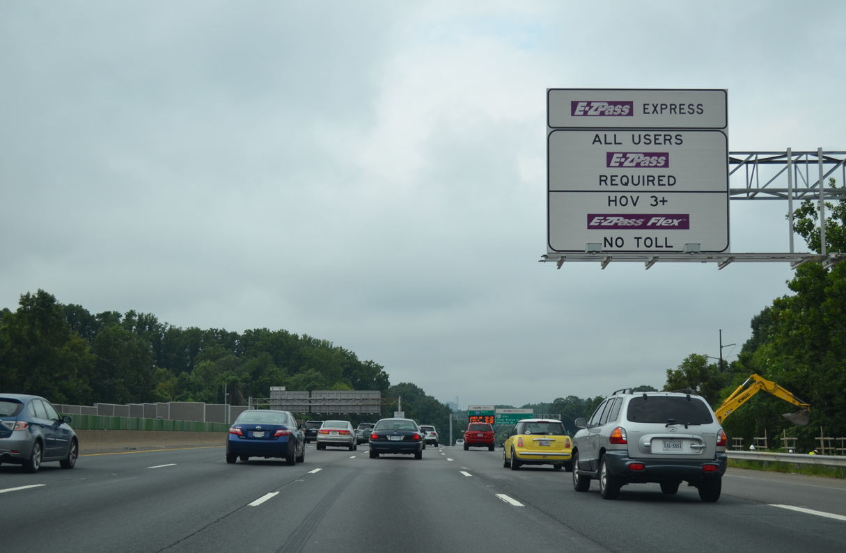
Construction of the I-495 Express Lanes Extension lengthened the toll lanes northward 2.5 miles to Exit 43. The HOT (High Occupancy Toll lanes) line the middle of the Capital Beltway southward from McLean to Springfield.
07/28/25
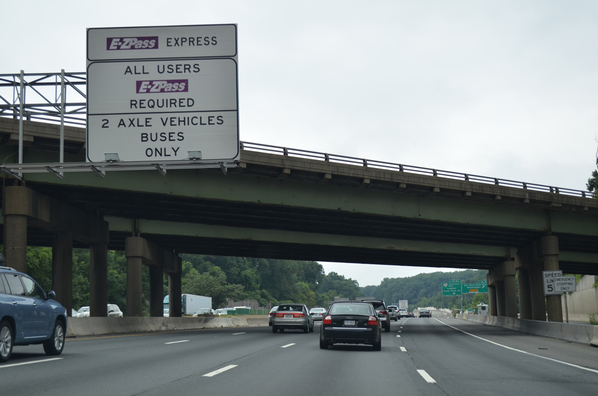
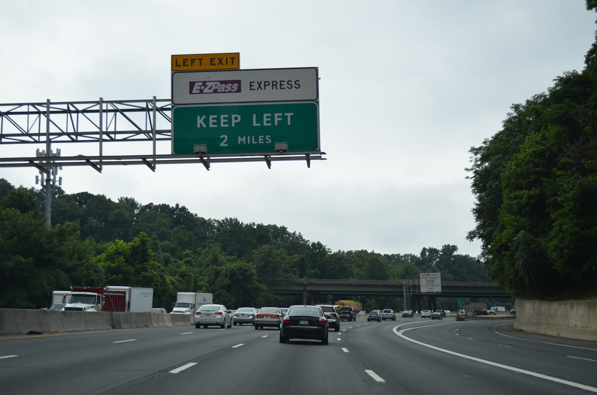
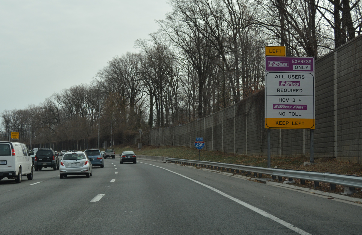
The I-495 Express Lanes are free to HOV-3 eligible motorists equipped with an E-ZPass Flex transponder. All other drivers are charged tolls that vary on time of day, levels of traffic and distance traveled. Commercial trucks are prohibited from the two lane roadway.
07/28/25
Live Oak Drive passes over I-495 where Exit 44 joins the distributor roadway from George Washington Memorial Parkway south to SR 193 (Georgetown Pike). Georgetown Pike takes an easterly route to Langley and SR 123 (Chain Bridge Road).
08/06/13
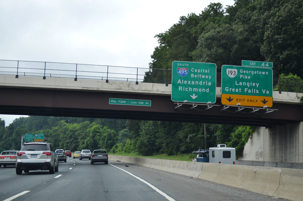
SR 193 meets I-495 near Scotts Run Nature Preserve north of McLean. The state route travels 11.79 miles between SR 7 at Dranesville and SR 123 at Langley.
08/06/13
The I-495 Express Lanes opened to traffic south from SR 267 (Dulles Toll Road) on November 17, 2012 with two lanes per direction and limited ingress and egress points.
07/28/25
The Dulles Access Road (Hirst Brault Expressway) connects I-495 south with Interstate 66 east to Arlington and Washington. SR 267 stretches 28.5 miles west from I-66 near Falls Church to U.S. 15 at Leesburg. The extension from Dulles Airport to Loudon County opened in 1995 as the Dulles Greenway toll road.
07/28/25
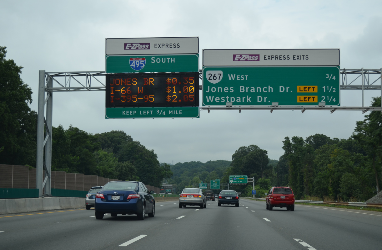
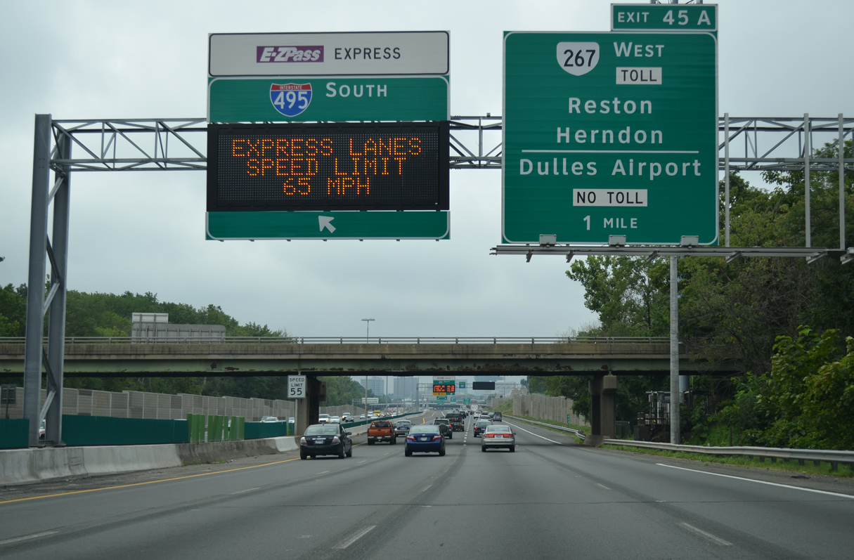
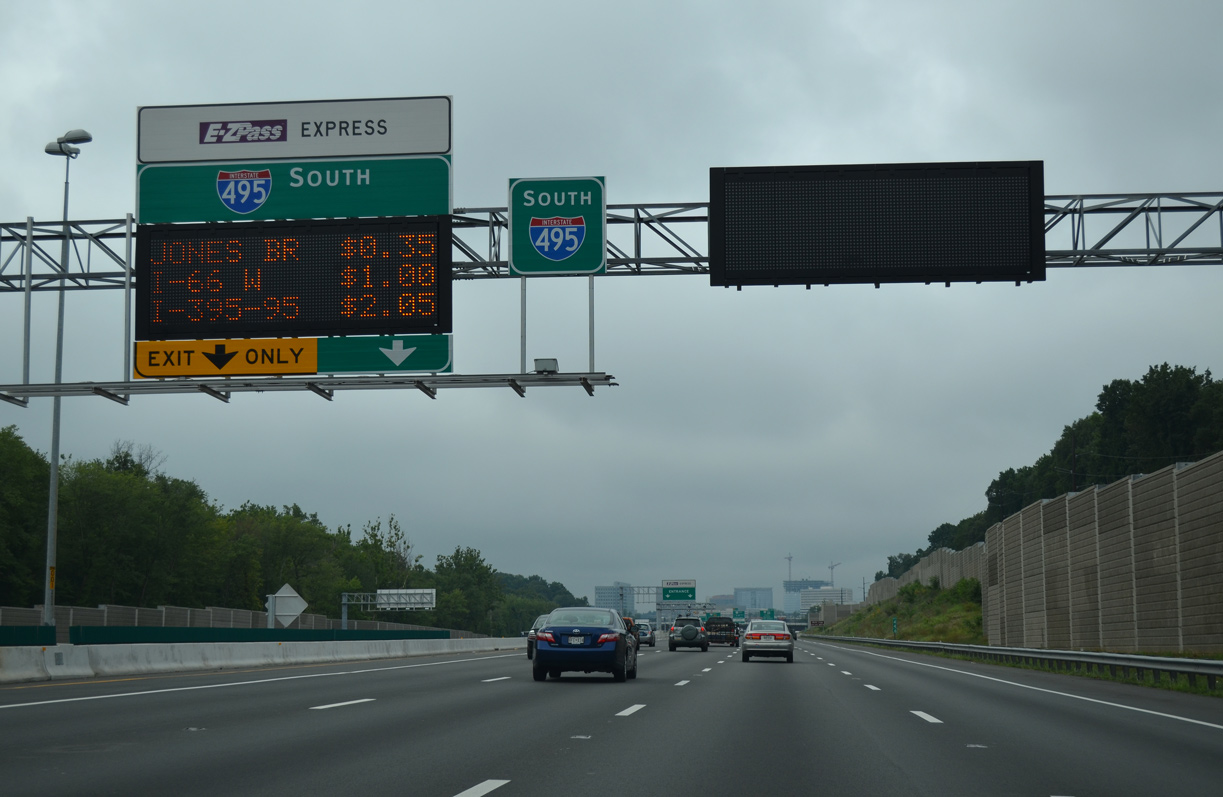
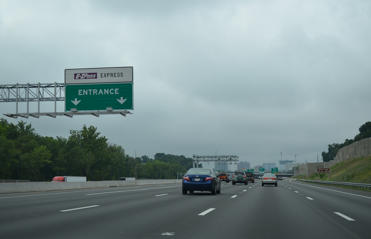
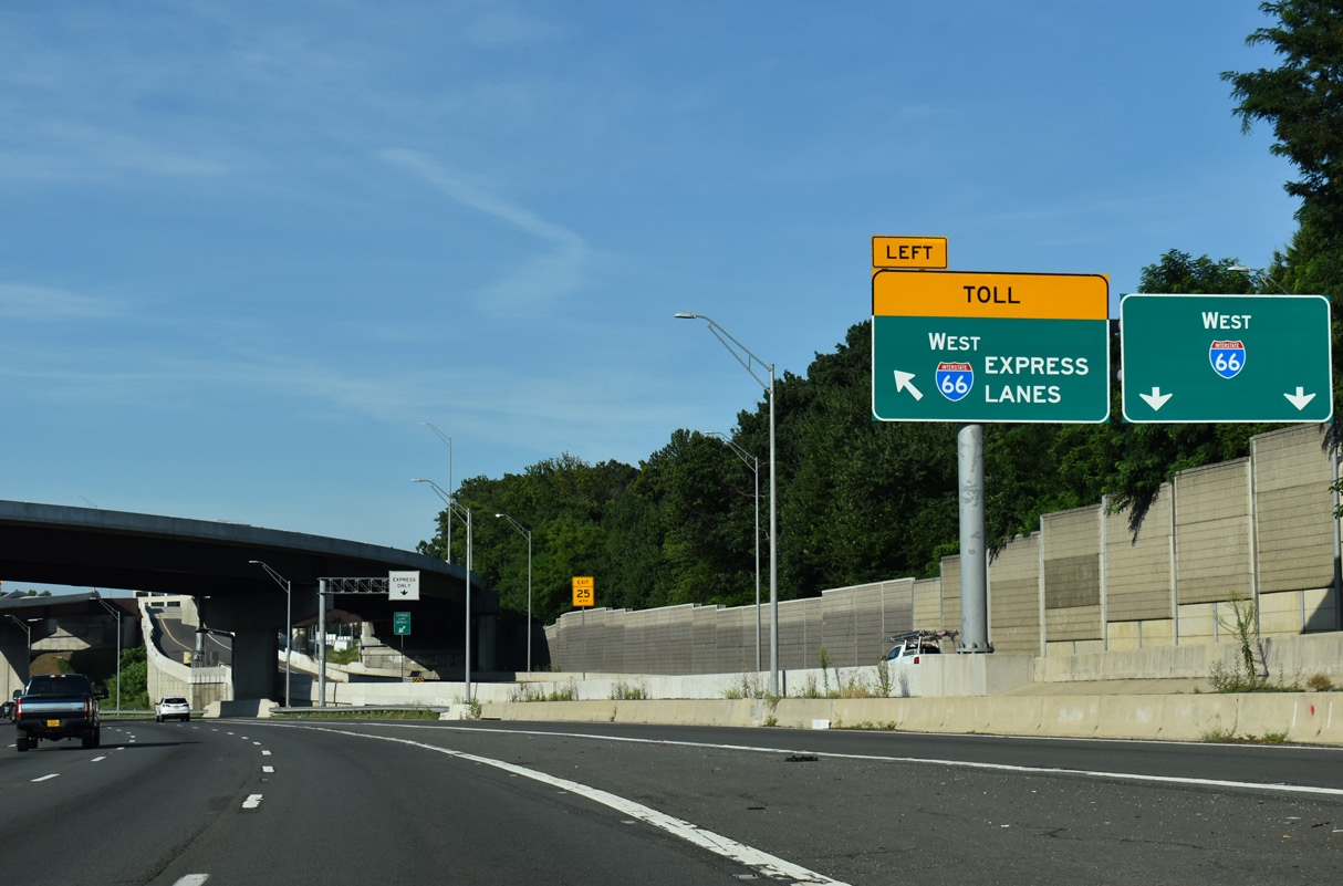
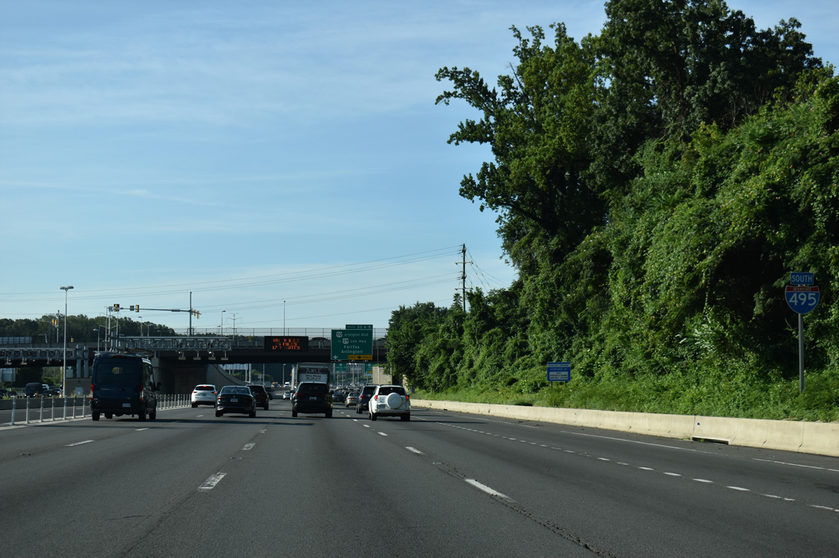
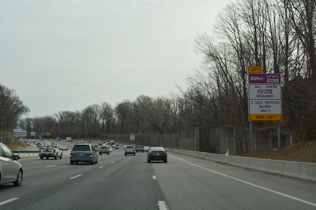
Dynamic message signs display the toll rates for the I-495 Express Lanes. All ramps from the HOT lanes depart independent of the I-495 mainline. The first three of those ramps serve Tysons Corner over the next 2.25 miles.
07/28/25
Prior to November 2025, the I-495 Express Lanes commenced southbound just ahead of Exit 45 to SR 267 (Dulles Toll Road).
07/28/25
The I-66 Inside the Beltway Express Lanes implements tolls on all non-HOV traffic between I-495 and U.S. 29 at Rosslyn during the morning peak hours.
07/28/25
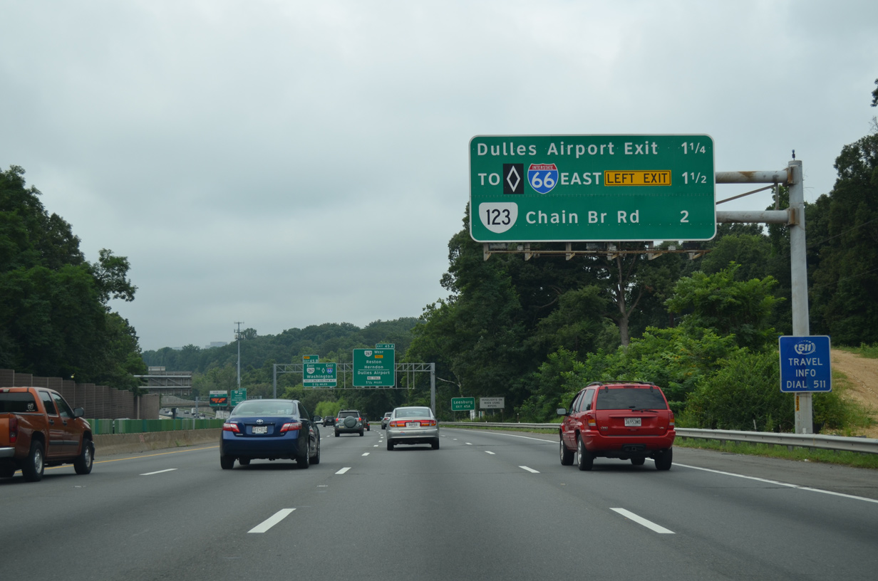
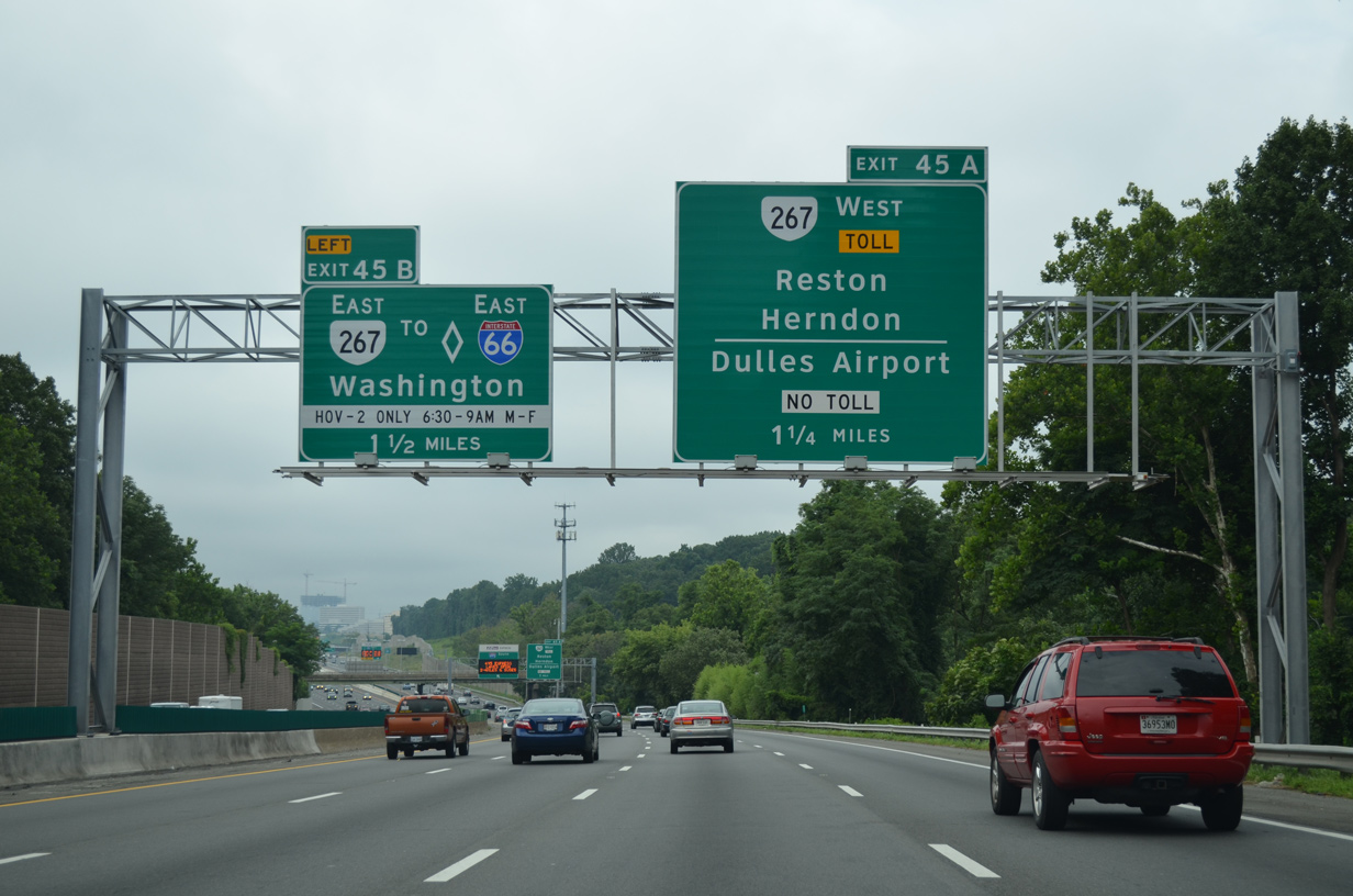
Exit 45 A joins I-495 south with both the Dulles Access Road to Washington Dulles International Airport (IAD) and the tolled Hirst Brault Expressway (SR 267) west. Paralleled by SR 267, Dulles Access Road constitutes a direct and uninterrupted freeway between I-66 and IAD Airport.
07/28/25
The I-495 Express Lanes exit to SR 267 (Dulles Airport & Toll Road) precedes Exit 45 A. SR 267 west leads to Wolf Trap Farm Park, Reston and Herndon.
07/28/25
Left Exit 45 B joins Dulles Access Road east ahead of Exit 19 to McLean and I-66 east. I-66 spurs into Washington via the Theodore Roosevelt Memorial Bridge, before turning north to K Street and the Whitehurst Freeway (U.S. 29). I-495 south meets the freeway directly in 2.5 miles.
07/28/25
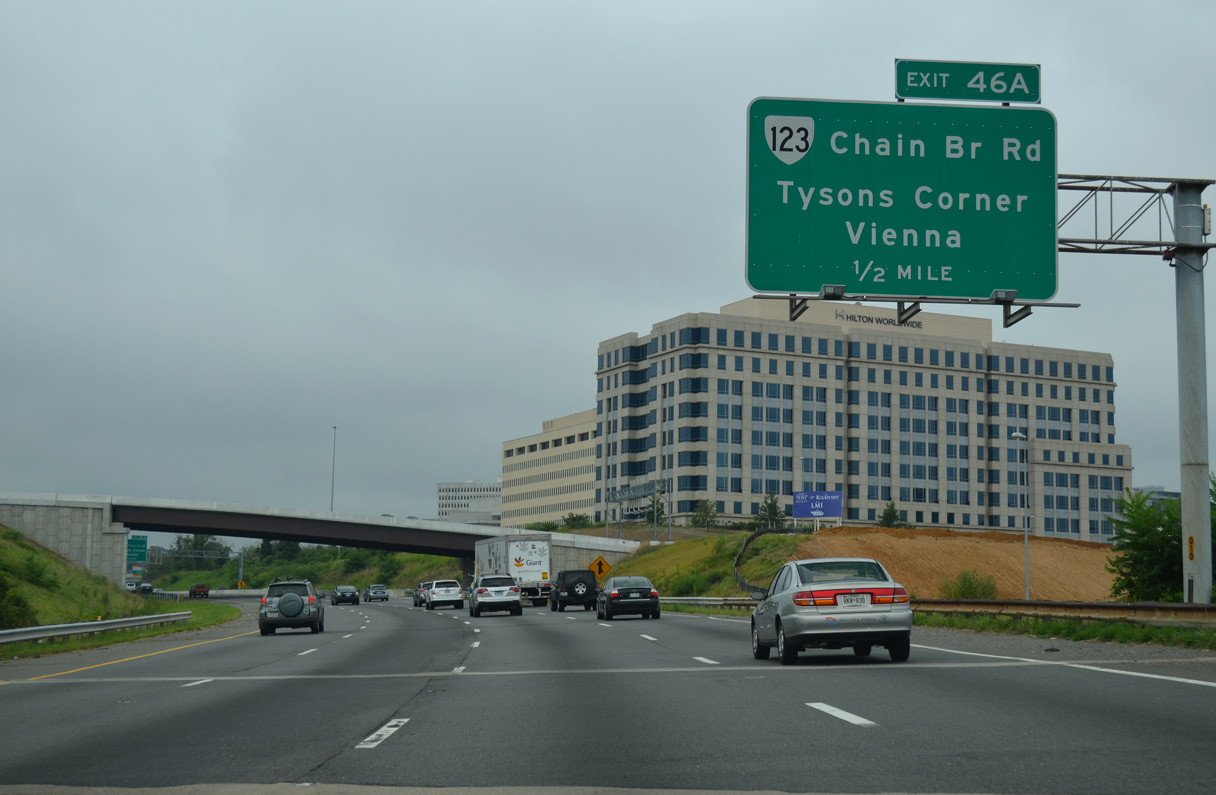
SR 123 (Chain Bridge Road west / Dolley Madison Boulevard east) meets Interstate 495 at the next interchange (Exits 46 A/B).
07/28/25
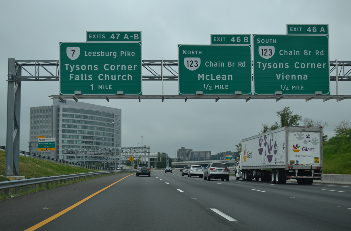
A cloverleaf interchange (Exits 46 A/B) joins Interstate 495 with SR 123 (Chain Bridge Road) at the first of two exits for Tysons.
07/28/25
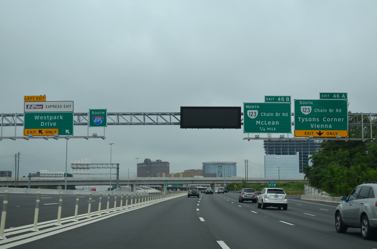
A two lane exit joins the I-495 Express Lanes with Scotts Crossing Road to Jones Branch Drive for Westpark at Tysons Corner.
07/28/25
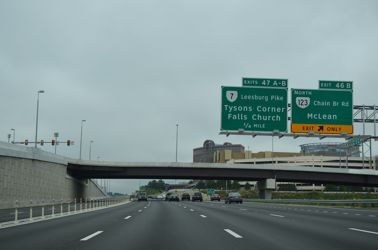
Exit 46 A parts ways with Interstate 495 south for SR 123 (Chain Bridge Road) west. SR 123 heads west through Tysons to Vienna and Fairfax.
07/28/25
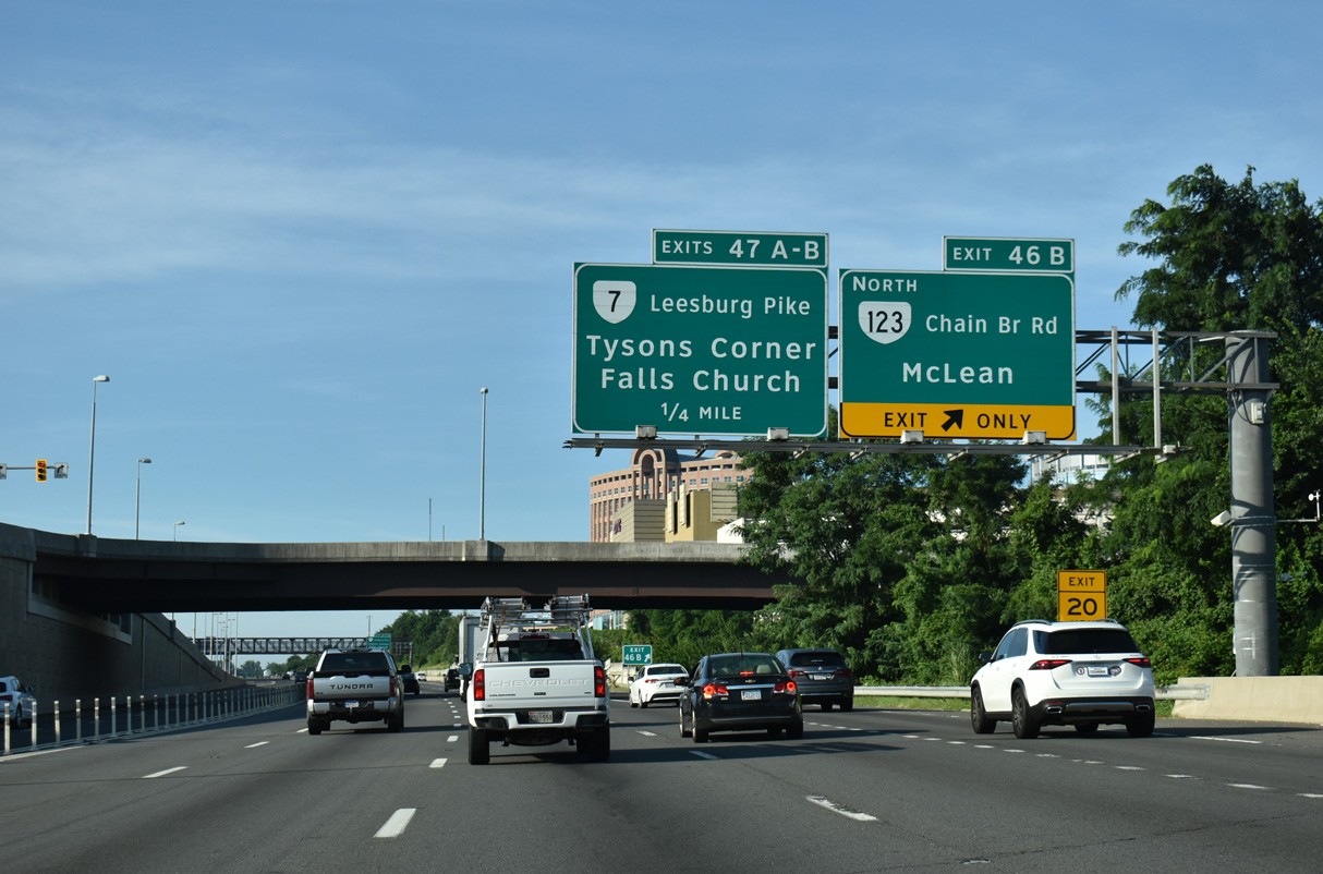
SR 123 (Chain Bridge Road) travels north from Exit 46 B into McLean while meeting the Dulles Access Road nearby. The state route follows Dolley Madison Boulevard east to Langley and SR 193 (Old Georgetown Pike).
07/28/25
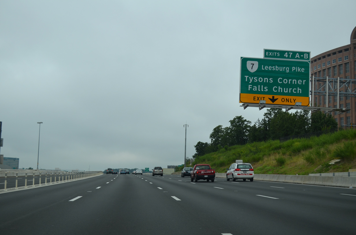
Continuing south, I-495 advances to a three quarter cloverleaf interchange (Exits 47 A/B) with SR 7 (Leesburg Pike). 73 miles in length, SR 7 travels overall from Alexandria west to Winchester.
07/28/25
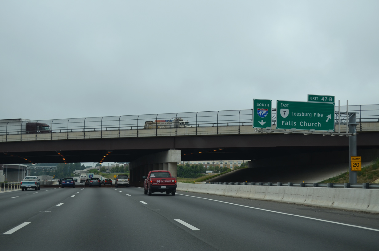
A c/d roadway separates for SR 7 (Leesburg Pike) from Interstate 495 south. Leesburg Pike is a busy arterial route southeast from Tysons into the independent city of Falls Church.
07/28/25
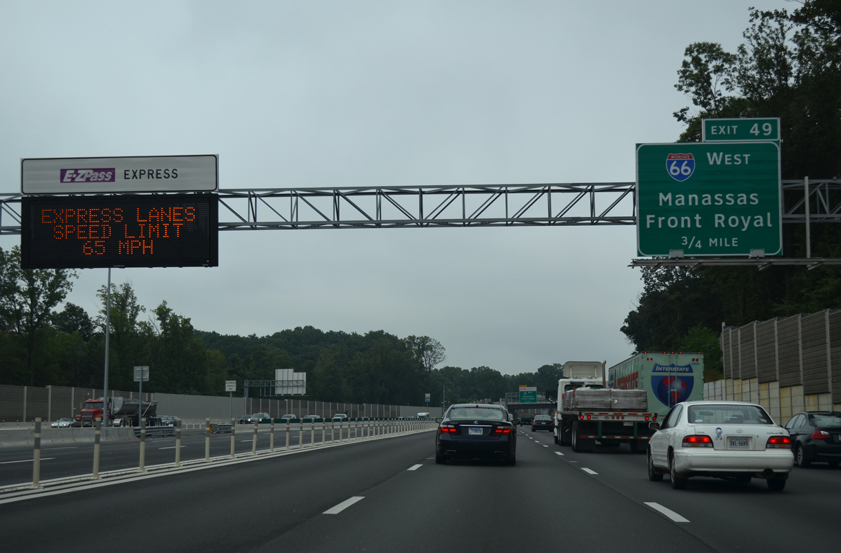
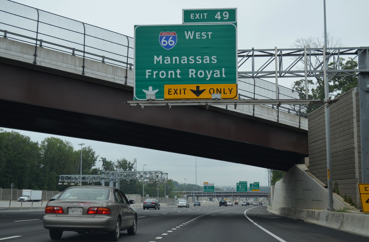
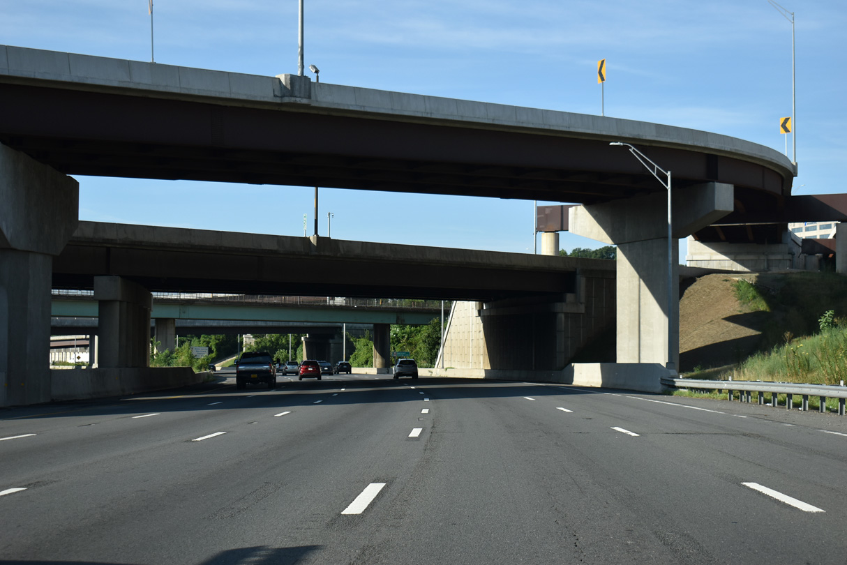
Leaving Tysons, I-495 weaves between the Dunn Loring and Idylwood communities to a systems interchange (Exit 49) with Interstate 66 in 0.75 miles.
07/28/25
Exits connect to both Interstate 66 west and the I-66 Outside the Beltway Express Lanes from the Capital Beltway mainline and the I-495 Express Lanes. I-66 passes between Vienna and Fairfax en route to Fair Oaks, Centreville and Manassas.
07/28/25
The I-66 Outside the Express Lanes use all electronic toll (AET) collection using E-ZPass or associated transponders. Like the I-495 Express Lanes, HOV-3 eligible motorists may use the toll lanes without being charged.
07/28/25
The I-66 Outside the Beltway Express lanes were constructed from Spring 2018 to November 2022 along I-66 west 22.5 miles from I-495 to U.S. 29 in Gainesville.
07/28/25
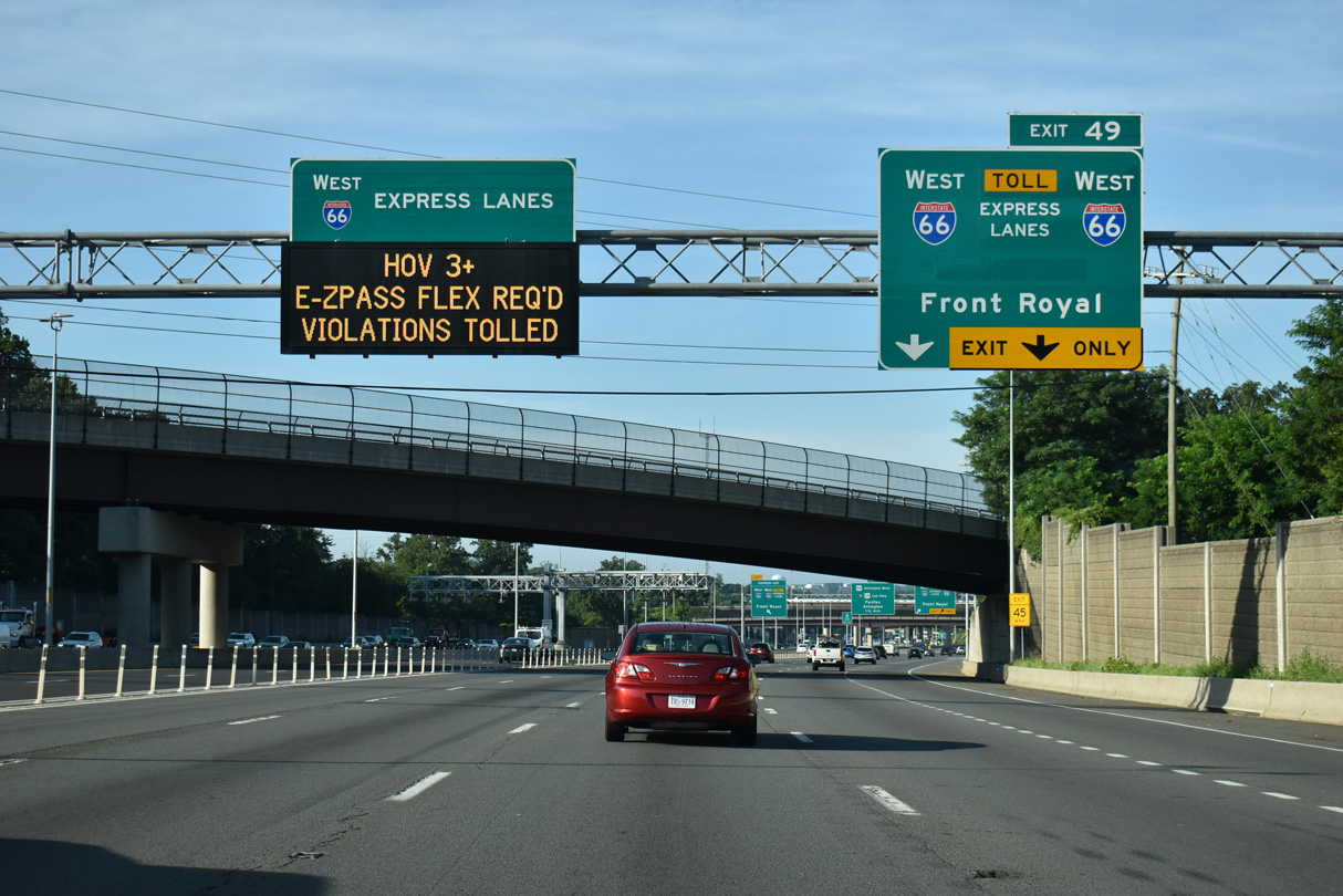
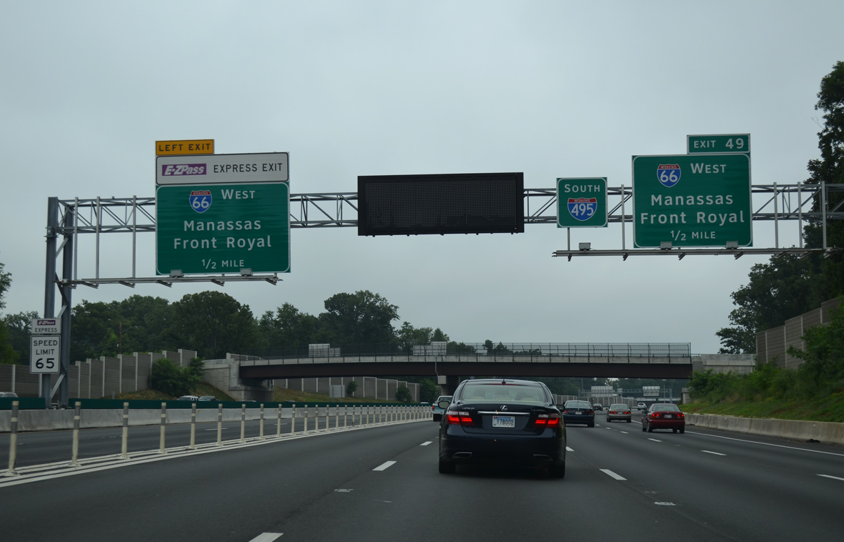
Exit 49 provides access to I-66 west only as SR 267 east already served the eastbound movement to D.C. Interstate 66 travels 76 miles overall between Washington and I-81 near Front Royal.
07/28/25

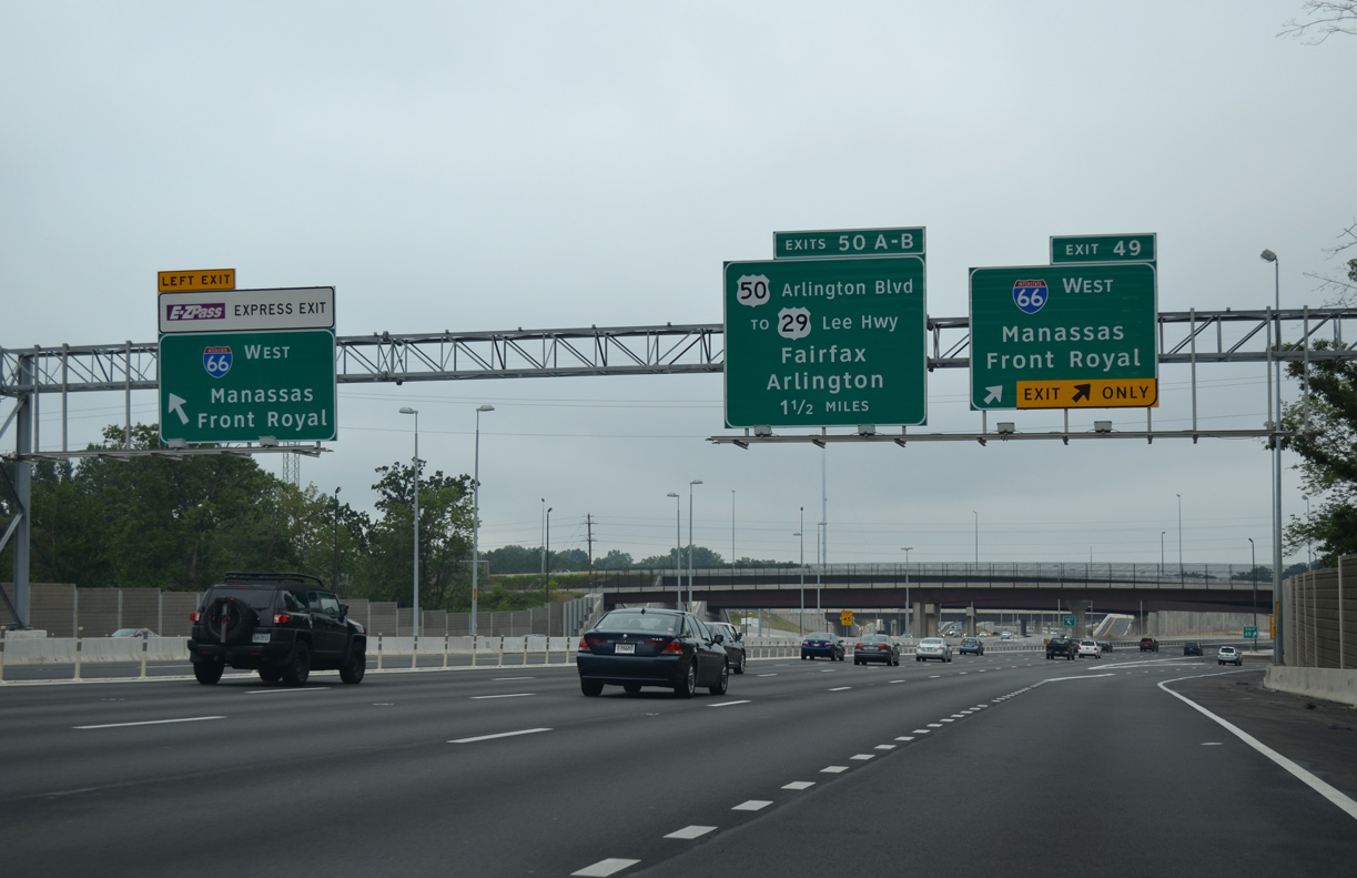
Exits for westbound I-66 and the I-66 Express Lanes depart simultaneously from the I-495 mainline and I-495 Express Lanes.
07/28/25
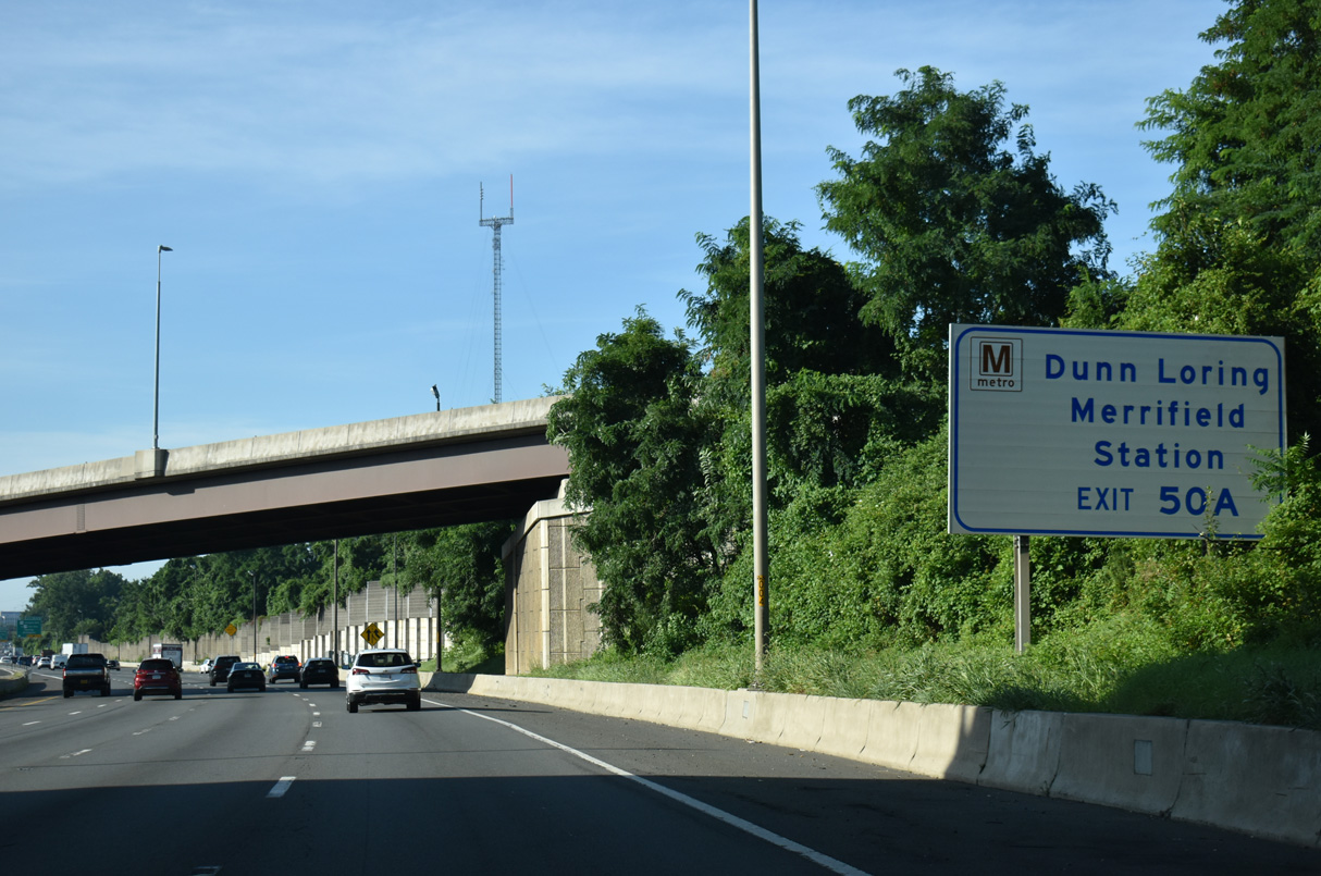
I-66 is a heavily traveled commuter route west through Fairfax County. The Metro Orange Line runs along the median of the freeway west to the Vienna/Fairfax Station.
07/28/25
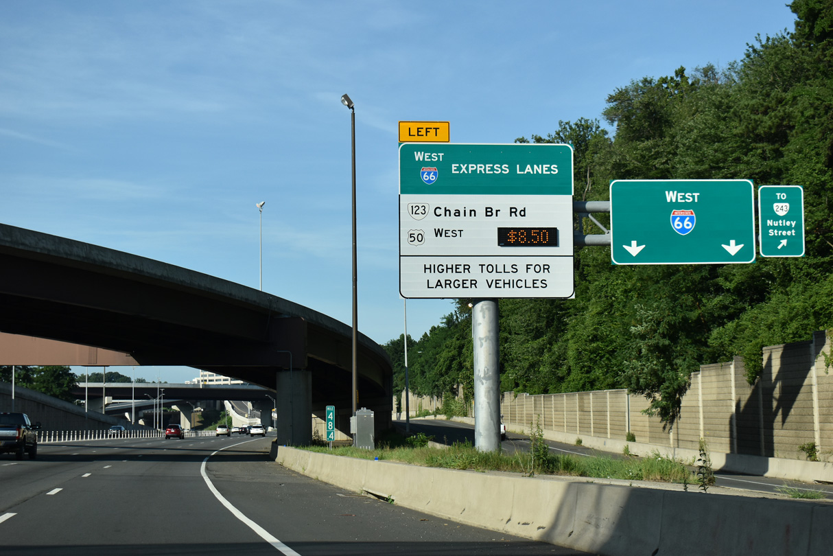
Exit 49 separates for ramps to the outside lanes of Interstate 66 west ahead of SR 243 (Nutley Street) to Vienna and the I-66 Express Lanes ahead of SR 123 (Chain Bridge Road) to Fairfax.
07/28/25
Flyovers join the general travel lanes and Express Lanes for both I-66 and I-495.
07/28/25
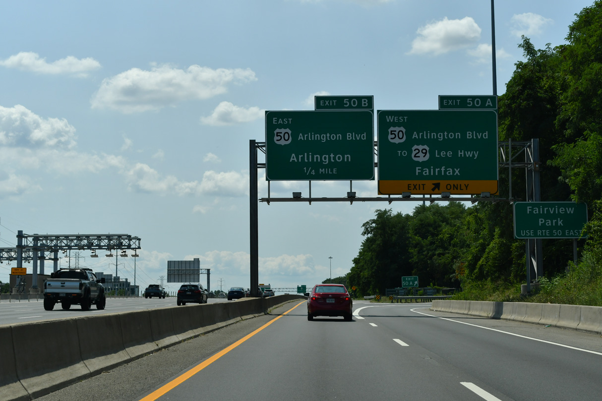
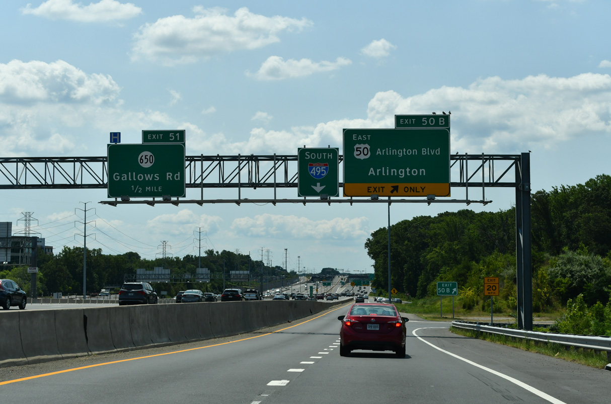
Interstate 495 advances south from I-66 one mile to a cloverleaf interchange with U.S. 50 (Arlington Boulevard).
07/28/25
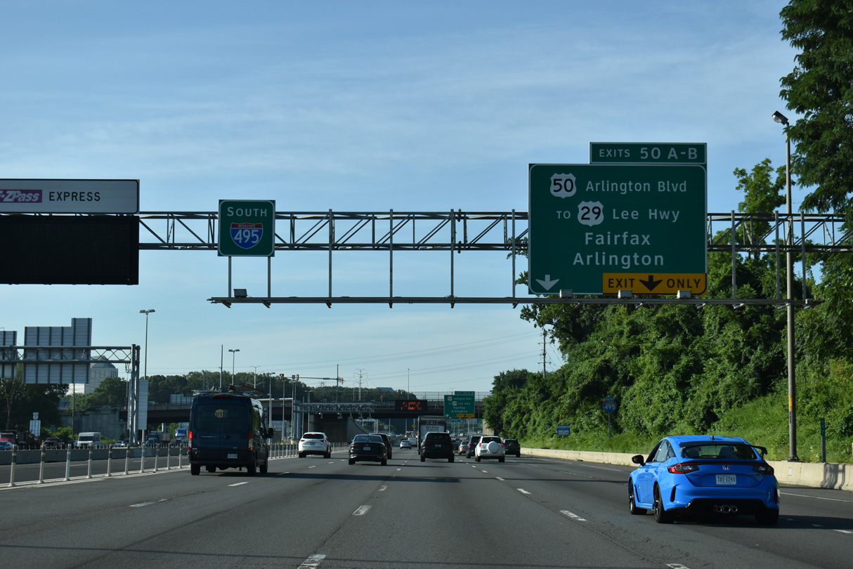
There is no direct access to U.S. 29 (Lee Highway) from Interstate 495 south. Motorists are directed to use Exit 50 A for the arterial as well.
07/28/25
Reassurance marker posted for Interstate 495 ahead of the U.S. 29 (Lee Highway) overpass. Ramps connect the south side of Lee Highway with the I-495 Express Lanes.
07/28/25

A collector distributor roadway (Exit 50) departs Interstate 495 south for U.S. 50 (Arlington Boulevard) at Merrifield.
07/28/25
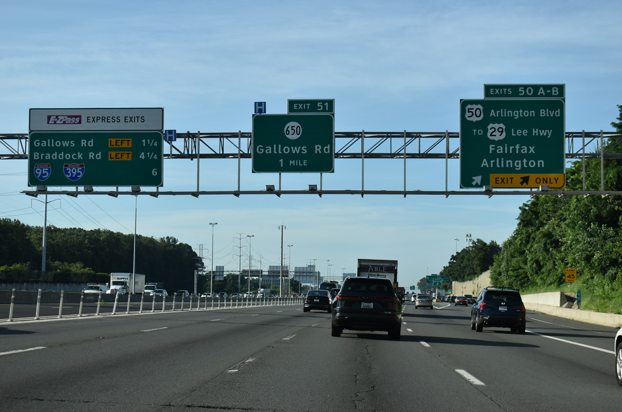
There are two remaining exits from the I-495 Express Lanes before the HOT lanes merge with the mainline ahead of I-95/395 (Springfield Interchange).
07/28/25
U.S. 50 and SR 650 (Gallows Road) converge at a SPUI to the west at Merrifield. SR 650 connects Arlington Boulevard with Lee Highway to the north. U.S. 50 continues west to combine with U.S. 29 at Fairfax.
07/28/24
U.S. 50 follows Arlington Boulevard east to Fairview Park, Seven Corners outside Falls Church, and Arlington.
07/28/24
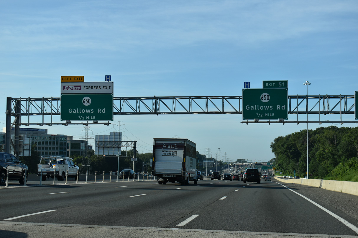
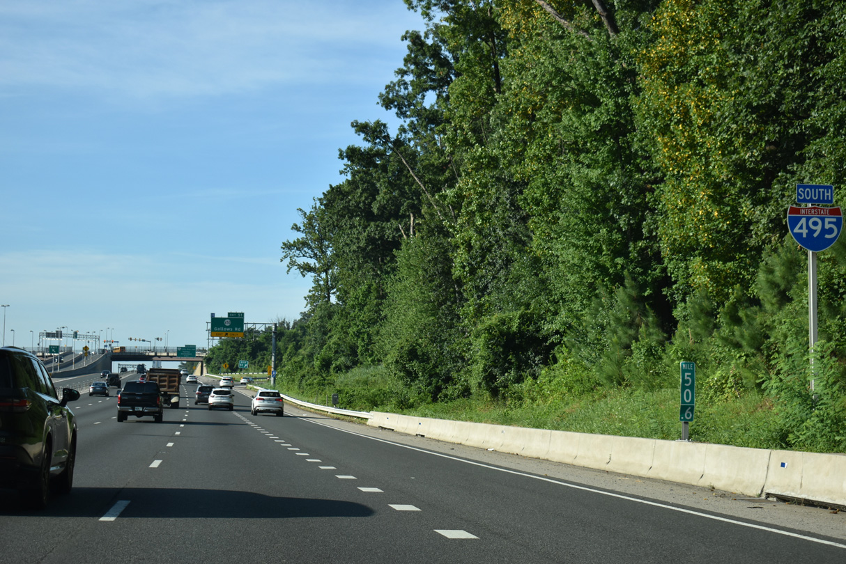
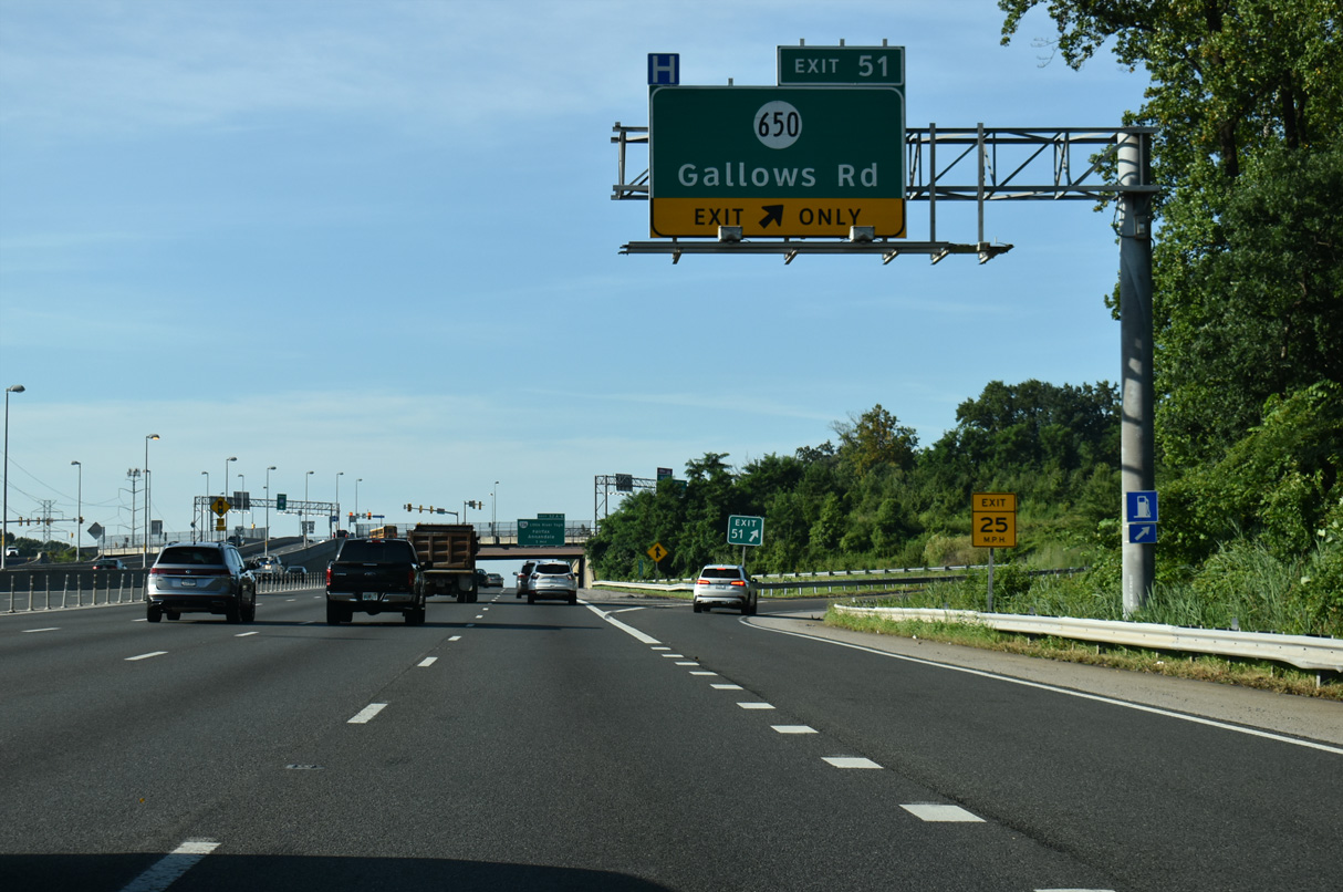
Gallows Road continues south from U.S. 50 (Arlington Boulevard) to meet Interstate 495 at a parclo interchange (Exit 51) in one half mile.
07/28/25
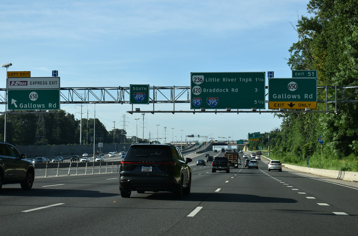
Two exits remain along the Capital Beltway ahead of I-95/395 in 5.5 miles.
07/28/25
An auxiliary lane lane opens southbound from U.S. 50 to Exit 51 for SR 650 (Gallows Road).
07/28/25
Progressing southeast from Exit 51, SR 650 continues along Gallows Road to Annandale Road and SR 236 (Little River Turnpike).
07/28/25
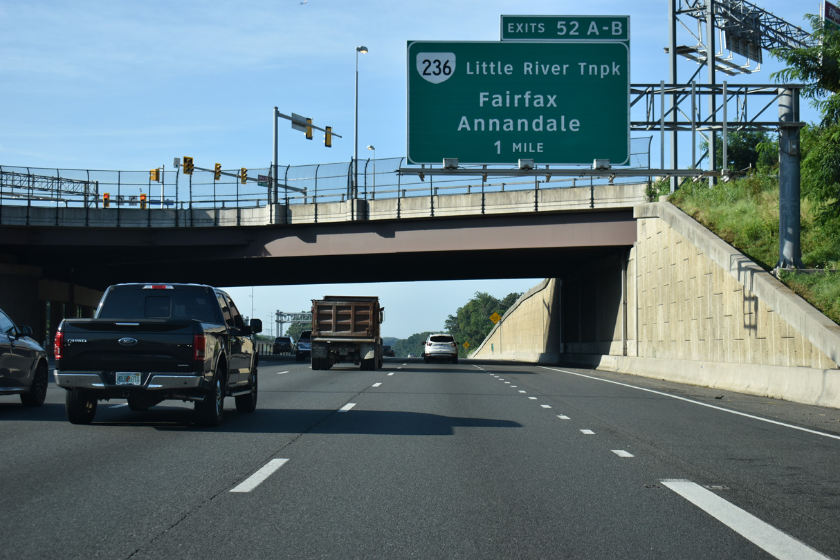
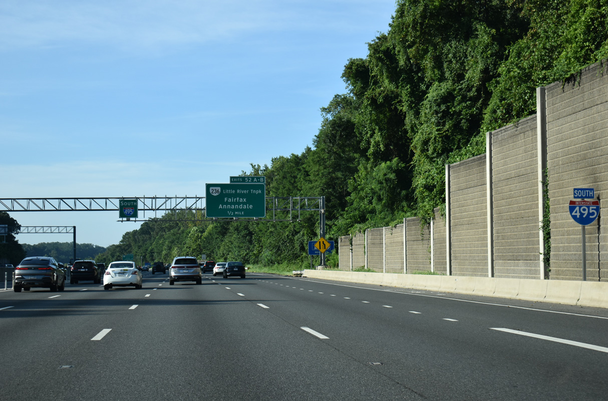
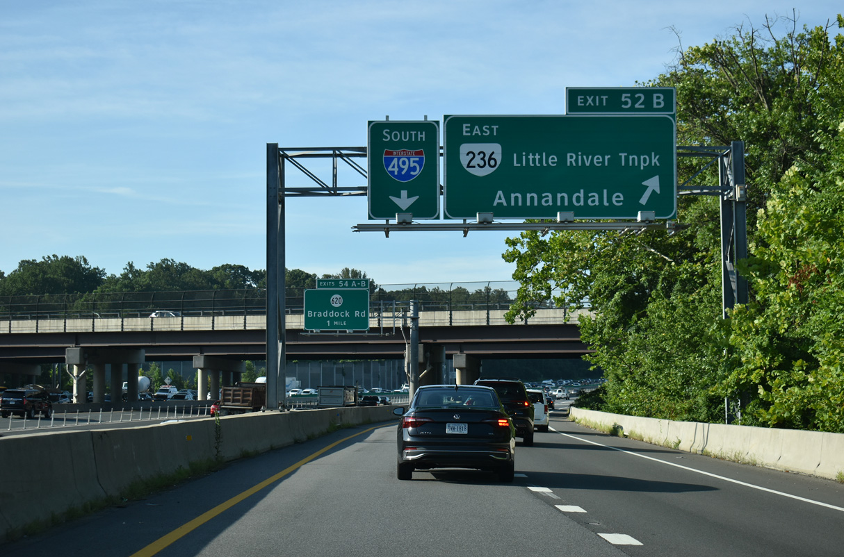
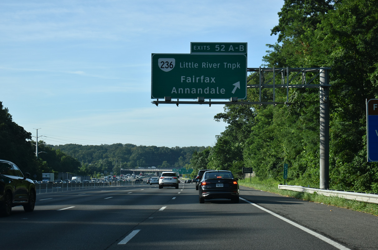
Interstate 495 next meets SR 123 (Little River Turnpike) at a cloverleaf interchange (Exits 52 A/B).
07/28/25
Mill Creek Park lines the west side of Interstate 495 beyond the sound walls by this reassurance marker.
07/28/25
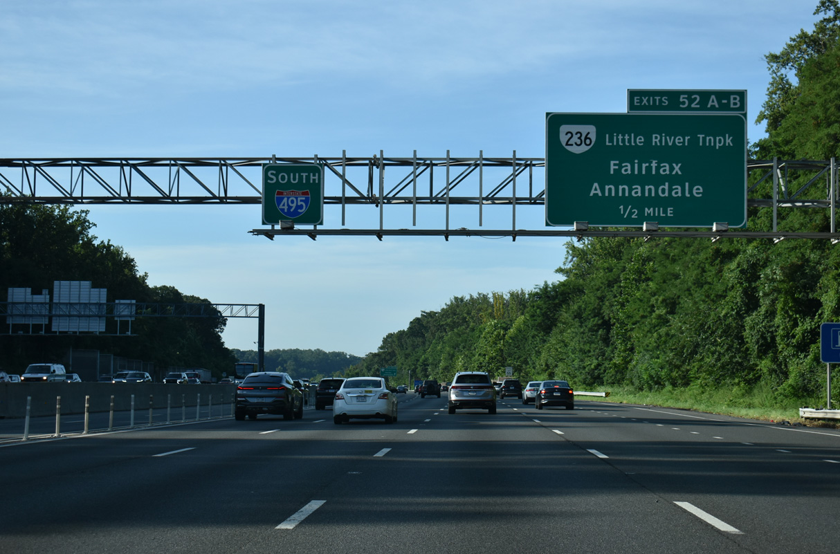
SR 236 is a 15.54 mile long route running between U.S. 29/50 in Fairfax and SR 400 in Alexandria.
07/28/25
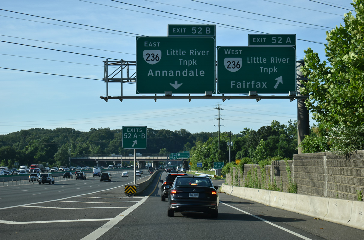
Westward from Exit 52 A, SR 236 meets SR 237 in 2.4 miles at the independent city of Fairfax.
07/28/25
SR 236 heads 1.3 miles east to commercial center of Annandale and 4.8 miles to Lincolnia.
07/28/25
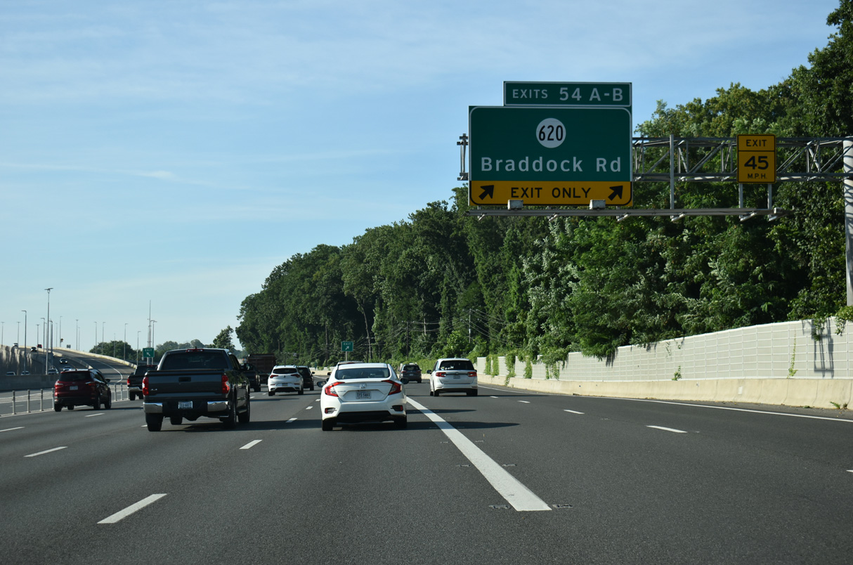
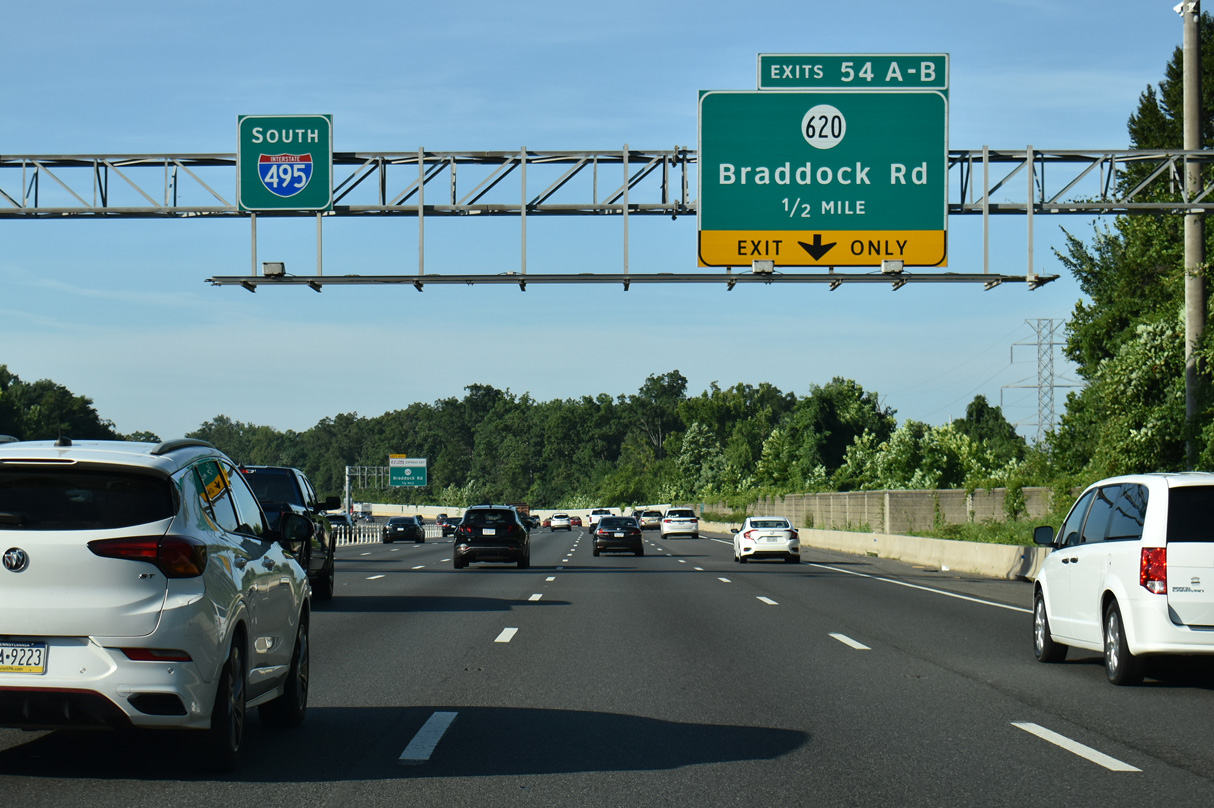
The second Annandale exit joins Interstate 495 south (outer loop) with SR 620 (Braddock Road) in one mile.
07/28/25
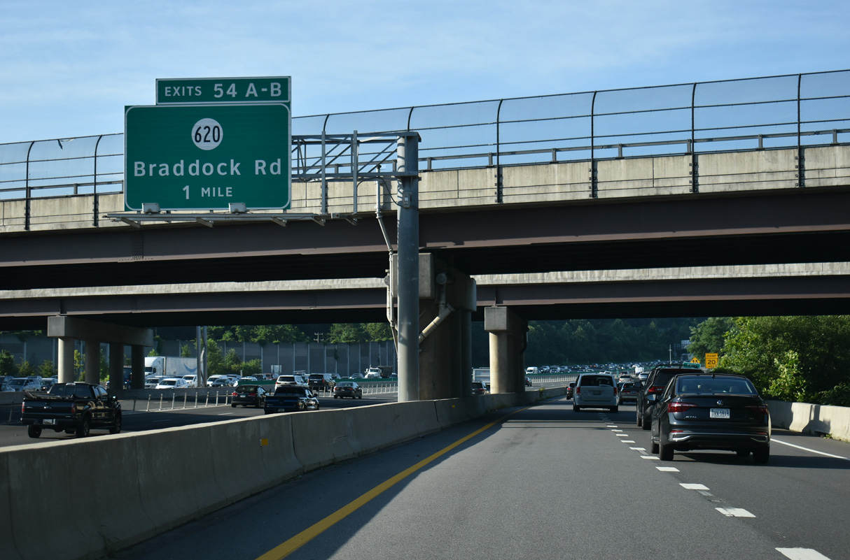
Interstate 495 lines the east side of Wakefield Park to Exit 54 with SR 620 (Braddock Road).
07/28/25
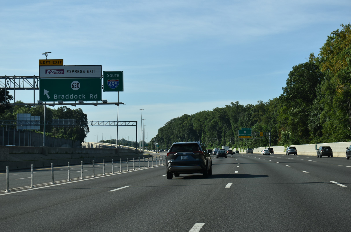
A flyover ramp elevates from the I-495 Express Lanes to cross over the I-495 southbound mainline to SR 620 (Braddock Road). SR 620 leads west to Ravensworth and east to Annandale.
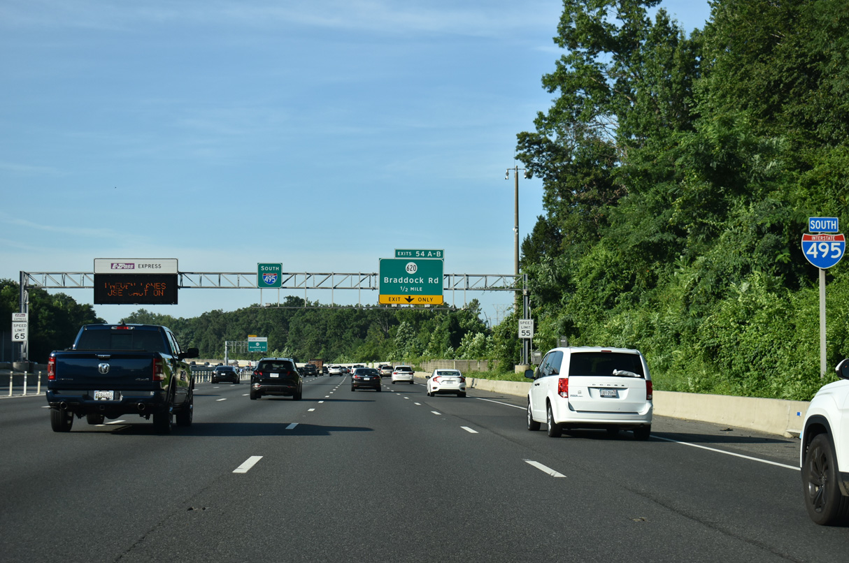
07/28/25
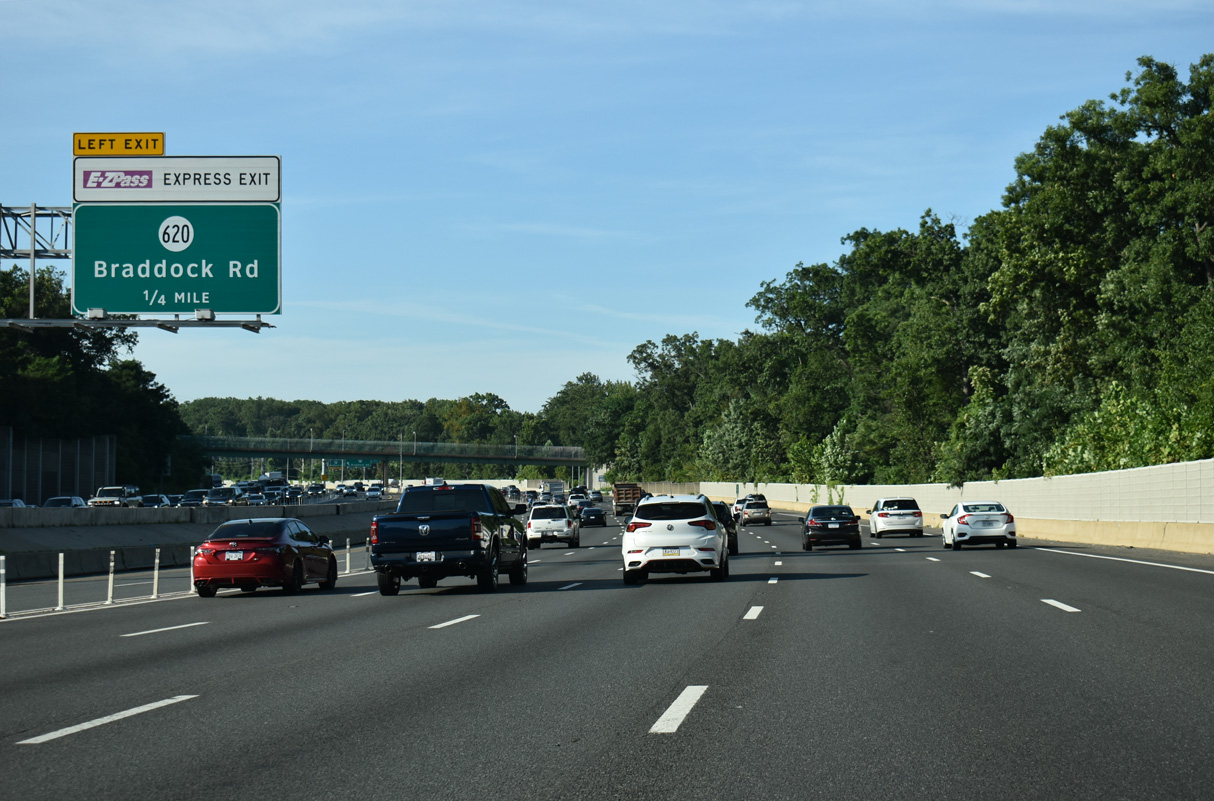
Two lanes separate from the I-495 southbound mainline for Braddock Road. Braddock Road leads east to Lincolnia and west to Fairfax Station and SR 659 (Union Mill Road) near Centreville.
07/28/25
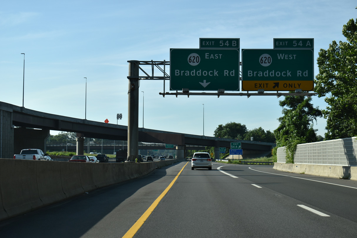
Exit 54 partitions into separate ramps for SR 620 west to George Mason University and east to North Springfield.
07/28/25
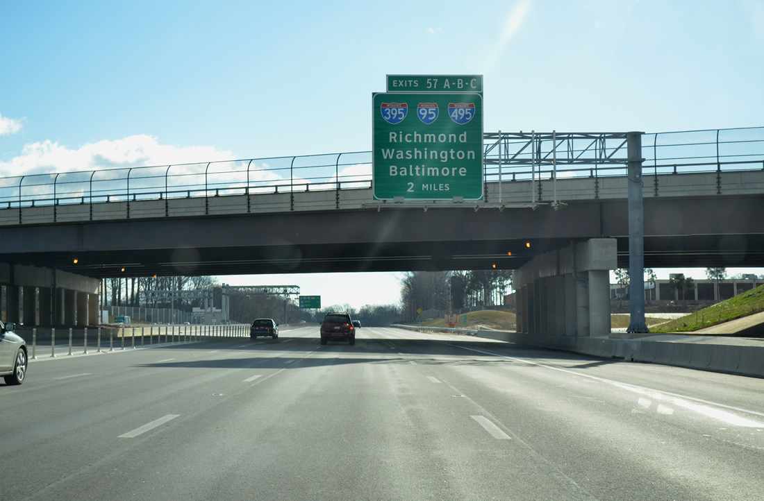
Interstate 495 turns southeasterly on the two miles preceding Exits 57 A/B to I-95 and I-395 north.
07/28/25
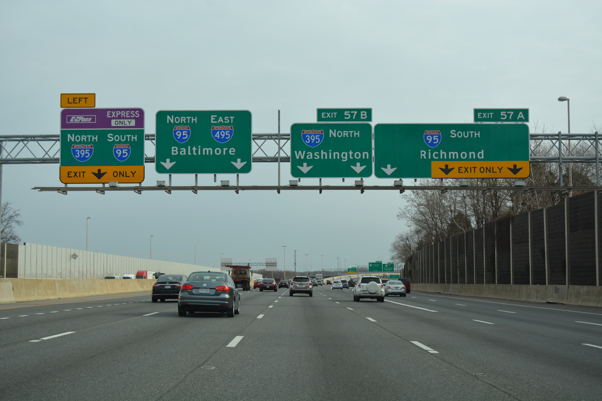
A left exit connects Interstate 495 south with the Reversible Express toll lanes for I-395 north and I-95 south at the first of three exits within the Springfield Interchange.
07/28/25
Curving east from Braddock Road and Annandale, I-495 advances toward the Springfield Interchange and the left exit for the I-95/395 Express Lanes.
07/28/25
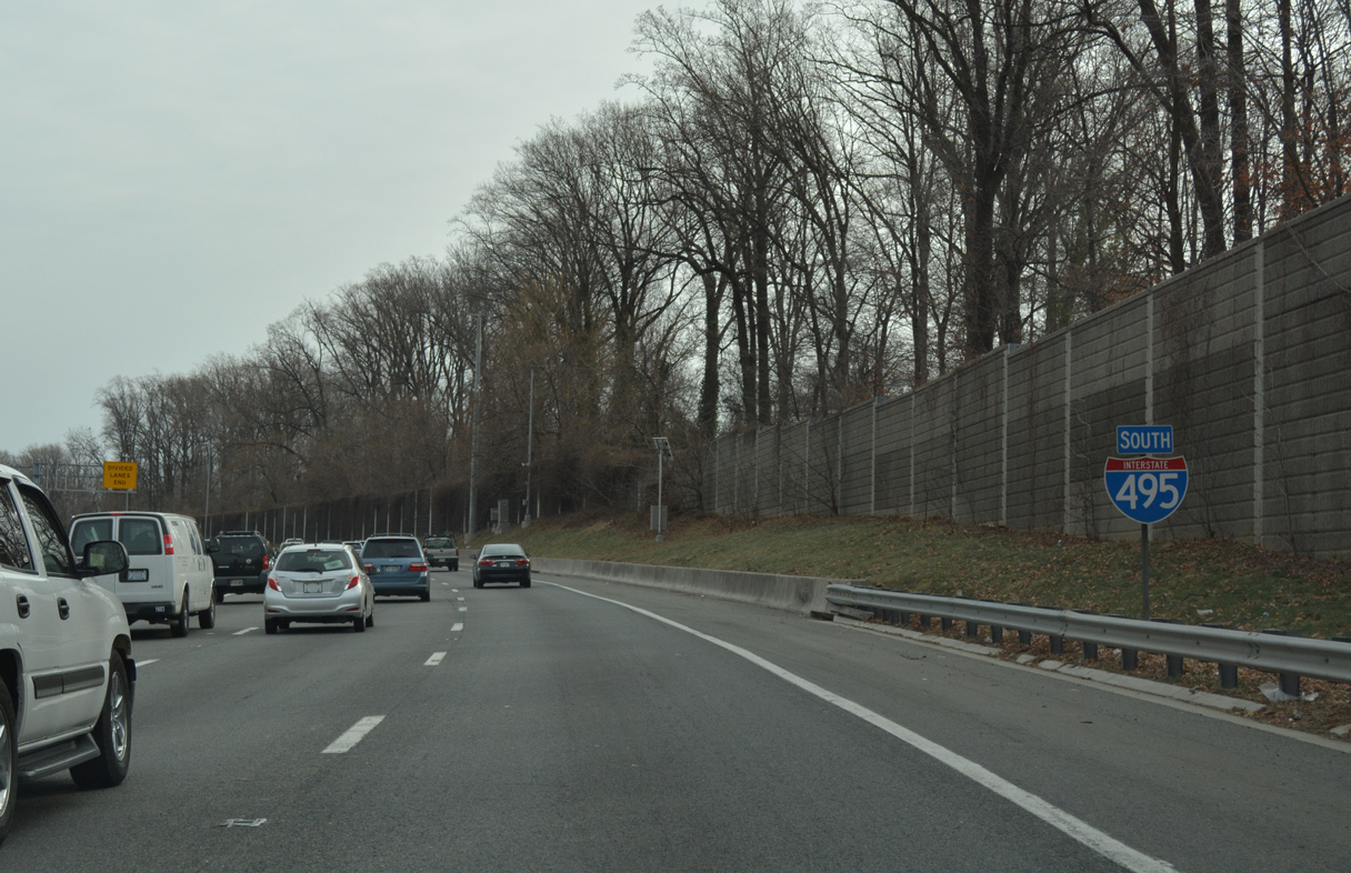
The last southbound shield posted for I-495 before the overlap with Interstate 95 north to Alexandria.
07/28/25
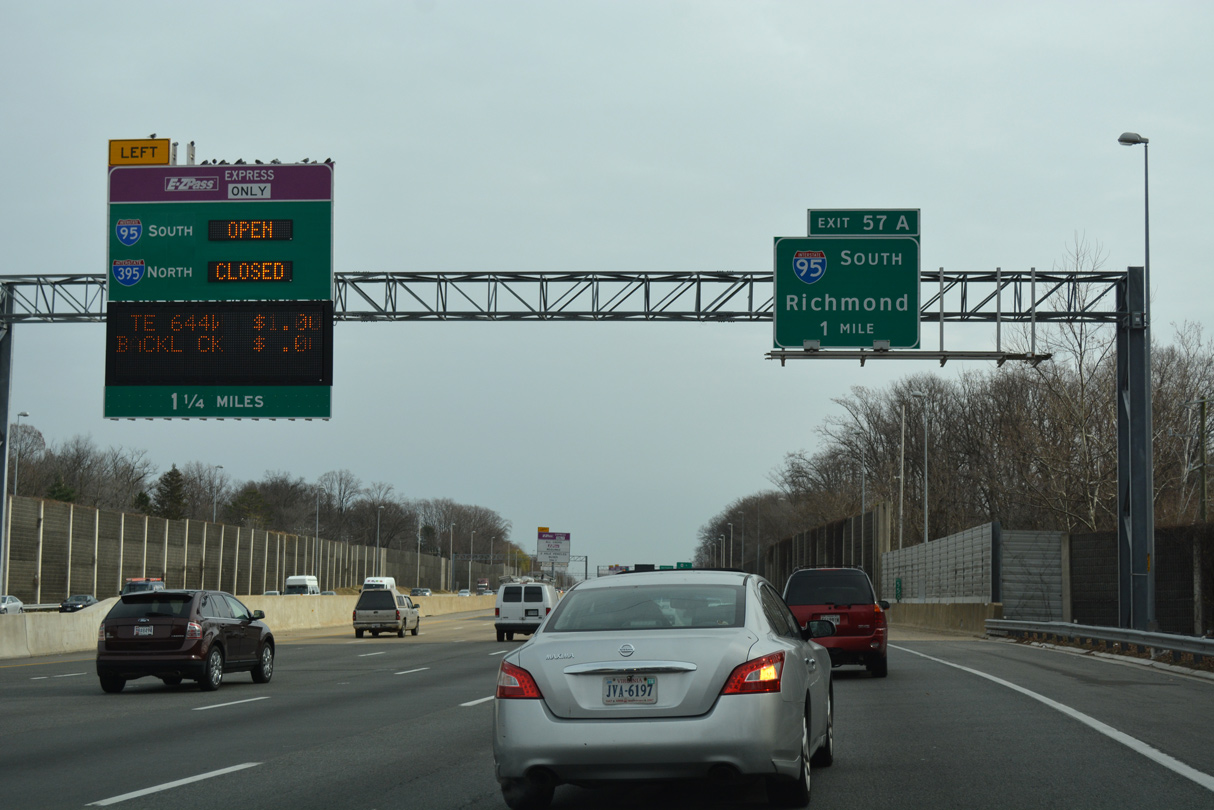
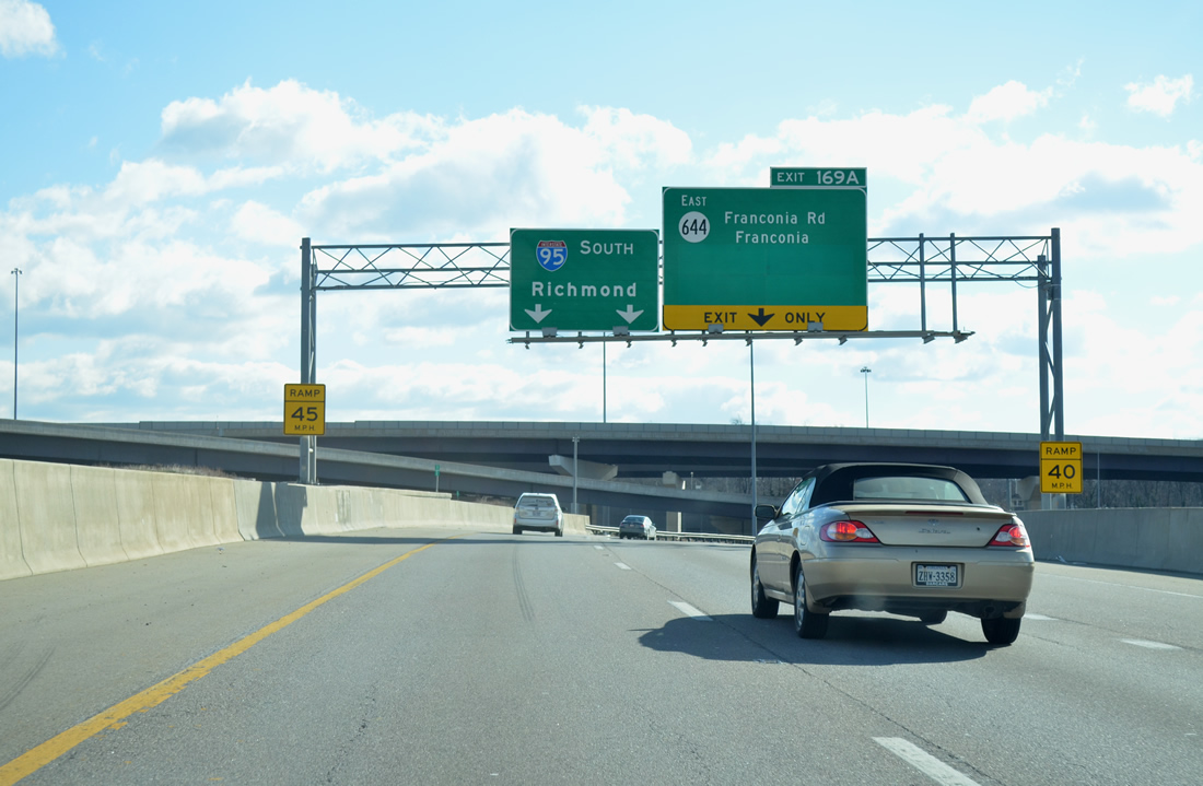
The I-495 Express Lanes conclude one mile ahead of Exit 57 A for Interstate 95 south to Richmond.
07/28/25

Interstate 495 continues with six southbound lanes to the multi level interchange with I-95 south and I-395 north.
07/28/25
The Express Lanes for I-95/395 flow north during the morning peak hours and south during the evening peak hours.
07/28/25
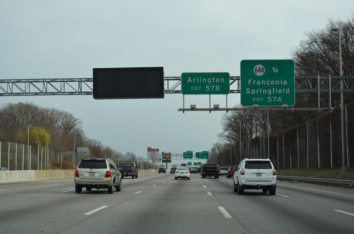
Interstate 395 extends north from western Alexandria to Arlington and the Pentagon before entering D.C. Exit 57 A for I-95 south includes ramps for the adjacent interchange with SR 644 (Old Keene Mill Road west / Franconia Road east).
07/28/25

Exit 57 B for I-395 north to Washington departs in one mile from I-495 southbound. I-95 and I-395 comprise a major commuting corridor south to Fredericksburg.
07/28/25
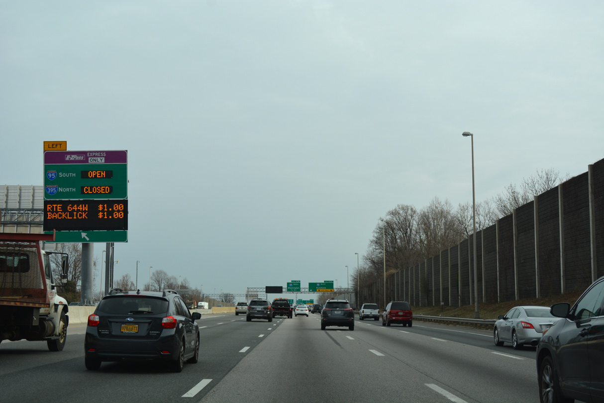
The left exit for the reversible I-95/395 Express Lanes separates from I-495 southbound. The HOT toll lanes line the middle of I-395 north to Washington and I-95 south to Fredericksburg.
07/28/25
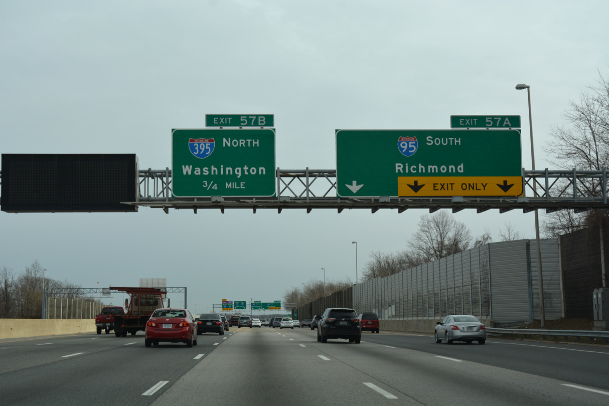
Exit 57 A expands into a three lane off-ramp for Interstate 95 south to Lorton, Dale City and Woodbridge.
07/28/25
Eastbound Interstate 495 continues with three overall lanes through the Springfield Interchange. Previously the mainline was designated as Exit 57 C.
07/28/25
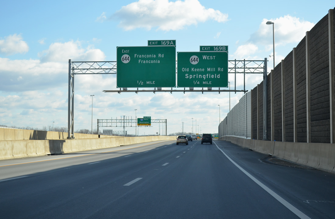
Exit 57 A leads southward to Interstate 95 through the multi level interchange (Exits 169 B/A) with SR 644 between Springfield and Franconia.
07/28/25
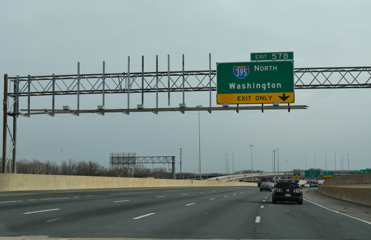
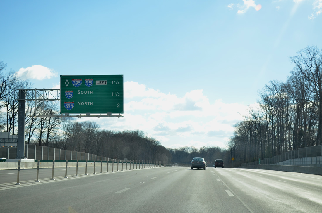
Exit 57 B follows on the I-495 mainline as a two lane flyover for Interstate 395 north. I-395 travels 9.91 miles to Washington and 13.39 miles overall.
07/28/25

The left exit for the I-95 Express Lanes departs simultaneously with Exit 57 B for I-395 north. I-95/495 combine from Springfield east to the Woodrow Wilson Bridge into Prince Georges County, Maryland.
07/28/25

Exit 169 B leaves the I-95 southbound ramp to join the right side of a six lane distributor roadway extending from I-395 south to SR 644.
07/28/25

Ramps to the Reversible Express Lanes are open either north to Washington or south to Prince William County depending upon time of day. Outside of the morning and evening commuting hours, the lanes vary with the direction they flow.
12/16/16
A lane drop occurs at Exit 169 A from the distributor roadway (Exit 57 A) for I-95 south for SR 644 (Franconia Road) east by the Springfield Town Center.
07/28/25

Two lanes from I-495 east combine with traffic from I-395 south as the I-95 southbound mainline lowers from a flyover. Exits 169 B/A join the multi-lane ramp for SR 644 from I-395 south to the right.
07/28/25

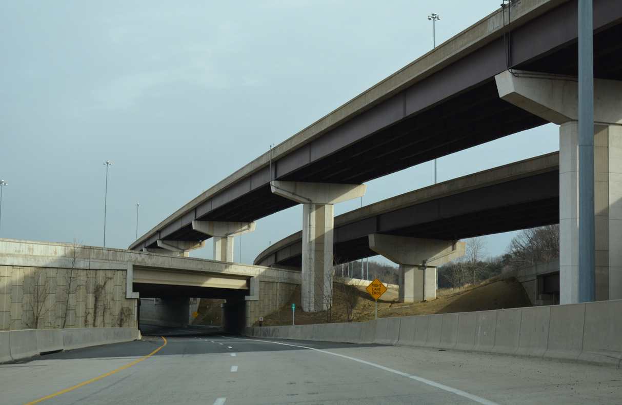
Some of the flyovers within the Springfield Interchange from the ramp joining I-495 south with I-395 north. Work to upgrade a low speed directional cloverleaf interchange between the Capital Beltway and Henry G. Shirley Memorial Highway took five years and $676 million to build.
12/16/16
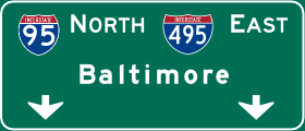
Photo Credits:
- Brent Ivy: 07/28/24, 07/28/25
- AARoads: 08/06/13
- Alex Nitzman: 12/16/16
Connect with:
Page Updated Friday January 02, 2026.