
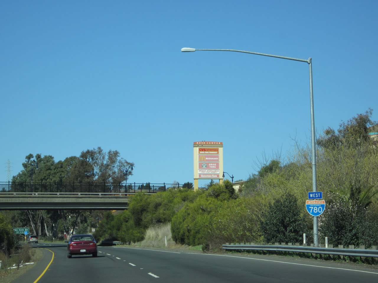
Interstate 780 West
 west
west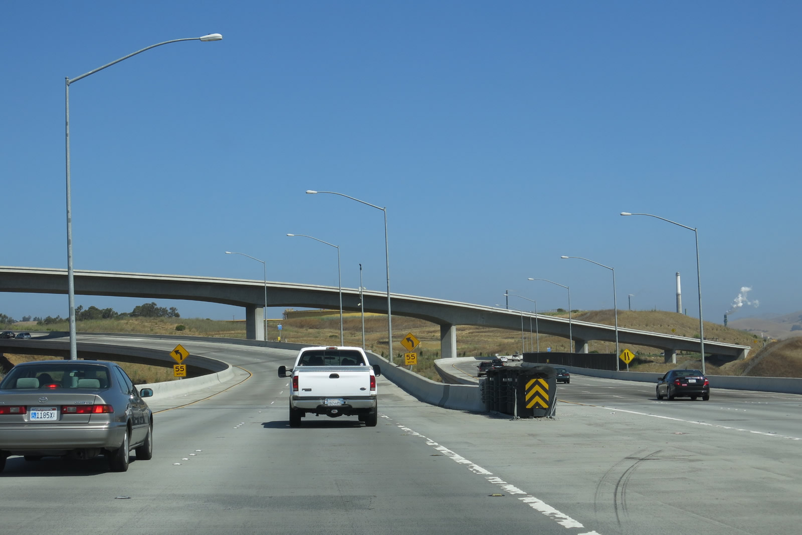
A two lane flyover separates from a left exit at the north end of the Benicia-Martinez Bridge on Interstate 680 north for I-780 west.
07/05/13
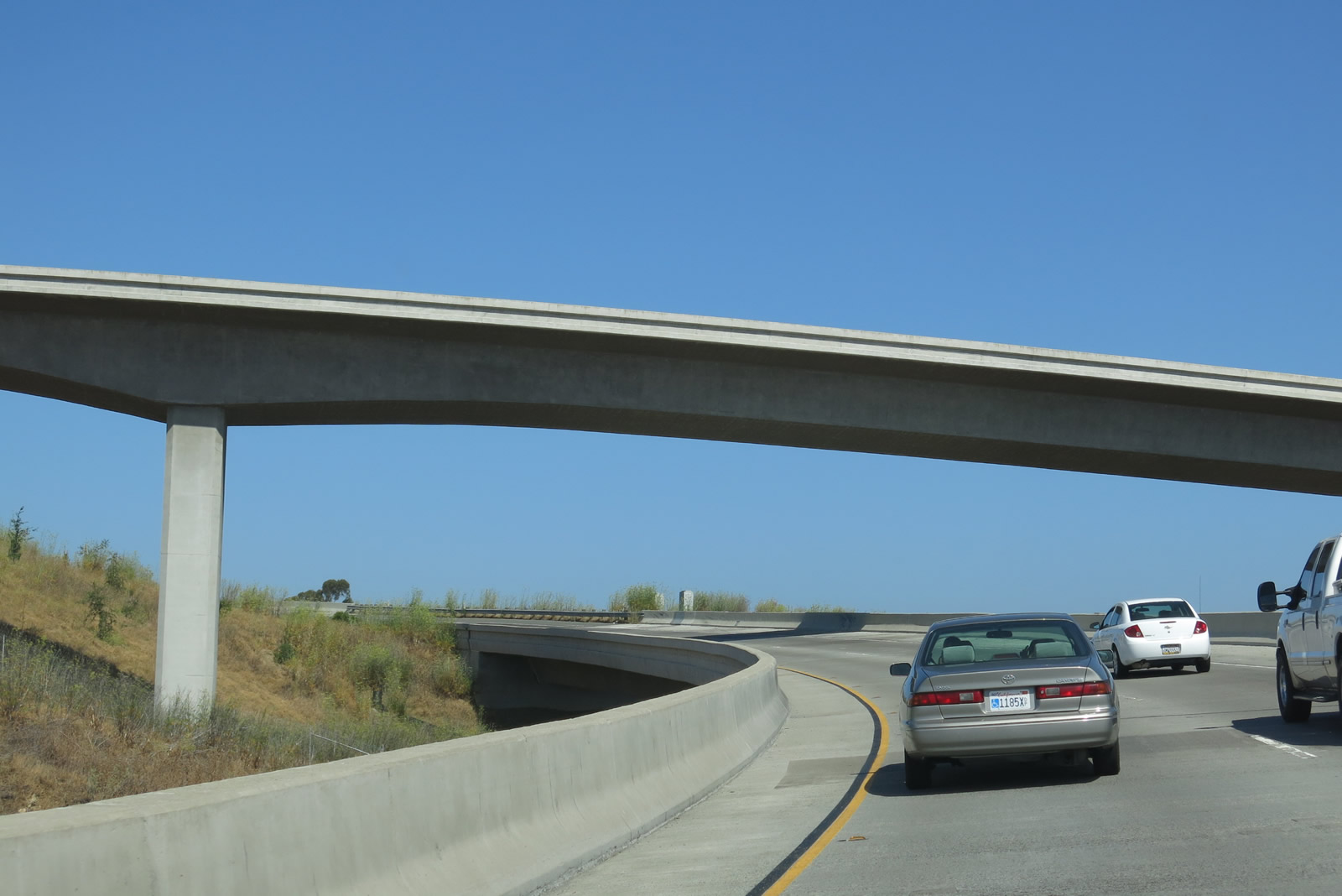
The initial 4.6 miles of Interstate 780 west travel through the city of Benicia. Home to 26,997 people as of the 2010 Census and incorporated on March 27, 1850, Benicia briefly served as the California state capital, from February 11, 1853 through February 25, 1854, until the capitol's relocation to Sacramento.
07/05/13
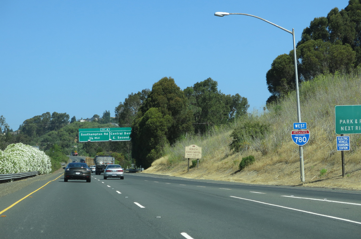
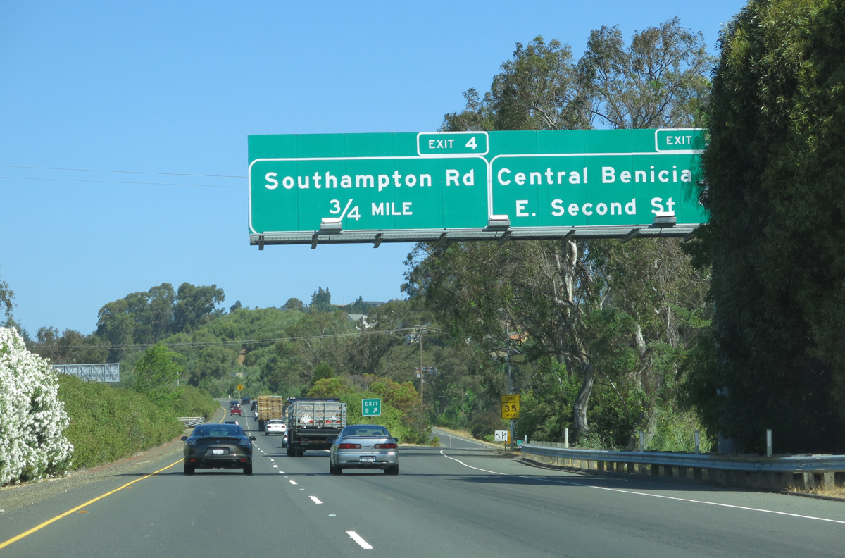
The freeway advances through residential areas of Benicia to Exit 4 with Southampton Road and 7th Street.
07/05/13
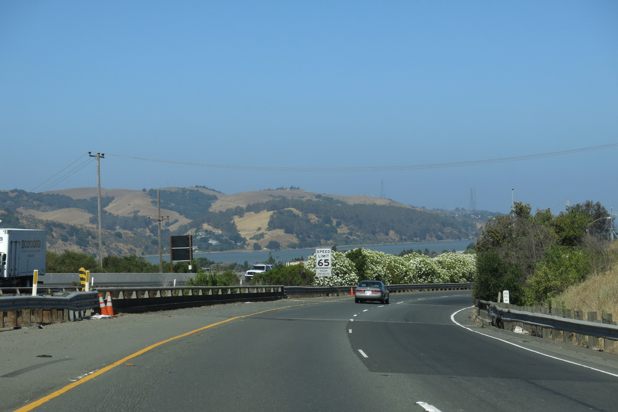
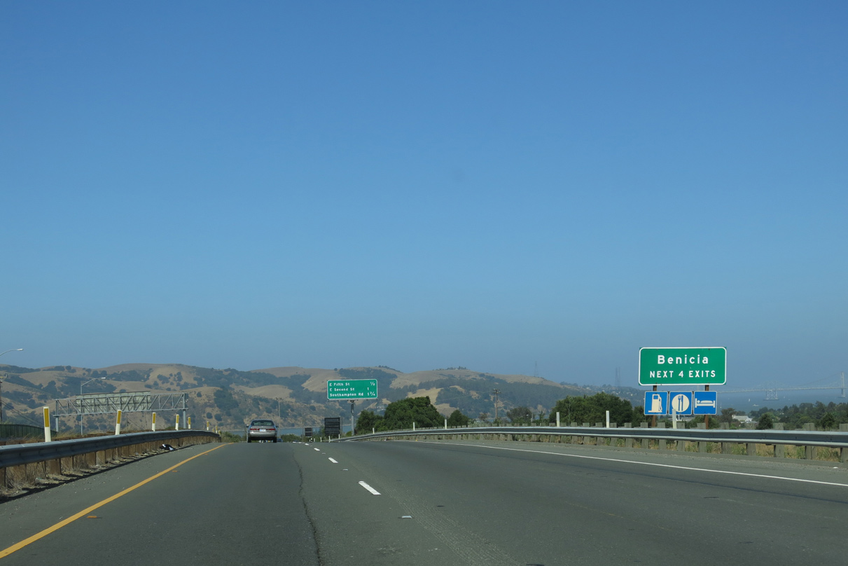
Interstate 780 parallels and overlooks the Carquinez Straits (Sacramento-San Joaquin Delta) to Southampton Bay at the west end of Benicia.
07/05/13
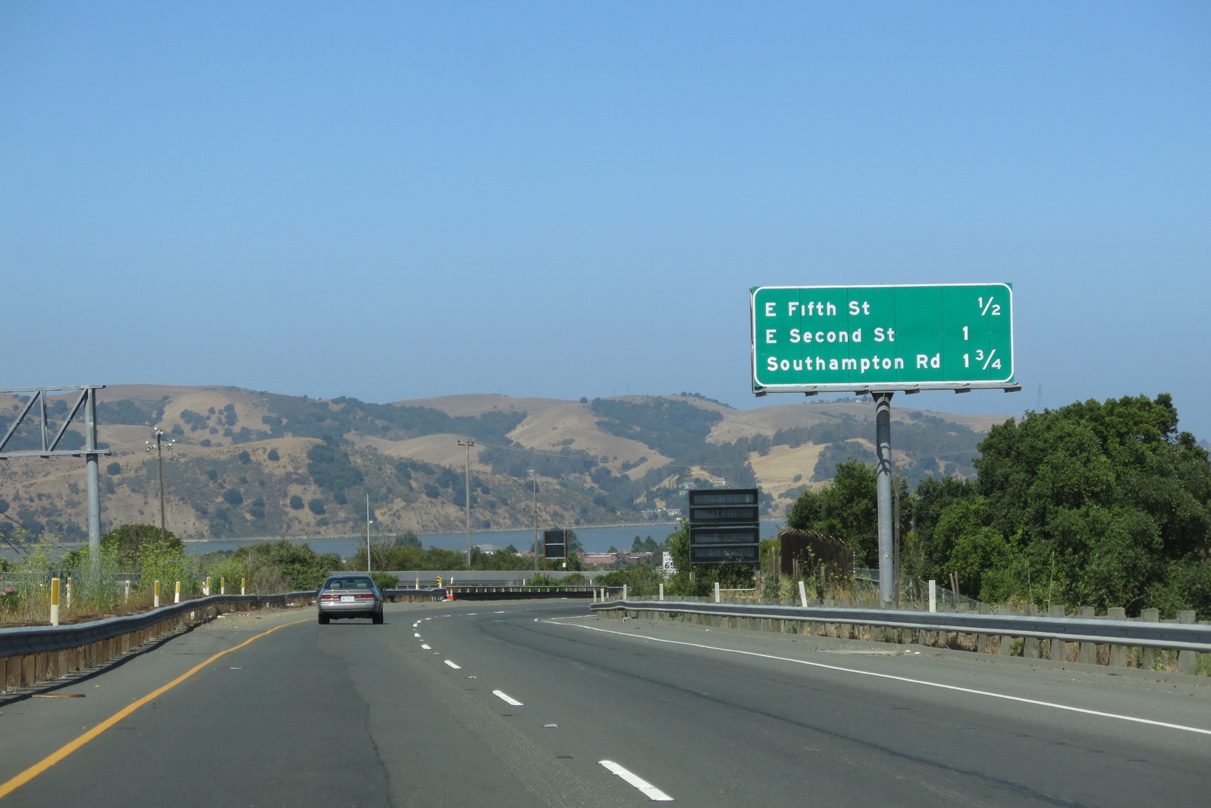
Curving northwest, I-780 enters a diamond interchange (Exit 6) with East 5th Street. 5th Street angles southwest to Turnbull Park on Carquinez Strait.
07/05/13
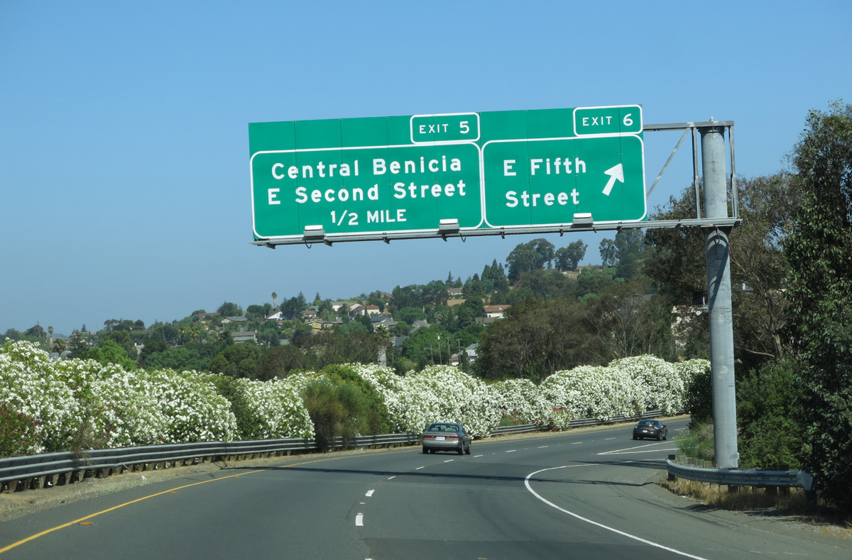
A scant tenth of a mile separate the westbound on-ramp to I-780 from 5th Street with the off-ramp (Exit 5) to East 2nd Street.
07/05/13
A parclo interchange joins I-780 with East 2nd Street in central Benicia. 2nd Street winds north to the Benicia Refinery. 2nd Street south to Military West and 1st Street leads to Benicia Capitol State Historic Park.
07/05/13
A number of subdivisions and townhome communities abut I-780 west on the ensuing stretch to West 7th Street.
02/19/12
7th Street stems north from Military West to become Southampton Road at the parclo interchange (Exit 4) with Interstate 780. Southampton Road loops north of the freeway to Southampton Shopping Center and Benicia Middle School.
07/05/13

Advancing west, hills in southeast Vallejo rise along the horizon beyond this confirming marker.
07/05/13

Crossing over Southampton Road, I-780 curves northwest around the periphery of Southampton Bay and Benicia State Recreation Area.
07/05/13
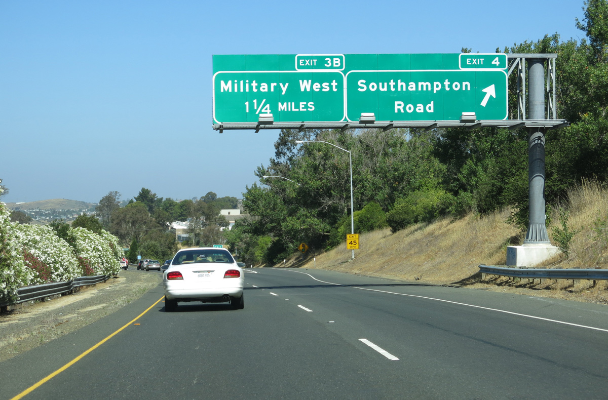
Military West merges with Interstate 780 at a partial trumpet interchange (Exit 3B).
07/05/13

Interstate 780 runs along the east side of wetland areas in Benicia State Recreation Area beyond Military West.
07/05/13
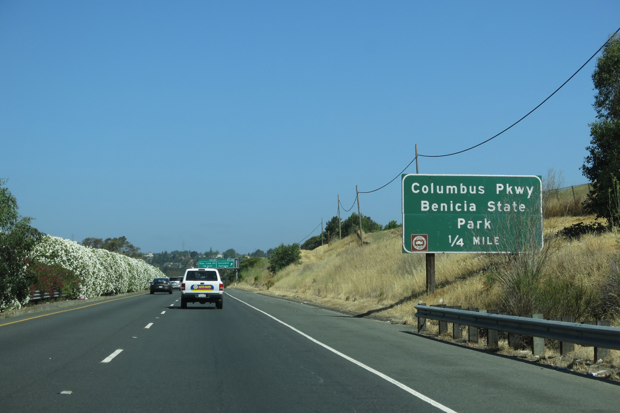
The upcoming folded diamond interchange (Exit 3) with Columbus Park and Rose Drive connects I-780 west to Benicia State Recreation Area. Signed as a state park here, hikers, RV campers, and fishermen enjoy this park, with its view of Carquinez Strait.
07/05/13
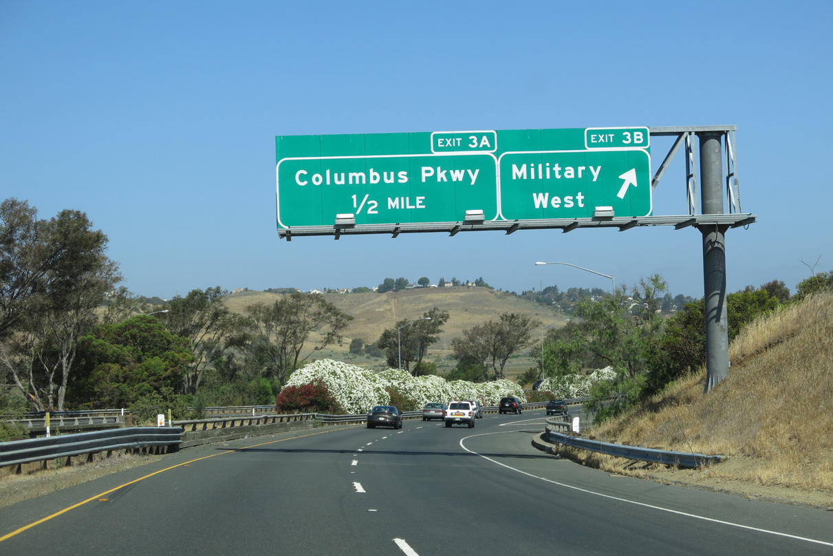
Columbus Parkway branches north from Exit 3A to encircle the east side of Vallejo between I-780 and I-80 at SR 37.
07/05/13
This confirming marker precedes the Rose Drive overpass at Exit 3B.
02/19/12
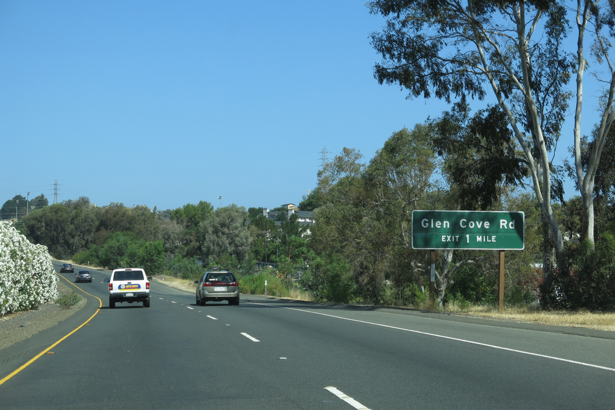
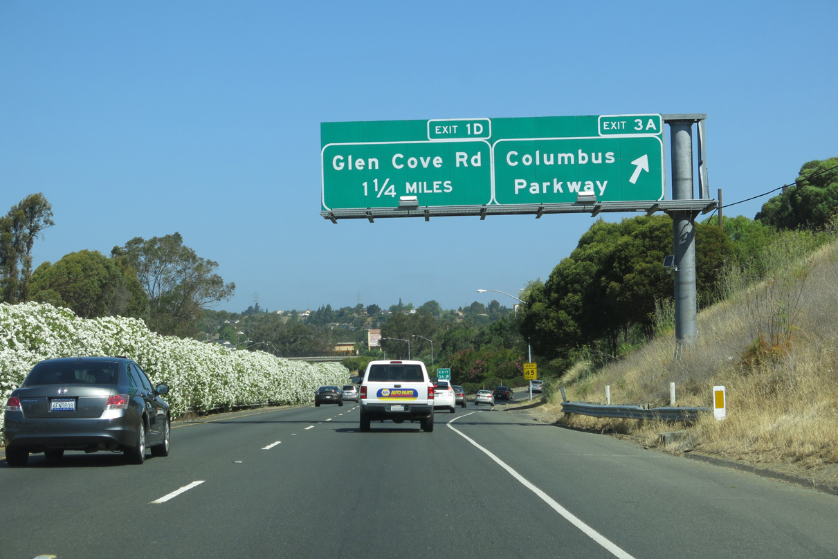
Interstate 780 arcs westward one mile to a diamond interchange (Exit 1D) with Glen Cove Road.
07/05/13
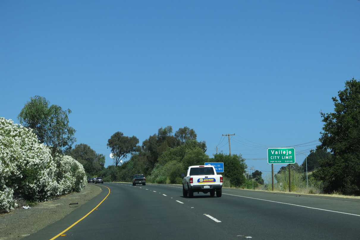
Westbound travelers along I-780 enter the city of Vallejo just ahead of Exit 1D. The city incorporated on March 30, 1868 and was home to 115,942 as of the 2010 Census.
07/05/13
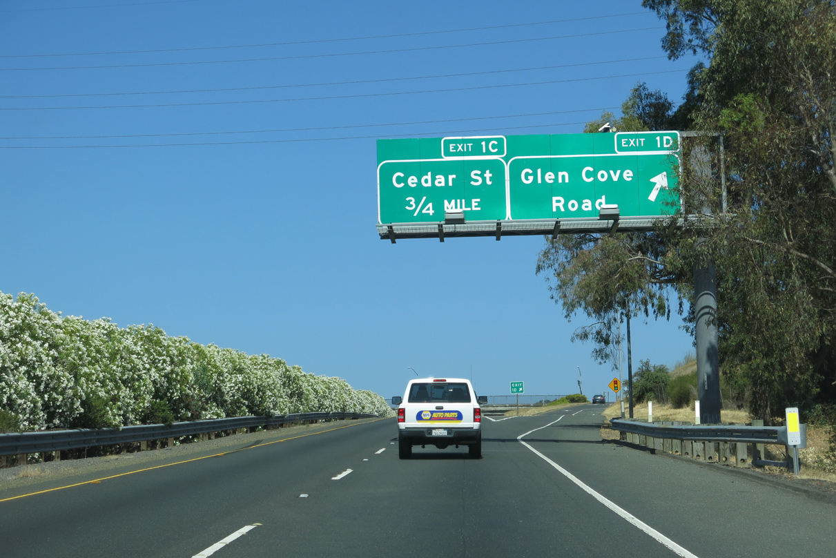
Glen Cove Parkway winds south from Exit 1D to the Glencove community in southeast Vallejo. Glen Cove Road extends north to parallel Benicia Road at Rollingwood Drive.
07/05/13
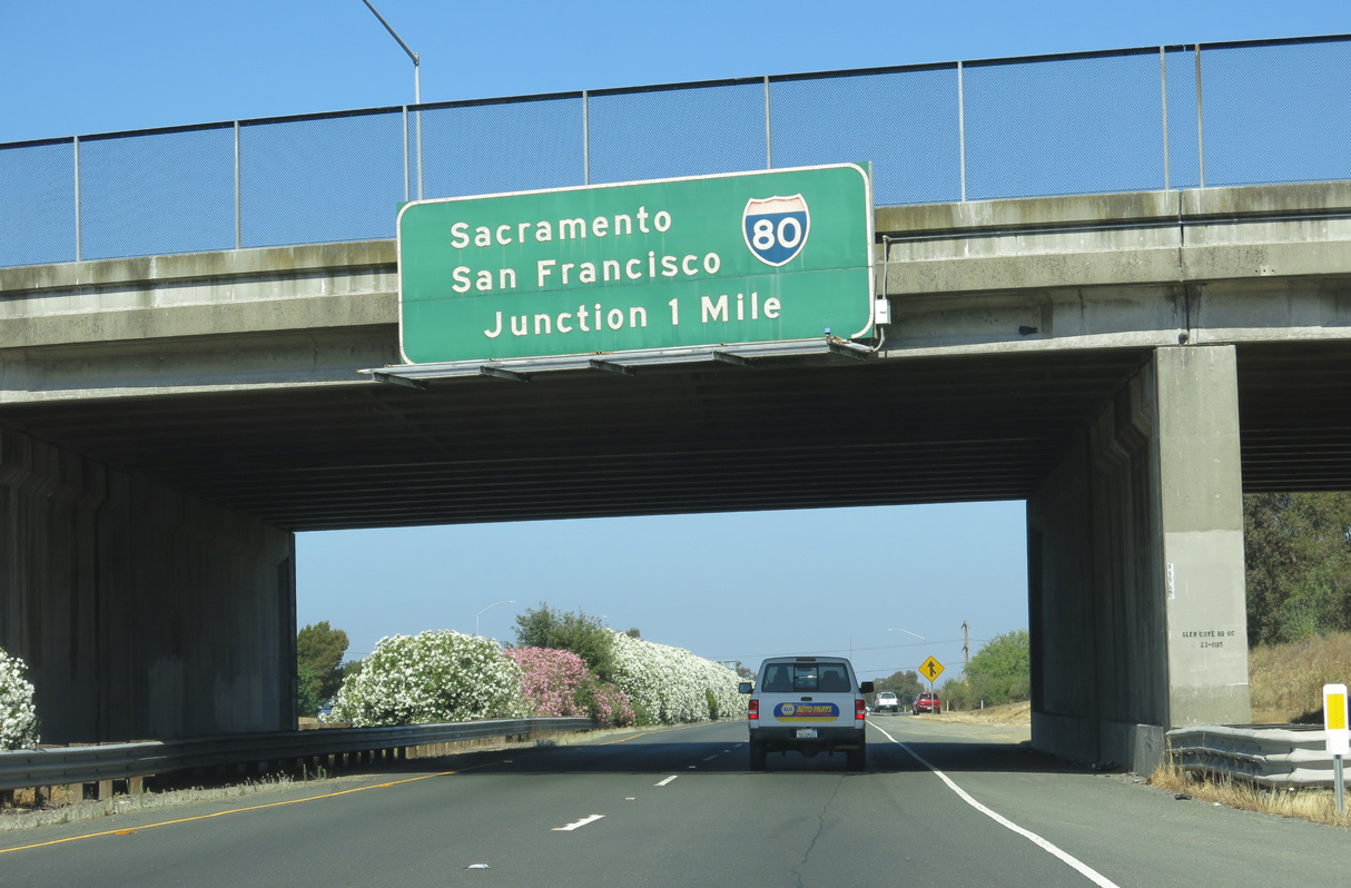
Interstate 780 lowers below the adjacent residential areas of Vallejo to the cloverleaf interchange (Exits 1B/A) with I-80.
07/05/13
The final reassurance marker for I-780 west stands along a subtle S-curve between Glen Cove Road and the Home Acres Avenue pedestrian overpass.
07/05/13

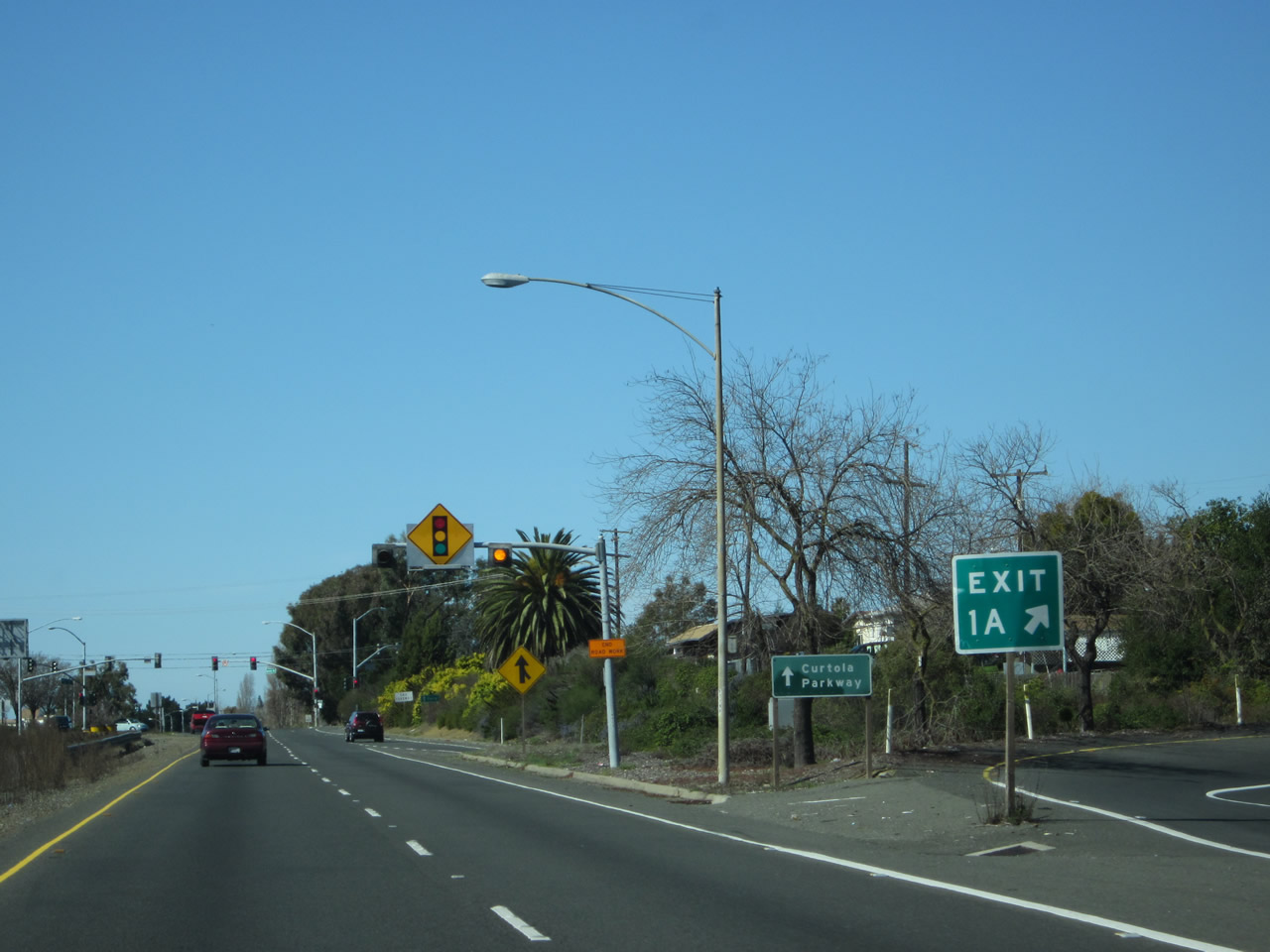
An interchange sequence sign references the first intersection along Curtolla Parkway, which extends west from the ending I-780 in 0.75 miles.
07/05/13
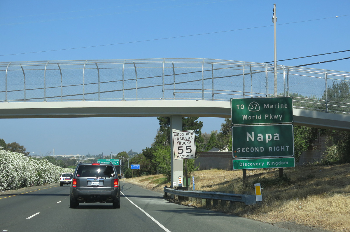
Removed in 2017, this button copy sign referenced SR 37 via I-80 east. SR 37 provides a high-speed connection to SR 29 north to Napa, while joining Vallejo with the U.S. 101 corridor north to Santa Rosa and Eureka.
07/05/13
RIRO (right in right out) type ramps (Exit 1C) link I-780 with adjacent Reis Avenue and Cedar Street north to Benicia Road. Exit 1B follows for I-80 northeast to Fairfield and Vacaville.
07/05/13
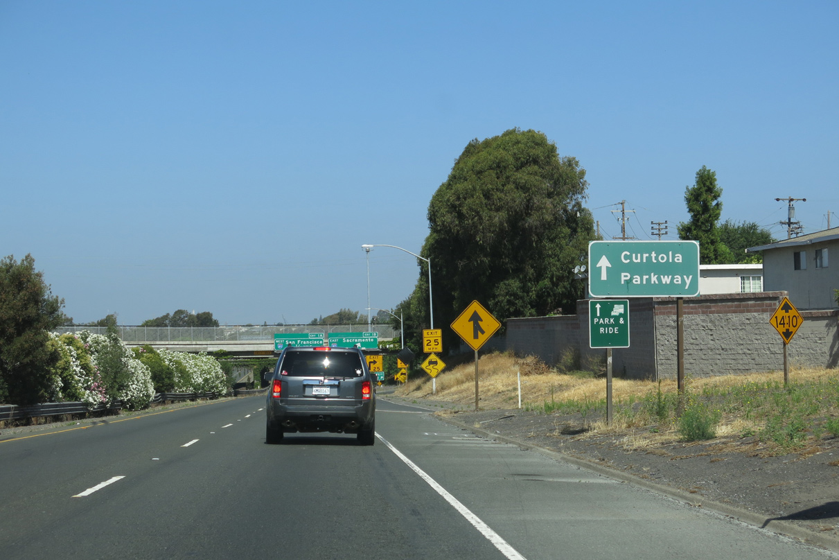
Cutrola Parkway emerges from the ending I-780 as an arterial route traveling 1.5 miles west to Mare Island Way along the Napa River.
07/05/13
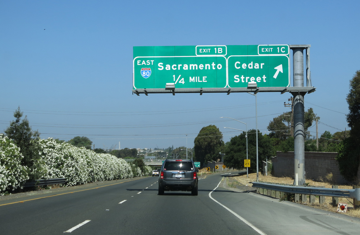
Exit 1B leaves I-780 west for Interstate 80 east to Sacramento. These overheads were affixed to the Laurel Street Bridge. With a 14 foot 10 inch clearance, the substandard crossing was replaced between May 2017 and January 2018.
03/10/15
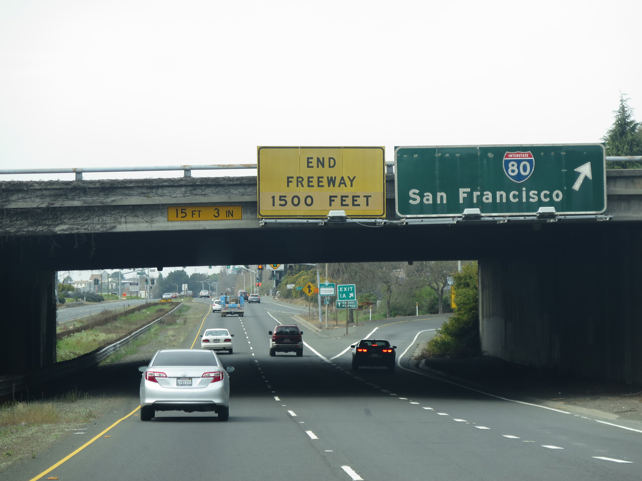
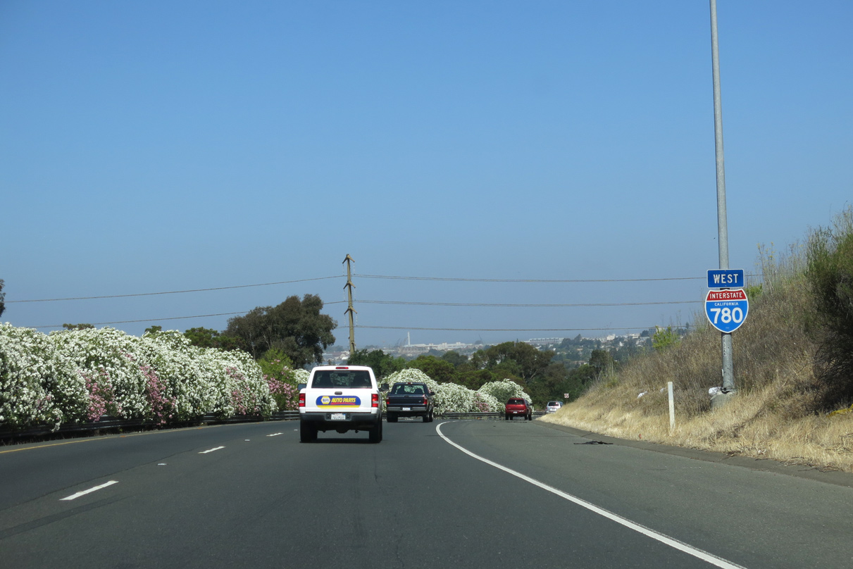
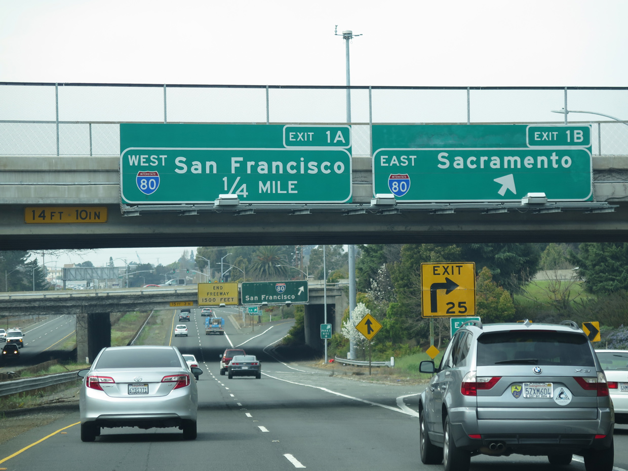
Exit 1A loops away from the west end of Interstate 780 to a collector distributor roadway along I-80 westbound. I-80 generally travels southward from Vallejo to Richmond, Berkeley and Oakland.
03/10/15
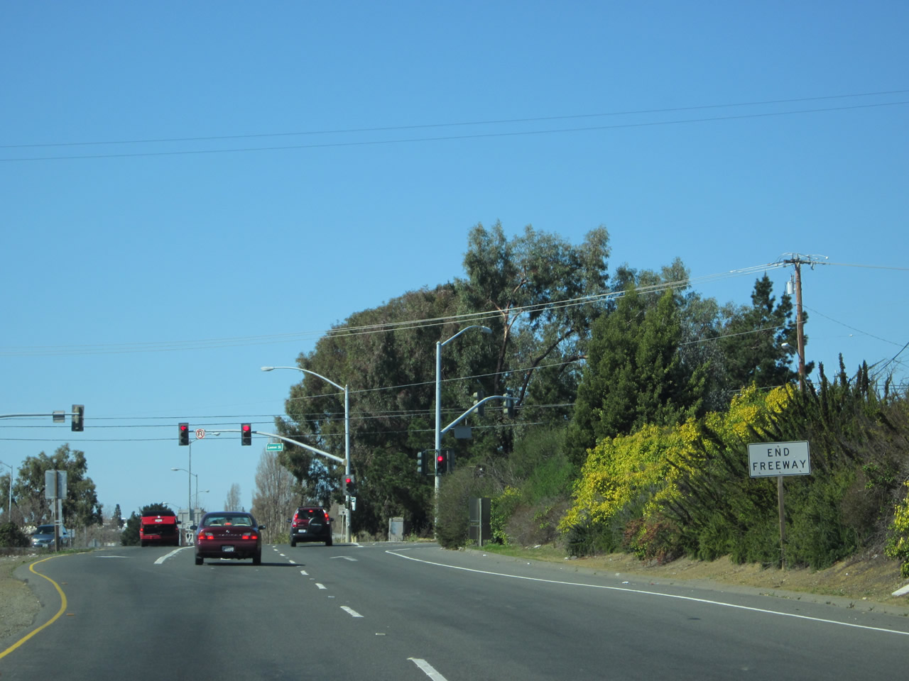
The freeway transitions into Curtola Parkway just ahead of a signalized intersection with Lemon Street.
02/19/12
Curtola Parkway leads west from I-780 to meet SR 29 (Sonoma Boulevard). Beyond SR 29, the roadway continues as Mare Island Way and Wilson Avenue to connect to the ferry docks, Vallejo marina, Mare Island (a former naval facility), and finally SR 37 (Sears Point Road).
02/19/12
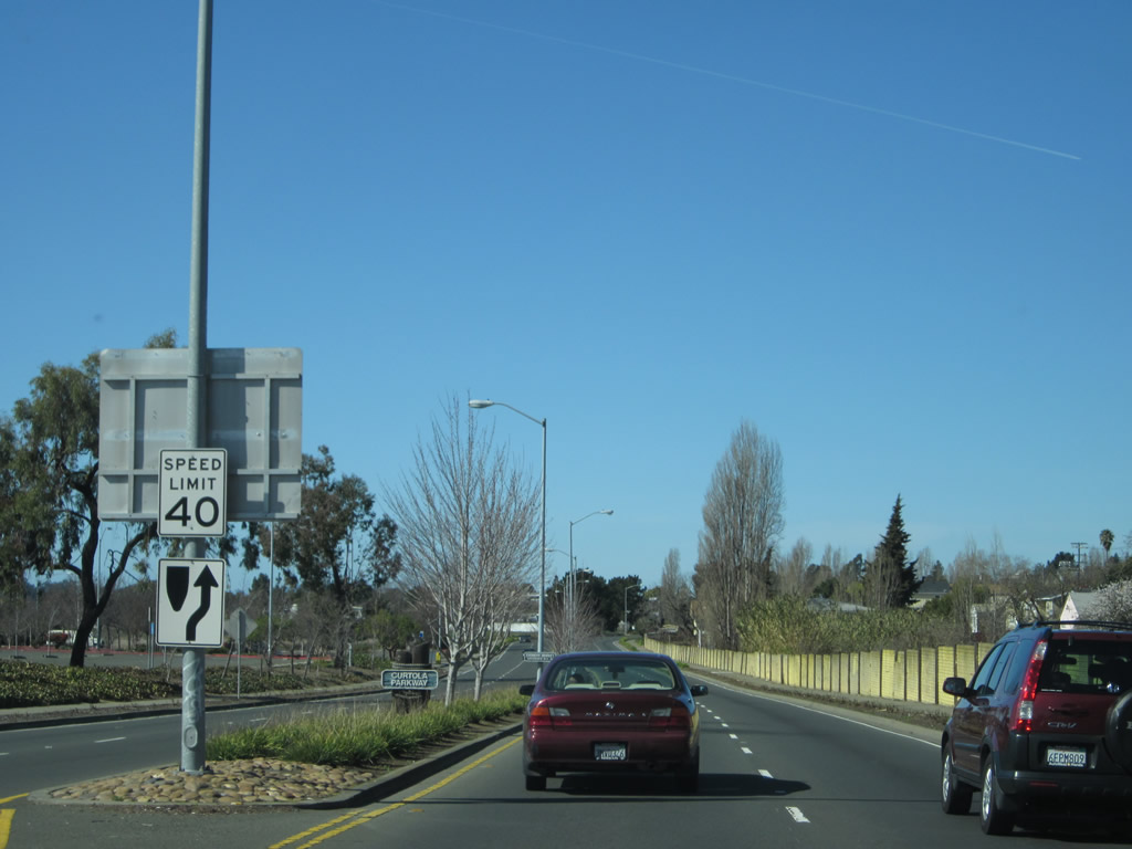
Curtola Parkway constitutes a controlled access arterial 0.75 miles west from Lemon Street to Sloano Avenue in the Vallejo street grid. The four lane roadway may have been incorporated in SR 141, which was deleted from the state system in 1988.
02/19/12
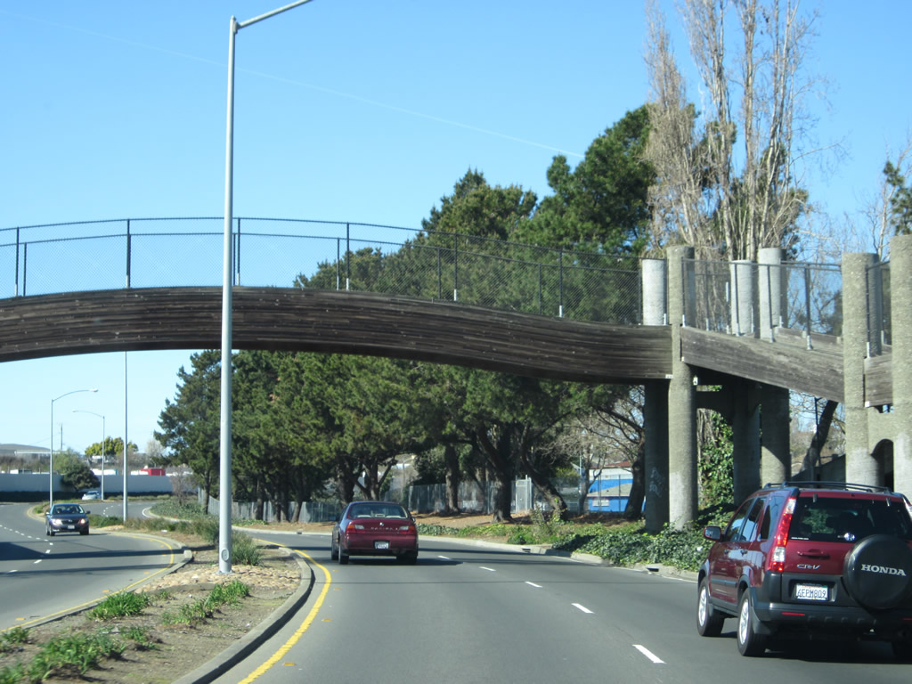
A pedestrian bridge spans Curtola Parkway between Wilson Lake Dalwigk Park with Lake Dalwigk Park. Managed by the Greater Vallejo Recreation District, both sites have walking paths that connect to the bridge.
02/19/12
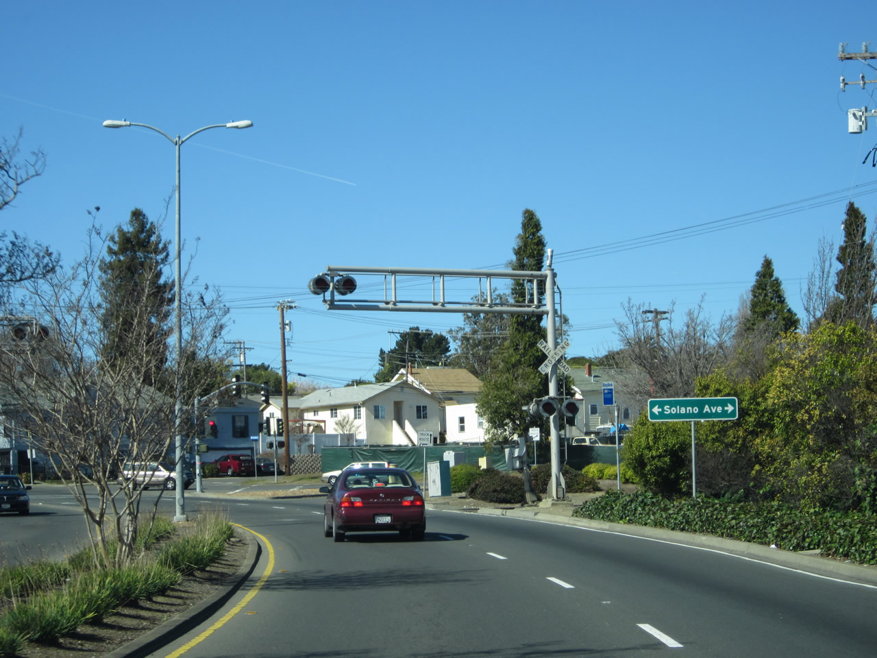
Curtola Parkway navigates through an S-curve alongside Wilson Lake Dalwigk Park to an at-grade railroad crossing and Solano Avenue.
02/19/12
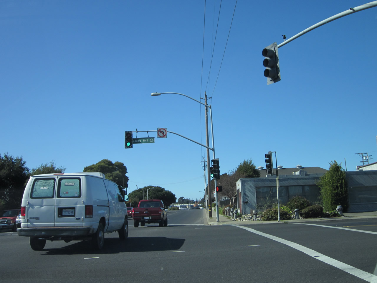
Five blocks west of Solano Avenue, Curtola Parkway intersects SR 29 (Sonoma Boulevard). The state route heads north into Downtown Vallejo and southeast to South Vallejo.
02/19/12
Photo Credits:
- Andy Field: 02/19/12, 07/05/13, 03/10/15
Connect with:
Page Updated Saturday June 23, 2018.