
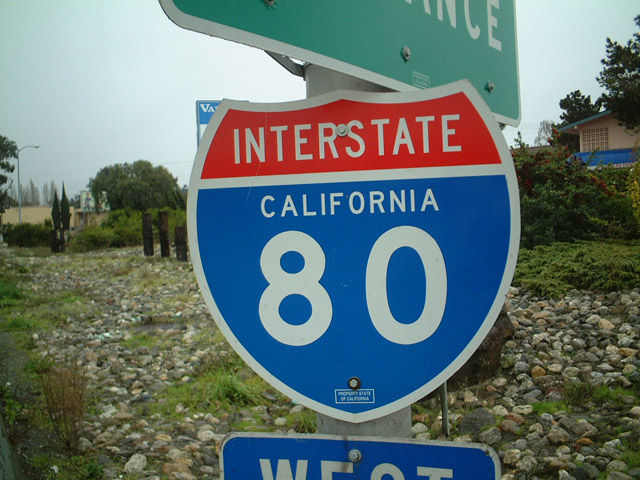
Interstate 80
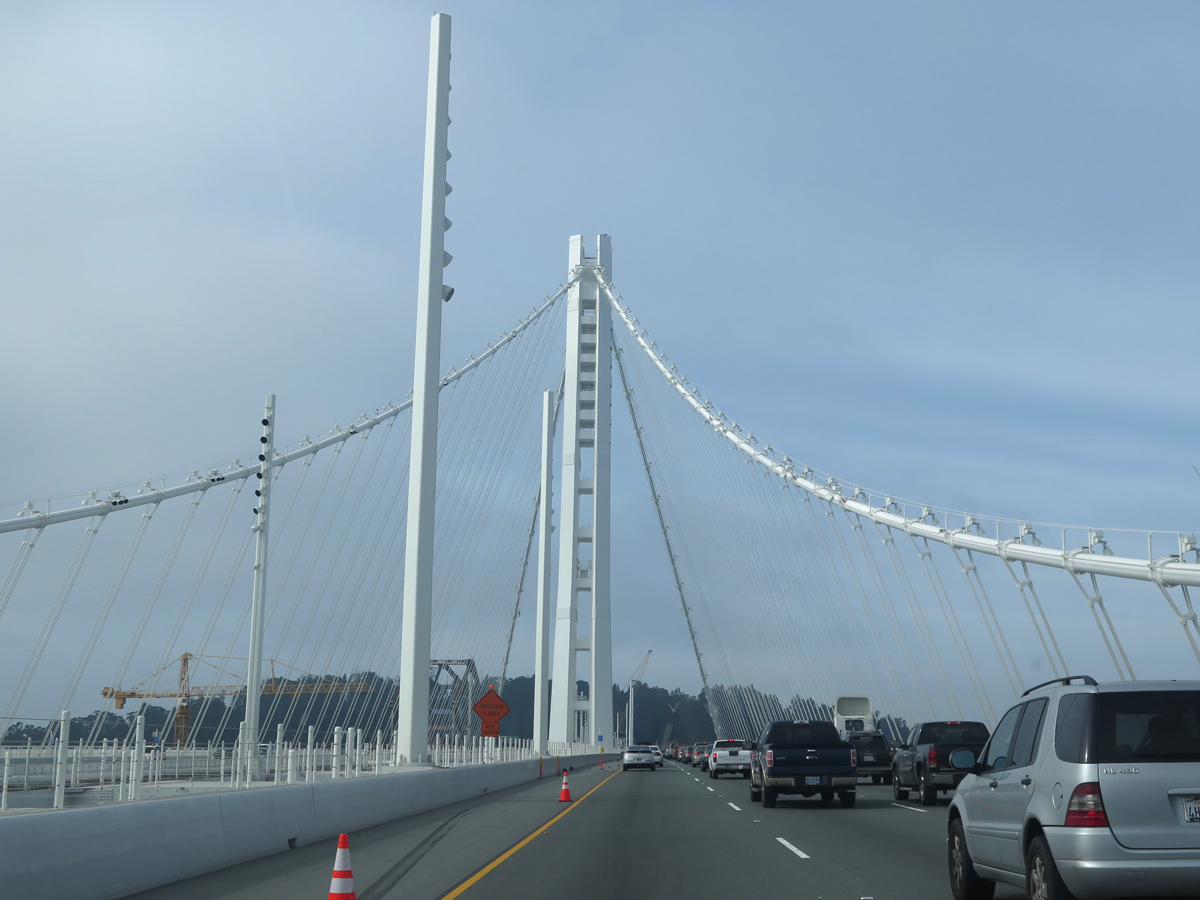
The new eastern span of the San Francisco-Oakland Bay Bridge opened to traffic on September 2, 2013. Built over the course of 11 years and at a cost of over $6.5 billion, the signature span connects Oakland with Yerba Buena Island. - 03/08/2015
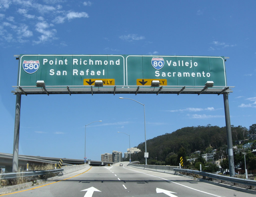
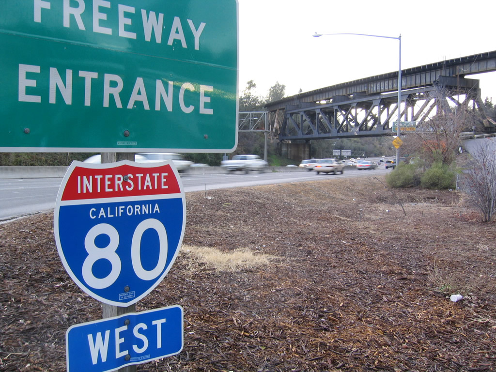
Interstate 80 is a major freeway across northern California. Starting in San Francisco, I-80 spans San Francisco Bay across the San Francisco-Oakland Bay Bridge. The toll bridge consists of two spans, a suspension bridge east to Yerba Buena Island, and a self-anchored suspension bridge from the island to Oakland. Combining with Interstate 580 along a wrong-way concurrency, I-80 turns north through Berkeley to Richmond. The northerly course extends to the Alfred Zampa Bridge spanning Carquinez Strait.
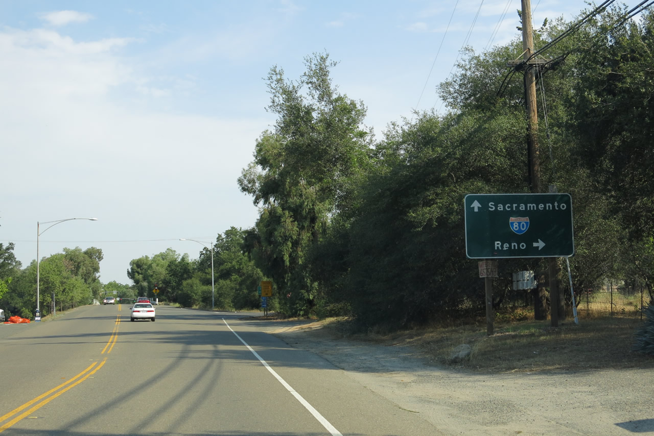
Making a gradual northeasterly turn, Interstate 80 passes through Vallejo to Fairfield, Vacaville, Davis and the Sacramento metropolitan area. The freeway bypasses the city to the north while U.S. 50 and Business Loop I-80 form an urban loop to the south. I-80 continues northeast through suburban areas to Roseville and Auburn.
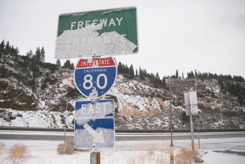
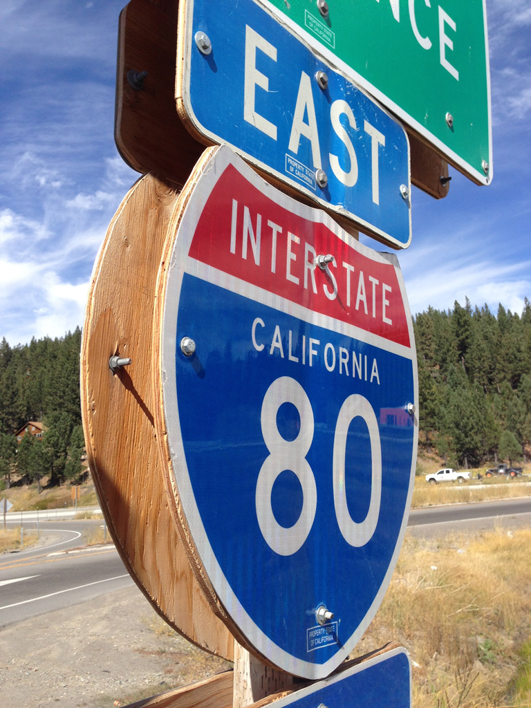
Gradually gaining elevation, I-80 arcs northeast into the Sierra Nevada, passing through Blue Canyon, Emigrant Gap and Yuba Pass. The often snow covered stretch culminates at Truckee, where SR 89 and SR 267 tie in from scenic Lake Tahoe. The remainder of Interstate 80 overlays historic U.S. 40 alongside the Truckee River to Verde and Reno, Nevada.
East
Business Routes
 Business Loop I-80 - Sacramento
follows I-305, U.S. 50 and SR 51
 Former Business Loop I-80 - Truckee
followed Historic U.S. 40
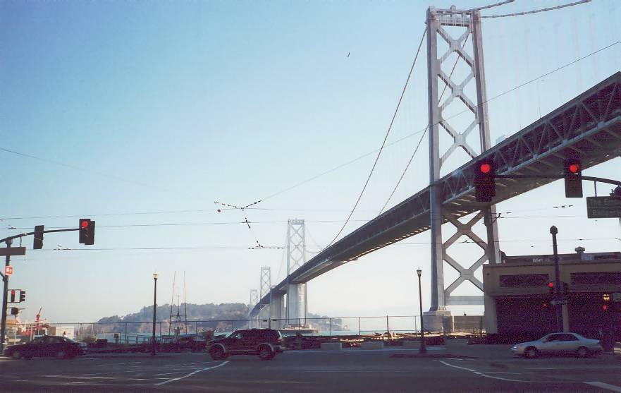
Interstate 80 begins its transcontinental route in San Francisco, the city by the bay. Originating at an interchange with U.S. 101, I-80 immediately ascends to the James Lick Skyway, which was rebuilt in its entirety in the late 2000s. The skyway grants spectacular views of Downtown San Francisco as it connects directly to the San Francisco-Oakland Bay Bridge.
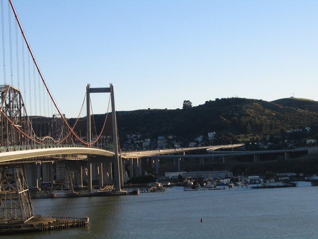
The San Francisco-Oakland Bay Bridge carries Interstate 80 across San Francisco Bay. The original bridge was under construction from July 9, 1933, and it opened to traffic on November 12, 1936. The bridge initially carried the dual designation of U.S. 40 and U.S. 50. The Bay Bridge originally consisted of three identifiable segments: western span (suspension bridge with four towers and mid-span anchorage), Yerba Buena Tunnel, and eastern span (a cantilever through truss bridge with an approach causeway). It was also the first suspension bridge to serve San Francisco (as it opened approximately six months prior to the Golden Gate Bridge on U.S. 101 and SR 1). The bridge was originally double-decked through all three segments. From 1936 to 1963, the lower deck carried rail, truck, and auto traffic, while the top deck carried auto traffic only in both directions. In 1963, the bridge converted to the current configuration with eastbound traffic on the bottom level and westbound traffic on the top level. The Yerba Buena Tunnel, which passes through Yerba Buena Island, is the largest diameter transportation bore tunnel in the country and possibly the world.
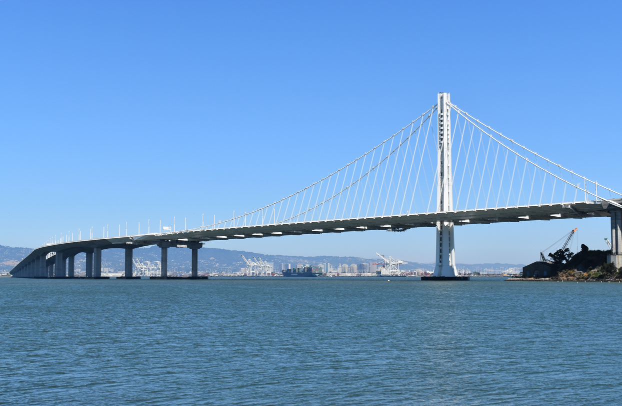
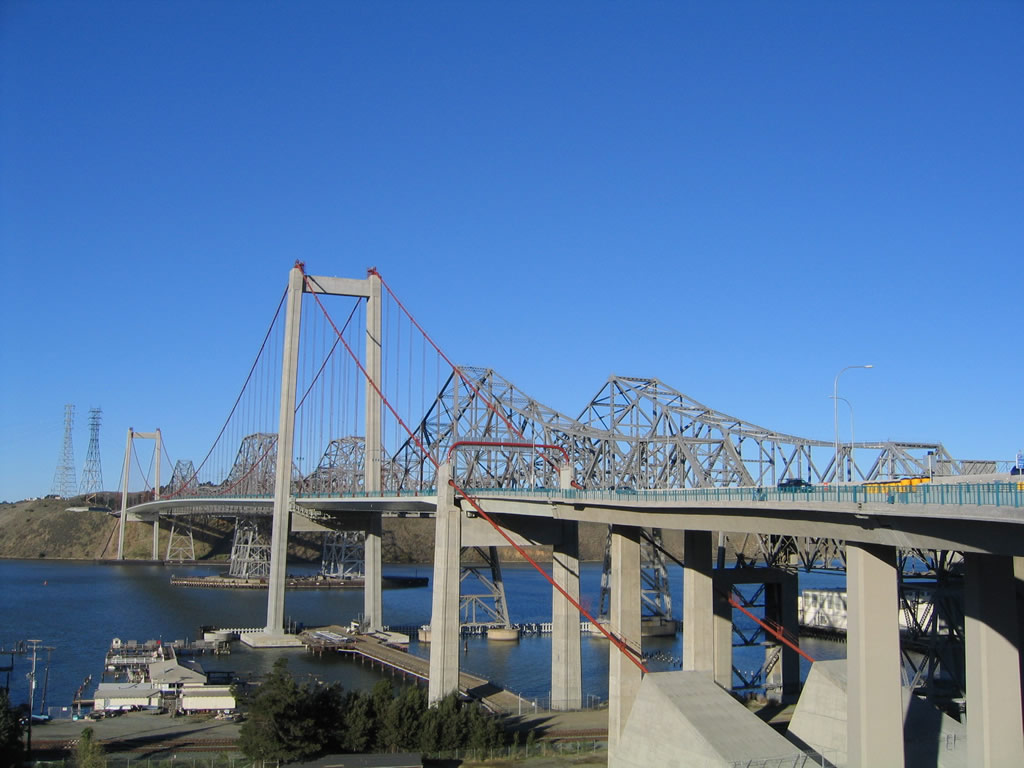
The San Francisco-Oakland Bay Bridge extending east from Yerba Vista Island and north of Oakland Outer Harbor. - 07/11/2018
Earthquake retrofitting improved the western (traditional suspension) span between 1994 and 2004, which is now up to current specifications. However, the original eastern span was not up to those specifications, and construction began in 2002 to replace it. After a decade of work, the new eastern span opened to traffic on September 2, 2013. The old eastern span was permanently closed on August 28, 2012, to allow for the shifting of traffic onto the new span. The new eastern span is a single-anchored suspension span with a single tower, along with a long approach causeway coming from Oakland. The causeway was completed first, and the single-anchored suspension segment was completed second. Unlike the tunnel and western span, the eastern span now has side-by-side travel lanes rather than double-deck travel lanes. A bicycle/pedestrian path also follows the eastern span all the way to Yerba Buena Island. The old eastern span was subsequently demolished.
Upon leaving the Bay Bridge, Interstate 80 enters the MacArthur Maze, then turns north at Oakland to parallel the bayshore via the Eastshore Freeway. This freeway, which was originally built as U.S. 40, carries Interstate 80 almost due north toward Vallejo. Much of this segment of freeway, especially near Berkeley, is built on landfill.
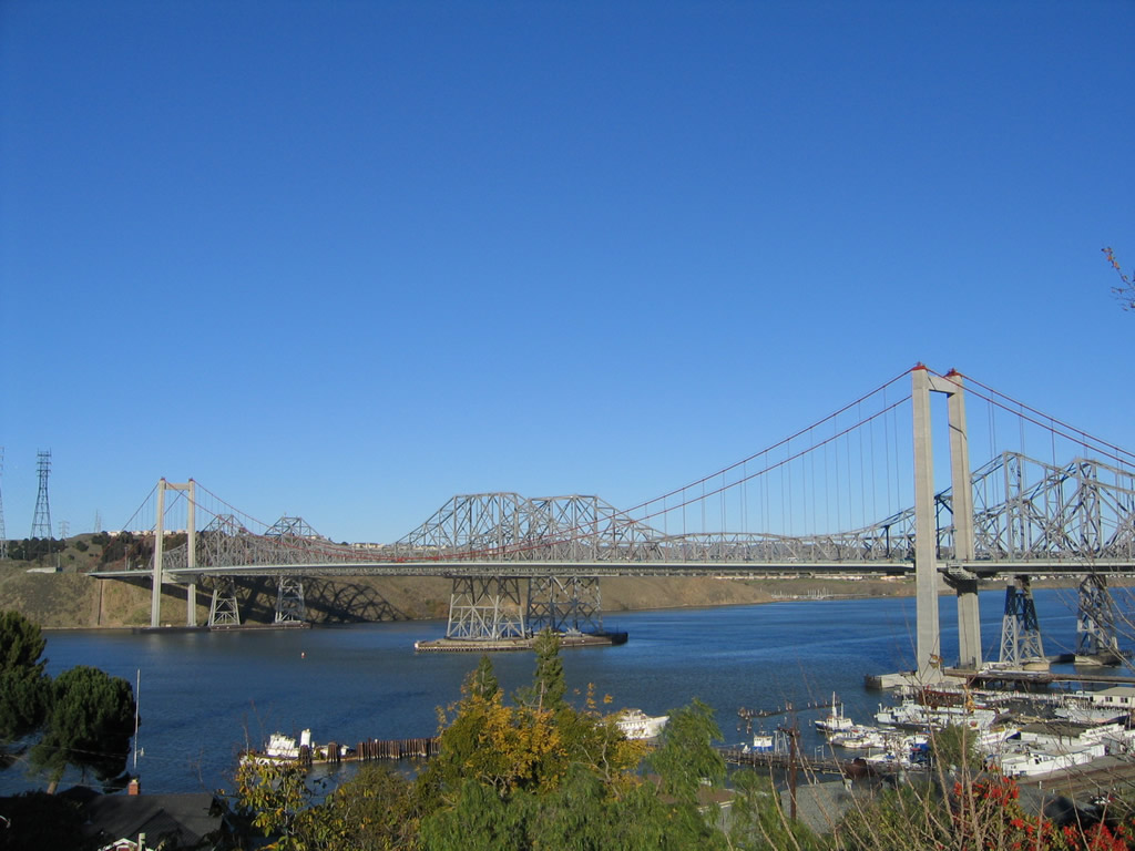
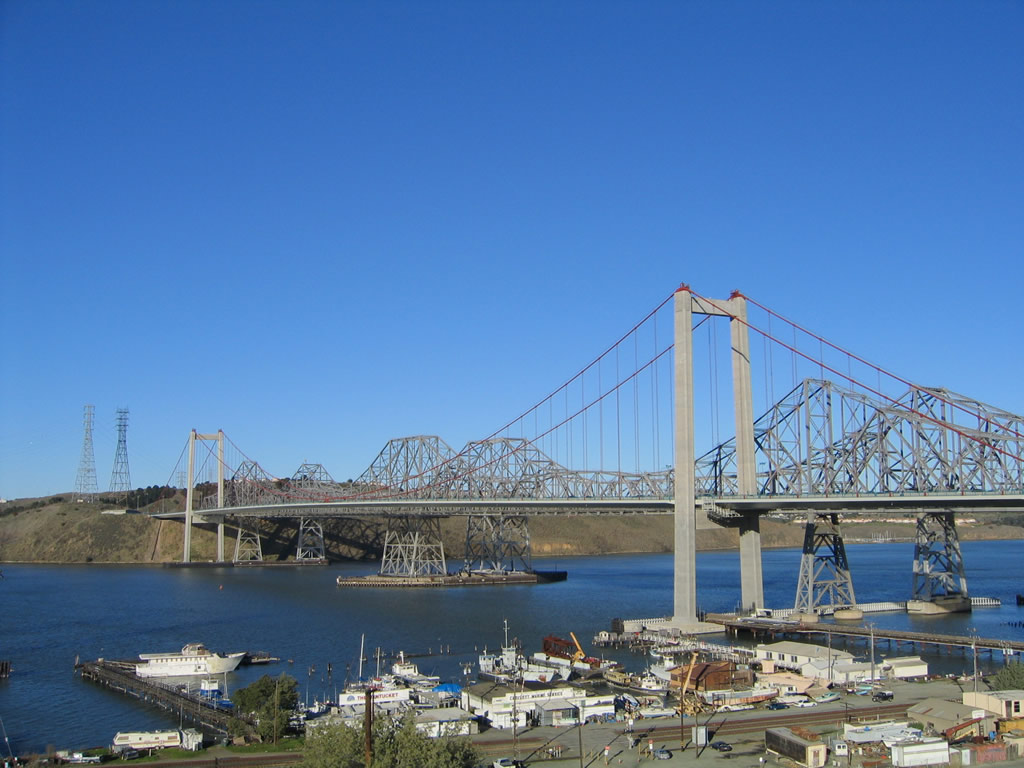
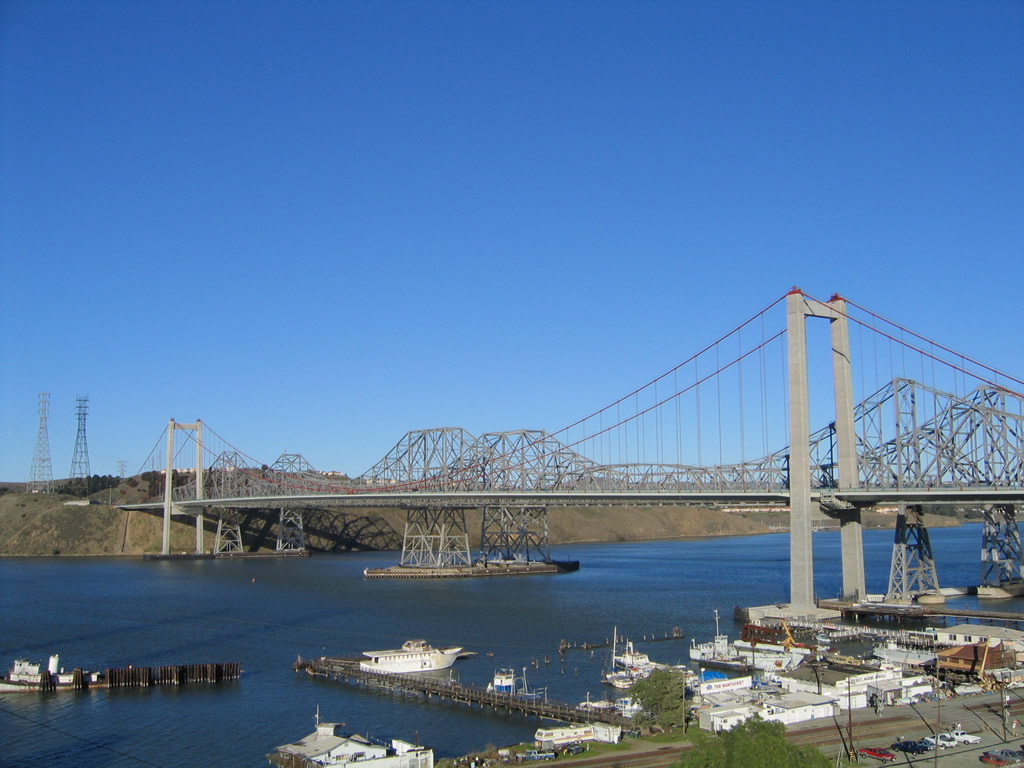
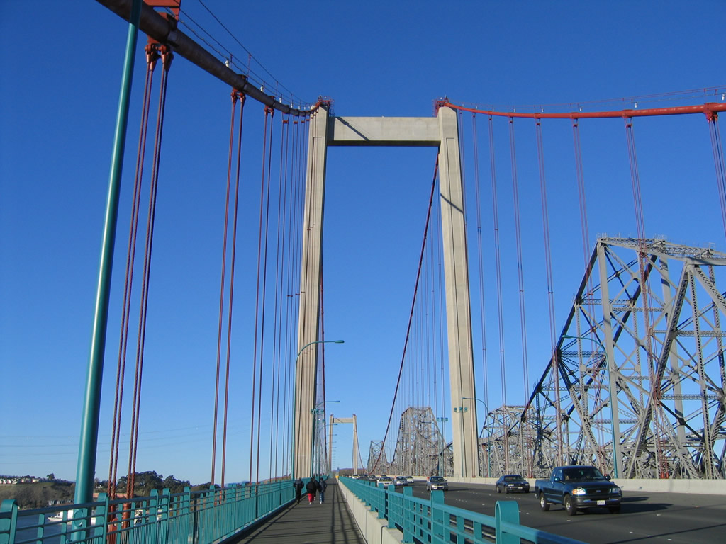
Prior to reaching Vallejo, Interstate 80 crosses the Carquinez Straits via asteel cantilever bridge westbound and a suspension bridge eastbound. Debuting to motorists on November 11, 2003, the Alfred Zampa Bridge replaced the original steel cantilever span that had opened on May 21, 1927 as part of U.S. 40. The eastbound span opened to traffic in 1958. Following completion of the Zampa Bridge, a succeeding project retrofitted the 1958-span for earthquake safety while eastbound traffic temporarily shifted to the 1927-bridge. Subsequent work through September 2007 dismantled the 1927 span. Leaving the Carquinez Straits, Interstate 80 turns northeast at Vallejo, following a well-traveled route between the Bay Area and the capital city of Sacramento.
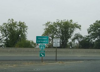
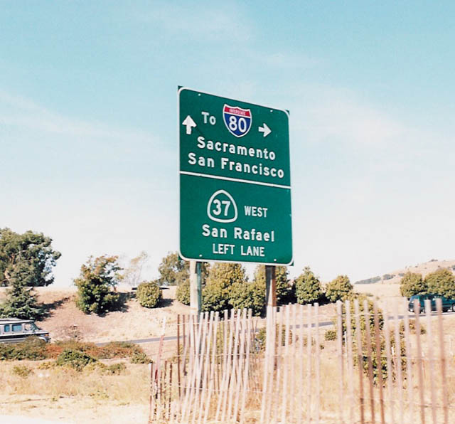
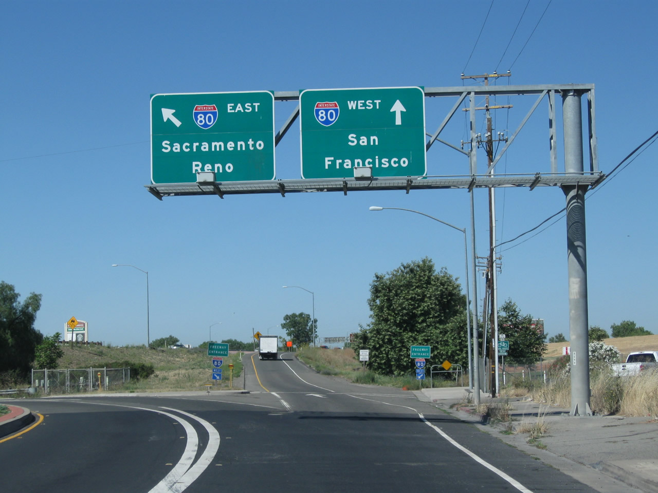
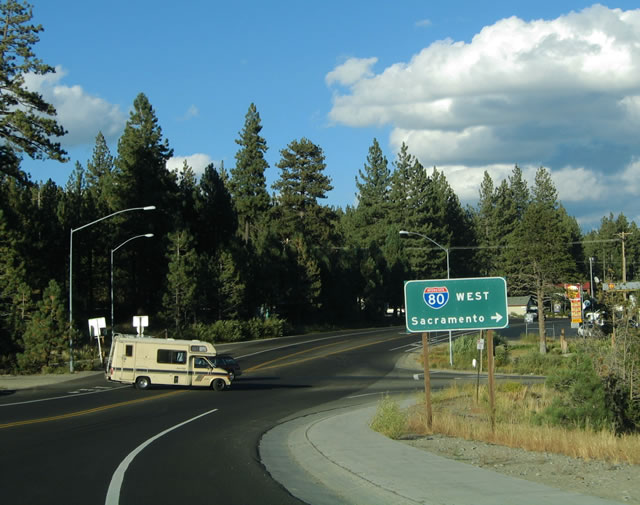
Beyond Carquinez Straits, Interstate 80 turns northeast at Vallejo, following a well-traveled route between the Bay Area and the capital city of Sacramento, passing through Fairfield, Vacaville, and Davis along the way, finally crossing the wide Yolo Bypass flood control channel before reaching the capital city metropolitan area. At West Sacramento, Interstate 80 splits into Business Loop I-80/U.S. 50, which serves downtown Sacramento, and regular Interstate 80, which bypasses the city to the north.
After leaving Solano County, Interstate 80 continues along a well-traveled route between the Bay Area and the capital city of Sacramento, passing through Davis and over the wide Yolo Bypass flood control channel before reaching the city of West Sacramento and the capital city metropolitan area. At West Sacramento, Interstate 80 splits into Business Loop I-80/U.S. 50, which serves downtown Sacramento, and regular Interstate 80, which bypasses the city to the north.
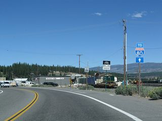
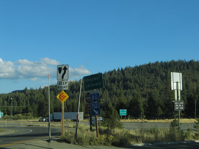
I-80 travels through several suburbs as it skirts Sacramento to the north. Passing through Roseville and Auburn, Interstate 80 begins a slow ascent into the foothills of the Sierra Nevada. As one of three major all-weather trans-Sierra routes in the winter (others include U.S. 50 and SR 88), Interstate 80 is frequently busy with commercial traffic, tourists, skiers, commuters to Reno, etc. The freeway narrows to four lanes and remains a busy corridor through the foothills toward Donner Summit. Interstate 80 crosses Donner Summit, one of the highest points along the freeway, then descends into Truckee, a gateway to scenic Lake Tahoe. Passing by a few small towns in the Truckee River valley, Interstate 80 enters Nevada just east of Farad.
History
Eastern and Central Freeway Proposals
Interstate 80 ends at an interchange with U.S. 101, where it meets the Central Freeway. This was not always the planned terminal point for the freeway. Prior to August 1965, Interstate 80 was planned to extend across the San Francisco Peninsula along a path roughly located along Fell and Oak Streets (called the Western Freeway) to meet SR 1 (which would have also carried the Interstate 280 designation as part of the 1960s plan). Along with the proposed and now cancelled Western Freeway, U.S. 101 (Central Freeway) (now Octavia Boulevard) between Fell Street (the planned Western Freeway split) east to the current Lick/Central interchange was proposed to carry part of Interstate 80.
The Western Freeway extension of Interstate 80 across the peninsula was killed due to community opposition, community impact, environmental concerns, and cost. At the time the Western Freeway was cancelled, signage for Interstate 80 was retracted off the Central Freeway to end at the interchange between the Central Freeway and James Lick Skyway (today's interchange between U.S. 101 and Interstate 80).
Many years after Interstate 80 was removed from U.S. 101 (Central Freeway), the 1989 Loma Prieta Earthquake damaged the Central Freeway, and much of the freeway was ultimately demolished in the early 2000s. It was replaced by at-grade Octavia Boulevard. Aside from the wider-than-normal right of way on Octavia Boulevard (where the Central Freeway used to run), the another remnant of the original freeway plan is the greenbelt area located between Fell and Oak Streets. This linear park was the original proposed east-west segment of Interstate 80 from Octavia Boulevard west to Golden Gate Park.
James Lick Skyway
The James Lick Skyway portion of Interstate 80 was replaced for a seismic retrofit through 2006 to 2009. Construction resulted in the demolition of several original structures approaching the Bay Bridge. The skyway was originally constructed in 1936 along with the Bay Bridge and was fully replaced in stages during this project. During construction, the highway was routed onto temporary structures located to the north of the existing viaduct, which was demolished and rebuilt from the ground up. Traffic has been switched to the new viaduct, and the temporary structures were later removed.
There have been prior discussions about whether the section of Interstate 80 between U.S. 101 and the Embarcadero exit (which is where Interstate 280 would have connected to Interstate 80 had that connection been constructed) may or may not be an official Interstate. An interesting confluence of facts leads to the reasons behind why the skyway may not be part of the Interstate Highway System:
- The legislative Route 80 is separated into two sections:
- From Route 101 near Division Street in San Francisco to Route 280 near First Street in San Francisco.
- From Route 280 near First Street in San Francisco to the Nevada state line near Verdi, Nevada, passing near Oakland, via Albany, via Sacramento, passing near Roseville, via Auburn, via Emigrant Gap, via Truckee and via the Truckee River Canyon.
- According to Daniel Faigin's page and Chris Sampang, this stretch of Route 80 was originally approved as a chargeable Interstate on 7/7/1947, but it was removed as a chargeable Interstate in August 1965.
- Several Thomas Brothers California State Map Guides from the 1980s and 1990s show a state route shield on this segment of freeway between U.S. 101 and Proposed Route 280.
- Joe Rouse mentions that the Caltrans publication about the history of the Interstates in California mentions a mileage change in 1968 where about 5.3 miles of Interstate 80 west of the Embarcadero Freeway was removed from the system. The postmile for the Embarcadero Freeway connections is 5.56. Given the fact that there is a postmile equation on the Skyway, the mileage seems to add up.
- A 1971 State Highway map shows the Interstate 80 designation ending at the Embarcadero Freeway interchange. The drawings on the map were all black and white, but various colors were used to depict the status of the state's Freeway and Expressway System. Interstate routes were labeled with very wide colored lines; 80 west of the Embarcadero Freeway/Former SR 480 is shown as narrower than other Interstate routes.
- Signage for Interstate 80 is sporadic at best, with overhead signage pointing to southbound U.S. 101 along westbound Interstate 80. However, there are some standalone reassurance shields in place in both directions along this stretch.
In spite of all these facts, there are competing reasons why Interstate 80 is continuous all the way to U.S. 101. Examples include the exit numbering program (which begins at U.S. 101 and proceeds west), the possibility that this segment is non-chargeable Interstate rather than chargeable Interstate, and the overhead signs and shields that display Interstate 80, not SR 80. With the recent project to upgrade the James Lick Skyway to Interstate standards, it seems like the skyway can be safely considered part of Interstate 80. Therefore, for our purposes we will continue to consider the skyway section as part of Interstate 80.
Route Switch in West Sacramento and Sacramento
In 1980, Interstate 80 was realigned out of downtown Sacramento and onto former Interstate 880, the Sacramento bypass. This switch occurred because the segment of former Interstate 80 (now Business Loop I-80) between SR 99 and SR 244 does not meet Interstate standards, and a plan to realign and widen this segment of freeway was scrapped in favor of expanding Sacramento's light rail system. When Interstate 80 was moved onto the bypass, Interstate 880 was decommissioned (with the number saved for later use in the Bay Area). The segment through West Sacramento and downtown Sacramento became designated as Business Loop I-80 and U.S. 50 (unsigned Interstate 305), and the north-south portion from U.S. 50 and SR 99 northeast to I-80 and SR 244 was designated as Business Loop I-80 and SR 51.
For much more on this routing change in Yolo and Sacramento Counties, see Business Loop I-80.
Key Opening Dates of Interstate 80 in California
- U.S. 101 to Transbay Transit Ramp - Circa 1935
- San Francisco Bay Bridge (from Transbay Transit Ramp to Interstate 580-880) - November 12, 1936 (new eastern span -- self-anchored suspension bridge -- opened September 2, 2013)
- Interstate 580-880 to Temescal Creek - Circa 1936 (widened Circa 1955)
- Temescal Creek to SR 13 - Circa 1954 (widened July 27, 1967)
- SR 13 to Gilman Street - Circa 1939 (widened Circa 1956)
- Gilman Street to Interstate 80-580 North Split - Circa 1955
- Interstate 80-580 North Split to Contra Costa County Line - Circa 1936 (widened Circa 1960)
- Contra Costa County Line to Central Avenue - Circa 1936 (widened Circa 1953)
- Central Avenue to Carlson Blvd - Circa 1960
- Carlson Blvd to SR 123 - Circa 1956
- SR 123 to MacDonald Avenue - Circa 1956 (widened May 23, 1979)
- MacDonald Avenue to El Portal Drive - Circa 1956
- El Portal Drive to SR 4 - Circa 1957
- SR 4 to California Street - Circa 1958
- California Street to Contra Costa County-Solano County Line - Circa 1958 (widened April 29, 1976)
- Carquinez Straits Bridge - (westbound span - original: May 21, 1927, new: November 11, 2003, and eastbound span: 1958)
- Contra Costa County-Solano County Line to Toll Plaza - Circa 1958 (widened December 31, 1978)
- Toll Plaza to SR 29 - Circa 1948 (widened Circa 1958)
- SR 29 to SR 37 - Circa 1958
- SR 37 to Solano-Napa County Line - Circa 1963 (widened December 23, 1975)
- Solano-Napa County Line to American Canyon Road - Circa 1963
- American Canyon Road to Lynch Road - Circa 1963 (widened April 2, 1970)
- Lynch Road to SR 12 - April 2, 1970
- SR 12 to Interstate 680 - Circa 1961
- Interstate 680 to Suisun Valley Road - Circa 1928 (widened 1961)
- Suisun Valley Road to Dan Wilson Creek - Circa 1951 (widened Janurary 14, 1983
- Dan Wilson Creek to Suisun Creek - Circa 1932 (widened April 25, 1971)
- Suisun Creek to W. Fairfield Road - Circa 1961 (widened October 24, 1973)
- W. Fairfield Road to N. Fairfield Road - Circa 1963 (widened May 24, 1966)
- North Fairfield Road to Pleasant Valley Road - May 24, 1966
- Pleasant Valley Road to Alamo Creek - October 27, 1964
- Alamo Creek to Mason Street - October 27, 1964 (widened October 24, 1973)
- Mason Street to Ulatis Creek - October 27, 1964
- Ulatis Creek to Nut Creek Road - October 27, 1964 (widened October 24, 1973)
- Nut Creek Road to Horse Creek - October 27, 1964 (widened January 24, 1994)
- Horse Creek to Leisure Town Overcrossing - Circa 1946 (widened January 24, 1994)
- Leisure Town Overcrossing to Sweeney Creek - Circa 1946 (widened December 9, 1965)
- Sweeney Creek to SR 113 - Circa 1946 (widened Circa 1963)
- SR 113 to Pedrick Road - Circa 1946 (widened April 5, 1965)
- Pedrick Road to South Fork Putah Creek - Circa 1941 (widened November 27, 1973)
- South Fork Putah Creek to SR 113 - Circa 1941 (widened October 10, 1974)
- SR 113 to Yolo County Line - October 10, 1974
- Yolo County Line to Webster Undercrossing - Circa 1960 (widened July 11, 1984)
- Webster Undercrossing to Yolo Causeway (East) - Circa 1963 (widened August 22, 1986)
- Yolo Causeway (East) to Business Loop I-80 and U.S. 50 (Capital City Freeway) - Circa 1951 (widened March 2, 1970)
- Business Loop I-80 and U.S. 50 (Capital City Freeway) to SR 84 (Jefferson Boulevard) - June 11th, 1970 (widened October 14, 1971)
- SR 84 (Jefferson Boulevard) to Interstate 5 - October 14, 1971
- Interstate 5 to San Juan Road - August 14, 1970
- San Juan Road to Northgate Boulevard - August 14, 1970 (widened October 10, 1996)
- Northgate Boulevard to Pinell Street - August 14, 1970
- Pinell Street to Business Loop I-80 (Capital City Freeway) and SR 244 - January 21, 1971
- Business Loop I-80 (Capital City Freeway) and SR 244 to Linda Creek - Circa 1955 (widened August 21, 1973)
- Linda Creek to Douglas Boulevard - Circa 1955 (widened November 25, 1975)
- Douglas Boulevard to Taylor Road - Circa 1954 (widened August 13, 1990)
- Taylor Road to Hallbom Road Undercrossing - Circa 1959 (widened November 25, 1975)
- Hallbom Road Undercrossing to Russell Road - Circa 1946 (widened October 11, 1990)
- Russell Road to Auburn Ravine - October 20, 1973
- Auburn Ravine to Bowman OH North - October 20, 1973 (widened August 8, 1990)
- Bowman OH North to Dry Creek Road - October 20, 1973
- Dry Creek Road to Clipper Gap - May 21, 1974
- Clipper Gap to Applegate Road - Circa 1958 (widened May 21, 1974)
- Applegate Road to Heather Glen Overcrossing - Circa 1958 (widened February 18, 1966)
- Heather Glen Overcrossing - Weimar Overcrossing - Circa 1958
- Weimar Overcrossing to Weimar Overhead - Circa 1958 (widened October 30, 1975)
- Weimar Overhead to Weimar X Road - Circa 1958
- Weimar X Road to New England Mills OH - Circa 1958 (widened October 30, 1975)
- New England Mills OH to Illinoistown Overcrossing - Circa 1958 (widened Feburary 18, 1966)
- Illinoistown Overcrossing to Long Ravine Undercrossing - Circa 1958
- Long Ravine Undercrossing to North Long Ravine UP - Circa 1913 (widened October 14, 1987)
- North Long Ravine UP to Magra Overcrossing - Circa 1958
- Magra Overcrossing to Sawmill Overcrossing - Circa 1959
- Sawmill Overcrossing to Blue Canyon Road - Circa 1961
- Blue Canyon Road to Putt Lake Undercrossing - Circa 1959 (September 19, 1973
- Putt Lake Undercrossing to Beginning Separate Alignment - Circa 1959
- Beginning Separate Alignment to End Separate Alignment - October 2, 1964
- End Separate Alignment to Soda Spring Overcrossing - Circa 1959
- Soda Spring Overcrossing to Donner Park Overcrossing - October 7, 1964
- Donner Park Overcrossing to SR 89 south - Circa 1959 (widened July 14, 1997
- SR 89 south to West Truckee Undercrossing - Circa 1959 (widened July 12, 1991)
- West Truckee Undercrossing to Polaris Undercrossing - Circa 1959
- Polaris Undercrossing to Union Mills Bridge - Circa 1959 (widened October 15, 1992)
- Union Mill Bridge to Truckee River - Circa 1959 (widened July 17, 1987)
- Truckee River to End of Chain Station - Circa 1959 (widened January 13, 1986)
- End of Chain Station to Truckee River - Circa 1959
- Truckee River area - Circa 1959 (widened November 8, 1985)
- Truckee River area to Farad Undercrossing - Circa 1959
- Farad Undercrossing to California-Nevada state line - Circa 1958
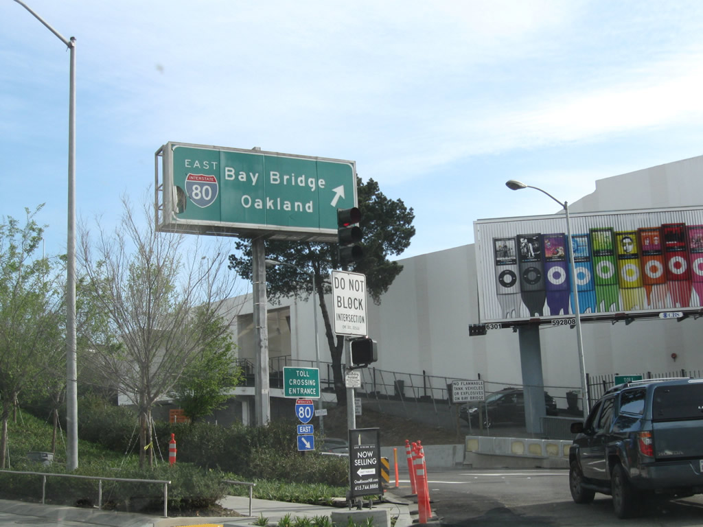
An on-ramp connects 1st and Harrison Streets in Downtown San Francisco with Interstate 80 east across the San Francisco-Oakland Bay Bridge. The overhead assembly here is a rare back-lit guide sign that was likely placed in the 1960s-1970s time frame.
04/06/09
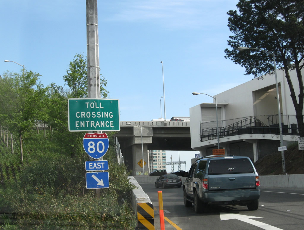
Although the ramp from First Street south to Interstate 80 east is signed as a "toll crossing entrance," there is no toll for vehicles crossing the Bay Bridge eastbound to Oakland. Tolls are only collected for westbound travelers.
04/06/09
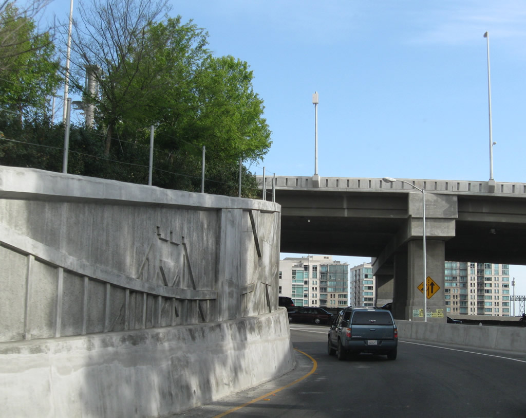
The on-ramp to Interstate 80 east was reconstructed as part of the James Lick Skyway construction. Note the decorative features on the retaining wall of this ramp, which shows the top of one of the suspension towers.
04/06/09
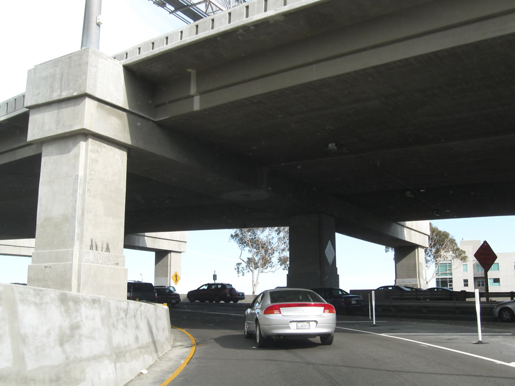
The ramp onto Interstate 80 east from First Street leads onto the lower deck of the Bay Bridge. There are no exits until Yerba Buena Island and Treasure Island.
04/06/09
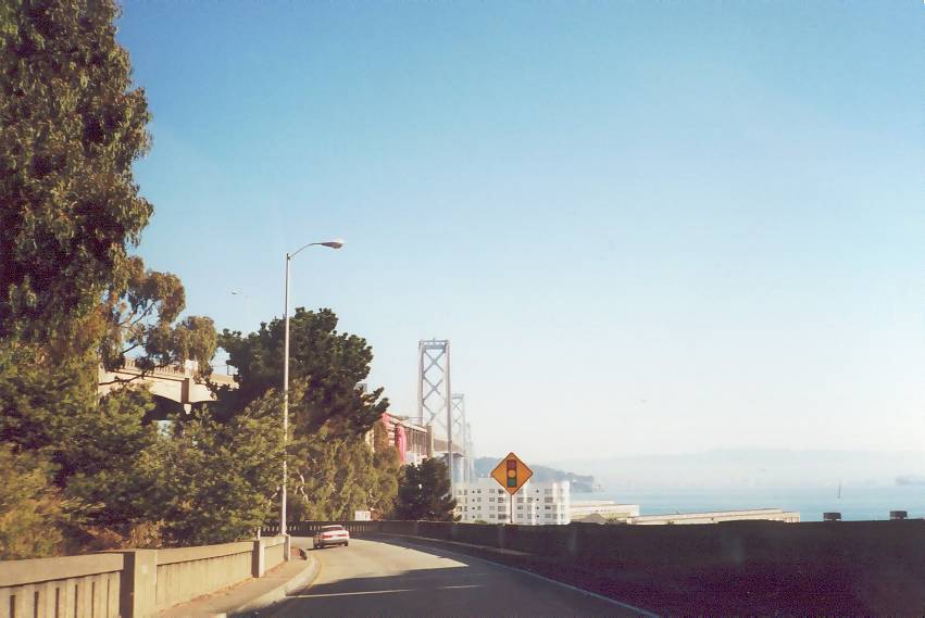
View of the San Francisco-Oakland Bay Bridge from the off-ramp (Exit 2B) connecting I-80 west with Harrison Street and the Embarcadero. With subsequent reconstruction of the James Lick Skyway and approach to the Bay Bridge, this scene changed substantially.
10/16/00
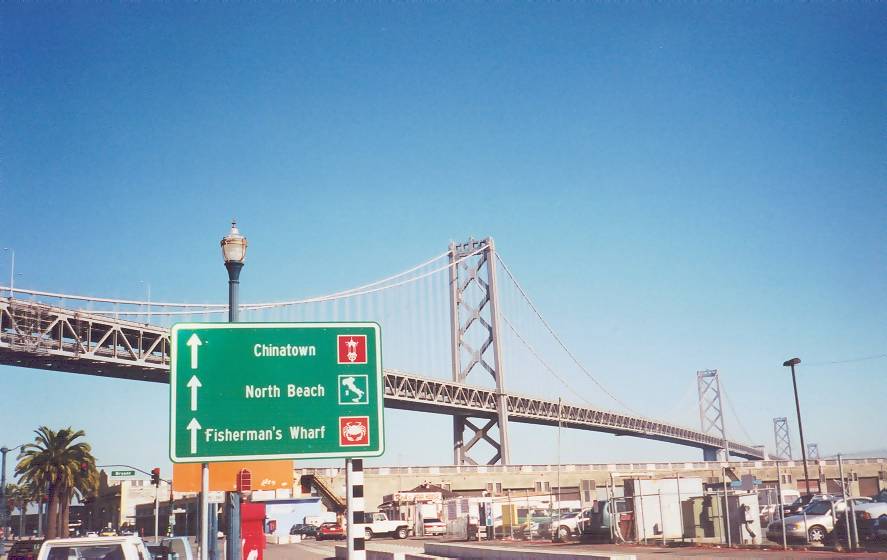
The San Francisco-Oakland Bay Bridge from the Embarcadero. A wayfinding sign references the internationally famous attractions of Chinatown, Fisherman's Wharf and North Beach.
10/16/00
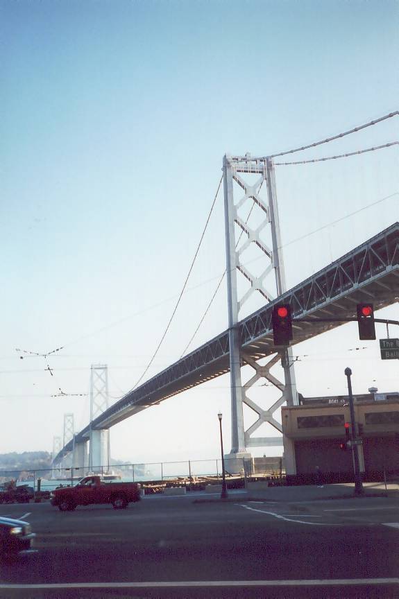
The San Francisco-Oakland Bay Bridge leading away from Downtown San Francisco to Yerba Buena Island,
10/16/00
On-ramps from Buchanan Street in the city of Albany connect to both Interstate 580 west and I-80 east.
07/18/09
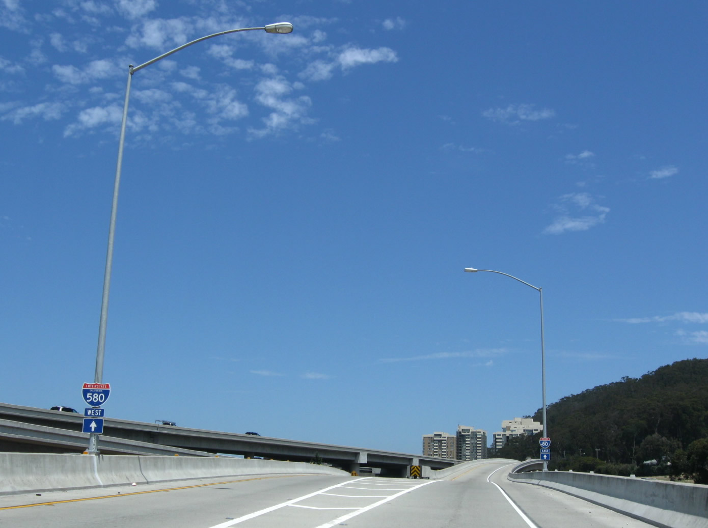
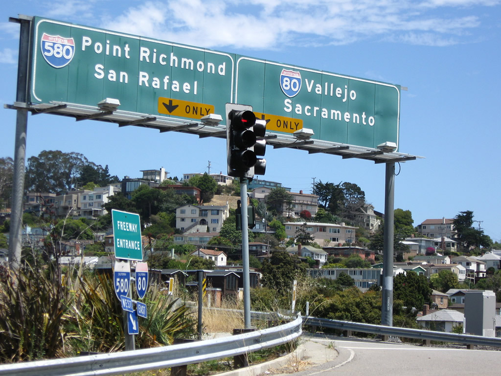
I-580 separates from I-80 and turns west across San Pablo Bay to San Rafael and U.S. 101 in Marin County.
07/18/09
Interstate 80 travels northeast from Buchanan Street and Albany to Vallejo, Fairfield, Vacaville, Davis and Sacramento.
07/18/09
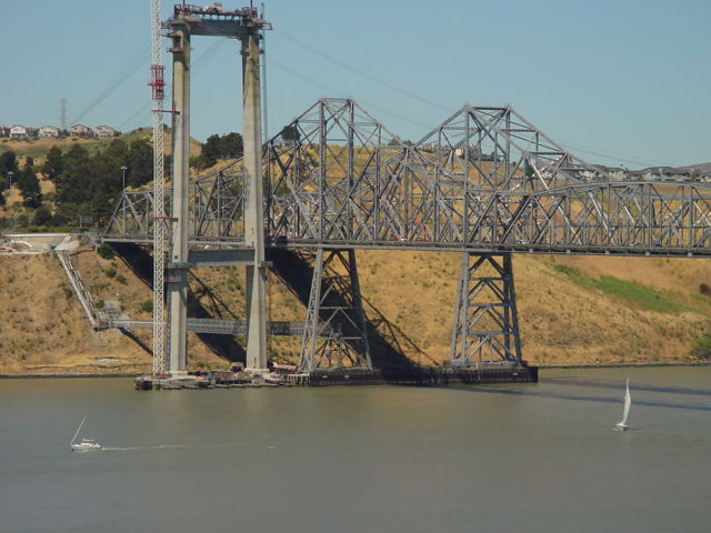
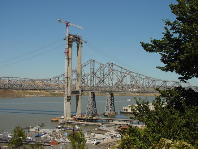
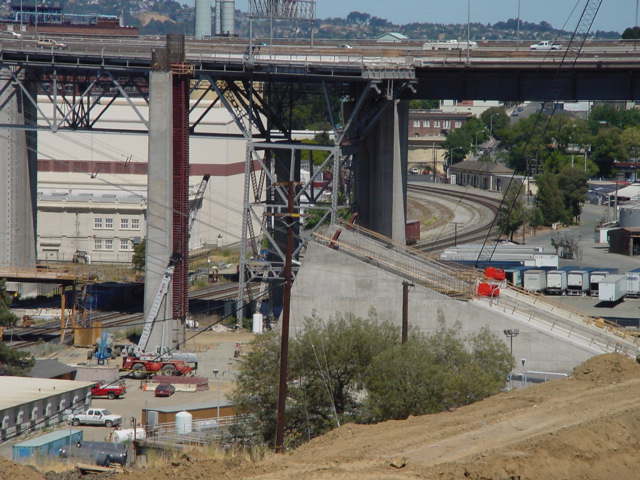
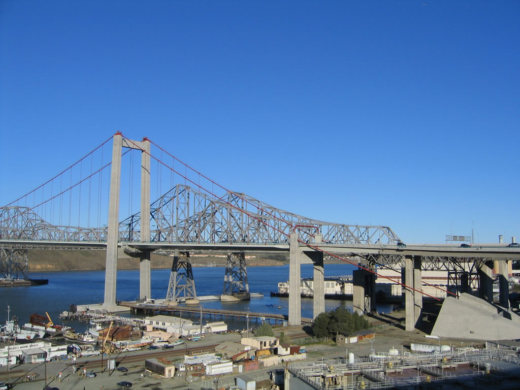
Construction for the Alfred Zampa Memorial Bridge at Carquinez Strait. This was the first suspension bridge constructed in the United States since the Chesapeake Bay Bridge (U.S. 50-301) in the early 1970s.
07/21/02
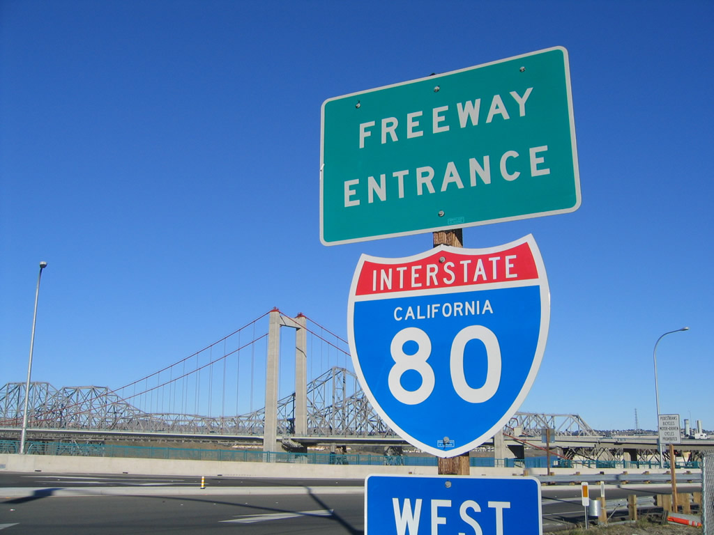
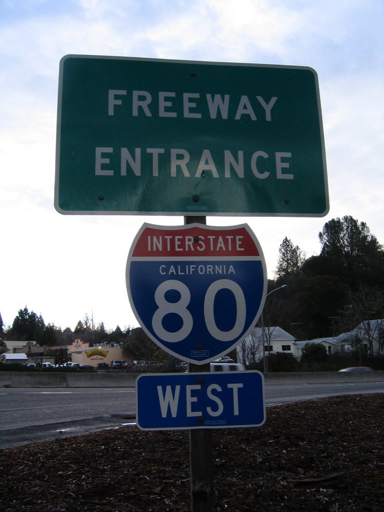
Freeway entrance signs for I-80 west at the Pomona Street and San Pablo Avenue on-ramp in Crockett.
11/28/04
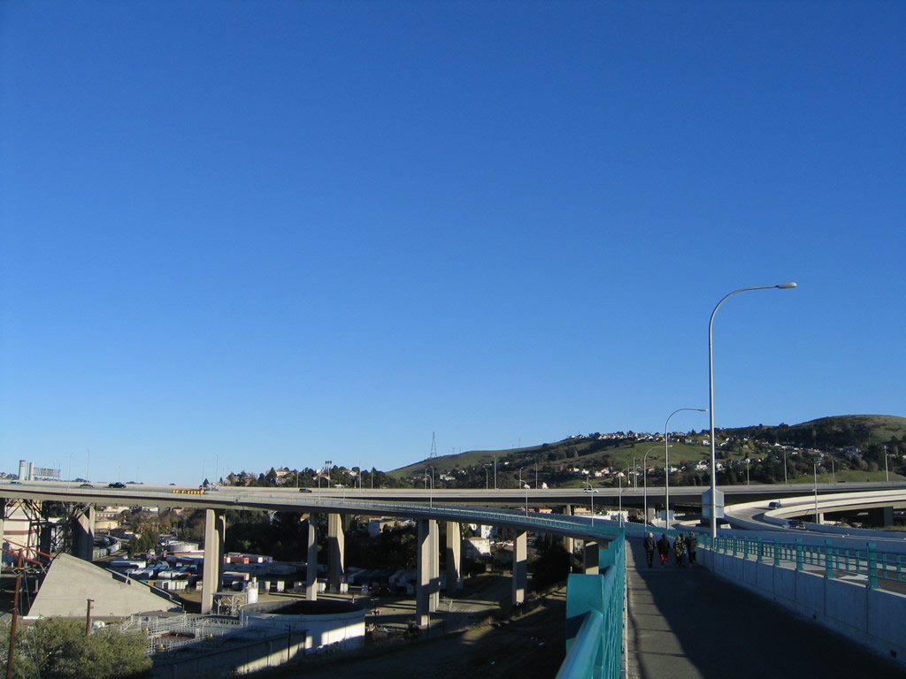
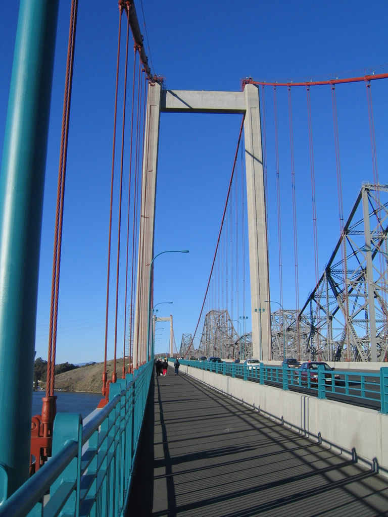
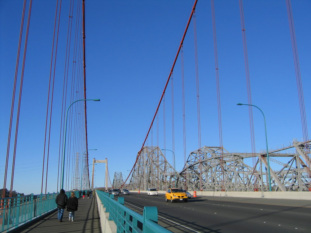
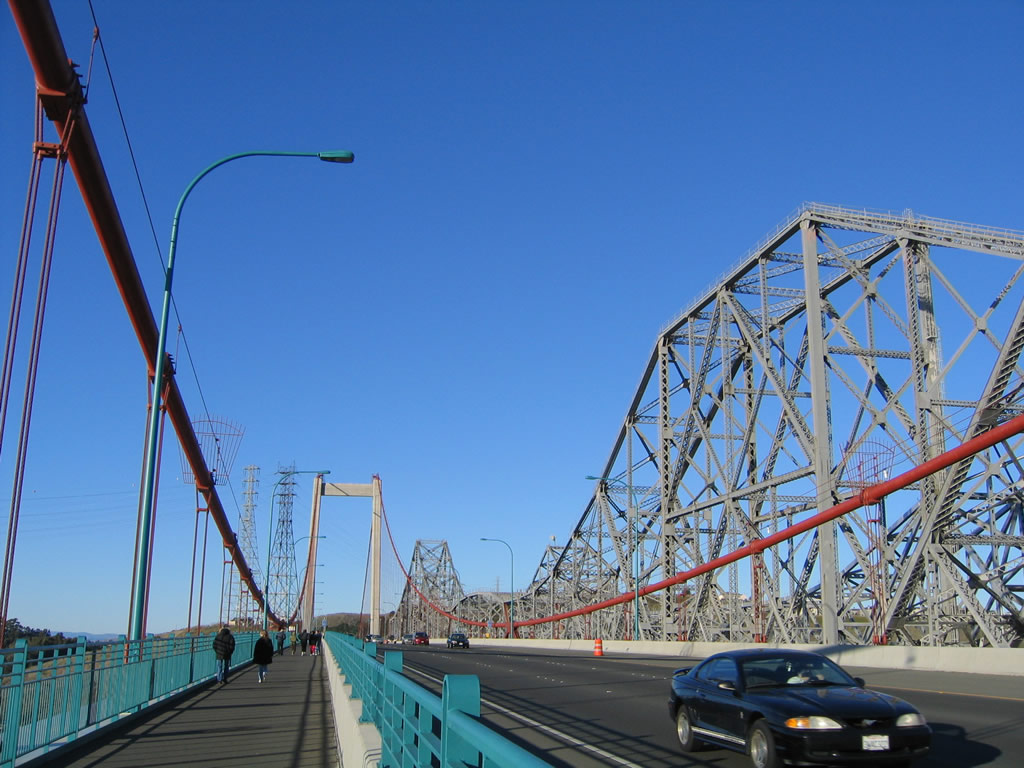
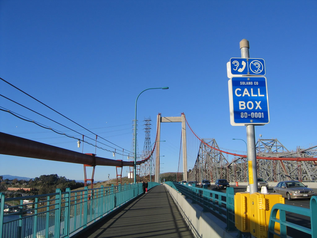
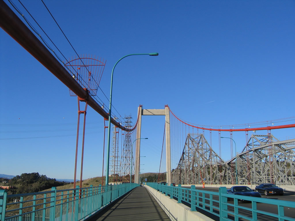
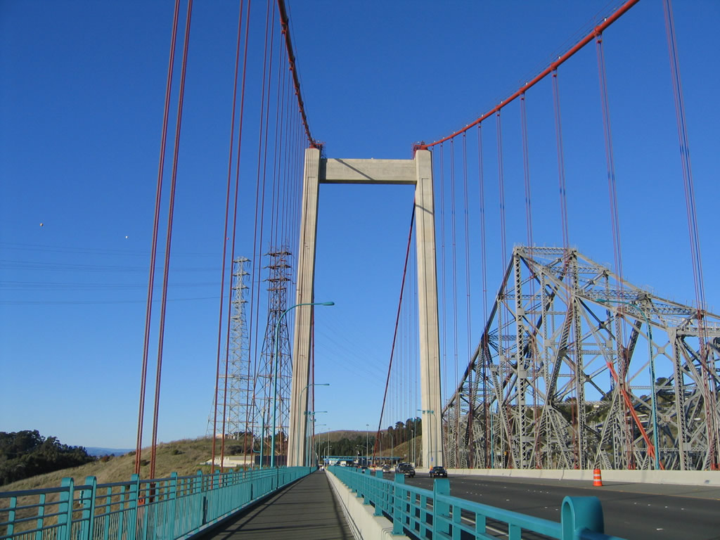
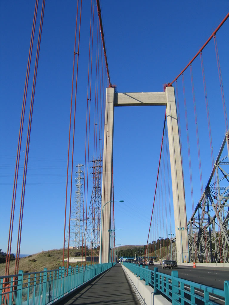
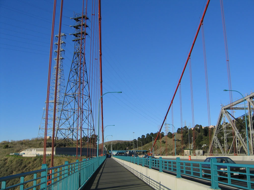
Walking north on the Carquinez Bridge Trail, which lines the west side of the Alfred Zampa Bridge. The teal bridge railing and orange suspension cables offer a splash of color on the concrete structure.
11/28/04
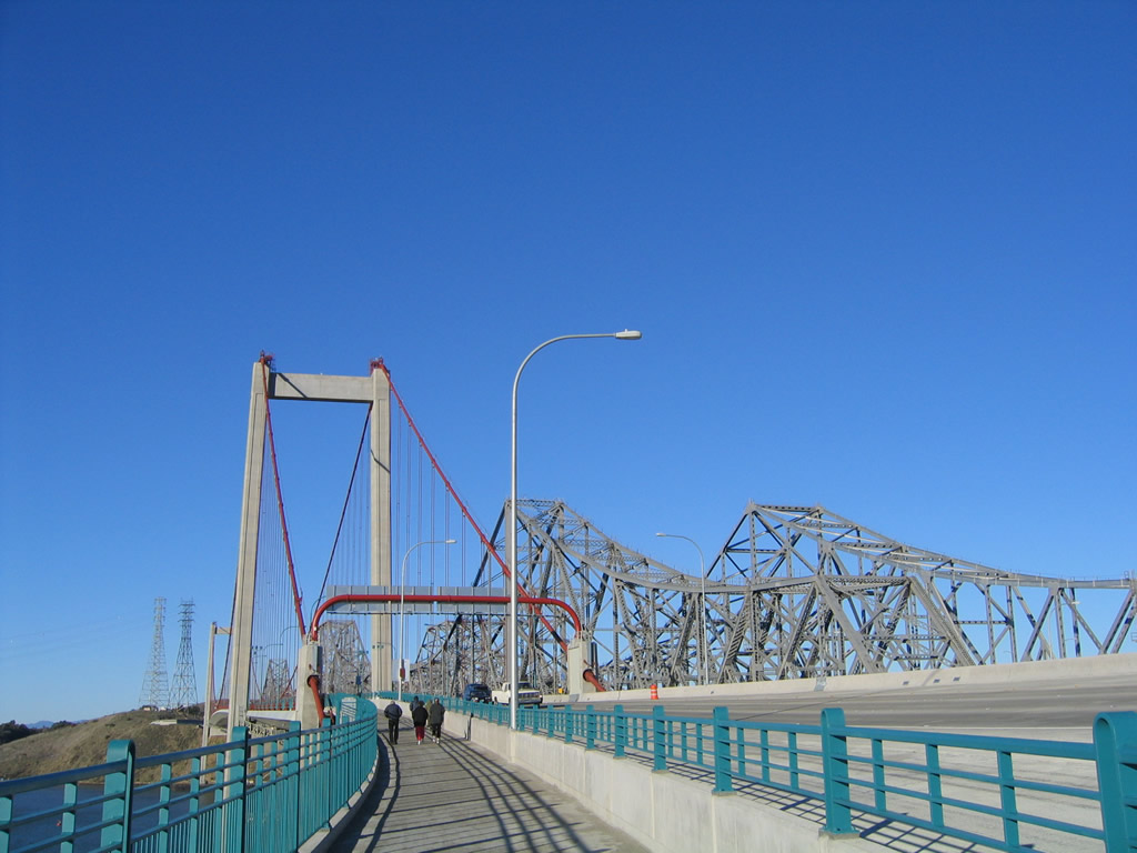
Heading northward across the Carquinez Bridge Trail along the Alfred Zampa Memorial Bridge (I-80 eastbound).
11/28/04
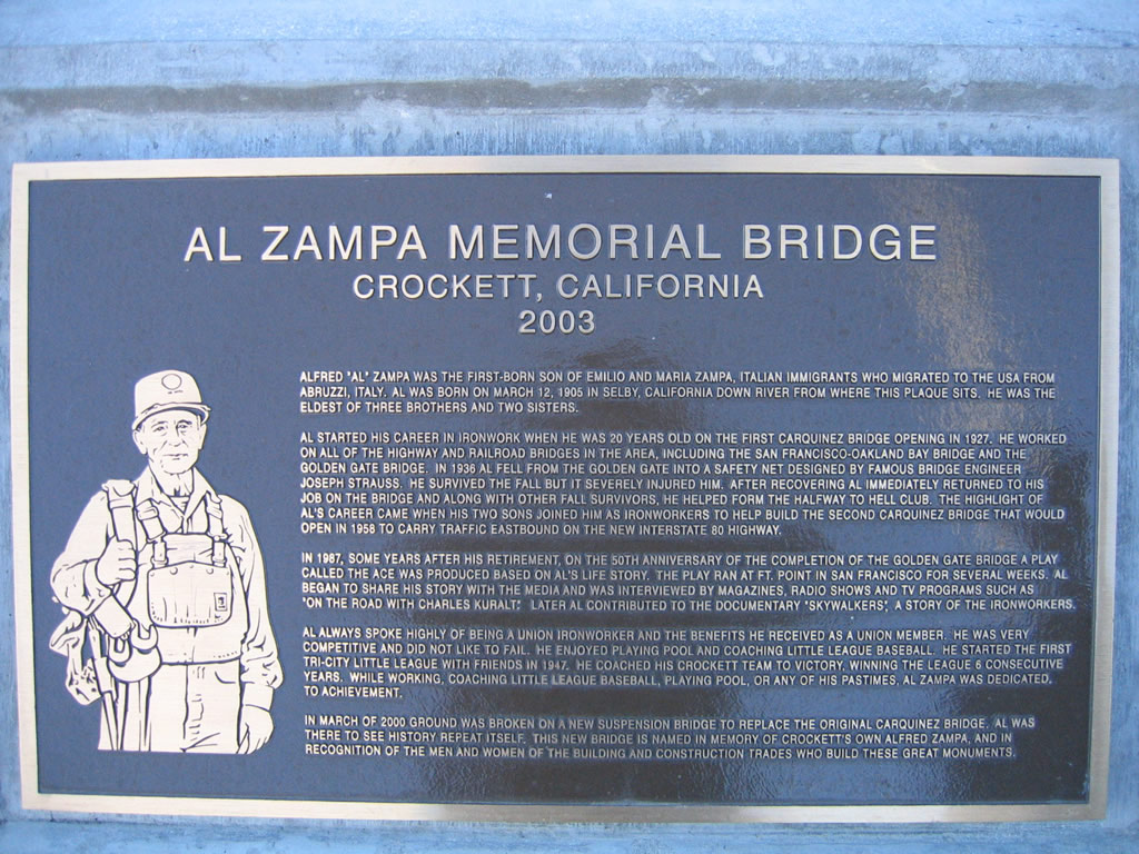
A plaque commemorating Alfred Zampa is located at the north end of the bridge.
11/28/04
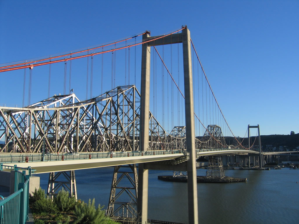
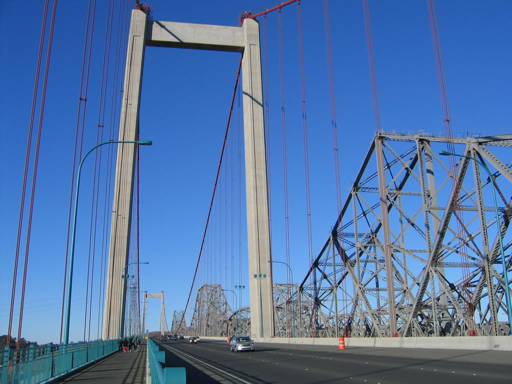
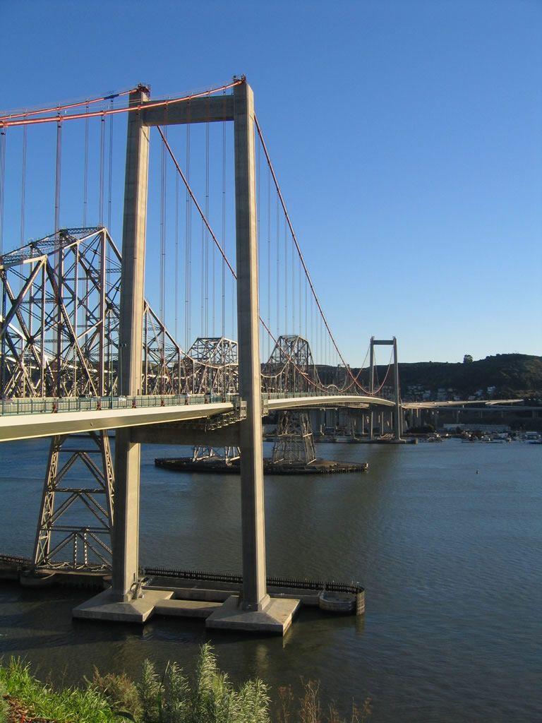
Looking south from the Alfred Zampa Memorial Bridge vista point at the Carquinez Bridge spans.
11/28/04
The distant Crockett interchange with Interstate 80 and San Pablo Avenue (Old U.S. 40) was modified to create the approach from the bridge onto the freeway.
11/28/04
Western vista of San Pablo Bay from the Carquinez Bridge Trail on the Alfred Zampa Memorial Bridge. The Carquinez Strait, which carries water from the Sacramento and San Joaquin Rivers through the delta, ends here. Marin County is visible in the distance.
11/28/04
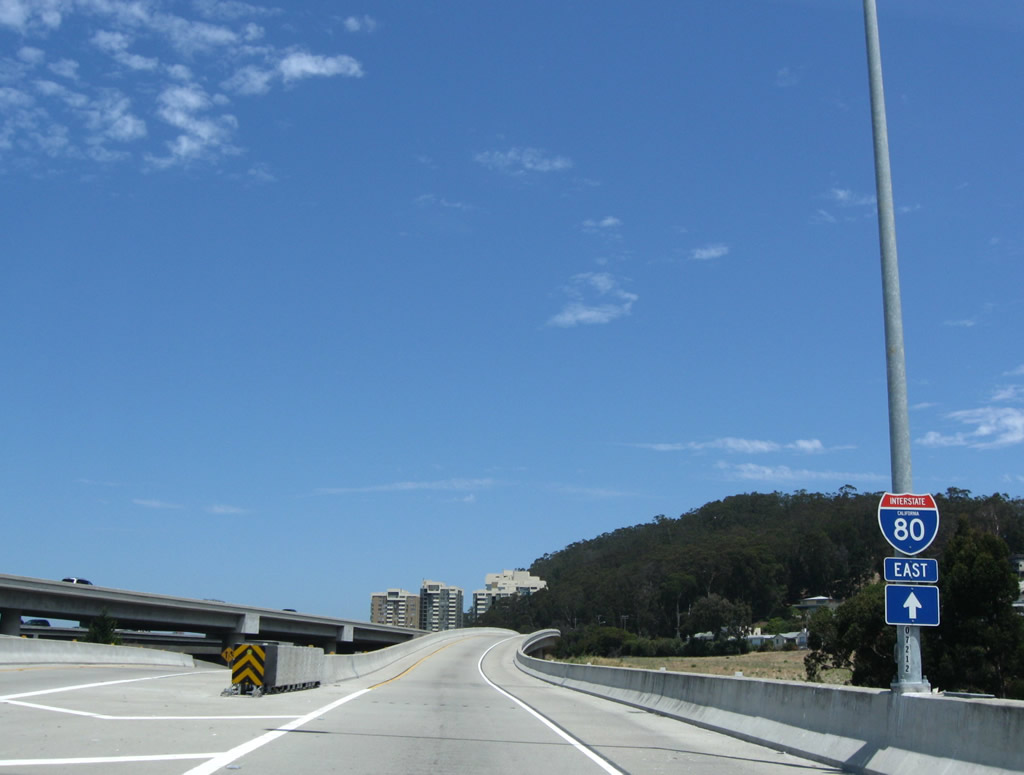
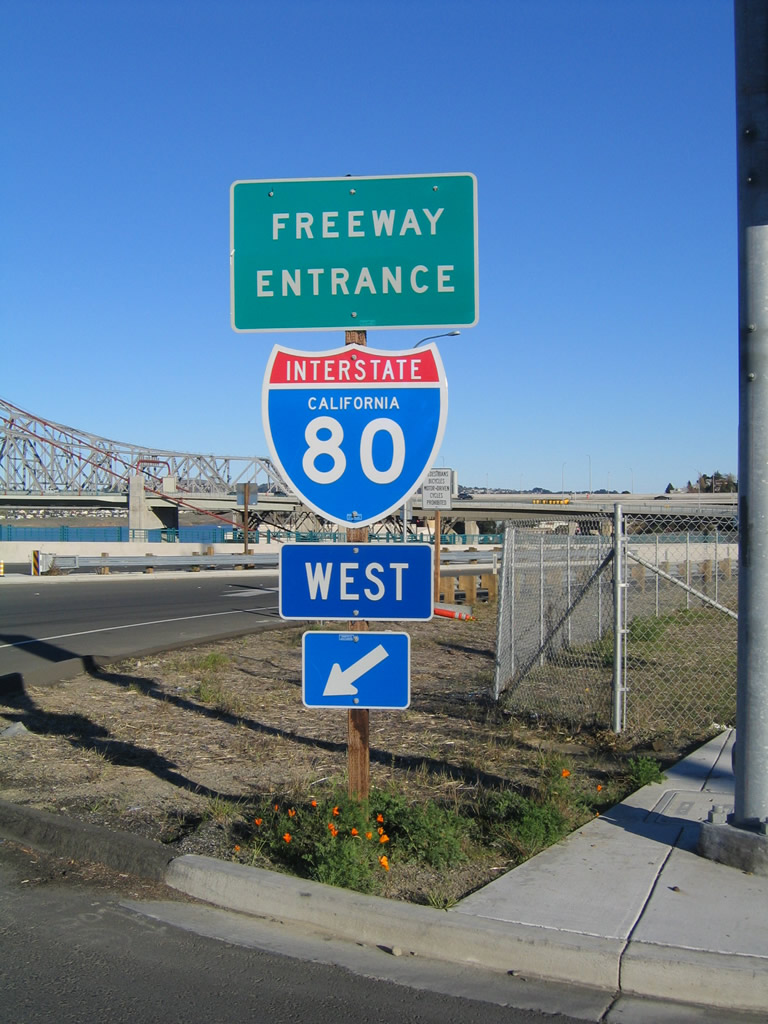
Interstate 80 freeway entrance shield assembly at the southern terminus of SR 29 in Vallejo (Exit 29A).
10/16/00
Columbus Parkway west connects to both I-80 and SR 37 in the city of Vallejo.
2002
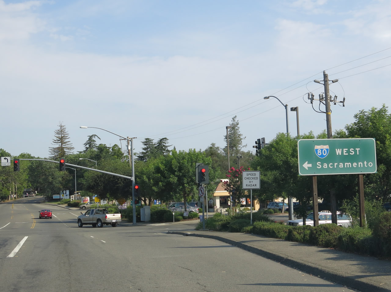
West Capitol Avenue (Historic U.S. 40) westbound at Interstate 80 in West Sacramento.
08/02/11
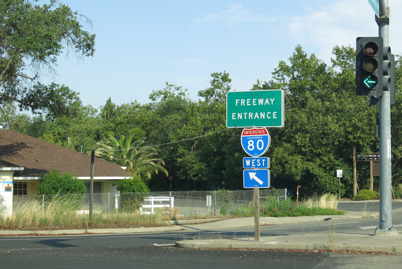
Horseshoe Bar Road connects with Interstate 80 (Alan S. Hart Freeway) at Exit 110 in the town of Loomis in western Placer.
07/02/13
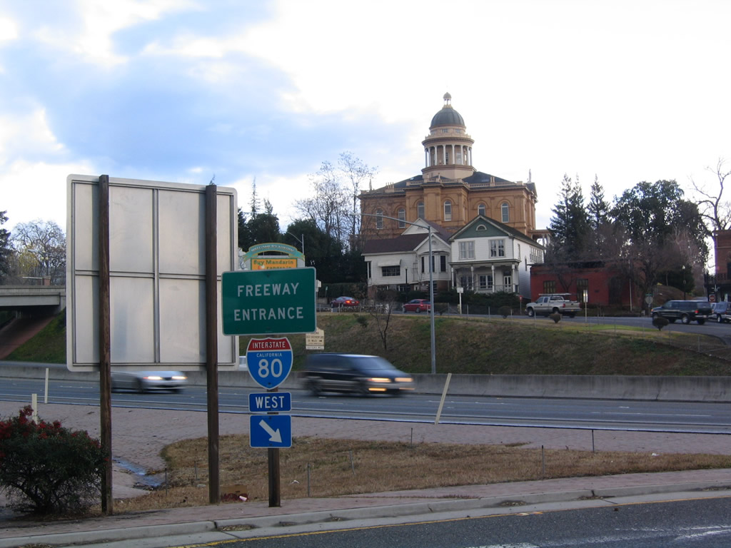
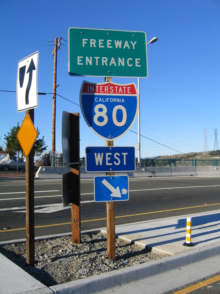
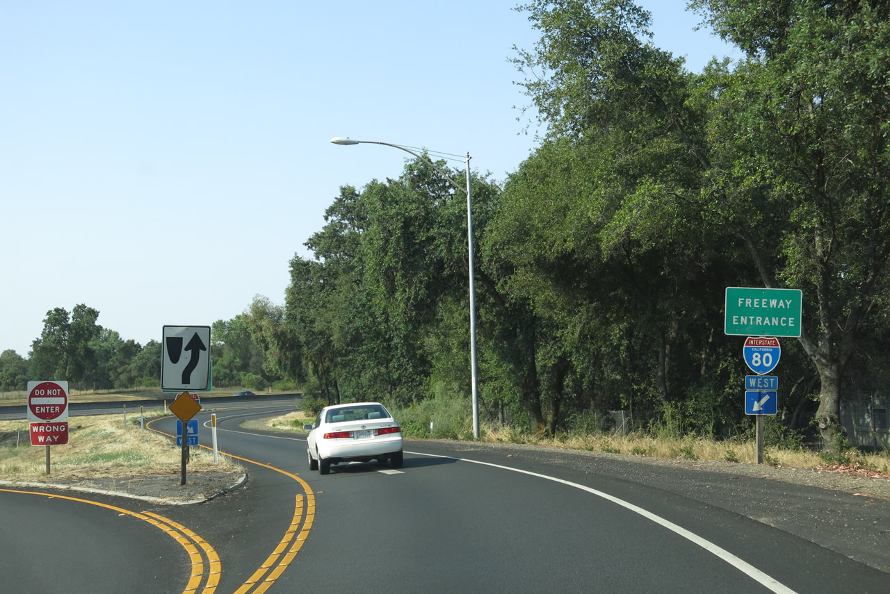
These freeway entrance shield assemblies for Interstate 80 are posted in Auburn at the southern end of Nevada Street (Exit 119A).
12/27/04
A parclo B2 interchange (Exit 199) links I-80 with Floriston Way at the community of Floriston. RIRO type ramps connect with the freeway on both sides of the Truckee River.
01/11/00
10/05/12
The westbound on-ramp to I-80 from Donner Pass Road (Historic U.S. 40) near Donner Lake and Truckee. Interstate 80 and Historic U.S. 40 diverge along separate paths from the lake area (el. 5,935 feet) to Donner Summit (el. 7,239 feet).
09/09/05
Photo Credits:
- Andy Field: 10/16/00, 12/27/04, 04/06/09, 07/18/09, 08/02/11, 10/05/12, 07/02/13
- Joel Windmiller: 07/21/02
- AARoads: 11/28/04, 09/09/05
- Trevor Carrier: 2002
- Jeff Royston: 01/11/00
Connect with:
Page Updated Friday May 15, 2015.