
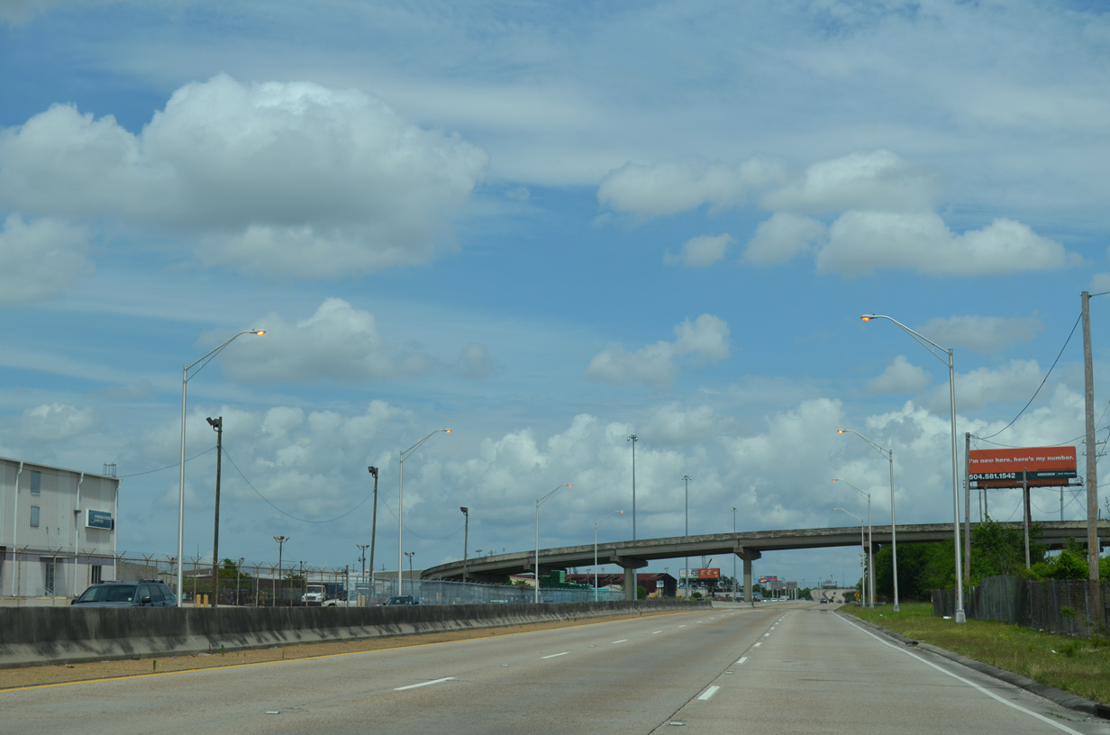
Highway 3139 - Earhart Expressway
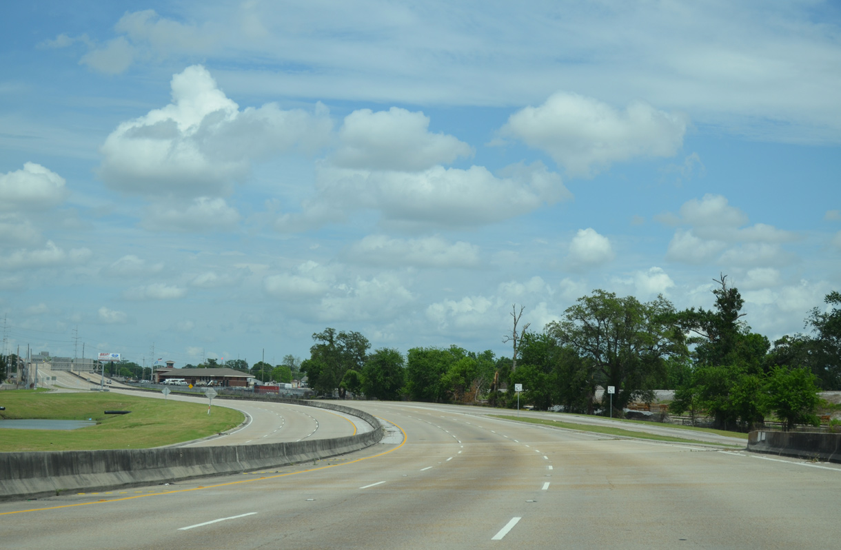
Only 4.8 miles of the planned eight mile long route of the Earhart Expressway were completed. The freeway portion of Louisiana Highway 3139 runs east from LA 3154 (Dickory Avenue) at Harahan through an industrial area of Jefferson Parish to the New Orleans city line. Earhart Boulevard extends the state highway southward just four blocks to Monroe Street in the Hollygrove neighborhood. The freeway is a commuter route with an expansive interchange at LA 3152 (Clearview Parkway), and local connections to residential areas north to U.S. 61 (Airline Highway) and south to U.S. 90 (Jefferson Highway). In addition to the unconstructed extension west to Williams Boulevard, the full interchange at Causeway Boulevard and partial exchange at Central Avenue were never constructed.1
With origins in 1947, the Earhart Expressway was designed in the 1960s by engineer George A. Heft. A bond issue approved by Jefferson Parish after 1964 authorized to study right of way and construction. The parish did not move forward on the road, and it was eventually taken over by the state. The first of five segments opened in July 1977. The last, from Cleary Avenue to Clearview Parkway (LA 3152), was completed in June 1986.2
Earhart Expressway Extension
An early study extended the Earhart Expressway route west to Moisant Airport. Later concepts, including a 1987 Regional Planning Commission recommendation1 and feasibility study, focused on an elevated alignment using the right of way along Airline Highway (U.S. 61) toward New Orleans International Airport (MSY). A subsequent feasibility study involved a new roadway from the Earhart extension and the Jefferson Parish line to Interstate 310.2
A proposal also called for the implementation of tolls along the Earhart Expressway to help pay for the western extension. Rep. Robert Garrity outlined a plan for 25 cent tolls as part of a bill in the April 1989 regular session. Funds would both pay for a $38 million extension to a planned interchange with North Lester, and $75-100 million for further lengthening west to U.S. 61 (Airline Highway) and either an end at LA 49 (Williams Boulevard) or at I-310 in the River Parishes.3,4 A side benefit would be a shift in traffic away from residential areas of Harahan and River Ridge. Toll plazas would be set up along eastbound at the Orleans Parish line, at the off-ramps for Clearview Parkway (LA 3152) in both directions, and at the westbound exits for Deckbar, Cleary and Dickory Avenues.3
Rep. Garrity later dropped the bill for implementing tolls on the Earhart Expressway and instead adopted a resolution urging LADOTD to add the extension in its five-year priority program. The resolution garnered unanimous approval by the House and Senate, while Garrity still proposed adding tolls to finance the project.5
With a lack of funding, the project remained idle until 1995, when the Regional Planning Commission completed a new study focusing on the same plan from eight years prior. It outlined possible construction by 2000, with potential completion by 2005. State funding issues however remained an issue.1 Another Regional Planning Commission study followed in Spring 1996. It included options for widening Airline Highway to a limited access highway, adding a rail line, and acquiring the abandoned Kansas City Southern Railroad right of way for a new roadway.6
Further Regional Planning Commission studies for the Earhart Expressway were initiated in September 1997. The $400,000 analysis of the Airline Drive-Earhart Expressway included options for extending the expressway west to Airline Drive (U.S. 61), widening Airline Drive west of David Drive, building a light rail line through the corridor, improving bus service along the corridor, adding turn lanes and synchronizing traffic lights on U.S. 61, or considering a no-build alternative.7 Upon its conclusion, the study recommended developing a rail system from the airport to either the Central Business District or Union Passenger Terminal in New Orleans (estimated to cost $130-$140 million), extending the Earhart Expressway to I-310 in St. Charles Parish and adding between four and nine interchanges along the route (cost estimated ranged between $470-500 million).8
Community opposition followed, with residents along the proposed corridor citing concerns over impacts from an elevated highway. Planners eventually dropped the proposal for the extension by January 2004, with the alternative to widen Airline Drive to six and eight lanes with a 75 foot wide median remaining under study. The $160 million alternate also included an $80 million flyover connecting U.S. 61 with the Earhart Expressway.9 It was never built and U.S. 61 remains with just four lanes.
 North
North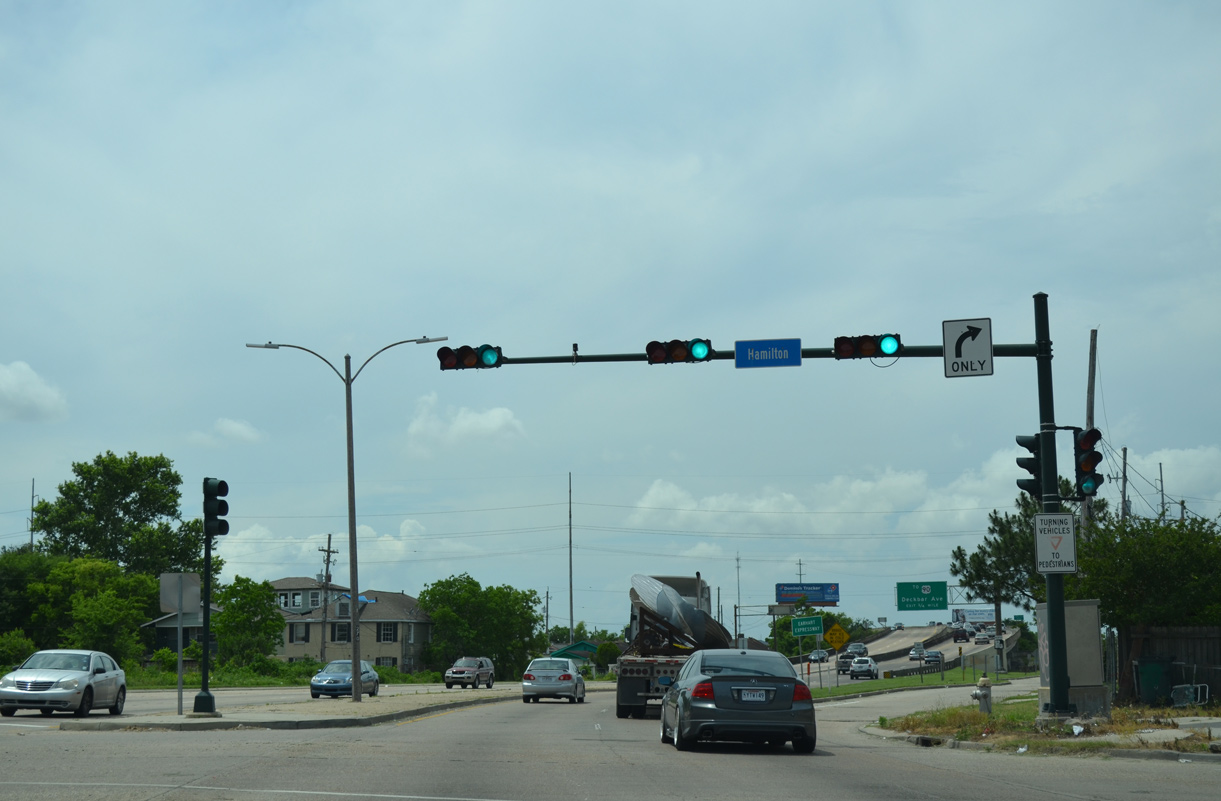
Earhart Boulevard curves northwest to a traffic light with Hamilton Avenue in the Holly Grove community before transitioning into a freeway.
05/09/15
Apricot Street forms a north side frontage road to LA 3139 as the Earhart Expressway begins.
11/20/08
LA 3139 elevates onto a viaduct across a levee across several railroad lines serving adjacent industrial areas. A wye interchange follows with Deckbar Avenue south to Jefferson.
05/09/15
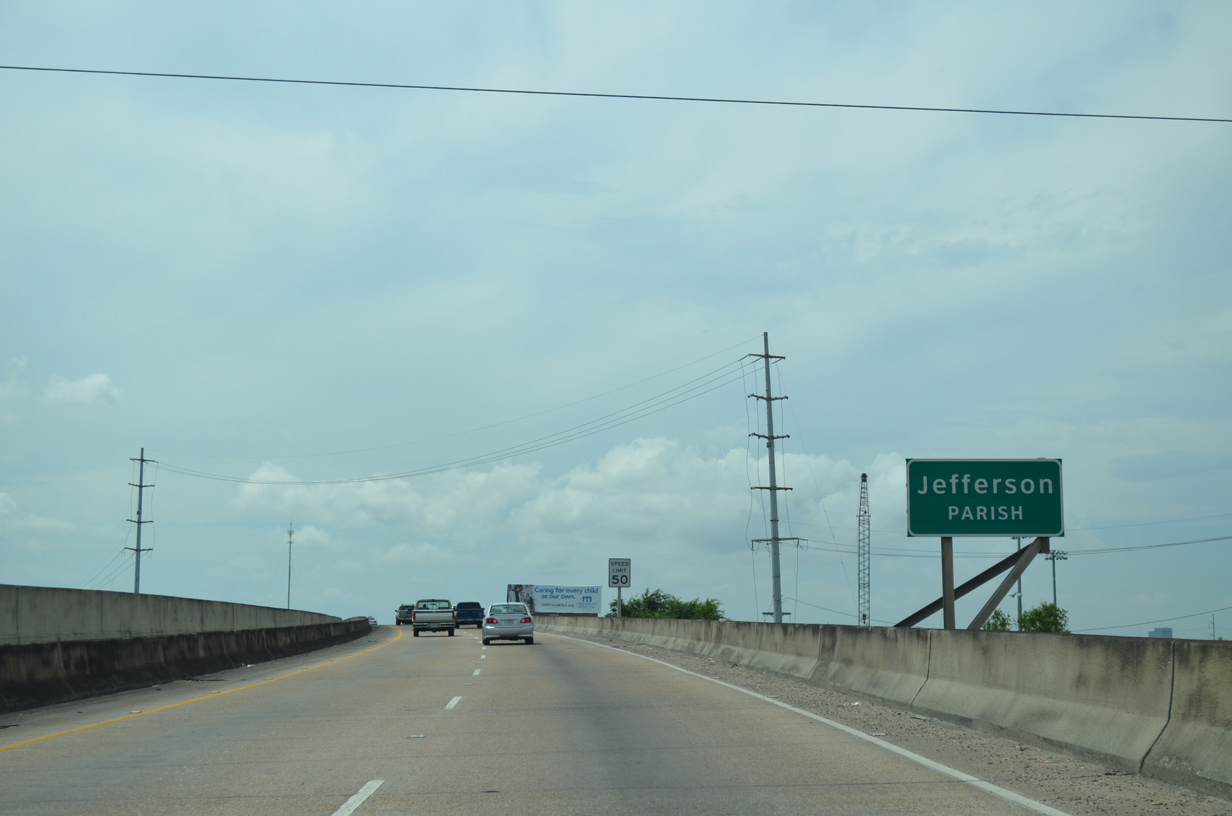
Motorists along the Earhart Expressway westbound pass over a levee and cross the Jefferson Parish line.
05/09/15
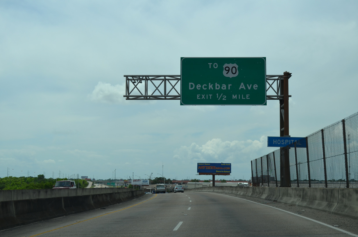
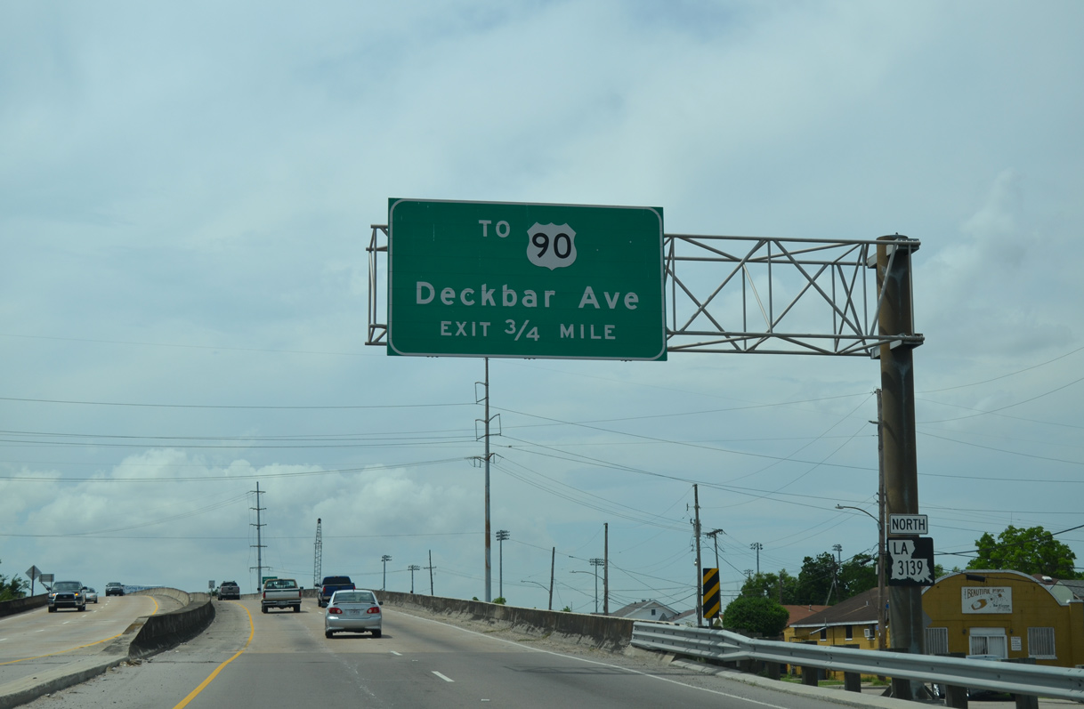
Deckbar Avenue is the first of three exits on LA 3139 north. The urban collector was extended northward with the completion of the Earhart Expressway.
05/09/15
The on-ramp from L & A Road forms an auxiliary lane west to the Deckbar Avenue off-ramp. Removed by 2011, this ground level was sign posted for merging traffic.
12/20/08
A confirming marker was added for LA 3139 following the completion of the new ramp from L & A Road and the adjacent Kansas Southern Railroad yard. Meant to be a temporary entrance ramp, the connection opened in the mid 2000s as part of the Jefferson Parish, Dakin Street Improvements project.
05/09/15
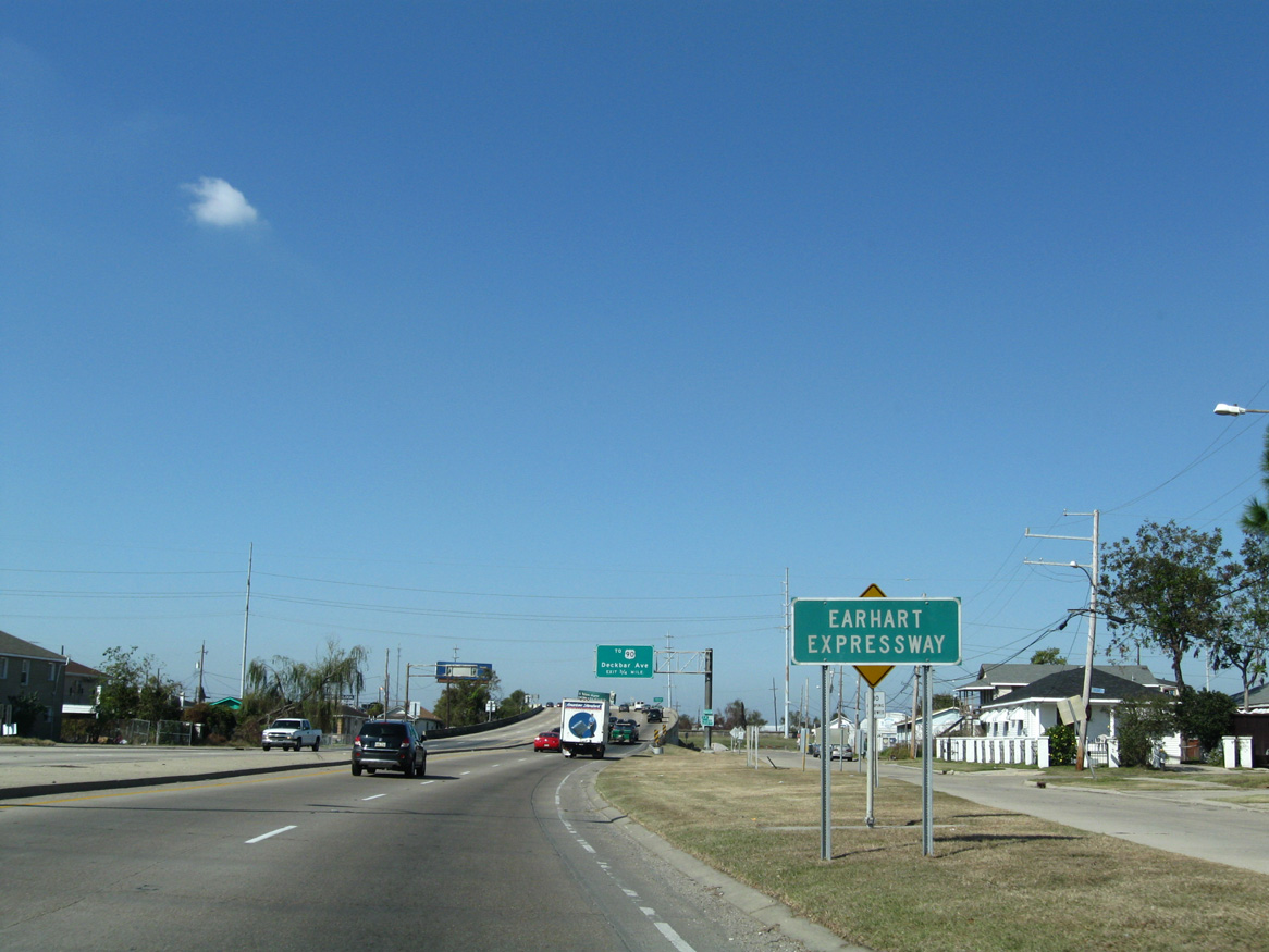
Deckbar Avenue spurs southwest from LA 3139 to end at LA 611-1 (River Road) west of Oschsner Hospital.
05/09/15
Flyovers with Deckbar Avenue pass over adjacent sets of railroad lines paralleling the south side of LA 3139.
05/09/15
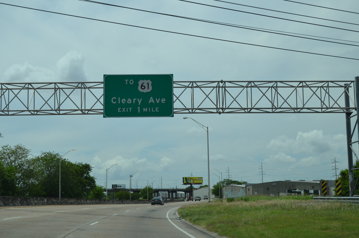
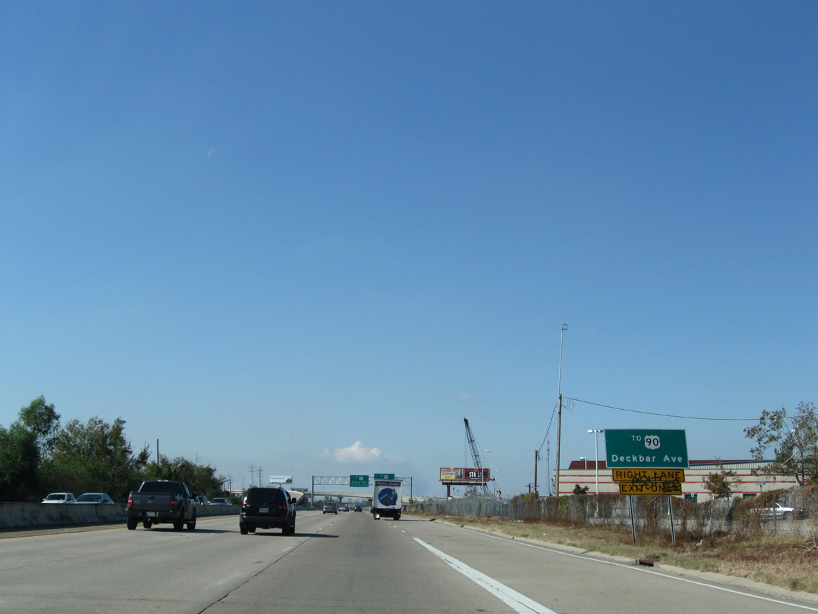
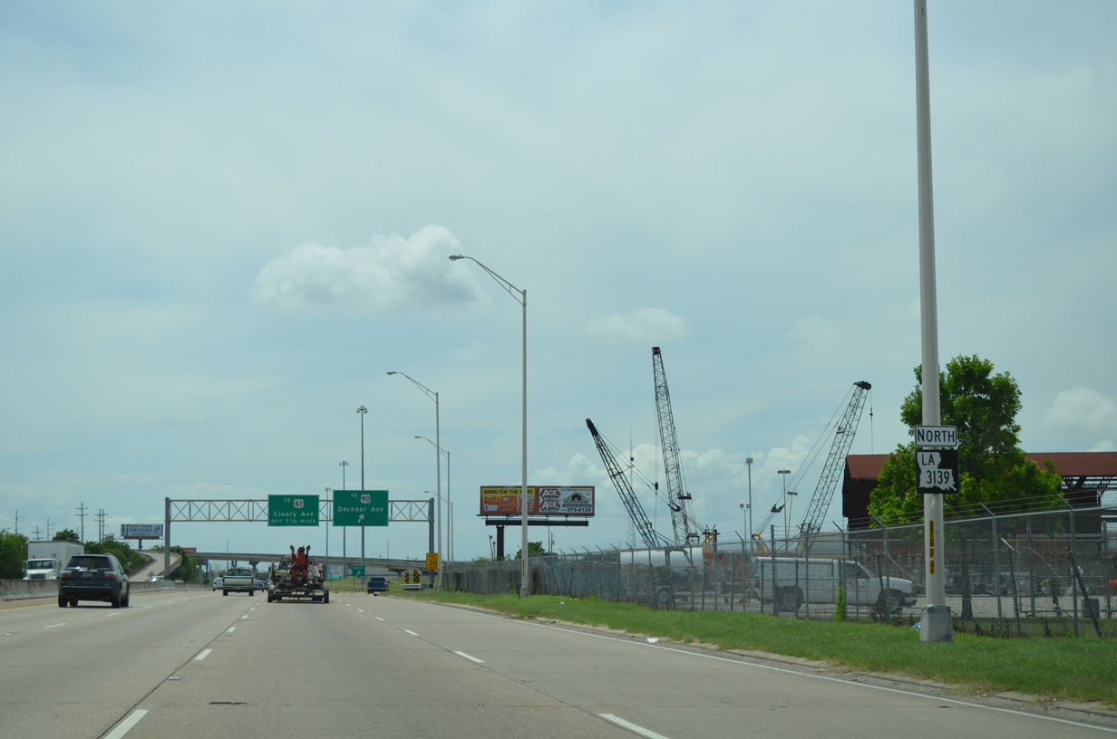
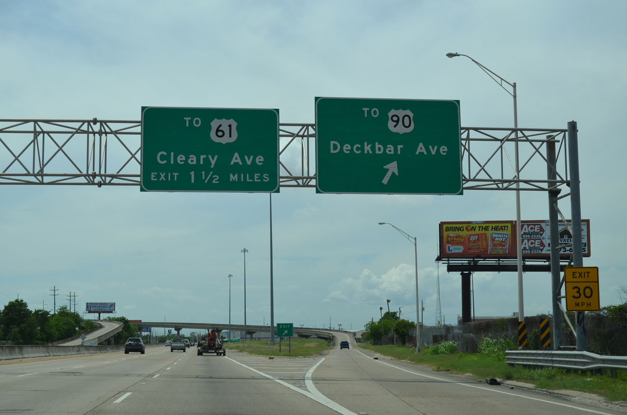
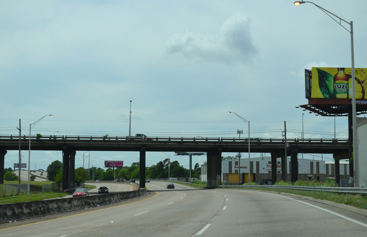
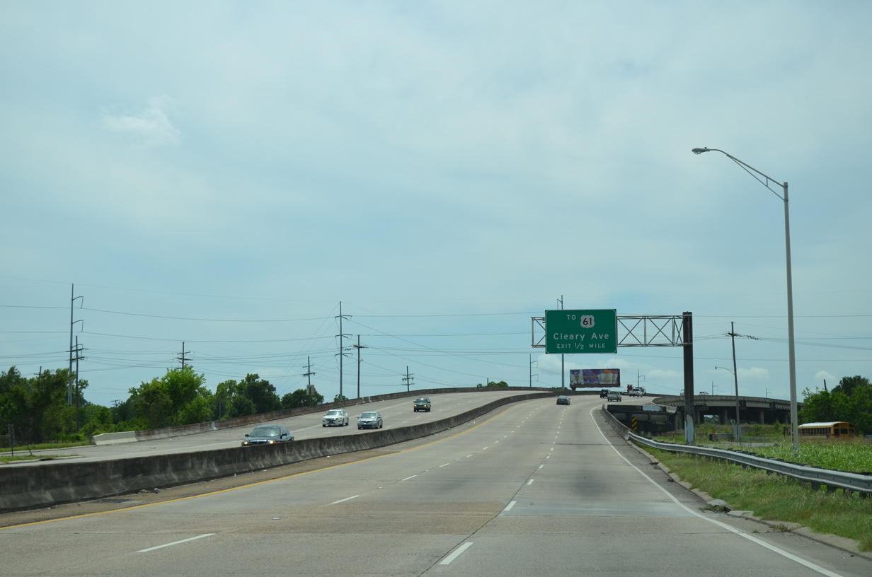
Currently the next westbound exit from the Earhart Expressway links LA 3139 with Cleary Avenue north at U.S. 61 (Airline Drive). U.S. 61 constitutes a six lane commercial arterial paralleling LA 3139 through south Metairie.
05/09/15
LA 3139 arcs north to pass under Causeway Boulevard. An interchange with elevated loop ramps is proposed to join the two thoroughfares, with the grassy area visible here slated for a future westbound off-ramp.
05/09/15
Causeway Boulevard (LA 3046) spans the Earhart Expressway south to Jefferson Highway (U.S. 90) and north to U.S. 61 (Airline Highway). The boulevard extends through Metairie to Lake Pontchartrain Causeway and the North Shore.
05/09/15
Stubs were built into the viaduct leading LA 3139 west across a CN Railroad for the eventual interchange with Causeway Boulevard as well.
05/09/15
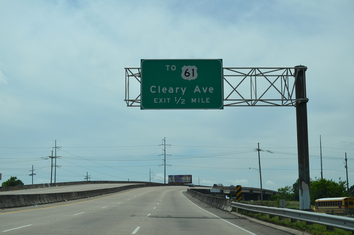
Cleary Avenue stems north from LA 3139 and U.S. 61 (Airline Drive) through the Metairie street grid to Esplanade Avenue.
05/09/15
The Earhart Expressway lowers to grade level to the wye interchange for Cleary Avenue before ascending again to cross over the parallel railroad tracks.
05/09/15
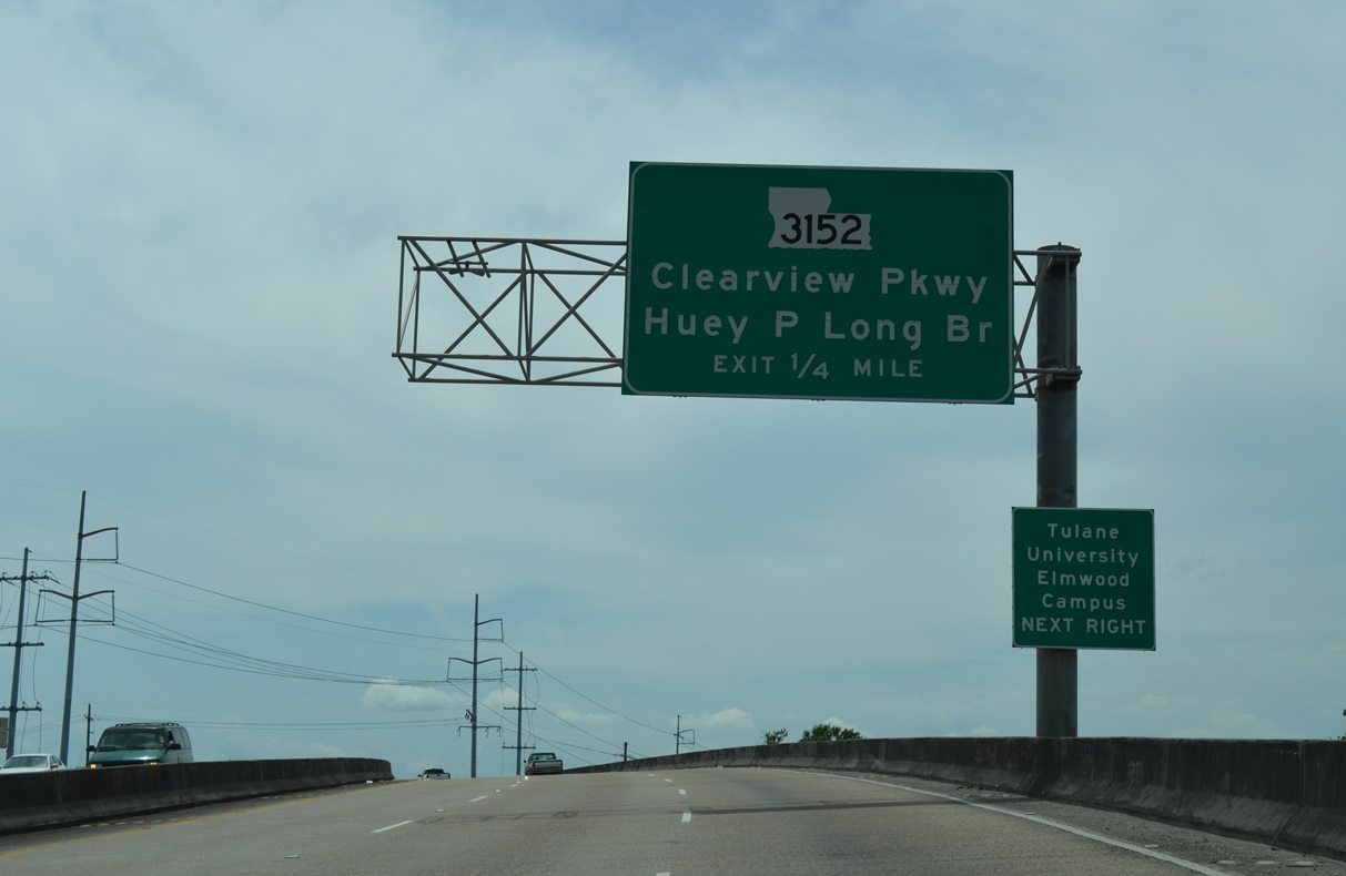
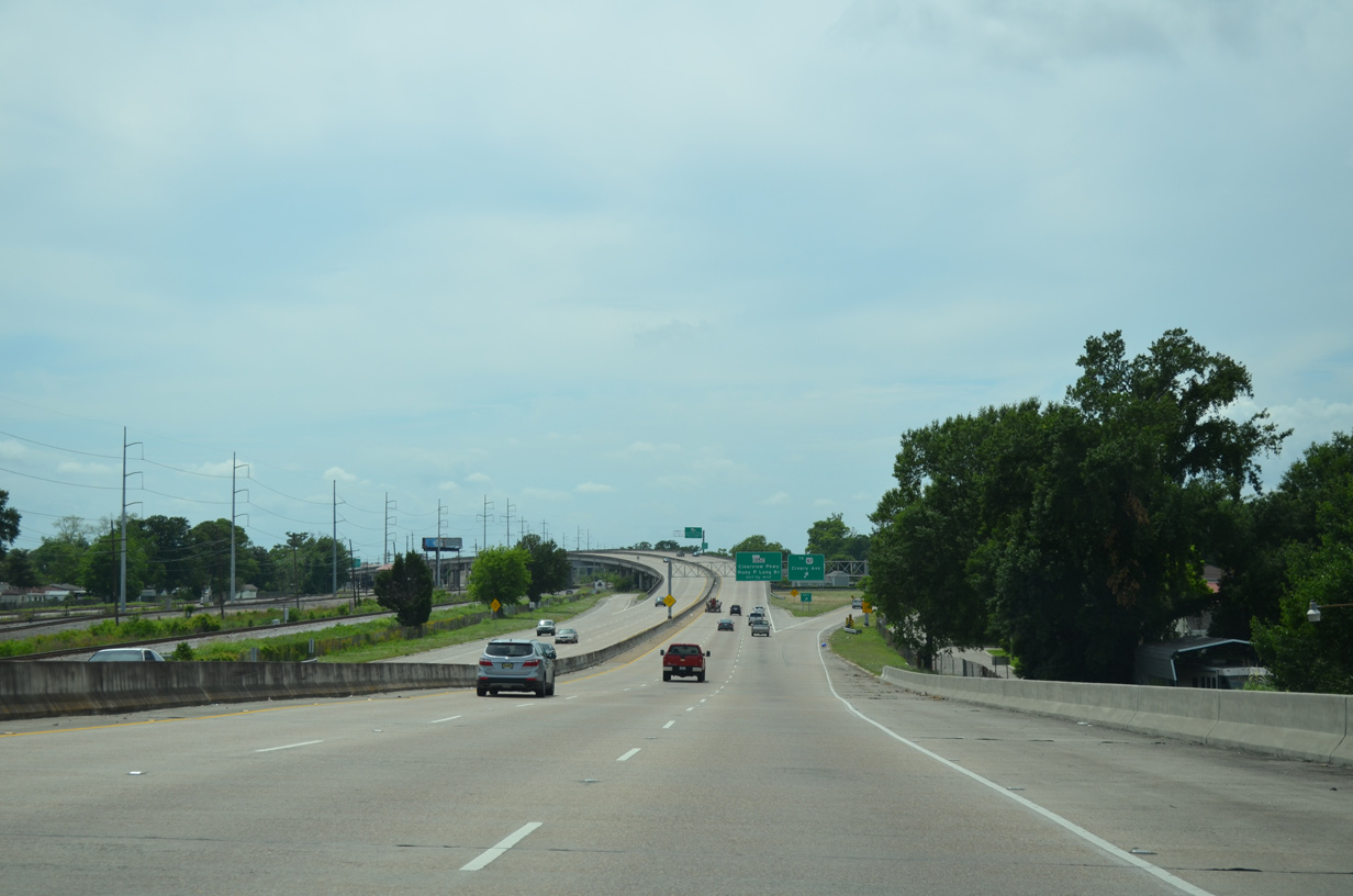
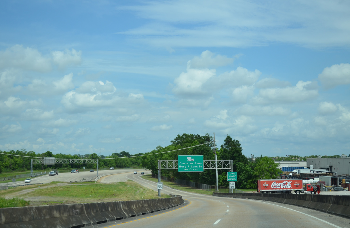
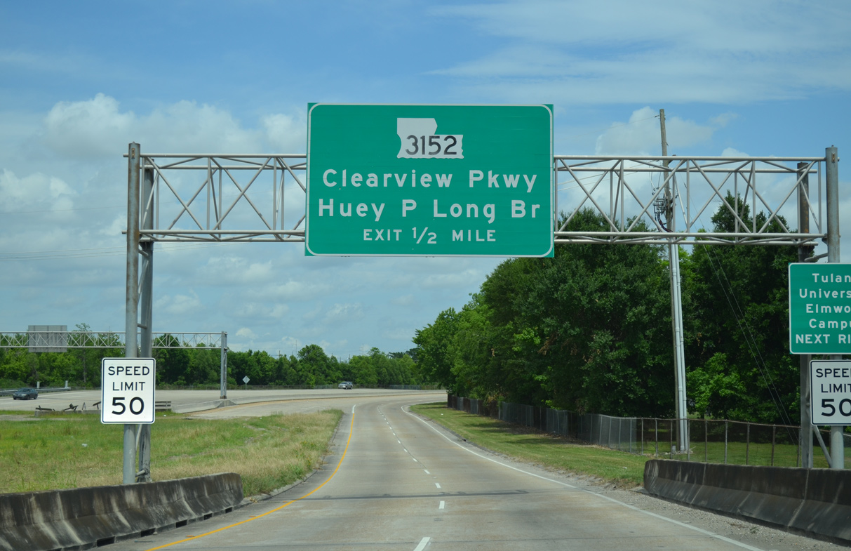
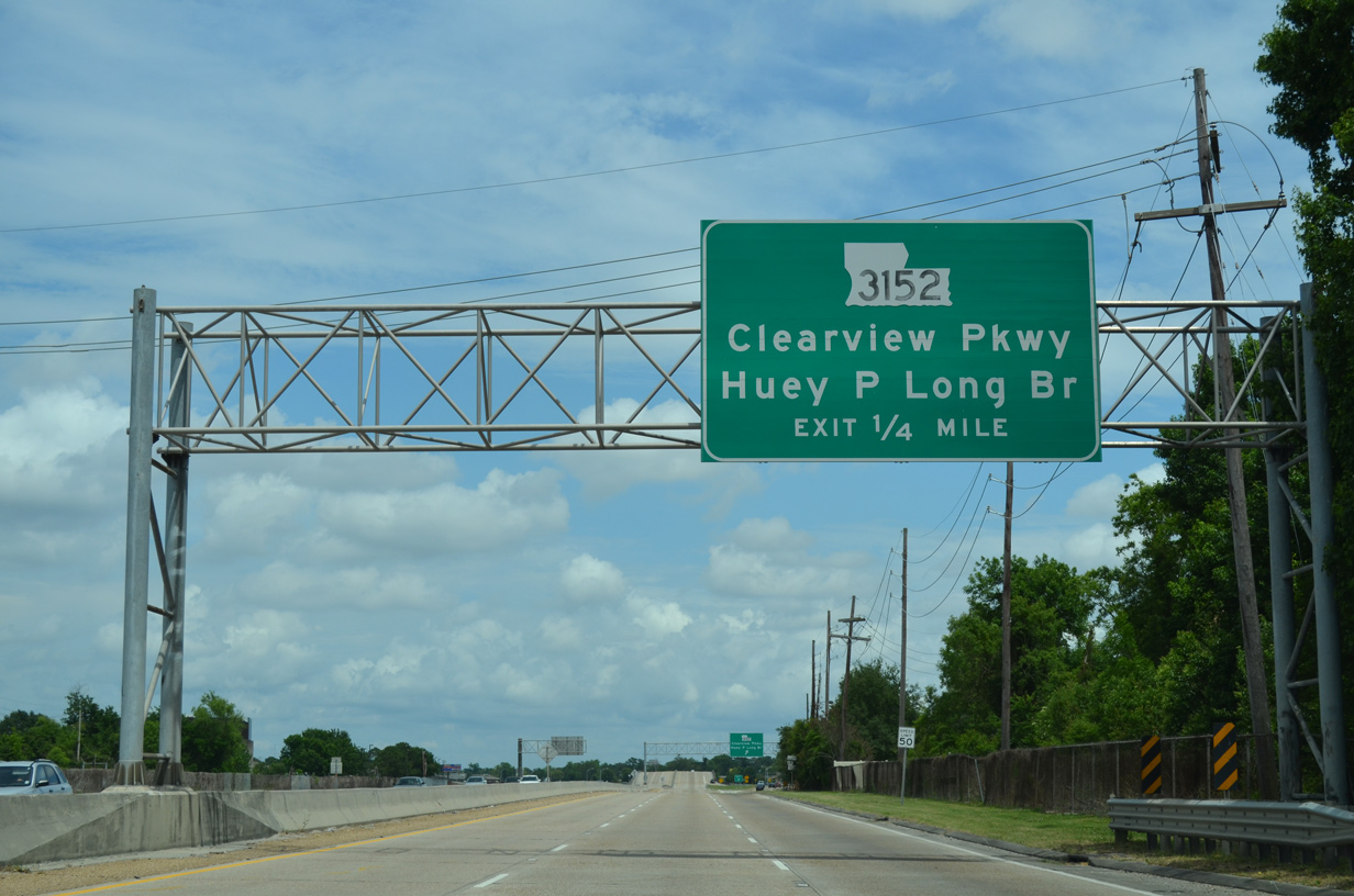
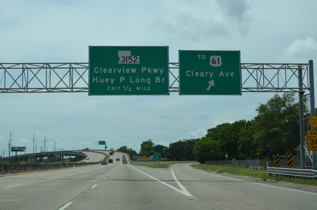
LA 3139 proceeds west a quarter mile to ramps for LA 3152 (Clearview Parkway), a four mile route south to the Huey P. Long Bridge and north to Interstate 10.
05/09/15
A single lane ramp partitions from the Earhart Expressway west for Clearview Parkway. The six lane arterial winds north along a congested route through Metairie and south through Elwood.
05/09/15
LA 3152 (Clearview Parkway) south leads directly to U.S. 90 west across the Huey P. Long Bridge to Avondale and the West Bank of Jefferson Parish. When the Earhart Expressway was first proposed, Clearview Parkway was not yet built.
05/09/15
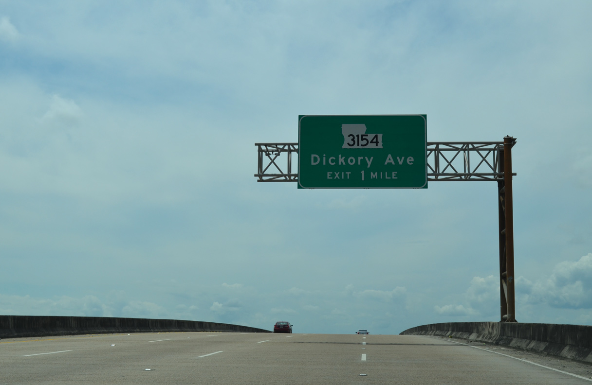
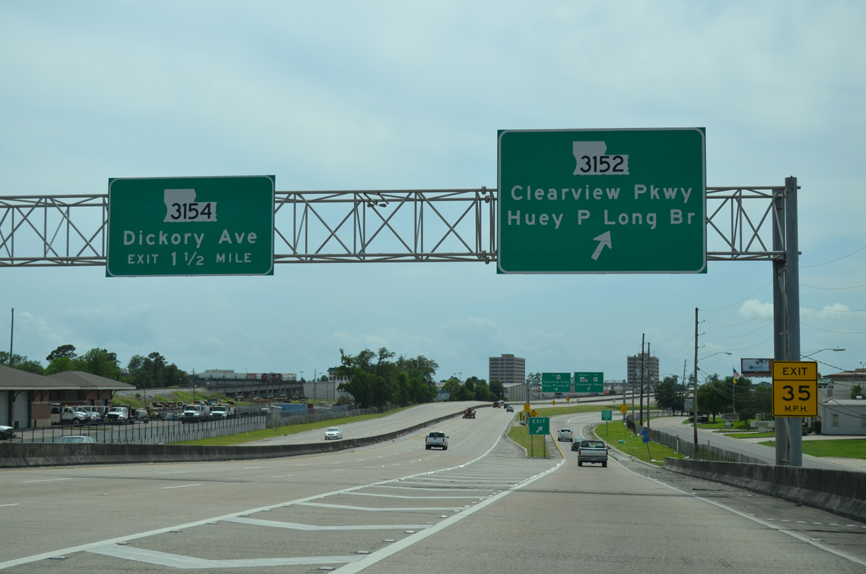
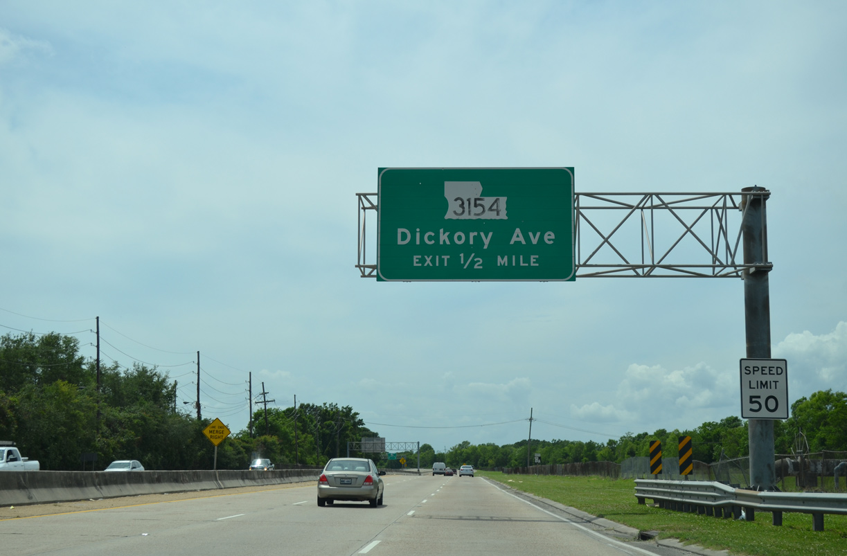
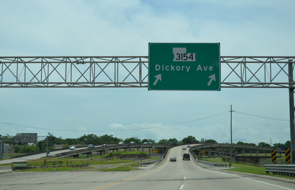
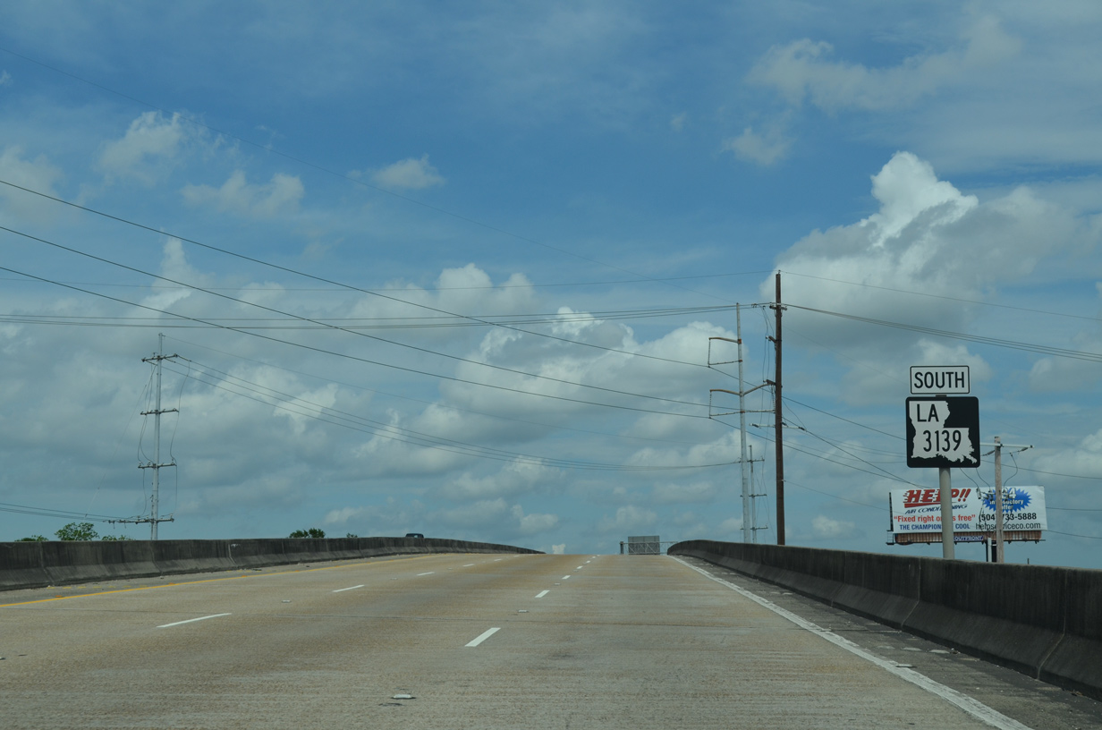
LA 3139 (Earhart Expressway) north ends in one mile at a half diamond interchange with LA 3154 (Dickory Avenue).
05/09/15
The final mile of LA 3139 passes between apartments to the south and a water treatment plant to the north. The freeway still maintains six lanes, despite the unintended end at Dickory Avenue.
05/09/15
Forthcoming LA 3154 runs north from LA 48 (Jefferson Highway) to end at U.S. 61 (Airline Drive) and David Drive.
05/09/15
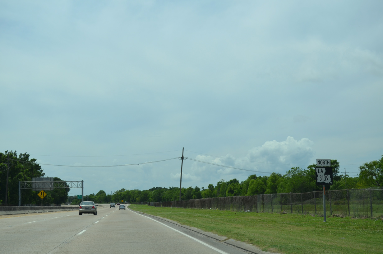
Confirming shield for LA 3139 north, the last for the 4.8 mile route.
05/09/15
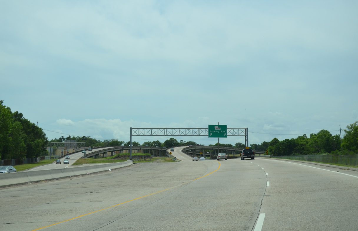
A lane drop occurs as LA 3139 shifts onto a two lane off-ramp to LA 3154 (Dickory Avenue). Stubs on the mainline allude to the unconstructed extension west to LA 49 (Williams Boulevard).
05/09/15
LA 3154 arcs east along Dickory Avenue from a number of apartments to Hickory Avenue by LaSalle Park. David Drive extends the street north to Power Boulevard across I-10.
05/09/15
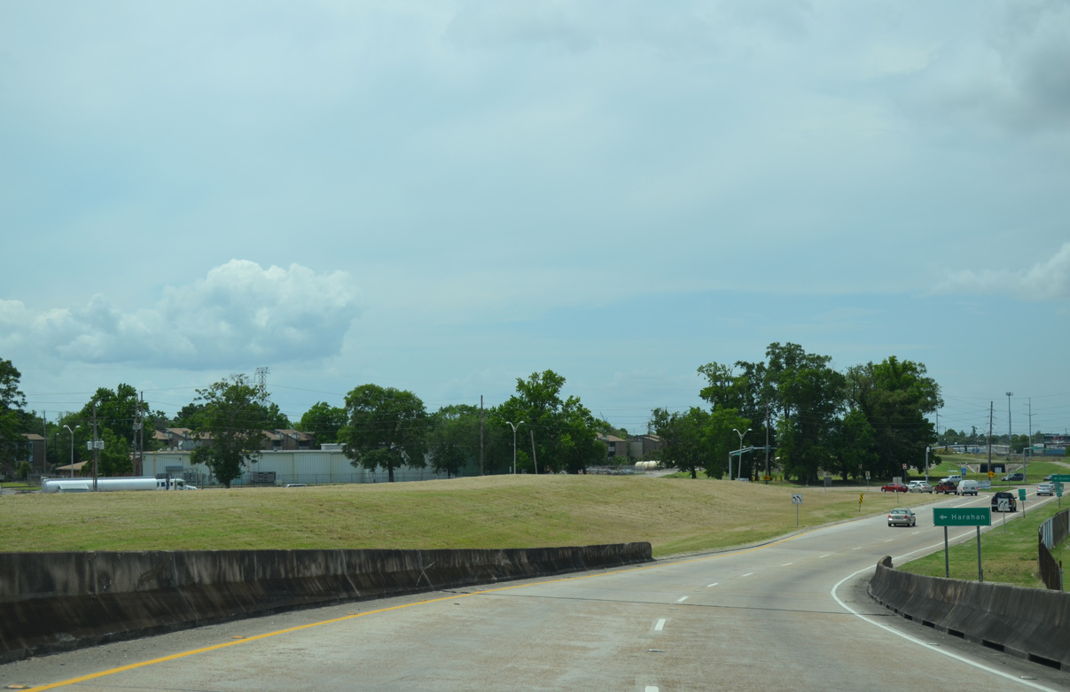
A grass berm separates the Earhart Expressway ramps with Dickory Avenue. The westward extension of LA 3139 to I-310 was ultimately dropped in 2004.
05/09/15
The city of Harahan lines the banks of the Mississippi River along LA 48 (Jefferson Highway), two miles to the south.
05/09/15
Viaducts carry LA 3154 (Dickory Avenue) across CN Railroad lines southwest of the New Orleans Zephyrs Baseball Stadium.
05/09/15
South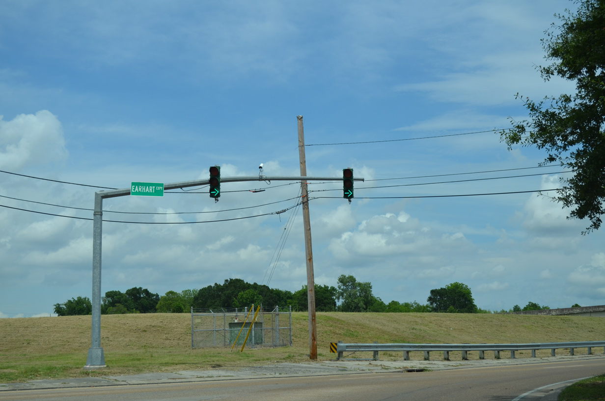
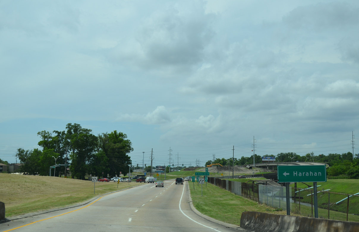
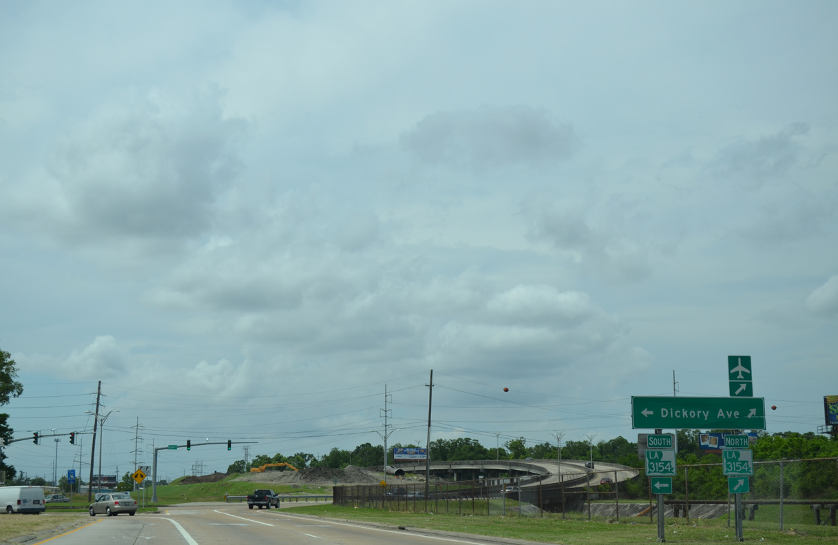
The protected left turn from LA 3154 (Dickory Avenue) south onto LA 3139 (Earhart Expressway) east ties into the signalized right turn from Dickory Avenue north.
05/09/15
A high overpass carries LA 3139 south over a drainage ditch, Lead Street and a railroad spur to the immediate east of Dickory Avenue. The bridge was built as an on-ramp, but was restriped to accommodate two lanes in place of a shoulder.
05/09/15
Stub ends are located at the west end of the Earhart Expressway. Work on the western extension to North Lester ceased in the 1980s due to lack of state funds. The route was eventually dropped by 2004.
05/09/15
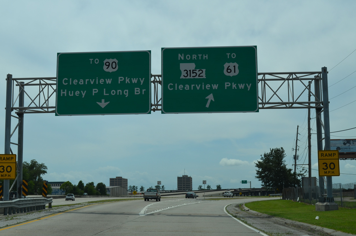
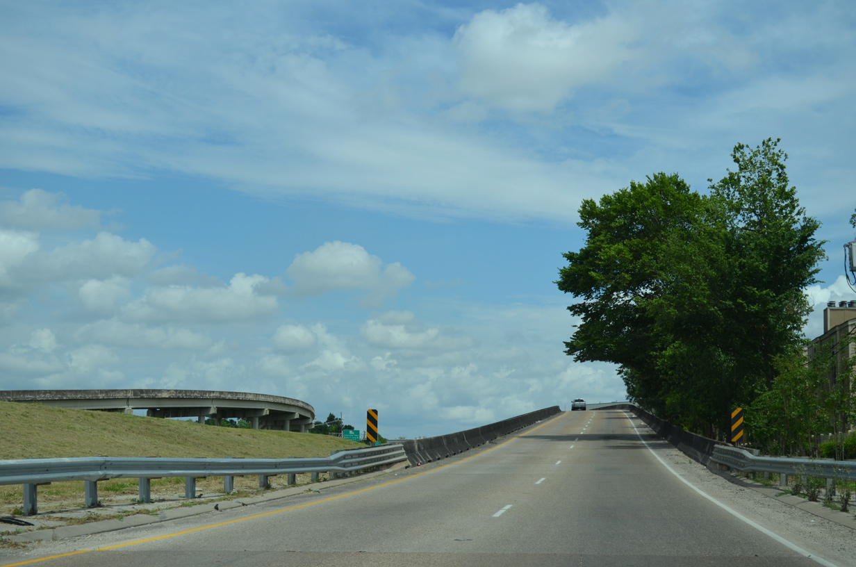
A third of a mile separates the Earhart Expressway on-ramp from Dickory Avenue with the directional cloverleaf interchange to LA 3152 (Clearview Parkway). Exits are unnumbered along LA 3139.
05/09/15
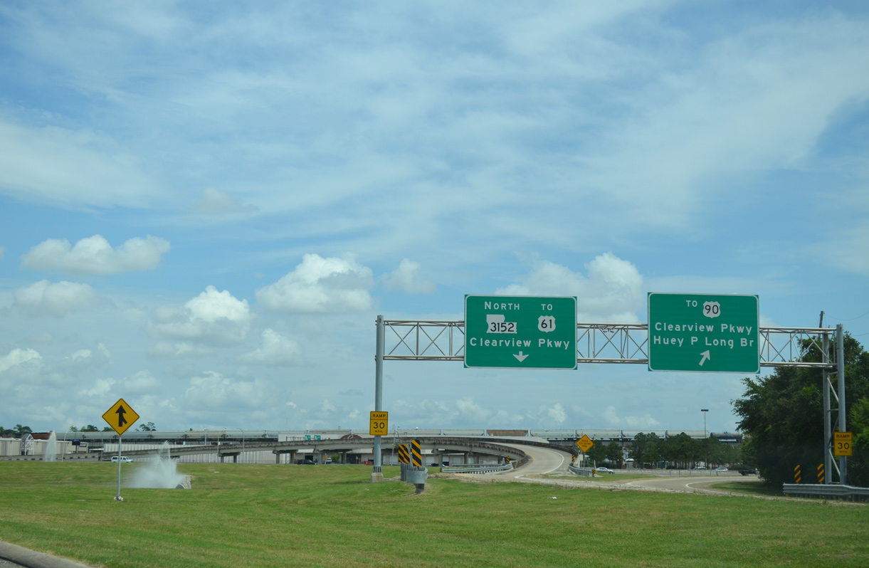
LA 3152 follows Clearview Parkway south to Elmwood and the Huey P. Long Bridge (U.S. 90) and north to Interstate 10 and Clearview Mall.
05/09/15
LA 3139 south expands to six overall lanes as eastbound motorists pass by the first confirming marker.
05/09/15
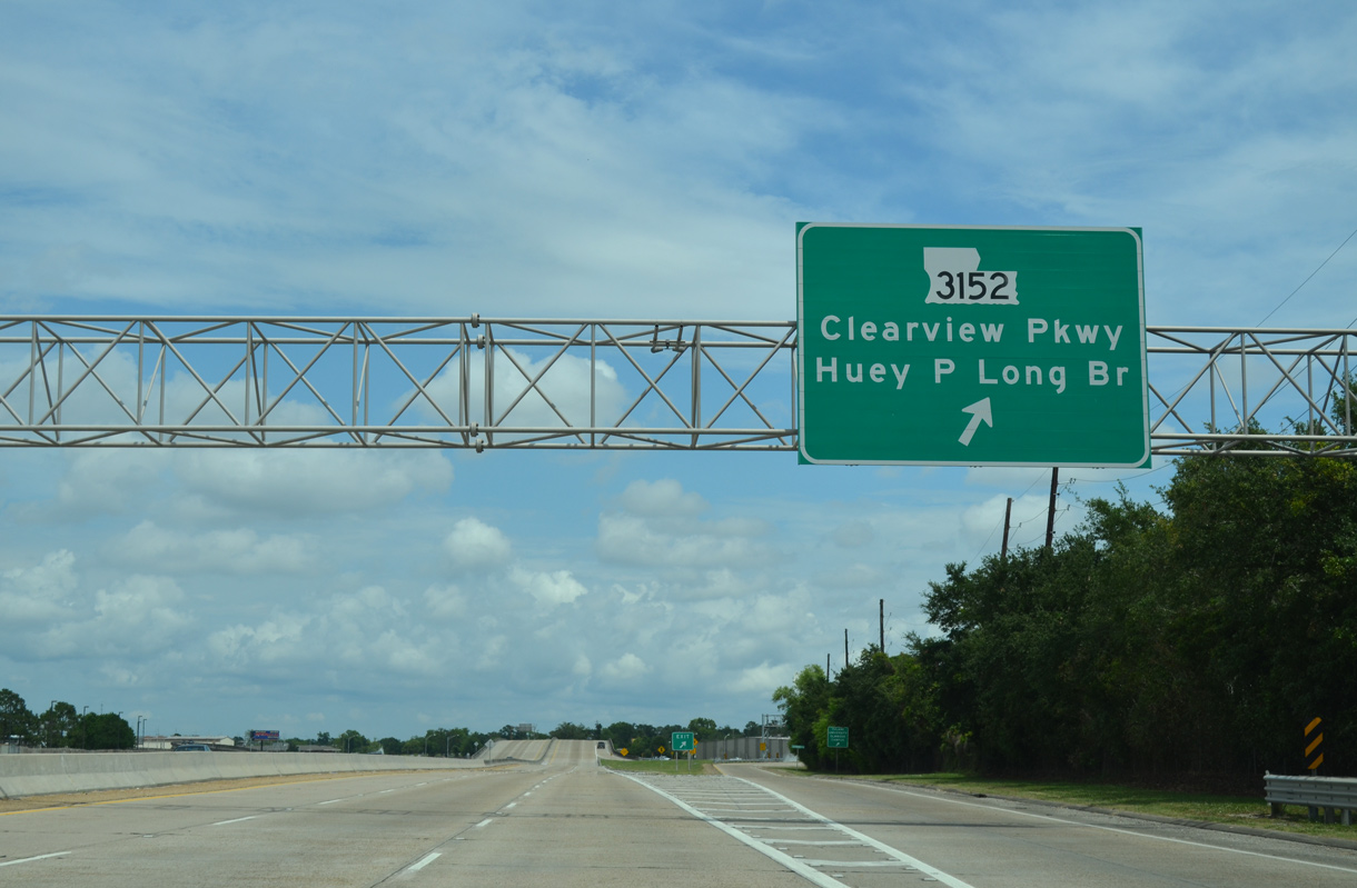
Traffic to LA 3152 (Clearview Parkway) departs LA 3139 (Earhart Expressway) south. Clearview Parkway comprises a busy commercial arterial south by Elmwood Shopping Center and the Tulane University Elmwood Campus to Jefferson Highway (U.S. 90 east / LA 48 west).
05/09/15
A directional ramp joins the left side of LA 3152 north ahead of a viaduct leading to U.S. 61 (Airline Drive). Clearview Parkway bisects a dense residential area northward to Napoleon Avenue as a slow moving boulevard.
05/09/15
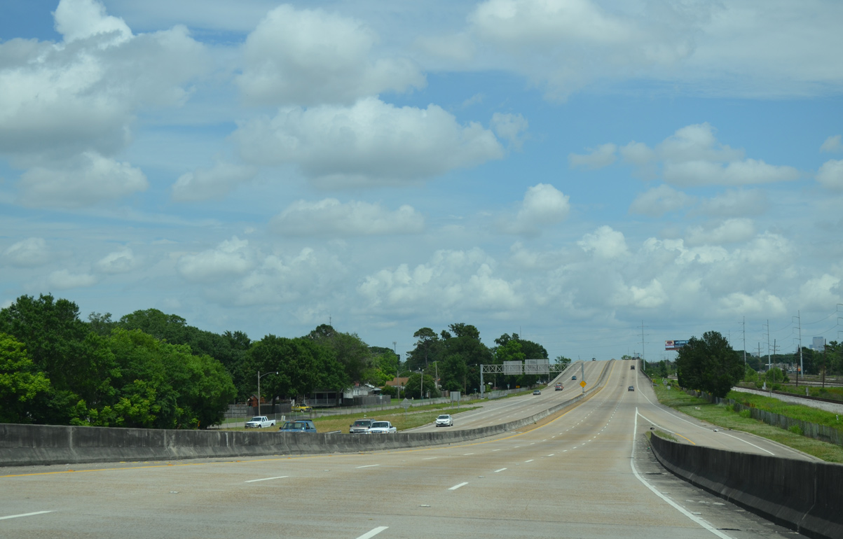
Advancing east, the Earhart Expressway makes a gradual S-curve between an industrial park and the New Orleans Public Belt Railroad.
05/09/15
LA 3139 crosses a viaduct over Central Avenue and several CN Railroad lines to a wye interchange with Cleary Avenue and U.S. 61 (Airline Drive).
05/09/15
LA 3139 south continues east from the Cleary Avenue on-ramp to ascend across CN Railroad tracks.
05/09/15
The Earhart Expressway arcs northward by storm water ponds west and east of Causeway Boulevard (LA 3046). A planned interchange will use this right of way to connect LA 3139 with Causeway Boulevard in the future.
05/09/15
A stub ramp remains from the original Earhart Expressway construction for the unconstructed Causeway Boulevard off-ramp. The future ramp will provide access to both Causeway Boulevard south to Jefferson and north to Metairie.
05/09/15
East from Causeway Boulevard (LA 3046), LA 3139 straightens out between a parallel railroad line and industrial areas on the south side of U.S. 61 (Airline Drive).
05/09/15
A wye interchange follows to add traffic from Deckbar Avenue north onto LA 3139 south.
05/09/15
Deckbar Avenue stems north from LA 611-1 (River Road) as an urban collector linking U.S. 90 (Jefferson Highway) with the Earhart Expressway. A reassurance marker appears at the Deckbar Avenue on-ramp.
05/09/15
Another southbound shield for LA 3139 precedes a stub ramp for an unbuilt exit to U.S. 61 (Airline Drive).
05/09/15
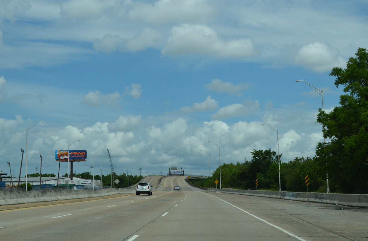
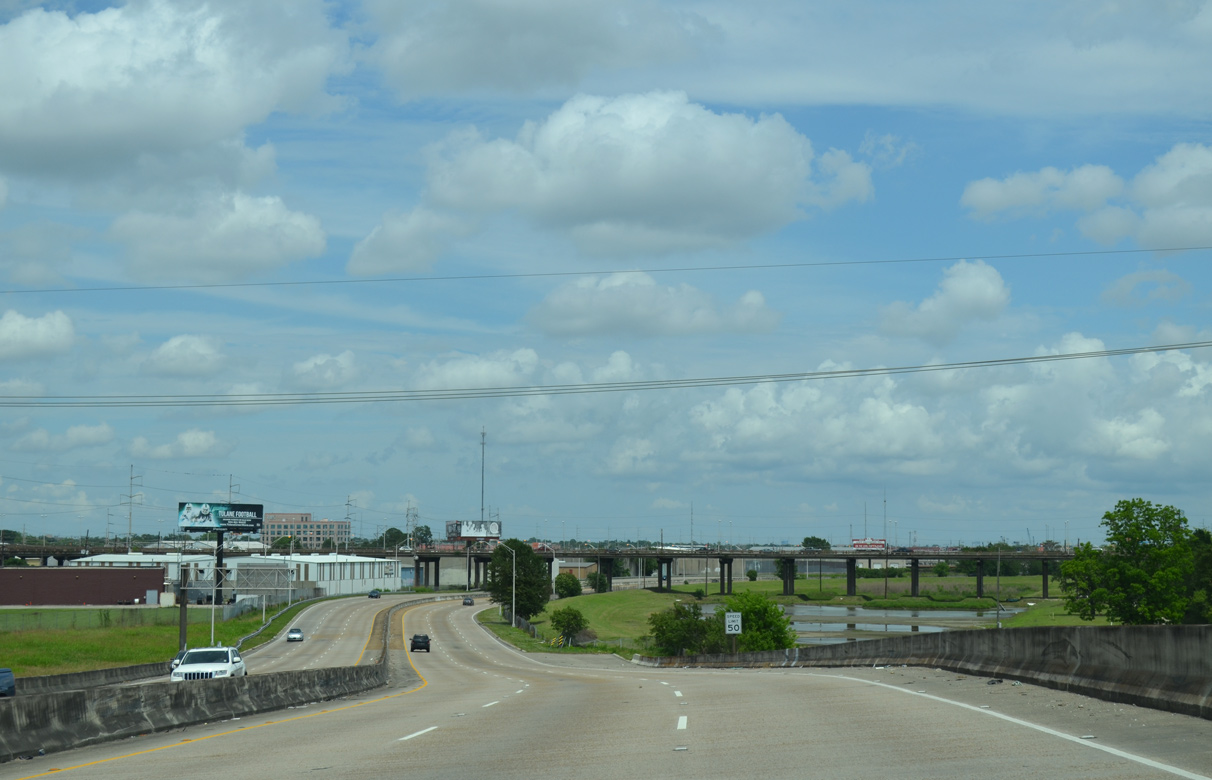
A lengthy viaduct arcs the Earhart Expressway southeast into the Holly Grove neighborhood of New Orleans.
05/09/15
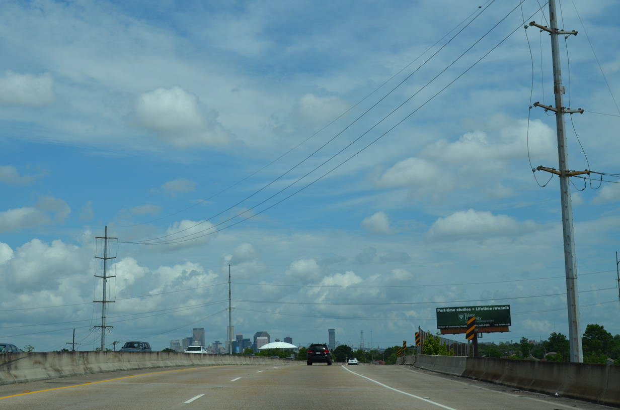
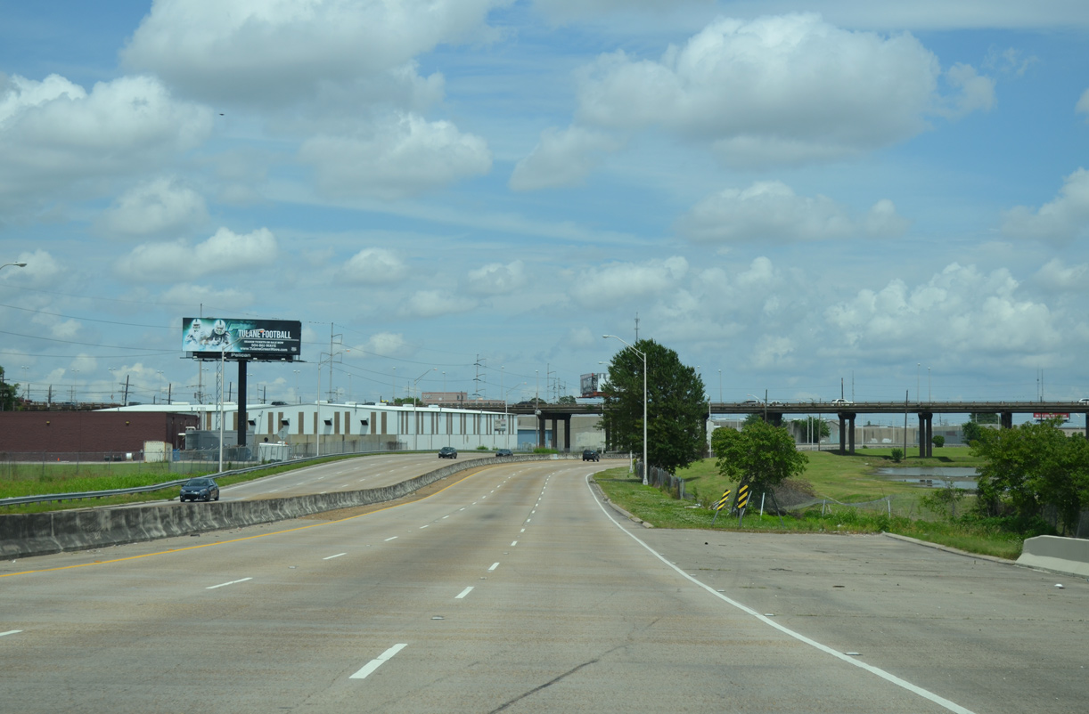
The Mercedes-Benz Superdome appears on the eastern horizon as LA 3139 spans two more railroad lines, a canal and a levee.
05/09/15
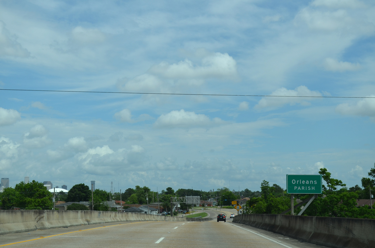
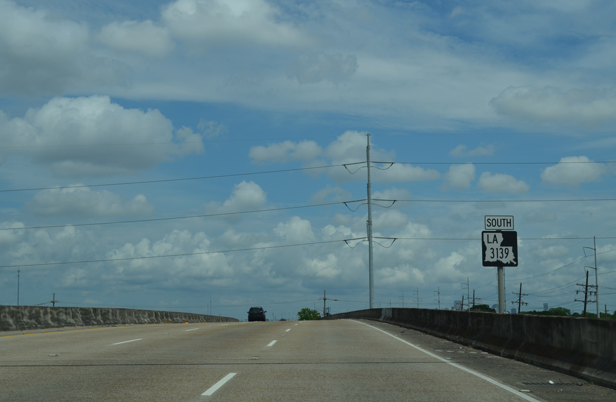
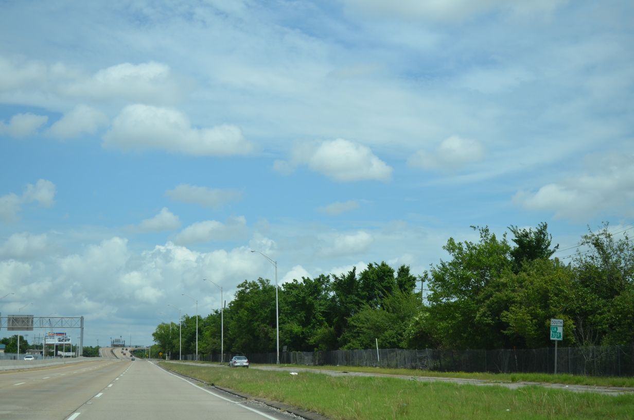
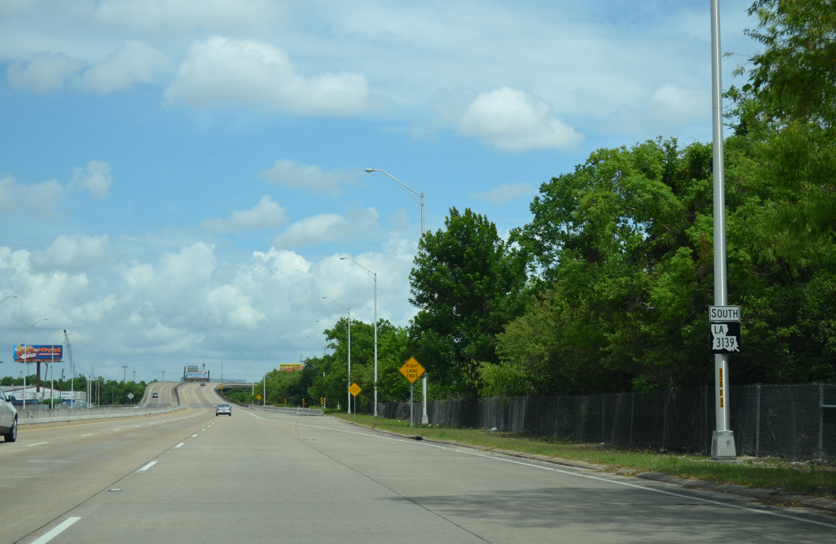
LA 3139 reduces to four lanes as the state highway enters Orleans Parish and the New Orleans city limits.
05/09/15
The final confirming marker for LA 3139 stands as the Earhart Expressway ends.
05/09/15
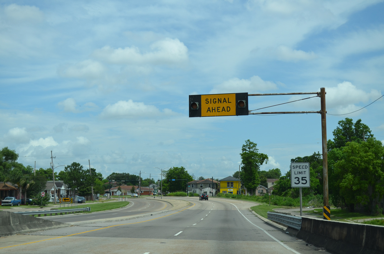
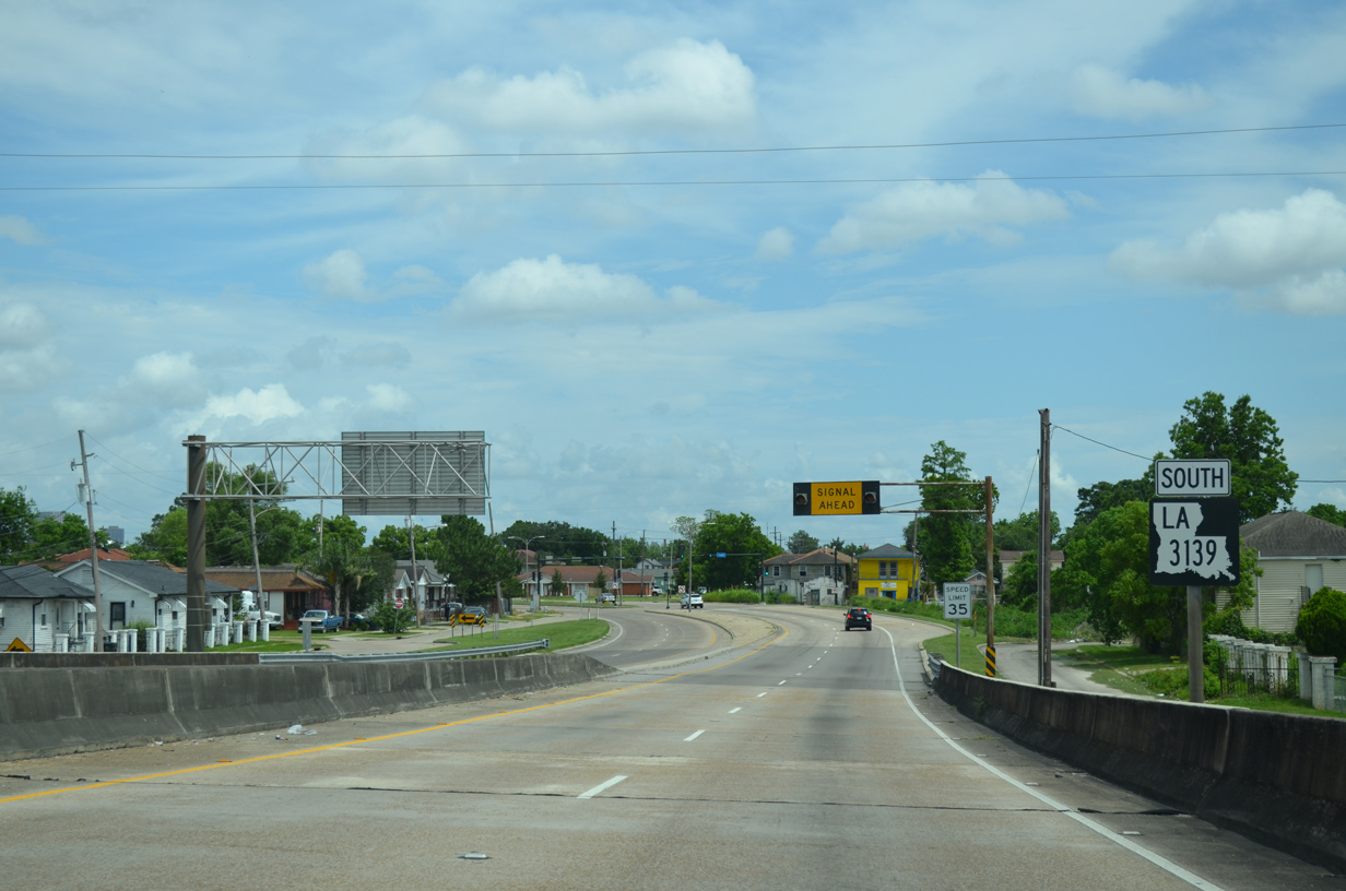
Earhart Boulevard constitutes a four lane signalized boulevard with a 35 mile per hour speed limit meandering east to Gert Town, B.W. Cooper and the Central Business District.
05/09/15
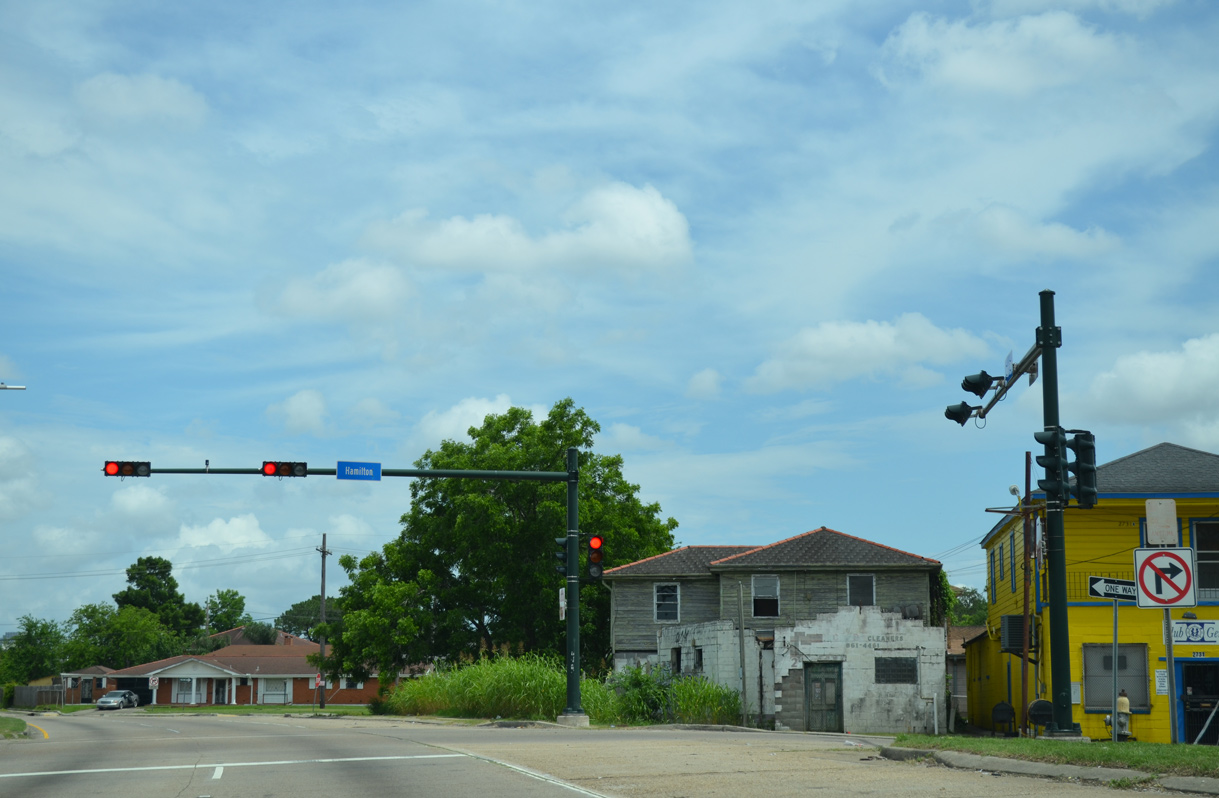
Hamilton Street connects Earhart Boulevard with U.S. 90 (Claiborne Avenue) to the southwest from the succeeding eastbound traffic light.
05/09/15
References:
- "Earhart Stuck at Halfway Point." Times-Picayune, The (New Orleans, LA), November 12, 1995.
- "Earhart May be Extended to Ease Traffic Problems." Times-Picayune, The (New Orleans, LA), January 29, 1989.
- "Jeff Official Urges Tolls on Earhart Expressway." Times-Picayune, The (New Orleans, LA), February 15, 1989.
- "Area Lawmakers Resist Earhart Toll." Times-Picayune, The (New Orleans, LA), April 7, 1989.
- "Extended Earhart Toll Road Proposed." Times-Picayune, The (New Orleans, LA), July 4, 1989.
- "Westward Ho! Earhart Eyed." Times-Picayune, The (New Orleans, LA), March 16, 1996.
- "Study to Look at Airline Corridor - Options Will Include Rail Link With Airport." Times-Picayune, The (New Orleans, LA), November 19, 1997.
- "Traffic Study: Extend Earhart - Rail System Proposed Between Airport, N.O." Times-Picayune, The (New Orleans, LA), November 11, 1998.
- "Elevated expressway idea dropped - Widening Airline still under study." Times-Picayune, The (New Orleans, LA), January 8, 2004.
Photo Credits:
- Alex Nitzman: 05/09/15
- AARoads: 11/20/08, 12/20/08
Connect with:
Page Updated Monday October 03, 2016.