
Missouri 364 West

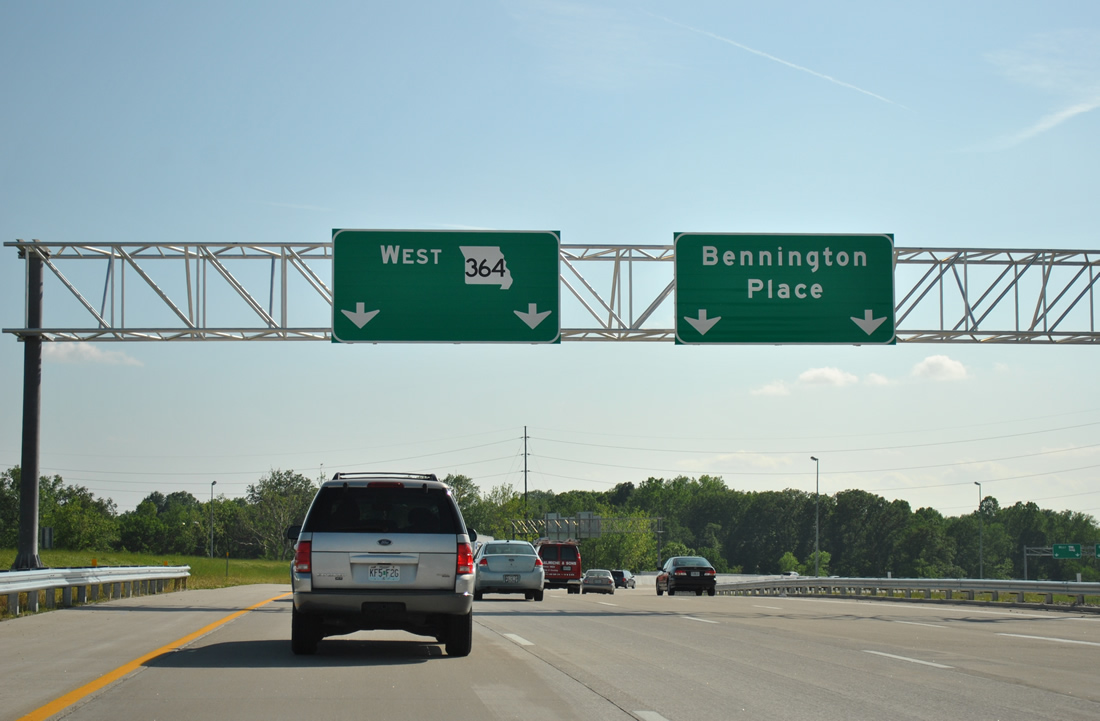
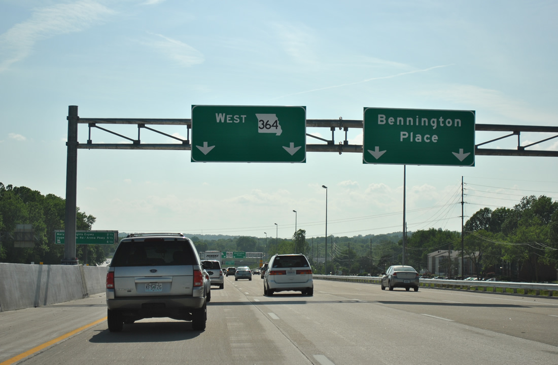
Commuters joining Missouri 364 leading west from Interstate 270 form a roadway along the westbound mainline to the diamond interchange with Bennington Place.
05/03/12
Bennington Place spurs north from parallel Fee Fee Road and Green Hill Drive, a subdivision entrance, to the city of Maryland Heights north of Missouri 364.
05/03/12
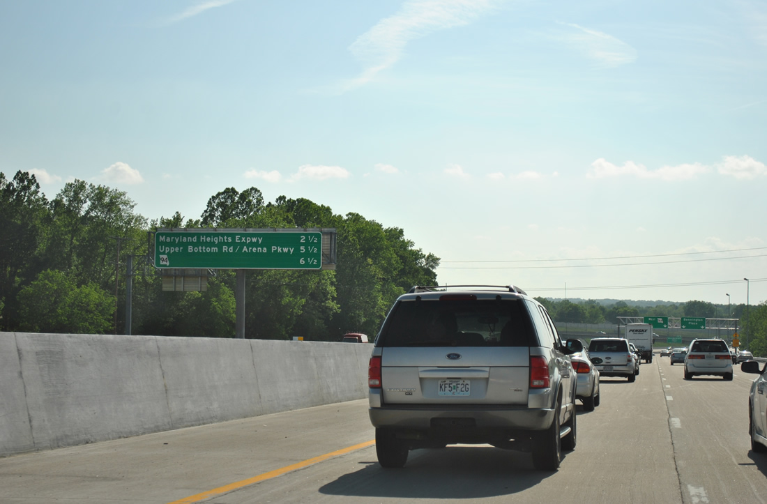
Mainline drivers see an interchange sequence sign posted 2.5 miles east of Exit 17 with Missouri 141 (Maryland Heights Expressway) and 6.5 miles from the merge with Missouri 94 west in St. Charles County.
05/03/12
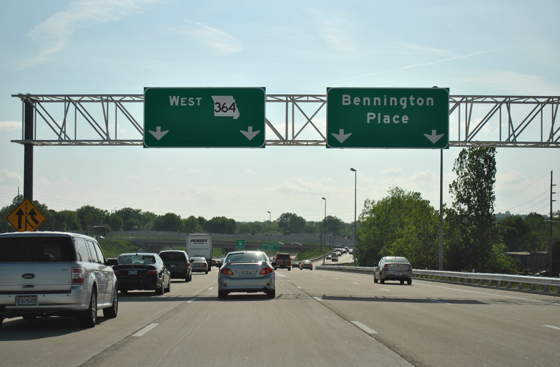
Two lanes leave the collector distributor roadway for Bennington Place. Bennington Place angles northeast between several apartment complexes to become McKelvey Road north of Marine Avenue.
05/03/12
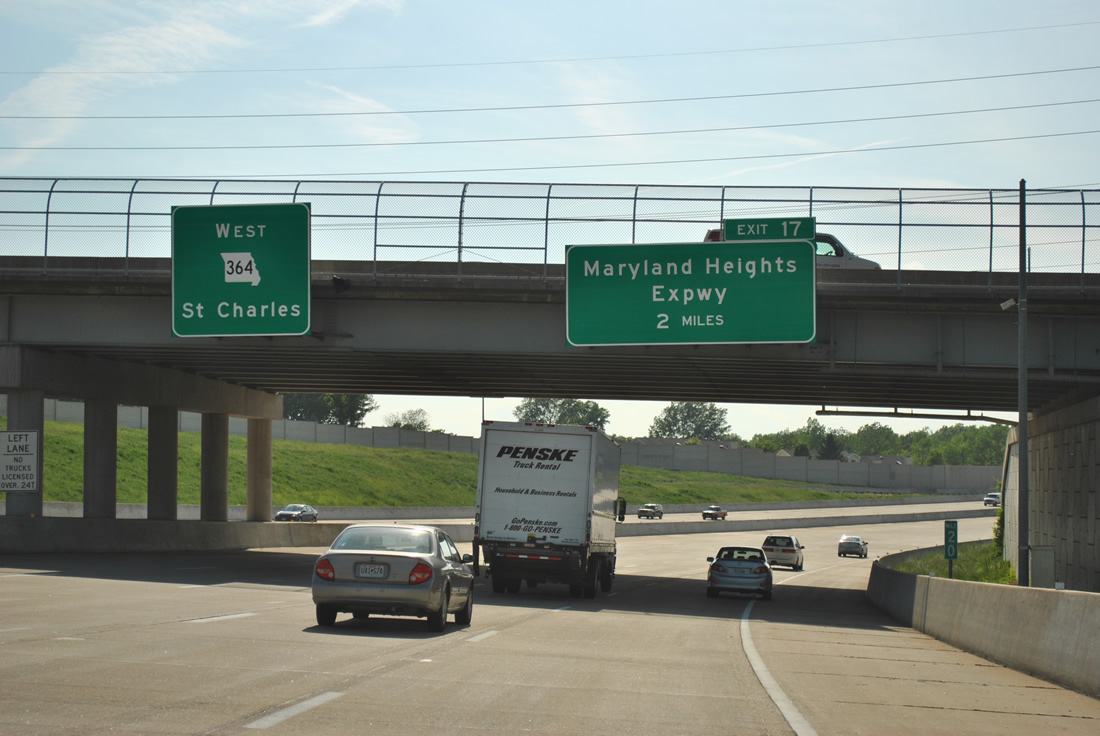
Maryland Heights Expressway crosses paths with Missouri 364 in two miles. The north-south controlled-access route was completed between MO 364 and I-64/U.S. 40 at Town and Country in July 2012.
05/03/12
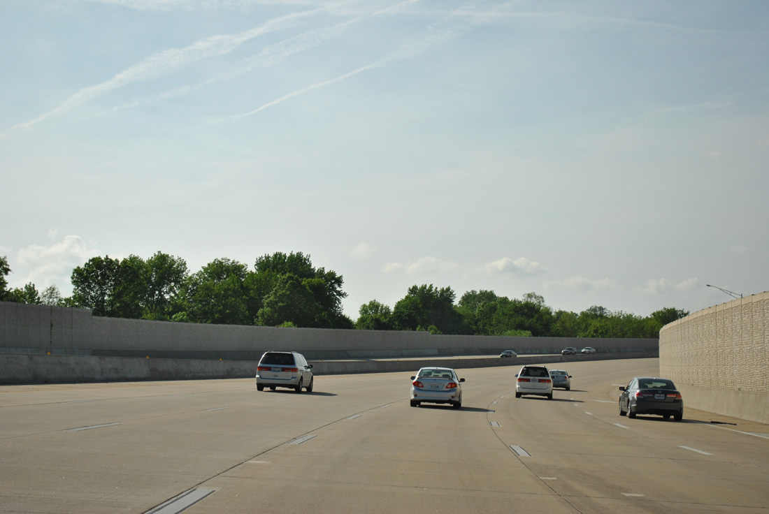
Sound walls buffer the ten lane freeway from the Le Coeur Du Monde apartment community to the east and neighborhood areas of unincorporated St. Louis County to the west.
05/03/12
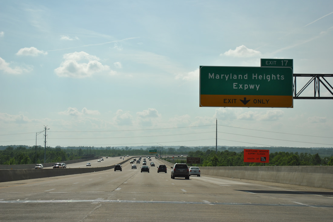
Approaching the Amiot Drive overpass, Missouri 364 curves west and meets Missouri 141 (Maryland Heights Expressway) at a parclo interchange (Exit 17) in 1.25 miles. The first St. Charles County exit follows in three miles with Upper Bottom Road.
05/03/12
A lengthy causeway and viaduct carries Missouri 364 over both southern reaches of Creve Coeur Lake and wetlands associated with Creve Coeur Creek.
05/03/12
The right lane of Route 364 west departs next for Route 141 (Maryland Heights Expressway). Traveling 30.90 miles from Route 370 at Bridgeton and U.S. 61/67 at Arnold, Route 141 varies between expressway and arterial portions as an outer belt route for the St. Louis metropolitan area.
05/03/12
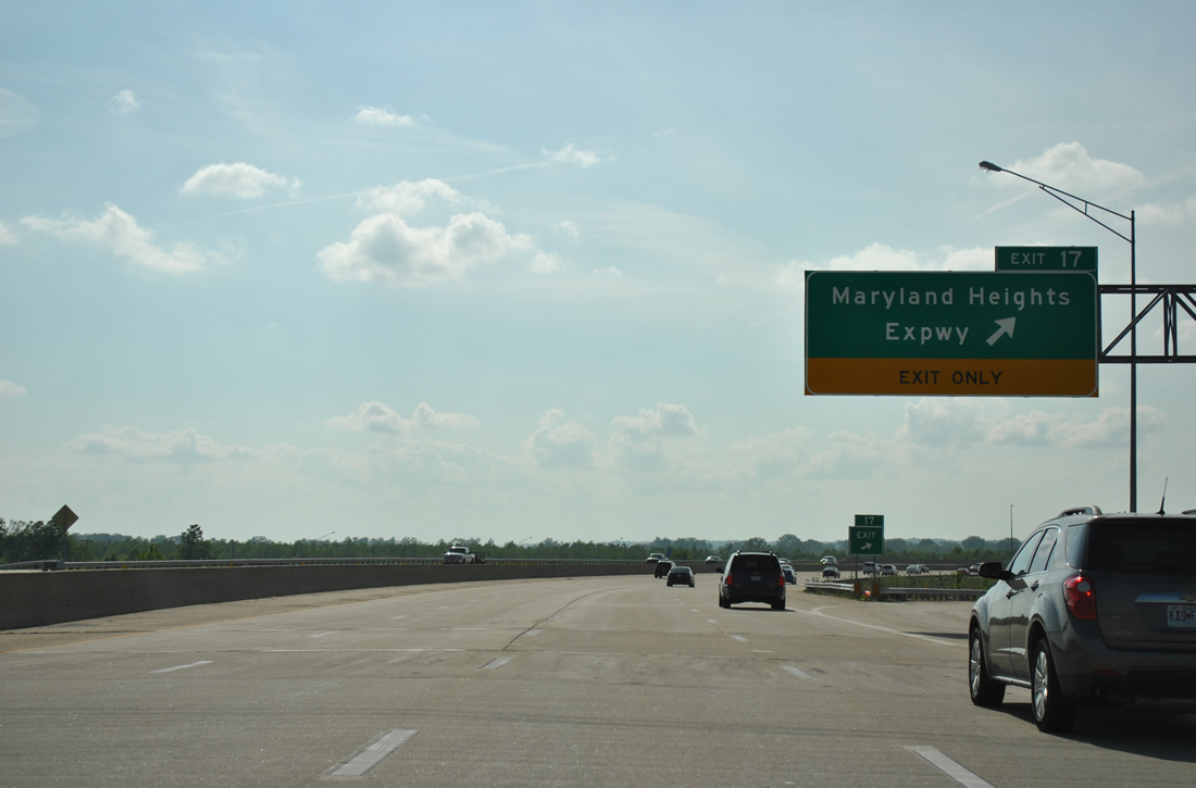
Exit 17 leaves Missouri 364 west for Missouri 141 (Maryland Heights Road) north to Creve Coeur Airport, the Earth City Levee District and west Bridgeton. The state highway south continues to east Chesterfield, Manchester and Valley Park.
05/03/12
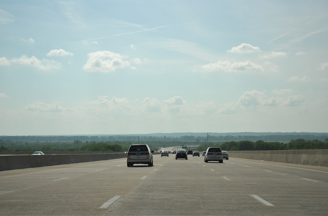
Reassurance marker posted as Missouri 364 turns northward. The freeway traverses flats and agricultural areas east of the Missouri River along this stretch.
05/03/12
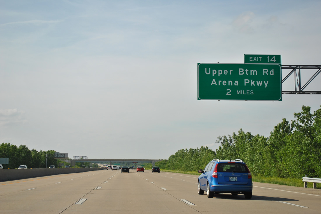
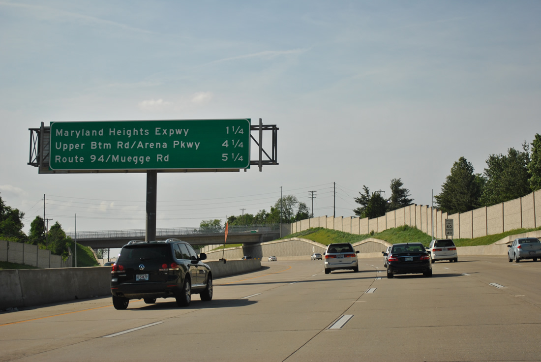
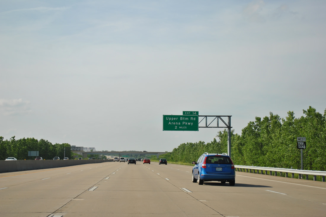
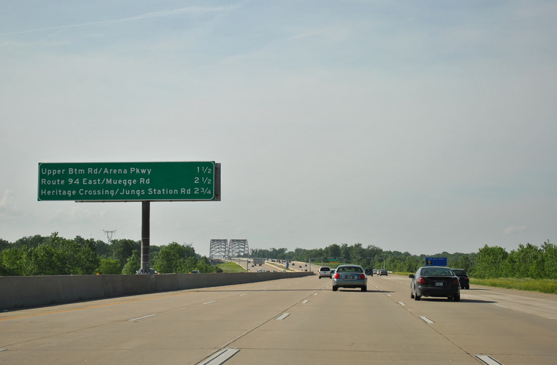
Upper Bottom Road east and Arena Parkway west come together at a diamond interchange (Exit 14) in two miles.
05/03/12
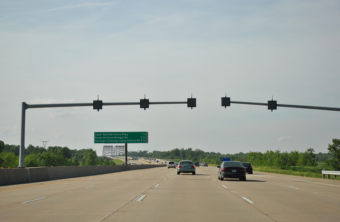
Lane control signals precede the Veterans Memorial Bridge across the Missouri River. Operation of these signals alerts motorists to lane closures and other blockages due to construction or weather.
05/03/12
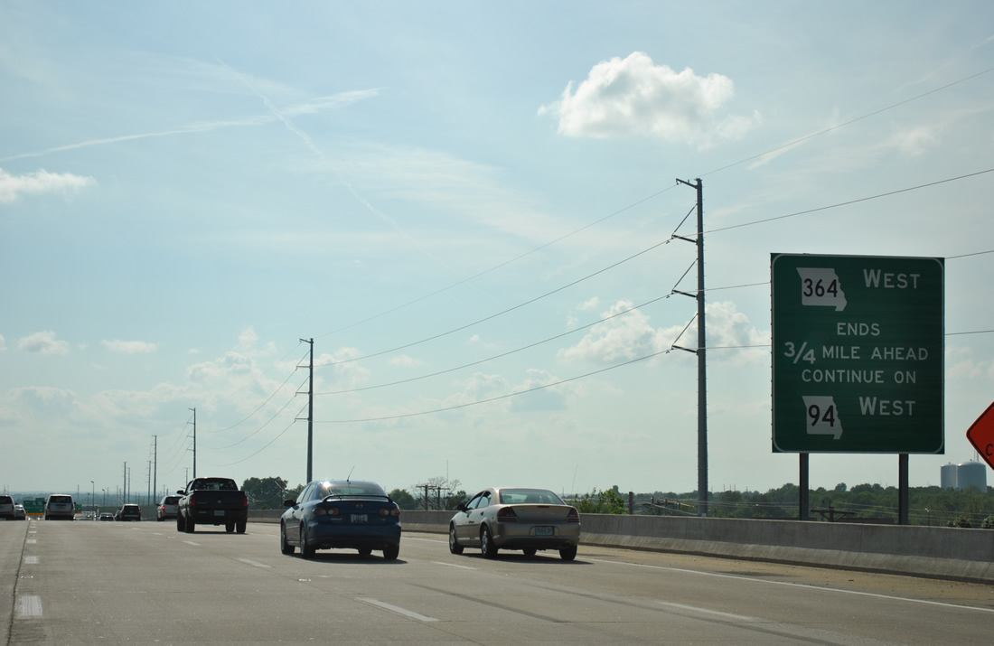
Back to back off-ramps depart Missouri 364 west at the three-wye interchange with Missouri 94 in 2.25 miles. The eastbound ramp leads motorists to St. Charles while the Heritage Crossing exit joins the adjacent frontage road (North St. Peters Parkway) alongside Missouri 94 & 364 west.
05/03/12
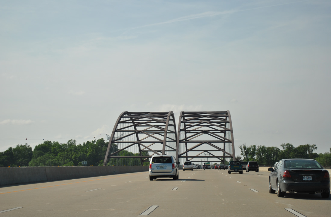
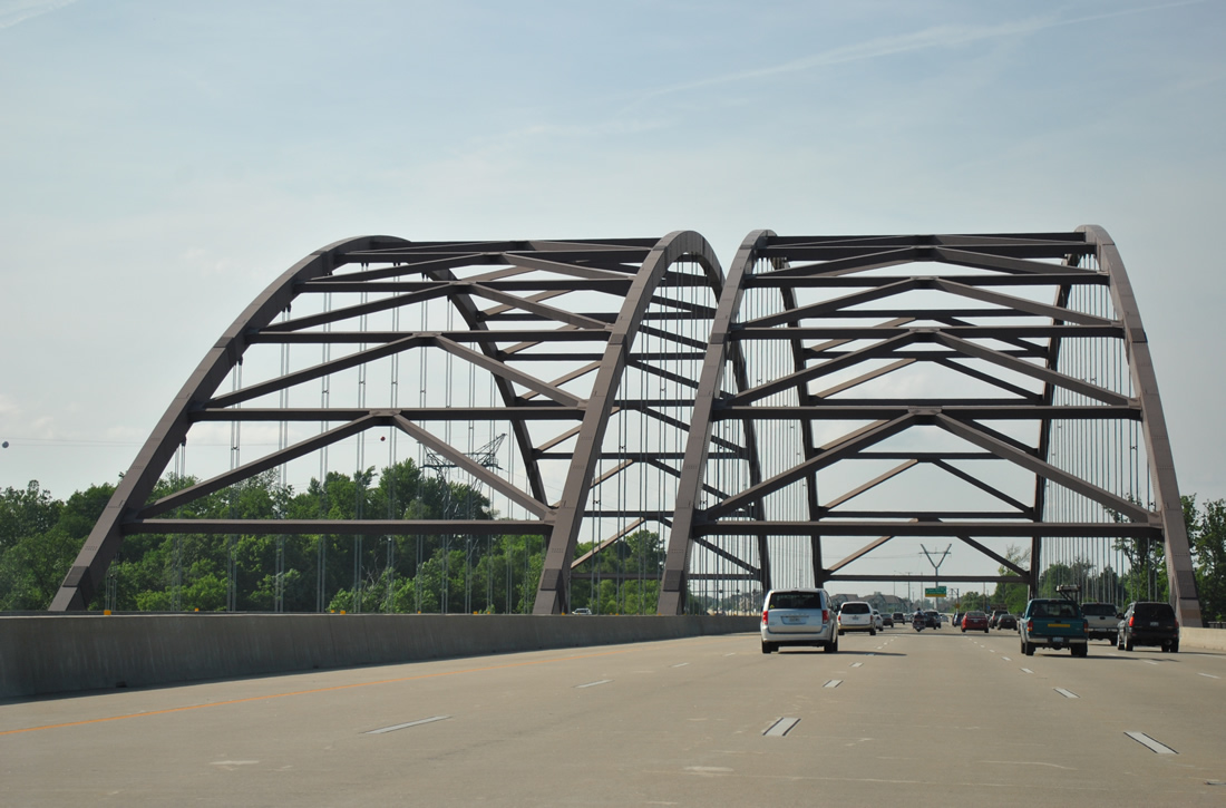
Missouri 364 again increases to ten overall lanes as it spans the Missouri River to Exit 14.
05/03/12
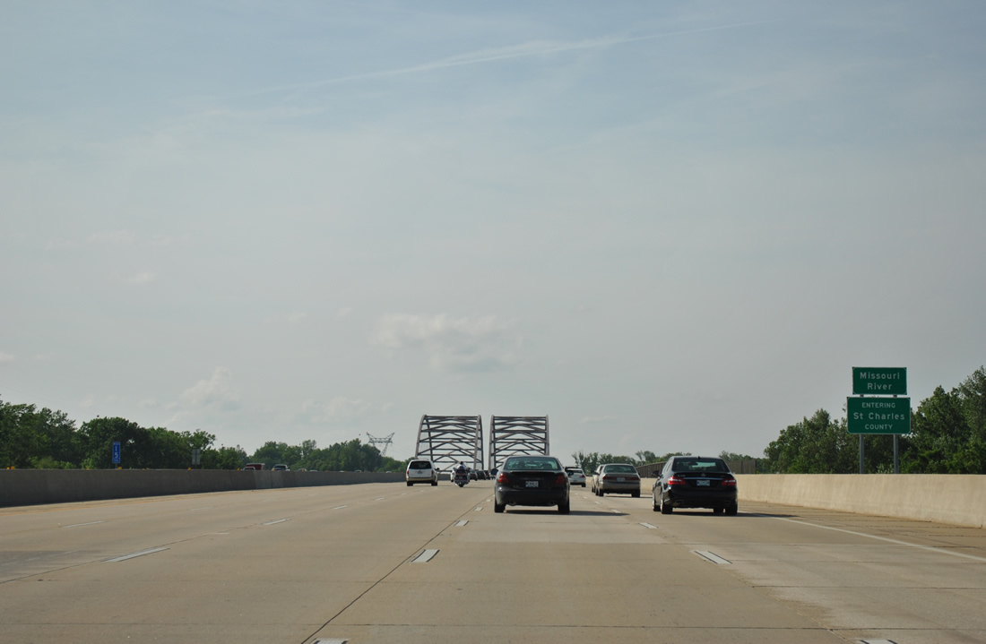
5.72 miles of Missouri 364 in St. Louis County conclude as commuters enter St. Charles County via the Veterans Memorial Bridge. The tied-arch bridge opened to traffic on December 13, 2003.
05/03/12
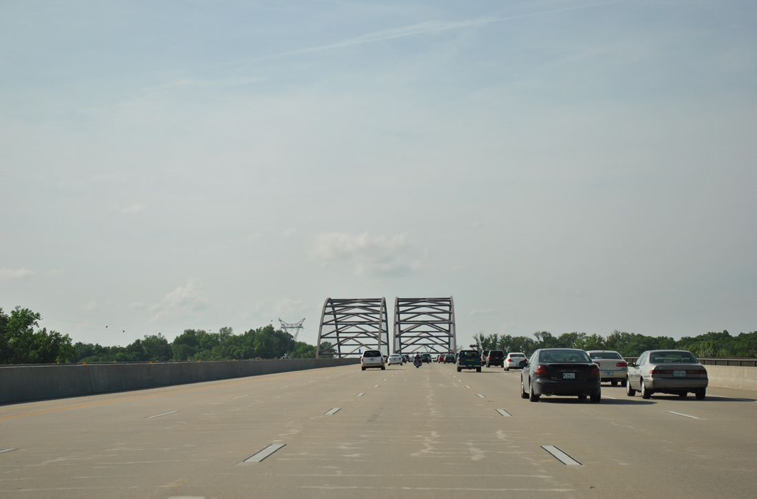
Spanning the Missouri River at Jane Downing Island, the Veterans Memorial Bridge consists of twin bridges at 3,238 feet in length with 83 feet decks.1
05/03/12
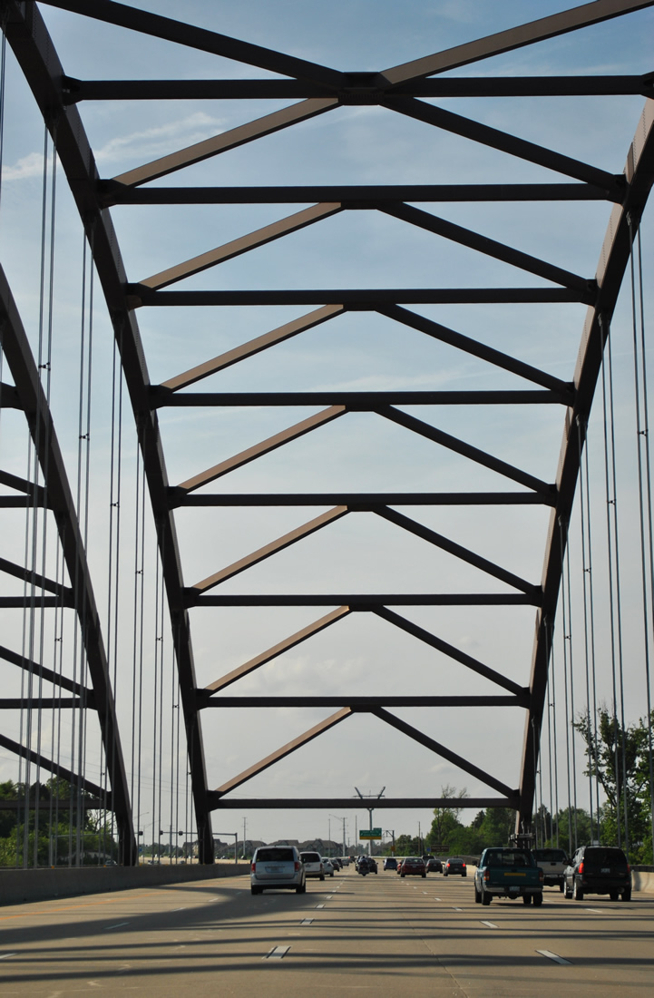
The Veterans Memorial Bridge ends at a bluff above Katy Trail State Park (a linear park along the former Missouri-Kansas-Texas Railroad line). The westbound span includes a bicycle/pedestrian path connecting Katy Trail with Creve Coeur Lake Memorial Park.
05/03/12
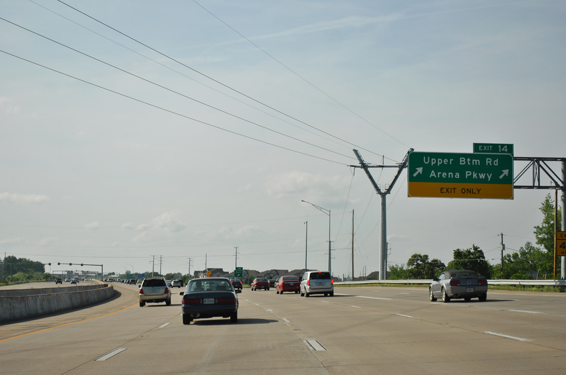
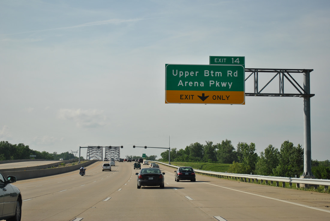
Exit 14 immediately parts ways with Missouri 364 west beyond the Missouri River. Upper Bottom Road winds west to Jungs Station Road, serving a number of unincorporated residential areas. Arena Parkway extends the road east from MO 364 to The Family Arena (a sports and entertainment venue), and South River Road in the city of St. Charles.
05/03/12
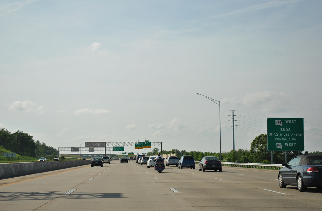
The west end phase one of Missouri 364 occurs 2.75 miles ahead in south St. Peters. Missouri 94 overlaps with the freeway to its temporary conclusion at Mid Rivers Mall Drive.
05/03/12
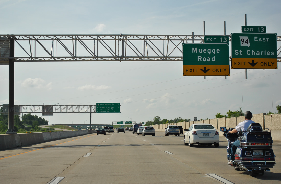
Exit 13 provides access to both Missouri 94 (First Capitol Drive) northeast to Business Loop I-70 and Downtown St. Charles and Muegge Road northwest to the Cave Springs Road exit of Interstate 70.
05/03/12
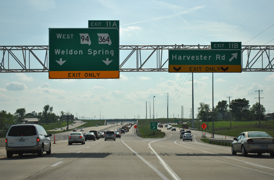
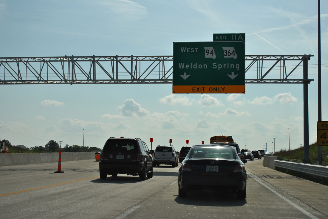
Beyond the merge with Missouri 94 west, Missouri 364 continues 1.5 miles to a diamond interchange (Exit 11A) with Harvester Road.
05/03/12
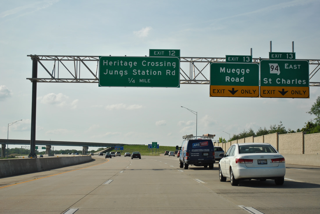
Ramps for both MO 94 east and Muegge Road north at Old Highway 94 in south St. Charles split from the Missouri 364 westbound mainline. Missouri 94 totals 136.31 miles from U.S. 67 at West Alton to Jefferson City (U.S. 54 & 63).
05/03/12
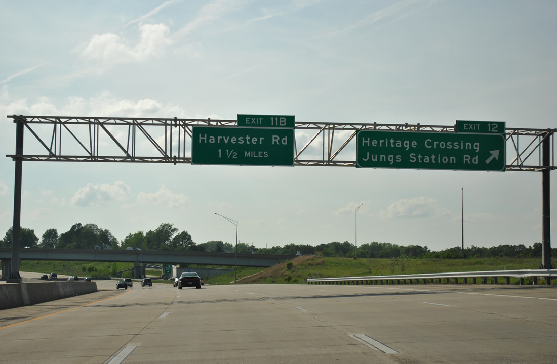
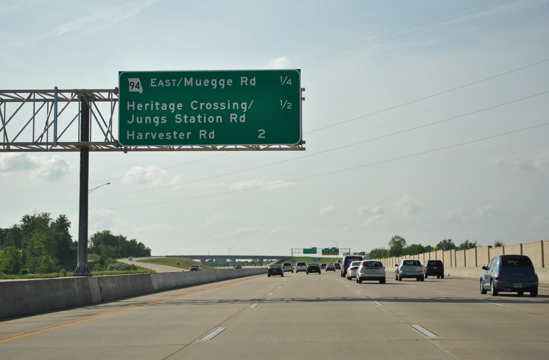
Exit 12 joins the North St. Peters Parkway west to Heritage Crossing, an overpass connecting the service roads with residential areas to the south of the freeway. Jungs Station Road spurs south from the frontage roads nearby to a pair of schools, additional unincorporated suburbs and the Greens Bottom area.
05/03/12
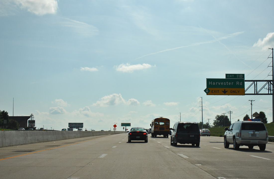
A half diamond interchange (Exit 11B) facilitates commuter interests to Harvester Road via the St. Peters Parkway frontage roads.
05/03/12
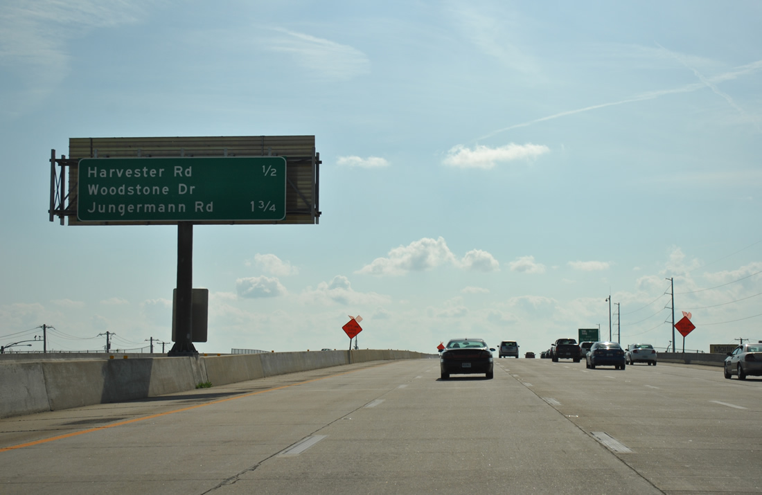
Harvester Road was the last exit for Missouri 364 preceding the default of traffic from the mainline onto North St. Peters Parkway west ahead of Woodstone Drive. The freeway continues west to Mid Rivers Mall Drive.
05/03/12
An end sign was posted ahead of the Exit 11A off-ramp for Woodstone Drive and Jungermann Road.
05/03/12
Harvester Road arcs north from Old Highway 94 and Harvester to Exit 11B and McClay Road at Country Lake Drive in the city of St. Peters.
05/03/12
Traffic defaulted from Missouri 94 & 364 west onto North St. Peters Parkway until the next phase of freeway opened on August 30, 2012.
05/03/12
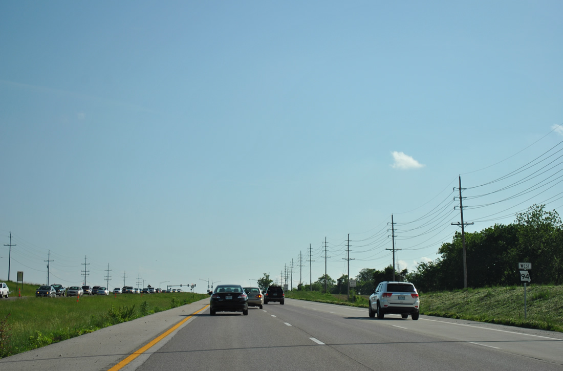
Missouri 94 transitions from the Missouri 364 freeway into a semi-controlled-access arterial west through Weldon Spring to I-64/U.S. 40-61.
05/03/12
References:
- Page Avenue Bridge. http://bridgehunter.com/mo/st-louis/page/ Bridgehunter.com.
Photo Credits:
- ABRoads: 05/03/12
Connect with:
Page Updated Monday December 02, 2013.