
Highway 135

Following the Clark Fork River south of the Coeur d'Alene Mountains, Montana Highway 135 travels 21.549 miles east from Interstate 90 (Exit 33) in St. Regis to Highway 200 south of Paradise. Highway 135 doubles at the St. Regis Paradise Scenic Byway.
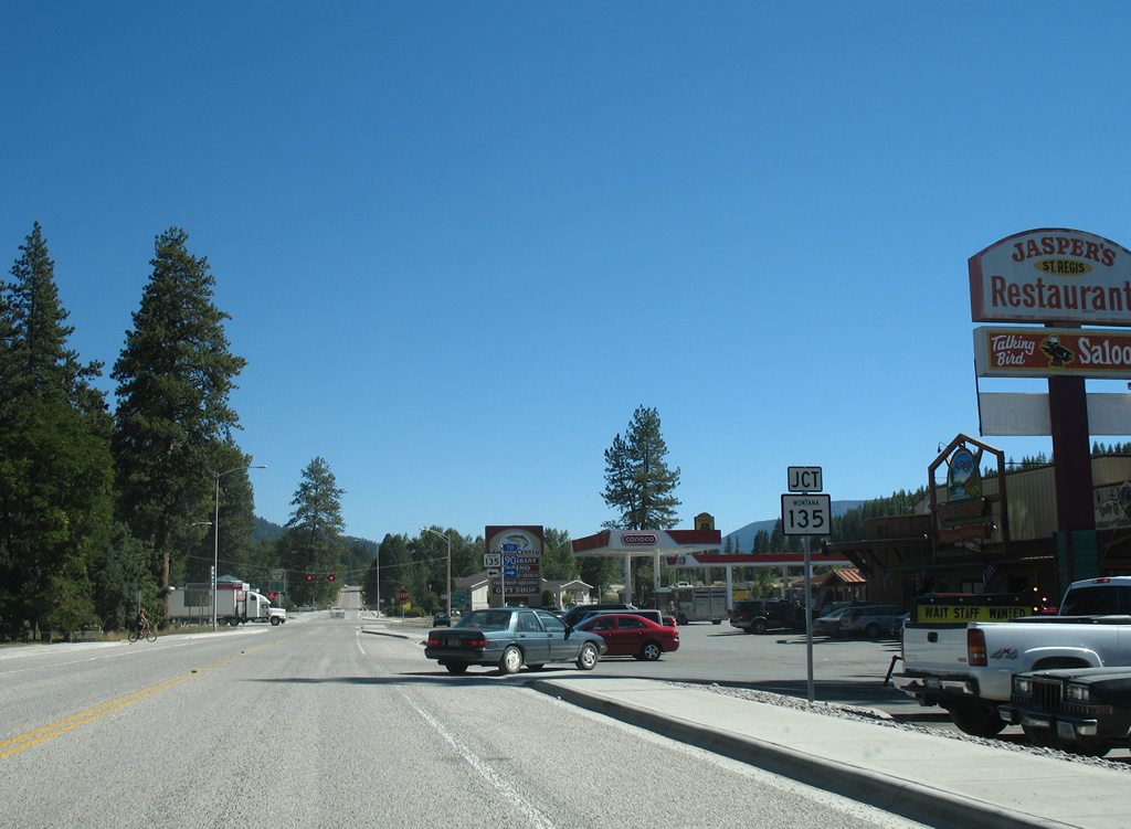
A MT 135 shield, since replaced, directs motorists from Interstate 90 west onto the state highway beginning at St. Regis. The state highway intersects old U.S. 10 to the right.
09/01/06
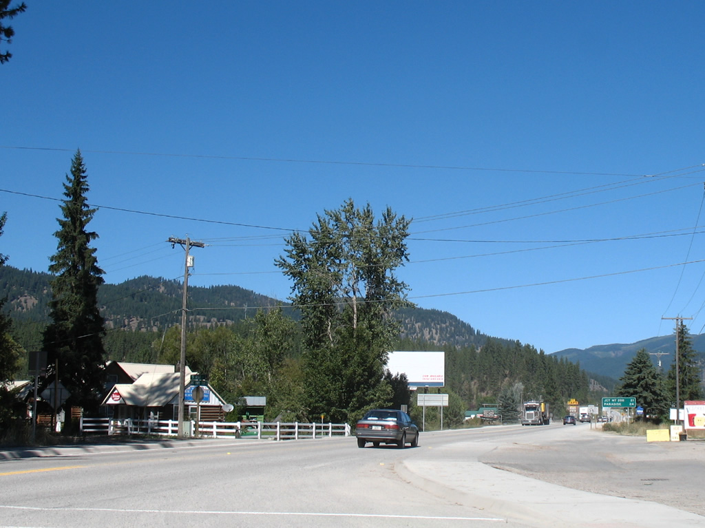
Leaving St. Regis, MT 135 travels 21 miles to MT 200, three miles south of Paradise.
09/01/06

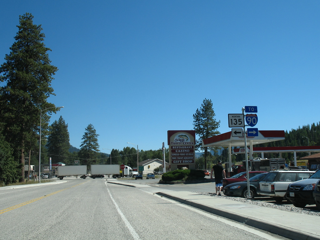
MT 135 enters a diamond interchange (Exit 33) with Interstate 90 immediately south of Old U.S. 10 (Mullan Gulch Road / Old Highway 10 East) in St. Regis.
09/01/06
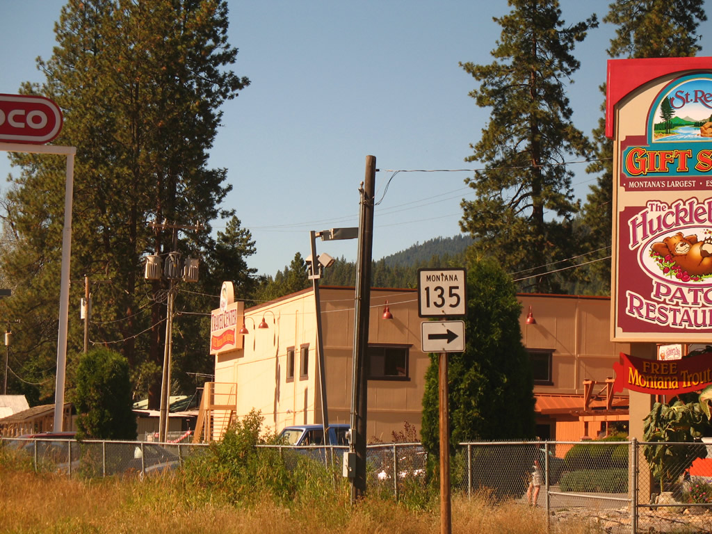
Mullan Gulch Road overtakes the former alignment of U.S. 10 from Little River Lane and approaches MT 135 in the St. Regis business district.
09/01/06
MT 135 leads north from the adjacent ramps with Interstate 90 to Toole, Donlan and Quinns Hot Springs along the Clark Fork River.
09/01/06
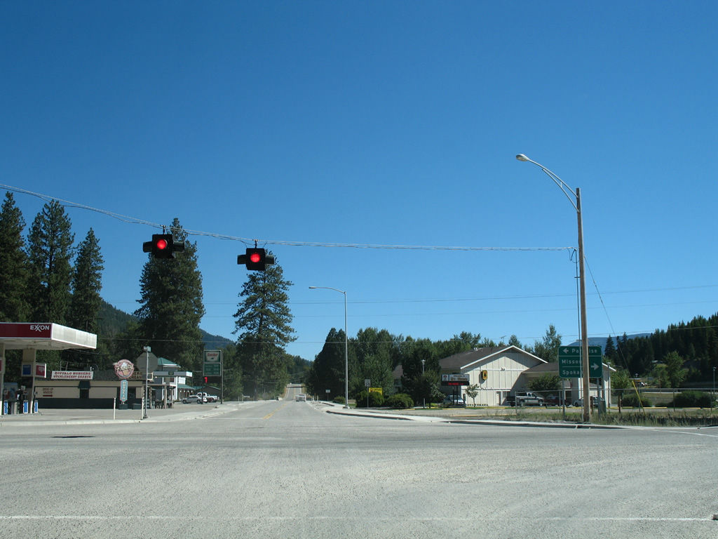
A guide sign references Paradise, a community of around 200 along MT 200, for MT 135 north. Spokane, Washington takes the place of Coeur d' Alene, Idaho for I-90 west.
09/01/06
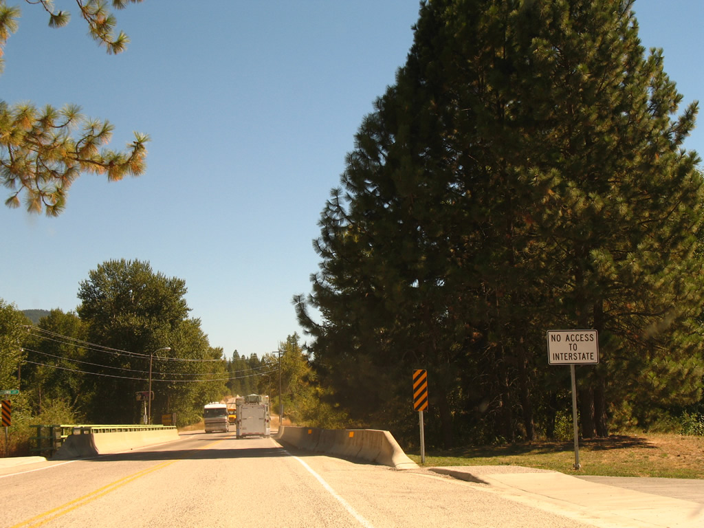
A portion of old U.S. 10 (Old Highway 10) remains in service east and west from MT 135 at St. Regis. Leading south from town, Old Highway 10 spans the St. Regis River here as motorists are advised that there is no access to I-90 ahead.
09/01/06
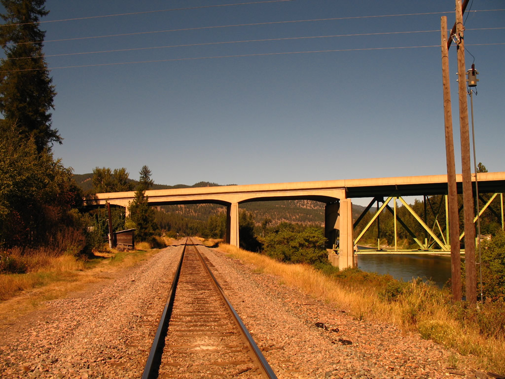
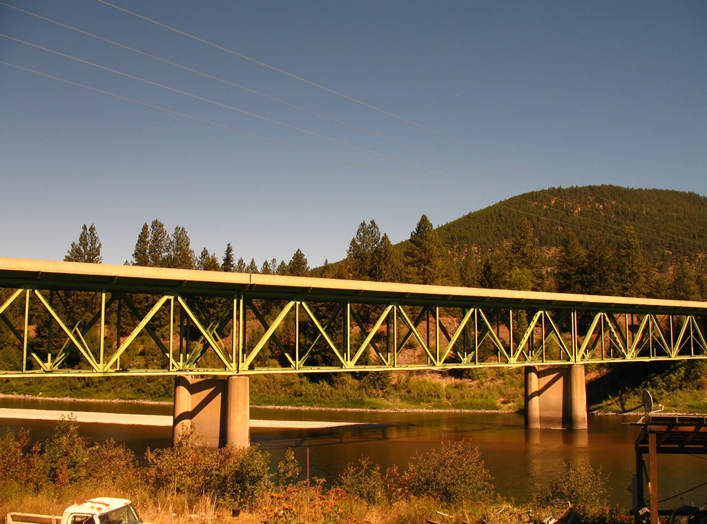
Old Highway 10 crosses the St. Regis River just north of Interstate 90 along a 1942 deck-truss bridge. Passing below the bridge as well is a line of the Montana Rail Link.
09/01/06
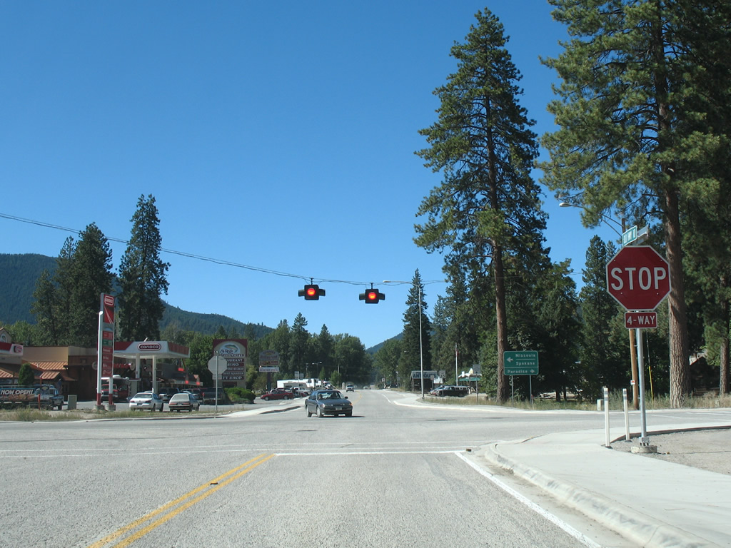
A four-way stop and a set of flashers operate at the intersection of Old Highway 10 west at MT 135. Mullan Gulch Road continues the road northwest through Mullan Gulch to Cabin City, Henderson and I-90 at Exit 22.
09/01/06
Photo Credits:
- AARoads, Chris Kalina: 09/01/06
Connect with:
Page Updated Thursday October 17, 2013.