
Highway 200

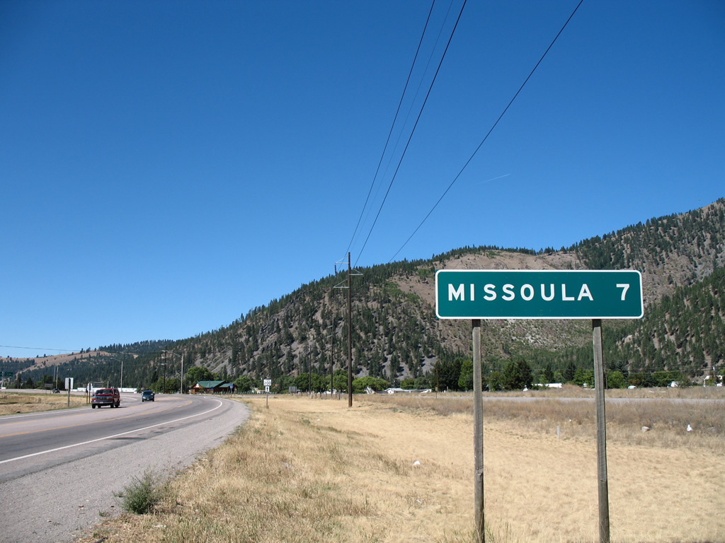
Montana Highway 200 represents a 706 mile portion of the 1,361 mile multi-state route stretching east from Sandpoint, Idaho to Northeast Aitkin, Minnesota. The state highway enters Montana alongside Cabinet Gorge Reservoir of the Clark Fork River near Heron, traveling southeast to Thompson Falls, Plains, Paradise and U.S. 93 at Ravalli. A 28 mile overlap with U.S. 93 takes the route southward to Interstate 90 (Exit 96), where both join the freeway east to Missoula.
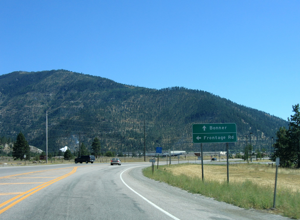
Leaving Interstate 90 at Exit 109 near Milltown and Bonner, MT 200 arcs eastward to Ovando and Kleinschmidt Flat before following the Blackfoot River between Marcum and Trapper Mountains to Lincoln. The state highway turns northeast from Helena National Forest across Rogers Pass (elevation 5,610 feet) and the Continental Divide to Simms, Fort Shaw and a merge with U.S. 89 south at Sun River.
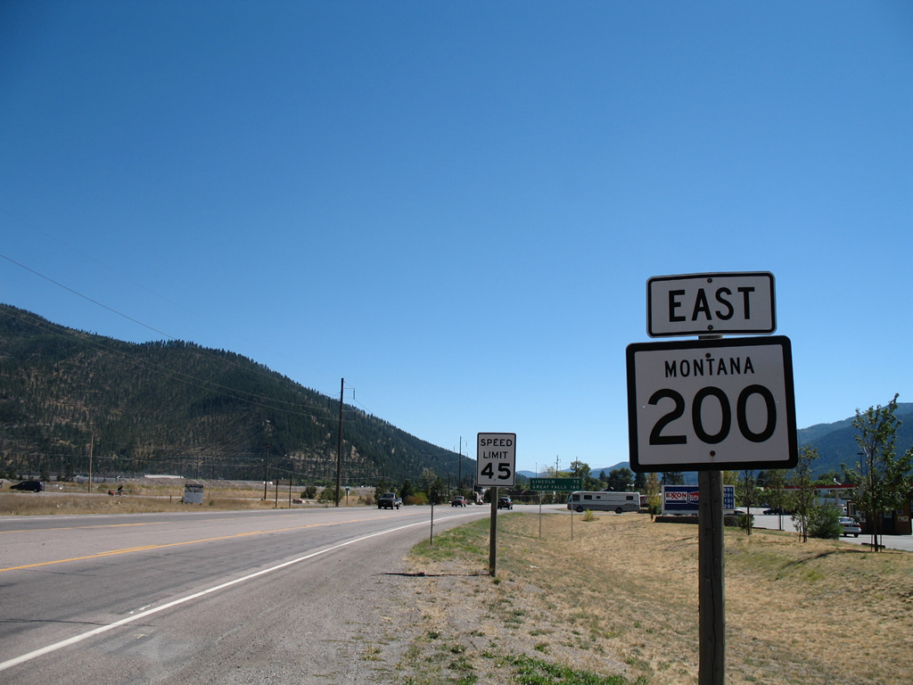
U.S. 89 and MT 200 combine east to Interstate 15 south at Vaughn and with the freeway into Great Falls. The pair double as unsigned Interstate 315 and Business Loop I-15 east from Exit 278 to the Missouri River and the Great Falls street grid. U.S. 87 joins the pair from 14th & 15th Streets, with the trio heading southeast to Belt and Armington. U.S. 89 leads south from there to White Sulphur Springs while U.S. 87 & MT 200 continue east to Stanford, Windham, Lewiston and Grass Range. MT 3 also follows the route from Great Falls southeast to U.S. 191 at Eddies Corner.
East from Grass Range, MT 200 continues solo east to Winnett and Mosby and northeast to Sand Springs and Jordan. The rural highway travels another 66 miles to Circle and a split with MT 200S. MT 200S branches southeast to Lindsay and I-94 at Glendive while MT 200 presses northeast to Richey, Sidney and an exit of the state at Fairview.
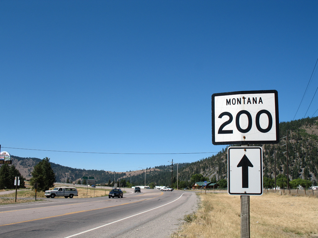
Just beyond the trumpet interchange (Exit 109) with Interstate 90, MT 200 overtakes its former alignment (Highway 200 East) at the community of West Riverside. Highway 200 leads west along former U.S. 10 and MT 200 to East Missoula.
09/01/06
The first reassurance marker posted after Interstate 90 follows the intersection with Highway 200 East. Portions of old U.S. 10 parallel the state highway just to the east as Anaconda Street and a closed truss bridge over the Blackfoot River.
09/01/06
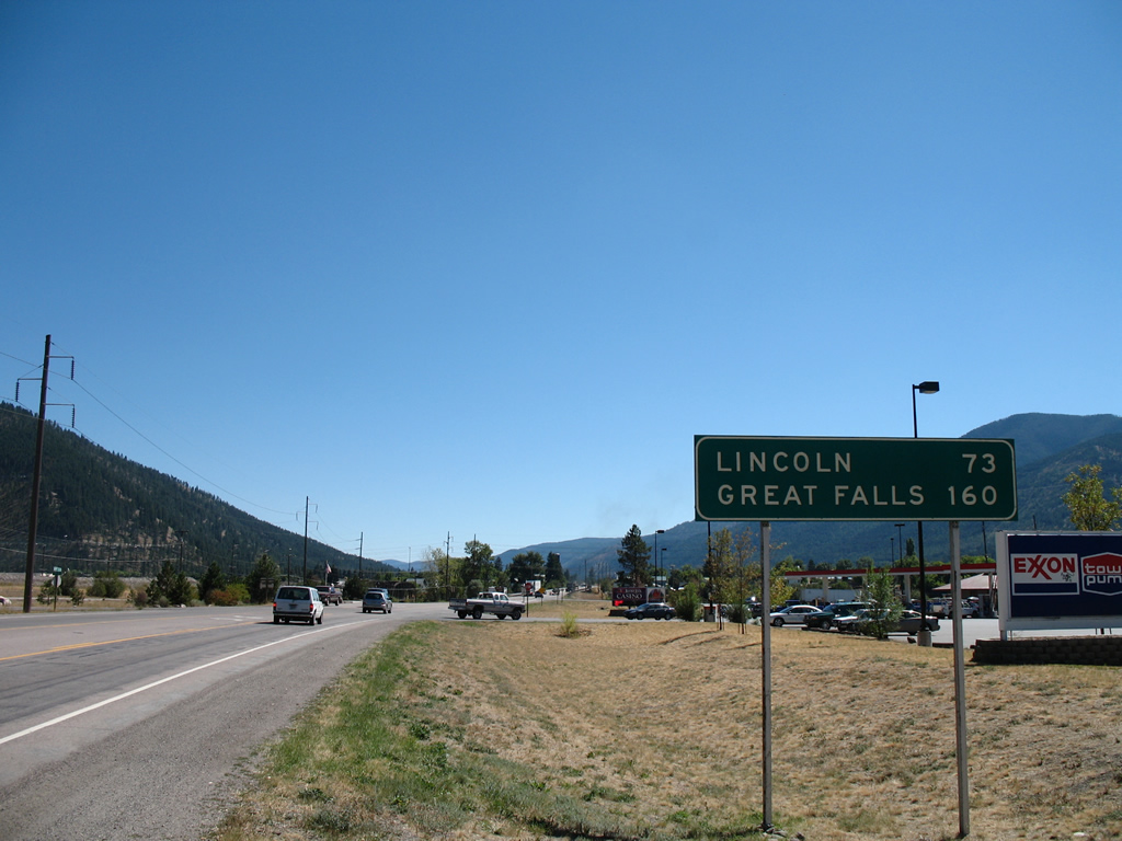
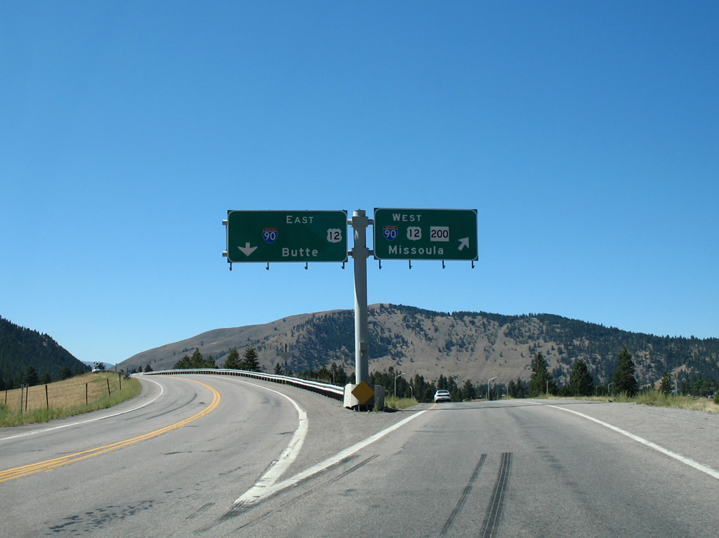
Lincoln appears as the next city for MT 200 east, 73 miles away in Lewis and Clark County. Great Falls, the control city for MT 200 from I-90 east, is 160 miles to the northeast.
09/01/06
MT 200 leaves the communities of Bonner and Milltown across the Blackfoot River into West Riverside. The state highway combines with Interstate 90 west into Missoula while the former alignment (Highway 200 East) splits with MT 200 ahead for East Missoula. Following old MT 200 and Old U.S. 10 takes travelers to the Missoula County Courthouse in 6.4 miles.
09/01/06
A MT 200 shield directs motorists to stay straight to the trumpet interchange with Interstate 90 as Highway 200 East veers northward to follow the Clark Fork river into East Missoula.
09/01/06
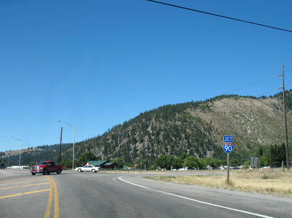
Interstate 90 enters the Missoula area from Butte, 107 miles to the southeast. U.S. 12 overlaps with the freeway west from Garrison through Drummond and Clinton.
09/01/06

Nearing the westbound on-ramp to Interstate 90 & U.S. 12, MT 200 combines with the freeway to bypass Missoula to Exit 96.
09/01/06
Interstate 90 & U.S. 12 head 11 miles east to Clinton, with U.S. 12 continuing from the freeway at Garrison to reach the capital city in 112 miles. I-90 follows the Clark Fork southeast to Warm Springs, 20 miles out from Butte.
09/01/06
Photo Credits:
- AARoads, Chris Kalina: 09/01/06
Connect with:
Page Updated Thursday October 17, 2013.