
State Route 51

Located in northwestern Ohio, State Route 51 travels 30.73 miles northwest from U.S. 20 between Woodwville and Washington Townships in Sandusky County to U.S. 23/223 and SR 184 (Alexis Road) in the city of Sylvania. Initially heading north, SR 51 connects with the Ohio Turnpike (I-80/90) at Exit 81 and the village of Elmore. Crossing the Portage River, SR 51 turns northwest toward Genoa, Millbury and Northwood.
Within the city of Oregon, SR 51 combines with SR 2 (Woodville Road) for 0.45 miles to Oak Street. SR 65 joins SR 2/51 west from there across the Anthony Wayne Bridge spanning the Maumee River 0.84 miles to Summit Street in Toledo. SR 2 turns southwest along Broadway Street while SR 51/65 head north into the Saint Clair Street Historic District.
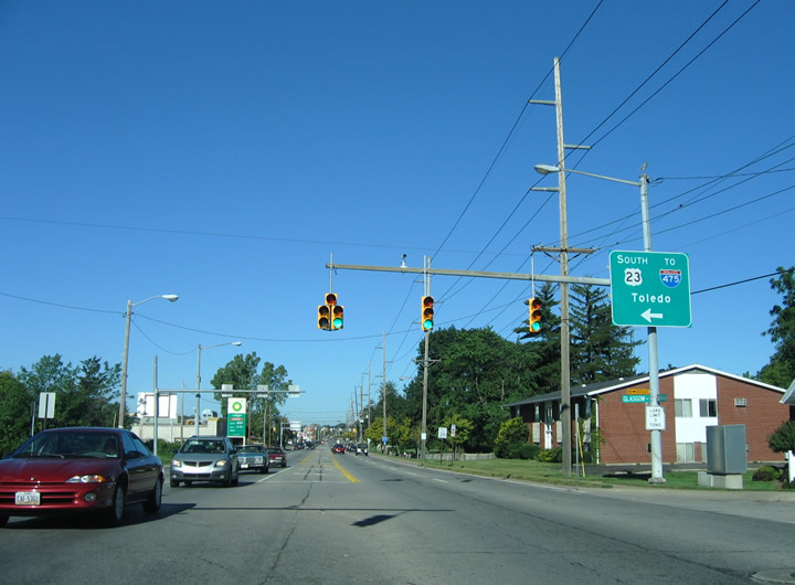
SR 65 remains along Summit Street through Downtown Toledo while SR 51 lines Monroe Street northwest to the Auburndale neighborhood. SR 51 (Monroe Street) continues to I-475 at Exit 18A and Franklin Park Mall in north Toledo. Entering the city of Sylvania, SR 51 concludes with SR 184 west and U.S. 223 south at a folded diamond interchange with U.S. 23.
 North
North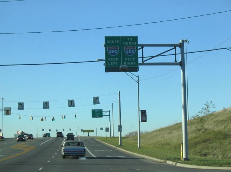
SR 51 (Woodville Road) north connects with I-280 at a parclo interchange (Exit 6). Wales Road ties into SR 51 at the northbound entrance ramp to Toledo.
11/13/04
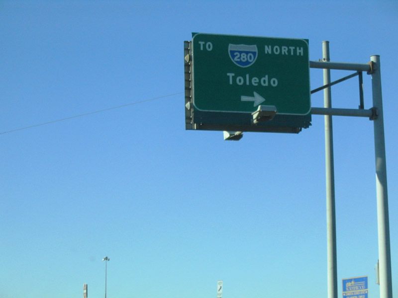
The northbound entrance ramp from SR 51 and Wales Road joins a distributor roadway leading to Curtice Road before joining Interstate 280 into the city of Oregon.
11/13/04
SR 51 (Monroe Street) north converges with the west end of SR 184 (Alexis Road) within the folded diamond interchange along U.S. 23.
09/02/05
U.S. 223 begins northbound along side U.S. 23 from SR 51 (Monroe Street) in Sylvania. U.S. 23/223 overlap six miles to St. Anthony Road in Whiteford Township, Michigan.
09/02/05
SR 51 ends at the southbound entrance ramp for U.S. 23 to Toledo and Maumee. Monroe Street (CR 4) continues west into Downtown Sylvania.
09/02/05
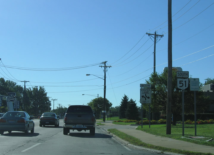
South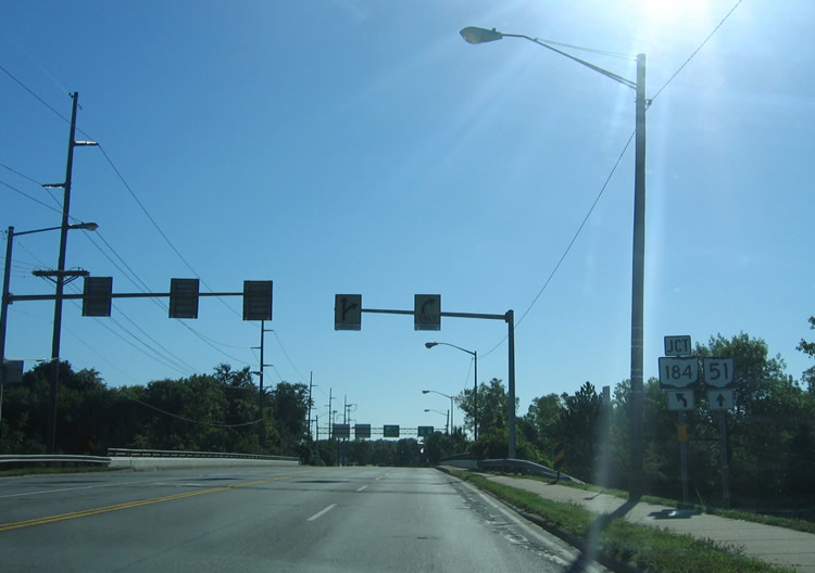
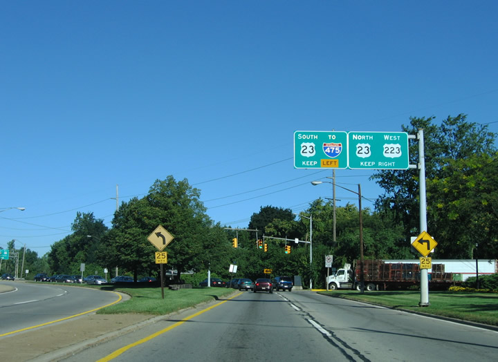
SR 51 south begins along Monroe Street in Sylvania at the exchange with U.S. 23/223. Spanning the freeway, SR 51 advances east to split with SR 184 (Alexis Road).
09/02/05
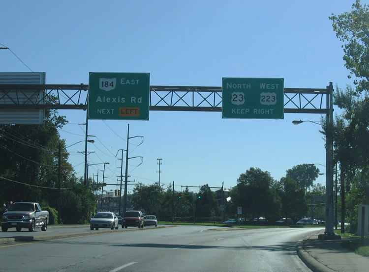
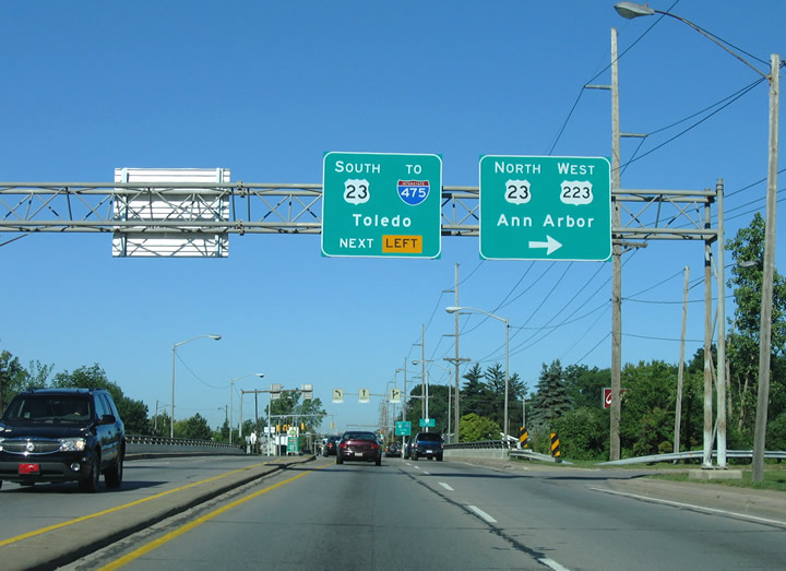
SR 184 (Alexis Road) heads 10.15 miles east through north Toledo to Interstate 75 at Shoreland. SR 51 (Monroe Street) angles southeast to a loop ramp for U.S. 23/223 north.
09/02/05
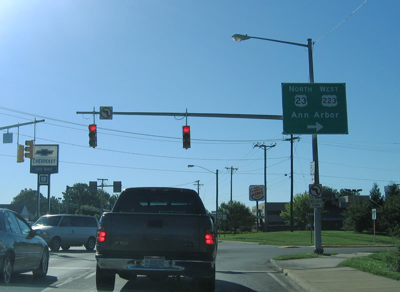
U.S. 223 begins northbound along U.S. 23 from SR 51 (Monroe Street) in Sylvania. U.S. 223 travels northwest to Adrian while U.S. 23 continues along a limited access highway north to Ann Arbor.
09/02/05
SR 51 (Monroe Street) heads southeast along a commercial arterial from U.S. 23/223 at Sylvania to Franklin Park Mall in Toledo.
09/02/05
Photo Credits:
- Carter Buchanan: 11/13/04
- AARoads: 09/02/05
Connect with:
Page Updated Tuesday August 03, 2021.