
Interstate 90

Interstate 90 travels across northern Ohio. The western half overlaps with I-80 on the Ohio Turnpike to Toldeo and Elyria. The remainder of I-90 is toll free, running across the Cleveland area from Avon to Euclid en route to Ashtabula and Conneaut along Lake Erie.
Interstate 90 Ohio Guides
West - Conneaut to Madison - 38 photos
West - Painesville to Willoughby Hills - 51 photos
West - Euclid to Cleveland - 61 photos


I-80/90 Ohio Turnpike West - Toledo to Indiana - 68 photos
The Ohio Turnpike is a toll road traveling across rural areas of Williams and Fulton Counties in northwestern Ohio to the Toledo and Perrysburg area. I-80/90 connects with SR 2 in Tucas County and I-75 and I-280/SR 420 in Wood County, south of Northwood. The turnpike shifts southward, passing between Fremont and Sandusky Bay. Paralleling SR 2 to the south, I-80/90 continue into Erie County where they meet U.S. 250 to Norwolk and Sandusky. East across the Lorain County line, I-80/90 advance to Amherst and partition outside the city of Elyria.
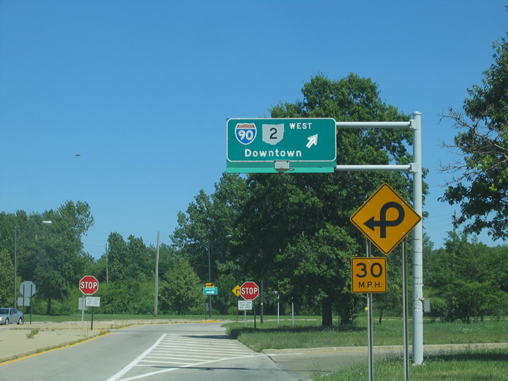
Interstate 90 turns north from Exit 143 along the Ohio Turnpike and combines with SR 2 through north Elyra. The two routes overlap east through Sheffield, Avon and into Cuyahoga County at the city of Westlake. Following the Northwest Freeway, I-90/SR 2 part ways in Rocky River.
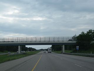
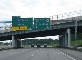
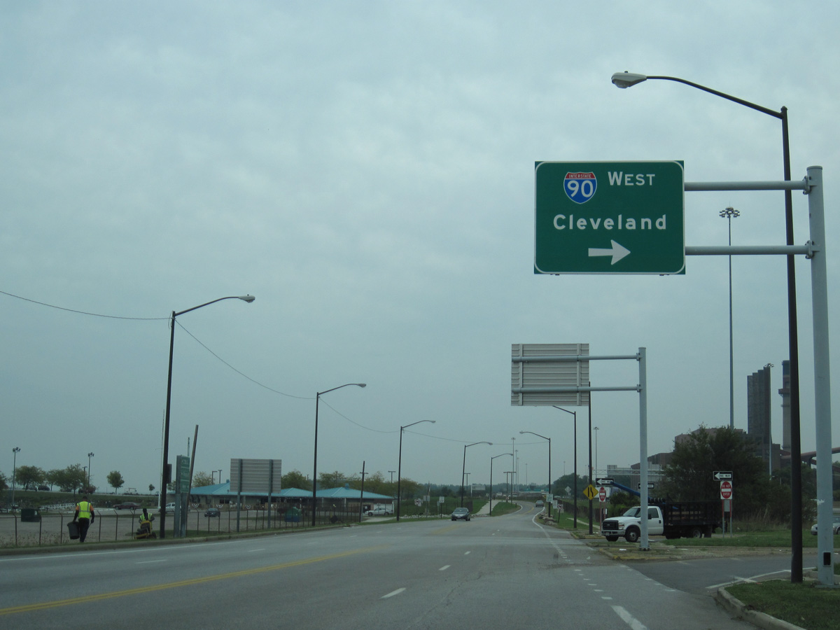
Continuing through southwest Lakewood, Interstate 90 (Northwest Freeway) enters the city of Cleveland at the Kamms Corners neighborhood. I-90 advances through the Cudell, Detroit Shoreway and Ohio City neighborhoods to a four level interchange with I-71 south and I-490 east. I-90 turns north onto the Innerbelt Freeway, spanning the Cuyahoga River across the George V. Voinovich Bridge. Encircling Downtown, I-90 meets the north end of I-77 and then reconvenes with SR 2 (Cleveland Memorial Shoreway) at a compact trumpet interchange locally known as "Deadman's Curve".
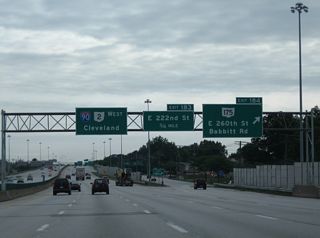
Paralleling the Lake Erie shoreline, I-90 overlaps with SR 2 to North Collinwood in Cleveland and the city of Euclid. SR 2 splits with I-90 along the Lakeland Freeway to Willowwick and Eastlake while I-90 curves southeast to Wickliffe and Interstate 271 in the city of Willoughby Hills.
Continuing east through Lake County, I-90 passes south of Mentor and Painesville, transitioning into a rural freeway to Ashtabula County. Connecting Geneva, Ashtabula and Conneaut, I-90 runs 28.69 miles through Ohio's northeastern most County en route to Erie, Pennsylvania.
E 55th Street extends a half mile north from SR 283 and St. Clair Avenue to a parclo interchange (Exit 175) with I-90/SR 2 at the St. Clair neighborhood in Cleveland.
09/30/10
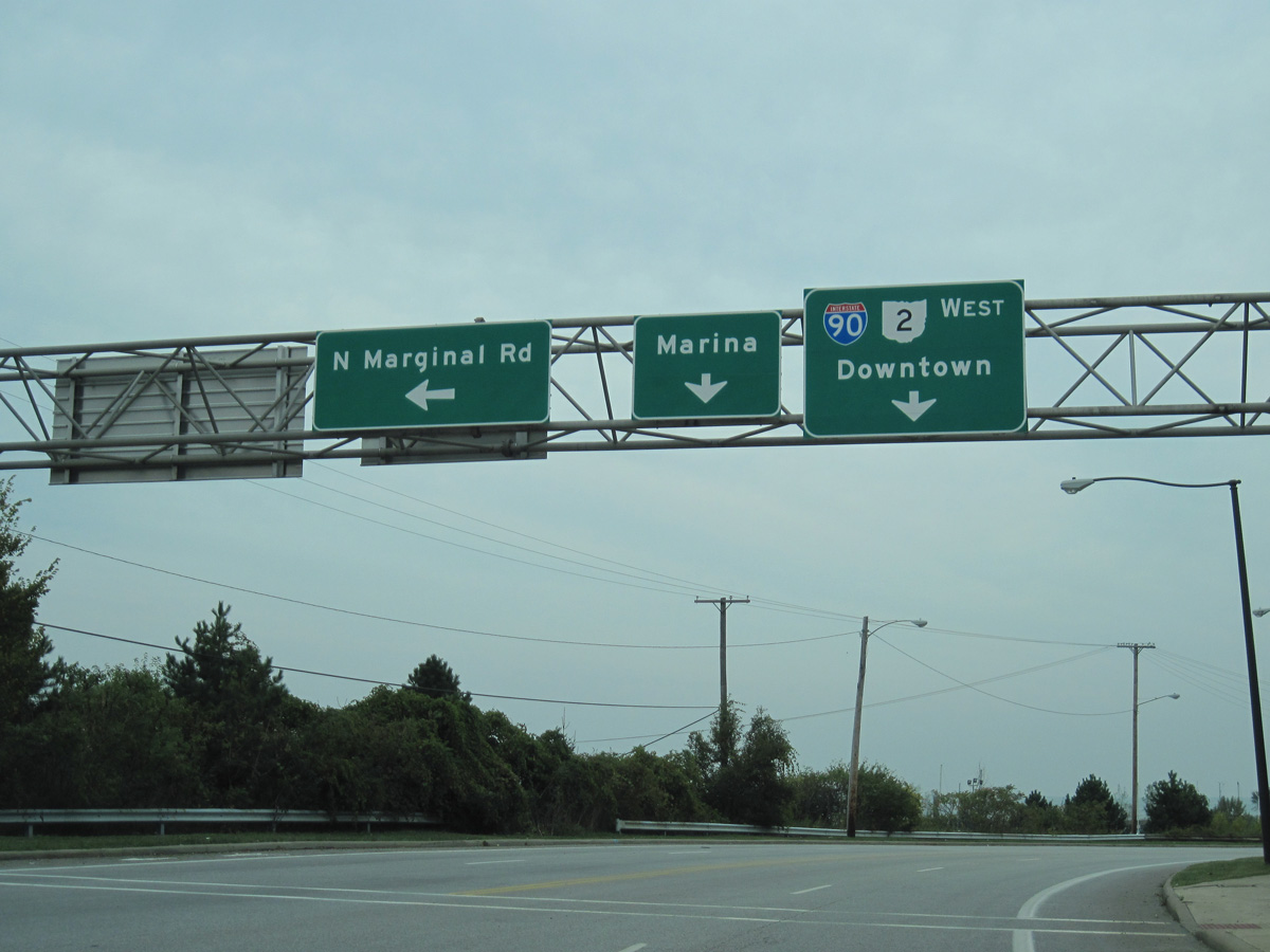
E 55th Street north becomes N Marginal Road east ahead of the entrance ramp for I-90/SR 2 westbound. N Marginal Road runs along the north side of I-90/SR 2 west to Cleveland Burke Lakefront Airport (BKL).
09/30/10
Dr. Martin Luther King, Jr. Drive north connects with I-90/SR 2 at N Marginal Road and Gordon Park in the Glenville neighborhood of Cleveland.
08/10/06
Photo Credits:
- ABRoads: 09/30/10
- Justin Cozart: 08/10/06
Connect with:
Page Updated Sunday March 24, 2024.