
Highway 48

A 29 mile long route, South Carolina Highway 48 runs west from U.S. 601 at Wateree to Gadsden and Interstate 77 along the industrial south side of Columbia. S.C. 48 follows Assembly Street north from Bluff Road by the University of South Carolina (USC) campus to the South Carolina State Capitol, Downtown Columbia and U.S. 21-76-176-321 on Elmwood Avenue.
 East
East
S.C. 48 is unmarked along Assembly Street south from U.S. 21/76/176/321 (Elmwood Avenue).
11/21/21
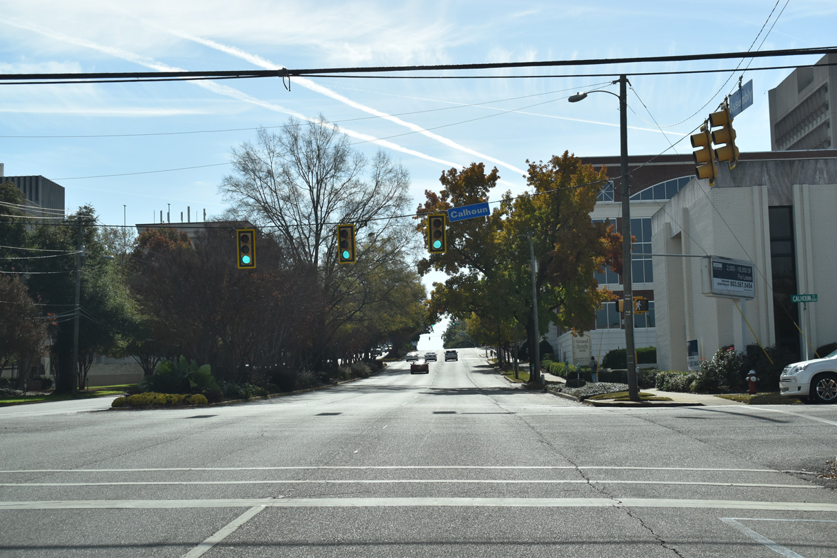
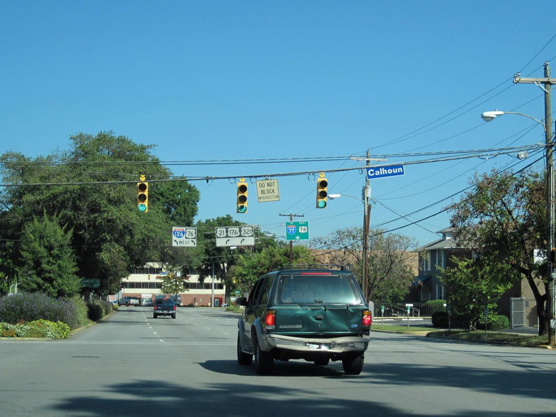
Advancing toward Downtown Columbia, S.C. 48 (Assembly Street) east first intersects Calhoun Street.
11/21/21
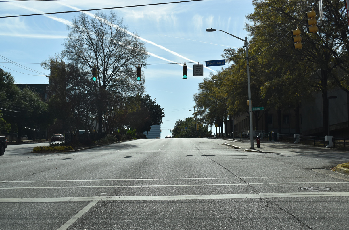
Assembly Street south at Richland Street.
11/21/21
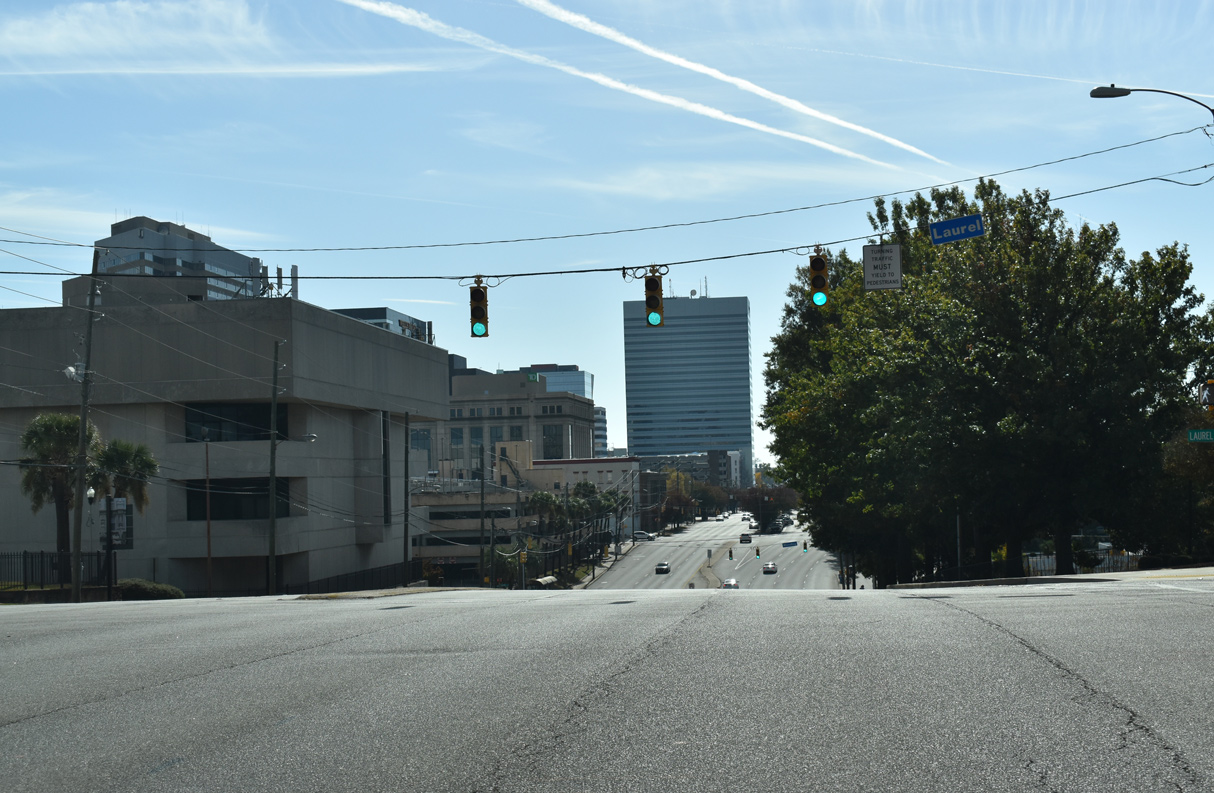
Laurel Street intersects Assembly Street just west of Columbia City Hall by Finlay Park.
11/21/21
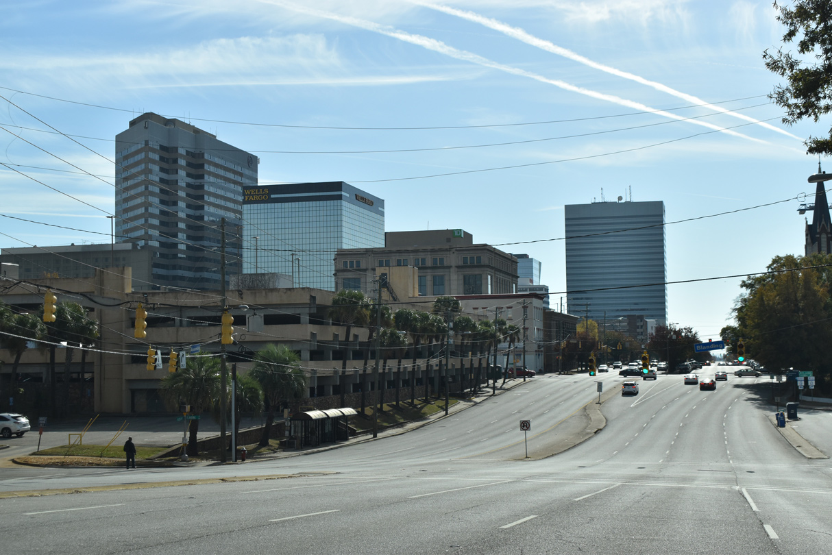
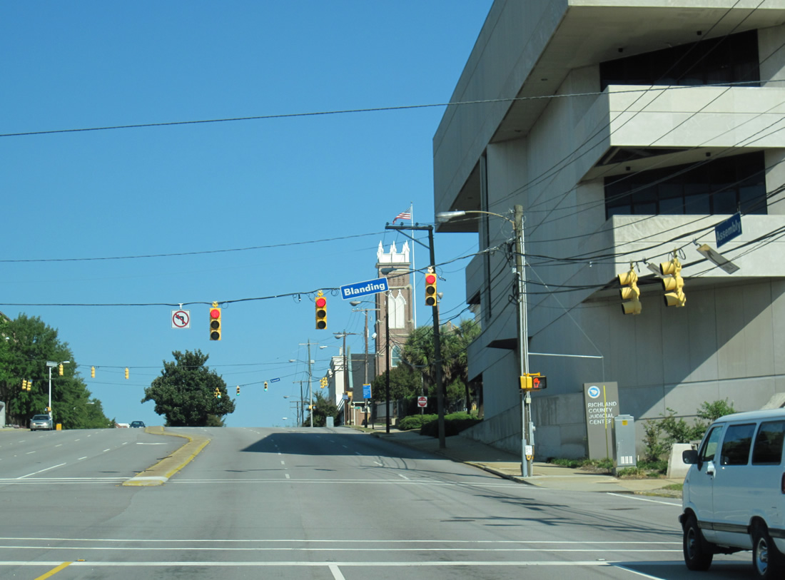
S.C. 48 (Assembly Street) east next intersects Blanding Street.
11/21/21
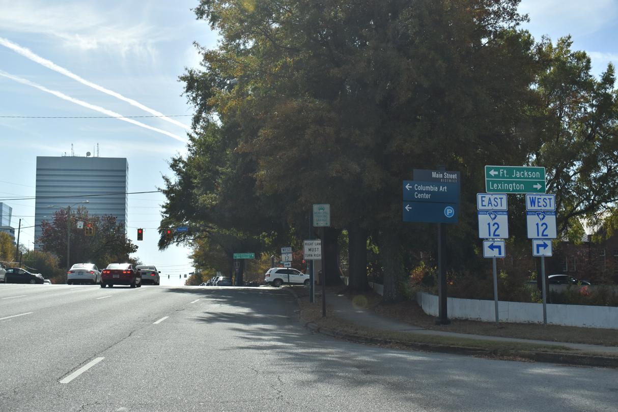
S.C. 48 (Assembly Street) meets S.C. 12 (Taylor Street) by the Main Street District. S.C. 12 leads east from Downtown Columbia to Forest Acres and Fort Jackson.
11/21/21
One block west of Assembly Street, S.C. 12 separates into a couplet along Taylor Street west and Hampton Street east. Beyond Williams Street, S.C. 12 spans the Congaree River along a Jarvis Klapman Boulevard, an urban expressway into West Columbia.
11/21/21
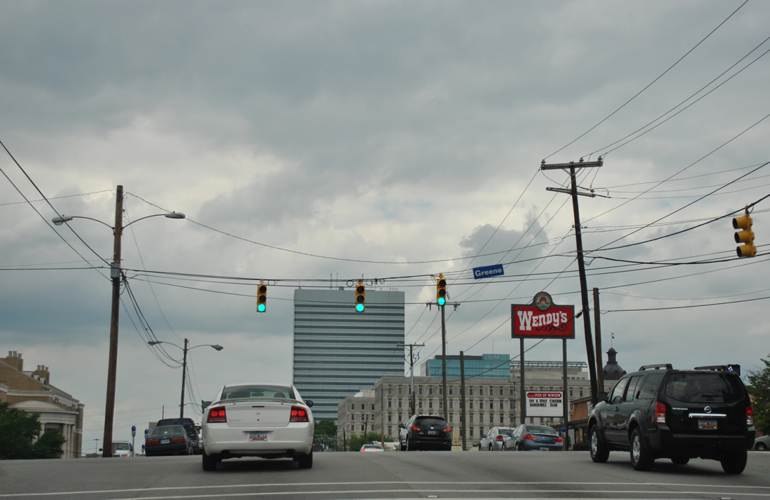
S.C. 48 (Assembly Street) intersects Blossom Street (unsigned U.S. 21 Connector) by the Carolina Coliseum. Blossom Street leads west to Cayce and east to Five Points. The multi lane boulevard is the main route to the USC campus.
04/14/12
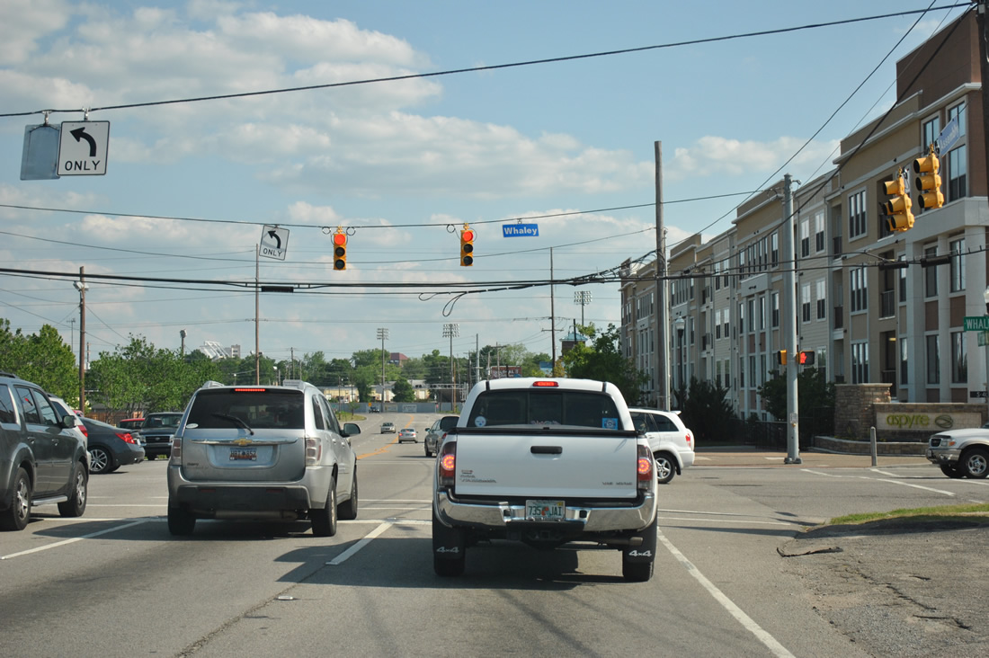
Assembly Street continues south by the University of South Carolina campus to the signalized intersection with Whaley Street.
04/14/12
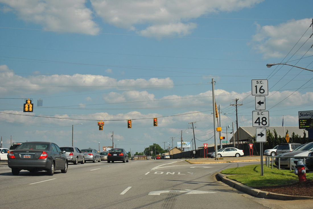
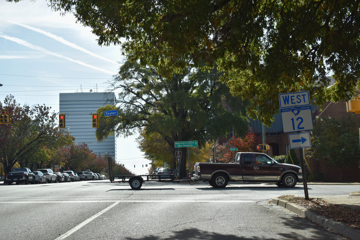
Turning southeast at the site of Capital City Stadium, S.C. 48 (Assembly Street) advances to S.C. 16 (Rosewood Drive) and George Rogers Boulevard at the South Carolina State Fairgrounds. S.C. 16 loops around Columbia from S.C. 48 to U.S. 176 (River Drive).
04/14/12

Williams-Brice Stadium, home of USC Gamecocks football, rises along the east side of Bluff Road. S.C. 48 takes Bluff Road south from Rosewood Drive to Gadsden.
04/14/12
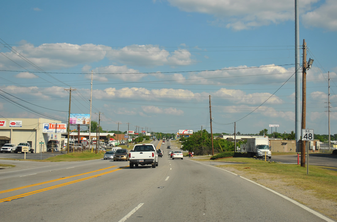
Reassurance marker posted along Bluff Road south at Eden Street. Industrial businesses line the arterial southeast from the stadium area to Abbott Road.
04/14/12
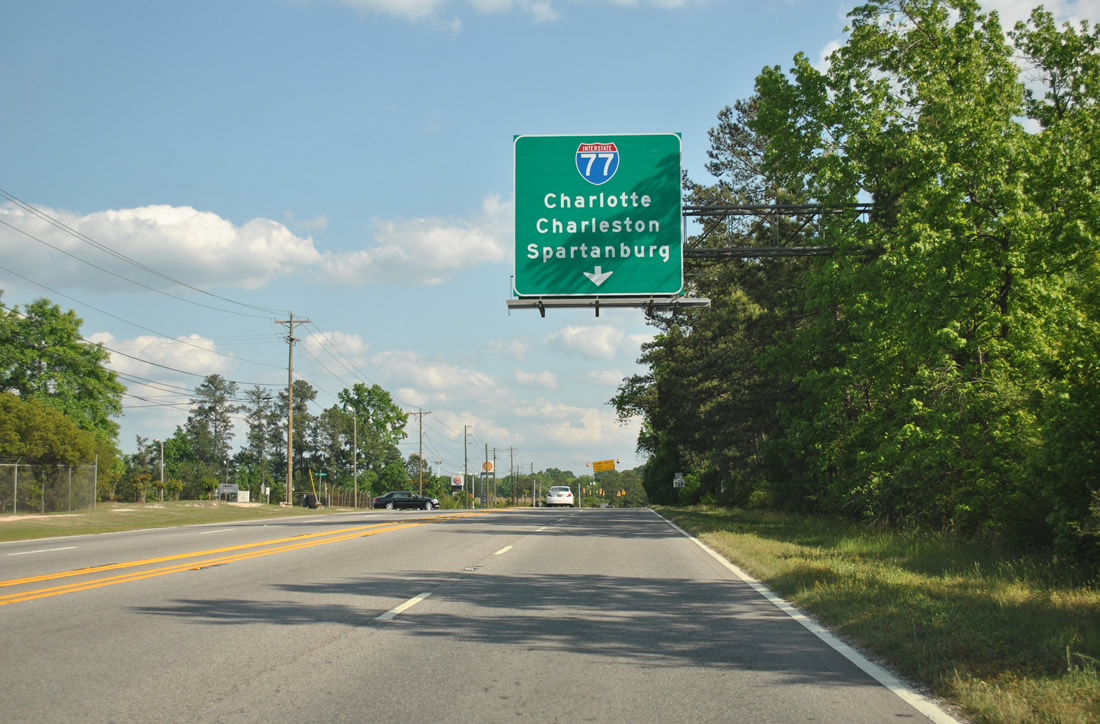
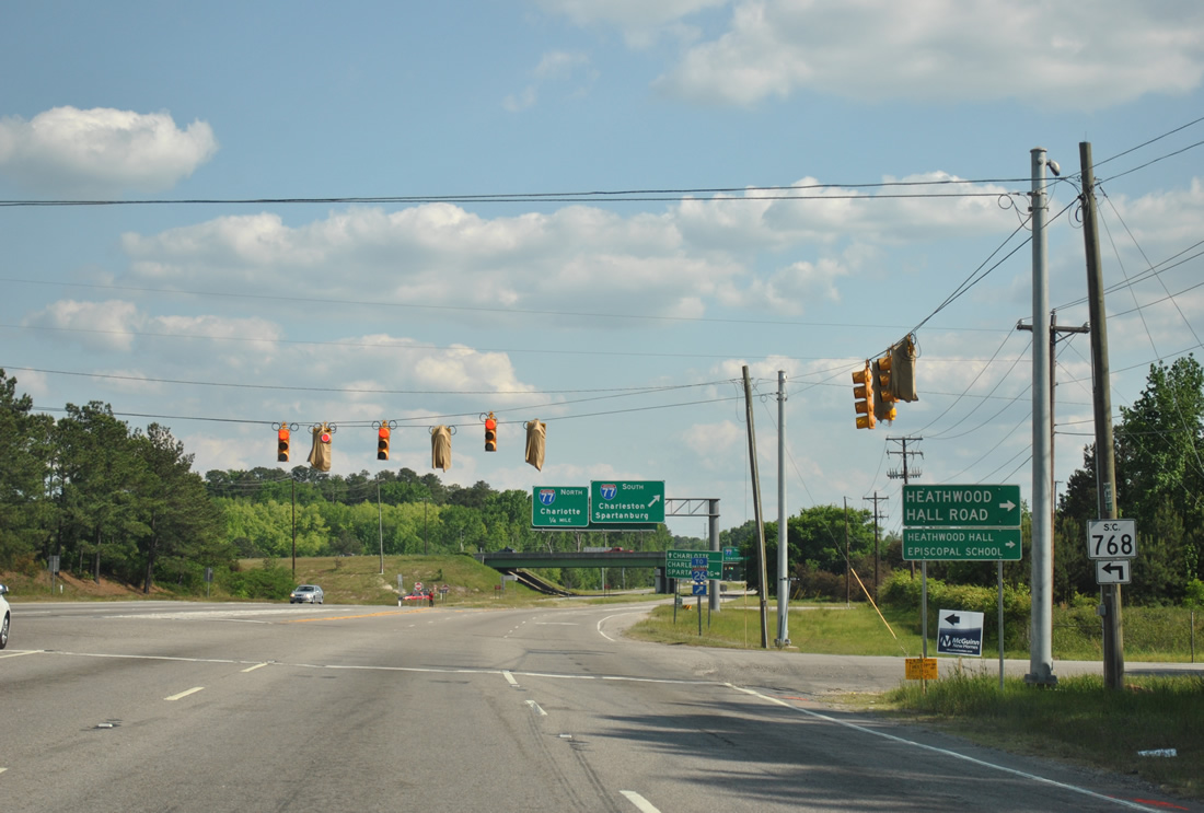
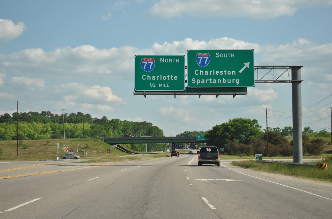
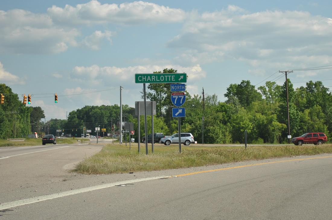
A six-ramp parclo interchange joins Interstate 77 and S.C. 48 (Bluff Road).
04/14/12
Interstate 77 follows the Southeastern Beltway around Columbia from near Pine Ridge to Fort Jackson and Dentsville.
04/14/12
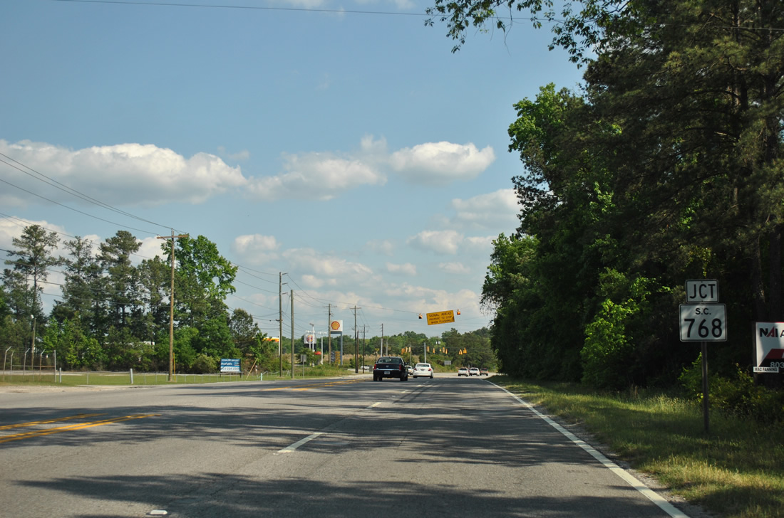
S.C. 768 stems east along S Beltline Boulevard from S.C. 48 (Bluff Road) to Shop Road. Shop Road continues the route southeast to Pineview Road east.
04/14/12
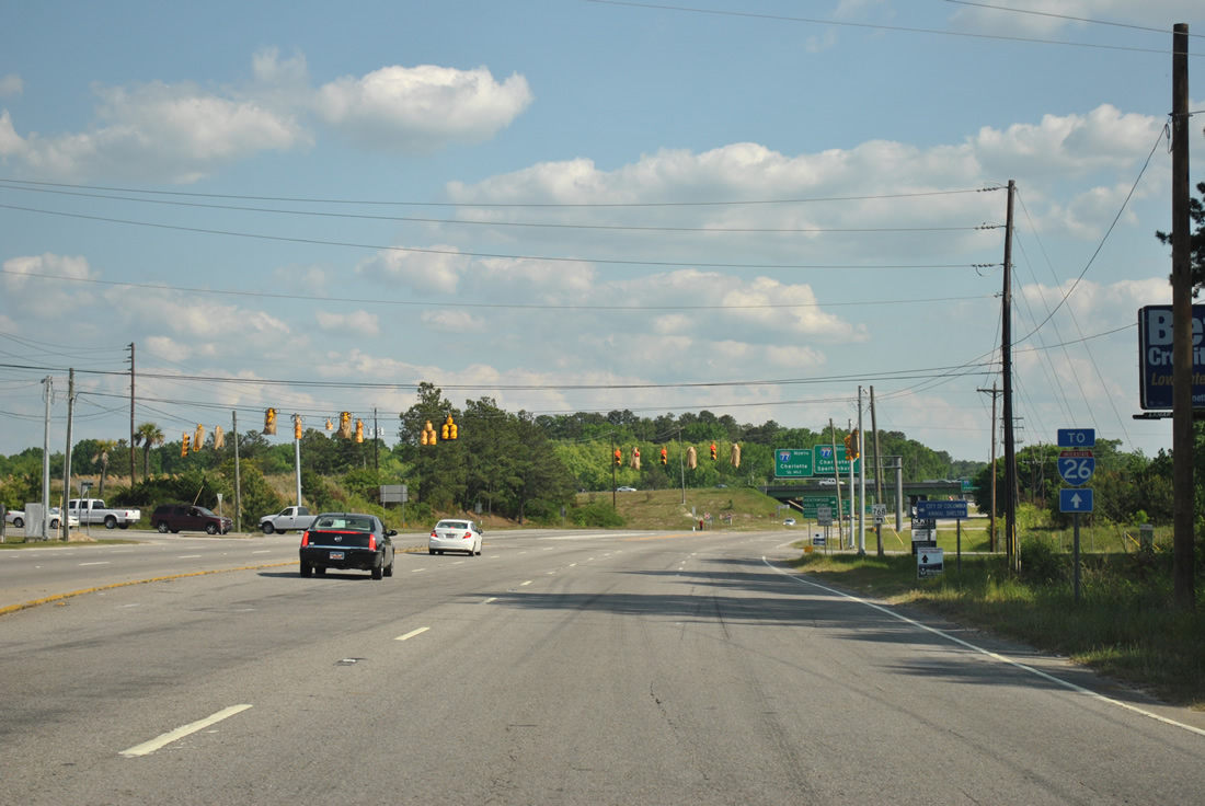
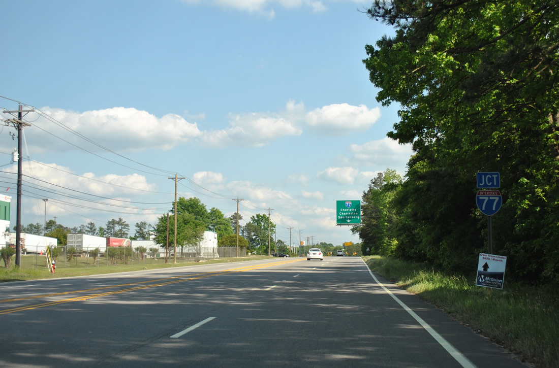
An Interstate 26 trailblazer precedes S Beltline Boulevard, directing motorists to I-77 for the freeway north to Spartanburg and south to Charleston.
04/14/12
S.C. 768 runs 4.8 miles east from S.C. 48 (Bluff Road) at Beltline Boulevard to U.S. 76/378 (Garners Ferry Road).
04/14/12
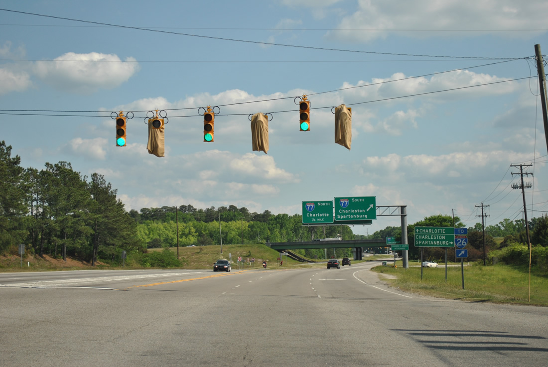
The right lane defaults onto Interstate 77 south across the Congaree River to I-26 at south Cayce.
04/14/12
I-77 ends 5.7 miles to the west at U.S. 21-176-321 (Charleston Highway). Interstate 26 continues the Capital Beltway system north from there to West Columbia.
04/14/12
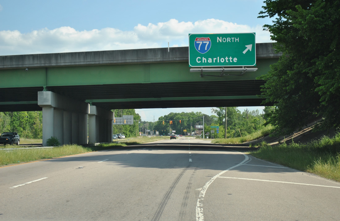
A loop ramp follows onto Interstate 77 north for Rock Hill and Charlotte, North Carolina.
04/14/12
Interstate 77 meets S.C. 768 (Shop Road) next before turning northward to Fort Jackson.
04/14/12
West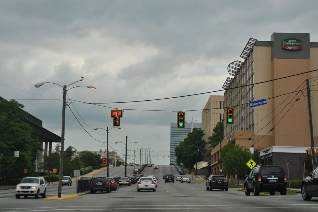
Blossom Street (unsigned U.S. 21 Connector) provides the main route through the University of South Carolina campus from the Five Points area of Columbia to the east and Cayce to the west.
04/15/12
S.C. 48 passes by the Carolina Coliseum between Blossom Street and the traffic light with Greene Street. Colonial Life Arena replaced the coliseum, two blocks to the west on Greene Street, as the main home for South Carolina Gamecocks basketball when it opened in 2002.
04/15/12
College Street travels four blocks between Lincoln Street and the Colonial Life Arena to Sumter Street at The Horseshoe green.
04/15/12
Pendleton Street lines the south side of the South Carolina State Government complex east from S.C. 48 (Assembly Street) to the University of South Carolina.
04/15/12

S.C. 48 (Assembly Street) passes by the South Carolina Capitol Complex between Senate Street and U.S. 1/378 (Gervais Street).
04/15/12
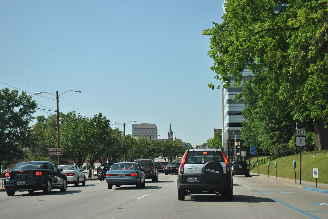
U.S. 1/378 overlap along Gervais Street east to Millwood Avenue and west across the Gervais Street Bridge into West Columbia. U.S. 76 joins the four lane boulevard four blocks to the east from Bull Street.
04/14/12
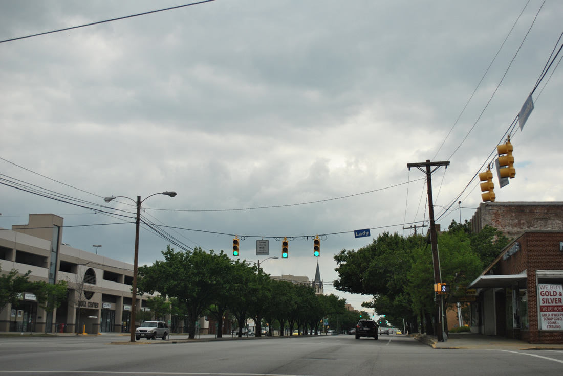
Lady Street parallels U.S. 1/378 one block to the north between Huger Street (U.S. 21-176-321) and Pickens Street.
04/15/12
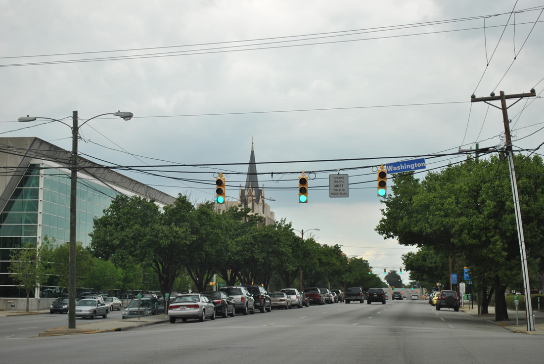
Traffic lights line Assembly Street north at every intersection through the Columbia central business district. This set of signals operates at Washington Street.
04/15/12
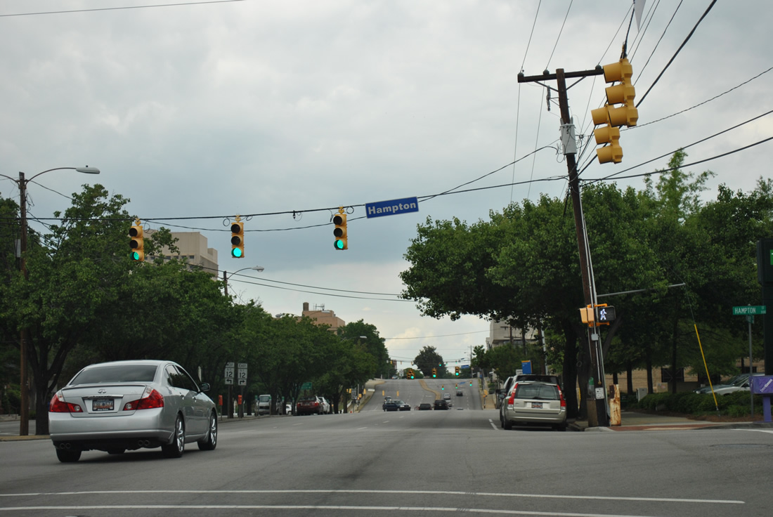
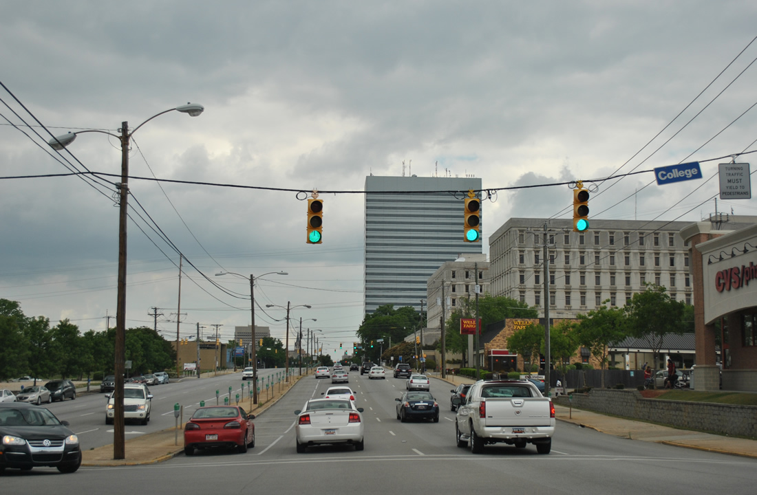
Hampton Street doubles as S.C. 12 east from Williams Street to S.C. 48 (Assembly Street) north. S.C. 12 west follows Taylor Street.
04/15/12
One block removed from the unsigned split of S.C. 12 east onto Taylor Street from S.C. 48 (Assembly Street) north at Blanding Street.
10/03/10
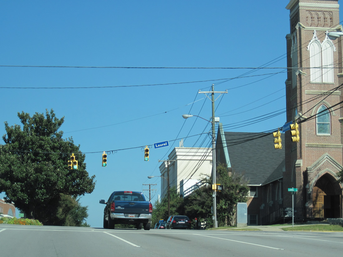
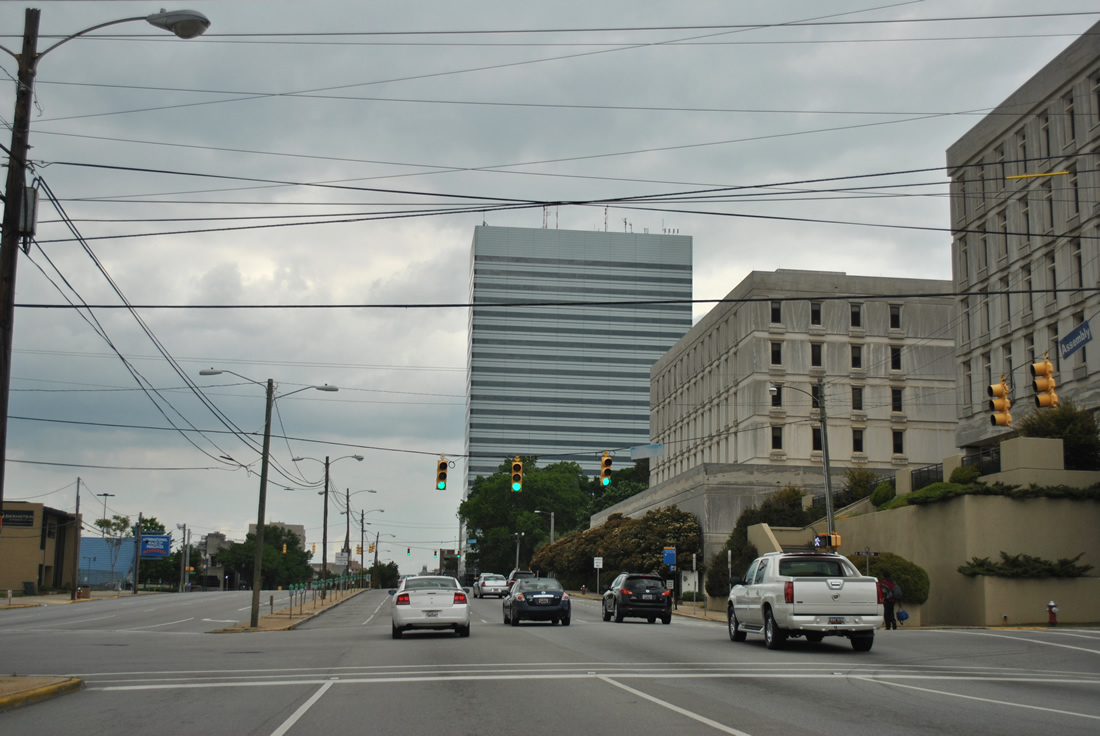
S.C. 48 (Assembly Street) rises from Blanding Street to Laurel Street next. Laurel Street leads west by Finlay Park to the Columbia Water Treatment Plant and east to U.S. 1 (Two Notch Road) and Sisters of Charity Providence Hospital.
10/03/10
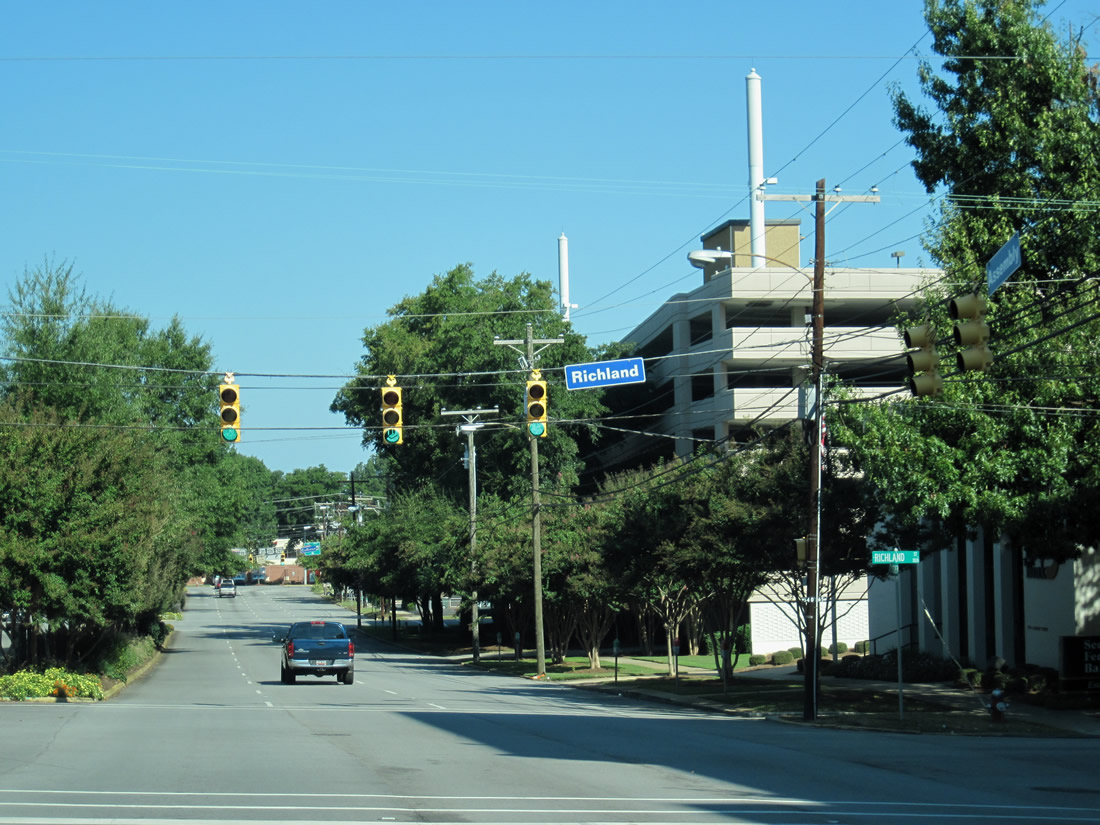
Richland and Calhoun Streets round out the downtown area intersections of Assembly Street (S.C. 48) north. S.C. 48 is essentially an unsigned route northbound throughout downtown.
10/03/10

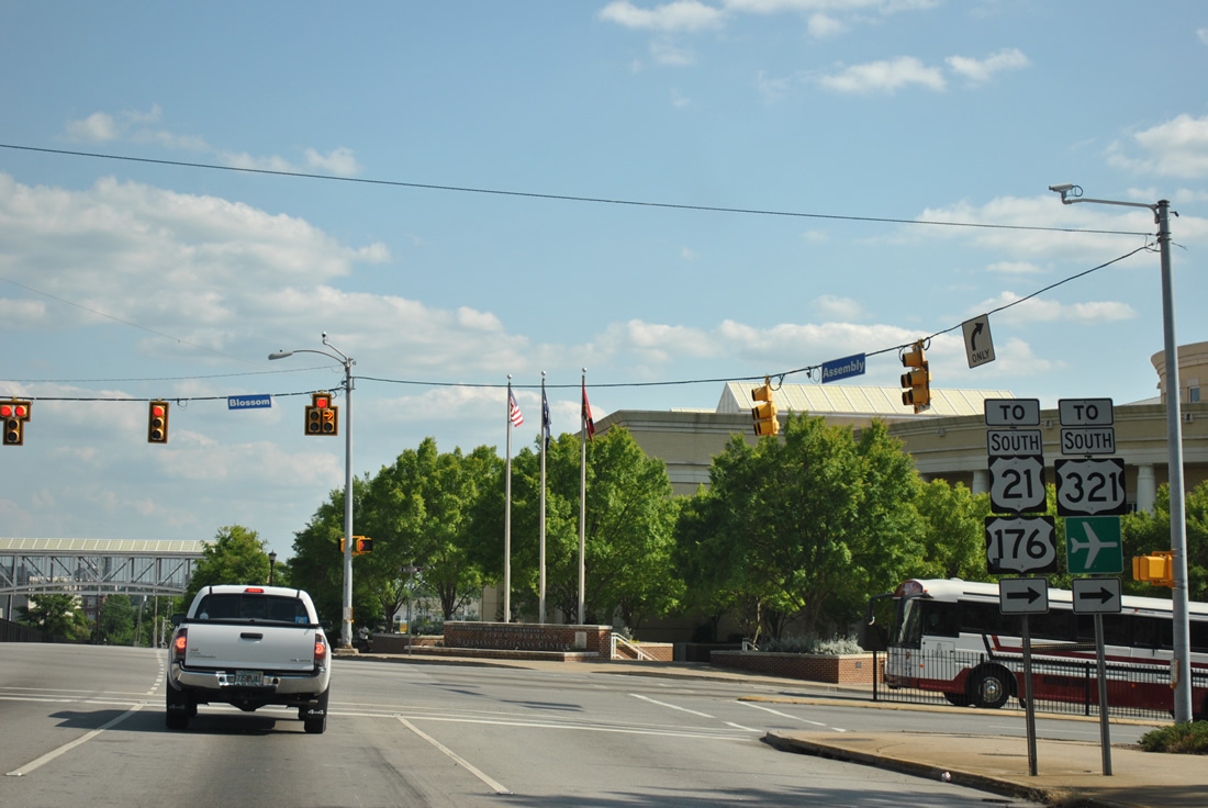
S.C. 48 ends at Elmwood Avenue, which is part of U.S. 21/76/176/321 and Business Spur I-126 west. Chester and Rock Hill are referenced for U.S. 21/321 leading north from Columbia.
10/03/10
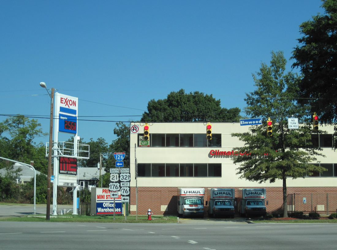
U.S. 21-176-321 turn north from Elmwood Avenue onto Main Street, one block to the east. U.S. 76 continues another three blocks east to S.C. 277 and Bull Street south. Westward the five routes meet Interstate 126 in four blocks.
10/03/10
Photo Credits:
- ABRoads: 10/03/10, 11/21/21
- AARoads: 04/14/12, 04/15/12
Connect with:
Page Updated Thursday December 30, 2021.