
U.S. 12 East
 East - Yakima
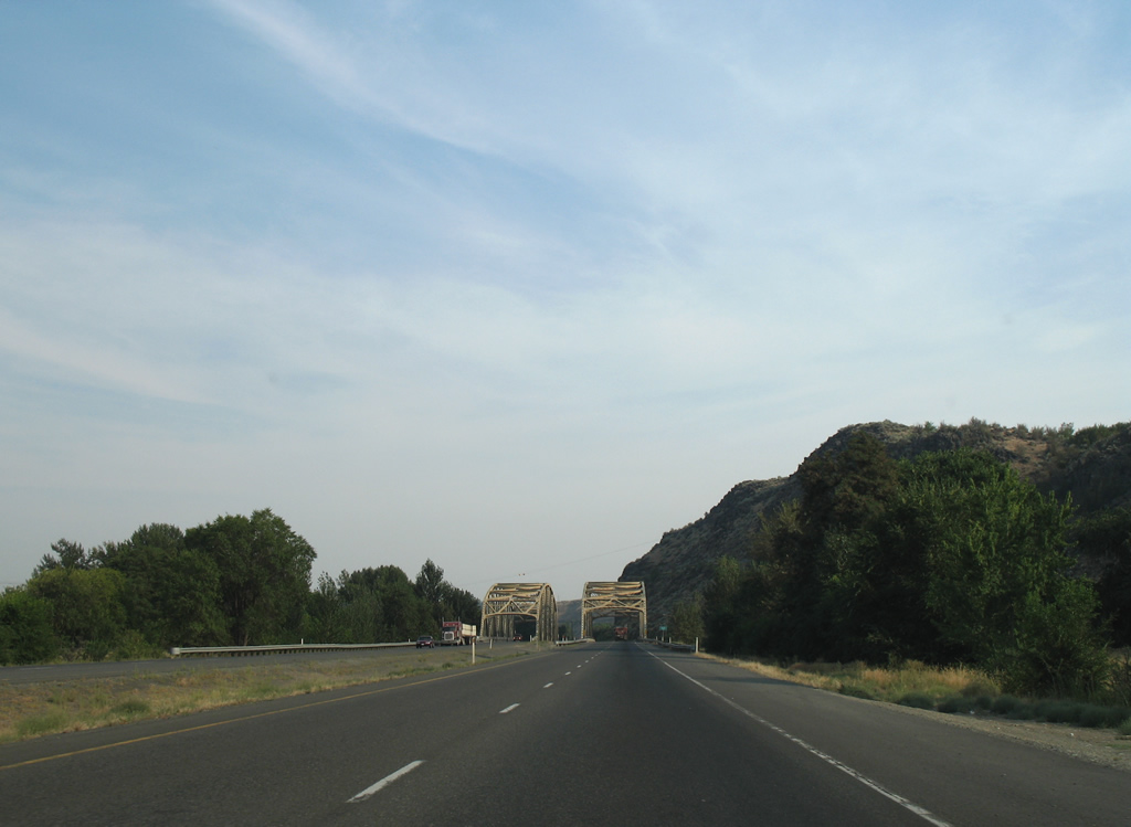
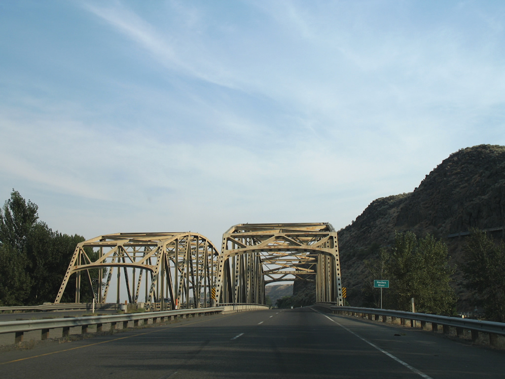
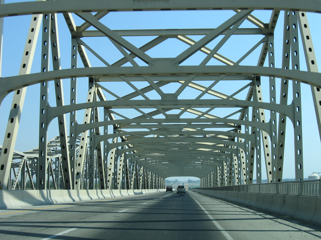
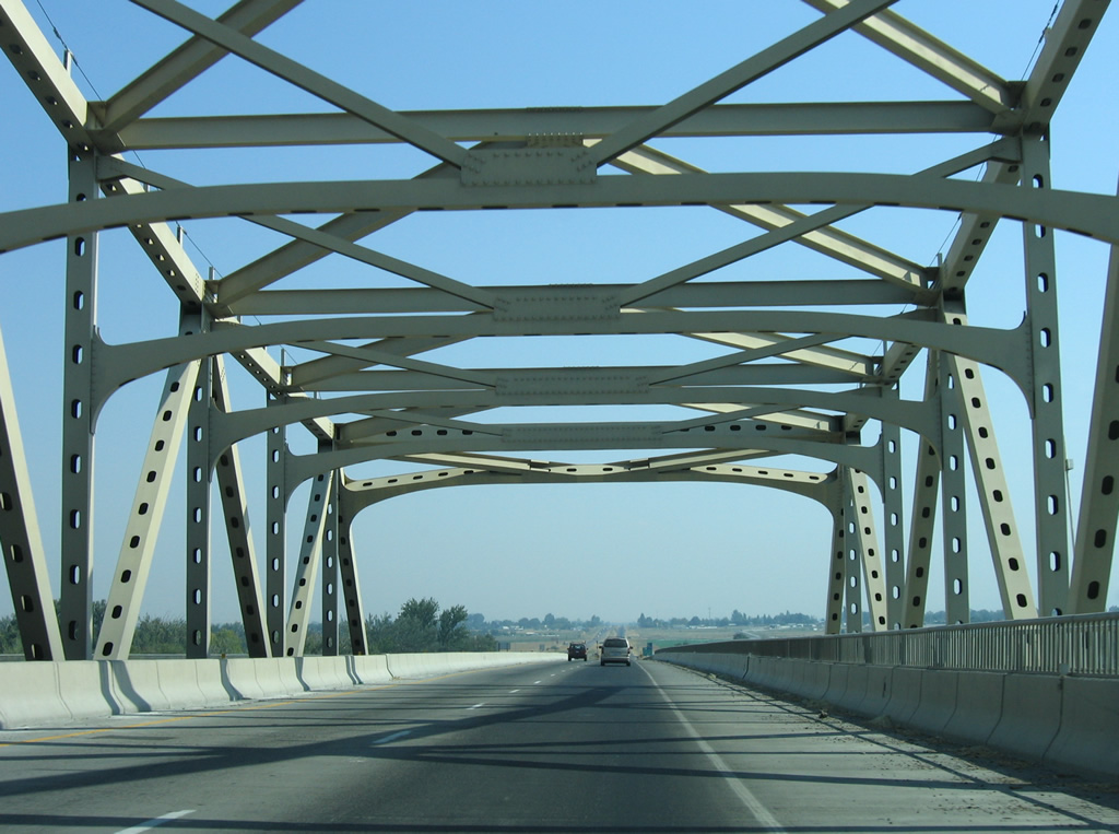
U.S. 12 travels an expressway southeast from Naches into the Yakima vicinity. The four lane highway sees a 60 mph speed limit and approaches a pair of steel truss bridges over the Naches River east of Powerhouse Road and Ramblers Park.
08/28/06
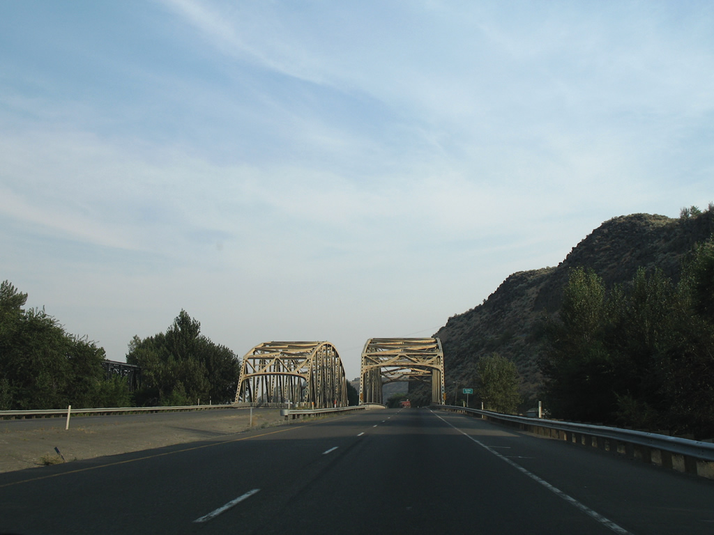
The truss bridges over the Naches River were built when the expressway was still numbered as U.S. 410. The older westbound span was constructed in 1958; the eastbound span dates from 1966.
08/28/06
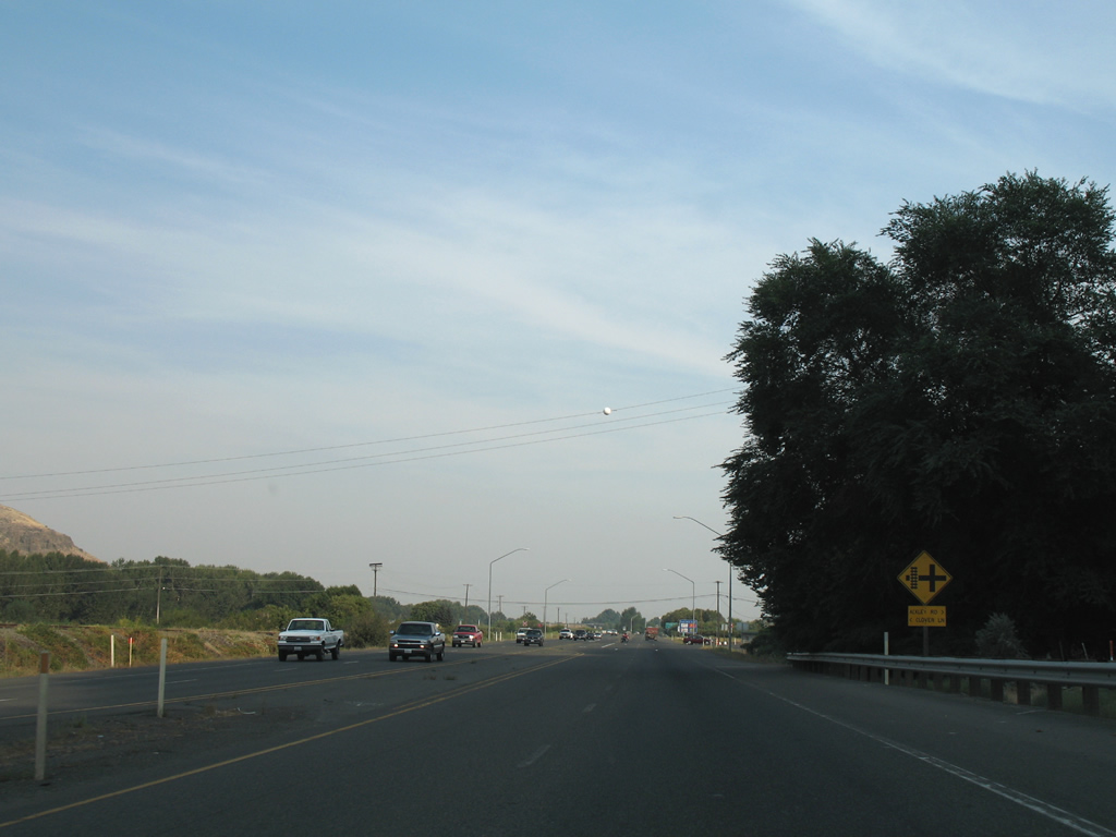
Ackley Road and Clover Lane come together at the west end of the freeway portion of U.S. 12 through Yakima. Ackley Road connects with parallel Powerhouse Road adjacent to Cowiche Canyon.
08/28/06
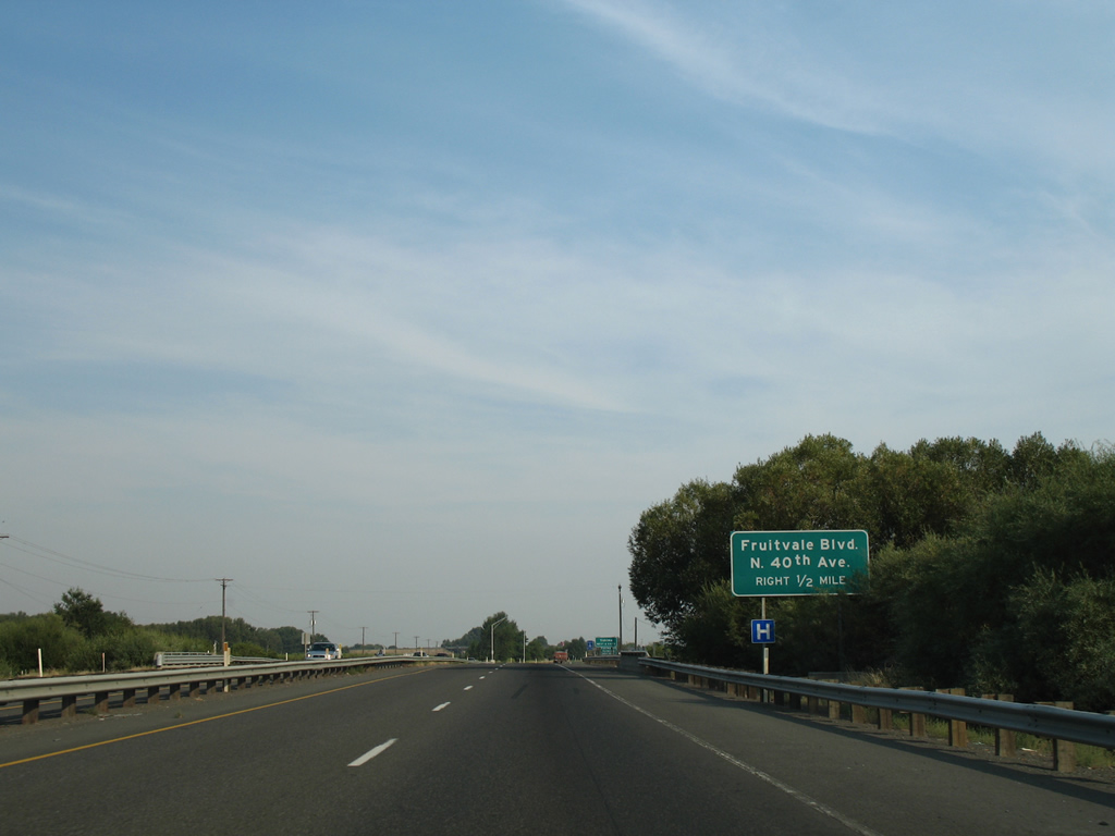
U.S. 12 enters the city of Yakima on the half mile approach to the wye interchange with Fruitvale Boulevard east to North 40th Avenue. This is the first of six interchanges for the city when added to the I-82/U.S. 12 exits east of the city center.
08/28/06
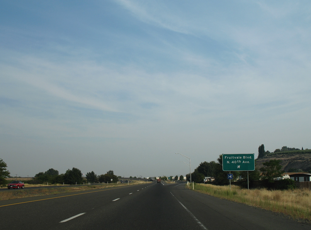
Fruitvale Boulevard angles southeast from the U.S. 12 freeway to North 5th Avenue. North 40th Avenue stems south from an adjacent wye interchange to Washington Avenue near Yakima Air Terminal (YKM).
08/28/06
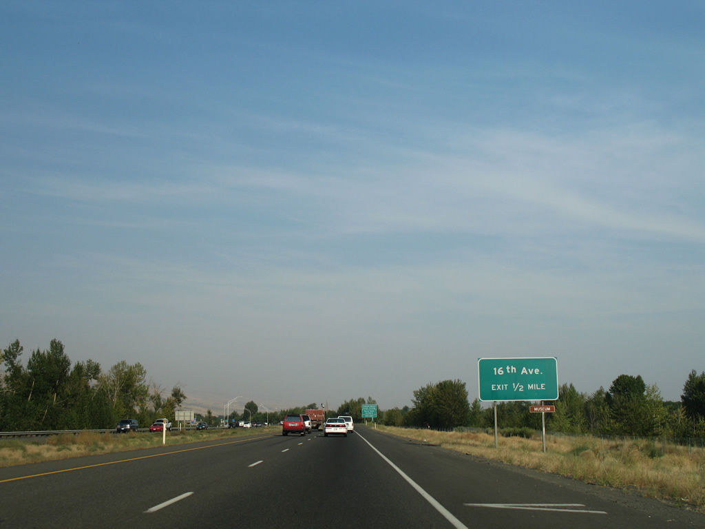
Eastbound travelers parallel the Naches River and man made ponds associated with the waterway to a diamond interchange with North 16th Avenue.
08/28/06
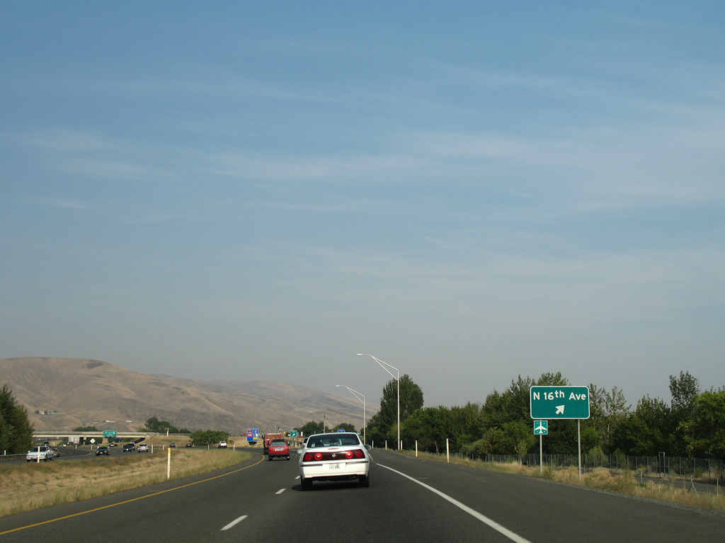
North 16th Avenue begins at the U.S. 12 freeway and ventures south to Yakima Valley Community College and Yakima Air Terminal near Perry Technical Institute. The road south end was realigned onto a 2009-opened four lane extension of Valley Mall Boulevard.
08/28/06
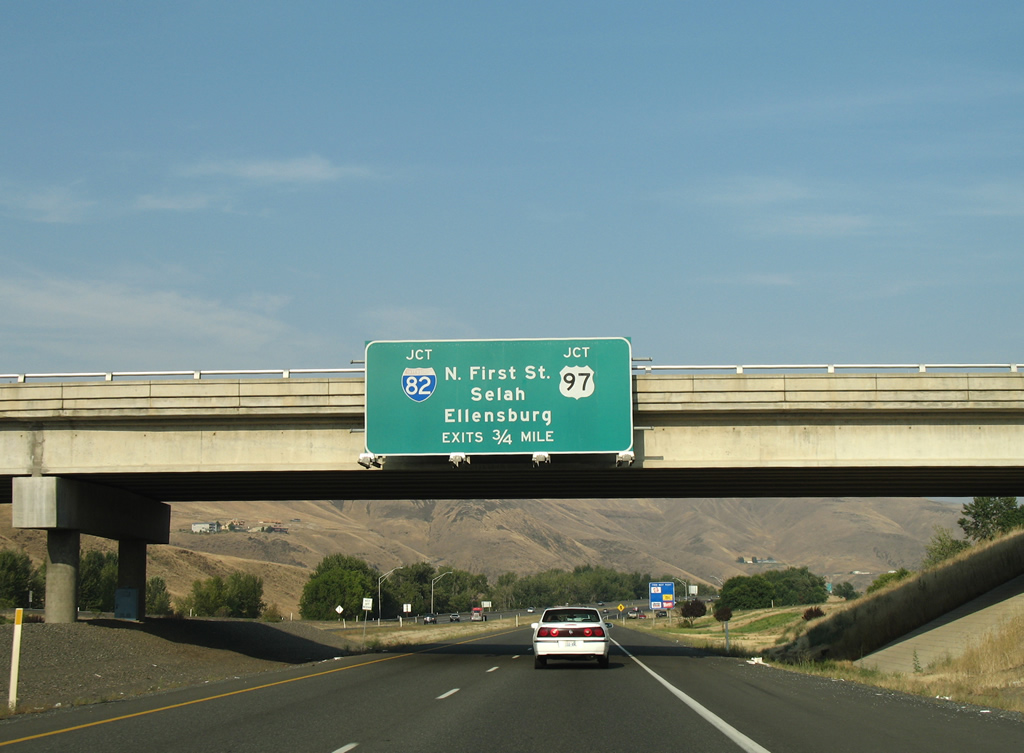
U.S. 12 continues east 0.75 miles to merge with Interstate 82 east & U.S. 97 south to Union Gap. North 1st Street (former U.S. 97 and Business Loop I-82) ties into the exchange opposite the south end of SR 823 from Selah.
08/28/06
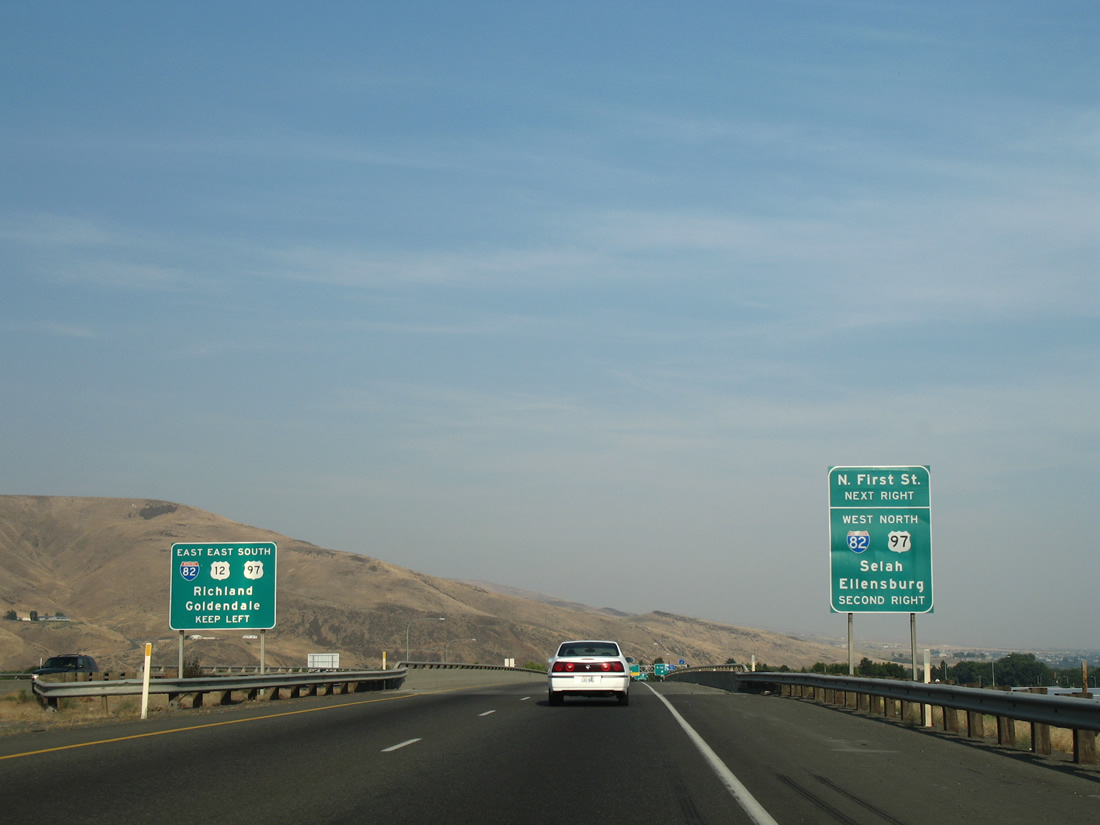
A parclo interchange first joins the U.S. 12 freeway with North 1st Street south to the Yakima city center. Wye interchanges follow with the respective directions of I-82/U.S. 97.
08/28/06
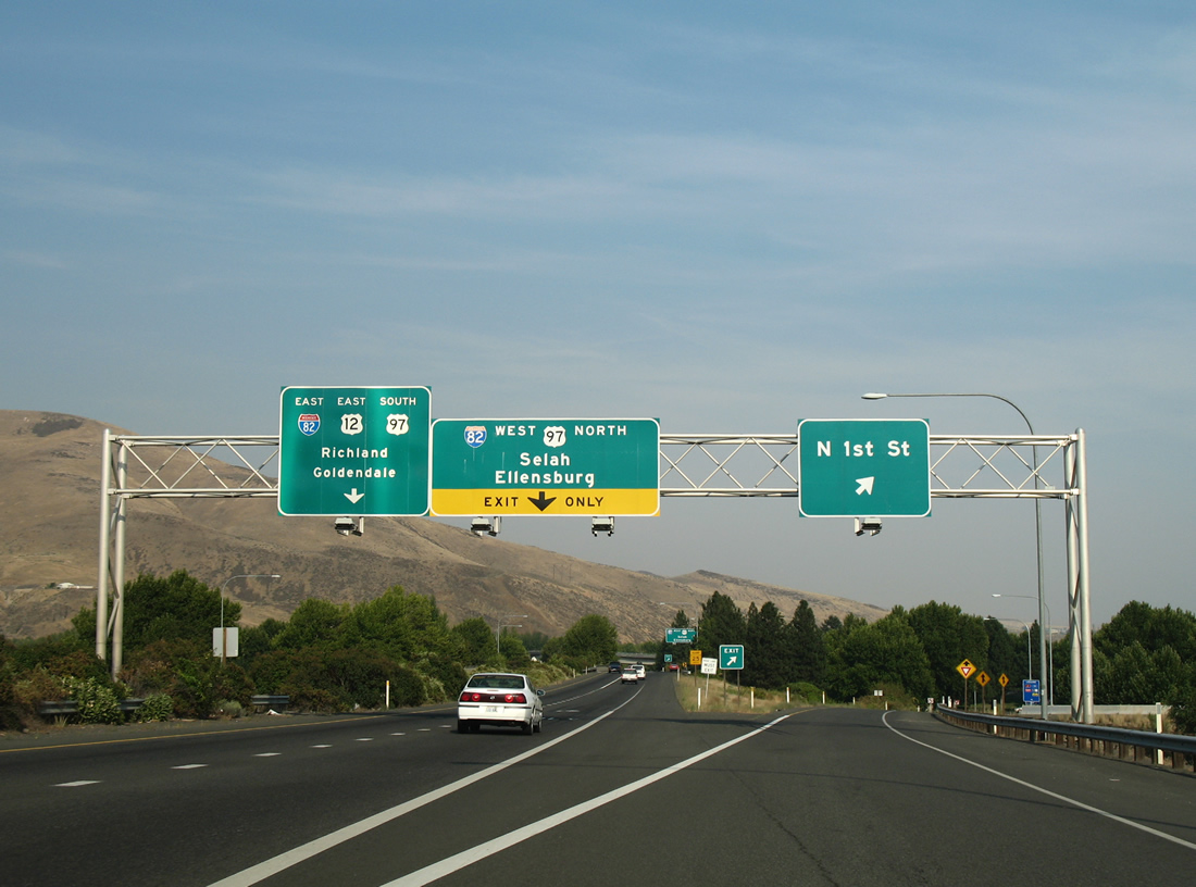
The ramp to North 1st Street drops down from U.S. 12 east ahead of the loop ramp onto the 1st Street ramp to Interstate 82 west & U.S. 97 north for Ellensburg. Access is not permitted to SR 823 from U.S. 12 east.
08/28/06
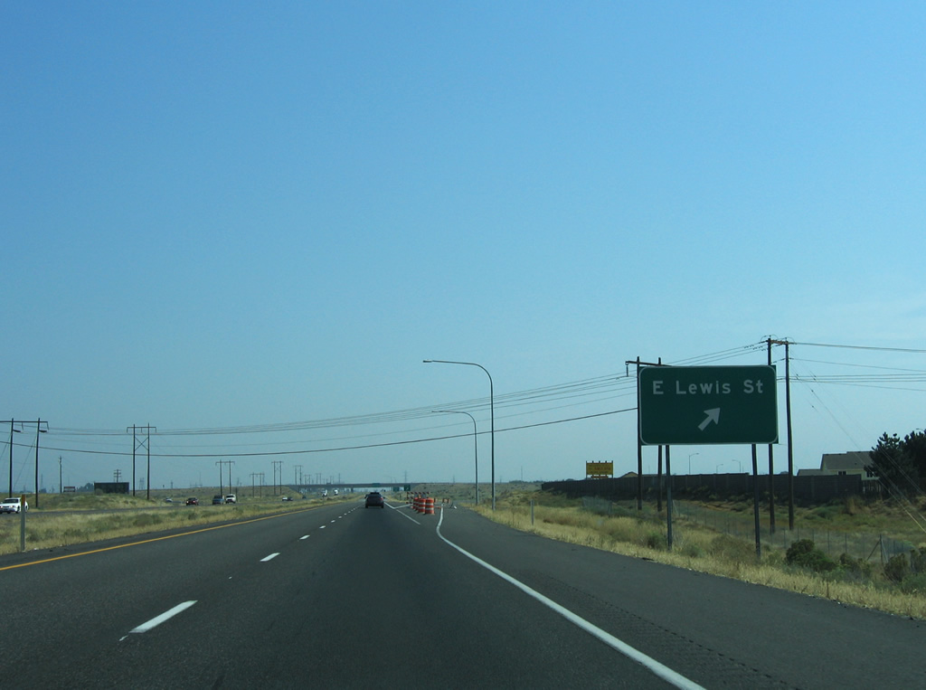
U.S. 12 eastbound traffic parts ways with the East Lewis Street off-ramp to the Pasco city center.
08/28/06
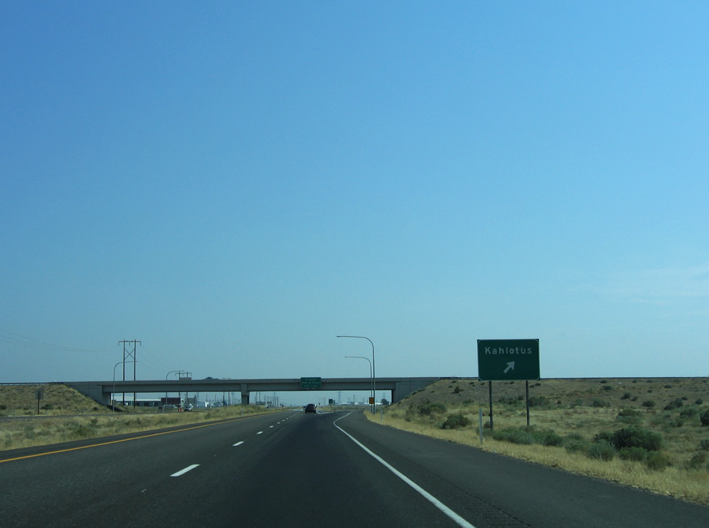
A loop ramp connects U.S. 12 east with Pasco-Kahlotus Road north. Lewis Street and Pasco-Kahlotus Road originally met U.S. 12 at an at-grade intersection further south, but were relocated when Interstate 182 was built.
08/28/06
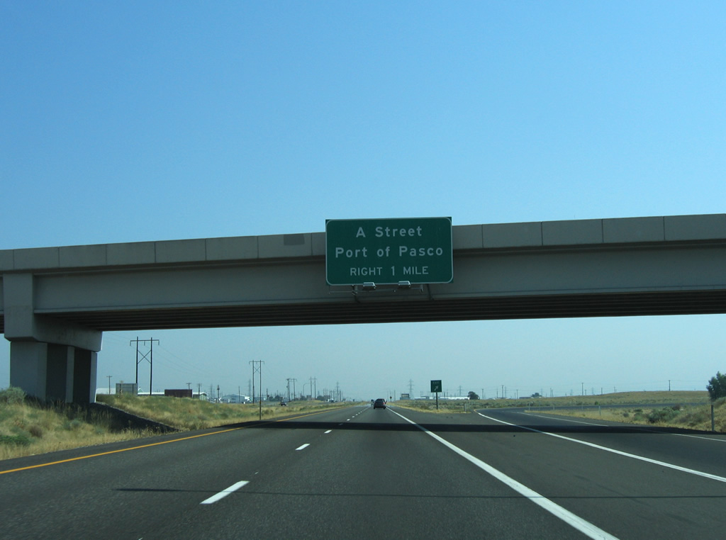
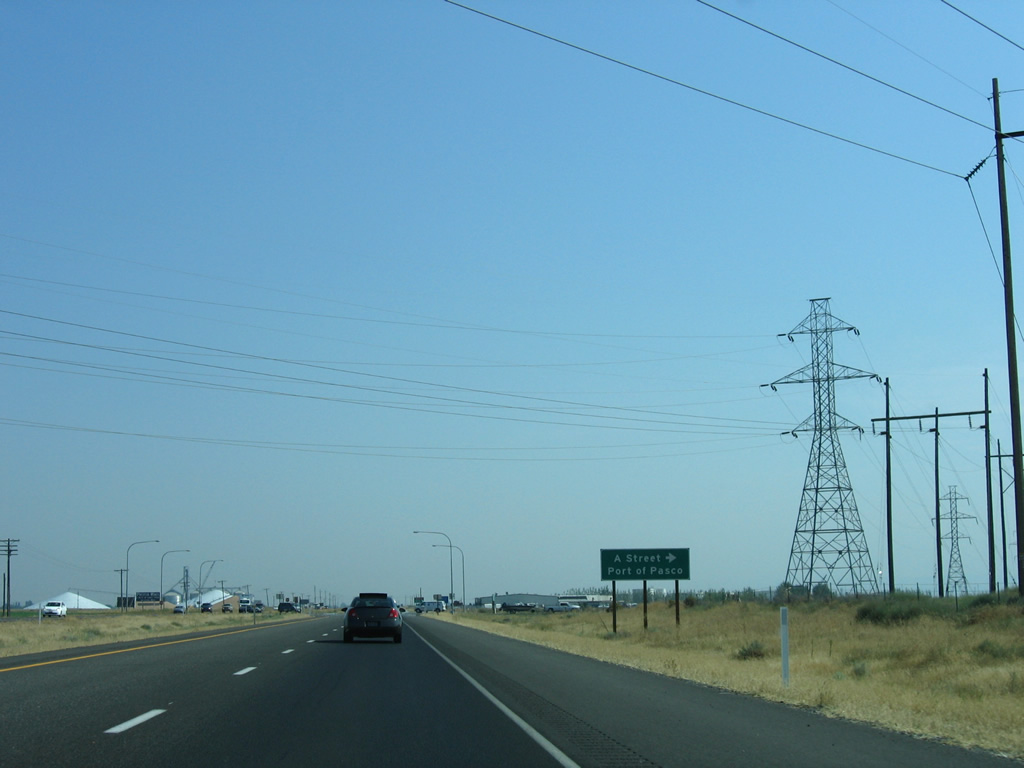
East A Street travels west from the U.S. 12 freeway end to SR 397 (Oregon Avenue) near the Port of Pasco.
08/28/06
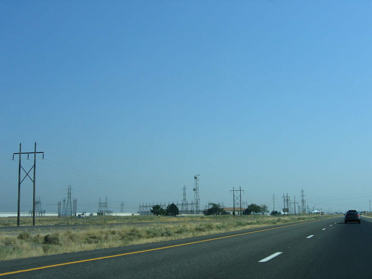
Lining the east side of the U.S. 12 freeway is the Franklin Substation.
08/28/06
An advisory sign ushers in the transition to expressway grade U.S. 12 from East A Street southeast to Burbank.
08/28/06
Presently an at-grade intersection joins U.S. 12 with East A Street west. A WSDOT study involves constructing a new folded diamond interchange with Tank Farm Road further south to handle movements both to it and A Street via a new local access road.
08/28/06
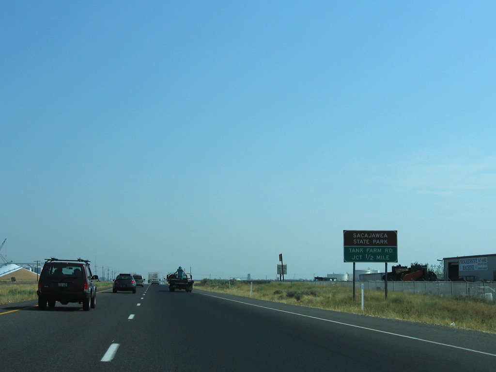
The next intersection joins U.S. 12 with Tank Farm Road north and Sacajawea Park Road south.
08/28/06
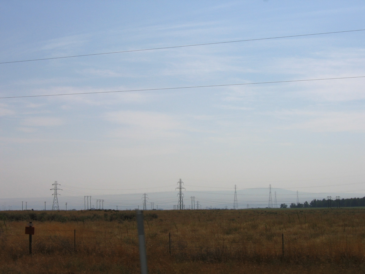
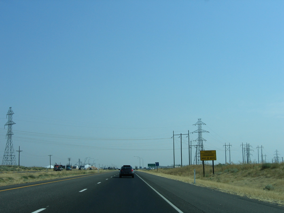
Transmission lines head south from the Franklin Substation across Sacajawea State Park and the Columbia River to McNary Dam.
08/28/06
Tank Farm Road spurs east to industrial storage tanks along the Columbia River. Sacajawea Park Road loops southward to Ainsworth Junction, the Port of Pasco and the state park.
08/28/06
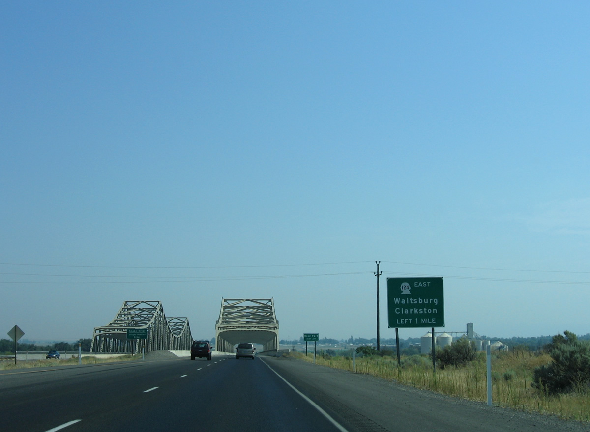
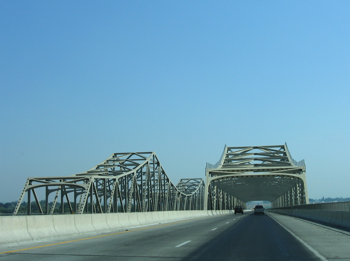
U.S. 12 continues east one mile to the west end of SR 124 (Ice Harbor Drive).
08/28/06
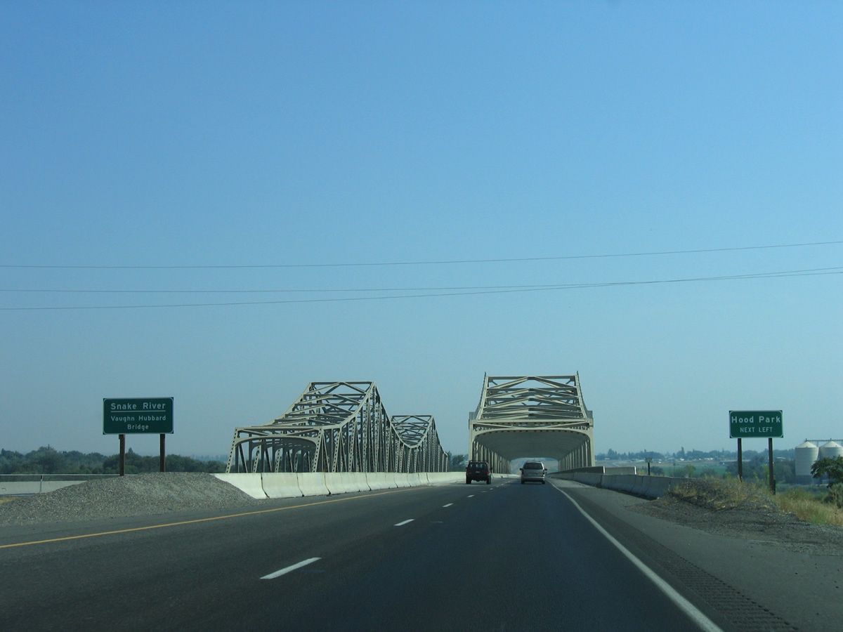
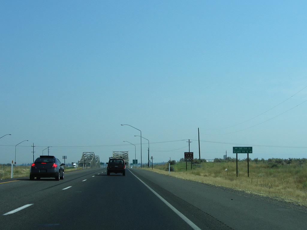
A pair of steel truss bridges (Vaughn Hubbard Bridge) span the Snake River between Tank Farm Road and SR 124 at Hood Park.
08/28/06
The eastbound Snake River bridge opened in 1986; the westbound span dates to 1950 as part of U.S. 410.
08/28/06
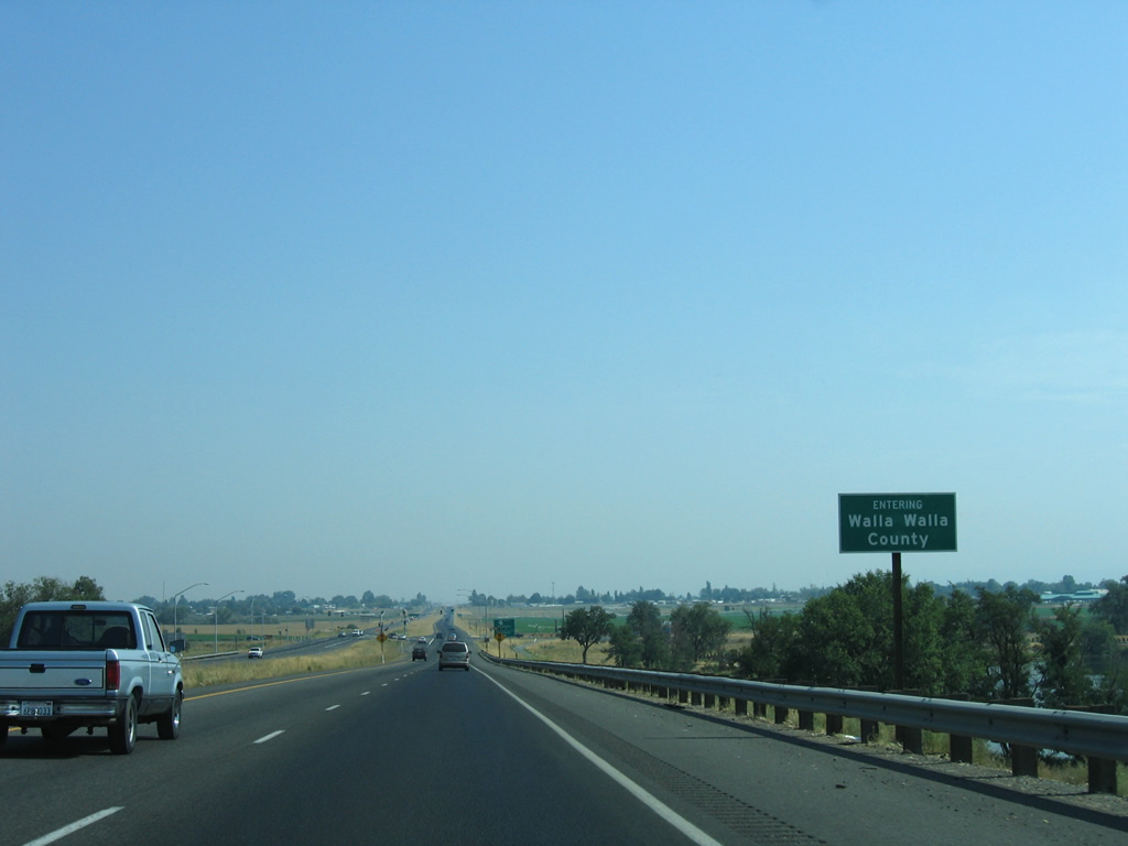
The Snake River separates Franklin and Walla Walla Counties from the Columbia River northeastward. U.S. 12 totals 64.37 miles in Walla Walla County through Wallula, College Place, Walla Walla and Waitsburg.
08/28/06
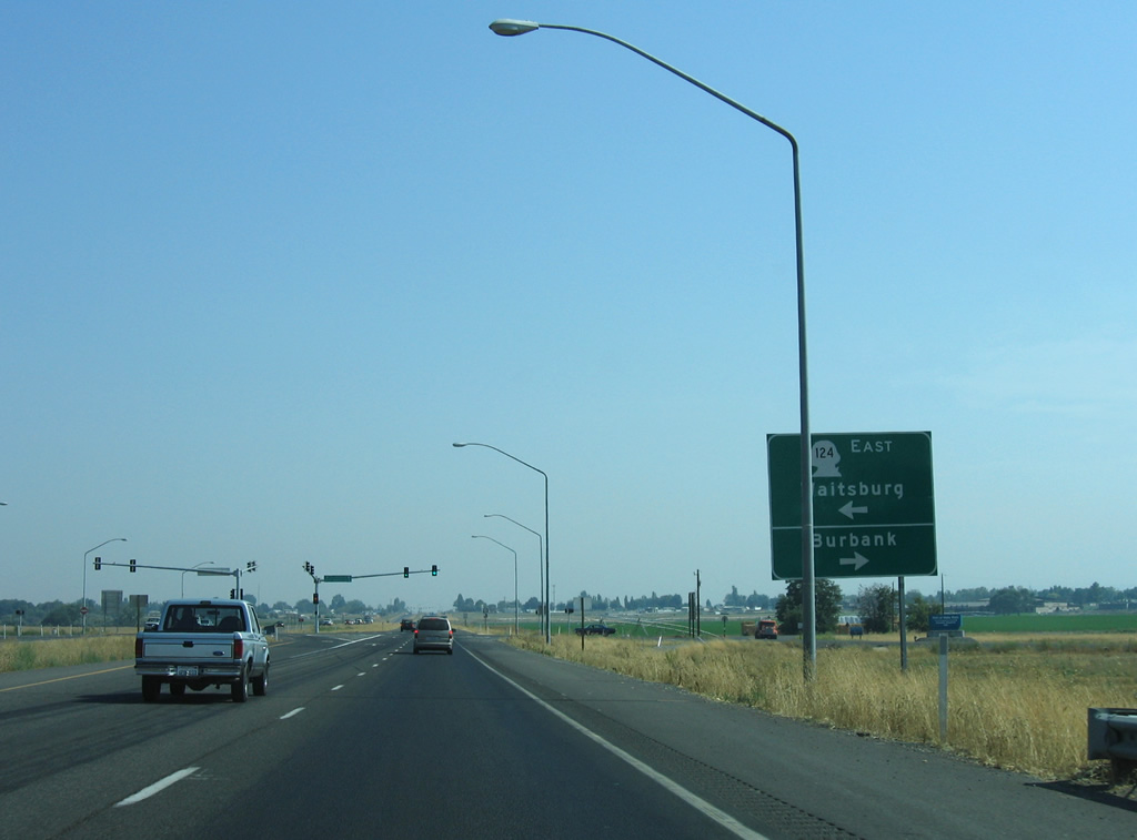
SR 124 (Ice Harbor Drive) provides a more direct route to Waitsburg and Clarkston in lieu of the U.S. 12 loop south to Walla Walla. The route travels 44.68 miles between U.S. 12.
08/28/06
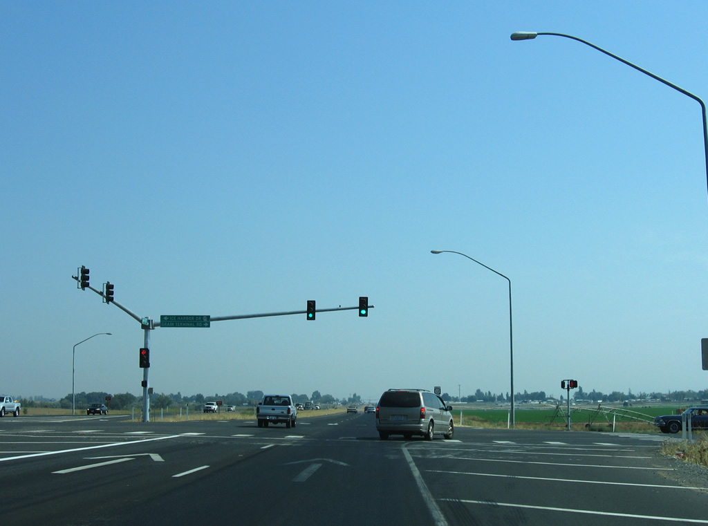
Grain Terminal Road ties into the west end of SR 124 at a signalized intersection with U.S. 12 in this scene. A parclo interchange with roundabouts replaced the at-grade intersection with SR 124 east and 5th Avenue from Burbank by 2012.
08/28/06
Photo Credits:
- AARoads: 08/28/06
Connect with:
Page Updated Thursday October 13, 2011.