
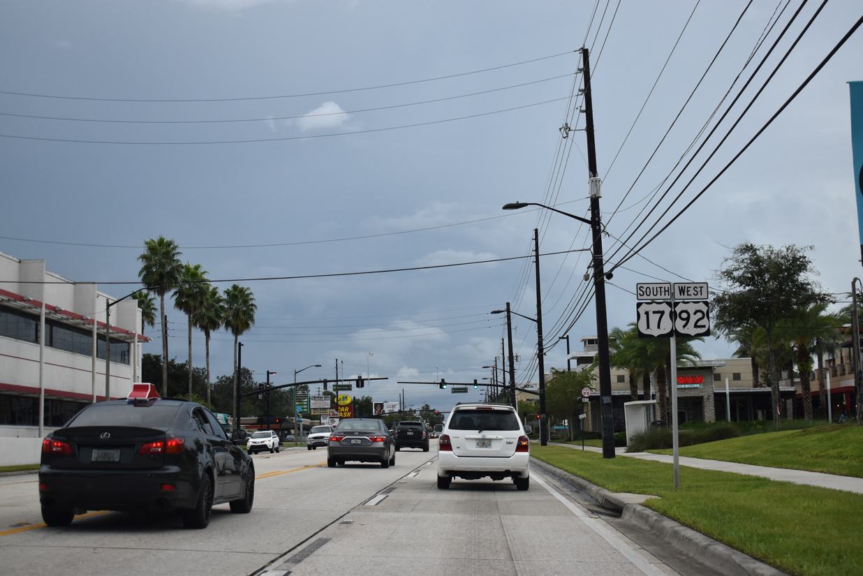
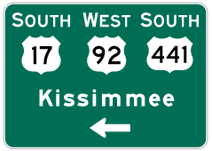
U.S. 17 South / U.S. 92 West - Maitland to Orlando


Traveling through the modified trumpet interchange with SR 414 (Maitland Boulevard) west on U.S. 17/92 (Orlando Avenue) south. Mayo Avenue intersects Orlando Avenue just beyond the Maitland Boulevard overpass.
02/25/17
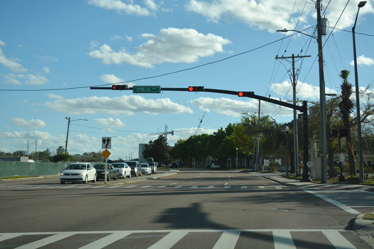
Turning southward beyond Maitland SunRail Station, U.S. 17-92 (Orlando Avenue) enter Downtown Maitland and intersect Sybelia Avenue west and Sybelia Parkway south.
02/25/17
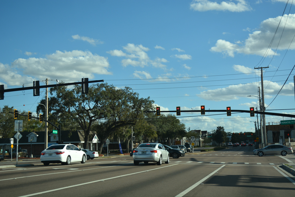
Horatio Avenue crosses U.S. 17-92 (Orlando Avenue) east from Lake Sybellia and Maitland City Hall at the succeeding traffic light. Horatio Avenue expands into a four lane, divided arterial east to the Dommerich Estates neighborhood. East across Howell Branch Creek, the arterial enters the city of Winter Park and becomes Howell Branch Road.
02/25/17
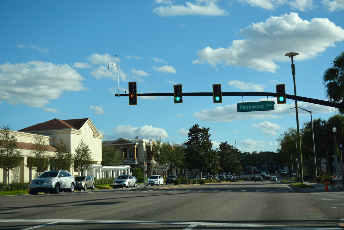
Packwood Avenue intersects U.S. 17-92 one block south of Horatio Avenue by the Maitland City Centre development built in 2017.
02/25/17
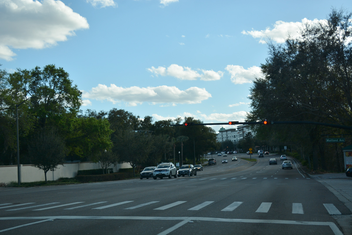
Maitland Avenue converges with U.S. 17-92 (Orlando Avenue) at the south end of Downtown Maitland across from Manor Road. Maitland Avenue is CR 427 leading north to Altamonte Springs, though signs are not posted here.
02/25/17
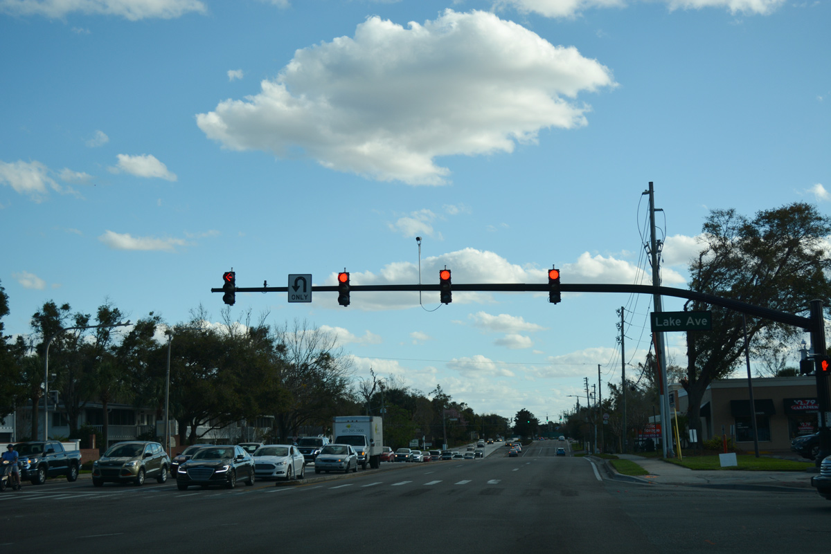
Curving southward by Lake Lily, the ensuing traffic light on U.S. 17-92 (Orlando Avenue) south is at Lake Avenue. Lake Avenue west to Kennedy Boulevard through the town of Eatonville is unsigned CR 438A. CR 438A extends west to SR 434 (Forest City Road) at All American Boulevard.
02/25/17
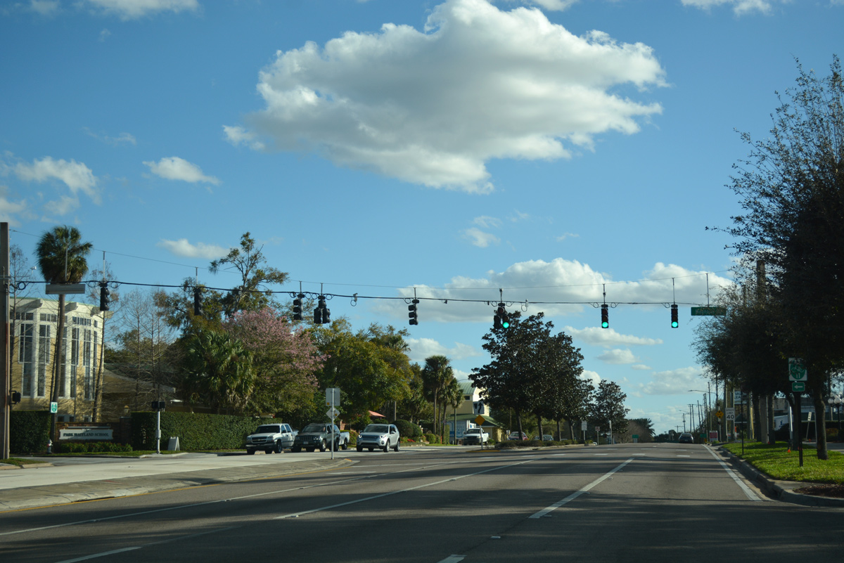
Magnolia Road east connects U.S. 17-92 (Orlando Avenue) with residential areas of south Maitland and Winter Park off Lake Maitland.
02/25/17
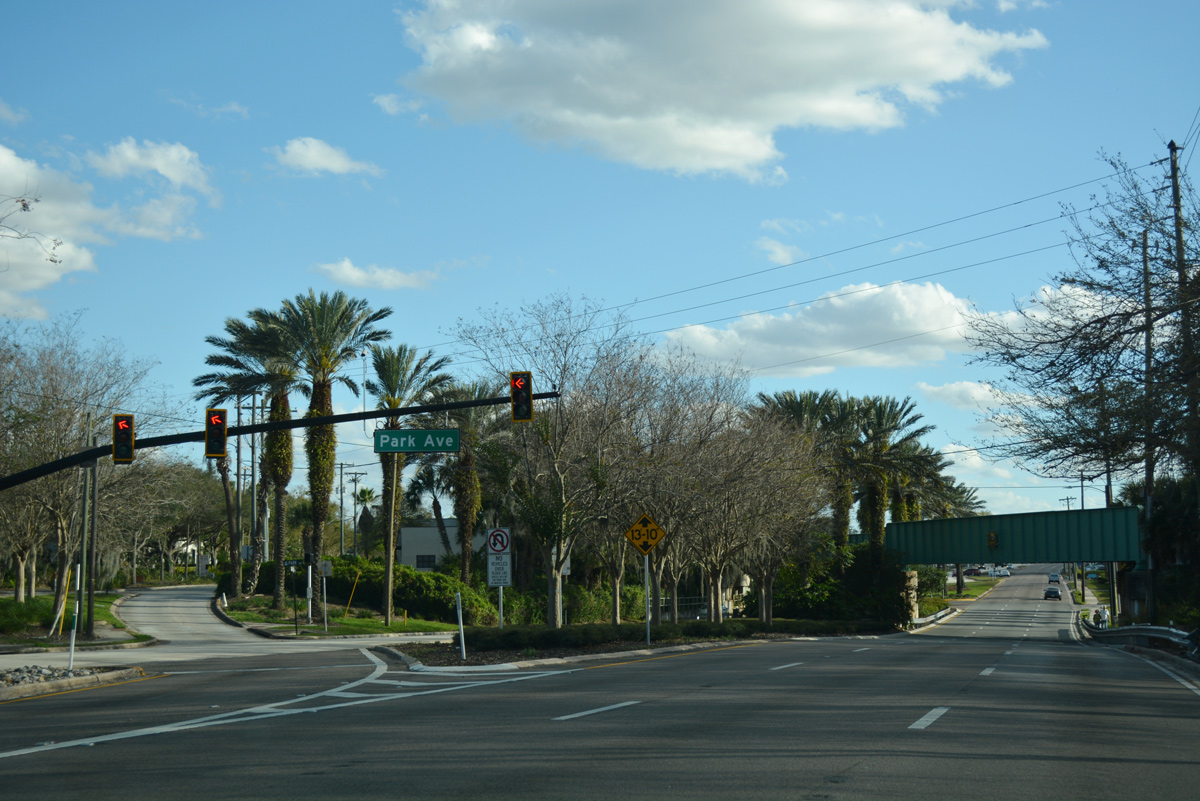
Park Avenue branches southeast from U.S. 17/92 ahead of the CSX / SunRail overpass. Park Avenue navigates east then south into Downtown Winter Park.
02/25/17
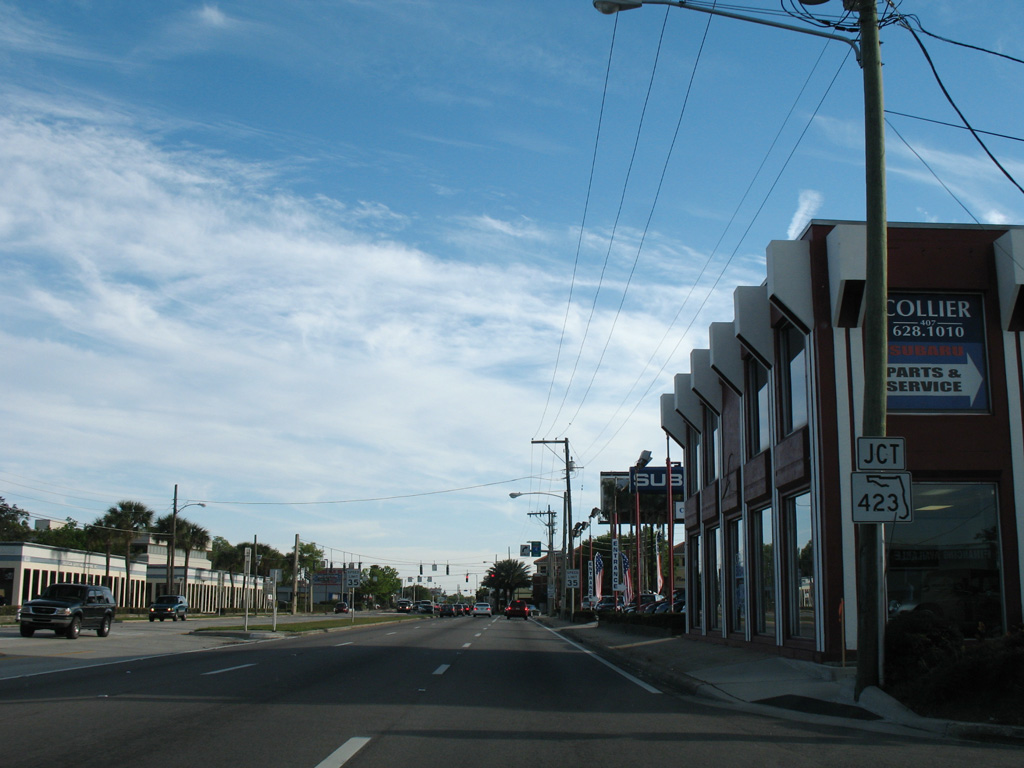
Approaching SR 423 (Lee Road), a major arterial leading west to Interstate 4 and south to John Young Parkway, on U.S. 17/92 in Winter Park. This shield assembly was removed in 2015 during a curb replacement project. The former industrial area west of Orlando Avenue along this stretch was demolished to make way for the Ravaudage development.
03/20/08
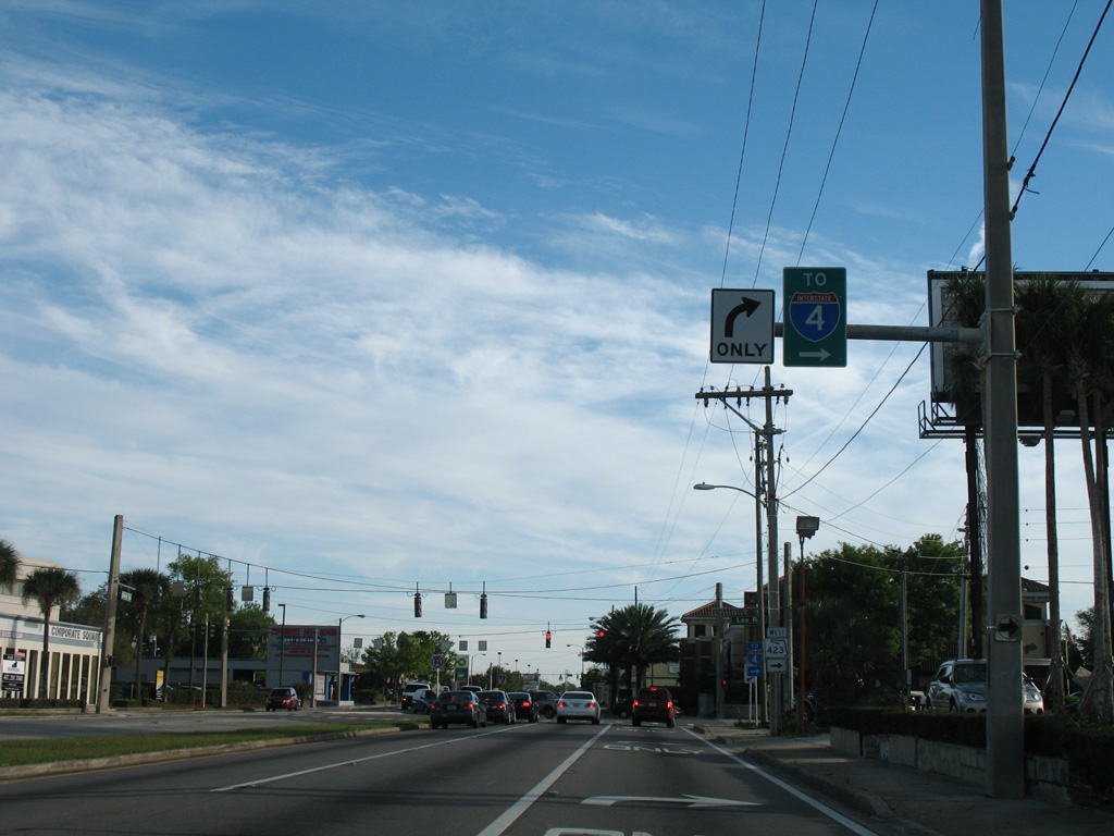
The previous traffic pattern at the east end of SR 423 (Lee Road) included a median separating the U.S. 17-92 mainline, and a bypass lane along northbound. Construction underway in 2016 extended Lee Road southeast to Webster Avenue as part of area redevelopment.
03/20/08
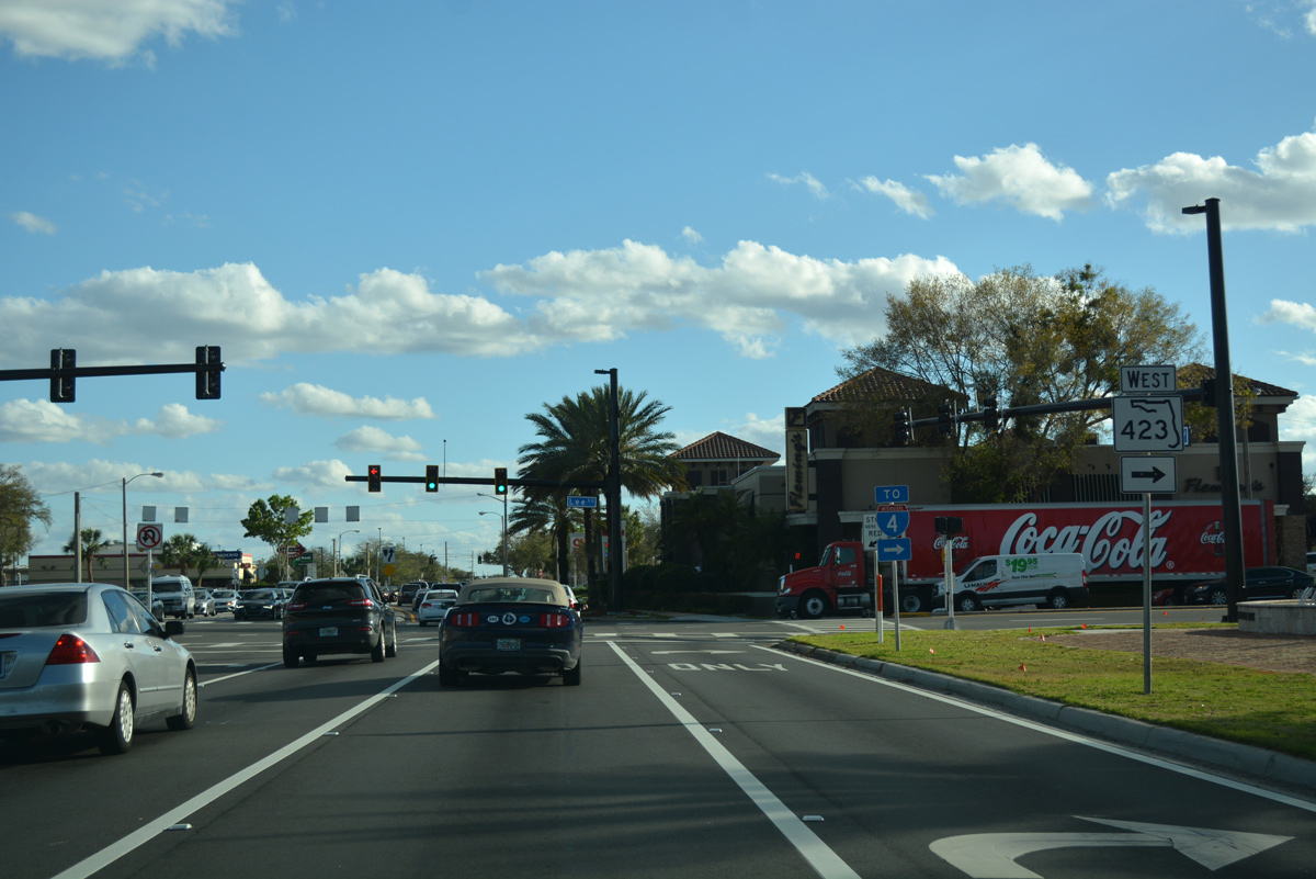
SR 423 follows Lee Road 1.25 miles west to Interstate 4 and the Winter Park city line. The arterial route continues from there through Fairview Shores to become John Young Parkway south at U.S. 441 (Orange Blossom Trail) by Trotters Park. John Young Parkway extends south through Orlando to Hunter's Creek in south Orange County.
02/25/17
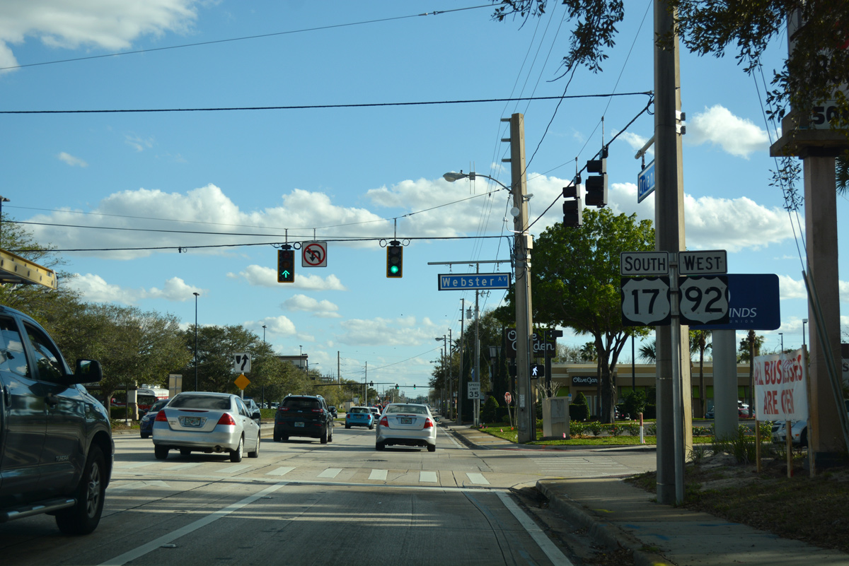
Webster Avenue stems east from the Center of Winter Park shopping center entrance and U.S. 17-92 (Orlando Avenue) to Winter Park Country Club and neighborhoods off Lake Osceola.
02/25/17
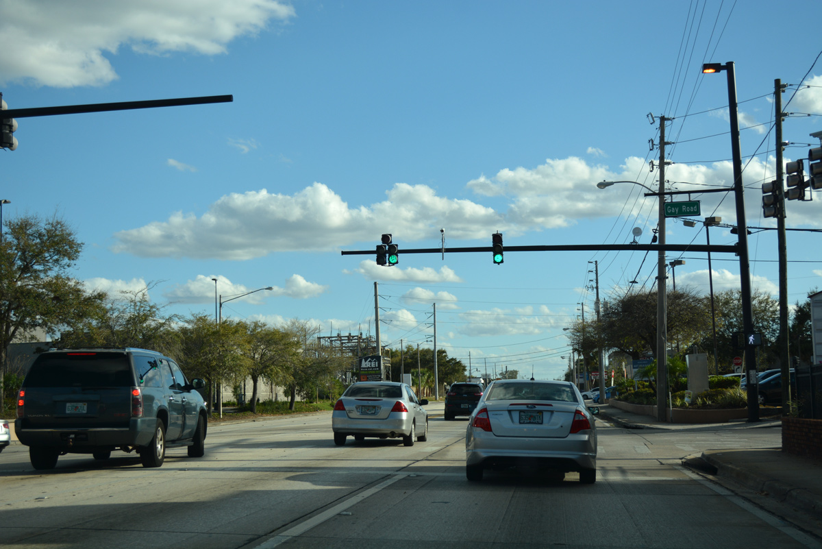
Gay Road runs along the south side of Center of Winter Park to intersect U.S. 17-92 (Orlando Avenue) across from the Winter Park Village retail center.
02/25/17
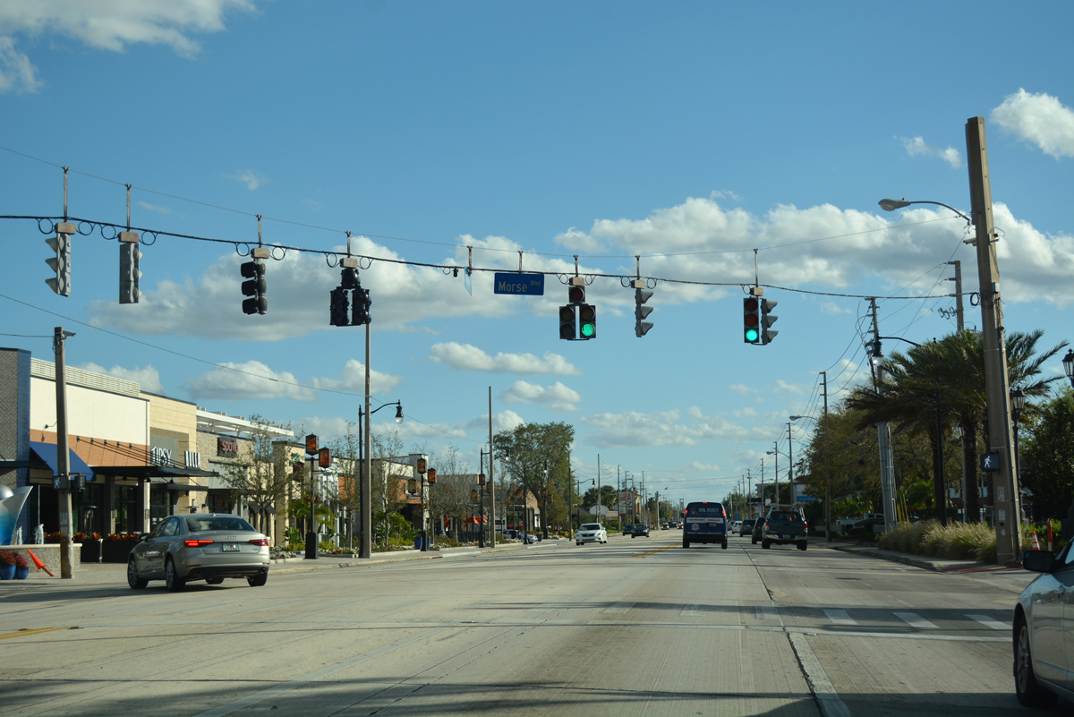
Morse Boulevard heads east from U.S. 17-92 along the north side of Martin Luther King, Jr. Park and Lake Mendsen to Winter Park Station (Amtrak, SunRail) in Downtown Winter Park.
02/25/17
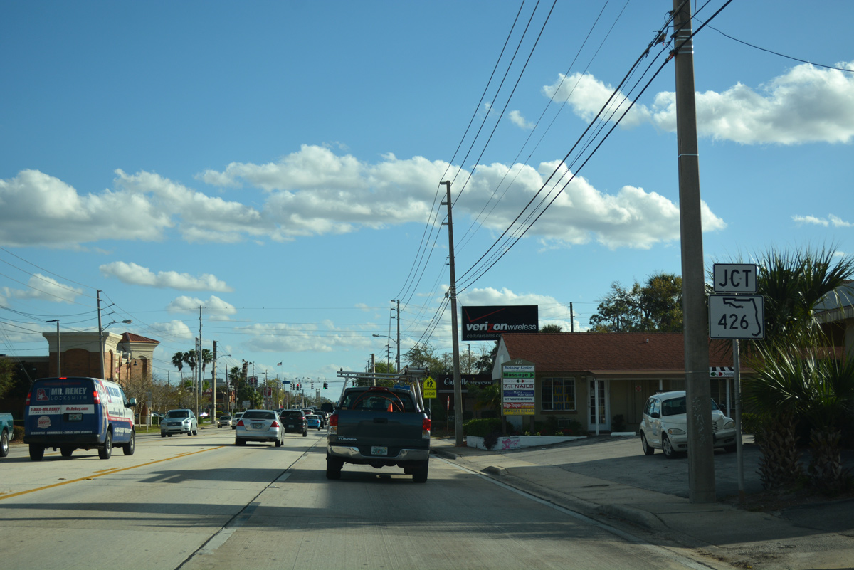
Advancing south from near Lake Killarney, U.S. 17-92 approach SR 426 (Fairbanks Avenue) east toward Downtown Winter Park and west to Fairview Shores.
02/25/17
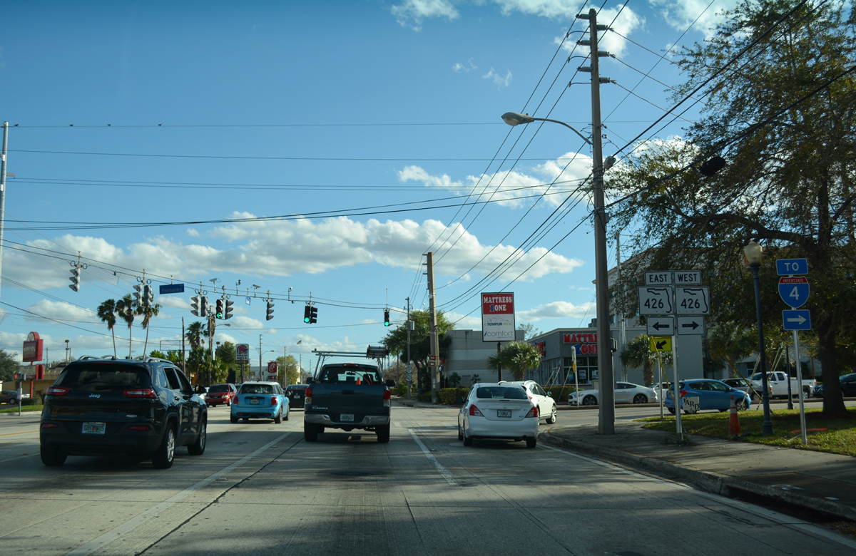
SR 426 travels 15.7 miles overall, joining Winter Park with I-4 and SR 424 (Edgewater Drive) to the west, and Aloma, Goldenrod and the city of Oviedo to the northeast.
02/25/17
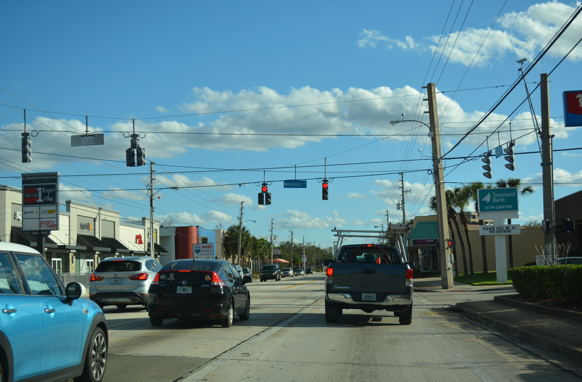
Minnesota Avenue crosses U.S. 17/92 south from Pennsylvania Avenue to the Lawndale community and the Golfview and Dubsdread Heights neighborhoods in Orlando.
02/25/17
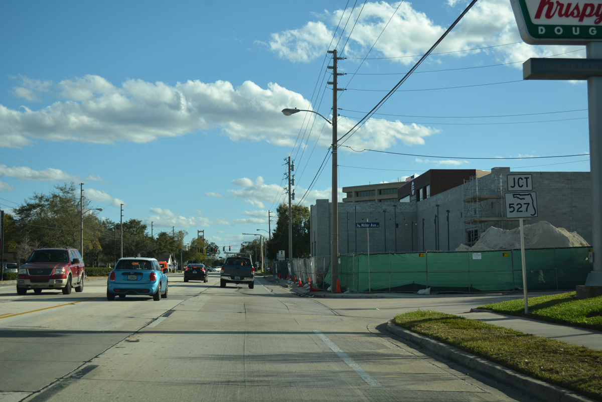
Orange Avenue (CR 527) angles southwest from SR 426 (Fairbanks Avenue) to a six-point intersection with U.S. 17-92 (Orlando Avenue) at Harmon Avenue.
02/25/17
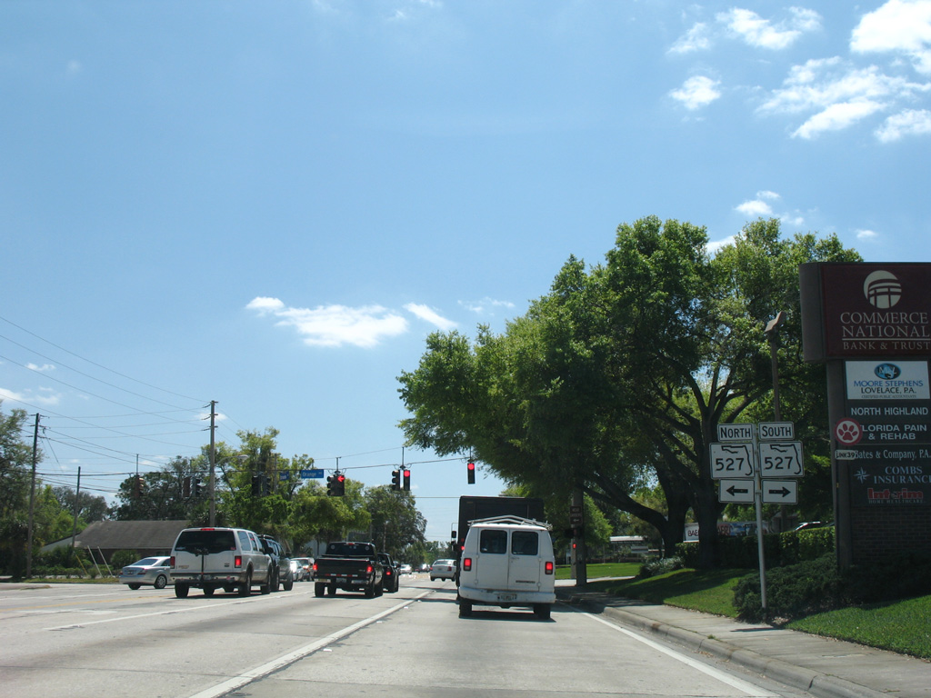
Former shield assembly referencing SR 527 still traveling north along Orange Avenue to SR 426 (Fairbanks Avenue).
03/21/08
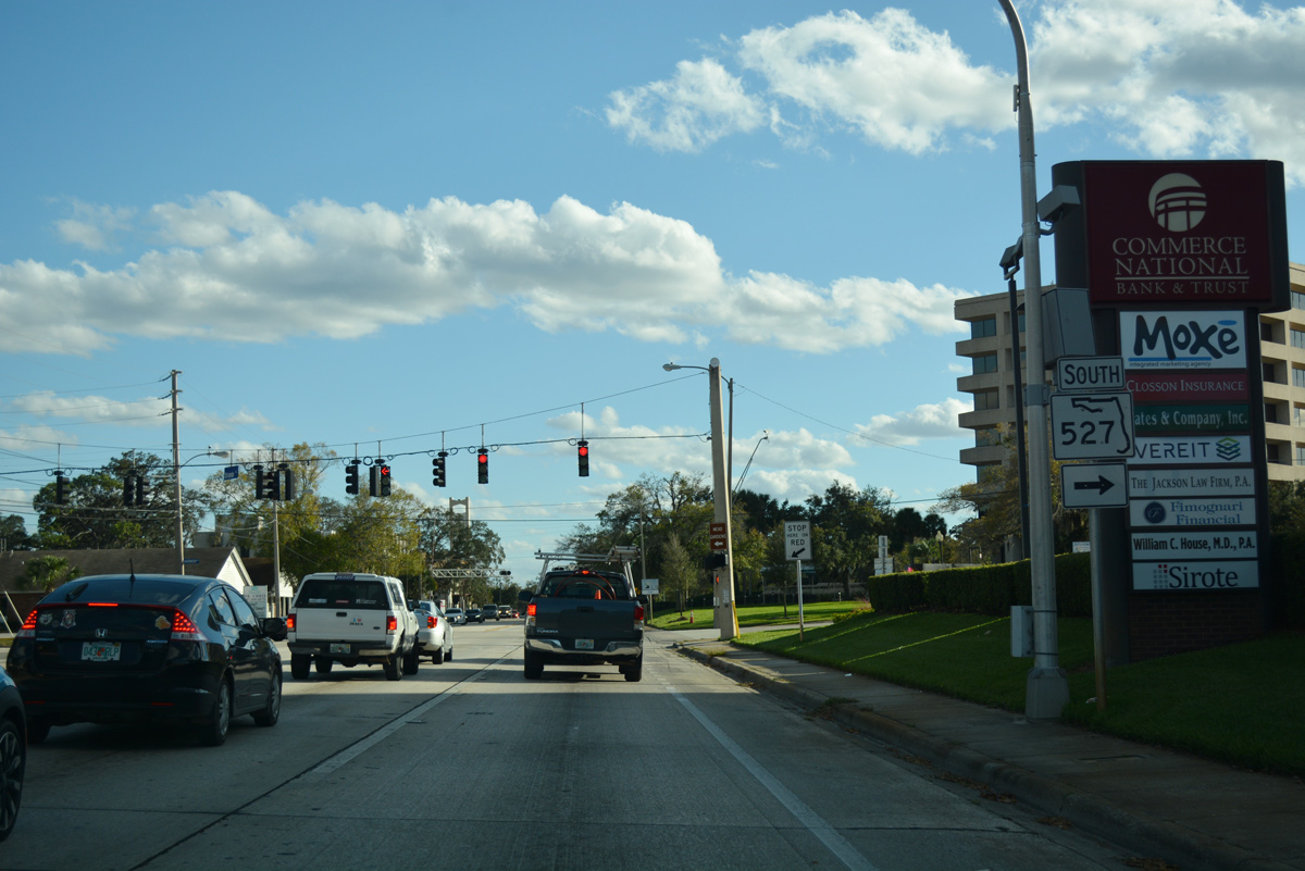
SR 527 remains along Orange Avenue 2.6 miles south at U.S. 17-92/SR 50 (Colonial Drive) in Orlando.
02/25/17
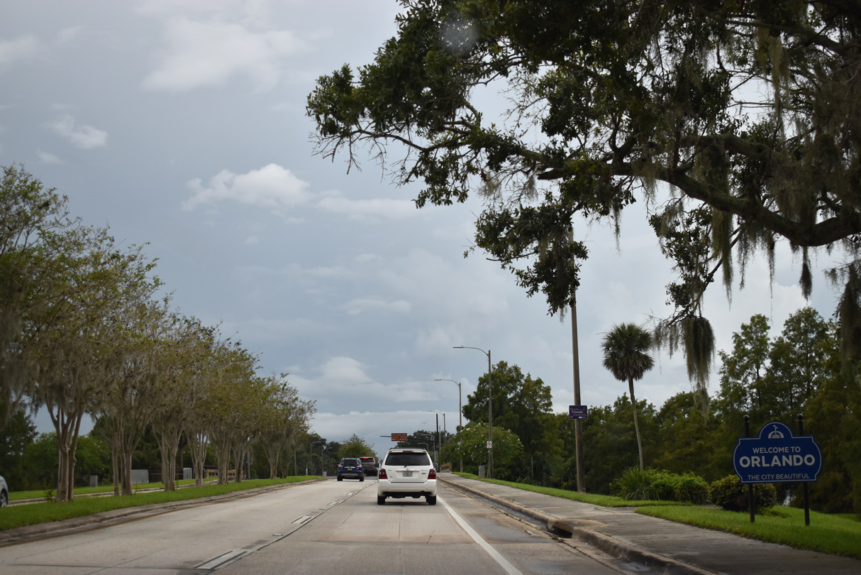
Southbound U.S. 17/92 (Mills Avenue) enters the Orlando city limits just ahead of Nottingham Street at the Orwin Manor neighborhood. A welcome sign for The City Beautiful appears at Lake Estelle Park.
09/08/18
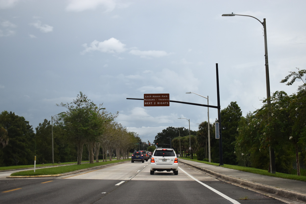
A causeway leads U.S. 17/92 south across Lake Estelle. Loch Haven Park, home of the Orlando Science Center, Mennello Museum of Art and other attractions, follows along the west side of Mills Avenue.
09/08/18
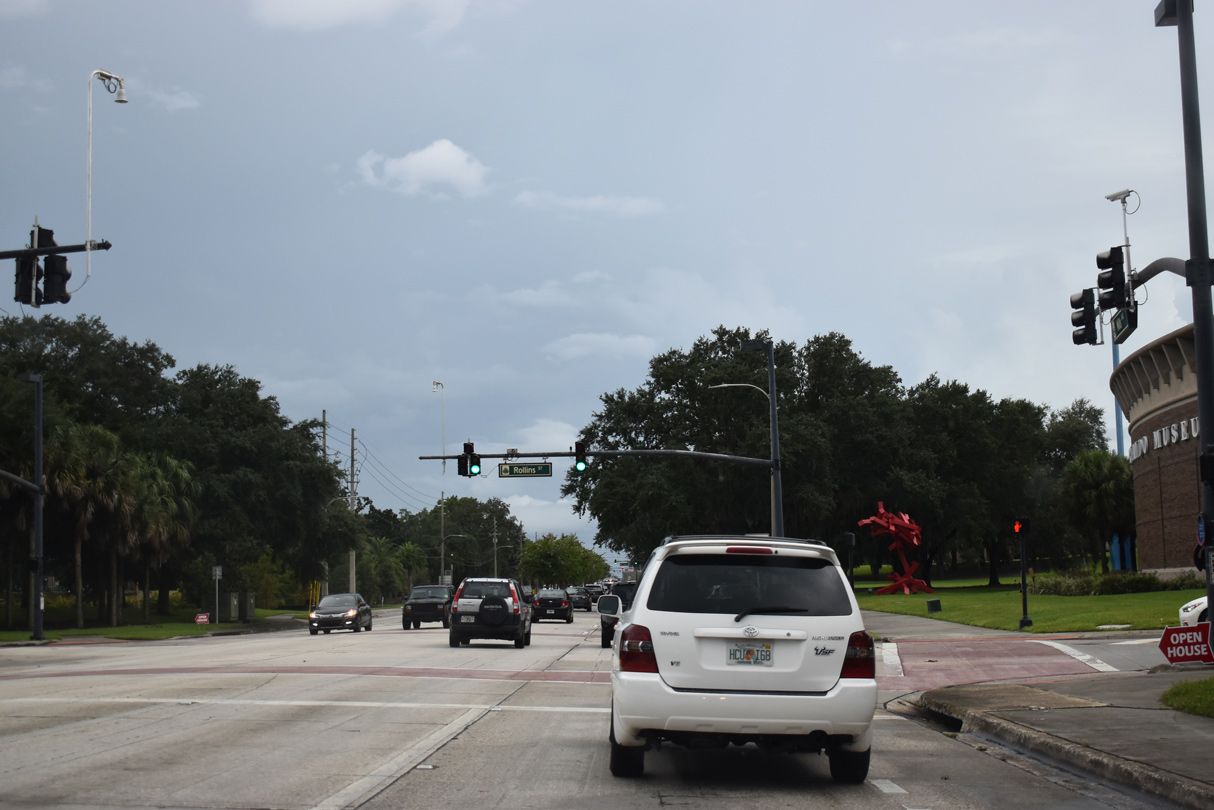
Rollins Street east and Lake Shore Drive west come together at Loch Haven Park on the south side of Lake Estelle.
09/08/18
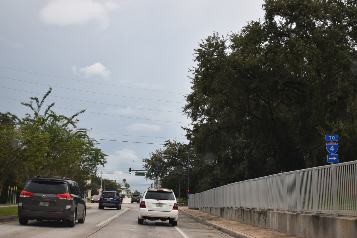
Princeton Street winds west through Loch Haven Park as a four lane arterial linking U.S. 17/92 with Interstate 4 and the College Park neighborhood.
09/08/18
These shields for U.S. 17/92 stand along Mills Avenue south at McCamy Street.
09/08/18
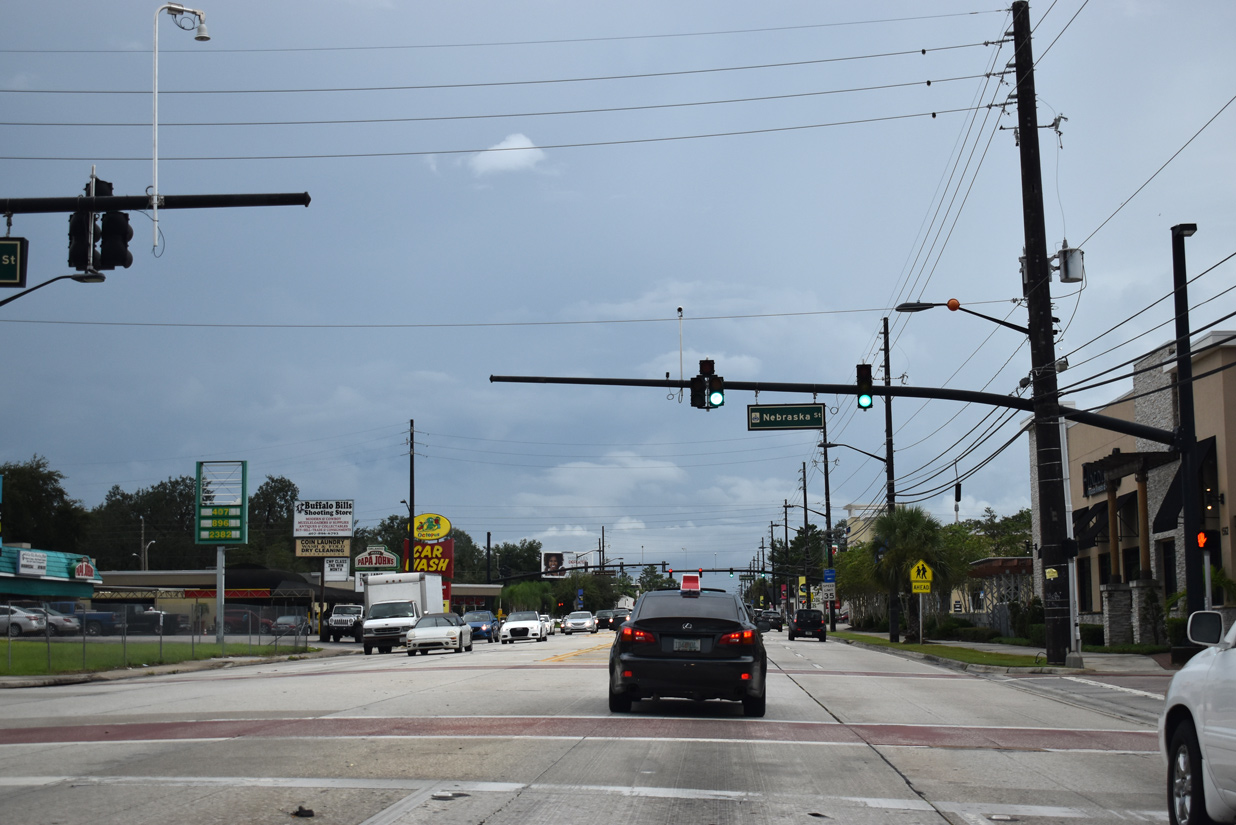
Nebraska Street heads east to Rowena Gardens and Forest Avenue to Harry P. Leu Gardens.
09/08/18
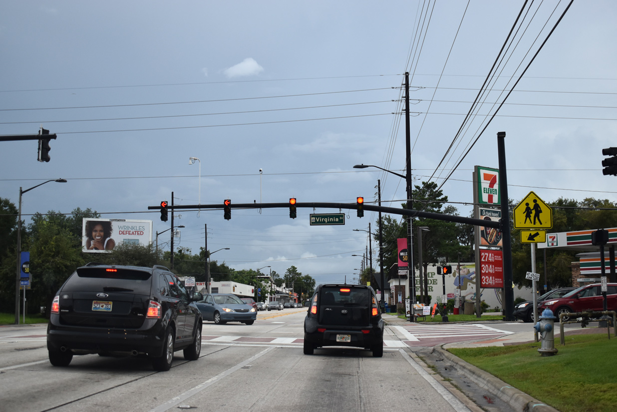
Virginia Drive forms part of a through route east to Baldwin Park with Forest Avenue north and Corrine Drive east. West from U.S. 17-92, Virginia Drive extends along a commercial strip to SR 527 (Orange Avenue) at Lake Ivanhoe.
09/08/18
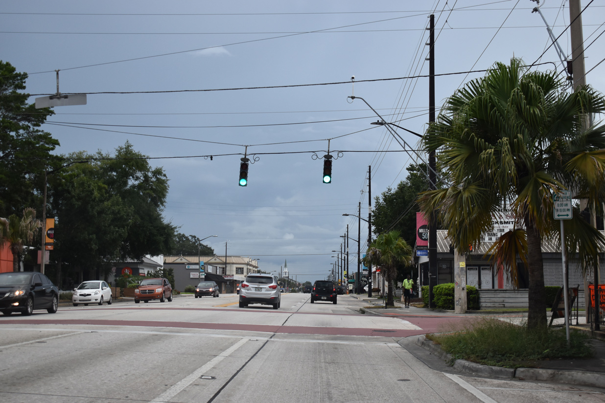
Two blocks further south, Mills Avenue intersects Lake Highland Drive at the next traffic light.
09/08/18
U.S. 17/92 (Mills Avenue) south at Marks Street and the Colonialtown neighborhood.
09/08/18
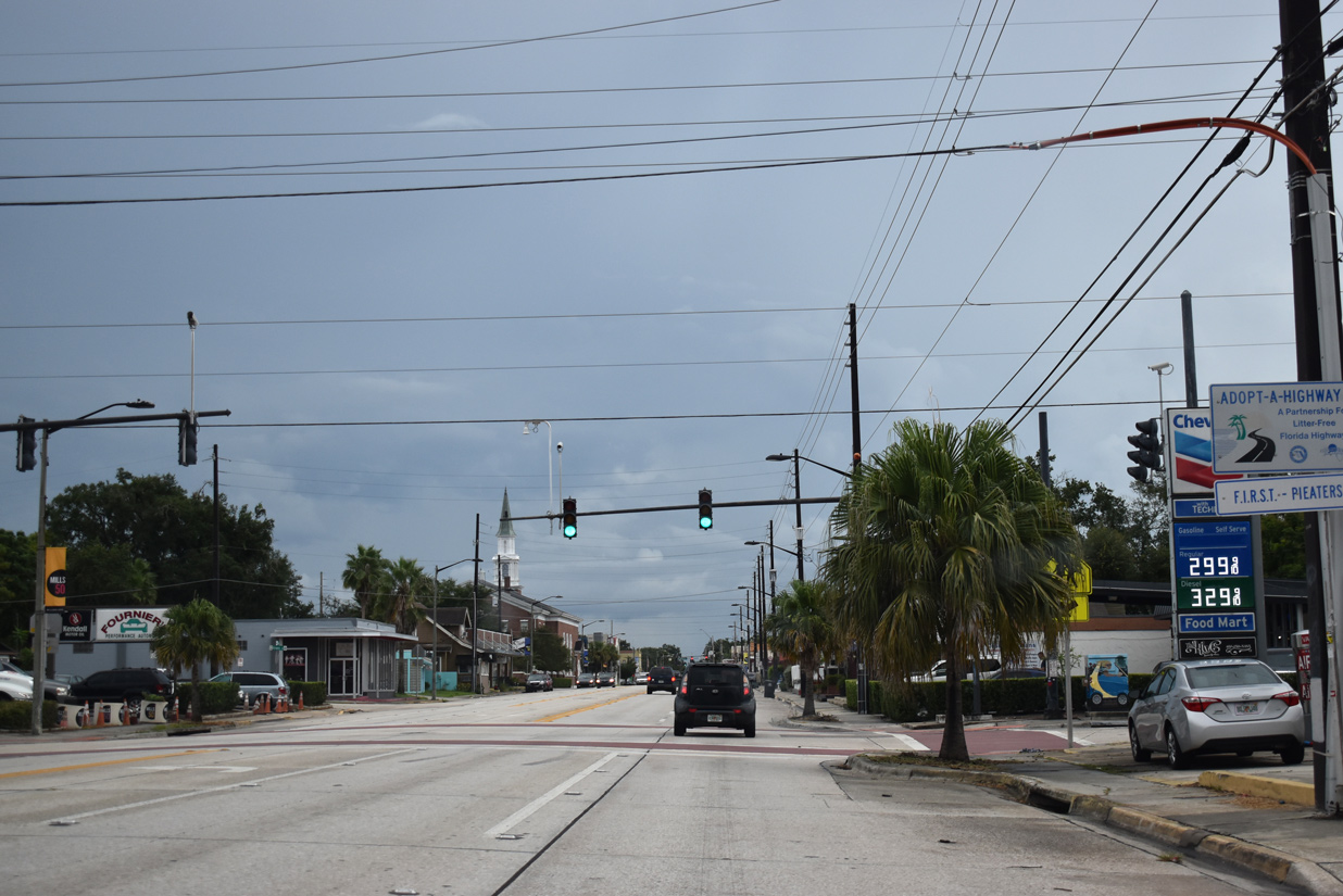
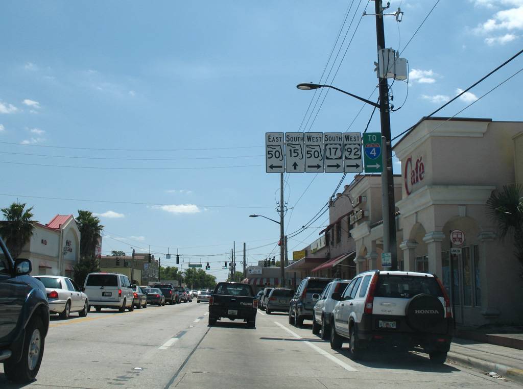
U.S. 17-92 and SR 50 (Colonial Drive) converge at the Colonialtown business district northeast of Downtown Orlando.
09/08/18
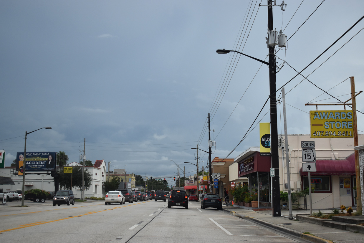
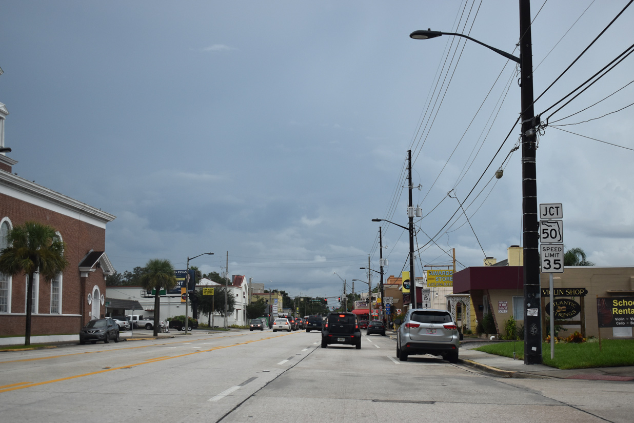
SR 15 emerges from U.S. 17-92 along Mills and Thornton Avenues south from SR 50 (Colonial Drive) to Lake Lawsona and the East-West Expressway (SR 408).
09/08/18
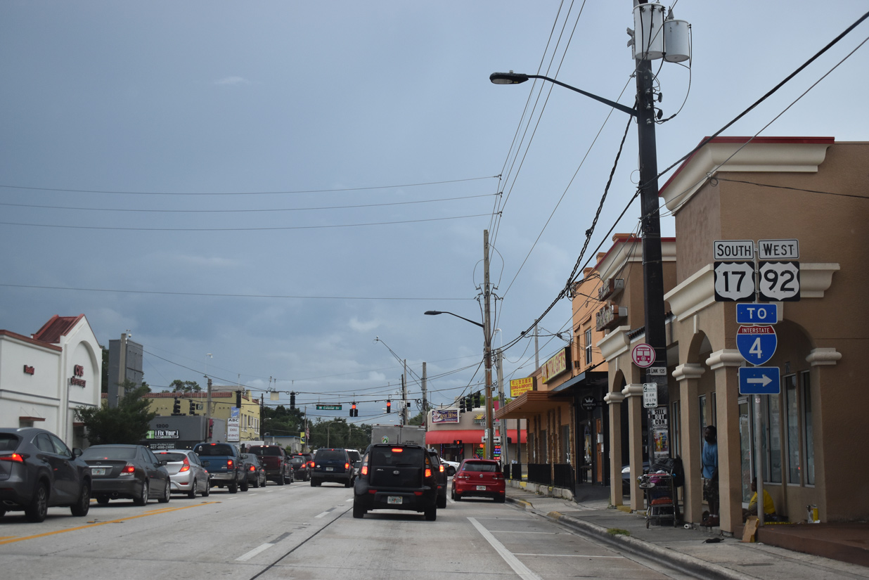
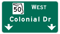
U.S. 17/92 west combine with SR 50 along Colonial Drive west to Lake Eola Heights, Interstate 4 and Concord Park.
09/08/18
Removed in 2011, an overhead sign outlined both the forthcoming split of SR 15 (Mills Avenue) from U.S. 17-92, and SR 50 along East Colonial Drive.
03/21/08
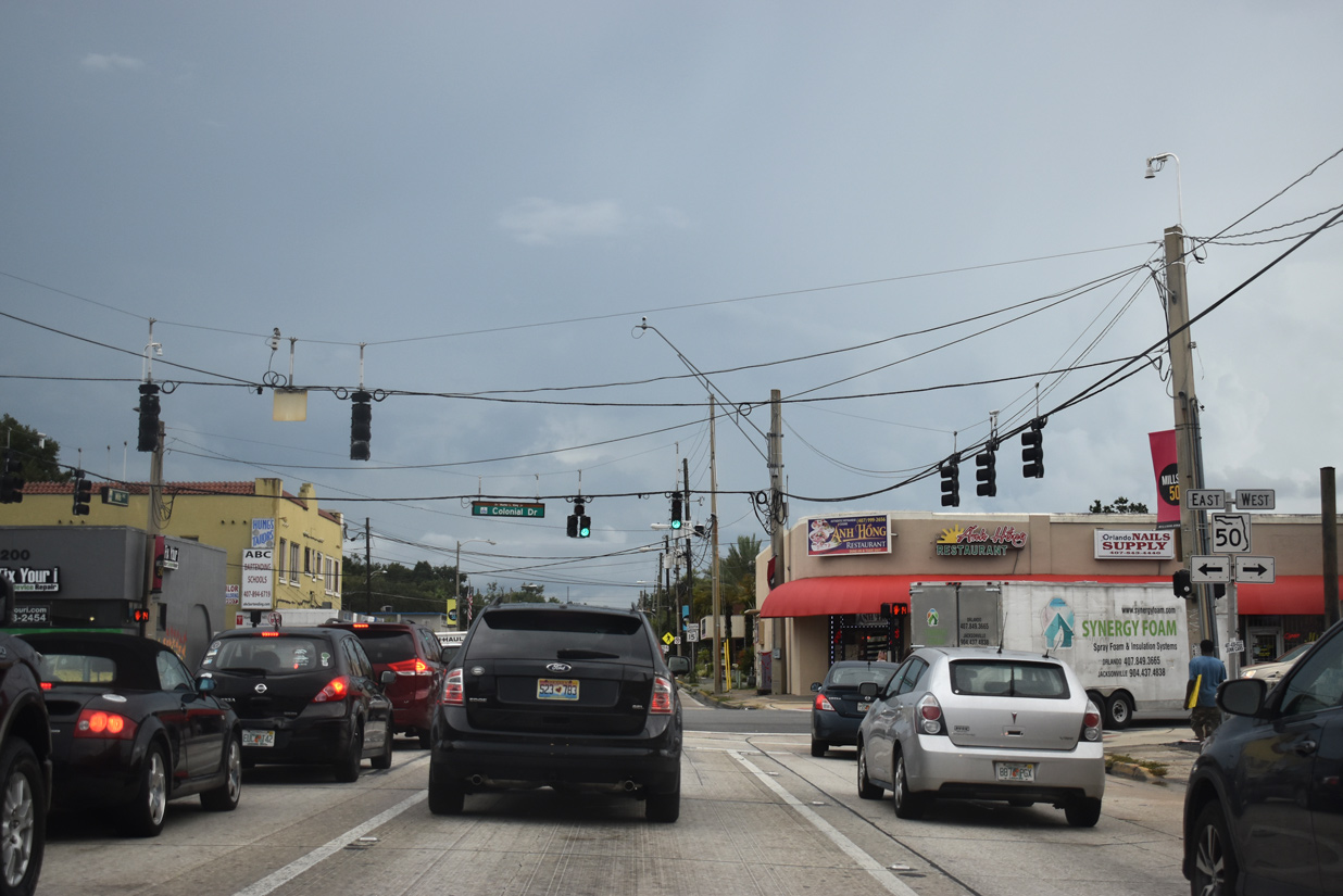
SR 50 (East Colonial Drive) travels east from Colonialtown to Colonial Town Center, Orlando Executive Airport (ORL) and Azalea Park in Orange County. The state road extends 35.6 miles from U.S. 17-92 and SR 15 to U.S. 1 in Titusville.
09/08/18
References:
- "Orlando's new pedestrian bridge on West Colonial Drive is now open." Orlando Weekly, March 18, 2019.
Photo Credits:
- ABRoads: 02/25/17, 09/08/18
- Alex Nitzman: 03/20/08, 03/21/08
Connect with:
Page Updated Thursday June 06, 2019.