
U.S. 24 East - Newton / Jasper Counties

 East
East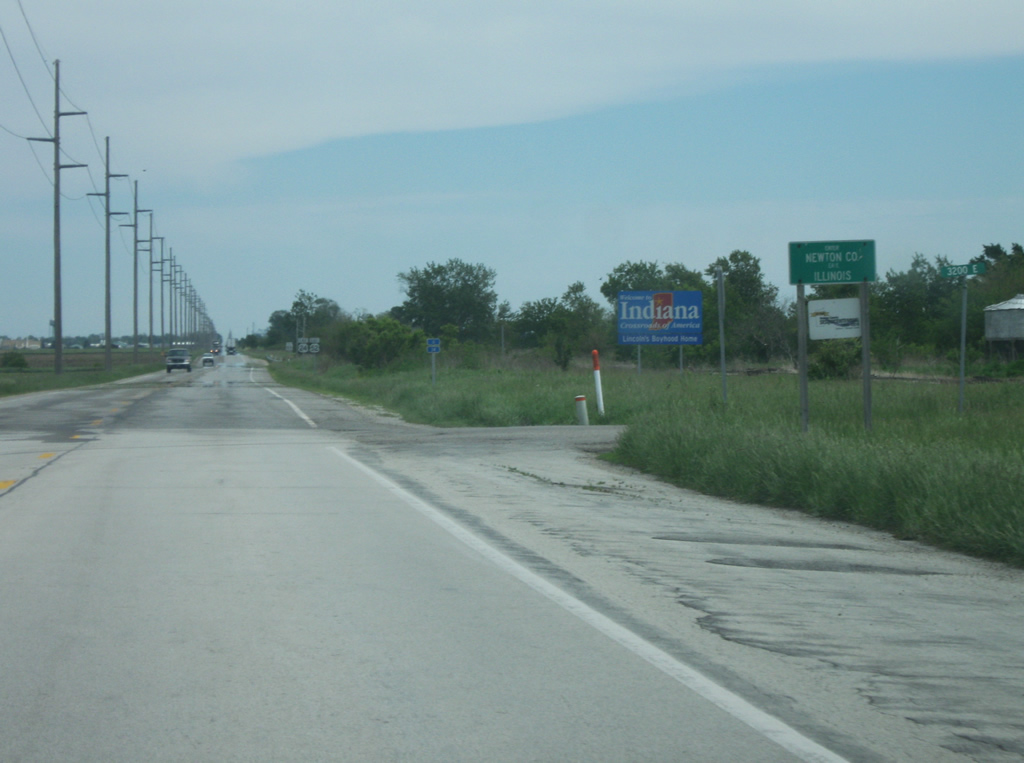
U.S. 24 enters the state of Indiana multiplexed with U.S. 52. The pair cross into Newton County (population 14,244) and follow a straight line across the far southern tier of the county, paralleling the Toledo, Peoria and Western Railway to the south.
05/14/10
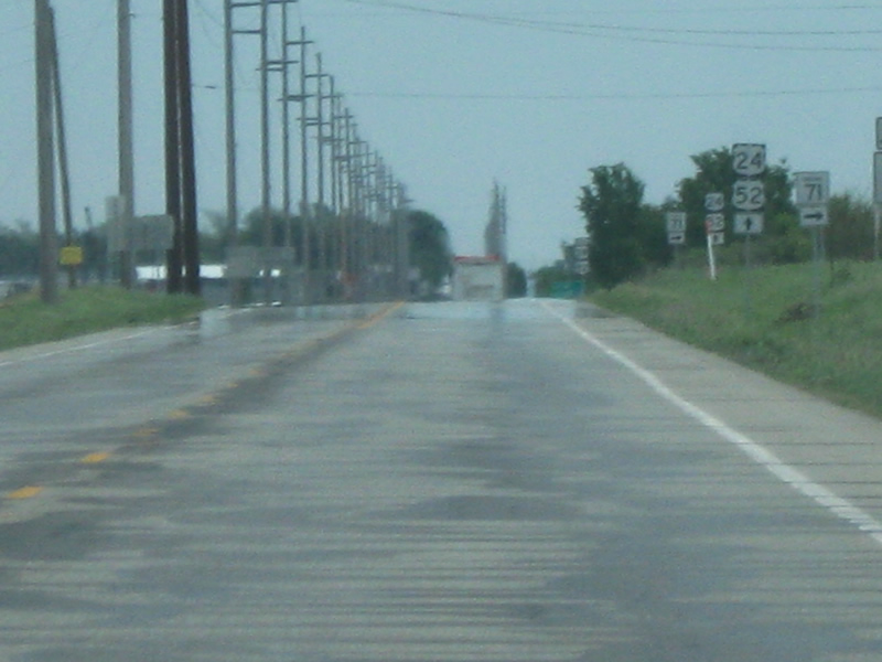
SR 71 exists as two segments, with a northern one in Newton and Benton Counties and the southern one in Vermillion County. The northern segment begins here and heads south for 17.5 miles to its southern terminus at SR 352 near Ambia.
05/14/10
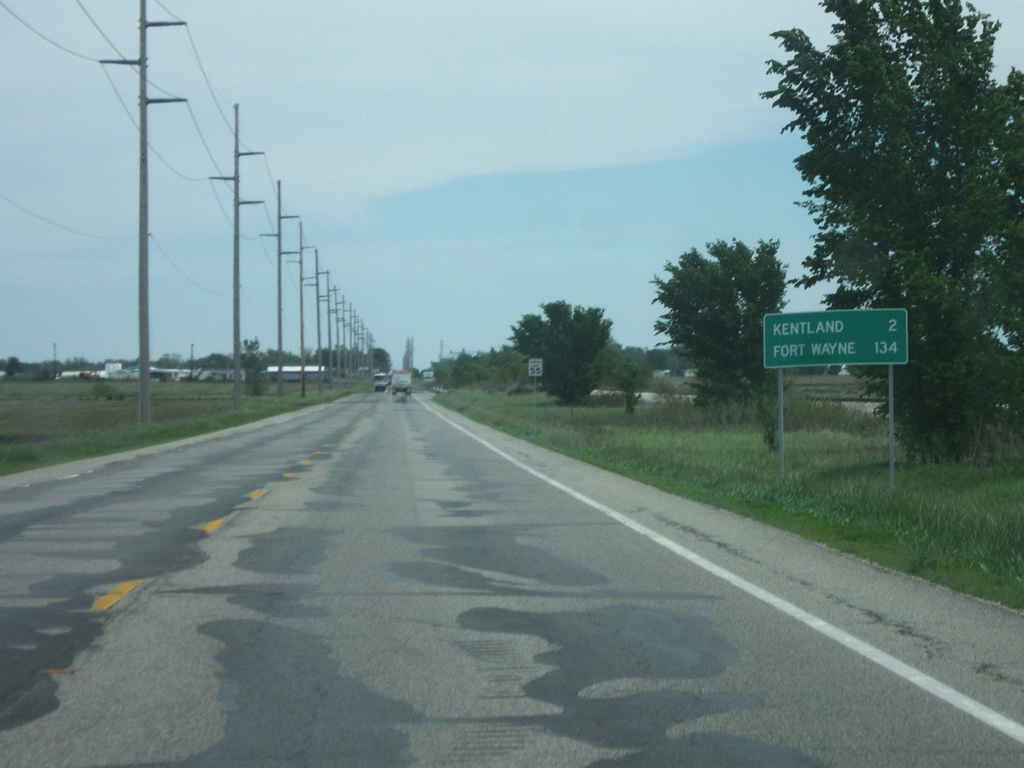
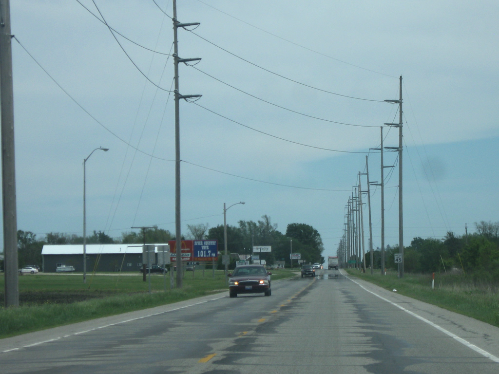
East of the junction with SR 71 south, the first distance sign in Indiana along U.S. 24/52 shows that the Newton County seat of Kentland is only two miles away, while Fort Wayne, the ultimate control city for U.S. 24 across the state, is 134 miles down the road on the other side of Indiana.
05/14/10
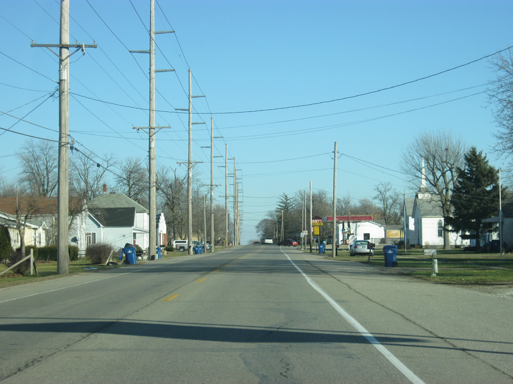
Further up, U.S. 24/52 enters the town of Kentland (population 1,748). Despite being located in the far southwest corner of the county (given that Roselawn in the northeast corner is 37 miles away), Kentland is both the county seat and largest city in Newton County. In town, the highway is given the name of Seymour Street.
05/14/10
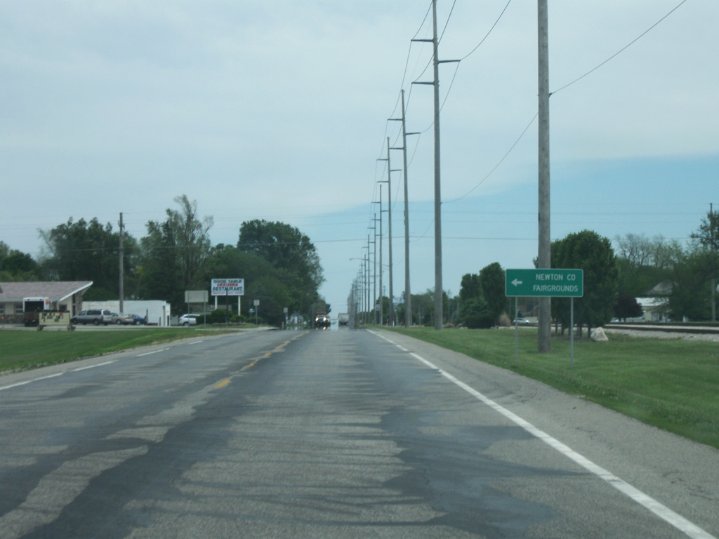
U.S. 24/52 (Seymour Street) approaches the intersection Fairground Road, which leads north to the Newton County Fairgrounds beyond Kentland. The two U.S. highways follow Seymour Street on the south side of Kentland as the Downtown lies a few blocks to the north.
05/14/10
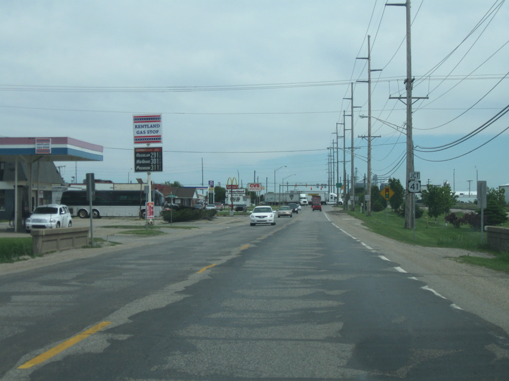
U.S. 24/52 (Seymour Street) now approaches the only stoplight intersection in Kentland, with U.S. 41/U.S. 52 east. Going for 280 miles, U.S. 41 maintains four lane expressway standards in conjunction with SR 63 from Northwest Indiana and south through Terre Haute, Vincennes and Evansville, with the towns of Attica and Rockville served by a two lane portion of U.S. 41. Nationally, U.S. 41 goes for 2,000 miles from Copper Harbor, Michigan south to Miami, Florida.
05/14/10
Nearing the junction with U.S. 41/U.S. 52 east. U.S. 52 east follows U.S. 41 south to Earl Park where it splits off en route to Lafayette, Lebanon, Indianapolis, Rushville and Connersville before leaving Indiana near Harrison, Ohio. From there, it continues its 2,072 mile path, started at the Canadian border in North Dakota, southeast to its final endpoint at Charleston, South Carolina. Fowler is the control city for the expressway south while Hammond, not Chicago, is the control city for U.S. 41 north. Hammond is about 58 miles away with Chicago a little further beyond that.
05/14/10
East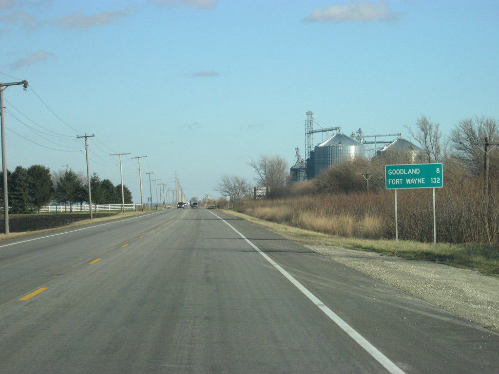
East of U.S. 41/52, U.S. 24 advances eight miles to the community of Goodland and 128 miles to Fort Wayne.
12/29/11
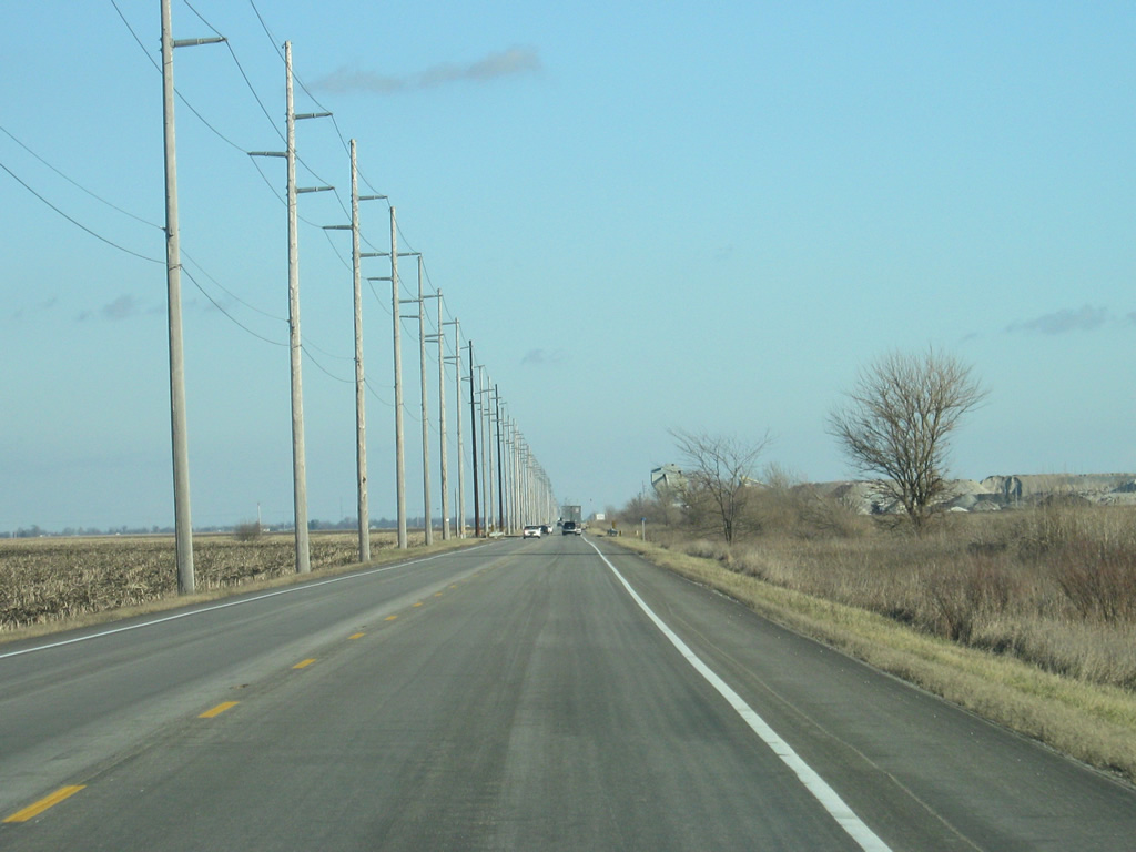
East of Kentland, U.S. 24 resembles a rural two lane highway that heads east across far southern Newton County with utility lines to the left and the Toledo, Peoria and Western Railway to the right.
12/29/11
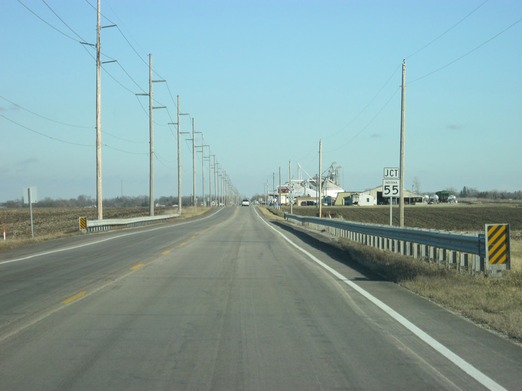
U.S. 24 next approaches the junction with SR 55 south. SR 55 goes for 110 miles from Wingate at SR 25 north through Attica, Fowler and Crown Point before ending at Business U.S. 6 in Gary.
12/29/11

SR 55 enters from the south and follows U.S. 24 for a brief multiplex to the east.
12/29/11
East 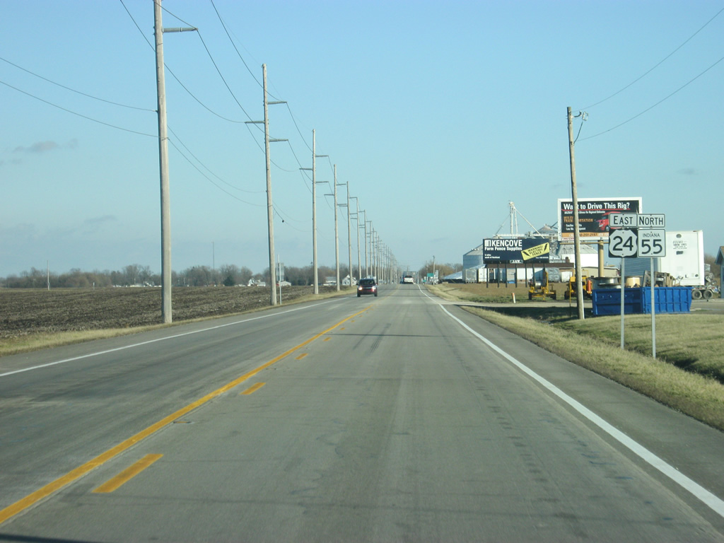
Reassurance shields for both U.S. 24 and SR 55 north, posted east of their merge.
12/29/11
Just down the road, SR 55 turns toward the north.
12/29/11
Traffic follows SR 55 to the north toward Crown Point while Goodland and Monticello is further to the east along U.S. 24.
12/29/11
East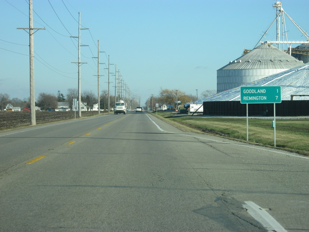
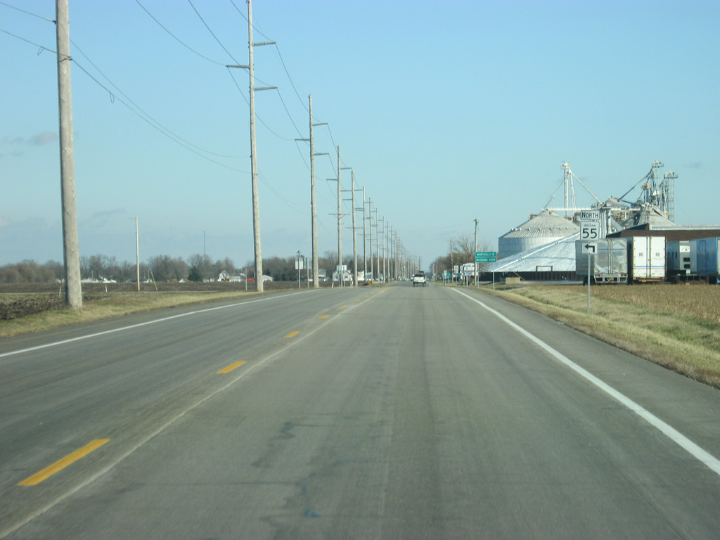
East of the junction with SR 55 north, U.S. 24 is one mile from Goodland and seven miles from Remington.
12/29/11
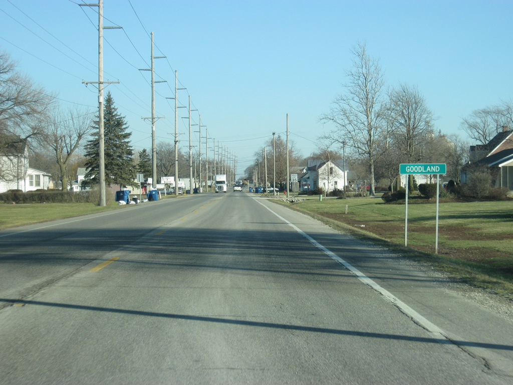
East of the junction with SR 55 north, U.S. 24 enters the town of Goodland (population 1,043). Within Goodland, U.S. 24 is known as Jasper Street.
12/29/11
A view of U.S. 24 (Jasper Street) through the town of Goodland.
12/29/11
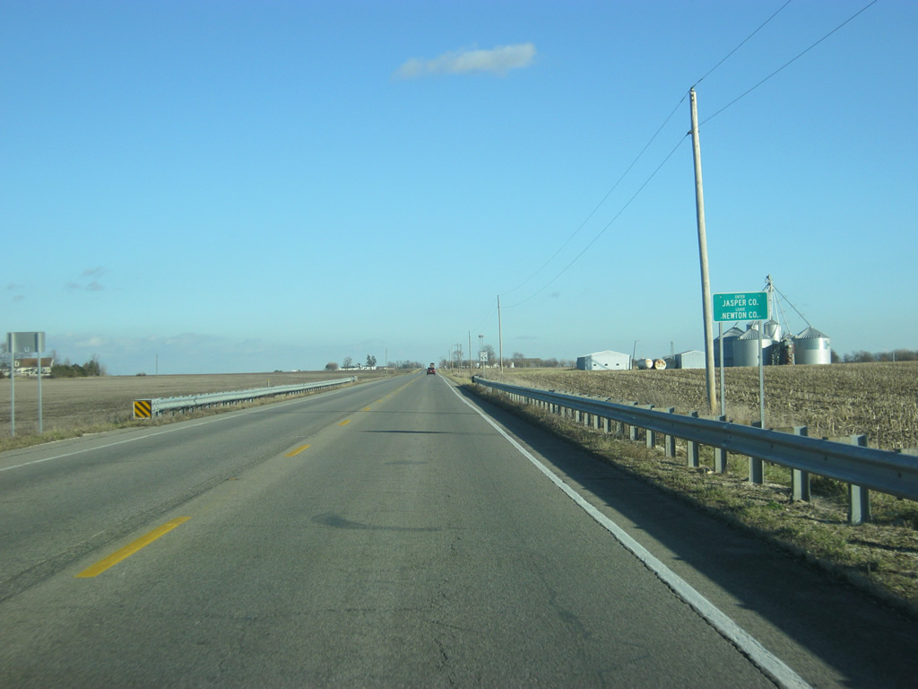
East of Goodland, U.S. 24 crosses into Jasper County (population 33,478).
12/29/11
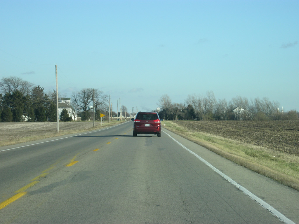
A view of U.S. 24 beyond the county line. As with Newton County, U.S. 24 crosses the far southern part of Jasper County.
12/29/11
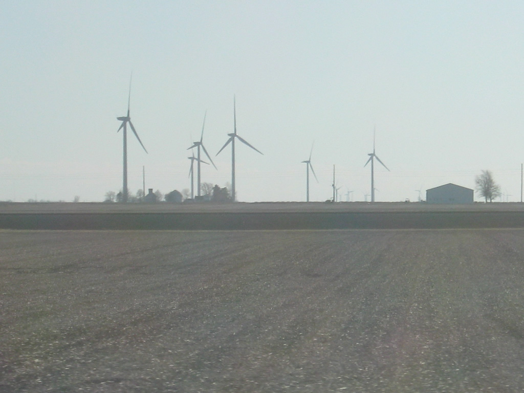
Wind turbines from a nearby wind farm in Benton County can be viewed from U.S. 24 to the south. The wind farm stretches across Benton County into White County and stays south of U.S. 24 the whole time.
12/29/11
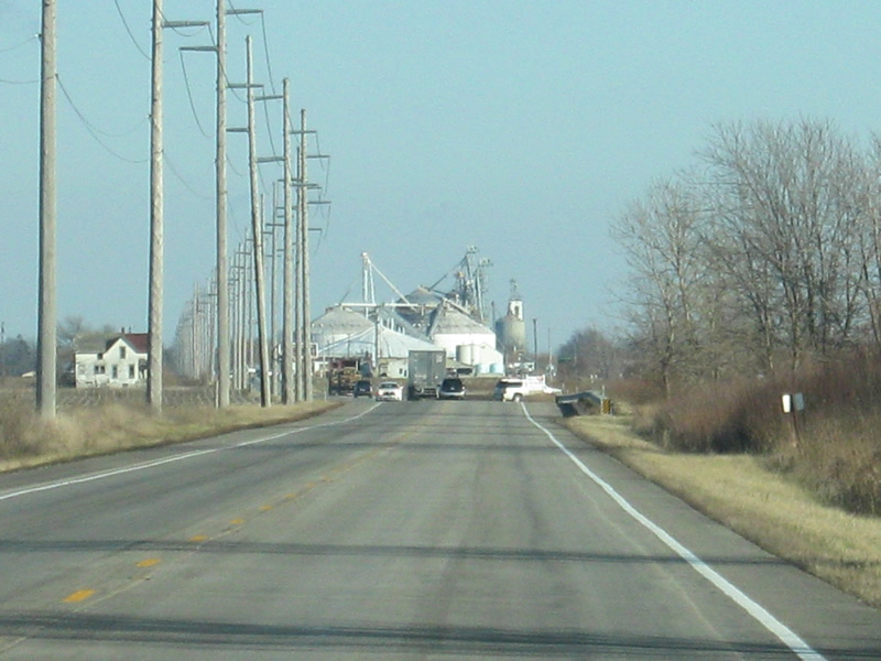
The further east one goes along U.S. 24 in Jasper County, the further to the south the Peoria, Toledo and Western Railway diverges. Despite that, it still parallels the highway as it travels through the upcoming town of Remington.
12/29/11
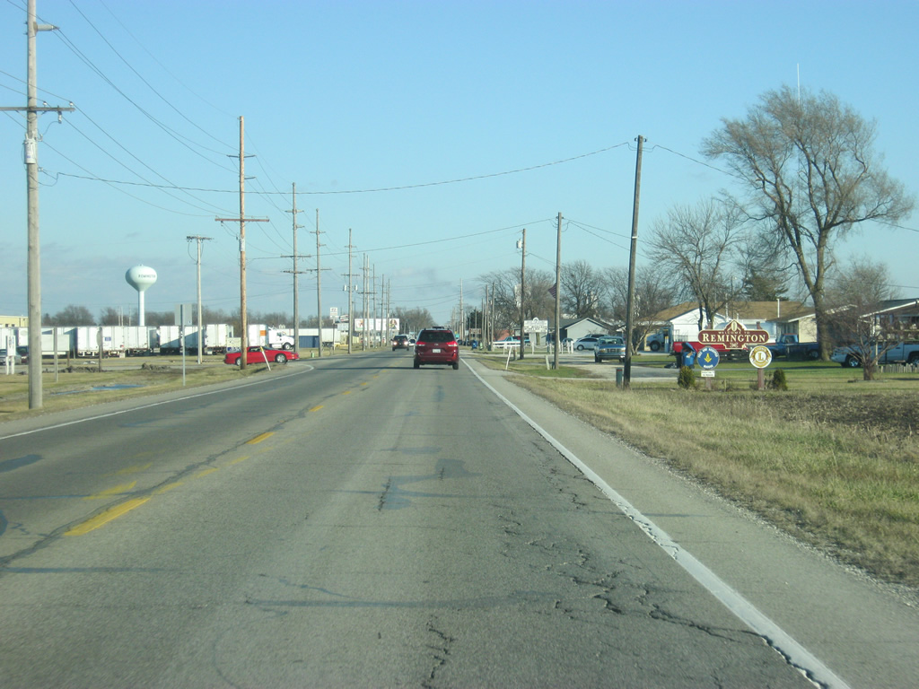
U.S. 24 enters the town of Remington (population 1,185) along Division Street.
12/29/11
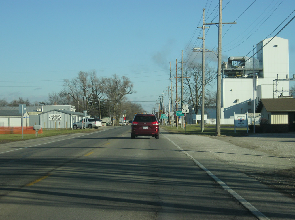
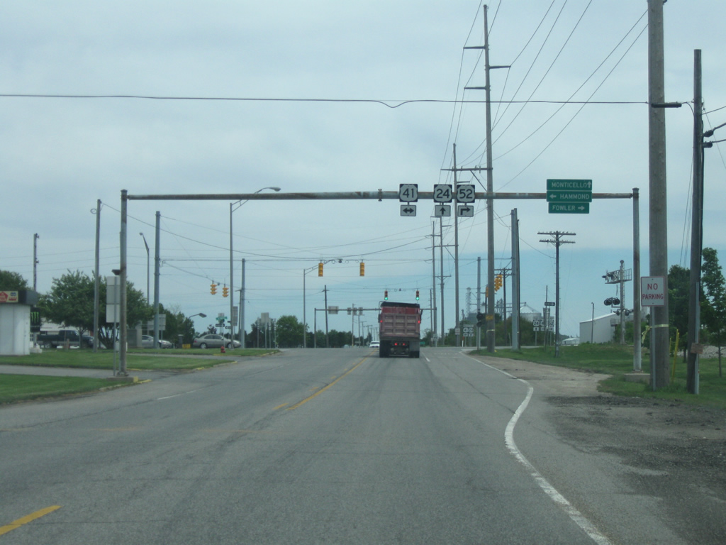
U.S. 24 (Division Street) crosses the north side of Remington, with the downtown located four blocks to the south along the railroad track. Ahead is the junction with U.S. 231, which will multiplex with U.S. 24 (Division Street) east to Wolcott. U.S. 231 goes for 297 miles across Indiana from St. John at U.S. 41 southeast through Crown Point, Rensellaer, Remington, Lafayette, Crawfordsville, Greencastle, Spencer and Jasper before crossing into Kentucky near Owensboro. Nationally, the highway travels for 912 miles from St. John to Panama City, Florida.
12/29/11
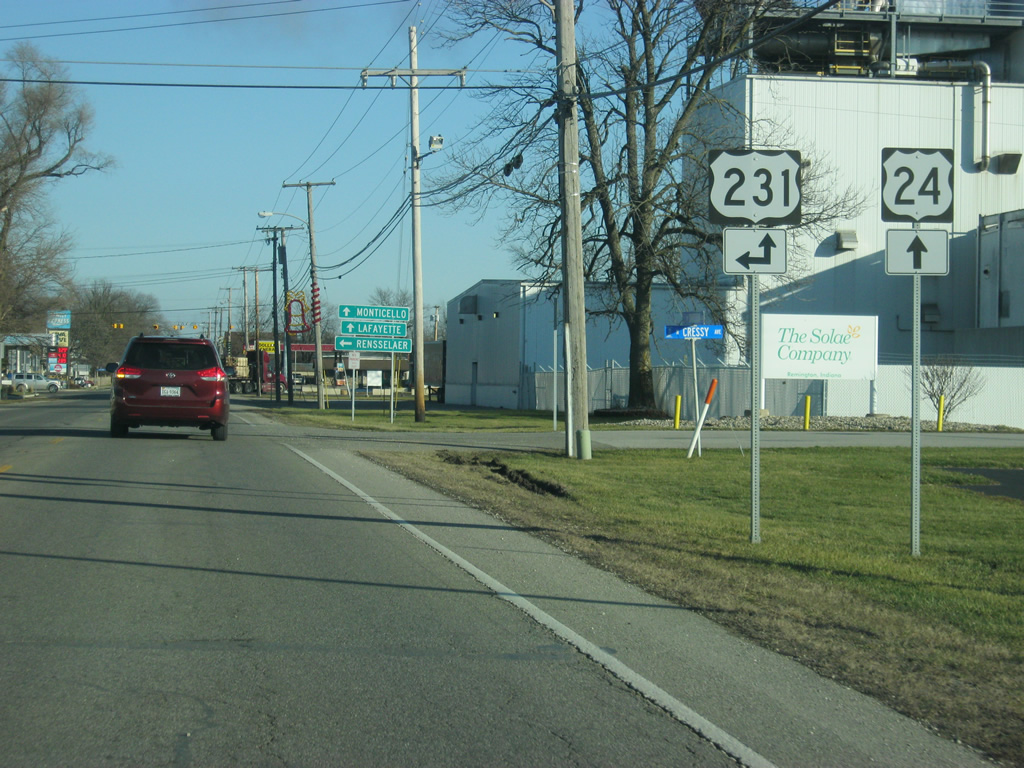
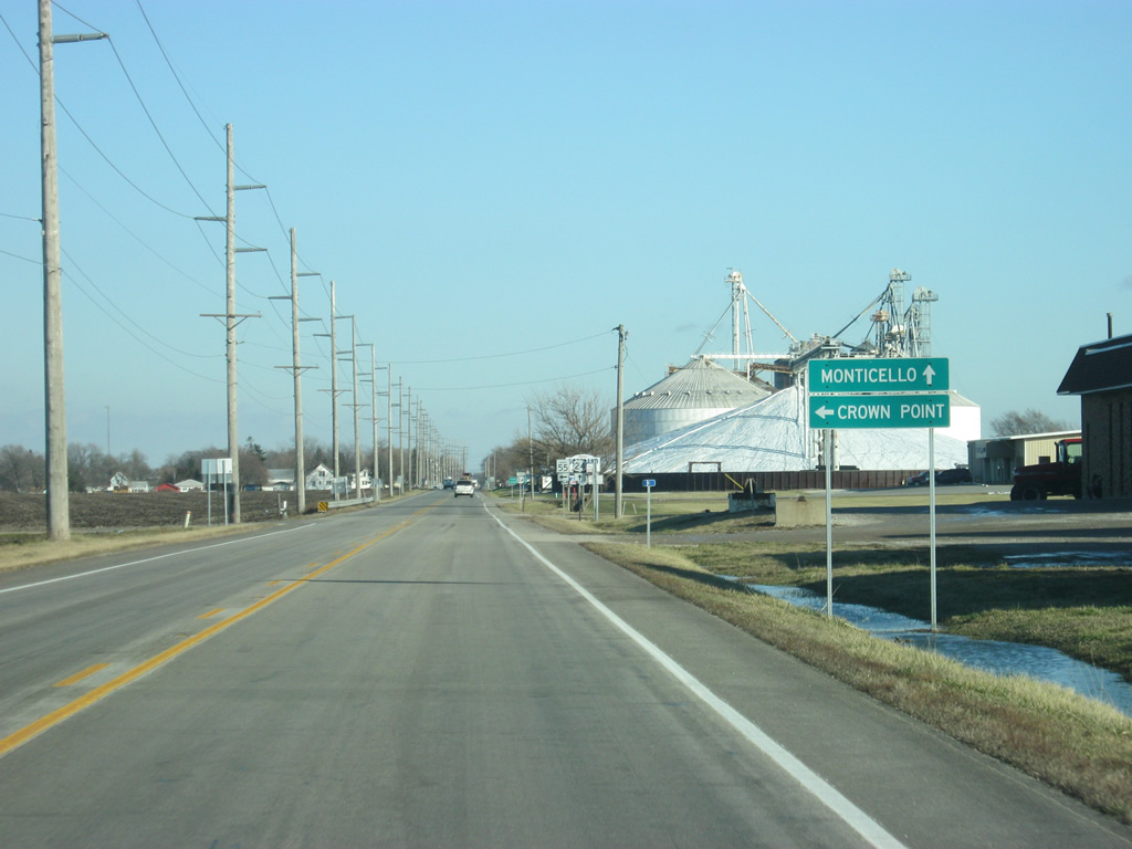
The Jasper County seat of Rensellaer is 12 miles to the north from Remington. Traffic bound for Monticello and Lafayette should continue east along U.S. 24 and U.S. 231 south.
12/29/11
Now at the intersection between U.S. 24 (Division Street) and U.S. 231 (Maine Street) north. To the south, Maine Street leads toward Downtown Remington.
11/05/09
East  South
South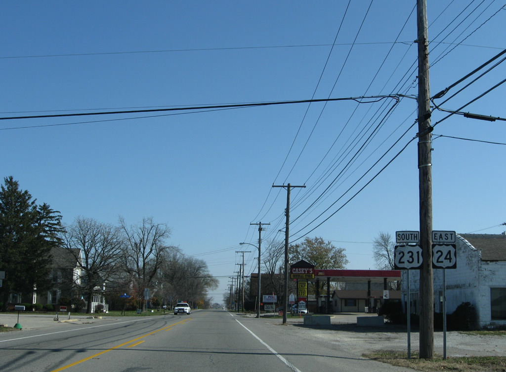
Reassurance markers posted after U.S. 231 south joins U.S. 24 east in Remington.
11/05/09
U.S. 24/ 231 (Division Street) cross Carpenter Creek and leave the town of Remington.
12/29/11
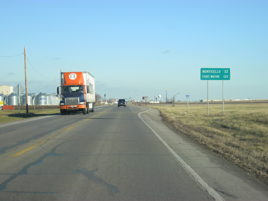
The White County seat of Monticello is 22 miles away from Remington along U.S. 24 while Fort Wayne is 125 miles away.
12/29/11
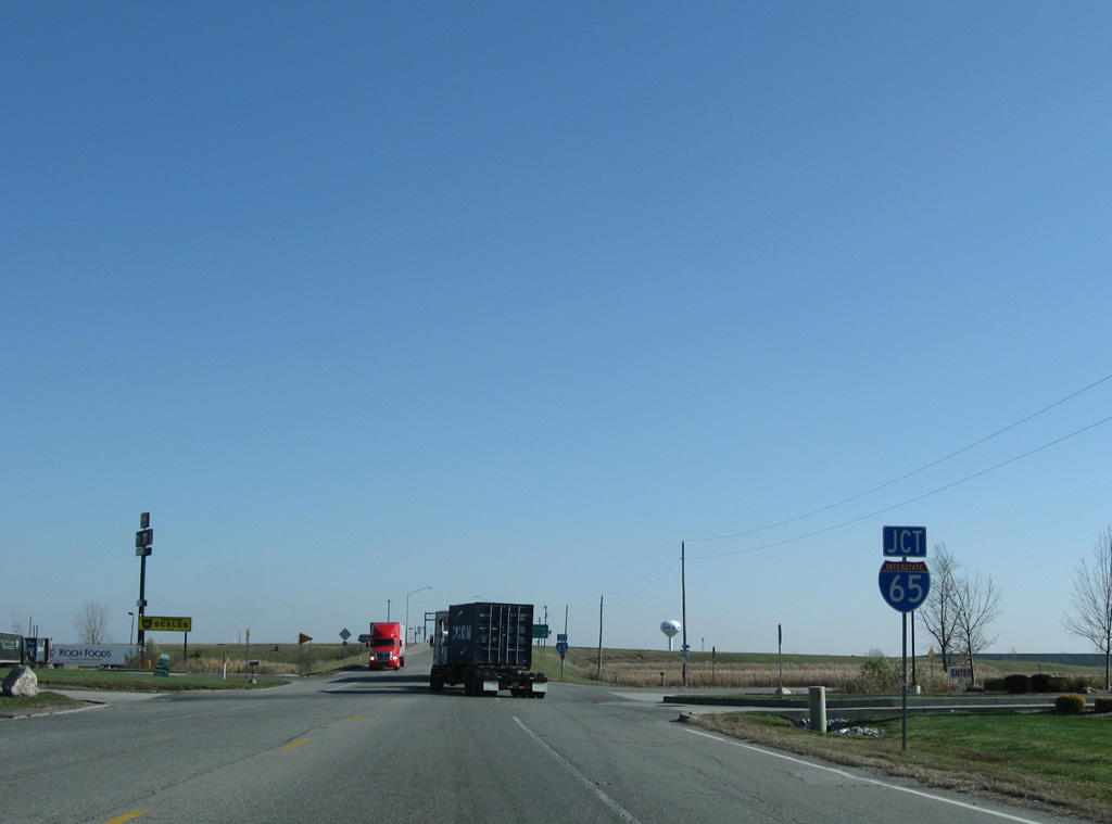
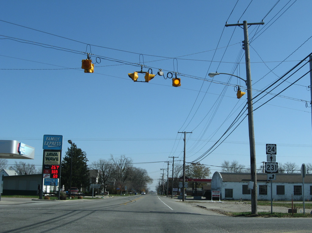
U.S. 24/231 converge with I-65 one mile east of Remington. Some highway-oriented businesses are located around their exchange, serving Interstate 65 traffic and the nearby communities of Remington and Wolcott.
12/29/11
Interstate 65 is an 887 mile long route from Gary, Indiana south to Louisville, Kentucky, Nashville, Tennessee and Mobile, Alabama along the Gulf Coast.
12/29/11
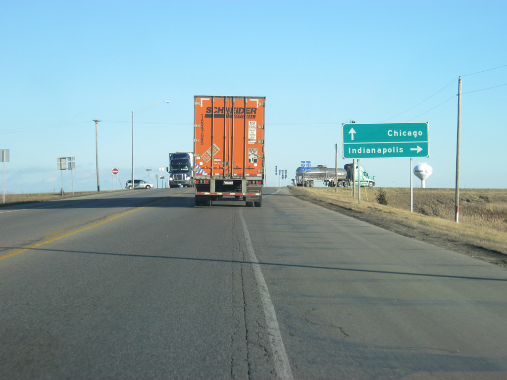
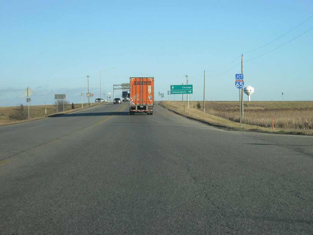
Interstate 65 heads south from the diamond interchange with U.S. 24/231 toward Lafayette, reaching the Hoosier State capital of Indianapolis in 90 miles.
12/29/11
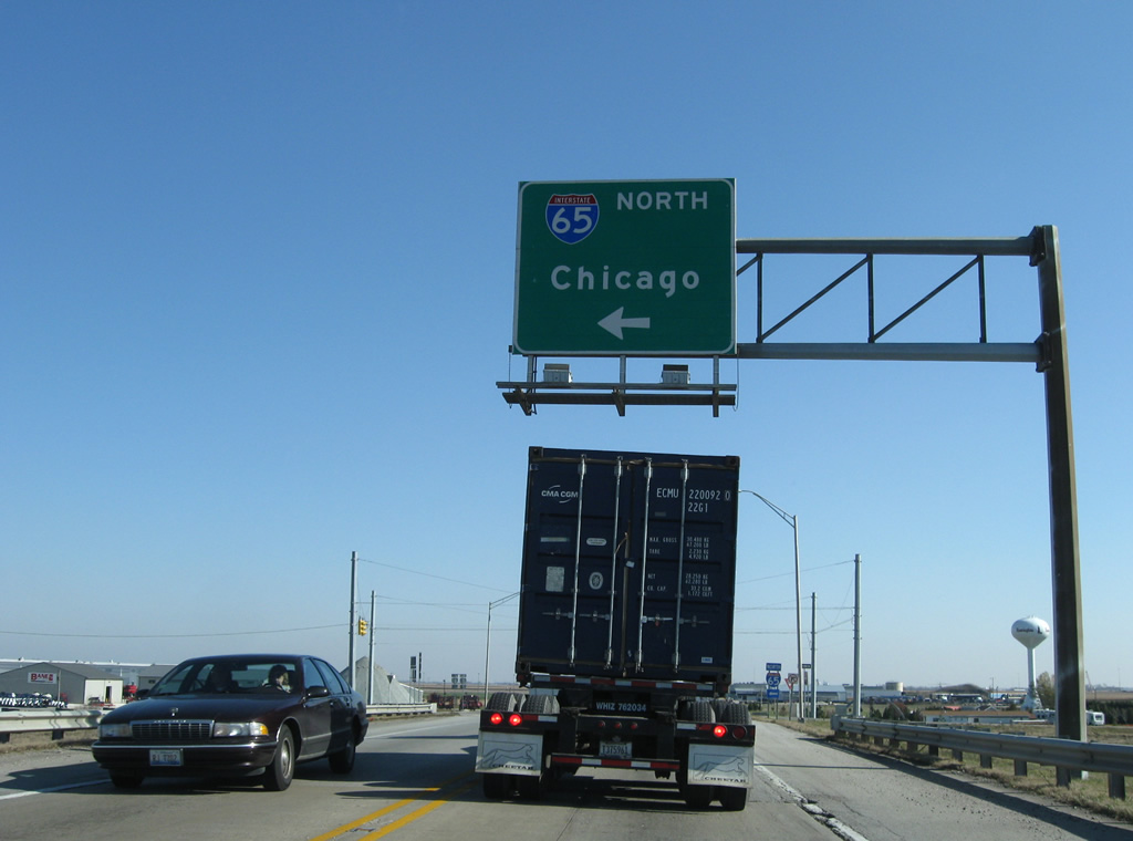
Interstate 65 travels toward the Northwest Indiana area and the Windy City of Chicago, which lies 95 miles away via I-80, I-90 or I-94.
11/05/09
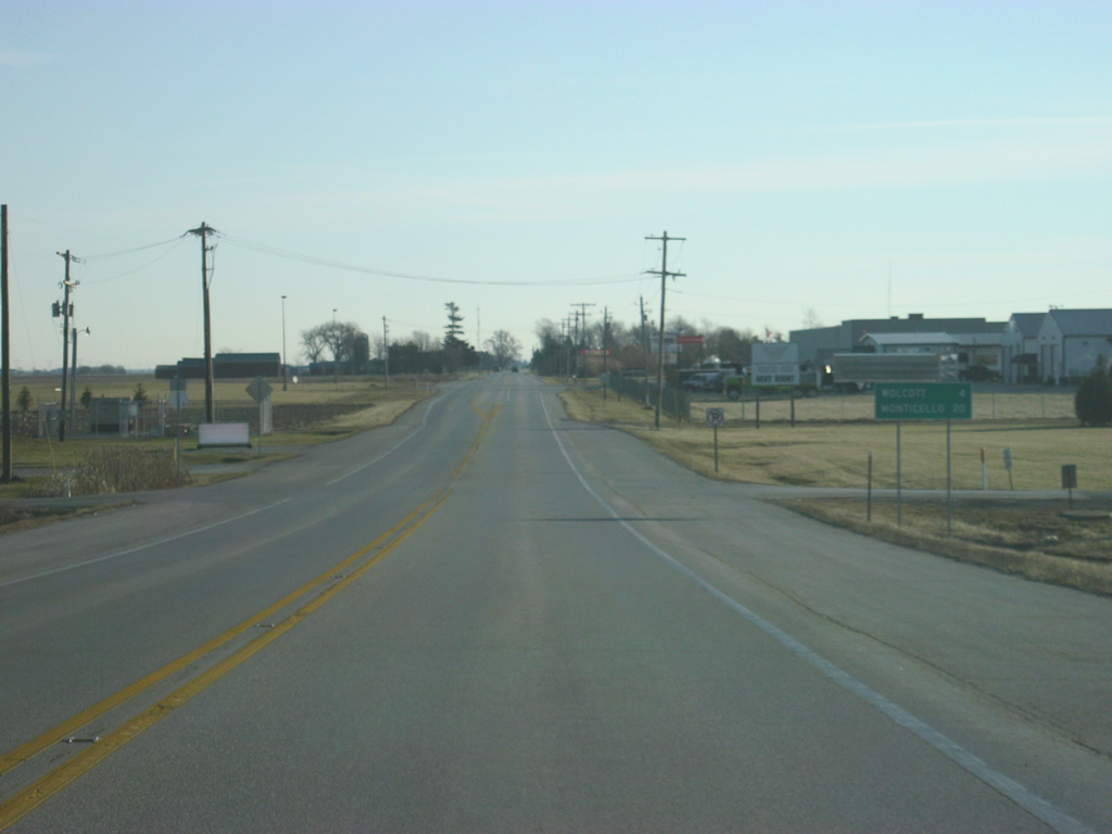
Leading away from the exchange with I-65, U.S. 24 east / U.S. 231 south are four miles from Wolcott and 20 miles from the White County seat of Monticello.
12/29/11
Although traffic counts are still rather low east of I-65, U.S. 24/231 can be a busy highway for commerce for those that may be heading toward Logansport or Fort Wayne.
04/13/10
U.S. 24 east/U.S. 231 south enter White County (population 24,643). Upon entering White County, the highway crosses into the Eastern Time Zone.
04/13/10
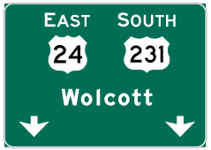
Photo Credits:
- Thomas Decker: 04/13/10, 05/14/10, 12/29/11
- ABRoads: 11/05/09
Connect with:
Page Updated Monday March 26, 2012.