
U.S. 29 North - Ruckersville to Culpeper

 North
North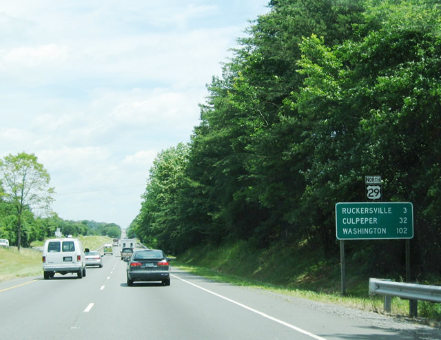
Distance sign for Ruckersville, Culpeper, and Washington.
06/02/04
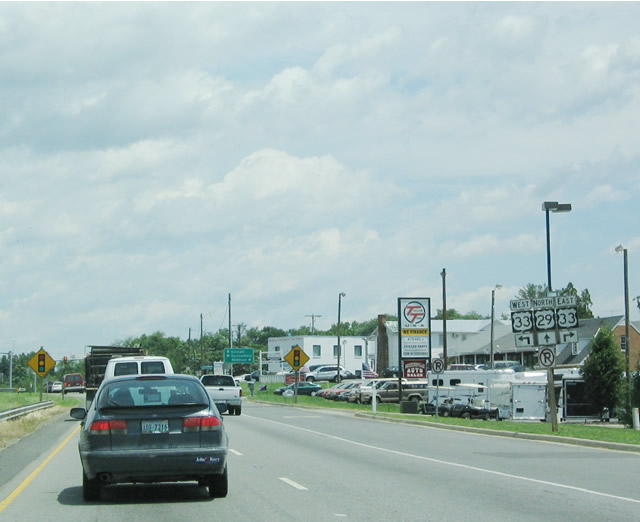
In Ruckersville, U.S. 29 intersects U.S. 33. East U.S. 33 heads southeast to Richmond, while west U.S. 33 serves the Greene County seat of Stanardsville, crosses Skyline Drive in Shenandoah National Park, and enters Harrisonburg at its interchange with Interstate 81.
06/02/04
U.S. 29 continues north through Ruckersville toward Madison, Culpeper, Remington, Warrenton, and Arlington County. The control city of Washington, D.C., is not mentioned on this sign.
06/02/04
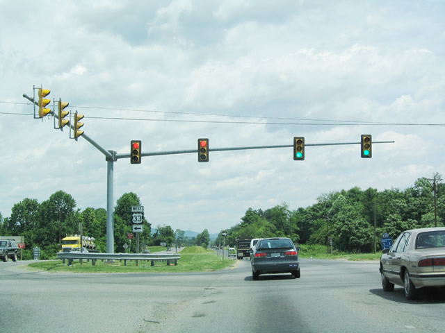
A traffic signal provides control at the intersection of U.S. 29 and U.S. 33. U.S. 33 is a diagonal route, originating in Richmond, then heading northwest through Virginia, West Virginia, and Ohio before culminating in Indiana southeast of Elkhart (U.S. 20).
06/02/04
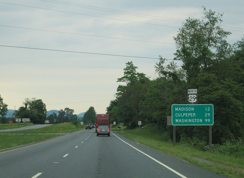
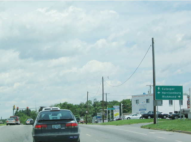
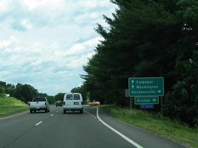
This distance sign, located after the U.S. 33 intersection, provides the distance to Madison, Culpeper, and Washington.
05/30/05
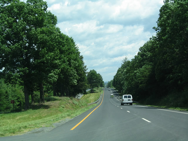
U.S. 29 passes through beautiful rolling hills, and the highway affords spectacular views of the surrounding green countryside. The highway continues as an expressway, with four lanes all the way to Interstate 66.
06/02/04
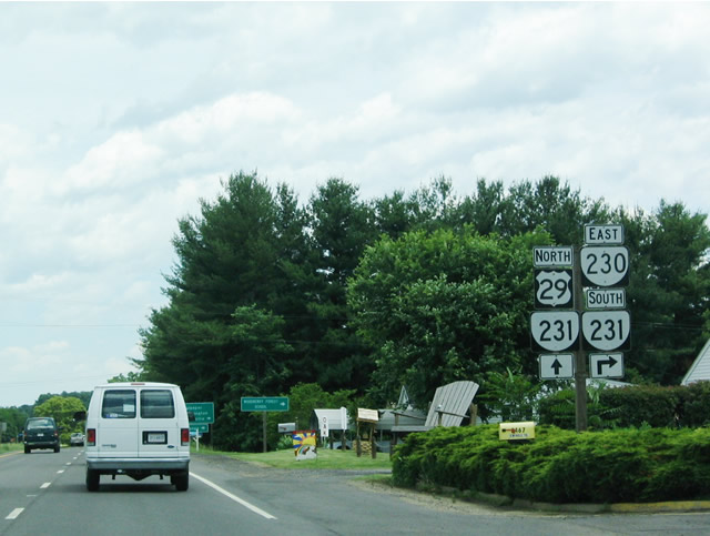
The next intersection along northbound U.S. 29 is the connection with SR 230 west. A left turn follows SR 230 southwest to Stanardsville (U.S. 33).
06/02/04
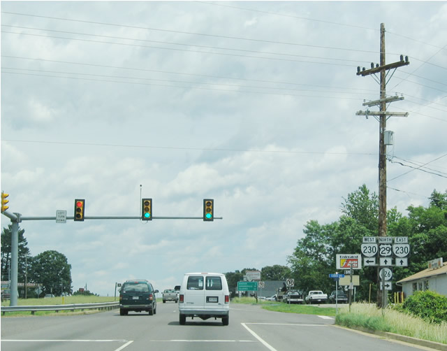
A traffic signal is in place at the intersection of U.S. 29 and SR 230.
06/02/04
North 
U.S. 29/SR 230 combine for 0.52 miles north along Seminole Trail to the west of Pratts.
06/02/04
SR 230 overlaps with SR 231 south from U.S. 29 along Orange Road 0.63 miles east to SR 687 (Fairground Road) at Pratts.
06/02/04
SR 230 (Orange Road) extends 9.19 miles east from U.S. 29 to U.S. 15 northwest of Orange. SR 231 branches 16.03 miles south from Pratts to U.S. 33 at Gordonsville.
06/02/04
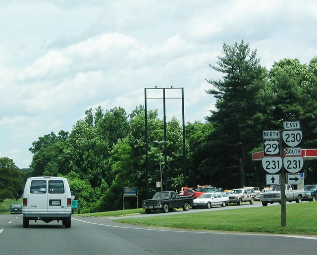
SR 231 joins U.S. 29 (Seminole Trail) north 1.34 miles to S Main Street in the town of Madison. SR 230 continues east from SR 231 at Pratts to Aroda and Radiant.
06/02/04
 North
North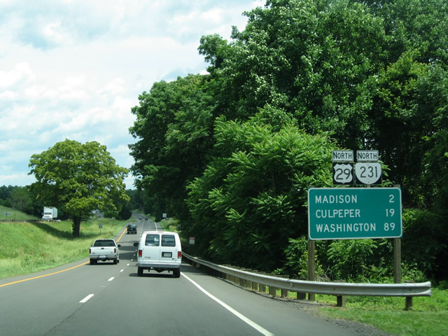
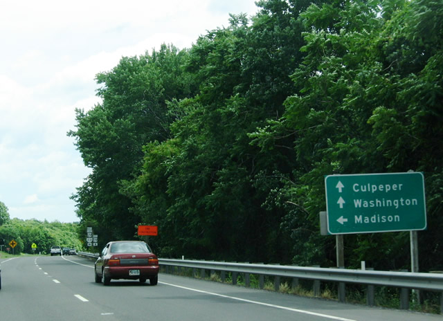
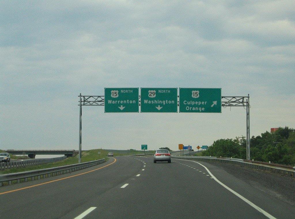
Beyond the SR 230-231 intersection, this distance sign references Madison, Culpeper, and Washington, D.C. En route, U.S. 29 will also pass through Remington, Warrenton, Fairfax, and Arlington County. Notably, no SR 231 destinations are listed on this sign (such as Sperryville or Skyline Drive).
06/02/04
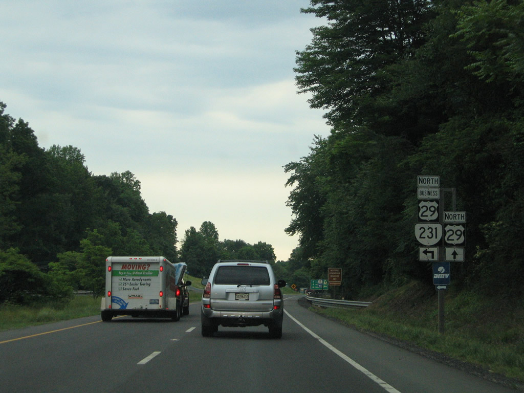
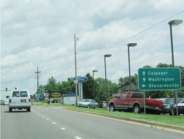
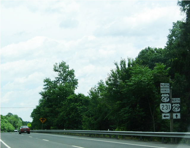
A left turn is required to continue north along SR 231 and follow Business U.S. 29 into Madison. SR 231 continues north through Madison to Sperryville, then connects to U.S. 211 west to Shenandoah National Park and Skyline Drive.
05/30/05
U.S. 29 Business/SR 231 north leads to Madison and Sperryville. U.S. 29 continues northeast toward Culpeper, Warrenton, Fairfax, and Arlington County.
06/02/04
Reaching the turnoff for Madison, SR 231 and Business U.S. 29 head northwest into the town, while U.S. 29 bypasses the town to the east. U.S. 29 continues northeast from here to Culpeper and Warrenton before entering the metropolitan area of Washington, D.C.
06/02/04
North
U.S. 29 Business returns to U.S. 29 via North Main Street from Madison to end at U.S. 29 opposite SR 722 (Fishback Road).
05/30/05
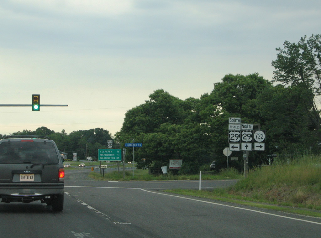
U.S. 29 Business south provides a second opportunity to access SR 231 (Blue Ridge Turnpike) leading north to Etlan and Sperryville. The two otherwise merge together ahead of Washington Street in Madison. SR 722 connects U.S. 29 with SR 634 (Oak Park Road) near Prices Shop.
05/30/05
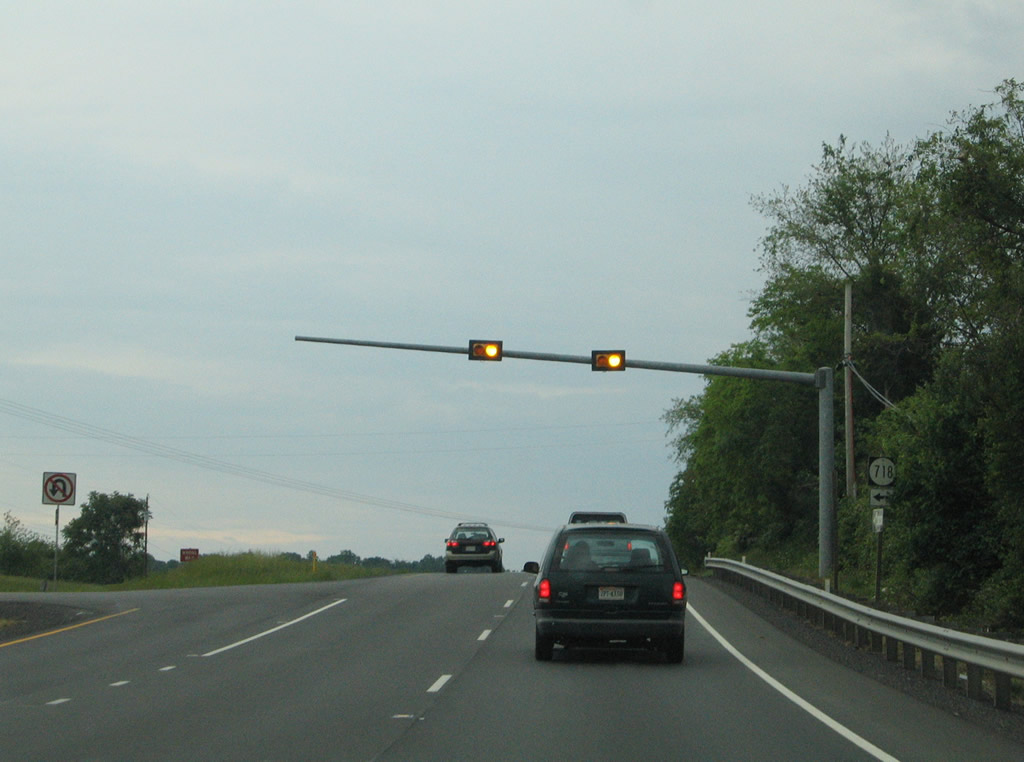
Traveling more easterly, U.S. 29 enters Culpeper County ahead of Lake Pelham and the city of Culpeper. A set of flashers operate at the east end of SR 718 (Mountain Run Lake Road), a local road joining James Monroe Highway with Mountain Run Lake.
05/30/05
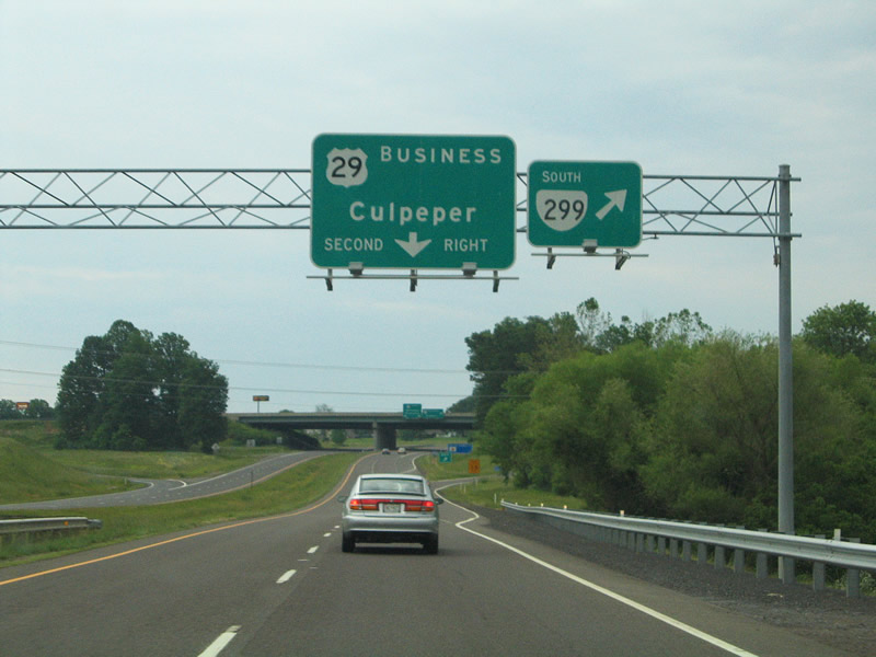
After crossing Lake Pelham, U.S. 29 (James Monroe Highway) upgrades to a limited access freeway to bypass the city of Culpeper. SR 299 (Madison Road) south and U.S. 29 Business (Madison Road) north come together at a six-ramp parclo interchange southwest of town. SR 299 connects U.S. 29 travelers with U.S. 15 (James Madison Highway) leading south to Orange.
05/30/05
A loop ramp connects with U.S. 29 Business (Madison Road) north to an overlap with U.S. 522/15 Business (Germanna Highway south / Main Street north).
05/30/05
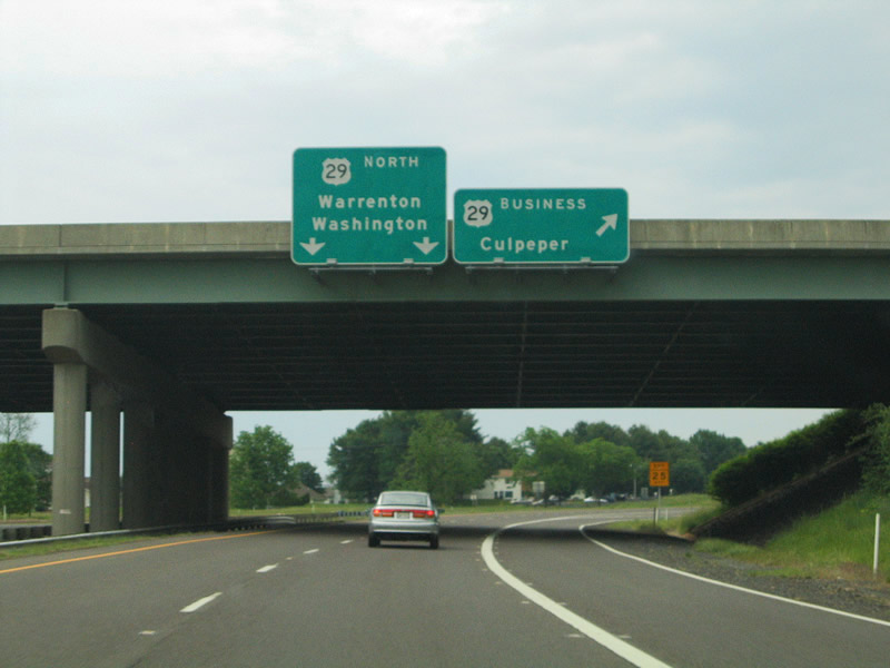
U.S. 15 (James Madison Highway) meets U.S. 29 (James Monroe Highway) directly at a diamond interchange on the suburbanized south side of Culpeper. U.S. 15 heads 18 miles south from the Culpeper bypass to the Orange County seat.
05/30/05
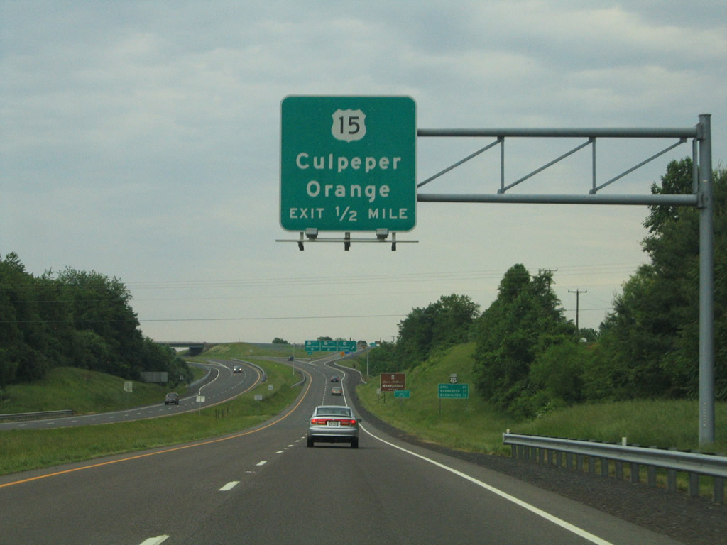
Northbound at the off-ramp to U.S. 15 (James Madison Highway) south and U.S. 15 Business (shown here as simply a part of U.S. 15) north into Culpeper. Orange Road carries U.S. 15 Business north to the overlap with U.S. 522 (Germanna Highway) west.
05/30/05
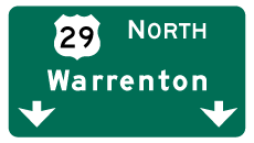
Photo Credits:
- Andy Field: 06/02/04
- Alex Nitzman: 05/30/05
Connect with:
Page Updated Wednesday March 24, 2010.