
U.S. 29 North

 north
north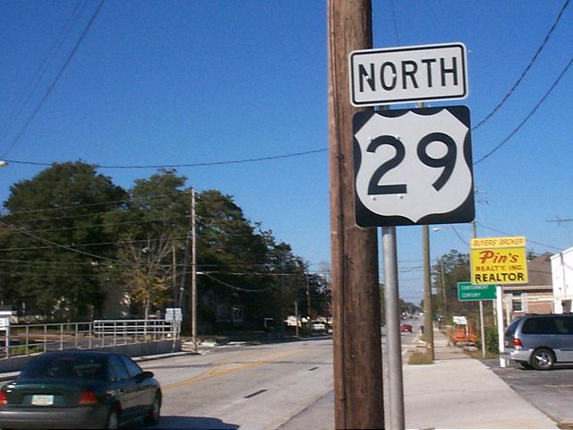
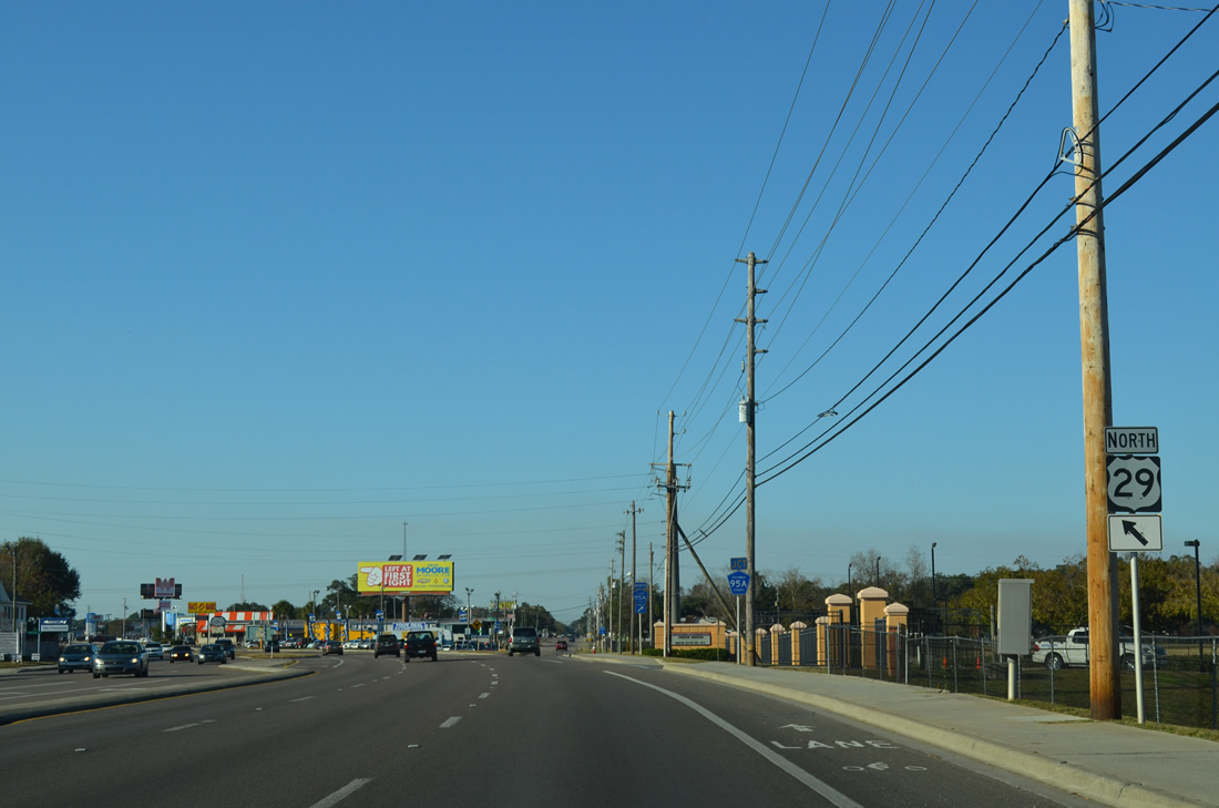
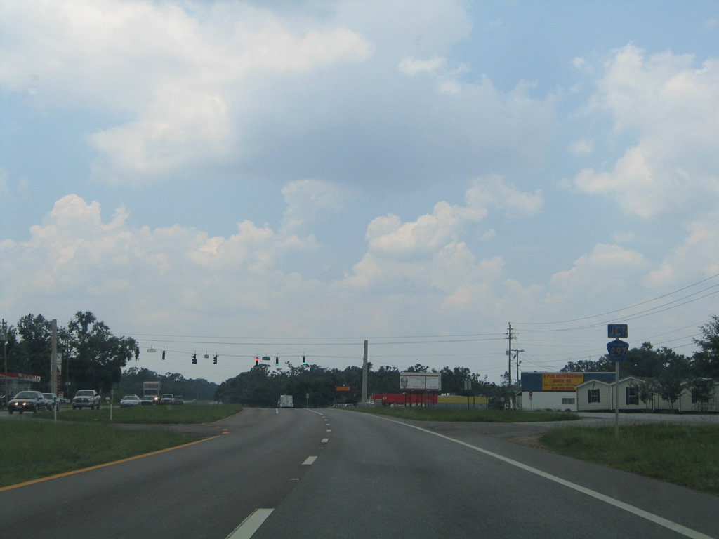
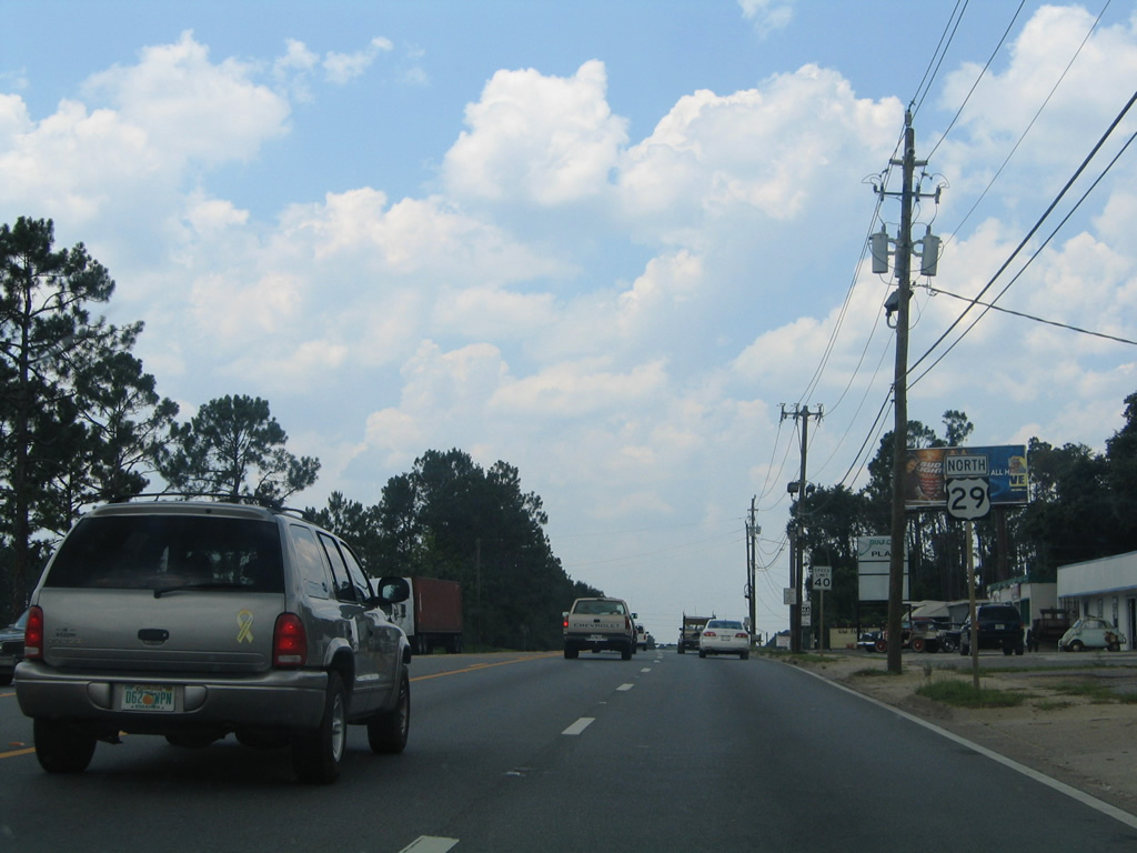
The first U.S. 29 northbound shield and associated distance sign. U.S. 29 carries local traffic northward to SR 292 (Pace Boulevard). There Palafox Street increases in traffic counts to Interstate 10 and Nine Mile Road (U.S. 90 Alternate). The northern terminus of U.S. 29 is seven states and the District of Columbia away at Mount Hebron, Maryland.
11/27/99
11/17/12
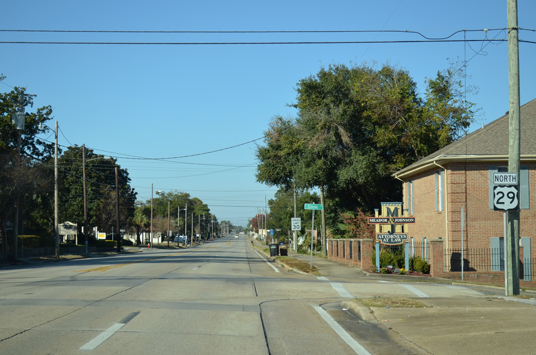
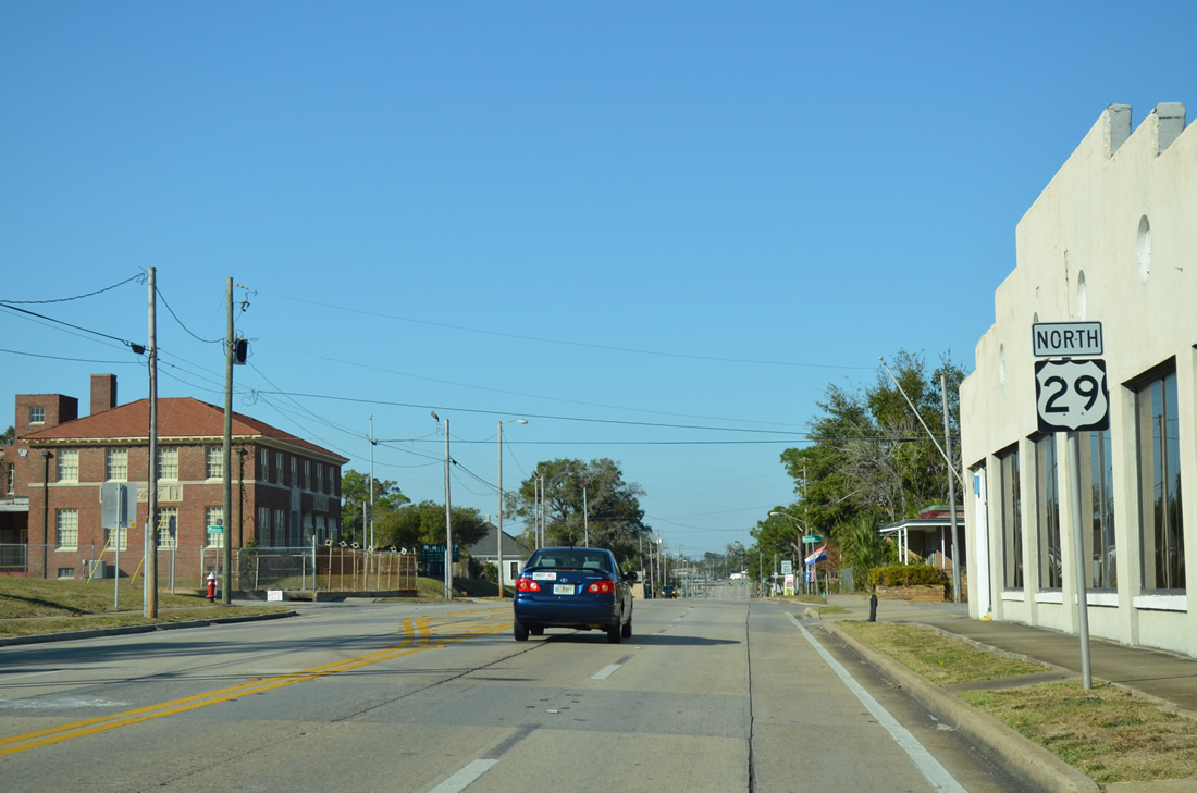
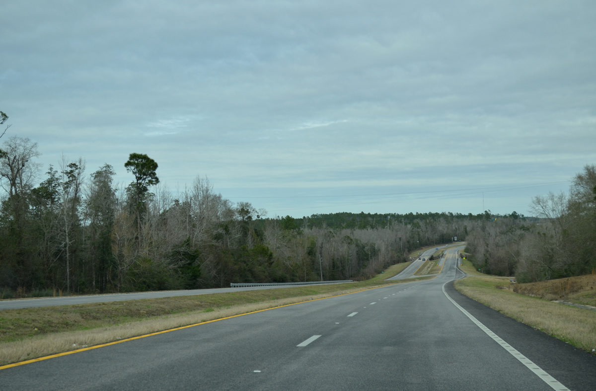
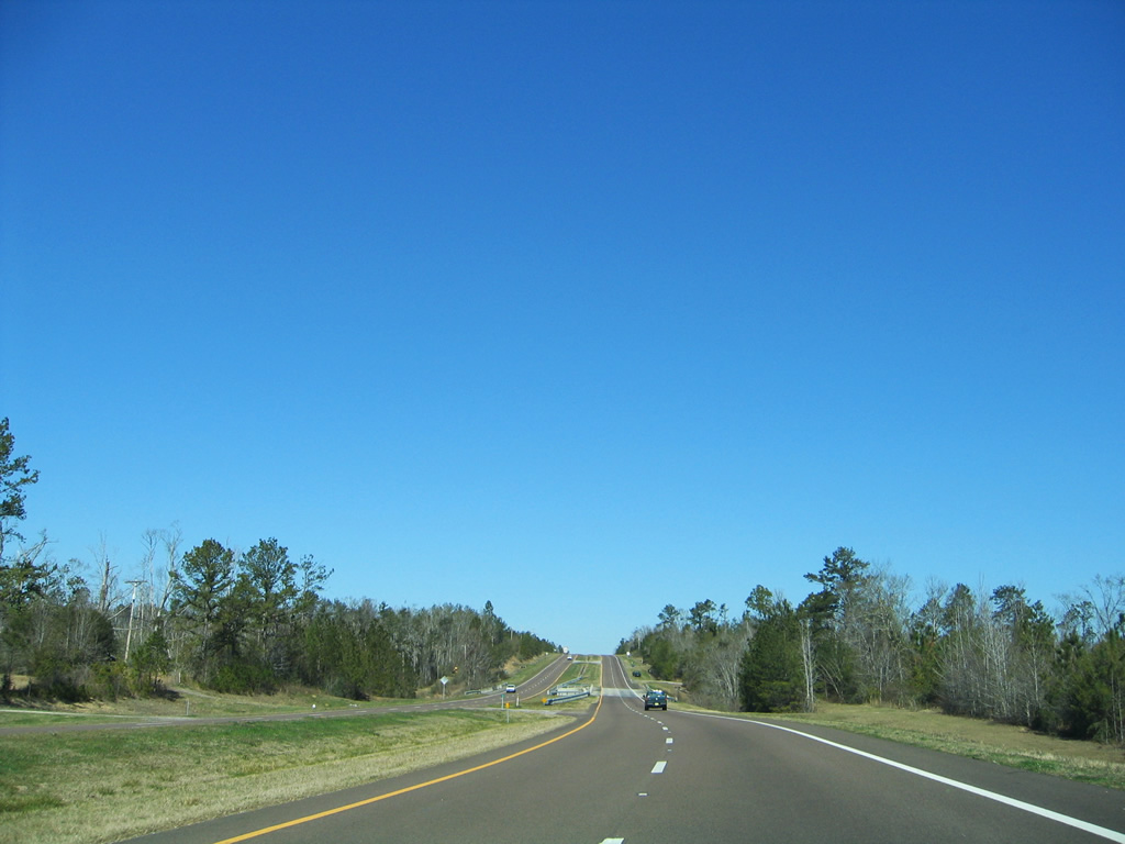
The first northbound reassurance shield was moved one block northward to Strong Street by 2004. U.S. 29 follows a four lane concrete roadway 17 blocks north to Scott Street.
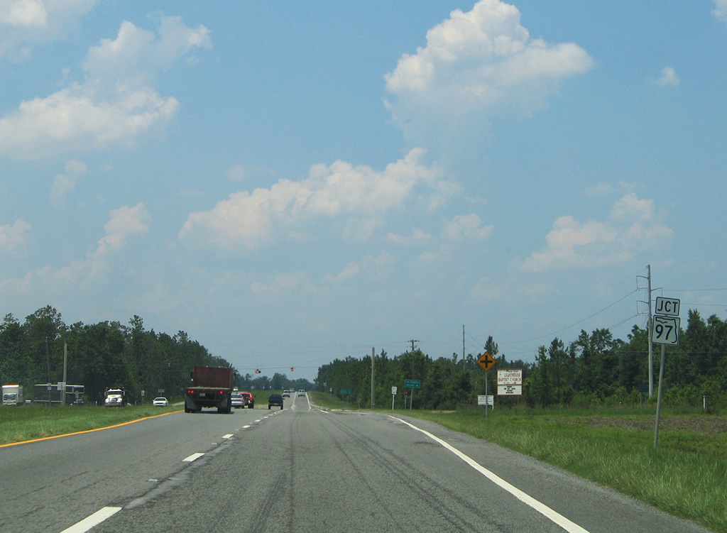
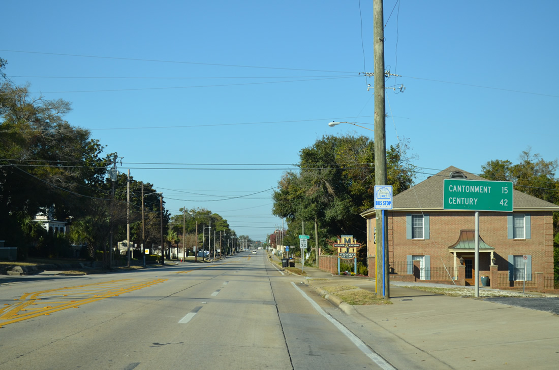
Cantonment lies 15 miles to the north followed by Century in 42 miles.
11/17/12
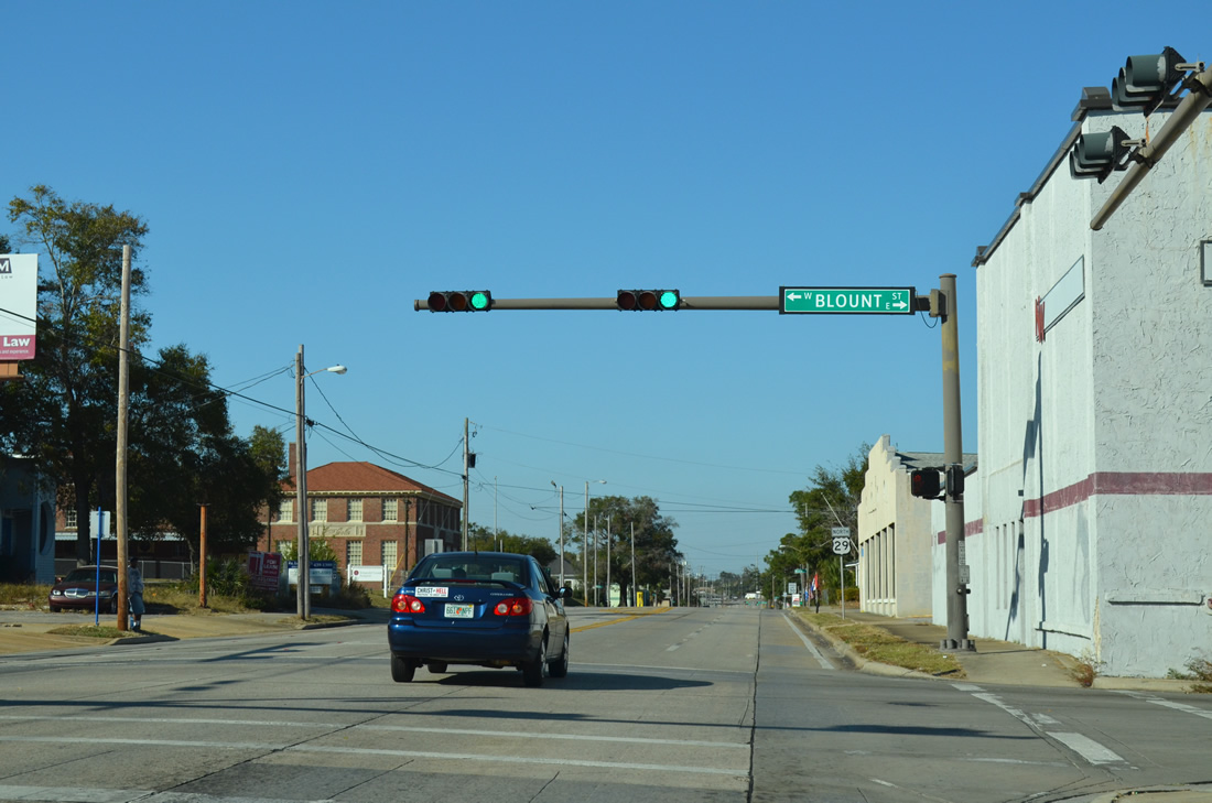
Blount Street is a through street west from U.S. 29 (Palafox Street) to A Street and east under I-110 to Bayview Park.
11/17/12
The second shield for U.S. 29 north follows the Palafox Street intersection with Blount Street.
11/17/12
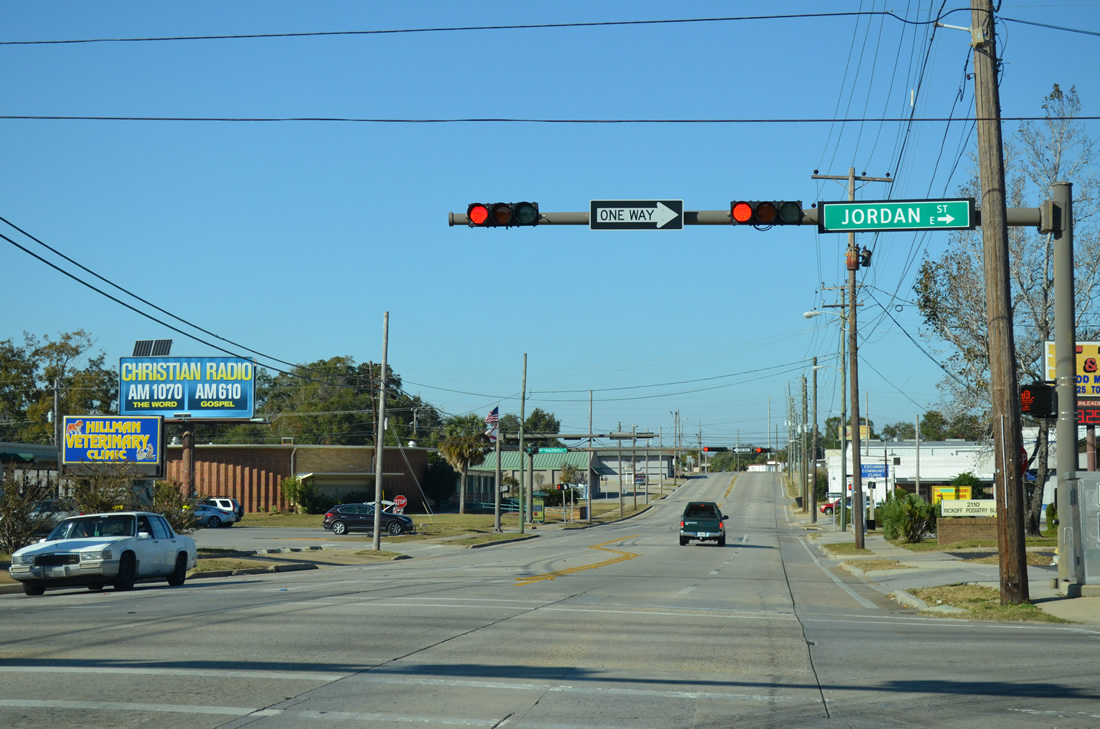
Jordan Street flows east from A Street and U.S. 29 to Hayne Street and the Maxwell Street on-ramp to Interstate 110 north.
11/17/12
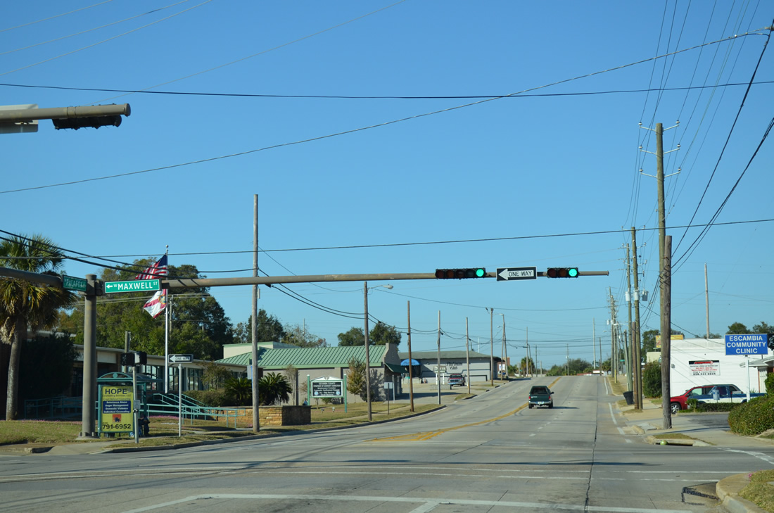
Maxwell Street compliments Jordan Street in the westbound direction, one block to the north.
11/17/12
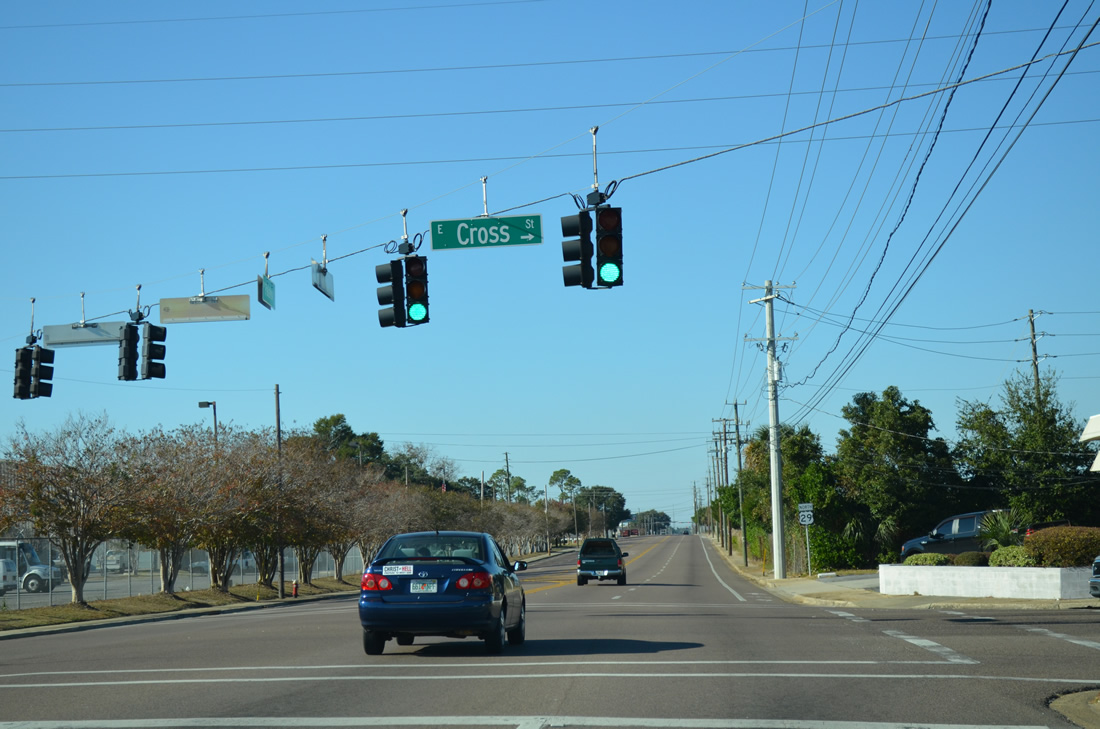
Cross Street west and Leonard Street east come together at U.S. 29 as Palafox Street veers westward. The city service center resides just to the west.
11/17/12
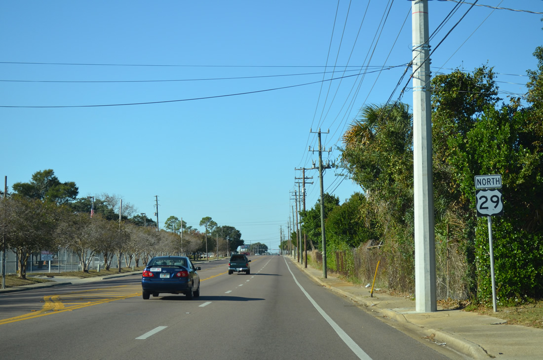
The third northbound shield for U.S. 29 follows as Palafox Street expands to include a center turn lane. Leonard Street was once a county road, which is why a shield is placed here.
11/17/12

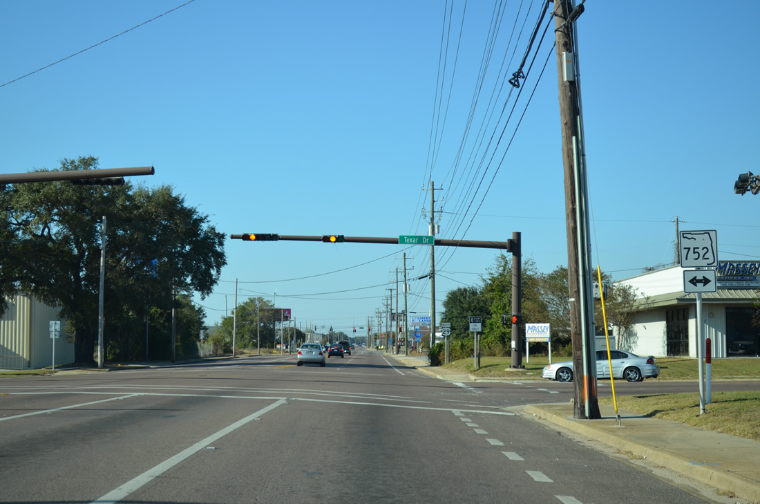
Industrial businesses line both sides of U.S. 29 (Palafox Street) as the US highway exits the city. SR 752 (Texar Drive) crosses Palafox Street next from just east of SR 295 to an overpass above the parallel CSX Railroad.
11/17/12
SR 742 travels just 1.18 miles from Fairfield Drive (SR 295) east to Ninth Avenue (SR 289) in the city of Pensacola.
11/17/12

Northbound U.S. 29 at the fourth reassurance marker between Texar Drive and adjacent SR 295 (Fairfield Drive).
11/17/12
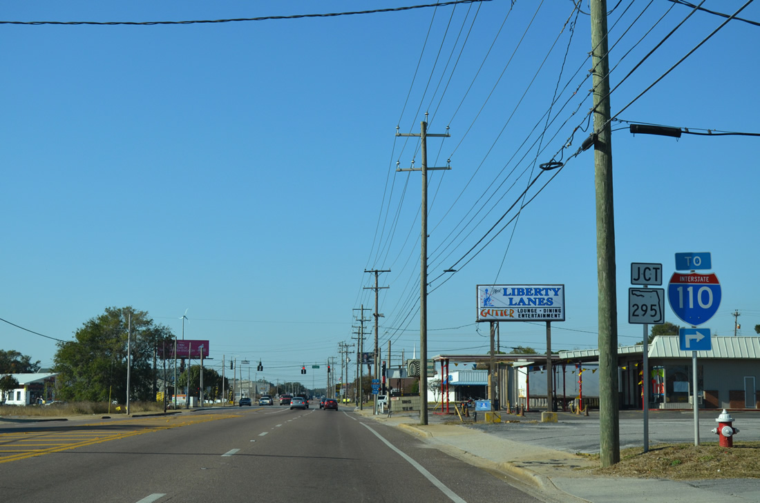
SR 295 branches northward from its split with SR 752 (Texar Drive) to a parclo interchange with Interstate 110 (Exit 4) nearby. The state road ends a short distance east of there at SR 289 (Ninth Avenue) in Pensacola.
11/17/12
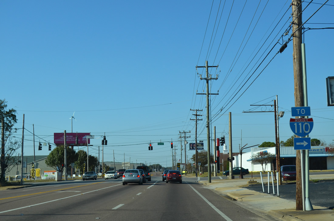
A second trailblazer for Interstate 110 stands at the intersection between U.S. 29 (Palafox Street) north and SR 295 (Fairfield Drive). Fairfield Drive carries SR 295 southwest to SR 727 and West Pensacola. The state road follows a combination of New Warrington Road and Navy Boulevard south from there to Warrington and the main gate to Pensacola NAS.
11/17/12
U.S. 29 passes by Palafox Industrial Park on the northward drive beyond SR 295. The Pensacola city limits line the east side of the arterial along this stretch.
11/17/12
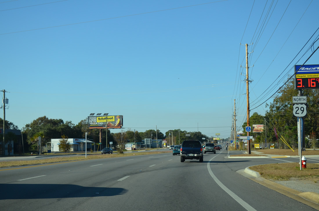
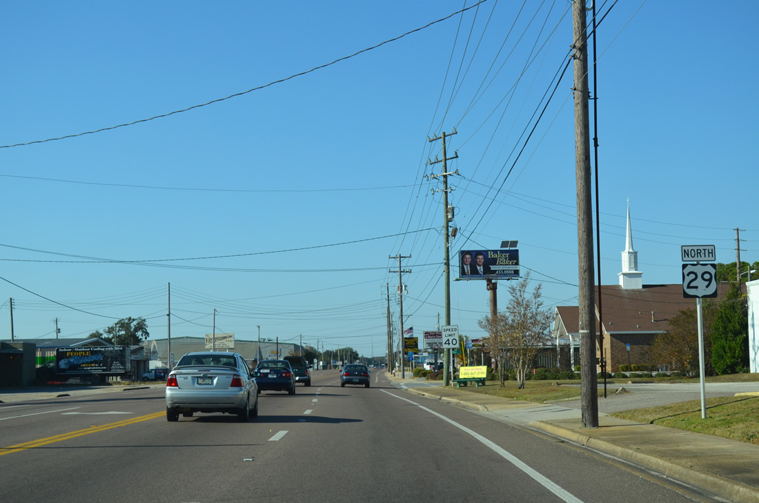
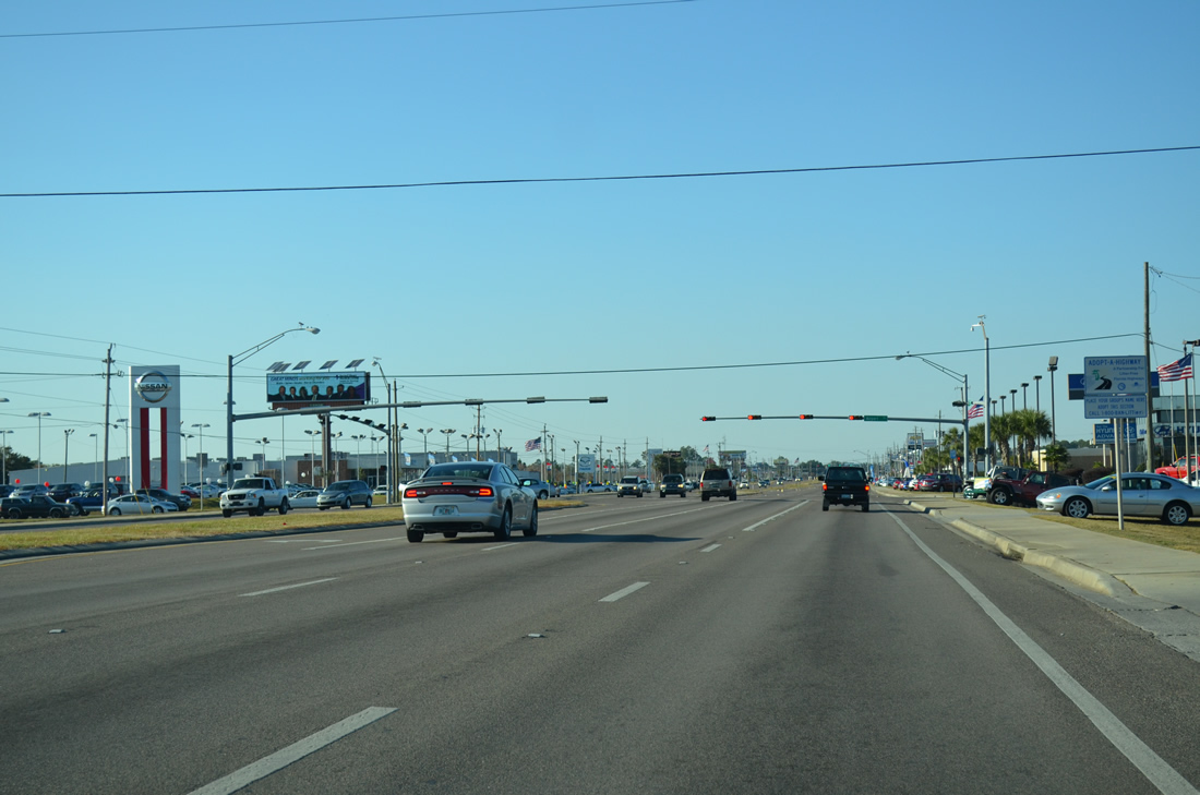
Northbound U.S. 29 shield posted after the merge with Pensacola 292 (Pace Boulevard) at Bayliss Court. SR 292 brings in traffic from southwest Pensacola, Warrington, and Pensacola Naval Air Station to an increasingly busy six lane Palafox Street.
11/17/12
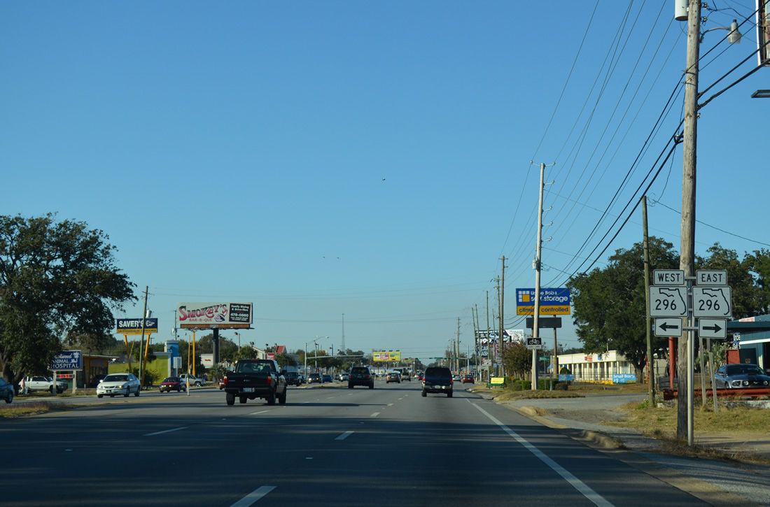
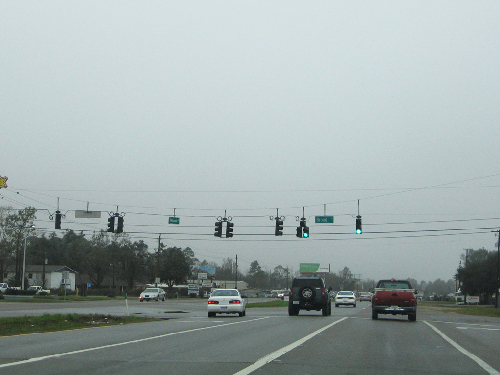
The first of three sets of SR 296 shields posted for the U.S. 29 (Palafox Street) northbound intersection with Beverly Parkway and Brent Lane. SR 296 comprises a busy five lane arterial between U.S. 90 (Mobile Highway) and SR 289 (Ninth Avenue) at Cordova Mall.
05/08/04
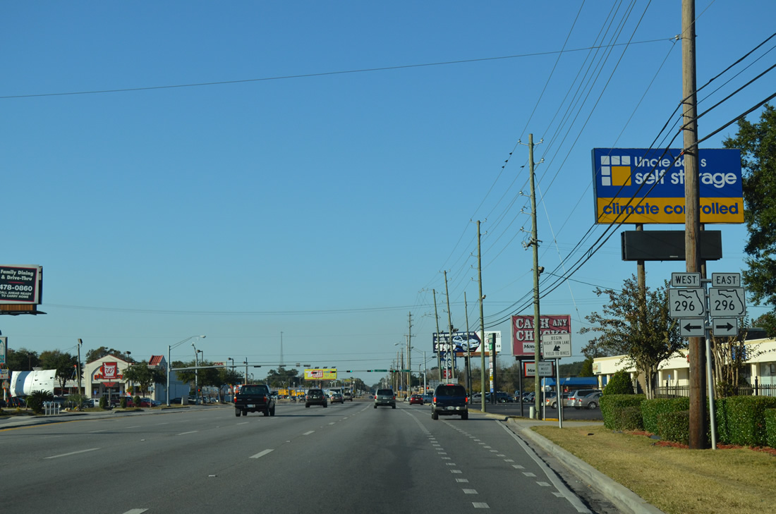
SR 296 crosses paths with U.S. 29 (Palafox Street) one half mile north of SR 292 (Pace Boulevard). SR 296 name changes from Beverly Parkway to Brent Lane as it crosses U.S. 29 from west to east at Brent. The state road arcs 9.66 miles from U.S. 90 at Bellview to U.S. 90 at Bayou Texar.
11/17/12
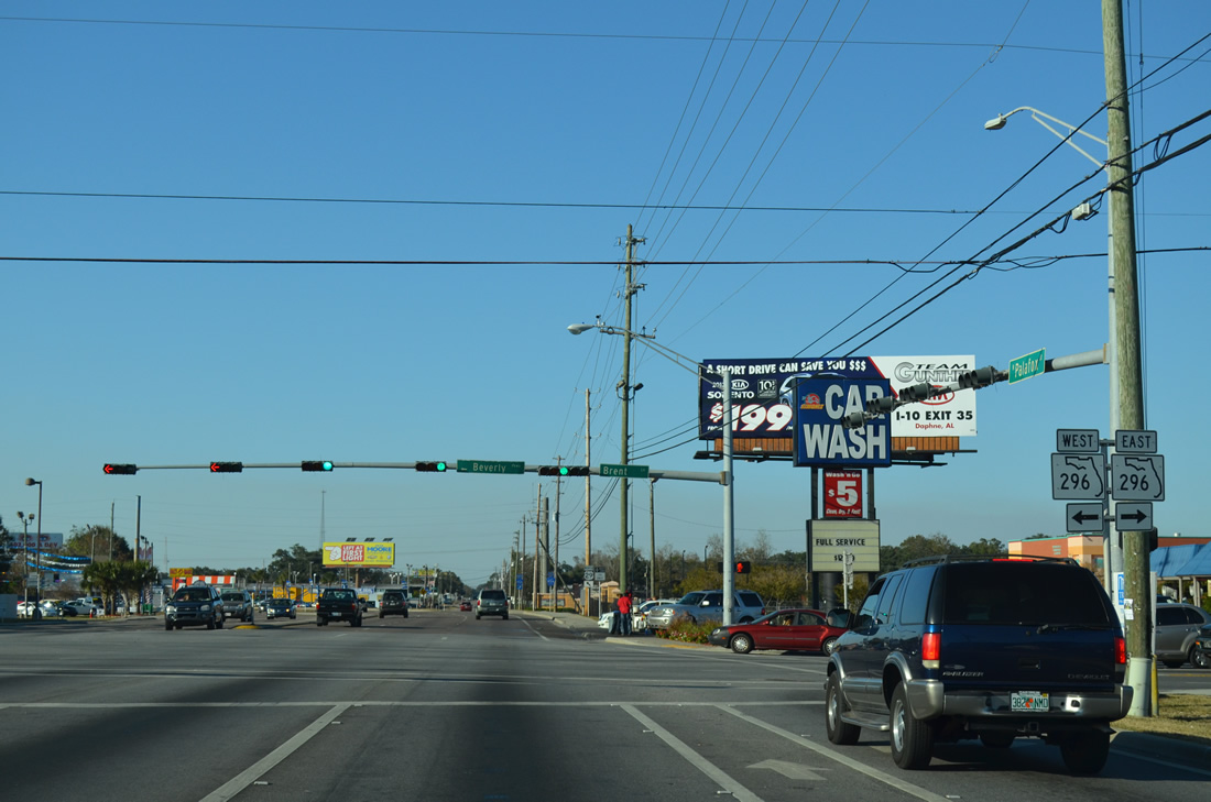
U.S. 29 northbound at SR 296 (Beverly Parkway west / Brent Lane east). A diamond interchange with Interstate 110 lies 0.9 miles to the east. Beverly Parkway west meets W Street (CR 453) in 0.75 miles.
11/17/12
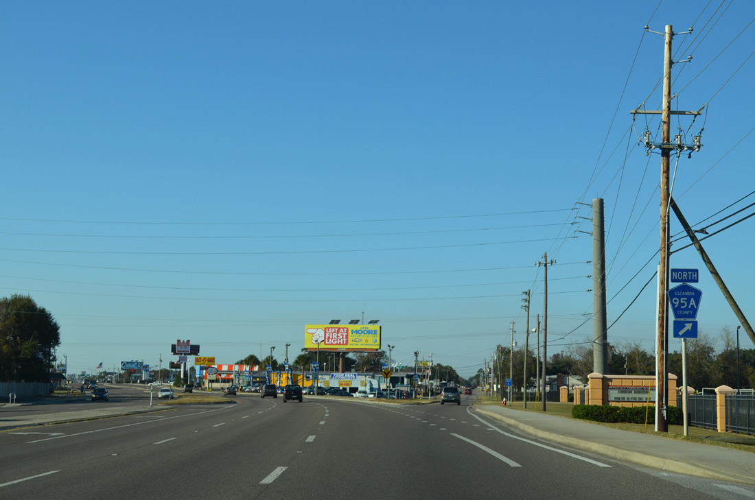
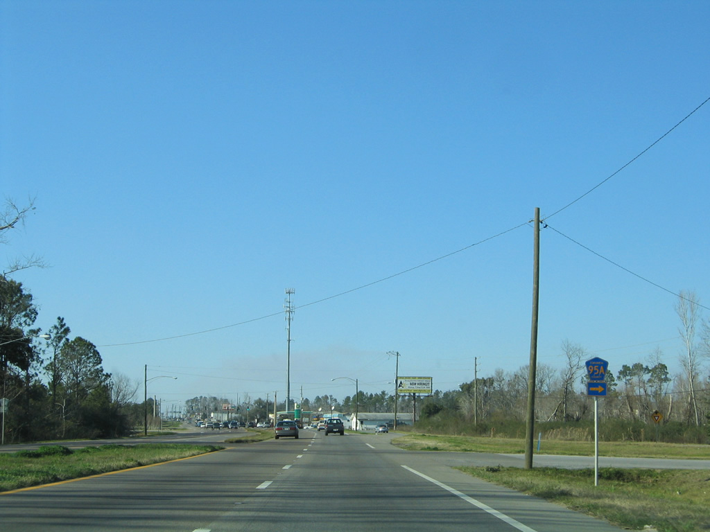
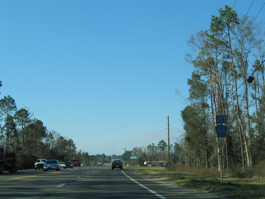
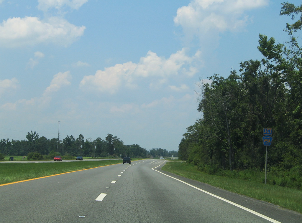
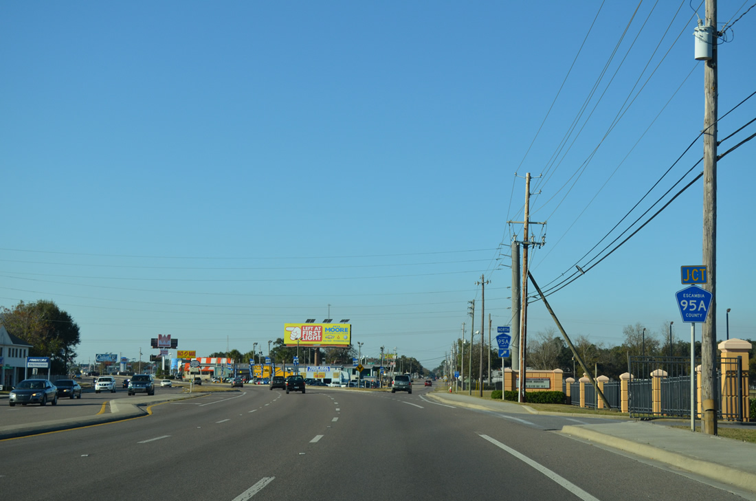
U.S. 29 parts ways with Palafox Street for Pensacola Boulevard at the southern terminus of CR 95A. County Road 95A comprises the original U.S. 29 along Palafox Street / Old Palafox Highway northward from Brent to Cantonment.
11/17/12
Six lanes of U.S. 29 (Pensacola Boulevard) veer northwest toward Interstate 10. Escambia County Road 95A remains parallel to the east of Pensacola Boulevard through Ensley and Gonzalez.
11/17/12
A short distance beyond the split with Palafox Street, U.S. 29 northbound meets SR 750 (Airport Boulevard) east. Unsigned on Pensacola Boulevard, the west end of SR 750 concludes a 3.27 mile course from Pensacola International Airport (PNS) and 12th Avenue.
11/17/12
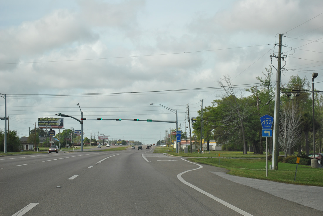
Approaching the north end of Escambia County Road 453 (W Street) on U.S. 29 north. W Street links Pensacola Boulevard with U.S. 98 (Navy Boulevard) and U.S. 90 (Cervantes Street) through the community of Brownsville. CR 453 is the lone remaining 400 series route still used in the Pensacola area.
03/20/12
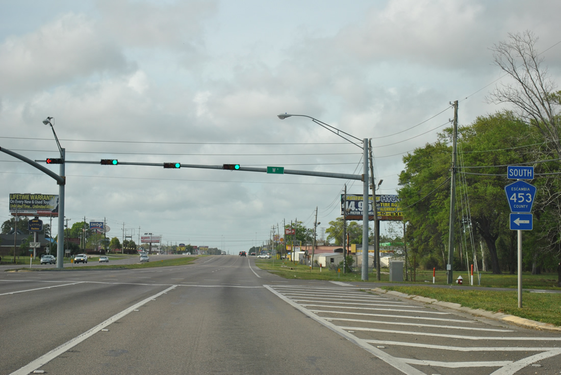
U.S. 29 north at Escambia County Road 453 (W Street). W Street angles southward 1.7 miles to SR 296 (Beverly Parkway), 3.1 miles to SR 295 (Fairfield Drive) and 4.7 miles to U.S. 90 (Cervantes Street).
03/20/12
Pinestead Road provides another link between U.S. 29 (Pensacola Boulevard) and Palafox Street (CR 95A) to the east. Westward the road continues to a residential area and a middle school.
03/20/12
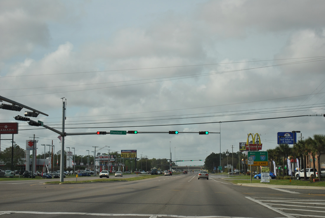
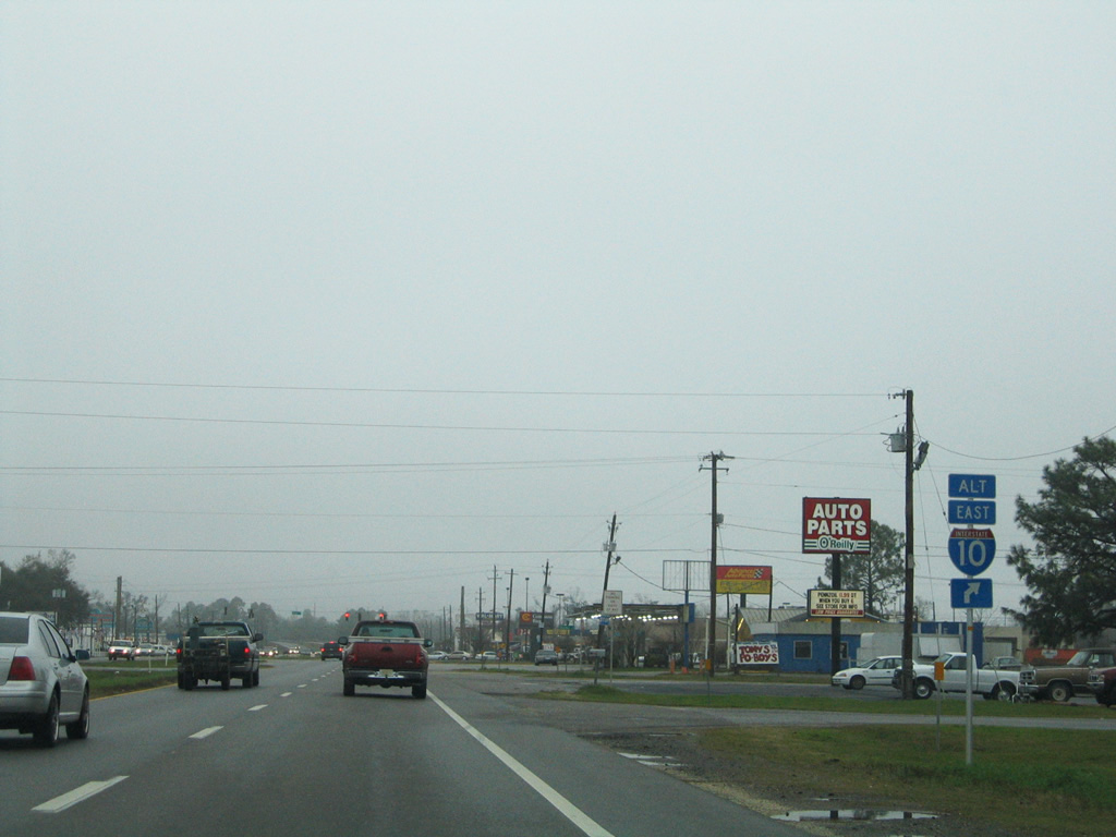
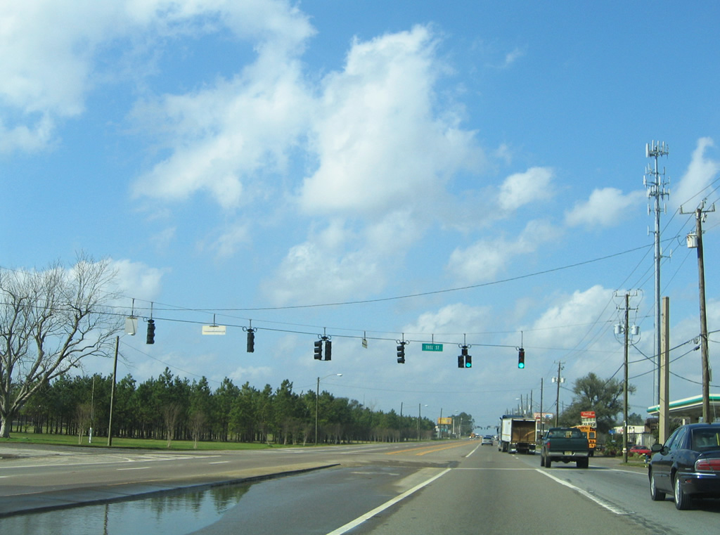
U.S. 29 maintains six lanes from W Street northward to Interstate 10. All traffic lights were converted to mast-arm assemblies by late 1999. Several car dealerships and other commercial establishments line the arterial, with periodic congestion occurring often between County Road 453 and the ramps to Interstate 10. New signs for I-10 and the west end of SR 742 were installed in 2002.
07/24/11
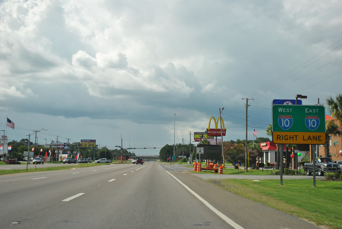
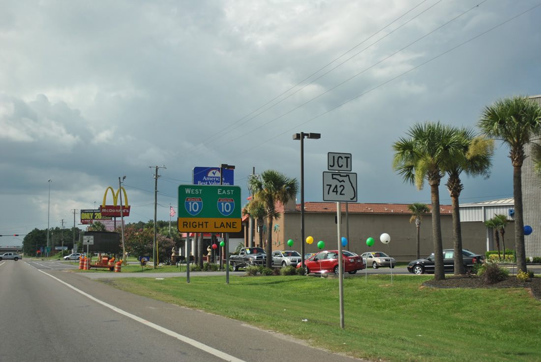
All traffic to Interstate 10 departs in unison beyond the eastbound beginning of SR 742 (Burgess Road).
07/24/11
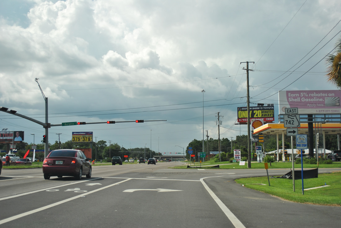
Burgess Road carries SR 742 eastward to parallel CR 95A (Palafox Highway) and Creighton Road over Interstate 10. The 8.28 mile route concludes at U.S. 90 (Scenic Highway) by Scenic Heights in northeast Pensacola.
07/24/11
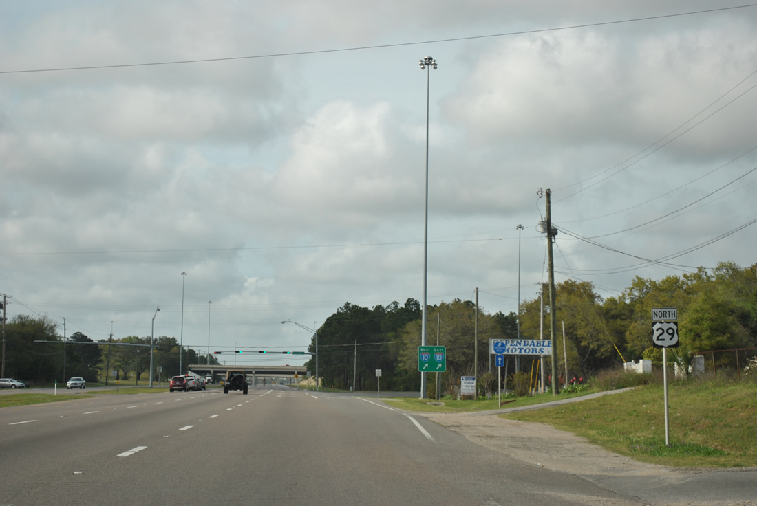
A brief reprieve from traffic lights and cross traffic ensues along U.S. 29 northbound through the directional cloverleaf interchange with Interstate 10.
03/20/12
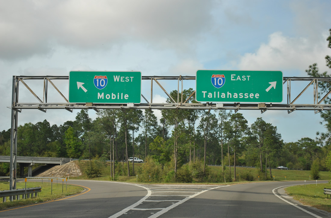
All traffic to I-10 leaves U.S. 29 north via a two lane ramp near Ensley. Interstate 10 travels 50 miles west to Mobile, Alabama and 16 miles east to the Milton vicinity.
03/20/12
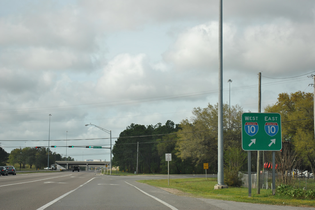
Traffic separates for Interstate 10 on the northbound U.S. 29 on-ramp.
03/20/12
Continuing north of Interstate 10, U.S. 29 (Pensacola Boulevard) trudges along as a commercial arterial through Ensley. Several signals line the road starting with Broad Street, and east-west road to Untreiner Avenue (former County Road 465) and Pittman Avenue.
02/02/06
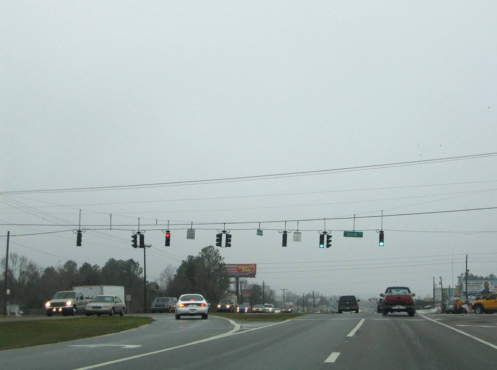
Detroit Boulevard meets Pensacola Boulevard at the next traffic light. Westward the through road leads through residential areas to SR 297 (Pine Forest Road) and east as former County Road 465 to County Road 95A (Palafox Street).
02/02/06
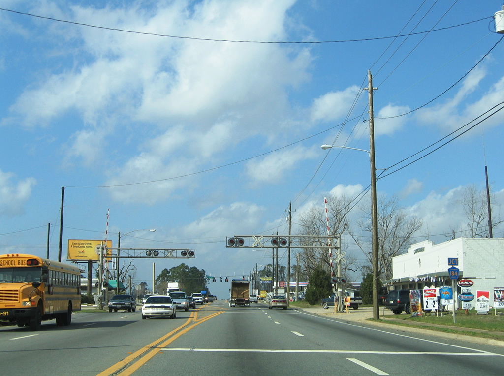
Approaching Hood Drive, a connector between U.S. 29 and County Road 95A on the south side of a busy Walmart complex. The Alternate Interstate 10 assembly was used during the Escambia Bay Bridge reconstruction project to direct trucks exceeding weight restrictions.
02/02/06

A diamond interchange with U.S. 90 Alternate (Nine Mile Road) follows on U.S. 29 north.
02/02/06
Taking the northbound off-ramp to Nine Mile Road. The U.S. 90 control cities of Mobile and Tallahassee are still used, despite the commuter route aspect of Nine Mile Road. This exit was constructed in 1956.
02/02/06
Traveling by the Gonzalez community to County Road 297 (Roberts Road) on U.S. 29 north.
06/21/05
County Road 297 follows Roberts Road west to Pine Forest Road south on a 3.37 mile loop to U.S. 90 Alternate and SR 297 at Pine Forest.
06/21/05
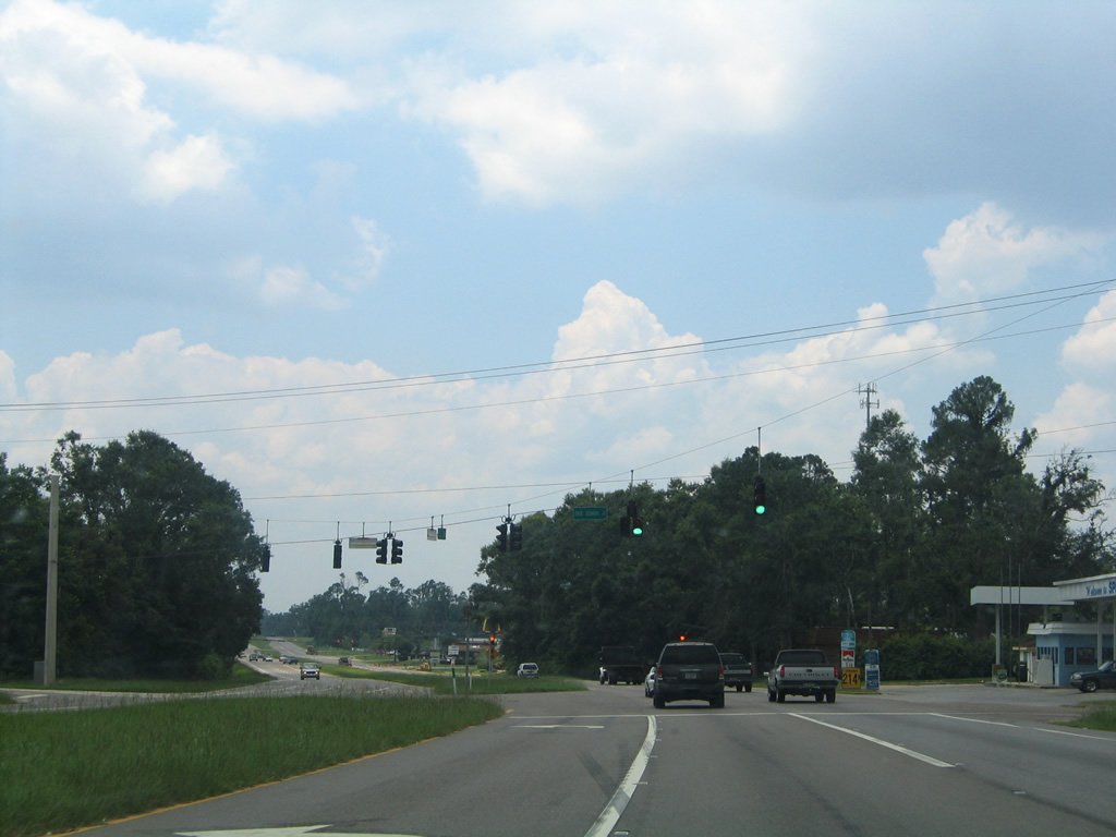
U.S. 29 reassurance marker posted beyond Escambia County Road 297 (Roberts Road). Paralleling closely is a Burlington Railroad line to the west and a combination of County Road 95A (Palafox Street) and a CSX Railroad to the east.
07/24/11
County Road 186 (Kingsfield Road) meets U.S. 29 west from Chemstrand Road at Gonzalez.
07/24/11
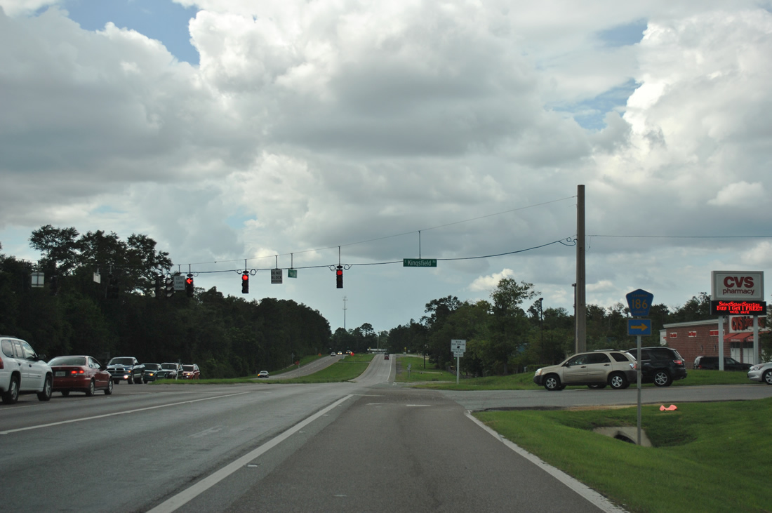
Signage for Escambia County Road 186 points to Kingsfield Road east from U.S. 29. The County Road is unsigned beyond this intersection and along the entire stretch of Kingsfield Road west to County Road 99 (Beulah Road).
07/24/11
Tate School Road stems west from County Road 95A (Old Palafox Highway) to north-south Tate Road and J.M. Tate High School.
06/21/05
Old Chemstrand Road doubles as County Road 749 east, 2.241 miles to an industrial plant entrance at Chemstrand Road south in Gonzalez.
06/21/05
Escambia County Road 95A (Old Palafox Highway) merges into U.S. 29 on the south side of Cantonment.
02/08/06
Northbound at the right-turn onto County Road 95A (Old Palafox Highway) south back to Gonzalez. The southern segment of Escambia County Road 95A stretches 10.65 miles from Brent to Cantonment.
02/08/06
Tree Street connects U.S. 29 with the adjacent International Paper Company mill to the west.
02/02/06
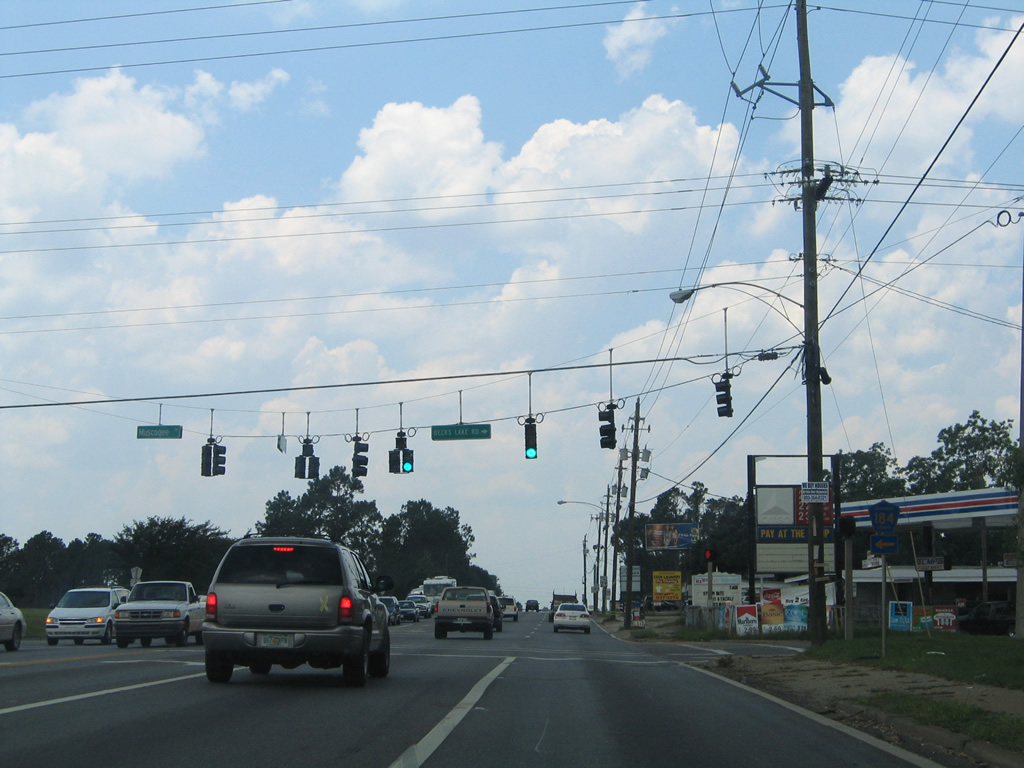
U.S. 29 narrows to a four lane arterial through Cantonment. Meeting the US Route is County Road 184 (Muscogee Road) east and Becks Lake Road west.
02/02/06
Escambia County Road 184 west travels 5.505 miles from Cantonment to Farm Hill, Muscogee and across the Perdido River to Baldwin County Road 112.
06/21/05
Continuing from Muscogee Road through northern reaches of Cantonment on U.S. 29.
06/21/05
County Road 95A again branches eastward from U.S. 29 to Cottage Hill, Quintette and Molino. Connections with County Road 184 (Quintette Road) east lead to Santa Rosa County on the second of three Escambia River crossings.
02/08/06
The northern segment of Escambia County Road 95A winds 8.962 miles to U.S. 29 near Barth. Again the county road represents an old alignment of the US Highway.
02/08/06
Rising along the hills of northern Escambia County from Quintette Road over Jack's Branch on U.S. 29 north.
02/01/06
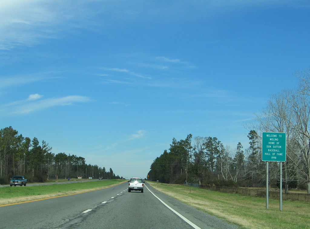
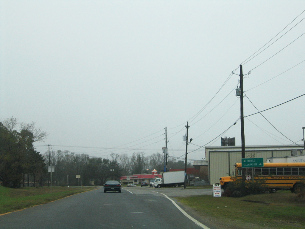
Although west of Molino, U.S. 29 motorists see a sign celebrating the career of MLB Hall of Fame pitcher and Molino-native, Don Sutton. This stretch of highway is also designated the Don Sutton Highway.
02/01/06
County Road 196 stretches 7.589 miles from County Road 99 at Barrineau Park to County Road 95A near Quintette.
02/01/06
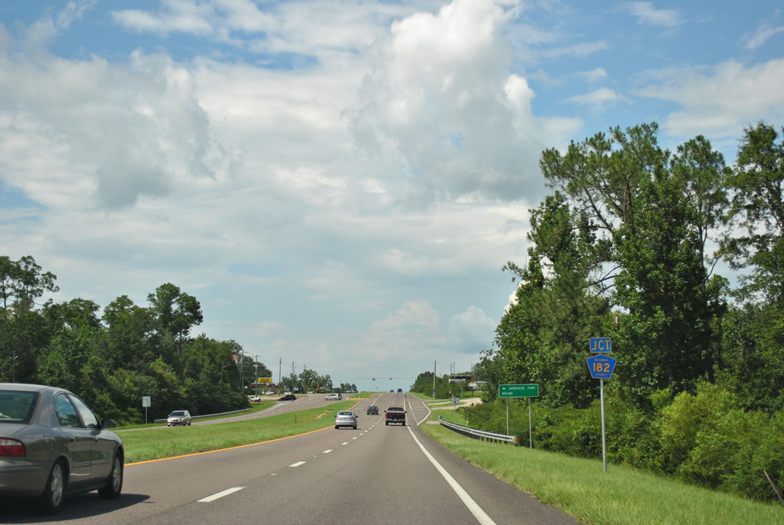
Two and half miles further north is the U.S. 29 intersection with Escambia County Road 182 (Molino Road).
07/24/11
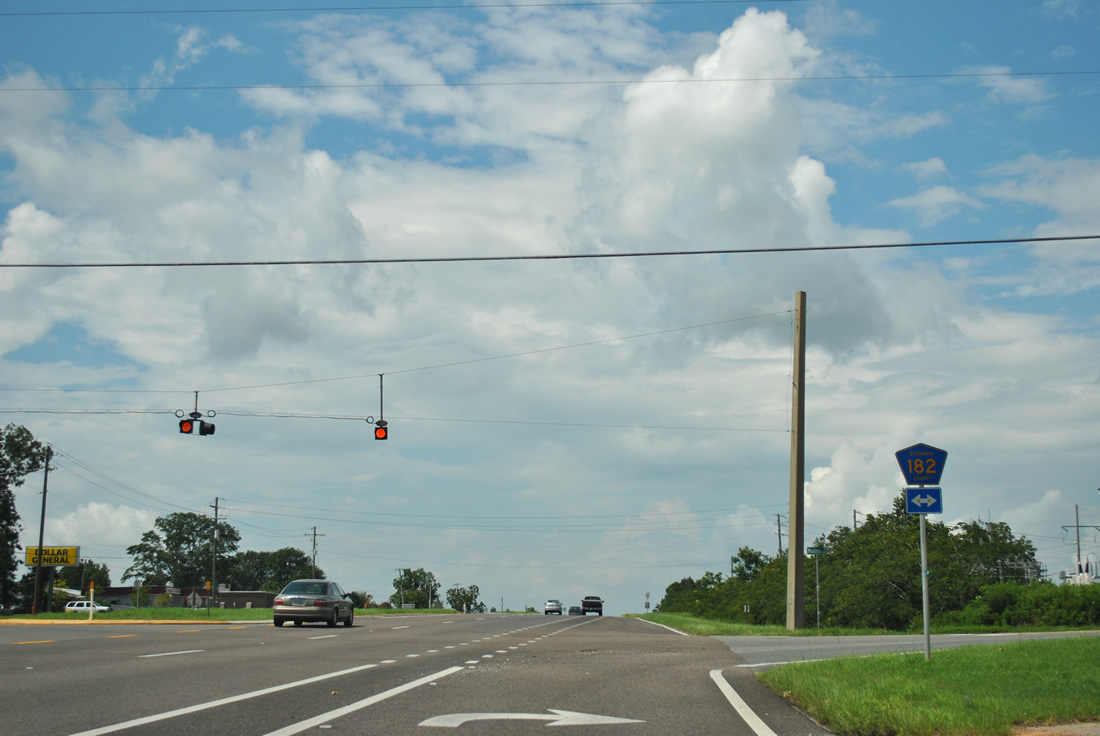
Molino lies east of U.S. 29 via County Road 182 (Molino Road). CR 182 ends at Molino Crossroads (CR 95A) to the east and westward at CR 99 near Barrineau Park. The road is vastly rural throughout its 7.448 mile path.
07/24/11
SR 97 angles northwest from Escambia County Road 95A and crosses paths with U.S. 29.
06/21/05
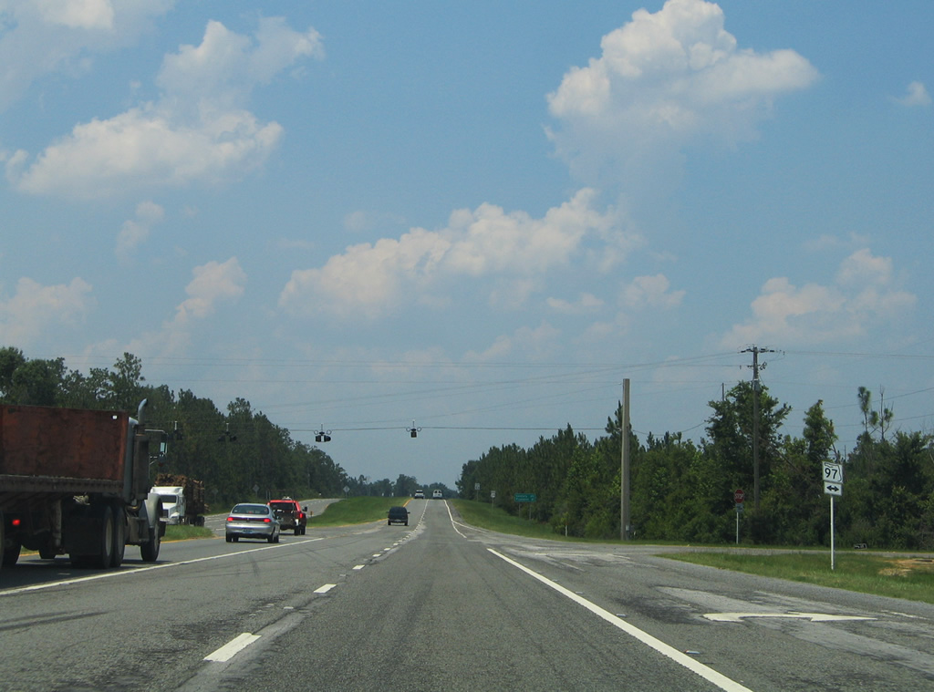
Measuring 22.65 miles in length, SR 97 joins U.S. 29 and the Pensacola area with Davisville, Atmore and Interstate 65 (via the transition with Alabama 21).
06/21/05
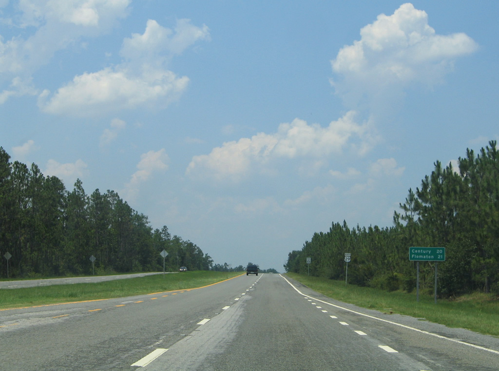
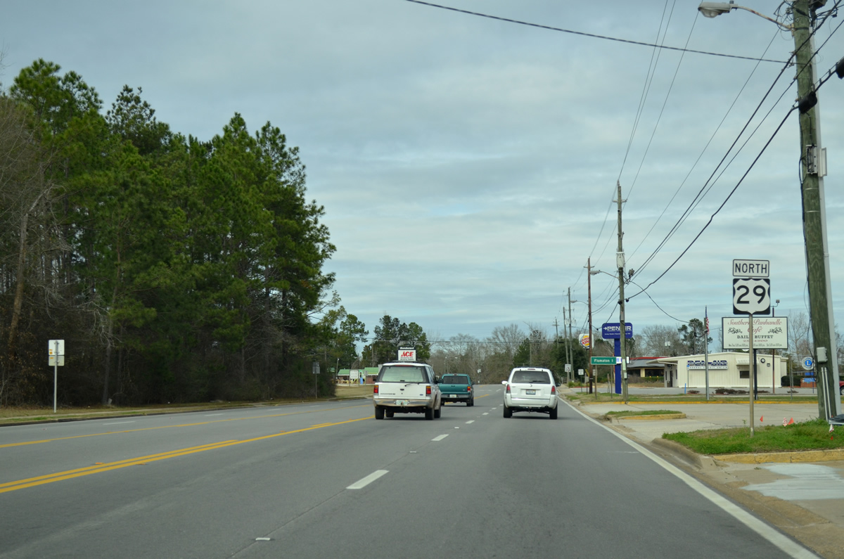
Leaving the traffic light with SR 97, U.S. 29 advances 20 miles north to Century.
06/21/05
County Road 95A returns to U.S. 29 for the final time outside the Molino area.
06/21/05
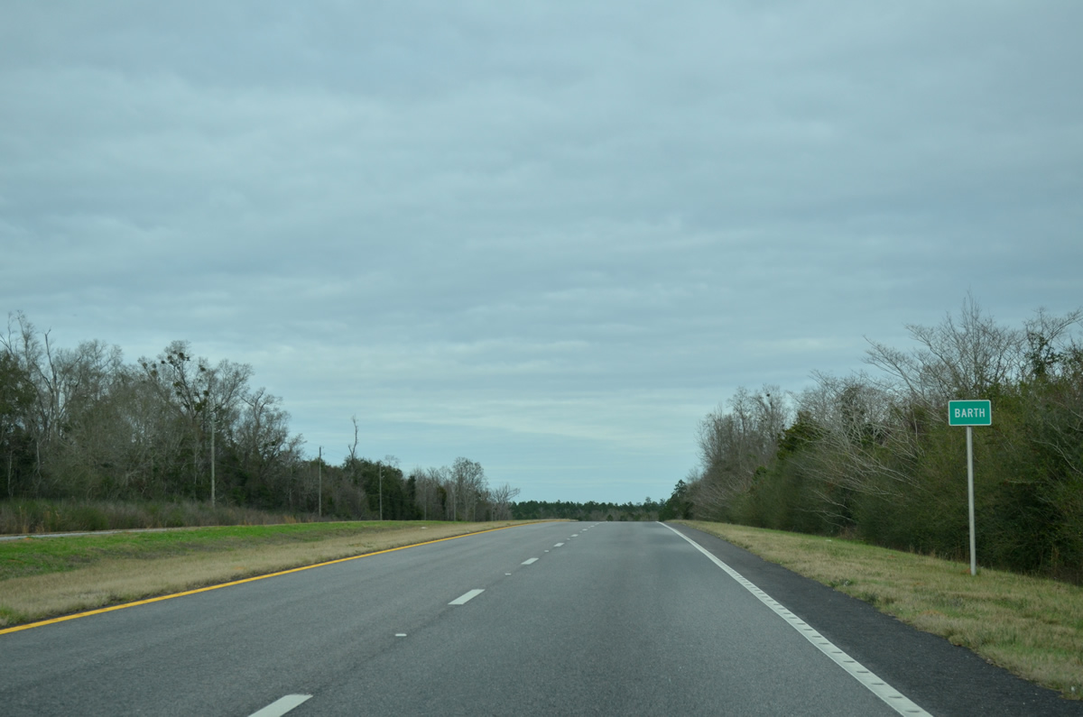
Timberland replaces open agricultural areas as U.S. 29 reaches the settlement of Barth.
01/19/13
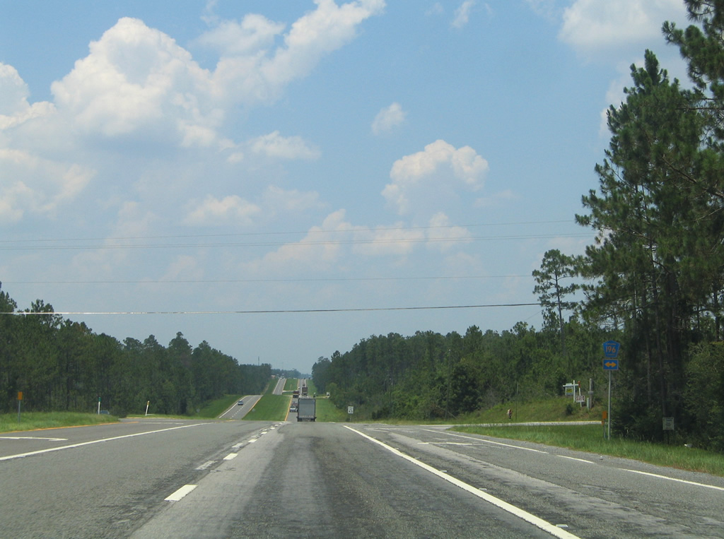
A vastly uninterrupted stretch continues the northbound drive of U.S. 29. Pictured in this scene is the crossing over Pine Barren Creek.
01/19/13
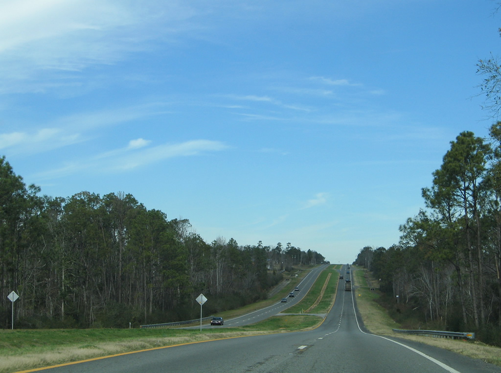
Scenes along U.S. 29 north from Pine Barren to Bogia.
06/21/05
01/19/13
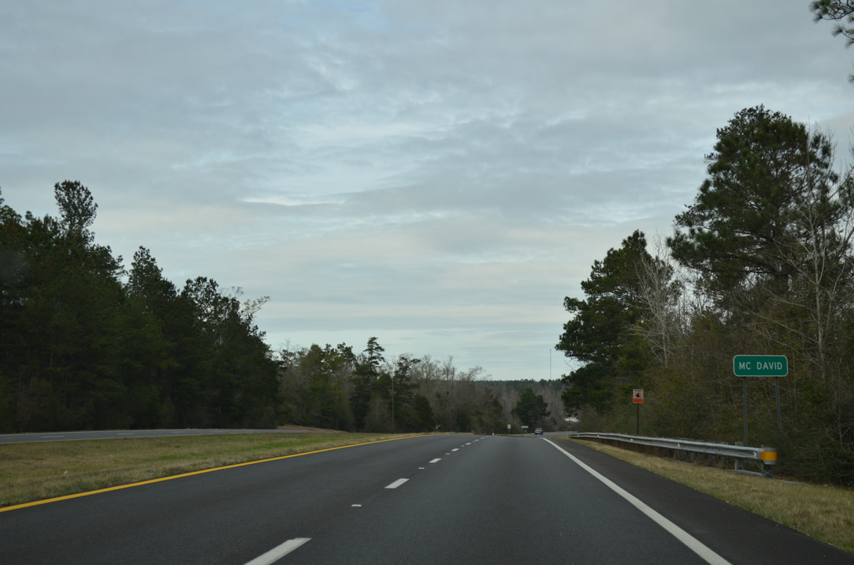
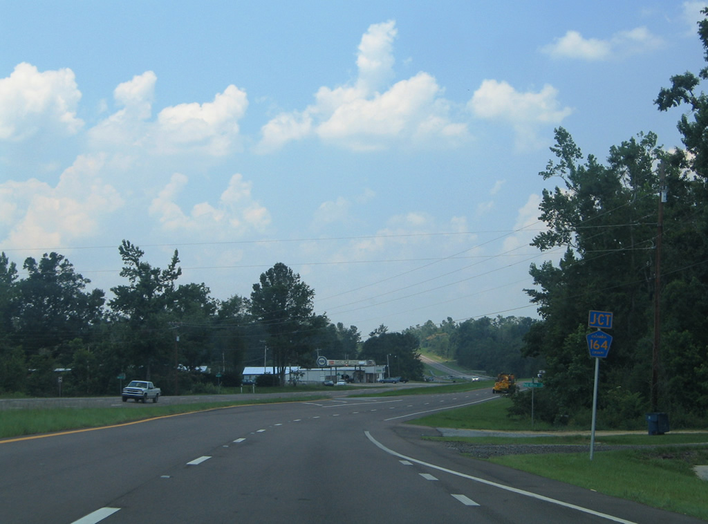
Entering the community of McDavid, U.S. 29 meets the east end of Escambia County Road 164.
01/19/13
06/21/05
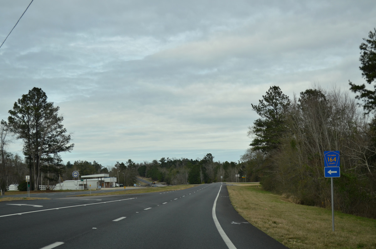
Escambia County Road 164 meanders 11.352 miles west to Oak Grove and SR 97 near Walnut Hill.
01/19/13
Approaching the crossing of Mitchell Creek on U.S. 29 north of McDavid.
02/07/06
Turning northeastward at Canoe Creek on U.S. 29.
06/21/05
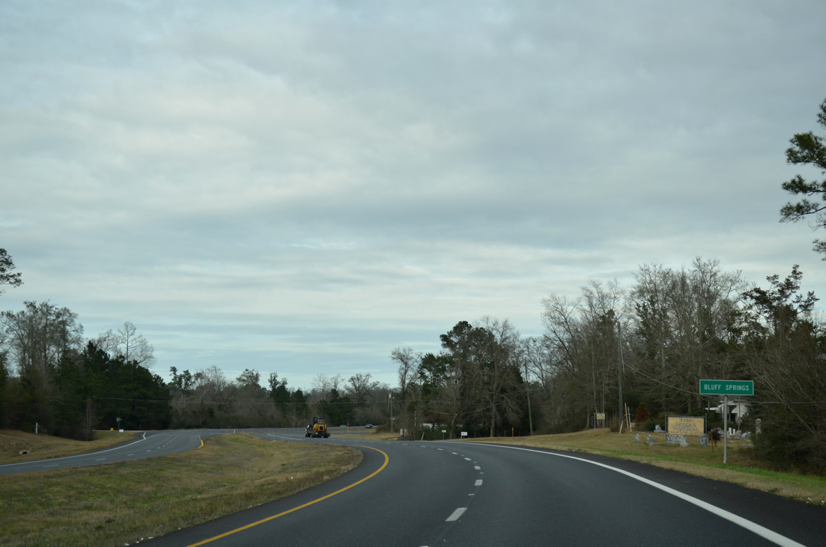
Entering the Bluff Springs area, U.S. 29 meets Byrneville Road, a local road leading north to County Road 4 at County Road 4A.
01/19/13
Northbound travelers enter the city limits of Century at the U.S. 29 (Century Boulevard) intersection with Salters Lake Boulevard.
06/21/05
Nearing the east end of Escambia County Road 4 on U.S. 29 (Century Boulevard) north in Century.
01/19/13
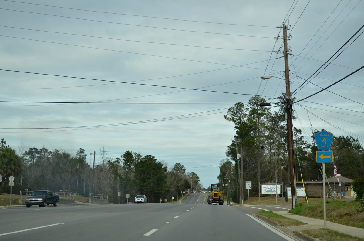
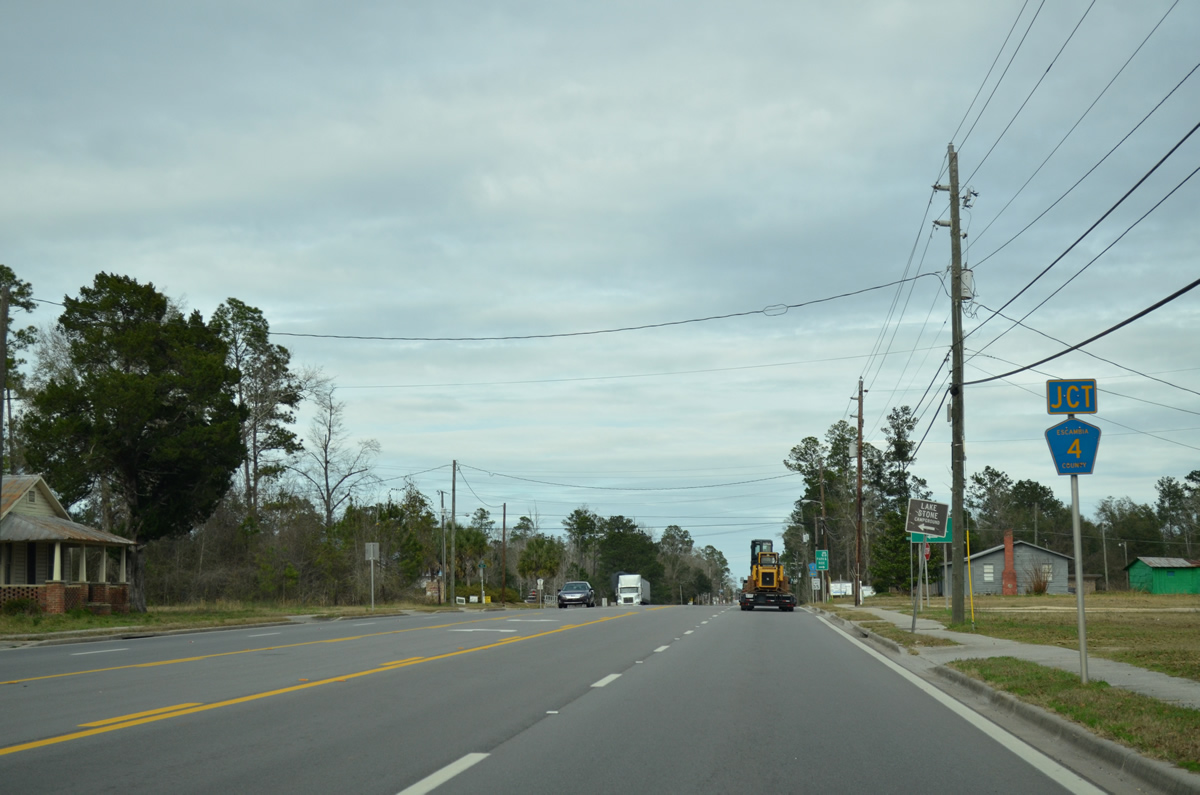
County Road 4 leads west 13.35 miles to Lake Stone, Byrneville, Bratt and Davisville (jSR 97).
01/19/13
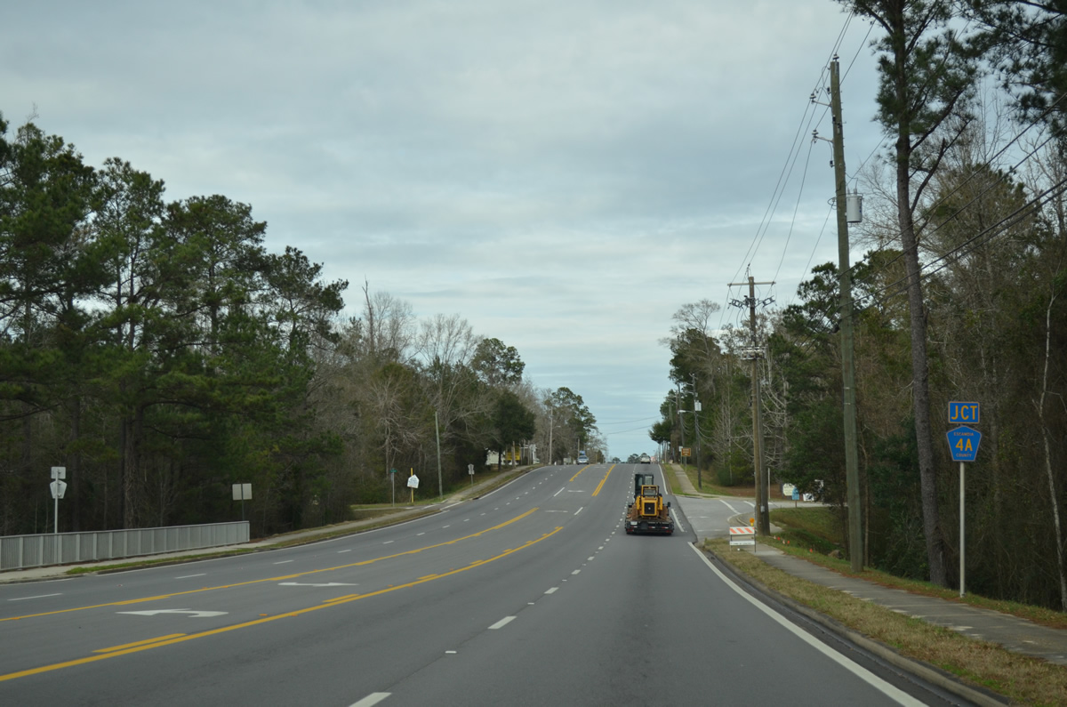
The intersection with County Road 4A (Hare Road) immediately follows on U.S. 29 (Century Boulevard) north. This segment of County Road 4A includes just 0.438 miles of Hare Road leading northwest to Gandyville. A second County Road 4A straddles the state line along a 6.005 mile loop from Century west to Byrneville.
01/19/13
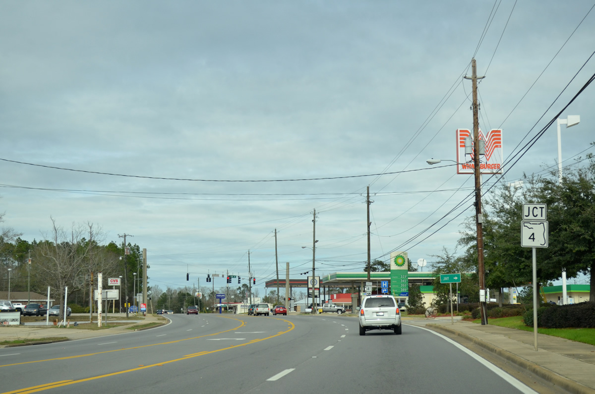
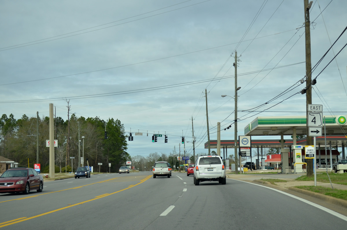
U.S. 29 passes by Century City Hall and approaches the west end of SR 4 (Jay Road). SR 4 constitutes the northernmost east-west state road in both Escambia and Santa Rosa Counties.
01/19/13
SR 4 (Jay Road) stems east 43.75 miles from Century to U.S. 90 at Milligan. The town of Jay lies eight miles to the east.
01/19/13
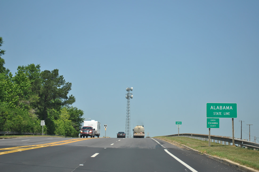
Century Boulevard arcs northwest toward South Flomaton and the Alabama state line.
01/19/13
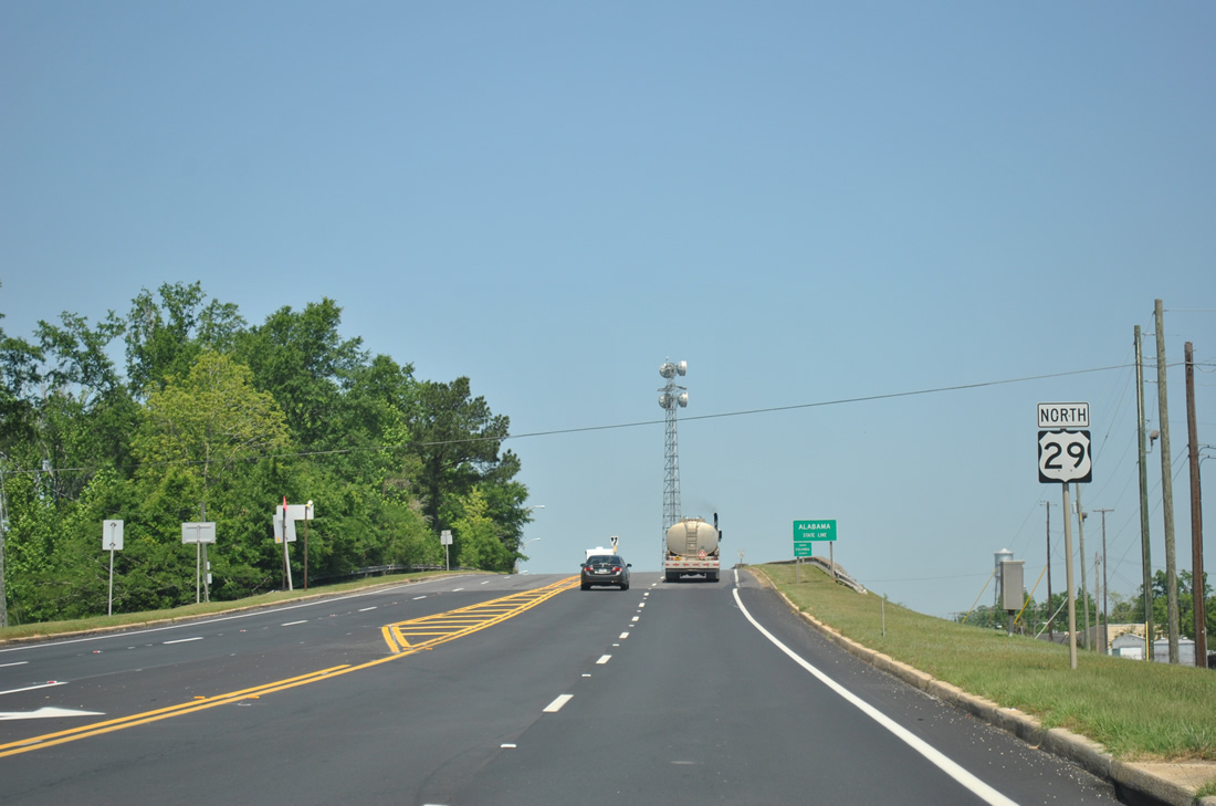
U.S. 29 ascends from Century, Florida over a CSX Railroad line and Ringgold Street in Flomaton, Alabama. SR 113 begins and follows the US Route northward a short distance to U.S. 31.
04/13/12

Photo Credits:
- Alex Nitzman: 11/27/99, 05/08/04, 06/21/05, 02/01/06, 02/02/06, 02/07/06, 02/08/06, 03/20/12, 04/13/12
- ABRoads: 07/24/11, 11/17/12
- AARoads: 01/19/13
Connect with:
Page Updated Wednesday January 23, 2013.