
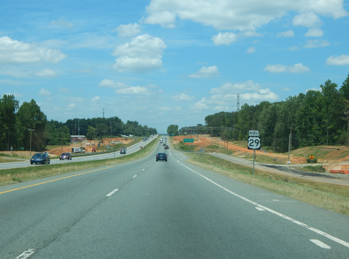
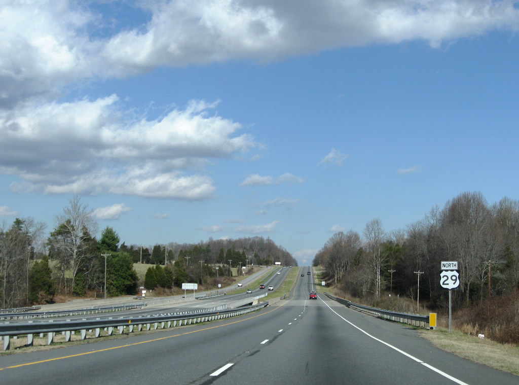
U.S. 29 North - Greensboro


 North
North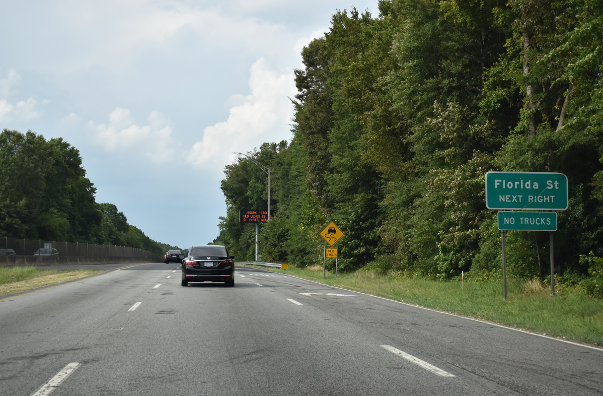
U.S. 29/220 turn north from I-40 at a wye interchange onto O'Henry Boulevard, an urban expressway through east Greensboro. Right in right out (RIRO) ramps follow for Florida Street at the Dudley Heights neighborhood.
08/14/21
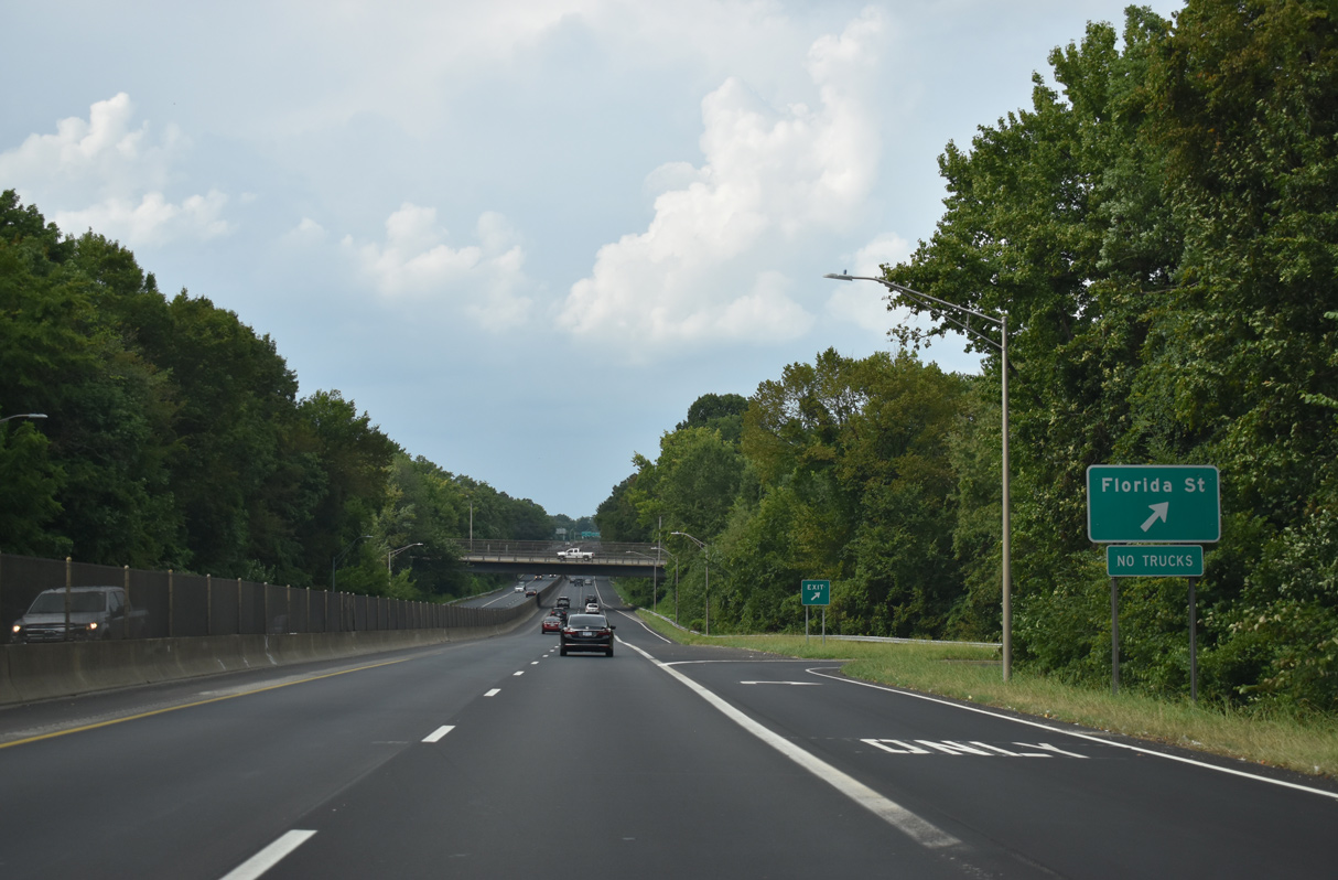
The RIRO ramps from U.S. 29/220 northbound tie into parallel Hooks Street south of Florida Street. Florida Street heads west to Clinton Hills and east to Barber Park.
08/14/21
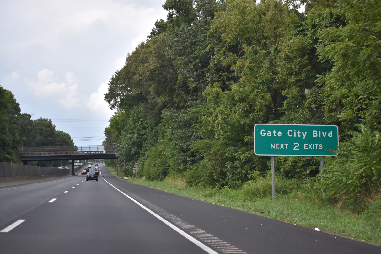
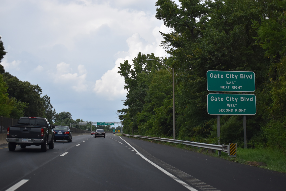
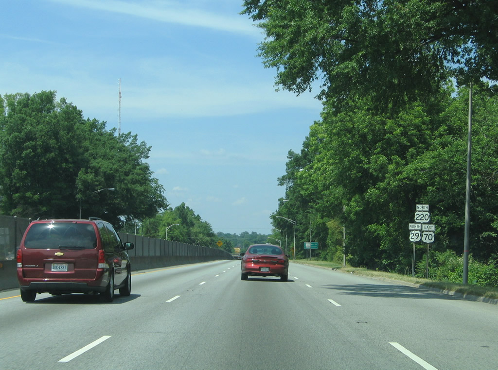
The succeeding two exits from U.S. 29/70/220 north are part of a cloverleaf interchange utilizing Hacket Street to connect with Gate City Boulevard (old NC 6).
08/14/21
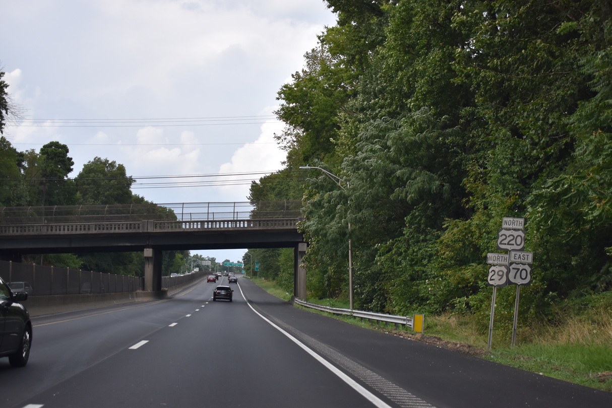
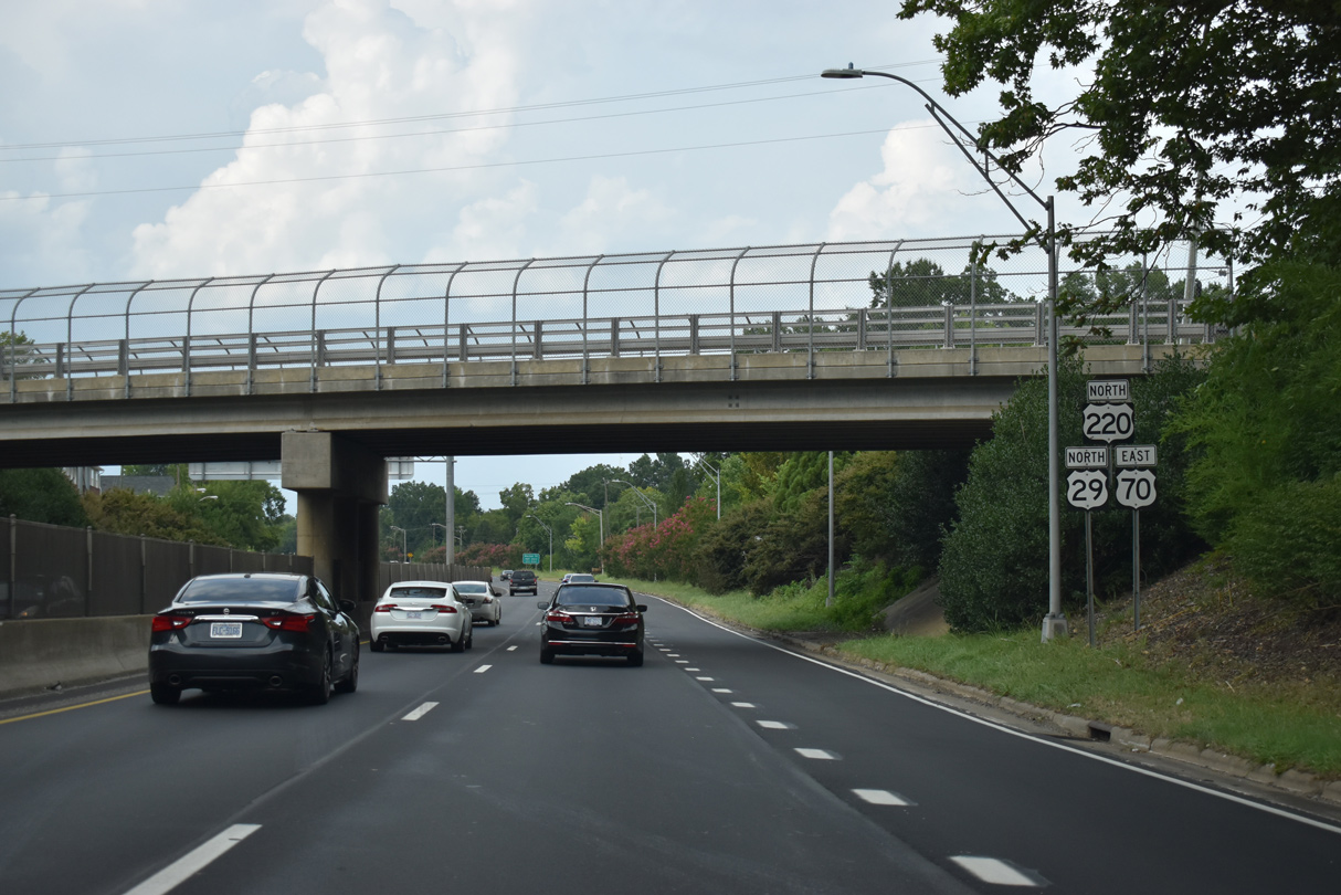
Confirming markers for U.S. 29-70-220 posted by the Tuscaloosa Street overpass.
08/14/21
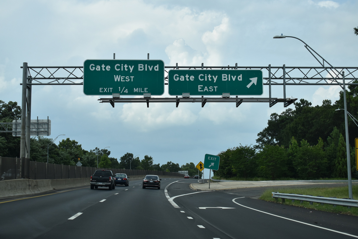
Gate City Boulevard (SR 4240) constitutes a four lane urban arterial west to Bennett College, the Southside, Warnersville and College Hill neighborhood outside Downtown Greensboro
08/14/21
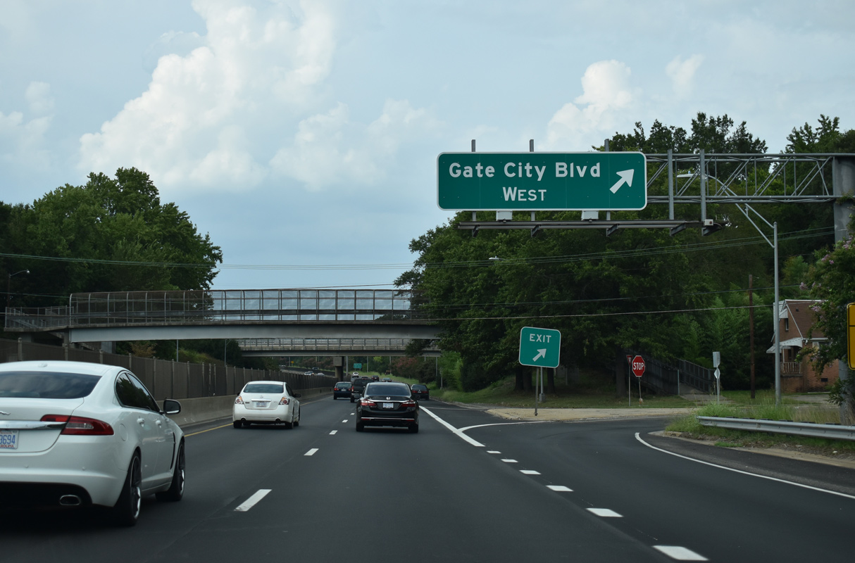
Gate City Boulevard (SR 4240) runs southeast 2.02 miles to Barber Park and Interstate 40 at E Lee Street (SR 3037).
08/14/21
Prior to 2005, Gate City Boulevard was part of NC 6, an eight mile loop north from Interstate 40 in Greensboro. Gate City Boulevard was previously part of Lee Street east from Coliseum Boulevard as well.
08/14/21
Ramps for Gate City Boulevard (former Lee Street) were modernized during 2004 reconstruction of the exchange. Work also replaced the nearby McConnell Road overpass by this shield assembly.
08/14/21
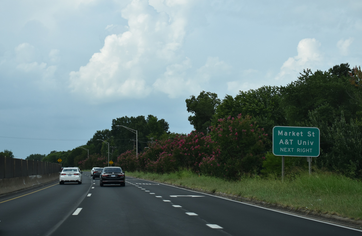
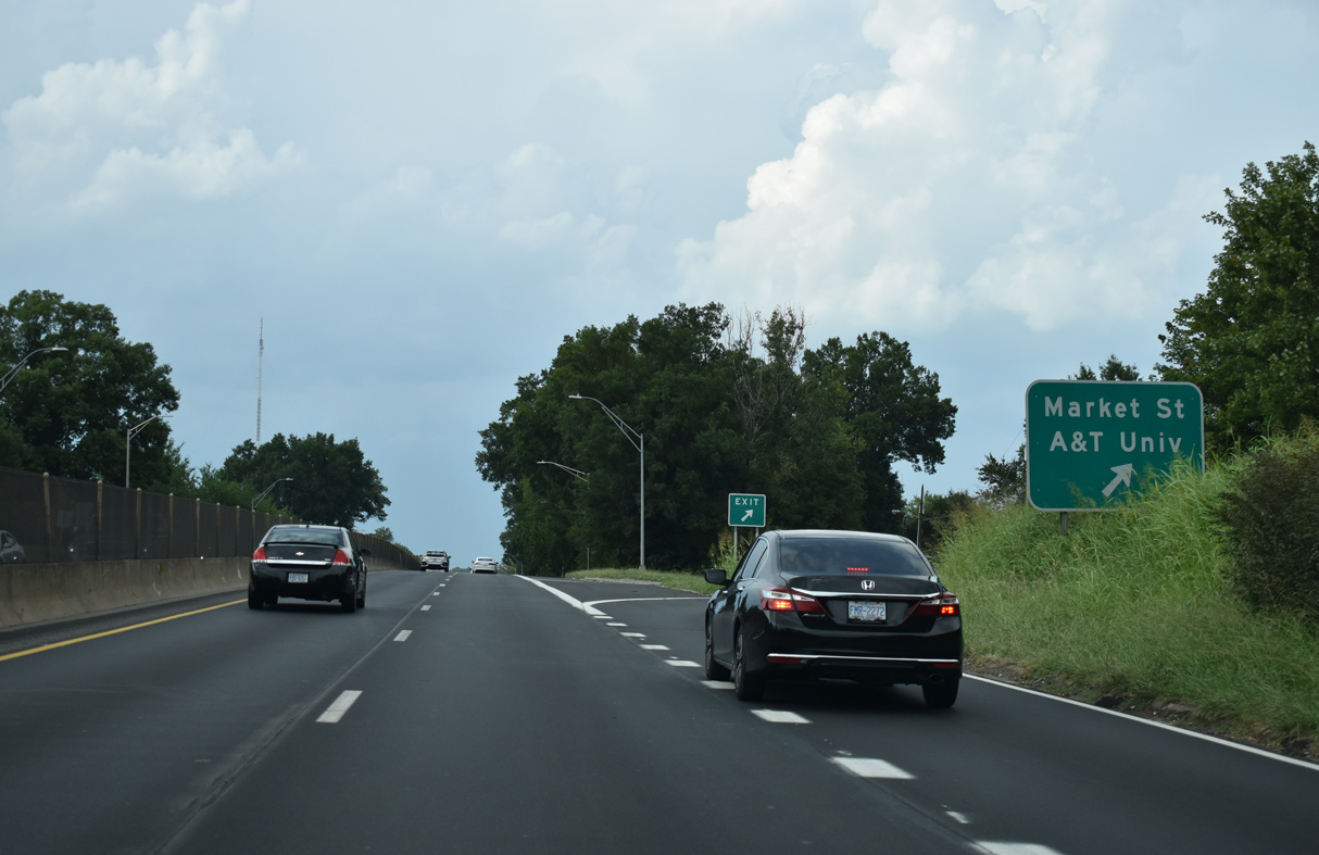
Market Street meets U.S. 29/70/220 by North Carolina A&T University at the succeeding exit. Mid 2000s construction at the forthcoming parclo interchange removed the RIRO ramps with eastbound Market Street.
08/14/21
RIRO ramps connect with Marshall Street at the Scott Park neighborhood. Paralleling a Norfolk Southern Railroad line, Market Street is the historic alignment of U.S. 70 west to Friendly Avenue and Downtown Greensboro and east to Bessemer.
08/14/21
U.S. 29/70/220 advance north between Scott Park and the campus of North Carolina A&T University to a RIRO intersection with Lutheran Street east.
05/30/05
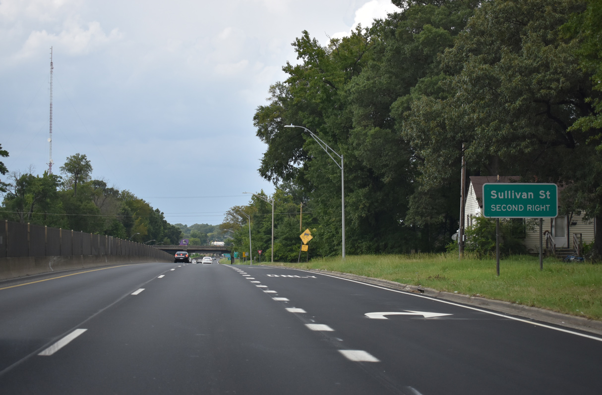
RIRO ramps with Post Street follow from U.S. 29-70-220 north for Sullivan Street and Aggie Stadium at NC A&T University.
08/14/21
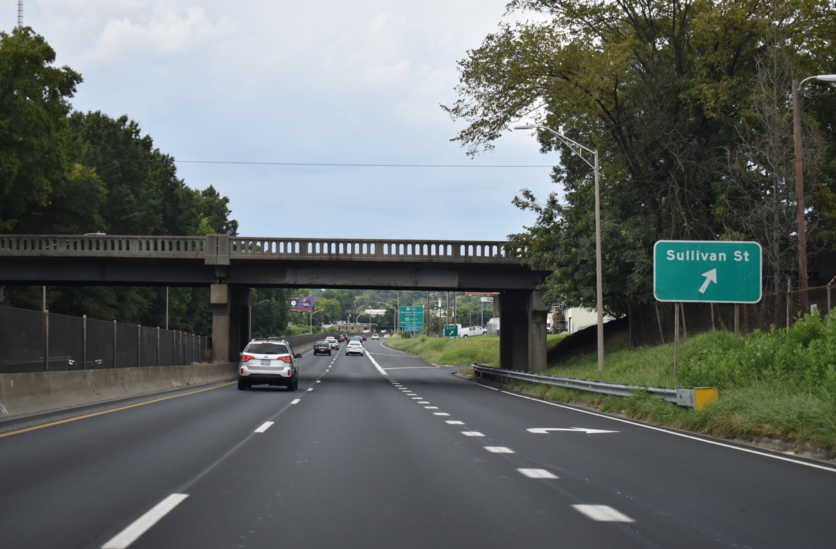
Sullivan Street heads west to Lindsay Street near War Memorial Stadium and east to English Street through a large warehouse district.
08/14/21
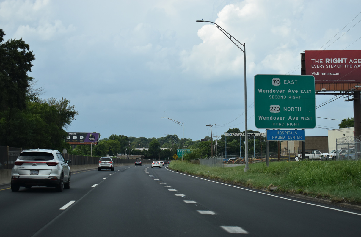
Succeeding RIRO ramps link U.S. 29 north with Headquarters Drive to Bessemer Avenue and the continuation of U.S. 70 east and U.S. 220 north on Wendover Avenue.
08/14/21
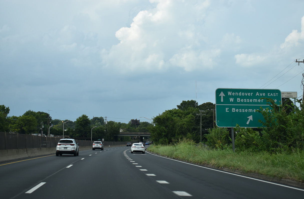
Bessemer Avenue parallels Wendover Avenue to the south through an adjacent warehouse district east to Burlington Road (SR 3163) and west to Parkway Avenue near Latham Park.
08/14/21
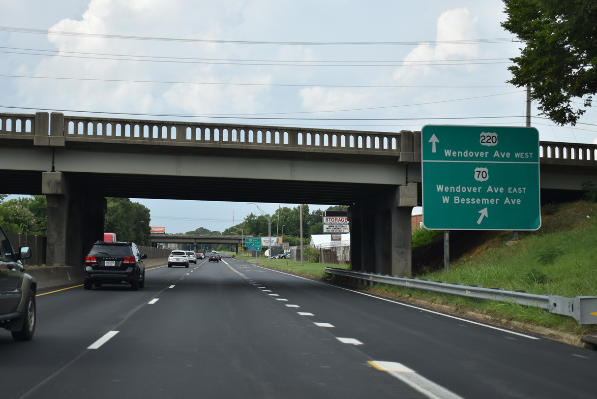
U.S. 70 east leaves the expressway along U.S. 29/220 for Wendover Avenue east to Burlington.
08/14/21

U.S. 220 north loops onto Wendover Avenue west toward Moses H. Cone Memorial Hospital, the Latham Park community and Battleground Avenue.
08/14/21
North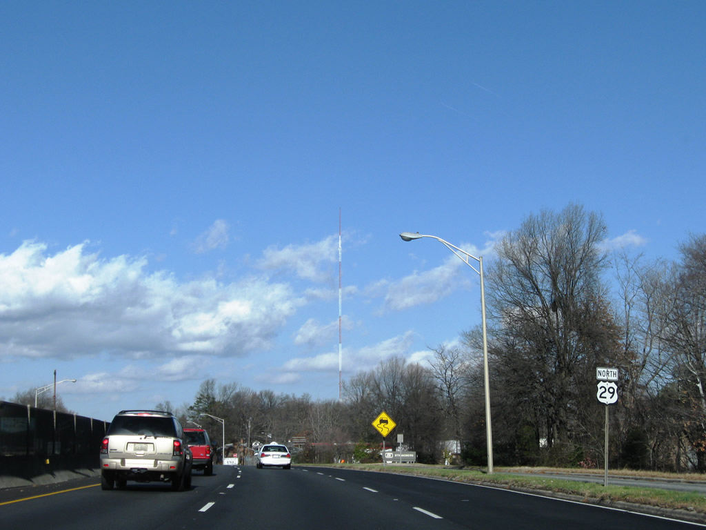
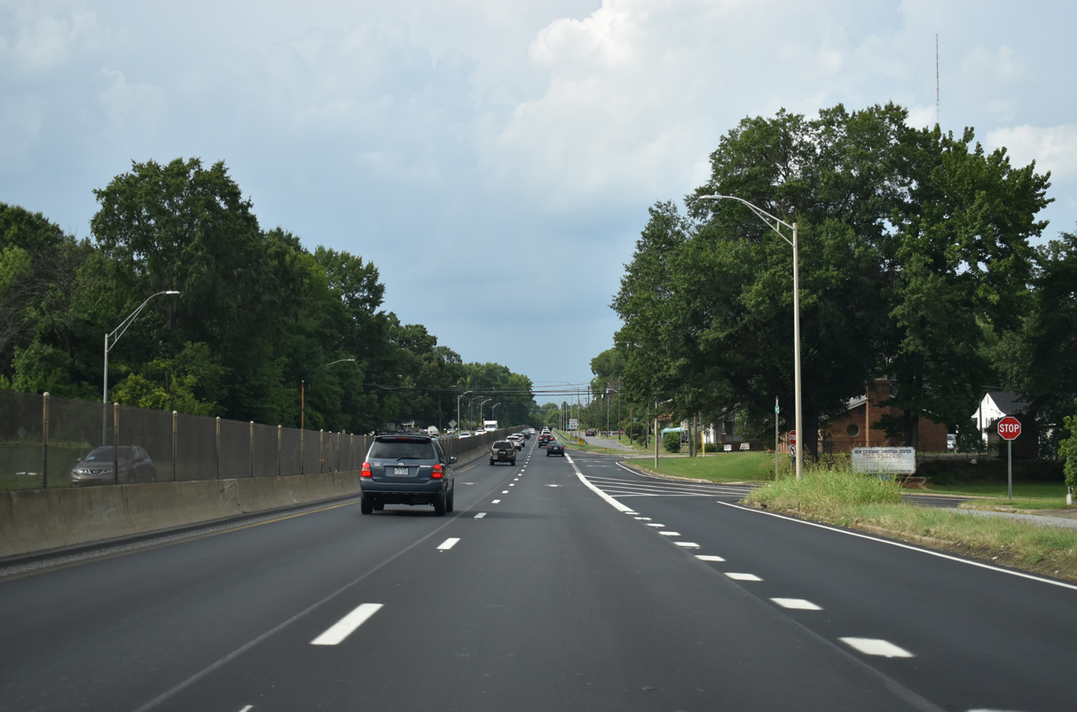
U.S. 29 continues north into the Edgeville section of Greensboro. The reassurance marker posted north of Wendover Avenue was removed by 2016.
12/21/08
Gatewood Avenue and Textile Drive west tie into northbound U.S. 29 (O'Henry Boulevard) at RIRO intersections.
08/14/21
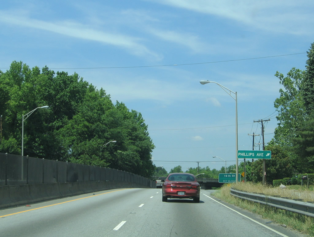
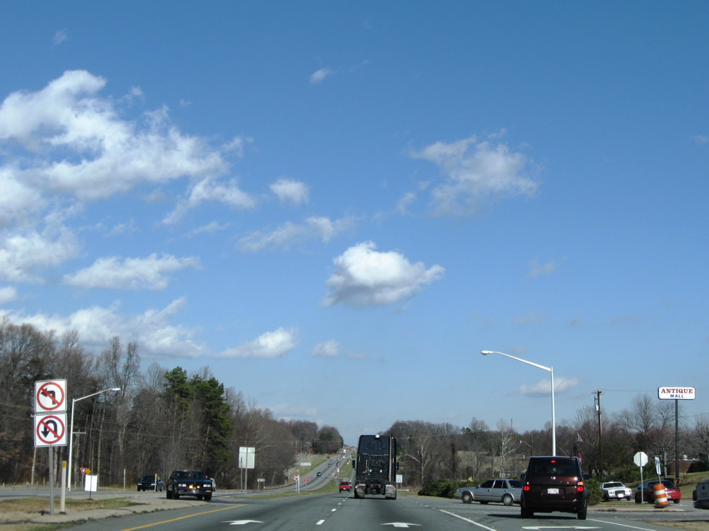
A turn off onto Ryan Street east to Ball Street and Phillips Avenue was removed from U.S. 29 northbound by 2007.
05/30/05
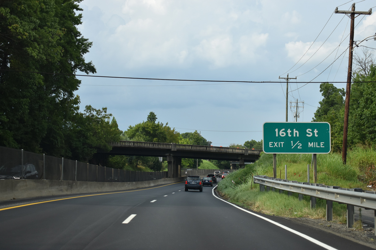
U.S. 29 advances north from the entrance ramp joining Summit Avenue (SR 2526) with O'Henry Boulevard a half mile to a parclo A2 interchange with 16th Street.
08/14/21
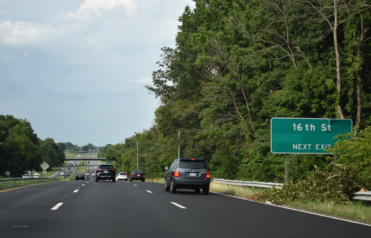
16th Street leads west to the White Oak neighborhood and Church Street (SR 1001) and arcs northeast from the site of Carolina Circle Mall to McKnight Mill Road (SR 2835). Replaced by big box retail, adjacent Carolina Circle Mall closed for business in 2002 and was torn down in 2005.1
08/14/21
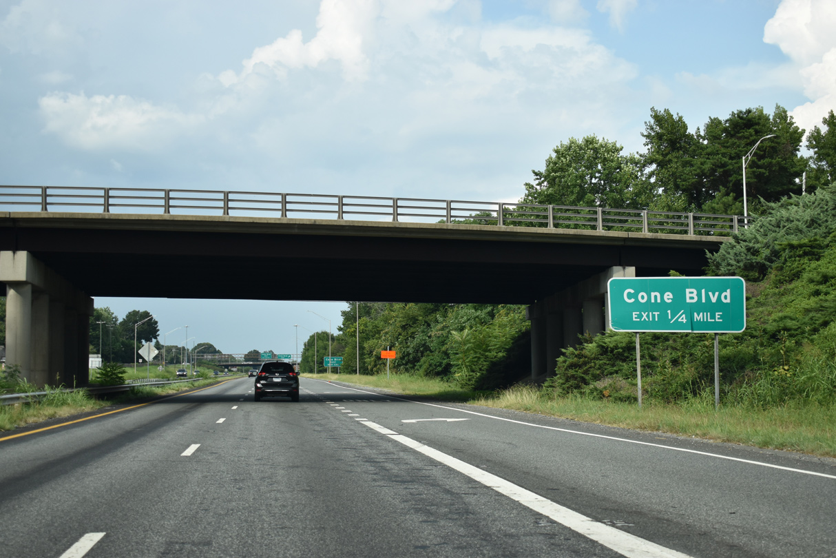
Cone Boulevard meets U.S. 29 at a parclo interchange east of the Rankin and O'Henry Oaks neighborhoods next.
08/14/21
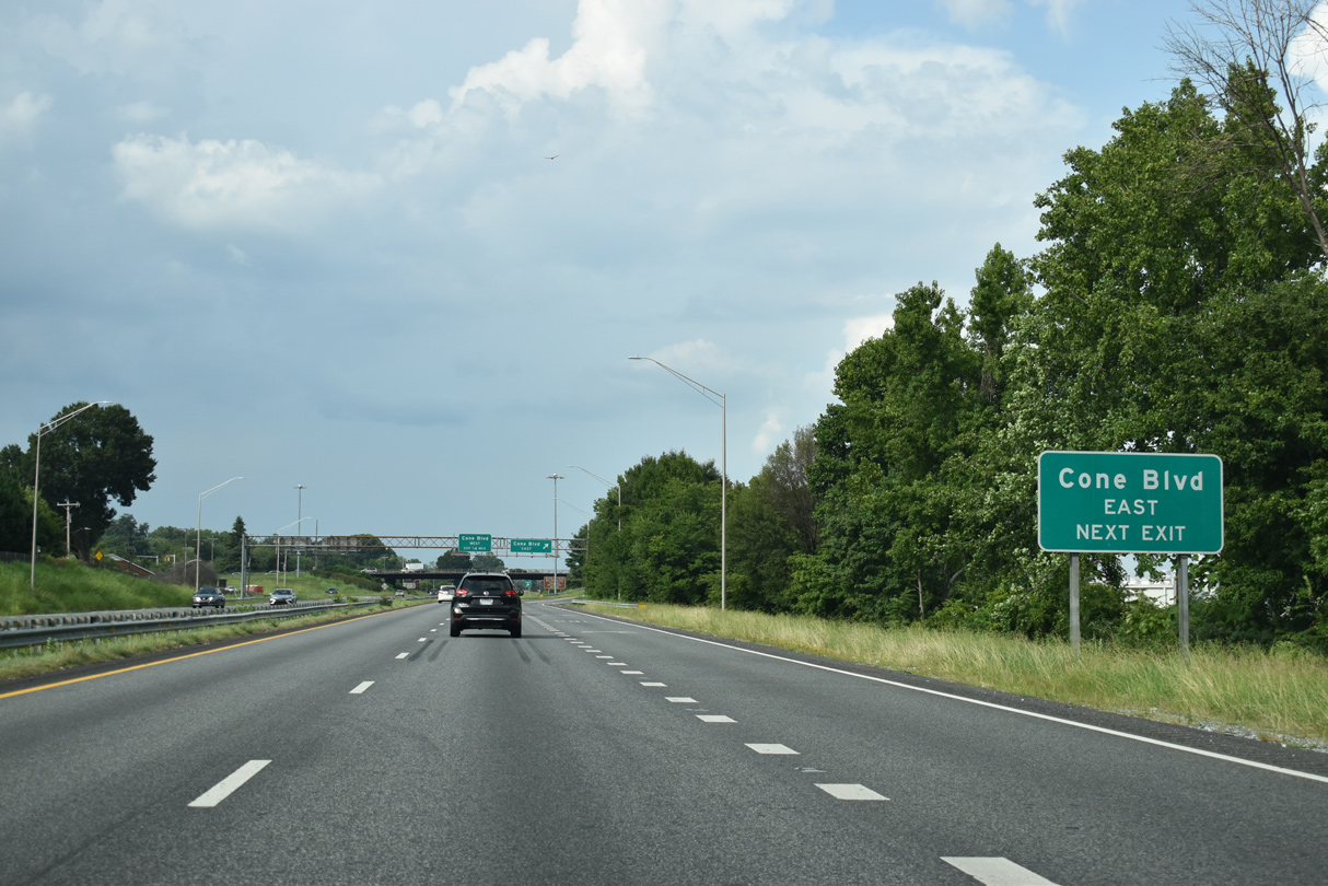
Cone Boulevard extends east from an adjacent retail area to 16th Street and White Elder Road (SR 2844) outside the Greensboro city limits.
08/14/21
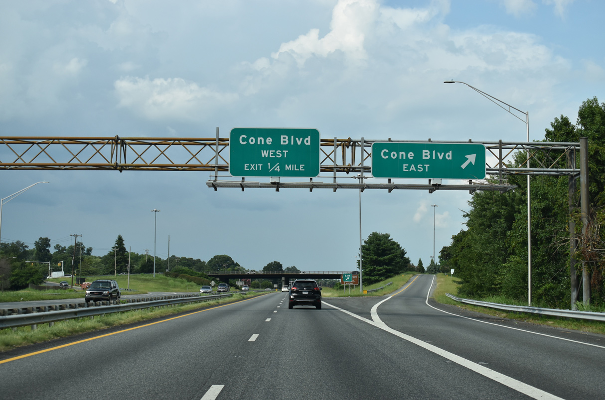
Cone Boulevard west to U.S. 220 (Battleground Avenue) north leads tourists to Guilford Courthouse National Military Park.
08/14/21
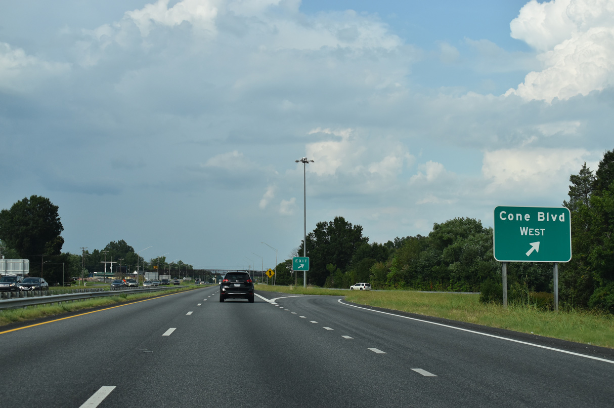
Cone Boulevard meanders west across Greensboro to Buffalo Lake, Brookwood Gardens and Kirkwood. The arterial transitions to Benjamin Parkway south at U.S. 220 (Battleground Avenue).
08/14/21
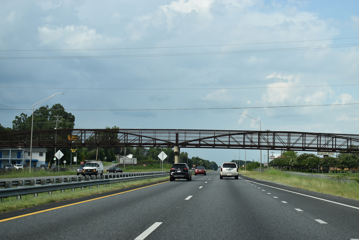
A pedestrian overpass spans U.S. 29 at McKnight Mill Road.
08/14/21
The N O' Henry Boulevard service roads (SR 2937/2612) tie into the expressway along U.S. 29 ahead of Terry Lane and Jorden Branch.
12/21/08
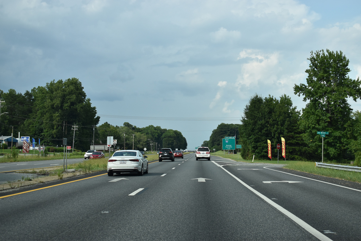
Joe Brown Drive spurs east from U.S. 29 into an industrial park.
08/14/21
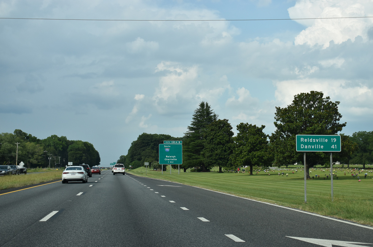
Three access points join U.S. 29 northbound with Lakeview Memorial Park beyond a distance sign posted 41 miles from Danville, Virginia.
08/14/21
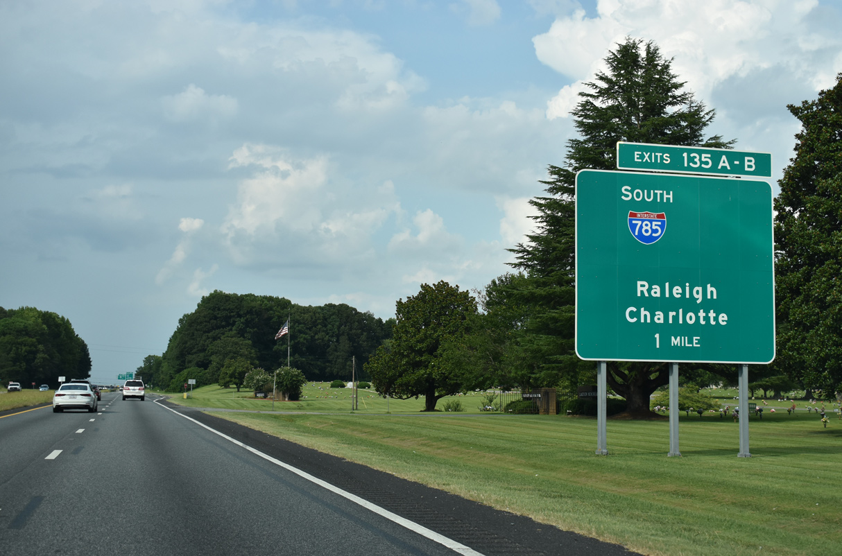
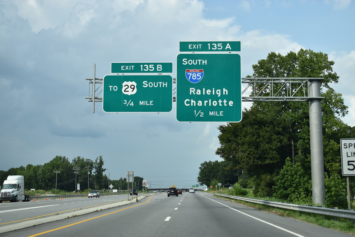
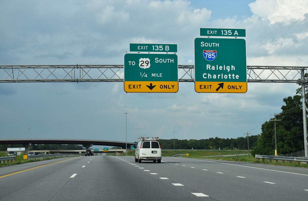
Construction for the Greensboro Urban Loop (I-785/840) added the cloverstack interchange at Exit 135. I-785 opened south to U.S. 70 on December 6, 2017.
08/14/21
Oakwood Drive (SR 5336) intersects U.S. 29 from the Oakwood Forest mobile home park beyond this reassurance marker northbound.
08/14/21
I-785/840 overlap 7.43 miles south from U.S. 29 to the west split of I-40/85 near Stewarts Mill in east Greensboro.
08/14/21
I-785/840 lead directly onto Interstate 85 south around the south side of Greensboro to Charlotte. I-40/85 overlap east from Greensboro to Durham.
08/14/21
Upon completion of the Greensboro Urban Loop in 2023, a high flyover will connect I-840 east with U.S. 29/Future I-785 north.
08/14/21

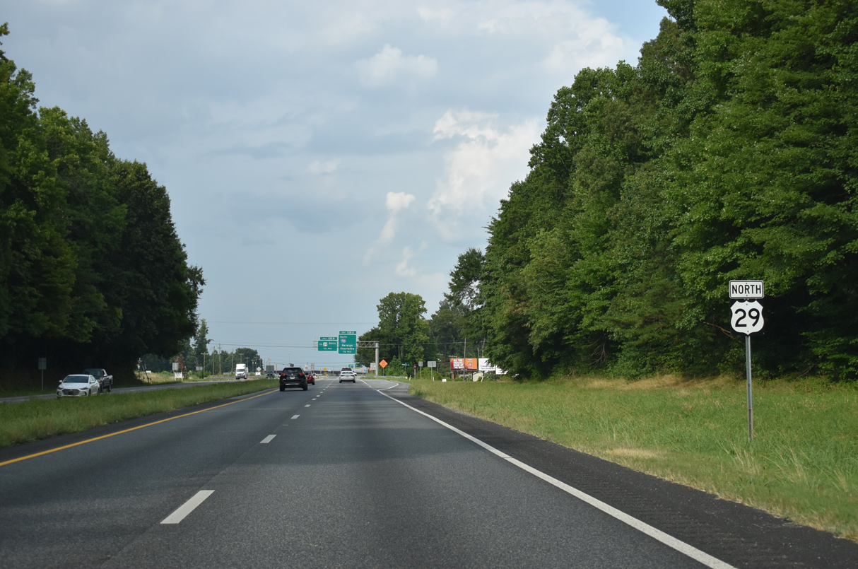
Exit 135B joins the Greensboro Urban Loop west to the loop ramp for U.S. 29 south at the temporary end of I-840.
08/14/21
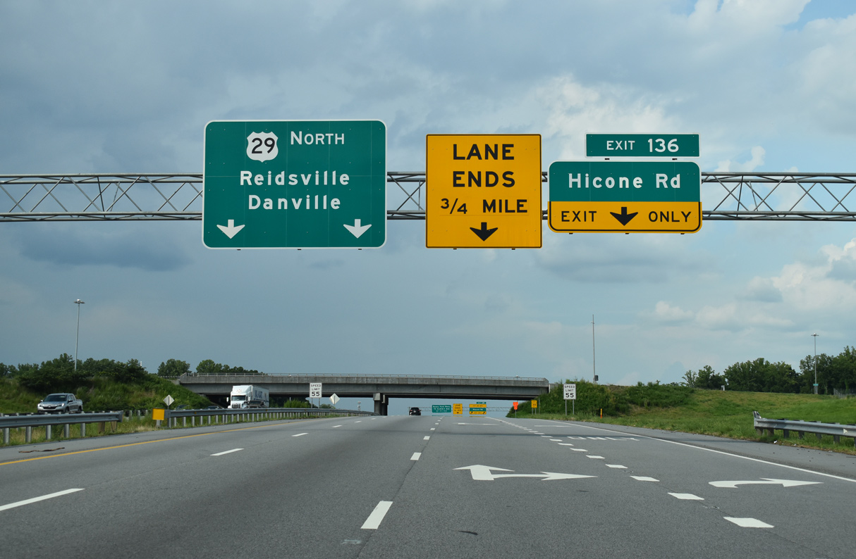
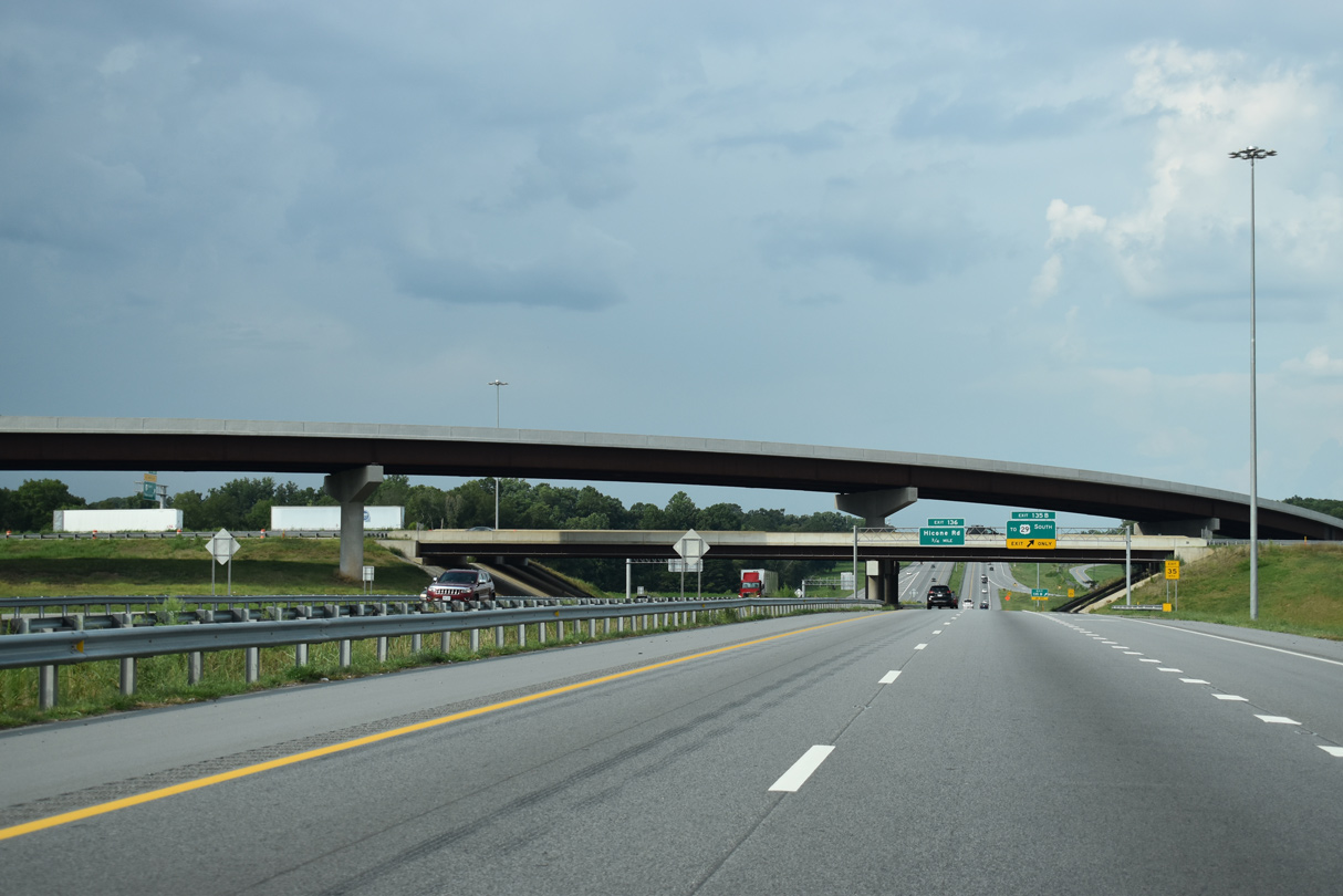
Construction upgrading U.S. 29 to Interstate standards replaced the diamond interchange with Hicone Road (SR 2565) into a diamond interchange (Exit 136).
08/14/21
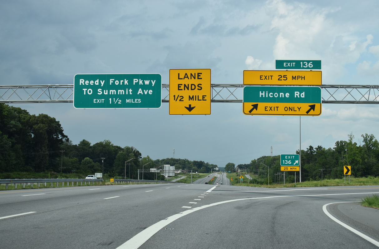
Hicone Road (SR 2565) links with Summit Avenue, the former alignment of U.S. 29 through northeast Greensboro, in 0.79 miles. Hicone Road east continues 5.30 miles to an array of subdivisions and Huffine Mill Road (SR 2770).
08/14/21
Aldine Road (SR 2564) and Milford Road (SR 5334), service roads along U.S. 29, were extended north from Hicone Road to a J-turn intersection.
06/15/15
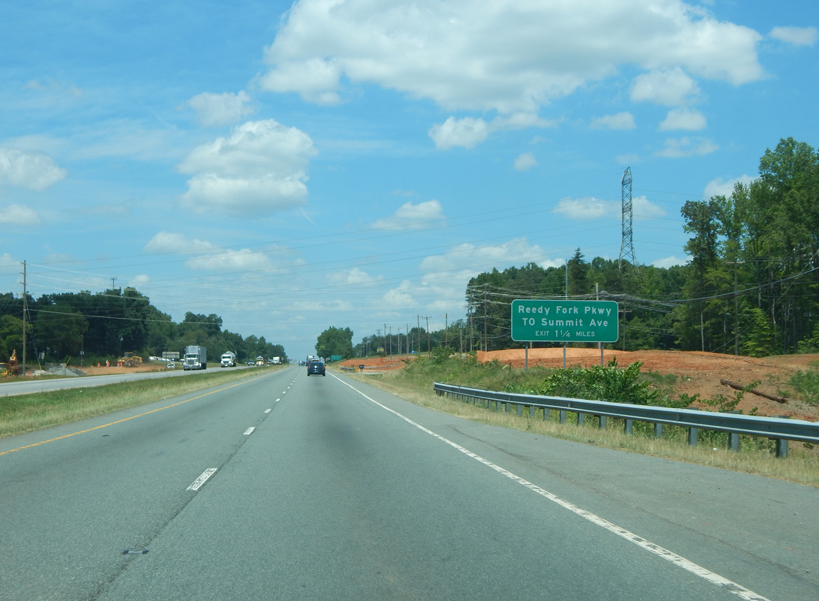
Summit Avenue (former U.S. 29) converges with U.S. 29 at Reedy Fork Parwkay northeast from Lake Herman/Summit Industrial Park near Bryan Park.
06/15/15
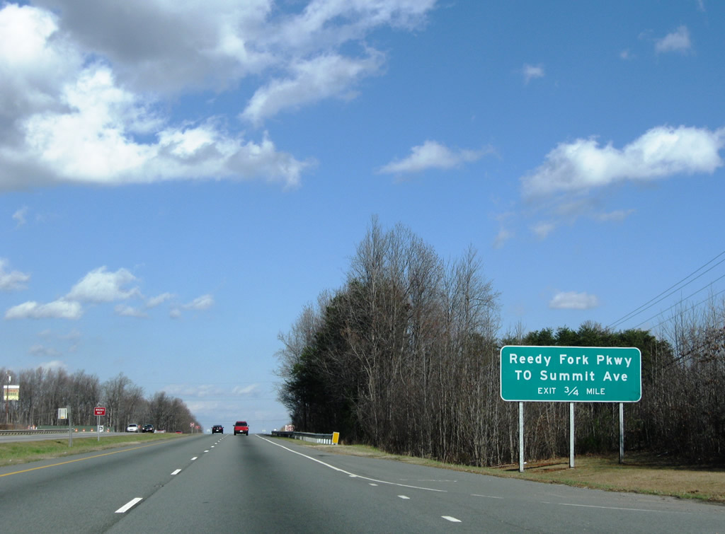
The folded diamond interchange with Reedy Fork Parkway and Summit Avenue lies 0.75 miles north of April Lane (SR 2916).
12/21/08
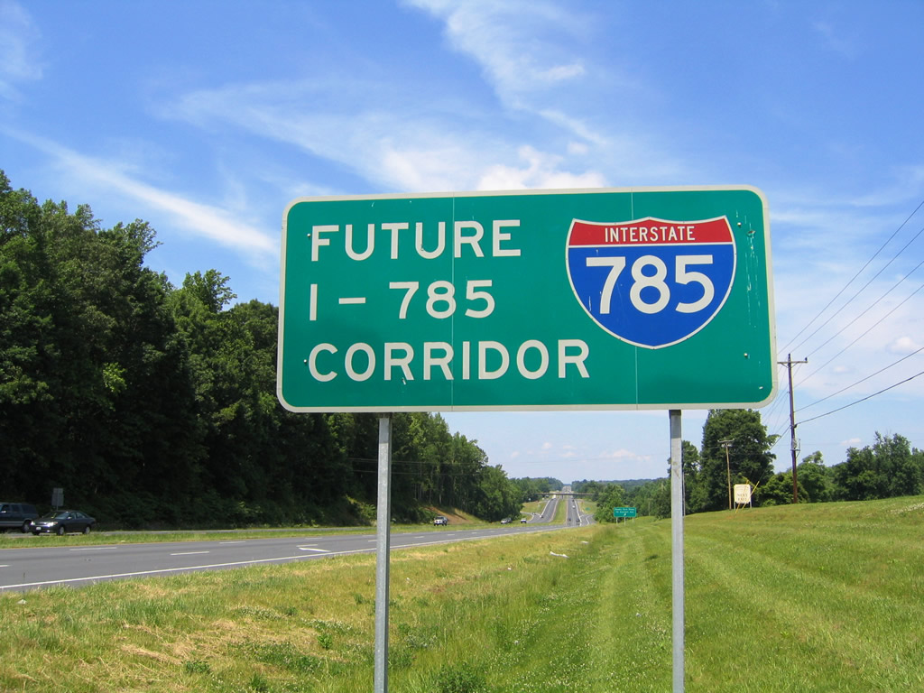
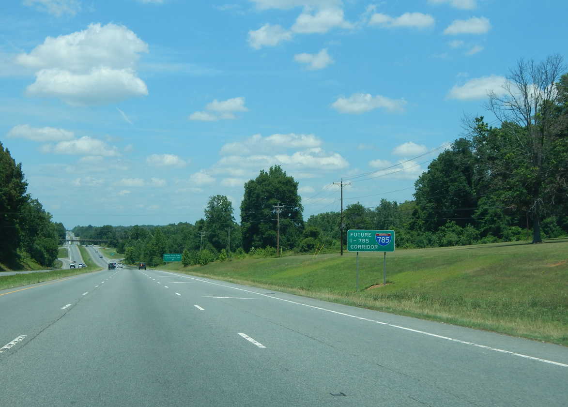
A sign for Future I-785 precedes Reedy Fork Parkway. The Interstate corridor overlays all of U.S. 29 northeast from I-840 to U.S. 58 (Danville Expressway) in Virginia.
05/30/05
06/15/15
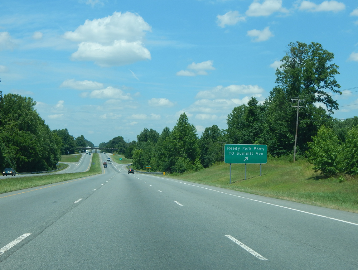
Reedy Fork Parkway (SR 4771) links U.S. 29 and parallel Summit Avenue (SR 2526) with suburban development east to Turner Smith Road.
06/15/15
U.S. 29 and Summit Avenue (SR 2526) cross Reedy Fork east of Hardys Mill Pond.
12/21/08
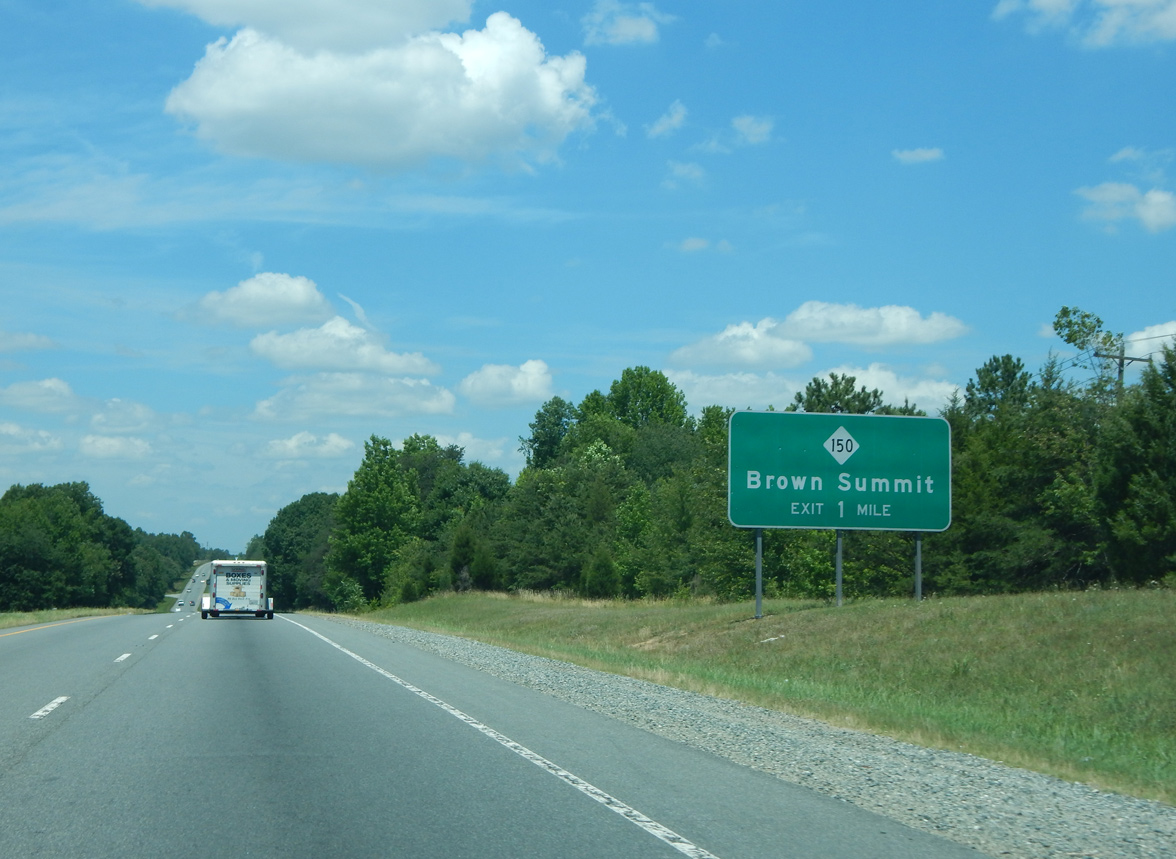
NC 150 crosses paths with the expressway along U.S. 29 east of Browns Settlement and west of Monticello.
06/15/15
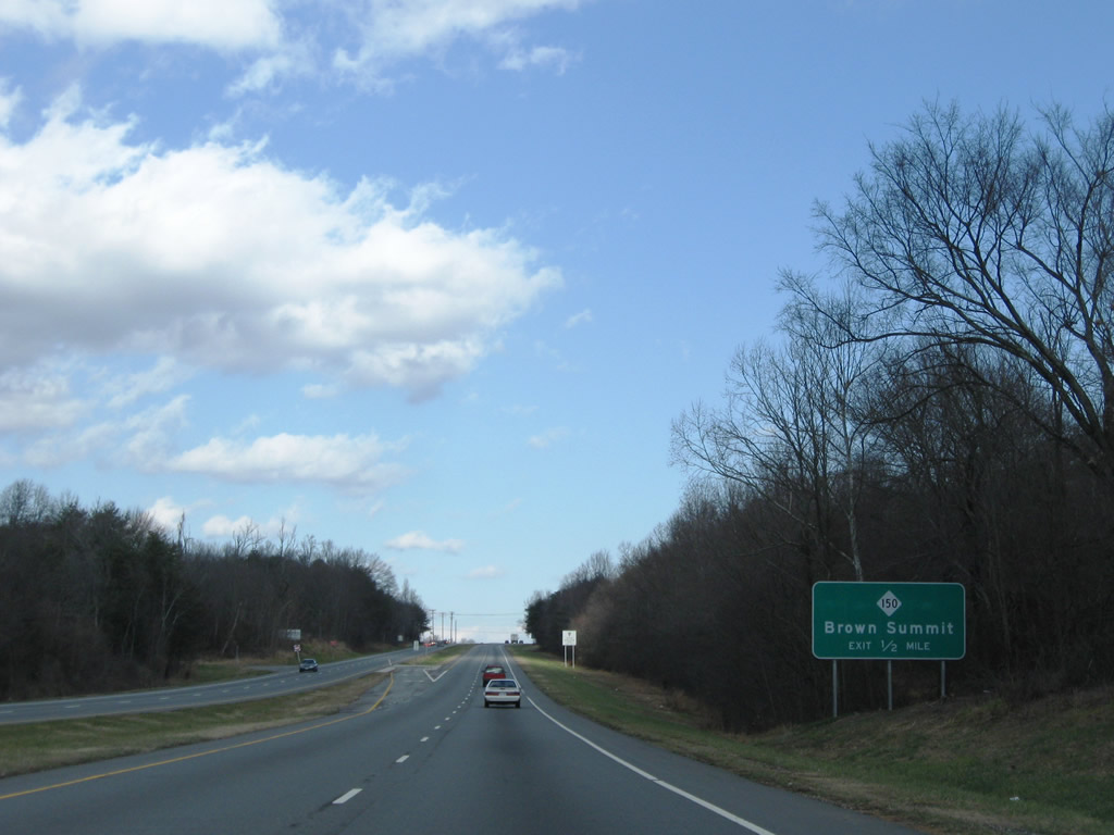
A U-turn for two residences along U.S. 29 southbound precedes the parclo interchange with NC 150.
12/21/08
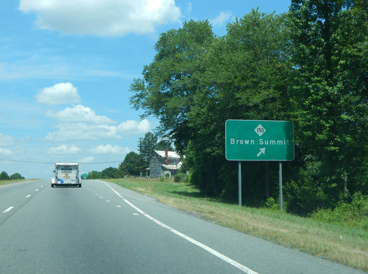
NC 150 is a multi state route, stretching east from S.C. 150 in Cleveland County to U.S. 158 at Locust Hill. Locally NC 150 travels west to U.S. 220 at Summerfield and east to Osceola and Williamsburg.
06/15/15
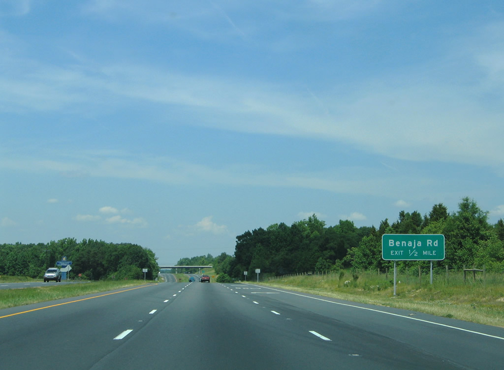
Benaja Road stems 0.32 miles north from Old Reidsville Road (old U.S. 29) near Monticello to a parclo A2 interchange with U.S. 29.
05/30/05
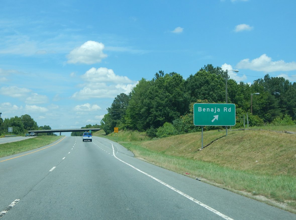
Continuing 1.59 miles north from U.S. 29, the south branch of Benaja Road (SR 2510/2499) ties into Benaja Road (SR 2427) near Benaja in Rockingham County.
06/15/15
U.S. 29 advances north to Old Reidsville Road and Benaja Road (SR 2427) west.
05/30/05
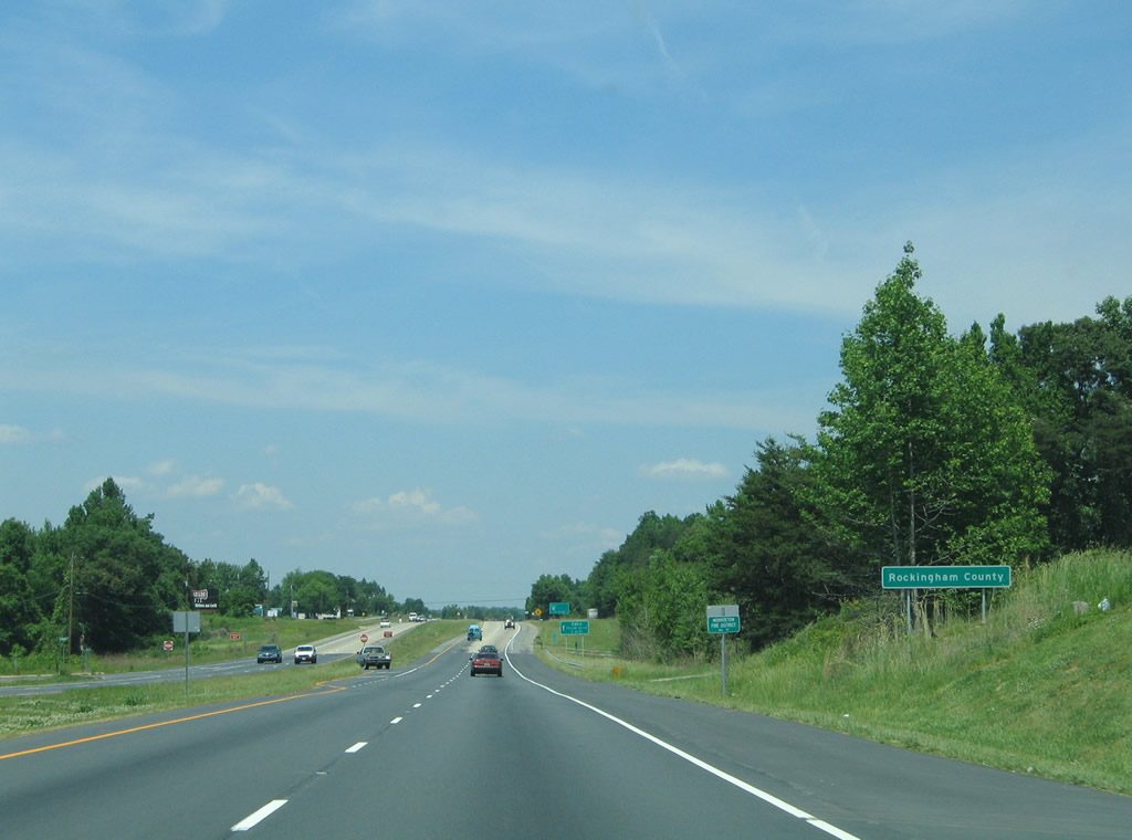
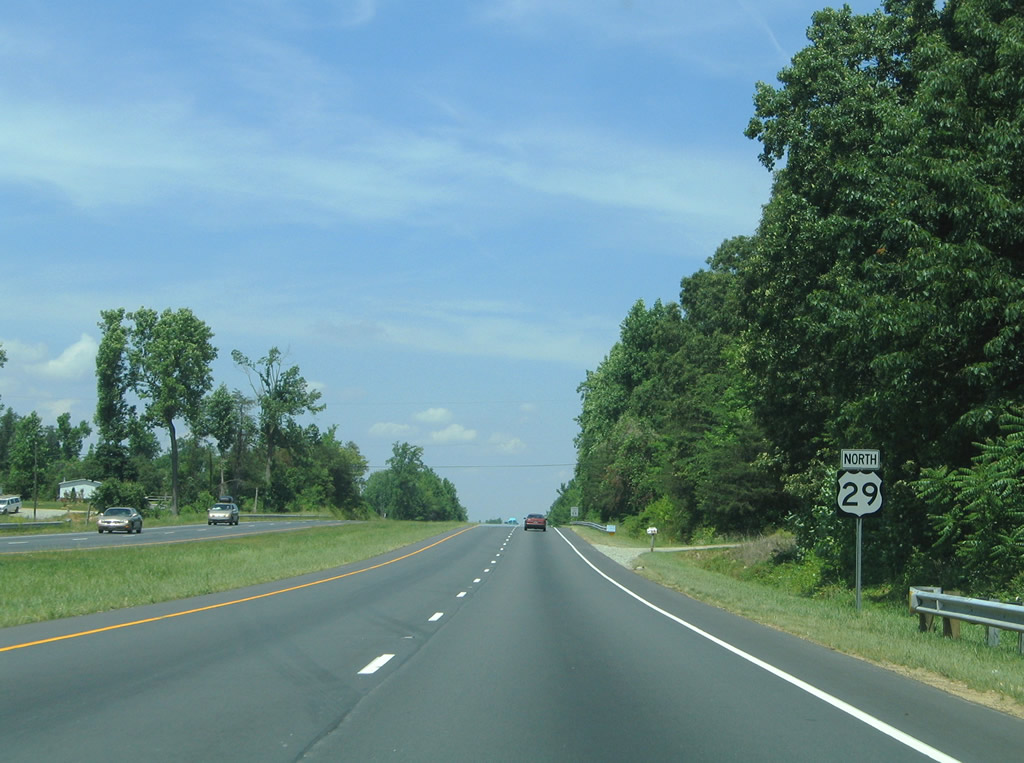
U.S. 29 travels 18.72 miles north across Rockingham County, mostly along a limited access highway.
05/30/05

References:
- Carolina Circle Mall. Retro Junk.
Photo Credits:
- Alex Nitzman: 05/30/05, 08/14/21
- ABRoads: 12/21/08
- Carter Buchanan: 06/15/15
Connect with:
Page Updated Monday November 29, 2021.