
U.S. 29 South - Gretna to Danville

 South
South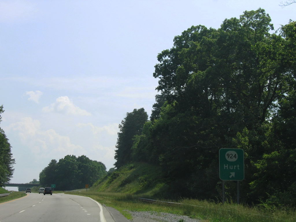
SR 924 follows Pocket Road east from a rural end near the Staunton River to U.S. 29 Business (Main Street) in Hurt. A diamond interchange joins the route with U.S. 29.
06/05/05
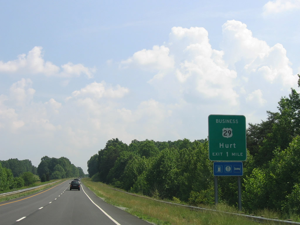
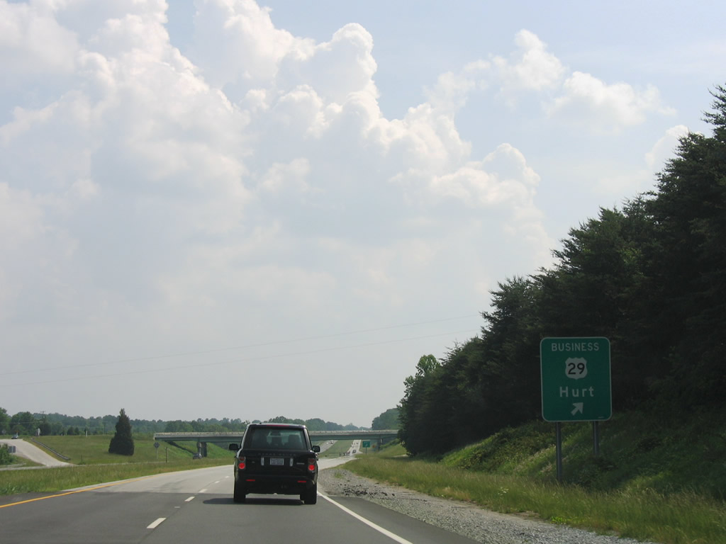
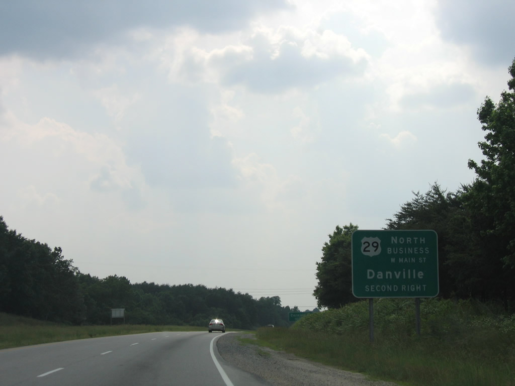
U.S. 29 Business (Main Street) returns from Hurt to end at a diamond interchange with U.S. 29 at Motley.
06/05/05
Southbound at the ramp departure to U.S. 29 Business (Main Street) north and SR 988 (Highwayview Road) south. Highwayview Road represents old U.S. 29 through Motley.
06/05/05
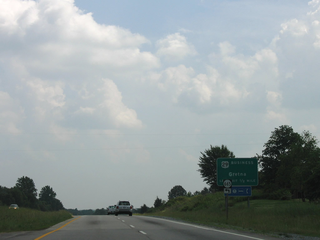
One half mile north of the wye interchange with U.S. 29 Business (Main Street) south into Gretna. SR 665 (Rockford School Road) links with SR 634 (Blue Ridge Drive / original U.S. 29).
06/05/05
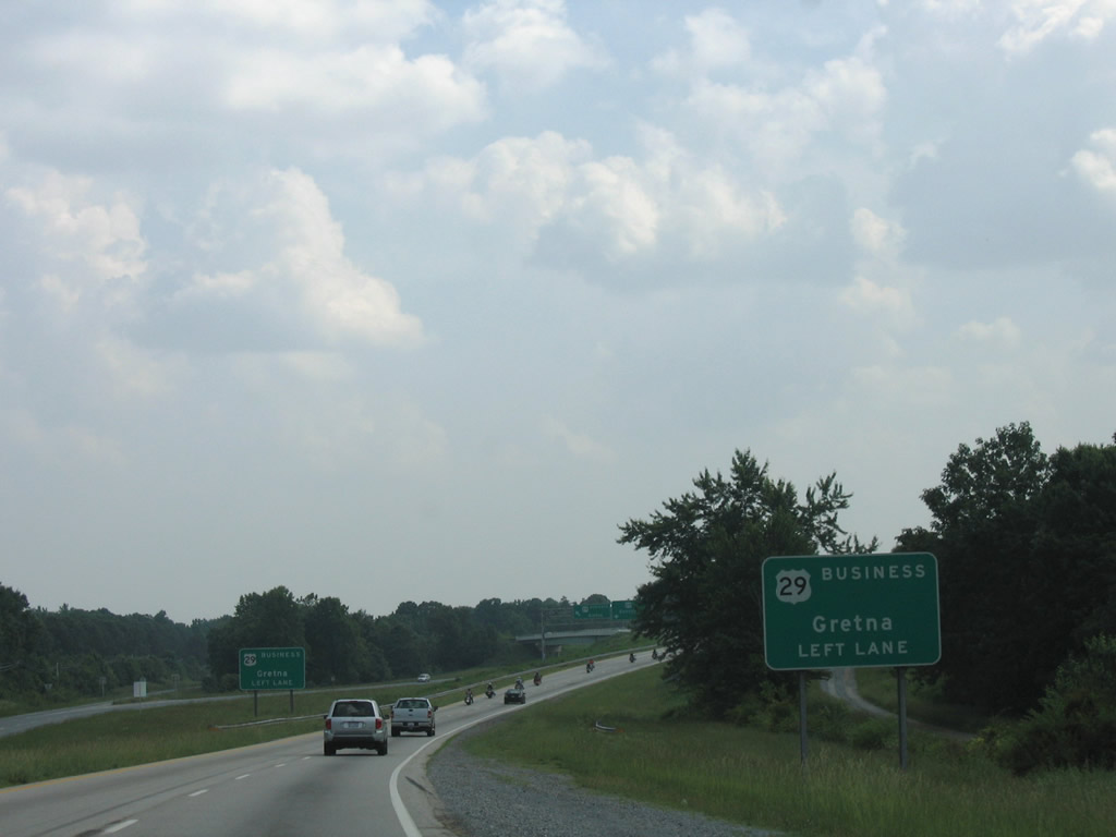
U.S. 29 again upgrades into a full freeway as it bypasses Gretna and U.S. 29 Business (Main Street) to the west.
06/05/05
A left exit carries drivers onto Main Street leading south into downtown Gretna.
06/05/05
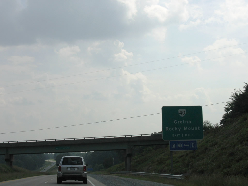
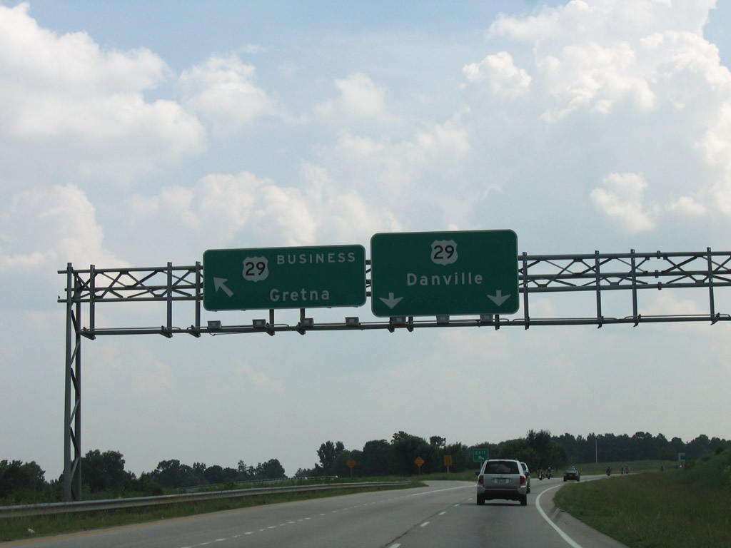
A diamond interchange joins U.S. 29 with SR 40 on the west side of Gretna. SR 40 follows Vaden Drive east to U.S. 29 Business (Main Street) and West Gretna Road west to Penhook in neighboring Franklin County.
SR 40 travels 233 miles from Woolwine to Spring Grove across southern Virginia. SR 40 joins Gretna with Rocky Mount (U.S. 220) with Mt. Airy and Brookneaf (U.S. 501).
06/05/05
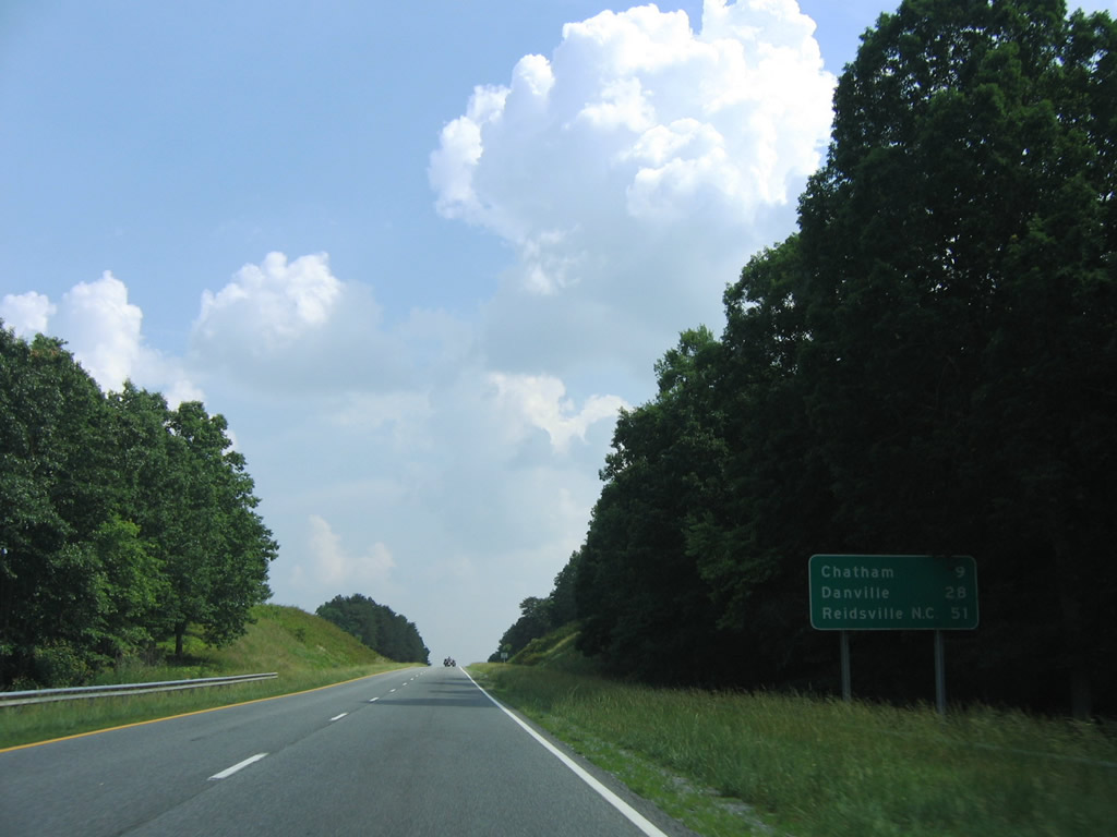
U.S. 29 continues next to Chatham, nine miles south of SR 40.
06/05/05
U.S. 29 Business (Main Street) returns at a wide wye interchange, with U.S. 29 resuming its arterial status on the seven mile drive to the Pittsylvania County seat of Chatham.
06/05/05
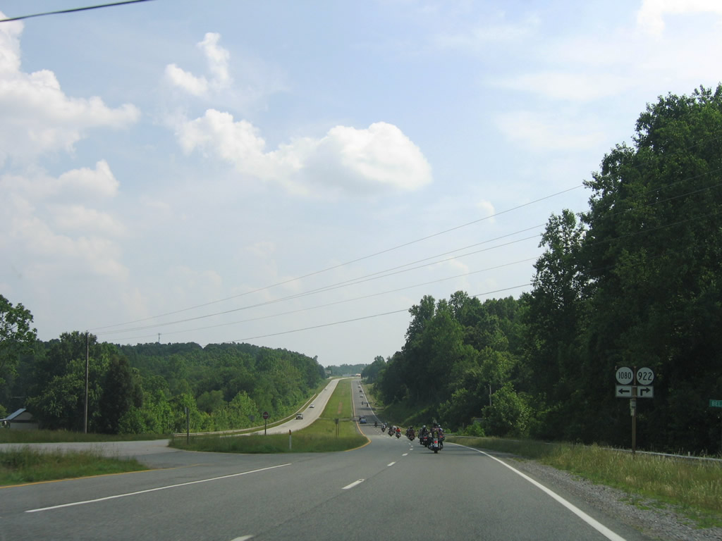
SR 1080 (Belair Road) and 922 (Andrew Road) come together at U.S. 29 near Smothers. SR 1080 represents old U.S. 29 while SR 922 spurs west to SR 794 (Old Mine Road).
06/05/05
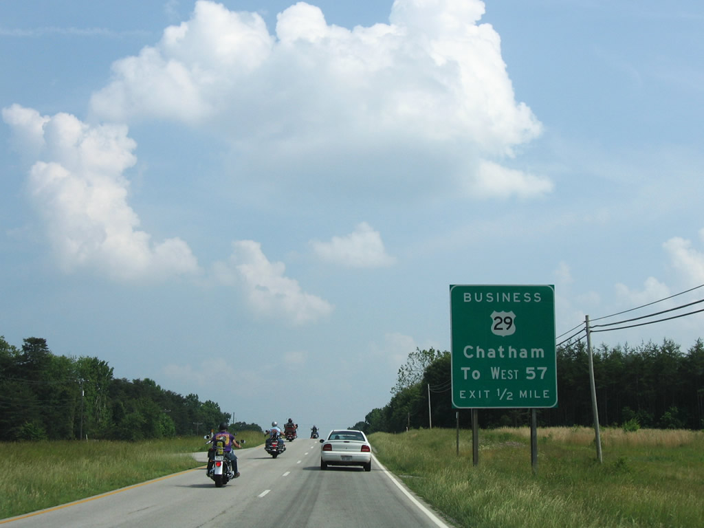
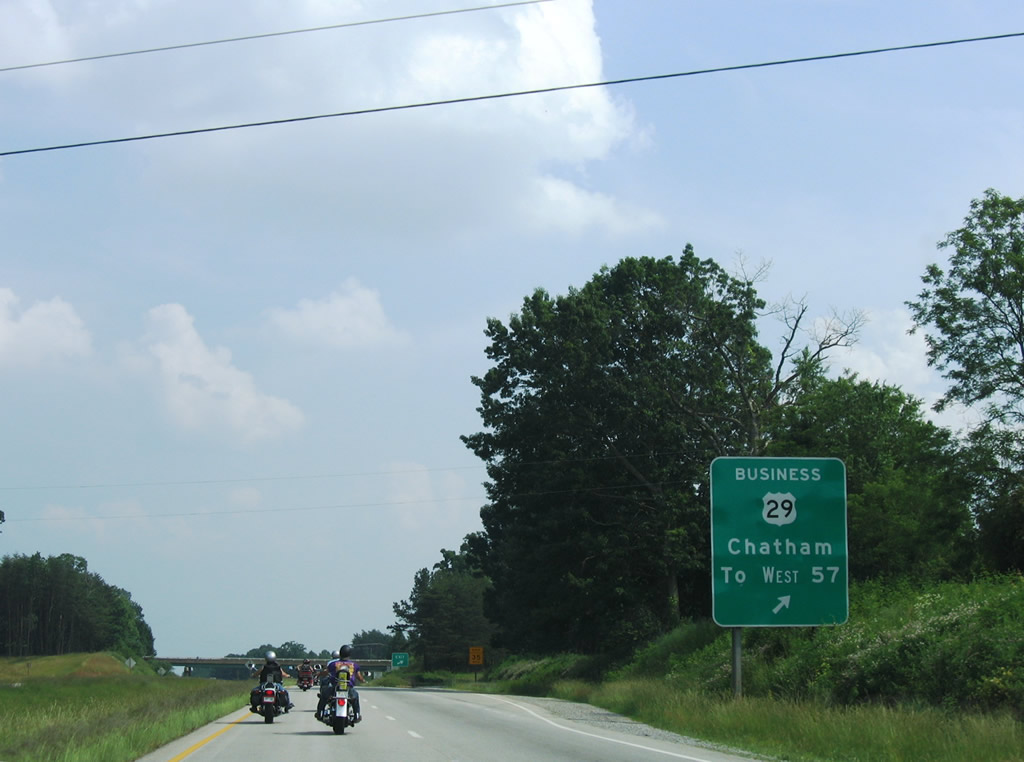
Chatham is served by another U.S. 29 Business loop, as the highway mainly arcs east of the town. Interests to SR 57 (Callands Road) west are advised to follow Main Street south as a more direct route to the state route.
06/05/05
A diamond interchange comprises the north end of the Chatham Business loop with SR 691 (Mill Creek Road) east. SR 691 travels to SR 685 near Sheva, while U.S. 29 Business merges with SR 57 through Downtown Chatham.
06/05/05
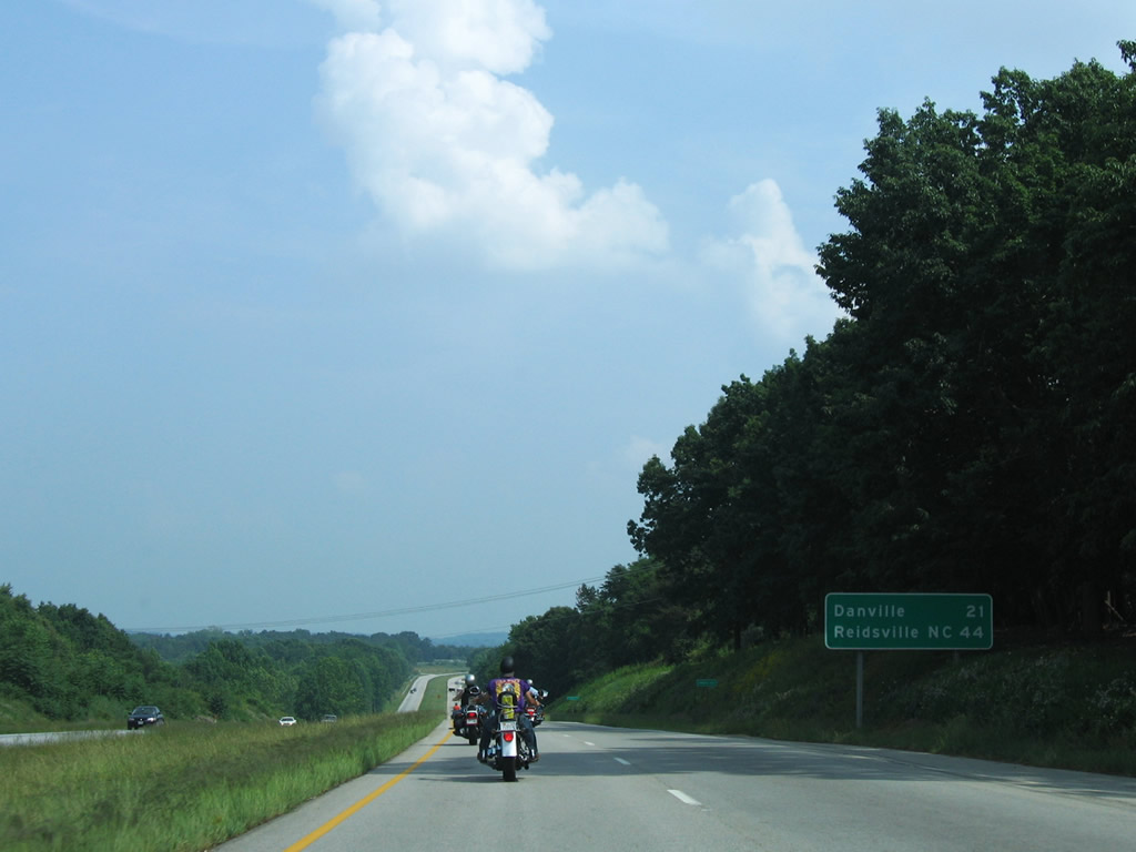
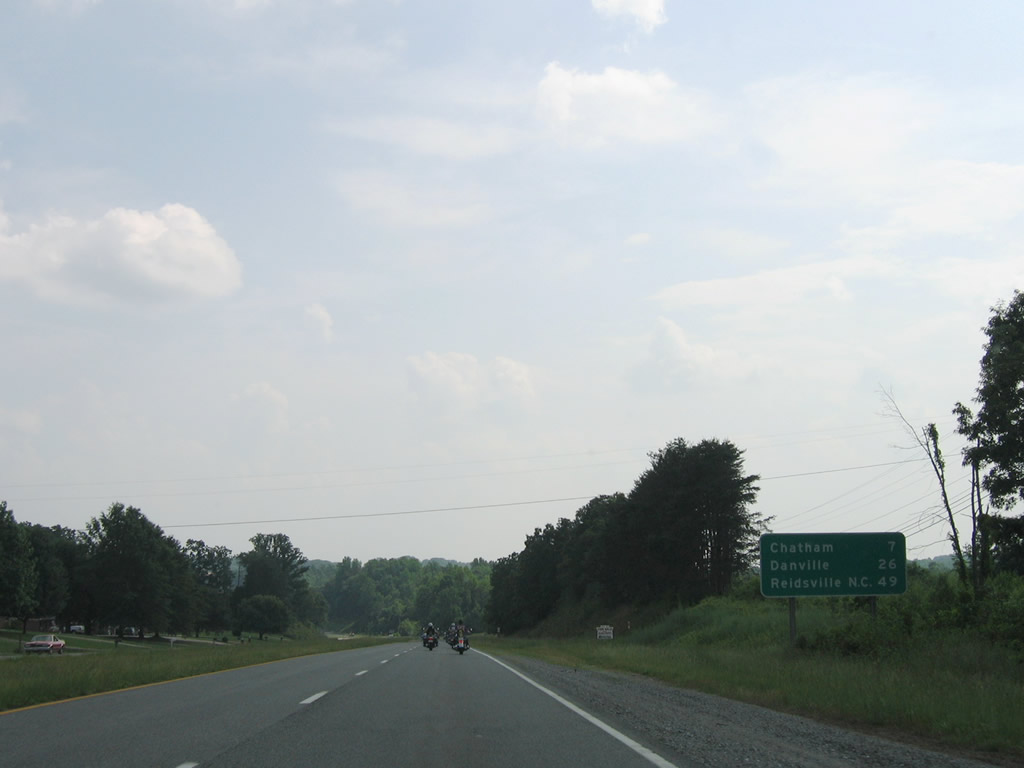
Danville is now just 21 miles to the south along U.S. 29. Reidsville, North Carolina joins as the next destination of interest for U.S. 29 south.
06/05/05

SR 685 (Chalk Level Road) continues south from Sheva and SR 691 to meet U.S. 29 at a diamond interchange.
06/05/05

Southbound at the SR 685 (Chalk Level Road) off-ramp of U.S. 29. SR 685 follows Hurt Street to its end at U.S. 29 Business (Main Street) and Military Drive to Chatham Hall Hargrave Military Academy.
06/05/05
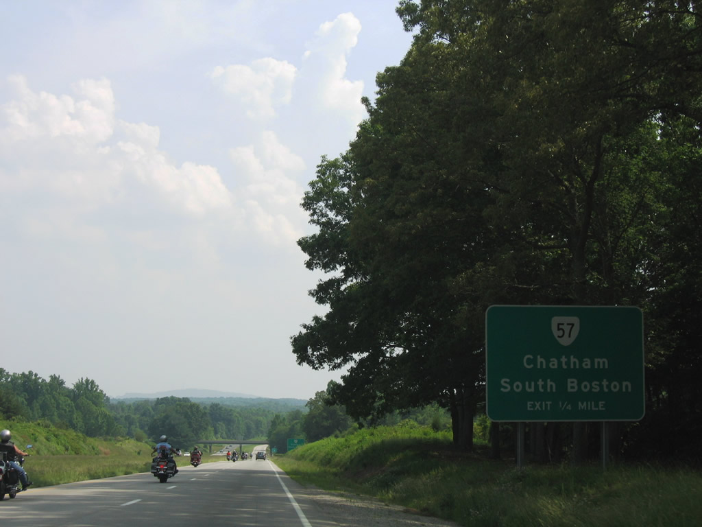
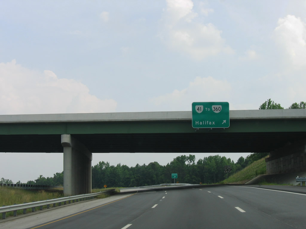
SR 57 east exits Chatham via Halifax Road to a diamond interchange with U.S. 29.
06/05/05
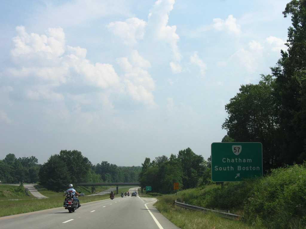
SR 57 joins Chatham with SR 360 west of Halifax and north of South Boston. The state route replaced SR 832 east from Chatham by 2002, a routing that it used previously until 1953.1
06/05/05
U.S. 29 Business (Main Street) and U.S. 29 merge at a wye interchangee just north of Cherrystone Creek and SR 1433 (Cherrystone Road) south.
06/05/05
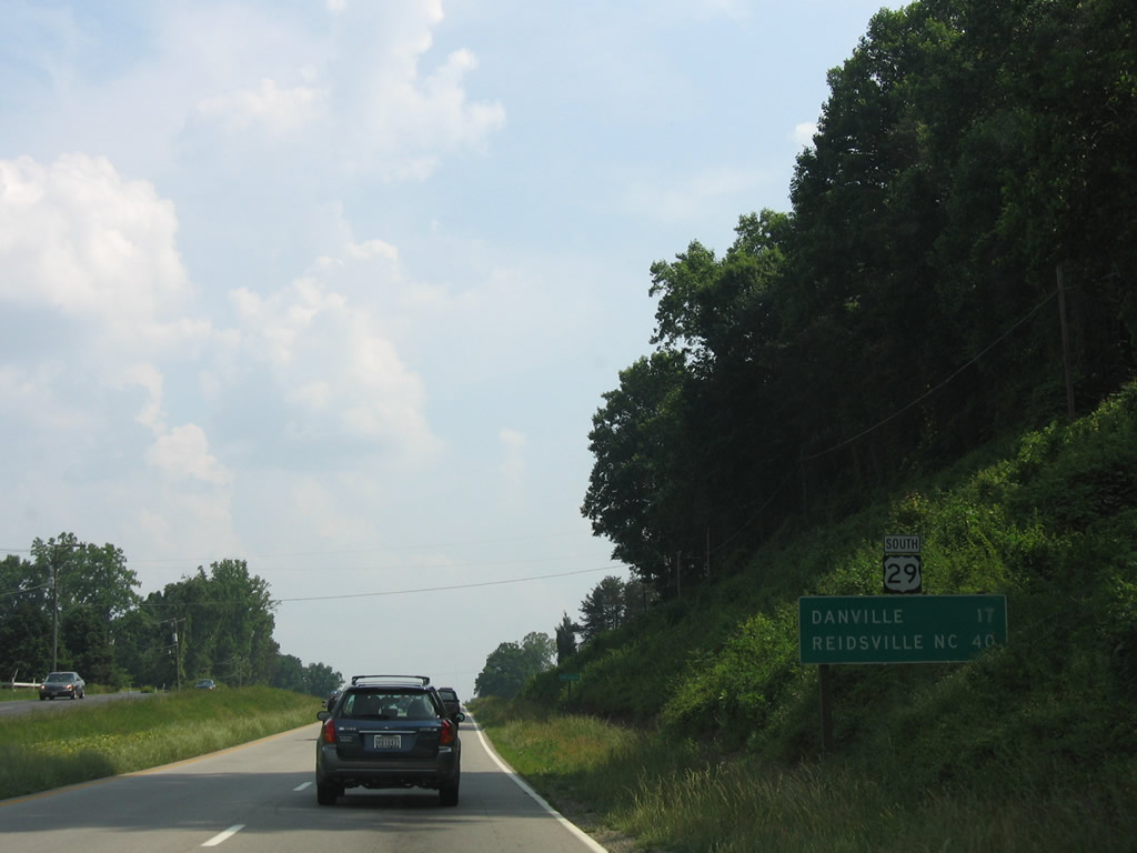
17 miles north of Danville and 40 miles from Reidsville, North Carolina along U.S. 29 south. Tight Squeeze and the crossing of Oak Mountain lie ahead.
06/05/05
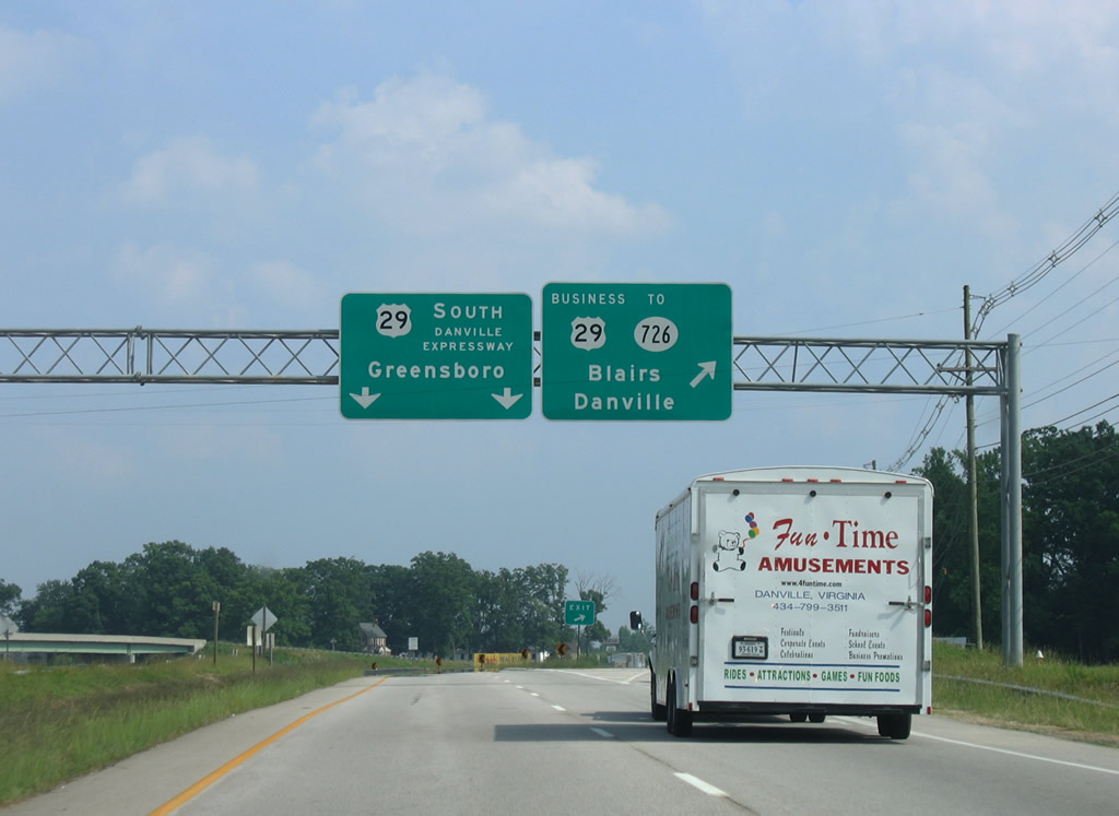
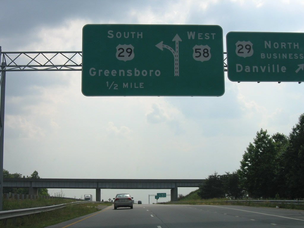
U.S. 29 splits with its final Virginia Business route at Blairs. U.S. 29 Business angles southwest from Blairs to Piney Forest Road in Danville. SR 293 (Main Street) travels the original U.S. 29 alignment toward downtown, while the business route utilizes a commercial arterial route through New Design to the west. SR 726 (Malmaison Road) meanwhile travels east from U.S. 29 Business to Kentucky and south to Ringgold.
06/05/05
South - Danville Expressway
A wye interchange links southbound travelers with U.S. 29 Business. Two additional ramps join SR 726 with U.S. 29 (Danville Expressway) nearby.
06/05/05

A six-ramp parclo interchange joins U.S. 29 with SR 41 (Franklin Turnpike) just west of SR 360 (Old Richmond Road). SR 41 runs northwest to SR 293 (N Main Street) and U.S. 29 Business (Piney Forest Road) in north Danville.
06/05/05
SR 41 (Franklin Turnpike) opened northwest from U.S. 29 (Danville Expressway) in 2012. Nearby SR 360 constitutes a 41 mile long route from Danville to Halifax north of South Boston. SR 360 represents the pre-1984 alignment of U.S. 360.3
06/05/05
SR 41 (Franklin Turnpike) concludes just east of U.S. 29 at SR 360 (Old Richmond Road). A planned extension of Franklin Turnpike will continue south to SR 730 (Eagle Springs Road). SR 360 follows Richmond Boulevard southwest to Main Street (SR 293) and U.S. 360/58 Business (River Street).
06/05/05
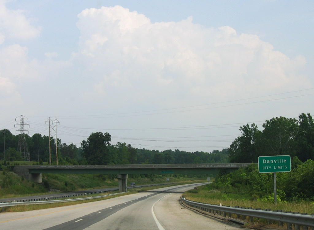
Southbound travelers enter the city of Danville after passing under SR 360 (Old Richmond Road).
06/05/05
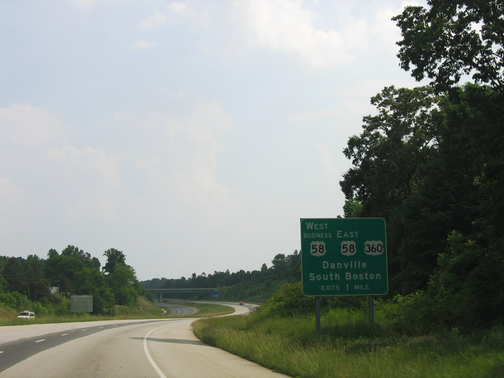
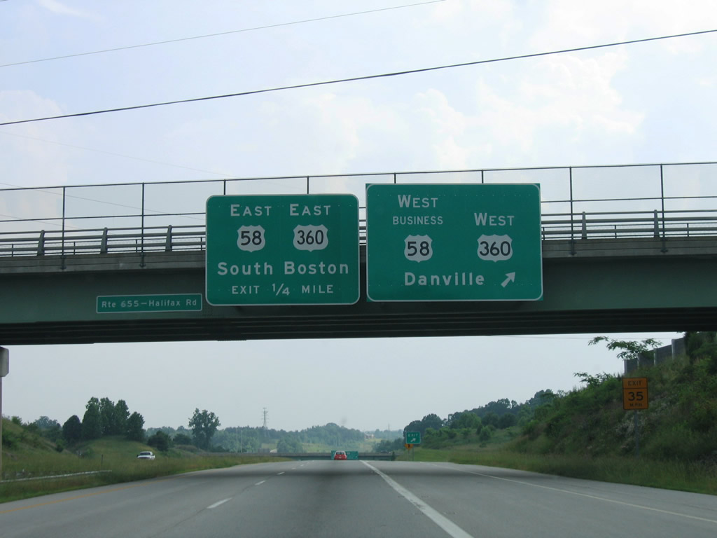
U.S. 58 joins the city of Danville with South Boston and Martinsville. U.S. 360 begins in Danville and travels east with U.S. 58 to South Boston and northeast to Richmond. The two meet U.S. 29 (Danville Expressway) at a cloverleaf interchange west of Danville Regional Airport (DAN).
06/05/05

U.S. 360/58 Business (South Boston Road) travel 1.76 miles westward to SR 293 (Main Street). The business route leads to the Danville Science Center and Historic District while U.S. 29 south continues to River Park Drive and Dan Daniel Memorial Park.
06/05/05
Motorists bound for U.S. 360/58 Business (South Boston Road) west to River Street and Downtown depart U.S. 29 south. U.S. 58 merges with the Danville Expressway and bypasses the entire city west to Bachelors Hall.
06/05/05
South  West - Danville Expressway
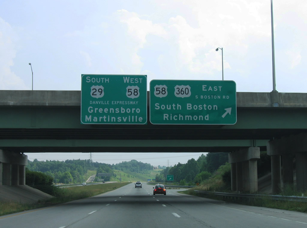
U.S. 58/360 (S Boston Road) overlap 25.70 miles from U.S. 29 to South Boston.
06/05/05
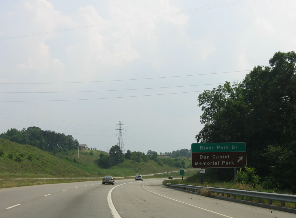
Dan Daniel Memorial Park lies along the Dan River north of U.S. 29/58 (Danville Expressway). A diamond interchange joins the freeway with River Park Drive to the park and SR 1224 (Stinson Drive).
06/05/05
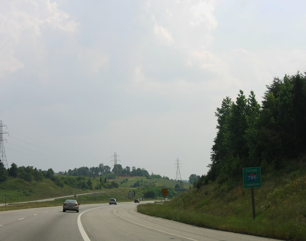
The Danville Expressway is the northernmost section of the Future I-785 Corridor. Dating back to 1996 with the Interstate Connection: Alliance for Economic Growth, several improvements remain necessary to upgrade U.S. 29 between Danville and Greensboro, North Carolina.
06/05/05
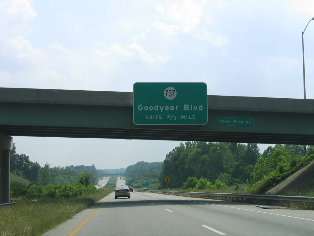
A six ramp parclo interchange connects the Danville Expressway west with SR 737 (Goodyear Boulevard) next.
06/05/05
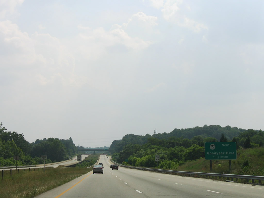
SR 737 (Goodyear Boulevard) serves the industrialized southeast side of Danville and the Goodyear plant south of U.S. 29/58.
06/05/05
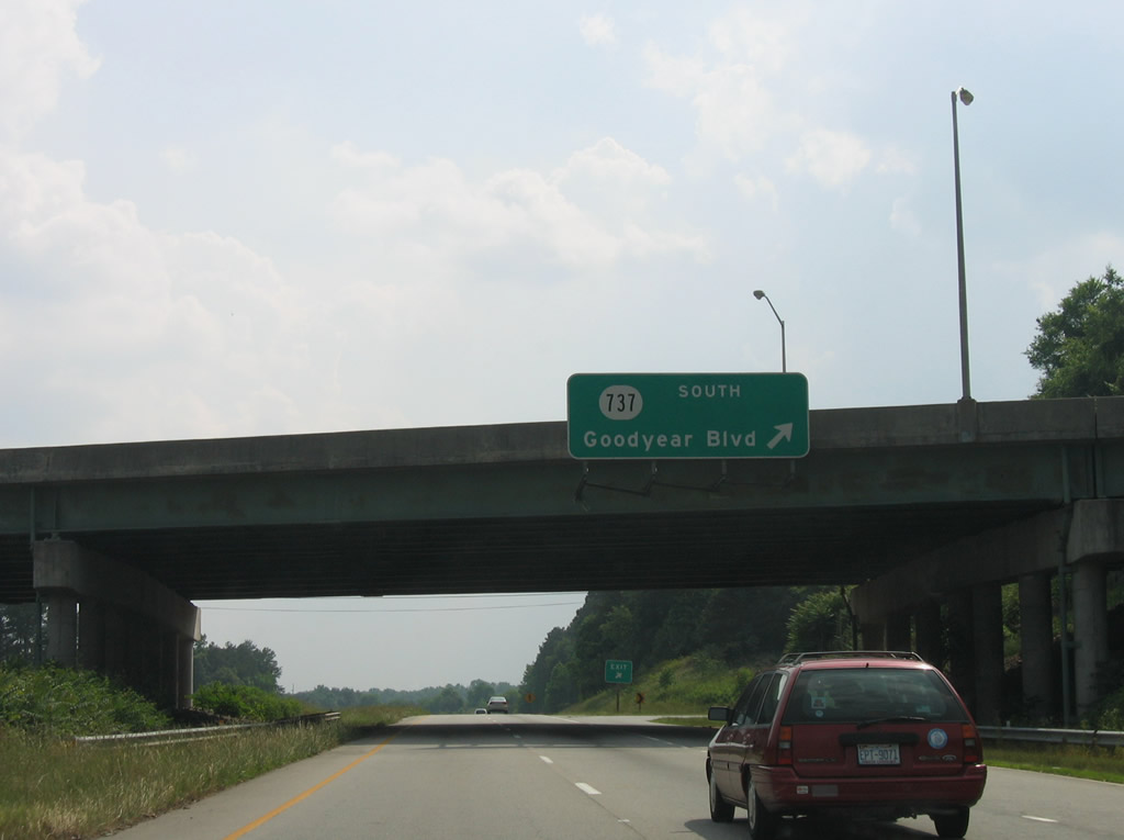
SR 737 (Goodyear Boulevard) links with SR 736 (Gypsum Road) southeast to Wallace Mill, North Carolina. SR 737 continues west from the Goodyear plant to Pleasant Grove and SR 86 north of Gatewood, North Carolina.
06/05/05
Reassurance shield assembly for U.S. 29 south / U.S. 58 west along the Danville Expressway between SR 737 and SR 86 (S Main Street).
06/05/05
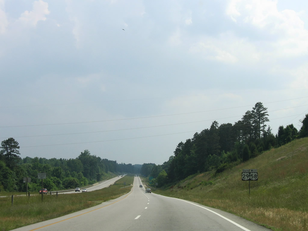
SR 86 extends four miles north from NC 86 north along Main Street to U.S. 29-58 Business (Memorial Drive).
06/05/05
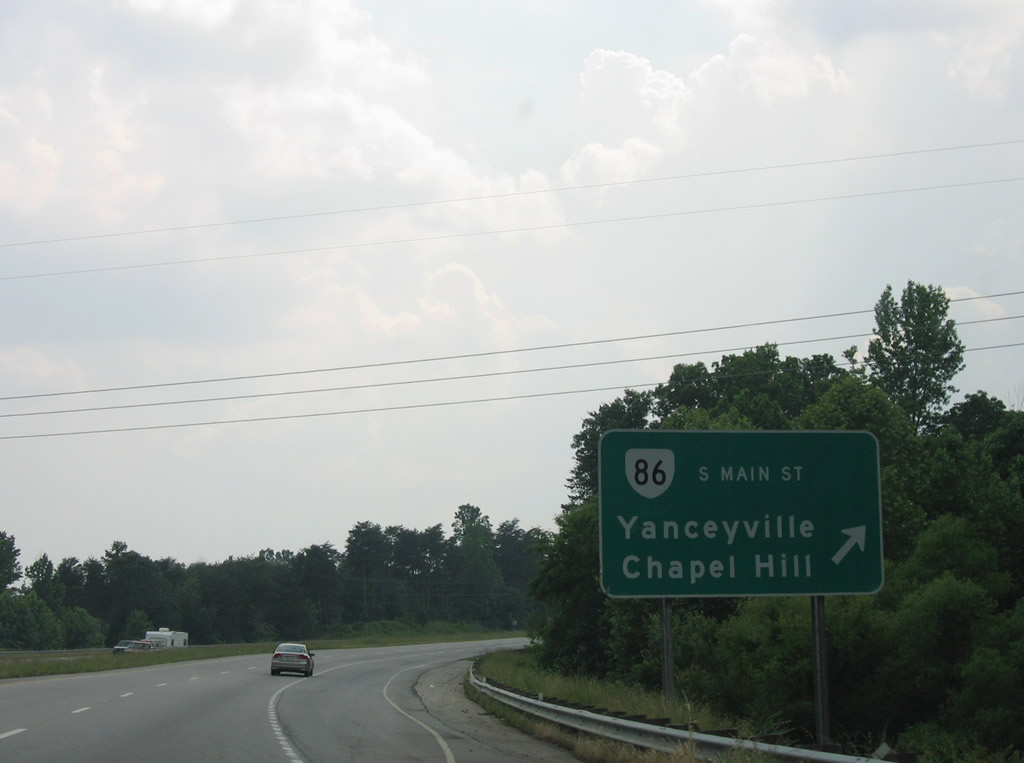
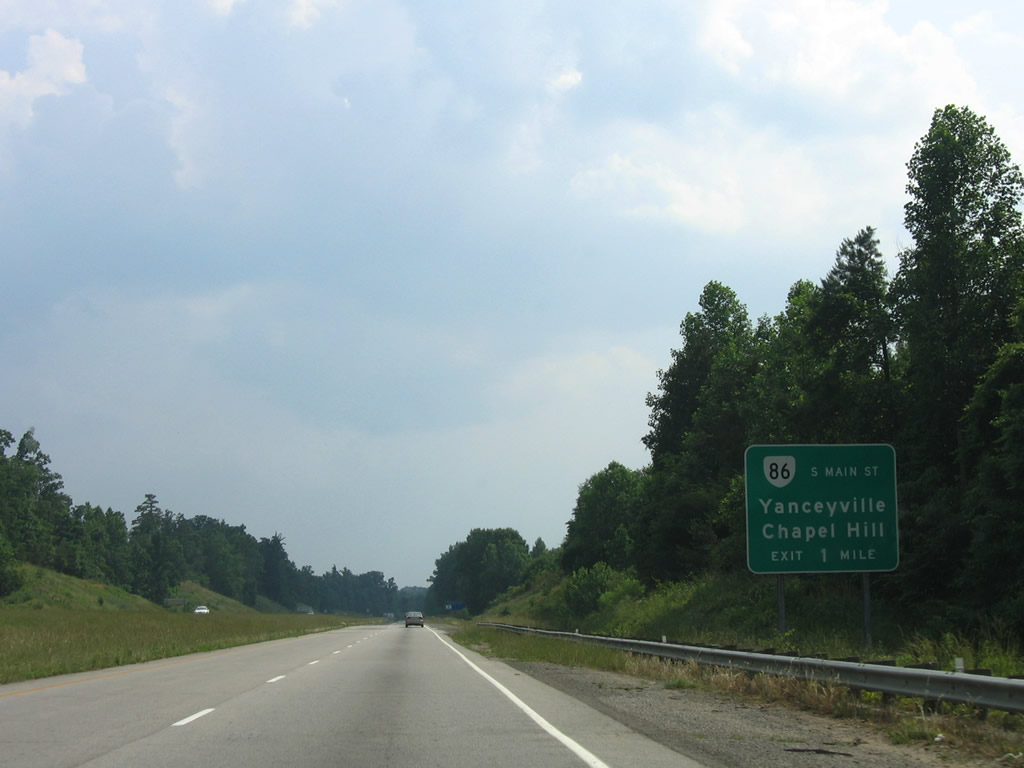
Westbound at the diamond interchange with SR 86 (S Main Street). NC 86 travels south 53 miles through Yanceyville and Hillsborough to Chapel Hill.
06/05/05
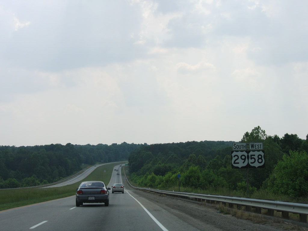
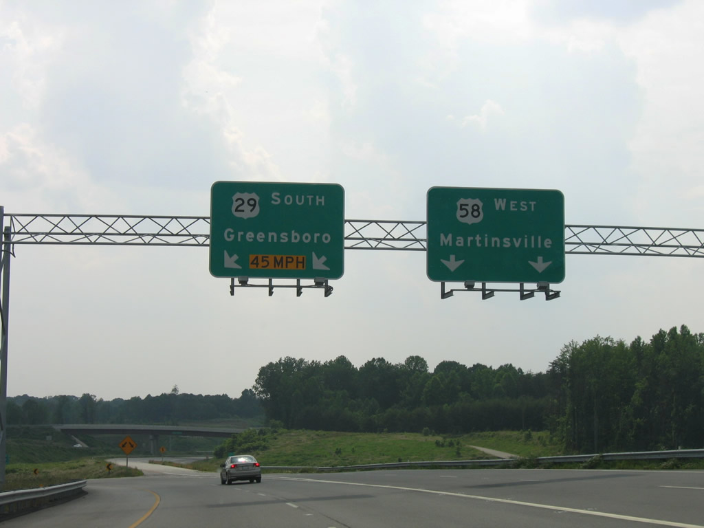
U.S. 29/58 straddle the North Carolina state line west between S Main Street and their split near Stokesland. This is the original section of the Danville Expressway. Opened in 1982, it was originally designated SR 265.2
06/05/05
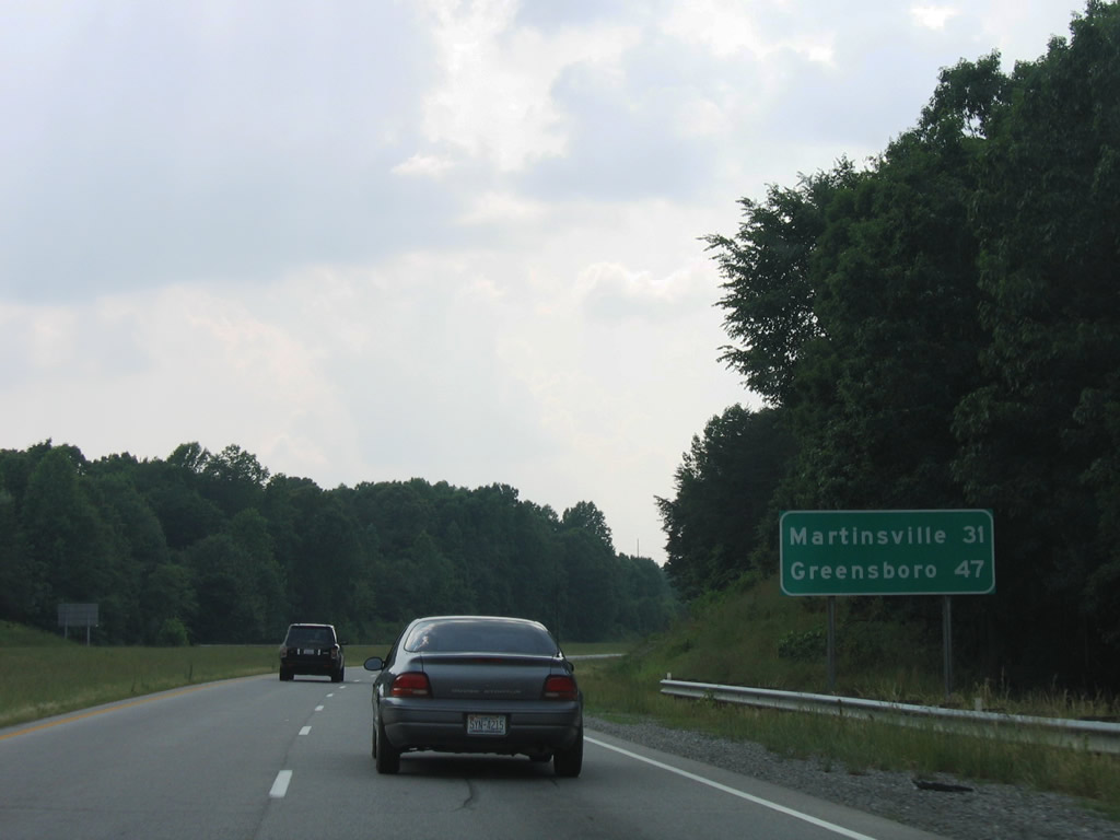
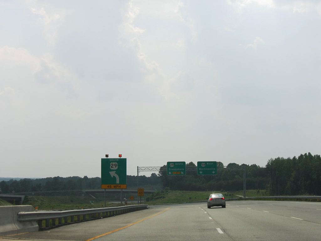
U.S. 58 travels west 31 miles from this stretch of the Danville Expressway to Martinsville. U.S. 29 south continues 47 miles to Greensboro.
06/05/05
U.S. 29 turns south from the Danville Expressway beyond the right in right out (RIRO) ramps with Elizabeth Street. An interchange is planned here, with stubs in place at three of the four future ramp ends.
06/05/05
U.S. 29 Business follows W Main Street southwest from SR 293 and Memorial Drive to the directional cloverleaf interchange with U.S. 29 leading south into North Carolina.
06/05/05
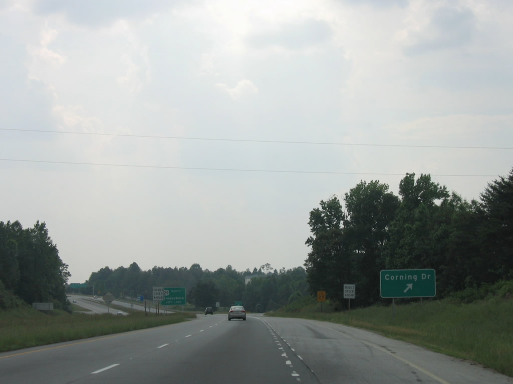
A half diamond interchange joins U.S. 29/58 (Danville Expressway) with parallel Corning Drive to Stokesland and SR 1353 south to Shelton. SR 1353 represents an old alignment of U.S. 29.
06/05/05
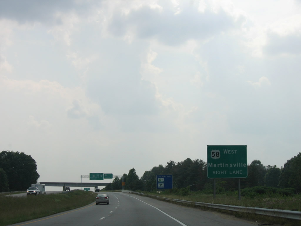
U.S. 58 continues along the Danville Expressway west from U.S. 29 to Bachelors Hall and U.S. 58 Business (Martinsville Highway).
06/05/05
U.S. 29 Business follows W Main Street to Memorial Drive along the Dan River. U.S. 58 Business parallels the river to the north on Riverside Drive.
06/05/05
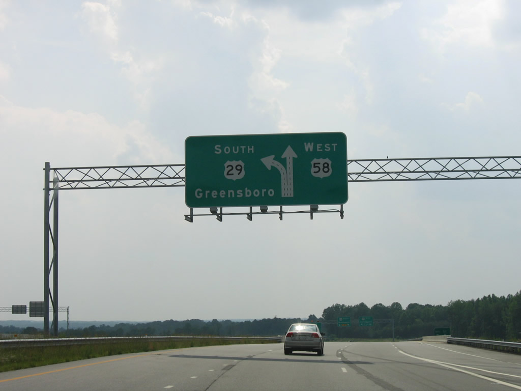
U.S. 29 south / U.S. 58 west expand to four overall lanes ahead of their split.
06/05/05
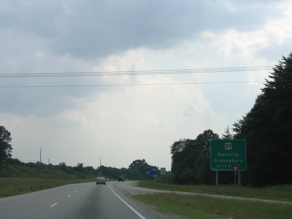
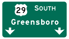
If it is ever signed, Interstate 785 will depart the Danville Expressway with U.S. 29 south to Reidsville and Greensboro.
06/05/05
U.S. 29 south enters North Carolina before merging with U.S. 29 Business ahead of Pelham.
06/05/05
South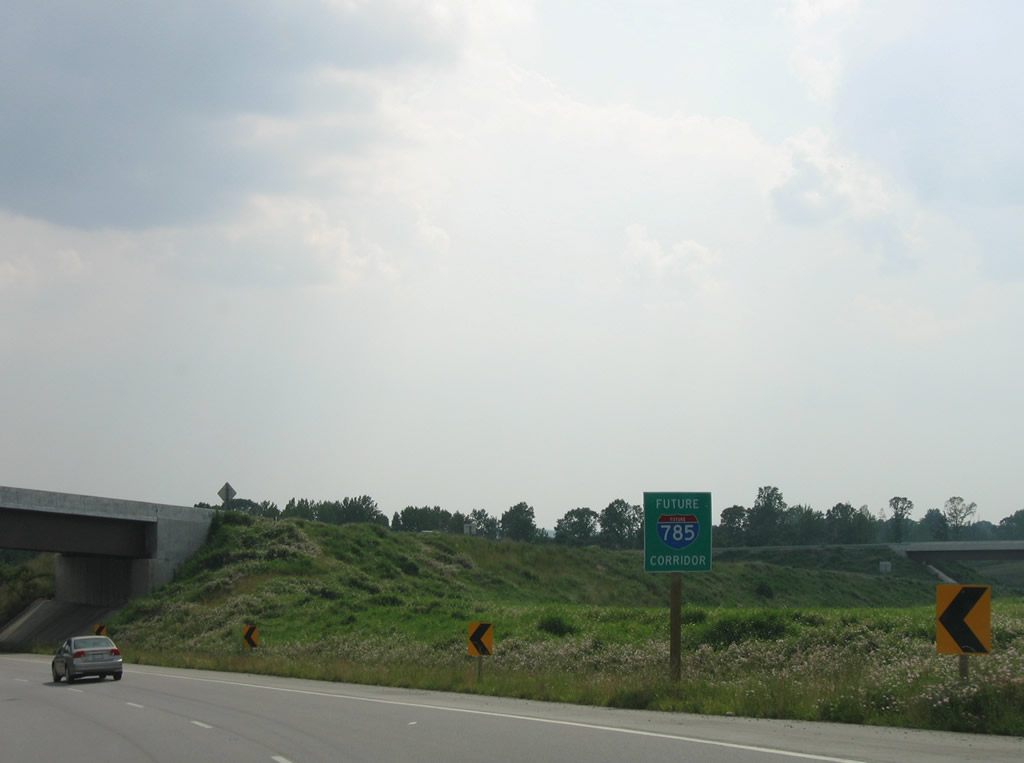
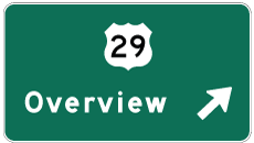
A second Future Interstate 785 corridor sign is posted on the ramp continuation of U.S. 29 south. There are a couple I-785 Corridor signs in North Carolina as well.
06/05/05
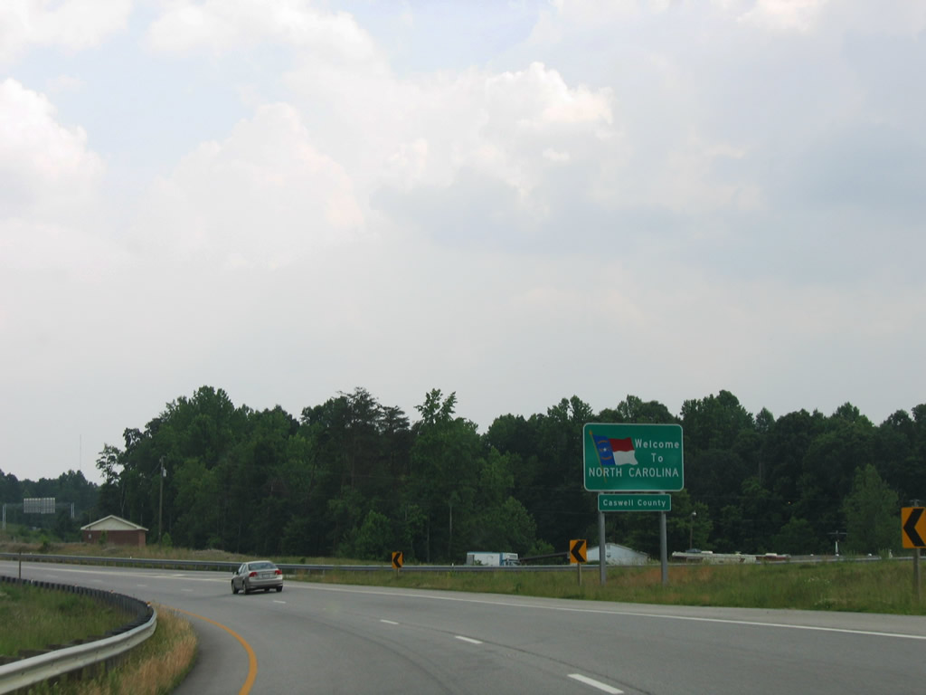
Entering Caswell County, North Carolina on the U.S. 29 southbound ramp from the Danville Expressway.
06/05/05
References:
- VA 57. Virginia Highways Page.
- VA 261 to 280. Virginia Highways Page.
- VA 360. Virginia Highways Page.
Photo Credits:
- Andy Field: 06/05/05
Connect with:
Page Updated Friday March 12, 2010.